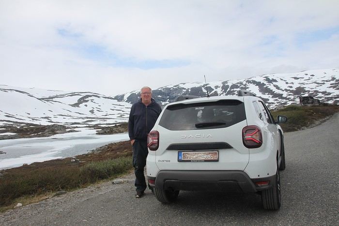
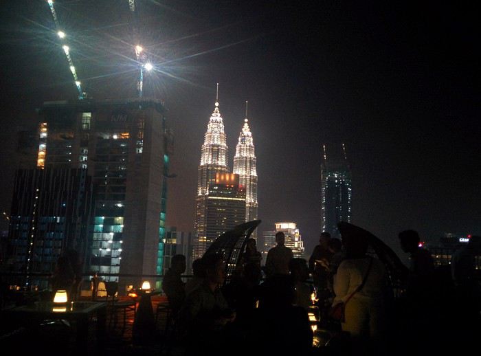
My daughter went to SPDA two years ago and was disappointed. Too touristy, too many restrictions, mandatory reservations for some sites... Nothing like the Sud Lipez.
I just found out there are mandatory reservations for some sites in SPDA . Thanks for the info! Nothing mentioned in the *Guide du Routard* or on the various websites I used to plan. I hadn’t seen Attila’s travel journal, but I’ll check it out to ask my questions—or maybe even start a thread about my itinerary to fine-tune it...
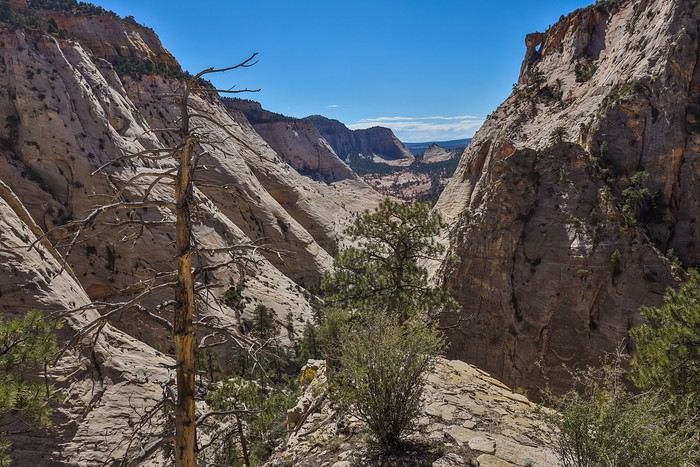
 But instead of turning back, we decide to follow the advice of Zion expert Joe Braun and his site citrusmilo.com. That’s how we end up climbing the steep rocky wall. No real danger since the slickrock provides good grip, but our calves are burning!!
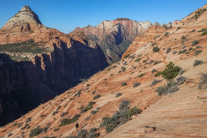 We slowly approach East Temple mountain. When I’m the first to cross over the summit, I’m lucky enough to spot a whole herd of bighorn sheep below!
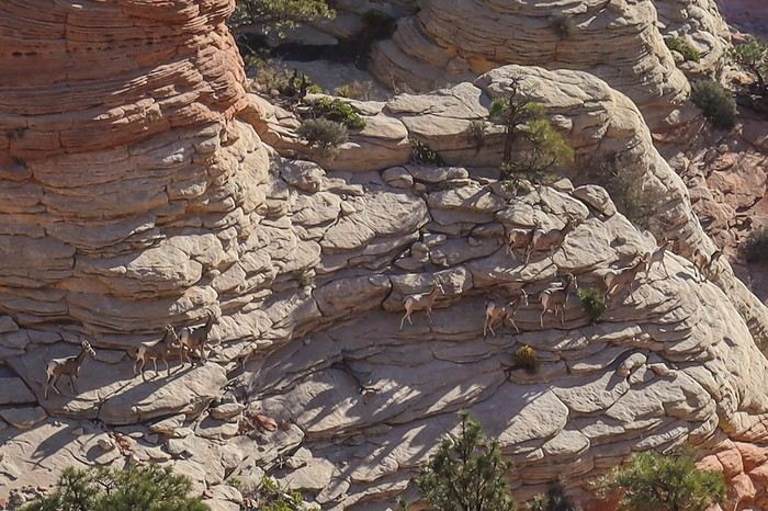 Franck and Sullivan also get to see them, but the sheep quickly sense our presence and move farther away.
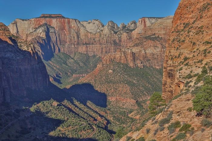
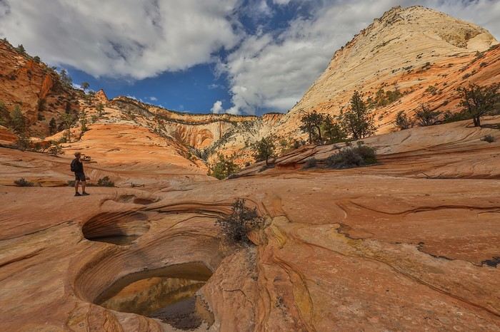
A glance back, and we enjoy a beautiful view of East Temple.
Franck and Sullivan also get to see them, but the sheep quickly sense our presence and move farther away.
A glance back, and we enjoy a beautiful view of East Temple.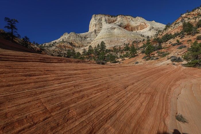 But it’s the succession of peaks in front of us that really catches our eye! What a landscape, so close to the Scenic Drive!
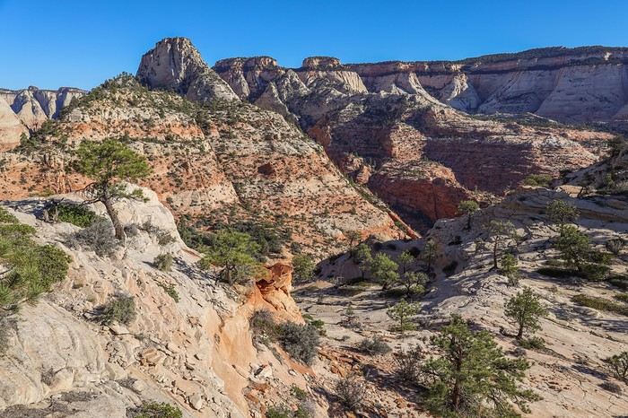
 The end of this first loop takes us through Upper Pine Creek, navigating by feel, always heading south until we reach the main road.
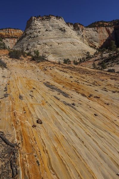 Then, we spot Jughandle Arch, an arch attached to the cliff wall—not very photogenic.
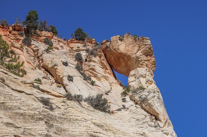
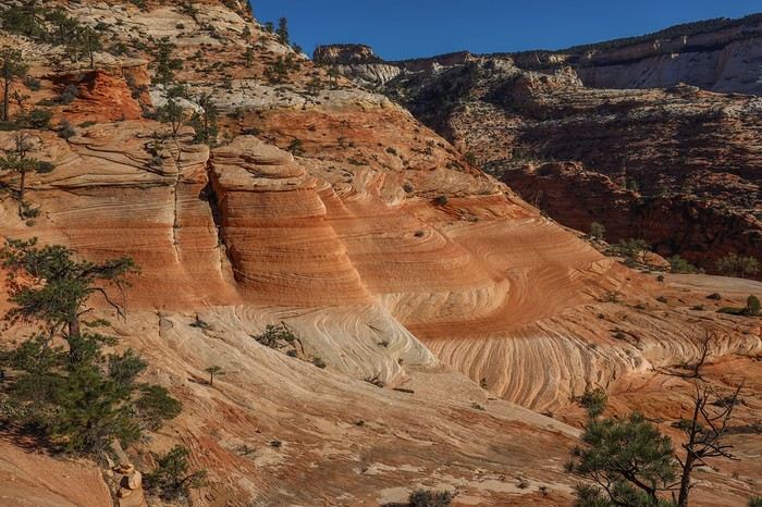
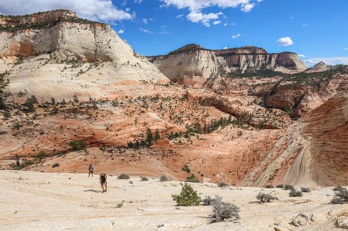
 Then we reach the edge of the "plateau" that Franck sold us on... !!! 😎 😇 😇
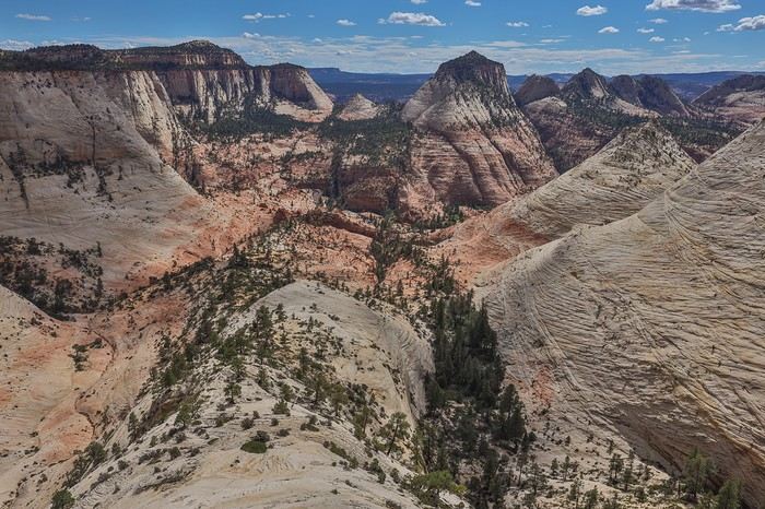 We see him beaming, with that sparkling, triumphant look in his eyes 😄! We have to admit the scenery is absolutely breathtaking—probably one of the most incredible 180° views in the American West—and we give him credit for it!
And a view that’s almost unknown to the general public 😛!
We see him beaming, with that sparkling, triumphant look in his eyes 😄! We have to admit the scenery is absolutely breathtaking—probably one of the most incredible 180° views in the American West—and we give him credit for it!
And a view that’s almost unknown to the general public 😛!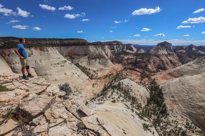 Across from us, we can see the massive Aries Peak and the smaller South Ariel Peak, between which we’ll pass to reach Center of Universe.
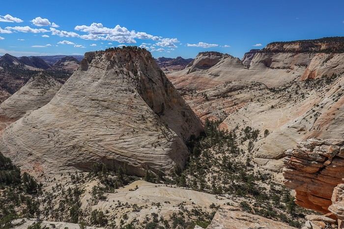 It’s the perfect spot for a picnic!
While rereading Citrumilo.Com to write the travel journal, I discovered we could’ve had a unique view of Jughandle Arch from above! And to think we were just a few dozen meters away without knowing what we were missing. Oh well...
It’s the perfect spot for a picnic!
While rereading Citrumilo.Com to write the travel journal, I discovered we could’ve had a unique view of Jughandle Arch from above! And to think we were just a few dozen meters away without knowing what we were missing. Oh well...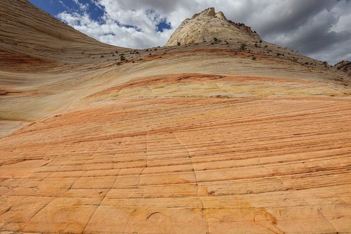
 Center of Universe is a pretty pompous name for this traverse between two rocky peaks.
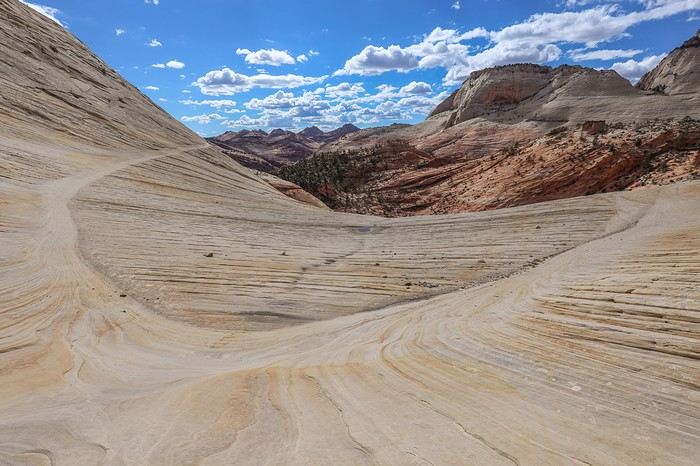 The place is nice, but not necessarily prettier than other spots on our route.
There’s an interesting succession of potholes, but you shouldn’t follow your instinct to take the path slightly higher up—it leads to a dangerous cliff!
The place is nice, but not necessarily prettier than other spots on our route.
There’s an interesting succession of potholes, but you shouldn’t follow your instinct to take the path slightly higher up—it leads to a dangerous cliff!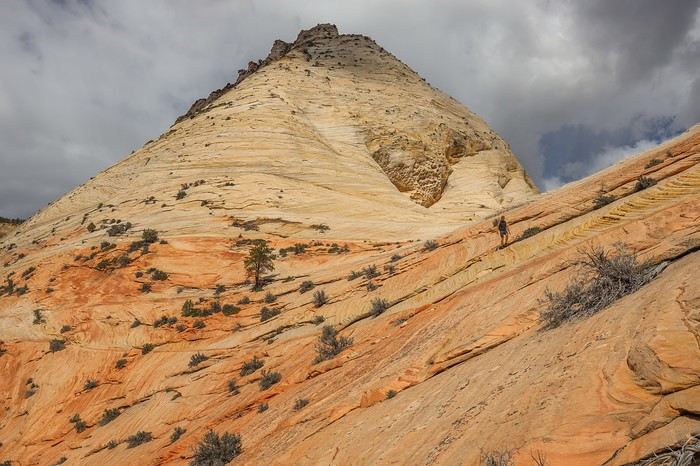
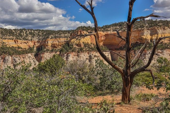
 We stumble upon some petroglyphs by chance, then walk a few hundred meters along Scenic Drive to reach our car.
 We then explain to Sullivan that normal people are content just admiring Checkerboard Mesa from this viewpoint, but we’re not normal people!
He asks if we’re really serious !!
We then explain to Sullivan that normal people are content just admiring Checkerboard Mesa from this viewpoint, but we’re not normal people!
He asks if we’re really serious !!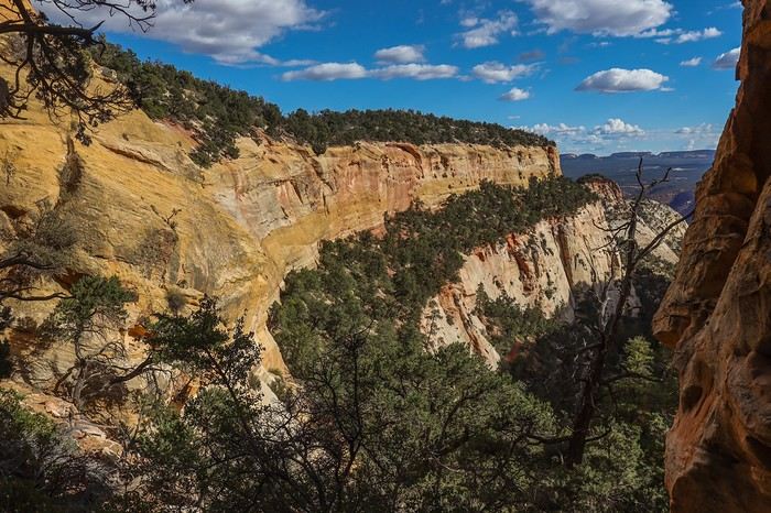 Then, we use the GPS to head due north toward the edge of the plateau. When we reach the end—another *wow* moment in a day already full of surprises!!
We’re treated to a panoramic view of the Scenic Drive and all the surrounding summits!
Then, we use the GPS to head due north toward the edge of the plateau. When we reach the end—another *wow* moment in a day already full of surprises!!
We’re treated to a panoramic view of the Scenic Drive and all the surrounding summits!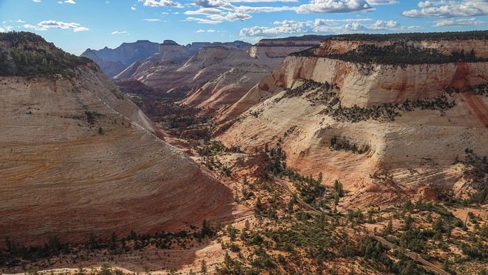 Zooming in, you can clearly see the Scenic Drive
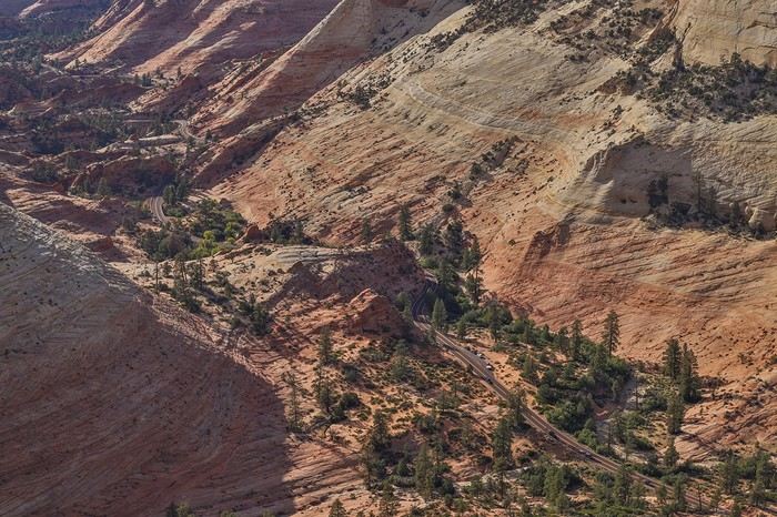 In the end, it was another insane day, during which we must’ve climbed nearly 1000 m in elevation gain. But you can adjust the difficulty based on your fitness level or stamina.
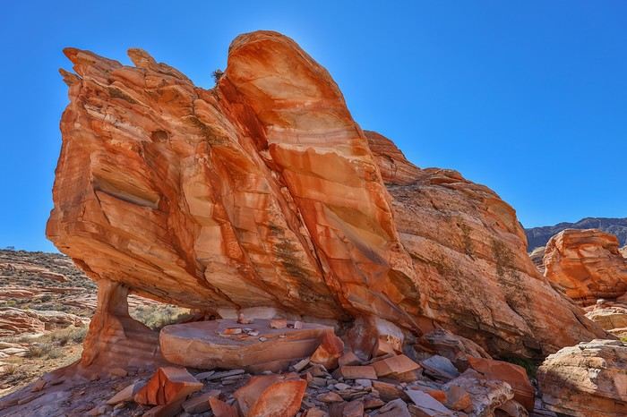
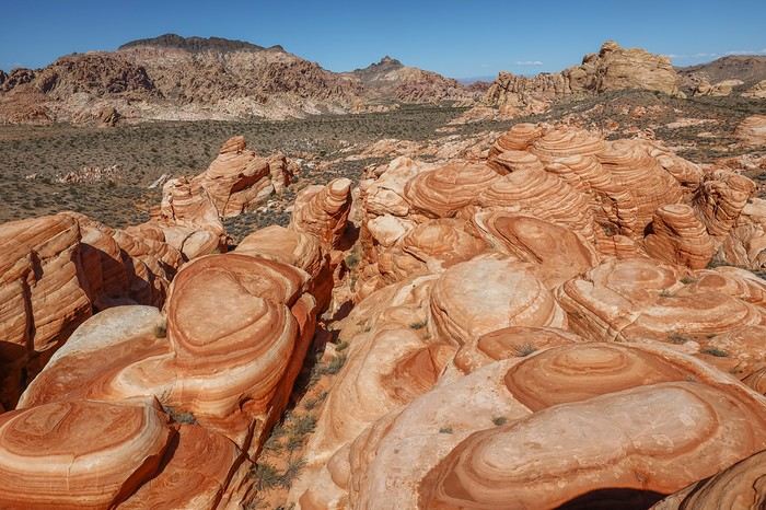
 But we struggled a bit more to find the tafonis.
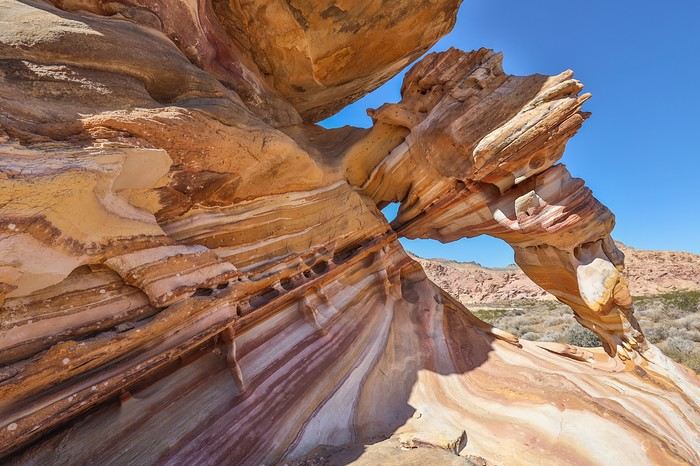 We then headed south and wandered among the two-toned rocks with all sorts of unique shapes:
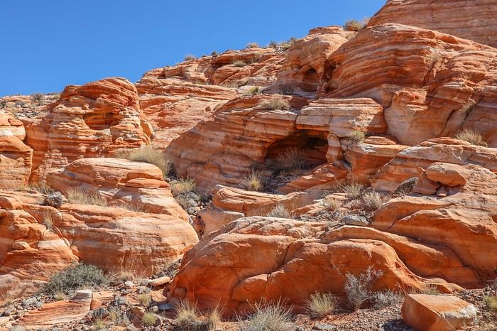 A unique piano-shaped arch:
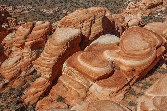
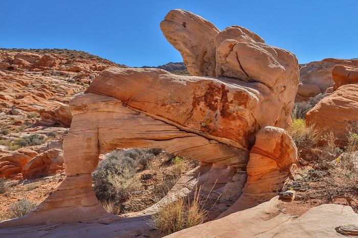 There are tons of mini-arches, caves, and special rock formations, and even a tripod (N36.32683° W114.70508°):
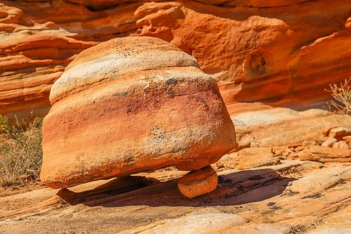
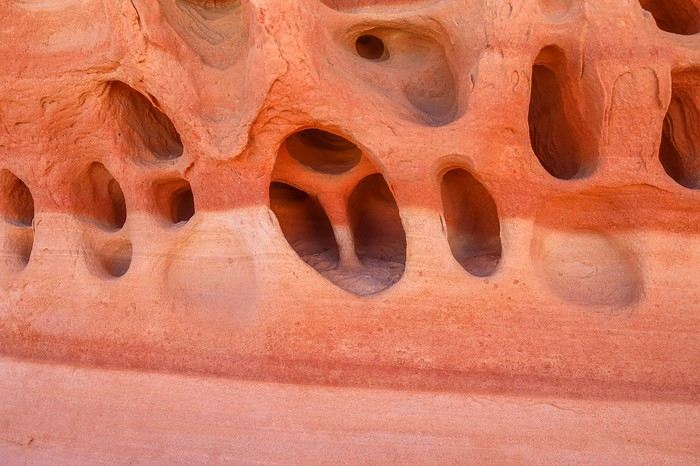
 A Swiss-cheese rock:
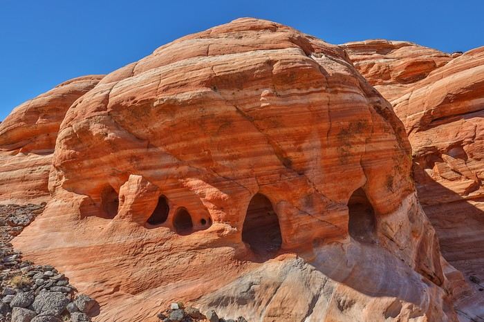 A "Mercedes" tafoni we stumbled upon by accident (N36.32616° W114.70500°) 😇!
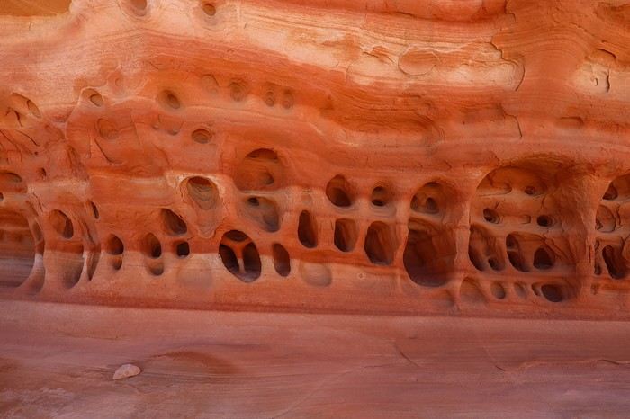

 I’d never seen photos of this area before—the surprise is total, and we’re thrilled!
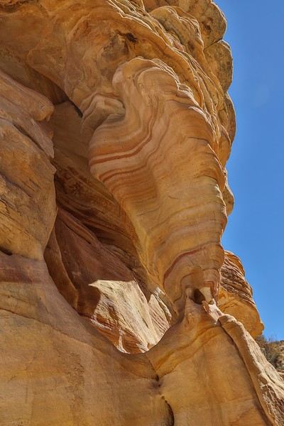 Right next to it, other mini-arches or rocks balanced on tiny bases.
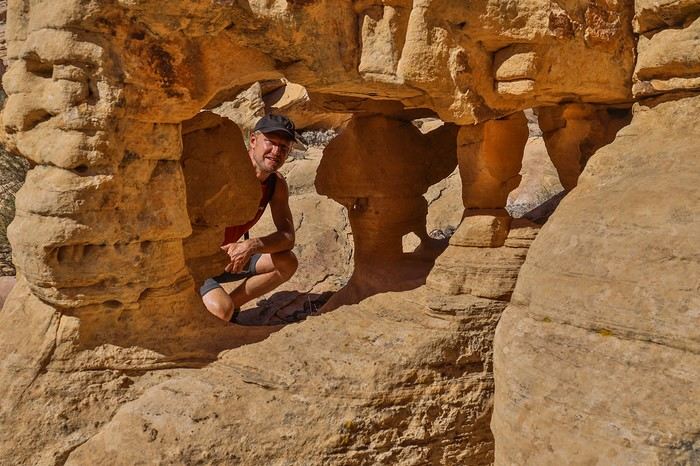 The second remarkable arch in Buffington Pockets is "Triple Arch," which, as the name suggests, is a triple arch. At first glance, you only see two, and you have to contort yourself under the arch to spot the third mini mini-arch (invisible in this wide shot)!
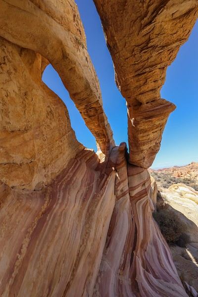 We continue our loop heading north toward Zebra Wave.
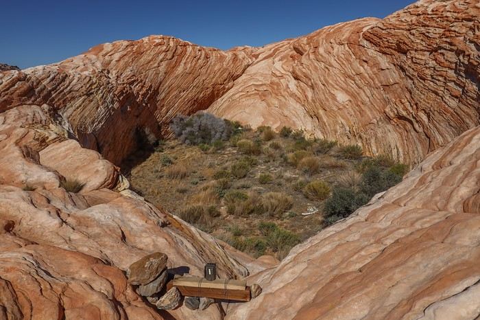 Climbing to the top of Zebra Wave, you understand its name!
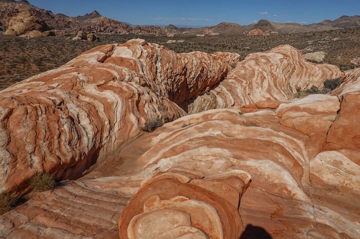 The last area we explore has an arch called "Lion King Arch" (N36.33148° W114.69522°). It’s easy to spot and so cute and fragile!!
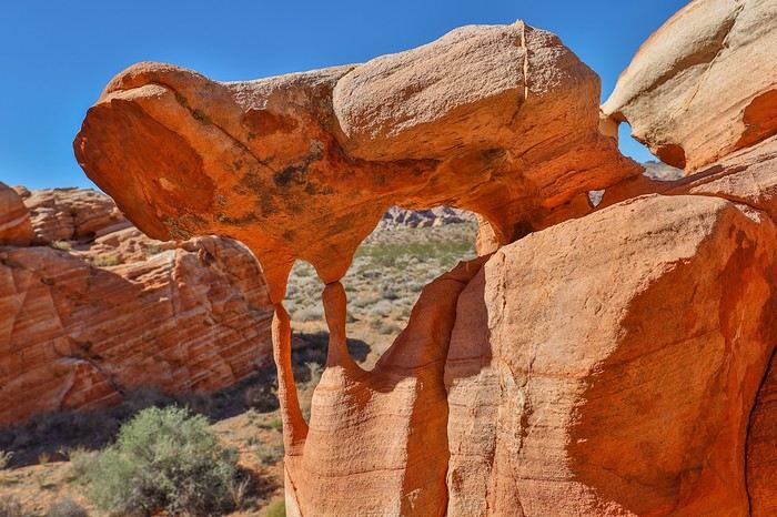 We finish our loop by passing through several areas that could be explored more deeply. But we’re a bit tired from the blazing sun, so we move through them a little quickly.
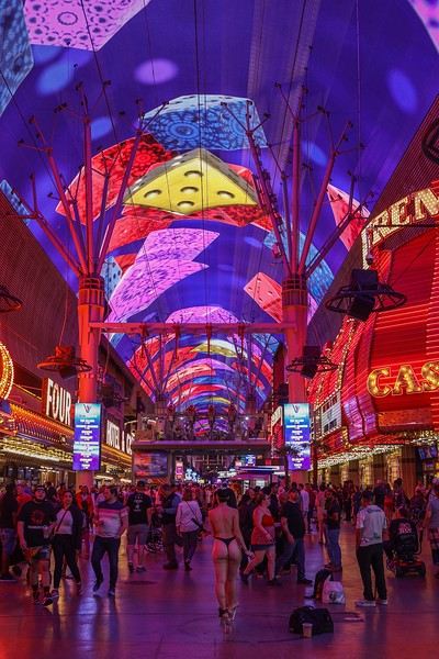 We’re also there for its fast-food joint, the Heart Attack Grill! At the entrance, there’s a scale to weigh yourself before and after—so you can see how much weight you’ve gained. The Heart Attack Grill even takes it to the next level by offering free single burgers to anyone weighing over 350 pounds ! That’s still 160 kg... Sullivan and I combined barely exceed that!
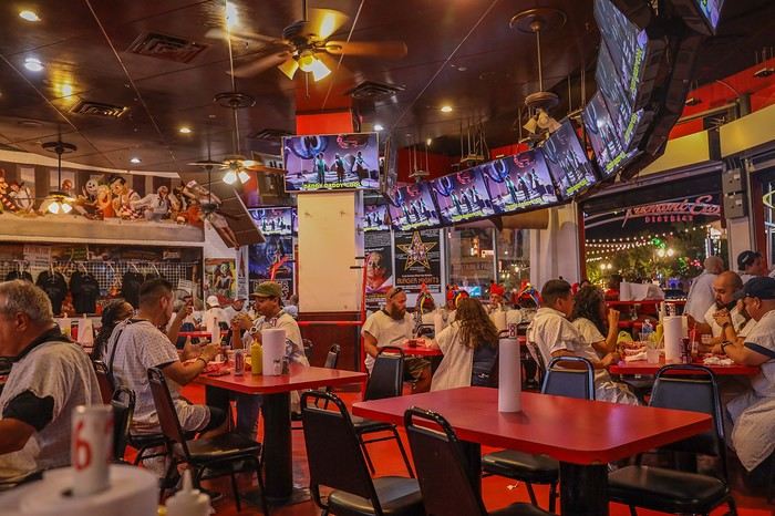 We all decide on a triple burger, which we each finish—though that doesn’t stop us from getting spanked by a waitress, just for fun...


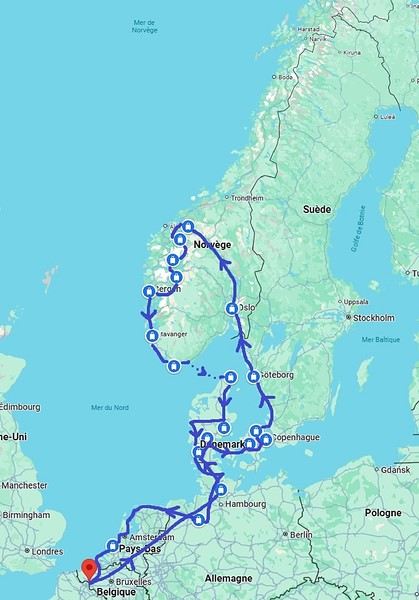
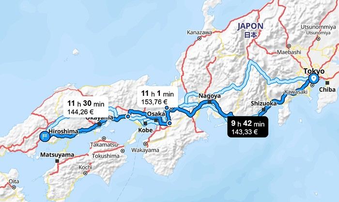
This trip had been on my mind for about fifteen years.
But the discomfort of overnight stays, the difficulty of communication, and the prices of the few car rentals kept making me postpone the project.
And then, everything fell into place—I told myself, now’s the time!
Preparations took longer than usual; the destination is still far from mainstream.
A bit of Kazakhstan? Not in the end.
The south or not? Yes, in the end.
Pre-book or play it by ear? Only two stops were a leap into the unknown.
To help me find the ideal route, I made great use of this forum (thanks to everyone for patiently answering my questions!), pored over travel journals and blogs (Christian, Jeff), zoomed in on Google Maps and Yandex, and bought the guide published by OunTravela on this destination (the guide has been updated since).
---/---
You’ve got your passport, international driver’s license, bank cards, and euros?
Off we go to Lyon—just one night left before our early morning flight.
Tomorrow night, we’ll be sleeping in Bishkek! (‘Beefsteak’ for my partner’s mischievous nephews...)
You’ll find here a post with some practical info.
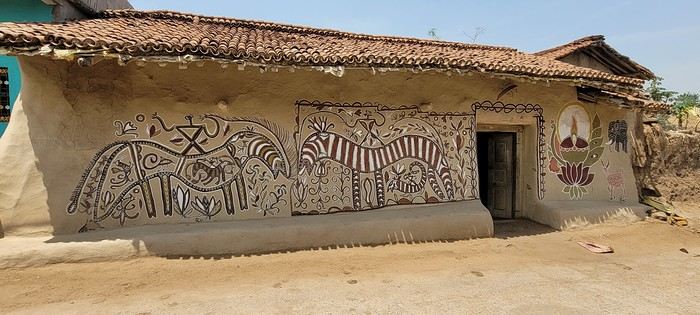
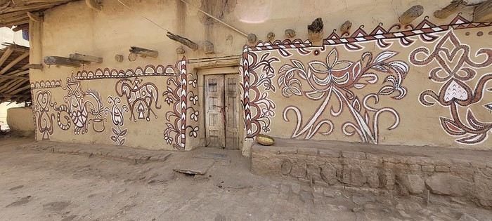
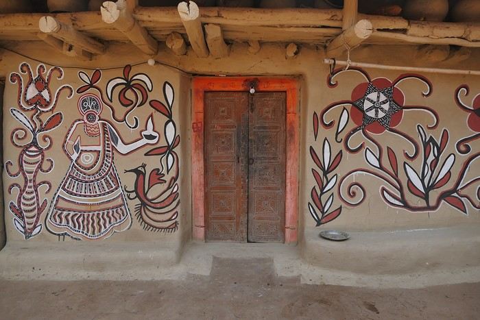
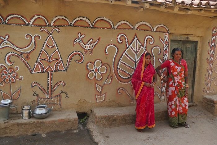
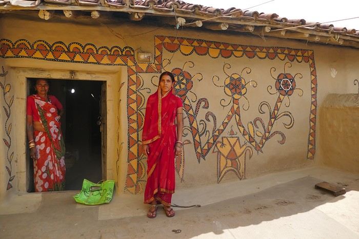
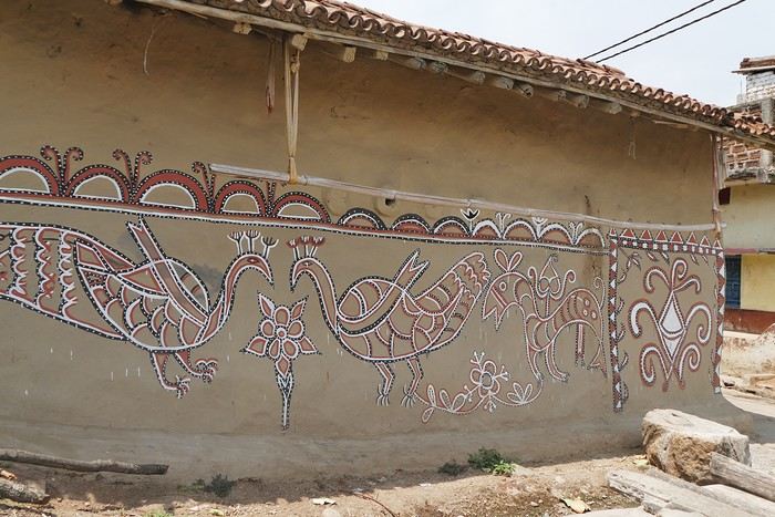 On some paintings, the scenes become almost narrative: you can make out figures, everyday gestures, like a memory of the village inscribed in the walls. The decorative frames around the doors aren’t left to chance either—they symbolically protect the house, like a boundary between the inside and the outside world.
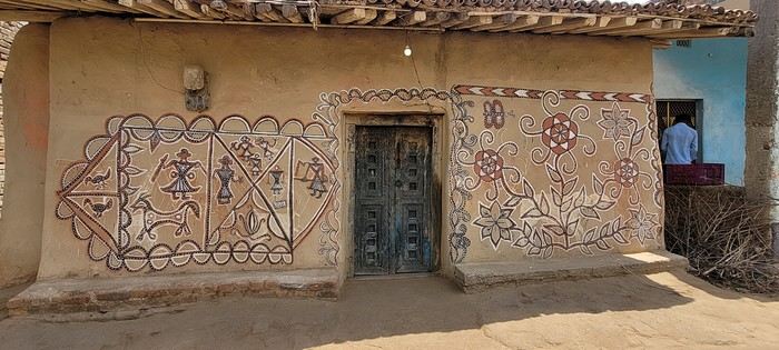

 A little sneak peek?
 Come along, I'm taking you to this country where it's so nice to wander and slow down...
 I’m inviting you on a stroll through my drawings—a completely subjective, far from exhaustive, and totally personal take, since it’s based on my own sketches. I put this travel journal together after returning in late 2024, mostly using felt-tip pens and pencils, with a few collages thrown in. I worked from our personal photos.
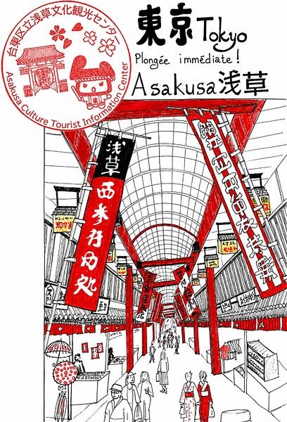
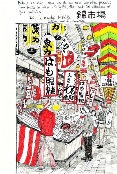
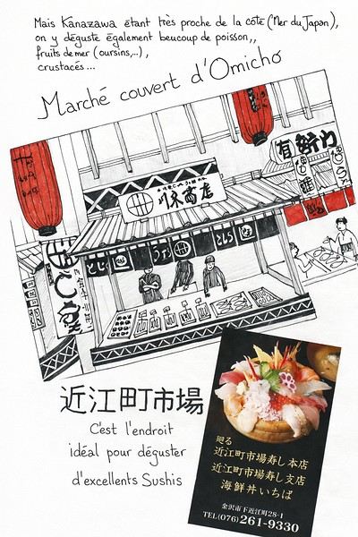 And in Kyoto, Nishiki Market:
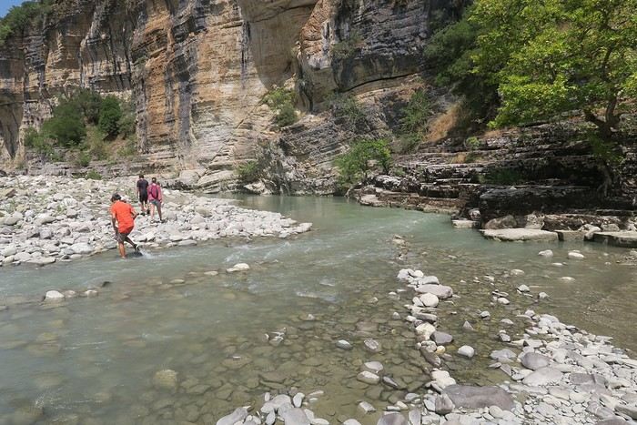
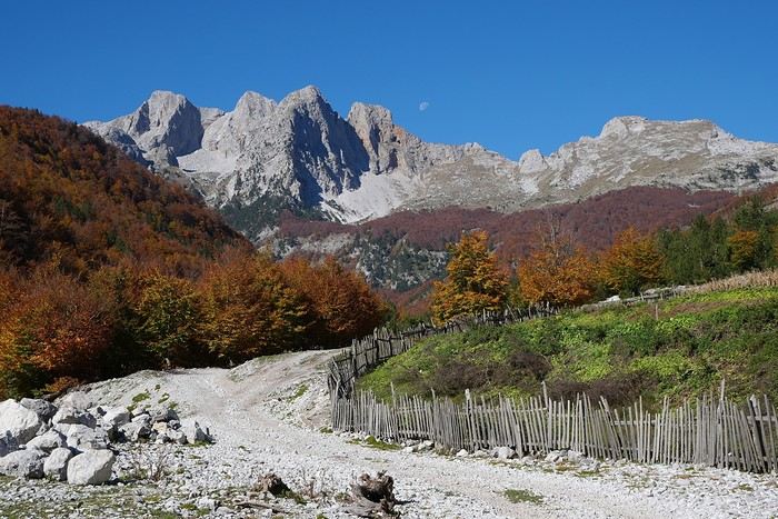

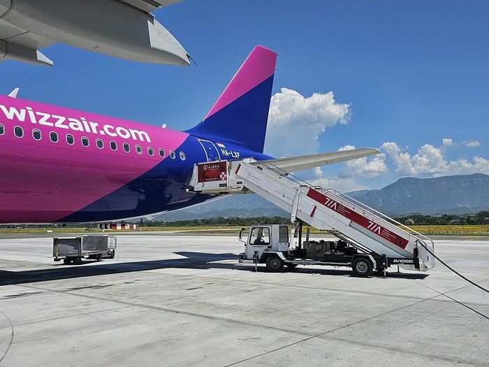 Since Albania isn’t part of Europe when it comes to phone service (at least not yet! :-)), we had to buy a physical SIM card—otherwise, the bill would’ve been sky-high if we’d used our French plan! We got one from Vodafone AL at the airport. You can buy online before leaving with a virtual SIM (e-SIM) for compatible phones, so you don’t have to swap cards. But given the uncertainty about choosing a plan online, we preferred buying one directly at Tirana Airport. Cost: 31 € for 100 GB. That’s way too much—100 GB is overkill. For 40 GB, it’s 27 €, and the plan lasts 21 days. The price difference isn’t huge, and it was cheaper than online. This plan covers all the countries along the Balkan range.
Money tip: All guesthouses and accommodations accept euros. The local currency in Albania is the LEK. In Montenegro, it’s the euro. Bank fees for withdrawing money from an ATM in Albania are pretty steep: 8 € for a withdrawal of 600–700 LEK (about 200 €)! So it’s better to withdraw cash (euros) in France. Oh, and we booked all our accommodations before leaving, but payment is always in cash. Budget around 400–500 € for 9 days of trekking.
Since Albania isn’t part of Europe when it comes to phone service (at least not yet! :-)), we had to buy a physical SIM card—otherwise, the bill would’ve been sky-high if we’d used our French plan! We got one from Vodafone AL at the airport. You can buy online before leaving with a virtual SIM (e-SIM) for compatible phones, so you don’t have to swap cards. But given the uncertainty about choosing a plan online, we preferred buying one directly at Tirana Airport. Cost: 31 € for 100 GB. That’s way too much—100 GB is overkill. For 40 GB, it’s 27 €, and the plan lasts 21 days. The price difference isn’t huge, and it was cheaper than online. This plan covers all the countries along the Balkan range.
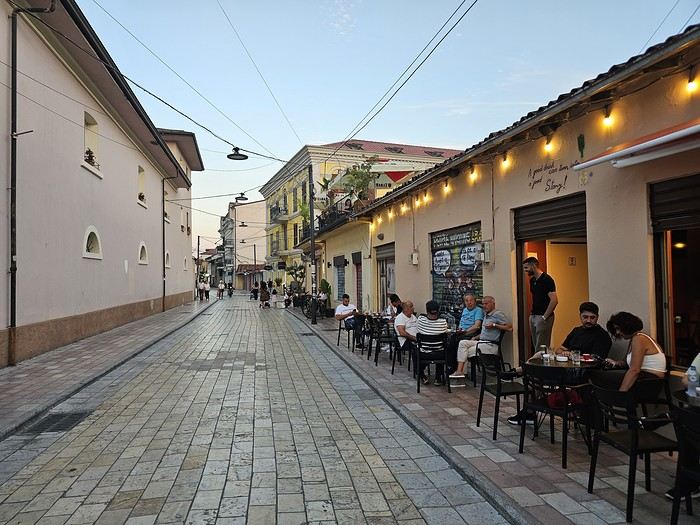
Money tip: All guesthouses and accommodations accept euros. The local currency in Albania is the LEK. In Montenegro, it’s the euro. Bank fees for withdrawing money from an ATM in Albania are pretty steep: 8 € for a withdrawal of 600–700 LEK (about 200 €)! So it’s better to withdraw cash (euros) in France. Oh, and we booked all our accommodations before leaving, but payment is always in cash. Budget around 400–500 € for 9 days of trekking.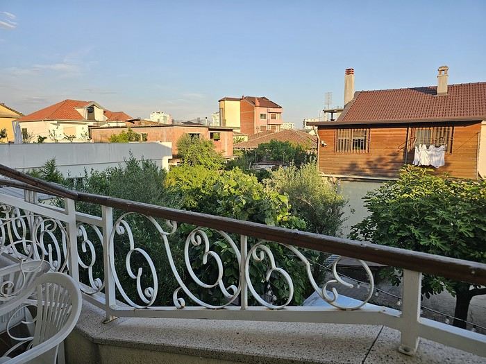 I really liked Shköder, especially its pedestrian street lined with restaurants and lit up at night. It’s a great place to stroll and eat. The food isn’t expensive—two big salads and two beers: 14 € :-) . Fruit prices are also very reasonable: 3 € for a kilo of cherries, compared to 9–10 € in France.
Religions coexist peacefully in these countries—Catholics and Muslims. From our balcony, my friend heard the call to prayer for the first time, coming from one of the city’s mosques.
I really liked Shköder, especially its pedestrian street lined with restaurants and lit up at night. It’s a great place to stroll and eat. The food isn’t expensive—two big salads and two beers: 14 € :-) . Fruit prices are also very reasonable: 3 € for a kilo of cherries, compared to 9–10 € in France.
Religions coexist peacefully in these countries—Catholics and Muslims. From our balcony, my friend heard the call to prayer for the first time, coming from one of the city’s mosques.
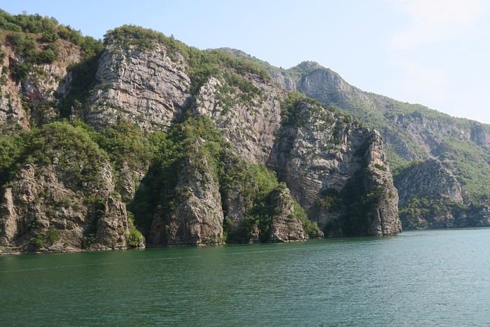
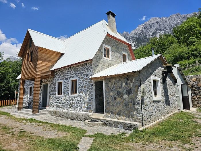 We slept in the heights of Theth at a new guesthouse, "Mountain Vista Shkafi," with an amazing view.

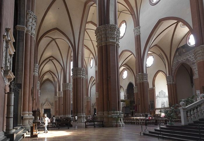
 But Bologna’s real charm lies in its porticoes, which were added to the UNESCO World Heritage list in 2021: 62 km of arcades running along buildings, letting you walk sheltered from the sun or rain. Back in 1288, the city required houses to include private arcades for public use. In the city center, you can stroll under 32 km of porticoes in all sorts of styles—some plain, some ornate—with a strong presence of red tones.