Results for "Massif+Central+événement"
About 6,838 results.
More options
Many results are in French, the community’s main language. English translations are added over time.
Search results
Retour d'Ethiopie, Djibouti et Erythrée
Bonjour
je rentre d'Ethiopie où j'ai pu terminer mon périple dans la vallée de l'OMO; je n'avais pu le faire en juin à cause de pluies qui rendaient les pistes impraticables..
J'ai donc pas mal d'infos sur ce pays et cet endroit. (JINKA comme point de départ)
Puis, j'ai testé le chemin de fer entre Dire Dawa et Djibouti. 3 départs par semaine et 85 birr en 1ère; Ne pas hésiter car la seconde est à 65 birrs et pas de place pour s'assoeoir. Départ le matin à 8h 30 et arrivée a Djibouti la nuit vers 20h. On perd une heure à chaque passage de frontière. Donc 1 heure en quittant l'Ethiopie et une heure en entrant à Djibouti. possibilité d'obetenir un visa temp touristique de 10 jours pour 3000Francs Djiboutens ( 20us$);; Djibouti... Cher, assez sale et vraiment peu de chose à y faire..
le seul hotel abordable et propre est l'hotel de France à coté (derrière) l'assemblée nationale ) Environ 35 Dollars sans le petit dej. propre.
ne pas confondre avec l'hotel de l'Europe.. Sur la grand place MENELIK. les prix ne sont pas les mêmes...!!!
Pour le change et éventuellement du cash avec la visa ou la Master. Sur la place Menélik. Un changeur trés connu et réglo. demandez l'INDHOU... de son vrai nom Prakash MEHTA...On peut aussi changer dans la rue perpendiculaire auprés des femmes qui vendent des bricoles; En cas de besoins urgents...
Difficile de se rendre à ASMARA en bus. Peu ou pas de communication entre Djibouti et ASSAB; c'est possible mais prévoir du temps...
les Cies Aériennes sont toutes regroupées dans le même secteur. prés de la place Ménélik. Ethiopian; Djibouti airlines et Erytrée Airlines.
Attention, ils ne veulent pas venbdre d'aller simple pour ASMARA en avion. il faut absolument un billet retour. 250 Euros payable avec carte Visa ou Amex. 2 à 3 vols par semaines. Avion souvent vide.
A l'arrivée à ASMARA, il y a un individu fort peu sympathique qui gère les relations avec les chauffeurs de taxi. Il a organisé tout ça en mafia. le prix maxi maxi est de 150 Nakfa. Et faites attention, si vous êtes 2 à partager un taxi pour des hotels voisins, il veut voius faire prendre 2 taxi différents.
Asmara possède suffisemment de petites pensions. mais le confort et la propreté sont assez inégaux..
J'ai choisi le "SAVANNA Hotel" 40US $ pour une simple avec petit dèj. Chambres impeccables et spacieuses.. Rien à redire . Excellent service. Tel 116183- 202141 -202142 Un peu excentré mais rien de bien méchant. Dans une rue tres calme. Un petit bémol pour la boîte Disco au sous-sol mais cela s'arrete tot dans la soirée..
Ne laissez pas votre billet de retour en Europe à votre hotel de départ car à Djibouti, on ne vous vendra (théoriquement) pas d'aller simple pour Addis ou Dire dawa. obtention trés rapide du visa Ethiopien à la toute nouvelle ambassade d'Ethiopie. (20 us $)
Voilà pour l'essentiel.
Bus frequents (entre 2 à 3 heures pour Mawassa; 30 nakfa.. mais possibilité louer une voiture à l'hotel qui arrange tout ça pour 80 $ en 4x4 . parfaitement inutile d'ailleurs...!! Route superbe et bien entretenue. essayez le train s'ils ont du charbon pour la loco...!!!!
bus direct également pour ASSAB . la journée entière. pas cher.
Si vous voulez d'autres infos; dépêchez vous car dimanche je pars en Tanzanie et je ne reviens qu'en fin de mois.
je rentre d'Ethiopie où j'ai pu terminer mon périple dans la vallée de l'OMO; je n'avais pu le faire en juin à cause de pluies qui rendaient les pistes impraticables..
J'ai donc pas mal d'infos sur ce pays et cet endroit. (JINKA comme point de départ)
Puis, j'ai testé le chemin de fer entre Dire Dawa et Djibouti. 3 départs par semaine et 85 birr en 1ère; Ne pas hésiter car la seconde est à 65 birrs et pas de place pour s'assoeoir. Départ le matin à 8h 30 et arrivée a Djibouti la nuit vers 20h. On perd une heure à chaque passage de frontière. Donc 1 heure en quittant l'Ethiopie et une heure en entrant à Djibouti. possibilité d'obetenir un visa temp touristique de 10 jours pour 3000Francs Djiboutens ( 20us$);; Djibouti... Cher, assez sale et vraiment peu de chose à y faire..
le seul hotel abordable et propre est l'hotel de France à coté (derrière) l'assemblée nationale ) Environ 35 Dollars sans le petit dej. propre.
ne pas confondre avec l'hotel de l'Europe.. Sur la grand place MENELIK. les prix ne sont pas les mêmes...!!!
Pour le change et éventuellement du cash avec la visa ou la Master. Sur la place Menélik. Un changeur trés connu et réglo. demandez l'INDHOU... de son vrai nom Prakash MEHTA...On peut aussi changer dans la rue perpendiculaire auprés des femmes qui vendent des bricoles; En cas de besoins urgents...
Difficile de se rendre à ASMARA en bus. Peu ou pas de communication entre Djibouti et ASSAB; c'est possible mais prévoir du temps...
les Cies Aériennes sont toutes regroupées dans le même secteur. prés de la place Ménélik. Ethiopian; Djibouti airlines et Erytrée Airlines.
Attention, ils ne veulent pas venbdre d'aller simple pour ASMARA en avion. il faut absolument un billet retour. 250 Euros payable avec carte Visa ou Amex. 2 à 3 vols par semaines. Avion souvent vide.
A l'arrivée à ASMARA, il y a un individu fort peu sympathique qui gère les relations avec les chauffeurs de taxi. Il a organisé tout ça en mafia. le prix maxi maxi est de 150 Nakfa. Et faites attention, si vous êtes 2 à partager un taxi pour des hotels voisins, il veut voius faire prendre 2 taxi différents.
Asmara possède suffisemment de petites pensions. mais le confort et la propreté sont assez inégaux..
J'ai choisi le "SAVANNA Hotel" 40US $ pour une simple avec petit dèj. Chambres impeccables et spacieuses.. Rien à redire . Excellent service. Tel 116183- 202141 -202142 Un peu excentré mais rien de bien méchant. Dans une rue tres calme. Un petit bémol pour la boîte Disco au sous-sol mais cela s'arrete tot dans la soirée..
Ne laissez pas votre billet de retour en Europe à votre hotel de départ car à Djibouti, on ne vous vendra (théoriquement) pas d'aller simple pour Addis ou Dire dawa. obtention trés rapide du visa Ethiopien à la toute nouvelle ambassade d'Ethiopie. (20 us $)
Voilà pour l'essentiel.
Bus frequents (entre 2 à 3 heures pour Mawassa; 30 nakfa.. mais possibilité louer une voiture à l'hotel qui arrange tout ça pour 80 $ en 4x4 . parfaitement inutile d'ailleurs...!! Route superbe et bien entretenue. essayez le train s'ils ont du charbon pour la loco...!!!!
bus direct également pour ASSAB . la journée entière. pas cher.
Si vous voulez d'autres infos; dépêchez vous car dimanche je pars en Tanzanie et je ne reviens qu'en fin de mois.
Ouverture d'un commerce en Thaïlande
Bonjour, jaurai voulu savoir où sur paris je pourrai me renseigner au niveau des loi thailandaise pour l'ouverture d'un commerce en thailande.
Trois étudiantes en Tunisie c'est risqué ou pas?
On voudrez partir avec 2copines en Tunisie mais quelques personnes nous le déconseille parce qu'elles trouvent que c'est trop dangeureux pour 3 jeunes filles seules
Qu'en pensez vous sincèrement sachant que nous n'allons tout de meme pas nous ballader dans de petites rues tardivement...
Merci de repondre nombreux et honnetement😏
Qu'en pensez vous sincèrement sachant que nous n'allons tout de meme pas nous ballader dans de petites rues tardivement...
Merci de repondre nombreux et honnetement😏
Villages around Hazaribagh in West Bengal
Wednesday, April 1st
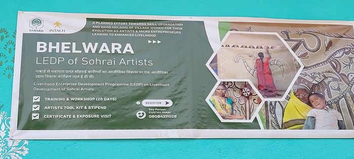
Hazaribagh I’ve got a meet-up with Adam Iman, a guide and painter. He picks me up from the hotel at 10 AM. Another traveler from Bangalore is supposed to join us, but while we wait for him to arrive, Adam takes me to see the paintings his mother and sister created at Hazaribagh station. The town became famous thanks to these murals, which can also be found in several surrounding villages. This art form has earned recognition and is now protected, a sign of its cultural importance. Once the visit is over, we go to pick up the other traveler and then head to our first village: Belwara, where Sohrai art is practiced. At the entrance, a sign proudly announces that we’re entering an artists’ village, where this art is created by women organized into micro-enterprises. Some even offer workshops for those who’d like to learn this tradition.
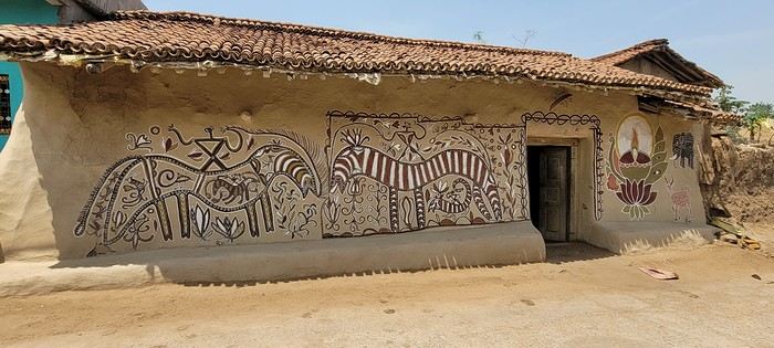
Sohrai art is tied to the harvest season, from October to mid-November. The motifs, in natural colors, celebrate fertility and abundance. The artists use pigments from the earth: red oxides, ochre, white kaolin, and black manganese. On the walls, you’ll see animals, fish, birds—all symbols of life and prosperity. As I look closer at the murals, I start to realize that each motif tells a story. Large animals like cows or bulls often take center stage. Their bodies are filled with intricate, almost hypnotic patterns. They symbolize wealth and prosperity for the household, as well as the deep respect for cattle, which are essential to daily life. On some facades, elephants stand out—massive and decorated with the same precision. They evoke quiet strength and protection. But it’s when I stop in front of one of the houses that I really take the time to look. The wall, a soft ochre, is entirely covered in murals. Two large animals stretch out on either side of the door, their elongated bodies fitting the length of the wall. Their silhouettes are filled with geometric patterns and incredibly fine curved lines, as if every space was patiently filled. Around them, stylized plants, flowers, and small decorative elements fill every gap. The door, dark and worn, becomes almost the silent center of the composition, framed by these living, protective forms. To the right, a more colorful motif catches the eye—a flower or a stylized lamp—like a touch of light on the earth. The whole thing gives an impression of perfect balance, between the rigor of the patterns and the freedom of the gesture.
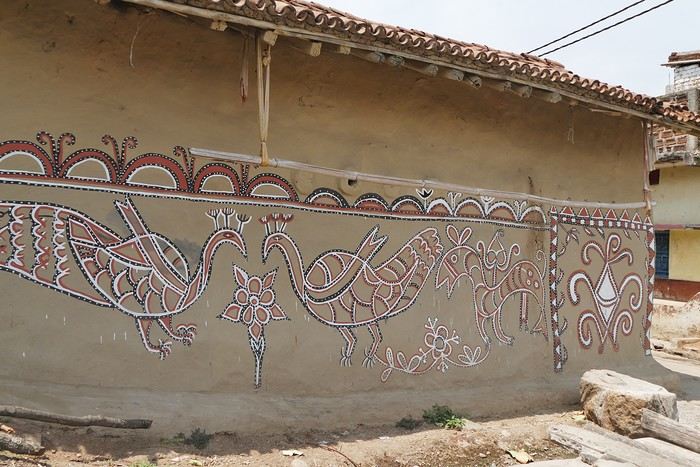
Elsewhere, birds and freer forms bring movement. Peacocks, recognizable by their stylized silhouettes, embody beauty and vitality, while fish symbolize water, fertility, and the continuity of life.
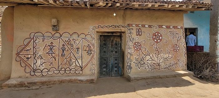
 On some paintings, the scenes become almost narrative: you can make out figures, everyday gestures, like a memory of the village inscribed in the walls. The decorative frames around the doors aren’t left to chance either—they symbolically protect the house, like a boundary between the inside and the outside world.
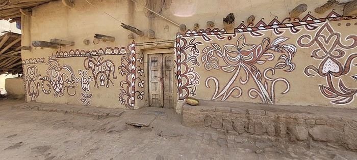
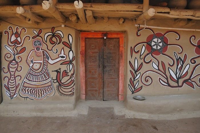
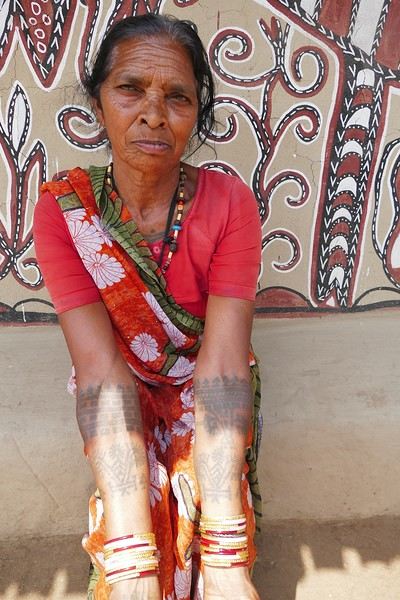
During the Sohrai festival, cattle are led into the jungle in the morning. Meanwhile, the women finish the *aripans*—these floor paintings—and continue the wall murals. Around noon, the animals return to the village, and the bulls’ horns are anointed with oil and vermilion in a gesture of gratitude, amid the vibrant colors adorning the houses. We visit several artists, including Parvat Devi, a well-known woman who has received many awards. Her arms are adorned with intriguing tattoos, which I’ll talk about in more detail later.
On another wall, the style changes completely. Here, no massive animals—just birds occupying the space, light and graceful, as if caught in mid-movement. Two silhouettes face each other, their long necks arched almost like mirrors, while their outstretched wings seem to vibrate with the patterns that compose them.
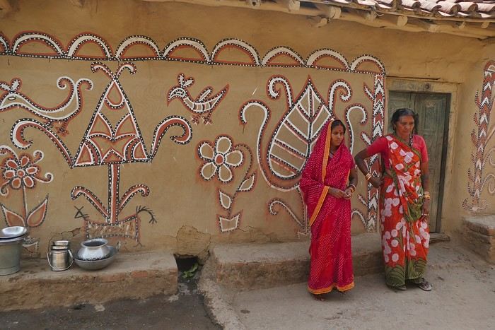
The design is more graphic, almost airy. The lines are smoother, more fluid, as if drawn in one confident stroke. The birds’ bodies aren’t solid—they’re filled with repetitive motifs like scales, stylized feathers, and spirals, giving a sense of continuous movement. Around them, everything comes to life: flowers burst open, arabesques swirl, and even the simplest shapes seem alive. What strikes me here is the sense of lightness. Where the large animals evoked stability and grounding, these birds bring something freer, almost joyful. They seem to embody movement, the circulation of life, like a breath flowing through the village.
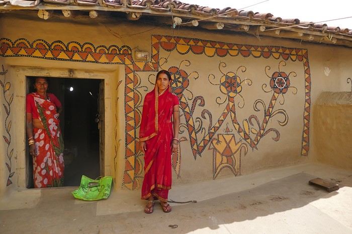
The colors remain the same—deep reds, intense blacks, and chalky white—but the rhythm is different. Faster, more spontaneous. As if each wall had its own personality, while still speaking the same language.
That’s probably why I’m so moved. I’d heard about these paintings from my friend Raja, and last year, I saw an exhibition in a village near my home. That first encounter made me want to come here. But seeing them in person is a whole different experience. These paintings are unique. This ancient art is passed down from mother to daughter, or mother-in-law to daughter-in-law, in a quiet, deeply living continuity. At first glance, it might seem almost childlike in its simplicity and pared-down forms. And yet, everything is thought out, balanced, mastered. Nothing is left to chance.
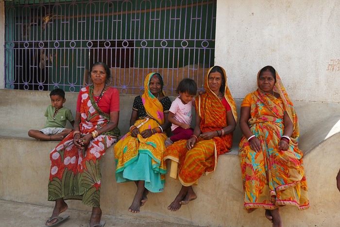
That apparent simplicity, combined with such rich symbolism, touches me deeply. There’s something sincere and essential in these walls—and that’s what moves me.
Hazaribagh I’ve got a meet-up with Adam Iman, a guide and painter. He picks me up from the hotel at 10 AM. Another traveler from Bangalore is supposed to join us, but while we wait for him to arrive, Adam takes me to see the paintings his mother and sister created at Hazaribagh station. The town became famous thanks to these murals, which can also be found in several surrounding villages. This art form has earned recognition and is now protected, a sign of its cultural importance. Once the visit is over, we go to pick up the other traveler and then head to our first village: Belwara, where Sohrai art is practiced. At the entrance, a sign proudly announces that we’re entering an artists’ village, where this art is created by women organized into micro-enterprises. Some even offer workshops for those who’d like to learn this tradition.
Sohrai art is tied to the harvest season, from October to mid-November. The motifs, in natural colors, celebrate fertility and abundance. The artists use pigments from the earth: red oxides, ochre, white kaolin, and black manganese. On the walls, you’ll see animals, fish, birds—all symbols of life and prosperity. As I look closer at the murals, I start to realize that each motif tells a story. Large animals like cows or bulls often take center stage. Their bodies are filled with intricate, almost hypnotic patterns. They symbolize wealth and prosperity for the household, as well as the deep respect for cattle, which are essential to daily life. On some facades, elephants stand out—massive and decorated with the same precision. They evoke quiet strength and protection. But it’s when I stop in front of one of the houses that I really take the time to look. The wall, a soft ochre, is entirely covered in murals. Two large animals stretch out on either side of the door, their elongated bodies fitting the length of the wall. Their silhouettes are filled with geometric patterns and incredibly fine curved lines, as if every space was patiently filled. Around them, stylized plants, flowers, and small decorative elements fill every gap. The door, dark and worn, becomes almost the silent center of the composition, framed by these living, protective forms. To the right, a more colorful motif catches the eye—a flower or a stylized lamp—like a touch of light on the earth. The whole thing gives an impression of perfect balance, between the rigor of the patterns and the freedom of the gesture.
Elsewhere, birds and freer forms bring movement. Peacocks, recognizable by their stylized silhouettes, embody beauty and vitality, while fish symbolize water, fertility, and the continuity of life.
On some paintings, the scenes become almost narrative: you can make out figures, everyday gestures, like a memory of the village inscribed in the walls. The decorative frames around the doors aren’t left to chance either—they symbolically protect the house, like a boundary between the inside and the outside world.During the Sohrai festival, cattle are led into the jungle in the morning. Meanwhile, the women finish the *aripans*—these floor paintings—and continue the wall murals. Around noon, the animals return to the village, and the bulls’ horns are anointed with oil and vermilion in a gesture of gratitude, amid the vibrant colors adorning the houses. We visit several artists, including Parvat Devi, a well-known woman who has received many awards. Her arms are adorned with intriguing tattoos, which I’ll talk about in more detail later.
On another wall, the style changes completely. Here, no massive animals—just birds occupying the space, light and graceful, as if caught in mid-movement. Two silhouettes face each other, their long necks arched almost like mirrors, while their outstretched wings seem to vibrate with the patterns that compose them.
The design is more graphic, almost airy. The lines are smoother, more fluid, as if drawn in one confident stroke. The birds’ bodies aren’t solid—they’re filled with repetitive motifs like scales, stylized feathers, and spirals, giving a sense of continuous movement. Around them, everything comes to life: flowers burst open, arabesques swirl, and even the simplest shapes seem alive. What strikes me here is the sense of lightness. Where the large animals evoked stability and grounding, these birds bring something freer, almost joyful. They seem to embody movement, the circulation of life, like a breath flowing through the village.
The colors remain the same—deep reds, intense blacks, and chalky white—but the rhythm is different. Faster, more spontaneous. As if each wall had its own personality, while still speaking the same language.
That’s probably why I’m so moved. I’d heard about these paintings from my friend Raja, and last year, I saw an exhibition in a village near my home. That first encounter made me want to come here. But seeing them in person is a whole different experience. These paintings are unique. This ancient art is passed down from mother to daughter, or mother-in-law to daughter-in-law, in a quiet, deeply living continuity. At first glance, it might seem almost childlike in its simplicity and pared-down forms. And yet, everything is thought out, balanced, mastered. Nothing is left to chance.
That apparent simplicity, combined with such rich symbolism, touches me deeply. There’s something sincere and essential in these walls—and that’s what moves me.
Review of an expedition cruise to the Seychelles with Ponant from January 25 to February 2, 2026
Hi everyone,
It was totally by chance that I found this cruise while chatting with Alfred in November 2024. It wasn’t planned, but the price was attractive—one of those "great deals" from Ponant that I love and that don’t exist anymore. Since everyone’s wondering, here’s the answer without waiting for the end of the story: after my various loyalty discounts, I paid **3,250 € per person** for 8 nights/9 days on the expedition cruise *The Essentials of the Seychelles*.
Expedition cruises are by far our favorites. The outings are done by Zodiac with the ship’s naturalist guides, everything’s included, and there’s no need to add any excursions or prepare anything.
We’re liking long flights less and less, so to break up the trip, we decided to stop over in Doha for four days on the way there and one day on the way back.
I’m happy to share the good and not-so-good moments, the great surprises, and the disappointments of this trip with you.
It was totally by chance that I found this cruise while chatting with Alfred in November 2024. It wasn’t planned, but the price was attractive—one of those "great deals" from Ponant that I love and that don’t exist anymore. Since everyone’s wondering, here’s the answer without waiting for the end of the story: after my various loyalty discounts, I paid **3,250 € per person** for 8 nights/9 days on the expedition cruise *The Essentials of the Seychelles*.
Expedition cruises are by far our favorites. The outings are done by Zodiac with the ship’s naturalist guides, everything’s included, and there’s no need to add any excursions or prepare anything.
We’re liking long flights less and less, so to break up the trip, we decided to stop over in Doha for four days on the way there and one day on the way back.
I’m happy to share the good and not-so-good moments, the great surprises, and the disappointments of this trip with you.
A summer in the sun in... Iceland!!
Ah, Iceland and us—it’s quite the story, or rather, a long wait... The first time we considered going was already 7-8 years ago, after reading travel journals describing breathtaking landscapes, countless active and dormant volcanoes, glaciers, and waterfalls with extraordinary flows. In short, this island, made of fire and ice, right at Europe’s doorstep with its own unique culture, had nothing but advantages, and it was urgent to visit without delay 😇
My *Routard* guidebook is actually from 2016. So why did Iceland make us wait so long before we finally gave in to its charms? Yes, why indeed?
Simply because reading other travel journals revealed the cost of living there—and especially the harsh climate, even in the middle of July 🤪! Some journals described entire weeks of rain and foggy weather, making it tricky to explore the island. The budget wasn’t spared either, because in the most touristy areas, especially in the south and around Myvatn, accommodation prices are downright indecent—even outright robbery. 😕
Plus, in the Highlands, there’s literally no permanent lodging, and the only way to spend several nights there is to camp. And camping in winter conditions wasn’t exactly part of our plans... 😄
So, year after year, this trip kept getting postponed...
until August 2023, when prices for Southern Africa, North or South America, or even Asia were all way too high for summer 2024!
That’s when I turned my attention back to the Land of Fire and Ice and scoured all the comparison sites for the best accommodation deals across the country. Planning for 20 nights, I found 13 nights in "proper" lodging for 5 people at an average cost of under 200 €! A miracle, considering that in the southern glacier region, around Vik or Myvatn, prices range from 300 to 1000 € per night 😮 😮!
Still, that means we’ll have to camp for 7 nights, mostly in the Highlands, near Askja or Landmannalaugar. 😎
For once, I built the daily itinerary entirely around the decently priced lodgings I found 11 months in advance! The shortage of places to stay in some areas forced me to plan a few long transition days and make some tough choices. No big deal, though—there’s so much to do on this island 🙂!
Once the main itinerary was set, everyone agreed to the plan: 2/3 in proper lodging and 1/3 camping, even the most camping-averse among us! *Follow my gaze...*
By the time we bought the flight tickets, I had to tweak the itinerary a bit because one or two places were already booked! Plus, it was impossible to wait for a more refined plan to adjust reservations, since almost all bookings are non-refundable!! The harsh law of supply and demand...
For the car rental, we booked a Hyundai Tucson, approved for the Highlands, from Lava Car Rental—a company I’d read good reviews about in a Facebook group—for a cool 2500 € with full insurance. A real 4x4, like a Defender, would’ve been more than double...! Welcome to Iceland 😕...
Activities and excursions also required some tough choices. We had two must-dos: whale watching in Húsavík (60 € pp on Getyourguide) and a Glacier and Summer Treasure Glacier Walk with BlueIceland (165 € pp with discount codes on Getyourguide).
For the baths, we skipped the Blue Lagoon—too expensive—in favor of the Secret Lagoon and the Myvatn Baths, the Blue Lagoon’s equivalent but half the price.
Two baths for the price of one... and even more, since I spotted several free hot-water swimming spots.
Itinerary: Day 1: Arrival in Reykjavik - Hraunfossar Waterfall - Surtshellir Cave Day 2: Grábrók Crater - Snæfellsnes Peninsula Day 3: Stykkishólmur - Sturlungalaug Hot Springs Day 4: Northwest Coast - Akureyri - Goðafoss Day 5: Myvatn Day 6: Myvatn - Dettifoss - Selfoss - Rauðhólar Day 7: Húsavík Whale Watching - Dettifoss - Selfoss Day 8: Stuðlagil Canyon - Seyðisfjörður Day 9: Puffin colony - Störurð Hike Day 10: Hengifoss - East Fjords, Mjóifjörður Day 11: Viking Village - Jökulsárlón - Fjallsárlón Day 12: Glacier Excursion - Svartifoss Day 13: Fjaðrárgljúfur Canyon - Vík Day 14: Þakgil - Lava Show Vík Day 15: Southern Waterfalls Day Day 16: Landmannalaugar - Skalli Hike Day 17: Landmannalaugar - Bláhnjúkur - Brennisteinsalda Day 18: Secret Lagoon, Kerlingarfjöll, and Gullfoss Day 19: Geysir - Reykjavik Day 20: Bruarfoss - Þingvellir - Kerid Crater - Krýsuvík Geothermal Area Day 21: Reykjanes Peninsula
Friday, July 5, 2024, is our last workday before driving up to Alsace overnight to leave the cockers at Grandpa’s for boarding. Then, at 1:30 AM, we’ll head to Frankfurt, where a direct flight to Iceland awaits.
We arrive at 4 AM. Since we leave at 7 AM, the "night" will only last the equivalent of a 30-minute nap 🤪... just enough to get us in the road-trip mood 😏!!
My *Routard* guidebook is actually from 2016. So why did Iceland make us wait so long before we finally gave in to its charms? Yes, why indeed?
Simply because reading other travel journals revealed the cost of living there—and especially the harsh climate, even in the middle of July 🤪! Some journals described entire weeks of rain and foggy weather, making it tricky to explore the island. The budget wasn’t spared either, because in the most touristy areas, especially in the south and around Myvatn, accommodation prices are downright indecent—even outright robbery. 😕
Plus, in the Highlands, there’s literally no permanent lodging, and the only way to spend several nights there is to camp. And camping in winter conditions wasn’t exactly part of our plans... 😄
So, year after year, this trip kept getting postponed...
until August 2023, when prices for Southern Africa, North or South America, or even Asia were all way too high for summer 2024!
That’s when I turned my attention back to the Land of Fire and Ice and scoured all the comparison sites for the best accommodation deals across the country. Planning for 20 nights, I found 13 nights in "proper" lodging for 5 people at an average cost of under 200 €! A miracle, considering that in the southern glacier region, around Vik or Myvatn, prices range from 300 to 1000 € per night 😮 😮!
Still, that means we’ll have to camp for 7 nights, mostly in the Highlands, near Askja or Landmannalaugar. 😎
For once, I built the daily itinerary entirely around the decently priced lodgings I found 11 months in advance! The shortage of places to stay in some areas forced me to plan a few long transition days and make some tough choices. No big deal, though—there’s so much to do on this island 🙂!
Once the main itinerary was set, everyone agreed to the plan: 2/3 in proper lodging and 1/3 camping, even the most camping-averse among us! *Follow my gaze...*
By the time we bought the flight tickets, I had to tweak the itinerary a bit because one or two places were already booked! Plus, it was impossible to wait for a more refined plan to adjust reservations, since almost all bookings are non-refundable!! The harsh law of supply and demand...
For the car rental, we booked a Hyundai Tucson, approved for the Highlands, from Lava Car Rental—a company I’d read good reviews about in a Facebook group—for a cool 2500 € with full insurance. A real 4x4, like a Defender, would’ve been more than double...! Welcome to Iceland 😕...
Activities and excursions also required some tough choices. We had two must-dos: whale watching in Húsavík (60 € pp on Getyourguide) and a Glacier and Summer Treasure Glacier Walk with BlueIceland (165 € pp with discount codes on Getyourguide).
For the baths, we skipped the Blue Lagoon—too expensive—in favor of the Secret Lagoon and the Myvatn Baths, the Blue Lagoon’s equivalent but half the price.
Two baths for the price of one... and even more, since I spotted several free hot-water swimming spots.
Itinerary: Day 1: Arrival in Reykjavik - Hraunfossar Waterfall - Surtshellir Cave Day 2: Grábrók Crater - Snæfellsnes Peninsula Day 3: Stykkishólmur - Sturlungalaug Hot Springs Day 4: Northwest Coast - Akureyri - Goðafoss Day 5: Myvatn Day 6: Myvatn - Dettifoss - Selfoss - Rauðhólar Day 7: Húsavík Whale Watching - Dettifoss - Selfoss Day 8: Stuðlagil Canyon - Seyðisfjörður Day 9: Puffin colony - Störurð Hike Day 10: Hengifoss - East Fjords, Mjóifjörður Day 11: Viking Village - Jökulsárlón - Fjallsárlón Day 12: Glacier Excursion - Svartifoss Day 13: Fjaðrárgljúfur Canyon - Vík Day 14: Þakgil - Lava Show Vík Day 15: Southern Waterfalls Day Day 16: Landmannalaugar - Skalli Hike Day 17: Landmannalaugar - Bláhnjúkur - Brennisteinsalda Day 18: Secret Lagoon, Kerlingarfjöll, and Gullfoss Day 19: Geysir - Reykjavik Day 20: Bruarfoss - Þingvellir - Kerid Crater - Krýsuvík Geothermal Area Day 21: Reykjanes Peninsula
Friday, July 5, 2024, is our last workday before driving up to Alsace overnight to leave the cockers at Grandpa’s for boarding. Then, at 1:30 AM, we’ll head to Frankfurt, where a direct flight to Iceland awaits.
We arrive at 4 AM. Since we leave at 7 AM, the "night" will only last the equivalent of a 30-minute nap 🤪... just enough to get us in the road-trip mood 😏!!
Texas, Louisiana, and a Touch of Florida
After five trips to the American West, we had planned to switch countries and continents to visit Turkey. However, by the time we made up our minds, flight ticket prices had nearly doubled, reaching 400 € for a round-trip ticket. A bit disappointed, I started looking at transatlantic flight prices and stumbled upon discounted tickets from Basel-Mulhouse to Dallas—at the same price as our tickets to Turkey!
No hesitation needed; we bought the five tickets for a total of 1,860 € excluding baggage!
From Fort Worth Airport, we had two options: - Head west on a loop through Texas, New Mexico, and southern Colorado - Head east to change the scenery and explore East Texas, Louisiana, with a possible detour into Florida.
The latter option won unanimously, so here we are, off to discover new states, mainly Louisiana and Texas.
One of the main post-COVID challenges is finding a reasonably priced car rental. After an initial booking around 1,300 €, we kept an eye on prices a few weeks before departure and managed to snag a better deal at around 900 € for a comfortable sedan.
Yes, this summer will also be a first: no 4x4, no camping, and plenty of restaurants!
As always, I’ve planned a packed itinerary, ready to adjust on the go. A few weeks before departure, we learned we’d be at full capacity—our eldest son, Maxime, got his first-year med school results. By finishing as a top admit, he avoided the mandatory July-August internship that would’ve kept him from joining us. Instead, he wrapped up his internship at the last minute the night before our big departure.
We’ll get to savor these special moments together.
The itinerary: Day 1 - 07/15: Fort Worth Day 2: Dallas Day 3: Jefferson - Caddo Lake Day 4: Black Bayou Lake - Natchez - Stanton Hall and Rosalie Mansion Day 5: St. Francisville - Rosedown Plantation - Cat Island Wildlife Refuge Day 6: Mobile - USS Alabama Battleship Memorial Park Day 7 - 8: Pensacola Beach Day 9: Bellingrath Gardens - New Orleans Day 10 - 11: New Orleans Day 12: Plantation Route Day 13: Jungle Gardens - Tabasco Factory - Vermilionville - Lake Martin Day 14: Baton Rouge - USS Kidd Day 15: Houma - Cajun Man's Swamp Tour Day 16: Galveston, Texas Day 17: Space Center Houston - Painted Churches Day 18: San Antonio Day 19: Texas Hill Country Day 20: Texas Hill Country and evening in San Antonio Day 21: Austin and Waco
Day 0 - 07/14: The departure timing isn’t exactly relaxing. On Thursday late afternoon, we hit the road to Alsace, aiming to drop off our two cockers with family before reaching the airport at 2 AM for a 3-hour power nap. Not exactly fresh, we arrive at the terminal looking for a British Airways counter. None in sight, so we try our luck at a United Airlines counter—who knows, maybe it’ll work out. And bingo! The agent checks us in. We didn’t quite understand why, but maybe there’s some agreement between airlines. For the first time, we’re traveling without checked baggage, so no extra fees. Not a huge feat, given the scorching temperatures awaiting us!
The connecting flight to London goes smoothly.
During the layover, liquid checks get stricter—now requiring small bottles to be in a pre-approved clear bag, with only one bag allowed per passenger. Normally, no big deal, but between deodorant, sunscreen, after-sun lotion, hand sanitizer, contact lens solution, etc., we spend 20 minutes optimizing the arrangement! When we finally succeed, one of the security staff bursts out laughing and congratulates us!
With our stomachs growling, we grab an American breakfast before browsing the airport shops.
We then discover our plane for the long-haul flight and are thrilled to see it’s an A380—a first for Laetitia, though the rest of the family experienced it during our winter getaway. Still just as impressive!
With a hint of uncertainty, we take off for the States—my third trip in barely 12 months. This time, no endless badlands, canyons, slot canyons, hoodoos, or brain rocks, but a journey through five states (Texas, Louisiana, a quick stop in Mississippi, Alabama, and the northwest tip of Florida), where we hope to soak up a unique vibe... with a packed schedule of diverse visits.
Arrival at Fort Worth Airport and customs go smoothly. Since we have no checked baggage, we’re first in line at the Dollar counter. In just 3 minutes, the formalities are done. We decline the Toll Pass, which I don’t think we’ll need based on my "calculations," and head to the Dollar parking lot, where an employee tells us we can pick any car we want!
There are about thirty cars waiting. Too many choices!
After last year’s mishap in Oakland, where our 4x4’s trunk was broken into, we’re looking for a sedan to hide our luggage this time. Unfortunately, there are none—only SUVs. We finally settle on a comfortable 7-seater Ford SUV with a massive trunk when set up for five.
On the road from Fort Worth to Dallas, we accidentally take a toll highway without realizing until it’s too late to exit. Let’s hope Dollar doesn’t charge us a week’s worth of their pricey Toll Pass for a $2 toll. We’ll see... In the meantime, Maxime sets up Google Maps to avoid toll roads.
Since it’s not too late, we stop by the nearest Walmart for groceries before checking into our hotel room for three nights in East Dallas suburb.
No hesitation needed; we bought the five tickets for a total of 1,860 € excluding baggage!
From Fort Worth Airport, we had two options: - Head west on a loop through Texas, New Mexico, and southern Colorado - Head east to change the scenery and explore East Texas, Louisiana, with a possible detour into Florida.
The latter option won unanimously, so here we are, off to discover new states, mainly Louisiana and Texas.
One of the main post-COVID challenges is finding a reasonably priced car rental. After an initial booking around 1,300 €, we kept an eye on prices a few weeks before departure and managed to snag a better deal at around 900 € for a comfortable sedan.
Yes, this summer will also be a first: no 4x4, no camping, and plenty of restaurants!
As always, I’ve planned a packed itinerary, ready to adjust on the go. A few weeks before departure, we learned we’d be at full capacity—our eldest son, Maxime, got his first-year med school results. By finishing as a top admit, he avoided the mandatory July-August internship that would’ve kept him from joining us. Instead, he wrapped up his internship at the last minute the night before our big departure.
We’ll get to savor these special moments together.
The itinerary: Day 1 - 07/15: Fort Worth Day 2: Dallas Day 3: Jefferson - Caddo Lake Day 4: Black Bayou Lake - Natchez - Stanton Hall and Rosalie Mansion Day 5: St. Francisville - Rosedown Plantation - Cat Island Wildlife Refuge Day 6: Mobile - USS Alabama Battleship Memorial Park Day 7 - 8: Pensacola Beach Day 9: Bellingrath Gardens - New Orleans Day 10 - 11: New Orleans Day 12: Plantation Route Day 13: Jungle Gardens - Tabasco Factory - Vermilionville - Lake Martin Day 14: Baton Rouge - USS Kidd Day 15: Houma - Cajun Man's Swamp Tour Day 16: Galveston, Texas Day 17: Space Center Houston - Painted Churches Day 18: San Antonio Day 19: Texas Hill Country Day 20: Texas Hill Country and evening in San Antonio Day 21: Austin and Waco
Day 0 - 07/14: The departure timing isn’t exactly relaxing. On Thursday late afternoon, we hit the road to Alsace, aiming to drop off our two cockers with family before reaching the airport at 2 AM for a 3-hour power nap. Not exactly fresh, we arrive at the terminal looking for a British Airways counter. None in sight, so we try our luck at a United Airlines counter—who knows, maybe it’ll work out. And bingo! The agent checks us in. We didn’t quite understand why, but maybe there’s some agreement between airlines. For the first time, we’re traveling without checked baggage, so no extra fees. Not a huge feat, given the scorching temperatures awaiting us!
The connecting flight to London goes smoothly.
During the layover, liquid checks get stricter—now requiring small bottles to be in a pre-approved clear bag, with only one bag allowed per passenger. Normally, no big deal, but between deodorant, sunscreen, after-sun lotion, hand sanitizer, contact lens solution, etc., we spend 20 minutes optimizing the arrangement! When we finally succeed, one of the security staff bursts out laughing and congratulates us!
With our stomachs growling, we grab an American breakfast before browsing the airport shops.
We then discover our plane for the long-haul flight and are thrilled to see it’s an A380—a first for Laetitia, though the rest of the family experienced it during our winter getaway. Still just as impressive!
With a hint of uncertainty, we take off for the States—my third trip in barely 12 months. This time, no endless badlands, canyons, slot canyons, hoodoos, or brain rocks, but a journey through five states (Texas, Louisiana, a quick stop in Mississippi, Alabama, and the northwest tip of Florida), where we hope to soak up a unique vibe... with a packed schedule of diverse visits.
Arrival at Fort Worth Airport and customs go smoothly. Since we have no checked baggage, we’re first in line at the Dollar counter. In just 3 minutes, the formalities are done. We decline the Toll Pass, which I don’t think we’ll need based on my "calculations," and head to the Dollar parking lot, where an employee tells us we can pick any car we want!
There are about thirty cars waiting. Too many choices!
After last year’s mishap in Oakland, where our 4x4’s trunk was broken into, we’re looking for a sedan to hide our luggage this time. Unfortunately, there are none—only SUVs. We finally settle on a comfortable 7-seater Ford SUV with a massive trunk when set up for five.
On the road from Fort Worth to Dallas, we accidentally take a toll highway without realizing until it’s too late to exit. Let’s hope Dollar doesn’t charge us a week’s worth of their pricey Toll Pass for a $2 toll. We’ll see... In the meantime, Maxime sets up Google Maps to avoid toll roads.
Since it’s not too late, we stop by the nearest Walmart for groceries before checking into our hotel room for three nights in East Dallas suburb.
The "Must-Sees" of the American West
This adventure began during Covid... Yep, Covid turned a lot of things upside down, but most of all, it kept us cooped up for a few months and stopped us from traveling for a while—even longer for a die-hard fan of the American West like me.
While borders were closed, I started imagining what an ideal itinerary might look like—one that would string together all the Southwest must-sees in just two weeks, during the best time of year: September and October. When the U.S. announced in September 2021 that borders would reopen in the coming weeks, I regained hope and began scouting flight tickets for a departure in September 2022.
But here’s the thing: tackling solo hikes, each one tougher than the last, right in the heart of the Wilderness, could be a risky—even reckless—endeavor for a father of three. After a quick chat with some virtual friends who are just as passionate about the Southwest as I am, with good physical condition and nearly the same list of must-visit spots, Franck and his brother Sullivan were in! 🙂
In November, we snagged flight tickets from Nice to San Francisco for the modest sum of 400 €, and a few days later, I booked a Toyota Tacoma pickup for 840 € !
It’s not cheap for just 15 days, and a pickup isn’t exactly ideal for luggage, but the prices for full-size 4x4s have become totally outrageous! Due to border closures, rental companies had to offload a lot of these big 4x4s, which tourists love. Then, supply and demand did the rest !
Franck and I spent the winter and spring trying to cram the equivalent of three weeks of hikes into two. But even with physical limits, we had to stay reasonable! Three to four months before departure, we entered the lotteries for different must-see spots: The Subway, Coyote Buttes North (home to the famous Wave), and Coyote Buttes South (CBS).
The Wave is the holy grail for any Southwest enthusiast. Since 2015, we’ve tried our luck with the online and on-site lotteries about ten times, but the spots are unfortunately limited: just 20 per day. A glimmer of hope, though—since early 2022, that number has increased to 64 people allowed per day, with 48 spots awarded via the online lottery.
After all three of us tried our luck for The Wave, on June 1st at exactly 5 PM, I got an email that started with, "Congratulations! You were successful in the Coyote Buttes North (The Wave) September 2022 Permit Lottery at Coyote Buttes North (The Wave)...". At 5:01 PM, I called Franck, whose dream it’s been for over 20 years—ever since the first photos were published in a travel magazine! He didn’t believe me when I told him, and I had to forward the email for him to finally accept the unbelievable: we were going to The Wave and all the incredible spots scattered across the protected area of Coyote Buttes North.
I’ve already been to Coyote Buttes South twice, but there are areas I couldn’t explore in the middle of summer because they were too remote. So, I had no trouble letting my buddies convince me to go back for a third time. Plus, given how hard it is to access, we had no trouble securing a permit online as long as we logged in at exactly 8 PM on the dot!
For The Subway, all three of us struck out. No big deal—we won at CBN and CBS!
Among the sites to visit, there are two that I’m particularly attached to because I know my chances of wanting to see them again are slim. The first is Angel Arch, one of the most legendary arches in the Southwest, due to its remoteness from any trace of civilization. To get there, the recommended hike is Upper Salt Creek, and you’re looking at a 50 km round-trip in an area with no water (in September) and populated by bears.
The second site is the Hopi Salt Trail, in Navajo land, which, after a very tough hike, lets you marvel at the turquoise-blue waters of the Little Colorado before it meets the Colorado River. The Hopi Salt Trail is, like The Wave, the holy grail for any Southwest enthusiast, and the windows of opportunity to see the water in that magical color are very short each year. For this, you have to monitor the Little Colorado’s gauges downstream from Cameron: if the level stays at its lowest for 10 consecutive days—meaning no rain—you can hope for turquoise water. The ideal period rarely exceeds 30 days a year, and it’s usually in June that all the stars align.
But unfortunately, one month before departure, while the flow rate at Cameron looked promising, several storms in September dashed our hopes of doing the Hopi Salt Trail, even at the end of the road trip.
We still had two consolation prizes, though:
After a last-minute cancellation, while keeping an eye out for available spots for The Subway, it turned out that three spots opened up exactly on the day we’d planned to go—so we rushed to grab them!! Regarding the 4x4 rental, the prices for full-size models dropped by several hundred dollars, and we ended up finding a Chevrolet Tahoe for less than $1000. A steal and a serious boost in comfort, so we could store all our gear and food without worry!
Here’s the initial plan in a perfect world: D1 The White Domes - Camping D2 Sunrise at The White Domes - The Subway D3 Coyote Buttes North D4 Coyote Buttes South - White Pocket D5 Wahweap Hoodoos - Sidestep Canyon - Colourful Canyon - White Rocks - Sunset at Yellow Rock D6 Broken Bow Arch - Reflection Canyon D7 Coyote Gulch D8 The Volcano (or The Oasis - Zebra Slot Canyon if the weather’s good) - North Caineville Mesa D9 The Needles: Squaw Canyon - Lost Canyon combo - Druid Arch - Chesler Park D10 Upper Salt Creek Day 1 - Camping D11 Upper Salt Creek Day 2 D12 Hopi-Navajo Territory: Ha Ho No Geh Canyon, Coal Mine Canyon, Bends of the Little Colorado D13 Grand Canyon: South Kaibab Trail and Bright Angel Trail D14 Upper East Zion: East Temple Loop, Jughandle Arch, Center of the Universe, and Checkerboard Mesa Summit And several backup options in case of bad weather, including Spencer Trail, West Cove, and Buffington Pockets.
Enough talking—time for action!
While borders were closed, I started imagining what an ideal itinerary might look like—one that would string together all the Southwest must-sees in just two weeks, during the best time of year: September and October. When the U.S. announced in September 2021 that borders would reopen in the coming weeks, I regained hope and began scouting flight tickets for a departure in September 2022.
But here’s the thing: tackling solo hikes, each one tougher than the last, right in the heart of the Wilderness, could be a risky—even reckless—endeavor for a father of three. After a quick chat with some virtual friends who are just as passionate about the Southwest as I am, with good physical condition and nearly the same list of must-visit spots, Franck and his brother Sullivan were in! 🙂
In November, we snagged flight tickets from Nice to San Francisco for the modest sum of 400 €, and a few days later, I booked a Toyota Tacoma pickup for 840 € !
It’s not cheap for just 15 days, and a pickup isn’t exactly ideal for luggage, but the prices for full-size 4x4s have become totally outrageous! Due to border closures, rental companies had to offload a lot of these big 4x4s, which tourists love. Then, supply and demand did the rest !
Franck and I spent the winter and spring trying to cram the equivalent of three weeks of hikes into two. But even with physical limits, we had to stay reasonable! Three to four months before departure, we entered the lotteries for different must-see spots: The Subway, Coyote Buttes North (home to the famous Wave), and Coyote Buttes South (CBS).
The Wave is the holy grail for any Southwest enthusiast. Since 2015, we’ve tried our luck with the online and on-site lotteries about ten times, but the spots are unfortunately limited: just 20 per day. A glimmer of hope, though—since early 2022, that number has increased to 64 people allowed per day, with 48 spots awarded via the online lottery.
After all three of us tried our luck for The Wave, on June 1st at exactly 5 PM, I got an email that started with, "Congratulations! You were successful in the Coyote Buttes North (The Wave) September 2022 Permit Lottery at Coyote Buttes North (The Wave)...". At 5:01 PM, I called Franck, whose dream it’s been for over 20 years—ever since the first photos were published in a travel magazine! He didn’t believe me when I told him, and I had to forward the email for him to finally accept the unbelievable: we were going to The Wave and all the incredible spots scattered across the protected area of Coyote Buttes North.
I’ve already been to Coyote Buttes South twice, but there are areas I couldn’t explore in the middle of summer because they were too remote. So, I had no trouble letting my buddies convince me to go back for a third time. Plus, given how hard it is to access, we had no trouble securing a permit online as long as we logged in at exactly 8 PM on the dot!
For The Subway, all three of us struck out. No big deal—we won at CBN and CBS!
Among the sites to visit, there are two that I’m particularly attached to because I know my chances of wanting to see them again are slim. The first is Angel Arch, one of the most legendary arches in the Southwest, due to its remoteness from any trace of civilization. To get there, the recommended hike is Upper Salt Creek, and you’re looking at a 50 km round-trip in an area with no water (in September) and populated by bears.
The second site is the Hopi Salt Trail, in Navajo land, which, after a very tough hike, lets you marvel at the turquoise-blue waters of the Little Colorado before it meets the Colorado River. The Hopi Salt Trail is, like The Wave, the holy grail for any Southwest enthusiast, and the windows of opportunity to see the water in that magical color are very short each year. For this, you have to monitor the Little Colorado’s gauges downstream from Cameron: if the level stays at its lowest for 10 consecutive days—meaning no rain—you can hope for turquoise water. The ideal period rarely exceeds 30 days a year, and it’s usually in June that all the stars align.
But unfortunately, one month before departure, while the flow rate at Cameron looked promising, several storms in September dashed our hopes of doing the Hopi Salt Trail, even at the end of the road trip.
We still had two consolation prizes, though:
After a last-minute cancellation, while keeping an eye out for available spots for The Subway, it turned out that three spots opened up exactly on the day we’d planned to go—so we rushed to grab them!! Regarding the 4x4 rental, the prices for full-size models dropped by several hundred dollars, and we ended up finding a Chevrolet Tahoe for less than $1000. A steal and a serious boost in comfort, so we could store all our gear and food without worry!
Here’s the initial plan in a perfect world: D1 The White Domes - Camping D2 Sunrise at The White Domes - The Subway D3 Coyote Buttes North D4 Coyote Buttes South - White Pocket D5 Wahweap Hoodoos - Sidestep Canyon - Colourful Canyon - White Rocks - Sunset at Yellow Rock D6 Broken Bow Arch - Reflection Canyon D7 Coyote Gulch D8 The Volcano (or The Oasis - Zebra Slot Canyon if the weather’s good) - North Caineville Mesa D9 The Needles: Squaw Canyon - Lost Canyon combo - Druid Arch - Chesler Park D10 Upper Salt Creek Day 1 - Camping D11 Upper Salt Creek Day 2 D12 Hopi-Navajo Territory: Ha Ho No Geh Canyon, Coal Mine Canyon, Bends of the Little Colorado D13 Grand Canyon: South Kaibab Trail and Bright Angel Trail D14 Upper East Zion: East Temple Loop, Jughandle Arch, Center of the Universe, and Checkerboard Mesa Summit And several backup options in case of bad weather, including Spencer Trail, West Cove, and Buffington Pockets.
Enough talking—time for action!
Getting around Zambia and choosing wildlife parks
Hello,
We’re planning a trip to Zambia in 2 years. This will be our 4th trip to Southern Africa—the last one this year was Moremi, Boteti, KCGR, and KTP as a self-drive with campsites and no guide, just my wife and me. For this year’s trip, we prepared 2 years in advance—bookings are really complicated. We were lucky to get a spot at Bitterpan in KTP (there are only 4 chalets).
We’d like to know if it’s easy to get around Zambia, especially when it comes to restocking supplies. Should we rent a 4x4 in Zambia, Namibia, or South Africa? Botswana is very expensive. Which parks are the most interesting? We’re into wildlife photography.
Looking forward to hearing from you. Thanks in advance! Best regards, Jean-Marc
We’d like to know if it’s easy to get around Zambia, especially when it comes to restocking supplies. Should we rent a 4x4 in Zambia, Namibia, or South Africa? Botswana is very expensive. Which parks are the most interesting? We’re into wildlife photography.
Looking forward to hearing from you. Thanks in advance! Best regards, Jean-Marc
To the Top West End
In this time of general travel-journal scarcity, I’m stepping up to tell you about a far-too-short getaway to the Top West End, a local term for the very northern part of Western Australia, right on the border ( ;) ) with the Northern Territory.
As usual, I didn’t manage to keep it short, but this time I’ve got photos to go with it!
August 2020. Since the opportunities to explore the world are extremely limited right now, all we (R&X) can do is explore our own island! Well, just a part of it, because with the state borders still closed, we’re stuck in Western Australia (WA).
Luckily, we’re pretty fortunate because this state is huge: over 2.5 million km² (that’s more than four times the size of France or 1.5 times Quebec). What’s more, stretching over 20 degrees of latitude between the Antarctic Ocean and the Timor Sea, you’ll find climates ranging from Mediterranean to arid to tropical. That’s actually why we decided to head as far north as possible. Sick of the endless rainy winter in Perth, bring on the heat of the Kimberley... way up Nooorth!
Friday. At the airport, the main terminal was closed (not enough flights), so we ended up in the annex (where flights to the various mines usually depart from). There was no crowd at the gate, and in this huge, single departure lounge, empty seats were plentiful. Only three flights were listed on the screens for the rest of the morning: the first to Coondewanna (?), the second to Darwin, and ours to Kununurra (code KNX).
A cool breeze swept through the half-open corridors along the runways. At the top of the walkway leading to the Fokker 100 (the Airbuses and Boeings are now parked!), a flight attendant greeted us with a basket full of sanitary masks. We were actually the only masked passengers (the staff weren’t wearing them either). With zero Covid-19 cases in WA at the time, the only rule was to maintain social distancing—something pretty hard to do on a full plane!
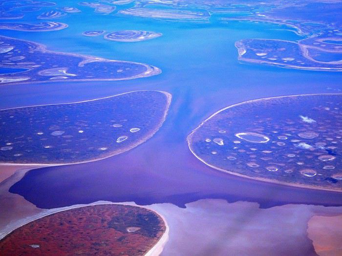
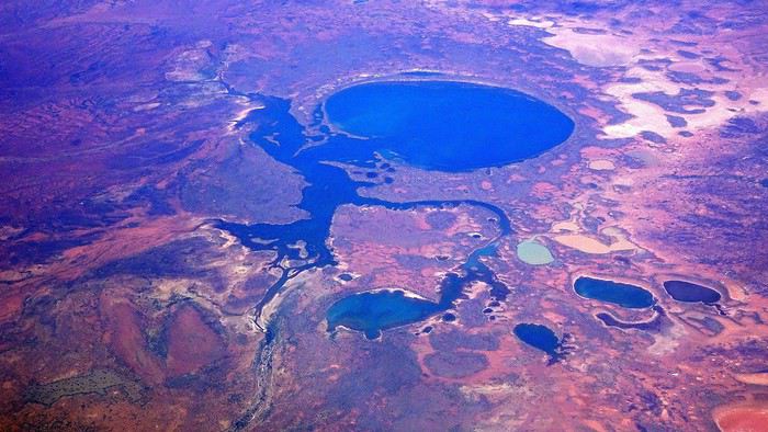
It was also my first time wearing a mask—it felt weird, pretty uncomfortable, and after a while, painful behind the ears. I really feel for those who have to wear one all day, every day. The flight lasted three long hours, but luckily, I had a good book. From the window, I watched an endless expanse of salt lakes in all shapes and sizes—round, elongated, gray, white, sometimes blue and green—and an infinity of winding, capricious meanders, along with long straight lines that led nowhere. The last half-hour got more interesting as rocky, swollen formations and long, sloping plateaus appeared. Against the vast ochre landscape, green patches became more frequent.
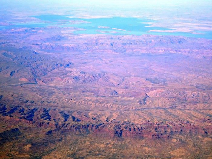
Just before landing, rows of green fields briefly appeared, along with an surprisingly wide river—but we were already rolling down the tarmac. A few hangars, a myriad of small, stationary planes, and a tiny terminal topped with a sign: “Welcome to Kununurra.”
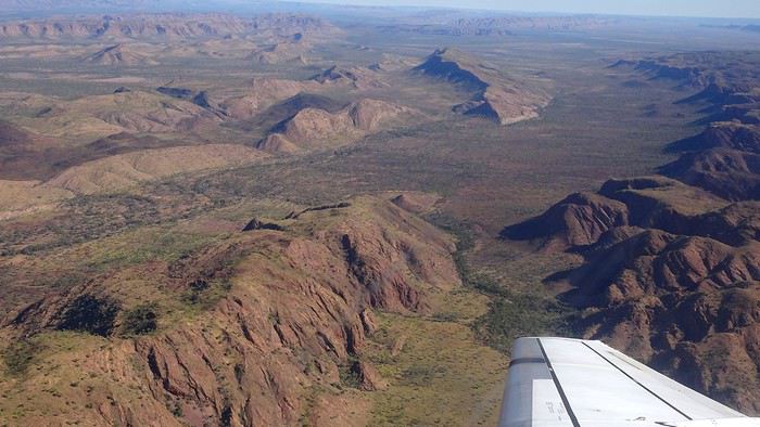
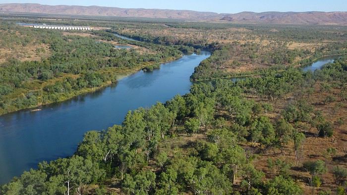
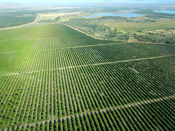
We wanted heat, and here it was—34°C the moment we stepped off the plane! We felt alive again and totally ridiculous in our jeans and sweaters. We quickly grabbed our suitcase and picked up the 4x4 we’d rented—more out of necessity, since only that type of vehicle can access the national parks we planned to visit.
Just four kilometers separated us from Kununurra, a town of 5,000 people founded in 1961 during the construction of the Lake Argyle Dam and the development of the Ord River Irrigation Area Scheme (more on that later). On the horizon, mountain ranges (a bit of an exaggeration, since we know Mt. Meharry, WA’s highest ‘mountain,’ doesn’t even reach 1,250 meters!) and closer to the road, a few irrigation canals cutting through stretches of bush, then a huge park overlooking a small lake lined with reeds.
A row of baobabs (yes, there are baobabs in Australia too!), a series of motels with immaculate lawns, a gas station, and there’s the main street leading to the town center—that is, the parking lots of the two supermarkets, the bottleshop, the pub, the Town Hall, the municipal pool, and the Tourist Office (already closed!), and at the next roundabout, another park, the Presbyterian church, and a few other shops. In short, two or three green blocks that you can explore in no time.
One road leads to the small industrial area and one of the town’s three or four campgrounds, while another heads toward the residential neighborhoods, which look just like the typical suburbs you find in any Australian city—except with tropical vegetation. We stocked up at Coles, an identical copy of the one near our place, and—surprise—the prices were practically the same.
We checked into one of the motels. The receptionist listed the town’s three or four restaurants, insisting that it’s always better to book a table. She recommended the Pump House, a bit outside town on the lake’s edge. “Best spot to watch the sunset, but hurry up.” she told us. It was only 5:00 PM!
When we got there half an hour later, the place was packed, and the sun had already disappeared behind a row of trees! Sure enough, we’d see a few days later that the sunset can be a stunning spectacle—if you wait a bit for the sky (especially if it’s cloudy) to blaze and reflect in the lake’s calm waters. A little disappointed, we headed back into town, where we easily found the other lively spot in town: the pub (nothing like an old English pub). Above the long L-shaped bar, several giant screens (thankfully muted) were broadcasting live footy, rugby league, etc. In one corner, players circled the pool table, while in another, customers were digging into plates of the day’s special. Instead of rooms, there were various patios where groups of friends and coworkers (easily recognizable by the fluoro vests they were still wearing) were gathered. We found a table under a mango tree—unfortunately, a little too close to the guitarist strumming his entire Country Music repertoire, complete with Keith Urban-style tremolos. Guaranteed culture shock!
Since it’s the custom here, we called the Country Club to book a table before the kitchen closed! The CC is the town’s—and even the region’s—fancy spot. Dark decor, modern furniture, dim lighting, and the air conditioning blasting. The twenty or so customers had taken refuge on the vast terrace, lit by torches. The view of the tall eucalyptus trees, illuminated by spotlights shifting from red to blue, was breathtaking.
The menu was minimal, but the grilled salmon was excellent, and the Pavlova (the meringue dessert Kiwis and Aussies have been arguing over since 1906) with melon and watermelon was absolutely divine.
It wasn’t even 9:00 PM, and we were already in bed. Had we already adopted the Top West End’s chicken schedule?!
To be continued... Journal dedicated to Attila
As usual, I didn’t manage to keep it short, but this time I’ve got photos to go with it!
August 2020. Since the opportunities to explore the world are extremely limited right now, all we (R&X) can do is explore our own island! Well, just a part of it, because with the state borders still closed, we’re stuck in Western Australia (WA).
Luckily, we’re pretty fortunate because this state is huge: over 2.5 million km² (that’s more than four times the size of France or 1.5 times Quebec). What’s more, stretching over 20 degrees of latitude between the Antarctic Ocean and the Timor Sea, you’ll find climates ranging from Mediterranean to arid to tropical. That’s actually why we decided to head as far north as possible. Sick of the endless rainy winter in Perth, bring on the heat of the Kimberley... way up Nooorth!
Friday. At the airport, the main terminal was closed (not enough flights), so we ended up in the annex (where flights to the various mines usually depart from). There was no crowd at the gate, and in this huge, single departure lounge, empty seats were plentiful. Only three flights were listed on the screens for the rest of the morning: the first to Coondewanna (?), the second to Darwin, and ours to Kununurra (code KNX).
A cool breeze swept through the half-open corridors along the runways. At the top of the walkway leading to the Fokker 100 (the Airbuses and Boeings are now parked!), a flight attendant greeted us with a basket full of sanitary masks. We were actually the only masked passengers (the staff weren’t wearing them either). With zero Covid-19 cases in WA at the time, the only rule was to maintain social distancing—something pretty hard to do on a full plane!
It was also my first time wearing a mask—it felt weird, pretty uncomfortable, and after a while, painful behind the ears. I really feel for those who have to wear one all day, every day. The flight lasted three long hours, but luckily, I had a good book. From the window, I watched an endless expanse of salt lakes in all shapes and sizes—round, elongated, gray, white, sometimes blue and green—and an infinity of winding, capricious meanders, along with long straight lines that led nowhere. The last half-hour got more interesting as rocky, swollen formations and long, sloping plateaus appeared. Against the vast ochre landscape, green patches became more frequent.
Just before landing, rows of green fields briefly appeared, along with an surprisingly wide river—but we were already rolling down the tarmac. A few hangars, a myriad of small, stationary planes, and a tiny terminal topped with a sign: “Welcome to Kununurra.”
We wanted heat, and here it was—34°C the moment we stepped off the plane! We felt alive again and totally ridiculous in our jeans and sweaters. We quickly grabbed our suitcase and picked up the 4x4 we’d rented—more out of necessity, since only that type of vehicle can access the national parks we planned to visit.
Just four kilometers separated us from Kununurra, a town of 5,000 people founded in 1961 during the construction of the Lake Argyle Dam and the development of the Ord River Irrigation Area Scheme (more on that later). On the horizon, mountain ranges (a bit of an exaggeration, since we know Mt. Meharry, WA’s highest ‘mountain,’ doesn’t even reach 1,250 meters!) and closer to the road, a few irrigation canals cutting through stretches of bush, then a huge park overlooking a small lake lined with reeds.
A row of baobabs (yes, there are baobabs in Australia too!), a series of motels with immaculate lawns, a gas station, and there’s the main street leading to the town center—that is, the parking lots of the two supermarkets, the bottleshop, the pub, the Town Hall, the municipal pool, and the Tourist Office (already closed!), and at the next roundabout, another park, the Presbyterian church, and a few other shops. In short, two or three green blocks that you can explore in no time.
One road leads to the small industrial area and one of the town’s three or four campgrounds, while another heads toward the residential neighborhoods, which look just like the typical suburbs you find in any Australian city—except with tropical vegetation. We stocked up at Coles, an identical copy of the one near our place, and—surprise—the prices were practically the same.
We checked into one of the motels. The receptionist listed the town’s three or four restaurants, insisting that it’s always better to book a table. She recommended the Pump House, a bit outside town on the lake’s edge. “Best spot to watch the sunset, but hurry up.” she told us. It was only 5:00 PM!
When we got there half an hour later, the place was packed, and the sun had already disappeared behind a row of trees! Sure enough, we’d see a few days later that the sunset can be a stunning spectacle—if you wait a bit for the sky (especially if it’s cloudy) to blaze and reflect in the lake’s calm waters. A little disappointed, we headed back into town, where we easily found the other lively spot in town: the pub (nothing like an old English pub). Above the long L-shaped bar, several giant screens (thankfully muted) were broadcasting live footy, rugby league, etc. In one corner, players circled the pool table, while in another, customers were digging into plates of the day’s special. Instead of rooms, there were various patios where groups of friends and coworkers (easily recognizable by the fluoro vests they were still wearing) were gathered. We found a table under a mango tree—unfortunately, a little too close to the guitarist strumming his entire Country Music repertoire, complete with Keith Urban-style tremolos. Guaranteed culture shock!
Since it’s the custom here, we called the Country Club to book a table before the kitchen closed! The CC is the town’s—and even the region’s—fancy spot. Dark decor, modern furniture, dim lighting, and the air conditioning blasting. The twenty or so customers had taken refuge on the vast terrace, lit by torches. The view of the tall eucalyptus trees, illuminated by spotlights shifting from red to blue, was breathtaking.
The menu was minimal, but the grilled salmon was excellent, and the Pavlova (the meringue dessert Kiwis and Aussies have been arguing over since 1906) with melon and watermelon was absolutely divine.
It wasn’t even 9:00 PM, and we were already in bed. Had we already adopted the Top West End’s chicken schedule?!
To be continued... Journal dedicated to Attila
Three weeks in Quebec at the start of summer 2018, on a "semi-organized" trip
I’ve been putting off posting my Quebec travel experience for a long time. Two years later, I’ve finally decided to share it. The memories are still vivid. I hope this gives you the urge to visit this beautiful region, which I literally fell in love with.
We’re traveling as four adults: my brother Guy, my sister-in-law Martine, my friend Pascal, and myself (Christian).
We entrusted the flight, hotel, and car reservations to the travel agency Amplitudes in Toulouse. Planning the day-to-day activities was up to us. We scheduled a few must-see visits, but for the rest, we’d figure it out on the spot.
Our itinerary: Quebec City / Rimouski / Carleton-sur-Mer / Percé / Sainte-Anne-des-Monts / Matane / Tadoussac / Sainte-Rose-du-Nord / Chambord / Saint-Alexis-des-Monts / Montreal
06/25 Here we are at Roissy Charles de Gaulle for the usual pre-flight formalities. Everything goes smoothly and quickly. The hardest part is waiting for takeoff. After an uneventful flight on an Air Canada Boeing 777-300ER, we land at Montréal-Pierre Elliott Trudeau Airport (YUL) in the early afternoon.
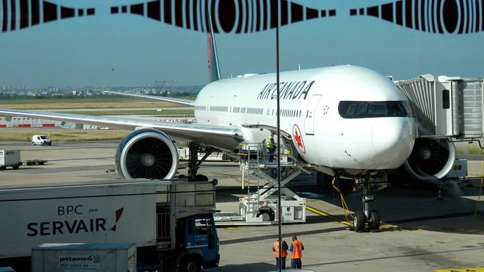
At customs, a surprise—no grumpy officer, but a smiling customs agent who jokingly asks me to name three tourist spots in Quebec, or else he won’t let me in. I pass the test easily and enter Quebec!
We head to the Alamo counter at Trudeau Airport to pick up our car: a Ford Escape with only 300 kilometers on the odometer.
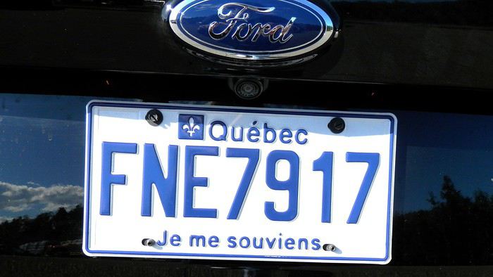
We decided to head straight to Quebec City, saving Montreal for the end of the trip. Pascal takes the wheel and gets on the Trans-Canada Highway E20 for a 255 km drive, taking about 2 hours and 45 minutes. With the time difference, we’re already feeling hungry, so we stop for our first poutine at a highway restaurant.

When we arrive in Quebec City, we go straight to the Clarendon Hotel, located right in the heart of Old Quebec. We’ll be staying there for three nights. Tonight, no restaurant—just a short walk around the hotel before bed. We discover a square with pretty colored water fountains near the city hall.
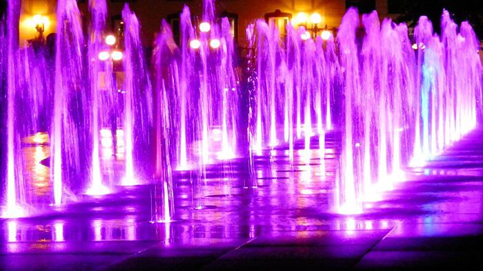 It’s only 9 PM, but our body clocks say it’s 3 AM.
We’re traveling as four adults: my brother Guy, my sister-in-law Martine, my friend Pascal, and myself (Christian).
We entrusted the flight, hotel, and car reservations to the travel agency Amplitudes in Toulouse. Planning the day-to-day activities was up to us. We scheduled a few must-see visits, but for the rest, we’d figure it out on the spot.
Our itinerary: Quebec City / Rimouski / Carleton-sur-Mer / Percé / Sainte-Anne-des-Monts / Matane / Tadoussac / Sainte-Rose-du-Nord / Chambord / Saint-Alexis-des-Monts / Montreal
06/25 Here we are at Roissy Charles de Gaulle for the usual pre-flight formalities. Everything goes smoothly and quickly. The hardest part is waiting for takeoff. After an uneventful flight on an Air Canada Boeing 777-300ER, we land at Montréal-Pierre Elliott Trudeau Airport (YUL) in the early afternoon.
At customs, a surprise—no grumpy officer, but a smiling customs agent who jokingly asks me to name three tourist spots in Quebec, or else he won’t let me in. I pass the test easily and enter Quebec!
We head to the Alamo counter at Trudeau Airport to pick up our car: a Ford Escape with only 300 kilometers on the odometer.
We decided to head straight to Quebec City, saving Montreal for the end of the trip. Pascal takes the wheel and gets on the Trans-Canada Highway E20 for a 255 km drive, taking about 2 hours and 45 minutes. With the time difference, we’re already feeling hungry, so we stop for our first poutine at a highway restaurant.
When we arrive in Quebec City, we go straight to the Clarendon Hotel, located right in the heart of Old Quebec. We’ll be staying there for three nights. Tonight, no restaurant—just a short walk around the hotel before bed. We discover a square with pretty colored water fountains near the city hall.
It’s only 9 PM, but our body clocks say it’s 3 AM.Selfie à Auschwitz
Bonjour à tous,
Le hasard total de mes "promenades " sur le net m'ont amené à un article du Huffington post qui explique que le centre mémorial d'Auschwitz a été contraint de faire un " rappel à l'ordre " devant la recrudescence des visiteurs ( comme si on visitait en ce lieu ! ) faisant des selfies devant la porte, devant les bâtiments, devant des photos de prisonniers décharnés, sur les rails....
J'ai eu peine à le croire et en regardant sur G images en tapant selfie Auschwitz, j'ai pu constater le summum de la honte ! Déjà, cette mode des selfies m'agace un peu, mais alors là, cela dépasse mon entendement et le respect qui doit prévaloir en ce lieu.
C'était mon " coup de gueule de ce soir,
Respect à vous toutes et tous et bonne soirée.
Le hasard total de mes "promenades " sur le net m'ont amené à un article du Huffington post qui explique que le centre mémorial d'Auschwitz a été contraint de faire un " rappel à l'ordre " devant la recrudescence des visiteurs ( comme si on visitait en ce lieu ! ) faisant des selfies devant la porte, devant les bâtiments, devant des photos de prisonniers décharnés, sur les rails....
J'ai eu peine à le croire et en regardant sur G images en tapant selfie Auschwitz, j'ai pu constater le summum de la honte ! Déjà, cette mode des selfies m'agace un peu, mais alors là, cela dépasse mon entendement et le respect qui doit prévaloir en ce lieu.
C'était mon " coup de gueule de ce soir,
Respect à vous toutes et tous et bonne soirée.
Les Cyclades en juillet: Anafi, Amorgos, Astypaléa
GENESE
Comme tous, le COVID a chamboulé nos plans. Normalement nous devions aller à Madagascar pendant un mois, projet reporté à l’année prochaine. Seulement, n’ayant jamais arrêté de travailler, malgré le confinement et le Covid j’avais réellement besoin de faire une « pause ».
Souhaitant limiter les risques de restrictions de déplacements nous ne quitterons pas l’Europe en nous centrant sur des endroits que nous avons toujours voulu visiter, mais habituellement trop fréquentés pour nous. Il y avait la Suisse avec ses montagnes et ses trains de légende, l’Islande et les îles Grecques.
Au final c’est l’attrait du soleil qui l’a emporté … enfin surtout auprès de madame ! Nous avions « entrevu » Santorin et Myconos lors d’une croisière en méditerranée en 2007 avec les enfants. Nous avions adoré … sauf la fréquentation !
Le premier élément à choisir est le point d’entrée, accessible en avion. Il y a Santorin et Myconos dans les Cyclades. Comme je rêvais de revoir la caldera de Santorin, le choix fut rapide. Ensuite je voulais des îles peu fréquentées ne nécessitant pas de trop long trajet en ferry. Sur 2 semaines 3 îles m’a paru être le bon choix. Avec le recul je confirme que c’est un bon dosage. Je me suis beaucoup servi du site Hellenica et Cycladen.be, qui sont très bien, pour faire mes choix.
La première sera Anafi, dans la catégorie « peu fréquentée » elle est très bien placée, en plus elle est petite, montagneuse et avec de belles plages. Une des raisons de sa faible fréquentation est le peu de liaison maritimes, ce sera donc à partir de cette contrainte que s’articulera le voyage.
Le second choix sera Astypalea car il y a un aéroport pour repartir, en plus c’est aussi une île peu fréquentée par les étrangers. Elle fait partie des Dodécanèse mais géographique se trouve proche des Cyclades.
Amorgos se glissera très naturellement entre les deux.
Une fois le planning établi j’ai réservé les vols chez Volotea qui a le bon goût de partir de Strasbourg … mauvais choix car les vols seront annulés 2 semaines plus tard.🏴☠️ Je me suis retourné vers Easy Jet qui part de Bâle Mulhouse, finalement tout aussi proche de chez nous que Strasbourg. Il faut dire qu’en Alsace nous avons la chance d’avoir pas mal d’aéroports dans un rayon de 3 heures autour de chez nous (en plus des deux précités il y a surtout Zurich et Frankfurt). Nous ferons donc BSL – Athènes – Santorin puis Astypalea – Athènes – BSL.
J’ai réservé par internet en direct les pensions : Villa Kalamiotissa pour Anafi Emprostiada Traditional Guest House et Pano Gitonia pour Amorgos Studio Killindra pour Astypalea Je réserve aussi une voiture à Amorgos puisque l’île est assez grande … et au final, suite à un échange avec mon logeur, également à Anafi.
Le roadbook sera assez rapide à établir … tant mieux car je n’ai que très peu de temps disponible, relancer mon entreprise suite au Covid-19 a accaparé tout mon temps.
En voiture ... pour ceux qui veulent 🙂
Comme tous, le COVID a chamboulé nos plans. Normalement nous devions aller à Madagascar pendant un mois, projet reporté à l’année prochaine. Seulement, n’ayant jamais arrêté de travailler, malgré le confinement et le Covid j’avais réellement besoin de faire une « pause ».
Souhaitant limiter les risques de restrictions de déplacements nous ne quitterons pas l’Europe en nous centrant sur des endroits que nous avons toujours voulu visiter, mais habituellement trop fréquentés pour nous. Il y avait la Suisse avec ses montagnes et ses trains de légende, l’Islande et les îles Grecques.
Au final c’est l’attrait du soleil qui l’a emporté … enfin surtout auprès de madame ! Nous avions « entrevu » Santorin et Myconos lors d’une croisière en méditerranée en 2007 avec les enfants. Nous avions adoré … sauf la fréquentation !
Le premier élément à choisir est le point d’entrée, accessible en avion. Il y a Santorin et Myconos dans les Cyclades. Comme je rêvais de revoir la caldera de Santorin, le choix fut rapide. Ensuite je voulais des îles peu fréquentées ne nécessitant pas de trop long trajet en ferry. Sur 2 semaines 3 îles m’a paru être le bon choix. Avec le recul je confirme que c’est un bon dosage. Je me suis beaucoup servi du site Hellenica et Cycladen.be, qui sont très bien, pour faire mes choix.
La première sera Anafi, dans la catégorie « peu fréquentée » elle est très bien placée, en plus elle est petite, montagneuse et avec de belles plages. Une des raisons de sa faible fréquentation est le peu de liaison maritimes, ce sera donc à partir de cette contrainte que s’articulera le voyage.
Le second choix sera Astypalea car il y a un aéroport pour repartir, en plus c’est aussi une île peu fréquentée par les étrangers. Elle fait partie des Dodécanèse mais géographique se trouve proche des Cyclades.
Amorgos se glissera très naturellement entre les deux.
Une fois le planning établi j’ai réservé les vols chez Volotea qui a le bon goût de partir de Strasbourg … mauvais choix car les vols seront annulés 2 semaines plus tard.🏴☠️ Je me suis retourné vers Easy Jet qui part de Bâle Mulhouse, finalement tout aussi proche de chez nous que Strasbourg. Il faut dire qu’en Alsace nous avons la chance d’avoir pas mal d’aéroports dans un rayon de 3 heures autour de chez nous (en plus des deux précités il y a surtout Zurich et Frankfurt). Nous ferons donc BSL – Athènes – Santorin puis Astypalea – Athènes – BSL.
J’ai réservé par internet en direct les pensions : Villa Kalamiotissa pour Anafi Emprostiada Traditional Guest House et Pano Gitonia pour Amorgos Studio Killindra pour Astypalea Je réserve aussi une voiture à Amorgos puisque l’île est assez grande … et au final, suite à un échange avec mon logeur, également à Anafi.
Le roadbook sera assez rapide à établir … tant mieux car je n’ai que très peu de temps disponible, relancer mon entreprise suite au Covid-19 a accaparé tout mon temps.
En voiture ... pour ceux qui veulent 🙂
La crème miracle c'est vraiment le pied?
Bonjour,
Comme beaucoup ici mon passeport restera donc dans son tiroir cet été. Mon vélo, lui, restera dans le garage et c'est en France, et à pied, que je vais voyager. Départ de Calais dans la semaine prochaine. L'idée est de rejoindre Hendaye, en 3 mois environ. J'ai déjà traversé la France en marchant il y a une dizaine d'années ( de Saint-Malo à Menton ). Je crois que j'ai réuni tout mon matériel ( je vais bivouaquer le plus clair du temps, donc le sac sera plutôt lourd ). Je vais étrenner mes Meindl en cuir toutes neuves pour l'occasion, donc je prends des kilomètres de sparadrap pour éteindre mes ampoules 🙂. Par contre je me demandais s'il existait une crème qui détend muscles et/ou tendons en fin d'étape ? Quotidiennement je pédale beaucoup mais je n'ai pas beaucoup marché ces derniers temps et j'ai peur des jambes-piquets du petit matin, surtout au début...
L.
Comme beaucoup ici mon passeport restera donc dans son tiroir cet été. Mon vélo, lui, restera dans le garage et c'est en France, et à pied, que je vais voyager. Départ de Calais dans la semaine prochaine. L'idée est de rejoindre Hendaye, en 3 mois environ. J'ai déjà traversé la France en marchant il y a une dizaine d'années ( de Saint-Malo à Menton ). Je crois que j'ai réuni tout mon matériel ( je vais bivouaquer le plus clair du temps, donc le sac sera plutôt lourd ). Je vais étrenner mes Meindl en cuir toutes neuves pour l'occasion, donc je prends des kilomètres de sparadrap pour éteindre mes ampoules 🙂. Par contre je me demandais s'il existait une crème qui détend muscles et/ou tendons en fin d'étape ? Quotidiennement je pédale beaucoup mais je n'ai pas beaucoup marché ces derniers temps et j'ai peur des jambes-piquets du petit matin, surtout au début...
L.
Suisse, pays de lacs et montagnes du 16 au 28 mai 2020
Bonjour,
Comme pour beaucoup de voyageurs, le Coronavirus a perturbé nos plans pour cette année. Notre road trip au Pérou est tombé à l’eau et la fermeture des frontières ne nous permettait pas de quitter la Suisse.
Heureusement, en Suisse, nous n’avons pas subi un confinement strict et nous pouvions nous déplacer librement dans le pays, en respectant certaines règles (distance de 2 mètres entres les personnes, rassemblements de maximum 5 personnes). De plus, une semaine avant notre départ, les magasins, restaurants et musées pouvaient ouvrir. Par contre, les campings, télécabines et télésièges sont restés fermés jusqu’au 6 juin.
Nous avons décidé de ne pas préparer un itinéraire fixe. Le but principal était le canton des Grisons que nous connaissions très peu. Pour y aller et pour revenir, nous avons traversé d’autres cantons où nous avons profité de faire des visites et randonnées. Certains endroits nous étaient bien connus, mais les voir sans les touristes habituels, asiatiques, indiens et américains, change complètement la perception des lieux. Imaginez, le fameux pont de la Chapelle à Lucerne, sans les hordes de touristes asiatiques qui l’envahissent tous les jours.
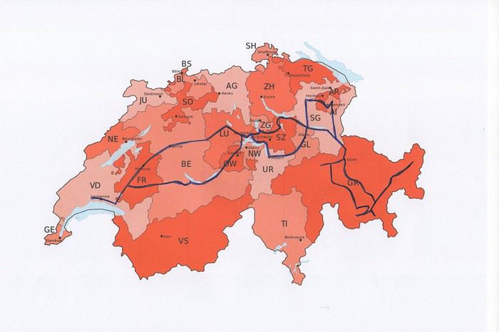
Nous avons loué un van, afin d’être autonome et libre. Notre choix s’est porté sur le VW California Ocean. Ce van est passe-partout, on peut facilement emprunter toutes les petites routes de montagnes et se parquer partout. Seul inconvénient, il n’a pas de salle de bain. La douche se fait à l’extérieur (eau froide), mais nous avons des toilettes portables. Le California Ocean est équipé avec une petite cuisine (un réchaud à gaz avec deux feux, un frigo de 42 litres, un petit évier). Il y a des placards sous la cuisine, au-dessus de la banquette et à l’arrière, ainsi qu’un grand tiroir sous la banquette. Les sièges avant se tournent, il y a deux tables, une à l’intérieur et une autre, encastrée dans la portière, pour l’extérieur. Les deux chaises pour l’extérieur sont encastrées dans la porte du coffre. Le toit se lève, on peut donc se mettre debout à l’intérieur du van. Le lit sous le toit est confortable, avec son sommier sur lequel sont fixé des ressorts. Un store extérieur nous protège du soleil lorsqu’on est à l’arrêt. Le chauffage stationnaire est bien agréable pour chauffer l’habitacle lorsqu’il fait froid. Il y a aussi plusieurs prises, dont une qui fonctionne avec la deuxième batterie et permet de charger le téléphone, tablette, etc. la nuit. Bref, ce petit van est vraiment fonctionnel.
Au dernier moment, nous avons décidé de prendre notre chien Tidou avec nous. Il a fallu adapter nos randonnées et visites. Eh oui, notre Tidou n’est plus tout jeune et il a des soucis avec son dos. Nous avons acheté un sac à dos spécifique, pour pouvoir le porter en terrain abrupte et lorsqu’il sera trop fatigué.
Nous avons chargé l’application park4night sur nos iPhones. Cette application est bien utile pour trouver des emplacements pour passer la nuit. Contrairement, à ce que l’on peut souvent lire, nous n’avons rencontré aucune difficulté pour passer la nuit. Le camping sauvage est donc possible en Suisse, si on ne s’installe pas pour plusieurs jours au même endroit. Concernant l’eau potable, on trouve de nombreuses fontaines, le plus souvent avec de l’eau potable.
Comme pour beaucoup de voyageurs, le Coronavirus a perturbé nos plans pour cette année. Notre road trip au Pérou est tombé à l’eau et la fermeture des frontières ne nous permettait pas de quitter la Suisse.
Heureusement, en Suisse, nous n’avons pas subi un confinement strict et nous pouvions nous déplacer librement dans le pays, en respectant certaines règles (distance de 2 mètres entres les personnes, rassemblements de maximum 5 personnes). De plus, une semaine avant notre départ, les magasins, restaurants et musées pouvaient ouvrir. Par contre, les campings, télécabines et télésièges sont restés fermés jusqu’au 6 juin.
Nous avons décidé de ne pas préparer un itinéraire fixe. Le but principal était le canton des Grisons que nous connaissions très peu. Pour y aller et pour revenir, nous avons traversé d’autres cantons où nous avons profité de faire des visites et randonnées. Certains endroits nous étaient bien connus, mais les voir sans les touristes habituels, asiatiques, indiens et américains, change complètement la perception des lieux. Imaginez, le fameux pont de la Chapelle à Lucerne, sans les hordes de touristes asiatiques qui l’envahissent tous les jours.
Nous avons loué un van, afin d’être autonome et libre. Notre choix s’est porté sur le VW California Ocean. Ce van est passe-partout, on peut facilement emprunter toutes les petites routes de montagnes et se parquer partout. Seul inconvénient, il n’a pas de salle de bain. La douche se fait à l’extérieur (eau froide), mais nous avons des toilettes portables. Le California Ocean est équipé avec une petite cuisine (un réchaud à gaz avec deux feux, un frigo de 42 litres, un petit évier). Il y a des placards sous la cuisine, au-dessus de la banquette et à l’arrière, ainsi qu’un grand tiroir sous la banquette. Les sièges avant se tournent, il y a deux tables, une à l’intérieur et une autre, encastrée dans la portière, pour l’extérieur. Les deux chaises pour l’extérieur sont encastrées dans la porte du coffre. Le toit se lève, on peut donc se mettre debout à l’intérieur du van. Le lit sous le toit est confortable, avec son sommier sur lequel sont fixé des ressorts. Un store extérieur nous protège du soleil lorsqu’on est à l’arrêt. Le chauffage stationnaire est bien agréable pour chauffer l’habitacle lorsqu’il fait froid. Il y a aussi plusieurs prises, dont une qui fonctionne avec la deuxième batterie et permet de charger le téléphone, tablette, etc. la nuit. Bref, ce petit van est vraiment fonctionnel.
Au dernier moment, nous avons décidé de prendre notre chien Tidou avec nous. Il a fallu adapter nos randonnées et visites. Eh oui, notre Tidou n’est plus tout jeune et il a des soucis avec son dos. Nous avons acheté un sac à dos spécifique, pour pouvoir le porter en terrain abrupte et lorsqu’il sera trop fatigué.
Nous avons chargé l’application park4night sur nos iPhones. Cette application est bien utile pour trouver des emplacements pour passer la nuit. Contrairement, à ce que l’on peut souvent lire, nous n’avons rencontré aucune difficulté pour passer la nuit. Le camping sauvage est donc possible en Suisse, si on ne s’installe pas pour plusieurs jours au même endroit. Concernant l’eau potable, on trouve de nombreuses fontaines, le plus souvent avec de l’eau potable.
Je vous invite à découvrir l'île de Lanzarote
INTRODUCTION
Des vidéos sont insérées tout au long du résumé. Veuillez cliquer sur l'image pour démarrer la vidéo.
En février dernier, nous avons séjourné 2 semaines sur l'île de Lanzarote afin d'en découvrir les différents attraits touristiques.
Comme la plupart de nos précédents voyages, plusieurs semaines ont été consacrées à la création de notre itinéraire afin de pouvoir être en mesure d'atteindre parfaitement nos objectifs.
Lors de notre séjour, nous avons utilisé l'application Maps.me, une application mobile qui fournit des cartes hors ligne. Cette application s'avère très précieuse lors de nos déplacements en voiture, en randonnée et même lors de nos circuits à pied dans les grandes villes.
J'avais préalablement téléchargé les coordonnées GPS de toutes les attractions prévues à notre itinéraire dans l'application Maps.me, ce qui a facilité grandement nos déplacements.
La réservation de l'hébergement ainsi que la location d'une voiture ont été effectuées sur le web avant notre départ.
Nous sommes partis de l'aéroport de Québec et avons eu une escale à Montréal ainsi qu'à Bruxelles en Belgique avant d'atteindre Lanzarote.
Lanzarote fait partie des Îles Canaries qui elles-mêmes sont situées dans l'océan Atlantique, à l'ouest du Maroc. Celles-ci font d'ailleurs partie de l'Espagne.
Nous avions déjà visité l'île de Tenerife et nous avions adoré notre séjour à cet endroit.
Nous avons donc décidé de poursuivre la découverte des Îles Canaries en nous rendant à Lanzarote car cette île offre un paysage volcanique spectaculaire, des plages à faire rêver ainsi que de magnifiques villages aux maisons typiques de l'île qui sont majoritairement blanches.
Les sentiers de randonnée sont nombreux et nous permettent de découvrir une grande diversité de paysages.
Les attraits touristiques sont également fort nombreux et facilement accessibles car les routes de Lanzarote se parcourent aisément en voiture car celles-ci sont dans un état impeccable.
D'ailleurs, c'est un pur plaisir que de se déplacer sur ces routes car les paysages qui défilent sous nos yeux sont sensationnels et présentent une perspective différente selon la lumière du jour.
Des vidéos sont insérées tout au long du résumé. Veuillez cliquer sur l'image pour démarrer la vidéo.
En février dernier, nous avons séjourné 2 semaines sur l'île de Lanzarote afin d'en découvrir les différents attraits touristiques.
Comme la plupart de nos précédents voyages, plusieurs semaines ont été consacrées à la création de notre itinéraire afin de pouvoir être en mesure d'atteindre parfaitement nos objectifs.
Lors de notre séjour, nous avons utilisé l'application Maps.me, une application mobile qui fournit des cartes hors ligne. Cette application s'avère très précieuse lors de nos déplacements en voiture, en randonnée et même lors de nos circuits à pied dans les grandes villes.
J'avais préalablement téléchargé les coordonnées GPS de toutes les attractions prévues à notre itinéraire dans l'application Maps.me, ce qui a facilité grandement nos déplacements.
La réservation de l'hébergement ainsi que la location d'une voiture ont été effectuées sur le web avant notre départ.
Nous sommes partis de l'aéroport de Québec et avons eu une escale à Montréal ainsi qu'à Bruxelles en Belgique avant d'atteindre Lanzarote.
Lanzarote fait partie des Îles Canaries qui elles-mêmes sont situées dans l'océan Atlantique, à l'ouest du Maroc. Celles-ci font d'ailleurs partie de l'Espagne.
Nous avions déjà visité l'île de Tenerife et nous avions adoré notre séjour à cet endroit.
Nous avons donc décidé de poursuivre la découverte des Îles Canaries en nous rendant à Lanzarote car cette île offre un paysage volcanique spectaculaire, des plages à faire rêver ainsi que de magnifiques villages aux maisons typiques de l'île qui sont majoritairement blanches.
Les sentiers de randonnée sont nombreux et nous permettent de découvrir une grande diversité de paysages.
Les attraits touristiques sont également fort nombreux et facilement accessibles car les routes de Lanzarote se parcourent aisément en voiture car celles-ci sont dans un état impeccable.
D'ailleurs, c'est un pur plaisir que de se déplacer sur ces routes car les paysages qui défilent sous nos yeux sont sensationnels et présentent une perspective différente selon la lumière du jour.
Porto Rico: 10 lieux à découvrir à San Juan
Le temps d'une escale à San Juan de Porto Rico, j'ai récemment découvert quelques lieux parmi les plus intéressants à visiter dans la capitale de cette île du nord des Caraïbes.
Bienvenue à Puerto Rrrrrico ! A prononcer avec un accent chantant et en faisant rouler les « r » comme aiment tant le faire les habitants de l'île.
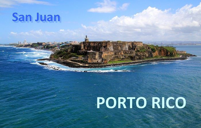
Abordées par la mer, les côtes portoricaines se dévoilent peu à peu … l'agglomération de San Juan est maintenant bien en vue. Des fortifications dominent la ville, sur un versant de falaise apparaît un quartier haut en couleurs, plus loin, on distingue dans la brume des plages et un alignement de buildings.

A mesure que l'on progresse dans la rade, c'est la vieille ville fondée par les conquistadors que l'on détaille du regard : une imbrication d'habitations et une imposante demeure blanche, celle des gouverneurs du territoire.

Voici 5 lieux au programme de nos visites, il en reste 5 autres à découvrir en suivant notre itinéraire d'une dizaine d'étapes dans cette agglomération de plus de deux millions d'habitants.
--
Viejo San Juan, le cœur historique de la ville
A placer en tête des visites à effectuer à San Juan de Porto Rico, celle de son Vieux quartier. Pour y apprécier notamment le charme de ses anciens monuments et de ses habitations au style colonial espagnol et pour y côtoyer également la décontraction de ses habitants au comportement très latino.
Il faut parcourir les rues de ce secteur historique, arpenter la rue SantoCristo ou Fortaleza, les plus fréquentées, les plus animées. Mais bien entendu, on ne doit pas hésiter à cheminer vers les petites rues de traverse, quitte à tomber sur une impasse ou à s'y égarer.

On y découvre des façades aux multiples couleurs, de belles décorations murales, des balcons et des ferronneries ouvragées. Un style inspiré par la lointaine Espagne, nous voilà plongés dans l'atmosphère coloniale du Nouveau Monde, celle des conquistadors des XVe au XVIe siècle.

Des maisons coloniales et des commerces longent les rues principales. Restaurants, bars, boutiques de souvenirs, galeries d'art et quelques magasins d'articles de luxe. Un exemple parmi d'autres avec au 202 de la RueSanto Cristo, une entrée par un porche qui dévoile une cour intérieure, un vrai patio qui ne détonnerait pas en Andalousie.

On continue la flânerie en battant le pavé du Viejo San Juan. Justement, au sujet de ces pavés, leur teinte bleutée étonne. On apprendra que ces pavés étaient utilisés comme ballast dans les cales des navires marchands à l'époque de la colonisation et que leurs reflets bleus satinés sont dus à l'usure du temps.

La façade inondée de lumière de la Cathédrale de San Juan domine de sa hauteur tout le quartier. Le premier édifice édifié ici date de 1521 mais il n'a pas résisté aux ouragans tropicaux fréquents sous ces latitudes. L'aspect actuel est plus récent, précisément de 1917.
Plus loin, notre déambulation nous mène de rue en rue, de la place ombragée de l'édifice catholique à la Place de l'Hôtel de ville. Là encore, la plupart des bâtiments témoignent du passé colonial de la ville les bâtisses restaurées dans le pure style de l'époque, il n'en manque pas dans le Viejo San Juan, on en compterait près de quatre cents.

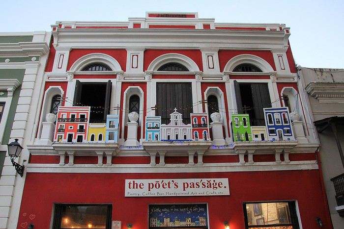
A l'extrémité de la rue Fortaleza, on parvient à cette imposante maison blanche appelée aussi « Fortaleza ». Perchée sur les falaises, elle domine toute la baie de San Juan. Sur la photo, on ne voit qu'une partie seulement du bâtiment construit à partir de 1533. L'édifice rénovée depuis son origine a été utilisé à certaines périodes d'arsenal et de prison.
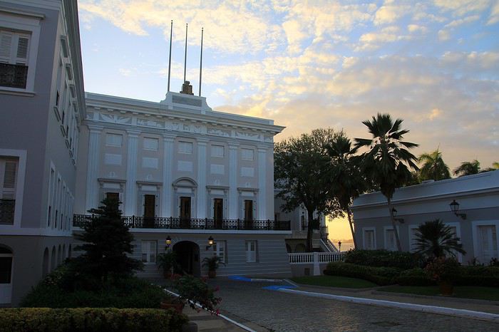
Une bâtisse où résident les Gouverneurs de l'île. Ainsi, ce sont quelques 170 Gouverneurs qui se sont succédé à la tête de cette colonie ultramarine.. L'île de Porto Rico s'honore d'être la première colonie espagnole du Nouveau Monde. Sur une des places de la ville trône la statue de l'illustre Ponce de Leon, un vaillant explorateur qui fut le premier Gouverneur de Porto Rico en 1509.

Après la guerre hispano-américaine, l'île est passée sous domination américaine, c'était en 1898. De nos jours Porto Rico a un statut particulier au sein des USA. Un État libre mais associé aux États-Unis. Les Porto Ricains ont la nationalité américaine mais ils ne votent pas pour les élections présidentielles des États-Unis. Le Gouverneur de l'île bénéficie d'une large autonomie de gestion de son territoire insulaire.
--
Les couleurs portoricaines
Là, il ne s'agit pas d'un lieu précis à voir mais plutôt d'une vision qui s'impose au regard lorsque l'on se balade dans les rues de San Juan. La ville est pavoisée presque à chaque coin de rue de drapeaux aux couleurs portoricaines.
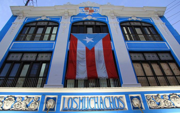
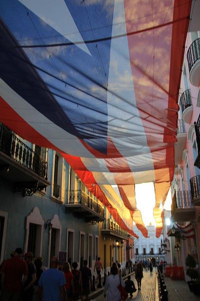
Dans une des rues passantes de la vieille ville il y a même un immense drapeau qui concurrence le bleu du ciel. Immense, ce voile fait office de décor et tamise les chauds rayons du soleil tropical. Ce drapeau local avec ses teintes bleues, blanches et rouges n'est pas sans en évoquer un autre, celui de l'île sœur, la proche Cuba. En effet, le graphisme est identique entre les deux étendards mais les couleurs sont inversées. Triangle bleu et alternance de bandes horizontales blanches et rouges pour Porto Rico et tout l'inverse pour celui de Cuba (triangle rouge et bandes blanches et bleues). Une certaine harmonie donc mais dans la différence, une idée inspirée à l'origine par le parti révolutionnaire cubain. La signification de ces teintes ? Le bleu pour le ciel et la mer, le blanc évoque la paix et le rouge le sang versé pour la patrie.
--
La Perla, un quartier populaire haut en couleur
Une vraie mosaïque aux teintes éclatantes, ce quartier de « La Perla » accroché aux falaises qui font face à l'océan. Il vaut assurément le coup d’œil et même un peu plus.
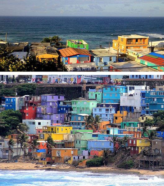
La meilleure vision est celle que l'on a depuis la mer, d'ailleurs on en avait bénéficié en arrivant depuis le large. A présent, nous longeons ce quartier ouvrier en parcourant la route de la corniche. Quel bric-à-brac avec ses modestes maisons dont certaines sont en piteux états … mais les couleurs sont là, tentant d'égayer à grand renfort de coups de pinceaux. La misère semble plus belle en technicolor. Tenez, là ! une façade est parée des couleurs de l'étendard portoricain, une tradition sur cette île.
Longtemps ce quartier populaire de San Juan a eu une mauvaise réputation : trafic de drogue et insécurité … autant dire que les visiteurs évitaient de s'y aventurer. Mais depuis 2017 la situation a changé, beaucoup de touristes vont y faire un tour et pas seulement pour sa palette de couleurs vives. Connaissez-vous Luis Fonsi ? Et la musique entêtante de son titre phare, « Despacito * » ? Ce chanteur portoricain a tourné son clip dans les ruelles de La Perla, aussi, des amateurs de ce morceau très « caliente », véritable hymne à la séduction latino, sont attirés ici. Ce clip de janvier 2017 a été un tube mondial et serait même le plus « streamé » de l'histoire !
--
Imposantes et dissuasives forteresses
Après la visite de la vielle ville, il faut en faire le tour, on pourrait presque parler de balade sur un long chemin de ronde tellement la périphérie du quartier est protégée de fortifications et de murailles. Les conquistadors savaient que leur colonie était convoitée, ils ont fait en sorte de bien la préserver. Quelques mots d'histoire à ce sujet. En 1595, ce sont les troupes de la marine anglaise qui attaquent, sans succès ! Puis c'est au tour des Hollandais en 1625 de tenter la prise de San Juan, ils réussirent à accéder à une partie de la cité mais furent repoussés par des Espagnols, ardents défenseurs de leur possession. En 1797, un nouvel assaut des Britanniques et un nouvel échec. Mais face aux bombardements américains de 1898, les militaires espagnols ont cette fois capitulés … San Juan et l'île de Porto Rico passèrent ainsi sous domination des États-Unis.
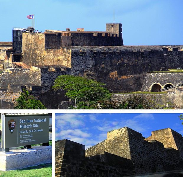
La route sur la corniche nord fait passer au pied d'imposantes murailles. Voici le Fort San Cristobal, une forteresse qui avait de bons atouts pour dissuader toutes attaques étrangères. Construit à partir de 1634, ce massif château fort fait honneur évidemment au célébrissime explorateur Christophe Colomb. Perché sur une colline, il domine l'ensemble de la ville, les falaises et surtout l'océan. Depuis le large, les éventuels assaillants l'apercevaient ainsi de très loin, aussi ils comprenaient vite ce a quoi il devaient s'attendre !
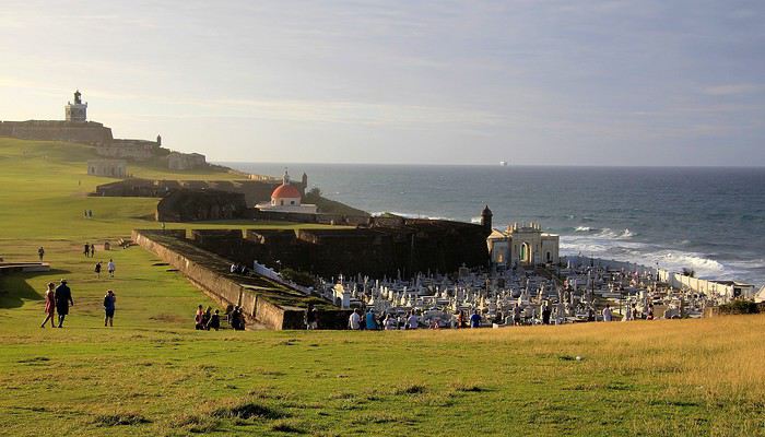
Tout au bout de la corniche, juché sur un promontoire rocheux on voit maintenant plein cadre le Fort San Felipe del Morro. Cette autre forteresse est idéalement située à l'entrée de la rade. Sa construction est antérieure à celle du Fort San Cristobal elle a débuté en 1539. A cette époque, il était facile de trouver de la main-d’œuvre … on parle de centaines d'esclaves enrôlés dans ces gigantesques travaux ! Un fort, un phare et à proximité une église et son cimetière au nom à rallonge : Santa Maria Magdalena de Pazzis. Un cimetière avec vue privilégié sur l'horizon marin, dommage que les morts qui y reposent en paix ne puissent en profiter ! L'impression de puissance que dégage le château amplement fortifié par ses murailles est contrebalancée par la douceur de la luminosité et par cette étendue verdoyante. La colline couverte d'herbe fait penser à un green de golf. On ne peut pas mieux dire … en effet, plus tard, lorsque ce lieu défensif a été investi par les troupes américaines, sur ces pelouses un terrain de golf a été aménagé pour les loisirs des soldats US !
Abordées par la mer, les côtes portoricaines se dévoilent peu à peu … l'agglomération de San Juan est maintenant bien en vue. Des fortifications dominent la ville, sur un versant de falaise apparaît un quartier haut en couleurs, plus loin, on distingue dans la brume des plages et un alignement de buildings.
A mesure que l'on progresse dans la rade, c'est la vieille ville fondée par les conquistadors que l'on détaille du regard : une imbrication d'habitations et une imposante demeure blanche, celle des gouverneurs du territoire.
Voici 5 lieux au programme de nos visites, il en reste 5 autres à découvrir en suivant notre itinéraire d'une dizaine d'étapes dans cette agglomération de plus de deux millions d'habitants.
--
Viejo San Juan, le cœur historique de la ville
A placer en tête des visites à effectuer à San Juan de Porto Rico, celle de son Vieux quartier. Pour y apprécier notamment le charme de ses anciens monuments et de ses habitations au style colonial espagnol et pour y côtoyer également la décontraction de ses habitants au comportement très latino.
Il faut parcourir les rues de ce secteur historique, arpenter la rue SantoCristo ou Fortaleza, les plus fréquentées, les plus animées. Mais bien entendu, on ne doit pas hésiter à cheminer vers les petites rues de traverse, quitte à tomber sur une impasse ou à s'y égarer.
On y découvre des façades aux multiples couleurs, de belles décorations murales, des balcons et des ferronneries ouvragées. Un style inspiré par la lointaine Espagne, nous voilà plongés dans l'atmosphère coloniale du Nouveau Monde, celle des conquistadors des XVe au XVIe siècle.
Des maisons coloniales et des commerces longent les rues principales. Restaurants, bars, boutiques de souvenirs, galeries d'art et quelques magasins d'articles de luxe. Un exemple parmi d'autres avec au 202 de la RueSanto Cristo, une entrée par un porche qui dévoile une cour intérieure, un vrai patio qui ne détonnerait pas en Andalousie.
On continue la flânerie en battant le pavé du Viejo San Juan. Justement, au sujet de ces pavés, leur teinte bleutée étonne. On apprendra que ces pavés étaient utilisés comme ballast dans les cales des navires marchands à l'époque de la colonisation et que leurs reflets bleus satinés sont dus à l'usure du temps.
La façade inondée de lumière de la Cathédrale de San Juan domine de sa hauteur tout le quartier. Le premier édifice édifié ici date de 1521 mais il n'a pas résisté aux ouragans tropicaux fréquents sous ces latitudes. L'aspect actuel est plus récent, précisément de 1917.
Plus loin, notre déambulation nous mène de rue en rue, de la place ombragée de l'édifice catholique à la Place de l'Hôtel de ville. Là encore, la plupart des bâtiments témoignent du passé colonial de la ville les bâtisses restaurées dans le pure style de l'époque, il n'en manque pas dans le Viejo San Juan, on en compterait près de quatre cents.
A l'extrémité de la rue Fortaleza, on parvient à cette imposante maison blanche appelée aussi « Fortaleza ». Perchée sur les falaises, elle domine toute la baie de San Juan. Sur la photo, on ne voit qu'une partie seulement du bâtiment construit à partir de 1533. L'édifice rénovée depuis son origine a été utilisé à certaines périodes d'arsenal et de prison.
Une bâtisse où résident les Gouverneurs de l'île. Ainsi, ce sont quelques 170 Gouverneurs qui se sont succédé à la tête de cette colonie ultramarine.. L'île de Porto Rico s'honore d'être la première colonie espagnole du Nouveau Monde. Sur une des places de la ville trône la statue de l'illustre Ponce de Leon, un vaillant explorateur qui fut le premier Gouverneur de Porto Rico en 1509.
Après la guerre hispano-américaine, l'île est passée sous domination américaine, c'était en 1898. De nos jours Porto Rico a un statut particulier au sein des USA. Un État libre mais associé aux États-Unis. Les Porto Ricains ont la nationalité américaine mais ils ne votent pas pour les élections présidentielles des États-Unis. Le Gouverneur de l'île bénéficie d'une large autonomie de gestion de son territoire insulaire.
--
Les couleurs portoricaines
Là, il ne s'agit pas d'un lieu précis à voir mais plutôt d'une vision qui s'impose au regard lorsque l'on se balade dans les rues de San Juan. La ville est pavoisée presque à chaque coin de rue de drapeaux aux couleurs portoricaines.
Dans une des rues passantes de la vieille ville il y a même un immense drapeau qui concurrence le bleu du ciel. Immense, ce voile fait office de décor et tamise les chauds rayons du soleil tropical. Ce drapeau local avec ses teintes bleues, blanches et rouges n'est pas sans en évoquer un autre, celui de l'île sœur, la proche Cuba. En effet, le graphisme est identique entre les deux étendards mais les couleurs sont inversées. Triangle bleu et alternance de bandes horizontales blanches et rouges pour Porto Rico et tout l'inverse pour celui de Cuba (triangle rouge et bandes blanches et bleues). Une certaine harmonie donc mais dans la différence, une idée inspirée à l'origine par le parti révolutionnaire cubain. La signification de ces teintes ? Le bleu pour le ciel et la mer, le blanc évoque la paix et le rouge le sang versé pour la patrie.
--
La Perla, un quartier populaire haut en couleur
Une vraie mosaïque aux teintes éclatantes, ce quartier de « La Perla » accroché aux falaises qui font face à l'océan. Il vaut assurément le coup d’œil et même un peu plus.
La meilleure vision est celle que l'on a depuis la mer, d'ailleurs on en avait bénéficié en arrivant depuis le large. A présent, nous longeons ce quartier ouvrier en parcourant la route de la corniche. Quel bric-à-brac avec ses modestes maisons dont certaines sont en piteux états … mais les couleurs sont là, tentant d'égayer à grand renfort de coups de pinceaux. La misère semble plus belle en technicolor. Tenez, là ! une façade est parée des couleurs de l'étendard portoricain, une tradition sur cette île.
Longtemps ce quartier populaire de San Juan a eu une mauvaise réputation : trafic de drogue et insécurité … autant dire que les visiteurs évitaient de s'y aventurer. Mais depuis 2017 la situation a changé, beaucoup de touristes vont y faire un tour et pas seulement pour sa palette de couleurs vives. Connaissez-vous Luis Fonsi ? Et la musique entêtante de son titre phare, « Despacito * » ? Ce chanteur portoricain a tourné son clip dans les ruelles de La Perla, aussi, des amateurs de ce morceau très « caliente », véritable hymne à la séduction latino, sont attirés ici. Ce clip de janvier 2017 a été un tube mondial et serait même le plus « streamé » de l'histoire !
--
Imposantes et dissuasives forteresses
Après la visite de la vielle ville, il faut en faire le tour, on pourrait presque parler de balade sur un long chemin de ronde tellement la périphérie du quartier est protégée de fortifications et de murailles. Les conquistadors savaient que leur colonie était convoitée, ils ont fait en sorte de bien la préserver. Quelques mots d'histoire à ce sujet. En 1595, ce sont les troupes de la marine anglaise qui attaquent, sans succès ! Puis c'est au tour des Hollandais en 1625 de tenter la prise de San Juan, ils réussirent à accéder à une partie de la cité mais furent repoussés par des Espagnols, ardents défenseurs de leur possession. En 1797, un nouvel assaut des Britanniques et un nouvel échec. Mais face aux bombardements américains de 1898, les militaires espagnols ont cette fois capitulés … San Juan et l'île de Porto Rico passèrent ainsi sous domination des États-Unis.
La route sur la corniche nord fait passer au pied d'imposantes murailles. Voici le Fort San Cristobal, une forteresse qui avait de bons atouts pour dissuader toutes attaques étrangères. Construit à partir de 1634, ce massif château fort fait honneur évidemment au célébrissime explorateur Christophe Colomb. Perché sur une colline, il domine l'ensemble de la ville, les falaises et surtout l'océan. Depuis le large, les éventuels assaillants l'apercevaient ainsi de très loin, aussi ils comprenaient vite ce a quoi il devaient s'attendre !
Tout au bout de la corniche, juché sur un promontoire rocheux on voit maintenant plein cadre le Fort San Felipe del Morro. Cette autre forteresse est idéalement située à l'entrée de la rade. Sa construction est antérieure à celle du Fort San Cristobal elle a débuté en 1539. A cette époque, il était facile de trouver de la main-d’œuvre … on parle de centaines d'esclaves enrôlés dans ces gigantesques travaux ! Un fort, un phare et à proximité une église et son cimetière au nom à rallonge : Santa Maria Magdalena de Pazzis. Un cimetière avec vue privilégié sur l'horizon marin, dommage que les morts qui y reposent en paix ne puissent en profiter ! L'impression de puissance que dégage le château amplement fortifié par ses murailles est contrebalancée par la douceur de la luminosité et par cette étendue verdoyante. La colline couverte d'herbe fait penser à un green de golf. On ne peut pas mieux dire … en effet, plus tard, lorsque ce lieu défensif a été investi par les troupes américaines, sur ces pelouses un terrain de golf a été aménagé pour les loisirs des soldats US !
Mais où qu'il est ce truc là (4)
Une pensée pour ceux qui vivent de tourisme au Népal
Namasté,
Bien sûr il a des milliers de morts dans le monde liés au COVD 19, bien sûr il y a bien plus de désastres dans les familles touchées par l’infection, mais je voulais juste avoir une pensée pour les Népalais qui subissent la double peine de cette pandémie.
J’ai des relations avec un responsable d’agence de treks à KTM, avec deux accompagnateurs de moyenne ( ?!) montagne et un guide de haute montagne. Pour eux l’avenir est très sombre et leur situation à court terme par le manque de touristes étrangers est quasi dramatique, mais je pense aussi à toutes ces personnes qui en vivent : porteurs, guesthouses, commerces etc etc..
Fait chier !
A++ Le Belu
Bien sûr il a des milliers de morts dans le monde liés au COVD 19, bien sûr il y a bien plus de désastres dans les familles touchées par l’infection, mais je voulais juste avoir une pensée pour les Népalais qui subissent la double peine de cette pandémie.
J’ai des relations avec un responsable d’agence de treks à KTM, avec deux accompagnateurs de moyenne ( ?!) montagne et un guide de haute montagne. Pour eux l’avenir est très sombre et leur situation à court terme par le manque de touristes étrangers est quasi dramatique, mais je pense aussi à toutes ces personnes qui en vivent : porteurs, guesthouses, commerces etc etc..
Fait chier !
A++ Le Belu
On the Silk Road: Chronicles of a Sixty-Something Traveling Completely Independently
From Beijing to Khiva: China, Kyrgyzstan, Tajikistan, Uzbekistan
Chronicle of anecdotes, highlights, and other adventures that marked this eight-week journey in 2018.
The Chinese Far West More than 30 years after my first trip to eastern China, I finally fulfilled an old dream: traveling solo from Beijing to the far west, discovering Xinjiang, the Uyghur people and the oppression they endure, the oases of Turpan and Kashgar, the Taklamakan Desert, the end of the Great Wall... The route was covered by train.
MENU PART 1: CHINA
1- Beijing (Jiankou) : the authentic Great Wall, without tourists 2- Cycling in Beijing, the best way to get around 3- Beijing : departure for the far west 4- Jiayuguan : getting by without English 5- Jiayuguan : scams and heritage 6- Dunhuang : abundance in the middle of the desert 7- Turpan : the Uyghurs under heavy surveillance 8- Kashgar : love at first sight for the old city 9- Kashgar : China’s recipe for controlling the populace 10- Tashkurgan : what on earth was I thinking going there! Kyrgyz border: a surreal epic Photo album from the 80s, contributions from other travelers (page 2)
1- JIANKOU Finding the authentic Great Wall, without tourists or a guide Friday, August 24, 2018 Thirty years later, I didn’t feel like revisiting the Great Wall at Badaling or any other overcrowded site. I chose to explore it at Jiankou, in its wildest, most authentic, and unrestored section, starting from a lost village deep in a valley—though it wasn’t *that* lost, since it had everything for communication.
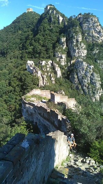
No need to pay for a taxi to get there—by timing it right, you can take the bus for just a few yuan. You have to get off at Xizhazi, the bus terminus. Be careful, there are only two buses a day in each direction. At the Xizhazi bus stop, I met a young couple who’d arrived with zero information about what to expect. We hiked the three of us toward the restored section of Mutianyu.
Still, be cautious With GPS and a topographic map (OpenTopoMap), you can set off without a problem or guide. The trail up to Jiankou is easy and well-marked. The trails down are too. But be careful—once you’re on the Wall, it’s real mountain hiking, with easy but dangerous climbing sections (over sheer drops). Not for amateurs or those afraid of heights! But what a reward. The Wall all to yourself, where it’s at its most daring. Truly mesmerizing.
More photos...
2- BEIJING The best way to get around the capital Sunday, August 26 The best way to explore the city is still by bike. Most are in a bike-share system, but you need to use an app—WeChat, the app that does everything, like monitoring your every move. No way I was installing that.
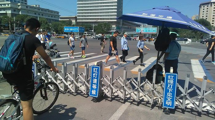
I found one at a rental shop near the hostel. The key is to quickly learn local traffic customs to minimize risks. Bike lanes are wide along the avenues.
But you still have to: - Watch out for anything parked on the bike paths—the most annoying are people napping or talking on the phone in their cars - Keep an eye on everything coming the wrong way—the list is long - The worst is right turns on red, which in Chinese traffic rules seem to have priority Once you get the hang of it, it’s fine. The city is huge but flat, so you can just wing it.
3- BEIJING By train to the far west Sunday, August 26 Beijing West Station is the size and operates like an airport. With your e-ticket from the agency, you first have to pick up your ticket at the special "English" counter, after passing through security. With your ticket in hand, you have to exit and enter through the boarding waiting area—not the platform—after a second security check.
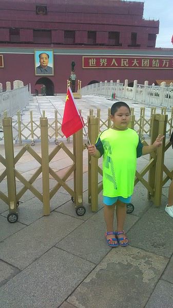 Then you find the right hall and wait for the sign to finally access the platform. In the end, it works pretty well given the incredible number of passengers to manage. Everywhere in Beijing, I saw that the Chinese have mastered crowd flow management.
Nice surprise: second-class carriages are clean, air-conditioned, and bright. Perfect, since I was in for 20 hours. One uniformed attendant per carriage, mobile meal service—luxury! Small downside: no luggage space. Hauling your suitcase up to the top bunk is quite a workout. I was in the middle, so it wasn’t too bad. The landscape, though, whether rural or urban, is pretty bleak. That should change once we leave the eastern plains.
Of course, I got my first police visit, with a thorough passport check and bag search. I was warned—going to the Chinese far west exposes you to this kind of hassle. But they were polite and respectful.
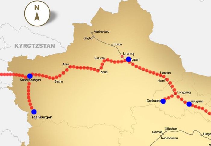 The Chinese Far West
4- JIAYUGUAN Getting by without English Monday, August 27 At the gates of two deserts (Gobi and Taklamakan) and at the foot of the Tibetan highlands, the Great Wall ends at Jiayuguan. Here, I found the deeper China I’d somewhat rediscovered during my bike ride, even if now everyone gets around on electric bikes and I’m no longer stared at like an alien.
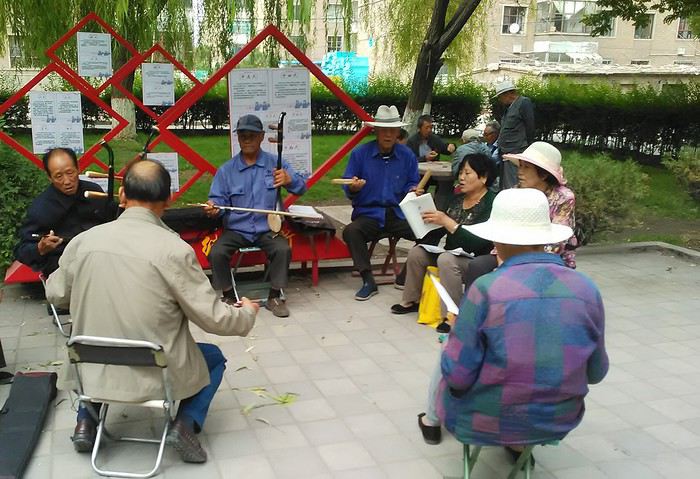
Prices are nothing like Beijing: you can find a full meal for 2 €, and my bike cost 7 € for two days. Plus, few people speak English—neither the owner of the HI hostel where I stayed, nor the ticket sellers at the sites, let alone the servers at the small eateries where I ate. Everything is written in Chinese. So I had to use the little Chinese I know to communicate about essentials. It makes the locals laugh to see a European trying to speak their language, but it earns respect. With Google Translate’s help, I managed.
Rant: With their avenues blocked for construction for kilometers without warning, and new roads not yet on maps, I must’ve taken 15 km of detours. More photos...
5- JIAYUGUAN Scams and heritage Tuesday, August 28 The Great Wall doesn’t exactly end at the fort I visited yesterday but 10 km further, at the entrance to a river gorge at the foot of the mountains. All that’s left is a badly damaged tower (more like a mound of earth) and a section of clay wall, similar to the one I biked yesterday.
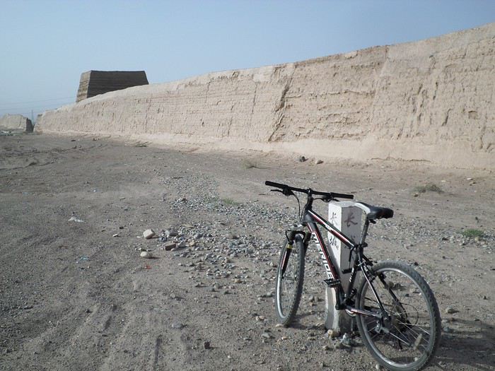
This morning, I hopped on my bike, determined to venture into the desert to see this highly symbolic site. First, you access it via a wide, brand-new road with not a soul in sight. Just before the site, I came across a grand welcome gate, very period-style, but it’s actually the inevitable toll booth.
Behind the gate, the road continues straight to the site, which you can see in the distance—at least 2 km away—the remains of the tower and wall. I had to leave my bike here. Fine. I went to the ticket counter and asked the price: 120 yuan! I couldn’t believe it—over 15 € for a simple mound of earth.
I showed my displeasure to the attendant, who couldn’t care less, and immediately turned back. 120 yuan—that’s the price for a new road, a fancy gate planted 2 km before the site just to force you to take a shuttle, and employees with nothing to do all day... Now I understand why I didn’t meet anyone!
Heritage China is a bit pricey Generally, sites are expensive for the country’s standard of living, but travelers are supposed to have money, so why hold back? I even gave up on the Forbidden City—reservations required days in advance (or on the black market at an impossible price). I prefer to keep the memory of my first visit, when entry must’ve cost a few dozen cents, and there were only a handful of visitors.
This morning, I took a taxi to see remarkable tombs of common people from the 3rd to 6th centuries. They’re small vaulted caves made of painted bricks, depicting scenes of daily life. Very pretty and moving. But even here, though the price was more reasonable, I was left wanting—only one of the 16 tombs is open to visitors, and it’s apparently not the most beautiful.
The authentic China—at least what’s left of it... Wandering the impersonal avenues of the city, you stumble upon a market. There, you still find traditional China—small shops with questionable hygiene, Go players, musicians, and even a dental prosthetist. The last refuge for those untouched by modernity. More photos...
6- DUNHUANG Abundance in the middle of the desert Wednesday, August 29 Well, I thought the landscape would be less bleak as I headed west. Nope. The only distraction in this expanse of dark, clayey sand is the forests of pylons and wind turbines, plus wild camels racing each other.
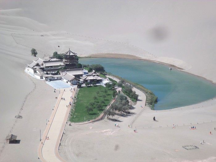 However, Dunhuang, the gateway to the Taklamakan, is by far the most pleasant Chinese city I know. There’s a real city center you can explore on foot. It’s hot but not unbearable, with a light, dry breeze. Much nicer than Beijing. The Han Chinese are still the majority, but the Muslim Uyghurs are more numerous, and the muezzin’s call to prayer echoes around the mosque.
The most surprising thing is the abundance and diversity of fruits and vegetables. You wonder how it all grows here. Well-irrigated, the desert sands are very fertile. Here, raisins have subtle, mysterious flavors, and the lamb really tastes like lamb.
Today, I visited the must-see Mingshashan, a dune complex next to which Pila is a molehill. The Basque Country, but covered in sand... More photos...
7- TURPAN The Uyghurs under heavy surveillance Friday, August 31 Surveillance cameras everywhere in the city, armed police stationed at intersections, in front of public buildings, at the entrance and inside tourist sites, police stations on every corner, patrols on foot or by car, khaki uniforms even for middle schoolers... here, the Han Chinese are in the minority, and you can feel it. Turpan feels like a city under siege.
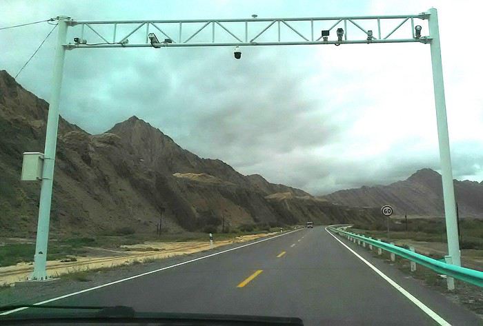
To enter the youth hostel where I stayed, there’s even a security gate, and the receptionist (a Han, like everyone in tourism) wears a bulletproof vest! Reassuring. Still, you don’t feel particularly threatened here, especially as a European. The troublemakers are the Chinese, not the Uyghurs. Generally, China is a very safe country for visitors.
Smile, you’re on camera! I was biking on an avenue when the car in front of me got flashed for driving slowly. I quickly understood why when I got flashed too.
Here, the official time is Beijing time, but it gets dark two hours later. It’ll be even worse in Kashgar. Trickier to manage: everything is displayed in Chinese and Arabic. Nothing in English. Choosing a menu is a shot in the dark. Apart from a few young Chinese, no one here speaks English, and my Chinese doesn’t seem very understandable...
Mogao, the end of the road for the Han Yesterday, near Dunhuang, I went to Mogao, a complex of decorated caves with Buddha sculptures and paintings. Stunning, but so crowded! Luckily, here in Turpan, Chinese tourists barely venture out. So I visited a Silk Road ghost town with only a handful of other visitors and under a howling wind.
The modern Chinese city is swallowing up the old Uyghur neighborhoods—only a museum-like district remains in the center, and pockets of resistance on the outskirts are doomed to disappear soon. More photos...
8- KASHGAR A (relative) love at first sight for the old city Sunday, September 2 After three overnight trains, here I am in the far west of China, nearly 4,000 km from the capital. Despite the omnipresent police and an old city preserved UNESCO-style, Kashgar is my Chinese love at first sight.
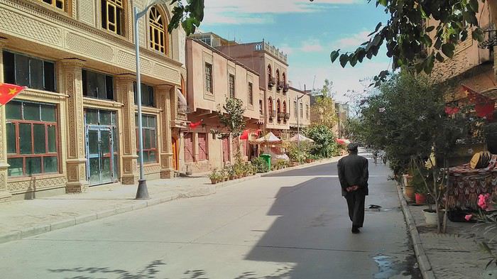
Finally, Chinese... well, sort of, because we’re in Uyghur territory here—a Turkic people with nothing culturally in common with the Han, the eastern Chinese. It started badly yesterday at Turfan station, where after three security gate passes, at least five passport checks, and a bag search, three adorable policewomen confiscated my antibacterial lotion because it had a flammable logo...
Then came the welcoming committee of armed cops at Kashgar station. Once all that was over, they left me alone—except you still have to go through security checks like everyone else to enter the old city, the bazaar, the livestock market... The further west you go, the more the siege mentality is evident. Luckily, the border isn’t far...
Despite the inevitable destruction-reconstruction, the city center has been well preserved. Thankfully, because it’s a very original style, a mix of local and colonial. I love it, even if it’s a bit too artificial, sanitized, and watered-down, and rather empty of residents. On the Silk Road, the city was famous for its great food. And it still is—rarely have I seen such richness and abundance of food! And not just scorpions or snakes. More photos...
9- KASHGAR China’s recipe for controlling the populace Saturday, September 1 Xinjiang, along with Tibet, is a "sensitive" area of rebellion in the eyes of Chinese authorities. As a result, the state has these regions and their populations under total control. Tourists also feel the consequences, even if they’re not at risk of re-education camps.
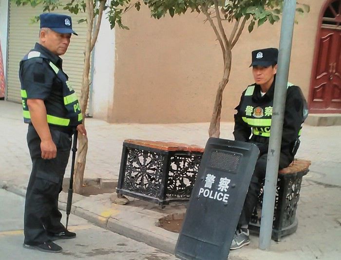 - Putting barbed wire and anti-ramming barriers around sensitive sites (schools, big hotels, government buildings...)
- Installing traffic surveillance gates with cameras and photo flashes (for all vehicles passing, including bikes) throughout the city and even in the countryside
- Posting uniformed guards with tasers, batons, or huge baseball bats every 100 meters
- Training the Han population (ethnic Chinese) in self-defense with sticks, preferably in the morning on the street. Men and women of all ages
- Starting school with the national anthem, doing military exercises, and receiving political indoctrination, all neatly lined up in the courtyard. (The dream school for any teacher)
- Placing a snitch in uniform (a pseudo-guard) in public gathering places, like youth hostels. Mine spends the day loafing around the courtyard
- Putting Chinese flags everywhere on the streets to remind everyone who’s in charge
- Installing security gates at every entrance to areas frequented by tourists (thanks for that) but not just there
- Never photographing cops, or else! I tried, but it’s not easy...
- Putting barbed wire and anti-ramming barriers around sensitive sites (schools, big hotels, government buildings...)
- Installing traffic surveillance gates with cameras and photo flashes (for all vehicles passing, including bikes) throughout the city and even in the countryside
- Posting uniformed guards with tasers, batons, or huge baseball bats every 100 meters
- Training the Han population (ethnic Chinese) in self-defense with sticks, preferably in the morning on the street. Men and women of all ages
- Starting school with the national anthem, doing military exercises, and receiving political indoctrination, all neatly lined up in the courtyard. (The dream school for any teacher)
- Placing a snitch in uniform (a pseudo-guard) in public gathering places, like youth hostels. Mine spends the day loafing around the courtyard
- Putting Chinese flags everywhere on the streets to remind everyone who’s in charge
- Installing security gates at every entrance to areas frequented by tourists (thanks for that) but not just there
- Never photographing cops, or else! I tried, but it’s not easy...
With all that, you can stroll around safely Not much crime! As for the amount the Chinese state spends to maintain such a system, it’s staggering! A third of the Han living in Xinjiang work in security. Today, I wandered freely around old Kashgar, which is quite large after all. More photos...
10- TASHKURGAN What on earth was I thinking going there! Wednesday, September 5 First, there’s the taxi—pretty crappy, with a driver who doesn’t speak a word of English and won’t stop smoking. Over six hours in that... shared with a completely out-of-it American.
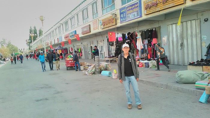
Then there are all the checkpoints along the way. I won’t go on—you know the drill by now.
After that, there’s Tashkurgan—a town with nothing to see, nothing to do. Deserted as soon as night falls. There’s this huge youth hostel and a few lost Chinese tapping away on their smartphones, chain-smoking. This lost American-European crowd, swapping tips on how to enter Pakistan or Tajikistan.
Luckily, there’s the Chinese Pamir Highway, lined with peaks over 7,000m. There’s the feeling of no longer being in China, with a population whose features are Middle Eastern. And these Tajik women with their stunning hairstyles and vibrant costumes. There’s the fact of having reached the westernmost Chinese city, far from crowds and tourist sites. A sort of end of the world. More photos...
11- KYRGYZ BORDER A surreal epic Thursday, September 6 The road from Kashgar to the Kyrgyzstan border is a little over 200 km and passes through beautiful landscapes of colorful, desert-like mountains with acrobatic folds. That’s the bucolic part of the trip.
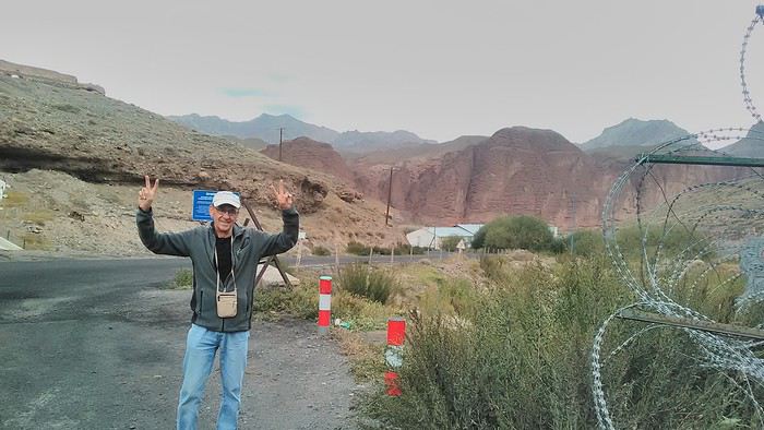 Yesterday, I managed to gather four people to rent a minibus to reach the border more easily: a Spaniard and an Argentine I’d already met in Turpan, and two New Zealanders who responded to the ad left at the hostel.
Absurdity and paranoia of Chinese authorities The highlight was crossing the town of Wuqia, 50 km past Kashgar. After tallying up with my fellow sufferers, we must’ve passed about ten checkpoints with: - Passport checks: 14 times, sometimes by two cops side by side - Bag checks: 4 times - Smartphone checks: 2 times, with deletion of "non-compliant" photos, and registration of your IMEI in the exit log!... Absurd and surreal at the same time, since my camera stayed in my bag, my apps are in French, and my photos have been online for ages...
With all that, we arrived just as the last checkpoint before the no man’s land marking the border between the two countries was on lunch break. And bam! Another 1.5-hour wait, alongside truckers who were much more used to this than we were.
What to think? The cops themselves aren’t fooled. They play the role they’re asked to, but sometimes you can coax a smile out of them—they realize how ridiculous the situation is.
What’s the point? That’s the big question my companions and I were tempted to answer with "to piss people off." To show you your place isn’t here, but with the other tourists, over there in the east, in Shanghai, Xi’an, or Guangzhou.
As for you, a traveler from a democratic country, you really experience this as aggression, humiliation, a violation of your private space. And yet, I’m respected, they speak to me properly. Today, I better understand what a Palestinian or a citizen of an occupied country might feel daily. A unique experience! Thanks, China.
And to top it off, the cherry on the cake! It’s still this glowing button you press to rate your passage after clearing the last obstacle before the exit stamp. I was so surprised it turned off before I could react. The Spaniard, with great humor and irony, had time to vote "excellent." In the end, he wasn’t wrong—you can hardly do better!
PS: I ditched my buddies at the border. They didn’t want to pay for a taxi to continue. So I took a direct taxi to Osh. The first 100 km are fabulous. I couldn’t take many photos, but I’ll be back on Monday to go to Tajikistan.
More photos...
The rest of the Silk Road, Part 2, in these travel journals: Kyrgyzstan, Tajikistan, Uzbekistan.
The Chinese Far West More than 30 years after my first trip to eastern China, I finally fulfilled an old dream: traveling solo from Beijing to the far west, discovering Xinjiang, the Uyghur people and the oppression they endure, the oases of Turpan and Kashgar, the Taklamakan Desert, the end of the Great Wall... The route was covered by train.
MENU PART 1: CHINA
1- Beijing (Jiankou) : the authentic Great Wall, without tourists 2- Cycling in Beijing, the best way to get around 3- Beijing : departure for the far west 4- Jiayuguan : getting by without English 5- Jiayuguan : scams and heritage 6- Dunhuang : abundance in the middle of the desert 7- Turpan : the Uyghurs under heavy surveillance 8- Kashgar : love at first sight for the old city 9- Kashgar : China’s recipe for controlling the populace 10- Tashkurgan : what on earth was I thinking going there! Kyrgyz border: a surreal epic Photo album from the 80s, contributions from other travelers (page 2)
1- JIANKOU Finding the authentic Great Wall, without tourists or a guide Friday, August 24, 2018 Thirty years later, I didn’t feel like revisiting the Great Wall at Badaling or any other overcrowded site. I chose to explore it at Jiankou, in its wildest, most authentic, and unrestored section, starting from a lost village deep in a valley—though it wasn’t *that* lost, since it had everything for communication.
No need to pay for a taxi to get there—by timing it right, you can take the bus for just a few yuan. You have to get off at Xizhazi, the bus terminus. Be careful, there are only two buses a day in each direction. At the Xizhazi bus stop, I met a young couple who’d arrived with zero information about what to expect. We hiked the three of us toward the restored section of Mutianyu.
Still, be cautious With GPS and a topographic map (OpenTopoMap), you can set off without a problem or guide. The trail up to Jiankou is easy and well-marked. The trails down are too. But be careful—once you’re on the Wall, it’s real mountain hiking, with easy but dangerous climbing sections (over sheer drops). Not for amateurs or those afraid of heights! But what a reward. The Wall all to yourself, where it’s at its most daring. Truly mesmerizing.
More photos...
2- BEIJING The best way to get around the capital Sunday, August 26 The best way to explore the city is still by bike. Most are in a bike-share system, but you need to use an app—WeChat, the app that does everything, like monitoring your every move. No way I was installing that.
I found one at a rental shop near the hostel. The key is to quickly learn local traffic customs to minimize risks. Bike lanes are wide along the avenues.
But you still have to: - Watch out for anything parked on the bike paths—the most annoying are people napping or talking on the phone in their cars - Keep an eye on everything coming the wrong way—the list is long - The worst is right turns on red, which in Chinese traffic rules seem to have priority Once you get the hang of it, it’s fine. The city is huge but flat, so you can just wing it.
3- BEIJING By train to the far west Sunday, August 26 Beijing West Station is the size and operates like an airport. With your e-ticket from the agency, you first have to pick up your ticket at the special "English" counter, after passing through security. With your ticket in hand, you have to exit and enter through the boarding waiting area—not the platform—after a second security check.
Then you find the right hall and wait for the sign to finally access the platform. In the end, it works pretty well given the incredible number of passengers to manage. Everywhere in Beijing, I saw that the Chinese have mastered crowd flow management.Nice surprise: second-class carriages are clean, air-conditioned, and bright. Perfect, since I was in for 20 hours. One uniformed attendant per carriage, mobile meal service—luxury! Small downside: no luggage space. Hauling your suitcase up to the top bunk is quite a workout. I was in the middle, so it wasn’t too bad. The landscape, though, whether rural or urban, is pretty bleak. That should change once we leave the eastern plains.
Of course, I got my first police visit, with a thorough passport check and bag search. I was warned—going to the Chinese far west exposes you to this kind of hassle. But they were polite and respectful.
The Chinese Far West4- JIAYUGUAN Getting by without English Monday, August 27 At the gates of two deserts (Gobi and Taklamakan) and at the foot of the Tibetan highlands, the Great Wall ends at Jiayuguan. Here, I found the deeper China I’d somewhat rediscovered during my bike ride, even if now everyone gets around on electric bikes and I’m no longer stared at like an alien.
Prices are nothing like Beijing: you can find a full meal for 2 €, and my bike cost 7 € for two days. Plus, few people speak English—neither the owner of the HI hostel where I stayed, nor the ticket sellers at the sites, let alone the servers at the small eateries where I ate. Everything is written in Chinese. So I had to use the little Chinese I know to communicate about essentials. It makes the locals laugh to see a European trying to speak their language, but it earns respect. With Google Translate’s help, I managed.
Rant: With their avenues blocked for construction for kilometers without warning, and new roads not yet on maps, I must’ve taken 15 km of detours. More photos...
5- JIAYUGUAN Scams and heritage Tuesday, August 28 The Great Wall doesn’t exactly end at the fort I visited yesterday but 10 km further, at the entrance to a river gorge at the foot of the mountains. All that’s left is a badly damaged tower (more like a mound of earth) and a section of clay wall, similar to the one I biked yesterday.
This morning, I hopped on my bike, determined to venture into the desert to see this highly symbolic site. First, you access it via a wide, brand-new road with not a soul in sight. Just before the site, I came across a grand welcome gate, very period-style, but it’s actually the inevitable toll booth.
Behind the gate, the road continues straight to the site, which you can see in the distance—at least 2 km away—the remains of the tower and wall. I had to leave my bike here. Fine. I went to the ticket counter and asked the price: 120 yuan! I couldn’t believe it—over 15 € for a simple mound of earth.
I showed my displeasure to the attendant, who couldn’t care less, and immediately turned back. 120 yuan—that’s the price for a new road, a fancy gate planted 2 km before the site just to force you to take a shuttle, and employees with nothing to do all day... Now I understand why I didn’t meet anyone!
Heritage China is a bit pricey Generally, sites are expensive for the country’s standard of living, but travelers are supposed to have money, so why hold back? I even gave up on the Forbidden City—reservations required days in advance (or on the black market at an impossible price). I prefer to keep the memory of my first visit, when entry must’ve cost a few dozen cents, and there were only a handful of visitors.
This morning, I took a taxi to see remarkable tombs of common people from the 3rd to 6th centuries. They’re small vaulted caves made of painted bricks, depicting scenes of daily life. Very pretty and moving. But even here, though the price was more reasonable, I was left wanting—only one of the 16 tombs is open to visitors, and it’s apparently not the most beautiful.
The authentic China—at least what’s left of it... Wandering the impersonal avenues of the city, you stumble upon a market. There, you still find traditional China—small shops with questionable hygiene, Go players, musicians, and even a dental prosthetist. The last refuge for those untouched by modernity. More photos...
6- DUNHUANG Abundance in the middle of the desert Wednesday, August 29 Well, I thought the landscape would be less bleak as I headed west. Nope. The only distraction in this expanse of dark, clayey sand is the forests of pylons and wind turbines, plus wild camels racing each other.
However, Dunhuang, the gateway to the Taklamakan, is by far the most pleasant Chinese city I know. There’s a real city center you can explore on foot. It’s hot but not unbearable, with a light, dry breeze. Much nicer than Beijing. The Han Chinese are still the majority, but the Muslim Uyghurs are more numerous, and the muezzin’s call to prayer echoes around the mosque.The most surprising thing is the abundance and diversity of fruits and vegetables. You wonder how it all grows here. Well-irrigated, the desert sands are very fertile. Here, raisins have subtle, mysterious flavors, and the lamb really tastes like lamb.
Today, I visited the must-see Mingshashan, a dune complex next to which Pila is a molehill. The Basque Country, but covered in sand... More photos...
7- TURPAN The Uyghurs under heavy surveillance Friday, August 31 Surveillance cameras everywhere in the city, armed police stationed at intersections, in front of public buildings, at the entrance and inside tourist sites, police stations on every corner, patrols on foot or by car, khaki uniforms even for middle schoolers... here, the Han Chinese are in the minority, and you can feel it. Turpan feels like a city under siege.
To enter the youth hostel where I stayed, there’s even a security gate, and the receptionist (a Han, like everyone in tourism) wears a bulletproof vest! Reassuring. Still, you don’t feel particularly threatened here, especially as a European. The troublemakers are the Chinese, not the Uyghurs. Generally, China is a very safe country for visitors.
Smile, you’re on camera! I was biking on an avenue when the car in front of me got flashed for driving slowly. I quickly understood why when I got flashed too.
Here, the official time is Beijing time, but it gets dark two hours later. It’ll be even worse in Kashgar. Trickier to manage: everything is displayed in Chinese and Arabic. Nothing in English. Choosing a menu is a shot in the dark. Apart from a few young Chinese, no one here speaks English, and my Chinese doesn’t seem very understandable...
Mogao, the end of the road for the Han Yesterday, near Dunhuang, I went to Mogao, a complex of decorated caves with Buddha sculptures and paintings. Stunning, but so crowded! Luckily, here in Turpan, Chinese tourists barely venture out. So I visited a Silk Road ghost town with only a handful of other visitors and under a howling wind.
The modern Chinese city is swallowing up the old Uyghur neighborhoods—only a museum-like district remains in the center, and pockets of resistance on the outskirts are doomed to disappear soon. More photos...
8- KASHGAR A (relative) love at first sight for the old city Sunday, September 2 After three overnight trains, here I am in the far west of China, nearly 4,000 km from the capital. Despite the omnipresent police and an old city preserved UNESCO-style, Kashgar is my Chinese love at first sight.
Finally, Chinese... well, sort of, because we’re in Uyghur territory here—a Turkic people with nothing culturally in common with the Han, the eastern Chinese. It started badly yesterday at Turfan station, where after three security gate passes, at least five passport checks, and a bag search, three adorable policewomen confiscated my antibacterial lotion because it had a flammable logo...
Then came the welcoming committee of armed cops at Kashgar station. Once all that was over, they left me alone—except you still have to go through security checks like everyone else to enter the old city, the bazaar, the livestock market... The further west you go, the more the siege mentality is evident. Luckily, the border isn’t far...
Despite the inevitable destruction-reconstruction, the city center has been well preserved. Thankfully, because it’s a very original style, a mix of local and colonial. I love it, even if it’s a bit too artificial, sanitized, and watered-down, and rather empty of residents. On the Silk Road, the city was famous for its great food. And it still is—rarely have I seen such richness and abundance of food! And not just scorpions or snakes. More photos...
9- KASHGAR China’s recipe for controlling the populace Saturday, September 1 Xinjiang, along with Tibet, is a "sensitive" area of rebellion in the eyes of Chinese authorities. As a result, the state has these regions and their populations under total control. Tourists also feel the consequences, even if they’re not at risk of re-education camps.
- Putting barbed wire and anti-ramming barriers around sensitive sites (schools, big hotels, government buildings...)
- Installing traffic surveillance gates with cameras and photo flashes (for all vehicles passing, including bikes) throughout the city and even in the countryside
- Posting uniformed guards with tasers, batons, or huge baseball bats every 100 meters
- Training the Han population (ethnic Chinese) in self-defense with sticks, preferably in the morning on the street. Men and women of all ages
- Starting school with the national anthem, doing military exercises, and receiving political indoctrination, all neatly lined up in the courtyard. (The dream school for any teacher)
- Placing a snitch in uniform (a pseudo-guard) in public gathering places, like youth hostels. Mine spends the day loafing around the courtyard
- Putting Chinese flags everywhere on the streets to remind everyone who’s in charge
- Installing security gates at every entrance to areas frequented by tourists (thanks for that) but not just there
- Never photographing cops, or else! I tried, but it’s not easy...With all that, you can stroll around safely Not much crime! As for the amount the Chinese state spends to maintain such a system, it’s staggering! A third of the Han living in Xinjiang work in security. Today, I wandered freely around old Kashgar, which is quite large after all. More photos...
10- TASHKURGAN What on earth was I thinking going there! Wednesday, September 5 First, there’s the taxi—pretty crappy, with a driver who doesn’t speak a word of English and won’t stop smoking. Over six hours in that... shared with a completely out-of-it American.
Then there are all the checkpoints along the way. I won’t go on—you know the drill by now.
After that, there’s Tashkurgan—a town with nothing to see, nothing to do. Deserted as soon as night falls. There’s this huge youth hostel and a few lost Chinese tapping away on their smartphones, chain-smoking. This lost American-European crowd, swapping tips on how to enter Pakistan or Tajikistan.
Luckily, there’s the Chinese Pamir Highway, lined with peaks over 7,000m. There’s the feeling of no longer being in China, with a population whose features are Middle Eastern. And these Tajik women with their stunning hairstyles and vibrant costumes. There’s the fact of having reached the westernmost Chinese city, far from crowds and tourist sites. A sort of end of the world. More photos...
11- KYRGYZ BORDER A surreal epic Thursday, September 6 The road from Kashgar to the Kyrgyzstan border is a little over 200 km and passes through beautiful landscapes of colorful, desert-like mountains with acrobatic folds. That’s the bucolic part of the trip.
Yesterday, I managed to gather four people to rent a minibus to reach the border more easily: a Spaniard and an Argentine I’d already met in Turpan, and two New Zealanders who responded to the ad left at the hostel.Absurdity and paranoia of Chinese authorities The highlight was crossing the town of Wuqia, 50 km past Kashgar. After tallying up with my fellow sufferers, we must’ve passed about ten checkpoints with: - Passport checks: 14 times, sometimes by two cops side by side - Bag checks: 4 times - Smartphone checks: 2 times, with deletion of "non-compliant" photos, and registration of your IMEI in the exit log!... Absurd and surreal at the same time, since my camera stayed in my bag, my apps are in French, and my photos have been online for ages...
With all that, we arrived just as the last checkpoint before the no man’s land marking the border between the two countries was on lunch break. And bam! Another 1.5-hour wait, alongside truckers who were much more used to this than we were.
What to think? The cops themselves aren’t fooled. They play the role they’re asked to, but sometimes you can coax a smile out of them—they realize how ridiculous the situation is.
What’s the point? That’s the big question my companions and I were tempted to answer with "to piss people off." To show you your place isn’t here, but with the other tourists, over there in the east, in Shanghai, Xi’an, or Guangzhou.
As for you, a traveler from a democratic country, you really experience this as aggression, humiliation, a violation of your private space. And yet, I’m respected, they speak to me properly. Today, I better understand what a Palestinian or a citizen of an occupied country might feel daily. A unique experience! Thanks, China.
And to top it off, the cherry on the cake! It’s still this glowing button you press to rate your passage after clearing the last obstacle before the exit stamp. I was so surprised it turned off before I could react. The Spaniard, with great humor and irony, had time to vote "excellent." In the end, he wasn’t wrong—you can hardly do better!
PS: I ditched my buddies at the border. They didn’t want to pay for a taxi to continue. So I took a direct taxi to Osh. The first 100 km are fabulous. I couldn’t take many photos, but I’ll be back on Monday to go to Tajikistan.
More photos...
The rest of the Silk Road, Part 2, in these travel journals: Kyrgyzstan, Tajikistan, Uzbekistan.