Results for "Saint-Jean+Monts+|+127"
82348 results found.
September 2026 Photo Contest Discussion Thread: "The Street as a Livelihood"
Good evening to all you photographers and photo enthusiasts on VF,
This is the place to exchange, debate, chat, philosophize, nitpick, ramble, bicker, and congratulate each other on this month’s theme: "The Street as a Livelihood."
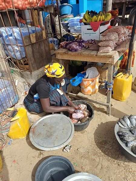
Just a reminder that the photos expected in the contest thread should depict street scenes showing people using the street as a place to earn a living—whether it’s legal work, informal jobs, illegal activities, or begging. In the discussion thread, feel free to be much more open-ended.
This is the place to exchange, debate, chat, philosophize, nitpick, ramble, bicker, and congratulate each other on this month’s theme: "The Street as a Livelihood."
Just a reminder that the photos expected in the contest thread should depict street scenes showing people using the street as a place to earn a living—whether it’s legal work, informal jobs, illegal activities, or begging. In the discussion thread, feel free to be much more open-ended.
A Brief A to Z of Peru
Foreword
This text has been proofread many times.
Sorry if some points in this A to Z have already been covered on this forum.
Text and drawings by the author.
Peru is still a very vast country, with so much to see, and obviously this text can't list all the attractions of the country.
*Abiseo (River) A national park that's very hard to access and doesn’t seem open to visitors. Includes the Gran Pajaten site (see below). Personally, it really sparks my imagination (not visited personally)
*Aguas Calientes the town next to Machu Picchu, more precisely below the archaeological site. As far as I know, you can only get there by train. Reminds me of the market where stalls line both sides of the tracks near Bangkok. I love it
*Altiplano: somewhere the "heart" of the Andes. I was able to trek across it on foot, starting from Caracollo in Bolivia, and of course, it’s vast plains to explore. This is where people live in a very rural way. Andean populations are quite austere compared to those in the lowlands or on the coast. You really have to appreciate the harshness of life to live there. Life is anything but superficial. I set a compass heading and found myself walking west toward the expanse of water near a place called La Joya. For pitching the tent, the nights were still chilly
*Canyon del Colca One of the deepest canyons in the world. Personally, I hiked down and back up on foot. The toughest stretch I’ve ever covered in my life.
*Ceviche More or less the national dish. A marinade of fish, shellfish, and lime. But you can find it in some restaurants in Europe, France, and certainly in Belgium or Switzerland. In the small restaurants of Pisco, you can eat excellent ceviche
*Cerro Sechín: Mostly bas-reliefs. A site little known to travelers in the Casma province. The first vestiges of a pre-Inca civilization with iconography similar to that of Chavín (not visited personally)
*Chan Chan A large city of the Chimú civilization and relatively vast to visit. You can see adobe walls with bas-reliefs. Visit from Trujillo, take a colectivo. Plan for the whole day
*Charango: a small guitar widely used in Andean music
*Chauchilla A necropolis near Nazca where you can see mummies exposed on the ground. YouTubers can do paranormal experiments there. And for anyone wondering about the fate of the soul and body after death, here’s the answer: the body remains after death. You can imagine your own flesh and body exposed to the winds of the Pampa and before eternity... (not visited personally)
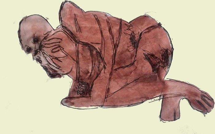
*Chavín de Huántar (Lanzón) The site’s appeal lies in its mountainous surroundings, the Lanzón stela, and the sculpted heads on the façades. What few people know is that the Chavín civilization began its expansion centuries before the Incas. Unfortunately, you can’t get too close to see the Lanzón—the day I was there, it was protected by grilles. To get there: minibus from Huaraz or trek from Olleros. Then cross a high pass (over 5,000m). If you do it solo on foot, be careful—the path isn’t obvious from Olleros
*Chullpa: funerary tower, notably at Sillustani in the Lake Titicaca region
*Chimú: pre-Inca civilization whose center was Chan Chan.
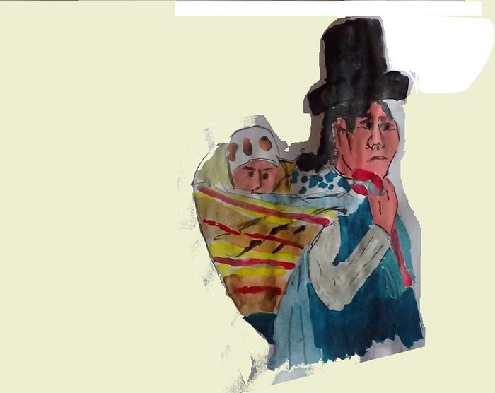
*Chola/Cholitas (Bolivia): typical clothing style of women from the Andean plateaus
*Chompa: pronounce it *Chompaaa!* A common term for a wool sweater with vicuña patterns, often knitted from alpaca wool. If you dress like this, it’s a bit kitschy around the edges
*Cuy That one isn’t a guinea pig like in Guyana but an actual guinea pig. During a trip to Peru, I was hiking near a village north of Quillabamba (the terminus of the train line that passes through Aguas Calientes), and I was invited to stay in a house. The family raised a few of these pets. Apparently, the locals eat them. Since I’m not much of a meat-eater, it doesn’t really tempt me. How about you?
*Pacific Coast or how to talk about a place you haven’t visited? Except for the coast near Pisco and San Andrés, I haven’t visited any coastal cities. But that doesn’t mean these places lack interest or poetry. For fans of clichéd images, pelicans, seabirds, and fishing boats appear by the sea.
*Gran Pajaten: also closed to the public. Features anthropomorphic bas-reliefs. (not visited personally)
*Huaca. Visit the Huaca del Sol and Huaca de la Luna, especially near Trujillo. However, you can skip them—Chan Chan is still more interesting. Don’t forget to spend time visiting Chan Chan
*Huacachina A small oasis in the desert near Ica. Yes, we’re talking about an oasis because for those who’ve never traveled to Peru, the coastal strip along the Pacific is almost entirely desert, from north to south. Peru is territorially made up of three different regions: the desert coast, the Altiplano stretching north to south with mountain ranges (the Cordilleras), and the Amazon basin to the east. (not visited personally)
*Inca Kola It’s neither Coca-Cola nor Pepsi but a unique cola with a slightly orange color. Tastes like bubble gum
*Intiwatana: a carved rock shaped like a parallelepiped. Is it a sundial?
*Ballestas Islands: a highlight in Peru, though very touristy. You can only get there by boat from the port of San Andrés, a few kilometers from Pisco. It’s a surreal place to me—actually islets with cavities where sea lions and fur seals live. Since it’s a protected area, you’re not allowed to disembark. Guano is harvested there, which can be used as fertilizer.
*Kuelap: a fortress built by the Chachapoyas people. Rarely visited by travelers. (not visited personally)
*Larco Museum: an iconic museum in Lima with a large collection of pieces from archaeological and pre-Columbian sites. From what I remember, it has many pieces from the Moche civilization. As for the Moche statuettes, the prudish might look away. Probably a veneration of the god Priapus without knowing it.
*Nazca Lines Discovered by German archaeologist Maria Reiche, they stretch for kilometers. The designs in the desert around Nazca depict animals and cabalistic signs. The question I ask myself is why the creators of these lines represented a monkey and a hummingbird—species endemic to the tropical forest, not the desert plains around Nazca.
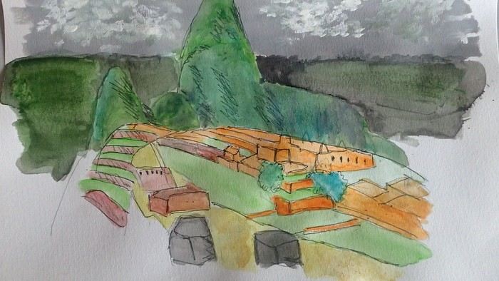
*Machu Picchu: means "old mountain" in Quechua. There’s also Wayna Picchu. The ruins of the site emerge from a sort of small plateau above Aguas Calientes. When the mist rises above the site and the bend of the Urubamba River, it’s truly magical... Also the starting point of the Inca Trail.
*Coca tea A decoction/infusion of the coca plant, meant to ease altitude sickness or *soroche*
*Chullo A rough translation would be a Peruvian wool hat.
*Moche: a civilization established in the Moche Valley, hence the term *Mochica*. What characterizes this civilization are the distinctive clay pieces representing faces and erotic statuettes
*Papa a la Huancaína A local potato dish
*Pisac: a typical market near Cusco
*Pisco Sour: perhaps the Peruvian equivalent of the *caipirinha* you drink in Brazil.
*Puya Raimondii A Bromeliaceae that still looks like a cactus, endemic to the Altiplano
*Quechua The language spoken by the indigenous people of the high plateaus (as well as Aymara in Bolivia)
*Quipu A knotted string used for counting. Widely used by the Inca administration.
*Sacsayhuamán (Q’enqo, Inca Bath) From Cusco’s Plaza de Armas, take the streets that climb above the city. Sacsayhuamán is called a fortress and is made up of large stone blocks. You wonder how the Incas could cut such huge blocks to assemble them—just like some streets in Cusco. The Q’enqo block is enigmatic; no one really knows what it represents.
*Savia Andina An Andean folk group.
*Tambo (=> Ollantaytambo) The Inca emperor (Atahualpa, Manco Capac) had the mission of controlling a vast empire. An empire that was still very extensive. Hence the importance of these *tambos* or relay stations. Napoleon created the civil code; the Incas invented the *tambos* and *quipus*.
*Tawantinsuyu: the Inca Empire
*Tinku: a warrior dance practiced mainly in Bolivia
*Golden Tumi: a sacrificial weapon. Often featured in Peru travel guides. See illustration
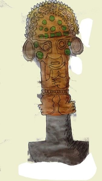
*Terra X: a documentary series from the German TV channel that aired on Arte. Some episodes focused on pre-Inca and Inca Peru. I must have some old recording tapes. In memory of Gottfried Kirchner as a source of inspiration.
*Uros: I checked—it actually refers to the people who live on these floating islands. Even if it’s touristy, it’s a must-visit because it’s incredible how people can live on islets made from nothing. Take the boat from Puno
*Vicuña, llama, guanaco: camelids characteristic of the Altiplano
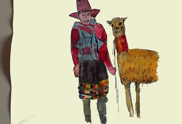
*Wayna Picchu The young Picchu mountain. In the first minutes of *Aguirre, the Wrath of God*, you see Klaus Kinski—well, Aguirre—making his way along the Inca Trail. Werner Herzog must have broken his back filming those sequences.
*Zampoña: pan flute
Peru is still a very vast country, with so much to see, and obviously this text can't list all the attractions of the country.
*Abiseo (River) A national park that's very hard to access and doesn’t seem open to visitors. Includes the Gran Pajaten site (see below). Personally, it really sparks my imagination (not visited personally)
*Aguas Calientes the town next to Machu Picchu, more precisely below the archaeological site. As far as I know, you can only get there by train. Reminds me of the market where stalls line both sides of the tracks near Bangkok. I love it
*Altiplano: somewhere the "heart" of the Andes. I was able to trek across it on foot, starting from Caracollo in Bolivia, and of course, it’s vast plains to explore. This is where people live in a very rural way. Andean populations are quite austere compared to those in the lowlands or on the coast. You really have to appreciate the harshness of life to live there. Life is anything but superficial. I set a compass heading and found myself walking west toward the expanse of water near a place called La Joya. For pitching the tent, the nights were still chilly
*Canyon del Colca One of the deepest canyons in the world. Personally, I hiked down and back up on foot. The toughest stretch I’ve ever covered in my life.
*Ceviche More or less the national dish. A marinade of fish, shellfish, and lime. But you can find it in some restaurants in Europe, France, and certainly in Belgium or Switzerland. In the small restaurants of Pisco, you can eat excellent ceviche
*Cerro Sechín: Mostly bas-reliefs. A site little known to travelers in the Casma province. The first vestiges of a pre-Inca civilization with iconography similar to that of Chavín (not visited personally)
*Chan Chan A large city of the Chimú civilization and relatively vast to visit. You can see adobe walls with bas-reliefs. Visit from Trujillo, take a colectivo. Plan for the whole day
*Charango: a small guitar widely used in Andean music
*Chauchilla A necropolis near Nazca where you can see mummies exposed on the ground. YouTubers can do paranormal experiments there. And for anyone wondering about the fate of the soul and body after death, here’s the answer: the body remains after death. You can imagine your own flesh and body exposed to the winds of the Pampa and before eternity... (not visited personally)
*Chavín de Huántar (Lanzón) The site’s appeal lies in its mountainous surroundings, the Lanzón stela, and the sculpted heads on the façades. What few people know is that the Chavín civilization began its expansion centuries before the Incas. Unfortunately, you can’t get too close to see the Lanzón—the day I was there, it was protected by grilles. To get there: minibus from Huaraz or trek from Olleros. Then cross a high pass (over 5,000m). If you do it solo on foot, be careful—the path isn’t obvious from Olleros
*Chullpa: funerary tower, notably at Sillustani in the Lake Titicaca region
*Chimú: pre-Inca civilization whose center was Chan Chan.
*Chola/Cholitas (Bolivia): typical clothing style of women from the Andean plateaus
*Chompa: pronounce it *Chompaaa!* A common term for a wool sweater with vicuña patterns, often knitted from alpaca wool. If you dress like this, it’s a bit kitschy around the edges
*Cuy That one isn’t a guinea pig like in Guyana but an actual guinea pig. During a trip to Peru, I was hiking near a village north of Quillabamba (the terminus of the train line that passes through Aguas Calientes), and I was invited to stay in a house. The family raised a few of these pets. Apparently, the locals eat them. Since I’m not much of a meat-eater, it doesn’t really tempt me. How about you?
*Pacific Coast or how to talk about a place you haven’t visited? Except for the coast near Pisco and San Andrés, I haven’t visited any coastal cities. But that doesn’t mean these places lack interest or poetry. For fans of clichéd images, pelicans, seabirds, and fishing boats appear by the sea.
*Gran Pajaten: also closed to the public. Features anthropomorphic bas-reliefs. (not visited personally)
*Huaca. Visit the Huaca del Sol and Huaca de la Luna, especially near Trujillo. However, you can skip them—Chan Chan is still more interesting. Don’t forget to spend time visiting Chan Chan
*Huacachina A small oasis in the desert near Ica. Yes, we’re talking about an oasis because for those who’ve never traveled to Peru, the coastal strip along the Pacific is almost entirely desert, from north to south. Peru is territorially made up of three different regions: the desert coast, the Altiplano stretching north to south with mountain ranges (the Cordilleras), and the Amazon basin to the east. (not visited personally)
*Inca Kola It’s neither Coca-Cola nor Pepsi but a unique cola with a slightly orange color. Tastes like bubble gum
*Intiwatana: a carved rock shaped like a parallelepiped. Is it a sundial?
*Ballestas Islands: a highlight in Peru, though very touristy. You can only get there by boat from the port of San Andrés, a few kilometers from Pisco. It’s a surreal place to me—actually islets with cavities where sea lions and fur seals live. Since it’s a protected area, you’re not allowed to disembark. Guano is harvested there, which can be used as fertilizer.
*Kuelap: a fortress built by the Chachapoyas people. Rarely visited by travelers. (not visited personally)
*Larco Museum: an iconic museum in Lima with a large collection of pieces from archaeological and pre-Columbian sites. From what I remember, it has many pieces from the Moche civilization. As for the Moche statuettes, the prudish might look away. Probably a veneration of the god Priapus without knowing it.
*Nazca Lines Discovered by German archaeologist Maria Reiche, they stretch for kilometers. The designs in the desert around Nazca depict animals and cabalistic signs. The question I ask myself is why the creators of these lines represented a monkey and a hummingbird—species endemic to the tropical forest, not the desert plains around Nazca.
*Machu Picchu: means "old mountain" in Quechua. There’s also Wayna Picchu. The ruins of the site emerge from a sort of small plateau above Aguas Calientes. When the mist rises above the site and the bend of the Urubamba River, it’s truly magical... Also the starting point of the Inca Trail.
*Coca tea A decoction/infusion of the coca plant, meant to ease altitude sickness or *soroche*
*Chullo A rough translation would be a Peruvian wool hat.
*Moche: a civilization established in the Moche Valley, hence the term *Mochica*. What characterizes this civilization are the distinctive clay pieces representing faces and erotic statuettes
*Papa a la Huancaína A local potato dish
*Pisac: a typical market near Cusco
*Pisco Sour: perhaps the Peruvian equivalent of the *caipirinha* you drink in Brazil.
*Puya Raimondii A Bromeliaceae that still looks like a cactus, endemic to the Altiplano
*Quechua The language spoken by the indigenous people of the high plateaus (as well as Aymara in Bolivia)
*Quipu A knotted string used for counting. Widely used by the Inca administration.
*Sacsayhuamán (Q’enqo, Inca Bath) From Cusco’s Plaza de Armas, take the streets that climb above the city. Sacsayhuamán is called a fortress and is made up of large stone blocks. You wonder how the Incas could cut such huge blocks to assemble them—just like some streets in Cusco. The Q’enqo block is enigmatic; no one really knows what it represents.
*Savia Andina An Andean folk group.
*Tambo (=> Ollantaytambo) The Inca emperor (Atahualpa, Manco Capac) had the mission of controlling a vast empire. An empire that was still very extensive. Hence the importance of these *tambos* or relay stations. Napoleon created the civil code; the Incas invented the *tambos* and *quipus*.
*Tawantinsuyu: the Inca Empire
*Tinku: a warrior dance practiced mainly in Bolivia
*Golden Tumi: a sacrificial weapon. Often featured in Peru travel guides. See illustration
*Terra X: a documentary series from the German TV channel that aired on Arte. Some episodes focused on pre-Inca and Inca Peru. I must have some old recording tapes. In memory of Gottfried Kirchner as a source of inspiration.
*Uros: I checked—it actually refers to the people who live on these floating islands. Even if it’s touristy, it’s a must-visit because it’s incredible how people can live on islets made from nothing. Take the boat from Puno
*Vicuña, llama, guanaco: camelids characteristic of the Altiplano
*Wayna Picchu The young Picchu mountain. In the first minutes of *Aguirre, the Wrath of God*, you see Klaus Kinski—well, Aguirre—making his way along the Inca Trail. Werner Herzog must have broken his back filming those sequences.
*Zampoña: pan flute
Some trips are born twice - Peru April - May 2025
Some trips are born twice.
Ours was supposed to happen in 2020. Everything was ready: the itinerary, the flight tickets, hotel reservations and Machu Picchu, the rental car, dreams of high altitudes and wide-open spaces. And then the world stopped.
Like so many other plans, our trip to Peru was put on hold. Disappointment was followed by a more concrete reality: paperwork, endless back-and-forth, and battles to recover some of the costs we’d already paid.
The years went by. Life moved on, with its shifting priorities and unexpected twists. Rescheduling this trip wasn’t possible until 2025.
The itinerary stayed mostly true to what we’d imagined five years earlier. One major difference, though—in 2020, we’d planned to rent a car and explore the roads completely independently. Most importantly, we hadn’t included the three-day Ausangate trek, due to lack of time.
For 2025, our plans evolved. 4x4 rental prices had skyrocketed, and when we looked at our schedule more closely, we realized quite a few days didn’t actually need a vehicle. So we made a different choice and opted for private drivers instead. A decision we never regretted. Always punctual, thoughtful, and available... they were so much more than just drivers.
All our reservations were made in January, except for the trek, which we booked in February.
Finding reliable drivers on our own was tough, so we asked Laurent from Tout Pérou to handle it for us. Going through Tout Pérou also gave us a discount on the train ride to Aguas Calientes, so Laurent booked those tickets too. He also bought our Machu Picchu entrance tickets at the same price we would’ve paid on the official website. When comparing domestic flight prices, we found it was cheaper to book from Peru, so Laurent took care of those as well.
This time, nothing was going to stop us. Peru was waiting. And we were ready. 🙂
Ours was supposed to happen in 2020. Everything was ready: the itinerary, the flight tickets, hotel reservations and Machu Picchu, the rental car, dreams of high altitudes and wide-open spaces. And then the world stopped.
Like so many other plans, our trip to Peru was put on hold. Disappointment was followed by a more concrete reality: paperwork, endless back-and-forth, and battles to recover some of the costs we’d already paid.
The years went by. Life moved on, with its shifting priorities and unexpected twists. Rescheduling this trip wasn’t possible until 2025.
The itinerary stayed mostly true to what we’d imagined five years earlier. One major difference, though—in 2020, we’d planned to rent a car and explore the roads completely independently. Most importantly, we hadn’t included the three-day Ausangate trek, due to lack of time.
For 2025, our plans evolved. 4x4 rental prices had skyrocketed, and when we looked at our schedule more closely, we realized quite a few days didn’t actually need a vehicle. So we made a different choice and opted for private drivers instead. A decision we never regretted. Always punctual, thoughtful, and available... they were so much more than just drivers.
All our reservations were made in January, except for the trek, which we booked in February.
Finding reliable drivers on our own was tough, so we asked Laurent from Tout Pérou to handle it for us. Going through Tout Pérou also gave us a discount on the train ride to Aguas Calientes, so Laurent booked those tickets too. He also bought our Machu Picchu entrance tickets at the same price we would’ve paid on the official website. When comparing domestic flight prices, we found it was cheaper to book from Peru, so Laurent took care of those as well.
This time, nothing was going to stop us. Peru was waiting. And we were ready. 🙂
7 weeks and 150 years between us on a southern Morocco road trip
We arrive in the evening in Marrakesh, and a taxi arranged by our friendly Riad is waiting for us. The driver takes us to the door, where we’re briefly greeted by our hosts. The room is heated—phew—because it’s really cold on this January 17th for our arrival. Riad Alisma, where we’re staying for 2 nights. The next morning, it’s pouring rain when we wake up, but after a good breakfast, the rain has calmed down. Off we go to the medersa, which allows for a relatively sheltered visit. We’d visited this palace 15 years ago—it’s been renovated since then.
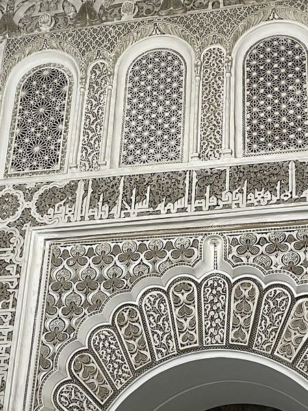
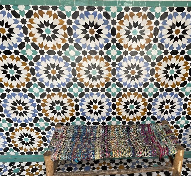
From there, without the rain, we wander aimlessly and eventually end up near the tanneries, but it’s Sunday, and there’s very little activity. Of course, we get hassled by a tout.
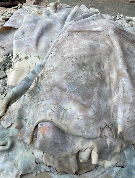
Here, the hides after being treated with lime—I love the colors.
We part ways a bit annoyed. He gets a little revenge by giving us bad directions, and we end up outside the city walls. We decide to take a taxi to the new modern art museum—60 dirhams for the 5 km, which is nothing when you think about it. That tout, who we didn’t ask for anything and made it clear we weren’t buying anything, dragged us into a shop supposedly only open that day and demanded 50 dirhams for his "services"! Let’s forget that bad moment and enjoy the exhibition at the MACAL.
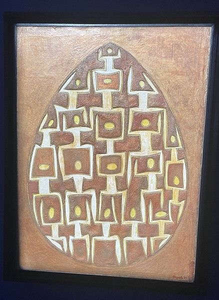
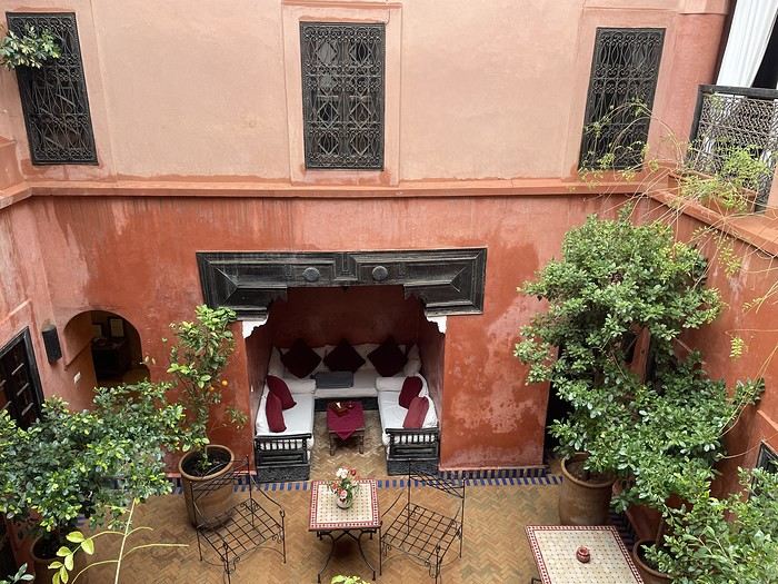
The taxi on the way back drops us off at Place des Ferblantiers, not far from our Riad. We’re a little peckish—it’s worth mentioning that at lunchtime, we only ate a plate of beans from a street vendor. So, we buy a bunch of little sweets, each more delicious than the last, at Ajar. We snack while sipping mint tea and watching life go by around us. A final visit to the Museum of Moroccan Cuisine on our way back helps us dodge a few more showers. Then it’s back to the Riad. The atmosphere in the city is heating up—it’s the AFCON final tonight. The temperatures, though? Not so much. We ordered a meal at the Riad, and it was a good call—not only was it really tasty, but the rain also picked up again. Our day in Marrakesh ends under the covers with a good book and some photo sorting. Still, we managed 10,750 steps. View of our Riad
Tomorrow, we’ll pick up our rental car from Medloc and head to Essaouira.
From there, without the rain, we wander aimlessly and eventually end up near the tanneries, but it’s Sunday, and there’s very little activity. Of course, we get hassled by a tout.
Here, the hides after being treated with lime—I love the colors.
We part ways a bit annoyed. He gets a little revenge by giving us bad directions, and we end up outside the city walls. We decide to take a taxi to the new modern art museum—60 dirhams for the 5 km, which is nothing when you think about it. That tout, who we didn’t ask for anything and made it clear we weren’t buying anything, dragged us into a shop supposedly only open that day and demanded 50 dirhams for his "services"! Let’s forget that bad moment and enjoy the exhibition at the MACAL.
The taxi on the way back drops us off at Place des Ferblantiers, not far from our Riad. We’re a little peckish—it’s worth mentioning that at lunchtime, we only ate a plate of beans from a street vendor. So, we buy a bunch of little sweets, each more delicious than the last, at Ajar. We snack while sipping mint tea and watching life go by around us. A final visit to the Museum of Moroccan Cuisine on our way back helps us dodge a few more showers. Then it’s back to the Riad. The atmosphere in the city is heating up—it’s the AFCON final tonight. The temperatures, though? Not so much. We ordered a meal at the Riad, and it was a good call—not only was it really tasty, but the rain also picked up again. Our day in Marrakesh ends under the covers with a good book and some photo sorting. Still, we managed 10,750 steps. View of our Riad
Tomorrow, we’ll pick up our rental car from Medloc and head to Essaouira.
In the land... of Senegambia
Hey fellow travelers!
So, a new year has begun. It’s time to reconnect with the VF buddies and wish you all my best for 2026—a year I hope is obviously full of travel, since, as I just made up: "If travel’s good, everything’s good" 😄.
To celebrate, I’m inviting you into my new "travel journal," the one from our latest trip in November 2025, a little two-week adventure.
This time, we headed to The Gambia, a tiny country tucked right in the middle of Senegal, before making our way to Casamance.
The Gambia is English-speaking, Senegal is French-speaking, but the locals? They couldn’t care less—because in this part of the world, they mostly speak Wolof, Fula, Jola, or Mandinka. Hence the title: Senegambia 😉.
As usual, I’m sharing the live updates I sent to friends and family—super casual, of course.
I know this isn’t the kind of destination that draws crowds, but if you love adventure, laughter, and emotion, it might just be your thing 😊.
Hugs 😘
So, a new year has begun. It’s time to reconnect with the VF buddies and wish you all my best for 2026—a year I hope is obviously full of travel, since, as I just made up: "If travel’s good, everything’s good" 😄.
To celebrate, I’m inviting you into my new "travel journal," the one from our latest trip in November 2025, a little two-week adventure.
This time, we headed to The Gambia, a tiny country tucked right in the middle of Senegal, before making our way to Casamance.
The Gambia is English-speaking, Senegal is French-speaking, but the locals? They couldn’t care less—because in this part of the world, they mostly speak Wolof, Fula, Jola, or Mandinka. Hence the title: Senegambia 😉.
As usual, I’m sharing the live updates I sent to friends and family—super casual, of course.
I know this isn’t the kind of destination that draws crowds, but if you love adventure, laughter, and emotion, it might just be your thing 😊.
Hugs 😘
Trip to Morocco in September-October 2025, in our camper van
Hi everyone,
We’re just back from a month-long trip to Morocco in our camper van.
After crossing France (we left from the Nantes area) and Spain, we arrived in Algeciras where we bought our boat tickets to Tangier. When we got to Tangier, as we were going through customs, you can imagine our surprise when the customs officer took our road map of Morocco and pointed out the label "Western Sahara" (just like in the forum’s destination section, by the way!).
He wanted it to say "Moroccan Sahara" instead!!! But there was nothing we could do—it was an old map... He wouldn’t listen, and after long discussions with the other (younger) customs officers, he finally gave it back and let us through... Unbelievable! Later, we heard that other travelers had their maps confiscated outright.
So, hide it well if you want to keep yours!!!
Anyway, we skirted around Tangier’s suburbs—pretty grim—and finally arrived in Asilah.
Following the coast and the long promenade along the beach, we reached the campsite. It was a bit crowded, not much shade, but it wasn’t far from the medina or the beach, and it wasn’t expensive. There’s some life here: Moroccan families seem to live on-site, in tents or basic bungalows. A woman was cooking tagine on a brazier—we were right in the atmosphere! The night was quiet, and we slept well. We set off on foot, walking along the seafront to the medina... We’d already been here in 2009. It was less touristy back then! Still, at this early hour, the little streets inside were very quiet. The walls had been freshly whitewashed, and there were even more murals than before. Around 11:30 AM, we strolled along the ramparts by the sea. There was a nice breeze! And a lot more people around. We enjoyed a milkshake on the terrace of a café overlooking the beach that stretches out at the foot of the medina. Some young guys were having fun diving off the rocks—and even off the top of the wall!
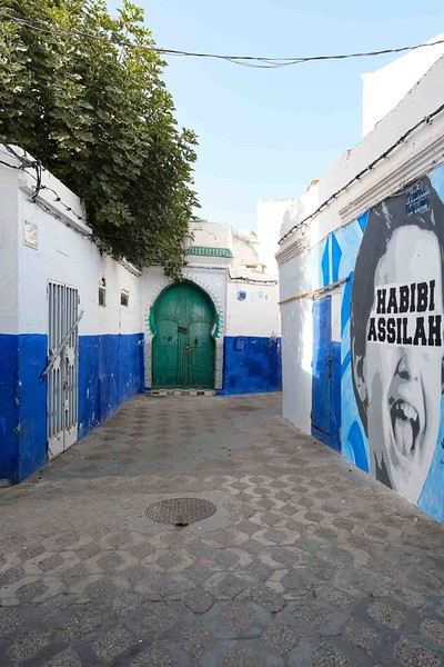
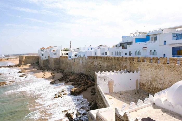
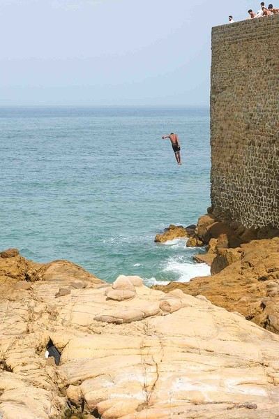
Anyway, we skirted around Tangier’s suburbs—pretty grim—and finally arrived in Asilah.
Following the coast and the long promenade along the beach, we reached the campsite. It was a bit crowded, not much shade, but it wasn’t far from the medina or the beach, and it wasn’t expensive. There’s some life here: Moroccan families seem to live on-site, in tents or basic bungalows. A woman was cooking tagine on a brazier—we were right in the atmosphere! The night was quiet, and we slept well. We set off on foot, walking along the seafront to the medina... We’d already been here in 2009. It was less touristy back then! Still, at this early hour, the little streets inside were very quiet. The walls had been freshly whitewashed, and there were even more murals than before. Around 11:30 AM, we strolled along the ramparts by the sea. There was a nice breeze! And a lot more people around. We enjoyed a milkshake on the terrace of a café overlooking the beach that stretches out at the foot of the medina. Some young guys were having fun diving off the rocks—and even off the top of the wall!
CAPE VERDE 2025: 3 weeks, 4 islands.
And we still haven’t seen everything!
Before setting off for new horizons at the end of this year, it’s time for me to share my trip to Cape Verde this summer 2025.
I particularly love these spontaneous trips, and our stay in Cape Verde is one of those because it was only at the beginning of April that we decided on this getaway, which had been catching our eye for a while, given our love for the mountains.
As always—well, when it’s open—I turned to VF, and I want to immediately thank Marie, aka ptitortue, who helped me a lot in planning this trip through her travel journals and our exchanges!
Because Cape Verde is both small and vast! We decided not to rush from one airport to another, to enjoy the places and the people, but also to relax, since the work backlog from being stuck in May (see my previous travel journal 😅) had to be caught up on in June.
So, 4 islands will be our winners from 06/28 to 07/19:
Santiago first for logistical reasons, as round-trip flights from the capital Praia were the cheapest (650 €/person from Lyon via Lisbon with TAP, still!)
São Vicente, because it’s the gateway to the next one but ultimately more than that...
Santo Antão, pretty much the main goal of the trip since Marie (and the photos) had really sold it to me.
And finally, Sal Island, for some rest—a non-negotiable condition for my other half—and we’ll see that I should’ve listened to Marie...
That said, what a chatterbox I am—buckle up, flight attendants at the doors, off we go on new beautiful escapes! (Thanks to Sophie for the easy loan)
Last note for my eager fan club 😏: yes, there will be alcohol—how could there not be in the land of grogue!
It starts here:
https://voyageforum.com/v.f?post=10790234;a=10790234

I particularly love these spontaneous trips, and our stay in Cape Verde is one of those because it was only at the beginning of April that we decided on this getaway, which had been catching our eye for a while, given our love for the mountains.
As always—well, when it’s open—I turned to VF, and I want to immediately thank Marie, aka ptitortue, who helped me a lot in planning this trip through her travel journals and our exchanges!
Because Cape Verde is both small and vast! We decided not to rush from one airport to another, to enjoy the places and the people, but also to relax, since the work backlog from being stuck in May (see my previous travel journal 😅) had to be caught up on in June.
So, 4 islands will be our winners from 06/28 to 07/19:
Santiago first for logistical reasons, as round-trip flights from the capital Praia were the cheapest (650 €/person from Lyon via Lisbon with TAP, still!)
São Vicente, because it’s the gateway to the next one but ultimately more than that...
Santo Antão, pretty much the main goal of the trip since Marie (and the photos) had really sold it to me.
And finally, Sal Island, for some rest—a non-negotiable condition for my other half—and we’ll see that I should’ve listened to Marie...
That said, what a chatterbox I am—buckle up, flight attendants at the doors, off we go on new beautiful escapes! (Thanks to Sophie for the easy loan)
Last note for my eager fan club 😏: yes, there will be alcohol—how could there not be in the land of grogue!
It starts here:
https://voyageforum.com/v.f?post=10790234;a=10790234
Yet Another Travel Journal in this (Too) Familiar Rajasthan, But with Family and Kids
Prologue
This journal recounts a trip to Rajasthan that’s already over a year old and that I’ve only now found the chance to write about. The summer of 2024 marked my return to India—my tenth trip—after six long years away since my last solo wanderings in Tamil Nadu in 2018 (the journal of which is published on this site). That absence was partly (but not only) due to the long COVID and post-COVID period, which saw a complete halt and then a major slowdown in global tourism. To top it off, Voyage Forum announced its closure in an end-of-the-world atmosphere. A sad time for our favorite social activity…
A few weeks after returning from Rajasthan, I tried to motivate myself to start writing a journal to publish on a forum claiming to be VF’s successor, which I’d eventually signed up for out of desperation. But I kept hesitating and putting the project off because, for one, I no longer have the time I used to. For another, the vibe wasn’t really taking off on that forum—it was overrun with ads and not very active, contrary to what its host’s name suggested. Despite its good intentions and commendable role as a stopgap, it also turned out to be very impractical to use, especially when you don’t have much time like me. I’ll admit I’d occasionally check back on VF to see if anything was happening. But all the discussions remained frozen in time, stuck in that fateful year, 2020. Then, rumors swirled online about shady reasons behind its closure, leaving little room for hope.
And then, one fine morning, I got a message at work from Marien informing me that VF had reopened. What a huge surprise! Even though the forum’s “end” had played out in a somewhat apocalyptic atmosphere, the memories of passionate and heated discussions, the frank debates, and the useful exchanges that made this site a traveler’s goldmine and a unique hub of conviviality all came rushing back to me like a breath of fresh air. I finally saw a sign and tried to motivate myself to find the time to publish the journal of this tenth trip to India and fifth to Rajasthan. But in the end, I got bogged down in professional and family obligations and never managed to find the time to get started. That’s now fixed, though, because I had two reasons for wanting to do it: I find that looking back on a trip to tell others about it is a highly beneficial introspective exercise. Also, I thought this journal could be useful to other travelers on a few points.
Because, “do we really need yet another journal about Rajasthan?” you might rightly ask! Especially in a time when so many journals about the “Land of Kings” have been published since VF’s return, not to mention the countless stories you can already find online about this region, one of India’s most touristy. And I’d add, why go back to Rajasthan for a fifth time, where I’ve already dragged my feet more than enough—through its forts, deserts, temples, cities, villages, bumpy roads, train stations, tasty street food stalls, cheap guesthouses, and more? Where some might see just another overhyped tourist destination full of the same old *Arabian Nights* clichés, worn to a thread, that I mentioned earlier, when there’s so much else to see in India? Well, first because it’s a magnificent country I never tire of, where I started an academic study and made so many connections. It’s also packed with places where you won’t find a single tourist (right, Marie-Jo?), even in the heart of well-trodden paths and classic itineraries. And most importantly, as I said earlier, things have changed in recent years. First, after six years without traveling far, the urge to go back to India was getting stronger. But this time, no more solo trips (often) or duo adventures (sometimes)—now it’s a team of four that has to come along! And even if you can argue with that, what better place than Rajasthan to introduce India to people who’ve never seen it? To kids you want to amaze? Plus, traveling with your new little family to your favorite country isn’t the same as going solo in often spartan conditions that only affect you. It’s a different challenge, but ultimately probably much harder. So, is it really reasonable to take two kids to India, including a two-year-old baby? That’s one of the main goals of this journal (but not the only one)—to try to answer that question.
As you can tell, it’s not so much the destination but the slightly unusual setup of this trip that, in my opinion, will make this journal interesting. Despite my experience and expertise (yes, I dare say it) in India, there were plenty of questions before we finalized the plan and said, “Alright, let’s go!” The questions were flying for us parents. Is it wise to travel to India with a two-year-old? What would we do (it happened) if the kids got very sick? Would they be able to handle a road trip on Rajasthan’s bumpy, dusty roads using public transport? Could they handle the shock of such a different world—the dirt, poverty, pollution, noise (…and the smell, as they say), the spicy food, monkeys, mosquitoes, snakes, tigers, leopards, and so on? In short, all the clichés that I usually joke about suddenly became potential realities. Another concern: as a mixed Franco-African family (not me, but my partner and her oldest), wouldn’t we risk not always being well received, given what you sometimes hear about that in India? How would Indians react to seeing a mixed-race family, the ultimate taboo in a country of purity and social segregation, which would undoubtedly raise many questions for them? Of course, not everything went as expected… Because, as you know, with India—and what makes it charming for some—there are always complications: sometimes where you don’t expect them… and sometimes where you do. I’ll go into detail about that in the journal to come (not right away) and in the final review (even later). These experiences could be useful to travelers who find themselves in similar situations and have the same questions we did before embarking on such a journey. And maybe it’ll spark the curiosity of those who aren’t concerned and will read yet another Rajasthan journal, but with its own unique twists.
Despite my unchanged constraints, which mean I have little time to write this, I don’t want to rush the story, so I’ll take my time. There will probably be lulls. I hope that won’t stop people from coming to react, debate, share their impressions, or ask for information.
This journal recounts a trip to Rajasthan that’s already over a year old and that I’ve only now found the chance to write about. The summer of 2024 marked my return to India—my tenth trip—after six long years away since my last solo wanderings in Tamil Nadu in 2018 (the journal of which is published on this site). That absence was partly (but not only) due to the long COVID and post-COVID period, which saw a complete halt and then a major slowdown in global tourism. To top it off, Voyage Forum announced its closure in an end-of-the-world atmosphere. A sad time for our favorite social activity…
A few weeks after returning from Rajasthan, I tried to motivate myself to start writing a journal to publish on a forum claiming to be VF’s successor, which I’d eventually signed up for out of desperation. But I kept hesitating and putting the project off because, for one, I no longer have the time I used to. For another, the vibe wasn’t really taking off on that forum—it was overrun with ads and not very active, contrary to what its host’s name suggested. Despite its good intentions and commendable role as a stopgap, it also turned out to be very impractical to use, especially when you don’t have much time like me. I’ll admit I’d occasionally check back on VF to see if anything was happening. But all the discussions remained frozen in time, stuck in that fateful year, 2020. Then, rumors swirled online about shady reasons behind its closure, leaving little room for hope.
And then, one fine morning, I got a message at work from Marien informing me that VF had reopened. What a huge surprise! Even though the forum’s “end” had played out in a somewhat apocalyptic atmosphere, the memories of passionate and heated discussions, the frank debates, and the useful exchanges that made this site a traveler’s goldmine and a unique hub of conviviality all came rushing back to me like a breath of fresh air. I finally saw a sign and tried to motivate myself to find the time to publish the journal of this tenth trip to India and fifth to Rajasthan. But in the end, I got bogged down in professional and family obligations and never managed to find the time to get started. That’s now fixed, though, because I had two reasons for wanting to do it: I find that looking back on a trip to tell others about it is a highly beneficial introspective exercise. Also, I thought this journal could be useful to other travelers on a few points.
Because, “do we really need yet another journal about Rajasthan?” you might rightly ask! Especially in a time when so many journals about the “Land of Kings” have been published since VF’s return, not to mention the countless stories you can already find online about this region, one of India’s most touristy. And I’d add, why go back to Rajasthan for a fifth time, where I’ve already dragged my feet more than enough—through its forts, deserts, temples, cities, villages, bumpy roads, train stations, tasty street food stalls, cheap guesthouses, and more? Where some might see just another overhyped tourist destination full of the same old *Arabian Nights* clichés, worn to a thread, that I mentioned earlier, when there’s so much else to see in India? Well, first because it’s a magnificent country I never tire of, where I started an academic study and made so many connections. It’s also packed with places where you won’t find a single tourist (right, Marie-Jo?), even in the heart of well-trodden paths and classic itineraries. And most importantly, as I said earlier, things have changed in recent years. First, after six years without traveling far, the urge to go back to India was getting stronger. But this time, no more solo trips (often) or duo adventures (sometimes)—now it’s a team of four that has to come along! And even if you can argue with that, what better place than Rajasthan to introduce India to people who’ve never seen it? To kids you want to amaze? Plus, traveling with your new little family to your favorite country isn’t the same as going solo in often spartan conditions that only affect you. It’s a different challenge, but ultimately probably much harder. So, is it really reasonable to take two kids to India, including a two-year-old baby? That’s one of the main goals of this journal (but not the only one)—to try to answer that question.
As you can tell, it’s not so much the destination but the slightly unusual setup of this trip that, in my opinion, will make this journal interesting. Despite my experience and expertise (yes, I dare say it) in India, there were plenty of questions before we finalized the plan and said, “Alright, let’s go!” The questions were flying for us parents. Is it wise to travel to India with a two-year-old? What would we do (it happened) if the kids got very sick? Would they be able to handle a road trip on Rajasthan’s bumpy, dusty roads using public transport? Could they handle the shock of such a different world—the dirt, poverty, pollution, noise (…and the smell, as they say), the spicy food, monkeys, mosquitoes, snakes, tigers, leopards, and so on? In short, all the clichés that I usually joke about suddenly became potential realities. Another concern: as a mixed Franco-African family (not me, but my partner and her oldest), wouldn’t we risk not always being well received, given what you sometimes hear about that in India? How would Indians react to seeing a mixed-race family, the ultimate taboo in a country of purity and social segregation, which would undoubtedly raise many questions for them? Of course, not everything went as expected… Because, as you know, with India—and what makes it charming for some—there are always complications: sometimes where you don’t expect them… and sometimes where you do. I’ll go into detail about that in the journal to come (not right away) and in the final review (even later). These experiences could be useful to travelers who find themselves in similar situations and have the same questions we did before embarking on such a journey. And maybe it’ll spark the curiosity of those who aren’t concerned and will read yet another Rajasthan journal, but with its own unique twists.
Despite my unchanged constraints, which mean I have little time to write this, I don’t want to rush the story, so I’ll take my time. There will probably be lulls. I hope that won’t stop people from coming to react, debate, share their impressions, or ask for information.
Australia 2025: Discovering the 5th Continent
Hi everyone.
Because that’s also what sparks the desire in every traveler (well, at least for me) to set foot on Australian soil: discovering a new continent.
Right now, I’ve got some time on my hands—those who follow me know that. A nasty muscle tear (which really doesn’t want to heal) is keeping me grounded for another week, so I’ve decided to open a new travel journal, recounting my recent trip from December 14, 2024, to January 12, 2025, in Australia.
The origins of this trip started last May in Crete, an island I chose for a 10-day break. It’s really lovely, by the way, but that’s not the point… It’s around this time every year that we decide on our next winter destination, and Argentina was at the top of the list—Sydney wasn’t even on the radar… I’d been looking at flights to Buenos Aires for a while, and the prices were shocking… But by the pool one lazy afternoon, scrolling on my iPhone, a promo from Geneva to Sydney caught my eye. The deal ticked two boxes on my traveler’s bucket list: a flight to Australia and a flight with Singapore Airlines, often ranked as the world’s best airline. A quick chat with the missus (well, of course!) and the decision was made: off to the land of kangaroos! Now, once you add luggage and Economy Plus, it still comes to 1600 € per person, but that’s a reasonable price. Either way, we already know what we’re in for—Australia is a budget commitment!

Thanks to 123rf for the image loan 😛
Right now, I’ve got some time on my hands—those who follow me know that. A nasty muscle tear (which really doesn’t want to heal) is keeping me grounded for another week, so I’ve decided to open a new travel journal, recounting my recent trip from December 14, 2024, to January 12, 2025, in Australia.
The origins of this trip started last May in Crete, an island I chose for a 10-day break. It’s really lovely, by the way, but that’s not the point… It’s around this time every year that we decide on our next winter destination, and Argentina was at the top of the list—Sydney wasn’t even on the radar… I’d been looking at flights to Buenos Aires for a while, and the prices were shocking… But by the pool one lazy afternoon, scrolling on my iPhone, a promo from Geneva to Sydney caught my eye. The deal ticked two boxes on my traveler’s bucket list: a flight to Australia and a flight with Singapore Airlines, often ranked as the world’s best airline. A quick chat with the missus (well, of course!) and the decision was made: off to the land of kangaroos! Now, once you add luggage and Economy Plus, it still comes to 1600 € per person, but that’s a reasonable price. Either way, we already know what we’re in for—Australia is a budget commitment!
Thanks to 123rf for the image loan 😛
The (Almost) Tour of the Dominican Republic - April 2025
Another fresh travel journal!
The context: For my 60th birthday, I had planned to take my family (kids + partners) for a week in Gran Canaria, at an all-inclusive hotel, but with the firm intention of exploring and hiking. The deal was to meet up at least in the evenings to spend time together, if my pace didn’t suit them. Personally, I’m not into beaches and lazing around, but my daughter-in-law is pretty cool. We were going to be together, do what we liked, and all would be well. Unfortunately, five days before departure, my mother-in-law passed away, and of course, we had to cancel everything. I was able to get a refund for a lot of things, including the hotel despite missing the free cancellation deadline (really cool of them), and I got a one-year credit for the full price of the flight tickets. So, we tried to plan the same thing for my kids, but with their schedules, we couldn’t find a date. I had to find a destination served by Iberia, far enough to use up my credit. We don’t know the Caribbean, we needed sun and a bit of rest, so the Dominican Republic won out. But no way were we going to mess up by staying in an all-inclusive hotel and only visiting the island’s paradise beaches… (we’ll get back to that). So, as usual, I put together a little road trip with a rental car.
Here we go!!!!
Day 1: Crossing the Atlantic Super early departure for Lyon-Saint Exupéry Airport. A 3-hour layover in Madrid (my wife’s had enough of flight delays, so I played it safe). Flight to Santo Domingo without any issues. The luggage arrived, the driver I’d booked was there, everything went smoothly. We got to our hotel in the Zona Colonial around 4 PM. Bad luck—it’s on a cute little square where there was supposed to be neighborhood activity in the evening. It’s completely under construction! Too bad! We decided to head to the Malecón, a sort of local Promenade des Anglais, except there are no English people. It’s nice, safe, spacious, and by the ocean. We walked for a while, and as happy hour rolled around, I started my training as an intern in rum-based cocktails. A mojito, classic, but it’s amazing to be sipping the drink in the warmth, right by the big blue. On the way back to the hotel, we grabbed some bananas, ate them in the room, and then bedtime.
The plus: We actually left! The minus: There isn’t one
The context: For my 60th birthday, I had planned to take my family (kids + partners) for a week in Gran Canaria, at an all-inclusive hotel, but with the firm intention of exploring and hiking. The deal was to meet up at least in the evenings to spend time together, if my pace didn’t suit them. Personally, I’m not into beaches and lazing around, but my daughter-in-law is pretty cool. We were going to be together, do what we liked, and all would be well. Unfortunately, five days before departure, my mother-in-law passed away, and of course, we had to cancel everything. I was able to get a refund for a lot of things, including the hotel despite missing the free cancellation deadline (really cool of them), and I got a one-year credit for the full price of the flight tickets. So, we tried to plan the same thing for my kids, but with their schedules, we couldn’t find a date. I had to find a destination served by Iberia, far enough to use up my credit. We don’t know the Caribbean, we needed sun and a bit of rest, so the Dominican Republic won out. But no way were we going to mess up by staying in an all-inclusive hotel and only visiting the island’s paradise beaches… (we’ll get back to that). So, as usual, I put together a little road trip with a rental car.
Here we go!!!!
Day 1: Crossing the Atlantic Super early departure for Lyon-Saint Exupéry Airport. A 3-hour layover in Madrid (my wife’s had enough of flight delays, so I played it safe). Flight to Santo Domingo without any issues. The luggage arrived, the driver I’d booked was there, everything went smoothly. We got to our hotel in the Zona Colonial around 4 PM. Bad luck—it’s on a cute little square where there was supposed to be neighborhood activity in the evening. It’s completely under construction! Too bad! We decided to head to the Malecón, a sort of local Promenade des Anglais, except there are no English people. It’s nice, safe, spacious, and by the ocean. We walked for a while, and as happy hour rolled around, I started my training as an intern in rum-based cocktails. A mojito, classic, but it’s amazing to be sipping the drink in the warmth, right by the big blue. On the way back to the hotel, we grabbed some bananas, ate them in the room, and then bedtime.
The plus: We actually left! The minus: There isn’t one
Warm January in Kerala (and a bit of Karnataka)
Hi everyone,
We're back in India for the 7th time (for the other trips, check here:
https://www.unendroitoualler.fr/asie/) ... But this time, no more exploring or trekking! With age, we're just spending a quiet month in southern India, a country we particularly love...
Our journey starts in Kovalam, then Monroe Island, Varkala, Kochi, Kannur, Udupi, and finally, as in recent years, Gokarna.
No problem getting around—there’s the train all along the coast...
Night in Trivandrum
Prepaid taxi to the « Safire Residency », where we stayed last year. This hotel is still just as nice and welcoming (980 INR). Then, dinner at the restaurant « Ariya Niwas » where we enjoyed those delicious dosas again! (We missed them!)
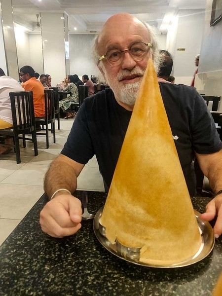
Night in Trivandrum
Prepaid taxi to the « Safire Residency », where we stayed last year. This hotel is still just as nice and welcoming (980 INR). Then, dinner at the restaurant « Ariya Niwas » where we enjoyed those delicious dosas again! (We missed them!)
What are the criteria that make you choose one destination over another?
Hi there,
The title might be a bit long, but I hope it’s completely understandable!
When it comes to choosing your next trip, what tips the scales in favor of Eritrea over Ibiza?
Why pick Canada over French Polynesia?
The price? A magazine or TV report, a travel journal, an Instagram ad? Ease of travel? Minimal time difference? The country that has the most in common with all the trip participants? Activities? Relaxation? The desire to push your limits?
A photo?
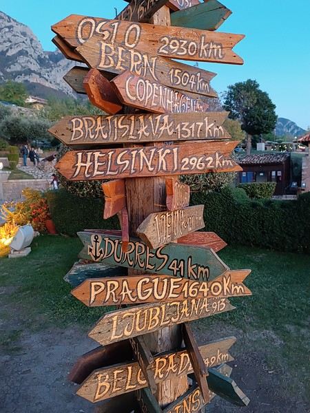
What else, I wonder...
Personally, I often prioritize simple destinations (no administrative hassles), where I’m not at risk (nothing extraordinary like getting kidnapped by Daesh or ending up in a jail cell because the current geopolitics aren’t favorable to my passport, etc.), and where I can drive.
Wide-open natural spaces are more my thing than urban anthills.
Finally, I try not to spend three days on a plane to reach my destination, and I aim for a maximum budget of 3500 € (for 3 weeks) in comfortable conditions—that means charming hotels, good meals, etc.
What about you?🙂
The title might be a bit long, but I hope it’s completely understandable!
When it comes to choosing your next trip, what tips the scales in favor of Eritrea over Ibiza?
Why pick Canada over French Polynesia?
The price? A magazine or TV report, a travel journal, an Instagram ad? Ease of travel? Minimal time difference? The country that has the most in common with all the trip participants? Activities? Relaxation? The desire to push your limits?
A photo?
What else, I wonder...
Personally, I often prioritize simple destinations (no administrative hassles), where I’m not at risk (nothing extraordinary like getting kidnapped by Daesh or ending up in a jail cell because the current geopolitics aren’t favorable to my passport, etc.), and where I can drive.
Wide-open natural spaces are more my thing than urban anthills.
Finally, I try not to spend three days on a plane to reach my destination, and I aim for a maximum budget of 3500 € (for 3 weeks) in comfortable conditions—that means charming hotels, good meals, etc.
What about you?🙂
Morocco, an encounter...
Hello everyone,
I’ve been to Morocco about fifteen times, but I’ve never posted a travel journal here on Voyage Forum. Why? I have no idea… Maybe because this section was so active, with lots of stories and photos. I thought sharing my adventures in *al Maghrib* wouldn’t be very original. Today, this space feels quieter, so what if I tried to give it a little life back, modestly? With some help…
This trip will be different. From the start of my relationship with Richard, I was determined to introduce him to *my* Morocco. But he was a bit reluctant… He’ll tell you about our 2022 meeting, and I’ll illustrate it with my photos, just like we did with our India travel journal.
I’ve been to Morocco about fifteen times, but I’ve never posted a travel journal here on Voyage Forum. Why? I have no idea… Maybe because this section was so active, with lots of stories and photos. I thought sharing my adventures in *al Maghrib* wouldn’t be very original. Today, this space feels quieter, so what if I tried to give it a little life back, modestly? With some help…
This trip will be different. From the start of my relationship with Richard, I was determined to introduce him to *my* Morocco. But he was a bit reluctant… He’ll tell you about our 2022 meeting, and I’ll illustrate it with my photos, just like we did with our India travel journal.
The "Must-Sees" of the American West
This adventure began during Covid... Yep, Covid turned a lot of things upside down, but most of all, it kept us cooped up for a few months and stopped us from traveling for a while—even longer for a die-hard fan of the American West like me.
While borders were closed, I started imagining what an ideal itinerary might look like—one that would string together all the Southwest must-sees in just two weeks, during the best time of year: September and October. When the U.S. announced in September 2021 that borders would reopen in the coming weeks, I regained hope and began scouting flight tickets for a departure in September 2022.
But here’s the thing: tackling solo hikes, each one tougher than the last, right in the heart of the Wilderness, could be a risky—even reckless—endeavor for a father of three. After a quick chat with some virtual friends who are just as passionate about the Southwest as I am, with good physical condition and nearly the same list of must-visit spots, Franck and his brother Sullivan were in! 🙂
In November, we snagged flight tickets from Nice to San Francisco for the modest sum of 400 €, and a few days later, I booked a Toyota Tacoma pickup for 840 € !
It’s not cheap for just 15 days, and a pickup isn’t exactly ideal for luggage, but the prices for full-size 4x4s have become totally outrageous! Due to border closures, rental companies had to offload a lot of these big 4x4s, which tourists love. Then, supply and demand did the rest !
Franck and I spent the winter and spring trying to cram the equivalent of three weeks of hikes into two. But even with physical limits, we had to stay reasonable! Three to four months before departure, we entered the lotteries for different must-see spots: The Subway, Coyote Buttes North (home to the famous Wave), and Coyote Buttes South (CBS).
The Wave is the holy grail for any Southwest enthusiast. Since 2015, we’ve tried our luck with the online and on-site lotteries about ten times, but the spots are unfortunately limited: just 20 per day. A glimmer of hope, though—since early 2022, that number has increased to 64 people allowed per day, with 48 spots awarded via the online lottery.
After all three of us tried our luck for The Wave, on June 1st at exactly 5 PM, I got an email that started with, "Congratulations! You were successful in the Coyote Buttes North (The Wave) September 2022 Permit Lottery at Coyote Buttes North (The Wave)...". At 5:01 PM, I called Franck, whose dream it’s been for over 20 years—ever since the first photos were published in a travel magazine! He didn’t believe me when I told him, and I had to forward the email for him to finally accept the unbelievable: we were going to The Wave and all the incredible spots scattered across the protected area of Coyote Buttes North.
I’ve already been to Coyote Buttes South twice, but there are areas I couldn’t explore in the middle of summer because they were too remote. So, I had no trouble letting my buddies convince me to go back for a third time. Plus, given how hard it is to access, we had no trouble securing a permit online as long as we logged in at exactly 8 PM on the dot!
For The Subway, all three of us struck out. No big deal—we won at CBN and CBS!
Among the sites to visit, there are two that I’m particularly attached to because I know my chances of wanting to see them again are slim. The first is Angel Arch, one of the most legendary arches in the Southwest, due to its remoteness from any trace of civilization. To get there, the recommended hike is Upper Salt Creek, and you’re looking at a 50 km round-trip in an area with no water (in September) and populated by bears.
The second site is the Hopi Salt Trail, in Navajo land, which, after a very tough hike, lets you marvel at the turquoise-blue waters of the Little Colorado before it meets the Colorado River. The Hopi Salt Trail is, like The Wave, the holy grail for any Southwest enthusiast, and the windows of opportunity to see the water in that magical color are very short each year. For this, you have to monitor the Little Colorado’s gauges downstream from Cameron: if the level stays at its lowest for 10 consecutive days—meaning no rain—you can hope for turquoise water. The ideal period rarely exceeds 30 days a year, and it’s usually in June that all the stars align.
But unfortunately, one month before departure, while the flow rate at Cameron looked promising, several storms in September dashed our hopes of doing the Hopi Salt Trail, even at the end of the road trip.
We still had two consolation prizes, though:
After a last-minute cancellation, while keeping an eye out for available spots for The Subway, it turned out that three spots opened up exactly on the day we’d planned to go—so we rushed to grab them!! Regarding the 4x4 rental, the prices for full-size models dropped by several hundred dollars, and we ended up finding a Chevrolet Tahoe for less than $1000. A steal and a serious boost in comfort, so we could store all our gear and food without worry!
Here’s the initial plan in a perfect world: D1 The White Domes - Camping D2 Sunrise at The White Domes - The Subway D3 Coyote Buttes North D4 Coyote Buttes South - White Pocket D5 Wahweap Hoodoos - Sidestep Canyon - Colourful Canyon - White Rocks - Sunset at Yellow Rock D6 Broken Bow Arch - Reflection Canyon D7 Coyote Gulch D8 The Volcano (or The Oasis - Zebra Slot Canyon if the weather’s good) - North Caineville Mesa D9 The Needles: Squaw Canyon - Lost Canyon combo - Druid Arch - Chesler Park D10 Upper Salt Creek Day 1 - Camping D11 Upper Salt Creek Day 2 D12 Hopi-Navajo Territory: Ha Ho No Geh Canyon, Coal Mine Canyon, Bends of the Little Colorado D13 Grand Canyon: South Kaibab Trail and Bright Angel Trail D14 Upper East Zion: East Temple Loop, Jughandle Arch, Center of the Universe, and Checkerboard Mesa Summit And several backup options in case of bad weather, including Spencer Trail, West Cove, and Buffington Pockets.
Enough talking—time for action!
While borders were closed, I started imagining what an ideal itinerary might look like—one that would string together all the Southwest must-sees in just two weeks, during the best time of year: September and October. When the U.S. announced in September 2021 that borders would reopen in the coming weeks, I regained hope and began scouting flight tickets for a departure in September 2022.
But here’s the thing: tackling solo hikes, each one tougher than the last, right in the heart of the Wilderness, could be a risky—even reckless—endeavor for a father of three. After a quick chat with some virtual friends who are just as passionate about the Southwest as I am, with good physical condition and nearly the same list of must-visit spots, Franck and his brother Sullivan were in! 🙂
In November, we snagged flight tickets from Nice to San Francisco for the modest sum of 400 €, and a few days later, I booked a Toyota Tacoma pickup for 840 € !
It’s not cheap for just 15 days, and a pickup isn’t exactly ideal for luggage, but the prices for full-size 4x4s have become totally outrageous! Due to border closures, rental companies had to offload a lot of these big 4x4s, which tourists love. Then, supply and demand did the rest !
Franck and I spent the winter and spring trying to cram the equivalent of three weeks of hikes into two. But even with physical limits, we had to stay reasonable! Three to four months before departure, we entered the lotteries for different must-see spots: The Subway, Coyote Buttes North (home to the famous Wave), and Coyote Buttes South (CBS).
The Wave is the holy grail for any Southwest enthusiast. Since 2015, we’ve tried our luck with the online and on-site lotteries about ten times, but the spots are unfortunately limited: just 20 per day. A glimmer of hope, though—since early 2022, that number has increased to 64 people allowed per day, with 48 spots awarded via the online lottery.
After all three of us tried our luck for The Wave, on June 1st at exactly 5 PM, I got an email that started with, "Congratulations! You were successful in the Coyote Buttes North (The Wave) September 2022 Permit Lottery at Coyote Buttes North (The Wave)...". At 5:01 PM, I called Franck, whose dream it’s been for over 20 years—ever since the first photos were published in a travel magazine! He didn’t believe me when I told him, and I had to forward the email for him to finally accept the unbelievable: we were going to The Wave and all the incredible spots scattered across the protected area of Coyote Buttes North.
I’ve already been to Coyote Buttes South twice, but there are areas I couldn’t explore in the middle of summer because they were too remote. So, I had no trouble letting my buddies convince me to go back for a third time. Plus, given how hard it is to access, we had no trouble securing a permit online as long as we logged in at exactly 8 PM on the dot!
For The Subway, all three of us struck out. No big deal—we won at CBN and CBS!
Among the sites to visit, there are two that I’m particularly attached to because I know my chances of wanting to see them again are slim. The first is Angel Arch, one of the most legendary arches in the Southwest, due to its remoteness from any trace of civilization. To get there, the recommended hike is Upper Salt Creek, and you’re looking at a 50 km round-trip in an area with no water (in September) and populated by bears.
The second site is the Hopi Salt Trail, in Navajo land, which, after a very tough hike, lets you marvel at the turquoise-blue waters of the Little Colorado before it meets the Colorado River. The Hopi Salt Trail is, like The Wave, the holy grail for any Southwest enthusiast, and the windows of opportunity to see the water in that magical color are very short each year. For this, you have to monitor the Little Colorado’s gauges downstream from Cameron: if the level stays at its lowest for 10 consecutive days—meaning no rain—you can hope for turquoise water. The ideal period rarely exceeds 30 days a year, and it’s usually in June that all the stars align.
But unfortunately, one month before departure, while the flow rate at Cameron looked promising, several storms in September dashed our hopes of doing the Hopi Salt Trail, even at the end of the road trip.
We still had two consolation prizes, though:
After a last-minute cancellation, while keeping an eye out for available spots for The Subway, it turned out that three spots opened up exactly on the day we’d planned to go—so we rushed to grab them!! Regarding the 4x4 rental, the prices for full-size models dropped by several hundred dollars, and we ended up finding a Chevrolet Tahoe for less than $1000. A steal and a serious boost in comfort, so we could store all our gear and food without worry!
Here’s the initial plan in a perfect world: D1 The White Domes - Camping D2 Sunrise at The White Domes - The Subway D3 Coyote Buttes North D4 Coyote Buttes South - White Pocket D5 Wahweap Hoodoos - Sidestep Canyon - Colourful Canyon - White Rocks - Sunset at Yellow Rock D6 Broken Bow Arch - Reflection Canyon D7 Coyote Gulch D8 The Volcano (or The Oasis - Zebra Slot Canyon if the weather’s good) - North Caineville Mesa D9 The Needles: Squaw Canyon - Lost Canyon combo - Druid Arch - Chesler Park D10 Upper Salt Creek Day 1 - Camping D11 Upper Salt Creek Day 2 D12 Hopi-Navajo Territory: Ha Ho No Geh Canyon, Coal Mine Canyon, Bends of the Little Colorado D13 Grand Canyon: South Kaibab Trail and Bright Angel Trail D14 Upper East Zion: East Temple Loop, Jughandle Arch, Center of the Universe, and Checkerboard Mesa Summit And several backup options in case of bad weather, including Spencer Trail, West Cove, and Buffington Pockets.
Enough talking—time for action!
46-Day Itinerary in Thailand
Hi everyone,
I’m a die-hard fan of India, but it’s time I discovered Thailand too to broaden my Asian horizons.
I’m heading there on January 19, 2025, for a 46-day trip (no visa needed as I’m French). I’ve pored over a few guidebooks and travel blogs. Based on what caught my interest, I’ve put together a rough itinerary and list of sights. But since I know absolutely nothing about Thailand, I’m kind of flying blind here.
Since I’m not exactly a spring chicken anymore, I’ve opted for a few bases where I’ll stay several days in the same place. That way, I won’t have to change locations and hotels every day or so, packing and unpacking my suitcase constantly. Instead, I plan to explore the surrounding area each day, within a maximum radius of 50 to 70 km.
So, first question: Is that kind of round-trip distance manageable in a day in Thailand?
In India, renting a car for a day—with a driver—currently costs around 35 to 40 € per day. Knowing that 1,300 to 1,500 THB would be my absolute max, and even then, only if I don’t rent a car every single day.
Which brings me to my second question: Am I being unrealistic?
Otherwise—third question—once I’m settled in the city I’ve chosen as my base, can I get around within that 50–70 km radius using public transport?
I’ve already booked all my hotels—with free cancellation—on booking.com at an average price of 950/1,000 THB per night. Does that put me in a good range for value for money? Or am I dreaming?
Here’s my plan:
BANGKOK (13 days, 14 nights): 1 week for exploring Bangkok – Kanchanaburi/Erawan National Park? – Ayutthaya/Lopburi? – Muang Boran – Samut – Songkram/Amphawa
Bangkok -> Chiang Mai by overnight train in first-class sleeper
CHIANG MAI (6 days/6 nights): Mae Hong Son – Hot springs – Chiang Dao – caves – Lamphun – other places to be decided on the spot based on what’s worth seeing and transport options
Chiang Mai -> Chiang Rai
CHIANG RAI (7 days/8 nights): Fang – Tha Ton – Chiang Saen – Doi Tung – Chiang Khong – Doi Ang Khang, Phu Chi Fah, etc.
Chiang Rai -> Phrae
PHRAE (4 days/5 nights): Lampang and surrounding areas, depending on what’s interesting to see
Phrae -> Loei
LOEI (4 days/5 nights): Phu Kradung – Chiang Khan and surrounding areas, depending on what’s worth seeing
Loei -> Buriram
PHIMAI (Nakhon Ratchasima/Khorat) (5 days/6 nights): Phimai – Prasat Muang Tam – Phanom Rung – Prasat Phanom Wan
Phimai -> Khorat (airport or train station) -> Bangkok (overnight in Bangkok)
Day 46: BANGKOK -> KOCHI
Thanks in advance for your thoughts and advice!
Here’s my plan:
BANGKOK (13 days, 14 nights): 1 week for exploring Bangkok – Kanchanaburi/Erawan National Park? – Ayutthaya/Lopburi? – Muang Boran – Samut – Songkram/Amphawa
Bangkok -> Chiang Mai by overnight train in first-class sleeper
CHIANG MAI (6 days/6 nights): Mae Hong Son – Hot springs – Chiang Dao – caves – Lamphun – other places to be decided on the spot based on what’s worth seeing and transport options
Chiang Mai -> Chiang Rai
CHIANG RAI (7 days/8 nights): Fang – Tha Ton – Chiang Saen – Doi Tung – Chiang Khong – Doi Ang Khang, Phu Chi Fah, etc.
Chiang Rai -> Phrae
PHRAE (4 days/5 nights): Lampang and surrounding areas, depending on what’s interesting to see
Phrae -> Loei
LOEI (4 days/5 nights): Phu Kradung – Chiang Khan and surrounding areas, depending on what’s worth seeing
Loei -> Buriram
PHIMAI (Nakhon Ratchasima/Khorat) (5 days/6 nights): Phimai – Prasat Muang Tam – Phanom Rung – Prasat Phanom Wan
Phimai -> Khorat (airport or train station) -> Bangkok (overnight in Bangkok)
Day 46: BANGKOK -> KOCHI
Thanks in advance for your thoughts and advice!
Petit tour dans le Péloponnèse English translation pending
Tous nos séjours en Grèce nous ont enchantées alors, après un séjour en Crète, à Rhodes, à Zakynthos et en Grèce centrale, pourquoi pas un tour du Péloponnèse?
Nous avons quelques hésitations quant à la chaleur possible (notamment pour les randonnées) mais finalement, hop! la réservation des billets d'avion est faite fin janvier: ce sera un départ de Bruxelles (avec Brussels airlines) le 05/07 à 7h30. Puis arrive le (la) Covid avec son lot d'incertitudes: partira? Partira pas? Partira? Partira pas? Faut-il tout annuler, reporter? Au mois de juin les règles d'ouverture des frontières changent en permanence mais il arrive un moment où il faut bien se décider car certains hébergements ne sont plus annulables. Les frontières de la Grèce doivent théoriquement ouvrir totalement le 1er juillet (sous réserve de...) on doit partir le 5 ...alors, c'est décidé, on part! ...enfin, si tout se passe comme prévu!
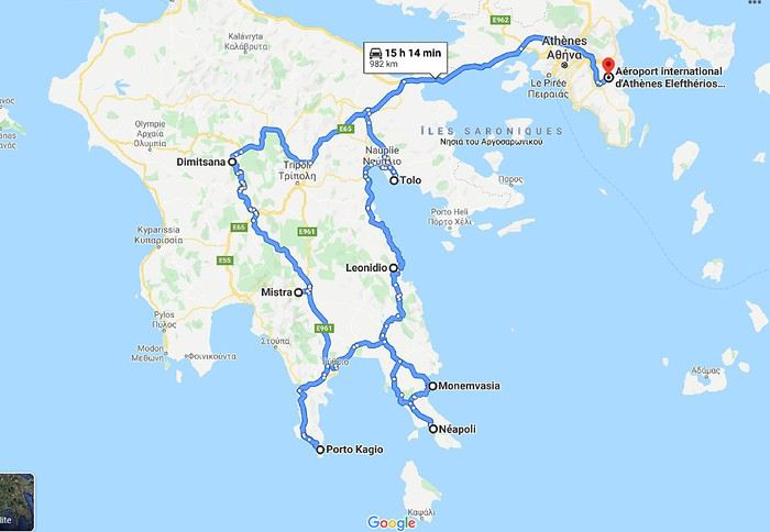
L'ouest du Péloponnèse ne m'inspire pas plus que ça. Par contre Cythère me tente bien, alors voilà à quoi ressemblera notre circuit (on prendra le bateau pour Cythère à Neapoli):
 Muriel
Nous avons quelques hésitations quant à la chaleur possible (notamment pour les randonnées) mais finalement, hop! la réservation des billets d'avion est faite fin janvier: ce sera un départ de Bruxelles (avec Brussels airlines) le 05/07 à 7h30. Puis arrive le (la) Covid avec son lot d'incertitudes: partira? Partira pas? Partira? Partira pas? Faut-il tout annuler, reporter? Au mois de juin les règles d'ouverture des frontières changent en permanence mais il arrive un moment où il faut bien se décider car certains hébergements ne sont plus annulables. Les frontières de la Grèce doivent théoriquement ouvrir totalement le 1er juillet (sous réserve de...) on doit partir le 5 ...alors, c'est décidé, on part! ...enfin, si tout se passe comme prévu!
L'ouest du Péloponnèse ne m'inspire pas plus que ça. Par contre Cythère me tente bien, alors voilà à quoi ressemblera notre circuit (on prendra le bateau pour Cythère à Neapoli):
MurielRetour aux Marquises: les îles méridionales Hiva Oa, Tahuata et Fatu Iva English translation pending
INTRO
En ces temps épidémiques troublés, la Polynésie Française - et en particulier l' archipel des Marquises - ont des atouts exceptionnels en matière de tourisme. A ce jour, l' épidémie de Coronavirus a juste effleuré le Territoire -presque uniquement Tahiti et Moorea - dont les îles éloignées ont été strictement confinées dès le départ, les offres sanitaires et hospitalières sur place étant très limitées. Pour l' instant, la situation est sous contrôle.
Le tourisme retrouve lentement ses marques depuis la mi-juillet. Il s'agit actuellement plus de tourisme local que de tourisme international, bien que la destination Polynésie / Marquises soit attirante : beauté et unicité des paysages, authenticité d'un archipel, certes situé à 4 heures d'avion ATR de Tahiti, mais que l' on peut facilement découvrir en solo et donc en dehors de la très onéreuse croisière sur l' Aranui, sécurité physique mais aussi sanitaire. Les Européens - dont une majorité de Français - arrivent... Ils avaient déjà leurs billets depuis des mois et l' entrée sur le territoire est facilitée.
Nous devions faire ce second voyage aux Marquises en mai dernier, mais il fut annulé jusqu'à la reprise progressive des vols en interne.
Nous avons simplement acheté un billet Air Tahiti en ligne, sans utiliser le Pass Marquises qui ne permet pas de visiter les deux îles les plus méridionales, à savoir Tahuata et Fatu Iva, dépourvues d'aéroport. On ne peut y aller qu' en bateau, en excursion à la journée ( ou plus bien sur ) pour Tahuata et en navette municipale au départ de Hiva Oa pour aller à Fatu Iva.
Les horaires changeant fréquemment, la première chose à faire est de se renseigner sur les jours de passage vers Fatu Iva. En ce moment, il y en a trois : le lundi ( départ à 2 heures du matin ), le mardi ( départ à 6 heures ) et le samedi ( départ à 6 heures également ). Mais tout cela aura peut-être changé dans 3 mois. Il faut donc une stratégie d'approche !
On peut rajouter la visite de ces deux îles à celles qui sont incluses dans le Pass, à savoir Nuku Hiva, Ua Pou, Ua Huka et Hiva Oa. Prévoir alors une extension de 8 jours environ, à partir de Hiva Oa.
Pourquoi vouloir absolument visiter ces deux îles peu accessibles ? Justement parce qu'il faut les mériter ! Elles demeurent très différentes.
L' une, Tahuata, a un lagon, des plages de sable blanc, des falaises abruptes, des baies échancrées ourlées d'une végétation luxuriante, des couleurs uniques dans les bleus et turquoise et culmine à plus de 1000 mètres.
L' autre, Fatu Iva , est une beauté sauvage et altière avec ses à-pics qui dévalent vers l' océan bleu outremer ( ou 'moana' en tahitien ), connue surtout pour sa fameuse baie des Vierges, considérée par beaucoup - en particulier les navigateurs - comme la plus belle île de Polynésie.
Dans mon premier carnet sur les Marquises, j' avais déjà mentionné notre séjour à Hiva Oa, un peu trop court. Cette fois, entre notre arrivée et notre retour, nous passerons 4 nuits à Hiva Oa et 4 nuits à Fatu Iva. Une journée et demie sera consacrée aussi à Hiva Oa.
Avant de partir à la découverte de ces îles polynésiennes lointaines et peu visitées, quelques chiffres édifiants qui montrent que les Marquises ont échappé de peu à l' oubli, à la perte de leur identité singulière et à la disparition de leur culture. L' archipel comptait 20000 habitants en 1842, seulement 2000 en 1920, environ 8000 actuellement en 2020. Au début des années 1920, c'est grâce à la politique nataliste du Dr Rollin, administrateur des Marquises de l' époque, que la situation commença lentement à s' améliorer. Ensuite et paradoxalement, ce fut un évêque, Mgr Lecleac'h, qui s'érigea en animateur engagé du réveil identitaire, via la sauvegarde du patrimoine, la reconnaissance de la langue marquisienne ( et non tahitienne ), les danses ( jugées trop lascives par les missionnaires ), les chants, le tatouage, enfin l' artisanat inspiré des motifs et des symboles de la culture ancienne. L' icône du renouveau marquisien est sans conteste le tiki, demi-dieu et créateur de l' homme. En lui réside la divinité et les ancêtres légendaires.

TAHUATA ou Île Lumière
DANS LA LEGENDE DES MARQUISES C' est la plus petite île habitée des Marquises dont le nom signifie l' aube en marquisien. J' aurai, plus tard, l' occasion de revenir sur la légende de la création des Marquises : dans cette légende, Tahuata représente le dernier acte de la construction avant l' aube. La symbolique de son nom est liée à l' arrivée de la lumière du jour, signifiant la fin de la construction de la 'Grande Maison', alias l' archipel des Marquises.
UN PEU DE GEOLOGIE Tahuata et Fatu Iva sont soeurs géologiquement parlant. Ce sont des îles plus jeunes que celles du nord de l' archipel ( de 5, 5 millions d'années au Nord-Ouest à seulement 1,2 million d'années au Sud-Est ) L' activité volcanique passée s' est matérialisée sous la forme de volcans dits boucliers, différents des volcans hawaiïens ou tahitiens, qui , suite à des secousses sismiques violentes et répétées, se sont peu à peu effondrés, disparaissant sous les flots de la moitié voire davantage des boucliers initiaux. Résultat : les calderas sont imbriquées l'une dans l' autre , la caldeira initiale étant dotée d'un volcan interne plus petit et plus récent. C 'est le cas à Fatu Iva par exemple.
UN PEU DE GEOGRAPHIE
Située à seulement 4 kms de Hiva Oa , on ne peut rejoindre Tahuata que par mer après 40 à 60 mn de navigation selon le temps ( il existe un catamaran communal, le Tahuata Nui mais qui est souvent en panne pour une durée indéterminée... ). On choisira entre l' excursion à la journée ou le passage simple en speedboat privé, assez cher. Ou si l' on doit résider à Tahuata, on s'arrangera au préalable avec la pension de famille choisie pour discuter des modalités et du prix de la course aller-retour entre Tahuata et Hiva Oa. Le canal dit du Bordelais qui est emprunté par les bateaux peut être extrêmement agité par des courants violents et rallonger un peu la course. (Petite digression sur ce fameux canal du Bordelais... Qui est donc ce Bordelais ? Un certain Joseph Capri ( ou Kabri ou Kabris ), originaire de Bordeaux même, initialement matelot de son état sur un bâtiment baleinier qui fait naufrage sur la côte de Nuku Hiva. Kabri , capturé par les guerriers du roi anthropophage de NH, s'apprête à mourir et à finir rôti à la broche, mais est sauvé in extremis par la fille du roi qui demande sa grâce. Celle-ci est accordée, il épouse la belle dans la foulée, le roi tatoue son gendre lui-même, lui offre des parures en tapa et mousse et le nomme grand juge du pays. Il tue, torture, garrotte, découpe en morceaux. Il pacifie à sa manière ! La vie est douce et belle, il a six enfants de sa princesse marquisienne ... Et puis un jour où il sommeille dans la nature, il est kidnappé par le navigateur russe Krunsenstern qui, à coups de knout, le ramène au navire puis à St Petersbourg pour y être interrogé et jugé. Kabri parvient à s' échapper vers Paris, demande à rencontrer Louis XVIII qu'il traite comme son cousin. Ce dernier - contre toute attente - le reçoit et lui donne un peu d'argent, mais la chance a définitivement tourné pour Kabri qui se retrouve à Valenciennes, gagnant son pain comme bête de foire. Il mourra à 42 ans, épuisé et sans avoir pu repartir vers son île marquisienne et vers sa famille nombreuse. Les autorités lui éviteront post mortem l' infamie d'une exhumation et d'un empaillage, son tatouage corporel et facial ayant conquis un amateur !!!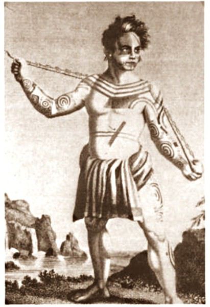 JB Kabri le Tatoué, dessin publié dans le livre de Von Langsdorff
Retour à Tahuata... L' île n'est entourée que partiellement de récifs coralliens ( comme Mangareva aux îles Gambier ) , et est agrémentée de magnifiques plages de sable blanc, en particulier celle de Hanamoenoa. Avec ses versants escarpés se terminant en falaises, des vallées étroites et profondes ouvrant sur des baies échancrées à la végétation dense telles celles jumelles de Iva Iva Nui et de Iva Iva Iti, Tahuata surprend et attire. ' C'est une des rares fois où j' eus le désir de posséder de la terre ', écrivit en son temps le navigateur Alain Gerbault, conquis par une île qu'il qualifiait d'enchanteresse. Son relief est très accidenté et les communications terrestres - sur des pistes improbables - entre les vallées sont difficiles. L' île culmine au Mont Tumu-Mea-Ufa à 1050 m. Sa superficie est de 60 km2, avec une population de 650 à 700 habitants environ. L' île comporte 4 villages : Vaitahu, petit port historique, avec son église aux murs de galets et un magnifique vitrail, son musée d'art et d'histoire, et sa proximité avec des sites archéologiques; Hapatoni, autre village avec sa voie pavée ou ' allée de la reine ', construite sur ordre de la reine Vaekehu II au 19ème siècle, bordée d'arbres centenaires de tamanu plantés par les anciens , et ses ' me'ae ' ( ou ' marae ' en tahitien). Egalement Motopu et Hanatetena, deux plus petits villages. Il y a d'autres chemins pavés dans l' île, à Hapatoni en particulier, et des pétroglyphes à Hanatahua. On peut donc passer plus d'une journée à Tahuata, y séjourner dans l' une de ses pensions. Les chemins et pistes de l' île se prêtent parfaitement à la randonnée pédestre.
UN PEU D HISTOIRE
Plusieurs édifices du village de Vaitahu commémorent un passé souvent tragique. On peut y voir les trois stèles érigées en souvenir de l' arrivée des Espagnols en 1595, puis de celle de militaires français en 1838 et enfin de la prise de possession de l' archipel par l' amiral Abel Dupetit-Thouars en 1842. Alvaro de Mendaña y Neira jeta l' ancre à Vaitahu en 1595, un premier contact avec ceux que l' on appelait à l' époque dans les mers du Sud et ailleurs ' les naturels ' qui tourna rapidement au massacre par les soldats espagnols de 200 villageois, guerriers et civils mélangés. On peut comprendre, dans ce contexte, que l' arrivée d'Occidentaux au 18ème siècle et au début du 19ème siècle ait suscité beaucoup de méfiance, d'animosité et d'hostilité de la part des habitants de Tahuata, et des autres îles également. Les premières tentatives d' évangélisation protestante d'abord en 1797 puis catholique en 1839 se soldèrent par un échec retentissant ( le gouvernement français avait l' habitude d'envoyer les missionnaires en éclaireurs afin de tâter le terrain.. ). Le religieux ayant failli à sa mission, il restait donc le politique et le militaire : l' expédition Dupetit-Thouars arrive en vue de Tahuata mi - avril 1842. Les Français sont dans un premier temps plutôt bien reçus par le chef / roi Iotete qui a récemment subi la pression de la marine américaine et qui se dit que la France le protégera. On attribue donc un terrain en hauteur aux Français pour la construction d'un fortin et d'une garnison. Dupetit-Thouars veut aller vite et propose à Iotete de se mettre sous la protection du roi de France, Louis-Philippe. Iotete accepte et, le 1er mai, est organisée une cérémonie pour la prise de possession officielle des îles Sud de l' archipel des Marquises - et par extension de tout l' archipel - par la France en présence des missionnaires et du neveu de Iotete, Maheono, également chef de Hanatetena. Et puis rapidement, un malaise grandissant s'installe, l' ambiance se dégrade, Iotete devient peu accommodant et versatile, ne supportant pas de se voir privé de son autorité de chef incontesté. Il fugue dans la montagne, organise la résistance aux Français que l' on vient pourtant de fêter, et finit par assiéger le fortin à moitié achevé avec ses guerriers. Résultat : des morts et des blessés des deux côtés et un chaos inattendu. Après palabres et promesses, l' amiral, fidèle à sa stratégie initiale, convainc Iotete - contacté et ramené à la raison par son neveu - de revenir à la table des négociations, et les termes d' une paix durable sont établis définitivement. Iotete a tenté de lutter mais a perdu et la guerre et son pouvoir, son ' mana '. Il mourra l' année suivante, une fin triste et sans avenir pour un chef qui ne sera pas élevé au rang de dieu le jour de ses funérailles.
 Prise de possession officielle de Tahuata
De g. à d. : Maheono, Iotete ( en habit militaire d'apparat à galons d'or époque Louis XV ), le père Baudichon, Abel Dupetit-Thouars
Prise de possession officielle de Tahuata
De g. à d. : Maheono, Iotete ( en habit militaire d'apparat à galons d'or époque Louis XV ), le père Baudichon, Abel Dupetit-Thouars
 Iotete le 1er Mais 1842 ( portrait par Max Radiguet )
 Iotete le 1er mai 1842 ( portrait par Max Radiguet )
 Maheono, neveu de Iotete et son saisissant tatouage facial
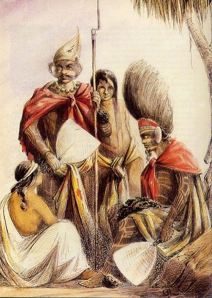 Guerriers marquisiens 19ème siècle
L' amiral repart bientôt sur son navire La Reine Blanche vers Tahiti où il va obtenir le 9 septembre 1842 de la reine Pomaré IV son acceptation formelle de placer son île sous protectorat français. C' est ainsi que Les Marquises alias La Terre des Hommes ( ou Te Fenua Enata en marquisien ) devient la première colonie française dans le Pacifique Sud un peu avant Tahiti.
FAUNE ET FLORE Depuis sa disparition de Hiva Oa, suite à l' introduction malheureuse d'un rapace nocturne, le grand-duc de Virginie ( ou Bubo Virginiasus en latin ), la seule population survivante de ' pahi ' ou martin-chasseur des Marquises, vit à Tahuata, en grand danger d'extinction, car en déclin lent mais constant. il ne resterait que 300 individus au mieux. La destruction du grand-duc est autorisée à cause de son impact fatal sur la faune aviaire locale. Des excursions à pied et à cheval, en excursion à la demi-journée ou à la journée entière, à la découverte du ' pahi ' sont possibles. Contacter le comité de tourisme de Tahuata.
ACTIVITES TRADITIONNELLES
Il y a à Tahuata plusieurs centres d'artisanat et ce dernier est le plus réputé des Marquises, en particulier pour la sculpture sur os. Dans l' île, on est souvent sculpteur de père en fils; les hommes travaillent le bois de rose, l' os de cheval, de chèvre et de mouton et le rostre d'espadon. Dans la vallée d'Hapatoni, ce sont surtout d' expertes sculptrices qui sont à l' oeuvre, souvent depuis des années. Au travail de l' os ou du rostre d'espadon, elles ajoutent la confection de bijoux originaux. La culture du coprah est bien présente à Tahuata et permet aux agriculteurs de gagner un revenu fixe. Les cultures vivrières et les récoltes d'agrumes tels les pamplemousses, très réputés permettent l' autosuffisance alimentaire des habitants de l' île et un peu d'exportation vers le marché et les supermarchés de Papeete ( via la diaspora marquisienne installée à Tahiti ). Pêche et chasse participent également, pleinement, de ce désir d'autosuffisance. La nature est généreuse et tout pousse à profusion et l' on vit simplement mais plutôt bien à Tahuata comme ailleurs aux Marquises, d'autant que désormais, les cargos mixtes apportent régulièrement de Tahiti ce qui manque aux îliens.
Fatu Iva L' île de tous les superlatifs / L'île érotique

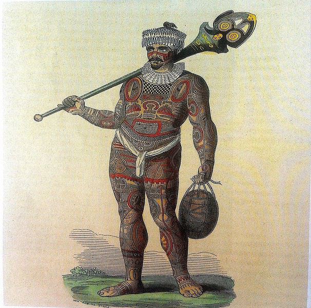
Guerrier marquisien tatoué originaire de Fatu Iva 19ème siècle On notera sur sa poitrine les motifs reconstitués d'une tête de tiki, que l' on retrouve aussi sur la crosse du casse-tête ( ou ' u'u ' en marquisien ), arme réservée au guerrier. Cette tête est supposée augmenter le ' mana ' ( alias la puissance ), les yeux en amande évoquent cette puissance surnaturelle tandis que la bouche étirée où apparaissent parfois langue et dents, est censée défier l' adversaire.
SELON LA LEGENDE Dans la légende de la construction de l' archipel des Marquises, selon laquelle chaque île est partie intégrante de la Maison des Dieux, Fatu Iva représente la toiture faite de 9 ( Iva ) tresses ( Fatu ) de feuilles de palmier. Elle s'est aussi appelée Santa Magdalena, nom donné par Alvaro de Mendaña en l' honneur de la sainte du même nom.
UN PEU DE GEOGRAPHIE Fatu Iva est une île située à 75 kms de Hiva Oa, d'une superficie de 84 km2. Longue de 10 kilomètres et large de 4, elle a la forme d'un croissant ou d'un haricot. Elle culmine au Mont Touaouoho à 960 mètres et héberge une population d'environ 600 habitants. C' est l' île la plus australe de l' archipel, la plus isolée aussi car il est impossible d'y construire un aéroport en raison du relief accidenté ou même un aérodrome comme à Ua Pou par exemple. C' est aussi la plus pluvieuse, étant la plus proche du tropique du Capricorne. Les pluies étant abondantes, l' île est recouverte d'une végétation luxuriante en particulier en son centre où prospère une forêt primaire tropicale dense. C' est aussi l'île la plus sauvage et la plus spectaculaire de l' archipel. Géologiquement parlant, elle est constituée de deux caldeiras volcaniques enchâssées l' une dans l' autre. La première date de 2 millions d'années environ, la seconde, deux fois plus petite est née d'une énorme éruption, comme en témoignent les massives chandelles basaltiques qui montent au ciel tout autour de la baie de Hanavave, dite baie des Vierges. Initialement appelée baie des Verges par les Marquisiens, elle a été rebaptisée par de pudibonds missionnaires, effarouchés par l' imagerie locale et ses sous-entendus. Fatu Iva n' a que deux villages situées chacun sur le bord extérieur des deux caldeiras : Hanavave aux colonnes basaltiques et Omoa, chef-lieu de l' île , village surplombé par un piton rocheux qui surprend par son profil rappelant la tête d'un moai de l' île de Pâques.
UN PEU D'HISTOIRE Comme les autres îles de l' archipel, Fatu Iva fut initialement peuplée par des Polynésiens venus de l' ouest. Les rivalités entre tribus étaient au départ incessantes et donnèrent lieu à des batailles sanglantes. C' est en juillet 1595 que l'île - tout comme celle de Tahuata - fut abordée pour la première fois par un occidental, le navigateur espagnol Alvaro de Mendaña de Neira , le premier du genre à avoir établi des contacts avec des populations polynésiennes. Mais il n' y débarqua pas. Il crût tout d'abord avoir découvert les Iles Salomon, le but ultime de son voyage, mais se rendit rapidement compte qu' il avait découvert une nouvelle terre dans un archipel d' îles auxquelles il donna le nom de ' Marquesas de Mendoza ' pour remercier le Vice-Roi du Pérou - alias Garcia Hurtado de Mendoza y Maurique, IV marquis de Cañete - qui l' avait aidé à monter et financer son expédition, et pour honorer en même temps son épouse et ses filles. En 1935, l' anthropologue norvégien Thor Heyerdahl - et futur aventurier du Kon Tiki - aborda Fatu Iva avec l' idée bien ancrée d' en faire son éden. Il y vécut un an avec sa femme, d'abord à Omoa, puis à Ouia, une vallée inconfortablement située sur la côte au vent et désormais retournée à l' état naturel, ayant été abandonnée par ses quelques habitants. Heyerdahl avait à l' époque avancé l' hypothèse erronée que les Maori descendaient des Indiens d'Amérique du Sud alors qu'ils sont originellement arrivés en pirogue de l' Asie du Sud-Est, et plus particulièrement de Taïwan. ( Je vous renvoie à mon carnet sur Taïwan où j' aborde ce sujet )
De 1960 à 1966, une majorité d'hommes de Fatu Iva partirent travailler au CEP de Mururoa, participant ainsi de l' émigration économique ayant commencé à l' époque, et s'étant poursuivie jusqu'à nos jours, les perspectives en termes d' emploi étant plus que limitées si l' on ne veut pas rester ou devenir agriculteur ou coprahculteur comme ses parents ou grands-parents.
FAUNE ET FLORE L' île est une terre d'abondance pour les agrumes, les fruits en général et les fleurs... Tout pousse ou presque. Elle possède une espèce endémique très menacée aujourd'hui : le Monarque ( ou oma'o ke'eke'e en marquisien ', dont il ne restait il y a peu que 6 couples au monde ! Le rat noir et le chat haret ont littéralement décimé cette espèce, dévorant oeufs, oisillons et même femelles en couvaison. Un programme de sauvegarde de l' espèce a été mis en place, avec des résultats encourageants, le nombre de couples ayant augmenté ces dernières années.
ECONOMIE L' île est ravitaillée uniquement par bateau. Une unique route partiellement bétonnée des deux côtés, et partiellement à l' état de piste, et longue de 17 kilomètres relie les deux villages. On peut également aller d'un village à l' autre par la mer en un quart d'heure de navigation. Le secteur primaire prévaut à Fatu Iva, en particulier la culture du coprah, et puis la pêche au thon, à l' espadon et au thazard. On y a cultivé le noni à outrance à une certaine époque mais celle-ci est un peu révolue, les bienfaits miraculeux du noni n' ayant pas vraiment été prouvés scientifiquement. Comme à Rurutu, on a abandonné la culture du café qui était pourtant prometteuse il y a une quarantaine d'années. En revanche, on trouve davantage de vergers et des vanillières. La chasse aux cochons et aux chèvres permet l' auto-suffisance en viande quand le ravitaillement venu de Tahiti vient à manquer ou arrive irrégulièrement. L' artisanat s'est développé grâce au tourisme et aux expositions semestrielles organisées à Papeete. La spécialité - principalement féminine - de Fatu Iva est le tapa dont les dessins s'inspirent des anciens tatouages marquisiens. La sculpture sur bois ou os ou noix de coco est plutôt réservée aux hommes, nourrie des anciennes figures et des symboles centenaires : tikis sculptés en bois de rose ou en bois noir, casse-tête, plats de présentation.
Suivez-moi en page 2.....
TAHUATA ou Île Lumière
DANS LA LEGENDE DES MARQUISES C' est la plus petite île habitée des Marquises dont le nom signifie l' aube en marquisien. J' aurai, plus tard, l' occasion de revenir sur la légende de la création des Marquises : dans cette légende, Tahuata représente le dernier acte de la construction avant l' aube. La symbolique de son nom est liée à l' arrivée de la lumière du jour, signifiant la fin de la construction de la 'Grande Maison', alias l' archipel des Marquises.
UN PEU DE GEOLOGIE Tahuata et Fatu Iva sont soeurs géologiquement parlant. Ce sont des îles plus jeunes que celles du nord de l' archipel ( de 5, 5 millions d'années au Nord-Ouest à seulement 1,2 million d'années au Sud-Est ) L' activité volcanique passée s' est matérialisée sous la forme de volcans dits boucliers, différents des volcans hawaiïens ou tahitiens, qui , suite à des secousses sismiques violentes et répétées, se sont peu à peu effondrés, disparaissant sous les flots de la moitié voire davantage des boucliers initiaux. Résultat : les calderas sont imbriquées l'une dans l' autre , la caldeira initiale étant dotée d'un volcan interne plus petit et plus récent. C 'est le cas à Fatu Iva par exemple.
UN PEU DE GEOGRAPHIE
Située à seulement 4 kms de Hiva Oa , on ne peut rejoindre Tahuata que par mer après 40 à 60 mn de navigation selon le temps ( il existe un catamaran communal, le Tahuata Nui mais qui est souvent en panne pour une durée indéterminée... ). On choisira entre l' excursion à la journée ou le passage simple en speedboat privé, assez cher. Ou si l' on doit résider à Tahuata, on s'arrangera au préalable avec la pension de famille choisie pour discuter des modalités et du prix de la course aller-retour entre Tahuata et Hiva Oa. Le canal dit du Bordelais qui est emprunté par les bateaux peut être extrêmement agité par des courants violents et rallonger un peu la course. (Petite digression sur ce fameux canal du Bordelais... Qui est donc ce Bordelais ? Un certain Joseph Capri ( ou Kabri ou Kabris ), originaire de Bordeaux même, initialement matelot de son état sur un bâtiment baleinier qui fait naufrage sur la côte de Nuku Hiva. Kabri , capturé par les guerriers du roi anthropophage de NH, s'apprête à mourir et à finir rôti à la broche, mais est sauvé in extremis par la fille du roi qui demande sa grâce. Celle-ci est accordée, il épouse la belle dans la foulée, le roi tatoue son gendre lui-même, lui offre des parures en tapa et mousse et le nomme grand juge du pays. Il tue, torture, garrotte, découpe en morceaux. Il pacifie à sa manière ! La vie est douce et belle, il a six enfants de sa princesse marquisienne ... Et puis un jour où il sommeille dans la nature, il est kidnappé par le navigateur russe Krunsenstern qui, à coups de knout, le ramène au navire puis à St Petersbourg pour y être interrogé et jugé. Kabri parvient à s' échapper vers Paris, demande à rencontrer Louis XVIII qu'il traite comme son cousin. Ce dernier - contre toute attente - le reçoit et lui donne un peu d'argent, mais la chance a définitivement tourné pour Kabri qui se retrouve à Valenciennes, gagnant son pain comme bête de foire. Il mourra à 42 ans, épuisé et sans avoir pu repartir vers son île marquisienne et vers sa famille nombreuse. Les autorités lui éviteront post mortem l' infamie d'une exhumation et d'un empaillage, son tatouage corporel et facial ayant conquis un amateur !!!
JB Kabri le Tatoué, dessin publié dans le livre de Von LangsdorffRetour à Tahuata... L' île n'est entourée que partiellement de récifs coralliens ( comme Mangareva aux îles Gambier ) , et est agrémentée de magnifiques plages de sable blanc, en particulier celle de Hanamoenoa. Avec ses versants escarpés se terminant en falaises, des vallées étroites et profondes ouvrant sur des baies échancrées à la végétation dense telles celles jumelles de Iva Iva Nui et de Iva Iva Iti, Tahuata surprend et attire. ' C'est une des rares fois où j' eus le désir de posséder de la terre ', écrivit en son temps le navigateur Alain Gerbault, conquis par une île qu'il qualifiait d'enchanteresse. Son relief est très accidenté et les communications terrestres - sur des pistes improbables - entre les vallées sont difficiles. L' île culmine au Mont Tumu-Mea-Ufa à 1050 m. Sa superficie est de 60 km2, avec une population de 650 à 700 habitants environ. L' île comporte 4 villages : Vaitahu, petit port historique, avec son église aux murs de galets et un magnifique vitrail, son musée d'art et d'histoire, et sa proximité avec des sites archéologiques; Hapatoni, autre village avec sa voie pavée ou ' allée de la reine ', construite sur ordre de la reine Vaekehu II au 19ème siècle, bordée d'arbres centenaires de tamanu plantés par les anciens , et ses ' me'ae ' ( ou ' marae ' en tahitien). Egalement Motopu et Hanatetena, deux plus petits villages. Il y a d'autres chemins pavés dans l' île, à Hapatoni en particulier, et des pétroglyphes à Hanatahua. On peut donc passer plus d'une journée à Tahuata, y séjourner dans l' une de ses pensions. Les chemins et pistes de l' île se prêtent parfaitement à la randonnée pédestre.
UN PEU D HISTOIRE
Plusieurs édifices du village de Vaitahu commémorent un passé souvent tragique. On peut y voir les trois stèles érigées en souvenir de l' arrivée des Espagnols en 1595, puis de celle de militaires français en 1838 et enfin de la prise de possession de l' archipel par l' amiral Abel Dupetit-Thouars en 1842. Alvaro de Mendaña y Neira jeta l' ancre à Vaitahu en 1595, un premier contact avec ceux que l' on appelait à l' époque dans les mers du Sud et ailleurs ' les naturels ' qui tourna rapidement au massacre par les soldats espagnols de 200 villageois, guerriers et civils mélangés. On peut comprendre, dans ce contexte, que l' arrivée d'Occidentaux au 18ème siècle et au début du 19ème siècle ait suscité beaucoup de méfiance, d'animosité et d'hostilité de la part des habitants de Tahuata, et des autres îles également. Les premières tentatives d' évangélisation protestante d'abord en 1797 puis catholique en 1839 se soldèrent par un échec retentissant ( le gouvernement français avait l' habitude d'envoyer les missionnaires en éclaireurs afin de tâter le terrain.. ). Le religieux ayant failli à sa mission, il restait donc le politique et le militaire : l' expédition Dupetit-Thouars arrive en vue de Tahuata mi - avril 1842. Les Français sont dans un premier temps plutôt bien reçus par le chef / roi Iotete qui a récemment subi la pression de la marine américaine et qui se dit que la France le protégera. On attribue donc un terrain en hauteur aux Français pour la construction d'un fortin et d'une garnison. Dupetit-Thouars veut aller vite et propose à Iotete de se mettre sous la protection du roi de France, Louis-Philippe. Iotete accepte et, le 1er mai, est organisée une cérémonie pour la prise de possession officielle des îles Sud de l' archipel des Marquises - et par extension de tout l' archipel - par la France en présence des missionnaires et du neveu de Iotete, Maheono, également chef de Hanatetena. Et puis rapidement, un malaise grandissant s'installe, l' ambiance se dégrade, Iotete devient peu accommodant et versatile, ne supportant pas de se voir privé de son autorité de chef incontesté. Il fugue dans la montagne, organise la résistance aux Français que l' on vient pourtant de fêter, et finit par assiéger le fortin à moitié achevé avec ses guerriers. Résultat : des morts et des blessés des deux côtés et un chaos inattendu. Après palabres et promesses, l' amiral, fidèle à sa stratégie initiale, convainc Iotete - contacté et ramené à la raison par son neveu - de revenir à la table des négociations, et les termes d' une paix durable sont établis définitivement. Iotete a tenté de lutter mais a perdu et la guerre et son pouvoir, son ' mana '. Il mourra l' année suivante, une fin triste et sans avenir pour un chef qui ne sera pas élevé au rang de dieu le jour de ses funérailles.
Prise de possession officielle de Tahuata
De g. à d. : Maheono, Iotete ( en habit militaire d'apparat à galons d'or époque Louis XV ), le père Baudichon, Abel Dupetit-Thouars
Iotete le 1er Mais 1842 ( portrait par Max Radiguet )
Iotete le 1er mai 1842 ( portrait par Max Radiguet )
Maheono, neveu de Iotete et son saisissant tatouage facial
Guerriers marquisiens 19ème siècleL' amiral repart bientôt sur son navire La Reine Blanche vers Tahiti où il va obtenir le 9 septembre 1842 de la reine Pomaré IV son acceptation formelle de placer son île sous protectorat français. C' est ainsi que Les Marquises alias La Terre des Hommes ( ou Te Fenua Enata en marquisien ) devient la première colonie française dans le Pacifique Sud un peu avant Tahiti.
FAUNE ET FLORE Depuis sa disparition de Hiva Oa, suite à l' introduction malheureuse d'un rapace nocturne, le grand-duc de Virginie ( ou Bubo Virginiasus en latin ), la seule population survivante de ' pahi ' ou martin-chasseur des Marquises, vit à Tahuata, en grand danger d'extinction, car en déclin lent mais constant. il ne resterait que 300 individus au mieux. La destruction du grand-duc est autorisée à cause de son impact fatal sur la faune aviaire locale. Des excursions à pied et à cheval, en excursion à la demi-journée ou à la journée entière, à la découverte du ' pahi ' sont possibles. Contacter le comité de tourisme de Tahuata.
ACTIVITES TRADITIONNELLES
Il y a à Tahuata plusieurs centres d'artisanat et ce dernier est le plus réputé des Marquises, en particulier pour la sculpture sur os. Dans l' île, on est souvent sculpteur de père en fils; les hommes travaillent le bois de rose, l' os de cheval, de chèvre et de mouton et le rostre d'espadon. Dans la vallée d'Hapatoni, ce sont surtout d' expertes sculptrices qui sont à l' oeuvre, souvent depuis des années. Au travail de l' os ou du rostre d'espadon, elles ajoutent la confection de bijoux originaux. La culture du coprah est bien présente à Tahuata et permet aux agriculteurs de gagner un revenu fixe. Les cultures vivrières et les récoltes d'agrumes tels les pamplemousses, très réputés permettent l' autosuffisance alimentaire des habitants de l' île et un peu d'exportation vers le marché et les supermarchés de Papeete ( via la diaspora marquisienne installée à Tahiti ). Pêche et chasse participent également, pleinement, de ce désir d'autosuffisance. La nature est généreuse et tout pousse à profusion et l' on vit simplement mais plutôt bien à Tahuata comme ailleurs aux Marquises, d'autant que désormais, les cargos mixtes apportent régulièrement de Tahiti ce qui manque aux îliens.
Fatu Iva L' île de tous les superlatifs / L'île érotique
Guerrier marquisien tatoué originaire de Fatu Iva 19ème siècle On notera sur sa poitrine les motifs reconstitués d'une tête de tiki, que l' on retrouve aussi sur la crosse du casse-tête ( ou ' u'u ' en marquisien ), arme réservée au guerrier. Cette tête est supposée augmenter le ' mana ' ( alias la puissance ), les yeux en amande évoquent cette puissance surnaturelle tandis que la bouche étirée où apparaissent parfois langue et dents, est censée défier l' adversaire.
SELON LA LEGENDE Dans la légende de la construction de l' archipel des Marquises, selon laquelle chaque île est partie intégrante de la Maison des Dieux, Fatu Iva représente la toiture faite de 9 ( Iva ) tresses ( Fatu ) de feuilles de palmier. Elle s'est aussi appelée Santa Magdalena, nom donné par Alvaro de Mendaña en l' honneur de la sainte du même nom.
UN PEU DE GEOGRAPHIE Fatu Iva est une île située à 75 kms de Hiva Oa, d'une superficie de 84 km2. Longue de 10 kilomètres et large de 4, elle a la forme d'un croissant ou d'un haricot. Elle culmine au Mont Touaouoho à 960 mètres et héberge une population d'environ 600 habitants. C' est l' île la plus australe de l' archipel, la plus isolée aussi car il est impossible d'y construire un aéroport en raison du relief accidenté ou même un aérodrome comme à Ua Pou par exemple. C' est aussi la plus pluvieuse, étant la plus proche du tropique du Capricorne. Les pluies étant abondantes, l' île est recouverte d'une végétation luxuriante en particulier en son centre où prospère une forêt primaire tropicale dense. C' est aussi l'île la plus sauvage et la plus spectaculaire de l' archipel. Géologiquement parlant, elle est constituée de deux caldeiras volcaniques enchâssées l' une dans l' autre. La première date de 2 millions d'années environ, la seconde, deux fois plus petite est née d'une énorme éruption, comme en témoignent les massives chandelles basaltiques qui montent au ciel tout autour de la baie de Hanavave, dite baie des Vierges. Initialement appelée baie des Verges par les Marquisiens, elle a été rebaptisée par de pudibonds missionnaires, effarouchés par l' imagerie locale et ses sous-entendus. Fatu Iva n' a que deux villages situées chacun sur le bord extérieur des deux caldeiras : Hanavave aux colonnes basaltiques et Omoa, chef-lieu de l' île , village surplombé par un piton rocheux qui surprend par son profil rappelant la tête d'un moai de l' île de Pâques.
UN PEU D'HISTOIRE Comme les autres îles de l' archipel, Fatu Iva fut initialement peuplée par des Polynésiens venus de l' ouest. Les rivalités entre tribus étaient au départ incessantes et donnèrent lieu à des batailles sanglantes. C' est en juillet 1595 que l'île - tout comme celle de Tahuata - fut abordée pour la première fois par un occidental, le navigateur espagnol Alvaro de Mendaña de Neira , le premier du genre à avoir établi des contacts avec des populations polynésiennes. Mais il n' y débarqua pas. Il crût tout d'abord avoir découvert les Iles Salomon, le but ultime de son voyage, mais se rendit rapidement compte qu' il avait découvert une nouvelle terre dans un archipel d' îles auxquelles il donna le nom de ' Marquesas de Mendoza ' pour remercier le Vice-Roi du Pérou - alias Garcia Hurtado de Mendoza y Maurique, IV marquis de Cañete - qui l' avait aidé à monter et financer son expédition, et pour honorer en même temps son épouse et ses filles. En 1935, l' anthropologue norvégien Thor Heyerdahl - et futur aventurier du Kon Tiki - aborda Fatu Iva avec l' idée bien ancrée d' en faire son éden. Il y vécut un an avec sa femme, d'abord à Omoa, puis à Ouia, une vallée inconfortablement située sur la côte au vent et désormais retournée à l' état naturel, ayant été abandonnée par ses quelques habitants. Heyerdahl avait à l' époque avancé l' hypothèse erronée que les Maori descendaient des Indiens d'Amérique du Sud alors qu'ils sont originellement arrivés en pirogue de l' Asie du Sud-Est, et plus particulièrement de Taïwan. ( Je vous renvoie à mon carnet sur Taïwan où j' aborde ce sujet )
De 1960 à 1966, une majorité d'hommes de Fatu Iva partirent travailler au CEP de Mururoa, participant ainsi de l' émigration économique ayant commencé à l' époque, et s'étant poursuivie jusqu'à nos jours, les perspectives en termes d' emploi étant plus que limitées si l' on ne veut pas rester ou devenir agriculteur ou coprahculteur comme ses parents ou grands-parents.
FAUNE ET FLORE L' île est une terre d'abondance pour les agrumes, les fruits en général et les fleurs... Tout pousse ou presque. Elle possède une espèce endémique très menacée aujourd'hui : le Monarque ( ou oma'o ke'eke'e en marquisien ', dont il ne restait il y a peu que 6 couples au monde ! Le rat noir et le chat haret ont littéralement décimé cette espèce, dévorant oeufs, oisillons et même femelles en couvaison. Un programme de sauvegarde de l' espèce a été mis en place, avec des résultats encourageants, le nombre de couples ayant augmenté ces dernières années.
ECONOMIE L' île est ravitaillée uniquement par bateau. Une unique route partiellement bétonnée des deux côtés, et partiellement à l' état de piste, et longue de 17 kilomètres relie les deux villages. On peut également aller d'un village à l' autre par la mer en un quart d'heure de navigation. Le secteur primaire prévaut à Fatu Iva, en particulier la culture du coprah, et puis la pêche au thon, à l' espadon et au thazard. On y a cultivé le noni à outrance à une certaine époque mais celle-ci est un peu révolue, les bienfaits miraculeux du noni n' ayant pas vraiment été prouvés scientifiquement. Comme à Rurutu, on a abandonné la culture du café qui était pourtant prometteuse il y a une quarantaine d'années. En revanche, on trouve davantage de vergers et des vanillières. La chasse aux cochons et aux chèvres permet l' auto-suffisance en viande quand le ravitaillement venu de Tahiti vient à manquer ou arrive irrégulièrement. L' artisanat s'est développé grâce au tourisme et aux expositions semestrielles organisées à Papeete. La spécialité - principalement féminine - de Fatu Iva est le tapa dont les dessins s'inspirent des anciens tatouages marquisiens. La sculpture sur bois ou os ou noix de coco est plutôt réservée aux hommes, nourrie des anciennes figures et des symboles centenaires : tikis sculptés en bois de rose ou en bois noir, casse-tête, plats de présentation.
Suivez-moi en page 2.....
La Bolivie, un voyage riche en émotions! English translation pending
Bonjour à tous,
Ce carnet, je ne pensais pas le rédiger, à mon retour de Bolivie. Certains d’entre vous le savent d’ailleurs. Trop amère, trop choquée.
Et puis heureusement, le temps fait son affaire et estompe les mauvais souvenirs pour laisser principalement les bons. Rédiger ce carnet m’aide aussi je pense à tourner la page sur certains (très) mauvais moments, quand bien même ils datent déjà de huit mois. Certains épisodes auront été riches en émotions….
La Bolivie, j’en rêvais depuis plusieurs années. Envie de grands espaces, de nature, de kaléidoscope coloré. Envie de voir des lamas, des viscaches, des vigognes, des condors. Envie de voir les lagunes, LE salar, les couleurs du désert de Dali. Envie de découvrir l’Amérique du Sud et ce pays encore peu prisé des touristes. Envie de réaliser ce voyage tel que nous le pouvons sans nos enfants : peu de réservations d’hôtels, du camping sauvage et un itinéraire décidé pour les grandes étapes mais ajusté au jour le jour selon nos coups de cœur.
Les carnets lus au fil des mois confirmaient que le Sud Lipez reste accessible en individuel et autonome, même s’il est évidemment préférable de voyager à deux voitures. Mes beaux-parents acceptant de venir garder nos fils quelques jours avant le début des vacances scolaires de la Toussaint, je commence à organiser dès le mois de mai un périple de 16 jours entiers sur place. Depuis plusieurs mois, je m’étais forgé un début d’itinéraire selon ces différents critères :
J’exclus La Paz. Nous visiterons la capitale lors d’un futur voyage au Pérou où nous ajouterons quelques étapes nord-boliviennes. Je choisis d’atterrir à Santa Cruz de la Sierra avant de reprendre dans la foulée un avion pour Sucre. En effet, notre loueur de voiture, Biz Rent a Car, est situé à Sucre et a bonne réputation sur forum, notamment grâce à l’une des employées, Alejandra et sa maîtrise du français. Je prévois la majorité de notre temps dans le Sud Lipez afin de pouvoir admirer notamment les lagunes et le salar. Le carnet d’AirOne me donne envie de découvrir Tajira, région viticole et par conséquent plus verdoyante que le Sud Lipez désertique. Je réserve auprès de Vicente deux nuits dans sa ferme-auberge à Rosillas et un trek d’une journée permettant d’observer les condors Difficultés d’acclimatation liées à l’altitude : ne pas atterrir à La Paz permet déjà d’éviter une mise dans le bain d’entrée à 3600 mètres. Il sera plus aisé d’atterrir à Santa Cruz (416 mètres) et même Sucre (2750 mètres), d’autant que nous prévoyons de partir rapidement sur la région de Tajira (1900 mètres).
L’Amérique du Sud offrant plusieurs pays nous attirant depuis quelques années, mon mari a commencé à apprendre l’espagnol deux ans auparavant. Heureusement, car nous n’avons rencontré que très peu de Boliviens parlant (un peu) l’anglais. Comme beaucoup de voyageurs, nous avions téléchargé des cartes sous Maps.me qui une fois stockées sur les téléphones permettent de circuler sans accès au réseau.
J’apprends dans le courant de l’été 2019 que les élections présidentielles auront lieu pendant notre séjour. Soit ! Ce ne sera pas notre premier voyage en pleine campagne présidentielle. Au départ, je n’y prête pas tellement attention. Et puis fin août, Carmen (Ticapi) m’apprend qu’il sera interdit de circuler lors du premier tour des élections, le dimanche 20 octobre. Après consultation de mon ébauche d’itinéraire, nous avions justement prévu de repartir ce jour-là de Rosillas pour rejoindre Tupiza avant d’enchaîner sur le Sud Lipez. Avec seize jours sur place, nous n’avions pas envie de « perdre » une journée à Rosillas et reporter notre départ d’une journée. Il était également difficile de prévoir le trek le dimanche 20 car Vincent nous a précisé qu’en raison des élections, les villageois ne seraient pas disponibles pour faire office de guide dans la montagne. Il nous fallait trouver un endroit où nous pourrions passer la journée entière sans utiliser la voiture. Pas si simple. Alors finalement, plutôt qu’entamer notre séjour par Rosillas, cette étape sera la dernière de notre voyage. Nous devons atterrir à Sucre le matin du mercredi 17 et je prévois d’y séjourner deux jours. Direction ensuite Tupiza puis Guadalupe et enfin la laguna Celeste où nous resterons la fameuse journée des élections présidentielles à randonner dans les environs. Ça, c’était le programme initial. Ça ne s’est pas tout à fait déroulé ainsi !
Allez, quelques photos pour, peut-être, vous donner envie de poursuivre la lecture de ce carnet 🙂
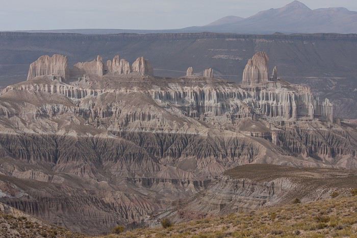
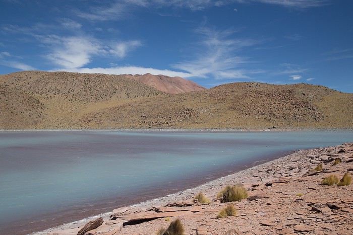
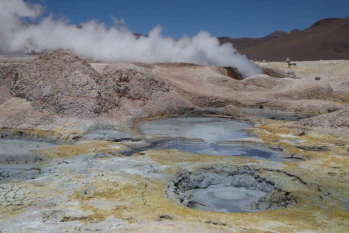
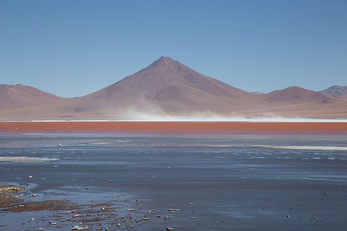
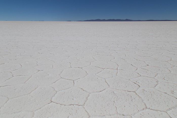
Et puis heureusement, le temps fait son affaire et estompe les mauvais souvenirs pour laisser principalement les bons. Rédiger ce carnet m’aide aussi je pense à tourner la page sur certains (très) mauvais moments, quand bien même ils datent déjà de huit mois. Certains épisodes auront été riches en émotions….
La Bolivie, j’en rêvais depuis plusieurs années. Envie de grands espaces, de nature, de kaléidoscope coloré. Envie de voir des lamas, des viscaches, des vigognes, des condors. Envie de voir les lagunes, LE salar, les couleurs du désert de Dali. Envie de découvrir l’Amérique du Sud et ce pays encore peu prisé des touristes. Envie de réaliser ce voyage tel que nous le pouvons sans nos enfants : peu de réservations d’hôtels, du camping sauvage et un itinéraire décidé pour les grandes étapes mais ajusté au jour le jour selon nos coups de cœur.
Les carnets lus au fil des mois confirmaient que le Sud Lipez reste accessible en individuel et autonome, même s’il est évidemment préférable de voyager à deux voitures. Mes beaux-parents acceptant de venir garder nos fils quelques jours avant le début des vacances scolaires de la Toussaint, je commence à organiser dès le mois de mai un périple de 16 jours entiers sur place. Depuis plusieurs mois, je m’étais forgé un début d’itinéraire selon ces différents critères :
J’exclus La Paz. Nous visiterons la capitale lors d’un futur voyage au Pérou où nous ajouterons quelques étapes nord-boliviennes. Je choisis d’atterrir à Santa Cruz de la Sierra avant de reprendre dans la foulée un avion pour Sucre. En effet, notre loueur de voiture, Biz Rent a Car, est situé à Sucre et a bonne réputation sur forum, notamment grâce à l’une des employées, Alejandra et sa maîtrise du français. Je prévois la majorité de notre temps dans le Sud Lipez afin de pouvoir admirer notamment les lagunes et le salar. Le carnet d’AirOne me donne envie de découvrir Tajira, région viticole et par conséquent plus verdoyante que le Sud Lipez désertique. Je réserve auprès de Vicente deux nuits dans sa ferme-auberge à Rosillas et un trek d’une journée permettant d’observer les condors Difficultés d’acclimatation liées à l’altitude : ne pas atterrir à La Paz permet déjà d’éviter une mise dans le bain d’entrée à 3600 mètres. Il sera plus aisé d’atterrir à Santa Cruz (416 mètres) et même Sucre (2750 mètres), d’autant que nous prévoyons de partir rapidement sur la région de Tajira (1900 mètres).
L’Amérique du Sud offrant plusieurs pays nous attirant depuis quelques années, mon mari a commencé à apprendre l’espagnol deux ans auparavant. Heureusement, car nous n’avons rencontré que très peu de Boliviens parlant (un peu) l’anglais. Comme beaucoup de voyageurs, nous avions téléchargé des cartes sous Maps.me qui une fois stockées sur les téléphones permettent de circuler sans accès au réseau.
J’apprends dans le courant de l’été 2019 que les élections présidentielles auront lieu pendant notre séjour. Soit ! Ce ne sera pas notre premier voyage en pleine campagne présidentielle. Au départ, je n’y prête pas tellement attention. Et puis fin août, Carmen (Ticapi) m’apprend qu’il sera interdit de circuler lors du premier tour des élections, le dimanche 20 octobre. Après consultation de mon ébauche d’itinéraire, nous avions justement prévu de repartir ce jour-là de Rosillas pour rejoindre Tupiza avant d’enchaîner sur le Sud Lipez. Avec seize jours sur place, nous n’avions pas envie de « perdre » une journée à Rosillas et reporter notre départ d’une journée. Il était également difficile de prévoir le trek le dimanche 20 car Vincent nous a précisé qu’en raison des élections, les villageois ne seraient pas disponibles pour faire office de guide dans la montagne. Il nous fallait trouver un endroit où nous pourrions passer la journée entière sans utiliser la voiture. Pas si simple. Alors finalement, plutôt qu’entamer notre séjour par Rosillas, cette étape sera la dernière de notre voyage. Nous devons atterrir à Sucre le matin du mercredi 17 et je prévois d’y séjourner deux jours. Direction ensuite Tupiza puis Guadalupe et enfin la laguna Celeste où nous resterons la fameuse journée des élections présidentielles à randonner dans les environs. Ça, c’était le programme initial. Ça ne s’est pas tout à fait déroulé ainsi !
Allez, quelques photos pour, peut-être, vous donner envie de poursuivre la lecture de ce carnet 🙂
Promenades au Rwanda English translation pending
C'est un voyage qui date un peu, mais il se trouve que les circonstances de la vie m'offrent du temps libre... L'occasion de replonger dans mes souvenirs et partager un voyage qui reste probablement d’actualité même si nous habitons un monde qui change de plus en plus vite...
dimanche 4 juin 2017 Mulhouse-Kigali
Le décollage approche, il faut choisir son Macron, heu, je voulais dire, son livre, pardon. Bon, dans la France du mois de juin 2017, cela revient strictement au même…

09:30 embarquement 11:20 Départ Basel Turkish Airlines (TK1924) 3 heures de vol 15:20 Arrivée Istanbul (heure locale) Changement d'Avion 18:35 TK 569 Turkich Airline
durée 6h30
00:05 Arrivée: Kigali (KGL), Kigali, Rwanda
Je précise que le mobile de ce voyage est que ma sœur vit à Kigali depuis quelques années. Son mari travaille "dans la diplomatie". Nous sommes attendus à l’aéroport par un chauffeur de l’ambassade. Ma soeur nous avait dit qu’ils seraient au lit, que la maison était ouverte et des infos pour retrouver sans aide notre chambre. Ceux qui connaissent mon célèbre sens de l’orientation ont déjà deviné que je suis allé me vautrer directement dans la chambre de nos hôtes…
lundi 5 juin 2017
Kigali C’est le lendemain qu’on a vraiment réalisé qu’on était en Afrique...
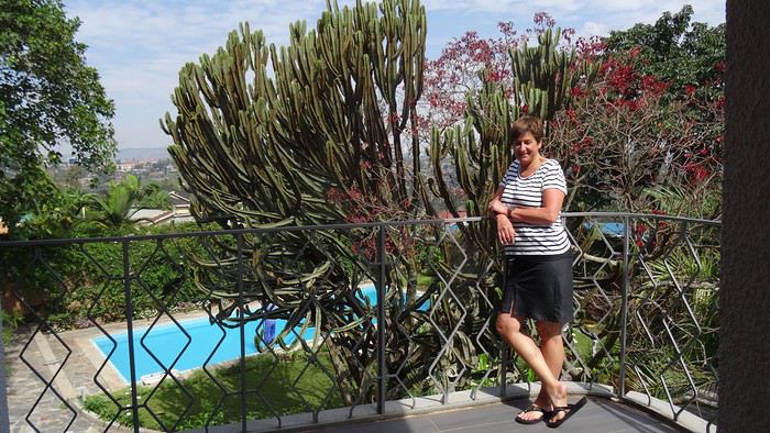
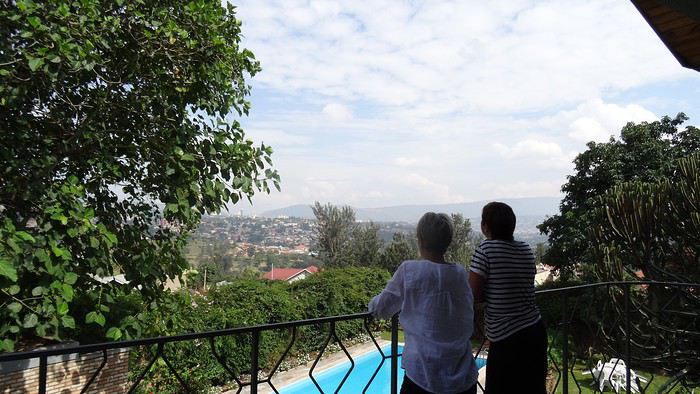
Bon, mais faut manger…On part faire des courses en ville, excellent moyen de prendre la température de l’endroit…Avec ma soeur, c’est tout de suite magouilles et compagnies…Elle me fait changer ma bonne vieille puce Bouygues contre une puce MTN locale. Elle alpague ensuite un gamin dans la rue qui tape sur mon clavier des suites de chiffres cabalistiques pour m’ouvrir les chemins d’une 3g low cost…
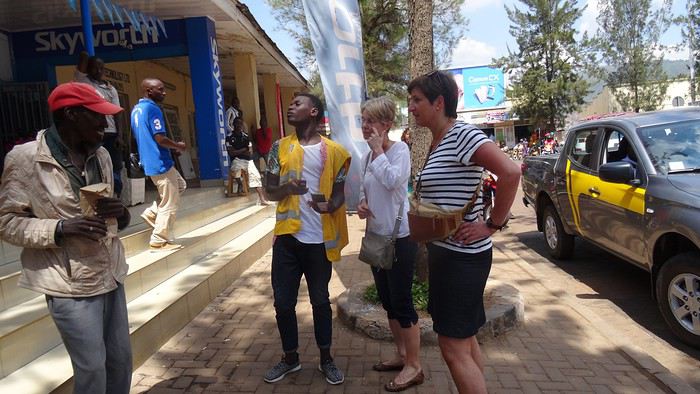
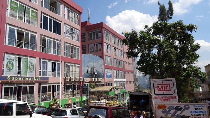
Comme souvent dans les pays qui se sont déversés dans le courant consumériste trop vite, les villes sont un gigantesque foutoir où l’architecture s’inspire beaucoup des gâteaux à la meringue, on côtoie le pire et le meilleur, un flot d’humains qui se débattent pour survivre, des raz de marée de véhicules, gigantesques 4*4 en concurrence avec des myriades de deux roues hétéroclites…C’est une ambiance, à l’africaine, des sonos déversent de la rumba congolaise, des types jouent au tam-tam…
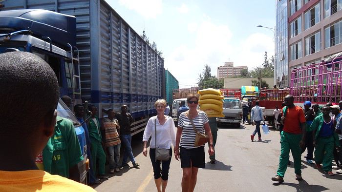
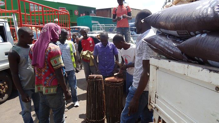
Partout des portefaix s’activent avec des montagnes posées sur la tête…
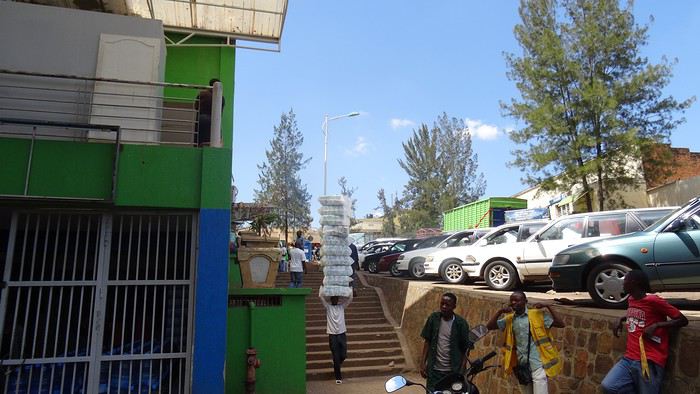
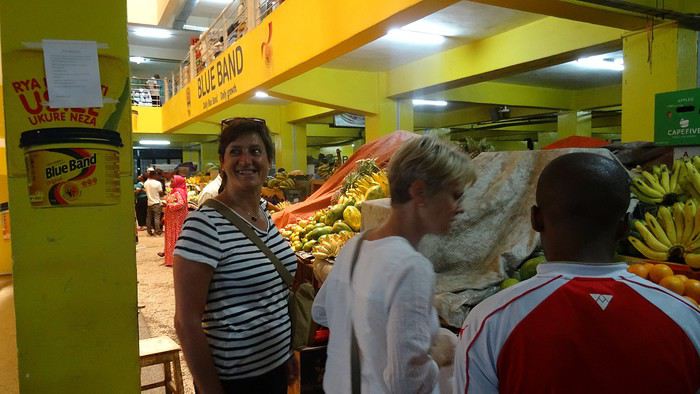
On arrive au marché. Ma sœur y est en territoire connu, négocie, interpelle
dimanche 4 juin 2017 Mulhouse-Kigali
Le décollage approche, il faut choisir son Macron, heu, je voulais dire, son livre, pardon. Bon, dans la France du mois de juin 2017, cela revient strictement au même…
09:30 embarquement 11:20 Départ Basel Turkish Airlines (TK1924) 3 heures de vol 15:20 Arrivée Istanbul (heure locale) Changement d'Avion 18:35 TK 569 Turkich Airline
durée 6h30
00:05 Arrivée: Kigali (KGL), Kigali, Rwanda
Je précise que le mobile de ce voyage est que ma sœur vit à Kigali depuis quelques années. Son mari travaille "dans la diplomatie". Nous sommes attendus à l’aéroport par un chauffeur de l’ambassade. Ma soeur nous avait dit qu’ils seraient au lit, que la maison était ouverte et des infos pour retrouver sans aide notre chambre. Ceux qui connaissent mon célèbre sens de l’orientation ont déjà deviné que je suis allé me vautrer directement dans la chambre de nos hôtes…
lundi 5 juin 2017
Kigali C’est le lendemain qu’on a vraiment réalisé qu’on était en Afrique...
Bon, mais faut manger…On part faire des courses en ville, excellent moyen de prendre la température de l’endroit…Avec ma soeur, c’est tout de suite magouilles et compagnies…Elle me fait changer ma bonne vieille puce Bouygues contre une puce MTN locale. Elle alpague ensuite un gamin dans la rue qui tape sur mon clavier des suites de chiffres cabalistiques pour m’ouvrir les chemins d’une 3g low cost…
Comme souvent dans les pays qui se sont déversés dans le courant consumériste trop vite, les villes sont un gigantesque foutoir où l’architecture s’inspire beaucoup des gâteaux à la meringue, on côtoie le pire et le meilleur, un flot d’humains qui se débattent pour survivre, des raz de marée de véhicules, gigantesques 4*4 en concurrence avec des myriades de deux roues hétéroclites…C’est une ambiance, à l’africaine, des sonos déversent de la rumba congolaise, des types jouent au tam-tam…
Partout des portefaix s’activent avec des montagnes posées sur la tête…
On arrive au marché. Ma sœur y est en territoire connu, négocie, interpelle
Suisse, pays de lacs et montagnes du 16 au 28 mai 2020 English translation pending
Bonjour,
Comme pour beaucoup de voyageurs, le Coronavirus a perturbé nos plans pour cette année. Notre road trip au Pérou est tombé à l’eau et la fermeture des frontières ne nous permettait pas de quitter la Suisse.
Heureusement, en Suisse, nous n’avons pas subi un confinement strict et nous pouvions nous déplacer librement dans le pays, en respectant certaines règles (distance de 2 mètres entres les personnes, rassemblements de maximum 5 personnes). De plus, une semaine avant notre départ, les magasins, restaurants et musées pouvaient ouvrir. Par contre, les campings, télécabines et télésièges sont restés fermés jusqu’au 6 juin.
Nous avons décidé de ne pas préparer un itinéraire fixe. Le but principal était le canton des Grisons que nous connaissions très peu. Pour y aller et pour revenir, nous avons traversé d’autres cantons où nous avons profité de faire des visites et randonnées. Certains endroits nous étaient bien connus, mais les voir sans les touristes habituels, asiatiques, indiens et américains, change complètement la perception des lieux. Imaginez, le fameux pont de la Chapelle à Lucerne, sans les hordes de touristes asiatiques qui l’envahissent tous les jours.
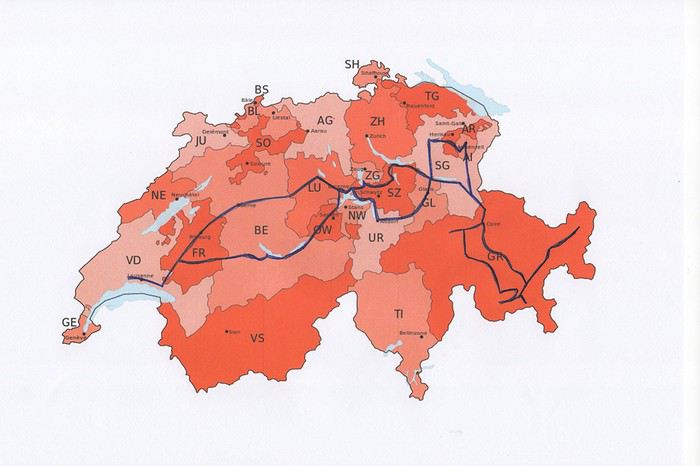
Nous avons loué un van, afin d’être autonome et libre. Notre choix s’est porté sur le VW California Ocean. Ce van est passe-partout, on peut facilement emprunter toutes les petites routes de montagnes et se parquer partout. Seul inconvénient, il n’a pas de salle de bain. La douche se fait à l’extérieur (eau froide), mais nous avons des toilettes portables. Le California Ocean est équipé avec une petite cuisine (un réchaud à gaz avec deux feux, un frigo de 42 litres, un petit évier). Il y a des placards sous la cuisine, au-dessus de la banquette et à l’arrière, ainsi qu’un grand tiroir sous la banquette. Les sièges avant se tournent, il y a deux tables, une à l’intérieur et une autre, encastrée dans la portière, pour l’extérieur. Les deux chaises pour l’extérieur sont encastrées dans la porte du coffre. Le toit se lève, on peut donc se mettre debout à l’intérieur du van. Le lit sous le toit est confortable, avec son sommier sur lequel sont fixé des ressorts. Un store extérieur nous protège du soleil lorsqu’on est à l’arrêt. Le chauffage stationnaire est bien agréable pour chauffer l’habitacle lorsqu’il fait froid. Il y a aussi plusieurs prises, dont une qui fonctionne avec la deuxième batterie et permet de charger le téléphone, tablette, etc. la nuit. Bref, ce petit van est vraiment fonctionnel.
Au dernier moment, nous avons décidé de prendre notre chien Tidou avec nous. Il a fallu adapter nos randonnées et visites. Eh oui, notre Tidou n’est plus tout jeune et il a des soucis avec son dos. Nous avons acheté un sac à dos spécifique, pour pouvoir le porter en terrain abrupte et lorsqu’il sera trop fatigué.
Nous avons chargé l’application park4night sur nos iPhones. Cette application est bien utile pour trouver des emplacements pour passer la nuit. Contrairement, à ce que l’on peut souvent lire, nous n’avons rencontré aucune difficulté pour passer la nuit. Le camping sauvage est donc possible en Suisse, si on ne s’installe pas pour plusieurs jours au même endroit. Concernant l’eau potable, on trouve de nombreuses fontaines, le plus souvent avec de l’eau potable.
Comme pour beaucoup de voyageurs, le Coronavirus a perturbé nos plans pour cette année. Notre road trip au Pérou est tombé à l’eau et la fermeture des frontières ne nous permettait pas de quitter la Suisse.
Heureusement, en Suisse, nous n’avons pas subi un confinement strict et nous pouvions nous déplacer librement dans le pays, en respectant certaines règles (distance de 2 mètres entres les personnes, rassemblements de maximum 5 personnes). De plus, une semaine avant notre départ, les magasins, restaurants et musées pouvaient ouvrir. Par contre, les campings, télécabines et télésièges sont restés fermés jusqu’au 6 juin.
Nous avons décidé de ne pas préparer un itinéraire fixe. Le but principal était le canton des Grisons que nous connaissions très peu. Pour y aller et pour revenir, nous avons traversé d’autres cantons où nous avons profité de faire des visites et randonnées. Certains endroits nous étaient bien connus, mais les voir sans les touristes habituels, asiatiques, indiens et américains, change complètement la perception des lieux. Imaginez, le fameux pont de la Chapelle à Lucerne, sans les hordes de touristes asiatiques qui l’envahissent tous les jours.
Nous avons loué un van, afin d’être autonome et libre. Notre choix s’est porté sur le VW California Ocean. Ce van est passe-partout, on peut facilement emprunter toutes les petites routes de montagnes et se parquer partout. Seul inconvénient, il n’a pas de salle de bain. La douche se fait à l’extérieur (eau froide), mais nous avons des toilettes portables. Le California Ocean est équipé avec une petite cuisine (un réchaud à gaz avec deux feux, un frigo de 42 litres, un petit évier). Il y a des placards sous la cuisine, au-dessus de la banquette et à l’arrière, ainsi qu’un grand tiroir sous la banquette. Les sièges avant se tournent, il y a deux tables, une à l’intérieur et une autre, encastrée dans la portière, pour l’extérieur. Les deux chaises pour l’extérieur sont encastrées dans la porte du coffre. Le toit se lève, on peut donc se mettre debout à l’intérieur du van. Le lit sous le toit est confortable, avec son sommier sur lequel sont fixé des ressorts. Un store extérieur nous protège du soleil lorsqu’on est à l’arrêt. Le chauffage stationnaire est bien agréable pour chauffer l’habitacle lorsqu’il fait froid. Il y a aussi plusieurs prises, dont une qui fonctionne avec la deuxième batterie et permet de charger le téléphone, tablette, etc. la nuit. Bref, ce petit van est vraiment fonctionnel.
Au dernier moment, nous avons décidé de prendre notre chien Tidou avec nous. Il a fallu adapter nos randonnées et visites. Eh oui, notre Tidou n’est plus tout jeune et il a des soucis avec son dos. Nous avons acheté un sac à dos spécifique, pour pouvoir le porter en terrain abrupte et lorsqu’il sera trop fatigué.
Nous avons chargé l’application park4night sur nos iPhones. Cette application est bien utile pour trouver des emplacements pour passer la nuit. Contrairement, à ce que l’on peut souvent lire, nous n’avons rencontré aucune difficulté pour passer la nuit. Le camping sauvage est donc possible en Suisse, si on ne s’installe pas pour plusieurs jours au même endroit. Concernant l’eau potable, on trouve de nombreuses fontaines, le plus souvent avec de l’eau potable.
Voyageurs européens bientôt autorisés aux États-Unis? English translation pending
Hello,
Je suis tombé sur cet article de Newsweek, apparemment les voyageurs Européens pourrait bientôt de nouveau être autorisés.
https://www.newsweek.com/trump-suggests-u-s-could-soon-lift-coronavirus-travel-ban-countries-that-are-making-progress-1506707
https://www.newsweek.com/trump-suggests-u-s-could-soon-lift-coronavirus-travel-ban-countries-that-are-making-progress-1506707
Assurance voyage pour senior aux États-Unis English translation pending
Bonjour,
J'emmène mes grands-parents en voyage aux États-Unis à la fin du mois de décembre 2020. J'ai imaginé que ça pouvait être une très bonne idée de souscrire à une assurance voyage. Mon assurance CB ne couvre que "les ascendants et descendants, vivant sous le même toit", ce qui exclu de jure mes grands parents (ils auront 74 et 75 ans à la date du voyage).
Avez-vous des conseils ? Je peine un peu à me faire un avis, et je ne sais pas juger quelle police pourrait être "raisonnable". J'ai navigué sur le forum sans succès...
Merci beaucoup,
J'emmène mes grands-parents en voyage aux États-Unis à la fin du mois de décembre 2020. J'ai imaginé que ça pouvait être une très bonne idée de souscrire à une assurance voyage. Mon assurance CB ne couvre que "les ascendants et descendants, vivant sous le même toit", ce qui exclu de jure mes grands parents (ils auront 74 et 75 ans à la date du voyage).
Avez-vous des conseils ? Je peine un peu à me faire un avis, et je ne sais pas juger quelle police pourrait être "raisonnable". J'ai navigué sur le forum sans succès...
Merci beaucoup,
Sur les terres mayas English translation pending
Bonjour à tous les amoureux de voyage,
Je me propose de vous faire partager notre voyage au Guatemala, pays assez peu renseigné sur VF. Je l’agrémenterai de quelques photos (tablette) sans prétention qui se veulent seulement illustratives et je demande par avance votre indulgence.
Initialement nous avions opté pour un périple au Pérou en février. Les agences contactées ont eu l’honnêteté, et nous les en remercions, de nous indiquer que cela n’était pas une bonne période pour se rendre sur les plateaux andins. Après une longue hésitation nous avons orienté nos recherches vers le Guatemala et le Honduras et avons pris des contacts avec 2 agences francophones à Antigua pour des propositions et des devis. Très vite nous avons retenu « Bon Voyage » plus réactive et nettement moins chère que sa consœur. Après plusieurs itérations avec Arnaud (patron de l’agence) nous avons convergé vers un circuit de 16 j entre le 6/2 et le 21/2/2020.
Jour 1 :
Pour les vols internationaux nous avions le choix entre une escale aux USA ou à Madrid. Pour à peine plus cher (660 €/p) et un temps de vol bien plus court nous avons finalement choisi IBERIA au détriment des compagnies et contraintes (ESTA et douane) américaines. De plus les vols IBERIA sont au départ (et retour) d’Orly plus commode pour nous.
L’horaire de départ étant très matinal nous décidons de dormir à Orly. L’hôtel Ibis Budget « cœur d’Orly » fera l’affaire. Disons le, c’est cher pour un hôtel de ce type (entrée de gamme) mais il a le mérite de servir le PdJ à partir de 4 h. Cet horaire nous permet de garer notre voiture dans un parking de la zone industriel de Senia et une navette nous dépose à l’aéroport vers 6h. Le vol Orly - Madrid part à 7h30 et nous attendrons 3h pour prendre celui qui nous mènera à Guatemala City où nous arrivons vers 17 h (heure locale soit – 7h de décalage. Ces vols seront sans histoire ni retard. A notre arrivée, Luis notre chauffeur, nous attend. Son sourire et sa gentillesse nous séduisent de suite. Il est chargé de nous conduire à Antigua. Mais les routes à cette heure sont saturées et nous mettrons plus de 2h pour parvenir à Antigua pourtant distante de moins de 40 km de la capitale. Il nous dépose à l’hôtel Posada San Pedro dans lequel nous résiderons 5 nuits durant notre séjour. L’hôtel n’a que 8 chambres et ne sert pas de PdJ mais il est bien situé (7ième avenue) et il dispose d’un joli jardin intérieur et d’un solarium. La chambre n’est pas très grande mais offre une vue directe sur le volcan Fuego en activité permanente. Des fumées s’en échappent régulièrement et parfois des rougeurs nous signalent des coulées de lave. Sitôt arrivés nous nous couchons pour être d’attaque le lendemain.
Jour 2 :
Notre première tâche est de trouver le lieu de notre PdJ car l’hôtel ne propose pas ce service. Il s’agit du restaurant « Viejo Café » dans la 6ième avenue. Ce lieu regroupe une boulangerie et un joli patio où sont servis les PdJ. L’offre est excellente et le service souriant. Tant mieux car nous y reviendrons à maintes reprises. Nous avons RDV avec notre agent de voyage dont nous faisons la connaissance. Il nous fourni un roadbook très détaillé de notre périple avec une carte détaillée pour chaque ville étape, une liste de restaurants qu’il recommande, les lieux à visiter, les recommandations (sûreté, banques, …) et un téléphone pour le joindre en cas de nécessité. Nous rejoignons ensuite un guide francophone qui nous fait découvrir cette jolie ville d’Antigua classée par l’UNESCO. Il nous fait un historique de la cité bâtie par les Espagnols et nous indique comment s’orienter le plan des rues, toutes pavées, s’apparente à celui des villes américaines et elles se coupent toutes à angle droit. Comme à New York la 5ième avenue est la principale artère de la ville. Nous visitons successivement l’église Merced, son monastère, son jardin et sa terrasse d’où l’on peut contempler les 3 volcans qui entourent la ville. L’église bâtie en 1548 a été détruite puis restaurée plusieurs fois suite aux nombreux séismes qui ont frappé la ville, le plus récent datant de 1976, sa façade est jaune et ornée de nénuphars. Puis notre visite se poursuit par le monastère dont il ne subsiste que des ruines. Au milieu de la cour centrale, on découvre une fontaine monumentale elle aussi en forme de nénuphar.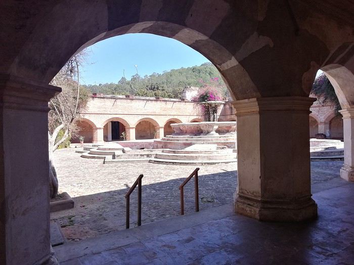
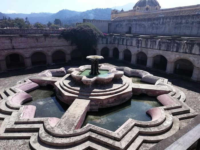
Pour profiter du panorama sur 3 volcans, nous gravissons les marches qui mènent à la terrasse. Puis nous gagnons la « Plaza mayor » cernée par de beaux édifices bâtis par les Espagnols, allant de la mairie à la cathédrale de la ville.
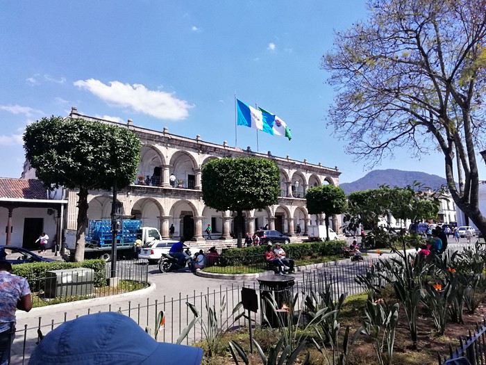 Nous passons devant le musée du chocolat avant de faire une halte pour découvrir le plus beau « Mac Do » du monde logé dans une magnifique hacienda d’époque avec un grand patio fleuri.
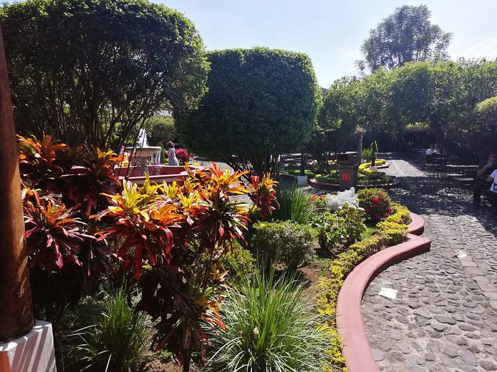
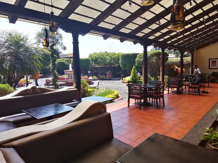 Cela change des établissements habituels de cette marque.
On arpente les rues de la ville, occasion de découvrir des demeures coloniales splendides aux patios intérieurs abondamment fleuris,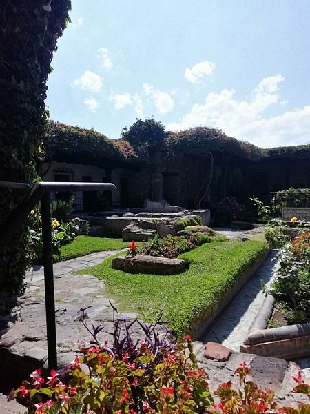
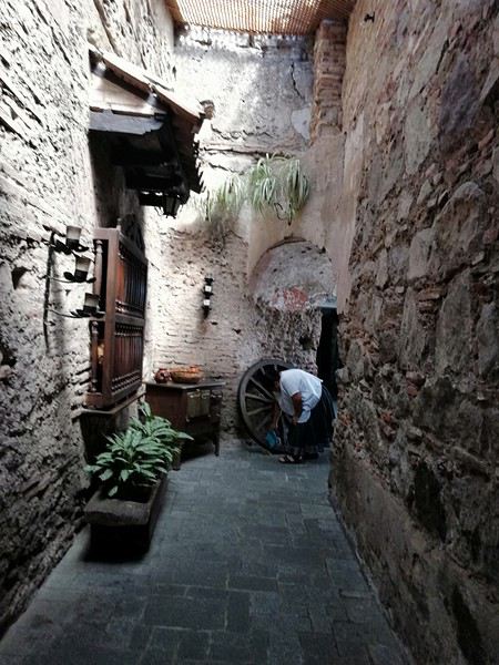
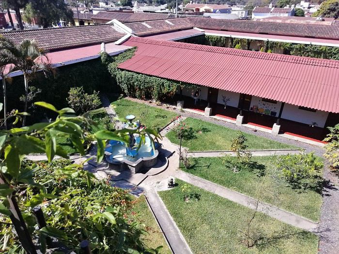
de voir un nombre impressionnant d’églises détruites par les tremblements de terre. Elles ne sont pas reconstruites faute de moyens pour les entretenir mais elles témoignent de l’emprise de la religion catholique sur le pays.
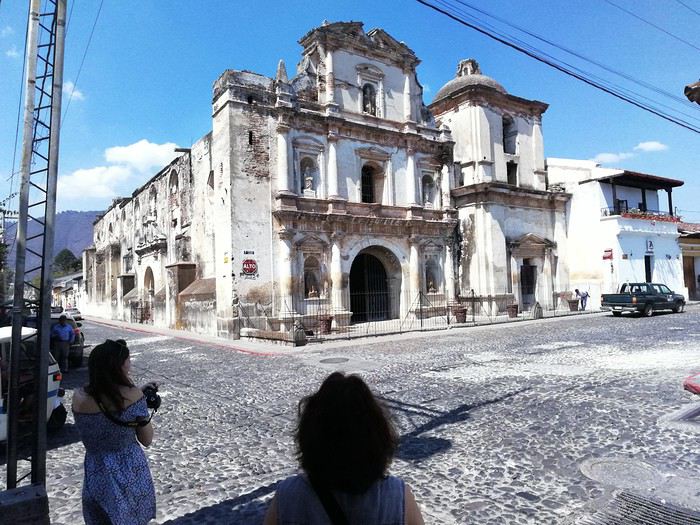
Notons à ce propos que l’on verra par la suite beaucoup de temples protestants de différentes obédiences, tout comme aux USA.
Je me propose de vous faire partager notre voyage au Guatemala, pays assez peu renseigné sur VF. Je l’agrémenterai de quelques photos (tablette) sans prétention qui se veulent seulement illustratives et je demande par avance votre indulgence.
Initialement nous avions opté pour un périple au Pérou en février. Les agences contactées ont eu l’honnêteté, et nous les en remercions, de nous indiquer que cela n’était pas une bonne période pour se rendre sur les plateaux andins. Après une longue hésitation nous avons orienté nos recherches vers le Guatemala et le Honduras et avons pris des contacts avec 2 agences francophones à Antigua pour des propositions et des devis. Très vite nous avons retenu « Bon Voyage » plus réactive et nettement moins chère que sa consœur. Après plusieurs itérations avec Arnaud (patron de l’agence) nous avons convergé vers un circuit de 16 j entre le 6/2 et le 21/2/2020.
Jour 1 :
Pour les vols internationaux nous avions le choix entre une escale aux USA ou à Madrid. Pour à peine plus cher (660 €/p) et un temps de vol bien plus court nous avons finalement choisi IBERIA au détriment des compagnies et contraintes (ESTA et douane) américaines. De plus les vols IBERIA sont au départ (et retour) d’Orly plus commode pour nous.
L’horaire de départ étant très matinal nous décidons de dormir à Orly. L’hôtel Ibis Budget « cœur d’Orly » fera l’affaire. Disons le, c’est cher pour un hôtel de ce type (entrée de gamme) mais il a le mérite de servir le PdJ à partir de 4 h. Cet horaire nous permet de garer notre voiture dans un parking de la zone industriel de Senia et une navette nous dépose à l’aéroport vers 6h. Le vol Orly - Madrid part à 7h30 et nous attendrons 3h pour prendre celui qui nous mènera à Guatemala City où nous arrivons vers 17 h (heure locale soit – 7h de décalage. Ces vols seront sans histoire ni retard. A notre arrivée, Luis notre chauffeur, nous attend. Son sourire et sa gentillesse nous séduisent de suite. Il est chargé de nous conduire à Antigua. Mais les routes à cette heure sont saturées et nous mettrons plus de 2h pour parvenir à Antigua pourtant distante de moins de 40 km de la capitale. Il nous dépose à l’hôtel Posada San Pedro dans lequel nous résiderons 5 nuits durant notre séjour. L’hôtel n’a que 8 chambres et ne sert pas de PdJ mais il est bien situé (7ième avenue) et il dispose d’un joli jardin intérieur et d’un solarium. La chambre n’est pas très grande mais offre une vue directe sur le volcan Fuego en activité permanente. Des fumées s’en échappent régulièrement et parfois des rougeurs nous signalent des coulées de lave. Sitôt arrivés nous nous couchons pour être d’attaque le lendemain.
Jour 2 :
Notre première tâche est de trouver le lieu de notre PdJ car l’hôtel ne propose pas ce service. Il s’agit du restaurant « Viejo Café » dans la 6ième avenue. Ce lieu regroupe une boulangerie et un joli patio où sont servis les PdJ. L’offre est excellente et le service souriant. Tant mieux car nous y reviendrons à maintes reprises. Nous avons RDV avec notre agent de voyage dont nous faisons la connaissance. Il nous fourni un roadbook très détaillé de notre périple avec une carte détaillée pour chaque ville étape, une liste de restaurants qu’il recommande, les lieux à visiter, les recommandations (sûreté, banques, …) et un téléphone pour le joindre en cas de nécessité. Nous rejoignons ensuite un guide francophone qui nous fait découvrir cette jolie ville d’Antigua classée par l’UNESCO. Il nous fait un historique de la cité bâtie par les Espagnols et nous indique comment s’orienter le plan des rues, toutes pavées, s’apparente à celui des villes américaines et elles se coupent toutes à angle droit. Comme à New York la 5ième avenue est la principale artère de la ville. Nous visitons successivement l’église Merced, son monastère, son jardin et sa terrasse d’où l’on peut contempler les 3 volcans qui entourent la ville. L’église bâtie en 1548 a été détruite puis restaurée plusieurs fois suite aux nombreux séismes qui ont frappé la ville, le plus récent datant de 1976, sa façade est jaune et ornée de nénuphars. Puis notre visite se poursuit par le monastère dont il ne subsiste que des ruines. Au milieu de la cour centrale, on découvre une fontaine monumentale elle aussi en forme de nénuphar.
Pour profiter du panorama sur 3 volcans, nous gravissons les marches qui mènent à la terrasse. Puis nous gagnons la « Plaza mayor » cernée par de beaux édifices bâtis par les Espagnols, allant de la mairie à la cathédrale de la ville.
Nous passons devant le musée du chocolat avant de faire une halte pour découvrir le plus beau « Mac Do » du monde logé dans une magnifique hacienda d’époque avec un grand patio fleuri.
Cela change des établissements habituels de cette marque.On arpente les rues de la ville, occasion de découvrir des demeures coloniales splendides aux patios intérieurs abondamment fleuris,
de voir un nombre impressionnant d’églises détruites par les tremblements de terre. Elles ne sont pas reconstruites faute de moyens pour les entretenir mais elles témoignent de l’emprise de la religion catholique sur le pays.
Notons à ce propos que l’on verra par la suite beaucoup de temples protestants de différentes obédiences, tout comme aux USA.
On remonte le temps: Népal 2000, Camp de base de l'Everest English translation pending
Allez on se retrouve en Asie cette fois pour tutoyer le toit du monde 😛 Là internet commençait à pointer le bout de son nez, VF en 1999 je sais pas si ça existait, en tout cas je ne connaissait pas 🙂. Il y avait la possibilité de partir tout seul et de trouver un guide, des porteurs sur place ..... J'ai préféré passer par un agence spécialisée dans le trekking pour réaliser se voyage !
C'est un voyage de 22 jours que je vais vous conter !
Le groupe est constitué de 15 personnes, dont l'age va de 23 à 62 ans. Mise à part un couple particulièrement pénible tout le monde à fait les efforts nécessaires pour que le voyage se passe bien. Des parties acharnées de Uno tous les soirs ont grandement contribué à la bonne humeur du groupe et des porteurs qui ne comprenaient pas pourquoi un jeu de carte pouvait nous faire autant rire.
Le guide un accompagnateur en haute montagne, c'est en grande partie grâce à lui si le voyage c'est aussi bien passé il a toujours était disponible pour tout le monde et il a su désamorcer tous les petits conflits, inhérent à ce type de voyage, dans l’œuf.
Vendredi 21/04/2000 : Paris Katmandou
Le rendez vous est fixé 20 heures à l'aéroport Charles de Gaulle, pour un décollage à 23h30 la compagnie que nous allons prendre est Pakistan Airlines ce qui est loin d'être le top. Nous partons finalement avec 1 heure de retard. J'adore les consignes qui sont ponctués avec un à la grâce de dieu 🤪, J'ai dormi tout le long du vol, dors du sommeil du juste jusqu'à notre première escale Islamabad, capitale du Pakistan. Maintenant j'ai plus de mal à dormir en avion pas parce que j'en ai peur, mais avec l'age j'ai besoin d'un peux plus de confort 😇
Nous allons prendre notre deuxième avion à destination de Katmandou terminus de notre voyage, bonjour les formalités dans l'aéroport 4 contrôles de passeport et des bagages de soute, alors que nous sommes toujours dans la zone franche. Nous atterrissons à l'aéroport de Katmandou, un court transfert en car nous fait découvrir la ville, les premières impressions sont la pauvreté et la pollution qui entourent la ville, nous finissons par arriver dans un magnifique Hotel, dans le centre de la ville, vers 17 h 50. Le temps de déposer nos affaires, nous descendons manger et direction le lit.
Là vous vous dites quelle mémoire, ben non faut pas croire, j'ai pris des notes pour ce voyage et je les ai encore 🙂
Pour le moment mon record d'altitude ( 5 895 m) va-t-il être battu ? Vous le saurez en me suivant
A demain
C'est un voyage de 22 jours que je vais vous conter !
Le groupe est constitué de 15 personnes, dont l'age va de 23 à 62 ans. Mise à part un couple particulièrement pénible tout le monde à fait les efforts nécessaires pour que le voyage se passe bien. Des parties acharnées de Uno tous les soirs ont grandement contribué à la bonne humeur du groupe et des porteurs qui ne comprenaient pas pourquoi un jeu de carte pouvait nous faire autant rire.
Le guide un accompagnateur en haute montagne, c'est en grande partie grâce à lui si le voyage c'est aussi bien passé il a toujours était disponible pour tout le monde et il a su désamorcer tous les petits conflits, inhérent à ce type de voyage, dans l’œuf.
Vendredi 21/04/2000 : Paris Katmandou
Le rendez vous est fixé 20 heures à l'aéroport Charles de Gaulle, pour un décollage à 23h30 la compagnie que nous allons prendre est Pakistan Airlines ce qui est loin d'être le top. Nous partons finalement avec 1 heure de retard. J'adore les consignes qui sont ponctués avec un à la grâce de dieu 🤪, J'ai dormi tout le long du vol, dors du sommeil du juste jusqu'à notre première escale Islamabad, capitale du Pakistan. Maintenant j'ai plus de mal à dormir en avion pas parce que j'en ai peur, mais avec l'age j'ai besoin d'un peux plus de confort 😇
Nous allons prendre notre deuxième avion à destination de Katmandou terminus de notre voyage, bonjour les formalités dans l'aéroport 4 contrôles de passeport et des bagages de soute, alors que nous sommes toujours dans la zone franche. Nous atterrissons à l'aéroport de Katmandou, un court transfert en car nous fait découvrir la ville, les premières impressions sont la pauvreté et la pollution qui entourent la ville, nous finissons par arriver dans un magnifique Hotel, dans le centre de la ville, vers 17 h 50. Le temps de déposer nos affaires, nous descendons manger et direction le lit.
Là vous vous dites quelle mémoire, ben non faut pas croire, j'ai pris des notes pour ce voyage et je les ai encore 🙂
Pour le moment mon record d'altitude ( 5 895 m) va-t-il être battu ? Vous le saurez en me suivant
A demain
Voyage Texas et Louisiane en novembre-décembre 2019 English translation pending
Hello tous.
En cette période de disette de voyage , je vais me replonger dans notre voyage (road trip ..avec beaucoup de road.. (route).. Surement un avec le plus de miles.. il est vrai que le Texas c’est vaste.. et la Louisiane aussi..
Donc vous l’aurez compris c’est un voyage à travers le Texas (avec des villes comme Dallas bien sur !, San Antonio (la petite Venise), Austin (la capitale), un super parc (coup de cœur) , la Louisiane avec la nouvelle Orléans bien sûr, le pays cajun, une petite incursion aussi dans le Mississipi et bâton rouge et Lafayette.
Bon ce road trip est « un dernière minute »..Décidé en novembre pour novembre… A peine rentré d’Alaska.. je n’avais qu’une seule envie. Repartir… Alain moins… il me disait on a déjà un gros truc prévu en février. Faut pas abuser.. Je m’étais résignée.. et voilà qu’air France fait des promos en miles pour Los Angeles.. Je finis par le convaincre même s’il me dit qu’on connait déjà ce coin. Pas grave toujours tellement de chose à découvrir ! Mais voilà ces prix miles promos…ben en fait faut cliquer direct parce que le lendemain y’a plus rien ..ou plus rien qui va.. ou alors on part et ne revient pas. Ou le contraire ! Mais maintenant j’ai la tête à partir ! Un vieux rêves (bon pas si vieux).. Je veux aller en Louisiane.. Pas de vol direct pour « N O (nouvelle Orléans).. on fera du coup Houston Houston.. Et me voilà entrain d’organiser tout cela… Vols ok.. Voiture ok. (hertz) et les hôtels…qu’il faut organiser dans ces trois semaines.. Parce que pour moi le grand plaisir d’un road trip c’est de tout organiser. Surtout pas de voyage organisé.. C’est l’inverse d’une croisière pour nous. Et même si je m’efforce de trouver des hôtels « correct » dans ces trips on ne recherche pas le luxe.. Bon pas le bui bui non plus. Aller je vous emmène ?
En cette période de disette de voyage , je vais me replonger dans notre voyage (road trip ..avec beaucoup de road.. (route).. Surement un avec le plus de miles.. il est vrai que le Texas c’est vaste.. et la Louisiane aussi..
Donc vous l’aurez compris c’est un voyage à travers le Texas (avec des villes comme Dallas bien sur !, San Antonio (la petite Venise), Austin (la capitale), un super parc (coup de cœur) , la Louisiane avec la nouvelle Orléans bien sûr, le pays cajun, une petite incursion aussi dans le Mississipi et bâton rouge et Lafayette.
Bon ce road trip est « un dernière minute »..Décidé en novembre pour novembre… A peine rentré d’Alaska.. je n’avais qu’une seule envie. Repartir… Alain moins… il me disait on a déjà un gros truc prévu en février. Faut pas abuser.. Je m’étais résignée.. et voilà qu’air France fait des promos en miles pour Los Angeles.. Je finis par le convaincre même s’il me dit qu’on connait déjà ce coin. Pas grave toujours tellement de chose à découvrir ! Mais voilà ces prix miles promos…ben en fait faut cliquer direct parce que le lendemain y’a plus rien ..ou plus rien qui va.. ou alors on part et ne revient pas. Ou le contraire ! Mais maintenant j’ai la tête à partir ! Un vieux rêves (bon pas si vieux).. Je veux aller en Louisiane.. Pas de vol direct pour « N O (nouvelle Orléans).. on fera du coup Houston Houston.. Et me voilà entrain d’organiser tout cela… Vols ok.. Voiture ok. (hertz) et les hôtels…qu’il faut organiser dans ces trois semaines.. Parce que pour moi le grand plaisir d’un road trip c’est de tout organiser. Surtout pas de voyage organisé.. C’est l’inverse d’une croisière pour nous. Et même si je m’efforce de trouver des hôtels « correct » dans ces trips on ne recherche pas le luxe.. Bon pas le bui bui non plus. Aller je vous emmène ?
Azur Croisières prend une commission lors d'une annulation de croisière! English translation pending
Bonjour,
J'ai remarqué que AZUR CROISIÈRES, (agence sérieuse et qui a bonne réputation soit dit en passant malgré tout ), se prend tout de même une commission sur l'annulation d'une croisière.
Frais d'annulation d'une croisière MSC de moins de 15 nuits chez AZUR CROISIÈRES (hors Yacht Club) :
- Jusqu’à 60 jours 100 € par personne - Entre 59 et 30 jours 30% du montant de la croisière - Entre 29 et 22 jours 50% - Entre 21 et 15 jours 70% - Dans les 14 jours précédents le départ et non présentation le jour de l’embarquement au port de départ 100%
Normalement, comme précisé sur le site internet de MSC dans les conditions générales de vente, les frais d'annulation sont les suivants :
- Jusqu’à 60 jours 50 € par personne (frais de dossier) - Entre 59 et 30 jours 25% du montant de la croisière - Entre 29 et 22 jours 40% - Entre 21 et 15 jours 60% - Entre 14 et 6 jours avant le départ : 80% - Dans les 5 jours précédents le départ et non présentation le jour de l’embarquement au port de départ 100%
Donc, si compare ces 2 données, on constate qu'AZUR CROISIÈRES "se prend" en commission :
- Jusqu’à 60 jours 50 € par personne - Entre 59 et 30 jours 5% du montant de la croisière - Entre 29 et 22 jours 10% - Entre 21 et 15 jours 10% - Entre 14 et 6 jours avant le départ : 20% - Dans les 5 jours précédents le départ et non présentation le jour de l’embarquement au port de départ 0%
Nous avons réservé, avant le problème du COVID 19, 2 croisières MSC chez AZUR CROISIÈRES et nous n'avons jamais été informé de ces commissions retenues par AZUR CROISIÈRES, en supplément de ceux de MSC lors d'une annulation de croisière.
De plus, je trouve que ces commissions retenues par AZUR CROISIÈRES sont élevées alors que je ne pense pas que ça leur demande beaucoup de travail !
Plus la croisière est longue et chère, plus il retienne une commission élevée alors que l'annulation ne leur prend pas plus de temps que pour une croisière courte et bon marché !
Bien évidemment, notre première croisière est de 15 jours et la deuxième de 12 jours ! 😠
AZUR CROISIÈRES n'est pas la seule à procéder ainsi ! Certains le font, d'autres non !
CROISILAND par exemple, agence également sérieuse et qui a bonne réputation, ne "se prend" aucune commission lors d'une annulation de croisière. On doit juste payer un frais de dossier de 15 € TTC lorsqu'on réserve une croisière et c'est tout, même si vous annulez votre croisière !
Dorénavant, nous réserverons toujours chez eux ! (Si nous pouvons toujours faire des croisières ! ... 🤪).
Pierre
J'ai remarqué que AZUR CROISIÈRES, (agence sérieuse et qui a bonne réputation soit dit en passant malgré tout ), se prend tout de même une commission sur l'annulation d'une croisière.
Frais d'annulation d'une croisière MSC de moins de 15 nuits chez AZUR CROISIÈRES (hors Yacht Club) :
- Jusqu’à 60 jours 100 € par personne - Entre 59 et 30 jours 30% du montant de la croisière - Entre 29 et 22 jours 50% - Entre 21 et 15 jours 70% - Dans les 14 jours précédents le départ et non présentation le jour de l’embarquement au port de départ 100%
Normalement, comme précisé sur le site internet de MSC dans les conditions générales de vente, les frais d'annulation sont les suivants :
- Jusqu’à 60 jours 50 € par personne (frais de dossier) - Entre 59 et 30 jours 25% du montant de la croisière - Entre 29 et 22 jours 40% - Entre 21 et 15 jours 60% - Entre 14 et 6 jours avant le départ : 80% - Dans les 5 jours précédents le départ et non présentation le jour de l’embarquement au port de départ 100%
Donc, si compare ces 2 données, on constate qu'AZUR CROISIÈRES "se prend" en commission :
- Jusqu’à 60 jours 50 € par personne - Entre 59 et 30 jours 5% du montant de la croisière - Entre 29 et 22 jours 10% - Entre 21 et 15 jours 10% - Entre 14 et 6 jours avant le départ : 20% - Dans les 5 jours précédents le départ et non présentation le jour de l’embarquement au port de départ 0%
Nous avons réservé, avant le problème du COVID 19, 2 croisières MSC chez AZUR CROISIÈRES et nous n'avons jamais été informé de ces commissions retenues par AZUR CROISIÈRES, en supplément de ceux de MSC lors d'une annulation de croisière.
De plus, je trouve que ces commissions retenues par AZUR CROISIÈRES sont élevées alors que je ne pense pas que ça leur demande beaucoup de travail !
Plus la croisière est longue et chère, plus il retienne une commission élevée alors que l'annulation ne leur prend pas plus de temps que pour une croisière courte et bon marché !
Bien évidemment, notre première croisière est de 15 jours et la deuxième de 12 jours ! 😠
AZUR CROISIÈRES n'est pas la seule à procéder ainsi ! Certains le font, d'autres non !
CROISILAND par exemple, agence également sérieuse et qui a bonne réputation, ne "se prend" aucune commission lors d'une annulation de croisière. On doit juste payer un frais de dossier de 15 € TTC lorsqu'on réserve une croisière et c'est tout, même si vous annulez votre croisière !
Dorénavant, nous réserverons toujours chez eux ! (Si nous pouvons toujours faire des croisières ! ... 🤪).
Pierre
Adventures of a Bygone Era: The Philippines in 1984
After several discussions on VF about travel journals from the Philippines, I decided to write this curiosity: a trip report from a journey made in 1984, when traveling to the Philippines was still an adventure.
A curiosity because writing a travel journal about a trip 35 years later isn’t common, but also (mostly?) because exploring the Philippines at that time had little in common with traveling there today.
Obviously, I’ve forgotten a number of facts, most of the details, but with the help of a few notes from that time and a stack of slides (yes, there was life before digital 😊), many memories came back and added to the highlights I’d never forgotten. The scanned slides aren’t always great quality, but there are still quite a few to brighten up this chatter. Back then, we didn’t snap photos like we do now—film was too expensive—so I don’t have pictures of every place we visited... too bad, comparing some of those spots to how they look today would’ve been interesting.
Why "Adventures"? Why call it "Adventures" in the Philippines in 1984, a word so often used for a simple exotic trip? - Because the lack of information (no *Guide du Routard*, no *Lonely Planet*, no *Michelin Guide*, nothing, and obviously no internet) gave this trip what’s at the heart of adventure: the unknown. - Because the political situation made the stay sometimes dangerous. - Because transportation conditions were always epic, often perilous. - Because the question of where we’d spend the night came up almost every evening. - And for... quite a few other reasons.
That said, we weren’t exactly explorers!
Why the Philippines? First of all, why go to the Philippines in 1984—a country not exactly set up for tourism and about which we knew very little? How could we get an idea of the beauty of the Philippines and its points of interest when we had no guides or photos?
The idea came to us from Thailand a year earlier, during our first long-haul trip. After touring the north of the country, we met a Frenchman living in Phuket, where there were only a few tourists in Patong, with just a few small hotels and guesthouses. Kata and Karon had no buildings or roads, Rawai only had three palm-thatched bungalows, including ours, and the other islands were unknown to tourists. There was plenty to discover, and we wanted to return to this beautiful country... but the Frenchman made us dream about the Philippines—a country to explore, with wild landscapes.
Long evenings of discussion over multiple Sprite-Mekong cocktails (what memories of those headaches!) finally convinced us we had to go to the Philippines.
Episode 0: Before Departure The decision was made: we’d go to the Philippines in May 1984. Our friends and family were surprised when we announced we were going on vacation to the Philippines (a bit like saying today we were going paddleboarding in the Kerguelen Islands 🤪).
These days, preparing for each of our trips takes long evenings of research, planning, and noting down good addresses... etc. But for the Philippines in 1984, preparation was quick: we had very little information about the country, we were leaving almost at random, and the discovery would only be more exciting.
We still had a few bits of info gathered here and there: the rice terraces in northern Luzon, volcanoes, Negros where we were supposed to visit an acquaintance, Cebu and its marine life (we ended up going elsewhere), and absolutely avoid Mindanao, which was practically at war with the regime. That was about it, but it was already a great itinerary.
Nothing was organized in advance; we’d see day by day. We had no idea about travel times or even the existence of transportation options. The main (and sometimes only) way to connect two islands was by overloaded, rusty ferry. Only the big cities had airports.
Let’s Go: Episode 1: Paris to Manila My travel journals always start after arriving at the airport—the Europe-to-“Other Continent” trip isn’t interesting—but the flight to the Philippines was already an adventure, so I’ll make an exception.
This was the era when only a few Asian airlines were on par with Western ones: Thai, Singapore Airlines, and Philippine Airlines. They had beautiful, brand-new planes, and to attract customers (almost exclusively “businessmen”) from the usual airlines (Air France, Lufthansa, British Airways), there was opulence on board: unlimited champagne, all sorts of cocktails... Compared to today’s long-haul flights, there was still one small difference: no personal screens, just one screen at the front of the cabin with one mandatory movie. And I don’t know why, but we only got James Bond films, both ways... that must’ve been the trend at the time.
The tourism boom to Southeast Asia hadn’t started yet, and the “Asian Tigers” weren’t a thing, so there weren’t many business trips. That meant long-haul flights made stops everywhere to fill the planes. Our Philippine Airlines Boeing 747 left London, picked us up in Paris, then stopped in Frankfurt to take on a few Germans. I don’t know why we then made a stop in Dubai—a totally exotic place at the time. There was nothing to do there... things have changed a lot since. It was a small town lost in the desert. The airport was tiny, with just one or two buildings and a supermarket. During the stopover, everyone had to get off the plane and walk to the supermarket. Photo and electronic equipment were dirt cheap—I guess that was the only reason for the stop. Maybe it was their first commercial move. Emirates didn’t exist yet, as I checked online, but anyway, the idea that such a remote place could have its own airline was unthinkable.
Online, I found this photo of Dubai Airport in 1980. Anyone who’s transited through today’s massive airport with its rows of A380s will appreciate it: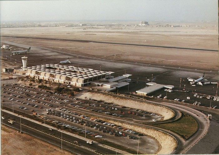
Next stop: New Delhi to drop off some Europeans and pick up a few Indians, and finally, the terminus: Manila. I don’t remember how long the trip took with its five stops—an unimaginable journey today. Despite all those stops to fill the plane, there was still enough space to stretch out on the four center seats of the 747, something that never happens these days despite all the flights in every direction.
So here we are, finally at Manila Airport around midnight.
Episode 1: Manila and Baguio To start, a quick note on the political and economic situation in the Philippines in 1984, which had consequences for us as tourists, as we’d soon realize upon arrival.
After several centuries of Spanish colonization, the Philippines became American at the start of the 20th century, then independent. In 1966, Marcos took power, and little by little, his regime sank into corruption and mismanagement, becoming a dictatorship with martial law, all for the benefit of his family and friends, who enriched themselves endlessly. The peak was the assassination of opposition leader Benigno Aquino in August 1983, which triggered harshly repressed protests. So we arrived a few months later in a very poor country, with omnipresent corruption and an extremely tense political situation, as we’d soon see for ourselves. Major protests took place in the main cities during our trip—I’ll come back to that. Two years later, Marcos fled to Hawaii after being forced out of power following rigged elections. This historical context explains a lot of the situations we found ourselves in over the following weeks.
Arriving in the middle of the night isn’t very cheerful. Manila was already a huge city with many slums, where you could find a few business hotels like the Hilton or Intercontinental—way out of our budget—and plenty of run-down hotels. Luckily, two Indians we’d chatted with on the plane offered to take us to their usual hotel. They came to Manila twice a year for business. We accepted their offer, relieved not to have to look for a place to stay in the middle of the night, figuring the address must be good since they came back every time... we were wrong 🙁
We left the airport and immediately got a taste of the local vibe when we got into the taxi: the police asked for our passports. We thought: what’s more normal than police in a dictatorship?
But that wasn’t it at all. Our two Indian friends explained that the police were noting our names along with the taxi number and time. Crime in Manila was so bad that the taxi driver would be held responsible if anything happened to us... welcome to the Philippines 😎 😎
Historically, the Philippines was a very violent country, where everything was settled with guns or machetes. Previous governments had banned carrying weapons, but Marcos later allowed the free sale and carrying of guns, and disputes were settled with pistols again (or worse, as we’d discover later). Since he’d released most of the criminals from prison to form a paramilitary militia at his service (I’ll talk about our encounter with these “heroes” later), it was pretty dangerous to go into many parts of Manila, where these “tonton macoutes” ruled.
We arrived at our hotel without incident... and then things started badly. The room was infested with big cockroaches—exactly what I hate most in those kinds of countries. No way to find another hotel at that hour. After the long flight, the urge to take a shower was so strong that we squeezed into the bathroom as best we could. After that, I don’t remember—I guess we must’ve fallen asleep exhausted under the sheets in the heat... air conditioning wasn’t widespread yet.
The next day, we just wanted to leave that dump as soon as possible. So we decided to head north right away, stopping in Baguio, and we’d visit Manila a bit on the way back.
When we stepped outside, we discovered a pretty run-down neighborhood with potholed streets. But we also discovered the jeepneys. They were everywhere, flooding the streets.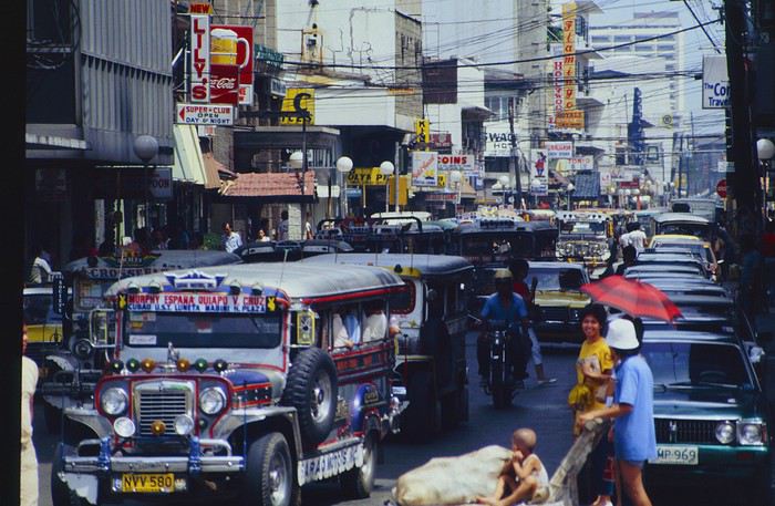
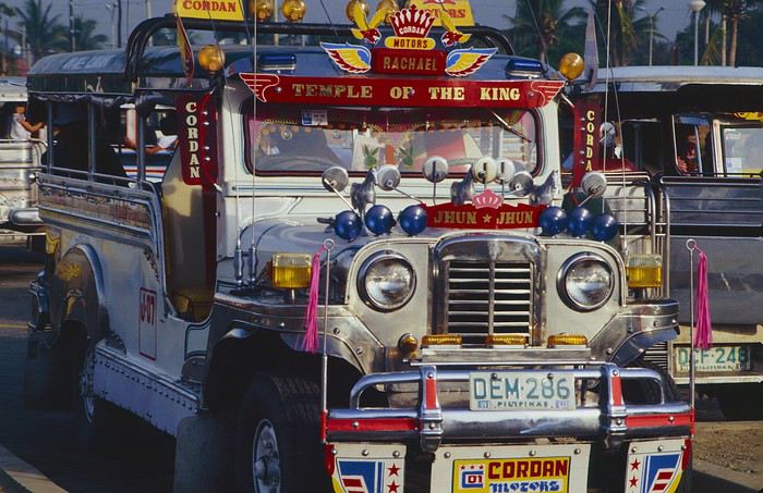
They had crazy sound systems, each one blasting louder than the last. The interiors were kitschy but fun. There weren’t many private cars—almost all transportation was by jeepney, with buses reserved for intercity trips.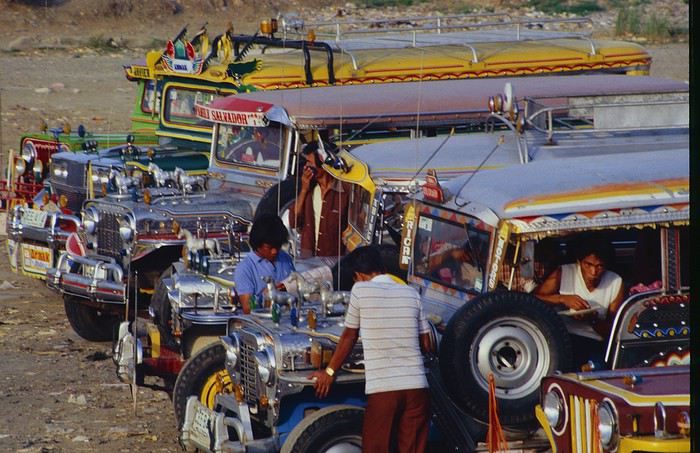
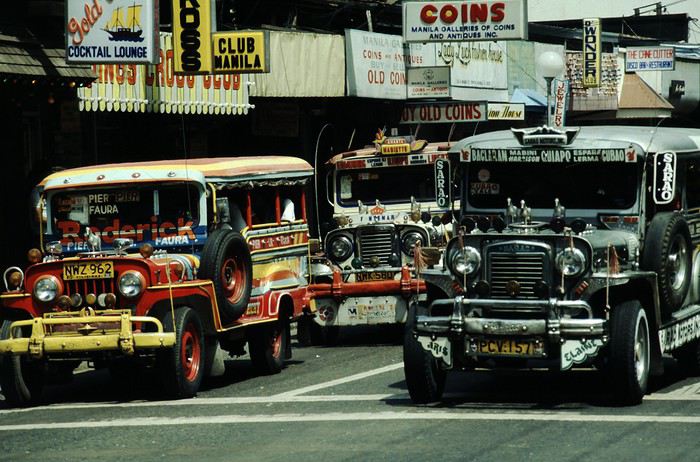
Before heading to the bus terminal for the north, somewhere on the outskirts of the city, we needed to exchange some money. I don’t remember how we ended up in a policeman’s jeep who offered his services: - Exchange money on the black market at a better rate than the banks. - Take us wherever we wanted, in this case, the bus terminal.
We accepted both offers (we’d still checked the official exchange rate from dollars to pesos). So we found ourselves in his jeep. After exchanging money, we left in his vehicle and stopped for gas. Without turning off the engine, he calmly smoked a cigarette while filling up. Since we were in a jeep with no doors or roof, we were ready to jump out if things went south, our travel bag in hand.
But we weren’t done with surprises yet. Once we left the small streets, we ended up in a neighborhood with wide avenues and not much traffic, which didn’t justify his incredible behavior. At every intersection, he made the sign of the cross, closed his eyes, and crossed without looking. I was more stunned than terrified! It wasn’t until we got out of the car later that I told Anne-Marie what had happened. I’d seen everything because the cop had put me in the front seat. Luckily, A-Marie hadn’t noticed anything from the back. Crossing Manila by trusting God rather than the rules of the road was ultimately effective. We were lucky—the trip was off to a good start. 🙂 🙂
We then passed through a neighborhood where slums stretched on for a while, and we left our policeman—friendly but a bit crazy—with relief.
A few hours by bus later, here we are in Baguio, cool in the mountains. My memories of Baguio are pretty fuzzy. I remember a small town. After some research while writing this journal, I found that the population was 120,000 in 1980. Given the population density in each home, that confirms my memory of a smallish town. Outside the “official” district with the president’s summer residence and government buildings, there were two or three paved streets with nice houses. The rest was very dirty and very poor, with lots of slums and dirt roads.
People we met on the street invited us to stay with them. These days, we wouldn’t just show up at strangers’ houses, which we should’ve done in Baguio—it would’ve saved us from an unimaginable and dangerous situation... which I won’t say anything about... !😊
The simple wooden house was on stilts at the edge of a hill with a view of the mountains. Since it was the start of the rainy season in a city that gets a lot of rain, we saw a lot of water. Our outings in town happened between downpours.
View from our lodging: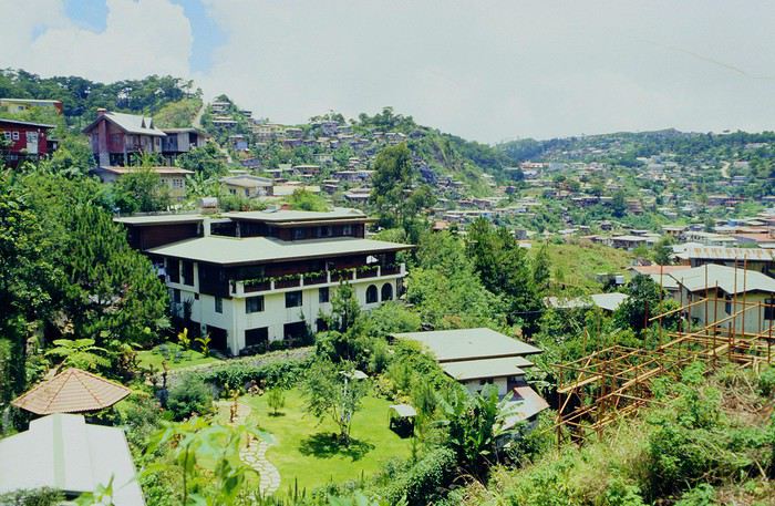
Episode 2: Baguio to Bontoc Aside from the situation briefly mentioned above, it was on the next leg to Bontoc that the adventure really began: an endless and dangerous road, a bus from another era, breathtaking landscapes, and surprising people.
We didn’t know the distance or how long it would take to get to Bontoc. When we arrived after about ten hours, we learned that Baguio to Bontoc was 140 km.
We got on a bus with wooden seats and settled in, two to a seat meant for two. As the bus filled up, passengers squeezed in three or four per seat, with chickens and baskets full of all sorts of things in the aisle. A little embarrassed, we didn’t know if we should squeeze in three on our seat. The seats were super tight (luckily, Filipinos are small), and I didn’t know where to put my legs given my height. I don’t remember if we stayed alone on our bench or if we ended up sharing with others.
The “road” was a dirt track (or rather, a mud track) with endless turns. We held on as best we could to our slippery wooden seats—it was shaking in every direction. The woman behind us was carsick and throwing up... gross... but what were we doing there? Then we plunged into the Sierra Madre... just the name is dreamy!
Rice terraces started to appear: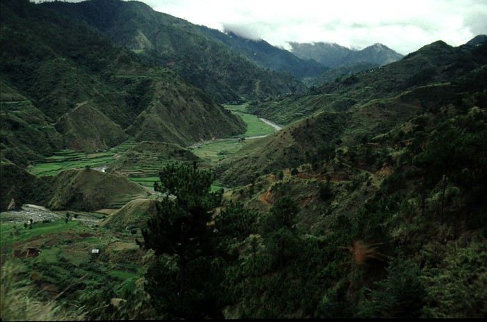
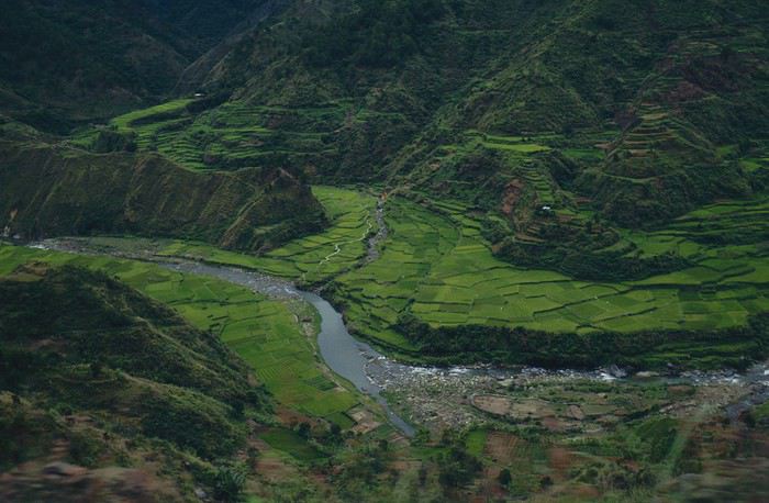
they took up more and more space along cliffs where we weren’t always reassured,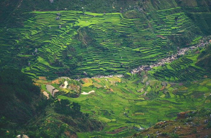
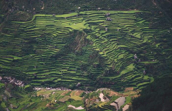
with lots of waterfalls (all that water had to go somewhere).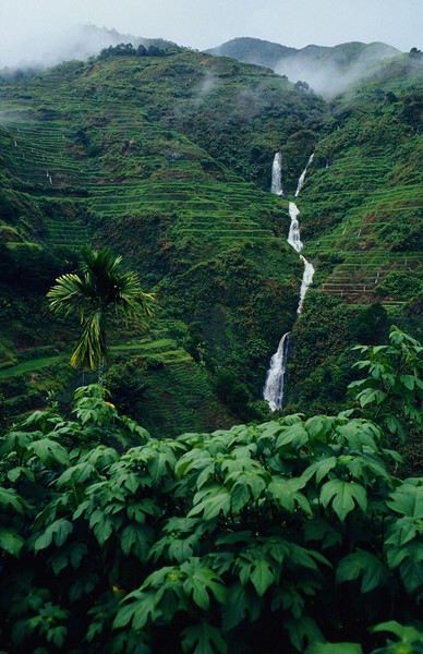
A few miserable villages stretched along the track, most often just a few houses balancing between the road and the drop. The bus stopped in every village—people got on or off and settled inside or on the roof. Street vendors offered their products to the bus passengers—a common sight in Asia, even today.
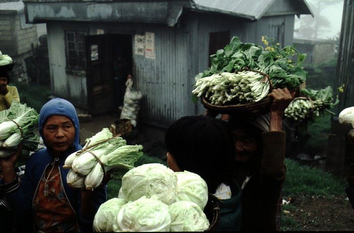
We were in another world—villagers were in loincloths, others had spears. The atmosphere was strange... but all good, we wanted exoticism, and we got it:
This so-called traditional outfit was everyday wear—it wasn’t for tourists since there weren’t any.
A curiosity because writing a travel journal about a trip 35 years later isn’t common, but also (mostly?) because exploring the Philippines at that time had little in common with traveling there today.
Obviously, I’ve forgotten a number of facts, most of the details, but with the help of a few notes from that time and a stack of slides (yes, there was life before digital 😊), many memories came back and added to the highlights I’d never forgotten. The scanned slides aren’t always great quality, but there are still quite a few to brighten up this chatter. Back then, we didn’t snap photos like we do now—film was too expensive—so I don’t have pictures of every place we visited... too bad, comparing some of those spots to how they look today would’ve been interesting.
Why "Adventures"? Why call it "Adventures" in the Philippines in 1984, a word so often used for a simple exotic trip? - Because the lack of information (no *Guide du Routard*, no *Lonely Planet*, no *Michelin Guide*, nothing, and obviously no internet) gave this trip what’s at the heart of adventure: the unknown. - Because the political situation made the stay sometimes dangerous. - Because transportation conditions were always epic, often perilous. - Because the question of where we’d spend the night came up almost every evening. - And for... quite a few other reasons.
That said, we weren’t exactly explorers!
Why the Philippines? First of all, why go to the Philippines in 1984—a country not exactly set up for tourism and about which we knew very little? How could we get an idea of the beauty of the Philippines and its points of interest when we had no guides or photos?
The idea came to us from Thailand a year earlier, during our first long-haul trip. After touring the north of the country, we met a Frenchman living in Phuket, where there were only a few tourists in Patong, with just a few small hotels and guesthouses. Kata and Karon had no buildings or roads, Rawai only had three palm-thatched bungalows, including ours, and the other islands were unknown to tourists. There was plenty to discover, and we wanted to return to this beautiful country... but the Frenchman made us dream about the Philippines—a country to explore, with wild landscapes.
Long evenings of discussion over multiple Sprite-Mekong cocktails (what memories of those headaches!) finally convinced us we had to go to the Philippines.
Episode 0: Before Departure The decision was made: we’d go to the Philippines in May 1984. Our friends and family were surprised when we announced we were going on vacation to the Philippines (a bit like saying today we were going paddleboarding in the Kerguelen Islands 🤪).
These days, preparing for each of our trips takes long evenings of research, planning, and noting down good addresses... etc. But for the Philippines in 1984, preparation was quick: we had very little information about the country, we were leaving almost at random, and the discovery would only be more exciting.
We still had a few bits of info gathered here and there: the rice terraces in northern Luzon, volcanoes, Negros where we were supposed to visit an acquaintance, Cebu and its marine life (we ended up going elsewhere), and absolutely avoid Mindanao, which was practically at war with the regime. That was about it, but it was already a great itinerary.
Nothing was organized in advance; we’d see day by day. We had no idea about travel times or even the existence of transportation options. The main (and sometimes only) way to connect two islands was by overloaded, rusty ferry. Only the big cities had airports.
Let’s Go: Episode 1: Paris to Manila My travel journals always start after arriving at the airport—the Europe-to-“Other Continent” trip isn’t interesting—but the flight to the Philippines was already an adventure, so I’ll make an exception.
This was the era when only a few Asian airlines were on par with Western ones: Thai, Singapore Airlines, and Philippine Airlines. They had beautiful, brand-new planes, and to attract customers (almost exclusively “businessmen”) from the usual airlines (Air France, Lufthansa, British Airways), there was opulence on board: unlimited champagne, all sorts of cocktails... Compared to today’s long-haul flights, there was still one small difference: no personal screens, just one screen at the front of the cabin with one mandatory movie. And I don’t know why, but we only got James Bond films, both ways... that must’ve been the trend at the time.
The tourism boom to Southeast Asia hadn’t started yet, and the “Asian Tigers” weren’t a thing, so there weren’t many business trips. That meant long-haul flights made stops everywhere to fill the planes. Our Philippine Airlines Boeing 747 left London, picked us up in Paris, then stopped in Frankfurt to take on a few Germans. I don’t know why we then made a stop in Dubai—a totally exotic place at the time. There was nothing to do there... things have changed a lot since. It was a small town lost in the desert. The airport was tiny, with just one or two buildings and a supermarket. During the stopover, everyone had to get off the plane and walk to the supermarket. Photo and electronic equipment were dirt cheap—I guess that was the only reason for the stop. Maybe it was their first commercial move. Emirates didn’t exist yet, as I checked online, but anyway, the idea that such a remote place could have its own airline was unthinkable.
Online, I found this photo of Dubai Airport in 1980. Anyone who’s transited through today’s massive airport with its rows of A380s will appreciate it:
Next stop: New Delhi to drop off some Europeans and pick up a few Indians, and finally, the terminus: Manila. I don’t remember how long the trip took with its five stops—an unimaginable journey today. Despite all those stops to fill the plane, there was still enough space to stretch out on the four center seats of the 747, something that never happens these days despite all the flights in every direction.
So here we are, finally at Manila Airport around midnight.
Episode 1: Manila and Baguio To start, a quick note on the political and economic situation in the Philippines in 1984, which had consequences for us as tourists, as we’d soon realize upon arrival.
After several centuries of Spanish colonization, the Philippines became American at the start of the 20th century, then independent. In 1966, Marcos took power, and little by little, his regime sank into corruption and mismanagement, becoming a dictatorship with martial law, all for the benefit of his family and friends, who enriched themselves endlessly. The peak was the assassination of opposition leader Benigno Aquino in August 1983, which triggered harshly repressed protests. So we arrived a few months later in a very poor country, with omnipresent corruption and an extremely tense political situation, as we’d soon see for ourselves. Major protests took place in the main cities during our trip—I’ll come back to that. Two years later, Marcos fled to Hawaii after being forced out of power following rigged elections. This historical context explains a lot of the situations we found ourselves in over the following weeks.
Arriving in the middle of the night isn’t very cheerful. Manila was already a huge city with many slums, where you could find a few business hotels like the Hilton or Intercontinental—way out of our budget—and plenty of run-down hotels. Luckily, two Indians we’d chatted with on the plane offered to take us to their usual hotel. They came to Manila twice a year for business. We accepted their offer, relieved not to have to look for a place to stay in the middle of the night, figuring the address must be good since they came back every time... we were wrong 🙁
We left the airport and immediately got a taste of the local vibe when we got into the taxi: the police asked for our passports. We thought: what’s more normal than police in a dictatorship?
But that wasn’t it at all. Our two Indian friends explained that the police were noting our names along with the taxi number and time. Crime in Manila was so bad that the taxi driver would be held responsible if anything happened to us... welcome to the Philippines 😎 😎
Historically, the Philippines was a very violent country, where everything was settled with guns or machetes. Previous governments had banned carrying weapons, but Marcos later allowed the free sale and carrying of guns, and disputes were settled with pistols again (or worse, as we’d discover later). Since he’d released most of the criminals from prison to form a paramilitary militia at his service (I’ll talk about our encounter with these “heroes” later), it was pretty dangerous to go into many parts of Manila, where these “tonton macoutes” ruled.
We arrived at our hotel without incident... and then things started badly. The room was infested with big cockroaches—exactly what I hate most in those kinds of countries. No way to find another hotel at that hour. After the long flight, the urge to take a shower was so strong that we squeezed into the bathroom as best we could. After that, I don’t remember—I guess we must’ve fallen asleep exhausted under the sheets in the heat... air conditioning wasn’t widespread yet.
The next day, we just wanted to leave that dump as soon as possible. So we decided to head north right away, stopping in Baguio, and we’d visit Manila a bit on the way back.
When we stepped outside, we discovered a pretty run-down neighborhood with potholed streets. But we also discovered the jeepneys. They were everywhere, flooding the streets.
They had crazy sound systems, each one blasting louder than the last. The interiors were kitschy but fun. There weren’t many private cars—almost all transportation was by jeepney, with buses reserved for intercity trips.
Before heading to the bus terminal for the north, somewhere on the outskirts of the city, we needed to exchange some money. I don’t remember how we ended up in a policeman’s jeep who offered his services: - Exchange money on the black market at a better rate than the banks. - Take us wherever we wanted, in this case, the bus terminal.
We accepted both offers (we’d still checked the official exchange rate from dollars to pesos). So we found ourselves in his jeep. After exchanging money, we left in his vehicle and stopped for gas. Without turning off the engine, he calmly smoked a cigarette while filling up. Since we were in a jeep with no doors or roof, we were ready to jump out if things went south, our travel bag in hand.
But we weren’t done with surprises yet. Once we left the small streets, we ended up in a neighborhood with wide avenues and not much traffic, which didn’t justify his incredible behavior. At every intersection, he made the sign of the cross, closed his eyes, and crossed without looking. I was more stunned than terrified! It wasn’t until we got out of the car later that I told Anne-Marie what had happened. I’d seen everything because the cop had put me in the front seat. Luckily, A-Marie hadn’t noticed anything from the back. Crossing Manila by trusting God rather than the rules of the road was ultimately effective. We were lucky—the trip was off to a good start. 🙂 🙂
We then passed through a neighborhood where slums stretched on for a while, and we left our policeman—friendly but a bit crazy—with relief.
A few hours by bus later, here we are in Baguio, cool in the mountains. My memories of Baguio are pretty fuzzy. I remember a small town. After some research while writing this journal, I found that the population was 120,000 in 1980. Given the population density in each home, that confirms my memory of a smallish town. Outside the “official” district with the president’s summer residence and government buildings, there were two or three paved streets with nice houses. The rest was very dirty and very poor, with lots of slums and dirt roads.
People we met on the street invited us to stay with them. These days, we wouldn’t just show up at strangers’ houses, which we should’ve done in Baguio—it would’ve saved us from an unimaginable and dangerous situation... which I won’t say anything about... !😊
The simple wooden house was on stilts at the edge of a hill with a view of the mountains. Since it was the start of the rainy season in a city that gets a lot of rain, we saw a lot of water. Our outings in town happened between downpours.
View from our lodging:
Episode 2: Baguio to Bontoc Aside from the situation briefly mentioned above, it was on the next leg to Bontoc that the adventure really began: an endless and dangerous road, a bus from another era, breathtaking landscapes, and surprising people.
We didn’t know the distance or how long it would take to get to Bontoc. When we arrived after about ten hours, we learned that Baguio to Bontoc was 140 km.
We got on a bus with wooden seats and settled in, two to a seat meant for two. As the bus filled up, passengers squeezed in three or four per seat, with chickens and baskets full of all sorts of things in the aisle. A little embarrassed, we didn’t know if we should squeeze in three on our seat. The seats were super tight (luckily, Filipinos are small), and I didn’t know where to put my legs given my height. I don’t remember if we stayed alone on our bench or if we ended up sharing with others.
The “road” was a dirt track (or rather, a mud track) with endless turns. We held on as best we could to our slippery wooden seats—it was shaking in every direction. The woman behind us was carsick and throwing up... gross... but what were we doing there? Then we plunged into the Sierra Madre... just the name is dreamy!
Rice terraces started to appear:
they took up more and more space along cliffs where we weren’t always reassured,
with lots of waterfalls (all that water had to go somewhere).
A few miserable villages stretched along the track, most often just a few houses balancing between the road and the drop. The bus stopped in every village—people got on or off and settled inside or on the roof. Street vendors offered their products to the bus passengers—a common sight in Asia, even today.
We were in another world—villagers were in loincloths, others had spears. The atmosphere was strange... but all good, we wanted exoticism, and we got it:
This so-called traditional outfit was everyday wear—it wasn’t for tourists since there weren’t any.
Faut-il organiser le tour de France en 2020? English translation pending
c'est un peu en dehors de notre mouvement, mais la question peut se poser
https://www.cyclismactu.net/news-tour-de-france-une-epidemiologiste-tire-la-sonnette-d-alarme-90384.html
Et vous qu'en pensez vous ?
Happiness Settles in the Heart of the Maasai Mara
(October 2018).
This account of a short stay in Kenya was originally meant for our friends and family, but to pass the time—for both us and you—and to add some content to the increasingly quiet columns of Voyage Forum during these weeks of confinement, when travelers can only journey in their minds, we decided to share the 25 pages of my ramblings, illustrated with Yolande’s photos, from an extraordinary stay in the Maasai Mara National Reserve. We waited until the two previous discussions on this same topic, filled with stunning photos and started by Régis and then Claire—sometimes in agreement, sometimes differing but always full of insights—had quieted down a bit before jumping in. Well, we’ll give it a try.
Let’s clarify: one of us claims to be a beginner photographer, and the other is just an unrepentant dreamer and modest writer. We often pursued our passions separately—Yolande with her mentor and me with an incomparable tracker—so sometimes the photos don’t quite match the text, or vice versa.
We hope you enjoy reading this lengthy post, which is longer than usual in VF’s sections (except, of course, for Mr. Voyajou). A thousand apologies for straying off the beaten path.
Alright, here we go!
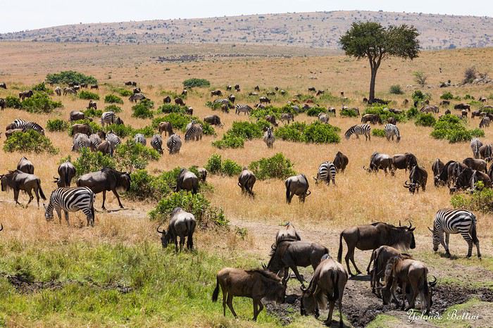
This account of a short stay in Kenya was originally meant for our friends and family, but to pass the time—for both us and you—and to add some content to the increasingly quiet columns of Voyage Forum during these weeks of confinement, when travelers can only journey in their minds, we decided to share the 25 pages of my ramblings, illustrated with Yolande’s photos, from an extraordinary stay in the Maasai Mara National Reserve. We waited until the two previous discussions on this same topic, filled with stunning photos and started by Régis and then Claire—sometimes in agreement, sometimes differing but always full of insights—had quieted down a bit before jumping in. Well, we’ll give it a try.
Let’s clarify: one of us claims to be a beginner photographer, and the other is just an unrepentant dreamer and modest writer. We often pursued our passions separately—Yolande with her mentor and me with an incomparable tracker—so sometimes the photos don’t quite match the text, or vice versa.
We hope you enjoy reading this lengthy post, which is longer than usual in VF’s sections (except, of course, for Mr. Voyajou). A thousand apologies for straying off the beaten path.
Alright, here we go!
Les mythes touristiques English translation pending
Les Mythes Touristiques
Dans un carnet que je suis en train d'écrire sur un voyage récent au Mexique, nous sommes arrivés à une petite discussion sur les fameux groupes de musiciens Mexicains, les mariachis. Il existe un mythe selon lequel « mariachi » serait une déformation du mot Français « mariage », et que cela viendrait des fêtes tenues par les Français lors de leurs quelques années d’occupation du Mexique, dans les années 1860 et quelques. Je cite l’un des intervenants sur mon poste Mexicain :
« Les français organisaient de grandes fêtes aux mariages et avaient l'habitude d'inviter des musiciens…. Mariachi serait une déformation du mot mariage ..? »
Ce mythe a été réfuté car il a été prouvé que le terme « mariachi » était d’usage longtemps avant la peu glorieuse « Intervention » de la France au Mexique (c’était sous Napoléon III).
Plusieurs mythes semblables circulent. Certains semblent être propagés à l’intention des touristes, pour leur donner l’illusion de « mieux comprendre le pays », pour donner une profondeur supplémentaire à leurs voyages, pour alimenter leurs conversations avec les amis quand ils sont de retour. Car tout cela gonfle l’égo et donne envie de faire d’autres voyages, ça alimente le tourisme. D’où revenus, tiens donc, pour qui ?
Mais d’autres mythes existent qui ne sont peut-être pas créés à but lucratif.
Vous connaissez sans aucun doute de tels mythes et je vous propose de les partager. Et de donner les raisons pour lesquelles ces mythes existent.
Dans un carnet que je suis en train d'écrire sur un voyage récent au Mexique, nous sommes arrivés à une petite discussion sur les fameux groupes de musiciens Mexicains, les mariachis. Il existe un mythe selon lequel « mariachi » serait une déformation du mot Français « mariage », et que cela viendrait des fêtes tenues par les Français lors de leurs quelques années d’occupation du Mexique, dans les années 1860 et quelques. Je cite l’un des intervenants sur mon poste Mexicain :
« Les français organisaient de grandes fêtes aux mariages et avaient l'habitude d'inviter des musiciens…. Mariachi serait une déformation du mot mariage ..? »
Ce mythe a été réfuté car il a été prouvé que le terme « mariachi » était d’usage longtemps avant la peu glorieuse « Intervention » de la France au Mexique (c’était sous Napoléon III).
Plusieurs mythes semblables circulent. Certains semblent être propagés à l’intention des touristes, pour leur donner l’illusion de « mieux comprendre le pays », pour donner une profondeur supplémentaire à leurs voyages, pour alimenter leurs conversations avec les amis quand ils sont de retour. Car tout cela gonfle l’égo et donne envie de faire d’autres voyages, ça alimente le tourisme. D’où revenus, tiens donc, pour qui ?
Mais d’autres mythes existent qui ne sont peut-être pas créés à but lucratif.
Vous connaissez sans aucun doute de tels mythes et je vous propose de les partager. Et de donner les raisons pour lesquelles ces mythes existent.