Results for "campement+|+99+>+78"
26844 results found.
Les cataractes d'Iguazu... sous l'eau! English translation pending
Bonjour;
Je voulais partager avec vous une photo des Cataractes d'Iguazu reçu hier d'un ami argentin. Les cataractes sont actuellement interdites au public pour cause de très hautes eaux. En effet !
Septembre 2010 lorsque nous y étions. Vue prise du coté Brésilien. Regardez bien la passerelle ! Les gens minuscule en bas se promènent coté Argentin.

Et revoilà la passerelle !!! Photo pris coté Argentin.

Lorsqu'on se promène à Iguazu on ressent partout la force incroyable de la nature mais là !
Je voulais partager avec vous une photo des Cataractes d'Iguazu reçu hier d'un ami argentin. Les cataractes sont actuellement interdites au public pour cause de très hautes eaux. En effet !
Septembre 2010 lorsque nous y étions. Vue prise du coté Brésilien. Regardez bien la passerelle ! Les gens minuscule en bas se promènent coté Argentin.
Et revoilà la passerelle !!! Photo pris coté Argentin.
Lorsqu'on se promène à Iguazu on ressent partout la force incroyable de la nature mais là !
Petits conseils pour le Sénégal English translation pending
Bonjour
je rentre d'un voyage de 12 jours a Saly. Aucun probleme suite au Mali. Il a fait tres beau. Profiter bien de vos journée car elle passent tres vite. Pour les moustiques, en ce moment, ca va. Je n'ai eu aucune piqures mais ils sont présent. Prenez comme meme un répulsif. Si vous avez des questions, n'hésiter pas. Bon voyage a tous et profiter bien. Ah oui, une derniere chose, en arrivant à l'aeroport de Dakkar, faites attention a vos valises car il y a pas mal de gens mal intentioné qui vous aide mais ce n'est pas gratuit. Je me suis fait avoir de 5000 f. ATTENTION
Achat d'un vélo de randonnée English translation pending
Bonjour,
nouveau fan de rando à vélo, et nouvel utilisateur de ce forum, je pense que je suis au bon endroit pour demander quelques conseil à propos d'un futur achat et de mon prochain voyage.
Je souhaite faire un voyage (en solo) france-allemagne-suisse-france de 2000km environ, en étant autonome. L'année dernière j'ai pu faire 3200km avec un giant explorer (prêté) d'une dizaine d'année, celui ci m'a totalement convenu et je souhaiterais m'orienter vers un vélo du même type (vtc). Petit problème cependant, mon budget n'est pas si élevé (500€), et je me demande si d'occasion je pourrais en trouver à ce prix.
J'habite à Metz, je connais quelques magasin de cycle (véloland etc), mais peut être existe-t-il de bonne adresses dans le coin où je pourrais faire un saut ? Je compte aussi l'équiper avec pédalier auto, pas de contre indication ? Pendant mon précédent voyage, j'ai remarqué que la position n'était pas vraiment aérodynamique et j'ai passé beaucoup de temps en position "contre la montre" avec ma sacoche guidon, y a-t-il une autre façon de faire ?
Je vous remercie par avance pour vos réponses et prépare mes prochaines questions ;)
Luca.
PS : si vous avez des conseils, une idée qui pourrait m'intéresser, à propos ou non de mon parcours, peut être à propos du voyage à l'étranger, des routes d'allemagne et de suisse ou que sais-je encore, je suis preneur, n'hésitez pas =)
nouveau fan de rando à vélo, et nouvel utilisateur de ce forum, je pense que je suis au bon endroit pour demander quelques conseil à propos d'un futur achat et de mon prochain voyage.
Je souhaite faire un voyage (en solo) france-allemagne-suisse-france de 2000km environ, en étant autonome. L'année dernière j'ai pu faire 3200km avec un giant explorer (prêté) d'une dizaine d'année, celui ci m'a totalement convenu et je souhaiterais m'orienter vers un vélo du même type (vtc). Petit problème cependant, mon budget n'est pas si élevé (500€), et je me demande si d'occasion je pourrais en trouver à ce prix.
J'habite à Metz, je connais quelques magasin de cycle (véloland etc), mais peut être existe-t-il de bonne adresses dans le coin où je pourrais faire un saut ? Je compte aussi l'équiper avec pédalier auto, pas de contre indication ? Pendant mon précédent voyage, j'ai remarqué que la position n'était pas vraiment aérodynamique et j'ai passé beaucoup de temps en position "contre la montre" avec ma sacoche guidon, y a-t-il une autre façon de faire ?
Je vous remercie par avance pour vos réponses et prépare mes prochaines questions ;)
Luca.
PS : si vous avez des conseils, une idée qui pourrait m'intéresser, à propos ou non de mon parcours, peut être à propos du voyage à l'étranger, des routes d'allemagne et de suisse ou que sais-je encore, je suis preneur, n'hésitez pas =)
Patagonie mars 2012: Parc des Glaciers et Torres del Paine English translation pending
La Patagonie et ses grands espaces, ses glaciers, ses treks : nous voilà partis pour 17 jours vers ces terres lointaines pour visiter le Parc des glaciers et le Torres del Paine.
Samedi 10 mars 2012 :
- Arrivée à Buenos Aires vers 19h pour une arrivée prévue à 9h du matin, soit 10 heures de retard !!! ça commence bien les vacances : un type en business class un peu saoul, un peu drogué a agressé deux hôtesses au milieu de la nuit. Le commandant de bord prend la parole à 5h du matin (heure française) pour annoncer qu’il a décidé de remettre ce guignol à la police espagnole et donc de faire demi-tour pour les îles Canaries… Arrivée à Las Palmas, débarquement et 2 heures d’attente le temps de changer l’équipage affecté, semble t-il, par cet incident puis embarquement pour 10 heures de vol supplémentaire.
- Arrivée à Buenos Aires à 19h (heure locale) c'est-à-dire à l’heure à laquelle nous aurions dû atterrir à El Calafate. Au lieu de cela, nous partons à la recherche du bureau d’Air Europa pour qu’ils nous trouvent un vol pour le lendemain ce qu’ils feront ainsi qu’un hôtel pour la soirée.
- Finalement, nous atterrirons à El Calafate vers 12h30. Accueil par les services sanitaires qui fouilleront nos sacs : viandes séchée : OK, compote pomme banane lyo : OK, saucisson et comté : pas vu…
- Un bus pour El Chalten de la compagnie Las Lengas attend sur le parking pour partir : cool sauf qu’il faut qu’on passe par El Calafate pour réorganiser toutes les réservations compte tenu du retard de l’avion et acheter également une cartouche de gaz (la nôtre a été confisquée à l’aéroport de Buenos Aires).
- Pour les réservations de bus (pour El Chalten et Torres del Paine) et The Big Ice, je suis passé par l’agence Chaltentravel qui a un bureau à El Calafate : nous y passons, et la personne très sympathique s’est occupée de modifier les dates de réservation. Problème réglé. Nous partons le soir même pour El Chalten par le bus de 18h30 (3h de trajet environ.
- Nous arrivons à l’hôtel Rancho Grande (terminus du bus) qui est complet : on nous propose donc l’hôtel Poincenot à côté, soit 350 pesos la chambre (60 € quand même !).
Dimanche 11 mars 2012 :
- Départ de l’hôtel à 8 heures pour trouver un harnais car nous voulons aller jusqu’au Paso del Viento et ensuite relier le Cerro Torre par le col des Agachonas : il y a sur ce parcours 2 tyroliennes. Sauf qu’au moment de louer le harnais (100 pesos pour 3 jours), le type me dit que la première tyrolienne est cassée et que le chemin pour monter au col des Agachonas est difficile à trouver : ça promet.
- Direction la maison des guides : point de départ pour la Laguna Toro et 1er jour des vacances !
- L’un des guides me confirme que la tyrolienne pour traverser le Rio Tunel est cassée et qu’il faut donc traverser à pieds.
- Le trajet jusqu’à la Laguna Toro est indiquée pour 6 heures de trajet mais nous le ferons en 5 heures : il faut dire que la brume épaisse qui nous entoure n’incite pas à la contemplation des paysages.
Photo prise sur le retour avec le glacier Rio Tunel au fonds.

- Nous arrivons donc assez tôt au campement et décidons finalement de poursuivre jusqu’à un site de camping situé sur la carte (Chalten Out Door) près de la Laguna superieur (après le glacier Rio Tunel). Mais à l’approche de la Laguna Toro, il existe une multitude de sentes : il s’agit des traces de nombreux randonneurs qui cherchent à accéder au glacier sans traverser la rivière. Effectivement, la tyrolienne est cassée. Le débit de la rivière et la température de l’eau n’incite pas à traverser. Nous cherchons donc nous aussi à contourner cette rivière pendant pas mal de temps sans résultat. Le temps passe et nous ne trouvons toujours pas d’accès au glacier. Nous décidons de retourner au campement Toro pour la nuit.
Lundi 12 mars 2012 :
- On repart dès 8h vers le glacier pour essayer de trouver un passage en contournant la rivière par les rochers mais c’est dangereux et sans issue. On fini par traverser la rivière au niveau du delta, là où la rivière se divise en plusieurs cours d’eau juste avant de se jeter dans la Laguna Toro : le courant y est moins fort.
- On commence par sauter de pierre en pierre pour éviter que nos chaussures soient trempées. D’ailleurs, parfois certaines pierres étaient très claires voire translucides : ah, de petits blocs de glace détachés du glacier !
- Nous avons finalement dû y aller avec les chaussures qui resteront trempées jusqu’au lendemain. Il est facile de retrouver le sentier juste après la tyrolienne : il passe à flanc de montagne et très au dessus du glacier Rio Tunel pour finalement redescendre jusqu’au glacier. Il faut ensuite marcher un peu sur le glacier ce qui n’est pas dangereux car le glacier, à cet endroit-là, butte contre la montagne et est donc très compact. Pas d’équipement nécessaire car il y a pas mal de débris sur le glacier ce qui permet de marcher sans crampons.

- Il faut ensuite remonter à flanc de montagne mais, contrairement à ce que semble indiquer le tracé sur la carte, il ne faut pas rejoindre les bords de la Laguna Tunel supérieur. Le sentier passe bien au dessus et il faut suivre les cairns.
- Pour ce qui nous concerne, nous avons trouvé le sentier mais nous l’avons perdu à l’approche de cette seconde lagune : nous avons atteint les bords du lac (incités par la carte) où il y a d’ailleurs des cairns mais qui ne mènent nulle part. Nous avons donc atteint l’autre bout du lac puis le glacier mais sans jamais suivre le moindre sentier. Nous nous sommes retrouvés à flanc de montagne à nous demander si le col Paso del Viento était le col de droite, celui de gauche ou celui du fonds là-bas. Nous nous étions fixés la limite de 16h pour trouver le col avant de retourner au campement Toro et il est 15h.
- Ça va être dur : on croit voir des cairns, on s’en approche et puis non ou peut être. On observe au loin, on cherche sur la carte. Bon on tente ce col là. J’en ai marre. Je m’arrête pour pisser, regarde le paysage et… la trace du sentier au loin bien en évidence, là où jamais nous n’aurions eu idée de le chercher.
- La carte de Chalten Out Door est donc bien imprécise. Le sentier est suffisamment visible pour qu’on détermine sa direction et où il mène. Nous atteignons ainsi le Paso del Viento à 16h après avoir traversé la pampa sur une pente assez raide.
- Et là, une vue extraordinaire : une étendue de glace avec, au loin, une multitude de glaciers qui se rejoignent tous dans ce champ de glace que l’on voit s’étirer sur des kilomètres. Ça vaut le coup de se perdre pendant des heures pour cette petite demi-heure d’observation (le vent est fort et froid ce qui n’incite pas à rester trop longtemps aussi exposé d’autant plus que les nuages arrivent). Petites photos souvenir jusqu’à ce que les piles me lâchent vu qu’il fait très froid : décidément !

- Sur le retour, nous croisons quelques personnes dont un anglais, un français qui nous explique que la fille devant (une allemande) est partie tôt ce matin de la maison des guides (et elle porte son sac) ! D’ailleurs, on se rend compte qu’il y a des randonneurs un peu partout sur le versant de la montagne à la recherche du bon sentier : ce n’est pas pour rien que cette partie du parcours est déconseillée sans guide.
- Arrivée à 20 h au campement.
Mardi 13 mars 2012 :
- Départ 8h pour le col des Agachonas (l’un des plus beaux points de vue du parc paraît-il) mais un sentier difficile à trouver. Nous avions repérer, à l’aller, la rivière proche du sentier tel qu’il figure sur la carte sauf que nous n’avions plus trop confiance car les tracés sont imprécis sur cette carte.
- Nous trouvons assez facilement un sentier qui monte en direction du col. Nous voyons un beau cairn près de la rivière. Nous continuons la progression pour arriver sur une zone où le sentier se démultiplie, les traces partent dans toutes les directions. Bon. On pose nos sacs à la recherche d’un passage : en face, un marais impossible à traverser ; de l’autre côté de la rivière, aucune trace ni sente. On décide alors de contourner par la droite le marais mais au dessus du marais il y a une forêt qui est dense donc qu’il faut aussi contourner. Le temps passe et puis, nous croyons voir des sentes là où il n’y en a pas (passage d’animaux, érosion due à la pluie…). Le temps passe, il est 14 h : pause déjeuné au milieu de la pampa et nous sommes désormais assez éloignés de la rivière près de laquelle est supposé se trouver le sentier. On sort les jumelles pour chercher où se trouve le sentier et nous voyons, au loin, une trace au dessus de la forêt que nous cherchons à contourner depuis des heures mais, apparemment, du mauvais côté.
- Cette trace se trouve juste au dessus de la rivière ce qui nous laisse penser que le sentier consiste, au moins pour partie, à remonter le cours de la rivière afin de contourner la forêt.
- Bref, il est trop tard pour rebrousser chemin sur cette seule supposition donc nous décidons de rejoindre le campamento Poincenot (notre destination du jour) non pas en passant par le col des Agachonas mais par El Chalten. Ça tombe bien, à l’aller, nous n’avons pas vu le paysage à cause de la brume !
- Arrivée au camp vers 20h30 : le sentier pour atteindre le camp n’est pas difficile (même s’il le devient un peu après tant d’heures de marche et avec des chaussures mouillées !).
Mercredi 14 mars 2012 :
- Départ à 6h pour la Laguna Los Tres de nuit pour le lever de soleil sur le Fitz Roy : arrivée vers 7h15. Bien mais je me demande si la vue n’est pas mieux d’en bas : une autre fois.


- Petit-déjeuner au camp et départ vers 10h en direction du Cerro Torre : le sentier qui longe les Lagunas Madre et Hija est assez monotone : nous passons par le Cerro Torre : pas mal, la vue est dégagée jusqu’au moment de notre départ où les nuages viennent recouvrir le massif de manière subite.


- Retour à El Chalten pour prendre notre bus à 18h30 pour El Calafate (le départ est un peu plus tôt lorsqu’on prend le bus du Rancho Grande).
Jeudi 15 mars 2012 :
- Départ 7h de l’hôtel Hosteria Patagonia (coût : 170 pesos argentins, soit 29 € ; adresse : Don Bosco 160 ; tél : 492302 ; mail : hosteria-patagonia@cotecal.com.ar) par minibus (système de minibus qui sillonnent chacun une partie de la ville et vous mène au bus principal) pour The Big Ice avec Hielo y aventura (coût : 770 pesos argentin, soit 135 € transport compris mais pas le déjeuner) ;
- Arrivée aux passerelles à 9h pour 30 ou 40 minutes pour observer le Perito Moreno.

Le pont de glace a cédé début mars mais 15 jours avant notre arrivée : dommage !

Puis direction le port pour la traversée en bateau du lac. Petite randonnée à flanc de montagne pour accéder au glacier ; prise en main de l’équipement (crampon + harnais pour la sécurité) et premiers pas sur le glacier.
- Visite de deux petites grottes sous le glacier : la glace est bleue et on voit les petites bulles d’air piégées dans la glace : c’est assez étonnant comme milieu.

- La marche sur le glacier ne présente aucune difficulté particulière et ça devient même un peu ennuyeux au bout d’un certain temps : heureusement, les guides (2 pour 6 personnes) se sont employés à chercher des trous dans la glace d’un bleu profond ou de petites rivières pour égayer la marche de 4 heures. C’est une excursion à faire pour une initiation à la marche sur glacier. Pour ceux qui connaissent déjà, ça ne présentera que peu d’intérêt.
Une roche erratique.

- Retour à l’hôtel vers 18h30.
- Restaurant réparateur au Casimiro Bigua : menu découverte à 60 € par personne avec dégustation de vins, tous bons sauf le rouge (très bonne limonade maison).
Vendredi 16 mars 2012 :
- Départ 7h de l’hôtel direction Torres del Paine (7h de trajet direct avec un bus tout terrain de Patagonia Extrema Viajes réservé via Chaltentravel pour 746 pesos argentin l’aller retour, soit 130 € (le prix du trajet direct !) ; déjeuné compris). Passage par la douane : côté Argentine, il s’agit simplement de présenter le passeport mais, côté Chili, les sacs et les bagages à main sont passés aux rayons x. Du coup, on a planqué le saucisson et le fromage dans nos poches et c’est passé comme une lettre à la Poste. Petite précision : il faut remplir un papier dans lequel à la question, transportez-vous des marchandises interdites, il faut répondre oui car si la réponse donnée est non et que les douaniers trouvent quelque chose, l’amende est assurée ce qui n’est pas le cas autrement !
- Près de la douane, il y a une épicerie qui fait bureau de change (nous avons changé 60 dollars chacun pour payer le droit d’entré du parc et les campings).
- Le trajet est en fait une excursion à la journée donc il y a des arrêts pour les visites des lacs Sarmiento et Amarga et des explications en tout genre ce qui retarde d’autant, pour nous, le départ de notre randonnée. Exemple, Paine est une couleur entre le gris et le bleu : c’est un adjectif qui peut aller avec tout autre chose que les tours du parc. Pause déjeuné près des cascades du Paine.
Un guanaco à l'approche du parc.

- Vers 14h, nous arrivons enfin à l’entrée du Parc de la Laguna Amarga. Paiement du parc : 15 000 pesos chilien, soit 23 € par personne. Nous quittons l’excursion qui se poursuit de l’autre côté du parc et nous commençons notre trek direction le Campamento Seron (pas de réservation ; coût : 4 000 pesos chilien avec douches, soit 6 € par personne mais exceptionnellement gratuit car les douches sont fermées). Le paysage n’est franchement pas terrible car la forêt a visiblement cramée il y a quelques années et les Torres sont planquées sous les nuages mais nous croisons deux français qui nous rassurent pour la suite de notre périple. Arrivée vers 18h sous une fine pluie.
Samedi 17 mars 2012 :
- Direction camp Los Perros (pas de réservation ; coût : 3 500 pesos chilien par personne avec douche froide, soit 4 €) en passant par le refuge Dickson. La neige est tombée sur les sommets durant la nuit ce qui égaie les paysages.


Nous ne rencontrons personne jusqu’au refuge Dickson. Beau panorama et impression d’immensité et de solitude.

- Passage rapide au refuge : les gardiens nous indiquent qu’il est déconseillé de poursuivre jusqu’au camp Los Perros après 14h. Bon, il est 13h30 donc ça va. Pour rejoindre le glacier Dickson, il existe un bac mais il ne part qu’à 9h et revient également qu’à une heure fixe l’après-midi. Comme nous ne voulons pas attendre demain matin pour prendre le bac, nous renonçons et partons pour Los Perros.
- Le sentier traverse la forêt pendant des heures : c’est interminable (4 heures 30 mais sans difficulté)), extrêmement monotone car le paysage n’est pas visible du fait de la forêt qui est dense. Arrivée au glacier Perros vers 18h juste bien pour le couché de soleil.

Dimanche 18 mars 2012 :
- Direction le refuge Grey (pas de réservation ; coût : 3 500 pesos chilien par personne avec douche chaude, soit 4 €, épicerie). Départ vers 8h pour le col John Gardner : le sentier est très gras voire inondé à certains endroits : la progression est lente au départ. Il y a ceux qui tentent de marcher sur les troncs morts et les racines boueuses pour éviter de s’en mettre partout et les autres qui y vont franco. Toutefois, le sentier devient plus praticable au bout d’un certain temps : il est bien indiqué.

Nous passons devant un autre glacier : c’est ce qui est vraiment étonnant dans cette région. Il est possible d’approcher de très près des glaciers sans faire de la haute montagne et il y en a tellement.

- Arrivée au col vers 10h30 avec un vent fort pour nous accueillir : difficile de rester trop longtemps : la vue sur le glacier Grey est impressionnante. Sa taille, sa couleur, les autres glaciers au loin qui semblent le rejoindre comme les affluents d’un fleuve, ça ne vaut pas le champ de glace continental mais c’est pas mal quand même.

- La descente jusqu’au camp est longue mais la vue sur le glacier distrait avec une perspective qui change tout au long de la descente. Arrivée au camp vers 17h30.

- Le camp est bien plus fréquenté que ce qu’on avait vu jusqu’à présent avec quelques groupes de touristes. Un cuisinier chilien qui s’occupait de l’un de ces groupes passe d’ailleurs devant ma tente et me propose un fonds de casserole de poulet au maïs : sympa.
Lundi 19 mars 2012 :
- Direction camp Las Carretas (pas de réservation ; coût : gratuit). Nous avions prévu une journée de battement en cas de météo difficile qui nous aurait bloqué mais comme cela n’a pas été le cas, il faut trouver à s’occuper donc direction le Campamento Las Carretas.
- Il s’agit d’une promenade qui ne présente désormais guère d’intérêt vu qu’à partir du Refuge Grey, tout a cramé au mois de janvier dernier. Il est possible de marcher des heures dans un paysage entièrement carbonisé : cela va du Refuge Grey (qui n’a pas été atteint mais les alentours ont bien cramés) jusqu’à Las Carretas au sud et juste avant le Campamento Italiano à l’est.

- Départ 8h pour une arrivée au refuge Péhoé à 11h puis arrivée à Las Carretas à 15h15. Les bords du lac Péhoé n’ont pas été épargnés par le feu et la progression est rendue difficile à cause du vent qui soulève la cendre en petits tourbillons.
- D’ailleurs, le vent était particulièrement fort durant cette journée et on se rend compte que ce n’est pas parce qu’on l’a dans le dos que c’est plus facile : bien au contraire !
Mardi 20 mars 2012 :
- Direction camp Italiano (pas de réservation ; coût : gratuit). Départ 8h en reprenant le même chemin que la veille jusqu’au refuge Péhoé avec un vent de folie et de face cette fois-ci. Arrivée au camp Italiano vers 13h, montage de la tente, pause déjeuné et départ vers 14h pour le camp Britanico. La montée est sympa avec la vallée del Francès sur la gauche et les tours sur la droite qui se découvrent grâce au vent dans une ambiance tempétueuse. Et il y a aussi la vue sur le Lago Nordenskjöld qui est, pour le coup, ensoleillé. Pour ma part, j’ai trouvé qu’il s’agissait de la plus belle vue sur les tours mais la météo joue beaucoup sur cette impression.

- Nous verrons aussi trois avalanches au niveau du glacier del Francès mais c’est surtout le bruit qui est impressionnant. On voit la neige tomber sur des dizaines de mètres jusqu’à un chaos de neige noircie par les débris et se mêler aux petits ruisseaux de fonte du glacier.

Mercredi 21 mars 2012 :
- Direction camp Las Torres (pas de réservation ; coût : gratuit). Le temps est beau avec un lever de soleil sur la vallée del Francès en prime. Nous entrons dans la zone privée du parc avec le refuge Los Cuernos puis le Campamento Chileno (nous emprunterons le shortcut pour éviter de passer par l’Hosteria Las Torres). La vallée Ascencio est superbe.

- Arrivée au camp, montage de la tente et départ pour le mirador (45 minutes). La vue sur les tours avec le petit glacier et le lac en contrebas est sympa mais je n’ai pas trouvé ça aussi grandiose que la vue depuis le camp Britanico. Ça fait trop carte postal.

Jeudi 22 mars 2012 :
- Direction camp Guarderia Laguna Amargua. J’ai demandé au gardien s’il était possible de pousser jusqu’au Campamento Japonés mais il me répond que le sentier n’est pas praticable car c’est de la pierraille. La lassitude viendra à bout de notre motivation car il est vrai que j’ai été un peu déçu de la monotonie des sentiers car la plupart d’entre eux se situent en plaine et sur de longues distances (par exemple, Campamento Seron – Los Perros : 28km). Nous n’irons donc pas voir de nous même s’il est ou non possible de rejoindre le fond de la vallée.
- Arrivée au refuge Las Torres (un peu après l’Hosteria) : il y a un bus qui fait le transfert vers le poste de garde avec un départ à 9h, 14h et 16h. Sauf qu’il est 11h quand on y passe : on poursuivra donc à pieds jusqu’à la fin avec une arrivée à 12h30.

- Notre bus arrivera vers 16h30 comme prévu (ce n’est pas le même qu’au départ, ni la même compagnie, ni le même trajet vu que ce n’est pas un bus tout terrain : il doit donc relier El Calafate en passant par Esperanza pour éviter les pistes).
- Arrivée à El Calafate à 20h30.
Vendredi 23 mars 2012 :
- Avion à 10h50 pour Buenos aires et arrivée à 13h46 (taxe aéroport de 28 ARS, soit 5 €).
- Taxi (90 Ars) pour rejoindre l’Hostel Parada (Avenida Rivadavia 1291, Centro, coût 200 ARS, soit 36 €).
- Visite rapide de la ville en suivant le parcours proposé sur le Lonely Planet (Plaza San Martin, Galerias Pacifico, Florida, Obelisco, Plaza de Mayo, …) puis la rue Defensa. La ville est plaisante, agréable et l'architecture très européenne (pour ne pas dire parisienne) mais on sent quand même que l'âge d'or est passé.
- Restaurant Parilla Chiquilin pour enfin goûter le bœuf argentin.
Samedi 24 mars 2012 :
- Visite des quais avec le bateau école de l’armée argentine : joli quartier.
- Direction l’aéroport vers 10h par taxi (150 Ars).
Samedi 10 mars 2012 :
- Arrivée à Buenos Aires vers 19h pour une arrivée prévue à 9h du matin, soit 10 heures de retard !!! ça commence bien les vacances : un type en business class un peu saoul, un peu drogué a agressé deux hôtesses au milieu de la nuit. Le commandant de bord prend la parole à 5h du matin (heure française) pour annoncer qu’il a décidé de remettre ce guignol à la police espagnole et donc de faire demi-tour pour les îles Canaries… Arrivée à Las Palmas, débarquement et 2 heures d’attente le temps de changer l’équipage affecté, semble t-il, par cet incident puis embarquement pour 10 heures de vol supplémentaire.
- Arrivée à Buenos Aires à 19h (heure locale) c'est-à-dire à l’heure à laquelle nous aurions dû atterrir à El Calafate. Au lieu de cela, nous partons à la recherche du bureau d’Air Europa pour qu’ils nous trouvent un vol pour le lendemain ce qu’ils feront ainsi qu’un hôtel pour la soirée.
- Finalement, nous atterrirons à El Calafate vers 12h30. Accueil par les services sanitaires qui fouilleront nos sacs : viandes séchée : OK, compote pomme banane lyo : OK, saucisson et comté : pas vu…
- Un bus pour El Chalten de la compagnie Las Lengas attend sur le parking pour partir : cool sauf qu’il faut qu’on passe par El Calafate pour réorganiser toutes les réservations compte tenu du retard de l’avion et acheter également une cartouche de gaz (la nôtre a été confisquée à l’aéroport de Buenos Aires).
- Pour les réservations de bus (pour El Chalten et Torres del Paine) et The Big Ice, je suis passé par l’agence Chaltentravel qui a un bureau à El Calafate : nous y passons, et la personne très sympathique s’est occupée de modifier les dates de réservation. Problème réglé. Nous partons le soir même pour El Chalten par le bus de 18h30 (3h de trajet environ.
- Nous arrivons à l’hôtel Rancho Grande (terminus du bus) qui est complet : on nous propose donc l’hôtel Poincenot à côté, soit 350 pesos la chambre (60 € quand même !).
Dimanche 11 mars 2012 :
- Départ de l’hôtel à 8 heures pour trouver un harnais car nous voulons aller jusqu’au Paso del Viento et ensuite relier le Cerro Torre par le col des Agachonas : il y a sur ce parcours 2 tyroliennes. Sauf qu’au moment de louer le harnais (100 pesos pour 3 jours), le type me dit que la première tyrolienne est cassée et que le chemin pour monter au col des Agachonas est difficile à trouver : ça promet.
- Direction la maison des guides : point de départ pour la Laguna Toro et 1er jour des vacances !
- L’un des guides me confirme que la tyrolienne pour traverser le Rio Tunel est cassée et qu’il faut donc traverser à pieds.
- Le trajet jusqu’à la Laguna Toro est indiquée pour 6 heures de trajet mais nous le ferons en 5 heures : il faut dire que la brume épaisse qui nous entoure n’incite pas à la contemplation des paysages.
Photo prise sur le retour avec le glacier Rio Tunel au fonds.
- Nous arrivons donc assez tôt au campement et décidons finalement de poursuivre jusqu’à un site de camping situé sur la carte (Chalten Out Door) près de la Laguna superieur (après le glacier Rio Tunel). Mais à l’approche de la Laguna Toro, il existe une multitude de sentes : il s’agit des traces de nombreux randonneurs qui cherchent à accéder au glacier sans traverser la rivière. Effectivement, la tyrolienne est cassée. Le débit de la rivière et la température de l’eau n’incite pas à traverser. Nous cherchons donc nous aussi à contourner cette rivière pendant pas mal de temps sans résultat. Le temps passe et nous ne trouvons toujours pas d’accès au glacier. Nous décidons de retourner au campement Toro pour la nuit.
Lundi 12 mars 2012 :
- On repart dès 8h vers le glacier pour essayer de trouver un passage en contournant la rivière par les rochers mais c’est dangereux et sans issue. On fini par traverser la rivière au niveau du delta, là où la rivière se divise en plusieurs cours d’eau juste avant de se jeter dans la Laguna Toro : le courant y est moins fort.
- On commence par sauter de pierre en pierre pour éviter que nos chaussures soient trempées. D’ailleurs, parfois certaines pierres étaient très claires voire translucides : ah, de petits blocs de glace détachés du glacier !
- Nous avons finalement dû y aller avec les chaussures qui resteront trempées jusqu’au lendemain. Il est facile de retrouver le sentier juste après la tyrolienne : il passe à flanc de montagne et très au dessus du glacier Rio Tunel pour finalement redescendre jusqu’au glacier. Il faut ensuite marcher un peu sur le glacier ce qui n’est pas dangereux car le glacier, à cet endroit-là, butte contre la montagne et est donc très compact. Pas d’équipement nécessaire car il y a pas mal de débris sur le glacier ce qui permet de marcher sans crampons.
- Il faut ensuite remonter à flanc de montagne mais, contrairement à ce que semble indiquer le tracé sur la carte, il ne faut pas rejoindre les bords de la Laguna Tunel supérieur. Le sentier passe bien au dessus et il faut suivre les cairns.
- Pour ce qui nous concerne, nous avons trouvé le sentier mais nous l’avons perdu à l’approche de cette seconde lagune : nous avons atteint les bords du lac (incités par la carte) où il y a d’ailleurs des cairns mais qui ne mènent nulle part. Nous avons donc atteint l’autre bout du lac puis le glacier mais sans jamais suivre le moindre sentier. Nous nous sommes retrouvés à flanc de montagne à nous demander si le col Paso del Viento était le col de droite, celui de gauche ou celui du fonds là-bas. Nous nous étions fixés la limite de 16h pour trouver le col avant de retourner au campement Toro et il est 15h.
- Ça va être dur : on croit voir des cairns, on s’en approche et puis non ou peut être. On observe au loin, on cherche sur la carte. Bon on tente ce col là. J’en ai marre. Je m’arrête pour pisser, regarde le paysage et… la trace du sentier au loin bien en évidence, là où jamais nous n’aurions eu idée de le chercher.
- La carte de Chalten Out Door est donc bien imprécise. Le sentier est suffisamment visible pour qu’on détermine sa direction et où il mène. Nous atteignons ainsi le Paso del Viento à 16h après avoir traversé la pampa sur une pente assez raide.
- Et là, une vue extraordinaire : une étendue de glace avec, au loin, une multitude de glaciers qui se rejoignent tous dans ce champ de glace que l’on voit s’étirer sur des kilomètres. Ça vaut le coup de se perdre pendant des heures pour cette petite demi-heure d’observation (le vent est fort et froid ce qui n’incite pas à rester trop longtemps aussi exposé d’autant plus que les nuages arrivent). Petites photos souvenir jusqu’à ce que les piles me lâchent vu qu’il fait très froid : décidément !
- Sur le retour, nous croisons quelques personnes dont un anglais, un français qui nous explique que la fille devant (une allemande) est partie tôt ce matin de la maison des guides (et elle porte son sac) ! D’ailleurs, on se rend compte qu’il y a des randonneurs un peu partout sur le versant de la montagne à la recherche du bon sentier : ce n’est pas pour rien que cette partie du parcours est déconseillée sans guide.
- Arrivée à 20 h au campement.
Mardi 13 mars 2012 :
- Départ 8h pour le col des Agachonas (l’un des plus beaux points de vue du parc paraît-il) mais un sentier difficile à trouver. Nous avions repérer, à l’aller, la rivière proche du sentier tel qu’il figure sur la carte sauf que nous n’avions plus trop confiance car les tracés sont imprécis sur cette carte.
- Nous trouvons assez facilement un sentier qui monte en direction du col. Nous voyons un beau cairn près de la rivière. Nous continuons la progression pour arriver sur une zone où le sentier se démultiplie, les traces partent dans toutes les directions. Bon. On pose nos sacs à la recherche d’un passage : en face, un marais impossible à traverser ; de l’autre côté de la rivière, aucune trace ni sente. On décide alors de contourner par la droite le marais mais au dessus du marais il y a une forêt qui est dense donc qu’il faut aussi contourner. Le temps passe et puis, nous croyons voir des sentes là où il n’y en a pas (passage d’animaux, érosion due à la pluie…). Le temps passe, il est 14 h : pause déjeuné au milieu de la pampa et nous sommes désormais assez éloignés de la rivière près de laquelle est supposé se trouver le sentier. On sort les jumelles pour chercher où se trouve le sentier et nous voyons, au loin, une trace au dessus de la forêt que nous cherchons à contourner depuis des heures mais, apparemment, du mauvais côté.
- Cette trace se trouve juste au dessus de la rivière ce qui nous laisse penser que le sentier consiste, au moins pour partie, à remonter le cours de la rivière afin de contourner la forêt.
- Bref, il est trop tard pour rebrousser chemin sur cette seule supposition donc nous décidons de rejoindre le campamento Poincenot (notre destination du jour) non pas en passant par le col des Agachonas mais par El Chalten. Ça tombe bien, à l’aller, nous n’avons pas vu le paysage à cause de la brume !
- Arrivée au camp vers 20h30 : le sentier pour atteindre le camp n’est pas difficile (même s’il le devient un peu après tant d’heures de marche et avec des chaussures mouillées !).
Mercredi 14 mars 2012 :
- Départ à 6h pour la Laguna Los Tres de nuit pour le lever de soleil sur le Fitz Roy : arrivée vers 7h15. Bien mais je me demande si la vue n’est pas mieux d’en bas : une autre fois.
- Petit-déjeuner au camp et départ vers 10h en direction du Cerro Torre : le sentier qui longe les Lagunas Madre et Hija est assez monotone : nous passons par le Cerro Torre : pas mal, la vue est dégagée jusqu’au moment de notre départ où les nuages viennent recouvrir le massif de manière subite.
- Retour à El Chalten pour prendre notre bus à 18h30 pour El Calafate (le départ est un peu plus tôt lorsqu’on prend le bus du Rancho Grande).
Jeudi 15 mars 2012 :
- Départ 7h de l’hôtel Hosteria Patagonia (coût : 170 pesos argentins, soit 29 € ; adresse : Don Bosco 160 ; tél : 492302 ; mail : hosteria-patagonia@cotecal.com.ar) par minibus (système de minibus qui sillonnent chacun une partie de la ville et vous mène au bus principal) pour The Big Ice avec Hielo y aventura (coût : 770 pesos argentin, soit 135 € transport compris mais pas le déjeuner) ;
- Arrivée aux passerelles à 9h pour 30 ou 40 minutes pour observer le Perito Moreno.
Le pont de glace a cédé début mars mais 15 jours avant notre arrivée : dommage !
Puis direction le port pour la traversée en bateau du lac. Petite randonnée à flanc de montagne pour accéder au glacier ; prise en main de l’équipement (crampon + harnais pour la sécurité) et premiers pas sur le glacier.
- Visite de deux petites grottes sous le glacier : la glace est bleue et on voit les petites bulles d’air piégées dans la glace : c’est assez étonnant comme milieu.
- La marche sur le glacier ne présente aucune difficulté particulière et ça devient même un peu ennuyeux au bout d’un certain temps : heureusement, les guides (2 pour 6 personnes) se sont employés à chercher des trous dans la glace d’un bleu profond ou de petites rivières pour égayer la marche de 4 heures. C’est une excursion à faire pour une initiation à la marche sur glacier. Pour ceux qui connaissent déjà, ça ne présentera que peu d’intérêt.
Une roche erratique.
- Retour à l’hôtel vers 18h30.
- Restaurant réparateur au Casimiro Bigua : menu découverte à 60 € par personne avec dégustation de vins, tous bons sauf le rouge (très bonne limonade maison).
Vendredi 16 mars 2012 :
- Départ 7h de l’hôtel direction Torres del Paine (7h de trajet direct avec un bus tout terrain de Patagonia Extrema Viajes réservé via Chaltentravel pour 746 pesos argentin l’aller retour, soit 130 € (le prix du trajet direct !) ; déjeuné compris). Passage par la douane : côté Argentine, il s’agit simplement de présenter le passeport mais, côté Chili, les sacs et les bagages à main sont passés aux rayons x. Du coup, on a planqué le saucisson et le fromage dans nos poches et c’est passé comme une lettre à la Poste. Petite précision : il faut remplir un papier dans lequel à la question, transportez-vous des marchandises interdites, il faut répondre oui car si la réponse donnée est non et que les douaniers trouvent quelque chose, l’amende est assurée ce qui n’est pas le cas autrement !
- Près de la douane, il y a une épicerie qui fait bureau de change (nous avons changé 60 dollars chacun pour payer le droit d’entré du parc et les campings).
- Le trajet est en fait une excursion à la journée donc il y a des arrêts pour les visites des lacs Sarmiento et Amarga et des explications en tout genre ce qui retarde d’autant, pour nous, le départ de notre randonnée. Exemple, Paine est une couleur entre le gris et le bleu : c’est un adjectif qui peut aller avec tout autre chose que les tours du parc. Pause déjeuné près des cascades du Paine.
Un guanaco à l'approche du parc.
- Vers 14h, nous arrivons enfin à l’entrée du Parc de la Laguna Amarga. Paiement du parc : 15 000 pesos chilien, soit 23 € par personne. Nous quittons l’excursion qui se poursuit de l’autre côté du parc et nous commençons notre trek direction le Campamento Seron (pas de réservation ; coût : 4 000 pesos chilien avec douches, soit 6 € par personne mais exceptionnellement gratuit car les douches sont fermées). Le paysage n’est franchement pas terrible car la forêt a visiblement cramée il y a quelques années et les Torres sont planquées sous les nuages mais nous croisons deux français qui nous rassurent pour la suite de notre périple. Arrivée vers 18h sous une fine pluie.
Samedi 17 mars 2012 :
- Direction camp Los Perros (pas de réservation ; coût : 3 500 pesos chilien par personne avec douche froide, soit 4 €) en passant par le refuge Dickson. La neige est tombée sur les sommets durant la nuit ce qui égaie les paysages.
Nous ne rencontrons personne jusqu’au refuge Dickson. Beau panorama et impression d’immensité et de solitude.
- Passage rapide au refuge : les gardiens nous indiquent qu’il est déconseillé de poursuivre jusqu’au camp Los Perros après 14h. Bon, il est 13h30 donc ça va. Pour rejoindre le glacier Dickson, il existe un bac mais il ne part qu’à 9h et revient également qu’à une heure fixe l’après-midi. Comme nous ne voulons pas attendre demain matin pour prendre le bac, nous renonçons et partons pour Los Perros.
- Le sentier traverse la forêt pendant des heures : c’est interminable (4 heures 30 mais sans difficulté)), extrêmement monotone car le paysage n’est pas visible du fait de la forêt qui est dense. Arrivée au glacier Perros vers 18h juste bien pour le couché de soleil.
Dimanche 18 mars 2012 :
- Direction le refuge Grey (pas de réservation ; coût : 3 500 pesos chilien par personne avec douche chaude, soit 4 €, épicerie). Départ vers 8h pour le col John Gardner : le sentier est très gras voire inondé à certains endroits : la progression est lente au départ. Il y a ceux qui tentent de marcher sur les troncs morts et les racines boueuses pour éviter de s’en mettre partout et les autres qui y vont franco. Toutefois, le sentier devient plus praticable au bout d’un certain temps : il est bien indiqué.
Nous passons devant un autre glacier : c’est ce qui est vraiment étonnant dans cette région. Il est possible d’approcher de très près des glaciers sans faire de la haute montagne et il y en a tellement.
- Arrivée au col vers 10h30 avec un vent fort pour nous accueillir : difficile de rester trop longtemps : la vue sur le glacier Grey est impressionnante. Sa taille, sa couleur, les autres glaciers au loin qui semblent le rejoindre comme les affluents d’un fleuve, ça ne vaut pas le champ de glace continental mais c’est pas mal quand même.
- La descente jusqu’au camp est longue mais la vue sur le glacier distrait avec une perspective qui change tout au long de la descente. Arrivée au camp vers 17h30.
- Le camp est bien plus fréquenté que ce qu’on avait vu jusqu’à présent avec quelques groupes de touristes. Un cuisinier chilien qui s’occupait de l’un de ces groupes passe d’ailleurs devant ma tente et me propose un fonds de casserole de poulet au maïs : sympa.
Lundi 19 mars 2012 :
- Direction camp Las Carretas (pas de réservation ; coût : gratuit). Nous avions prévu une journée de battement en cas de météo difficile qui nous aurait bloqué mais comme cela n’a pas été le cas, il faut trouver à s’occuper donc direction le Campamento Las Carretas.
- Il s’agit d’une promenade qui ne présente désormais guère d’intérêt vu qu’à partir du Refuge Grey, tout a cramé au mois de janvier dernier. Il est possible de marcher des heures dans un paysage entièrement carbonisé : cela va du Refuge Grey (qui n’a pas été atteint mais les alentours ont bien cramés) jusqu’à Las Carretas au sud et juste avant le Campamento Italiano à l’est.
- Départ 8h pour une arrivée au refuge Péhoé à 11h puis arrivée à Las Carretas à 15h15. Les bords du lac Péhoé n’ont pas été épargnés par le feu et la progression est rendue difficile à cause du vent qui soulève la cendre en petits tourbillons.
- D’ailleurs, le vent était particulièrement fort durant cette journée et on se rend compte que ce n’est pas parce qu’on l’a dans le dos que c’est plus facile : bien au contraire !
Mardi 20 mars 2012 :
- Direction camp Italiano (pas de réservation ; coût : gratuit). Départ 8h en reprenant le même chemin que la veille jusqu’au refuge Péhoé avec un vent de folie et de face cette fois-ci. Arrivée au camp Italiano vers 13h, montage de la tente, pause déjeuné et départ vers 14h pour le camp Britanico. La montée est sympa avec la vallée del Francès sur la gauche et les tours sur la droite qui se découvrent grâce au vent dans une ambiance tempétueuse. Et il y a aussi la vue sur le Lago Nordenskjöld qui est, pour le coup, ensoleillé. Pour ma part, j’ai trouvé qu’il s’agissait de la plus belle vue sur les tours mais la météo joue beaucoup sur cette impression.
- Nous verrons aussi trois avalanches au niveau du glacier del Francès mais c’est surtout le bruit qui est impressionnant. On voit la neige tomber sur des dizaines de mètres jusqu’à un chaos de neige noircie par les débris et se mêler aux petits ruisseaux de fonte du glacier.
Mercredi 21 mars 2012 :
- Direction camp Las Torres (pas de réservation ; coût : gratuit). Le temps est beau avec un lever de soleil sur la vallée del Francès en prime. Nous entrons dans la zone privée du parc avec le refuge Los Cuernos puis le Campamento Chileno (nous emprunterons le shortcut pour éviter de passer par l’Hosteria Las Torres). La vallée Ascencio est superbe.
- Arrivée au camp, montage de la tente et départ pour le mirador (45 minutes). La vue sur les tours avec le petit glacier et le lac en contrebas est sympa mais je n’ai pas trouvé ça aussi grandiose que la vue depuis le camp Britanico. Ça fait trop carte postal.
Jeudi 22 mars 2012 :
- Direction camp Guarderia Laguna Amargua. J’ai demandé au gardien s’il était possible de pousser jusqu’au Campamento Japonés mais il me répond que le sentier n’est pas praticable car c’est de la pierraille. La lassitude viendra à bout de notre motivation car il est vrai que j’ai été un peu déçu de la monotonie des sentiers car la plupart d’entre eux se situent en plaine et sur de longues distances (par exemple, Campamento Seron – Los Perros : 28km). Nous n’irons donc pas voir de nous même s’il est ou non possible de rejoindre le fond de la vallée.
- Arrivée au refuge Las Torres (un peu après l’Hosteria) : il y a un bus qui fait le transfert vers le poste de garde avec un départ à 9h, 14h et 16h. Sauf qu’il est 11h quand on y passe : on poursuivra donc à pieds jusqu’à la fin avec une arrivée à 12h30.
- Notre bus arrivera vers 16h30 comme prévu (ce n’est pas le même qu’au départ, ni la même compagnie, ni le même trajet vu que ce n’est pas un bus tout terrain : il doit donc relier El Calafate en passant par Esperanza pour éviter les pistes).
- Arrivée à El Calafate à 20h30.
Vendredi 23 mars 2012 :
- Avion à 10h50 pour Buenos aires et arrivée à 13h46 (taxe aéroport de 28 ARS, soit 5 €).
- Taxi (90 Ars) pour rejoindre l’Hostel Parada (Avenida Rivadavia 1291, Centro, coût 200 ARS, soit 36 €).
- Visite rapide de la ville en suivant le parcours proposé sur le Lonely Planet (Plaza San Martin, Galerias Pacifico, Florida, Obelisco, Plaza de Mayo, …) puis la rue Defensa. La ville est plaisante, agréable et l'architecture très européenne (pour ne pas dire parisienne) mais on sent quand même que l'âge d'or est passé.
- Restaurant Parilla Chiquilin pour enfin goûter le bœuf argentin.
Samedi 24 mars 2012 :
- Visite des quais avec le bateau école de l’armée argentine : joli quartier.
- Direction l’aéroport vers 10h par taxi (150 Ars).
Sécurité au Maroc? English translation pending
Bonjour;
est t'il censé d'envisager un road tripp au maroc?
l'idée est de partir quelques semaines faire de la randonnée et du vtt (hors guide et trucs machins organisés)
faut'il obligatoirement partir a plusieurs et avoir plusieurs véhicules ? peut 'on dormir ""a l'arache"" au maroc (camping sauvage) ou le nombre et la répartition des camping est il satisfaisant?
Est ce que les voitures isolées sont détroussées direct?
l'idée est de partir quelques semaines faire de la randonnée et du vtt (hors guide et trucs machins organisés)
faut'il obligatoirement partir a plusieurs et avoir plusieurs véhicules ? peut 'on dormir ""a l'arache"" au maroc (camping sauvage) ou le nombre et la répartition des camping est il satisfaisant?
Est ce que les voitures isolées sont détroussées direct?
Tour du monde de notre barbarie English translation pending
Nous voyageons pour faire de belles rencontres, voir de beaux paysages. Pour nous connaître mieux aussi. Les tour du monde ont toujours des thèmes positifs : entre le tour des initiatives locales et celui du commerce équitable, en passant par les écoles et l'art.
Je vous propose là un tour du monde et de l'homme. Mais de ce que nous faisons de pire. Pas besoin d'aller très loin, il y a un massacre plus ou moins récent à chaque carrefour... L'Humanité a une tendance au masochisme. Je ne parlerai là que des massacres directs, pas de ceux à retardement qui passent par la destruction de notre environnement. Ni du nombre de morts des pays du sud, nécessaires à ma vie confortable...
Mémorial du Linge, Vosges.
Nous sommes une classe de CM2, excité de faire une petite excursion. Nous nous enfonçons dans les Vosges. C'est sans doute l'automne et il tombe une pluie fine. Un vieux monsieur nous guide dans les tranchées, là la ligne allemande, ici, celle française. On ne l'écoute pas trop, on recherche des éclats d'obus. Pour les gamins que nous sommes, la guerre, c'est l'action, les méchants, les gentils. On s'amuse bien. Dans le petit musée, nous posons de nombreuses questions sur le fonctionnement des armes. Mitrailleuses, obus, fusils, barbelés, etc... Une question commence à germer en moi : quel type d'homme peut inventer ces choses là ? Cet ingénieur d'Arsenal, de Manurhin ou de Dassault se dit sûrement que c'est un métier comme un autre, qu'il a une famille à nourrir...
Hiroshima, Japon.
Arrivée matinal en gare d'Hiroshima. Nous arrivons en Shinkansen de Hakata, dans l'île de Kyushu. La ville est moderne, à l'image des grandes villes japonaises. En face de la gare, trois immeubles anciens résistent. Parmi eux, un cinéma et un pachinko. Quand je dis ancien, cela signifie des années 60. Nous rejoignons le but de notre visite à pieds. Au bord d'une rivière, je devine le dôme. Le seul bâtiment à avoir résister au lancement de la bombe atomique, le 6 Avril 1945. Nous passons le pont qui a servi de repère aux pilotes du bombardier pour lâcher Little Boy, nom étrange pour une bombe A. C'est touchant de savoir garder un peu de légèreté en toutes circonstances... Au milieu du parc se dresse le mémorial de la Paix. On peut y lire 221 000 noms. Ceux des victimes du bombardement. Des enfants sont assis devant le musée. Casquette de couleurs différentes pour chaque classe. Un professeur s'adresse à eux en parlant dans un mégaphone. La première partie du musée tente d'expliquer le contexte qui a entraîné le lancement de la bombe. La deuxième regroupe des témoignages de toutes sortes : des lettres, des photos, des vidéos, des objets. On y voit des ongles coupés long de huit ou dix centimètres. Dans les semaines qui ont suivi l'explosion, les ongles des irradiés ont poussés à toute vitesse, avant de tomber. Dans une vitrine, il y a quelque chose d'informe, qui est à mi-chemin entre le verre fondu et le charbon. C'est tout ce qu'une mère de famille a retrouvé de son fils et de son mari dans la maison qu'ils occupaient. Je vois aussi un fantôme : sur un mur gris rapporté au musée, se dessine une ombre blanche. C'est celle de l' homme qui se tenait devant ce porche au moment de l'explosion. La chaleur et les rayonnement ont marqué le mur sauf là où l'homme se trouvait. Lui a disparu. Son ombre reste.

Le dôme à Hiroshima
Prague, République Tchèque.
Il est agréable de se promener dans cette ville. Une des plus grande minorité d'Europe centrale, les juifs ont été décimés par le nazisme et ses alliés. On peut découvrir les objets de cultes dans les nombreuses synagogues du quartier. Elles ne sont plus des lieux de vie ou de prière, mais des lieux de mémoire. Celle figée d'une culture qui a été exterminée. Sur les murs de la synagogue Pinkas, on peut lire les noms des familles qui ont été décimées durant l'holocauste. Cet enchaînement de noms, cette surface immense recouverte des traces des disparus permet à peine de fixer l'ampleur de l'extermination.
Îles du Salut, Guyane.
Ce lieu a tout d'un petit paradis : cocotiers, chemins de promenade, plage et même piscine. Oui, mais tout ça a été planté, creusé et aménagé par les bagnards. Et ce temps là n'est pas si loin. Le bagne a fermé en 1946. Nous sommes deux en plus du légionnaire de garde à passer la nuit sur la petite île St Joseph. Les hamacs et la bâche tendus entre deux cocotiers, je monte vers le centre de l'île. La végétation est dense. On croise quelques agoutis et une petite famille de chèvres. Une voie pavée monte tout droit vers les bâtiments pénitentiaires. Ils sont là, au sommet de l'île, entourés d'arbres. La nature n'a pas encore réussi à les engloutir. Aucune difficulté à s'imaginer la vie ici. Epuisés par le travail, impaludés, les détenus sont surveillés constamment de tous côtés. Le plafond consiste en une grille sur laquelle peuvent se promener le gardes. Pour eux aussi, d'ailleurs, la vie ici est insupportable. Des racines passent de cellule en cellule. Derrière une porte fermée, on s'attend presque à découvrir quelque bagnard oublié. Je suis seul dans ces ruines et seul le vent me tient compagnie. Je quitte ce camps de la mort français pour rejoindre mon campement. Sur le chemin, je passe devant le cimetière des bagnards. Pas de noms sur les croix.

Cimetière des bagnards
Moscou, Russie.
Je quitte des sosies de Staline présents sur la place rouge, je passe devant le théâtre Bolchoi et me voilà à un carrefour. Devant moi se dresse la Loubianka. L'ancien siège du KGB. Le nouveau siège du FSB ! En passant devant les petites fenêtres grillagées qui longent le trottoir, je me demande si de nos jours encore, on y amène des opposants pour les interroger ou les faire disparaître. Le KGB n'existe plus mais c'est bien la clique de ses anciens cadres qui dirige le pays. Lirons nous dans quelques décennies les crimes commis par le KGB-nouveau dans les murs muets de la Loubianka ?

La Loubianka
Phnom Penh, Cambodge.
S-21 ou Tuol Seng a été le lieu de toute la folie khmère rouge. On y a torturé, le but étant d'obtenir des aveux accompagnés d'une liste de complices. Ceux-ci étaient à leur tour internés. Les tortionnaires eux-même ont souvent changé de côté et sont devenus à leurs tours des ennemis de l'intérieur. Entre 1975 et 1979, environ 14000 hommes, femmes et enfants furent incarcérés, torturés et exécutés à S-21. Sur les murs, les images des victimes nous regardent avec un regard brûlant. Elles portent un numéro sur la poitrine. Certaines femmes portent des nourrissons. Les détenus étaient couchés et attachés par les pieds à une barre de fer. Entassés dans les salles de classe de cet ancien lycée, tout leur était interdit. Dans certaines salles, un maçonnage rapide a permis d'aménager des cellules individuelles. Dehors, les oiseaux chantent fort. Je me demande si les détenus, entre deux séances de torture les entendaient aussi. L'atmosphère est lourde en cette saison de mousson. Je vois les photos prises par les vietnamiens à leur arrivée dans la prison. Des corps achevés à la hâte, attachés à des tables. Il y a aussi la photo de Douch, le chef de la prison. A la porte de Tuol-Seng, le buisness continue. On me propose de voir les Killing Fields, champs d'exécution des détenus de S-21. On me propose aussi d'aller dans un stand de tir. Contre quelques dollars, je pourrai essayer des mitraillettes, lancer des grenades. Pour un peu plus, je pourrai même tirer au lance-roquette. Je vais plutôt aller me promener sur le quai Sisovath...

Règlement de S-21.
Retour à la maison :
En face de chez moi, une plaque rappelle que cet ancien collège a servi de quartier général au Général Joffre en août 1914. La ville est au centre de la bataille de la Marne qui a fait 250 000 morts. Durant la guerre suivante, en juin 1940, la ville est rasée à plus de 90 % par les bombardements.
J'ouvre le livre qui se trouve sur mon bureau : S-21 ou le crime impuni des khmères rouges. Je relis ce texte intelligent et sage, de David Chandler :
Les explications des phénomènes comme S-21 résident dans notre capacité à ordonner et à obéir, à nous souder contre les étrangers, à nous perdre au sein de groupes, à aspirer à la perfection et à l'approbation, et à décharger notre haine et notre confusion sur d'autres individus souvent sans défense, particulièrement lorsque nous y sommes encouragés par des gens que nous respectons. Pour trouver la source du mal mis en oeuvre chaque jour à S-21, nous ne devons finalement pas regarder plus loin que nous-mêmes.
Je vous propose là un tour du monde et de l'homme. Mais de ce que nous faisons de pire. Pas besoin d'aller très loin, il y a un massacre plus ou moins récent à chaque carrefour... L'Humanité a une tendance au masochisme. Je ne parlerai là que des massacres directs, pas de ceux à retardement qui passent par la destruction de notre environnement. Ni du nombre de morts des pays du sud, nécessaires à ma vie confortable...
Mémorial du Linge, Vosges.
Nous sommes une classe de CM2, excité de faire une petite excursion. Nous nous enfonçons dans les Vosges. C'est sans doute l'automne et il tombe une pluie fine. Un vieux monsieur nous guide dans les tranchées, là la ligne allemande, ici, celle française. On ne l'écoute pas trop, on recherche des éclats d'obus. Pour les gamins que nous sommes, la guerre, c'est l'action, les méchants, les gentils. On s'amuse bien. Dans le petit musée, nous posons de nombreuses questions sur le fonctionnement des armes. Mitrailleuses, obus, fusils, barbelés, etc... Une question commence à germer en moi : quel type d'homme peut inventer ces choses là ? Cet ingénieur d'Arsenal, de Manurhin ou de Dassault se dit sûrement que c'est un métier comme un autre, qu'il a une famille à nourrir...
Hiroshima, Japon.
Arrivée matinal en gare d'Hiroshima. Nous arrivons en Shinkansen de Hakata, dans l'île de Kyushu. La ville est moderne, à l'image des grandes villes japonaises. En face de la gare, trois immeubles anciens résistent. Parmi eux, un cinéma et un pachinko. Quand je dis ancien, cela signifie des années 60. Nous rejoignons le but de notre visite à pieds. Au bord d'une rivière, je devine le dôme. Le seul bâtiment à avoir résister au lancement de la bombe atomique, le 6 Avril 1945. Nous passons le pont qui a servi de repère aux pilotes du bombardier pour lâcher Little Boy, nom étrange pour une bombe A. C'est touchant de savoir garder un peu de légèreté en toutes circonstances... Au milieu du parc se dresse le mémorial de la Paix. On peut y lire 221 000 noms. Ceux des victimes du bombardement. Des enfants sont assis devant le musée. Casquette de couleurs différentes pour chaque classe. Un professeur s'adresse à eux en parlant dans un mégaphone. La première partie du musée tente d'expliquer le contexte qui a entraîné le lancement de la bombe. La deuxième regroupe des témoignages de toutes sortes : des lettres, des photos, des vidéos, des objets. On y voit des ongles coupés long de huit ou dix centimètres. Dans les semaines qui ont suivi l'explosion, les ongles des irradiés ont poussés à toute vitesse, avant de tomber. Dans une vitrine, il y a quelque chose d'informe, qui est à mi-chemin entre le verre fondu et le charbon. C'est tout ce qu'une mère de famille a retrouvé de son fils et de son mari dans la maison qu'ils occupaient. Je vois aussi un fantôme : sur un mur gris rapporté au musée, se dessine une ombre blanche. C'est celle de l' homme qui se tenait devant ce porche au moment de l'explosion. La chaleur et les rayonnement ont marqué le mur sauf là où l'homme se trouvait. Lui a disparu. Son ombre reste.
Le dôme à Hiroshima
Prague, République Tchèque.
Il est agréable de se promener dans cette ville. Une des plus grande minorité d'Europe centrale, les juifs ont été décimés par le nazisme et ses alliés. On peut découvrir les objets de cultes dans les nombreuses synagogues du quartier. Elles ne sont plus des lieux de vie ou de prière, mais des lieux de mémoire. Celle figée d'une culture qui a été exterminée. Sur les murs de la synagogue Pinkas, on peut lire les noms des familles qui ont été décimées durant l'holocauste. Cet enchaînement de noms, cette surface immense recouverte des traces des disparus permet à peine de fixer l'ampleur de l'extermination.
Îles du Salut, Guyane.
Ce lieu a tout d'un petit paradis : cocotiers, chemins de promenade, plage et même piscine. Oui, mais tout ça a été planté, creusé et aménagé par les bagnards. Et ce temps là n'est pas si loin. Le bagne a fermé en 1946. Nous sommes deux en plus du légionnaire de garde à passer la nuit sur la petite île St Joseph. Les hamacs et la bâche tendus entre deux cocotiers, je monte vers le centre de l'île. La végétation est dense. On croise quelques agoutis et une petite famille de chèvres. Une voie pavée monte tout droit vers les bâtiments pénitentiaires. Ils sont là, au sommet de l'île, entourés d'arbres. La nature n'a pas encore réussi à les engloutir. Aucune difficulté à s'imaginer la vie ici. Epuisés par le travail, impaludés, les détenus sont surveillés constamment de tous côtés. Le plafond consiste en une grille sur laquelle peuvent se promener le gardes. Pour eux aussi, d'ailleurs, la vie ici est insupportable. Des racines passent de cellule en cellule. Derrière une porte fermée, on s'attend presque à découvrir quelque bagnard oublié. Je suis seul dans ces ruines et seul le vent me tient compagnie. Je quitte ce camps de la mort français pour rejoindre mon campement. Sur le chemin, je passe devant le cimetière des bagnards. Pas de noms sur les croix.
Cimetière des bagnards
Moscou, Russie.
Je quitte des sosies de Staline présents sur la place rouge, je passe devant le théâtre Bolchoi et me voilà à un carrefour. Devant moi se dresse la Loubianka. L'ancien siège du KGB. Le nouveau siège du FSB ! En passant devant les petites fenêtres grillagées qui longent le trottoir, je me demande si de nos jours encore, on y amène des opposants pour les interroger ou les faire disparaître. Le KGB n'existe plus mais c'est bien la clique de ses anciens cadres qui dirige le pays. Lirons nous dans quelques décennies les crimes commis par le KGB-nouveau dans les murs muets de la Loubianka ?
La Loubianka
Phnom Penh, Cambodge.
S-21 ou Tuol Seng a été le lieu de toute la folie khmère rouge. On y a torturé, le but étant d'obtenir des aveux accompagnés d'une liste de complices. Ceux-ci étaient à leur tour internés. Les tortionnaires eux-même ont souvent changé de côté et sont devenus à leurs tours des ennemis de l'intérieur. Entre 1975 et 1979, environ 14000 hommes, femmes et enfants furent incarcérés, torturés et exécutés à S-21. Sur les murs, les images des victimes nous regardent avec un regard brûlant. Elles portent un numéro sur la poitrine. Certaines femmes portent des nourrissons. Les détenus étaient couchés et attachés par les pieds à une barre de fer. Entassés dans les salles de classe de cet ancien lycée, tout leur était interdit. Dans certaines salles, un maçonnage rapide a permis d'aménager des cellules individuelles. Dehors, les oiseaux chantent fort. Je me demande si les détenus, entre deux séances de torture les entendaient aussi. L'atmosphère est lourde en cette saison de mousson. Je vois les photos prises par les vietnamiens à leur arrivée dans la prison. Des corps achevés à la hâte, attachés à des tables. Il y a aussi la photo de Douch, le chef de la prison. A la porte de Tuol-Seng, le buisness continue. On me propose de voir les Killing Fields, champs d'exécution des détenus de S-21. On me propose aussi d'aller dans un stand de tir. Contre quelques dollars, je pourrai essayer des mitraillettes, lancer des grenades. Pour un peu plus, je pourrai même tirer au lance-roquette. Je vais plutôt aller me promener sur le quai Sisovath...
Règlement de S-21.
Retour à la maison :
En face de chez moi, une plaque rappelle que cet ancien collège a servi de quartier général au Général Joffre en août 1914. La ville est au centre de la bataille de la Marne qui a fait 250 000 morts. Durant la guerre suivante, en juin 1940, la ville est rasée à plus de 90 % par les bombardements.
J'ouvre le livre qui se trouve sur mon bureau : S-21 ou le crime impuni des khmères rouges. Je relis ce texte intelligent et sage, de David Chandler :
Les explications des phénomènes comme S-21 résident dans notre capacité à ordonner et à obéir, à nous souder contre les étrangers, à nous perdre au sein de groupes, à aspirer à la perfection et à l'approbation, et à décharger notre haine et notre confusion sur d'autres individus souvent sans défense, particulièrement lorsque nous y sommes encouragés par des gens que nous respectons. Pour trouver la source du mal mis en oeuvre chaque jour à S-21, nous ne devons finalement pas regarder plus loin que nous-mêmes.
Sénégal en camping-car English translation pending
Bonjour
Je suis Camping Carriste. Je suis entrain de préparer un voyage au Sénégal, et j'aimerai en dehors des renseignements du Guide Routard avoir des infos concrêtes sur le meilleur moyen de bivouac et sur la sécurité.
Je fais aussi un appel pour réunir 4 ou 5 équipages en vue d'un départ en janvier 2008.
Merci de vos réponses.
Michel
Tadjikistan: mise à jour 2006 English translation pending
Salut
Bon, je n'ai pas la prétention d'être le grand gourou du Tadjikistan, mais comme j'en reviens, voilà quelques petites mises à jour par rapport aux infos qu'on recueille classiquement sur le net, sur ce site, sur le forum anglophone du LP, sur les liens suivants
http://www.angelfire.com/...anupdate/travel.html http://www.traveltajikistan.com/books/guidebook.html http://www.virtualtourist.com/...uide-Tajikistan.html http://www.pamirs.org/index.htm
ou encore dans le guide LP de la région (ma foi bien inutile, soit dit en passant, empruntez le pour avoir le plan de Dushanbe et basta).
Je vais rester pratique, vu que ce sont les questions principales qu'on se pose généralement avant d'y aller. Quelques mots sur visas et permis, sur les transports, les prix, et le trekking. Ne comptez pas sur moi pour disserter sur ce qu'il y a à voir, c'est bien trop perso et dépendant de chacun d'entre-nous.
Je ne donne pas d'indications sur l'hébergement non plus parce que si vous voyagez avec un guide, les indications qui s'y trouvent sont amplement suffisantes et les rencontres sur place feront le reste, et si vous voyagez sans, ben vous êtes grands, vous demandez aux gens comme d'habitude. Inutile de s'inquiéter pour l'hébergement, dès lors qu'il y a une baraque dans le coin, il y a toujours moyen de s'arranger dans 99% des cas : et puis, si vous comptez trekker, au pire vous aurez votre tente sur le dos... Sachez cependant que les hôtels sont un peu chers (relativement au niveau de vie du pays s'entend, et au reste de l'Asie, 10-15 USD voire plus parfois), la meilleure formule reste de trouver un truc chez l'habitant ou de se faire des potes. Vous trouverez aussi un peu partout sur le net (VF et LP), distillés dans ce style concis inimitable que vous connaissez tous, les bons plans de tonton naps : imbattables niveau prix, mais attention, vous ne verrez pas une goutte d'eau...
Avant d'y aller, j'en profite pour remercier lephilo, naps, JYJO, PETRIS et leras, avec qui les échanges ont été bien utiles avant le départ.
Je compte sur tous ceux qui reviennent du Tadj pour modifier ou enrichir ce qui suit, évidemment.
Bon, je n'ai pas la prétention d'être le grand gourou du Tadjikistan, mais comme j'en reviens, voilà quelques petites mises à jour par rapport aux infos qu'on recueille classiquement sur le net, sur ce site, sur le forum anglophone du LP, sur les liens suivants
http://www.angelfire.com/...anupdate/travel.html http://www.traveltajikistan.com/books/guidebook.html http://www.virtualtourist.com/...uide-Tajikistan.html http://www.pamirs.org/index.htm
ou encore dans le guide LP de la région (ma foi bien inutile, soit dit en passant, empruntez le pour avoir le plan de Dushanbe et basta).
Je vais rester pratique, vu que ce sont les questions principales qu'on se pose généralement avant d'y aller. Quelques mots sur visas et permis, sur les transports, les prix, et le trekking. Ne comptez pas sur moi pour disserter sur ce qu'il y a à voir, c'est bien trop perso et dépendant de chacun d'entre-nous.
Je ne donne pas d'indications sur l'hébergement non plus parce que si vous voyagez avec un guide, les indications qui s'y trouvent sont amplement suffisantes et les rencontres sur place feront le reste, et si vous voyagez sans, ben vous êtes grands, vous demandez aux gens comme d'habitude. Inutile de s'inquiéter pour l'hébergement, dès lors qu'il y a une baraque dans le coin, il y a toujours moyen de s'arranger dans 99% des cas : et puis, si vous comptez trekker, au pire vous aurez votre tente sur le dos... Sachez cependant que les hôtels sont un peu chers (relativement au niveau de vie du pays s'entend, et au reste de l'Asie, 10-15 USD voire plus parfois), la meilleure formule reste de trouver un truc chez l'habitant ou de se faire des potes. Vous trouverez aussi un peu partout sur le net (VF et LP), distillés dans ce style concis inimitable que vous connaissez tous, les bons plans de tonton naps : imbattables niveau prix, mais attention, vous ne verrez pas une goutte d'eau...
Avant d'y aller, j'en profite pour remercier lephilo, naps, JYJO, PETRIS et leras, avec qui les échanges ont été bien utiles avant le départ.
Je compte sur tous ceux qui reviennent du Tadj pour modifier ou enrichir ce qui suit, évidemment.
Site à visiter entre Cape May et Virginia Beach English translation pending
je part en vacance fin juin pour 2 semaines je part de québec et je me rend a cape may pour 2 jours ensuite je prend le bateau qui traverse le delaware pour me rendre a virginia beach. je voudrais savoir en premier lieu combien ca prend de temps la traverser du delaware en bateau et ensuite les site a visiter entre le bateau et virginai beach. c'est la premiere fois que je me rend a virginia beach et je voudrais savoir les site a visiter si il y en a bien sur....
merci de vos réponse
merci de vos réponse
Royaume-Uni - Irlande - Écosse - Norvège - Suède - Danemark - Pays-Bas - Belgique, retour pour Londres à vélo English translation pending
L'année prochaine j'aimerais faire Royaume-Uni - Irlande Écosse Norvège Suède Danemark Pays-Bas Belgique Retour pour Londres en vélo.
J'aimerais savoir si ce voyage est réalisable en trois mois de voyage en vélo. Et comment Traverser des Royaume - uni a la Norvège. Quel est le prix d'une telle traversier.
Est t'il possible de trouver des campagne gratuit. Car se sont des pays qui coûte très cher.
J'aimerais savoir si ce voyage est réalisable en trois mois de voyage en vélo. Et comment Traverser des Royaume - uni a la Norvège. Quel est le prix d'une telle traversier.
Est t'il possible de trouver des campagne gratuit. Car se sont des pays qui coûte très cher.
Région de Nuoro en Sardaigne à moto English translation pending
bonjour a tous!le 13 juin nous partons quatre motos pour la sardaigne dans la région de nuoro, je souhaiterai avoir quelques informations sur les beaux coins à visiter mais surtout les petits restos symphatiques aux prix ok merçi !
Afrique, où? English translation pending
Bonjour... Je suis actuellement en train de refléchir à ma prochaine destination. L'Afrique m'attire bien, mais je ne connais pas du tout. C'est vaste, alors quel pays choisir? Alors quel pays vous a le plus marqué, que me conseilleriez vous sachant que je serai certainement seule?
Merci d'avance pour vos suggestions
Poco
Poco
From Avignon to Casamance Without Flying
Hi there,
Last February, I made a trip using "public transport" from France to southern Senegal via Spain, Morocco, Western Sahara, and Mauritania.
It’s a journey of about 5,000 km, where I took trains (as far as Marrakech), ferries (to cross Gibraltar and then to reach Casamance from Dakar), and mostly buses on the long desert straightaways. I hadn’t planned any stops in advance or booked any hotels, except for the very first train to Spain, which left plenty of room for the unexpected. Why travel by land and sea? In recent years, flight-free travel has been gaining popularity. On social media, posts explaining how to cross Europe by train as quickly as possible go viral. Traveling without flying—and making sure people know about it—has become a great way to earn a badge of eco-responsibility: an essential totem for anyone wanting to prove both their dedication to the ecological cause and the wisdom of slow travel. I haven’t flown in years, and this journey to West Africa could easily be filed under "responsible travel." But it wouldn’t be honest to say that: in reality, it wasn’t really my aversion to flying that motivated this long trek. I see overland travel primarily as a way to experience the world’s geography at a grounded, earthly pace—the pace of the locals. Besides, I’ll be flying back, which disqualifies any claim to being a model of sustainability. So no eco-badge, and no adventurer’s badge either: you won’t find any heroic tales of camel rides in lost lands or mineral train wagons in this account (popular with influencers, the Mauritania iron ore train now attracts tourists from all over the world, turning "the experience" into something you "have to do at least once in your life"). This five-part story, written on the road, has no other ambition than to recount a journey through places and people, and to share the thoughts they inspire in me. As simply and, I hope, as humbly as possible.
I’m posting the episodes here, which you can also find on my blog (with more photos) at the following links:
Episode 1: Spain, from Avignon to Algeciras
Episode 2: Morocco, from Tangier to Tarfaya
Episode 3: Western Sahara, from Tarfaya to Guerguerat
Episode 4: Mauritania, from Guerguerat to Nouakchott
Episode 5: Senegal, from Rosso to Saloulou
To help those who might want to make the same trip, I’ve also put together a summary of the route with recommendations—you can read it at the end of the story and on the blog: From France to Senegal Without Flying: Route and Itinerary Recommendations
Happy reading, and safe travels!
Last February, I made a trip using "public transport" from France to southern Senegal via Spain, Morocco, Western Sahara, and Mauritania.
It’s a journey of about 5,000 km, where I took trains (as far as Marrakech), ferries (to cross Gibraltar and then to reach Casamance from Dakar), and mostly buses on the long desert straightaways. I hadn’t planned any stops in advance or booked any hotels, except for the very first train to Spain, which left plenty of room for the unexpected. Why travel by land and sea? In recent years, flight-free travel has been gaining popularity. On social media, posts explaining how to cross Europe by train as quickly as possible go viral. Traveling without flying—and making sure people know about it—has become a great way to earn a badge of eco-responsibility: an essential totem for anyone wanting to prove both their dedication to the ecological cause and the wisdom of slow travel. I haven’t flown in years, and this journey to West Africa could easily be filed under "responsible travel." But it wouldn’t be honest to say that: in reality, it wasn’t really my aversion to flying that motivated this long trek. I see overland travel primarily as a way to experience the world’s geography at a grounded, earthly pace—the pace of the locals. Besides, I’ll be flying back, which disqualifies any claim to being a model of sustainability. So no eco-badge, and no adventurer’s badge either: you won’t find any heroic tales of camel rides in lost lands or mineral train wagons in this account (popular with influencers, the Mauritania iron ore train now attracts tourists from all over the world, turning "the experience" into something you "have to do at least once in your life"). This five-part story, written on the road, has no other ambition than to recount a journey through places and people, and to share the thoughts they inspire in me. As simply and, I hope, as humbly as possible.
I’m posting the episodes here, which you can also find on my blog (with more photos) at the following links:
Episode 1: Spain, from Avignon to Algeciras
Episode 2: Morocco, from Tangier to Tarfaya
Episode 3: Western Sahara, from Tarfaya to Guerguerat
Episode 4: Mauritania, from Guerguerat to Nouakchott
Episode 5: Senegal, from Rosso to Saloulou
To help those who might want to make the same trip, I’ve also put together a summary of the route with recommendations—you can read it at the end of the story and on the blog: From France to Senegal Without Flying: Route and Itinerary Recommendations
Happy reading, and safe travels!
Namibia Travel Journal: May 2025 - Trip Review
NAMIBIA TRIP 2025: April 24 to May 20: Feel free to comment or ask us any questions about this amazing journey.
>> Find all our photos and videos for each day on our website here: www.montagne-aventure.net
**DAY 1: Thursday, April 24, 2025: Outbound Flights from Lyon to Windhoek via Munich - Visit to Munich:**

Off we go on a new adventure. The alarm rings at 6:30 AM, the travel bags are packed, and we head to Lyon Airport. We booked our flight tickets with Lufthansa. The first leg to Munich, Germany, is operated by AirBaltic. Departure at 1:05 PM for a 1-hour and 20-minute flight. We arrive at 2:30 PM.
**We now have a 7-hour layover, so we take the opportunity to get some fresh air and explore Munich.** We quickly exit Terminal 2 of the airport and head towards the subway. We buy a group day ticket "Airport-city Day Zone M-5," valid for 2 to 5 people at a price of 30.50 € (instead of 16.30 € per person). We take the S8 line to **Marienplatz** in 35 minutes. **This is the heart of the city.** The weather is overcast, quite cool, but dry. Perfect for a little city trip between two flights while leaving our large luggage in transit at the airport. **Munich is the third-largest German city after Berlin and Hamburg, in the Bavaria region.** **The center has a lot of charm and brings together several religious buildings, easy to explore on foot.** We are impressed by the number of people enjoying these 100% pedestrian streets, which are very pleasant. After Marienplatz, the most famous square with the town hall, we head to the Cathedral of Our Lady, a Gothic church, then continue to **Karlsplatz** and move on to **the food market offering a wide selection of high-end food products in an atmosphere where a certain art of living prevails.** We also visit St. Peter's Church before grabbing a bite to eat. Two good hours were enough for this 10 km city walk. It's time to take the subway back: by 6:30 PM, we are back at the airport. Now, it's time for a bit of waiting and rest. Our second flight is scheduled for 9:35 PM for a 9-hour and 30-minute journey to our final destination in Namibia: **Windhoek.**
> Round-trip flight tickets with Lufthansa from Lyon: 2029 €, or 1,014.50 € per person.
> Lyon Airport parking: 120 €
> Today's expenses: 7 € for 2 pizzas in France / 14 € for the restaurant in Munich / 30.50 € for the daily subway ticket in Munich.
**DAY 2: Friday, April 25, 2024: Arrival in Windhoek, Visit to the Namibian Capital:**
After a 9-hour and 30-minute overnight flight with Discover Airlines, we finally land on Namibian soil just before 7:30 AM. The day is breaking, and the colors are already stunning. We are eager despite the usual fatigue from the flight. The airline was punctual, with friendly staff and good meals, though a bit light. We are the first flight of the day to land, with no more than 15 flights per day here, from 7 AM to 8 PM. We disembark on the tarmac at this airport located in the middle of nowhere, **I finally set foot on African soil for the first time.** We exit among the first from the aircraft to go through the long formalities at the front of the line, as the wait can quickly become endless. Allow at least 5 minutes per person for e-visas. We still wait 45 minutes despite only about twenty people ahead of us. Phew, it's done. We collect our luggage and then withdraw money from an ATM. We make 4 withdrawals of the maximum amount, 2000 NAD $ per withdrawal, for a total of 380 €, or 95.33 € per withdrawal.
Our driver arrives at the same time, perfect timing, we were quick.
We leave the airport at 8:45 AM. By 9:30 AM, we arrive at the **Gracious Whisp vehicle rental agency**, located at the entrance of Windhoek, small and human-sized with a fleet of recent vehicles. More formalities, then a short wait as our vehicle is not yet ready. Time to decompress, catch our breath, and enjoy the very pleasant morning temperature. Not a cloud in sight. Next, a briefing on the vehicle, always with a bit of apprehension due to our approximate English. Allow 45 minutes of explanations, including setting up the roof tent, camping equipment, technical information in case of a flat tire, driving tips in Namibia, and a tour of the 4x4. We have all the necessary equipment for camping: mattresses, sleeping bags, pillows, table, chairs, gas stove, BBQ grill... as well as 2 spare tires, a compressor, a dual tank, and accessories for removing wheels. Off we go, it's time to muster our courage and get behind the wheel. **Heading to SuperSpar Maerua**, fortunately located less than 10 minutes away. We park with the help of a parking attendant; it's very crowded, the space is narrow, but everything goes well despite the cursed right-hand drive. Today's new mission: stock up on groceries. The store is well-stocked with local and imported products, catering to all tastes. We spend 114 € on groceries, from pasta to meat, BBQ lighters to dishwashing products. Two people load our groceries into two carts and transfer them to our vehicle; we feel compelled to leave a tip, 50 NAD $, as we don't have change yet. Now, we head to the hotel, 15 minutes away. Traffic is difficult at a complicated intersection; this will likely be the only traffic jam in Namibia. **We arrive at Kate's Nest Guesthouse & Backpackers around 1:15 PM, quite tired.** We take some well-deserved rest at this recent establishment, quite calm with secure private parking. After a short nap, we enjoy the quiet by the hotel pool. Night falls between 6:30 PM and 7 PM. We eat quietly in our room tonight before starting this long 4x4 road trip in camping mode in the heart of Namibia.
> Today's grocery expenses: 114 € at Super Spar Marua (2395.21 NAD $).
> Round-trip flight tickets with Lufthansa from Lyon: 2029 €, or 1,014.50 € per person.
> Vehicle rental: 4x4 Toyota with roof tent for 24 days: Gracious Whisp Car Rentals: 2,638 € (N$50,640) or **1,319 €** per person - (https://gwcarrentals.com/)
> Distance driven today: 15 km.
> Accommodation: Kate's Nest Guesthouse & Backpackers - 4 Aristotles Street Academia, 9000 Windhoek - 36 € for two for one night.
> Windhoek International Airport website: (https://www.airports.com.na/)
**DAY 3: Saturday, April 26, 2025: Windhoek to Hardap: Mariental Region - Kalahari Desert:**
After a good, restful night, we wake up leisurely around 7 AM. We enjoy the comfort provided by this first and last hotel before 24 nights under the tent.
**We leave Kate's Nest Guesthouse at 8:30 AM to tackle the Namibian roads.** We quickly leave the capital; in just 30 minutes, we find ourselves almost alone in the world. The landscape is dotted with small domes. We leave the **paved B1** quickly to turn left onto the **C15**. **From there, we won't see more than 10 vehicles all day.** After passing through the few houses of **Lekkerwaterpoort**, we tackle our first gravel road. These road sections are limited to 100 km/h, but even at 70 km/h, I find it already challenging. However, I quickly get used to it and gradually pick up speed to reach my cruising speed of around 80 to 90 km/h. **We are on immense straight lines crossing wild expanses as far as the eye can see.** **We come across two baboons, a few ostriches, and numerous cattle and sheep farms.** We pass through the charming village of **Uhlenhorst** with its typical houses and children with broad smiles waving at us. Life here is already very different from Windhoek. **The thermometer rises quickly from 16°C at 8:30 AM to over 28°C in the early afternoon.**
**We arrive at the Hardap Dam reserve at 2 PM.** We stop at the toll booth at the park entrance to pay the entrance fee: 250 NAD $ for 2 people and 1 vehicle. We continue to the dam and then the camp entrance, located a bit further. We had booked in advance, but this place remains little frequented by foreigners.
We take advantage of the hottest hours to rest by the large pool overlooking the immense lake, a very enjoyable moment. Would this be a bit of a vacation?
Around 4:30 PM, we head to the campsite. We overlook this vast water reserve. We arrive first; we will be only 3 vehicles spending the night here. It's time to get to work and set up our equipment for the first time. It takes us a good 20 minutes to set everything up, with a slight apprehension about unfolding the tent. Once this task is done, which we will have to repeat for almost a month, we will become much more efficient over time. Time for rest and contemplation in total silence. The sun gradually sets, and the heat quickly becomes bearable again. Bliss! **This dam is located 20 km northwest of Mariental in an area dotted with conical hills topped with dolerite buttons (Hardap means "hillock" in Nama). It captures the Fish River, which flows south, creating a large lake in the middle of an arid environment. The contrast is striking.** We enjoy our first sunset facing this 360° otherworldly landscape.
Around 7 PM, we start our first BBQ, or "braai" as it's called here. The temperature is perfect. The sun sets, giving way to a star-filled sky of incredible beauty thanks to the absence of any light pollution. The Milky Way will lull us throughout the evening. After some good sausages and potatoes on the BBQ, we head to our roof tent around 9:30 PM with a complete change of scenery in just 24 hours. France already seems so far away...
This campsite has shared showers and toilets, quite clean and functional, as well as a central area with several BBQs and tables. The sites are arranged in a semicircle, each with an electrical outlet. The sites are close to each other but spacious, some slightly shaded. We are only three vehicles tonight, so it's perfectly comfortable and quiet. Not to mention the large pool near the restaurant. Our trip is off to a great start.
> Today's road itinerary: Windhoek > Head south on the B1 to Rehoboth > Turn left onto the C25 then C15 to Stampriet > C20 to Hardap > Full north on the B1 > Then turn left onto the M93 - 5 hours of driving.
> Distance driven today: 354 km.
> Accommodation: Hardap Recreation Resort - 23.3 € for two - Large pool - GR6W+3M2, Hardap Game Reserve, Mariental, Namibia - (http://www.nwr.com.na/resorts/hardap-resort/)
**DAY 4: Sunday, April 27, 2025: Hardap - Brukkaros Volcano - Keetmanshoop - Quivertree Forest Rest Camp**
Our first night under the tent was very pleasant; the little wind quickly calmed down, giving way to absolute silence. The mattress is decent, more comfortable than some nights in Nepal. The length and width give us enough space for maximum comfort, despite my height (1.91 m). We wake up a little before 7 AM as the sun rises, and the lights dazzle us from the start of the day. We pack up the equipment in 30 minutes, quite easily. Then we enjoy the sun, which warms up quickly while we keep our light fleece on.
At 8:30 AM, **we hit the road again, heading south** to our first stop in **Mariental**. We want to do some shopping at SuperSpar, but once we arrive in the parking lot, a young local is fighting with the supermarket security guards and then threatens to throw stones. We don't want to take any risks right at the start, so despite the baton blows he receives, he doesn't stop. We leave empty-handed but fill up with fuel at the Shell station 1 km further. The price per liter is 21.33 NAD $, we fill our 107-liter tank for 107 €. In Namibia, you get served, and they bring the card machine to the window to pay. It's then customary to leave a tip.
We then take the B1 heading due south on a recently renovated road. Around 11:30 AM, we leave it on our right to take **a wild gravel road, the M98**. Just before **Berseba**, we turn right onto a small track, the **D3904 towards Brukkaros Crater up to a camp at 1588 m altitude**. The track then becomes too bumpy. We stop on the counter-slopes where **a wide panorama unfolds over these immense plains as far as the eye can see**. It's 12:15 PM, time for us to eat a rice and tuna salad facing this landscape.
**We are alone in the world until a vehicle arrives and parks next to us.** A bit of apprehension, 4 men head towards us. It turns out to be 4 shepherds looking for a lost foal. The conversation is pleasant, lost in the middle of nowhere. We find ourselves alone again in this absolute silence. **The heat becomes stifling with a good 30°C**. We get back on the road around 1 PM. Back on the B1, **we continue due south to Keetmanshoop**, which we reach around 3 PM. We stop there to do some shopping for 262 NAD $ (12 eggs, a can of tuna, a can of corn, bread, a soda, and a 5-liter water container), or 12.48 €. Two quite insistent children ask us for money or candy at the store exit, yet we give them a small tip, but they continue to cling to the car. Locals parked next to us tell them to leave us alone. Anyway, we finish the trip to **Quivertree Forest**, 15 km away. We will spend the night in this **pleasant farm run by a German**. Upon arrival, as the day before, and as I suppose in the future, we dive straight into the cool pool to relax after all these kilometers. A bliss. Then we take our 4x4 and choose a spot near these famous trees. After the 33°C this afternoon, once 4 PM passed, the temperature drops again and becomes very pleasant. **We are in the middle of the Kokerboom, one of the most interesting and characteristic plants of hot and arid regions. It's not really a tree but a variant of the aloe plant whose botanical name is Aloe Dichotoma. This Kokerboom has a smooth and thick trunk reaching up to 1 m in thickness and 9 m in height. They bloom for the first time at the age of 20 to 30 years.** The flowers are yellow and reach about thirty centimeters during the season between June and July. **They grow mainly in an environment with a high concentration of black rocks absorbing a large amount of heat (38°C). The rocks also serve to anchor the tree with its tentacle-like roots. It also resists frost. Each is between 200 and 300 years old.**
Around 5 PM, we walk to the farm reception to watch the feeding of **two cheetahs**. Magnificent carnivores taking their time to savor their piece of meat. **Then we return near our campsite to enjoy the sunset among these trees. The colors are sublime, as every evening apparently. A magnificent spectacle with colors evolving from yellow to orange then to pink, before giving way once again to a sky filled with thousands of stars.** Our campsite at Quiver Tree Forest Camp is very comfortable; we have a water supply, a stone table, a small lamp, an electrical outlet, a small tree for shade, and a BBQ that we won't use tonight; we'll cook on gas. The sites are far apart, with some shared facilities scattered around, a very beautiful setting. No reservation possible, no need, just show up directly. **The campsite accommodation for 2 people costs 28 €, including the reserve entrance fee of 5 €**. We finish this second bivouac evening around 9:30 PM, time for some reading and sleep in peaceful silence without wind.
> Today's road itinerary: Mariental > B1 heading south to Brukkaros > At Tses turn right towards Berseba via the M98 > Turn right onto the D3904 > 8 km > Brukkaros Volcano (stop at the lower camp as the track is difficult for 1 hour) > Keetmanshoop > Turn left onto the M29 > Quivertree Forest - 4 hours of driving.
> Distance driven today: 371 km.
> Distance walked today: 6 km.
> Today's expenses: Groceries for 12.48 € (262 NAD $) / Fuel for 107 € (1 liter of diesel for 21.33 NAD $).
> Accommodation: Quivertree Forest Rest Camp, P.O. Box 262, Keetmanshoop, Namibia - BBQ, hot showers, toilets, and electricity - No reservation - Pool - 18 €/Person (N$ 340.00 with park entrance) - (http://www.quivertreeforest.com/)
**DAY 5: Monday, April 28, 2025: Quivertree Forest Rest Camp - Giant's Playground - Keetmanshoop - Fish River Canyon - Canyon Roadhouse:**
After an excellent start to the night, we are woken up by the wind shortly before 6 AM, but the sunrise is not far off. We get up at 6:30 AM to enjoy it. The atmosphere is a bit cooler this morning, but the reward is already here.
The adventure continues. At 7:45 AM, we head towards **Giant's Playground**, 4 km away. We take a 3-kilometer walk through this expanse of blocks and igneous rocks.
We continue south at 8:45 AM, passing through Keetmanshoop again where we do some shopping for 25 €, a big stock-up for a good part of the trip: meats, canned goods, pasta, fruits... At 9:30 AM, we take the B4 to Fish River Canyon.
At 11:30 AM, we arrive at the entrance to the NWR park (350 NAD $ entrance for 2 people and 1 vehicle). The track becomes bumpy immediately upon entering the park. After about ten kilometers, we come upon this landscape carved by nature. In the end, it's well worth the detour. We were at the Grand Canyon in the USA exactly (https://www.montagne-aventure.net/2024/04/29/j21-3-juin-2024-grand-canyon-et-lac-powell/) and can thus confirm that this Fish River Canyon is comparable. We make several stops along the southern flank. **Here, nothing is developed; nature is almost in the wild state.** **With 160 km in length, up to 27 km in width, and a depth of 150 m, it is indeed the second-largest canyon in the world.** The history of the canyon is apparent in its different earth layers and stratification: the antiquity of the place is tangible, and the absence of vegetation is surprising. **It consists of two nested canyons, formed at distinct periods. The first distinct layer of schist, sandstone, and eruptive material surrounding the canyon was formed a few two billion years ago, then transformed due to heat and pressure into more solid rock such as gneiss. The inner canyon, carved more recently by the Fish River, has a depth of 270 m.**
We have a picnic once again alone in the world facing this grand panorama at the **Sulphur Spring View Point**. This is where the hiking trail begins, plunging into this narrow canyon, but it is forbidden to venture there alone without a guide. It's 30°C, but a slight wind makes the atmosphere bearable. At 1 PM, we retrace our steps and continue to the **Main View Point** then to the **Hikers View Point**.
In the south of Namibia, the Fish River Canyon, 160 km long, is a true geological wonder: a canyon nested within another canyon, one of the largest in the world. The first sedimentary layers formed two billion years ago; 500 million years ago, a period of tectonic activity caused these layers to crack and tilt, opening a vast canyon in the Earth's crust. The second canyon, with a depth of 270 m, was carved over time by the passage of the Fish River in this new valley.
At 3 PM, we arrive at our very charming camp for the evening, the **Canyon Road House**. We fill up with fuel right away because tomorrow we have a long day of isolated driving: 55 liters for 1240 NAD $. Then we settle into the campsite we had previously reserved in France. We are assigned site 2, very well set up under a tree with its BBQ and stone table just steps from the pool. We quickly set up the tent and jump straight into the pool for the relaxation moment of the day. As usual, the water is quite cool, but it's a real pleasure. Then we stroll around this Canyon Road House, which recreates the atmosphere of the roadside inns of the 1950s with old car wrecks and vintage gas pumps in a bygone era. **Around 5:45 PM, we start a short walk leading us to the top of a hill overlooking the wide plateau where we are to watch the sunset.**
And finally, to end this beautiful day, it's time for the braai, with grilled sausages and white beans on the evening menu.
> Park entrance: 150 DN/person + 50 DN/vehicle (18 € for two). It is possible to enter at two access points: Hobas in the north and Ai-Ais in the south.
> Today's road itinerary: M29 > Keetmanshoop > B1 > B4 > C12 (track) > After Holoog turn right onto the D601 (C37 track) > Accommodation on our right (stop just to check in before 6 PM) > Continue 30 km (30 minutes of track) to the viewpoints after Hobas where you must pay the entrance fee. Sunset View Point to the left > Return before sunset as the park closes (best lights at sunrise). 3 hours.
> Distance driven today: 228 km.
> Distance walked today: 10 km.
> Today's expenses: 25 € for groceries / 17 € for the Fish River Canyon park entrance / 58 € for fuel.
> Accommodation: Canyon Roadhouse, Gondwana Collection Namibia – 34.4 € for two - Pool - Near Hobas - (http://www.gondwana-collection.com/fr/accommodation/canyon-road-campsite)
**DAY 6: Tuesday, April 29, 2025: Canyon Roadhouse - Orange River - South African Border - Vista Trail - Gondwana Sperrgebiet Park - Aus:**
The night was excellent in this very comfortable campsite. **We wake up to the sound of birds** before the alarm at 6:45 AM. Our little morning routine starts as the sun rises. **A big day of driving awaits us to the South African border. This will be the southernmost point of our journey.** We hit the road at 8 AM via the C37, pass through **Hobas**, then turn onto the D207 to **Aussenkehr.** **We cross a mountainous barrier with some high peaks and perfect cones. The rock varies from orange to pink to black.**
We then cross a lunar desert as far as the eye can see on a giant dome; the track winds through nowhere without meeting anyone for hours. The landscapes are surprising. **We spot several ostriches and a gemsbok.** In the middle of this endless expanse, we come to an improbable intersection and continue right onto the D278.
In the middle of these arid lands, we come across a green zone: a vast vineyard. At 10:30 AM, **we come across a "Road closed" sign, fortunately, a local resident waves us to continue; a bit stressed, we proceed.** We start to follow the beautiful Orange River. On the other side of the bank, just a few meters away, South Africa is there. It is the second-longest river in Southern Africa, after the Zambezi. It flows over 2,000 km to the Atlantic. After passing through narrow gorges, we regain altitude before starting the descent, gently heading back north.
**We now cross and follow the Fish River, which joins the Orange River further south** **along this gorge dating back millennia.** At exactly noon, we take a lunch break by the Fish River, still without meeting a soul in this landscape between greenery and aridity. The temperature here is cooler with a pleasant 23°C on the banks, the perfect spot. **We continue on the track to Rosh Pinah**, where we find a paved road again. **The section along the Orange River and the Fish River was officially closed, but we were able to pass without any issues, avoiding a detour of at least 3 hours.** Phew. We now drive at high speed (limited to 120 km/h) through these vast spaces. We come across many ostriches after the **dozens of monkeys along the Fish River**. Around 3 PM, 3 km after the very small town of **Aus**, we reach **our campsite for the evening at Klein Aus Vista**. A new **small peaceful haven very well set up**. As usual, after checking in at reception, we jump straight into the beautiful pool to get our well-deserved dose of coolness, another good thermal shock that our bodies appreciate. Once this moment of relaxation is over, we take our 4x4 to reach the campsite located a bit higher, set apart at the foot of a hill that overlooks us.
After setting up, **around 5 PM, we head to the Vista Trail to climb to the top of a mountain overlooking the vast plain that surrounds us at 360°**. It takes about 30 minutes to climb. The place is just magical, **the perfect viewpoint to admire the sunset**. **We fully savor the moment. We also spot one of the few wild horses in the world capable of living in the desert.** Their numbers have decreased in recent years due to predation and drought (around 100 to 150). At 7 PM, we return to the camp, time for the braai and preparing the meal in this peaceful little camp.
In the south of Namibia, the Fish River Canyon, 160 km long, is a true geological wonder: a canyon nested within another canyon, one of the largest in the world. The first sedimentary layers formed two billion years ago; 500 million years ago, a period of tectonic activity caused these layers to crack and tilt, opening a vast canyon in the Earth's crust. The second canyon, with a depth of 270 m, was carved over time by the passage of the Fish River in this new valley.
> Today's road itinerary: 5 hours of driving: D324 heading south (track) > turn right onto the C10 (track) > D316 heading south > turn right onto the C13 > In Aus turn left onto the B4 > Campsite via a track on the left.
> Fuel station: Solitaire or Aus.
> Distance driven today: 398 km.
> Distance walked today: 7 km.
> Accommodation: Klein-Aus Vista Desert Horse Campsite - Farm Klein-Aus No 8 on the B4 main road to Luederitz Aus 9000, Aus, Namibia - (http://www.klein-aus-vista.com/accommodation/desert-horse-campsite/) 17908 420 DN - Water + Shared shower (hot water). No electricity.
**DAY 7: Wednesday, April 30, 2025: Aus - Kolmanskop - Diaz Point - Luderitz - Kanaan Desert:**
We wake up around 6:45 AM, with partly cloudy weather for once; we feel the ocean's influence gradually. But the sun isn't far off. At 7 AM, we leave the campsite heading west towards Luderitz via the B4. **First stop of the day: Kolmanskop, the ghost town we reach at 8:30 AM**, entry costs 180 NAD $ per person. We discover this **timeless place** in 1.5 hours, moving from building to building amidst violent sand-laden gusts of wind. There's a lot of charm in these different living spaces. **The sand quickly reclaimed the place after this mining town was abandoned.** This was once the headquarters of Consolidated Diamond Mines. It's hard to believe that this former town, where the diamond industry once flourished, had a hospital, a bowling alley, and a theater. The decline in diamond sales after World War II and the discovery of richer deposits put an end to this golden age. By 1956, the town was already completely deserted, and the sand had reclaimed its rights. **These dilapidated buildings swallowed by shifting dunes have something surreal about them.**
At 10:15 AM, we hit the road again **heading to Luderitz, 22 km away**, and first to **Diaz Point** **facing the Atlantic Ocean**. It's a wind-swept peninsula with its characteristic red and white lighthouse. There's a campsite and a coffee shop on site, but the place doesn't inspire rest without shade or shelter from the wind. We return to the city via the D701 track that runs along the ocean, be careful at low tide. We come across **a few fishermen and a fox as well as flamingos.**
We walk through the few streets of the city, much smaller than I imagined, then climb to the **famous little Lutheran church that overlooks the city, the Felsenkirchr.** **The wind blows very strongly here, and the sand is omnipresent, surrounded by the Namib Desert and the southern Atlantic coast.** **A German colonial relic barely touched by the 21st century, Luderitz seems frozen in the past, giving it both a gloomy and a certain charm. In short, it's certainly one of the most incongruous places in Africa.**
At 1:15 PM, just before leaving Luderitz, we do some shopping for 20.50 € and fill up with fuel: 61.50 €, 1290 NAD $ for 61 liters (21.18 $ per liter).
**We return via the B4 to Aus** (paved), **then via rougher tracks**, the C13 then the D707, magnificent as it runs along a mountain range with multiple colors on our right and an endless flat desert on the other side.
To access our campsite for the evening, we must take a **narrow private track for 7 km** on our right to emerge, in this total vastness, at the **isolated Kanaan Desert Retreat on a small hill**. I don't have time today to jump into the pool near the reception; we arrive at 5 PM at 8 small, isolated, and unique sites with a small kitchen, a shower, and a private toilet under a small tarp shelter. **A crazy charm with a unique view...** **This will be my favorite accommodation of this trip. The photos speak for themselves.** We jump into the outdoor shower while savoring the landscape, then prepare our evening braai while enjoying the colors fading, facing this plateau with bushes turning a vivid orange. **A moment that will remain etched for life.** **Savanna atmosphere under a thin emerging moon. Every minute offers different colors. Facing our meal, we have a natural giant screen.**
We end this day contemplating the stars and admire this thin orange moon setting on the horizon (8:42 PM).
**Ghost town just before Luderitz: Kolmanskop** (open from 8 AM to 3 PM - N$ 180 p.p – 9 €). Once, Kolmanskoppe was organized around diamond mining. After finding new, more prolific spots, the town was abandoned and is now a ghost town. The sand and dunes have reclaimed their rights and buried everything humans had built. Houses, train station, bakery, everything has been covered by sand, which passes through the windows, even though they are 1 meter high.
> Today's road itinerary: 5h30: B4 to Luderitz (paved) > Round trip > Kolmanskop on the left > Return via the previous campsite > Then C13 (track) > Turn left D707 (track) > Then track to the right to the campsite.
> Distance driven today: 438 km.
> Distance walked today: 8 km.
> Today's expenses: Groceries at the Spar in Luderitz for 20.50 € / Fuel fill-up in Luderitz for 61.50 €.
> Official Kolmanskop website: (https://kolmanskuppe.com) (open from 8 AM to 1 PM - N$ 180 p.p – 9 €).
> Accommodation: Night at the south of the Namibrand Nature Reserve: Kanaan Desert Retreat – 26.5 € for two - (http://www.kanaannamibia.com/) - Farm 104 Karas 9000 - Sanitary facilities + BBQ + Water + Pool - No electricity - My favorite accommodation of this trip.
**DAY 8: Thursday, May 1, 2025: Kanaan Desert Retreat - Namib Desert - Crossing the Namibrand Nature Reserve – Sesriem Canyon - Elim Dune - Little Sossus Lodge**
After a cooler night than the previous ones with about 10°C, we wake up around 7 AM. We admire, as usual, the sunrise between the desert and the mountains. **The spot from last night was truly perfect, isolated from the world, in total serenity, with a wake-up call to the sound of birds.**
We hit the road a little after 8 AM, heading north via the D707 to Spes Bona, then the gravel road C27 via Betta to Sesriem. **The landscapes roll by and dazzle us.** **We are right in the heart of the Namibrand reserve**, coming across numerous **zebras**, **impalas**, **ruminants that reproduce in large numbers**, and **gemsboks**. At noon, we stop in the shade of a tree to eat. The spot is so romantic facing orange arid mountains and a vast green plateau. **A landscape full of contrasts, timeless and silent.**
**The Namib Desert is the oldest on the planet; its name means "vast arid plain," and it also gave its name to the entire country: Namibia.** The majority of these arid and semi-arid lands dotted with viewpoints are part of the Namib-Naukluft National Park, which covers 23,000 km².
At 1 PM, we enter the Sossusvlei park. We start with the **Sesriem Canyon**, which is 3 km long and 30 m deep. We enter it with a short 1-hour hike into its depths. **It was carved by the Tsauchab River in an agglomerate of sand and pebbles over 15 million years old.** We retrace our steps back to Sesriem, which means "six belts," referring to the number of leather belts (from ox wagons) needed to draw water from the canyon. This remote locality is mainly the gateway to Sossusvlei but offers a gas station and some accommodations. For our part, we sleep 40 km away tonight.
**We then move on to Elim Dune.** It takes about 45 minutes of walking to reach its summit, and the climb is very breath-taking as we progress in the sand where we almost slide back with each step. **A first grand 360° panorama unfolds. The ochre color of the sand contrasts completely with the yellow plain and the brown and black mountains in the distance.**
At 3:15 PM, we start the descent facing Sesriem. We were completely alone once again on this dune. **These Namib dunes are composed of colored quartzite sand, presenting hues ranging from cream to orange and from red to purple. Unlike the ancient dunes of the Kalahari, these move with the wind and adopt distinct, ever-changing shapes.** Star dunes resemble stars seen from above, while transverse dunes, like those on the coast south of Walvis Bay, stand perpendicular to the prevailing southwest wind. The most stable dunes, which thus have the most vegetation, are parabolic dunes, due to the variability of the winds. Longitudinal (seif) dunes measure up to 100 m in height, while barchan dunes, crescent-shaped and predominant at the extreme north of the Skeleton Coast and south of Luderitz, are the most mobile, created by unidirectional winds.
**We get back on the road for 45 minutes to our campsite for the evening, Little Sossus, which we reach at 5 PM**, via C27 then right onto C19. As often upon our arrival, I jump into the cool pool to relax after all this driving, then we proceed to set up the camp. As the day before, the campsite consists of 10 fairly distant sites, with private sanitary facilities and a small roof. We are delighted with this crazy charm. The hot water for our shower is wood-heated: a Namibian lights it every evening around 5 PM.
For a change, or not, the menu features a small BBQ with pork ribs and pasta, facing another sunset, this time with partial cloud cover giving equally splendid colors. Time for a well-deserved rest after long corrugated tracks covered in our 4x4 today.
> Today's road itinerary: 4h45 of driving: Find the D707 and head north (track) > At Spesbona turn left onto the C27 (track) > At Sesriem after entering the park, turn left following View Point Sesriem > Continue 4.5 km to the Sesriem Canyon Parking > Return then head towards Elim Dune > Exit the park then take the D826 > Turn right onto the C19 heading SE > Turn right facing the D854 to the campsite (campsite closes at 7 PM).
> Distance driven today: 272 km.
> Distance walked today: 8 km.
> Today's expenses: Entry to the Sossusvlei Namib-Naukluft Park: 17 € for two (with one car).
> Accommodation: Little Sossus Lodge – 35 € for two - At the junction of the C19 and D854 roads Maltahohe 9000, Maltahohe, Namibia - (http://www.littlesossus.net/) - Pool + Private bathroom + Hot water + Electricity + BBQ + Grocery store (bread to order the day before).
**DAY 9: Friday, May 2, 2025: Little Sossus Lodge - Namib-Naukluft National Park – Sesriem - Sossusvlei - Big Daddy – Deadvlei - Tsauchab River Camp**
Today we start the day early to tackle **the famous dunes of Sossusvlei at first light**. The alarm goes off at 6 AM to leave the camp at 6:45 AM. The wind is blowing quite strongly in gusts this morning, but it only woke us up a quarter of an hour before sunrise. The park opens at 7:15 AM. We start with a small encounter: a friendly **jackal lounging by the roadside.**
We first have to cover the 40 km of track to Sesriem, pay the entrance fee (350 NAD $), and drive 65 km on a paved road this time to reach the **vast salt pan (a lake whose sediments are made of salts) of Sossusvlei**. **It appears amidst the gigantic red dunes that rise on either side. The wind constantly changes the shape of the dunes, as well as their colors, which vary with the light. The setting is breathtaking, giving an impression of immensity and timeless grandeur.**
The paved road ends; the last 4 kilometers become technical and are reserved for 4x4s. Phew, I pass without any problems, though not without stress, switching to L4 mode. **We start the ascent to Big Daddy at 8:45 AM, 325 m of elevation gain in the sand nonetheless.** We climb at an excellent speed despite the strong wind, in exactly 1 hour. At 9:45 AM, we are at the summit of what will remain etched for a long time. The 360° view is simply unimaginable; you have to experience it to believe it. The wind blows violently up there, **it feels like being in the high mountains, on a snow ridge, with a strong transport of sand. The atmosphere is magical.** We start the descent running barefoot in the steep sand.
**We then move on to its neighbor, Deadvlei.** **Here, petrified trees stand in the "vlei" (basin) with their dried branches casting desolate shadows on the white ground. The juxtaposition of the deep blue sky and the towering dunes is captivating.**
We return to the 4x4 parking at 11 AM, the stress rises again for the sandy track passage. We retrace our steps and stop at **Dune 45**.
At noon, we take the opportunity to picnic at the foot of **the beautiful Dune 40**, where there is already no one left. We enjoy the quiet again, well, almost, as the wind remains omnipresent.
At 1 PM, we return to **Sesriem**, where we fill up with fuel (21.15 NAD $ per liter), totaling 1630 for 77 liters (78 €), and do some shopping for 245 NAD $ (two nice pieces of pork, 2 cans, 2 sandwiches for tomorrow, and 1 soda), which is 12.48 €. It's 27°C. We hit the road again, heading to a new destination at 2 PM. We take the C19 back to Little Sossus where we spent the night, then turn left onto the gravel road D854 for about 40 km to **Tsauchab River camp**. Finally, we won't be sleeping here; we are redirected 7 km downstream to **Naukluft View Camp**, which also belongs to Tsauchab River Camp.
We arrive at 4 PM, and thankfully, the fatigue was starting to set in. **Our campsite is located under a small forest, providing some protection from the wind that blew strongly all day. The calm does us a world of good. Once again, a lot of charm**, with very spaced-out sites without any visibility. We can't wait to take our shower. It will be possible from 5 PM with, as the day before, water heated by a wood fire. Time to prepare the campsite for the night. And on the menu, a braai with two superb pieces of pork bought in Sesriem and fries!!!!
**The Namib Desert**
An impressive coastal desert stretching from the Atlantic to a high plateau inland, the narrow Namib Desert runs along the southwest African coast for about 1,300 km. **Considered one of the oldest deserts in the world**, it is bordered to the north by the Kaokoland Desert, which extends into Angola, and to the south by South Africa's Karoo. The narrow Namib is mostly less than 160 km wide. Despite this, it is considered to consist of three sections: the coastal strip influenced by the Atlantic; the Outer Namib, occupying what remains of the western half; and the Inner Namib, comprising the eastern half of the desert. Generally called the Skeleton Coast, the coastal Namib receives almost no rain and depends on regular marine fogs for moisture. From sea level, the terrain rises to 900 m, where the desert meets the base of the Great Escarpment to the east. In the Inner Namib, average annual rainfall is only about 50 mm.
The dryness is such a characteristic of the Namib that it is thought to have been in this arid state for at least 55 million years. It is all the more surprising to learn that animals such as vipers, geckos, zebras, and elephants live in this desert. Some areas of the Namib are also rich in flora, including Welwitschia mirabilis, which grows near the ground with seemingly exhausted leaves, extracting moisture from marine fogs and can live over 1,000 years. In the southern Namib, some dunes are up to 32 km long and 240 m high.
**The frequent fog of the Skeleton Coast:** Driving north along the coast of Namibia, the cold Benguela Current in the Atlantic cools the moist air above the ocean, which, upon meeting the warm desert air, leads to the formation of thick fog banks that drift up to 100 km into the center of the Namib before evaporating under the sun.
> Today's road itinerary: 4 hours of driving: C19 towards Sesriem (track) > D826 (paved) > Foot of Big Daddy via a technical sandy track > Return via the same route > D854 to Tsauchab.
> Gas station: Sesriem.
> Distance driven today: 254 km.
> Distance walked today: 12 km.
> Today's expenses: Park entry at Sesriem for 2 people: 17 € / Fuel fill-up: 78 € / Groceries at Sesriem gas station: 12 € (245 NAD $).
> Accommodation: Tsauchab River Camp - Naukluft View Camp - D054 & D850 GPS: S24 26' 37" E16 10' 11" Sossusvlei 22007, Maltahohe, Namibia - BBQ + Private sanitary facilities + Water - www.tsauchab.com
**DAY 10: Saturday, May 3, 2025: Tsauchab River Camp - Naukluft National Park - Olive Trail Hike (10 km) - Ababis Guest Farm**
We pack up the camp at 8 AM and continue our road trip north via the D854, a bumpy track with many corrugated sections. It's cool this morning, 12°C.
**We enter the Naukluft massif, discovering landscapes with very different terrain than before.** We first need to check in at the campsite, 13 km from the entrance at the end of the track: 350 NAD $ for 2 people and 1 vehicle, then return 4 km back. **On the agenda is the lovely Olive Trail, a 10 km hiking loop that starts 4 km northwest of the park office**, along the D854 that we follow. At 9:45 AM, the hike begins with a fairly steep ascent (about 45 minutes) among the **wild olive trees** from which the trail gets its name. **At the summit, we enjoy a view that embraces the Naukluft Valley.** We then turn east and gradually descend into a deep valley, passing over sometimes slippery rocks. We have a snack around 11:30 AM in these small gorges. **Further on, to cross the wall of a canyon in front of us, some chains are fixed to the rock to help us pass.** We finish this superb loop clockwise at 1:15 PM, taking 3.5 hours including 30 minutes of breaks. We only crossed a small group of 3 people on this wild adventure far from everything. At 1:45 PM, we exit the park and take the **D854 track north to Bullsport**. From there, we turn left and take the C14, which **runs along the bed of the Tsondab River.**
**We arrive at our campsite for the evening, Ababis Guest Farm, at 3 PM.** Quite early for once, allowing us to rest a bit in this peaceful farm where many sheep wander around us. We also enjoy the pool under a magnificent sun, less hot than the previous days, it's 22°C. The camp has only 4 spaced-out sites around shared sanitary facilities. **We are in the middle of a vast plain facing the Naukluft massif mountains.** We will have another beautiful sunset on these mountains. For the first time on this trip, **we will be completely alone at this campsite.** **We haven't encountered many people today**, just 3 during the hike and fewer than 10 vehicles all day.
> Today's road itinerary: Head north on the D854 (track) > Turn left to enter the Naukfluft National Park > Continue on the track then turn right to the Olive Trail hike parking lot (1 hour for 45 km). Return to the D854 and continue north > At Bullsport turn left onto the C14 to Ababis (still a track) > The camp is located on the left facing the D1261 (1 hour for 60 km from Olive Trail). Total: 2 hours of driving for 100 km.
> Gas station: No gas station on the route, except in Solitaire.
> Distance driven today: 115 km.
> Distance walked today: 13 km.
> Accommodation: Ababis Gaestefarm - Night booked by email – payment on site: (https://www.ababis-gaestefarm.de/) - P.O.Box 1004, Maltahöhe - N$ 300.00 per person
**DAY 11: Sunday, May 4, 2025: Ababis Gaestefarm - Namib-Naukluft National Park – Solitaire - Gaub Pass - Kuiseb Canyon - Moon Landscape - Walvis Bay**
The night was, for the first time since the start of this road trip, quite difficult. A strong wind accompanied us all night, making the tent flap constantly. A racket that drove us crazy. We still managed to sleep a few hours. The morning sun brings back our smiles. We hit the road for this new stage a little before 7:45 AM.
We start the day with a first stop less than 15 km away **on the C14 in Solitaire** at 8:15 AM. **This town is lost in the middle of nowhere with its small gas station with a western atmosphere adorned with rusted and sand-covered car wrecks.** After a quick supply stop: 86 NAD $, or 4 € for 1 water container and a box of cookies, we continue north still on the C14, **crossing the Tropic of Capricorn** then devouring this **magnificent track up to Gaub Pass**. **A succession of narrow gorges, turns, climbs, and descents breaking the monotony of the previous long straight lines.** We are right in the heart of no man's land for 200 km. We then start the descent to the **Kuiseb Canyon. It houses the wide bed of the eponymous river, dry almost all year.** Even when it flows for 2 to 3 weeks during the rainy season, it doesn't go beyond Gobabeb and then seeps into the sand. **The drinking water that supplies Walvis Bay is pumped at Rooibank from this underground water table.** **We now cross the Kuiseb Desert where impressive dunes roll down.** We make a short stop at a **natural rock arch** reminding us of our (https://www.montagne-aventure.net/2024/04/29/j19-1-juin-2024-canyonlands-national-park-et-arches-national-park/). Then we gradually descend towards **Walvis Bay** where we will spend the night. At noon, we enter the **Dorob National Park**. The thermometer drops 10°C in 10 minutes as we get closer to the Atlantic Ocean.
At 12:45 PM, much earlier than initially planned, we arrive at the **Moon Landscape** (View Point 4, free) to have a snack, via a very recent surprising dual carriageway in the middle of nowhere, then via the C28. We are again in the hinterlands, the temperature has soared: 30°C without a bit of shade. Even if the colors and the panorama must be exceptional at sunrise or sunset, the detour for this 360° panorama is still worth it. Extreme aridity as far as the eye can see. The place lives up to its name; it really feels like being on the moon. We get back on the road at 1:30 PM via the D1991, C28, then again the A2, which is very new. The latter runs along the beautiful dunes up to the **Dune 7**, where we make another stop.
Then we head towards our final destination of the day, **Walvis Bay. Its port is sheltered by a sand spit, a natural breakwater that protects the city from the powerful assaults of the ocean. Its port was long a strategic place: claimed by the Cape Colony in 1795, it was officially annexed by the British in 1878 to counter Germany's ambitions in the region. A colony of fur seals, pelicans, flamingos, and whale terns have made it their home.**
We do a big grocery shopping at the Spar located in the center for 66 €; it's very easy to park there. Then we fill up with fuel at an Engen station right across for 1117 NAD $ for 54 liters (20.6 NAD $ per liter), which is 54 €. We then **enjoy the seaside in the Lagoon neighborhood**, where it's also easy to park. After kilometers in the desert, **this cool break is more than welcome. The outside temperature is 22°C. In the distance, we can clearly see the clouds lingering over Swakopmund.**
We take the 4x4 one last time to the **Lagoon Chalets where we will spend the night**. The spot is well set up and surprising in the heart of a residential neighborhood. The sites are quite large, separated by fences around very comfortable shared sanitary facilities. BBQ, electricity, and shaded area. We settle in quietly before going out on foot to watch the **sunset over the Pacific Ocean along Lagoon Promenade Road**. We can still see this impressive persistent mist in the distance. The neighborhood is very peaceful, certainly without much charm, but with a very well-developed seafront that inspires relaxation after kilometers without meeting anyone in inhospitable lands. We end the day with our traditional braai: grilled chicken thighs and sautéed potatoes in the coolness of a starry sky.
> Today's road itinerary: 5h30 of driving (or 3h30 of driving for 250 km without the Moon Landscape): Head north on the C14 > Cross the Tropic of Capricorn > Gaub Pass > Kuiseb Canyon on our left in a round trip > Continue to Green Valley and leave the C14 to the right on the D1984 > Turn right on the C28 > Then left D1991 to Moon Landscape D1991 View Point 4 > Return via the same road and stop at Dune 7 for sunset > Walvis Bay.
> Gas station: Solitaire or Walvis Bay.
> Distance driven today: 372 km.
> Distance walked today: 5 km.
> Today's expenses: Fuel fill-up for 54 € + Groceries for 66 € at Spar.
> Accommodation: Walvis Bay: Lagoon Chalets – 36.6 € for two - (http://www.lagoonchaletswb.com/) - 8th Road West, Meersig Meersig 9000, Walvis Bay, Namibia - BBQ – Electricity – Shared sanitary facilities.

**DAY 12: Monday, May 5, 2025: Walvis Bay - Swakopmund - Round Trip to Cape Cross (seals) - Wreck of the Zeila en route - Henties Bay - Spitzkoppe Tented Camp & Campsite**
After an excellent night, a bit cooler and more humid than usual, we wake up around 7 AM and leave the camp at 7:45 AM to **follow the Atlantic coast heading north**. We thus leave **Walvis Bay**, a very pleasant stopover town, and follow the ocean via the B2. **We enter the mist and Swakopmund** at 8:40 AM, parking **near the lighthouse**. The atmosphere is very quiet, the streets seem dead with large empty parking lots and very little traffic, but the few open shops are filled with expatriates enjoying their breakfasts, French bakeries, cafes, travel agencies... **We are in this Benguela Current, a fast cold ocean current that flows from South Africa, up the coasts of Namibia and Angola, towards the northwest to join a warm equatorial current. Hence the supply of very fish-rich waters and this tenacious mist depending on the seasons. In the northern part of the Namib Desert, fogs are frequent during the southern winter. It's almost the only source of moisture since the city of Swakopmund receives, on average, only 11 liters of water per m² in December and January.**
**Swakopmund is wedged between the dunes and the Atlantic rollers. It is the Namibian capital of adventure activities and has a ghostly colonial remnant. With its German architecture, its seaside promenade, it resembles a seaside town of the North Sea or the Baltic.** It is also a bustling African city. **Nearly two-thirds of Swakopmund's population live in Mondesa, a township created during apartheid, northeast of the city center, a legacy of the South African mandate.** The heart of the city is located in the area of the pier, at the foot of the lighthouse, better known as the Mole. During the South African occupation of Swakopmund, the port took a back seat to Walvis Bay.
Continuing on this C34, sometimes on salt, we come across the famous **wreck of the Zeila, stranded in 2008**, on our left. We can see it through the thick fog, being very close to the beach. It's 10:15 AM. Further on, Henties Bay is a bay that attracts many fishermen; it's teeming with vehicles equipped with fishing rods. Besides its fish-rich waters, it enjoys a relaxed atmosphere and a large beach suitable for walks.
We continue further north, heading to Cape Cross, this time a round trip because we will turn off later here in Henties Bay to reach Spitzkoppe via good gravel roads that are quiet alternatives to the very busy paved B2 further south. **Henties Bay is part of the Dorob National Park, a multi-purpose park protecting coastal ecosystems and hosting the many renowned recreational activities of the region. The part of the coast north of Swakopmund up to the Ugab is particularly popular with fishermen who come in droves to fish for saltwater fish.** The small concrete buildings spaced at regular intervals are actually toilets for fishermen and campers. The coastline is also dotted with world-renowned surf spots.
Even before arriving, we can already smell it before we come across thousands of seals (population in 2021: 1.5 million). **The Cape Cross Seal Reserve, the most renowned on the Namibian coast, is home to the most famous breeding colony of fur seals, which seems to take full advantage of the high concentrations of fish present in the icy waters of the Benguela Current. We are impressed by the sight of these 100,000 pinnipeds lounging on the beach and frolicking in the waves.** We have a picnic a little away from the smells facing the ocean in the sun.
At 12:45 PM, it's time to hit the road again. We retrace our steps back to Henties Bay. We stop there to do another big grocery run before not encountering any big cities for many days. We will only buy fresh items day by day until the end of the trip; we have 23 € worth. **In the space of 30 minutes, we go from 15 to 36°C. The thermal shock with an amplitude of more than 20°C.** At 1:45 PM, we hit the road again via the D1918, then we try a very small track on our left, the D1925. It becomes narrow and rough; I have a bit of apprehension. We arrive at a gate to open in the middle of nowhere, then young children run up to us asking for water or food... We then drive to **Spitzkoppe. The arrival right in front of the mountains is majestic, off the beaten path. This mountain appears in the distance like a mirage above the dusty plains of southern Damaraland.** We come across a second gate held by a guard. We enter the "Community Camp" campsite without realizing it through the west entrance. We are given a small paper, then we go to the reception passing **at the foot of these gigantic, magnificent rocks.** Once at the reception, we are informed that this is not the camp we had booked. Ours is located just a little further, and in the end, it's better because the latter was packed. We were able to cross the park very close to these rocks without paying. We exit through the main entrance; 5 Himba children cling to our doors and trunk asking for bread and food again. We continue despite them staying attached, worried about hurting them. Phew, more fear than harm. We cross the few houses and arrive at the right camp at 4:30 PM, the Spitzkoppe Tented & Campsite. The spot is much quieter and well set up. We have site C12, cozy to perfection with its sink, a private shower and toilet, as well as electricity, under the shade of a tree and facing the mountains. The sunset and sunrise will be perfect. We set up the tent and, without delay, head to the pool for a big dose of coolness. Then it's time to prepare the BBQ and **contemplate the fading lights on the Spitzkoppe massif.**
> Today's road itinerary: 5 hours of driving: Head north on the B2 (paved) along the ocean > Swakopmund > C34 (paved) still heading north > On the left, the wreck of the Zeila before Henties Bay > Cape Cross round trip > Henties Bay > D1916 heading east (track) > Turn left onto D3716 > Turn left to the campsite.
> Gas station: Swakopmund or Henties Bay.
> Distance driven today: 344 km.
> Distance walked today: 6 km.
> Today's expenses: Groceries in Henties Bay: 23 € + Cape Cross park entry: 17 €.
> Accommodation: Spitzkoppe Tented Camp & Campsite - Spitzkoppe River Valley 00000, Spitzkoppe river valley, Namibia - (http://spitzkoppemountaincamp.com/) - 26 € - Pool - BBQ - Shower and toilet.
**DAY 13: Tuesday, May 6, 2025: Spitzkoppe - Rock Pools - Uis**
It's 6:45 AM, **we wake up at the foot of one of the most emblematic landscapes of the country, Spitzkoppe, which towers over the valley at 1,728 m.** **The Spitzkoppe massif, "pointed hat" in Afrikaans, is actually a set of three rock formations: Big Spitzkoppe, the granite domes of the Pontok Mountains that surround it, and Little Spitzkoppe, to the southwest. It was first climbed in 1946 and has never stopped attracting experienced climbers; it remains one of the most challenging ascents in the country. The climate in the region is hot**, so try to visit during the cooler months, as it can quickly reach 36°C in the sun in the afternoon. **Spitzkoppe is particularly striking at dusk, as it was last night, and at dawn this morning when the low light sets the rocks ablaze with red and orange hues. The spectacle is unique.**
We re-enter the park managed by the local community (160 NAD $ per person), then start with the **arch sector**. We quietly enjoy all the viewpoints under perfect orange colors. We leave this magnificent spot, reminding us of (https://www.montagne-aventure.net/2024/04/29/j19-1-juin-2024-canyonlands-national-park-et-arches-national-park/), but with much less crowding here. Around 10 AM, we head closer to these mythical peaks, including the main one nicknamed the Matterhorn of Namibia. Then we finish with the **ascent of the rock above Rock Pool. The 360° view of the park is a must-see. Small natural pools carved into the rock bring a bit of water to this arid and rocky landscape.** The wind blows strongly up there, and during a photo shoot with a tripod, it falls forward right onto the lens glass, cracking it... Frustration and shouts, these will be the last quality photos of this trip, and a new bill to pay when we return to replace it... Disgusted.
We continue to **Bushmans Paradise**, have a lunch break in the shade of a rock before hitting the road again around 12:30 PM after thoroughly exploring the park, feeling weakened and sad about my passion: photography...
We fill up with fuel as soon as we arrive in Uis at the price of 21 NAD $ per liter, a total of 1021 NAD $ for 50 liters (52 € by card). **Uis is a former mining town. Tin mining ceased in the early 1990s, but the high white mountain where the ore was dumped is clearly visible. The region is rich in amethysts, Brandberg crystals, and other semi-precious stones; we come across many vendors on the roadside.**
We then head to our final destination of the day, the **Daureb Isib Restcamp**. We arrive quite early for once at 2:45 PM in the heat, but the camp is just perfectly set up, surely the most upscale we will have during this trip. We are in a fortunately shaded area under palm leaves, with a table, chairs with cushions, a sink, a hot shower, toilets, a beautiful pool, and of course our private BBQ. Perfect for regaining a bit of a smile after the fall of my DSLR camera. **We are facing the Brandberg massif, the "fire mountain" in Afrikaans, dominated by Königstein (2,573 m), the highest peak in Namibia.** **The Brandberg owes its name to the reddish-orange glow that forms on its slopes at dawn and dusk, when the sun's rays awaken its red granite faces studded with crystals. It also hides a real treasure inside, as it contains an exceptional concentration of prehistoric rock art**, mainly paintings and some petroglyphs, including the most famous of them, the **White Lady in the Tsisab Gorge**. There are over 43,000 in total, dating back 2,000 to 4,000 years, scattered in hundreds of crevices around the mountain.
Time for the usual swim, laundry, and evening cooking. On the braai menu, local sausages with cheese pasta and leftovers for a good salad the next day.
> Today's road itinerary: 1h45: Head north on the D3716 > Then D1930 (gravel and sand track) to Uis.
> Gas station: Uis.
> Distance driven today: 113 km.
> Distance walked today: 6 km.
> Today's expenses: Fuel fill-up in Uis for 52 € (1,021 NAD $).

> Accommodation: Daureb Isib Restcamp - Erf 672 C/O 3rd & 4th Avenue Uis 9000, Uis, Namibia - (http://www.daurebisib.com/) – 31 € - Pool. Comfort with private bathroom + electricity + Wi-Fi at the restaurant. Clear sky for a beautiful starry night.
**DAY 14: Wednesday, May 7, 2025: Brandberg (Namibia's Highest Mountain) - Damaraland:**
**The Brandberg massif is an isolated, dome-shaped mountain, an inselberg, that towers over the gravel plains scorched by the sun of the Namib Desert to the northwest. It measures 23 km long and 20 km wide. It is the highest point in Namibia at 2,573 meters.**
This massif formed about 130 million years ago when a gigantic viscous mass of magma from deep within the Earth's crust rose through the surrounding rock layers before solidifying. Later, the granite mass was exposed by the erosion of the surrounding rocks.
**The Brandberg is the highest mountain in Namibia, peaking at an altitude of 2,573 m. The indigenous San people call it the "burning mountain," as it appears to glow with a red light at sunset. With its considerable height and width, this massif influences the local climate, attracting more rain on its slopes than the desert below.** The rain seeps through the springs. Unique animal and plant species thrive in this high-altitude environment, and prehistoric paintings adorn the rock faces hidden in the ravines around the base of the mountain.
The first night was also hot since the start of this trip, the thermometer did not drop below 20°C. We wake up gently around 8 AM, a pleasant sleep-in, the sun is already out. After a quick morning cleanup of the 4x4, we have time today, we hit the road at 9:30 AM, getting lost in the Brandberg massif. We are now in the **Damaraland, which stretches from the majestic rock formations of the Brandberg in the south, where we are today, to the bushy expanses at the foot of the rugged mountains of Sesfontein in the north, where we will be tomorrow. It is the perfect destination for wildlife and flora observation.**
We take the track heading towards the **White Lady**, but we want an alternative to this guided visit only. So, just before arriving, we turn right towards a viewpoint named on Google Maps **Rastplatz**. We come across **small Himba villages, living in extreme poverty with no natural resources; the inhabitants ask for water with every passing vehicle...** A bit further, we encounter about ten **ostriches** in the middle of the track, magnificent, as we get closer to the mountains in the background, and a few meters further, **a herd of Oryx**. Then we approach the **bed of the Ugab River**. We then go back and have a snack in the middle of nowhere, under the shade of our 4x4, facing the mountainous massif. We get back on the road around noon, while the temperature is at its peak in this very hot region, 35°C on the gauge with very dry air. We go up the C35 slightly then turn left onto the small track D2319 until we reach the Ugab bed again. Back to Uis in the mid-afternoon.
We did not book the same campsite as the previous night; today we are at the Brandberg Rest Camp. Unfortunately, the camp is not at the same level as the previous one, which was perfect. But the price is also much lower. The sites are next to each other, separated by small fences behind the main building. But it will do just fine. We have our BBQ and electricity, the shared sanitary facilities are decent. We then lounge in the large pool. We will then buy some water for 10 € at the supermarket located right across.
> Gas station: Uis.
> Distance driven today: 118 km.
> Today's expenses: Groceries in Uis: 10 €.
> Accommodation: Brandberg Rest Camp Uis - No 3 Uis Street Namibia 9000, Damaraland, Namibia - (http://www.brandbergrestcamp.com/) - Large pool – Shower – Electricity
**DAY 15: Thursday, May 8, 2025: Damaraland: Petrified Forest - Ugab Valley - Palmwag**
The night was excellent and slightly cooler than the previous one. We wake up around 7 AM and hit the road just before 7:45 AM heading to a new destination as we continue this Namibian road trip. **We cross Damaraland today from south to north.** First via the C35 to **Khorixas**, then turning left onto the C39. **We come across some villagers walking kilometers under the scorching sun with only a small water container in their hand... What a tough life, light-years away from ours.** About 40 km west of this town, we arrive at the **Petrified Forest National Monument**. It is a vast expanse of veld (open vegetation area), dotted with petrified tree trunks that can reach 34 m in length and 6 m in circumference, estimated to be over 260 million years old. These trees belonged to the Gymnospermae family, conifers among which we find today's cycads and welwitschias. The absence of roots and branches suggests that the trunks were deposited here during a significant flood. The site has about fifty trees, some half-buried in sandstone, others perfectly petrified in silica with their bark and growth rings. A guide is mandatory at the entrance to visit the site.
We then continue on this C39 due west to the junction of the D2612. We make a round trip to the south to **Twyfelfontein, which means "uncertain spring" or "bubbling spring" in Damara**. The site is a UNESCO World Heritage site, located at the entrance of the grassy Aba Huab Valley and houses one of the largest collections of rock art on the continent. More than **2,500 petroglyphs** have been discovered on over 200 stones, as well as some rock paintings. They date back about 6,000 years and others 2,500 years. Many engravings depict species that have since disappeared from the region, such as elephants, rhinoceroses, giraffes, and lions. The presence of a seal attests to the existence of links with the coastline at the time, now over 100 km away. It is here, as well as at Brandberg, that the human history of Namibia began with these testimonies of ritual and economic practices among hunter-gatherer peoples.
We continue a bit further south on the D3214 then D3254 to visit the **Organ Pipes, "organ pipes"**. The entrance is also paid, much to our regret... 500 NAD $ for two. We take a well-marked trail leading to a small gorge containing dolerite (coarse-grained basalt) columns 4 m high and aligned on an astonishing 100 m long wall. We are in a volcanic chain stretching over a dozen kilometers, a pile of scoria that seems to have been exposed to fire, the Burnt Mountain "burnt mountain" stands in a bleak and desolate landscape where almost nothing grows.
We head back north and return to the C39 then the C43 to **Palmwag where we will spend the night**. **This concession, covering an area of 5,500 km², is a region of red hills and plains, remarkable for its rolling landscapes as well as its rich fauna and flora**. The region serves as a **buffer zone between Etosha and the Skeleton Coast**. We have a good chance of encountering black rhinos, desert elephants, and lions, as well as spotted hyenas, giraffes, gemsboks, and other antelopes.
We pass the sanitary control barrier at 4 PM, just before entering Palmwag. In our direction, from south to north, we are simply asked about our future destinations and to present my French driver's license. A few meters further, there is a small gas station, then on our left our final destination of the day: the Palmwag Lodge Campsites. We are happy to arrive after this long journey. The welcome is very pleasant, and the site is very comfortable with a real brick shelter housing our shower and toilet, as well as water and electricity. We always have a BBQ available, but today we unfortunately no longer have meat due to concerns about the sanitary control, but we were not sure if it was rather in the other direction that the transport of fresh meat and dairy products is prohibited. We now cross our fingers to be able to observe some different animals, as the place is renowned for elephants, giraffes, and rhinos. We first take some time to relax in the pool before going for a walk around the reserve, without encountering anything unfortunately this evening, but the wake-up will be up to par... Time for the sunset, which is always one of the highlights of the day.
> Today's road itinerary: 5h30 of driving: C35 heading north > Then turn left onto the C39 > Petrified Forest > Go down on the D3612 in a round trip to Twyfelfontain (rock paintings and Organ Pipes) > Go back up on the C39 then C43 to Palmwag > Round trip on the C40 to Mount Grootberg Pass.
For info on the C43, there is a sanitary control at the entrance and exit (transporting raw meat is prohibited).
Palmwag: black rhinos (guided or free visit? at sunrise or sunset).
> Gas station: Twyfelfontain or Palmwag (07:00 – 19:00) – Tire repair in Palmwag.
> Distance driven today: 349 km.
> Distance walked today: km.
> Accommodation: North of Palmwag Lodge Campsites - GPS Coordinates -19.88556°, 13.93694° - Pool – Water and electricity – 34 € - (https://gondwana-collection.com/accommodation/palmwag-campsite?LodgeName=PALMWAG%20CAMPSITE)
**DAY 16: Friday, May 9, 2025: Palmwag - Sesfontein - Entry into Kaokoland - Opuwo**
This morning, we take our time watching for wildlife. We can finally observe our first **kudus** as the sun begins to illuminate the plain in front of us (see video and time-lapse of the day). A few minutes later, we also spot **a couple of giraffes with their calf**, moving calmly and serenely.
**We leave Palmwag** at 9 AM, heading to the northernmost point of Damaraland via the C43 to Sesfontein.
A few kilometers on the track, and we come across **a herd of zebras**, 11 to be exact, in the middle of green hills. Even further, it's more than twenty that cross right in front of us, a treat for our eyes. Their gait is majestic; they are very sensitive to noise. Some are more curious than others and don't hesitate to stay close if we remain quiet. We then cross numerous rough riverbeds. We must always stay very attentive at the wheel because we can drive at over 80 km/h on straight lines and then suddenly have to brake to cross these small streams, usually already dry at this time of year. Many antelopes are still present by the side of the track; the heat is already rising, and they are often lying on the ground at this hour.
**We arrive in Sesfontein at 11:15 AM**, just as the children are leaving school. Transportation is done by donkey-drawn carts. The villagers spend their time in the shade of the trees and in front of the few small shops. The atmosphere of its streets is dusty with a laid-back pace; this town has the feel of an oasis located **by the Hoanib River**, the town of six springs from which it gets its name. Founded in 1896, it was a military outpost built after a cattle plague epidemic. This page of its history is reflected in Fort Sesfontein, erected in 1905 to fight cattle diseases, arms smuggling, and poaching.
We take a lunch break at the exit of the village around 11:30 AM in the shade of a tree, so peaceful, it's 32°C. We continue further north, away from the usual tourist routes, and **enter the Kunene region, also called Kaokoland**. The track becomes narrower and more winding. **These are now vast solitary spaces largely devoid of roads, simply crossed by sandy tracks opened by the South African army just a few decades ago.** The fauna and flora have managed to adapt to this harsh and dry environment, like the desert elephant, an endangered species whose slender legs are perfectly suited to the long journeys the animal must make to find water, a rare resource. This region is also the territory of the Himba people, emblematic of the country. Its name comes from the Kunene River, which marks a narrow belt of vegetation at the Angolan border.
**We arrive in Opuwo at 3 PM**, **this town is the capital of the Kunene region**. Its name means "the end" in the Herero language, a fitting term for this dusty collection of commercial buildings surrounded by traditional huts with round thatched roofs.
**Opuwo is a strong cultural moment of this trip in Himba territory, this semi-nomadic people traditionally settles in an onganda (small village), moving if necessary to find access to water. Himba women are known for their ochre-colored cream, otjize, a mixture of butterfat and ochre powder, applied to protect and moisturize the skin and hair. Fire and smoke play an important role in their culture.** Smoke, often scented with herbs, is used by women for purification. It can also convey prayers to the supreme being, Muluru. In traditional celebrations, there is always a sacred fire that remains lit between the main hut and the animal enclosure, to maintain ties with the ancestors.
Right upon arrival, we fill up with fuel at the Shell station at the price of 21.48 NAD $ per liter, or 67 liters for 1454 NAD $ (72 €) by card. We then quickly stock up on meat at the Spar **where Himba women with bare breasts mix with us, the only white people shopping in the aisles**. **Since the beginning of this trip, this is where life is most bustling**. There are many people on these dusty streets, after kilometers without seeing anyone, the shock is brutal. There are small markets, poverty but also wealth. The town is quite spread out. There are no white people left, **we finally discover the true, harsh African life.**
We arrive at the **Opuwo Country Lodge at 3:30 PM**, located slightly on the heights. We have site 9 at the end of the property for maximum isolation as we like. Once again, we have private sanitary facilities, a BBQ, and electricity. Once settled, we walk 10 minutes to the reception where the pool is located to cool off. An infinity pool that is just magnificent facing the vast landscape before us. But this contrast between this little comfort and the town below makes us uneasy. The employees walk back down. A guard is present at the entrance of the lodge to ensure security; the park where we are is fenced. We enjoy a good braai, then enjoy the few lights of the town gradually lighting up. The night will be quite noisy for once with very loud music rising from a party below until 2:30 AM... And yet it comes from far away... Maybe a bar? In any case, we rule out what we thought was just a party during our visit here on Friday.
> Today's road itinerary: 4 hours of track: Return via the C43 heading south to Opuwo.
> Gas station: Okangwati or Opuwo
> Distance driven today: 261 km.
> Today's expenses: Fuel fill-up in Opuwo for 72 € + Groceries in Opuwo for 21 €.
> Accommodation: Opuwo Country Hotel - Opuwo Hilltop Opuwo 9000, Opuwo, Namibia - -18.044682 / 13.833861 - (http://www.opuwolodge.com/) - N$600.00 - Pool / Water / Private sanitary facilities / Electricity / BBQ.
**DAY 17: Saturday, May 10, 2025: Opuwo to Epupa Falls:**
We take our time this morning by the **Kunene River**, then we hit the road at 8:45 AM. This is our return trip to Opuwo.
After 4 good hours of driving, **we return to the bustling life of Opuwo**. We refill with fuel at the Shell station (21.48 NAD $ per liter) 820 NAD $ (40 €) for 38 liters and do a quick grocery run at the Spar for 488 NAD $ (24 €). We don't take any meat because we have the **sanitary barrier** to cross tomorrow before entering Etosha Park. We pay for these two expenses in cash for the first time; until now, the credit card was always accepted, so we now have to use the cash we withdrew at the airport. Then we head back to the Opuwo Country Lodge, arriving at the campsite at 2 PM. We are the first to arrive, we rest for a moment before heading to the pool and then end the day around our traditional BBQ with sausages and sautéed potatoes. The full moon accompanies us, perfect for nighttime observations in Etosha starting tomorrow.
The campsite's location should be avoided because we again have infernal music that gets louder from 7 PM to 2:30 AM... And yet it comes from far away... Maybe a bar? In any case, we eliminate what we thought was just a party during our visit here on Friday.
> Today's road itinerary: 4 hours of track: Return via the C43 heading south to Opuwo.
> Gas station: Okangwati or Opuwo
> Distance driven today: 180 km.
> Accommodation: Opuwo Country Hotel - Opuwo Hilltop Opuwo 9000, Opuwo, Namibia - -18.044682 / 13.833861 - (http://www.opuwolodge.com/) - N$600.00 - Pool / Water / Electricity / BBQ
**DAY 18: Sunday, May 11, 2025: Epupa Falls:**
Time for a "vacation" day; we wake up leisurely at 8 AM and take our time this morning. Breakfast and even coffee. The night was good, lulled by the sound of the waterfalls.
In the late morning, we head out on the small path along the banks of the Kunene River, which offers magnificent landscapes. We have a beautiful view of Angola from the opposite bank. The falls extend over about 1.5 km and flow over a series of promontories, the highest of which reaches 37 m.
At noon, we return to our campsite to eat in the shade of the palm trees. On the menu: fried eggs and pasta. We take advantage of this afternoon to rest before the last part of this road trip, with reading, writing, and pool time on the agenda.
In the late afternoon, we return to one of the viewpoints overlooking Epupa Falls to once again enjoy the sunset colors from a different angle. We are over the moon; our thoughts wander in all directions. We discuss future trips, adventures, reminisce about our memories, and think about the world around us... We savor the luck of being here. On the way back, a Himba woman asks if we can give her a ride in our 4x4 to Opuwo tomorrow.
Tonight, we dine on our traditional braai with white beans by the Kunene River. We are lulled by the sound of this powerful river flowing under the song of insects. The coolness sets in, and we fall asleep under the stars.
> Distance driven today: 0 km.
> Distance walked today: 10 km.
> Accommodation: Omarunga Lodge Campsites - 68 € for two nights - Site by the river - (https://gondwana-collection.com/fr/accommodation/omarunga-epupa-falls-campsite?LodgeName=OMARUNGA%20EPUPA-FALLS%20CAMPSITE&hsLang=en)

**DAY 19: Monday, May 12, 2025: Epupa to Opuwo**
We enjoy the morning a bit more by the **Kunene River**, then we hit the road at 8:45 AM. This is our return trip to Opuwo.
After 4 good hours on the road, **we return to the bustling life of Opuwo**. We refill with fuel at the Shell station (21.48 NAD $ per liter) for 820 NAD $ (40 €) for 38 liters and do a quick grocery run at the Spar for 488 NAD $ (24 €). We don't take any meat because we have the **sanitary barrier** to cross tomorrow before entering Etosha Park. We pay in cash for these two expenses for the first time; until now, the credit card was always accepted, so we have to use the cash we withdrew at the airport. Then we head back to the Opuwo Country Lodge, arriving at the campsite at 2:30 PM. We are the first to arrive, rest for a moment before heading to the pool, and then end the day with our traditional BBQ: sausages and sautéed potatoes. The full moon accompanies us, perfect for nighttime observations in Etosha starting tomorrow.
The campsite's location should be avoided, as we again have loud music until 2:30 AM... And it comes from far away... Maybe a bar? In any case, we rule out what we thought was just a party during our visit here on Friday.
> Today's road itinerary: 4 hours of track: Return via the C43 heading south to Opuwo.
> Gas station: Okangwati or Opuwo
> Distance driven today: 180 km.
> Accommodation: Opuwo Country Hotel - Opuwo Hilltop Opuwo 9000, Opuwo, Namibia - -18.044682 / 13.833861 - (http://www.opuwolodge.com/) - N$600.00 - Pool / Water / Private sanitary facilities / Electricity / BBQ
**DAY 20: Tuesday, May 13, 2025: Opuwo – Etosha - Olifantsrus**
We wake up before dawn around 6:30 AM. We pack up the camp at 7:15 AM heading to a first waterhole to watch the sunrise and start our day of observations and discoveries. It's 11°C, and as soon as we leave the campsite, we come across numerous zebras, foxes, and springboks with the sun rising on the horizon. Magnificent images.
**At 8:30 AM, we are still alone**, we witness **one of the most beautiful scenes of this trip: 3 lionesses hunting springboks**. It's thanks to the latter, slowing down, that we manage to spot 4 lionesses' heads barely above the tall grass. They hide, stand up, move slowly... We wait without moving. This is their perfect terrain for camouflage. **We are on the lookout and try to be discreet during this hunting scene**. We leave the area to let them finish their remarkable work and continue the track towards the East. The terrain becomes completely flat. It's now been 3 hours since we left the campsite without noticing the time passing, and especially without meeting anyone. Around 10 AM, near a waterhole, we come across a solitary elephant mixed with zebras, buffaloes, and springboks.
Around 11 AM, we take a lunch break; here, it's us who are enclosed in enclosures. Whether in the campsites or the few small equipped areas, we are fenced in by a gate. The animals are free on their territory. The wind has picked up again, just like the sun. We eat alone in absolute calm in the heart of this incredible, unique park; there are no words to describe what nature offers us here, far from any human activity. We start to see some safari vehicles arriving, but the attendance remains much lower than I had imagined. At most, a total of fifteen throughout the day.
Etosha is also a wonderful reserve of vegetation; you can find multiple mopane groves. But also acacias and other trees appreciated by ruminants. The south and east of the park have the most waterholes, which is where most animals gather. In the West, the vegetation is denser, and the wildlife is harder to spot, but it is well present, especially the black-faced impala and Hartmann's mountain zebra, which are found almost nowhere else. The area being less frequented, the bush feeling is more pronounced.
30 minutes of track after eating, **we come across a solitary male lion. The build compared to the females this morning is noticeable from afar**, even though this one is quite far from us unfortunately, unlike this morning when they were right on top of us.
**Etosha is the preferred habitat of lions in Namibia, with about 330 individuals roaming the park's plains, nearly half of the country's wild lions.** The big cats rest under the trees near waterholes, especially the one at Okaukuejo where we arrive today, but it's also a good spot for elephants and rhinos.
We then enter the territory of buffaloes, which we come across by the dozens now. Wow, the encounters keep coming. Then around 2 PM, we follow this immense **Etosha Pan** for the first time, which we will follow for a good part of tomorrow's day.
We arrive at our campsite at 3:30 PM after more than 8 hours of self-safari filled with discoveries. We sleep tonight at the **Olifantsrus Camp**, which we had previously booked in France. We had to wait and click several times for a spot to open up, as the camp has very few sites, and that's a good thing. It is located in one of the wildest areas of Etosha and has a practical observation tower overlooking a waterhole, offering us great opportunities to spot wildlife after nightfall (see photos). **The sunset is once again memorable.** In the guestbook at the reception, where each visitor can note their observations, 3 lions were seen the day before just a few steps from here (1 male, 1 female, and their cub), on a part of the track we didn't cover today; it will be on tomorrow morning's program. We cross our fingers for these predators.
> Today's road itinerary: 6 hours of driving: Leave Opuwo via the C41 (paved road) > Turn right onto the C35 (paved road) to the Galton Gate > Enter Etosha Park.
> Gas station: Opuwo.
> Distance driven today: 369 km.
> Accommodation: Olifantsrus Camping site - 53.4 € for two – Shared sanitary facilities – Electricity – BBQ – No grocery store - (https://www.etoshanationalpark.org/fr/accommodation/olifantsrus-camp)

**DAY 21: Wednesday, May 14, 2025: Etosha National Park: From Olifantsrus to Okaukuejo:**
We wake up before dawn around 6:30 AM. We pack up the camp at 7:15 AM as the gates open, heading to a first waterhole to watch the sunrise and start our day of observations. It's 11°C, and just outside the campsite, we come across numerous zebras, foxes, and springboks with the sun rising on the horizon. Magnificent scenes.
**At 8:30 AM, we are still alone**, and we witness **one of the most beautiful moments of this trip: three lionesses hunting springboks**. Thanks to the springboks slowing down, we manage to spot four lionesses' heads barely above the tall grass. They hide, stand up, and move slowly... We wait without moving. This is their perfect terrain for camouflage. **We stay alert and try to be discreet during this hunting scene**. We leave the area to let them finish their remarkable work and continue the track towards the east. The terrain becomes completely flat. It's been 3 hours since we left the campsite without noticing the time, and especially without meeting anyone. Around 10 AM, near a waterhole, we come across a solitary elephant mixed with zebras, buffaloes, and springboks.
Around 11 AM, we take a lunch break; here, it's us who are enclosed in enclosures. Whether in the campsites or the few small equipped areas, we are fenced in by a gate. The animals are free on their territory. The wind has picked up again, just like the sun. We eat alone in absolute calm in the heart of this incredible, unique park; there are no words to describe what nature offers us here, far from any human activity. We start to see some safari vehicles arriving, but the attendance remains much lower than I had imagined. At most, a total of fifteen throughout the day.
Etosha is also a wonderful reserve of vegetation; you can find multiple mopane groves. But also acacias and other trees appreciated by ruminants. The south and east of the park have the most waterholes, which is where most animals gather. In the west, the vegetation is denser, and the wildlife is harder to spot, but it is well present, especially the black-faced impala and Hartmann's mountain zebra, which are found almost nowhere else. The area being less frequented, the bush feeling is more pronounced.
Thirty minutes of track after eating, **we come across a solitary male lion. The build compared to the females this morning is noticeable from afar**, even though this one is quite far from us unfortunately, unlike this morning when they were right on top of us.
**Etosha is the preferred habitat of lions in Namibia, with about 330 individuals roaming the park's plains, nearly half of the country's wild lions.** The big cats rest under the trees near waterholes, especially the one at Okaukuejo where we arrive today, but it's also a good spot for elephants and rhinos.
We then enter the territory of buffaloes, which we come across by the dozens now. Wow, the encounters keep coming. Then around 2 PM, we follow this immense **Etosha Pan** for the first time, which we will follow for a good part of tomorrow's day.
We arrive at our campsite at 3:30 PM after more than 8 hours of self-safari filled with discoveries. We sleep tonight at the **Okaukuejo Resort**. Upon arrival, this impression of a small town in the middle of hundreds of kilometers without infrastructure remains shocking. **The atmosphere is quite different from last night in our small wild campsite**. However, even though the attendance is higher, we are lucky to get a site in a corner (number 46). **The lit waterhole will also be a reward**. After checking in, we take advantage of the small grocery store to buy two meats for our next BBQs in the park, 3 pork chops and sausages, as well as a cold drink for 252 NAD $. This locality also offers a gas station, a restaurant, and a nice pool, but our goal during this park stay remains focused on the wildlife, so I won't give in this time. Time to set up, followed by a short rest, then our toilette before heading to the "waterhole" for the sunset around 6 PM. **A new grand spectacle unfolds before us, a hundred zebras come to hydrate right before our eyes at the water reserve facing the sunset in a cloud of dust. Then a couple of lions approach stealthily without managing to fill their stomachs. A third guest arrives, a second male lion also comes to drink. The waterhole now becomes the territory of the lions... We are speechless facing what nature offers us, we savor for over an hour scrutinizing the smallest details. What an intense day, images that will remain forever etched in our minds.** It's our turn to have our meal with three beautiful pork chops on the BBQ accompanied by curry vegetables.
At 9 PM, we decide to return to the waterhole, a wonderful idea because we find **an elephant and two black rhinos courting in the water. The male has a hard time seducing his sweetheart and eventually leaves, but a third rhino appears out of nowhere to join her. The scenes unfold under the spotlights** accompanied by a sky full of stars. We eventually go to bed. Looking forward to the rest of the story tomorrow.
> Today's road itinerary: Camp Olifantsrus > Camp Okaukuejo.
> Gas station: Okaukuejo camp.
> Distance driven today: 229 km. > Today's expenses: Groceries for 12 €.
> Accommodation: Okaukuejo Camping Site - 48.12 € for two - Pool - Gas station - Lit waterhole - Grocery store - (https://www.etoshanationalpark.org/fr/accommodation/okaukuejo)

**DAY 22: Thursday, May 15, 2025: Etosha National Park: From Okaukuejo to Halali:**
We wake up around 5:30 AM to a strange noise getting closer, a few thunderclaps, then heavy rain pours down on us! The first since the start of this trip, we had forgotten its sound and smell. We leave the campsite quickly at 7:13 AM as the gates open, the rain stops just in time!
We are right in the heart of the park today. We arrive at the Etosha Pan, an immense flat salt desert that, a few days a year, transforms into a shallow expanse teeming with flamingos and pelicans. At the end of the dry season, everything, from elephants to grasslands, is covered in the white, chalky dust of Etosha.
Around noon, at the Riedfontein waterhole, we spot two male lions in this picturesque savannah. As we've noticed, the females hunt while the males protect the territory. The males and cubs will benefit first.
The day was less emotional than the previous one. We encounter far fewer animals, often at a greater distance. Is it because of the stormy rain we had at dawn this morning, or is it the area? The tracks were also more exhausting, especially the Rhino Drive without meeting a soul. But the view over the immense salt pan as far as the eye can see is worth seeing. Maybe the waterhole at the campsite will surprise us tonight as it did yesterday?
We arrive at 4 PM at the Halali Resort for our last night in the park. We still have a lit waterhole, more intimate than yesterday's, and we can walk around the park thanks to a hiking trail. The sanitary facilities are shared and quite recent, with each site offering its own BBQ and electrical outlet. After setting up and a quick wash, we head on foot to the Halali waterhole for sunset. Tonight's menu features local sausages (beef and pork) with curry pasta.
> Today's road itinerary: Camp Okaukuejo > Camp Halali.
> Gas station: Halali Camp.
> Distance driven today: 242 km.
> Accommodation: Halali Camping Site - 48.12 € for two - Pool - Gas station - Lit waterhole - Grocery store - (https://www.nwr.com.na/resorts/halali-resort/)

**DAY 23: Friday, May 16, 2025: Etosha National Park: From Halali to Namutoni - Waterberg Park:**
We pack up the camp at 7:15 AM as the gates open. It's 17°C, and the sun is out as usual. **We follow the Etosha Pan, still quite wet at this time of year.** The small track offers different viewpoints under a sun gradually rising higher.
The further east we go, the more we encounter gnus, kudus, and impalas. **We are once again spoiled and delighted by everything we discover this morning.** A majestic **giraffe** appears before our eyes just before arriving at **Namutoni** around 9:45 AM, quickly followed by 4 other companions. From there, we change plans, do the **Fischer's Pan** loop, and then decide to exit through the northern gate, allowing us to cover the entire park. Our last encounters will be with these tallest animals, the giraffes, and what a spectacle to see them spread their legs to hydrate, followed by gnus.
Just before the exit, we take a lunch break at an equipped area at 11:30 AM.
**We leave Etosha National Park with a touch of nostalgia through the King Nehale Iya Mpingana gate** at 12:30 PM. We find the beautiful paved B1 road, which is a great relief. Cows and goats take over; driving at 120 km/h on these single-lane, two-way roads with these animals we brush past requires constant vigilance. We fill up with fuel at 1:30 PM in **Oshivelo** (21.33 $ per liter), 93 liters for 99 € by card. Since we hadn't planned to go so far north out of Etosha, we are surprised to go through a **sanitary check** at the exit of the town, but it turns out to be even quicker than the previous one, a simple glance in the fridge by very smiling women, much more pleasant than the staff at the Etosha entrances and exits.
We pass **near Lake Otjikoto** ("deep hole" in Herero), which is **one of the only two natural lakes in Namibia along with its neighbor Lake Guinas**. In 1851, explorers Charles Andersson and Francis Galton came across this karst lake occupying a limestone cauldron 100 m long, 150 m wide, and 55 m deep. Its steep walls, about 20 m high, are the result of the collapse of the rock roof of the sinkhole under water pressure. This lake is also known for the large quantity of weapons and ammunition found in its depths. Remnants of the region's violent past, they were dumped there in 1915 by the retreating German army, refusing to let South African troops get their hands on them. Unfortunately, it's paid entry, and given the late hour, we continue on our way. To our great surprise, there is a lot of traffic on this B1, including many trucks, the first time we've seen so many people in this country. The landscapes change; we even discover deciduous trees taking on their autumn colors.
We pass through **Tsumeb**, and the road continues to **Otjiwarongo**, which means "pleasant place" in the Herero language, and the town lives up to its name. Prosperous and peaceful, with wide avenues and a relaxed atmosphere, we stop there to do some shopping. We buy some local meat to treat ourselves during these last two remaining camping nights: skewers, pork, and sausages, as well as biscuits, a last water tank, and yogurt for Mimi; 388 NAD $ - 20 €. We get back on the road heading south via the B1 for 15 minutes, then turn left onto the C42, still paved, for 30 minutes and 41 km, then left again onto the D2512, a wavy sandy track for 15 minutes.
**We enter the Waterberg National Park this evening.** The arrival facing this mountainous massif in the middle of the plains under the end-of-day lights of a deep red makes us even more eager to discover it. **Composed of impressive sandstone cliffs, tangles of vines, a canopy teeming with birds, elusive wildlife, and improbable dinosaur footprints. The Waterberg occupies a large sandstone plateau 50 km long and 16 km wide, at an altitude of 150 m above the plain.** It is possible to encounter elands, black wildebeests, roan antelopes, buffaloes, and red hartebeests, and with luck, leopards, as well as 200 identified bird species.
We arrive at the NWR campsite at 6 PM, the first time we arrive so late, just before nightfall. It's from here that various hiking trails start for tomorrow's day, including the **Mountain View Trail** that climbs to the edge of the plateau. We quickly settle into this peaceful camp where calm reigns, no more than 5 vehicles tonight. The place is shaded, with fairly recent shared sanitary facilities, electricity, and a BBQ for each. We savor our second-to-last braai under the stars, hearing our plane that brought us to Frankfurt fly over, every day at the same time over the Waterberg then Etosha. Very rare, as there are very few flights that land or fly over Namibian skies.
> Today's road itinerary: 10 hours of driving: B1 then C42 then D2512.
> Gas station: Exit of Etosha Park, Tsumeb, Otavi, or Waterberg Park.
> Distance driven today: 616 km.
> Accommodation: NWR Waterberg Camping Site - Pool - Water - 45 € for two - (https://www.nwr.com.na/resorts/waterberg-resort/#1577510913112-8f243e49-35a647e7-1997)

**DAY 24: Saturday, May 17, 2025: Waterberg Park - Otjiwa:**
We wake up around 7 AM after a very cool night.
**At sunrise, the cliffs appear even redder, and the cries of baboons echo around us.** We come across about thirty of them. We start the hike around 8:15 AM. **The Mountain View Trail will take us to the Waterberg Plateau.** The temperature is pleasant for walking. **The trail starts in a thick forest where the song of birds resonates.** The path is little frequented, so progress is slow and irregular; we regularly have to duck, step over, and climb rocks. However, in 35 minutes, we reach the top of the plateau. We are once again alone in the world in this Namibian nature. **The 360° panorama extends over a wide plain of green shrubs below, then over these steep red cliffs** giving access to this suspended plateau of the Waterberg. To enter, unfortunately, a special permit is required, and you must be accompanied by a guide. We savor the moment under the already hot sun at 9 AM. After an hour reminiscing about our journey on our rocky promontory, we start the descent at 10 AM, completing a loop back to our starting point. **At 10:30 AM, we pass by the small cemetery of German fighters who died in 1904**, then we hit the road back to the B1. We take a lunch break at noon at one of the tables scattered regularly along the paved roads. We are watched by **baboons** perched in their tree. We then decide to make a **detour through the town of Otjiwarongo**, which we didn't have time to explore properly yesterday. **A quick visit to the train station is a must to see locomotive No. 41, built in 1912 by the German company Henschel. It was transported to Namibia to carry ore between the mines of Tsumeb and the port of Swakopmund before being decommissioned in 1960 when the tracks were modified.**
We return to do some shopping and bring back some souvenirs for 300 NAD $ (14 €). We then take the road south on the B1. I start to feel the end of this immense loop through Namibia. Morale is gradually dropping. But we still have plenty of beautiful things to discover. We arrive at 3 PM at the **Otjiwa Safari Lodge. This will be our last night camping after 22 nights sleeping in the wild to the sound of animals.** The nostalgia is palpable. We enter this high-end private park; we don't really feel at home upon arrival. The reception, the pool, the restaurant, everything is very upscale, unlike anything we've experienced during this road trip. However, the reserve has its charm; we come across our beautiful antelopes again. The 10 sites are very comfortable, spaced apart under some bushes. Each has, of course, its BBQ, electricity, lighting, and sink. Before enjoying our last evening, we need to do a thorough dusting of the 4x4 and a good cleaning and organizing of our belongings. Then it's time for our last perfect braai: chicken and pork skewers, as well as tomato-flavored white beans.
> Today's road itinerary: 1h30 of driving: Waterberg > Otjiwarongo > Okonjima wildlife reserve - D2512 then C22 then B1 then turn right onto a 3 km track.
> Gas station: Waterberg Park.
> Distance driven today: 135 km.
> Distance walked today: 6 km.
> Today's expenses: Souvenirs for 14 €.
> Accommodation: Otjiwa Safari Lodge - B1 main road, west side Otjiwarongo 12001, Otjiwarongo, Namibia - (http://www.otjiwa.com.na/) – 40 € for two – From 3 PM.
**DAY 25: Sunday, May 18, 2025: Otjiwa - Windhoek:**
For this last leg of our Namibian journey, we complete the loop back to our starting point, Windhoek. We leave our last campsite at Otjiwa, later than usual, at 10 AM. We head due south on the B1 in less than 3 hours to the country's capital, not without a touch of nostalgia after all these kilometers traveled through Namibia. The landscapes roll by with a lot of melancholy. We make a stop 60 km north, in Okahandja. We take the opportunity to fill up with fuel (21.10 $ per liter), 500 NAD $ for 23 liters; the card machine wasn't working, so we had to withdraw from an ATM at the next gas station. A local was quite insistent at my window, asking for food or money. Anyway, after 15 minutes, we get back on the road.
From here, we take the new A1, a 2x2 lane highway limited, like the previous roads, to 120 km/h. Then we gradually see some of the country's industries before entering the capital in the blink of an eye. We arrive at 1:45 PM at Chameleon Backpackers. It's a small hostel-style hotel with a central pool, a shared kitchen, secure indoor parking, and a restaurant. They also organize tours (3 Day Express, 3 Day Link, 4 Days Etosha, 7 Day Norbert Adventure), very different from everything we've encountered so far, a kind of atmosphere like in Thailand. There are dormitories, rooms with shared bathrooms, and our little cocoon, the Love Bird, a room located alone on the upper floor with its small balcony, a swing, its bathroom, and its large bed with a thatched roof. A lot of charm while overlooking the pool. We eat before setting off to explore the capital.
Windhoek is a modern and well-maintained city, contrasting completely with the rest of the country. It is heavily influenced by its German colonial heritage, still very present in some streets of the capital. The architecture is colorful and surprising. The skyline is shared between the spires of a neo-baroque cathedral, the unusual silhouette of three castles from the German colonial era, and glass and steel skyscrapers. Office workers head to Zoo Park at lunchtime.
We enjoy the smell of grills at some street corners lined with small single-story houses with zinc roofs.
We first head to Windhoek's emblematic monument, its unofficial symbol: Christuskirche, just a 10-minute walk away. This German Lutheran church rises above the traffic at the center of an intersection. Built in 1907 with local sandstone. The roof and other elements were imported from Europe. The result evokes a gingerbread house.
We then walk along the pedestrian shopping street of **Post Street Mall** to admire African crafts, but on this Sunday, most shops are closed; we'll come back tomorrow. We return via the Wernhil shopping center.
> Today's road itinerary: Return to Windhoek in 3 hours via the B1 then the A1. In the capital, turn left onto Florence Nightingale, then right onto Beethoven Street then C28 then B6, then Bismarck Street. Take Church Street and Trift Street towards Voight Street.
> Gas station: Okahandja or Windhoek.
> Distance driven today: 245 km.
> Accommodation: Chameleon Backpackers & Guesthouse – 49 € for two - 5-7 Voigt St, North Windhoek Central, 9000 Windhoek
**DAY 26: Monday, May 19, 2025: Windhoek, Visit to the Namibian Capital:**
Our last sleep in Namibia... The wake-up is a bit sad; we still enjoy this return to comfort in a real bed. After a hearty breakfast, we check out of our little cocoon at 10 AM. We leave our vehicle in the secure parking lot and return for a walk in the center of Windhoek. On this Monday, the center is immediately livelier while still remaining extremely calm for a capital. The pace of life is slow; employees move slowly without rushing, each task is performed with a slowness that is almost surprising. A few skyscrapers further on, we quickly leave the hyper-center. We retrace our steps to the shopping gallery where we linger for a while. We eat around noon with African music in the background, making us even more nostalgic. Then the trip will gradually come to an end, unfortunately, until the moment when we will have to, not without regret, return our rental vehicle around 3 PM... We stop by the hotel again and then head to the rental agency and then to the airport by shuttle, included in our contract.
At 4:20 PM, we are back at the airport. We see ourselves upon arrival as if it were yesterday... Tears are not far off; we wait, the formalities are much quicker than upon arrival. **We board by walking across the tarmac on foot, escorted by about fifteen Namibians, facing the sunset. It will be there until the end, beautifully drawn on the horizon, to say goodbye to Namibia...**
> Round-trip flight tickets with Lufthansa from Lyon: 2029 €, or **1,014.50 €** per person.
> Vehicle rental: 4x4 Toyota with roof tent for 24 days: Gracious Whisp Car Rentals: 2,638 € (N$50,640) or **1,319 €** per person - (https://gwcarrentals.com/)
**DAY 27: Tuesday, May 20, 2025:** Flight FRA 8:15 AM -> 9:35 AM LYS (Air Dolomite No. 1074)
Total expenses including flight tickets + vehicle rental + visa + Lyon parking + food + fuel:
Cost per person: 3467 € Cost for two: 6935 €
>> All our photos and videos for each day on our website here: (https://www.montagne-aventure.net/voyages-découvertes/namibie-2025/)
>> Find all our photos and videos for each day on our website here: www.montagne-aventure.net
**DAY 1: Thursday, April 24, 2025: Outbound Flights from Lyon to Windhoek via Munich - Visit to Munich:**
Off we go on a new adventure. The alarm rings at 6:30 AM, the travel bags are packed, and we head to Lyon Airport. We booked our flight tickets with Lufthansa. The first leg to Munich, Germany, is operated by AirBaltic. Departure at 1:05 PM for a 1-hour and 20-minute flight. We arrive at 2:30 PM.
**We now have a 7-hour layover, so we take the opportunity to get some fresh air and explore Munich.** We quickly exit Terminal 2 of the airport and head towards the subway. We buy a group day ticket "Airport-city Day Zone M-5," valid for 2 to 5 people at a price of 30.50 € (instead of 16.30 € per person). We take the S8 line to **Marienplatz** in 35 minutes. **This is the heart of the city.** The weather is overcast, quite cool, but dry. Perfect for a little city trip between two flights while leaving our large luggage in transit at the airport. **Munich is the third-largest German city after Berlin and Hamburg, in the Bavaria region.** **The center has a lot of charm and brings together several religious buildings, easy to explore on foot.** We are impressed by the number of people enjoying these 100% pedestrian streets, which are very pleasant. After Marienplatz, the most famous square with the town hall, we head to the Cathedral of Our Lady, a Gothic church, then continue to **Karlsplatz** and move on to **the food market offering a wide selection of high-end food products in an atmosphere where a certain art of living prevails.** We also visit St. Peter's Church before grabbing a bite to eat. Two good hours were enough for this 10 km city walk. It's time to take the subway back: by 6:30 PM, we are back at the airport. Now, it's time for a bit of waiting and rest. Our second flight is scheduled for 9:35 PM for a 9-hour and 30-minute journey to our final destination in Namibia: **Windhoek.**
> Round-trip flight tickets with Lufthansa from Lyon: 2029 €, or 1,014.50 € per person.
> Lyon Airport parking: 120 €
> Today's expenses: 7 € for 2 pizzas in France / 14 € for the restaurant in Munich / 30.50 € for the daily subway ticket in Munich.
**DAY 2: Friday, April 25, 2024: Arrival in Windhoek, Visit to the Namibian Capital:**
After a 9-hour and 30-minute overnight flight with Discover Airlines, we finally land on Namibian soil just before 7:30 AM. The day is breaking, and the colors are already stunning. We are eager despite the usual fatigue from the flight. The airline was punctual, with friendly staff and good meals, though a bit light. We are the first flight of the day to land, with no more than 15 flights per day here, from 7 AM to 8 PM. We disembark on the tarmac at this airport located in the middle of nowhere, **I finally set foot on African soil for the first time.** We exit among the first from the aircraft to go through the long formalities at the front of the line, as the wait can quickly become endless. Allow at least 5 minutes per person for e-visas. We still wait 45 minutes despite only about twenty people ahead of us. Phew, it's done. We collect our luggage and then withdraw money from an ATM. We make 4 withdrawals of the maximum amount, 2000 NAD $ per withdrawal, for a total of 380 €, or 95.33 € per withdrawal.
Our driver arrives at the same time, perfect timing, we were quick.
We leave the airport at 8:45 AM. By 9:30 AM, we arrive at the **Gracious Whisp vehicle rental agency**, located at the entrance of Windhoek, small and human-sized with a fleet of recent vehicles. More formalities, then a short wait as our vehicle is not yet ready. Time to decompress, catch our breath, and enjoy the very pleasant morning temperature. Not a cloud in sight. Next, a briefing on the vehicle, always with a bit of apprehension due to our approximate English. Allow 45 minutes of explanations, including setting up the roof tent, camping equipment, technical information in case of a flat tire, driving tips in Namibia, and a tour of the 4x4. We have all the necessary equipment for camping: mattresses, sleeping bags, pillows, table, chairs, gas stove, BBQ grill... as well as 2 spare tires, a compressor, a dual tank, and accessories for removing wheels. Off we go, it's time to muster our courage and get behind the wheel. **Heading to SuperSpar Maerua**, fortunately located less than 10 minutes away. We park with the help of a parking attendant; it's very crowded, the space is narrow, but everything goes well despite the cursed right-hand drive. Today's new mission: stock up on groceries. The store is well-stocked with local and imported products, catering to all tastes. We spend 114 € on groceries, from pasta to meat, BBQ lighters to dishwashing products. Two people load our groceries into two carts and transfer them to our vehicle; we feel compelled to leave a tip, 50 NAD $, as we don't have change yet. Now, we head to the hotel, 15 minutes away. Traffic is difficult at a complicated intersection; this will likely be the only traffic jam in Namibia. **We arrive at Kate's Nest Guesthouse & Backpackers around 1:15 PM, quite tired.** We take some well-deserved rest at this recent establishment, quite calm with secure private parking. After a short nap, we enjoy the quiet by the hotel pool. Night falls between 6:30 PM and 7 PM. We eat quietly in our room tonight before starting this long 4x4 road trip in camping mode in the heart of Namibia.
> Today's grocery expenses: 114 € at Super Spar Marua (2395.21 NAD $).
> Round-trip flight tickets with Lufthansa from Lyon: 2029 €, or 1,014.50 € per person.
> Vehicle rental: 4x4 Toyota with roof tent for 24 days: Gracious Whisp Car Rentals: 2,638 € (N$50,640) or **1,319 €** per person - (https://gwcarrentals.com/)
> Distance driven today: 15 km.
> Accommodation: Kate's Nest Guesthouse & Backpackers - 4 Aristotles Street Academia, 9000 Windhoek - 36 € for two for one night.
> Windhoek International Airport website: (https://www.airports.com.na/)
**DAY 3: Saturday, April 26, 2025: Windhoek to Hardap: Mariental Region - Kalahari Desert:**
After a good, restful night, we wake up leisurely around 7 AM. We enjoy the comfort provided by this first and last hotel before 24 nights under the tent.
**We leave Kate's Nest Guesthouse at 8:30 AM to tackle the Namibian roads.** We quickly leave the capital; in just 30 minutes, we find ourselves almost alone in the world. The landscape is dotted with small domes. We leave the **paved B1** quickly to turn left onto the **C15**. **From there, we won't see more than 10 vehicles all day.** After passing through the few houses of **Lekkerwaterpoort**, we tackle our first gravel road. These road sections are limited to 100 km/h, but even at 70 km/h, I find it already challenging. However, I quickly get used to it and gradually pick up speed to reach my cruising speed of around 80 to 90 km/h. **We are on immense straight lines crossing wild expanses as far as the eye can see.** **We come across two baboons, a few ostriches, and numerous cattle and sheep farms.** We pass through the charming village of **Uhlenhorst** with its typical houses and children with broad smiles waving at us. Life here is already very different from Windhoek. **The thermometer rises quickly from 16°C at 8:30 AM to over 28°C in the early afternoon.**
**We arrive at the Hardap Dam reserve at 2 PM.** We stop at the toll booth at the park entrance to pay the entrance fee: 250 NAD $ for 2 people and 1 vehicle. We continue to the dam and then the camp entrance, located a bit further. We had booked in advance, but this place remains little frequented by foreigners.
We take advantage of the hottest hours to rest by the large pool overlooking the immense lake, a very enjoyable moment. Would this be a bit of a vacation?
Around 4:30 PM, we head to the campsite. We overlook this vast water reserve. We arrive first; we will be only 3 vehicles spending the night here. It's time to get to work and set up our equipment for the first time. It takes us a good 20 minutes to set everything up, with a slight apprehension about unfolding the tent. Once this task is done, which we will have to repeat for almost a month, we will become much more efficient over time. Time for rest and contemplation in total silence. The sun gradually sets, and the heat quickly becomes bearable again. Bliss! **This dam is located 20 km northwest of Mariental in an area dotted with conical hills topped with dolerite buttons (Hardap means "hillock" in Nama). It captures the Fish River, which flows south, creating a large lake in the middle of an arid environment. The contrast is striking.** We enjoy our first sunset facing this 360° otherworldly landscape.
Around 7 PM, we start our first BBQ, or "braai" as it's called here. The temperature is perfect. The sun sets, giving way to a star-filled sky of incredible beauty thanks to the absence of any light pollution. The Milky Way will lull us throughout the evening. After some good sausages and potatoes on the BBQ, we head to our roof tent around 9:30 PM with a complete change of scenery in just 24 hours. France already seems so far away...
This campsite has shared showers and toilets, quite clean and functional, as well as a central area with several BBQs and tables. The sites are arranged in a semicircle, each with an electrical outlet. The sites are close to each other but spacious, some slightly shaded. We are only three vehicles tonight, so it's perfectly comfortable and quiet. Not to mention the large pool near the restaurant. Our trip is off to a great start.
> Today's road itinerary: Windhoek > Head south on the B1 to Rehoboth > Turn left onto the C25 then C15 to Stampriet > C20 to Hardap > Full north on the B1 > Then turn left onto the M93 - 5 hours of driving.
> Distance driven today: 354 km.
> Accommodation: Hardap Recreation Resort - 23.3 € for two - Large pool - GR6W+3M2, Hardap Game Reserve, Mariental, Namibia - (http://www.nwr.com.na/resorts/hardap-resort/)
**DAY 4: Sunday, April 27, 2025: Hardap - Brukkaros Volcano - Keetmanshoop - Quivertree Forest Rest Camp**
Our first night under the tent was very pleasant; the little wind quickly calmed down, giving way to absolute silence. The mattress is decent, more comfortable than some nights in Nepal. The length and width give us enough space for maximum comfort, despite my height (1.91 m). We wake up a little before 7 AM as the sun rises, and the lights dazzle us from the start of the day. We pack up the equipment in 30 minutes, quite easily. Then we enjoy the sun, which warms up quickly while we keep our light fleece on.
At 8:30 AM, **we hit the road again, heading south** to our first stop in **Mariental**. We want to do some shopping at SuperSpar, but once we arrive in the parking lot, a young local is fighting with the supermarket security guards and then threatens to throw stones. We don't want to take any risks right at the start, so despite the baton blows he receives, he doesn't stop. We leave empty-handed but fill up with fuel at the Shell station 1 km further. The price per liter is 21.33 NAD $, we fill our 107-liter tank for 107 €. In Namibia, you get served, and they bring the card machine to the window to pay. It's then customary to leave a tip.
We then take the B1 heading due south on a recently renovated road. Around 11:30 AM, we leave it on our right to take **a wild gravel road, the M98**. Just before **Berseba**, we turn right onto a small track, the **D3904 towards Brukkaros Crater up to a camp at 1588 m altitude**. The track then becomes too bumpy. We stop on the counter-slopes where **a wide panorama unfolds over these immense plains as far as the eye can see**. It's 12:15 PM, time for us to eat a rice and tuna salad facing this landscape.
**We are alone in the world until a vehicle arrives and parks next to us.** A bit of apprehension, 4 men head towards us. It turns out to be 4 shepherds looking for a lost foal. The conversation is pleasant, lost in the middle of nowhere. We find ourselves alone again in this absolute silence. **The heat becomes stifling with a good 30°C**. We get back on the road around 1 PM. Back on the B1, **we continue due south to Keetmanshoop**, which we reach around 3 PM. We stop there to do some shopping for 262 NAD $ (12 eggs, a can of tuna, a can of corn, bread, a soda, and a 5-liter water container), or 12.48 €. Two quite insistent children ask us for money or candy at the store exit, yet we give them a small tip, but they continue to cling to the car. Locals parked next to us tell them to leave us alone. Anyway, we finish the trip to **Quivertree Forest**, 15 km away. We will spend the night in this **pleasant farm run by a German**. Upon arrival, as the day before, and as I suppose in the future, we dive straight into the cool pool to relax after all these kilometers. A bliss. Then we take our 4x4 and choose a spot near these famous trees. After the 33°C this afternoon, once 4 PM passed, the temperature drops again and becomes very pleasant. **We are in the middle of the Kokerboom, one of the most interesting and characteristic plants of hot and arid regions. It's not really a tree but a variant of the aloe plant whose botanical name is Aloe Dichotoma. This Kokerboom has a smooth and thick trunk reaching up to 1 m in thickness and 9 m in height. They bloom for the first time at the age of 20 to 30 years.** The flowers are yellow and reach about thirty centimeters during the season between June and July. **They grow mainly in an environment with a high concentration of black rocks absorbing a large amount of heat (38°C). The rocks also serve to anchor the tree with its tentacle-like roots. It also resists frost. Each is between 200 and 300 years old.**
Around 5 PM, we walk to the farm reception to watch the feeding of **two cheetahs**. Magnificent carnivores taking their time to savor their piece of meat. **Then we return near our campsite to enjoy the sunset among these trees. The colors are sublime, as every evening apparently. A magnificent spectacle with colors evolving from yellow to orange then to pink, before giving way once again to a sky filled with thousands of stars.** Our campsite at Quiver Tree Forest Camp is very comfortable; we have a water supply, a stone table, a small lamp, an electrical outlet, a small tree for shade, and a BBQ that we won't use tonight; we'll cook on gas. The sites are far apart, with some shared facilities scattered around, a very beautiful setting. No reservation possible, no need, just show up directly. **The campsite accommodation for 2 people costs 28 €, including the reserve entrance fee of 5 €**. We finish this second bivouac evening around 9:30 PM, time for some reading and sleep in peaceful silence without wind.
> Today's road itinerary: Mariental > B1 heading south to Brukkaros > At Tses turn right towards Berseba via the M98 > Turn right onto the D3904 > 8 km > Brukkaros Volcano (stop at the lower camp as the track is difficult for 1 hour) > Keetmanshoop > Turn left onto the M29 > Quivertree Forest - 4 hours of driving.
> Distance driven today: 371 km.
> Distance walked today: 6 km.
> Today's expenses: Groceries for 12.48 € (262 NAD $) / Fuel for 107 € (1 liter of diesel for 21.33 NAD $).
> Accommodation: Quivertree Forest Rest Camp, P.O. Box 262, Keetmanshoop, Namibia - BBQ, hot showers, toilets, and electricity - No reservation - Pool - 18 €/Person (N$ 340.00 with park entrance) - (http://www.quivertreeforest.com/)
**DAY 5: Monday, April 28, 2025: Quivertree Forest Rest Camp - Giant's Playground - Keetmanshoop - Fish River Canyon - Canyon Roadhouse:**
After an excellent start to the night, we are woken up by the wind shortly before 6 AM, but the sunrise is not far off. We get up at 6:30 AM to enjoy it. The atmosphere is a bit cooler this morning, but the reward is already here.
The adventure continues. At 7:45 AM, we head towards **Giant's Playground**, 4 km away. We take a 3-kilometer walk through this expanse of blocks and igneous rocks.
We continue south at 8:45 AM, passing through Keetmanshoop again where we do some shopping for 25 €, a big stock-up for a good part of the trip: meats, canned goods, pasta, fruits... At 9:30 AM, we take the B4 to Fish River Canyon.
At 11:30 AM, we arrive at the entrance to the NWR park (350 NAD $ entrance for 2 people and 1 vehicle). The track becomes bumpy immediately upon entering the park. After about ten kilometers, we come upon this landscape carved by nature. In the end, it's well worth the detour. We were at the Grand Canyon in the USA exactly (https://www.montagne-aventure.net/2024/04/29/j21-3-juin-2024-grand-canyon-et-lac-powell/) and can thus confirm that this Fish River Canyon is comparable. We make several stops along the southern flank. **Here, nothing is developed; nature is almost in the wild state.** **With 160 km in length, up to 27 km in width, and a depth of 150 m, it is indeed the second-largest canyon in the world.** The history of the canyon is apparent in its different earth layers and stratification: the antiquity of the place is tangible, and the absence of vegetation is surprising. **It consists of two nested canyons, formed at distinct periods. The first distinct layer of schist, sandstone, and eruptive material surrounding the canyon was formed a few two billion years ago, then transformed due to heat and pressure into more solid rock such as gneiss. The inner canyon, carved more recently by the Fish River, has a depth of 270 m.**
We have a picnic once again alone in the world facing this grand panorama at the **Sulphur Spring View Point**. This is where the hiking trail begins, plunging into this narrow canyon, but it is forbidden to venture there alone without a guide. It's 30°C, but a slight wind makes the atmosphere bearable. At 1 PM, we retrace our steps and continue to the **Main View Point** then to the **Hikers View Point**.
In the south of Namibia, the Fish River Canyon, 160 km long, is a true geological wonder: a canyon nested within another canyon, one of the largest in the world. The first sedimentary layers formed two billion years ago; 500 million years ago, a period of tectonic activity caused these layers to crack and tilt, opening a vast canyon in the Earth's crust. The second canyon, with a depth of 270 m, was carved over time by the passage of the Fish River in this new valley.
At 3 PM, we arrive at our very charming camp for the evening, the **Canyon Road House**. We fill up with fuel right away because tomorrow we have a long day of isolated driving: 55 liters for 1240 NAD $. Then we settle into the campsite we had previously reserved in France. We are assigned site 2, very well set up under a tree with its BBQ and stone table just steps from the pool. We quickly set up the tent and jump straight into the pool for the relaxation moment of the day. As usual, the water is quite cool, but it's a real pleasure. Then we stroll around this Canyon Road House, which recreates the atmosphere of the roadside inns of the 1950s with old car wrecks and vintage gas pumps in a bygone era. **Around 5:45 PM, we start a short walk leading us to the top of a hill overlooking the wide plateau where we are to watch the sunset.**
And finally, to end this beautiful day, it's time for the braai, with grilled sausages and white beans on the evening menu.
> Park entrance: 150 DN/person + 50 DN/vehicle (18 € for two). It is possible to enter at two access points: Hobas in the north and Ai-Ais in the south.
> Today's road itinerary: M29 > Keetmanshoop > B1 > B4 > C12 (track) > After Holoog turn right onto the D601 (C37 track) > Accommodation on our right (stop just to check in before 6 PM) > Continue 30 km (30 minutes of track) to the viewpoints after Hobas where you must pay the entrance fee. Sunset View Point to the left > Return before sunset as the park closes (best lights at sunrise). 3 hours.
> Distance driven today: 228 km.
> Distance walked today: 10 km.
> Today's expenses: 25 € for groceries / 17 € for the Fish River Canyon park entrance / 58 € for fuel.
> Accommodation: Canyon Roadhouse, Gondwana Collection Namibia – 34.4 € for two - Pool - Near Hobas - (http://www.gondwana-collection.com/fr/accommodation/canyon-road-campsite)
**DAY 6: Tuesday, April 29, 2025: Canyon Roadhouse - Orange River - South African Border - Vista Trail - Gondwana Sperrgebiet Park - Aus:**
The night was excellent in this very comfortable campsite. **We wake up to the sound of birds** before the alarm at 6:45 AM. Our little morning routine starts as the sun rises. **A big day of driving awaits us to the South African border. This will be the southernmost point of our journey.** We hit the road at 8 AM via the C37, pass through **Hobas**, then turn onto the D207 to **Aussenkehr.** **We cross a mountainous barrier with some high peaks and perfect cones. The rock varies from orange to pink to black.**
We then cross a lunar desert as far as the eye can see on a giant dome; the track winds through nowhere without meeting anyone for hours. The landscapes are surprising. **We spot several ostriches and a gemsbok.** In the middle of this endless expanse, we come to an improbable intersection and continue right onto the D278.
In the middle of these arid lands, we come across a green zone: a vast vineyard. At 10:30 AM, **we come across a "Road closed" sign, fortunately, a local resident waves us to continue; a bit stressed, we proceed.** We start to follow the beautiful Orange River. On the other side of the bank, just a few meters away, South Africa is there. It is the second-longest river in Southern Africa, after the Zambezi. It flows over 2,000 km to the Atlantic. After passing through narrow gorges, we regain altitude before starting the descent, gently heading back north.
**We now cross and follow the Fish River, which joins the Orange River further south** **along this gorge dating back millennia.** At exactly noon, we take a lunch break by the Fish River, still without meeting a soul in this landscape between greenery and aridity. The temperature here is cooler with a pleasant 23°C on the banks, the perfect spot. **We continue on the track to Rosh Pinah**, where we find a paved road again. **The section along the Orange River and the Fish River was officially closed, but we were able to pass without any issues, avoiding a detour of at least 3 hours.** Phew. We now drive at high speed (limited to 120 km/h) through these vast spaces. We come across many ostriches after the **dozens of monkeys along the Fish River**. Around 3 PM, 3 km after the very small town of **Aus**, we reach **our campsite for the evening at Klein Aus Vista**. A new **small peaceful haven very well set up**. As usual, after checking in at reception, we jump straight into the beautiful pool to get our well-deserved dose of coolness, another good thermal shock that our bodies appreciate. Once this moment of relaxation is over, we take our 4x4 to reach the campsite located a bit higher, set apart at the foot of a hill that overlooks us.
After setting up, **around 5 PM, we head to the Vista Trail to climb to the top of a mountain overlooking the vast plain that surrounds us at 360°**. It takes about 30 minutes to climb. The place is just magical, **the perfect viewpoint to admire the sunset**. **We fully savor the moment. We also spot one of the few wild horses in the world capable of living in the desert.** Their numbers have decreased in recent years due to predation and drought (around 100 to 150). At 7 PM, we return to the camp, time for the braai and preparing the meal in this peaceful little camp.
In the south of Namibia, the Fish River Canyon, 160 km long, is a true geological wonder: a canyon nested within another canyon, one of the largest in the world. The first sedimentary layers formed two billion years ago; 500 million years ago, a period of tectonic activity caused these layers to crack and tilt, opening a vast canyon in the Earth's crust. The second canyon, with a depth of 270 m, was carved over time by the passage of the Fish River in this new valley.
> Today's road itinerary: 5 hours of driving: D324 heading south (track) > turn right onto the C10 (track) > D316 heading south > turn right onto the C13 > In Aus turn left onto the B4 > Campsite via a track on the left.
> Fuel station: Solitaire or Aus.
> Distance driven today: 398 km.
> Distance walked today: 7 km.
> Accommodation: Klein-Aus Vista Desert Horse Campsite - Farm Klein-Aus No 8 on the B4 main road to Luederitz Aus 9000, Aus, Namibia - (http://www.klein-aus-vista.com/accommodation/desert-horse-campsite/) 17908 420 DN - Water + Shared shower (hot water). No electricity.
**DAY 7: Wednesday, April 30, 2025: Aus - Kolmanskop - Diaz Point - Luderitz - Kanaan Desert:**
We wake up around 6:45 AM, with partly cloudy weather for once; we feel the ocean's influence gradually. But the sun isn't far off. At 7 AM, we leave the campsite heading west towards Luderitz via the B4. **First stop of the day: Kolmanskop, the ghost town we reach at 8:30 AM**, entry costs 180 NAD $ per person. We discover this **timeless place** in 1.5 hours, moving from building to building amidst violent sand-laden gusts of wind. There's a lot of charm in these different living spaces. **The sand quickly reclaimed the place after this mining town was abandoned.** This was once the headquarters of Consolidated Diamond Mines. It's hard to believe that this former town, where the diamond industry once flourished, had a hospital, a bowling alley, and a theater. The decline in diamond sales after World War II and the discovery of richer deposits put an end to this golden age. By 1956, the town was already completely deserted, and the sand had reclaimed its rights. **These dilapidated buildings swallowed by shifting dunes have something surreal about them.**
At 10:15 AM, we hit the road again **heading to Luderitz, 22 km away**, and first to **Diaz Point** **facing the Atlantic Ocean**. It's a wind-swept peninsula with its characteristic red and white lighthouse. There's a campsite and a coffee shop on site, but the place doesn't inspire rest without shade or shelter from the wind. We return to the city via the D701 track that runs along the ocean, be careful at low tide. We come across **a few fishermen and a fox as well as flamingos.**
We walk through the few streets of the city, much smaller than I imagined, then climb to the **famous little Lutheran church that overlooks the city, the Felsenkirchr.** **The wind blows very strongly here, and the sand is omnipresent, surrounded by the Namib Desert and the southern Atlantic coast.** **A German colonial relic barely touched by the 21st century, Luderitz seems frozen in the past, giving it both a gloomy and a certain charm. In short, it's certainly one of the most incongruous places in Africa.**
At 1:15 PM, just before leaving Luderitz, we do some shopping for 20.50 € and fill up with fuel: 61.50 €, 1290 NAD $ for 61 liters (21.18 $ per liter).
**We return via the B4 to Aus** (paved), **then via rougher tracks**, the C13 then the D707, magnificent as it runs along a mountain range with multiple colors on our right and an endless flat desert on the other side.
To access our campsite for the evening, we must take a **narrow private track for 7 km** on our right to emerge, in this total vastness, at the **isolated Kanaan Desert Retreat on a small hill**. I don't have time today to jump into the pool near the reception; we arrive at 5 PM at 8 small, isolated, and unique sites with a small kitchen, a shower, and a private toilet under a small tarp shelter. **A crazy charm with a unique view...** **This will be my favorite accommodation of this trip. The photos speak for themselves.** We jump into the outdoor shower while savoring the landscape, then prepare our evening braai while enjoying the colors fading, facing this plateau with bushes turning a vivid orange. **A moment that will remain etched for life.** **Savanna atmosphere under a thin emerging moon. Every minute offers different colors. Facing our meal, we have a natural giant screen.**
We end this day contemplating the stars and admire this thin orange moon setting on the horizon (8:42 PM).
**Ghost town just before Luderitz: Kolmanskop** (open from 8 AM to 3 PM - N$ 180 p.p – 9 €). Once, Kolmanskoppe was organized around diamond mining. After finding new, more prolific spots, the town was abandoned and is now a ghost town. The sand and dunes have reclaimed their rights and buried everything humans had built. Houses, train station, bakery, everything has been covered by sand, which passes through the windows, even though they are 1 meter high.
> Today's road itinerary: 5h30: B4 to Luderitz (paved) > Round trip > Kolmanskop on the left > Return via the previous campsite > Then C13 (track) > Turn left D707 (track) > Then track to the right to the campsite.
> Distance driven today: 438 km.
> Distance walked today: 8 km.
> Today's expenses: Groceries at the Spar in Luderitz for 20.50 € / Fuel fill-up in Luderitz for 61.50 €.
> Official Kolmanskop website: (https://kolmanskuppe.com) (open from 8 AM to 1 PM - N$ 180 p.p – 9 €).
> Accommodation: Night at the south of the Namibrand Nature Reserve: Kanaan Desert Retreat – 26.5 € for two - (http://www.kanaannamibia.com/) - Farm 104 Karas 9000 - Sanitary facilities + BBQ + Water + Pool - No electricity - My favorite accommodation of this trip.
**DAY 8: Thursday, May 1, 2025: Kanaan Desert Retreat - Namib Desert - Crossing the Namibrand Nature Reserve – Sesriem Canyon - Elim Dune - Little Sossus Lodge**
After a cooler night than the previous ones with about 10°C, we wake up around 7 AM. We admire, as usual, the sunrise between the desert and the mountains. **The spot from last night was truly perfect, isolated from the world, in total serenity, with a wake-up call to the sound of birds.**
We hit the road a little after 8 AM, heading north via the D707 to Spes Bona, then the gravel road C27 via Betta to Sesriem. **The landscapes roll by and dazzle us.** **We are right in the heart of the Namibrand reserve**, coming across numerous **zebras**, **impalas**, **ruminants that reproduce in large numbers**, and **gemsboks**. At noon, we stop in the shade of a tree to eat. The spot is so romantic facing orange arid mountains and a vast green plateau. **A landscape full of contrasts, timeless and silent.**
**The Namib Desert is the oldest on the planet; its name means "vast arid plain," and it also gave its name to the entire country: Namibia.** The majority of these arid and semi-arid lands dotted with viewpoints are part of the Namib-Naukluft National Park, which covers 23,000 km².
At 1 PM, we enter the Sossusvlei park. We start with the **Sesriem Canyon**, which is 3 km long and 30 m deep. We enter it with a short 1-hour hike into its depths. **It was carved by the Tsauchab River in an agglomerate of sand and pebbles over 15 million years old.** We retrace our steps back to Sesriem, which means "six belts," referring to the number of leather belts (from ox wagons) needed to draw water from the canyon. This remote locality is mainly the gateway to Sossusvlei but offers a gas station and some accommodations. For our part, we sleep 40 km away tonight.
**We then move on to Elim Dune.** It takes about 45 minutes of walking to reach its summit, and the climb is very breath-taking as we progress in the sand where we almost slide back with each step. **A first grand 360° panorama unfolds. The ochre color of the sand contrasts completely with the yellow plain and the brown and black mountains in the distance.**
At 3:15 PM, we start the descent facing Sesriem. We were completely alone once again on this dune. **These Namib dunes are composed of colored quartzite sand, presenting hues ranging from cream to orange and from red to purple. Unlike the ancient dunes of the Kalahari, these move with the wind and adopt distinct, ever-changing shapes.** Star dunes resemble stars seen from above, while transverse dunes, like those on the coast south of Walvis Bay, stand perpendicular to the prevailing southwest wind. The most stable dunes, which thus have the most vegetation, are parabolic dunes, due to the variability of the winds. Longitudinal (seif) dunes measure up to 100 m in height, while barchan dunes, crescent-shaped and predominant at the extreme north of the Skeleton Coast and south of Luderitz, are the most mobile, created by unidirectional winds.
**We get back on the road for 45 minutes to our campsite for the evening, Little Sossus, which we reach at 5 PM**, via C27 then right onto C19. As often upon our arrival, I jump into the cool pool to relax after all this driving, then we proceed to set up the camp. As the day before, the campsite consists of 10 fairly distant sites, with private sanitary facilities and a small roof. We are delighted with this crazy charm. The hot water for our shower is wood-heated: a Namibian lights it every evening around 5 PM.
For a change, or not, the menu features a small BBQ with pork ribs and pasta, facing another sunset, this time with partial cloud cover giving equally splendid colors. Time for a well-deserved rest after long corrugated tracks covered in our 4x4 today.
> Today's road itinerary: 4h45 of driving: Find the D707 and head north (track) > At Spesbona turn left onto the C27 (track) > At Sesriem after entering the park, turn left following View Point Sesriem > Continue 4.5 km to the Sesriem Canyon Parking > Return then head towards Elim Dune > Exit the park then take the D826 > Turn right onto the C19 heading SE > Turn right facing the D854 to the campsite (campsite closes at 7 PM).
> Distance driven today: 272 km.
> Distance walked today: 8 km.
> Today's expenses: Entry to the Sossusvlei Namib-Naukluft Park: 17 € for two (with one car).
> Accommodation: Little Sossus Lodge – 35 € for two - At the junction of the C19 and D854 roads Maltahohe 9000, Maltahohe, Namibia - (http://www.littlesossus.net/) - Pool + Private bathroom + Hot water + Electricity + BBQ + Grocery store (bread to order the day before).
**DAY 9: Friday, May 2, 2025: Little Sossus Lodge - Namib-Naukluft National Park – Sesriem - Sossusvlei - Big Daddy – Deadvlei - Tsauchab River Camp**
Today we start the day early to tackle **the famous dunes of Sossusvlei at first light**. The alarm goes off at 6 AM to leave the camp at 6:45 AM. The wind is blowing quite strongly in gusts this morning, but it only woke us up a quarter of an hour before sunrise. The park opens at 7:15 AM. We start with a small encounter: a friendly **jackal lounging by the roadside.**
We first have to cover the 40 km of track to Sesriem, pay the entrance fee (350 NAD $), and drive 65 km on a paved road this time to reach the **vast salt pan (a lake whose sediments are made of salts) of Sossusvlei**. **It appears amidst the gigantic red dunes that rise on either side. The wind constantly changes the shape of the dunes, as well as their colors, which vary with the light. The setting is breathtaking, giving an impression of immensity and timeless grandeur.**
The paved road ends; the last 4 kilometers become technical and are reserved for 4x4s. Phew, I pass without any problems, though not without stress, switching to L4 mode. **We start the ascent to Big Daddy at 8:45 AM, 325 m of elevation gain in the sand nonetheless.** We climb at an excellent speed despite the strong wind, in exactly 1 hour. At 9:45 AM, we are at the summit of what will remain etched for a long time. The 360° view is simply unimaginable; you have to experience it to believe it. The wind blows violently up there, **it feels like being in the high mountains, on a snow ridge, with a strong transport of sand. The atmosphere is magical.** We start the descent running barefoot in the steep sand.
**We then move on to its neighbor, Deadvlei.** **Here, petrified trees stand in the "vlei" (basin) with their dried branches casting desolate shadows on the white ground. The juxtaposition of the deep blue sky and the towering dunes is captivating.**
We return to the 4x4 parking at 11 AM, the stress rises again for the sandy track passage. We retrace our steps and stop at **Dune 45**.
At noon, we take the opportunity to picnic at the foot of **the beautiful Dune 40**, where there is already no one left. We enjoy the quiet again, well, almost, as the wind remains omnipresent.
At 1 PM, we return to **Sesriem**, where we fill up with fuel (21.15 NAD $ per liter), totaling 1630 for 77 liters (78 €), and do some shopping for 245 NAD $ (two nice pieces of pork, 2 cans, 2 sandwiches for tomorrow, and 1 soda), which is 12.48 €. It's 27°C. We hit the road again, heading to a new destination at 2 PM. We take the C19 back to Little Sossus where we spent the night, then turn left onto the gravel road D854 for about 40 km to **Tsauchab River camp**. Finally, we won't be sleeping here; we are redirected 7 km downstream to **Naukluft View Camp**, which also belongs to Tsauchab River Camp.
We arrive at 4 PM, and thankfully, the fatigue was starting to set in. **Our campsite is located under a small forest, providing some protection from the wind that blew strongly all day. The calm does us a world of good. Once again, a lot of charm**, with very spaced-out sites without any visibility. We can't wait to take our shower. It will be possible from 5 PM with, as the day before, water heated by a wood fire. Time to prepare the campsite for the night. And on the menu, a braai with two superb pieces of pork bought in Sesriem and fries!!!!
**The Namib Desert**
An impressive coastal desert stretching from the Atlantic to a high plateau inland, the narrow Namib Desert runs along the southwest African coast for about 1,300 km. **Considered one of the oldest deserts in the world**, it is bordered to the north by the Kaokoland Desert, which extends into Angola, and to the south by South Africa's Karoo. The narrow Namib is mostly less than 160 km wide. Despite this, it is considered to consist of three sections: the coastal strip influenced by the Atlantic; the Outer Namib, occupying what remains of the western half; and the Inner Namib, comprising the eastern half of the desert. Generally called the Skeleton Coast, the coastal Namib receives almost no rain and depends on regular marine fogs for moisture. From sea level, the terrain rises to 900 m, where the desert meets the base of the Great Escarpment to the east. In the Inner Namib, average annual rainfall is only about 50 mm.
The dryness is such a characteristic of the Namib that it is thought to have been in this arid state for at least 55 million years. It is all the more surprising to learn that animals such as vipers, geckos, zebras, and elephants live in this desert. Some areas of the Namib are also rich in flora, including Welwitschia mirabilis, which grows near the ground with seemingly exhausted leaves, extracting moisture from marine fogs and can live over 1,000 years. In the southern Namib, some dunes are up to 32 km long and 240 m high.
**The frequent fog of the Skeleton Coast:** Driving north along the coast of Namibia, the cold Benguela Current in the Atlantic cools the moist air above the ocean, which, upon meeting the warm desert air, leads to the formation of thick fog banks that drift up to 100 km into the center of the Namib before evaporating under the sun.
> Today's road itinerary: 4 hours of driving: C19 towards Sesriem (track) > D826 (paved) > Foot of Big Daddy via a technical sandy track > Return via the same route > D854 to Tsauchab.
> Gas station: Sesriem.
> Distance driven today: 254 km.
> Distance walked today: 12 km.
> Today's expenses: Park entry at Sesriem for 2 people: 17 € / Fuel fill-up: 78 € / Groceries at Sesriem gas station: 12 € (245 NAD $).
> Accommodation: Tsauchab River Camp - Naukluft View Camp - D054 & D850 GPS: S24 26' 37" E16 10' 11" Sossusvlei 22007, Maltahohe, Namibia - BBQ + Private sanitary facilities + Water - www.tsauchab.com
**DAY 10: Saturday, May 3, 2025: Tsauchab River Camp - Naukluft National Park - Olive Trail Hike (10 km) - Ababis Guest Farm**
We pack up the camp at 8 AM and continue our road trip north via the D854, a bumpy track with many corrugated sections. It's cool this morning, 12°C.
**We enter the Naukluft massif, discovering landscapes with very different terrain than before.** We first need to check in at the campsite, 13 km from the entrance at the end of the track: 350 NAD $ for 2 people and 1 vehicle, then return 4 km back. **On the agenda is the lovely Olive Trail, a 10 km hiking loop that starts 4 km northwest of the park office**, along the D854 that we follow. At 9:45 AM, the hike begins with a fairly steep ascent (about 45 minutes) among the **wild olive trees** from which the trail gets its name. **At the summit, we enjoy a view that embraces the Naukluft Valley.** We then turn east and gradually descend into a deep valley, passing over sometimes slippery rocks. We have a snack around 11:30 AM in these small gorges. **Further on, to cross the wall of a canyon in front of us, some chains are fixed to the rock to help us pass.** We finish this superb loop clockwise at 1:15 PM, taking 3.5 hours including 30 minutes of breaks. We only crossed a small group of 3 people on this wild adventure far from everything. At 1:45 PM, we exit the park and take the **D854 track north to Bullsport**. From there, we turn left and take the C14, which **runs along the bed of the Tsondab River.**
**We arrive at our campsite for the evening, Ababis Guest Farm, at 3 PM.** Quite early for once, allowing us to rest a bit in this peaceful farm where many sheep wander around us. We also enjoy the pool under a magnificent sun, less hot than the previous days, it's 22°C. The camp has only 4 spaced-out sites around shared sanitary facilities. **We are in the middle of a vast plain facing the Naukluft massif mountains.** We will have another beautiful sunset on these mountains. For the first time on this trip, **we will be completely alone at this campsite.** **We haven't encountered many people today**, just 3 during the hike and fewer than 10 vehicles all day.
> Today's road itinerary: Head north on the D854 (track) > Turn left to enter the Naukfluft National Park > Continue on the track then turn right to the Olive Trail hike parking lot (1 hour for 45 km). Return to the D854 and continue north > At Bullsport turn left onto the C14 to Ababis (still a track) > The camp is located on the left facing the D1261 (1 hour for 60 km from Olive Trail). Total: 2 hours of driving for 100 km.
> Gas station: No gas station on the route, except in Solitaire.
> Distance driven today: 115 km.
> Distance walked today: 13 km.
> Accommodation: Ababis Gaestefarm - Night booked by email – payment on site: (https://www.ababis-gaestefarm.de/) - P.O.Box 1004, Maltahöhe - N$ 300.00 per person
**DAY 11: Sunday, May 4, 2025: Ababis Gaestefarm - Namib-Naukluft National Park – Solitaire - Gaub Pass - Kuiseb Canyon - Moon Landscape - Walvis Bay**
The night was, for the first time since the start of this road trip, quite difficult. A strong wind accompanied us all night, making the tent flap constantly. A racket that drove us crazy. We still managed to sleep a few hours. The morning sun brings back our smiles. We hit the road for this new stage a little before 7:45 AM.
We start the day with a first stop less than 15 km away **on the C14 in Solitaire** at 8:15 AM. **This town is lost in the middle of nowhere with its small gas station with a western atmosphere adorned with rusted and sand-covered car wrecks.** After a quick supply stop: 86 NAD $, or 4 € for 1 water container and a box of cookies, we continue north still on the C14, **crossing the Tropic of Capricorn** then devouring this **magnificent track up to Gaub Pass**. **A succession of narrow gorges, turns, climbs, and descents breaking the monotony of the previous long straight lines.** We are right in the heart of no man's land for 200 km. We then start the descent to the **Kuiseb Canyon. It houses the wide bed of the eponymous river, dry almost all year.** Even when it flows for 2 to 3 weeks during the rainy season, it doesn't go beyond Gobabeb and then seeps into the sand. **The drinking water that supplies Walvis Bay is pumped at Rooibank from this underground water table.** **We now cross the Kuiseb Desert where impressive dunes roll down.** We make a short stop at a **natural rock arch** reminding us of our (https://www.montagne-aventure.net/2024/04/29/j19-1-juin-2024-canyonlands-national-park-et-arches-national-park/). Then we gradually descend towards **Walvis Bay** where we will spend the night. At noon, we enter the **Dorob National Park**. The thermometer drops 10°C in 10 minutes as we get closer to the Atlantic Ocean.
At 12:45 PM, much earlier than initially planned, we arrive at the **Moon Landscape** (View Point 4, free) to have a snack, via a very recent surprising dual carriageway in the middle of nowhere, then via the C28. We are again in the hinterlands, the temperature has soared: 30°C without a bit of shade. Even if the colors and the panorama must be exceptional at sunrise or sunset, the detour for this 360° panorama is still worth it. Extreme aridity as far as the eye can see. The place lives up to its name; it really feels like being on the moon. We get back on the road at 1:30 PM via the D1991, C28, then again the A2, which is very new. The latter runs along the beautiful dunes up to the **Dune 7**, where we make another stop.
Then we head towards our final destination of the day, **Walvis Bay. Its port is sheltered by a sand spit, a natural breakwater that protects the city from the powerful assaults of the ocean. Its port was long a strategic place: claimed by the Cape Colony in 1795, it was officially annexed by the British in 1878 to counter Germany's ambitions in the region. A colony of fur seals, pelicans, flamingos, and whale terns have made it their home.**
We do a big grocery shopping at the Spar located in the center for 66 €; it's very easy to park there. Then we fill up with fuel at an Engen station right across for 1117 NAD $ for 54 liters (20.6 NAD $ per liter), which is 54 €. We then **enjoy the seaside in the Lagoon neighborhood**, where it's also easy to park. After kilometers in the desert, **this cool break is more than welcome. The outside temperature is 22°C. In the distance, we can clearly see the clouds lingering over Swakopmund.**
We take the 4x4 one last time to the **Lagoon Chalets where we will spend the night**. The spot is well set up and surprising in the heart of a residential neighborhood. The sites are quite large, separated by fences around very comfortable shared sanitary facilities. BBQ, electricity, and shaded area. We settle in quietly before going out on foot to watch the **sunset over the Pacific Ocean along Lagoon Promenade Road**. We can still see this impressive persistent mist in the distance. The neighborhood is very peaceful, certainly without much charm, but with a very well-developed seafront that inspires relaxation after kilometers without meeting anyone in inhospitable lands. We end the day with our traditional braai: grilled chicken thighs and sautéed potatoes in the coolness of a starry sky.
> Today's road itinerary: 5h30 of driving (or 3h30 of driving for 250 km without the Moon Landscape): Head north on the C14 > Cross the Tropic of Capricorn > Gaub Pass > Kuiseb Canyon on our left in a round trip > Continue to Green Valley and leave the C14 to the right on the D1984 > Turn right on the C28 > Then left D1991 to Moon Landscape D1991 View Point 4 > Return via the same road and stop at Dune 7 for sunset > Walvis Bay.
> Gas station: Solitaire or Walvis Bay.
> Distance driven today: 372 km.
> Distance walked today: 5 km.
> Today's expenses: Fuel fill-up for 54 € + Groceries for 66 € at Spar.
> Accommodation: Walvis Bay: Lagoon Chalets – 36.6 € for two - (http://www.lagoonchaletswb.com/) - 8th Road West, Meersig Meersig 9000, Walvis Bay, Namibia - BBQ – Electricity – Shared sanitary facilities.
**DAY 12: Monday, May 5, 2025: Walvis Bay - Swakopmund - Round Trip to Cape Cross (seals) - Wreck of the Zeila en route - Henties Bay - Spitzkoppe Tented Camp & Campsite**
After an excellent night, a bit cooler and more humid than usual, we wake up around 7 AM and leave the camp at 7:45 AM to **follow the Atlantic coast heading north**. We thus leave **Walvis Bay**, a very pleasant stopover town, and follow the ocean via the B2. **We enter the mist and Swakopmund** at 8:40 AM, parking **near the lighthouse**. The atmosphere is very quiet, the streets seem dead with large empty parking lots and very little traffic, but the few open shops are filled with expatriates enjoying their breakfasts, French bakeries, cafes, travel agencies... **We are in this Benguela Current, a fast cold ocean current that flows from South Africa, up the coasts of Namibia and Angola, towards the northwest to join a warm equatorial current. Hence the supply of very fish-rich waters and this tenacious mist depending on the seasons. In the northern part of the Namib Desert, fogs are frequent during the southern winter. It's almost the only source of moisture since the city of Swakopmund receives, on average, only 11 liters of water per m² in December and January.**
**Swakopmund is wedged between the dunes and the Atlantic rollers. It is the Namibian capital of adventure activities and has a ghostly colonial remnant. With its German architecture, its seaside promenade, it resembles a seaside town of the North Sea or the Baltic.** It is also a bustling African city. **Nearly two-thirds of Swakopmund's population live in Mondesa, a township created during apartheid, northeast of the city center, a legacy of the South African mandate.** The heart of the city is located in the area of the pier, at the foot of the lighthouse, better known as the Mole. During the South African occupation of Swakopmund, the port took a back seat to Walvis Bay.
Continuing on this C34, sometimes on salt, we come across the famous **wreck of the Zeila, stranded in 2008**, on our left. We can see it through the thick fog, being very close to the beach. It's 10:15 AM. Further on, Henties Bay is a bay that attracts many fishermen; it's teeming with vehicles equipped with fishing rods. Besides its fish-rich waters, it enjoys a relaxed atmosphere and a large beach suitable for walks.
We continue further north, heading to Cape Cross, this time a round trip because we will turn off later here in Henties Bay to reach Spitzkoppe via good gravel roads that are quiet alternatives to the very busy paved B2 further south. **Henties Bay is part of the Dorob National Park, a multi-purpose park protecting coastal ecosystems and hosting the many renowned recreational activities of the region. The part of the coast north of Swakopmund up to the Ugab is particularly popular with fishermen who come in droves to fish for saltwater fish.** The small concrete buildings spaced at regular intervals are actually toilets for fishermen and campers. The coastline is also dotted with world-renowned surf spots.
Even before arriving, we can already smell it before we come across thousands of seals (population in 2021: 1.5 million). **The Cape Cross Seal Reserve, the most renowned on the Namibian coast, is home to the most famous breeding colony of fur seals, which seems to take full advantage of the high concentrations of fish present in the icy waters of the Benguela Current. We are impressed by the sight of these 100,000 pinnipeds lounging on the beach and frolicking in the waves.** We have a picnic a little away from the smells facing the ocean in the sun.
At 12:45 PM, it's time to hit the road again. We retrace our steps back to Henties Bay. We stop there to do another big grocery run before not encountering any big cities for many days. We will only buy fresh items day by day until the end of the trip; we have 23 € worth. **In the space of 30 minutes, we go from 15 to 36°C. The thermal shock with an amplitude of more than 20°C.** At 1:45 PM, we hit the road again via the D1918, then we try a very small track on our left, the D1925. It becomes narrow and rough; I have a bit of apprehension. We arrive at a gate to open in the middle of nowhere, then young children run up to us asking for water or food... We then drive to **Spitzkoppe. The arrival right in front of the mountains is majestic, off the beaten path. This mountain appears in the distance like a mirage above the dusty plains of southern Damaraland.** We come across a second gate held by a guard. We enter the "Community Camp" campsite without realizing it through the west entrance. We are given a small paper, then we go to the reception passing **at the foot of these gigantic, magnificent rocks.** Once at the reception, we are informed that this is not the camp we had booked. Ours is located just a little further, and in the end, it's better because the latter was packed. We were able to cross the park very close to these rocks without paying. We exit through the main entrance; 5 Himba children cling to our doors and trunk asking for bread and food again. We continue despite them staying attached, worried about hurting them. Phew, more fear than harm. We cross the few houses and arrive at the right camp at 4:30 PM, the Spitzkoppe Tented & Campsite. The spot is much quieter and well set up. We have site C12, cozy to perfection with its sink, a private shower and toilet, as well as electricity, under the shade of a tree and facing the mountains. The sunset and sunrise will be perfect. We set up the tent and, without delay, head to the pool for a big dose of coolness. Then it's time to prepare the BBQ and **contemplate the fading lights on the Spitzkoppe massif.**
> Today's road itinerary: 5 hours of driving: Head north on the B2 (paved) along the ocean > Swakopmund > C34 (paved) still heading north > On the left, the wreck of the Zeila before Henties Bay > Cape Cross round trip > Henties Bay > D1916 heading east (track) > Turn left onto D3716 > Turn left to the campsite.
> Gas station: Swakopmund or Henties Bay.
> Distance driven today: 344 km.
> Distance walked today: 6 km.
> Today's expenses: Groceries in Henties Bay: 23 € + Cape Cross park entry: 17 €.
> Accommodation: Spitzkoppe Tented Camp & Campsite - Spitzkoppe River Valley 00000, Spitzkoppe river valley, Namibia - (http://spitzkoppemountaincamp.com/) - 26 € - Pool - BBQ - Shower and toilet.
**DAY 13: Tuesday, May 6, 2025: Spitzkoppe - Rock Pools - Uis**
It's 6:45 AM, **we wake up at the foot of one of the most emblematic landscapes of the country, Spitzkoppe, which towers over the valley at 1,728 m.** **The Spitzkoppe massif, "pointed hat" in Afrikaans, is actually a set of three rock formations: Big Spitzkoppe, the granite domes of the Pontok Mountains that surround it, and Little Spitzkoppe, to the southwest. It was first climbed in 1946 and has never stopped attracting experienced climbers; it remains one of the most challenging ascents in the country. The climate in the region is hot**, so try to visit during the cooler months, as it can quickly reach 36°C in the sun in the afternoon. **Spitzkoppe is particularly striking at dusk, as it was last night, and at dawn this morning when the low light sets the rocks ablaze with red and orange hues. The spectacle is unique.**
We re-enter the park managed by the local community (160 NAD $ per person), then start with the **arch sector**. We quietly enjoy all the viewpoints under perfect orange colors. We leave this magnificent spot, reminding us of (https://www.montagne-aventure.net/2024/04/29/j19-1-juin-2024-canyonlands-national-park-et-arches-national-park/), but with much less crowding here. Around 10 AM, we head closer to these mythical peaks, including the main one nicknamed the Matterhorn of Namibia. Then we finish with the **ascent of the rock above Rock Pool. The 360° view of the park is a must-see. Small natural pools carved into the rock bring a bit of water to this arid and rocky landscape.** The wind blows strongly up there, and during a photo shoot with a tripod, it falls forward right onto the lens glass, cracking it... Frustration and shouts, these will be the last quality photos of this trip, and a new bill to pay when we return to replace it... Disgusted.
We continue to **Bushmans Paradise**, have a lunch break in the shade of a rock before hitting the road again around 12:30 PM after thoroughly exploring the park, feeling weakened and sad about my passion: photography...
We fill up with fuel as soon as we arrive in Uis at the price of 21 NAD $ per liter, a total of 1021 NAD $ for 50 liters (52 € by card). **Uis is a former mining town. Tin mining ceased in the early 1990s, but the high white mountain where the ore was dumped is clearly visible. The region is rich in amethysts, Brandberg crystals, and other semi-precious stones; we come across many vendors on the roadside.**
We then head to our final destination of the day, the **Daureb Isib Restcamp**. We arrive quite early for once at 2:45 PM in the heat, but the camp is just perfectly set up, surely the most upscale we will have during this trip. We are in a fortunately shaded area under palm leaves, with a table, chairs with cushions, a sink, a hot shower, toilets, a beautiful pool, and of course our private BBQ. Perfect for regaining a bit of a smile after the fall of my DSLR camera. **We are facing the Brandberg massif, the "fire mountain" in Afrikaans, dominated by Königstein (2,573 m), the highest peak in Namibia.** **The Brandberg owes its name to the reddish-orange glow that forms on its slopes at dawn and dusk, when the sun's rays awaken its red granite faces studded with crystals. It also hides a real treasure inside, as it contains an exceptional concentration of prehistoric rock art**, mainly paintings and some petroglyphs, including the most famous of them, the **White Lady in the Tsisab Gorge**. There are over 43,000 in total, dating back 2,000 to 4,000 years, scattered in hundreds of crevices around the mountain.
Time for the usual swim, laundry, and evening cooking. On the braai menu, local sausages with cheese pasta and leftovers for a good salad the next day.
> Today's road itinerary: 1h45: Head north on the D3716 > Then D1930 (gravel and sand track) to Uis.
> Gas station: Uis.
> Distance driven today: 113 km.
> Distance walked today: 6 km.
> Today's expenses: Fuel fill-up in Uis for 52 € (1,021 NAD $).
> Accommodation: Daureb Isib Restcamp - Erf 672 C/O 3rd & 4th Avenue Uis 9000, Uis, Namibia - (http://www.daurebisib.com/) – 31 € - Pool. Comfort with private bathroom + electricity + Wi-Fi at the restaurant. Clear sky for a beautiful starry night.
**DAY 14: Wednesday, May 7, 2025: Brandberg (Namibia's Highest Mountain) - Damaraland:**
**The Brandberg massif is an isolated, dome-shaped mountain, an inselberg, that towers over the gravel plains scorched by the sun of the Namib Desert to the northwest. It measures 23 km long and 20 km wide. It is the highest point in Namibia at 2,573 meters.**
This massif formed about 130 million years ago when a gigantic viscous mass of magma from deep within the Earth's crust rose through the surrounding rock layers before solidifying. Later, the granite mass was exposed by the erosion of the surrounding rocks.
**The Brandberg is the highest mountain in Namibia, peaking at an altitude of 2,573 m. The indigenous San people call it the "burning mountain," as it appears to glow with a red light at sunset. With its considerable height and width, this massif influences the local climate, attracting more rain on its slopes than the desert below.** The rain seeps through the springs. Unique animal and plant species thrive in this high-altitude environment, and prehistoric paintings adorn the rock faces hidden in the ravines around the base of the mountain.
The first night was also hot since the start of this trip, the thermometer did not drop below 20°C. We wake up gently around 8 AM, a pleasant sleep-in, the sun is already out. After a quick morning cleanup of the 4x4, we have time today, we hit the road at 9:30 AM, getting lost in the Brandberg massif. We are now in the **Damaraland, which stretches from the majestic rock formations of the Brandberg in the south, where we are today, to the bushy expanses at the foot of the rugged mountains of Sesfontein in the north, where we will be tomorrow. It is the perfect destination for wildlife and flora observation.**
We take the track heading towards the **White Lady**, but we want an alternative to this guided visit only. So, just before arriving, we turn right towards a viewpoint named on Google Maps **Rastplatz**. We come across **small Himba villages, living in extreme poverty with no natural resources; the inhabitants ask for water with every passing vehicle...** A bit further, we encounter about ten **ostriches** in the middle of the track, magnificent, as we get closer to the mountains in the background, and a few meters further, **a herd of Oryx**. Then we approach the **bed of the Ugab River**. We then go back and have a snack in the middle of nowhere, under the shade of our 4x4, facing the mountainous massif. We get back on the road around noon, while the temperature is at its peak in this very hot region, 35°C on the gauge with very dry air. We go up the C35 slightly then turn left onto the small track D2319 until we reach the Ugab bed again. Back to Uis in the mid-afternoon.
We did not book the same campsite as the previous night; today we are at the Brandberg Rest Camp. Unfortunately, the camp is not at the same level as the previous one, which was perfect. But the price is also much lower. The sites are next to each other, separated by small fences behind the main building. But it will do just fine. We have our BBQ and electricity, the shared sanitary facilities are decent. We then lounge in the large pool. We will then buy some water for 10 € at the supermarket located right across.
> Gas station: Uis.
> Distance driven today: 118 km.
> Today's expenses: Groceries in Uis: 10 €.
> Accommodation: Brandberg Rest Camp Uis - No 3 Uis Street Namibia 9000, Damaraland, Namibia - (http://www.brandbergrestcamp.com/) - Large pool – Shower – Electricity
**DAY 15: Thursday, May 8, 2025: Damaraland: Petrified Forest - Ugab Valley - Palmwag**
The night was excellent and slightly cooler than the previous one. We wake up around 7 AM and hit the road just before 7:45 AM heading to a new destination as we continue this Namibian road trip. **We cross Damaraland today from south to north.** First via the C35 to **Khorixas**, then turning left onto the C39. **We come across some villagers walking kilometers under the scorching sun with only a small water container in their hand... What a tough life, light-years away from ours.** About 40 km west of this town, we arrive at the **Petrified Forest National Monument**. It is a vast expanse of veld (open vegetation area), dotted with petrified tree trunks that can reach 34 m in length and 6 m in circumference, estimated to be over 260 million years old. These trees belonged to the Gymnospermae family, conifers among which we find today's cycads and welwitschias. The absence of roots and branches suggests that the trunks were deposited here during a significant flood. The site has about fifty trees, some half-buried in sandstone, others perfectly petrified in silica with their bark and growth rings. A guide is mandatory at the entrance to visit the site.
We then continue on this C39 due west to the junction of the D2612. We make a round trip to the south to **Twyfelfontein, which means "uncertain spring" or "bubbling spring" in Damara**. The site is a UNESCO World Heritage site, located at the entrance of the grassy Aba Huab Valley and houses one of the largest collections of rock art on the continent. More than **2,500 petroglyphs** have been discovered on over 200 stones, as well as some rock paintings. They date back about 6,000 years and others 2,500 years. Many engravings depict species that have since disappeared from the region, such as elephants, rhinoceroses, giraffes, and lions. The presence of a seal attests to the existence of links with the coastline at the time, now over 100 km away. It is here, as well as at Brandberg, that the human history of Namibia began with these testimonies of ritual and economic practices among hunter-gatherer peoples.
We continue a bit further south on the D3214 then D3254 to visit the **Organ Pipes, "organ pipes"**. The entrance is also paid, much to our regret... 500 NAD $ for two. We take a well-marked trail leading to a small gorge containing dolerite (coarse-grained basalt) columns 4 m high and aligned on an astonishing 100 m long wall. We are in a volcanic chain stretching over a dozen kilometers, a pile of scoria that seems to have been exposed to fire, the Burnt Mountain "burnt mountain" stands in a bleak and desolate landscape where almost nothing grows.
We head back north and return to the C39 then the C43 to **Palmwag where we will spend the night**. **This concession, covering an area of 5,500 km², is a region of red hills and plains, remarkable for its rolling landscapes as well as its rich fauna and flora**. The region serves as a **buffer zone between Etosha and the Skeleton Coast**. We have a good chance of encountering black rhinos, desert elephants, and lions, as well as spotted hyenas, giraffes, gemsboks, and other antelopes.
We pass the sanitary control barrier at 4 PM, just before entering Palmwag. In our direction, from south to north, we are simply asked about our future destinations and to present my French driver's license. A few meters further, there is a small gas station, then on our left our final destination of the day: the Palmwag Lodge Campsites. We are happy to arrive after this long journey. The welcome is very pleasant, and the site is very comfortable with a real brick shelter housing our shower and toilet, as well as water and electricity. We always have a BBQ available, but today we unfortunately no longer have meat due to concerns about the sanitary control, but we were not sure if it was rather in the other direction that the transport of fresh meat and dairy products is prohibited. We now cross our fingers to be able to observe some different animals, as the place is renowned for elephants, giraffes, and rhinos. We first take some time to relax in the pool before going for a walk around the reserve, without encountering anything unfortunately this evening, but the wake-up will be up to par... Time for the sunset, which is always one of the highlights of the day.
> Today's road itinerary: 5h30 of driving: C35 heading north > Then turn left onto the C39 > Petrified Forest > Go down on the D3612 in a round trip to Twyfelfontain (rock paintings and Organ Pipes) > Go back up on the C39 then C43 to Palmwag > Round trip on the C40 to Mount Grootberg Pass.
For info on the C43, there is a sanitary control at the entrance and exit (transporting raw meat is prohibited).
Palmwag: black rhinos (guided or free visit? at sunrise or sunset).
> Gas station: Twyfelfontain or Palmwag (07:00 – 19:00) – Tire repair in Palmwag.
> Distance driven today: 349 km.
> Distance walked today: km.
> Accommodation: North of Palmwag Lodge Campsites - GPS Coordinates -19.88556°, 13.93694° - Pool – Water and electricity – 34 € - (https://gondwana-collection.com/accommodation/palmwag-campsite?LodgeName=PALMWAG%20CAMPSITE)
**DAY 16: Friday, May 9, 2025: Palmwag - Sesfontein - Entry into Kaokoland - Opuwo**
This morning, we take our time watching for wildlife. We can finally observe our first **kudus** as the sun begins to illuminate the plain in front of us (see video and time-lapse of the day). A few minutes later, we also spot **a couple of giraffes with their calf**, moving calmly and serenely.
**We leave Palmwag** at 9 AM, heading to the northernmost point of Damaraland via the C43 to Sesfontein.
A few kilometers on the track, and we come across **a herd of zebras**, 11 to be exact, in the middle of green hills. Even further, it's more than twenty that cross right in front of us, a treat for our eyes. Their gait is majestic; they are very sensitive to noise. Some are more curious than others and don't hesitate to stay close if we remain quiet. We then cross numerous rough riverbeds. We must always stay very attentive at the wheel because we can drive at over 80 km/h on straight lines and then suddenly have to brake to cross these small streams, usually already dry at this time of year. Many antelopes are still present by the side of the track; the heat is already rising, and they are often lying on the ground at this hour.
**We arrive in Sesfontein at 11:15 AM**, just as the children are leaving school. Transportation is done by donkey-drawn carts. The villagers spend their time in the shade of the trees and in front of the few small shops. The atmosphere of its streets is dusty with a laid-back pace; this town has the feel of an oasis located **by the Hoanib River**, the town of six springs from which it gets its name. Founded in 1896, it was a military outpost built after a cattle plague epidemic. This page of its history is reflected in Fort Sesfontein, erected in 1905 to fight cattle diseases, arms smuggling, and poaching.
We take a lunch break at the exit of the village around 11:30 AM in the shade of a tree, so peaceful, it's 32°C. We continue further north, away from the usual tourist routes, and **enter the Kunene region, also called Kaokoland**. The track becomes narrower and more winding. **These are now vast solitary spaces largely devoid of roads, simply crossed by sandy tracks opened by the South African army just a few decades ago.** The fauna and flora have managed to adapt to this harsh and dry environment, like the desert elephant, an endangered species whose slender legs are perfectly suited to the long journeys the animal must make to find water, a rare resource. This region is also the territory of the Himba people, emblematic of the country. Its name comes from the Kunene River, which marks a narrow belt of vegetation at the Angolan border.
**We arrive in Opuwo at 3 PM**, **this town is the capital of the Kunene region**. Its name means "the end" in the Herero language, a fitting term for this dusty collection of commercial buildings surrounded by traditional huts with round thatched roofs.
**Opuwo is a strong cultural moment of this trip in Himba territory, this semi-nomadic people traditionally settles in an onganda (small village), moving if necessary to find access to water. Himba women are known for their ochre-colored cream, otjize, a mixture of butterfat and ochre powder, applied to protect and moisturize the skin and hair. Fire and smoke play an important role in their culture.** Smoke, often scented with herbs, is used by women for purification. It can also convey prayers to the supreme being, Muluru. In traditional celebrations, there is always a sacred fire that remains lit between the main hut and the animal enclosure, to maintain ties with the ancestors.
Right upon arrival, we fill up with fuel at the Shell station at the price of 21.48 NAD $ per liter, or 67 liters for 1454 NAD $ (72 €) by card. We then quickly stock up on meat at the Spar **where Himba women with bare breasts mix with us, the only white people shopping in the aisles**. **Since the beginning of this trip, this is where life is most bustling**. There are many people on these dusty streets, after kilometers without seeing anyone, the shock is brutal. There are small markets, poverty but also wealth. The town is quite spread out. There are no white people left, **we finally discover the true, harsh African life.**
We arrive at the **Opuwo Country Lodge at 3:30 PM**, located slightly on the heights. We have site 9 at the end of the property for maximum isolation as we like. Once again, we have private sanitary facilities, a BBQ, and electricity. Once settled, we walk 10 minutes to the reception where the pool is located to cool off. An infinity pool that is just magnificent facing the vast landscape before us. But this contrast between this little comfort and the town below makes us uneasy. The employees walk back down. A guard is present at the entrance of the lodge to ensure security; the park where we are is fenced. We enjoy a good braai, then enjoy the few lights of the town gradually lighting up. The night will be quite noisy for once with very loud music rising from a party below until 2:30 AM... And yet it comes from far away... Maybe a bar? In any case, we rule out what we thought was just a party during our visit here on Friday.
> Today's road itinerary: 4 hours of track: Return via the C43 heading south to Opuwo.
> Gas station: Okangwati or Opuwo
> Distance driven today: 261 km.
> Today's expenses: Fuel fill-up in Opuwo for 72 € + Groceries in Opuwo for 21 €.
> Accommodation: Opuwo Country Hotel - Opuwo Hilltop Opuwo 9000, Opuwo, Namibia - -18.044682 / 13.833861 - (http://www.opuwolodge.com/) - N$600.00 - Pool / Water / Private sanitary facilities / Electricity / BBQ.
**DAY 17: Saturday, May 10, 2025: Opuwo to Epupa Falls:**
We take our time this morning by the **Kunene River**, then we hit the road at 8:45 AM. This is our return trip to Opuwo.
After 4 good hours of driving, **we return to the bustling life of Opuwo**. We refill with fuel at the Shell station (21.48 NAD $ per liter) 820 NAD $ (40 €) for 38 liters and do a quick grocery run at the Spar for 488 NAD $ (24 €). We don't take any meat because we have the **sanitary barrier** to cross tomorrow before entering Etosha Park. We pay for these two expenses in cash for the first time; until now, the credit card was always accepted, so we now have to use the cash we withdrew at the airport. Then we head back to the Opuwo Country Lodge, arriving at the campsite at 2 PM. We are the first to arrive, we rest for a moment before heading to the pool and then end the day around our traditional BBQ with sausages and sautéed potatoes. The full moon accompanies us, perfect for nighttime observations in Etosha starting tomorrow.
The campsite's location should be avoided because we again have infernal music that gets louder from 7 PM to 2:30 AM... And yet it comes from far away... Maybe a bar? In any case, we eliminate what we thought was just a party during our visit here on Friday.
> Today's road itinerary: 4 hours of track: Return via the C43 heading south to Opuwo.
> Gas station: Okangwati or Opuwo
> Distance driven today: 180 km.
> Accommodation: Opuwo Country Hotel - Opuwo Hilltop Opuwo 9000, Opuwo, Namibia - -18.044682 / 13.833861 - (http://www.opuwolodge.com/) - N$600.00 - Pool / Water / Electricity / BBQ
**DAY 18: Sunday, May 11, 2025: Epupa Falls:**
Time for a "vacation" day; we wake up leisurely at 8 AM and take our time this morning. Breakfast and even coffee. The night was good, lulled by the sound of the waterfalls.
In the late morning, we head out on the small path along the banks of the Kunene River, which offers magnificent landscapes. We have a beautiful view of Angola from the opposite bank. The falls extend over about 1.5 km and flow over a series of promontories, the highest of which reaches 37 m.
At noon, we return to our campsite to eat in the shade of the palm trees. On the menu: fried eggs and pasta. We take advantage of this afternoon to rest before the last part of this road trip, with reading, writing, and pool time on the agenda.
In the late afternoon, we return to one of the viewpoints overlooking Epupa Falls to once again enjoy the sunset colors from a different angle. We are over the moon; our thoughts wander in all directions. We discuss future trips, adventures, reminisce about our memories, and think about the world around us... We savor the luck of being here. On the way back, a Himba woman asks if we can give her a ride in our 4x4 to Opuwo tomorrow.
Tonight, we dine on our traditional braai with white beans by the Kunene River. We are lulled by the sound of this powerful river flowing under the song of insects. The coolness sets in, and we fall asleep under the stars.
> Distance driven today: 0 km.
> Distance walked today: 10 km.
> Accommodation: Omarunga Lodge Campsites - 68 € for two nights - Site by the river - (https://gondwana-collection.com/fr/accommodation/omarunga-epupa-falls-campsite?LodgeName=OMARUNGA%20EPUPA-FALLS%20CAMPSITE&hsLang=en)
**DAY 19: Monday, May 12, 2025: Epupa to Opuwo**
We enjoy the morning a bit more by the **Kunene River**, then we hit the road at 8:45 AM. This is our return trip to Opuwo.
After 4 good hours on the road, **we return to the bustling life of Opuwo**. We refill with fuel at the Shell station (21.48 NAD $ per liter) for 820 NAD $ (40 €) for 38 liters and do a quick grocery run at the Spar for 488 NAD $ (24 €). We don't take any meat because we have the **sanitary barrier** to cross tomorrow before entering Etosha Park. We pay in cash for these two expenses for the first time; until now, the credit card was always accepted, so we have to use the cash we withdrew at the airport. Then we head back to the Opuwo Country Lodge, arriving at the campsite at 2:30 PM. We are the first to arrive, rest for a moment before heading to the pool, and then end the day with our traditional BBQ: sausages and sautéed potatoes. The full moon accompanies us, perfect for nighttime observations in Etosha starting tomorrow.
The campsite's location should be avoided, as we again have loud music until 2:30 AM... And it comes from far away... Maybe a bar? In any case, we rule out what we thought was just a party during our visit here on Friday.
> Today's road itinerary: 4 hours of track: Return via the C43 heading south to Opuwo.
> Gas station: Okangwati or Opuwo
> Distance driven today: 180 km.
> Accommodation: Opuwo Country Hotel - Opuwo Hilltop Opuwo 9000, Opuwo, Namibia - -18.044682 / 13.833861 - (http://www.opuwolodge.com/) - N$600.00 - Pool / Water / Private sanitary facilities / Electricity / BBQ
**DAY 20: Tuesday, May 13, 2025: Opuwo – Etosha - Olifantsrus**
We wake up before dawn around 6:30 AM. We pack up the camp at 7:15 AM heading to a first waterhole to watch the sunrise and start our day of observations and discoveries. It's 11°C, and as soon as we leave the campsite, we come across numerous zebras, foxes, and springboks with the sun rising on the horizon. Magnificent images.
**At 8:30 AM, we are still alone**, we witness **one of the most beautiful scenes of this trip: 3 lionesses hunting springboks**. It's thanks to the latter, slowing down, that we manage to spot 4 lionesses' heads barely above the tall grass. They hide, stand up, move slowly... We wait without moving. This is their perfect terrain for camouflage. **We are on the lookout and try to be discreet during this hunting scene**. We leave the area to let them finish their remarkable work and continue the track towards the East. The terrain becomes completely flat. It's now been 3 hours since we left the campsite without noticing the time passing, and especially without meeting anyone. Around 10 AM, near a waterhole, we come across a solitary elephant mixed with zebras, buffaloes, and springboks.
Around 11 AM, we take a lunch break; here, it's us who are enclosed in enclosures. Whether in the campsites or the few small equipped areas, we are fenced in by a gate. The animals are free on their territory. The wind has picked up again, just like the sun. We eat alone in absolute calm in the heart of this incredible, unique park; there are no words to describe what nature offers us here, far from any human activity. We start to see some safari vehicles arriving, but the attendance remains much lower than I had imagined. At most, a total of fifteen throughout the day.
Etosha is also a wonderful reserve of vegetation; you can find multiple mopane groves. But also acacias and other trees appreciated by ruminants. The south and east of the park have the most waterholes, which is where most animals gather. In the West, the vegetation is denser, and the wildlife is harder to spot, but it is well present, especially the black-faced impala and Hartmann's mountain zebra, which are found almost nowhere else. The area being less frequented, the bush feeling is more pronounced.
30 minutes of track after eating, **we come across a solitary male lion. The build compared to the females this morning is noticeable from afar**, even though this one is quite far from us unfortunately, unlike this morning when they were right on top of us.
**Etosha is the preferred habitat of lions in Namibia, with about 330 individuals roaming the park's plains, nearly half of the country's wild lions.** The big cats rest under the trees near waterholes, especially the one at Okaukuejo where we arrive today, but it's also a good spot for elephants and rhinos.
We then enter the territory of buffaloes, which we come across by the dozens now. Wow, the encounters keep coming. Then around 2 PM, we follow this immense **Etosha Pan** for the first time, which we will follow for a good part of tomorrow's day.
We arrive at our campsite at 3:30 PM after more than 8 hours of self-safari filled with discoveries. We sleep tonight at the **Olifantsrus Camp**, which we had previously booked in France. We had to wait and click several times for a spot to open up, as the camp has very few sites, and that's a good thing. It is located in one of the wildest areas of Etosha and has a practical observation tower overlooking a waterhole, offering us great opportunities to spot wildlife after nightfall (see photos). **The sunset is once again memorable.** In the guestbook at the reception, where each visitor can note their observations, 3 lions were seen the day before just a few steps from here (1 male, 1 female, and their cub), on a part of the track we didn't cover today; it will be on tomorrow morning's program. We cross our fingers for these predators.
> Today's road itinerary: 6 hours of driving: Leave Opuwo via the C41 (paved road) > Turn right onto the C35 (paved road) to the Galton Gate > Enter Etosha Park.
> Gas station: Opuwo.
> Distance driven today: 369 km.
> Accommodation: Olifantsrus Camping site - 53.4 € for two – Shared sanitary facilities – Electricity – BBQ – No grocery store - (https://www.etoshanationalpark.org/fr/accommodation/olifantsrus-camp)
**DAY 21: Wednesday, May 14, 2025: Etosha National Park: From Olifantsrus to Okaukuejo:**
We wake up before dawn around 6:30 AM. We pack up the camp at 7:15 AM as the gates open, heading to a first waterhole to watch the sunrise and start our day of observations. It's 11°C, and just outside the campsite, we come across numerous zebras, foxes, and springboks with the sun rising on the horizon. Magnificent scenes.
**At 8:30 AM, we are still alone**, and we witness **one of the most beautiful moments of this trip: three lionesses hunting springboks**. Thanks to the springboks slowing down, we manage to spot four lionesses' heads barely above the tall grass. They hide, stand up, and move slowly... We wait without moving. This is their perfect terrain for camouflage. **We stay alert and try to be discreet during this hunting scene**. We leave the area to let them finish their remarkable work and continue the track towards the east. The terrain becomes completely flat. It's been 3 hours since we left the campsite without noticing the time, and especially without meeting anyone. Around 10 AM, near a waterhole, we come across a solitary elephant mixed with zebras, buffaloes, and springboks.
Around 11 AM, we take a lunch break; here, it's us who are enclosed in enclosures. Whether in the campsites or the few small equipped areas, we are fenced in by a gate. The animals are free on their territory. The wind has picked up again, just like the sun. We eat alone in absolute calm in the heart of this incredible, unique park; there are no words to describe what nature offers us here, far from any human activity. We start to see some safari vehicles arriving, but the attendance remains much lower than I had imagined. At most, a total of fifteen throughout the day.
Etosha is also a wonderful reserve of vegetation; you can find multiple mopane groves. But also acacias and other trees appreciated by ruminants. The south and east of the park have the most waterholes, which is where most animals gather. In the west, the vegetation is denser, and the wildlife is harder to spot, but it is well present, especially the black-faced impala and Hartmann's mountain zebra, which are found almost nowhere else. The area being less frequented, the bush feeling is more pronounced.
Thirty minutes of track after eating, **we come across a solitary male lion. The build compared to the females this morning is noticeable from afar**, even though this one is quite far from us unfortunately, unlike this morning when they were right on top of us.
**Etosha is the preferred habitat of lions in Namibia, with about 330 individuals roaming the park's plains, nearly half of the country's wild lions.** The big cats rest under the trees near waterholes, especially the one at Okaukuejo where we arrive today, but it's also a good spot for elephants and rhinos.
We then enter the territory of buffaloes, which we come across by the dozens now. Wow, the encounters keep coming. Then around 2 PM, we follow this immense **Etosha Pan** for the first time, which we will follow for a good part of tomorrow's day.
We arrive at our campsite at 3:30 PM after more than 8 hours of self-safari filled with discoveries. We sleep tonight at the **Okaukuejo Resort**. Upon arrival, this impression of a small town in the middle of hundreds of kilometers without infrastructure remains shocking. **The atmosphere is quite different from last night in our small wild campsite**. However, even though the attendance is higher, we are lucky to get a site in a corner (number 46). **The lit waterhole will also be a reward**. After checking in, we take advantage of the small grocery store to buy two meats for our next BBQs in the park, 3 pork chops and sausages, as well as a cold drink for 252 NAD $. This locality also offers a gas station, a restaurant, and a nice pool, but our goal during this park stay remains focused on the wildlife, so I won't give in this time. Time to set up, followed by a short rest, then our toilette before heading to the "waterhole" for the sunset around 6 PM. **A new grand spectacle unfolds before us, a hundred zebras come to hydrate right before our eyes at the water reserve facing the sunset in a cloud of dust. Then a couple of lions approach stealthily without managing to fill their stomachs. A third guest arrives, a second male lion also comes to drink. The waterhole now becomes the territory of the lions... We are speechless facing what nature offers us, we savor for over an hour scrutinizing the smallest details. What an intense day, images that will remain forever etched in our minds.** It's our turn to have our meal with three beautiful pork chops on the BBQ accompanied by curry vegetables.
At 9 PM, we decide to return to the waterhole, a wonderful idea because we find **an elephant and two black rhinos courting in the water. The male has a hard time seducing his sweetheart and eventually leaves, but a third rhino appears out of nowhere to join her. The scenes unfold under the spotlights** accompanied by a sky full of stars. We eventually go to bed. Looking forward to the rest of the story tomorrow.
> Today's road itinerary: Camp Olifantsrus > Camp Okaukuejo.
> Gas station: Okaukuejo camp.
> Distance driven today: 229 km. > Today's expenses: Groceries for 12 €.
> Accommodation: Okaukuejo Camping Site - 48.12 € for two - Pool - Gas station - Lit waterhole - Grocery store - (https://www.etoshanationalpark.org/fr/accommodation/okaukuejo)
**DAY 22: Thursday, May 15, 2025: Etosha National Park: From Okaukuejo to Halali:**
We wake up around 5:30 AM to a strange noise getting closer, a few thunderclaps, then heavy rain pours down on us! The first since the start of this trip, we had forgotten its sound and smell. We leave the campsite quickly at 7:13 AM as the gates open, the rain stops just in time!
We are right in the heart of the park today. We arrive at the Etosha Pan, an immense flat salt desert that, a few days a year, transforms into a shallow expanse teeming with flamingos and pelicans. At the end of the dry season, everything, from elephants to grasslands, is covered in the white, chalky dust of Etosha.
Around noon, at the Riedfontein waterhole, we spot two male lions in this picturesque savannah. As we've noticed, the females hunt while the males protect the territory. The males and cubs will benefit first.
The day was less emotional than the previous one. We encounter far fewer animals, often at a greater distance. Is it because of the stormy rain we had at dawn this morning, or is it the area? The tracks were also more exhausting, especially the Rhino Drive without meeting a soul. But the view over the immense salt pan as far as the eye can see is worth seeing. Maybe the waterhole at the campsite will surprise us tonight as it did yesterday?
We arrive at 4 PM at the Halali Resort for our last night in the park. We still have a lit waterhole, more intimate than yesterday's, and we can walk around the park thanks to a hiking trail. The sanitary facilities are shared and quite recent, with each site offering its own BBQ and electrical outlet. After setting up and a quick wash, we head on foot to the Halali waterhole for sunset. Tonight's menu features local sausages (beef and pork) with curry pasta.
> Today's road itinerary: Camp Okaukuejo > Camp Halali.
> Gas station: Halali Camp.
> Distance driven today: 242 km.
> Accommodation: Halali Camping Site - 48.12 € for two - Pool - Gas station - Lit waterhole - Grocery store - (https://www.nwr.com.na/resorts/halali-resort/)
**DAY 23: Friday, May 16, 2025: Etosha National Park: From Halali to Namutoni - Waterberg Park:**
We pack up the camp at 7:15 AM as the gates open. It's 17°C, and the sun is out as usual. **We follow the Etosha Pan, still quite wet at this time of year.** The small track offers different viewpoints under a sun gradually rising higher.
The further east we go, the more we encounter gnus, kudus, and impalas. **We are once again spoiled and delighted by everything we discover this morning.** A majestic **giraffe** appears before our eyes just before arriving at **Namutoni** around 9:45 AM, quickly followed by 4 other companions. From there, we change plans, do the **Fischer's Pan** loop, and then decide to exit through the northern gate, allowing us to cover the entire park. Our last encounters will be with these tallest animals, the giraffes, and what a spectacle to see them spread their legs to hydrate, followed by gnus.
Just before the exit, we take a lunch break at an equipped area at 11:30 AM.
**We leave Etosha National Park with a touch of nostalgia through the King Nehale Iya Mpingana gate** at 12:30 PM. We find the beautiful paved B1 road, which is a great relief. Cows and goats take over; driving at 120 km/h on these single-lane, two-way roads with these animals we brush past requires constant vigilance. We fill up with fuel at 1:30 PM in **Oshivelo** (21.33 $ per liter), 93 liters for 99 € by card. Since we hadn't planned to go so far north out of Etosha, we are surprised to go through a **sanitary check** at the exit of the town, but it turns out to be even quicker than the previous one, a simple glance in the fridge by very smiling women, much more pleasant than the staff at the Etosha entrances and exits.
We pass **near Lake Otjikoto** ("deep hole" in Herero), which is **one of the only two natural lakes in Namibia along with its neighbor Lake Guinas**. In 1851, explorers Charles Andersson and Francis Galton came across this karst lake occupying a limestone cauldron 100 m long, 150 m wide, and 55 m deep. Its steep walls, about 20 m high, are the result of the collapse of the rock roof of the sinkhole under water pressure. This lake is also known for the large quantity of weapons and ammunition found in its depths. Remnants of the region's violent past, they were dumped there in 1915 by the retreating German army, refusing to let South African troops get their hands on them. Unfortunately, it's paid entry, and given the late hour, we continue on our way. To our great surprise, there is a lot of traffic on this B1, including many trucks, the first time we've seen so many people in this country. The landscapes change; we even discover deciduous trees taking on their autumn colors.
We pass through **Tsumeb**, and the road continues to **Otjiwarongo**, which means "pleasant place" in the Herero language, and the town lives up to its name. Prosperous and peaceful, with wide avenues and a relaxed atmosphere, we stop there to do some shopping. We buy some local meat to treat ourselves during these last two remaining camping nights: skewers, pork, and sausages, as well as biscuits, a last water tank, and yogurt for Mimi; 388 NAD $ - 20 €. We get back on the road heading south via the B1 for 15 minutes, then turn left onto the C42, still paved, for 30 minutes and 41 km, then left again onto the D2512, a wavy sandy track for 15 minutes.
**We enter the Waterberg National Park this evening.** The arrival facing this mountainous massif in the middle of the plains under the end-of-day lights of a deep red makes us even more eager to discover it. **Composed of impressive sandstone cliffs, tangles of vines, a canopy teeming with birds, elusive wildlife, and improbable dinosaur footprints. The Waterberg occupies a large sandstone plateau 50 km long and 16 km wide, at an altitude of 150 m above the plain.** It is possible to encounter elands, black wildebeests, roan antelopes, buffaloes, and red hartebeests, and with luck, leopards, as well as 200 identified bird species.
We arrive at the NWR campsite at 6 PM, the first time we arrive so late, just before nightfall. It's from here that various hiking trails start for tomorrow's day, including the **Mountain View Trail** that climbs to the edge of the plateau. We quickly settle into this peaceful camp where calm reigns, no more than 5 vehicles tonight. The place is shaded, with fairly recent shared sanitary facilities, electricity, and a BBQ for each. We savor our second-to-last braai under the stars, hearing our plane that brought us to Frankfurt fly over, every day at the same time over the Waterberg then Etosha. Very rare, as there are very few flights that land or fly over Namibian skies.
> Today's road itinerary: 10 hours of driving: B1 then C42 then D2512.
> Gas station: Exit of Etosha Park, Tsumeb, Otavi, or Waterberg Park.
> Distance driven today: 616 km.
> Accommodation: NWR Waterberg Camping Site - Pool - Water - 45 € for two - (https://www.nwr.com.na/resorts/waterberg-resort/#1577510913112-8f243e49-35a647e7-1997)
**DAY 24: Saturday, May 17, 2025: Waterberg Park - Otjiwa:**
We wake up around 7 AM after a very cool night.
**At sunrise, the cliffs appear even redder, and the cries of baboons echo around us.** We come across about thirty of them. We start the hike around 8:15 AM. **The Mountain View Trail will take us to the Waterberg Plateau.** The temperature is pleasant for walking. **The trail starts in a thick forest where the song of birds resonates.** The path is little frequented, so progress is slow and irregular; we regularly have to duck, step over, and climb rocks. However, in 35 minutes, we reach the top of the plateau. We are once again alone in the world in this Namibian nature. **The 360° panorama extends over a wide plain of green shrubs below, then over these steep red cliffs** giving access to this suspended plateau of the Waterberg. To enter, unfortunately, a special permit is required, and you must be accompanied by a guide. We savor the moment under the already hot sun at 9 AM. After an hour reminiscing about our journey on our rocky promontory, we start the descent at 10 AM, completing a loop back to our starting point. **At 10:30 AM, we pass by the small cemetery of German fighters who died in 1904**, then we hit the road back to the B1. We take a lunch break at noon at one of the tables scattered regularly along the paved roads. We are watched by **baboons** perched in their tree. We then decide to make a **detour through the town of Otjiwarongo**, which we didn't have time to explore properly yesterday. **A quick visit to the train station is a must to see locomotive No. 41, built in 1912 by the German company Henschel. It was transported to Namibia to carry ore between the mines of Tsumeb and the port of Swakopmund before being decommissioned in 1960 when the tracks were modified.**
We return to do some shopping and bring back some souvenirs for 300 NAD $ (14 €). We then take the road south on the B1. I start to feel the end of this immense loop through Namibia. Morale is gradually dropping. But we still have plenty of beautiful things to discover. We arrive at 3 PM at the **Otjiwa Safari Lodge. This will be our last night camping after 22 nights sleeping in the wild to the sound of animals.** The nostalgia is palpable. We enter this high-end private park; we don't really feel at home upon arrival. The reception, the pool, the restaurant, everything is very upscale, unlike anything we've experienced during this road trip. However, the reserve has its charm; we come across our beautiful antelopes again. The 10 sites are very comfortable, spaced apart under some bushes. Each has, of course, its BBQ, electricity, lighting, and sink. Before enjoying our last evening, we need to do a thorough dusting of the 4x4 and a good cleaning and organizing of our belongings. Then it's time for our last perfect braai: chicken and pork skewers, as well as tomato-flavored white beans.
> Today's road itinerary: 1h30 of driving: Waterberg > Otjiwarongo > Okonjima wildlife reserve - D2512 then C22 then B1 then turn right onto a 3 km track.
> Gas station: Waterberg Park.
> Distance driven today: 135 km.
> Distance walked today: 6 km.
> Today's expenses: Souvenirs for 14 €.
> Accommodation: Otjiwa Safari Lodge - B1 main road, west side Otjiwarongo 12001, Otjiwarongo, Namibia - (http://www.otjiwa.com.na/) – 40 € for two – From 3 PM.
**DAY 25: Sunday, May 18, 2025: Otjiwa - Windhoek:**
For this last leg of our Namibian journey, we complete the loop back to our starting point, Windhoek. We leave our last campsite at Otjiwa, later than usual, at 10 AM. We head due south on the B1 in less than 3 hours to the country's capital, not without a touch of nostalgia after all these kilometers traveled through Namibia. The landscapes roll by with a lot of melancholy. We make a stop 60 km north, in Okahandja. We take the opportunity to fill up with fuel (21.10 $ per liter), 500 NAD $ for 23 liters; the card machine wasn't working, so we had to withdraw from an ATM at the next gas station. A local was quite insistent at my window, asking for food or money. Anyway, after 15 minutes, we get back on the road.
From here, we take the new A1, a 2x2 lane highway limited, like the previous roads, to 120 km/h. Then we gradually see some of the country's industries before entering the capital in the blink of an eye. We arrive at 1:45 PM at Chameleon Backpackers. It's a small hostel-style hotel with a central pool, a shared kitchen, secure indoor parking, and a restaurant. They also organize tours (3 Day Express, 3 Day Link, 4 Days Etosha, 7 Day Norbert Adventure), very different from everything we've encountered so far, a kind of atmosphere like in Thailand. There are dormitories, rooms with shared bathrooms, and our little cocoon, the Love Bird, a room located alone on the upper floor with its small balcony, a swing, its bathroom, and its large bed with a thatched roof. A lot of charm while overlooking the pool. We eat before setting off to explore the capital.
Windhoek is a modern and well-maintained city, contrasting completely with the rest of the country. It is heavily influenced by its German colonial heritage, still very present in some streets of the capital. The architecture is colorful and surprising. The skyline is shared between the spires of a neo-baroque cathedral, the unusual silhouette of three castles from the German colonial era, and glass and steel skyscrapers. Office workers head to Zoo Park at lunchtime.
We enjoy the smell of grills at some street corners lined with small single-story houses with zinc roofs.
We first head to Windhoek's emblematic monument, its unofficial symbol: Christuskirche, just a 10-minute walk away. This German Lutheran church rises above the traffic at the center of an intersection. Built in 1907 with local sandstone. The roof and other elements were imported from Europe. The result evokes a gingerbread house.
We then walk along the pedestrian shopping street of **Post Street Mall** to admire African crafts, but on this Sunday, most shops are closed; we'll come back tomorrow. We return via the Wernhil shopping center.
> Today's road itinerary: Return to Windhoek in 3 hours via the B1 then the A1. In the capital, turn left onto Florence Nightingale, then right onto Beethoven Street then C28 then B6, then Bismarck Street. Take Church Street and Trift Street towards Voight Street.
> Gas station: Okahandja or Windhoek.
> Distance driven today: 245 km.
> Accommodation: Chameleon Backpackers & Guesthouse – 49 € for two - 5-7 Voigt St, North Windhoek Central, 9000 Windhoek
**DAY 26: Monday, May 19, 2025: Windhoek, Visit to the Namibian Capital:**
Our last sleep in Namibia... The wake-up is a bit sad; we still enjoy this return to comfort in a real bed. After a hearty breakfast, we check out of our little cocoon at 10 AM. We leave our vehicle in the secure parking lot and return for a walk in the center of Windhoek. On this Monday, the center is immediately livelier while still remaining extremely calm for a capital. The pace of life is slow; employees move slowly without rushing, each task is performed with a slowness that is almost surprising. A few skyscrapers further on, we quickly leave the hyper-center. We retrace our steps to the shopping gallery where we linger for a while. We eat around noon with African music in the background, making us even more nostalgic. Then the trip will gradually come to an end, unfortunately, until the moment when we will have to, not without regret, return our rental vehicle around 3 PM... We stop by the hotel again and then head to the rental agency and then to the airport by shuttle, included in our contract.
At 4:20 PM, we are back at the airport. We see ourselves upon arrival as if it were yesterday... Tears are not far off; we wait, the formalities are much quicker than upon arrival. **We board by walking across the tarmac on foot, escorted by about fifteen Namibians, facing the sunset. It will be there until the end, beautifully drawn on the horizon, to say goodbye to Namibia...**
> Round-trip flight tickets with Lufthansa from Lyon: 2029 €, or **1,014.50 €** per person.
> Vehicle rental: 4x4 Toyota with roof tent for 24 days: Gracious Whisp Car Rentals: 2,638 € (N$50,640) or **1,319 €** per person - (https://gwcarrentals.com/)
**DAY 27: Tuesday, May 20, 2025:** Flight FRA 8:15 AM -> 9:35 AM LYS (Air Dolomite No. 1074)
Total expenses including flight tickets + vehicle rental + visa + Lyon parking + food + fuel:
Cost per person: 3467 € Cost for two: 6935 €
>> All our photos and videos for each day on our website here: (https://www.montagne-aventure.net/voyages-découvertes/namibie-2025/)
So where are they and what are they doing?
This catchy and somewhat mysterious title comes from several questions I’ve been asking myself.
VF has been back open for a reasonable number of weeks and months now. The number of visitors overall matches past averages, but the number of members online in the last 24 hours seems relatively lower than what we used to see.
Yet, to my surprise, I’m seeing fewer travel journals, way fewer messages, and way fewer questions. I don’t see many new registered users online, and I notice a number of members who are logged in but either aren’t participating or have stopped participating.
Something’s not adding up for me because, in my opinion, VF is still appealing, and I don’t see which other sites could really compete.
Was there a real break between pre- and post-Covid? Does it just take more time for some people to discover the site or learn that it’s active again? Do people now prefer quick consumption on sites like FB or others I’m not familiar with? Where have the site’s old-timers gone, and what are they doing with their time now? What’s really going on here?
VF has been back open for a reasonable number of weeks and months now. The number of visitors overall matches past averages, but the number of members online in the last 24 hours seems relatively lower than what we used to see.
Yet, to my surprise, I’m seeing fewer travel journals, way fewer messages, and way fewer questions. I don’t see many new registered users online, and I notice a number of members who are logged in but either aren’t participating or have stopped participating.
Something’s not adding up for me because, in my opinion, VF is still appealing, and I don’t see which other sites could really compete.
Was there a real break between pre- and post-Covid? Does it just take more time for some people to discover the site or learn that it’s active again? Do people now prefer quick consumption on sites like FB or others I’m not familiar with? Where have the site’s old-timers gone, and what are they doing with their time now? What’s really going on here?
The "Must-Sees" of the American West
This adventure began during Covid... Yep, Covid turned a lot of things upside down, but most of all, it kept us cooped up for a few months and stopped us from traveling for a while—even longer for a die-hard fan of the American West like me.
While borders were closed, I started imagining what an ideal itinerary might look like—one that would string together all the Southwest must-sees in just two weeks, during the best time of year: September and October. When the U.S. announced in September 2021 that borders would reopen in the coming weeks, I regained hope and began scouting flight tickets for a departure in September 2022.
But here’s the thing: tackling solo hikes, each one tougher than the last, right in the heart of the Wilderness, could be a risky—even reckless—endeavor for a father of three. After a quick chat with some virtual friends who are just as passionate about the Southwest as I am, with good physical condition and nearly the same list of must-visit spots, Franck and his brother Sullivan were in! 🙂
In November, we snagged flight tickets from Nice to San Francisco for the modest sum of 400 €, and a few days later, I booked a Toyota Tacoma pickup for 840 € !
It’s not cheap for just 15 days, and a pickup isn’t exactly ideal for luggage, but the prices for full-size 4x4s have become totally outrageous! Due to border closures, rental companies had to offload a lot of these big 4x4s, which tourists love. Then, supply and demand did the rest !
Franck and I spent the winter and spring trying to cram the equivalent of three weeks of hikes into two. But even with physical limits, we had to stay reasonable! Three to four months before departure, we entered the lotteries for different must-see spots: The Subway, Coyote Buttes North (home to the famous Wave), and Coyote Buttes South (CBS).
The Wave is the holy grail for any Southwest enthusiast. Since 2015, we’ve tried our luck with the online and on-site lotteries about ten times, but the spots are unfortunately limited: just 20 per day. A glimmer of hope, though—since early 2022, that number has increased to 64 people allowed per day, with 48 spots awarded via the online lottery.
After all three of us tried our luck for The Wave, on June 1st at exactly 5 PM, I got an email that started with, "Congratulations! You were successful in the Coyote Buttes North (The Wave) September 2022 Permit Lottery at Coyote Buttes North (The Wave)...". At 5:01 PM, I called Franck, whose dream it’s been for over 20 years—ever since the first photos were published in a travel magazine! He didn’t believe me when I told him, and I had to forward the email for him to finally accept the unbelievable: we were going to The Wave and all the incredible spots scattered across the protected area of Coyote Buttes North.
I’ve already been to Coyote Buttes South twice, but there are areas I couldn’t explore in the middle of summer because they were too remote. So, I had no trouble letting my buddies convince me to go back for a third time. Plus, given how hard it is to access, we had no trouble securing a permit online as long as we logged in at exactly 8 PM on the dot!
For The Subway, all three of us struck out. No big deal—we won at CBN and CBS!
Among the sites to visit, there are two that I’m particularly attached to because I know my chances of wanting to see them again are slim. The first is Angel Arch, one of the most legendary arches in the Southwest, due to its remoteness from any trace of civilization. To get there, the recommended hike is Upper Salt Creek, and you’re looking at a 50 km round-trip in an area with no water (in September) and populated by bears.
The second site is the Hopi Salt Trail, in Navajo land, which, after a very tough hike, lets you marvel at the turquoise-blue waters of the Little Colorado before it meets the Colorado River. The Hopi Salt Trail is, like The Wave, the holy grail for any Southwest enthusiast, and the windows of opportunity to see the water in that magical color are very short each year. For this, you have to monitor the Little Colorado’s gauges downstream from Cameron: if the level stays at its lowest for 10 consecutive days—meaning no rain—you can hope for turquoise water. The ideal period rarely exceeds 30 days a year, and it’s usually in June that all the stars align.
But unfortunately, one month before departure, while the flow rate at Cameron looked promising, several storms in September dashed our hopes of doing the Hopi Salt Trail, even at the end of the road trip.
We still had two consolation prizes, though:
After a last-minute cancellation, while keeping an eye out for available spots for The Subway, it turned out that three spots opened up exactly on the day we’d planned to go—so we rushed to grab them!! Regarding the 4x4 rental, the prices for full-size models dropped by several hundred dollars, and we ended up finding a Chevrolet Tahoe for less than $1000. A steal and a serious boost in comfort, so we could store all our gear and food without worry!
Here’s the initial plan in a perfect world: D1 The White Domes - Camping D2 Sunrise at The White Domes - The Subway D3 Coyote Buttes North D4 Coyote Buttes South - White Pocket D5 Wahweap Hoodoos - Sidestep Canyon - Colourful Canyon - White Rocks - Sunset at Yellow Rock D6 Broken Bow Arch - Reflection Canyon D7 Coyote Gulch D8 The Volcano (or The Oasis - Zebra Slot Canyon if the weather’s good) - North Caineville Mesa D9 The Needles: Squaw Canyon - Lost Canyon combo - Druid Arch - Chesler Park D10 Upper Salt Creek Day 1 - Camping D11 Upper Salt Creek Day 2 D12 Hopi-Navajo Territory: Ha Ho No Geh Canyon, Coal Mine Canyon, Bends of the Little Colorado D13 Grand Canyon: South Kaibab Trail and Bright Angel Trail D14 Upper East Zion: East Temple Loop, Jughandle Arch, Center of the Universe, and Checkerboard Mesa Summit And several backup options in case of bad weather, including Spencer Trail, West Cove, and Buffington Pockets.
Enough talking—time for action!
While borders were closed, I started imagining what an ideal itinerary might look like—one that would string together all the Southwest must-sees in just two weeks, during the best time of year: September and October. When the U.S. announced in September 2021 that borders would reopen in the coming weeks, I regained hope and began scouting flight tickets for a departure in September 2022.
But here’s the thing: tackling solo hikes, each one tougher than the last, right in the heart of the Wilderness, could be a risky—even reckless—endeavor for a father of three. After a quick chat with some virtual friends who are just as passionate about the Southwest as I am, with good physical condition and nearly the same list of must-visit spots, Franck and his brother Sullivan were in! 🙂
In November, we snagged flight tickets from Nice to San Francisco for the modest sum of 400 €, and a few days later, I booked a Toyota Tacoma pickup for 840 € !
It’s not cheap for just 15 days, and a pickup isn’t exactly ideal for luggage, but the prices for full-size 4x4s have become totally outrageous! Due to border closures, rental companies had to offload a lot of these big 4x4s, which tourists love. Then, supply and demand did the rest !
Franck and I spent the winter and spring trying to cram the equivalent of three weeks of hikes into two. But even with physical limits, we had to stay reasonable! Three to four months before departure, we entered the lotteries for different must-see spots: The Subway, Coyote Buttes North (home to the famous Wave), and Coyote Buttes South (CBS).
The Wave is the holy grail for any Southwest enthusiast. Since 2015, we’ve tried our luck with the online and on-site lotteries about ten times, but the spots are unfortunately limited: just 20 per day. A glimmer of hope, though—since early 2022, that number has increased to 64 people allowed per day, with 48 spots awarded via the online lottery.
After all three of us tried our luck for The Wave, on June 1st at exactly 5 PM, I got an email that started with, "Congratulations! You were successful in the Coyote Buttes North (The Wave) September 2022 Permit Lottery at Coyote Buttes North (The Wave)...". At 5:01 PM, I called Franck, whose dream it’s been for over 20 years—ever since the first photos were published in a travel magazine! He didn’t believe me when I told him, and I had to forward the email for him to finally accept the unbelievable: we were going to The Wave and all the incredible spots scattered across the protected area of Coyote Buttes North.
I’ve already been to Coyote Buttes South twice, but there are areas I couldn’t explore in the middle of summer because they were too remote. So, I had no trouble letting my buddies convince me to go back for a third time. Plus, given how hard it is to access, we had no trouble securing a permit online as long as we logged in at exactly 8 PM on the dot!
For The Subway, all three of us struck out. No big deal—we won at CBN and CBS!
Among the sites to visit, there are two that I’m particularly attached to because I know my chances of wanting to see them again are slim. The first is Angel Arch, one of the most legendary arches in the Southwest, due to its remoteness from any trace of civilization. To get there, the recommended hike is Upper Salt Creek, and you’re looking at a 50 km round-trip in an area with no water (in September) and populated by bears.
The second site is the Hopi Salt Trail, in Navajo land, which, after a very tough hike, lets you marvel at the turquoise-blue waters of the Little Colorado before it meets the Colorado River. The Hopi Salt Trail is, like The Wave, the holy grail for any Southwest enthusiast, and the windows of opportunity to see the water in that magical color are very short each year. For this, you have to monitor the Little Colorado’s gauges downstream from Cameron: if the level stays at its lowest for 10 consecutive days—meaning no rain—you can hope for turquoise water. The ideal period rarely exceeds 30 days a year, and it’s usually in June that all the stars align.
But unfortunately, one month before departure, while the flow rate at Cameron looked promising, several storms in September dashed our hopes of doing the Hopi Salt Trail, even at the end of the road trip.
We still had two consolation prizes, though:
After a last-minute cancellation, while keeping an eye out for available spots for The Subway, it turned out that three spots opened up exactly on the day we’d planned to go—so we rushed to grab them!! Regarding the 4x4 rental, the prices for full-size models dropped by several hundred dollars, and we ended up finding a Chevrolet Tahoe for less than $1000. A steal and a serious boost in comfort, so we could store all our gear and food without worry!
Here’s the initial plan in a perfect world: D1 The White Domes - Camping D2 Sunrise at The White Domes - The Subway D3 Coyote Buttes North D4 Coyote Buttes South - White Pocket D5 Wahweap Hoodoos - Sidestep Canyon - Colourful Canyon - White Rocks - Sunset at Yellow Rock D6 Broken Bow Arch - Reflection Canyon D7 Coyote Gulch D8 The Volcano (or The Oasis - Zebra Slot Canyon if the weather’s good) - North Caineville Mesa D9 The Needles: Squaw Canyon - Lost Canyon combo - Druid Arch - Chesler Park D10 Upper Salt Creek Day 1 - Camping D11 Upper Salt Creek Day 2 D12 Hopi-Navajo Territory: Ha Ho No Geh Canyon, Coal Mine Canyon, Bends of the Little Colorado D13 Grand Canyon: South Kaibab Trail and Bright Angel Trail D14 Upper East Zion: East Temple Loop, Jughandle Arch, Center of the Universe, and Checkerboard Mesa Summit And several backup options in case of bad weather, including Spencer Trail, West Cove, and Buffington Pockets.
Enough talking—time for action!
Évasion en Thaïlande English translation pending
J'ai déjà expliqué ici le contexte de mes publications et pourquoi je remonte à ce point dans le temps. Cette fois-ci, on est en 2014. Je pars du présupposé que les choses n'ont pas considérablement changées et que ces voyages peuvent encore, malgré le temps passsé, en inspirer d'autres...
dimanche 30 novembre 2014 Mulhouse - Amsterdam
Bien sûr, tu le sais, ça fait des mois que j’en parle, ce matin on part vers Bangkok, Thaïlande. Pour Dom et moi, la voyago-thérapie : le must pour réduire à rien les agressions du moment, essentiellement liées à des histoires de boulot; mais je vais pas m'égarer là-dedans, ce n'est pas l'endroit!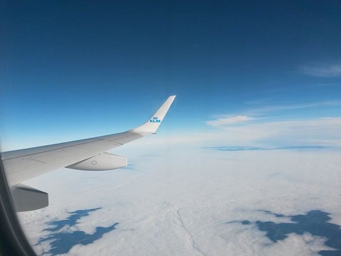
Escale à Amsterdam...
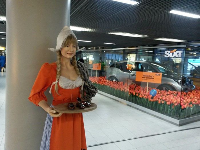
Lundi 1 décembre 2014 Bangkok
Même si c’est hautement probablement faux, on arrive à Bangkok alors qu’il m’a semblé n’avoir, à aucun moment, fermé l’œil. Les habituelles files d’attente à la douane présentent, il faut le souligner, des visages aimables… les bagages...Le taxi (rigolard comme ce n’est plus permis en occident :), l’hôtel...Nickel avec une magnifique terrasse au bord de la Navalaï River...Tous les flags sont au vert ! Tu nous connais, on traîne pas trop avant d’aller découvrir la ville ! On demande notre chemin à un type super accueillant qui hèle aussitôt un môme avec un « tuk tuk », une sorte de mobylette encarénée très appréciée des touristes because costless en diable ! Notre mentor négocie pour 40 baths (1 euro !), un tour des temples du nord. On se laisse driver sans discuter...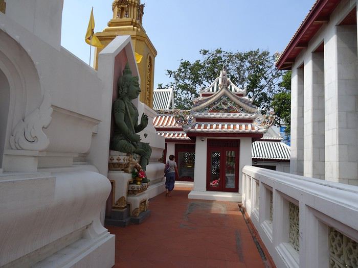
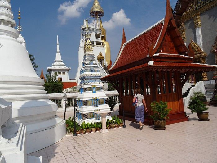
Après le troisième temple, le môme tourne bizarre. Il a arrêté d’être juste aimable. Nous presse. Puis, au milieu d’une visite, nous enjoint de le suivre, il veut nous montrer, dans une certaine urgence, quelque chose. Il nous emmène vers un homme d’âge respectable, une sorte de bonze aimable, affable, qui nous raconte, dans un français correct, sa jeunesse à Bordeaux, puis glisse insensiblement sur la théorie économique et ses inconstances, de la difficulté induite à placer le fruit de notre dur labeur dans quelque chose de pérenne. On le sentait venir. Devine où il est le plus sûr de placer son argent ? Dans la pierre précieuse, naturellement ! Et là, le monde est quand même bien fichu, figure toi que notre interlocuteur connait justement quelques joailliers d’art qui accepteraient de nous vendre à prix coûtant des saphirs de la région, et sans taxes encore! Bon. Le môme nous a embarqués dans un traquenard. On réussit cependant sans trop de difficulté à se débarrasser du fâcheux et reprenons l’expédition où nous l’avions laissée. Quand je demande au môme où se trouve la prochaine destination, je l’oblige à répéter plusieurs fois tant la chose me semble incongrue, mais c’est bien ça, sa réponse s’entend : « Thaï export !». On décide aussitôt d’abandonner la virée. On lâche 40 baths au gamin et sautons de sa mobylette au premier feu rouge. Ensuite, on a agité nos petites mains pour tenter d’attirer un taxi sous le cagnard, un Thaï d’un âge plus que respectable, nous a embarqué dans un véhicule qu’il a eu toute les peines du monde à maintenir sur la route, propulsés dans une sorte de jeu vidéo mortel, un grand thief auto à travers une circulation en délire… Mais ça va. Pour une poignée d’euros il nous a ramené à notre hôtel, sains et saufs ! Là, faut se remettre, pot au bord de la rivière... « Ça doit être possible de faire une ballade sur le fleuve, tu crois pas? » J’en parle à notre hôte à l’accueil, le truc est organisé dans la foulée ! Une efficacité qui laisse ébahi ! On a un bateau pour une virée d’une heure à travers la ville.
En traversant un petit village sur pilotis, je vois nager un drôle de truc, comme un chien. A force d’écarquiller les yeux, on distingue tout un groupe de Varans!
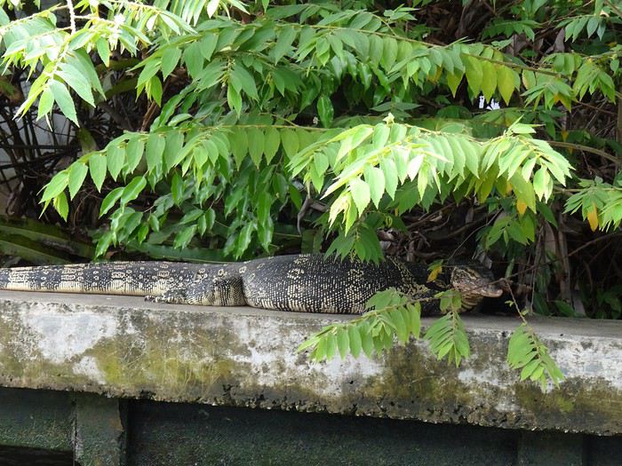
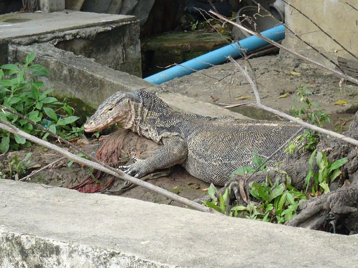
dimanche 30 novembre 2014 Mulhouse - Amsterdam
Bien sûr, tu le sais, ça fait des mois que j’en parle, ce matin on part vers Bangkok, Thaïlande. Pour Dom et moi, la voyago-thérapie : le must pour réduire à rien les agressions du moment, essentiellement liées à des histoires de boulot; mais je vais pas m'égarer là-dedans, ce n'est pas l'endroit!
Escale à Amsterdam...
Lundi 1 décembre 2014 Bangkok
Même si c’est hautement probablement faux, on arrive à Bangkok alors qu’il m’a semblé n’avoir, à aucun moment, fermé l’œil. Les habituelles files d’attente à la douane présentent, il faut le souligner, des visages aimables… les bagages...Le taxi (rigolard comme ce n’est plus permis en occident :), l’hôtel...Nickel avec une magnifique terrasse au bord de la Navalaï River...Tous les flags sont au vert ! Tu nous connais, on traîne pas trop avant d’aller découvrir la ville ! On demande notre chemin à un type super accueillant qui hèle aussitôt un môme avec un « tuk tuk », une sorte de mobylette encarénée très appréciée des touristes because costless en diable ! Notre mentor négocie pour 40 baths (1 euro !), un tour des temples du nord. On se laisse driver sans discuter...
Après le troisième temple, le môme tourne bizarre. Il a arrêté d’être juste aimable. Nous presse. Puis, au milieu d’une visite, nous enjoint de le suivre, il veut nous montrer, dans une certaine urgence, quelque chose. Il nous emmène vers un homme d’âge respectable, une sorte de bonze aimable, affable, qui nous raconte, dans un français correct, sa jeunesse à Bordeaux, puis glisse insensiblement sur la théorie économique et ses inconstances, de la difficulté induite à placer le fruit de notre dur labeur dans quelque chose de pérenne. On le sentait venir. Devine où il est le plus sûr de placer son argent ? Dans la pierre précieuse, naturellement ! Et là, le monde est quand même bien fichu, figure toi que notre interlocuteur connait justement quelques joailliers d’art qui accepteraient de nous vendre à prix coûtant des saphirs de la région, et sans taxes encore! Bon. Le môme nous a embarqués dans un traquenard. On réussit cependant sans trop de difficulté à se débarrasser du fâcheux et reprenons l’expédition où nous l’avions laissée. Quand je demande au môme où se trouve la prochaine destination, je l’oblige à répéter plusieurs fois tant la chose me semble incongrue, mais c’est bien ça, sa réponse s’entend : « Thaï export !». On décide aussitôt d’abandonner la virée. On lâche 40 baths au gamin et sautons de sa mobylette au premier feu rouge. Ensuite, on a agité nos petites mains pour tenter d’attirer un taxi sous le cagnard, un Thaï d’un âge plus que respectable, nous a embarqué dans un véhicule qu’il a eu toute les peines du monde à maintenir sur la route, propulsés dans une sorte de jeu vidéo mortel, un grand thief auto à travers une circulation en délire… Mais ça va. Pour une poignée d’euros il nous a ramené à notre hôtel, sains et saufs ! Là, faut se remettre, pot au bord de la rivière... « Ça doit être possible de faire une ballade sur le fleuve, tu crois pas? » J’en parle à notre hôte à l’accueil, le truc est organisé dans la foulée ! Une efficacité qui laisse ébahi ! On a un bateau pour une virée d’une heure à travers la ville.
En traversant un petit village sur pilotis, je vois nager un drôle de truc, comme un chien. A force d’écarquiller les yeux, on distingue tout un groupe de Varans!
La Dordogne à vélo avec bivouac English translation pending
Bonjour à tous.
Voici que je vais vous présenter le récit de notre troisième périple. Toujours les mêmes protagonistes, c’est-à-dire Mathieu et moi. C’est une nouvelle aventure, mais la même impatience nous tenaille, la même joie des préparatifs la veille du départ et les mêmes papillons dans le ventre quand on prend la route.
Cette année, c’est la Dordogne qui fut désignée par le hasard des dés. Une autre très belle région à découvrir.
Mathieu, à toujours son Bergamon, mais il a abandonné la remorque au profit de belles sacoches artisanales. Dans l’année, j’ai investi dans une nouvelle monture. Un VSF Fahrradmanufaktur TX-Randonneur. C’est un robuste vélo allemand, très bien équipé, avec lequel je m’entraîne depuis le mois de juin. J’y ai rajouté une sacoche de guidon.
Voici notre voyage en quelques chiffres.
Durée : 7 jours
Distance : ~ 484 km
Dénivelé : ~ 5700m D+
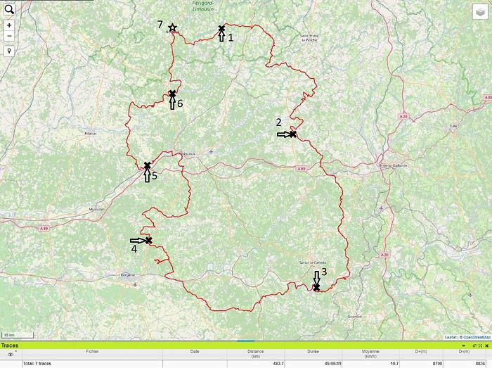
Voici que je vais vous présenter le récit de notre troisième périple. Toujours les mêmes protagonistes, c’est-à-dire Mathieu et moi. C’est une nouvelle aventure, mais la même impatience nous tenaille, la même joie des préparatifs la veille du départ et les mêmes papillons dans le ventre quand on prend la route.
Cette année, c’est la Dordogne qui fut désignée par le hasard des dés. Une autre très belle région à découvrir.
Mathieu, à toujours son Bergamon, mais il a abandonné la remorque au profit de belles sacoches artisanales. Dans l’année, j’ai investi dans une nouvelle monture. Un VSF Fahrradmanufaktur TX-Randonneur. C’est un robuste vélo allemand, très bien équipé, avec lequel je m’entraîne depuis le mois de juin. J’y ai rajouté une sacoche de guidon.
Voici notre voyage en quelques chiffres.
Durée : 7 jours
Distance : ~ 484 km
Dénivelé : ~ 5700m D+
Voyage à vélo prévu ce printemps, qu'envisagez vous? English translation pending
Bonjour,
nous devions partir mi avril pour un voyage à vélo ces jours mais le confinement nous fait repousser la date de départ.
Êtes vous dans ce cas également?
Comment envisagez vous la suite ?
Où et quand partir selon le déconfinement ?
Off to explore Jordan!
Well, since the lockdown is dragging on, I’m starting a new travel journal following the one I finished publishing yesterday:
https://voyageforum.com/discussion/voyage-pays-perles-voyage-dans-ouest-americain-d9943984/
This time, after the U.S., we’re heading to the Middle East—Jordan!
And we’re keeping up the good habits: one day’s entry published every day at 5:30 PM! Happy reading, and feel free to leave a comment, question, or remark...
Franck
Franck
Wild destination: Botswana
It’s been almost six months since we returned from our 15-day trip to Botswana, ending in front of the majestic Victoria Falls in Zimbabwe.
Our itinerary: 1 night at Maun Lodge in Maun 3 nights in the Central Kalahari at Deception Valley Lodge 1 night at Maun Lodge in Maun 3 nights in the Okavango Delta at Sango Safari Camp 3 nights in Chobe National Park at Chobe Safari Lodge 2 nights at Victoria Falls at A’Zambezi River Lodge
We were on a tight budget, so we opted to rent a vehicle for the Central Kalahari and the Okavango Delta.
The lodges are expensive but all-inclusive—meals, drinks (alcohol included), laundry, and the usual two daily safaris. In short, everything.
The lodges mentioned above offer a very high-end experience, with a guide and a 4x4 for each tent. We shared a 4x4 once at Sango Safari with an English couple.
Another little tip: I’d avoid staying at Chobe Riverfront like we did. It’s extremely touristy and overpriced. I think we should’ve spent one night there for the cruise and two other nights at a lodge deeper in Chobe National Park.
We arrived in Maun after an endless flight: Paris-Frankfurt-Johannesburg-Maun. We headed to the car rental agency to pick up our 4x4, and what a surprise to learn they’d canceled our booking—no vehicle! After 6 hours of waiting, we finally received our 4x4 at our hotel, fell asleep peacefully, and were ready to head to our first destination: the Central Kalahari!
Our itinerary: 1 night at Maun Lodge in Maun 3 nights in the Central Kalahari at Deception Valley Lodge 1 night at Maun Lodge in Maun 3 nights in the Okavango Delta at Sango Safari Camp 3 nights in Chobe National Park at Chobe Safari Lodge 2 nights at Victoria Falls at A’Zambezi River Lodge
We were on a tight budget, so we opted to rent a vehicle for the Central Kalahari and the Okavango Delta.
The lodges are expensive but all-inclusive—meals, drinks (alcohol included), laundry, and the usual two daily safaris. In short, everything.
The lodges mentioned above offer a very high-end experience, with a guide and a 4x4 for each tent. We shared a 4x4 once at Sango Safari with an English couple.
Another little tip: I’d avoid staying at Chobe Riverfront like we did. It’s extremely touristy and overpriced. I think we should’ve spent one night there for the cruise and two other nights at a lodge deeper in Chobe National Park.
We arrived in Maun after an endless flight: Paris-Frankfurt-Johannesburg-Maun. We headed to the car rental agency to pick up our 4x4, and what a surprise to learn they’d canceled our booking—no vehicle! After 6 hours of waiting, we finally received our 4x4 at our hotel, fell asleep peacefully, and were ready to head to our first destination: the Central Kalahari!
Islande et îles Féroé en van, petit récit et aspects pratiques English translation pending
De retour d'un voyage en Islande et escale aux îles Féroé, voici un carnet avec surtout des indications pratiques.
Nous sommes partis pratiquement 7 semaines, dont 5 semaines en Islande, du 8 juin au 24 juillet.
Le circuit que nous avons fait en 5 semaines peut se faire en nettement moins de temps, nous n'avions pas envie de courir, voulions avoir de la marge en cas de pépin mécanique, pour ne pas risquer de rater le ferry de retour, et surtout avoir du temps pour s'adapter à la météo le cas échéant.
J'avais préparé un itinéraire, que nous avons en partie modifié en fonction principalement de la météo, afin de profiter des excursions au Landmannalaugar et à Throsmörk dans les meilleures conditions.
Voici donc le programme, assez succinctement ( mais si besoin de détails, ce sera volontiers), puis je reviendrai sur tous les détails pratiques. Je donnerai tous les prix en monnaie locale en général, à chacun de convertir selon le cours du jour.
J 1-2-3 . Trajet de Genève jusqu'à Hirtshals 2 nuits en Allemagne, et une près du port.
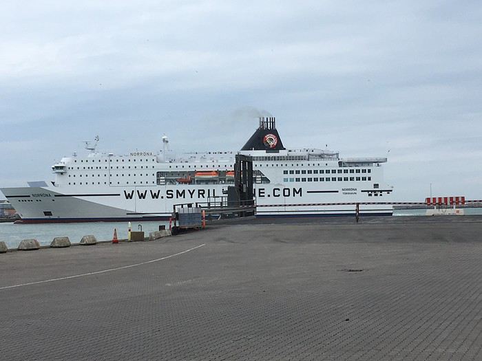
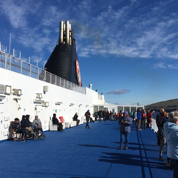
J 3 et 4 en mer. Brève escale à Torshavn,
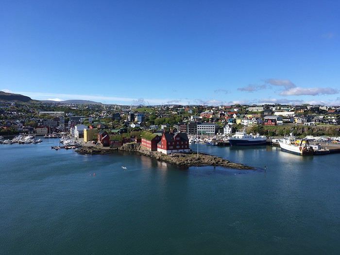
nous descendrons au retour
J 5 arrivée en Islande à 10h30 du matin, échange de la bouteille de gaz, change à la banque, courses à Egilsstadir, et route jusqu'à Modrudalur.
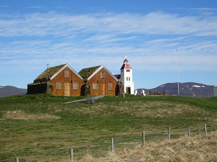
J 1-2-3 . Trajet de Genève jusqu'à Hirtshals 2 nuits en Allemagne, et une près du port.
J 3 et 4 en mer. Brève escale à Torshavn,
nous descendrons au retour
J 5 arrivée en Islande à 10h30 du matin, échange de la bouteille de gaz, change à la banque, courses à Egilsstadir, et route jusqu'à Modrudalur.
Retour sur un voyage au Kenya en sac à dos English translation pending
Nous avons passé 1 mois à visiter le Kenya en essayant de fuir les coins trop touristiques, sur un budget assez restreint (mais le Kenya reste une destination chère, particulièrement les parcs nationaux, pour lesquels il faut prévoir une centaine d’€/jour/personne pour les frais d’entrée et de transport). Déplacements en Matatus (prévoir approximativement ksh 100/heure de trajet), nuits dans des hôtels non répertoriés sur les Lonely Planet ni Bookings pour Ksh 500 à 1500 en fonction du niveau de confort/propreté pour des chambres double.
Meru National Parc: bien que pas très chauds pour les destinations touristiques, un voyage au Kenya sans safari aurait été un blasphème! Nous avons donc choisi ce parc peu couru, possédant une mauvaise réputation liée au braconnage, loin des sentiers touristiques du trio "Masaï Mara, Amboseli, Tsavo". Une journée de safari au milieu des girafes, zèbres, éléphants, hippopotames, zébus, impalas et même rhinocéros, animaux rares mais qui bénéficient d'un programme de réinsertion dans ce parc. En tentant de faire au moins cher, on a passé la première matinée en voiture classique pour ksh 3500 (pour 2 personnes), pas du tout adaptée à ces chemins chaotiques. Le chauffeur a fini par crever sans roue de secours, en plein milieu du parc, au top! Aprèm avec un véhicule plus adapté, un gros Defender avec toit ouvrant. Guides: Vous pouvez contacter Charles (07 24 39 35 17) situé à Maua et obtenir un tarif à Ksh5 000 pour une demi journée ou ksh 8 000 pour la journée complète. Simon (scientifique travaillant dans le parc, qui pourra vous organiser transport et sait où se trouvent les animaux) au 07 25 22 97 72 Shabrack (de l’association Born Free travaillant dans le parc, qui pourra vous organiser transport et sait où se trouvent les animaux) au 07 14 15 28 19
Lac Naivasha : Une des zones les plus touristiques du Kenya, de par sa proximité avec Nairobi, mais la beauté de ses paysages le justifie grandement. Un lac immense, entouré d'une végétation tropicale, et à proximité 2 parcs nationaux : -Mont Longonot et son cratère magnifique : 35 km de vélo depuis Naivasha sur des pistes (mais vous pouvez y aller en Matatu aussi, bcp moins fatiguant), 4h de marche autour du cratère avec un joli petit dénivelé, assez éreintant mais ça vaut le détour. -Hell's Gate National Park : un des seuls parcs nationaux que l'on peut parcourir en vélo puisqu'il n'y a pas de prédateurs. Rouler au milieu des zèbres, des girafes, des zébus, des phacochères et autres animaux à corne est une expérience grandiose
Nous avons dormi au Top camp, en face du Fisherman Camps (même propriétaire mais moins cher: ksh5 000/3nuits). Possibilité de louer des vélos dans les camps (nous avons payé ksh700/jour/2 bons vélos) ou à l’intersection vers Hell’s Gate.
Diani: Nous avons monté une ferme de spiruline à Muhaka, à proximité d’Ukunda, et passons donc pas mal de temps à Diani pour aller à la plage, faire du kite et aller manger au resto. Kite: Diani est un endroit assez approprié au kite (lagon, eau peu profonde, vent régulier bien que pas très fort - 15/25 noeuds) et quelques écoles officient. Elles offrent toutes les mêmes services, aux mêmes prix. Je suis venu avec mon matos (9 et 12m2, un twin et un surf. Une 14m2 est même conseillée parfois, 9m2 pour le foil et parfois en twin tip) mais Je me suis rapproché d’une école de kite, Kenya Kitesurfing school, dirigée par un kenyan vraiment sympa, Good Luke, et dont l’approche d’enseignement m’a semblée intéressante et avec lequel il y a moyen de négocier. Son numéro +254 721 173699 / www.kenyakitesurfingschool.com. -Jamie Hockley - Quest Kiteboarding - Diani Beach
Restaurants: Beaucoup de restaurants pour Muzungus à Diani, pratiquant des prix limite européens. A ce jeu, le restaurant de Nomads tire vraiment son épingle du jeu: nourriture fraiche, locale, raffinée dans un cadre vraiment sympa. Le restaurant japonais sur la route de Diani est lui aussi très bon. En mode local, Swahili Pot, essayez leur Biriani et les frites Massalah. Pareil pour le Tsunami Café à Ukunda.
Mont Kenya: Etant donné que nous avons eu du mal à trouver des informations sur l’ascension du mont Kenya, je vais essayer de retranscrire ce que nous avons pu constater, comprendre et les difficultés que nous avons rencontrées pour réaliser cette ascension avec un petit budget et sans tour opérateur.
Voies d’accès: Comme les guides de voyage l’indiquent, il y a 3 voies principales pour l’ascension du mont Kenya: -Naro Moru : la plus directe et la plus empruntée -Sirimon : ascension plus douce -Chogoria : réputée la plus belle mais un incendie en mars 2019 a ravagé ce versant de la montagne (entre le point d’entrée à 2500m d’altitude et Minto’s hut à 4200m, ce qui équivaut à une journée de marche dans des paysages brûlés) rendant l’ascension peu agréable. J’ai peur qu’il faille au moins une année pour que la montagne se remette de cet incendie. Nous nous sommes faits vendre cette ascension par un guide peu scrupuleux (le fameux Tony recommandé par le guide Lonely Planet, qui officie au transit Motel à Chogoria) qui nous a juré qu’il n’y avait aucun problème et que de toute façon toutes les voies avaient été touchées par l’incendie, ce qui est totalement faux. -Mais il existe aussi 2 autres voies : Timau et Burguret.
Durée de la randonnée et haltes : Tous les guides vous diront qu’il faut 5 jours, voire une semaine, pour tous ces chemins. Ceci étant tout benef. pour eux dans la mesure où le client paye pendant 5 jours des sommes considérables et souvent pour ne marcher que quelques heures la première et la dernière journée. Possibilité de réaliser la randonnée en 3 jours (4 si on veut réaliser le Summit Circuit), à condition d’avoir un bon niveau physique et si possible d’être entraîné à l’altitude et ainsi éviter le mal des montagnes (mais de toute façon celui-ci est difficilement évitable à ces altitudes et aléatoire. Boire bcp d’eau, être bien reposé et bien équipé contre le froid). Jour 1 : Les frais de parc de 52$/jour courant sur 24h, possibilité d’attaquer l’ascension vers 13/14h (cela implique de rentrer dans le parc à 13/14h et d’en sortir ¾ jours plus tard à la même heure et ainsi ne payer que ¾ jours et non 4/5 jours comme le font payer bcp d’agences. Reste à négocier avec vos accompagnants pour les frais) pour marcher une demi journée et dormir à 3000/3500m d’altitude et ainsi s’acclimater (Met Station Hut pour la voie Naro Moru, Old Moses Hut pour Sirimon, entrée du parc ou Road Head pour Chogoria). Jour 2 : ascension jusqu’au camp de base à 4200M (Mackinder’s camp pour Naro Moru, Shimpton’s camp pour Sirimon, Minto’s hut pour Chogoria) et nuit sur place. Jour 3 : Lever à 4h pour le lever du soleil au Point Lenana (à 4895m) et redescente jusqu’au camp de base (arrivé vers 10h, ce qui implique une journée à ne rien faire à 4200m et une nuit très fraiche). Nous conseillons donc de descendre jusqu’à la sortie pour éviter de payer un jour de plus et passer une nuit à se cailler à 4200m d’altitude. Jour 3/4, optionnel : une fois au point Lenana, possibilité de réaliser le summit circuit, splendide, mais sacrément physique après l’ascension du point lenana, puisque cela représente 4/6h de marche supplémentaires, entre 4300 et 4800m d’altitude, avec un D+ estimé à 1500m! La redescente jusqu’à l’entrée du parc dans la même journée devient alors un sacré défi physique (c’est ce que nous avons fait : départ de Minto’s Hut à 4h du matin, ascension du Point Lenana, Summit Circuit, arrivés à Minto’s à 15h puis à l’entrée du parc à 19h, 13h de marche avec plus de 2 000m de D+, 3 000 de D-, vraiment éreintant!).
Possibilité de redescendre par une autre voie : Il est possible de redescendre par une autre voie que celle de la montée (montée par Sirimon et descente par Naro Moru par exemple). Exemple pour le jour 3 : départ pour le Point Lenana à 4h du matin depuis le camp de base de la voie de la montée (Mackinder’s camp pour Naro Moru, Shimpton’s camp pour Sirimon, Minto’s hut pour Chogoria). Pendant ce temps, l’équipe de porteurs/cuisiniers empaque tout et vous rejoindra au camp de base de la voie de la descente (Mackinder’s camp pour Naro Moru, Shimpton’s camp pour Sirimon, Minto’s hut pour Chogoria) pour enchaîner sur la redescente. Un couple rencontré à Nanyuki ont fait l’ascension par la voie Burguret et sont descendus par Sirimon (descente en 1 journée), ce qui implique 3 jours de frais de parc.
Pour nous l’idéal aurait été de réaliser le parcours ainsi : Jour 1 : entrée dans le parc à 13/14h et montée par la voie de Burguret pour dormir à 3200m = acclimatation. Jour 2 : montée au camp de base de Burguret à 4200m Jour 3 : Ascension du point Lenana puis Summit circuit (parcours très physique) pour rejoindre l’équipe de porteurs au camp de base de Sirimon (old Moses Hut) Jour 4 : descente par la voie de Sirimon et sortie du parc avant 14h, ce qui implique 4 jours de frais de parc (ou 3 jours si vous décidez de ne pas faire le Summit Circuit)
Aspect financier : Un marché très lucratif s’est développé autour de cette ascension (comme partout), ce qui est bien pour certains puisque c’est une manne financière considérable, mais malheureusement, seul une infime partie en profite (les guides et agences), exploitant les plus faibles (porteurs, cuisiniers…). A savoir que l’on vous demande 30/25/20$/jour pour un guide/cuisinier/porteur, mais que les cuisiniers/porteurs ne sont pas payés plus de 50/40$ pour la totalité de l’ascension (le salaire moyen au Kenya est de 200$ / mois, à prendre en compte, même s’ils ne réalisent pas cette ascension tous les jours et qu’il faut lisser sur l’année avec des périodes creuses). De même pour les pourboires, énormissimes par rapport à ce que gagne un kenyan (on vous demande souvent 20 à 50$ pour un cuisinier/porteur et souvent le double pour le guide, qui s’en est déjà mis un paquet dans les poches avec les sommes payées). Nous étions 2 et avons payé 100$/jour/personne avec les frais de parc pour un cuisinier et 2 porteurs, mais avec tout le matériel (tente, sacs de couchage -18°C, matelas, vestes chaudes, vêtements de pluie…). C’est peu par rapport à ce que certains déboursent (on a vu des prix sur internet ahurissants) mais beaucoup par rapport par rapport au niveau de vie kenyan. Il doit y avoir moyen de bien mettre les choses au clair avec le guide, bien s’assurer que les porteurs et cuisiniers soient bien payés par rapport aux sommes versées. S’assurer aussi que les déchets soient bien ramenés en ville. Certains endroits, notamment autour des campements, sont recouverts d’immondices. Tous les plats sont recouverts de papier alu, pour conserver la chaleur, mais ce papier finit dans la nature.
Guides pour l’ascension : Comme indiqué, nous avons eu affaire à Anthony, qui officie au Transit Motel de Chogoria et avons été très déçus par son comportement. Il a cherché à nous vendre absolument l’ascension par Chogoria en nous certifiant que la voie n’avait pas subi les effets du feu alors que tout était brûlé. D’autre part il nous a déconseillé de descendre par une autre voie (Sirimon en l'occurrence) dans la mesure où toutes les voies avaient été brûlées, ce qui est faux! Nous avons rencontré plusieurs guides qui semblaient sérieux et honnêtes, à vous de négocier: John Abbas (nous l’avons rencontré sur la voie de Chogoria et il avait l’air très bien et très pro) - johnabasi736@gmail.com / 07 12 16 67 99 Francis Maina (de l’agence Montana Trek Agency à Nanyuki) - info@montanatrekks.com / 07 22 89 12 28 - 06 22 03 72 31 Julius (met in Nanyuki) - jmicanjo@yahoo.com Douglas - 07 11 86 95 10
Nuits avant ascencion: A Chogoria, le Lonely Planet vous conseille le Transit Motel, assez cher, mais le Safari Hotel, en ville, est très bien, et le resto Lenana sert de la très bonne nourriture.
MaTt +336 95 77 71 08 (via Whatsapp)
Meru National Parc: bien que pas très chauds pour les destinations touristiques, un voyage au Kenya sans safari aurait été un blasphème! Nous avons donc choisi ce parc peu couru, possédant une mauvaise réputation liée au braconnage, loin des sentiers touristiques du trio "Masaï Mara, Amboseli, Tsavo". Une journée de safari au milieu des girafes, zèbres, éléphants, hippopotames, zébus, impalas et même rhinocéros, animaux rares mais qui bénéficient d'un programme de réinsertion dans ce parc. En tentant de faire au moins cher, on a passé la première matinée en voiture classique pour ksh 3500 (pour 2 personnes), pas du tout adaptée à ces chemins chaotiques. Le chauffeur a fini par crever sans roue de secours, en plein milieu du parc, au top! Aprèm avec un véhicule plus adapté, un gros Defender avec toit ouvrant. Guides: Vous pouvez contacter Charles (07 24 39 35 17) situé à Maua et obtenir un tarif à Ksh5 000 pour une demi journée ou ksh 8 000 pour la journée complète. Simon (scientifique travaillant dans le parc, qui pourra vous organiser transport et sait où se trouvent les animaux) au 07 25 22 97 72 Shabrack (de l’association Born Free travaillant dans le parc, qui pourra vous organiser transport et sait où se trouvent les animaux) au 07 14 15 28 19
Lac Naivasha : Une des zones les plus touristiques du Kenya, de par sa proximité avec Nairobi, mais la beauté de ses paysages le justifie grandement. Un lac immense, entouré d'une végétation tropicale, et à proximité 2 parcs nationaux : -Mont Longonot et son cratère magnifique : 35 km de vélo depuis Naivasha sur des pistes (mais vous pouvez y aller en Matatu aussi, bcp moins fatiguant), 4h de marche autour du cratère avec un joli petit dénivelé, assez éreintant mais ça vaut le détour. -Hell's Gate National Park : un des seuls parcs nationaux que l'on peut parcourir en vélo puisqu'il n'y a pas de prédateurs. Rouler au milieu des zèbres, des girafes, des zébus, des phacochères et autres animaux à corne est une expérience grandiose
Nous avons dormi au Top camp, en face du Fisherman Camps (même propriétaire mais moins cher: ksh5 000/3nuits). Possibilité de louer des vélos dans les camps (nous avons payé ksh700/jour/2 bons vélos) ou à l’intersection vers Hell’s Gate.
Diani: Nous avons monté une ferme de spiruline à Muhaka, à proximité d’Ukunda, et passons donc pas mal de temps à Diani pour aller à la plage, faire du kite et aller manger au resto. Kite: Diani est un endroit assez approprié au kite (lagon, eau peu profonde, vent régulier bien que pas très fort - 15/25 noeuds) et quelques écoles officient. Elles offrent toutes les mêmes services, aux mêmes prix. Je suis venu avec mon matos (9 et 12m2, un twin et un surf. Une 14m2 est même conseillée parfois, 9m2 pour le foil et parfois en twin tip) mais Je me suis rapproché d’une école de kite, Kenya Kitesurfing school, dirigée par un kenyan vraiment sympa, Good Luke, et dont l’approche d’enseignement m’a semblée intéressante et avec lequel il y a moyen de négocier. Son numéro +254 721 173699 / www.kenyakitesurfingschool.com. -Jamie Hockley - Quest Kiteboarding - Diani Beach
Restaurants: Beaucoup de restaurants pour Muzungus à Diani, pratiquant des prix limite européens. A ce jeu, le restaurant de Nomads tire vraiment son épingle du jeu: nourriture fraiche, locale, raffinée dans un cadre vraiment sympa. Le restaurant japonais sur la route de Diani est lui aussi très bon. En mode local, Swahili Pot, essayez leur Biriani et les frites Massalah. Pareil pour le Tsunami Café à Ukunda.
Mont Kenya: Etant donné que nous avons eu du mal à trouver des informations sur l’ascension du mont Kenya, je vais essayer de retranscrire ce que nous avons pu constater, comprendre et les difficultés que nous avons rencontrées pour réaliser cette ascension avec un petit budget et sans tour opérateur.
Voies d’accès: Comme les guides de voyage l’indiquent, il y a 3 voies principales pour l’ascension du mont Kenya: -Naro Moru : la plus directe et la plus empruntée -Sirimon : ascension plus douce -Chogoria : réputée la plus belle mais un incendie en mars 2019 a ravagé ce versant de la montagne (entre le point d’entrée à 2500m d’altitude et Minto’s hut à 4200m, ce qui équivaut à une journée de marche dans des paysages brûlés) rendant l’ascension peu agréable. J’ai peur qu’il faille au moins une année pour que la montagne se remette de cet incendie. Nous nous sommes faits vendre cette ascension par un guide peu scrupuleux (le fameux Tony recommandé par le guide Lonely Planet, qui officie au transit Motel à Chogoria) qui nous a juré qu’il n’y avait aucun problème et que de toute façon toutes les voies avaient été touchées par l’incendie, ce qui est totalement faux. -Mais il existe aussi 2 autres voies : Timau et Burguret.
Durée de la randonnée et haltes : Tous les guides vous diront qu’il faut 5 jours, voire une semaine, pour tous ces chemins. Ceci étant tout benef. pour eux dans la mesure où le client paye pendant 5 jours des sommes considérables et souvent pour ne marcher que quelques heures la première et la dernière journée. Possibilité de réaliser la randonnée en 3 jours (4 si on veut réaliser le Summit Circuit), à condition d’avoir un bon niveau physique et si possible d’être entraîné à l’altitude et ainsi éviter le mal des montagnes (mais de toute façon celui-ci est difficilement évitable à ces altitudes et aléatoire. Boire bcp d’eau, être bien reposé et bien équipé contre le froid). Jour 1 : Les frais de parc de 52$/jour courant sur 24h, possibilité d’attaquer l’ascension vers 13/14h (cela implique de rentrer dans le parc à 13/14h et d’en sortir ¾ jours plus tard à la même heure et ainsi ne payer que ¾ jours et non 4/5 jours comme le font payer bcp d’agences. Reste à négocier avec vos accompagnants pour les frais) pour marcher une demi journée et dormir à 3000/3500m d’altitude et ainsi s’acclimater (Met Station Hut pour la voie Naro Moru, Old Moses Hut pour Sirimon, entrée du parc ou Road Head pour Chogoria). Jour 2 : ascension jusqu’au camp de base à 4200M (Mackinder’s camp pour Naro Moru, Shimpton’s camp pour Sirimon, Minto’s hut pour Chogoria) et nuit sur place. Jour 3 : Lever à 4h pour le lever du soleil au Point Lenana (à 4895m) et redescente jusqu’au camp de base (arrivé vers 10h, ce qui implique une journée à ne rien faire à 4200m et une nuit très fraiche). Nous conseillons donc de descendre jusqu’à la sortie pour éviter de payer un jour de plus et passer une nuit à se cailler à 4200m d’altitude. Jour 3/4, optionnel : une fois au point Lenana, possibilité de réaliser le summit circuit, splendide, mais sacrément physique après l’ascension du point lenana, puisque cela représente 4/6h de marche supplémentaires, entre 4300 et 4800m d’altitude, avec un D+ estimé à 1500m! La redescente jusqu’à l’entrée du parc dans la même journée devient alors un sacré défi physique (c’est ce que nous avons fait : départ de Minto’s Hut à 4h du matin, ascension du Point Lenana, Summit Circuit, arrivés à Minto’s à 15h puis à l’entrée du parc à 19h, 13h de marche avec plus de 2 000m de D+, 3 000 de D-, vraiment éreintant!).
Possibilité de redescendre par une autre voie : Il est possible de redescendre par une autre voie que celle de la montée (montée par Sirimon et descente par Naro Moru par exemple). Exemple pour le jour 3 : départ pour le Point Lenana à 4h du matin depuis le camp de base de la voie de la montée (Mackinder’s camp pour Naro Moru, Shimpton’s camp pour Sirimon, Minto’s hut pour Chogoria). Pendant ce temps, l’équipe de porteurs/cuisiniers empaque tout et vous rejoindra au camp de base de la voie de la descente (Mackinder’s camp pour Naro Moru, Shimpton’s camp pour Sirimon, Minto’s hut pour Chogoria) pour enchaîner sur la redescente. Un couple rencontré à Nanyuki ont fait l’ascension par la voie Burguret et sont descendus par Sirimon (descente en 1 journée), ce qui implique 3 jours de frais de parc.
Pour nous l’idéal aurait été de réaliser le parcours ainsi : Jour 1 : entrée dans le parc à 13/14h et montée par la voie de Burguret pour dormir à 3200m = acclimatation. Jour 2 : montée au camp de base de Burguret à 4200m Jour 3 : Ascension du point Lenana puis Summit circuit (parcours très physique) pour rejoindre l’équipe de porteurs au camp de base de Sirimon (old Moses Hut) Jour 4 : descente par la voie de Sirimon et sortie du parc avant 14h, ce qui implique 4 jours de frais de parc (ou 3 jours si vous décidez de ne pas faire le Summit Circuit)
Aspect financier : Un marché très lucratif s’est développé autour de cette ascension (comme partout), ce qui est bien pour certains puisque c’est une manne financière considérable, mais malheureusement, seul une infime partie en profite (les guides et agences), exploitant les plus faibles (porteurs, cuisiniers…). A savoir que l’on vous demande 30/25/20$/jour pour un guide/cuisinier/porteur, mais que les cuisiniers/porteurs ne sont pas payés plus de 50/40$ pour la totalité de l’ascension (le salaire moyen au Kenya est de 200$ / mois, à prendre en compte, même s’ils ne réalisent pas cette ascension tous les jours et qu’il faut lisser sur l’année avec des périodes creuses). De même pour les pourboires, énormissimes par rapport à ce que gagne un kenyan (on vous demande souvent 20 à 50$ pour un cuisinier/porteur et souvent le double pour le guide, qui s’en est déjà mis un paquet dans les poches avec les sommes payées). Nous étions 2 et avons payé 100$/jour/personne avec les frais de parc pour un cuisinier et 2 porteurs, mais avec tout le matériel (tente, sacs de couchage -18°C, matelas, vestes chaudes, vêtements de pluie…). C’est peu par rapport à ce que certains déboursent (on a vu des prix sur internet ahurissants) mais beaucoup par rapport par rapport au niveau de vie kenyan. Il doit y avoir moyen de bien mettre les choses au clair avec le guide, bien s’assurer que les porteurs et cuisiniers soient bien payés par rapport aux sommes versées. S’assurer aussi que les déchets soient bien ramenés en ville. Certains endroits, notamment autour des campements, sont recouverts d’immondices. Tous les plats sont recouverts de papier alu, pour conserver la chaleur, mais ce papier finit dans la nature.
Guides pour l’ascension : Comme indiqué, nous avons eu affaire à Anthony, qui officie au Transit Motel de Chogoria et avons été très déçus par son comportement. Il a cherché à nous vendre absolument l’ascension par Chogoria en nous certifiant que la voie n’avait pas subi les effets du feu alors que tout était brûlé. D’autre part il nous a déconseillé de descendre par une autre voie (Sirimon en l'occurrence) dans la mesure où toutes les voies avaient été brûlées, ce qui est faux! Nous avons rencontré plusieurs guides qui semblaient sérieux et honnêtes, à vous de négocier: John Abbas (nous l’avons rencontré sur la voie de Chogoria et il avait l’air très bien et très pro) - johnabasi736@gmail.com / 07 12 16 67 99 Francis Maina (de l’agence Montana Trek Agency à Nanyuki) - info@montanatrekks.com / 07 22 89 12 28 - 06 22 03 72 31 Julius (met in Nanyuki) - jmicanjo@yahoo.com Douglas - 07 11 86 95 10
Nuits avant ascencion: A Chogoria, le Lonely Planet vous conseille le Transit Motel, assez cher, mais le Safari Hotel, en ville, est très bien, et le resto Lenana sert de la très bonne nourriture.
MaTt +336 95 77 71 08 (via Whatsapp)
Conseils Mont Kenya, voies et guides English translation pending
Etant donné que nous avons eu du mal à trouver des informations sur l’ascension du mont Kenya, je vais essayer de retranscrire ce que nous avons pu constater, comprendre et les difficultés que nous avons rencontrées pour réaliser cette ascension avec un petit budget et sans tour opérateur.
Voies d’accès: Comme les guides de voyage l’indiquent, il y a 3 voies principales pour l’ascension du mont Kenya: -Moru : la plus directe et la plus empruntée -Sirimon : ascension plus douce -Chogoria : réputée la plus belle mais un incendie en mars 2019 a ravagé ce versant de la montagne (entre le point d’entrée à 2500m d’altitude et Minto’s hut à 4200m, ce qui équivaut à une journée de marche dans des paysages brûlés) rendant l’ascension peu agréable. J’ai peur qu’il faille au moins une année pour que la montagne se remette de cet incendie. Nous nous sommes faits vendre cette ascension par un guide peu scrupuleux (le fameux Tony recommandé par le guide Lonely Planet, qui officie au transit Motel à Chogoria) qui nous a juré qu’il n’y avait aucun problème et que de toute façon toutes les voies avaient été touchées par l’incendie, ce qui est totalement faux. -Mais il existe aussi 2 autres voies : Timau et Burguret.
Durée de la randonnée et haltes : Tous les guides vous diront qu’il faut 5 jours, voire une semaine, pour tous ces chemins. Ceci étant tout benef. pour eux dans la mesure où le client paye pendant 5 jours des sommes considérables et souvent pour ne marcher que quelques heures la première et la dernière journée. Possibilité de réaliser la randonnée en 3 jours (4 si on veut réaliser le Summit Circuit), à condition d’avoir un bon niveau physique et si possible d’être entraîné à l’altitude et ainsi éviter le mal des montagnes (mais de toute façon celui-ci est difficilement évitable à ces altitudes et aléatoire. Boire bcp d’eau, être bien reposé et bien équipé contre le froid). Jour 1 : Les frais de parc de 52$/jour courant sur 24h, possibilité d’attaquer l’ascension vers 13/14h (cela implique de rentrer dans le parc à 13/14h et d’en sortir ¾ jours plus tard à la même heure et ainsi ne payer que ¾ jours et non 4/5 jours comme le font payer bcp d’agences. Reste à négocier avec vos accompagnants pour les frais) pour marcher une demi journée et dormir à 3000/3500m d’altitude et ainsi s’acclimater (Met Station Hut pour la voie Naro Moru, Old Moses Hut pour Sirimon, entrée du parc ou Road Head pour Chogoria). Jour 2 : ascension jusqu’au camp de base à 4200M (Mackinder’s camp pour Naro Moru, Shimpton’s camp pour Sirimon, Minto’s hut pour Chogoria) et nuit sur place. Jour 3 : Lever à 4h pour le lever du soleil au Point Lenana (à 4895m) et redescente jusqu’au camp de base (arrivé vers 10h, ce qui implique une journée à ne rien faire à 4200m et une nuit très fraiche). Nous conseillons donc de descendre jusqu’à la sortie pour éviter de payer un jour de plus et passer une nuit à se cailler à 4200m d’altitude. Jour 3/4, optionnel : une fois au point Lenana, possibilité de réaliser le summit circuit, splendide, mais sacrément physique après l’ascension du point lenana, puisque cela représente 4/6h de marche supplémentaires, entre 4300 et 4800m d’altitude, avec un D+ estimé à 1500m! La redescente jusqu’à l’entrée du parc dans la même journée devient alors un sacré défi physique (c’est ce que nous avons fait : départ de Minto’s Hut à 4h du matin, ascension du Point Lenana, Summit Circuit, arrivés à Minto’s à 15h puis à l’entrée du parc à 19h, 13h de marche avec plus de 2 000m de D+, 3 000 de D-, vraiment éreintant!).
Possibilité de redescendre par une autre voie : Il est possible de redescendre par une autre voie que celle de la montée (montée par Sirimon et descente par Naro Moru par exemple). Exemple pour le jour 3 : départ pour le Point Lenana à 4h du matin depuis le camp de base de la voie de la montée (Mackinder’s camp pour Naro Moru, Shimpton’s camp pour Sirimon, Minto’s hut pour Chogoria). Pendant ce temps, l’équipe de porteurs/cuisiniers empaque tout et vous rejoindra au camp de base de la voie de la descente (Mackinder’s camp pour Naro Moru, Shimpton’s camp pour Sirimon, Minto’s hut pour Chogoria) pour enchaîner sur la redescente. Un couple rencontré à Nanyuki ont fait l’ascension par la voie Burguret et sont descendus par Sirimon (descente en 1 journée), ce qui implique 3 jours de frais de parc.
Pour nous l’idéal aurait été de réaliser le parcours ainsi : Jour 1 : entrée dans le parc à 13/14h et montée par la voie de Burguret pour dormir à 3200m = acclimatation. Jour 2 : montée au camp de base de Burguret à 4200m Jour 3 : Ascension du point Lenana puis Summit circuit (parcours très physique) pour rejoindre l’équipe de porteurs au camp de base de Sirimon (old Moses Hut) Jour 4 : descente par la voie de Sirimon et sortie du parc avant 14h, ce qui implique 4 jours de frais de parc (ou 3 jours si vous décidez de ne pas faire le Summit Circuit)
Aspect financier : Un marché très lucratif s’est développé autour de cette ascension (comme partout), ce qui est bien pour certains puisque c’est une manne financière considérable, mais malheureusement, seul une infime partie en profite (les guides et agences), exploitant les plus faibles (porteurs, cuisiniers…). A savoir que l’on vous demande 30/25/20$/jour pour un guide/cuisinier/porteur, mais que les cuisiniers/porteurs ne sont pas payés plus de 50/40$ pour la totalité de l’ascension (le salaire moyen au Kenya est de 200$ / mois, à prendre en compte, même s’ils ne réalisent pas cette ascension tous les jours et qu’il faut lisser sur l’année avec des périodes creuses). De même pour les pourboires, énormissimes par rapport à ce que gagne un kenyan (on vous demande souvent 20 à 50$ pour un cuisinier/porteur et souvent le double pour le guide, qui s’en est déjà mis un paquet dans les poches avec les sommes payées). Nous étions 2 et avons payé 100$/jour/personne avec les frais de parc pour un cuisinier et 2 porteurs, mais avec tout le matériel (tente, sacs de couchage -18°C, matelas, vestes chaudes, vêtements de pluie…). C’est peu par rapport à ce que certains déboursent (on a vu des prix sur internet ahurissants) mais beaucoup par rapport par rapport au niveau de vie kenyan. Il doit y avoir moyen de bien mettre les choses au clair avec le guide, bien s’assurer que les porteurs et cuisiniers soient bien payés par rapport aux sommes versées. S’assurer aussi que les déchets soient bien ramenés en ville. Certains endroits, notamment autour des campements, sont recouverts d’immondices. Tous les plats sont recouverts de papier alu, pour conserver la chaleur, mais ce papier finit dans la nature.
Guides pour l’ascension : Comme indiqué, nous avons eu affaire à Anthony, qui officie au Transit Motel de Chogoria et avons été très déçus par son comportement. Il a cherché à nous vendre absolument l’ascension par Chogoria en nous certifiant que la voie n’avait pas subi les effets du feu alors que tout était brûlé. D’autre part il nous a déconseillé de descendre par une autre voie (Sirimon en l'occurrence) dans la mesure où toutes les voies avaient été brûlées, ce qui est faux! Nous avons rencontré plusieurs guides qui semblaient sérieux et honnêtes, à vous de négocier: John Abbas (nous l’avons rencontré sur la voie de Chogoria et il avait l’air très bien et très pro) - johnabasi736@gmail.com / 07 12 16 67 99 Francis Maina (de l’agence Montana Trek Agency à Nanyuki) - info@montanatrekks.com / 07 22 89 12 28 - 06 22 03 72 31 Julius (met in Nanyuki) - jmicanjo@yahoo.com Douglas - 07 11 86 95 10
Nuits avant ascencion: A Chogoria, le Lonely Planet vous conseille le Transit Motel, assez cher, mais le Safari Hotel, en ville, est très bien, et le resto Lenana sert de la très bonne nourriture.
MaTt +336 95 77 71 08 (via Whatsapp)
Voies d’accès: Comme les guides de voyage l’indiquent, il y a 3 voies principales pour l’ascension du mont Kenya: -Moru : la plus directe et la plus empruntée -Sirimon : ascension plus douce -Chogoria : réputée la plus belle mais un incendie en mars 2019 a ravagé ce versant de la montagne (entre le point d’entrée à 2500m d’altitude et Minto’s hut à 4200m, ce qui équivaut à une journée de marche dans des paysages brûlés) rendant l’ascension peu agréable. J’ai peur qu’il faille au moins une année pour que la montagne se remette de cet incendie. Nous nous sommes faits vendre cette ascension par un guide peu scrupuleux (le fameux Tony recommandé par le guide Lonely Planet, qui officie au transit Motel à Chogoria) qui nous a juré qu’il n’y avait aucun problème et que de toute façon toutes les voies avaient été touchées par l’incendie, ce qui est totalement faux. -Mais il existe aussi 2 autres voies : Timau et Burguret.
Durée de la randonnée et haltes : Tous les guides vous diront qu’il faut 5 jours, voire une semaine, pour tous ces chemins. Ceci étant tout benef. pour eux dans la mesure où le client paye pendant 5 jours des sommes considérables et souvent pour ne marcher que quelques heures la première et la dernière journée. Possibilité de réaliser la randonnée en 3 jours (4 si on veut réaliser le Summit Circuit), à condition d’avoir un bon niveau physique et si possible d’être entraîné à l’altitude et ainsi éviter le mal des montagnes (mais de toute façon celui-ci est difficilement évitable à ces altitudes et aléatoire. Boire bcp d’eau, être bien reposé et bien équipé contre le froid). Jour 1 : Les frais de parc de 52$/jour courant sur 24h, possibilité d’attaquer l’ascension vers 13/14h (cela implique de rentrer dans le parc à 13/14h et d’en sortir ¾ jours plus tard à la même heure et ainsi ne payer que ¾ jours et non 4/5 jours comme le font payer bcp d’agences. Reste à négocier avec vos accompagnants pour les frais) pour marcher une demi journée et dormir à 3000/3500m d’altitude et ainsi s’acclimater (Met Station Hut pour la voie Naro Moru, Old Moses Hut pour Sirimon, entrée du parc ou Road Head pour Chogoria). Jour 2 : ascension jusqu’au camp de base à 4200M (Mackinder’s camp pour Naro Moru, Shimpton’s camp pour Sirimon, Minto’s hut pour Chogoria) et nuit sur place. Jour 3 : Lever à 4h pour le lever du soleil au Point Lenana (à 4895m) et redescente jusqu’au camp de base (arrivé vers 10h, ce qui implique une journée à ne rien faire à 4200m et une nuit très fraiche). Nous conseillons donc de descendre jusqu’à la sortie pour éviter de payer un jour de plus et passer une nuit à se cailler à 4200m d’altitude. Jour 3/4, optionnel : une fois au point Lenana, possibilité de réaliser le summit circuit, splendide, mais sacrément physique après l’ascension du point lenana, puisque cela représente 4/6h de marche supplémentaires, entre 4300 et 4800m d’altitude, avec un D+ estimé à 1500m! La redescente jusqu’à l’entrée du parc dans la même journée devient alors un sacré défi physique (c’est ce que nous avons fait : départ de Minto’s Hut à 4h du matin, ascension du Point Lenana, Summit Circuit, arrivés à Minto’s à 15h puis à l’entrée du parc à 19h, 13h de marche avec plus de 2 000m de D+, 3 000 de D-, vraiment éreintant!).
Possibilité de redescendre par une autre voie : Il est possible de redescendre par une autre voie que celle de la montée (montée par Sirimon et descente par Naro Moru par exemple). Exemple pour le jour 3 : départ pour le Point Lenana à 4h du matin depuis le camp de base de la voie de la montée (Mackinder’s camp pour Naro Moru, Shimpton’s camp pour Sirimon, Minto’s hut pour Chogoria). Pendant ce temps, l’équipe de porteurs/cuisiniers empaque tout et vous rejoindra au camp de base de la voie de la descente (Mackinder’s camp pour Naro Moru, Shimpton’s camp pour Sirimon, Minto’s hut pour Chogoria) pour enchaîner sur la redescente. Un couple rencontré à Nanyuki ont fait l’ascension par la voie Burguret et sont descendus par Sirimon (descente en 1 journée), ce qui implique 3 jours de frais de parc.
Pour nous l’idéal aurait été de réaliser le parcours ainsi : Jour 1 : entrée dans le parc à 13/14h et montée par la voie de Burguret pour dormir à 3200m = acclimatation. Jour 2 : montée au camp de base de Burguret à 4200m Jour 3 : Ascension du point Lenana puis Summit circuit (parcours très physique) pour rejoindre l’équipe de porteurs au camp de base de Sirimon (old Moses Hut) Jour 4 : descente par la voie de Sirimon et sortie du parc avant 14h, ce qui implique 4 jours de frais de parc (ou 3 jours si vous décidez de ne pas faire le Summit Circuit)
Aspect financier : Un marché très lucratif s’est développé autour de cette ascension (comme partout), ce qui est bien pour certains puisque c’est une manne financière considérable, mais malheureusement, seul une infime partie en profite (les guides et agences), exploitant les plus faibles (porteurs, cuisiniers…). A savoir que l’on vous demande 30/25/20$/jour pour un guide/cuisinier/porteur, mais que les cuisiniers/porteurs ne sont pas payés plus de 50/40$ pour la totalité de l’ascension (le salaire moyen au Kenya est de 200$ / mois, à prendre en compte, même s’ils ne réalisent pas cette ascension tous les jours et qu’il faut lisser sur l’année avec des périodes creuses). De même pour les pourboires, énormissimes par rapport à ce que gagne un kenyan (on vous demande souvent 20 à 50$ pour un cuisinier/porteur et souvent le double pour le guide, qui s’en est déjà mis un paquet dans les poches avec les sommes payées). Nous étions 2 et avons payé 100$/jour/personne avec les frais de parc pour un cuisinier et 2 porteurs, mais avec tout le matériel (tente, sacs de couchage -18°C, matelas, vestes chaudes, vêtements de pluie…). C’est peu par rapport à ce que certains déboursent (on a vu des prix sur internet ahurissants) mais beaucoup par rapport par rapport au niveau de vie kenyan. Il doit y avoir moyen de bien mettre les choses au clair avec le guide, bien s’assurer que les porteurs et cuisiniers soient bien payés par rapport aux sommes versées. S’assurer aussi que les déchets soient bien ramenés en ville. Certains endroits, notamment autour des campements, sont recouverts d’immondices. Tous les plats sont recouverts de papier alu, pour conserver la chaleur, mais ce papier finit dans la nature.
Guides pour l’ascension : Comme indiqué, nous avons eu affaire à Anthony, qui officie au Transit Motel de Chogoria et avons été très déçus par son comportement. Il a cherché à nous vendre absolument l’ascension par Chogoria en nous certifiant que la voie n’avait pas subi les effets du feu alors que tout était brûlé. D’autre part il nous a déconseillé de descendre par une autre voie (Sirimon en l'occurrence) dans la mesure où toutes les voies avaient été brûlées, ce qui est faux! Nous avons rencontré plusieurs guides qui semblaient sérieux et honnêtes, à vous de négocier: John Abbas (nous l’avons rencontré sur la voie de Chogoria et il avait l’air très bien et très pro) - johnabasi736@gmail.com / 07 12 16 67 99 Francis Maina (de l’agence Montana Trek Agency à Nanyuki) - info@montanatrekks.com / 07 22 89 12 28 - 06 22 03 72 31 Julius (met in Nanyuki) - jmicanjo@yahoo.com Douglas - 07 11 86 95 10
Nuits avant ascencion: A Chogoria, le Lonely Planet vous conseille le Transit Motel, assez cher, mais le Safari Hotel, en ville, est très bien, et le resto Lenana sert de la très bonne nourriture.
MaTt +336 95 77 71 08 (via Whatsapp)
Tour du Manaslu: tarif? English translation pending
Bonjour
Avec mon compagnon nous allons partir pour le Népal dans deux semaines. Nous avons pris le même guide que son frère pour faire le tour des Annapurnas l'année dernière.
Il nous propose 1850 USD par personne... en regardant sur d'autres sites de trekeurs, je remarque que ce tarif est celui payé pour deux personnes en moyenne... soit moins de 1000€ par personne.
Est-ce que nous sommes en train de nous faire arnaquer? Si on peut parler d'arnaque (nous ne partons pas avec une agence afin de verser la totalité de l'argent au guide et aux sherpas). Il faut savoir que nous serons que deux personnes.
Quel est votre avis? Avez-vous des guides à nous conseiller?
Merci d'avance,
Vanessa
Avec mon compagnon nous allons partir pour le Népal dans deux semaines. Nous avons pris le même guide que son frère pour faire le tour des Annapurnas l'année dernière.
Il nous propose 1850 USD par personne... en regardant sur d'autres sites de trekeurs, je remarque que ce tarif est celui payé pour deux personnes en moyenne... soit moins de 1000€ par personne.
Est-ce que nous sommes en train de nous faire arnaquer? Si on peut parler d'arnaque (nous ne partons pas avec une agence afin de verser la totalité de l'argent au guide et aux sherpas). Il faut savoir que nous serons que deux personnes.
Quel est votre avis? Avez-vous des guides à nous conseiller?
Merci d'avance,
Vanessa
Acceptation du risque en voyage English translation pending
Risque et voyage
Chacun d’entre nous dans ses choix de voyages prend en considération le facteur risque sous toutes ses formes. Chacun a sa propre tolérance au risque en voyage. Pour certains il faut tout planifier pour essayer de faire disparaître toute surprise en espérant minimiser le risque. Pour d’autres le risque et le côté aventureux d’un voyage sont des moteurs qui les font partir.
Il me semble que deux mondes se côtoient, sans vraiment se comprendre. Cette remarque me vient en lisant les réponses à certaines demandes de renseignement, tout particulièrement lorsqu’il s’agit de voyage à vélo. Je pense à un post récent d’une amie qui demandait des renseignements sur un pays à la frontière de l’Europe et de l’Asie. Pour ma part il m’est aussi arrivé d’être traité d’inconscient, voire une fois d’assassin en faisant part de mon vécu ou en donnant des conseils.
Et que dire de ce camarade qui, il y a deux ou trois ans a traversé le Soudan à vélo en solitaire. Il relate son expérience en parlant d’une population très accueillante, et il n’a jamais eu le moindre problème, alors que l'on nous parle sans arrêt de guerre.
Y-at-il d’un côté des fous et des inconscients et de l’autre des gens raisonnables ? Certes on va me répondre qu’un otage cela coûte très cher à récupérer, ou qu’un blessé à sauver dans les Grandes Jorasses cela coûte aussi cher, et il met en danger la vie des sauveteurs.
D’ailleurs, il y a sans doute une corrélation entre acceptation du risque en voyage et alpinisme. Les deux personnes dont je parle au-dessus ont été des alpinistes de haut niveau, pour ma part cela a aussi été l’activité que j’ai le plus pratiquée. J’ai constaté que dans les voyages à vélo « un peu engagés » la proportion d’alpinistes était loin d’être négligeable. Et malheureusement, toutes les personnes, ou presque, qui ont pratiqué l’alpinisme difficile ont perdu plusieurs de leurs amis dans cette pratique. Cela donnerait-il une vision décalée dans l’appréciation des risques et des responsabilités du fait de l’acceptation d’une certaine fatalité ?
Et vous, comment vivez-vous l’idée du risque en voyage, et considérez-vous que certains s’engagent trop ? Luc
Chacun d’entre nous dans ses choix de voyages prend en considération le facteur risque sous toutes ses formes. Chacun a sa propre tolérance au risque en voyage. Pour certains il faut tout planifier pour essayer de faire disparaître toute surprise en espérant minimiser le risque. Pour d’autres le risque et le côté aventureux d’un voyage sont des moteurs qui les font partir.
Il me semble que deux mondes se côtoient, sans vraiment se comprendre. Cette remarque me vient en lisant les réponses à certaines demandes de renseignement, tout particulièrement lorsqu’il s’agit de voyage à vélo. Je pense à un post récent d’une amie qui demandait des renseignements sur un pays à la frontière de l’Europe et de l’Asie. Pour ma part il m’est aussi arrivé d’être traité d’inconscient, voire une fois d’assassin en faisant part de mon vécu ou en donnant des conseils.
Et que dire de ce camarade qui, il y a deux ou trois ans a traversé le Soudan à vélo en solitaire. Il relate son expérience en parlant d’une population très accueillante, et il n’a jamais eu le moindre problème, alors que l'on nous parle sans arrêt de guerre.
Y-at-il d’un côté des fous et des inconscients et de l’autre des gens raisonnables ? Certes on va me répondre qu’un otage cela coûte très cher à récupérer, ou qu’un blessé à sauver dans les Grandes Jorasses cela coûte aussi cher, et il met en danger la vie des sauveteurs.
D’ailleurs, il y a sans doute une corrélation entre acceptation du risque en voyage et alpinisme. Les deux personnes dont je parle au-dessus ont été des alpinistes de haut niveau, pour ma part cela a aussi été l’activité que j’ai le plus pratiquée. J’ai constaté que dans les voyages à vélo « un peu engagés » la proportion d’alpinistes était loin d’être négligeable. Et malheureusement, toutes les personnes, ou presque, qui ont pratiqué l’alpinisme difficile ont perdu plusieurs de leurs amis dans cette pratique. Cela donnerait-il une vision décalée dans l’appréciation des risques et des responsabilités du fait de l’acceptation d’une certaine fatalité ?
Et vous, comment vivez-vous l’idée du risque en voyage, et considérez-vous que certains s’engagent trop ? Luc
Les animaux du Maroc (et aussi au Maroc) English translation pending
Bonjour,
L'idée d'un sujet sur les animaux du et au Maroc ayant été lancée, je me décide en espérant que ce carnet vivent longtemps, avec les contributions de toutes et tous . Les animaux du Maroc réservent au voyageur curieux un nombre infini d'émotions, qu'ils soient sauvages ou domestiques . Qui n'a pas photographié lors d'un séjour un chat particulièrement beau, ou un caméléon, une cigogne, un chameau….. Les animaux sont partout au Maroc, et me semble-t-il bien plus présent qu'en France, par exemple . Alors commençons….
Commençons dans le merveilleux jardin exotique de Marcel François , à Bouknadel, à une dizaine de kms au Nord de Salé . On y accède soit par l'autoroute, soit par la nationale 1 . J'y étais donc il y a 3 jours et j'ai rencontré ce couple . Comme on dit : plus beau que çà, tu meurs ! . On m'a dit qu'il s'agissait de canards flamboyants ( ? ) , mais peut-être que quelqu'un pourra confirmer ?
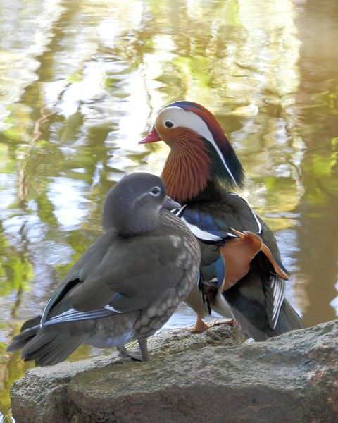
L'idée d'un sujet sur les animaux du et au Maroc ayant été lancée, je me décide en espérant que ce carnet vivent longtemps, avec les contributions de toutes et tous . Les animaux du Maroc réservent au voyageur curieux un nombre infini d'émotions, qu'ils soient sauvages ou domestiques . Qui n'a pas photographié lors d'un séjour un chat particulièrement beau, ou un caméléon, une cigogne, un chameau….. Les animaux sont partout au Maroc, et me semble-t-il bien plus présent qu'en France, par exemple . Alors commençons….
Commençons dans le merveilleux jardin exotique de Marcel François , à Bouknadel, à une dizaine de kms au Nord de Salé . On y accède soit par l'autoroute, soit par la nationale 1 . J'y étais donc il y a 3 jours et j'ai rencontré ce couple . Comme on dit : plus beau que çà, tu meurs ! . On m'a dit qu'il s'agissait de canards flamboyants ( ? ) , mais peut-être que quelqu'un pourra confirmer ?
Namibie et Afrique du Sud, paysages à couper le souffle English translation pending
Bonjour,
Jamais deux sans trois. Eh oui, nous sommes devenus accros à la Namibie et pour varier un peu, nous avons ajouté quelques étapes en Afrique du Sud.
Ce fut un voyage magnifique, le sud de la Namibie est un enchantement pour les yeux. En Afrique du Sud, nous sommes tombés sous le charme du Richtersveld NP. Ce parc est tout simplement sublime ! Augrabies Falls fut la bonne surprise du voyage, les chutes sont presque trop aménagées, mais le parc lui-même est très beau. En ce qui concerne le KTP, nous avons eu quelques doutes en l’incluant dans l’itinéraire. Certains voyageurs ont été chanceux et ont vu beaucoup de félins et pour d’autres, ce parc fut une déception. Déception ou pas, vous verrez dans le carnet.
J’aimerais remercier Jean-Luc (Voyajou) qui m’a encouragé d’aller au Richtersveld, Attila qui m’a rassuré sur l’état des pistes du parc, Jacky (Jety34) qui m’a donné envie de faire une étape à Kokerboomkloof. Sans eux, nous serions passés à côté de ce parc aux paysages magnifiques et sauvages.
Merci aussi à Michel (Michel85200) pour m’avoir encouragé de passer minimum deux nuits aux Augrabies Falls. Il a même écrit qu’on pouvait y rester trois nuits sans s’ennuyer et il a bien raison. Nous y sommes restés deux nuits, mais nous aurions pu rester une troisième sans avoir l’impression de perdre notre temps. Pour le Richtersveld, Jacky a écrit qu’il serait dommage d’y rester seulement une ou deux nuits. Nous avons passé trois nuits dans ce parc et ne le regrettons absolument pas.
Jacques (Blancond) et Jean-François (Max68), avec leurs photos nous ont donné envie de faire le Tok Tokkie Trail. Un grand merci à eux !
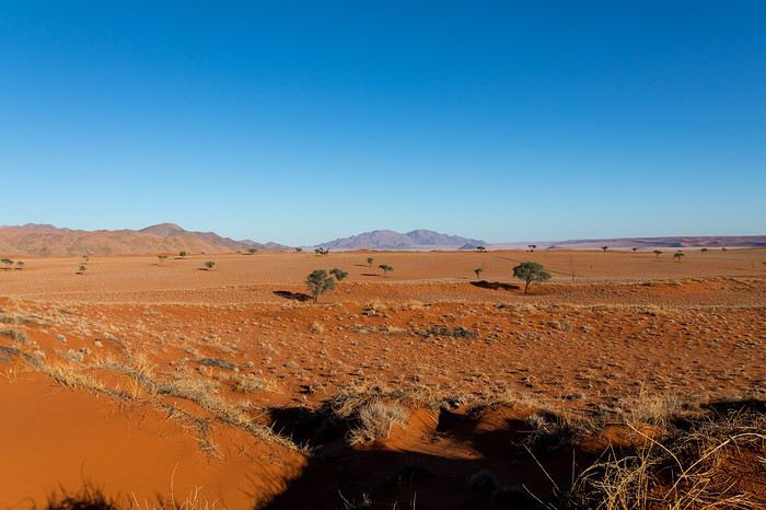
Namibrand Tok Tokkie Trail
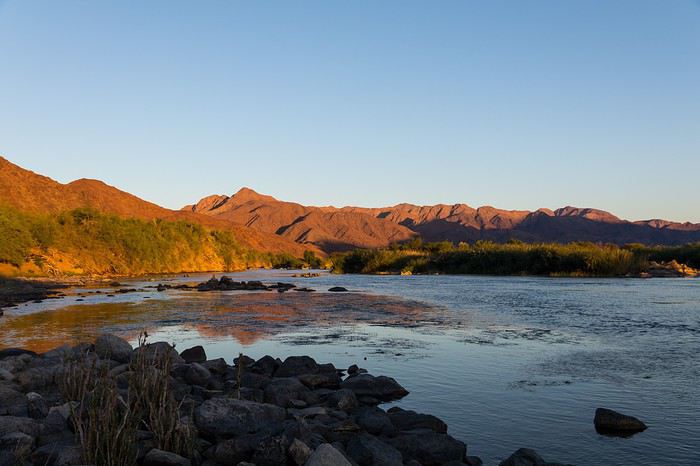 Richtersveld, Richtersberg Camp
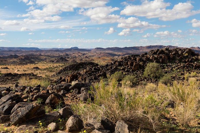
Augrabies Falls NP
Pour les réservations, nous sommes à nouveau passés par Tourmaline qui a fait un travail formidable. J’ai échangé beaucoup de mails avec Carole, jusqu’à ce que l’itinéraire soit bouclé. Nous avions une grande inconnue, en voyageant au mois de mars-avril, nous ne pouvions pas être sûrs de pouvoir traverser l’Orange River à Sendelingsdrif. En effet, s’il y a trop d’eau, le bac ne traverse pas et il faut faire le détour par Oranjemund. Bref, c’était un casse-tête et je ne voulais pas prendre le risque de perdre une nuit au Richtersveld. Tourmaline nous a finalement conseillé de laisser l’étape avant et celle après le Richtersveld libre et de nous adapter selon la météo et la possibilité de traverser l’Orange River en bac.
Tourmaline a fait les réservations une année avant notre départ, seul les réservations des parcs en Afrique du Sud se sont fait un peu plus tard (11 mois avant). En ce qui concerne la voiture, nous nous sommes fait plaisir en réservant un Toyota Hilux Safari avec boîte automatique de chez Asco et je peux vous assurer que nous ne l'avons pas regretté. Quelle voiture formidable !
En ce qui concerne la période du voyage, nous avions envie de voir la Namibie « verte » et ce fut mission accomplie. Voyager en mars-avril comporte quelques risques au niveau météo. Les orages et pluies peuvent perturber certains trajets et rendre les pistes boueuses. Néanmoins, nous avons beaucoup aimé cette période de l’année, même s’il fait encore un peu chaud pour faire des longues randonnées.
Notre itinéraire (en parenthèse les étapes prévues lors de la réservation) :
24.03. Départ de Zurich 25.03. Windhoek, Londiningi B&B 26.03 Tsauchaub River Camp, Oerwald campsite 27.03. Sesriem, NWR Sesriem 28.03. Namibrand Tok Tokkie Trail 29.03. Namibrand Tok Tokkie Trail 30.03. Namtib Biosphere Reserve, camping 31.03. Aus, Klein Aus Vista camp 01.04. Aus, Klein Aus Vista camp 02.04. Fish River Canyon, NWR Hobas 03.04. Norotshama River camp (étape libre) 04.04. Richtersberg NP, Richtersberg (Potjiespram) 05.04. Richtersberg NP, Richtersberg 06.04. Richtersberg NP, Kokerboomkloof (Richtersberg) 07.04. Port Nolloth, hôtel Scotia Inn (étape libre) 08.04. Augrabies Falls, camp du parc 09.04. Augrabies Falls, camp du parc 10.04. KTP, Twee Rivieren camp 11.04. KTP, Nossob camp 12.04. KTP, Bitterpan 13.04. KTP, Mata Mata camp 14.04. Red Dunes Camp 15.04. Auas Safari Lodge 16.04. Départ de Windhoek
Jamais deux sans trois. Eh oui, nous sommes devenus accros à la Namibie et pour varier un peu, nous avons ajouté quelques étapes en Afrique du Sud.
Ce fut un voyage magnifique, le sud de la Namibie est un enchantement pour les yeux. En Afrique du Sud, nous sommes tombés sous le charme du Richtersveld NP. Ce parc est tout simplement sublime ! Augrabies Falls fut la bonne surprise du voyage, les chutes sont presque trop aménagées, mais le parc lui-même est très beau. En ce qui concerne le KTP, nous avons eu quelques doutes en l’incluant dans l’itinéraire. Certains voyageurs ont été chanceux et ont vu beaucoup de félins et pour d’autres, ce parc fut une déception. Déception ou pas, vous verrez dans le carnet.
J’aimerais remercier Jean-Luc (Voyajou) qui m’a encouragé d’aller au Richtersveld, Attila qui m’a rassuré sur l’état des pistes du parc, Jacky (Jety34) qui m’a donné envie de faire une étape à Kokerboomkloof. Sans eux, nous serions passés à côté de ce parc aux paysages magnifiques et sauvages.
Merci aussi à Michel (Michel85200) pour m’avoir encouragé de passer minimum deux nuits aux Augrabies Falls. Il a même écrit qu’on pouvait y rester trois nuits sans s’ennuyer et il a bien raison. Nous y sommes restés deux nuits, mais nous aurions pu rester une troisième sans avoir l’impression de perdre notre temps. Pour le Richtersveld, Jacky a écrit qu’il serait dommage d’y rester seulement une ou deux nuits. Nous avons passé trois nuits dans ce parc et ne le regrettons absolument pas.
Jacques (Blancond) et Jean-François (Max68), avec leurs photos nous ont donné envie de faire le Tok Tokkie Trail. Un grand merci à eux !
Namibrand Tok Tokkie Trail
Richtersveld, Richtersberg CampAugrabies Falls NP
Pour les réservations, nous sommes à nouveau passés par Tourmaline qui a fait un travail formidable. J’ai échangé beaucoup de mails avec Carole, jusqu’à ce que l’itinéraire soit bouclé. Nous avions une grande inconnue, en voyageant au mois de mars-avril, nous ne pouvions pas être sûrs de pouvoir traverser l’Orange River à Sendelingsdrif. En effet, s’il y a trop d’eau, le bac ne traverse pas et il faut faire le détour par Oranjemund. Bref, c’était un casse-tête et je ne voulais pas prendre le risque de perdre une nuit au Richtersveld. Tourmaline nous a finalement conseillé de laisser l’étape avant et celle après le Richtersveld libre et de nous adapter selon la météo et la possibilité de traverser l’Orange River en bac.
Tourmaline a fait les réservations une année avant notre départ, seul les réservations des parcs en Afrique du Sud se sont fait un peu plus tard (11 mois avant). En ce qui concerne la voiture, nous nous sommes fait plaisir en réservant un Toyota Hilux Safari avec boîte automatique de chez Asco et je peux vous assurer que nous ne l'avons pas regretté. Quelle voiture formidable !
En ce qui concerne la période du voyage, nous avions envie de voir la Namibie « verte » et ce fut mission accomplie. Voyager en mars-avril comporte quelques risques au niveau météo. Les orages et pluies peuvent perturber certains trajets et rendre les pistes boueuses. Néanmoins, nous avons beaucoup aimé cette période de l’année, même s’il fait encore un peu chaud pour faire des longues randonnées.
Notre itinéraire (en parenthèse les étapes prévues lors de la réservation) :
24.03. Départ de Zurich 25.03. Windhoek, Londiningi B&B 26.03 Tsauchaub River Camp, Oerwald campsite 27.03. Sesriem, NWR Sesriem 28.03. Namibrand Tok Tokkie Trail 29.03. Namibrand Tok Tokkie Trail 30.03. Namtib Biosphere Reserve, camping 31.03. Aus, Klein Aus Vista camp 01.04. Aus, Klein Aus Vista camp 02.04. Fish River Canyon, NWR Hobas 03.04. Norotshama River camp (étape libre) 04.04. Richtersberg NP, Richtersberg (Potjiespram) 05.04. Richtersberg NP, Richtersberg 06.04. Richtersberg NP, Kokerboomkloof (Richtersberg) 07.04. Port Nolloth, hôtel Scotia Inn (étape libre) 08.04. Augrabies Falls, camp du parc 09.04. Augrabies Falls, camp du parc 10.04. KTP, Twee Rivieren camp 11.04. KTP, Nossob camp 12.04. KTP, Bitterpan 13.04. KTP, Mata Mata camp 14.04. Red Dunes Camp 15.04. Auas Safari Lodge 16.04. Départ de Windhoek
Afrique du Sud : de Cape Town à Johannesburg, des safaris et bien d'autres découvertes English translation pending
Depuis que nous avons fondé notre famille composée à présent de 3 enfants, Maxime, Rachel et Timéo, âgés respectivement de 11, 9 et 5 ans, nous entretenions le doux rêve de les emmener un jour en Afrique australe pour leur faire découvrir (et au passage à nous aussi) les animaux de la savane. Timéo allant bientôt souffler sa 6e bougie, on a décidé qu'on avait assez patienté et qu'il était en âge de conserver des souvenirs de ce voyage qui promettait d'être mémorable.
On sera particulièrement chanceux avec les lions
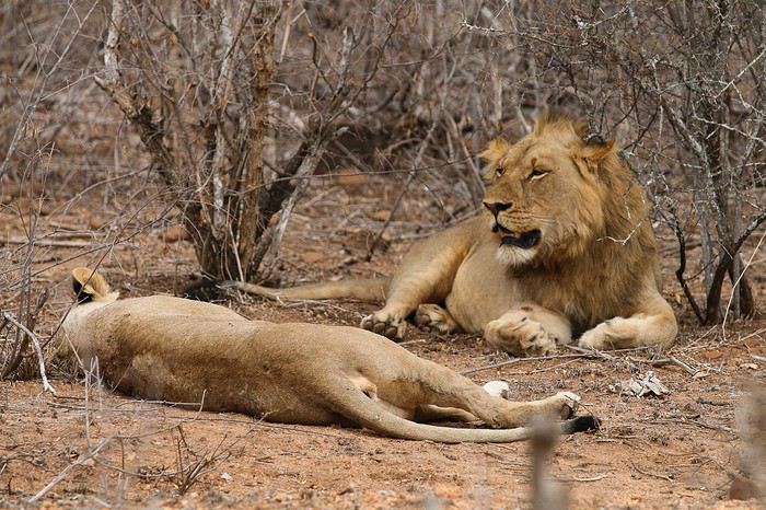
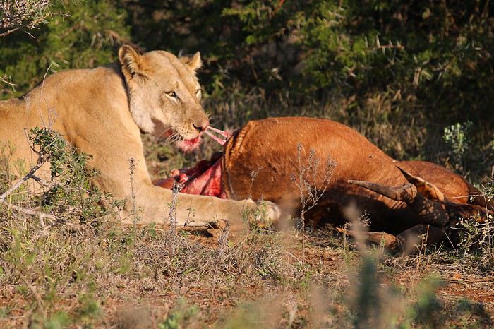
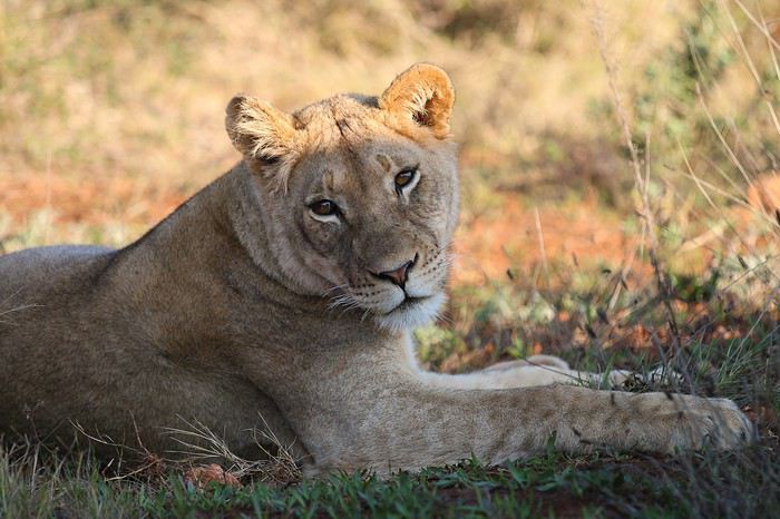
mais pas que...
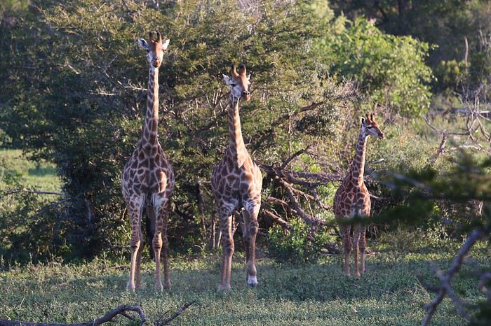
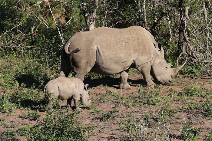
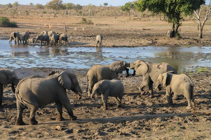
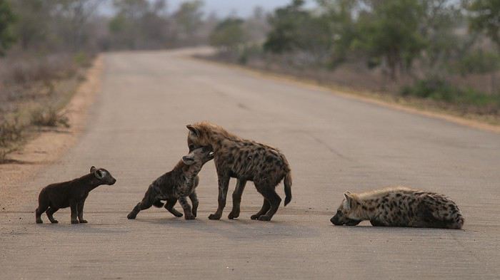
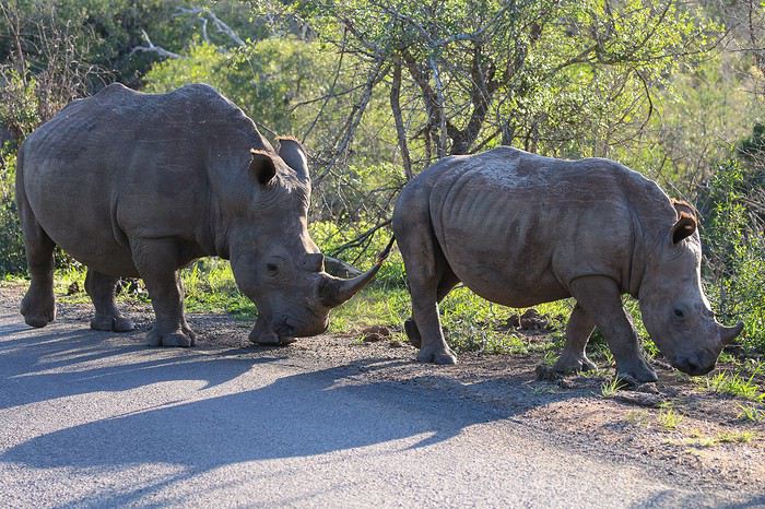
On a longtemps hésité à partir 3 semaines en faisant un parcours classique, à savoir 4-5 jours dans la région du Cap, puis une boucle autour de Johannesburg nous faisant passer par le Drakensberg, Santa Lucia, le Swaziland, le parc Kruger et le secteur de Sabie-Graskop. Mais comme on avait possibilité, exceptionnellement, de disposer de 4 semaines, on a finalement décidé de rajouter à la boucle classique la traversée du pays de Cape Town vers le Drakensberg en longeant la cote.
Pour minimiser les problèmes d'insécurité et satisfaire des grands-parents quelque peu inquiets, je décide d'éviter toutes les grandes villes, en particulier Johannesburg et Durban, exception faite de Cape Town où on passera tout de même 3 jours.
Voici le programme sommaire du 23 juillet au 21 août 2016
- Le Cap (3 jours) - Hermanus - De Hoop Nature Reserve - Wilderness NP - Tsitsikamma NP - Addo Elephant NP (1,5 j) - Golden Gate NP - Royal Natal NP - Eshowe - Santa Lucia - Hluhluwe Umfolozi Park (1,5 j) - Swaziland (3 jours) - Parc Kruger (4 jours) - Blyde River Canyon et Three Rondavels - Bourke's Luck Potholes - Chutes d'eau autour de Sabie
Avion : Vol Qatar Airways Francfort – Cape Town puis retour Johannesburg – Francfort : 3660 € A l'origine on avait réservé en septembre 2015 un vol FRA-JNB aller-retour et un vol intérieur JNB – CPT dès l'arrivée car c'était financièrement plus intéressant. Mais une modification des horaires de vol imposée par Qatar ne nous a plus permis de prendre le vol intérieur. C'est Qatar Airways qui nous a contactés pour s'assurer que le décalage du vol international de nous posait pas problème. J'ai eu à peine le temps d'expliquer qu'on était embêtés pour avoir la correspondance vers Cape Town, que déjà l'hôtesse a contacté son supérieur, et 20 secondes plus tard, elle validait un vol aller direct vers Cape Town. Y a pas à dire, c'est la classe comme service clientèle !
J'annule sans trop de conviction les 5 billets South african Airways censés être non annulables et non remboursables, et on aura la surprise d'avoir le remboursement de 80% de la somme versée au départ !
Budget : Vol : 3700 € Location voiture + Drop-off : 1400 € via BIDVEST, qu'on recommande chaleureusement car leur service clientèle a été tout simplement exceptionnel ! (je donnerai les détails dans le récit) Essence : 450 € 25 restos :1300 €, soit 50 € par resto Nuitées :1500 € (20 nuits en hôtels-auberges et 7 nuits en camping dans les coins les plus touristiques du Kruger, Blyde River Canyon et Sabie) Courses + souvenirs (bague au Swaziland, sculptures en bois, toiles swazi, bougies swazi...) 900 € Entrées parcs + Wild card : 485 € Sortie Hélicoptère au Cap : 365 € pour 12-15 mn Soit un total de 10100 € à 5 pour 4 semaines, soit un coût moyen de 500 €/personne/semaine.
Et maintenant, place au récit et aux images...
On sera particulièrement chanceux avec les lions
mais pas que...
On a longtemps hésité à partir 3 semaines en faisant un parcours classique, à savoir 4-5 jours dans la région du Cap, puis une boucle autour de Johannesburg nous faisant passer par le Drakensberg, Santa Lucia, le Swaziland, le parc Kruger et le secteur de Sabie-Graskop. Mais comme on avait possibilité, exceptionnellement, de disposer de 4 semaines, on a finalement décidé de rajouter à la boucle classique la traversée du pays de Cape Town vers le Drakensberg en longeant la cote.
Pour minimiser les problèmes d'insécurité et satisfaire des grands-parents quelque peu inquiets, je décide d'éviter toutes les grandes villes, en particulier Johannesburg et Durban, exception faite de Cape Town où on passera tout de même 3 jours.
Voici le programme sommaire du 23 juillet au 21 août 2016
- Le Cap (3 jours) - Hermanus - De Hoop Nature Reserve - Wilderness NP - Tsitsikamma NP - Addo Elephant NP (1,5 j) - Golden Gate NP - Royal Natal NP - Eshowe - Santa Lucia - Hluhluwe Umfolozi Park (1,5 j) - Swaziland (3 jours) - Parc Kruger (4 jours) - Blyde River Canyon et Three Rondavels - Bourke's Luck Potholes - Chutes d'eau autour de Sabie
Avion : Vol Qatar Airways Francfort – Cape Town puis retour Johannesburg – Francfort : 3660 € A l'origine on avait réservé en septembre 2015 un vol FRA-JNB aller-retour et un vol intérieur JNB – CPT dès l'arrivée car c'était financièrement plus intéressant. Mais une modification des horaires de vol imposée par Qatar ne nous a plus permis de prendre le vol intérieur. C'est Qatar Airways qui nous a contactés pour s'assurer que le décalage du vol international de nous posait pas problème. J'ai eu à peine le temps d'expliquer qu'on était embêtés pour avoir la correspondance vers Cape Town, que déjà l'hôtesse a contacté son supérieur, et 20 secondes plus tard, elle validait un vol aller direct vers Cape Town. Y a pas à dire, c'est la classe comme service clientèle !
J'annule sans trop de conviction les 5 billets South african Airways censés être non annulables et non remboursables, et on aura la surprise d'avoir le remboursement de 80% de la somme versée au départ !
Budget : Vol : 3700 € Location voiture + Drop-off : 1400 € via BIDVEST, qu'on recommande chaleureusement car leur service clientèle a été tout simplement exceptionnel ! (je donnerai les détails dans le récit) Essence : 450 € 25 restos :1300 €, soit 50 € par resto Nuitées :1500 € (20 nuits en hôtels-auberges et 7 nuits en camping dans les coins les plus touristiques du Kruger, Blyde River Canyon et Sabie) Courses + souvenirs (bague au Swaziland, sculptures en bois, toiles swazi, bougies swazi...) 900 € Entrées parcs + Wild card : 485 € Sortie Hélicoptère au Cap : 365 € pour 12-15 mn Soit un total de 10100 € à 5 pour 4 semaines, soit un coût moyen de 500 €/personne/semaine.
Et maintenant, place au récit et aux images...
Rencontre avec des vélos solaires et découverte du verglas d'été au Maroc English translation pending
Mercredi 13 Septembre 2017 Balaruc Sète 9 km
Je suis le seul participant à la randonnée Solarbike 2017 a avoir dormi au camping de Balaruc où était prévu le regroupement. Retardés les autres n’arriveront que pour le départ du bateau de 20h à Sète.
Voir préambule : voyageforum.com/...post=8369614#8369614
J’ai donc toute la journée pour plier ma tente et réorganiser mes bagages. J’en profite pour redresser les sardines de mon tapis de sol beaucoup moins rigides que les piquets de ma tente et qui ont déjà souffert de mes 3 premières nuits.
Au téléphone Thomas m’avait invité à télécharger l’application ZENLY www.numerama.com/...-de-la-snap-map.html Cela permet de localiser ses amis si la fonction GPS de leur Smartphone est activée et qu’ils sont connectés. En fin de matinée, je m’étonne de toujours voir Thomas et Francine à 65 km de Sète à l’endroit où ils ont dormi. Toujours pas d’info sur la page Facebook jusqu’à qu’enfin apparaisse : SUPER INQUIET CE MATIN MON HANDBIKE NE DEMARRE PLUS. 1 heure QU ON CHERCHE En fait ils perdront plusieurs heures avant de comprendre que l’interrupteur n’est jamais passant et de le shunter. Alors qu’ayant gagné Sète, je profite de la terrasse d’un restaurant quai du Mistral, j’ignore qu’eux vont commencer une course contre la montre pour embarquer avant le départ du ferry.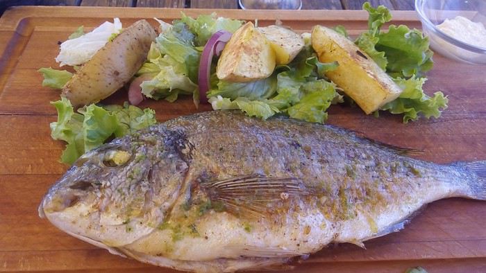
Je m’offre une daurade et une dame blanche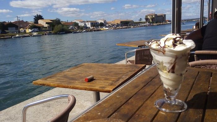 en regardant passer des bateaux de touristes surbaissés adaptés au pont de chemin de fer.
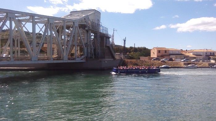 Il s’agit du pont à bascule proche de la gare. Puis je me promène en ville en achetant quelques vivres.
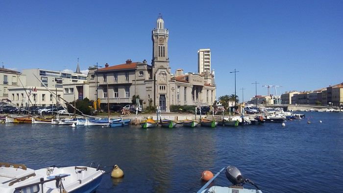 Peu après 17h je gagne la gare maritime. Une camionnette italienne attire mon attention et je fais connaissance d’Adalberto qui prépare son tricycle couché et sa remorque.
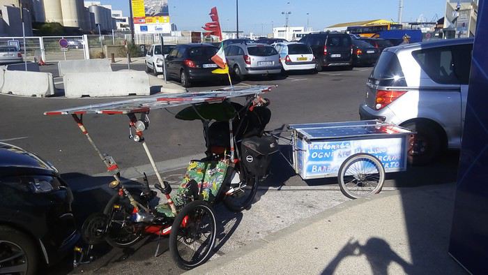 Les 2 sont recouverts de panneaux solaires et il a déjà participé comme Thomas Papay au Sun Trip www.thesuntrip.com/presentation/. Il parle bien français, nous échangeons et je lui offre du raisin que je viens d’acheter. Puis je surveille son attelage pendant qu’il se repose sur le matelas dans son fourgon. Il pensait le laisser stationner là pendant 2 mois. Un marocain vivant en France et qui vient assister à tous les départs de bateaux lui déconseille et l’accompagne à un garage peu couteux. Mais comme le propriétaire est absent, Adalberto est contraint de lui laisser les clés. Cela commence sous le signe de la confiance internationale. Ils reviennent tous les 2 sur le scooter du sétois. Puis arrive Francis avec son tricycle sur la remorque de sa voiture. Il a roulé avec les participants depuis la Savoie mais il ne pourra pas pour des raisons de calendrier embarqué pour le Maroc. Il confirme qu’ils sont en retard. Avec lui je monte les escaliers pour aller au guichet. L’hôtesse qui demande nos prénoms ne trouve pas nos réservations. Pas de Francine, Thomas, Joy ou Gilles. En fait c’est un peu compliqué : Joy n’est pas son vrai prénom, il s’appelle Thierry et le billet est au nom Thomas qui se prénomme en fait Pierre-Thomas. Je m’inquiète pour son accès au guichet mais il n’aura pas besoin de monter à l’étage (non équipé d’ascenseur). Il suffira de présenter nos 4 passeports pour avoir les tickets d’embarquement. Adalberto lui n’a pas demandé à Francine de lui acheté sa place préférant régler au dernier moment. Si vous avez réussi à suivre, nous serons 5 à embarquer pour cette aventure : Thomas paraplégique et initiateur de ce raid, Joy qui sera son aide, Francine qui a participé à l’organisation, Adalberto et moi. Enfin s’ils arrivent avant le départ du ferry.
Peu après 18h Thomas arrive avec Francine. Ils ont roulés jusqu’à 70 km/h sur la voie rapide. Alors que je viens lui dire bonjour, pour notre premier contact il sert affectueusement son bras au niveau de mes cuisses pour il me semble me féliciter de mes premiers 350 km et m’encourager. Je découvre son handbike
Les 2 sont recouverts de panneaux solaires et il a déjà participé comme Thomas Papay au Sun Trip www.thesuntrip.com/presentation/. Il parle bien français, nous échangeons et je lui offre du raisin que je viens d’acheter. Puis je surveille son attelage pendant qu’il se repose sur le matelas dans son fourgon. Il pensait le laisser stationner là pendant 2 mois. Un marocain vivant en France et qui vient assister à tous les départs de bateaux lui déconseille et l’accompagne à un garage peu couteux. Mais comme le propriétaire est absent, Adalberto est contraint de lui laisser les clés. Cela commence sous le signe de la confiance internationale. Ils reviennent tous les 2 sur le scooter du sétois. Puis arrive Francis avec son tricycle sur la remorque de sa voiture. Il a roulé avec les participants depuis la Savoie mais il ne pourra pas pour des raisons de calendrier embarqué pour le Maroc. Il confirme qu’ils sont en retard. Avec lui je monte les escaliers pour aller au guichet. L’hôtesse qui demande nos prénoms ne trouve pas nos réservations. Pas de Francine, Thomas, Joy ou Gilles. En fait c’est un peu compliqué : Joy n’est pas son vrai prénom, il s’appelle Thierry et le billet est au nom Thomas qui se prénomme en fait Pierre-Thomas. Je m’inquiète pour son accès au guichet mais il n’aura pas besoin de monter à l’étage (non équipé d’ascenseur). Il suffira de présenter nos 4 passeports pour avoir les tickets d’embarquement. Adalberto lui n’a pas demandé à Francine de lui acheté sa place préférant régler au dernier moment. Si vous avez réussi à suivre, nous serons 5 à embarquer pour cette aventure : Thomas paraplégique et initiateur de ce raid, Joy qui sera son aide, Francine qui a participé à l’organisation, Adalberto et moi. Enfin s’ils arrivent avant le départ du ferry.
Peu après 18h Thomas arrive avec Francine. Ils ont roulés jusqu’à 70 km/h sur la voie rapide. Alors que je viens lui dire bonjour, pour notre premier contact il sert affectueusement son bras au niveau de mes cuisses pour il me semble me féliciter de mes premiers 350 km et m’encourager. Je découvre son handbike
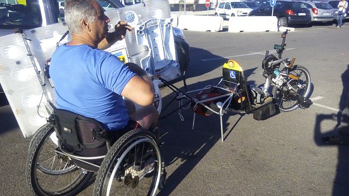 dont les roues servent également à son fauteuil pour limiter le poids.
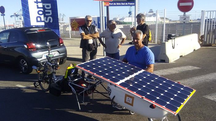 Je retrouve avec plaisir Francine. Mais Joy n’a pas pu suivre car il a une roue crevée sur sa remorque ce qui le ralentit.
ll n’arrive qu’à 18h30 épuisé. Nous sommes les derniers à embarquer.
Un contrôleur de billet se souvient d’avoir vu embarquer il y a un an Paul Bermejo avec son tricycle couché solaire : voyageforum.com/...post=7621147#7621147
Difficile de passer inaperçu avec de tels véhicules. Mais il semble que de simples vélos soient déjà rares. Rien n’est prévu pour. L’équipage philippin nous propose des sangles pour les arrimer aux crochets implantés régulièrement dans le sol métallique.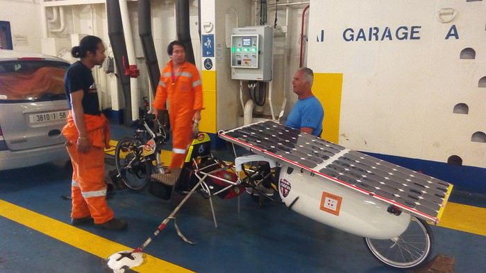 Pour les tricycles déjà stables sur leur roue pas de problème pour mon VTT je ne vois que la solution de le coucher.
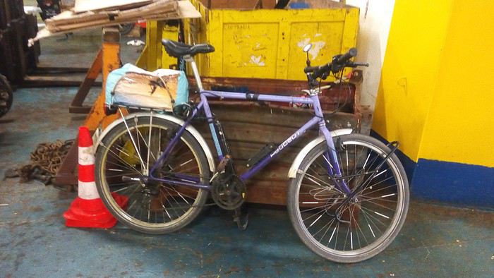 Un philippin me propose de le sangler contre une caisse en métal. Je laisse ma tente sur le porte bagage et emmène mes 5 sacoches jusqu’à la cabine que je partage avec Francine et Adalberto. Thomas et Joy dormiront dans une cabine avec sanitaire adapté aux Personnes à Mobilité Réduite que Francine avait retenue en achetant nos billets.
Sur le pont quelques membres du personnel immortalisent le départ de cette traversée qui va durer 37 h.
Un philippin me propose de le sangler contre une caisse en métal. Je laisse ma tente sur le porte bagage et emmène mes 5 sacoches jusqu’à la cabine que je partage avec Francine et Adalberto. Thomas et Joy dormiront dans une cabine avec sanitaire adapté aux Personnes à Mobilité Réduite que Francine avait retenue en achetant nos billets.
Sur le pont quelques membres du personnel immortalisent le départ de cette traversée qui va durer 37 h.
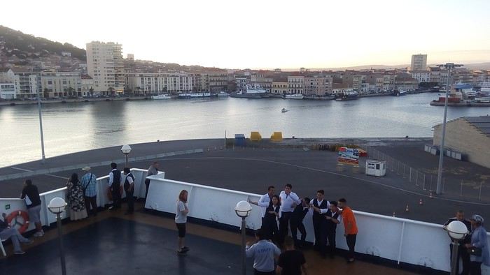 Nous quittons Sète en même temps que le soleil.
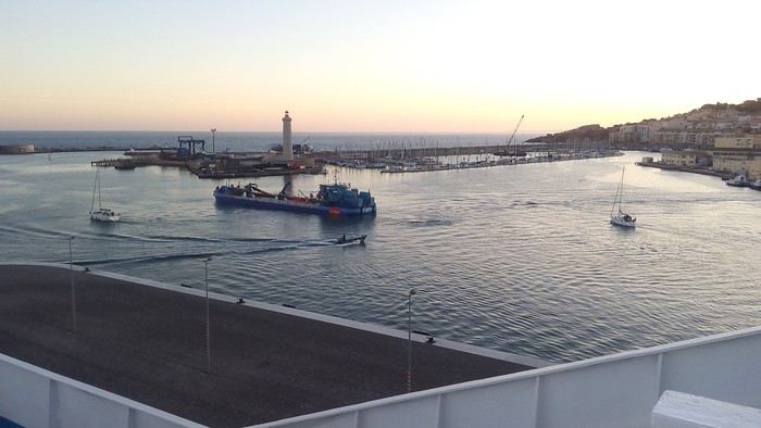
Je publie mon premier message sur le Groupe Solarbikes pour informer ses membres sur Facebook :
13 septembre, 19:56 Tom, Joy, Francine, Adalberto et moi, les 5 cyclistes sont bien montés à bord.
C'est parti ! bien installés dans les cabines.
Le pilote veille sur notre sortie du port.
je finis de rassurer les followers en ajoutant :
13 septembre, 20:10 Sortie réussie. Les canots de sauvetage sont en place.
Au téléphone Thomas m’avait invité à télécharger l’application ZENLY www.numerama.com/...-de-la-snap-map.html Cela permet de localiser ses amis si la fonction GPS de leur Smartphone est activée et qu’ils sont connectés. En fin de matinée, je m’étonne de toujours voir Thomas et Francine à 65 km de Sète à l’endroit où ils ont dormi. Toujours pas d’info sur la page Facebook jusqu’à qu’enfin apparaisse : SUPER INQUIET CE MATIN MON HANDBIKE NE DEMARRE PLUS. 1 heure QU ON CHERCHE En fait ils perdront plusieurs heures avant de comprendre que l’interrupteur n’est jamais passant et de le shunter. Alors qu’ayant gagné Sète, je profite de la terrasse d’un restaurant quai du Mistral, j’ignore qu’eux vont commencer une course contre la montre pour embarquer avant le départ du ferry.
Je m’offre une daurade et une dame blanche
en regardant passer des bateaux de touristes surbaissés adaptés au pont de chemin de fer.
Il s’agit du pont à bascule proche de la gare. Puis je me promène en ville en achetant quelques vivres.
Peu après 17h je gagne la gare maritime. Une camionnette italienne attire mon attention et je fais connaissance d’Adalberto qui prépare son tricycle couché et sa remorque.
Les 2 sont recouverts de panneaux solaires et il a déjà participé comme Thomas Papay au Sun Trip www.thesuntrip.com/presentation/. Il parle bien français, nous échangeons et je lui offre du raisin que je viens d’acheter. Puis je surveille son attelage pendant qu’il se repose sur le matelas dans son fourgon. Il pensait le laisser stationner là pendant 2 mois. Un marocain vivant en France et qui vient assister à tous les départs de bateaux lui déconseille et l’accompagne à un garage peu couteux. Mais comme le propriétaire est absent, Adalberto est contraint de lui laisser les clés. Cela commence sous le signe de la confiance internationale. Ils reviennent tous les 2 sur le scooter du sétois. Puis arrive Francis avec son tricycle sur la remorque de sa voiture. Il a roulé avec les participants depuis la Savoie mais il ne pourra pas pour des raisons de calendrier embarqué pour le Maroc. Il confirme qu’ils sont en retard. Avec lui je monte les escaliers pour aller au guichet. L’hôtesse qui demande nos prénoms ne trouve pas nos réservations. Pas de Francine, Thomas, Joy ou Gilles. En fait c’est un peu compliqué : Joy n’est pas son vrai prénom, il s’appelle Thierry et le billet est au nom Thomas qui se prénomme en fait Pierre-Thomas. Je m’inquiète pour son accès au guichet mais il n’aura pas besoin de monter à l’étage (non équipé d’ascenseur). Il suffira de présenter nos 4 passeports pour avoir les tickets d’embarquement. Adalberto lui n’a pas demandé à Francine de lui acheté sa place préférant régler au dernier moment. Si vous avez réussi à suivre, nous serons 5 à embarquer pour cette aventure : Thomas paraplégique et initiateur de ce raid, Joy qui sera son aide, Francine qui a participé à l’organisation, Adalberto et moi. Enfin s’ils arrivent avant le départ du ferry.
Peu après 18h Thomas arrive avec Francine. Ils ont roulés jusqu’à 70 km/h sur la voie rapide. Alors que je viens lui dire bonjour, pour notre premier contact il sert affectueusement son bras au niveau de mes cuisses pour il me semble me féliciter de mes premiers 350 km et m’encourager. Je découvre son handbike
dont les roues servent également à son fauteuil pour limiter le poids.
Je retrouve avec plaisir Francine. Mais Joy n’a pas pu suivre car il a une roue crevée sur sa remorque ce qui le ralentit.ll n’arrive qu’à 18h30 épuisé. Nous sommes les derniers à embarquer.
Un contrôleur de billet se souvient d’avoir vu embarquer il y a un an Paul Bermejo avec son tricycle couché solaire : voyageforum.com/...post=7621147#7621147
Difficile de passer inaperçu avec de tels véhicules. Mais il semble que de simples vélos soient déjà rares. Rien n’est prévu pour. L’équipage philippin nous propose des sangles pour les arrimer aux crochets implantés régulièrement dans le sol métallique.
Pour les tricycles déjà stables sur leur roue pas de problème pour mon VTT je ne vois que la solution de le coucher.
Un philippin me propose de le sangler contre une caisse en métal. Je laisse ma tente sur le porte bagage et emmène mes 5 sacoches jusqu’à la cabine que je partage avec Francine et Adalberto. Thomas et Joy dormiront dans une cabine avec sanitaire adapté aux Personnes à Mobilité Réduite que Francine avait retenue en achetant nos billets.
Sur le pont quelques membres du personnel immortalisent le départ de cette traversée qui va durer 37 h.
Nous quittons Sète en même temps que le soleil.
Je publie mon premier message sur le Groupe Solarbikes pour informer ses membres sur Facebook :
13 septembre, 19:56 Tom, Joy, Francine, Adalberto et moi, les 5 cyclistes sont bien montés à bord.
C'est parti ! bien installés dans les cabines.
Le pilote veille sur notre sortie du port.
je finis de rassurer les followers en ajoutant :
13 septembre, 20:10 Sortie réussie. Les canots de sauvetage sont en place.