Results for "adapter or electrical"
29149 results found.
Itinéraire Pérou-Bolivie-Chili en trente jours English translation pending
Bonjour,
Ca y est, depuis 10 ans je revais de faire ce voyage, cette année est enfin la bonne! Nous programmons de faire une partie de ces 3 pays en 30 jours, mais des milliers de questions me viennent à l'esprit! On a les billets d'avion depuis fin novembre, et grace aux lonely, GR et à ce forum, on a réussi à se faire un itinéraire alléchant. Mais, mais, que de doute sur sa faisabilité. Tout d'abord, j'aimerais savoir ce que vous pensez de notre itinéraire: (10 juillet - 8 aout)
Jour 1: Vol Paris-Lima Jour 2: Vol Lima - Puerto Maldonado Jour 3: Puerto Maldonado Jour 4: matin: Vol Puerto Maldonado - Cusco. Jour 5: Cusco + environs. Jour 6: Cusco-Pisaq-Nuit à Urubamba Jour 7: Salines de Maras et Moray - Nuit à Ollantaytambo Jour 8: Matin visite des ruines d'Ollantaytambo - Train pour Aguas Calientes. Jour 9: Marche très tot le matin jusqu'au Machu Picchu. Retour sur Cusco en fin d'après-midi. Jour 10: Cusco - Puno en bus. Nuit à Puno. Jour 11: Bateaux pour les Uros, puis nuit sur l'ile de Taquile. Jour 12: Bus et nuit pour Copacabana. Jour 13: Bus Copacabana - Desaguadero - Visite de Tihuanaco - La Paz. Jour 14: La Paz. Jour 15: Vol La Paz-Sucre et visite de la ville. Jour 16: Bus pour Potosi. Jour 17: Potosi Jour 18: Potosi-Uyuni Jour 19: Avec une Agence: Salar Jour 20: Laguna Colorada Jour 21: Laguna Verde Jour 22: Ascension du Licancabur Jour 23: San Pedro de Atacama Jour 24: Geyser d'El Tatio - Vallée de la lune et de la mort. Jour 25: Salar d'Atacama - Toconao Jour 26: Laguna Miniques - Miscanti Jour 27: Bus San Pedro de Atacama - Calama. Visite de la mine de Chuquicamata- Vol Calama-Santiago. Jour 28:Santiago Jour 29:Vol Santiago-Paris Jour 30:Vol Madrid-Paris
Je sais, il est speed, mais on veut forcément en voir un maximum!
Quelque-unes de mes interrogations:
Est ce qu'il y a des points bloquants? Dois-je prendre un jour de sécurité en arrivant à Lima? (j'arrive à 20h30, et j'ai un vol pour Puerto Maldonado le lendemain à 09H00) Qu'est ce que je dois réserver à l'avance? Salar et Sud Lipez? Train pour Aguas Calientes? Vol La Paz-Sucre? Autour du lac Titicaca: est ce possible de venir de Copacabana et d'aller vers Desaguadero ? En une journée est possible de partir de Copacabana, de visiter Tihuanaco et d'arriver à La Paz? A San Pedro de Atacama: les agences proposent en 1 journée le salar d'atacama et la laguna Miscanti et miniques. J'ai lu quelque part que ça faisait bcp en 1 journée?? Quelle somme d'argent emmener?? Que faire des lourds sac à dos durant la journée, lorsqu'on visite? Y a t'il des consignes où on peut les laisser?
Je sais, c'est énormément de questions, mais si je pouvais avoir quelques réponse pour me rassurer. C'est le premier voyage que l'on fait de cette manière, en organisant tout nous meme. On a déjà se sentiment de liberté ! Mais aussi le ptit stress qui va avec. Merci d'avance pour les réponses.
L'Afrique: le continent le plus riche en matières premières et pourtant le plus pauvre English translation pending
Bonjour à tous!!!!🙂
L'AFRIQUE le continent qui a le plus de richesses naturelles et pourtant le plus pauvre et le plus assisté, est ce une fatalité, pourquoi?😕
L'AFRIQUE le continent qui a le plus de richesses naturelles et pourtant le plus pauvre et le plus assisté, est ce une fatalité, pourquoi?😕
Insécurité à Madagascar: braquage à main armée en plein jour... English translation pending
Revenant de Madagascar on souhaite porter à la connaissance des futurs voyageurs la mésaventure pas si exceptionnelle qui nous est arrivée.
En effet on a failli se faire buter. Dans un endroit super touristique, dans la forêt des baobabs de Ifaty, dans la région de Tuléar, qui est dans tous les guides touristiques le samedi 17 novembre 2007 à 16h, en plein soleil, accompagnés d'un guide local (le serveur de notre hôtel) et d'un chauffeur de charette à zébus.
4 mecs armés chacun d'un pistolet, avec également une carabine, un coupe-coupe et un bidon d'essence sont arrivés sur nous d'un pas décidé, à visage découvert. On a juste eu le temps de se dire qu'ils avaient une sale gueule et que ça ne sentait pas bons que nos guides étaient à genoux et qu'ils demandaient l'argent. Nos 2 guides se sont retrouvés avec un pistolet contre la tempe et le doigt sur la gâchette !!!! Bien sûr on a donné le peu d'argent qu'on avait sur nous (environ 15 euros), et ils n'avaient pas l'air contents d'un si maigre butin. Ils nous ont fait également mettre à genoux et nous ont fouillé. Ils ont pris l'étui à lunettes et l'ont jeté. Ils ont pris l'appareil photo croyant que c'était un téléphone portable. On a demandé à notre guide qu'il leur demande de nous donner la carte mémoire (car nos agresseurs ne parlaient pas français). Comme ils étaient crétins, ils ne savaient pas de quoi il s'agissait et n'avaient pas l'air de savoir comment fonctionnait un appareil photo! Ils nous ont demandé si nous avions nos passeports, nos billets d'avion... heureusement tout était resté dans la valise fermée à clef à l'hôtel (ce qui est indspensable là-bas....). On redemande au guide pour la carte mémoire, et l'un de nos agresseurs lui shoote dans la tête comme dans un ballon de football lui faisant exploser ses lunettes. Ils nous ont pris nos lunettes de soleil et nos montres. Et puis ils débattaient entre eux. Là, on n'en menait pas large car on s'est dit qu'on allait se faire tabasser: on n'avait rien d'autre à donner..... Ils ont ensuite voulu voler la chevalière en argent de notre guide malgache et comme elle ne passait pas, on a vu un regard vers le coupe-coupe qui nous a fait frémir...
Bien que nous ayons tout donné ils restaient là en nous tenant sous la menace de leurs armes, discutaient de nous séparer des Malgaches, mettaient le pistolet sur la tempe du guide et disaient "boum boum". Le guide suait à grosse gouttes car il comprenait ce qu'ils disaient.On n'a compris qu'un mot: Vazaha ("étranger"), dans la discussion (le guide nous a raconté ensuite qu'il leur avait dit "vous ne pouvez pas faire ça à des vazaha").Manifestement ils discutaient de notre sort. On a demandé au guide ce qui se passait, il nous a dit de nous taire. Nous sommes bien restés 10 mn les genoux à terre attendant d'être fixés sur notre sort... Là on s'est vraiment sentis en danger de mort.On se disait chacun de notre côté que ce n'était pas possible, qu'ils ne pouvaient pas nous butter, que c'était absurde, que notre vie ne pouvait pas s'arrêter là, comme ça bêtement... On sentait vraiment une très forte tension chez eux. Le danger d'une arme à feu est que le coup peut partir et ça peut vite dégénérer et devenir un vrai carnage. Tout à coup 3 des agresseurs sont partis laissant le 4e nous tenir en joue pendant qu'ils séloignaient. Avaient-ils entendu quelque chose? Nous étions trop stressés pour avoir eu l'oreille à l'écoute des bruits environnants. Toujours est-il que 15 secondes après ils ont appelé le 4e qui a décroché. A ce moment, on a entendu à moins de 50 mètres un cri de femme (une touriste)et un coup de feu. On a déguerpi vers le village en courant à travers les broussailles. Ayant rejoint le chemin vers le village, on a croisé quelques touristes avec leurs guides et leurs appareils photos qui se dirigeaient vers la forêt. Ils ont bien entendu rebroussé chemin.
On est arrivés à notre hôtel vers 17 heures alors qu'on avait de la route à faire avant la tombée de la nuit! On avait prévu de partir pour Tuléar à 30 km de piste, on ne voulait pas rester dans nos bungalows isolés en bord de mer sans aucune sécurité (3 gendarmes sans voiture et sans aucun moyen pour surveiller cette station balnéaire très touristique....) Arrivés vers 19h et quelques, on est allé poser nos affaires à l'hôtel puis faire notre déposition à la gendarmerie. L'aventure continue: au fond d'une basse cour sans électricité au milieu des poules et des canards, un mec (un gendarme?) nous a accueillis en maillot de corps dans le noir, à la bougie! Quand on a vu les moyens, on s'est dit que tout le pays devait être aussi dangereux car l'impunité devait être reine! On raconte notre histoire et il nous donne un papier et un stylo pour faire nous mêmes la déclaration par écrit. Ce qu'on fait. Un gradé arrive, en bel uniforme, nous demande ce qu'il y a. Après notre récit il nous incite à ne pas porter plainte. On lui explique que pour l'assurance, on a besoin d'un papier tamponné de leurs services. "Alors si c'est pour l'assurance, faites une déclaration de perte!" On était stupéfaits et on a répondu que c'était hors de question. Il nous a dit alors de mettre en en-tête de la déclaration "à l'attention de Monsieur le commandant de la Brigade de Gendarmerie Nationale de Madagascar de la région de Tuléar"... C'était totalement grotesque et surréaliste! Evidemment pas d'électricité = pas de photocopie. Nous sommes donc retournés le lendemain matin, dimanche 18 novembre, pour apporter un double de notre déclaration que nous avions recopiée à la main, afin d'apposer les fameux tampons. Le gendarme n'était plus le même et il n'était au courant de rien !!!! On recommence notre laïus. Il sort le tampon et l'encrier: encre sèche!!!! Notre chauffeur va chercher de l'eau dans la voiture pour humidifier le tampon encreur et on a notre sésame. Le gendarme nous rend les 2 exemplaires. On lui dit qu'un exemplaire est pour la gendarmerie comme convenu la veille. Il nous répond "pourquoi faire"!!!! Texto. On insiste, il prend la feuille en disant "si ça peut vous faire plaisir". On imagine que le papier est passé à la poubelle dès que nous sommes sortis!
Comme ce braquage est arrivé le 2e jour de notre séjour à Mada, avec une telle réaction des autorités locales, vous imaginez bien comme on a pu se sentir en sécurité pendant les 11 jours suivants de notre séjour... Nous avons tout simplement parié sur le fait qu'on ne pouvait pas avoir la guigne une 2e fois!!!!!
A notre retour à Tana, nous sommes allés voir le conseiller sécurité de l'ambassade. Heureusement que c'était le dernier jour! Il nous a dit que ça arrivait à peu près une fois par semaine partout dans le pays mais que les autorités Malgaches étant très susceptibles il leur était très difficile de communiquer sur la réalité de l'insécurité à Mada. D'ailleurs il a quand même réussi à faire inscrire sur le site su Quai d'Orsay qu'il y avait à Madagascar des attaques par des bandes armées parfois d'une rare violence.... Il y a un an et demi par exemple, le premier secrétaire de l'ambassade (le n°2) organisait dans sa résidence privée dans un quartier central de Tana et plein de diplomates, gardé par la police Malgache, un diner avec le président de la banque mondiale, des huiles internationales et d'autres ambassades. Et bien 10 mecs armés de Kalachnikov ont débarqué et ont dépouillé tout le monde!!! Par ailleurs, il nous a également raconté que lorsque les gens avaient des accidents de la route, la première chose que faisaient le gens y compris les flics c'était de dépouiller les victimes!!! Pas d'appeler les secours... Charmant.
Vous comprendrez bien que dans ces conditions on déconseille vivement de se rendre à Madagascar malgré la beauté des paysages et des rencontres chaleureuses avec des malgaches très sympathiques. En discutant avec les gens sur place on a appris également qu'un bus de touriste s'est fait attaquer également à main armée il y a 5 mois à la fenêtre d'Issalo (également recommandée dans tous les guides) et que peu après notre attaque un grand hôtel de Nosy Be a aussi fait les frais d'un braquage à main armée... On ne peut donc se sentir en sécurité dans aucun endroit de l'ile, les autorités locales faute de moyen sont complétement inefficaces et étouffent les informations pour ne pas nuire au développement du tourisme....
On a encore bien d'autres histoires de vol, arnaques de flics sur la route... mais on préfère s'arrêter là...
Fragments de voyage I/II: d'Istanbul à Jakarta par la route English translation pending
J'entreprends un périple de 3 mois et plus jusqu'aux portes de l'Asie. Je vous livrerai en vrac mes impressions sous forme de carnet de bord, d'anecdotes, d'émotions brutes et aussi des informations pratiques. J'essaierai autant que possible d'écrire sur le vif et de vous envoyer quelques photos.
Pour passer directement au chapitre II des fragments de voyage le 21 février 2012 c'est ici : Fragments de voyage II : Istanbul-Téhéran-Lahore-Chengdu-Bangkok-Jakarta par la route
fraternellement Eric mosquée de Soleyman le Magnifique

PARFUMS D'ORIENT ISTANBOULIOTES
19-20-21-22-23-24 octobre Lyon-Strasbourg-Bâle-Istanbul
Des rues bruyantes et bigarrées. Des gens partout qui s'affairent, un ballet continu ponctué de coups de klaxons et des sirenes des bateaux, rythmé par l'appel du Muezzin, répercuté tel un écho dans toutes les mosquées majestueuses de la cité. Quel meilleur endroit pour commencer ce voyage si ce n'est Istanbul, carrefour et porte de l'Orient. C'est ma 4eme fois ici et je m'y sens bien, une ville attachante. Le soleil est de la partie. Je me balade dans le vieil Istanbul. A Eminonu, des gens qui pêchent, le pont de Galata est hérissé de cannes à pêche. Sur des bateaux amarrés le long des quais, des hommes font frire le poisson que l'on peut déguster dans des pains avec des oignons au bord de la Corne d'Or. Je me perds dans les ruelles qui remontent vers le grand bazar. Bain de foule. Des tas de drapeaux turcs pendent aux fenêtres, d'autres recouvrent des pans entiers de murs. Tout cela se passe dans tout le pays. Des manifs se déroulent un peu partout. Hommage aux soldats martyrs tombés au combat dans l'est. A la TV, des images passent en boucle, des généraux revanchards sont propulsés sur le devant de la scene. A qui profite cette inflation de violence ? une chose est sûre, pas à la population kurde de Turquie. Pêcheurs sur les quais d'Eminonu au fond la mosquée de Suleiman le Magnifique
Infos pratiques
Arrivée à l'aéroport Ataturk
prendre le métro (jeton 1, 30 YTL) jusqu'à Aksaray, puis le Tramway (jeton 1, 30 YTL) direction Sultanahmet ou Taksim
Arrivée à l'aéroport de Sabiha Gocken
prendre la navette ( à droite en sortant 3 YTL) E10 jusqu'à l'embarcadère de Kadikoy, puis le ferry (jeton 1, 10 YTL) jusqu'à Eminonu. Ensuite prendre le Tramway, soit direction Taksim (de l'autre coté du pont de Galata) soit direction Aksaray/Sultanahmet
Pour se loger, pléthore d'hôtels bon marché du coté de Sultanahmet derriere la Mosquée Bleue.
Pour manger : Eviter le quartier de Sultanahmet
Pour le change : changer le strict minimum a l'aéroport, taux plus avantageux autour du Grand Bazar
Pour aller au bord de la Mer Noire
Prendre un bus (du coté d'Eminonu) direction Sariyer sur le Bosphore, ensuite prendre un Dolmus direction Kilyos
SUR LA ROUTE DE LA SOIE...QUELQUE PART ENTRE SIVAS ET TERCAN
Istanbul-Erzurum 24-25 octobre
Aujourd'hui, je trace sur Erzurum. Il pleut légerement. Je me rend à l'immense otogar au nord d'Istanbul et je prend le bus de 16h. Cela m'arrange car j'ai ma demande de visa iranien à déposer au plus vite et ensuite, sachant qu'il faut 10 jours pour l'obtenir, je compte visiter l'est. Bus de nuit. 1375 kms à parcourir. Mon voisin ne parle pas Anglais, nous communiquons par gestes et par bribes de mots turcs pris dans mon lexique🙂. La TV diffuse le match de foot Besiktas-Liverpool, les Turcs sont fondus de football, ca tombe bien moi aussi.😏 A l'aube, en consultant ma carte, je réalise que nous empruntons la route de la Soie, route mythique pour bien des voyageurs, Nicolas Bouvier et Thierry Vernet étaient passés par ici en 1953. Nous roulons au milieu d'une vallée entourée de puissantes montagnes, la végétation est rare, quelques troupeaux de moutons paissent. Le climat doit être rude en hiver. Et premiere émotion : nous croisons l'Euphrate (en Turc : Firat). Depuis mon enfance, je suis fasciné par les grands fleuves, mon voyage qui s'annonce en sera parsemé. Et hop🙂 une photo pour immortaliser l'instant. Arrivée à Erzurum fin de matinée. Il fait beau, une chance car la température peut descendre très bas en cette période de l'année. Il y a une station de ski pas loin d'ici. Je me rend au consulat en marchant😎. Accueil austere mais correct, j'avais préparé les formulaires mais il n'en veut pas et je dois m'y coller une nouvelle fois. Puis il faut aller courir jusque dans le centre à la banque Oyak pour payer les frais de visa, heureusement un chauffeur de taxi qui m'avait vu poirauter devant le bureau, m'attend et m'amène sans hésiter à la banque puis fait le retour. Apparemment, il a l'habitude de la procédure😉
Passage éclair dans cette ville, je prendrai plus de temps dans 10 jours pour la visiter. Maintenant, je file sur Malatya. Bus de nuit. Jamais bu autant de thé et autant les mains parfumées d'eau de cologne🙂🙂.
Otogar de Malatya à 2h du matin, je décide de finir la nuit ici, il y a des sièges confortables😉. J'irai chercher un hôtel le matin.
Mes 4 premieres nuits
1 à l'aéroport/1 à l'hôtel /1 dans le bus/1 dans l'otogar de Malatya, vive les voyages😎
Infos pratiques Trajet Istanbul-Erzurum 55 YTL par la compagnie Esadas Trajet Erzurum-Malatya 40YTL par la compagnie Bingol 1 Bouteille d'eau 1l : 0, 50YTL 1 pide ou galette : 0, 30 YTL Demande de visa iranien : 2 photos/2 formulaires remplis a la main/copies des pages importantes du passeport/60 euros ou 103 YTL payables a la banque Oyak
Pour passer directement au chapitre II des fragments de voyage le 21 février 2012 c'est ici : Fragments de voyage II : Istanbul-Téhéran-Lahore-Chengdu-Bangkok-Jakarta par la route
fraternellement Eric mosquée de Soleyman le Magnifique
PARFUMS D'ORIENT ISTANBOULIOTES
19-20-21-22-23-24 octobre Lyon-Strasbourg-Bâle-Istanbul
Des rues bruyantes et bigarrées. Des gens partout qui s'affairent, un ballet continu ponctué de coups de klaxons et des sirenes des bateaux, rythmé par l'appel du Muezzin, répercuté tel un écho dans toutes les mosquées majestueuses de la cité. Quel meilleur endroit pour commencer ce voyage si ce n'est Istanbul, carrefour et porte de l'Orient. C'est ma 4eme fois ici et je m'y sens bien, une ville attachante. Le soleil est de la partie. Je me balade dans le vieil Istanbul. A Eminonu, des gens qui pêchent, le pont de Galata est hérissé de cannes à pêche. Sur des bateaux amarrés le long des quais, des hommes font frire le poisson que l'on peut déguster dans des pains avec des oignons au bord de la Corne d'Or. Je me perds dans les ruelles qui remontent vers le grand bazar. Bain de foule. Des tas de drapeaux turcs pendent aux fenêtres, d'autres recouvrent des pans entiers de murs. Tout cela se passe dans tout le pays. Des manifs se déroulent un peu partout. Hommage aux soldats martyrs tombés au combat dans l'est. A la TV, des images passent en boucle, des généraux revanchards sont propulsés sur le devant de la scene. A qui profite cette inflation de violence ? une chose est sûre, pas à la population kurde de Turquie.
Pêcheurs sur les quais d'Eminonu au fond la mosquée de Suleiman le Magnifique
Infos pratiques
Arrivée à l'aéroport Ataturk
prendre le métro (jeton 1, 30 YTL) jusqu'à Aksaray, puis le Tramway (jeton 1, 30 YTL) direction Sultanahmet ou Taksim
Arrivée à l'aéroport de Sabiha Gocken
prendre la navette ( à droite en sortant 3 YTL) E10 jusqu'à l'embarcadère de Kadikoy, puis le ferry (jeton 1, 10 YTL) jusqu'à Eminonu. Ensuite prendre le Tramway, soit direction Taksim (de l'autre coté du pont de Galata) soit direction Aksaray/Sultanahmet
Pour se loger, pléthore d'hôtels bon marché du coté de Sultanahmet derriere la Mosquée Bleue.
Pour manger : Eviter le quartier de Sultanahmet
Pour le change : changer le strict minimum a l'aéroport, taux plus avantageux autour du Grand Bazar
Pour aller au bord de la Mer Noire
Prendre un bus (du coté d'Eminonu) direction Sariyer sur le Bosphore, ensuite prendre un Dolmus direction KilyosSUR LA ROUTE DE LA SOIE...QUELQUE PART ENTRE SIVAS ET TERCAN
Istanbul-Erzurum 24-25 octobre
Aujourd'hui, je trace sur Erzurum. Il pleut légerement. Je me rend à l'immense otogar au nord d'Istanbul et je prend le bus de 16h. Cela m'arrange car j'ai ma demande de visa iranien à déposer au plus vite et ensuite, sachant qu'il faut 10 jours pour l'obtenir, je compte visiter l'est. Bus de nuit. 1375 kms à parcourir. Mon voisin ne parle pas Anglais, nous communiquons par gestes et par bribes de mots turcs pris dans mon lexique🙂. La TV diffuse le match de foot Besiktas-Liverpool, les Turcs sont fondus de football, ca tombe bien moi aussi.😏 A l'aube, en consultant ma carte, je réalise que nous empruntons la route de la Soie, route mythique pour bien des voyageurs, Nicolas Bouvier et Thierry Vernet étaient passés par ici en 1953. Nous roulons au milieu d'une vallée entourée de puissantes montagnes, la végétation est rare, quelques troupeaux de moutons paissent. Le climat doit être rude en hiver. Et premiere émotion : nous croisons l'Euphrate (en Turc : Firat). Depuis mon enfance, je suis fasciné par les grands fleuves, mon voyage qui s'annonce en sera parsemé. Et hop🙂 une photo pour immortaliser l'instant.
Arrivée à Erzurum fin de matinée. Il fait beau, une chance car la température peut descendre très bas en cette période de l'année. Il y a une station de ski pas loin d'ici. Je me rend au consulat en marchant😎. Accueil austere mais correct, j'avais préparé les formulaires mais il n'en veut pas et je dois m'y coller une nouvelle fois. Puis il faut aller courir jusque dans le centre à la banque Oyak pour payer les frais de visa, heureusement un chauffeur de taxi qui m'avait vu poirauter devant le bureau, m'attend et m'amène sans hésiter à la banque puis fait le retour. Apparemment, il a l'habitude de la procédure😉
Passage éclair dans cette ville, je prendrai plus de temps dans 10 jours pour la visiter. Maintenant, je file sur Malatya. Bus de nuit. Jamais bu autant de thé et autant les mains parfumées d'eau de cologne🙂🙂.
Otogar de Malatya à 2h du matin, je décide de finir la nuit ici, il y a des sièges confortables😉. J'irai chercher un hôtel le matin.
Mes 4 premieres nuits
1 à l'aéroport/1 à l'hôtel /1 dans le bus/1 dans l'otogar de Malatya, vive les voyages😎Infos pratiques Trajet Istanbul-Erzurum 55 YTL par la compagnie Esadas Trajet Erzurum-Malatya 40YTL par la compagnie Bingol 1 Bouteille d'eau 1l : 0, 50YTL 1 pide ou galette : 0, 30 YTL Demande de visa iranien : 2 photos/2 formulaires remplis a la main/copies des pages importantes du passeport/60 euros ou 103 YTL payables a la banque Oyak
Phuket change beaucoup trop vite! English translation pending
et pas en bien car j ai a titre personnel j ai ete fort decu des changements constates en particulier a Patong.
1 De moins en moins de consideration pour les touristes qui sont desormais de simples vache a lait. C est desormais flagrant y compris par la Police locale.
2 Multiples constructions a gogo et veritable anarchie immobiliere et donc
3 Forte hausse des prix pour tous les secteurs
4 Le nouveau Carrefour et les enseignes commerciales font perdre une grande partie de l authenticite qui pouvait encore rester de Patong et aux alentours
5 Insecurite palpable
Ceci ne constitue qu un avis personnel.... bien entendu.
Ceci ne constitue qu un avis personnel.... bien entendu.
La Chine, un mythe en danger English translation pending
Le Dernier Empereur, le Lotus Bleu… La Chine est l’objet de tous les fantasmes en occident. Préparer un voyage en Chine, c’est d’abord entretenir un mythe. Celui des jardins, des estampes, des temples bouddhistes, d’architecture millénaire, des pousse pousse… Arriver en Chine, c’est savoir oublier les mythes.
Prenez Shanghai par exemple. L’aéroport – ultra moderne – est relié à la ville par le Maglev, le train le plus rapide du monde avec ses 430 km/h ! En 7 minutes, le bolide parcourt les 35 km reliant l’aéroport au quartier des affaires de Pudong, qui était, il y a encore 15 ans, une vaste zone de marécages… Pour rejoindre le centre, prenons donc le métro. Rame automatique, métro design, écran plasma qui déroule de longs écrans publicitaires, atmosphère climatisée qui contraste avec l’insupportable canicule extérieure… Shanghai serait-elle devenue un nouveau Manhattan oriental ? En apparence oui. Sauf que le salaire moyen des ¾ des habitants de cette mégapole de 18 millions d’âmes ne dépasse pas les 300 dollars par mois. Sauf que derrière la rue de Nanking où se bousculent les plus grandes enseignes internationales derrière des néons et des écrans géants brillent de milles feux se cachent, à quelques pâtés de maison, des quartiers insalubres où l’on vend des fruits à même le sol, où la terre fait concurrence au bitume dans des nids de poule transformés en fosses septiques... Là se déroule aussi toute une histoire de la Chine ancienne : celle des artisans, des coiffeurs, des marchés, des cyclo pousse… Deux mondes vivent côte à côte sans jamais se croiser.
Les touristes en mal de Lotus Bleu se dirigeront vers la partie sauvegardée du Vieux Shanghai aux abords du magnifique jardin Yu. Et même si chaque maison est rénovée façon Disney Chinese style, même si la moindre demeure abrite un magasin de souvenirs ou un restaurant, le charme opère toujours dans ce quartier protégé luttant envers et contre tous contre l’envahisseur personnifié par d’immondes tours aux allures de HLM de la Courneuve fleurissant aux 4 coins de la ville. Malheureusement, au-delà de certains secteurs sauvegardés destinés aux touristes, les maisons traditionnelles disparaissent et les grues envahissent la ville.
« Cachez ce passé que je ne saurai voir »
Si le phénomène est inquiétant à Shanghai, il est carrément dramatique à Pékin. Les hutongs, ces vieux quartiers populaires de la capitale sont chaque jour un peu plus mangés par d’horribles tours dignes de l’époque soviétique. Exceptés quelques quartiers situés autour des lacs et de la Cité Interdite pour, encore une fois, satisfaire les touristes, tous les hutongs sont appelés à disparaître. Comme à l’époque de la Révolution culturelle, le gouvernement a fait sienne la devise : « cachez ce passé que je ne saurai voir ». Le passé, c’est mal. Le passé empêche la Chine de se développer. Détruisons le pour construire la Chine moderne semble être le leitmotiv de ce gouvernement qui n’a plus de communiste que le nom. Le passé a néanmoins un intérêt : celui de rameuter des touristes. Comme à Shanghai ou à Pékin, on sauvegarde quelques quartiers pittoresques exclusivement dédiés au tourisme et on détruit tout ce qui fait l’essence de cette Chine que l’on aime, l’authentique… Mais attention, les touristes que l’on chérit désormais en Chine, ce sont les Chinois ! Pour le gouvernement, les 300 millions de touristes potentiels de la classe moyenne (sur 1, 5 milliard d’habitants) sont une manne bien plus importante que celle représentée par les étrangers. Or, le nouveau touriste chinois est également un nouveau « riche » et son mot d’ordre est simple : CONSOMMER ! Au cœur du Vieux Shanghai, on trouve des galeries commerciales dignes des hypermarchés de banlieue occidentale! Même à Yangshuo, ancienne Mecque des routards du monde entier au cœur de l’une des plus belles régions du monde, les galeries commerciales font flores et les excursions sur la rivière Li sont devenues des autoroutes à bateau mouches climatisés où les touristes regardent les magnifiques « pains de sucres » à travers les vitres comme un film de Bruce Lee sur un écran plasma ! Des troupeaux de néo consommateurs envahissent des sites millénaires
Dans les sites touristiques comme la Cité Interdite, il vaut mieux arriver très tôt le matin. Et pour cause… Passé 11h, des dizaines de troupeaux de centaines de touristes chinois débarquent. Et quand un troupeau débarque, ça fait du bruit : mégaphones poussés au maximum, touristes qui hurlent comme des gamins, ombrelles multicolores qui vous cachent la vue, drapeaux bien hauts et cohue pour prendre des photos… « Je veux être prem’s », « nan, c’est moi » version mandarin, les coups de coudes pour être le premier dans le bus ou dans le train… Voyager en Chine est une expérience unique. A la fois culturelle et ethnologique. Ces néo consommateurs représentent une curiosité à eux seuls. Insupportables, mais incontournables, ils font partie de cette Chine moderne, speedée où être le premier passe avant tout autre considération. Le voyage devient pour eux une performance : voir 15 minutes la Grande Muraille et être un « brave », immortaliser un tailleur de jade derrière une vitre, sortir 2 minutes sur le pont d’un bateau mouche pour prendre quelques photos des « pains de sucre » de Guilin histoire de dire « j’y étais » et retourner tranquillement dans la salle climatisée et rassurante où tous les congénères mangent leur canard laqué… Néanmoins, au détour des chemins des vieux quartiers encore préservés des grandes villes ou sur les pistes des campagnes du Guangxi, on peut retrouver ce mode de vie millénaire où les sourires en disent plus que bien des conversations avec des Chinois « modernes ». Des marchés miséreux que les touristes ne voient que derrière les vitres de leur bus climatisé, des maisons délabrés dans les campagnes qui font davantage penser que l’on se balade dans le tiers-monde que dans la toute nouvelle troisième puissance économique mondiale. La spéculation immobilière qui poussent les pauvres vers les banlieues… Voilà le vrai visage de la Chine. En grattant un peu le vernis de Pudong ou de la Main Street de Yangshuo, on réalise qu’en Chine, tout n’est qu’apparence. Il faut faire bien. C’est bientôt les JO, il faut donner une image dynamique du pays. Hélas, ce n’est pas en donnant un coup de peinture sur une maison pourrie que les fondations tiendront plus longtemps. La troisième puissance économique mondiale, malgré tous les efforts qu’elle fait pour le faire oublier n’est finalement qu’un pays du tiers-monde où la majeure partie de la population vit dans la misère sous un régime autoritaire violant les droits de l’homme et asservissant le peuple tibétain. Cette civilisation multimillénaire, ce pays monde détenant un patrimoine culturel, naturel et architectural parmi les plus riches de la planète est en train de sombrer sous les assauts du « capitalisme d’état ». Bref, si vous voulez vivre le Lotus Bleu, dépêchez-vous, la Chine avec un grand C est, comme sa faune parmi la plus variée au monde, un pays en voie de disparition en vendant son âme au capitalisme le plus violent.
Votre envie de voyager a-t-elle influencé votre entourage? English translation pending
voila. moi le fait que ma passion et de voyager, donc un choix s impose m endetter vingt ans de credit pour une maison ou garder mon rytme de vie 3a4fois par ans.je profite de la vie pleinement, et donc ma vie influe sur certaine personne qui se dit c et vrai travailler que pour payer des facture c et usant et vous que choisirer vous ?
First time in India? Premier voyage en Inde? 2001 English translation pending
Bon, je me lance. J'espère en tout cas, que vous allez bien vous marrez comme moi, je me marre à chaque fois que je relis le récit de ce premier voyage en Inde.....
Samedi 31 mars 2001
6h30 !! C’est l’heure, c’est le moment, c’est l’instant, c’est le jour J !! Thierry fait couler le café, Marie fait couler la douche…
7h30. Il fait seulement 7°…brrrrrrrrrr…..vite vite un bus 71 qui nous mène à la gare centrale de Bruxelles puis, le train jusqu’à Zaventem. Ce sont les vacances scolaires de Pâques et il y a un monde fou !! Nous montons au resto qui donne sur les pistes et nous enfilons un petit-déjeuner en imaginant notre futur voyage. A peine avons-nous décollé que nous atterrissons déjà 40 minutes plutard à Roissy Charles de Gaulle. Notre avion ne décollant qu’à 16h, cela nous donne le temps de mettre notre sac à dos en consigne et de prendre un RER pour Paris car j’ai envie de boire un bon café crème au bord du canal St Martin. Hélas, le personnel du-dit RER est en grève et nous sommes condamnés à passer le restant de la journée à l’aéroport. Cela passe assez vite car il y tellement de choses à voir dans un aéroport. Comme nous n’avons chacun qu’un seul sac à dos très léger que nous garderons en cabine, l’enregistrement est rapide.
Une heure avant d’embarquer, nous sommes déjà à la gate 44. L’avion également. « C’est un boeing 747 des années ’70 » me dit Thierry. Il a l’air un peu vieux mais il est joli et original, chaque fenêtre est décorée avec des dessins indiens. Au compte-goutte, le personnel naviguant arrive. « Thierry, tu as vu le personnel de bord ? » « Oui, les hôtesses, c’est pas vraiment les miss monde qu’on voit dans les magazines » « Non, je voulais surtout que tu regardes l’état du costume des hommes. » « Ah oui, effectivement, le bord de leur col de chemise et veston est complètement élimés…. » « Ben, j’espère que l’avion n’est pas dans le même état…. »
Nous devrions décollés à 16h. Or, je vois qu’il est 17h….heu...…….18h et pas de nouvelles mais, tout à coup, nous entendons un appel dans le micro.
-« Les passagers du vol Air India 140 à destination de Delhi sont priés de patienter un instant, l’avion est en réparation…. »
-« Hein ?!?! Quoi ?!?!? Hé Thierry, moi je monte pas dans cet avion ». Il me corrige : « L’avion est en préparation »….….Ouf !!
Nous pouvons enfin embarquer vers 18h15. Nos sièges sont superbement bien placés à la première rangée, et Thierry pourra allonger ses jambes. Tiens, il y a déjà quelqu’un à sa place. C’est un monsieur indien. « Excuse me sir, but you took my place » « No, it’s my seat» « Sorry, but look once to your embarkment card and you will see that you are wrong. I have the window and my wife, the middle seat» « grrrrrrr……»”
Il se lève en râlant et recule de 2 places……Voilà notre premier contact avec l’Inde. ….
19h30. Un petit en-cas nous est servi. Bonne nouvelle : mousse de poisson sur toast. Mauvaise nouvelle : les toast font 3x2cm !! Est-ce là notre souper ?!?! Mauvaise langue que je suis. …….Une heure plu tard, notre hôtesse nous apporte un sachet de cacahuètes…..
L’avion traverse de grands trous d’air et je ne me sens pas trop bien. Assez mal en tout les cas pour ne pas avoir envie de manger ce bon repas indien qui arrive. C’est Thierry qui mange tout : poulet tandoori et mouton. L’odeur des épices me retourne l’estomac et je suis à 2 doigts de crier « Raoul »….…
Mais cela n’arrivera pas, je l’ai décidé !!
Autre chose : le pilote…..mais quelle babelutte celui-là !!
- « A votre gauche, vous pouvez admirer les Alpes » - « Si vous regardez à droite, vous verrez les Carpates » - « Attention, nous allons survoler….
En fait, il nous fait un cours de géographie. C’est super sympa. Non seulement, il nous pilote, mais en plus, il nous explique tout ce qu’il voit sur son chemin. Je me demande si je dois lui donner un pourboire en descendant de l’avion…….
Je parviens, malgré les turbulences qui ne cessent, à m’endormir.
Voilà qu’à 4h du matin, Mr le professeur de géographie réveille 700 passagers, juste pour dire que nous passons la frontière pakistanaise !!!
Mais il a eu raison, notre guide. La frontière entre le Pakistan et l’Inde est complètement illuminée. Je ne situe pas trop exactement le tronçon illuminé mais là, c’est géant !! Merci !!
Dimanche 1 avril 2001
5h13. Les formalités administratives accomplies, nous sommes les premiers à passer le hall de sortie de l'aéroport de Delhi. Un hall triste, éclairé de néons crasseux et quelques fans fatigués qui tournent au ralenti.
Il y a là, au milieu de ce hall, une femme assise sur une chaise branlante. Autour d’elle, des dizaines de personnes à même le sol qui tâtonnent, ouvrent, contrôle et trient des centaines colis. Ils lui crient le nom du destinataire (sans doute) et elle l’inscrit dans un vieux carnet tout destroy et jauni. Je regarde de plus près…..ah oui, je ne me suis pas trompée….c’est bien ce que je pensais avoir lu...ce sont des colis qui viennent d’arriver avec Fédéral Express…..
Il est un peu plus de 5h30 quand on sort de l’aéroport mais nous ne sommes pas seul……………..Une nuée de rickshaw nous saute dessus pour nous emmener en ville !!! C’est une véritable plaie…
Hé là, moi pas me faire avoir hein !! J’ai bien lu mon guide avant de partir et je sais qu’il y a le bus 780 qui va en ville pour à peine quelques sous. Il y a bien 2-3 bus devant l’entrée mais il n’y a personne à l’intérieur. Les rickshawallas nous disent que les chauffeurs de bus sont en grève et qu’il n’y a pas d’autre solution que de partir avec eux…. D’après notre guide, l’arrêt de bus se trouve de l’autre côté de la rue. On s’engage donc dans la pénombre………..et c’est là que je la vois !!!
Elle est très foncée, je dirais même racée, la tête bien haute comme pour défier les nouveaux arrivants. Ils ont bien fait ça, on dirait une vraie !!! « Waow !! T’as vu ? Ils ont fait, comme chez nous à Blankenberge, à la côte belge, une statue pour accueillir les touristes !! » « Oui, oui, Marie, il est temps que tu te reposes… » « Mais non, regarde !! On dirait une vraie !! « Marie…………. c’est une vraie….……...................vache ….. »
La honte……Pourtant je le savais. Cela faisait un an que je me documentais sur ce pays. J’ai tout vu, tout lu, tout entendu à propos de l’Inde….. Je suis à peine depuis 10 minutes sur le sol indien et voilà que je suis déjà perturbée….…. Hé non, ce n’est pas un poisson d’avril. Devant l’aéroport de Delhi ce samedi 01 avril 2001, il y a des vaches qui se baladent tranquillement… Tant que l’on n’est pas plongé dedans, on ne peut pas réaliser. Aucun livre, aucun documentaire, aucun récit ne peut remplacer la réalité, les bruits, les odeurs, la langue, les couleurs….
Décidément, il est temps que je me repose….
Après une promenade dans les environs de l’aéroport, nous y revenons et montons dans le premier bus dont le chauffeur nous confirme la destination du centre-ville. Là, pendant une heure, nous attrapons l’Inde en pleine poire !! Il n’est que 6h30 et il fait déjà 21°. Le chauffeur de bus se fraye un chemin à coup de klaxon comme si c’était une urgence. Ca nous dépasse déjà. Mais le pire, c’est ce que nous voyons tout au long du chemin. Nous en restons muets. De fatigue bien sur, mais également de stupéfaction de voir ce que l’on voit…… Tout ces gens qui dorment sur les trottoirs au milieu des vaches, singes, chiens, chèvres, cochons, corbeaux, de la crasse, de la puanteur partout. C’est tellement loin de nos réalités d’occidentaux…
Et soudain, le chauffeur de bus ralenti et nous dit de descendre. « Ok, you can go. It’s here. » « Are you sure this is the centre of Delhi? Connaught Place? » « Sure, no problem » (on l’entendra souvent ce “no problem”…)
No problem, no problem…..C’est vite dit ça…..
C’est sur, on s’est fait avoir, c’est pas le centre ici, ça doit encore être la banlieue…...mais….Connaught Place, ça devrait être plus moderne, non ? Plus vivant, non ? Heu, j’ sais pas moi, un peu plus occidental quoi, avec des belles rues bien tracées, histoire que je sois pas trop paumée….. Au lieu de cela, je ne vois que des trottoirs défoncés et de la saleté partout autour de nous. Qu’à cela ne tienne, j’ouvre mon guide pour me situer un peu. « Bon, allons jusqu’au coin de la rue voir si on trouve une plaque qui nous donne le nom de cet endroit » « Heu, je vois rien » « C’est pas grave. Il y a un Sikh là qui arrive. On va lui demander »
Il est grand et à l’air d’avoir bien capté notre désarroi…. « Can I help you? » « Yes, thank you. We are a little bit lost and we are looking for the Connaught place and a room. » « No problem, I can call you a rickshaw and tell him the adress of a good room» « Oh Thank you so much » « You’re welcome »
Dans la seconde qui suit, alors que l’on n’avait pas vu un seul véhicule circuler dans le coin depuis notre arrivée dans le quartier, un rickshaw arrive de nulle part. C’est magique non ?!?!?
Après une petite conversation entre le sikh et le chauffeur (évidemment, on sait pas ce qu’ils se disent), nous payons 10 rps. et nous nous installons pour une première course dans cet engin pétaradant. Nous savons bien évidemment que le chauffeur recevra une petite commission de l’hôtel où il nous emmène, mais ce n’est pas grave. On est tellement fatigués qu’on n’a plus de courage. Arrivés à l’hôtel Red Castel dans le quartier de Karol Bagh, on nous annonce 1500 rps. pour une chambre. Ca à l’air cher non ? Mais trop fatigués pour discuter, nous nous installons dans le petit salon dans le hall et attendons que la chambre soit prête. Le-dit hall est dallé de marbre et la cage d’escalier est tout en fer forgé. C’est très chic…..Le patron vient s’installer avec nous pour faire plus ample connaissance et nous offre un café. Cela nous fait du bien car nous n’avons encore rien ingurgité depuis l’avion. Arrive un gars ….. C’est, visiblement, un copain du patron qui veut tout savoir sur nous et parle même quelques mots de français. Nous intégrons enfin notre chambre. Elle est assez sympa. Un grand lit de 2 personnes, un petit frigo, une télé, une salle de bain et, de la fenêtre, nous avons une vue sur un joli petit parc. Nous prenons une douche et redescendons.
Notre « nouvel ami » est toujours là. Il nous propose d’aller à son agence. Il nous trouve tellement sympathique qu’il veut nous offrir un tour de la ville gratuit. Vu qu’on n’a pas de projets précis, on accepte. De toute façon, on a pas envie de se casser la tête le premier jour…. On embarque dans une belle voiture blanche, on dirait une voiture de ministre, une Tata ambassador et on roule….50 m !!! Ils sont fous ou quoi !!...on aurait pu les faire à pied !! L’agence d’Ali n’est pas très grande, 3x2 m à tout casser. Malgré le fan qui tourne au plafond, il fait une chaleur étouffante et cela fait maintenant plus de 36h que nous n’avons pas dormi, ça commence à être dur-dur…… Evidemment, Ali et son cousin sont très sympas. Ils nous offrent le thé, nous montrent les dizaines de livres d’or signés par leurs précédents clients, étalent leurs cartes géographiques de l’Inde, les photos magnifiques du Cashmire, région d’origine d’Ali.
On lui explique que le Cashmire n’est pas prévu au programme, que nous avons un avion à prendre dans 15 jours à Mumbai, que nous sommes fatigués et que nous allons réfléchir…. « No problem…..i can make you a good trip…and a good price » « Thank you Ali, but we have no idea what will be our plans. We have to think » « Look, you can have a car with driver for 1 week, 7 days and I can book you hotels, so, no worry, everything will be ok » « Ok, say what you propose and we will see » « You can go to Agra, Jaipur, Pushkar, Udaipur and come back to Delhi»« No, it’s not a good idea, we go to Mumbai. » « No problem, I can book train tickets from Udaipur to Mumbai and rooms for you till Udaipur »
En fait, Ali n’a pas d’autorisation de rouler au-delà de la frontière du Rajasthan. « Ca à l’air sympa comme proposition, qu’est-ce que t’en penses Thierry ?» « Oui, c’est pas mal. Comme ça, on ne doit plus se tracasser, tout est déjà réservé. En plus, demandons un ticket de train pour Daman, ça nous fera du bien. On veut de toute façon s’y arrêter 2-3 jours. » « Bon, je demande le prix maintenant….» « Ok, say us exactly what you porpose and give us a price. » « Look this programme: You have a car with driver for 8 days. Visit of Agra, Fathepur-Sikri, Jaipur, Amber, Pushkar, Udaipur. 7 nights in good hotels + 1 train ticket Udaipur-Ahmedabad+ 1 train ticket Ahmedabad-Vapi + 1 train ticket Vapi-Mumbai for only……….(et c’est là que vous commencer à rire comme des baleines)……………30000 rps…..…..and because you are good persons, i offer you a car for free today to visit Delhi »
Oui, vous avez bien lu, 30.000 rps !!! Le pire, c’est que grâce ou à cause de la chaleur suffocante, le décalage horaire, l’absence de repas depuis l’avion, le baratinage des 2 zouaves qu’on a en face de nous, le fait qu’on ne nous a pas lâché une seconde depuis la descente du bus, et bien, on ne fait pas du tout la conversion en euros, on n’a rien vu venir et on ne réagit pas !! Ou plutôt, on réagit comme des triples cons et on acquiesce à tout !! On signe et on paie directement sans réfléchir…..sauf que je sais que maintenant, on a plus un balle sur nous et qu’on doit trouver un distributeur de billet. « No problem, you can take my car and driver to get some money »
Quelle gentillesse...grrrrrrr. Là, il est trop sympa non ?!?!?
Nous sortons de l’agence et la voiture nous attend déjà pour aller à la banque. Nazir, notre chauffeur pour la journée, nous dépose à Connaught Place (on l’aura quand même vu) afin de manger un bout dans un petit snack le long des colonnades. Alors que nous sortons du snack, deux petits cireurs nous accostent. Thierry porte des bottines en toile et moi, je suis en tong. Pas de bol pour eux mais nous leur achetons une bouteille de coca et des chapatis. Ils s’en vont tout heureux. On se promène un peu dans le parc central mais nous sommes tout de suite suivi par une gamine à l’air pitoyable, genre, 8-9 ans avec un bébé dans les bras. « One roupee pleeeeeeeeease, one roupee for my baby…. » C’est très dur de vivre ça pour la première fois. Je ne sais pas du tout comment réagir. Je lui donne quelque chose ou je continue sans la regarder ? De toute façon, elle nous suit partout. Un sikh s’approche de nous et nous dit qu’il ne faut absolument rien donner aux enfants car ils doivent souvent remettre leur argent à des adultes pas toujours sympa avec eux. Mais si l’on veut faire des offrandes, « no problem » nous pouvons aller avec lui au temple sikh qui se trouve juste à côté. Nous accompagnons donc ce monsieur et nous nous baladons dans des petites ruelles. Il s’intéresse fort à nous, veut tout savoir sur la Belgique, quel est le but de notre voyage. Avant d’arriver au temple, il nous invite à monter chez lui qui, en fait, ……….n’est qu’un bureau !! Voilà qu’on s’y fait reprendre !! Il nous étale ses prospectus tous pourris ….Holà stop !!! On a déjà assez donné !! Nous déguerpissons et rejoignons Nazir.
13h. Il fait très chaud. Il règne une pollution indescriptible sur la ville. On s’arrête au Raj Gath, mémorial au Mahatma Gandhi au bord de la Jamuna, au temple du Lotus, au fort rouge et à la colonne du Qutb Minar. De là, nous allons jusqu’à l’ India Gate. Nous restons un moment à nous balader dans les pelouses aux alentours de l'arche mais l’on nous alpague de toutes parts. L’un avec un singe acrobate, l’autre avec un cobra. On veut tout nous vendre : des cartes postales, des tee-shirts, des ballons et des gadgets chinois. On stoppe également un petit coup au parlement où les singes squattent les jardins. Nazir nous explique que pour se faire un petit plus, il emmène les touristes dans des emporiums (magasins agrées par le gouvernement), et nous demande si ça ne nous ennuierait pas. Si c’est si gentiment demandé, pas de problème mais à une condition : pas d’arnaque hein !! On a déjà eu assez pour aujourd’hui !! On achète rien mais cela donne une vague idée des prix pratiqués.
Le soleil se couche déjà et nous rentrons à l’hôtel pour prendre une douche. A peine sortie de la salle de bain, l’électricité se coupe et nous entendons un boucan d’enfer. C’est un groupe électrogène qui se met en route tout à côté de notre chambre… Nous voulons ressortir pour aller souper mais le patron de l’hôtel nous dit que c’est hyper dangereux de sortir seul dans ce quartier et surtout quand il n’y a plus d’électricité……Il nous propose de nous offrir un taxi et nous allons manger un bout au Nirula’s restaurant. On y mange, oui, je sais, c’est pas très indien, un chili con carne et des pâtes au poulet.
Là, maintenant, on est complètement mort de fatigue et on rentre dormir. Mais arrivés dans la chambre, le groupe électrogène tourne toujours et la chambre est puante et bleue des émanations de pétrole qui entrent par les aérations de la salle de bain !!
-« Hey, our room is stincking!! What’s that?!?!? » -« No problem sir, it will be stop in a few minutes» -« Be sure, because we are very tired » -« No problem sir, I promiss»
-« Ok, I have to call. How much is it for a phonecall to Belgium? » -« Only 5 roupees for 1 minut. »
Après avoir rassurés les enfants qui sont restés à Bruxelles, nous regagnons notre chambre.
Le bruit infernal du générateur s’arrête et l’électricité revient...c'est enfin l'heure de dormir.....🤪
Missionnaires: quel impact selon vous? English translation pending
Bonjour,
suite à quelques voyages, quelques rencontres surprenantes dans des coins dit reculés et des lectures d'articles et de bouquins, je me pose bien des questions sur les missionnaires.
Ces hommes et ces femmes parcourent la terre avec comme seul élément dans leur sac à dos, la Bible ou certainement le Coran, (pour ma part, je n'en pas rencontré) et autres livres religieux. Ceux-là, ces itinérants ont tendance à me faire "rire", j'avoue...en même temps, cela m'intrigue d'avoir un tel but dans son voyage. Amener à des inconnus sa vérité et tenter de faire accepter celle-ci plutôt que d'en découvrir d'autres.
Ou bien, plus encore, ils se posent, famille réunie, avec l'accord d'un chef auprès d'une minorité, d'une ethnie ou autre appelation d'autochtones. Et là, il s'agit d'un travail en profondeur, en ce sens que le blanc fait un travail d'acceptation pour tenter de devenir lui-même, de part son attitude, un exemple auprès de minorités de culture ancestrale...jusqu'à ce qu'ils se penchent sur le fameux livre.
Evangéliser, christianniser...ça me gène...en même temps, on va me dire, c'est pour revaloriser la place de la femme, leur donner des notions d'hygiène etc...
Oui, une femme des Témoins de Géovah avait tout laché en France avec son mec pour d'après ces dires, "alphabétiser" les plus démunis dans un village de la brousse béninoise via...leur "livre". Je n'avais pas assez de temps pour rester avec eux voir comment cela se passait, et me faire un avis sur des réalités plus concrêtes que ces dires. D'un côté, il y avait quelque chose de reconnaissant, d'un autre il y a le profit de la vulnérabilité etc...il y a ce côté intérressé. Comme un appat.
Une famille entière a quitté sa grande ville californienne et tout le confort qui va avec, ainsi que la situation, pour attérir avec les 2 jeunes enfants dans un village Samburu au Kenya. Les photos dévoilent leur chemise plus que blanche à col rond, la raie sur le côté. Eux ont bien du mal à imposé leur livre, du coup, ils veulent l'adapter, faire des cours sous l'accacia par exemple pour plus d'impact. Et la fille de 13 ans qui signe de son "le message de Dieu ne m'a jamais dit d'être missionnaire" puisqu'elle a du mal ici, et subit le choix de ses parents.
Une autre famille s'installant chez les Fayou oblige les enfants à s'habiller et se laver pour aller dans l'école créé par la mère, et donnée en indonésien (alors que linguistes, les missionnaires avaient appris parfaitement leur langue, habitant depuis 10 ans à leurs côtés). Là, évidemment, leur présence a permis de préserver leur communauté, dans le sens où se faisant la guerre continuellement par rapport à la terre, aux femmes ou au cochon, les fayou vivaient dans la terreur et souvent peu de temps.
Au Soudan, ce sont les missionnaires qui tentent de convaincre le gournement de Bush de mettre des moyens ...
Il y a un sentiment colonisateur dans leurs missions que je garde dans la tête, un pas de plus vers la mondialisation...
Bon, je vais m'arrêter là, mais je voulais savoir quel est votre sentiment sur ce sujet, s'il vous interresse ou interpelle. Si vous aviez rencontré des missionnaires, et quels ont été vos sentiments sur leur impact, leur place etc.
Merci.
(je précise que je suis agnostique)
Implant dentaire en Thaïlande? English translation pending
Salut les copains🙂,
est-ce que la Thailande au niveau des soins dentaires ça vaut le coup? (hygiène etc) J'ai un ami qui aimerai se faire poser des implants dentaires http://video.google.fr/videoplay?docid=-2057748254659941786&q=implant+dentaire
Mais ici (en France), c'est pas remboursé et ça coute cher!😐Et il n'est pas très riche🤪!
Voilà!Voilà!Merci!
A plus! Lexa😎
Retour du Vietnam: les Vietnamiens English translation pending
Bonjour
Je reviens de 6 semaines au Vietnam et j y ai vécu des choses formidables. Je suis parti vers ce pays avec un a priori très positif sur les gens car en plus c est le pays de ma mère.
J ai voyagé avec un petit budget avec des chambres entre 10 et 15 dollars Le pays m a beaucoup plu mais les gens m ont pas mal déçus. En effet, j ai rencontré beaucoup de gens qui essayent d arnaquer le touriste .
Exemples :taxi :tarif nuit à 7 h du matin…, moto-taxi :ne vous dépose pas à l endroit prévu, hôtel :accord d un prix après négociation et désaccord au moment de payer, agence de voyage : les prestations ne correspondent pas, restaurant : régulièrement l addition n’est pas bonne et jamais en sa défaveur .) et j en ai encore pleins d autres. J ai pas mal voyagé en Asie et Asie du Sud Est et je n avais jamais ressenti ce malaise.
Je trouve normal que le touriste paye plus cher pour se déplacer, se loger ou visiter, que les gens du pays, et là n est pas le problème. Je trouve normal que le vendeur tente sa chance et moi de marchander, ça fait partie des rituels, et en plus cela facilite les échanges, mais la malhonnêteté cela me dérange beaucoup.
J ai rencontré beaucoup de gens revenant du Cambodge et du Laos, et ils sont tous choqués par cette mentalité des vietnamiens. En aucun cas je veux descendre ce pays que j aime beaucoup (car c est aussi un peu le mien), mais les vietnamiens sont en train de tuer la poule aux œufs d or, car j ai parlé avec de nombreux touristes et malheureusement ils ont un peu la même impression que moi, et c’ est vraiment dommage.
Si vous avez quelques influences sur eux, dites leurs, je suis sûr qu ils comprendront car c’est un peuple très courageux et intelligent.
Salut
guy
Voyageur pollueur English translation pending
Bonjour a tous.
Je sais bien que je risque de passer pour un troubleur de fete mais j aimerai vivement vous faire partager certaines reflexions que j ai pu avoir en voyageant.
La planete est polluée de toutes parts, je crois qu il n y a pas lieu de discuter la dessus. La terre, le ciel, l eau, les etres vivants, tout le monde en souffre.
J aime voyager, m evader, decouvrir de nouveaux horizons comme vous tous je suppose. Les frontieres s ouvrent de plus en plus, les transports deviennent moins chers, plus rapides, bref, on est de plus en plus nombreux a vouloir nous evader de notre quotidien. Mais est ce qu il ne vous est jamais arrivé de penser que le voyage ne peut qu accroitre cette pollution?
J ai souvent eu cette reflexion en prenant l avion par exemple, qui est devenu le moyen privilégié du voyageur moderne et le plus pollueur. Je culpabilise de vouloir etancher ma soif d evasion au detriment de notre si belle planete, je me sens egoiste.
Voila je vous ai fait part de ma reflexion. Maintenant j en appelle a vous: est-ce qu il vous est deja arrivé de ressentir le meme sentiment de culpabilité en voyageant?
Revue technique mercedes 508 D (1985) English translation pending
Salut à tous
Pour la remise en état de mon fourgon mercedes 508 D de 1985 je recherche une revue technique (particuliérement les shémas électriques)
Naturellement tous les conseils sur ce genre de véhicule m'interessent
merci d'avance à tous les voyageurs 🙂
Pour la remise en état de mon fourgon mercedes 508 D de 1985 je recherche une revue technique (particuliérement les shémas électriques)
Naturellement tous les conseils sur ce genre de véhicule m'interessent
merci d'avance à tous les voyageurs 🙂
On part en vadrouille au Pérou / Bolivie / Chili! English translation pending
Hello les aficionados de voyages ! Un nouveau petit carnet pour vous raconter ma vadrouille au Pérou, en Bolivie et au Chili en 18 jours. Voyage intense, fatigant, mais au combien dépaysant... Je te laisse découvrir ça même si tu peux déjà retrouver la version complète ici :
onpartenvadrouille.over-blog.com/...-pas-l-pero...
Bonne lecture et n'hésite pas à me faire part de tes éventuels remarques / commentaires...
23 octobre C’est pas l’Pérou ? Si ! Quand j’étais petit, je n’étais pas grand… Normal, vas-tu me dire… Et quand j’étais petit, j’étais fasciné par la carte du monde. Comme mes vieux posters de Chris Waddle et de Jean-Pierre Papin, je la fixais comme un ahuri en me posant cette question toute bête : Qu’est-ce qu’il y a là-bas, de l’autre côté de la planète ? Mon envie de voyage a certainement commencé à poindre le bout de son nez à ce moment-là. Malheureusement pour mon porte-monnaie et pour ma femme, elle n’a fait que s’accroître avec le temps. Ma femme, justement, parlons-en !! Le jour (ou plus précisément la nuit) où nous avons dormi (ou plus précisément essayé de dormir) dans une maison (ou plus précisément dans une cabane) mal isolée (ou plus précisément pas isolée du tout) par une température revigorante (ou plus précisément glaciale) au fin fond de la Birmanie, elle a dit « Stop ! Finito ! Terminé ! Kaput ! Les voyages dans ces conditions, ce n’est plus de mon âge ! » Sauf que moi, premièrement, je ne fais pas son âge !!! S’en est donc suivi un voyage à Bali cet été dans des conditions à la brosser dans le sens du poil. Sauf que moi, deuxièmement, ça ne m’a pas comblé mon envie de dormir à l’arrache au milieu des cochons ! Et puis un voyage à quatre à Bali en conditions préférentielles, ça a un coup ! La cigale ayant dépensé tout l’été, se trouva fort dépourvue quand la bise fut venue. Sauf que moi, troisièmement, j’en ai gardé un peu sous le pied. Mais juste un tout p’tit peu… Juste pour une seule personne… Juste pour moi, en fait ! Sauf que moi, quatrièmement, je ne me vois pas partir en solo à l’assaut du monde pour dormir avec des cochons... Partenaire particulier, je cherche partenaire particulière, débloqué, pas trop timide et avec une bonne dose de savoir faire !
Et là, se pointe mon frère. Lors d’une soirée bien arrosée faisant suite à une journée de ski, il nous confesse que le générique des « Mystérieuses cités d’or » le hante au plus profond de son être depuis qu’il est tout petit et qu’il lui faut donc absolument étancher sa soif d’aller toiser le Machu Picchu en tête à tête. « Franck, pourquoi n’y emmènerais-tu pas ton frère ? » Incrédule ou femme parfaite, Dieu seul le sait ! En tout cas, Sandrine a prononcé ces quelques mots à 21h57. Sur le coup, je pense qu’elle ne perçoit pas la portée de ses mots. Crédule ou homme opportuniste, Dieu seul le sait ! En tout cas, je saisis l’opportunité par les deux mains et à 22h25, je suis scotché à mon écran en train de retourner le net pour y dénicher des billets d’avion pas chers. 22h49, emballé, c’est pesé, y’a plus rien à voir, cinq cents euros par personne, départ en octobre prochain !!! C’est ce qu’on appelle « battre le net tant qu’il est encore tôt ! » Je t’annonce donc solennellement que pour ce nouveau voyage, je prends la direction de l'Amérique du Sud, et plus précisément de la Cordillère des Andes, la plus longue chaîne de montagnes du monde... Une traversée de Lima au Pérou, jusqu’à San Pédro de Atacama au Chili en passant par La Paz en Bolivie, pour une durée totale de dix-huit jours sur place, du 23 octobre au 11 novembre. Au programme de ce roadtrip, des noms qui résonnent comme autant de lieux magiques… Les lignes de Nazca, l'incontournable Machu Picchu, la ville ancestrale de Cuzco, le Lac Titicaca, la tentaculaire capitale La Paz, le Salar d’Uyuni, le sud Lipez, le désert d'Atacama, … et bien d’autres de leurs amis qui riment avec Esteban, Tao et Zia ! Et tu l’as donc compris, dans la rubrique « C’est qui qui vient ? », je serai pour cette fois-ci accompagné par mon frère que je m’en vais te présenter de ce pas...
Pour commencer, soit-disant qu’il serait ma copie. Pâle, mais copie quand même dixit les personnes qui nous connaissent… Ensuite et c’est bien là le plus important, dormir avec des cochons ne le rebute pas du tout, bien au contraire ! Ne me fais pas dire ce que je n’ai pas dit, je parle bien de l’animal mâle… Enfin, sache qu’il a une dizaine d’années de moins que moi et qu’il se prénomme Sullivan. Voilà pour les présentations sommaires, tu en sauras plus sur lui en allant consulter son compte Tinder, ou tout au long de notre vadrouille qui débute… maintenant ! Car comme dirait ma grand-mère, « il y a de la route, faut y aller mes gamins ! » Trente minutes de voiture jusqu’à la gare TGV de Reims. Trente minutes supplémentaires de train pour gagner l’aéroport Charles de Gaulle. Neuf heures d’avion pour aller jusqu’à Atlanta, puis sept nouvelles heures de vol pour enfin atterrir à Lima. Ajoute à ça les temps d’attente dont les quatre heures d’escale à Atlanta, secoue le shaker et tu obtiens un résultat de vingt-et-une heures de transport !... Mais on est des oufs, nous ! Car je profite du fait d’être cette fois-ci exonéré de ralentisseurs plaintifs pour pousser le bouchon un peu plus loin. A cela, comprendre que je voyage léger, sans femme ni enfant. Pour gagner du temps, on enchaîne donc direct en arrivant à Lima avec une heure de taxi pour gagner la gare routière, trois heures d’attente sur un banc en pleine nuit, puis cinq heures de bus pour aller jusqu’à Ica. De là, on prend un nouveau taxi et terminus, tout le monde descend !!! Ouf, nous arrivons enfin à notre lieu de villégiature, Huacachina, pas moins de trente-trois heures après avoir regardé ma maison s’éloigner dans mon rétroviseur. Que retenir de ce voyage à part que ce fut extrêmement long ? Pas grand’chose à part qu’à l’immigration américaine, vu qu’on porte logiquement le même nom avec mon frère, on nous a demandé si nous étions mariés ensemble ; qu’on a tué le temps à l’aéroport d’Atlanta à boire des bières à la citrouille d’Halloween ; que nous avons été accueillis par des prostituées pratiquement nues dans les rues de Lima (merci à elles pour cette délicate attention), et que des affiches de Julien Clerc couvraient les murs de la ville. Oui, oui, « Lili voulait aller danser » a apparemment son public là-bas… Allez, maintenant, tu m’excuseras pour le caractère expéditif de cette fin de description de journée, mais le thermomètre ici affiche déjà près de trente degrés. Si on ajoute à l’équation le temps de transport, ainsi que les six heures de décalage horaire, on obtient deux français complètement crevés qui doivent aller se coucher pour être en forme demain. De toute façon, demain est une autre aventure...
A Bold Combo: Southern Peru, Bolivia, and Northern Chile
Hello everyone,
For our latest 3-week family trip (yes, the kids are growing up, and two of them are about to enter the working world), we’re heading to South America! For our first time on this continent, I had planned a classic 3-week loop in Peru.
But since we won’t be returning to this part of the world anytime soon, I thought: why not follow in the footsteps of Franck, aka Bibouns51, who, in 18 days, didn’t just stick to Peru but also added two of the planet’s most stunning landscapes to his itinerary... the Salar de Uyuni in Bolivia and its neighbor, the fabulous Atacama Desert in northern Chile !!
So, I set about the tricky task of limiting the regions we’d visit in Peru to those we considered must-sees, to avoid rushing too much. The visit schedules were optimized, including several comfortable overnight buses that have the huge advantage of letting us hop between regions.
So, we’re off on a somewhat adventurous trip with three domestic flights (two on the first day and one on the last), two overnight buses for quick hops, several car rentals, the services of a few drivers to make the trip more comfortable, and even a tour operator for crossing the Salar...
Our main concern is altitude sickness, and we’re bringing Diamox, aspirin, etc., just in case.
Our second worry before departure was not even getting off the ground... Yes, for once, we’re leaving from France—Marseille, to be exact. The week before our departure, with the surprise air traffic controllers’ strike, I remembered why we usually prefer to leave from abroad, like Turin or Barcelona... In the end, it wasn’t the air traffic controllers who made us nervous but the early July wildfires that paralyzed the airport a few days before our departure. Fortunately, the fires were quickly brought under control, and on the big day, everything was smooth sailing!
Detailed itinerary (which changed on Day 1 due to departure hiccups): Day 0: Flight Marseille - Madrid - Lima PERU Theoretical and abandoned Day 1: Flight Lima - Cuzco and visit Cuzco (Puka Pukara, Tambomachay, Cristo Blanco Observatory, Sacsayhuaman sunset) - Night in Cuzco Day 2: Taxi -> Chinchero - Moray - Maras Salt Mines - Ollantaytambo - Train to Aguas Calientes Day 3: Machu Picchu - Return train to Ollantaytambo Day 4: 2-day taxi -> Pisac - Tipon - Andahuaylillas - Huaro - Night in San Pedro Day 5: Palcoyo - Checacupe - Vinicunca - Return and night in Cuzco Day 6: Day in Cuzco (catch-up on Sacsayhuaman, San Blas district, Temple of the Sun) - Overnight bus to Arequipa Day 7: Rental car -> On the road to Colca Canyon, night in Cabanaconde Day 8: Descent to the bottom of Colca Canyon, night at Oasis Sangalle Day 9: Ascent from the canyon - Maca - Chivay - Return and night in Arequipa Day 10: Visit Arequipa (Santa Catalina Convent, La Recoleta Church and Monastery, La Compañía Church, Cathedral) - Overnight bus to Puno Day 11: Lake Titicaca - Night in Puno BOLIVIA Day 12: Shared taxi -> Road to La Paz, visit downtown La Paz - Night 1 in La Paz Day 13: Moon Valley and Las Animas Valley - Night 2 in La Paz Day 14: Day in La Paz - Night 3 in La Paz Day 15: Flight to Uyuni - Day 1 of Salar de Uyuni tour - Night at the edge of the Salar Day 16: Crossing the Lipez region and lagoons - Night near Laguna Colorada Day 17: Sol de Mañana CHILE Day 17 cont.: Pre-booked transfer to SPDA - 4x4 rental - Pukara de Quitor - Stargazing tour - Night 1 in SPDA Day 18: Death Valley and Moon Valley - Night 2 in SPDA Day 19: Miscanti and Miniques Lagoons, Salar de Aguas Calientes and its Piedra Roja, Tebenquiche Lagoon and Quebrada del Diablo - Night 3 in SPDA Day 20: Rainbow Valley and swim in the Puritama River - Night 4 in SPDA Day 21: Tebenquiche Lagoon - Bus to Calama - Flight to Santiago Day 22: Return Santiago - Madrid - Marseille
Day 0 - 11/07: Destination Lima
Our first flight from Marseille went smoothly to our Iberia layover in Madrid.
In Madrid, just after getting off the plane around 8 PM, and as we were walking through the terminal, we got a rude awakening!!
We saw the word "Cancelled" next to our flight number on the display boards. Thinking it must be a glitch, we checked another screen, but the system was stubborn, and the same dreaded word appeared !
So, we headed to the Iberia counter, where an agent confirmed that our Friday evening flight was canceled and rescheduled for the next morning. The reason? A breakdown and no replacement plane, even though we were in Madrid, Iberia’s home base!
To make matters worse, I remembered our super-tight schedule, planned to the minute, with no buffer day in Lima. Since I’m a bit phobic of megacities and hadn’t found anything appealing in the Peruvian capital in our guidebooks, we’d planned to leave Lima as soon as possible for Cusco, the heart of the Sacred Valley, to spend our first day there.
Bad idea, because we already knew the 4-hour buffer wouldn’t be enough, and we’d miss the domestic flight, which was, of course, non-refundable and non-changeable. So, we had to call LATAM from Madrid to find another flight for Saturday evening and negotiate a rate to recover some of our initial outlay.
After an hour on the phone with customer service, several endless holds, and three failed attempts to dictate our credit card number over the phone to a Spaniard speaking English with a thick accent, we finally managed to confirm the transaction, securing our new flight tickets for a moderate extra cost of just 150 € total.
At first, we were pretty bummed about losing a day and incurring extra fees to reschedule the domestic flight, but then, when we learned from an Iberia customer service rep that we’d receive the max compensation of 600 € per traveler, we even ended up grinning... because 3000 € in refunds for only losing the first day in Cusco? We’d sign up for that 10 times over!!
Iberia then took care of us, putting us up in a hotel where we had dinner before a short 5-hour night and an early morning departure. I took the opportunity to improvise a quick day of sightseeing in Lima, focusing on the Barranco and Miraflores districts.
Road Trip USA 2023 - Part 2
HIGHWAY 1
Highway 1 runs along the Pacific coast of California from Leggett in the north to Dana Point in the south. It's the longest state route in California, stretching 1,050 km.
It's famous for its breathtaking ocean views. That’s actually why it’s become such a popular route for road trips, with tons of attractions and points of interest all along the way.
After crossing the U.S. interior on our way out (see Road Trip USA 2023 - Part 1), we’re starting our return trip along this route from Leggett.
Videos are embedded throughout the summary. Please click on the image to start the video. To jump to a specific post, here are the appropriate links:
CALIFORNIA:
Scenic Overlooks on Route 1 Between Leggett and Fort Bragg The Pudding Creek Trestle Bridge in Fort Bragg Glass Beach - Fort Bragg Jenner Lookout Point - Highway 1 Goat Rock Beach - Sonoma Coast State Park - Jenner Point Reyes National Seashore - White House Pool Trail Point Reyes National Seashore - Limantour Beach Point Reyes National Seashore - Point Reyes Shipwreck Point Reyes National Seashore - Kehoe Beach Trail Point Reyes National Seashore - McClures Beach Trail Point Reyes National Seashore - Cypress Tree Tunnel Point Reyes National Seashore - Point Reyes Beach North Point Reyes National Seashore - Elephant Seals on Drakes Beach Point Reyes National Seashore - Point Reyes Beach South Point Reyes National Seashore – Elephant Seals Overlooks Point Reyes National Seashore - Chimney Rock Trail Point Reyes National Seashore - Point Reyes Lighthouse Trail Point Reyes National Seashore – Tule Elk Observation Point Bonita Lighthouse Trail - Sausalito Hawk Hill - Sausalito Battery Spencer Trail - Sausalito Rodeo Beach - Sausalito Point Cavallo - Golden Gate View - Sausalito Exploring Downtown Sausalito Visiting Sausalito’s Houseboats Crossing the Golden Gate Bridge - San Francisco Golden Gate Bridge Viewpoints - San Francisco Cruise to Alcatraz Island - San Francisco Visiting Alcatraz Island - San Francisco Civic Center - Downtown San Francisco Market Street & Yerba Buena Gardens - Downtown San Francisco Union Square & Financial District - Downtown San Francisco Fisherman's Wharf, Pier 39 & Embarcadero - San Francisco Sea Lion Observation - Pier 39 - San Francisco Lombard Street & Cable Car - Russian Hill - San Francisco Macondray Lane Historic District - Russian Hill - San Francisco Grace Cathedral & Huntington Park - Nob Hill - San Francisco Telegraph Hill - San Francisco Chinatown - San Francisco Alamo Square & Painted Ladies - Western Addition - San Francisco Palace of Fine Arts - Marina District - San Francisco Presidio of San Francisco California Coastal Trail - Lincoln Park - San Francisco California Palace of the Legion of Honor - Lincoln Park - San Francisco Sutro Baths - Lincoln Park - San Francisco Queen Wilhelmina Garden - Golden Gate Park - San Francisco Bison Paddock - Golden Gate Park - San Francisco Portals of the Past - Golden Gate Park - San Francisco Strawberry Hill - Golden Gate Park – San Francisco Prayerbook Cross & Robin Williams Meadow - Golden Gate Park - San Francisco Hidden Garden Steps & 16th Avenue Tiled Steps - San Francisco Grandview Park - San Francisco Hike - Twin Peaks Three Summits - San Francisco Longboarding Down Twin Peaks Blvd in San Francisco Haight-Ashbury - San Francisco Corona Heights Park - San Francisco Mission Dolores - San Francisco Mural Frescoes (Part 1) - Mission District - San Francisco Mural Frescoes (Part 2) - Mission District - San Francisco Devil's Slide Bunker - Pacifica Mavericks Beach - Half Moon Bay Martins Beach - Half Moon Bay Pigeon Point Lighthouse State Historic Park - Pescadero What to See in Santa Cruz Visiting Capitola What to See in Monterey Carmel-by-the-Sea Lovers Point Park - Pacific Grove Castle Rock, Hurricane Point & Little Sur River Viewpoints Pfeiffer Falls Trail Julia Pfeiffer Burns State Park Vista Point & McWay Falls Highway 1 - Big Sur Viewpoints Salmon Creek Falls San Carpoforo Creek Trail Elephant Seal Vista Point - San Simeon San Simeon Pier Moonstone Beach Boardwalk Shipwreck - Estero Bluffs State Park Surfing Competition in Morro Bay Port San Luis Pier - San Luis Obispo Pismo Beach Monarch Butterfly Grove - Pismo State Beach Nojoqui Falls Park - Solvang Arroyo Hondo Vista Point Solvang, a Charming Danish Town in California Chumash Painted Cave - Santa Barbara Goleta San Marcos Rd & Cachuma Lake Vista Points - Santa Barbara Old Santa Barbara Mission Walking Tour of Santa Barbara’s Historic Downtown West Beach - Santa Barbara What to See in Ventura Paradise Falls - Wildwood Regional Park - Thousand Oaks Sandy Dune & El Matador State Beach - Malibu Point Dume Nature Reserve - Malibu Malibu Pier Road Trip in the Malibu Mountains Los Liones Trail - Santa Monica Santa Monica Pier Rodeo Drive - Beverly Hills Greystone Mansion - Beverly Hills Hollywood Walk of Fame - Los Angeles Griffith Observatory - Los Angeles Hollywood Forever Cemetery - Los Angeles What to See in Venice Beach Venice Beach Skatepark ShoreLine Aquatic Park - Long Beach Alamitos Beach - Long Beach Naples Island - Long Beach Crescent Bay Point Park & Helser Park Kiosk - Laguna Beach Shell Beach at Twin Points - Laguna Beach Prairie Dogs at Agra Vista Point Top Gun House & Oceanside Pier Annie's Canyon Trail - Solana Beach (Via North Rios Trailhead Loop) Old Town San Diego La Jolla Coastal Trail - San Diego Balboa Park - San Diego Pacific Beach - San Diego Mission Beach - San Diego Ocean Beach Tide Pools - San Diego Sunset Cliffs Natural Park - San Diego Tuna Harbor Park - San Diego Seaport Village & Embarcadero Marina Park - San Diego Gaslamp Quarter - Downtown San Diego Coronado Island - San Diego Dead Dolly Lane - Alpine Galleta Meadows Metal Sculptures - Borrego Springs What to See in Palm Springs Robolights - Palm Springs Andreas Canyon Trail - Indian Canyons - Palm Springs Palm Canyon Trail - Indian Canyons - Palm Springs West Fork Falls Trail - Indian Canyons - Palm Springs Tahquitz Canyon Loop Trail - Indian Canyons - Palm Springs Desert Christ Park - Yucca Valley Pioneertown Salvation Mountain - Niland Slab City - Niland
Namibia Travel Journal: May 2025 - Trip Review
NAMIBIA TRIP 2025: April 24 to May 20: Feel free to comment or ask us any questions about this amazing journey.
>> Find all our photos and videos for each day on our website here: www.montagne-aventure.net
**DAY 1: Thursday, April 24, 2025: Outbound Flights from Lyon to Windhoek via Munich - Visit to Munich:**
Off we go on a new adventure. The alarm rings at 6:30 AM, the travel bags are packed, and we head to Lyon Airport. We booked our flight tickets with Lufthansa. The first leg to Munich, Germany, is operated by AirBaltic. Departure at 1:05 PM for a 1-hour and 20-minute flight. We arrive at 2:30 PM.
**We now have a 7-hour layover, so we take the opportunity to get some fresh air and explore Munich.** We quickly exit Terminal 2 of the airport and head towards the subway. We buy a group day ticket "Airport-city Day Zone M-5," valid for 2 to 5 people at a price of 30.50 € (instead of 16.30 € per person). We take the S8 line to **Marienplatz** in 35 minutes. **This is the heart of the city.** The weather is overcast, quite cool, but dry. Perfect for a little city trip between two flights while leaving our large luggage in transit at the airport. **Munich is the third-largest German city after Berlin and Hamburg, in the Bavaria region.** **The center has a lot of charm and brings together several religious buildings, easy to explore on foot.** We are impressed by the number of people enjoying these 100% pedestrian streets, which are very pleasant. After Marienplatz, the most famous square with the town hall, we head to the Cathedral of Our Lady, a Gothic church, then continue to **Karlsplatz** and move on to **the food market offering a wide selection of high-end food products in an atmosphere where a certain art of living prevails.** We also visit St. Peter's Church before grabbing a bite to eat. Two good hours were enough for this 10 km city walk. It's time to take the subway back: by 6:30 PM, we are back at the airport. Now, it's time for a bit of waiting and rest. Our second flight is scheduled for 9:35 PM for a 9-hour and 30-minute journey to our final destination in Namibia: **Windhoek.**
> Round-trip flight tickets with Lufthansa from Lyon: 2029 €, or 1,014.50 € per person.
> Lyon Airport parking: 120 €
> Today's expenses: 7 € for 2 pizzas in France / 14 € for the restaurant in Munich / 30.50 € for the daily subway ticket in Munich.
**DAY 2: Friday, April 25, 2024: Arrival in Windhoek, Visit to the Namibian Capital:**
After a 9-hour and 30-minute overnight flight with Discover Airlines, we finally land on Namibian soil just before 7:30 AM. The day is breaking, and the colors are already stunning. We are eager despite the usual fatigue from the flight. The airline was punctual, with friendly staff and good meals, though a bit light. We are the first flight of the day to land, with no more than 15 flights per day here, from 7 AM to 8 PM. We disembark on the tarmac at this airport located in the middle of nowhere, **I finally set foot on African soil for the first time.** We exit among the first from the aircraft to go through the long formalities at the front of the line, as the wait can quickly become endless. Allow at least 5 minutes per person for e-visas. We still wait 45 minutes despite only about twenty people ahead of us. Phew, it's done. We collect our luggage and then withdraw money from an ATM. We make 4 withdrawals of the maximum amount, 2000 NAD $ per withdrawal, for a total of 380 €, or 95.33 € per withdrawal.
Our driver arrives at the same time, perfect timing, we were quick.
We leave the airport at 8:45 AM. By 9:30 AM, we arrive at the **Gracious Whisp vehicle rental agency**, located at the entrance of Windhoek, small and human-sized with a fleet of recent vehicles. More formalities, then a short wait as our vehicle is not yet ready. Time to decompress, catch our breath, and enjoy the very pleasant morning temperature. Not a cloud in sight. Next, a briefing on the vehicle, always with a bit of apprehension due to our approximate English. Allow 45 minutes of explanations, including setting up the roof tent, camping equipment, technical information in case of a flat tire, driving tips in Namibia, and a tour of the 4x4. We have all the necessary equipment for camping: mattresses, sleeping bags, pillows, table, chairs, gas stove, BBQ grill... as well as 2 spare tires, a compressor, a dual tank, and accessories for removing wheels. Off we go, it's time to muster our courage and get behind the wheel. **Heading to SuperSpar Maerua**, fortunately located less than 10 minutes away. We park with the help of a parking attendant; it's very crowded, the space is narrow, but everything goes well despite the cursed right-hand drive. Today's new mission: stock up on groceries. The store is well-stocked with local and imported products, catering to all tastes. We spend 114 € on groceries, from pasta to meat, BBQ lighters to dishwashing products. Two people load our groceries into two carts and transfer them to our vehicle; we feel compelled to leave a tip, 50 NAD $, as we don't have change yet. Now, we head to the hotel, 15 minutes away. Traffic is difficult at a complicated intersection; this will likely be the only traffic jam in Namibia. **We arrive at Kate's Nest Guesthouse & Backpackers around 1:15 PM, quite tired.** We take some well-deserved rest at this recent establishment, quite calm with secure private parking. After a short nap, we enjoy the quiet by the hotel pool. Night falls between 6:30 PM and 7 PM. We eat quietly in our room tonight before starting this long 4x4 road trip in camping mode in the heart of Namibia.
> Today's grocery expenses: 114 € at Super Spar Marua (2395.21 NAD $).
> Round-trip flight tickets with Lufthansa from Lyon: 2029 €, or 1,014.50 € per person.
> Vehicle rental: 4x4 Toyota with roof tent for 24 days: Gracious Whisp Car Rentals: 2,638 € (N$50,640) or **1,319 €** per person - (https://gwcarrentals.com/)
> Distance driven today: 15 km.
> Accommodation: Kate's Nest Guesthouse & Backpackers - 4 Aristotles Street Academia, 9000 Windhoek - 36 € for two for one night.
> Windhoek International Airport website: (https://www.airports.com.na/)
**DAY 3: Saturday, April 26, 2025: Windhoek to Hardap: Mariental Region - Kalahari Desert:**
After a good, restful night, we wake up leisurely around 7 AM. We enjoy the comfort provided by this first and last hotel before 24 nights under the tent.
**We leave Kate's Nest Guesthouse at 8:30 AM to tackle the Namibian roads.** We quickly leave the capital; in just 30 minutes, we find ourselves almost alone in the world. The landscape is dotted with small domes. We leave the **paved B1** quickly to turn left onto the **C15**. **From there, we won't see more than 10 vehicles all day.** After passing through the few houses of **Lekkerwaterpoort**, we tackle our first gravel road. These road sections are limited to 100 km/h, but even at 70 km/h, I find it already challenging. However, I quickly get used to it and gradually pick up speed to reach my cruising speed of around 80 to 90 km/h. **We are on immense straight lines crossing wild expanses as far as the eye can see.** **We come across two baboons, a few ostriches, and numerous cattle and sheep farms.** We pass through the charming village of **Uhlenhorst** with its typical houses and children with broad smiles waving at us. Life here is already very different from Windhoek. **The thermometer rises quickly from 16°C at 8:30 AM to over 28°C in the early afternoon.**
**We arrive at the Hardap Dam reserve at 2 PM.** We stop at the toll booth at the park entrance to pay the entrance fee: 250 NAD $ for 2 people and 1 vehicle. We continue to the dam and then the camp entrance, located a bit further. We had booked in advance, but this place remains little frequented by foreigners.
We take advantage of the hottest hours to rest by the large pool overlooking the immense lake, a very enjoyable moment. Would this be a bit of a vacation?
Around 4:30 PM, we head to the campsite. We overlook this vast water reserve. We arrive first; we will be only 3 vehicles spending the night here. It's time to get to work and set up our equipment for the first time. It takes us a good 20 minutes to set everything up, with a slight apprehension about unfolding the tent. Once this task is done, which we will have to repeat for almost a month, we will become much more efficient over time. Time for rest and contemplation in total silence. The sun gradually sets, and the heat quickly becomes bearable again. Bliss! **This dam is located 20 km northwest of Mariental in an area dotted with conical hills topped with dolerite buttons (Hardap means "hillock" in Nama). It captures the Fish River, which flows south, creating a large lake in the middle of an arid environment. The contrast is striking.** We enjoy our first sunset facing this 360° otherworldly landscape.
Around 7 PM, we start our first BBQ, or "braai" as it's called here. The temperature is perfect. The sun sets, giving way to a star-filled sky of incredible beauty thanks to the absence of any light pollution. The Milky Way will lull us throughout the evening. After some good sausages and potatoes on the BBQ, we head to our roof tent around 9:30 PM with a complete change of scenery in just 24 hours. France already seems so far away...
This campsite has shared showers and toilets, quite clean and functional, as well as a central area with several BBQs and tables. The sites are arranged in a semicircle, each with an electrical outlet. The sites are close to each other but spacious, some slightly shaded. We are only three vehicles tonight, so it's perfectly comfortable and quiet. Not to mention the large pool near the restaurant. Our trip is off to a great start.
> Today's road itinerary: Windhoek > Head south on the B1 to Rehoboth > Turn left onto the C25 then C15 to Stampriet > C20 to Hardap > Full north on the B1 > Then turn left onto the M93 - 5 hours of driving.
> Distance driven today: 354 km.
> Accommodation: Hardap Recreation Resort - 23.3 € for two - Large pool - GR6W+3M2, Hardap Game Reserve, Mariental, Namibia - (http://www.nwr.com.na/resorts/hardap-resort/)
**DAY 4: Sunday, April 27, 2025: Hardap - Brukkaros Volcano - Keetmanshoop - Quivertree Forest Rest Camp**
Our first night under the tent was very pleasant; the little wind quickly calmed down, giving way to absolute silence. The mattress is decent, more comfortable than some nights in Nepal. The length and width give us enough space for maximum comfort, despite my height (1.91 m). We wake up a little before 7 AM as the sun rises, and the lights dazzle us from the start of the day. We pack up the equipment in 30 minutes, quite easily. Then we enjoy the sun, which warms up quickly while we keep our light fleece on.
At 8:30 AM, **we hit the road again, heading south** to our first stop in **Mariental**. We want to do some shopping at SuperSpar, but once we arrive in the parking lot, a young local is fighting with the supermarket security guards and then threatens to throw stones. We don't want to take any risks right at the start, so despite the baton blows he receives, he doesn't stop. We leave empty-handed but fill up with fuel at the Shell station 1 km further. The price per liter is 21.33 NAD $, we fill our 107-liter tank for 107 €. In Namibia, you get served, and they bring the card machine to the window to pay. It's then customary to leave a tip.
We then take the B1 heading due south on a recently renovated road. Around 11:30 AM, we leave it on our right to take **a wild gravel road, the M98**. Just before **Berseba**, we turn right onto a small track, the **D3904 towards Brukkaros Crater up to a camp at 1588 m altitude**. The track then becomes too bumpy. We stop on the counter-slopes where **a wide panorama unfolds over these immense plains as far as the eye can see**. It's 12:15 PM, time for us to eat a rice and tuna salad facing this landscape.
**We are alone in the world until a vehicle arrives and parks next to us.** A bit of apprehension, 4 men head towards us. It turns out to be 4 shepherds looking for a lost foal. The conversation is pleasant, lost in the middle of nowhere. We find ourselves alone again in this absolute silence. **The heat becomes stifling with a good 30°C**. We get back on the road around 1 PM. Back on the B1, **we continue due south to Keetmanshoop**, which we reach around 3 PM. We stop there to do some shopping for 262 NAD $ (12 eggs, a can of tuna, a can of corn, bread, a soda, and a 5-liter water container), or 12.48 €. Two quite insistent children ask us for money or candy at the store exit, yet we give them a small tip, but they continue to cling to the car. Locals parked next to us tell them to leave us alone. Anyway, we finish the trip to **Quivertree Forest**, 15 km away. We will spend the night in this **pleasant farm run by a German**. Upon arrival, as the day before, and as I suppose in the future, we dive straight into the cool pool to relax after all these kilometers. A bliss. Then we take our 4x4 and choose a spot near these famous trees. After the 33°C this afternoon, once 4 PM passed, the temperature drops again and becomes very pleasant. **We are in the middle of the Kokerboom, one of the most interesting and characteristic plants of hot and arid regions. It's not really a tree but a variant of the aloe plant whose botanical name is Aloe Dichotoma. This Kokerboom has a smooth and thick trunk reaching up to 1 m in thickness and 9 m in height. They bloom for the first time at the age of 20 to 30 years.** The flowers are yellow and reach about thirty centimeters during the season between June and July. **They grow mainly in an environment with a high concentration of black rocks absorbing a large amount of heat (38°C). The rocks also serve to anchor the tree with its tentacle-like roots. It also resists frost. Each is between 200 and 300 years old.**
Around 5 PM, we walk to the farm reception to watch the feeding of **two cheetahs**. Magnificent carnivores taking their time to savor their piece of meat. **Then we return near our campsite to enjoy the sunset among these trees. The colors are sublime, as every evening apparently. A magnificent spectacle with colors evolving from yellow to orange then to pink, before giving way once again to a sky filled with thousands of stars.** Our campsite at Quiver Tree Forest Camp is very comfortable; we have a water supply, a stone table, a small lamp, an electrical outlet, a small tree for shade, and a BBQ that we won't use tonight; we'll cook on gas. The sites are far apart, with some shared facilities scattered around, a very beautiful setting. No reservation possible, no need, just show up directly. **The campsite accommodation for 2 people costs 28 €, including the reserve entrance fee of 5 €**. We finish this second bivouac evening around 9:30 PM, time for some reading and sleep in peaceful silence without wind.
> Today's road itinerary: Mariental > B1 heading south to Brukkaros > At Tses turn right towards Berseba via the M98 > Turn right onto the D3904 > 8 km > Brukkaros Volcano (stop at the lower camp as the track is difficult for 1 hour) > Keetmanshoop > Turn left onto the M29 > Quivertree Forest - 4 hours of driving.
> Distance driven today: 371 km.
> Distance walked today: 6 km.
> Today's expenses: Groceries for 12.48 € (262 NAD $) / Fuel for 107 € (1 liter of diesel for 21.33 NAD $).
> Accommodation: Quivertree Forest Rest Camp, P.O. Box 262, Keetmanshoop, Namibia - BBQ, hot showers, toilets, and electricity - No reservation - Pool - 18 €/Person (N$ 340.00 with park entrance) - (http://www.quivertreeforest.com/)
**DAY 5: Monday, April 28, 2025: Quivertree Forest Rest Camp - Giant's Playground - Keetmanshoop - Fish River Canyon - Canyon Roadhouse:**
After an excellent start to the night, we are woken up by the wind shortly before 6 AM, but the sunrise is not far off. We get up at 6:30 AM to enjoy it. The atmosphere is a bit cooler this morning, but the reward is already here.
The adventure continues. At 7:45 AM, we head towards **Giant's Playground**, 4 km away. We take a 3-kilometer walk through this expanse of blocks and igneous rocks.
We continue south at 8:45 AM, passing through Keetmanshoop again where we do some shopping for 25 €, a big stock-up for a good part of the trip: meats, canned goods, pasta, fruits... At 9:30 AM, we take the B4 to Fish River Canyon.
At 11:30 AM, we arrive at the entrance to the NWR park (350 NAD $ entrance for 2 people and 1 vehicle). The track becomes bumpy immediately upon entering the park. After about ten kilometers, we come upon this landscape carved by nature. In the end, it's well worth the detour. We were at the Grand Canyon in the USA exactly (https://www.montagne-aventure.net/2024/04/29/j21-3-juin-2024-grand-canyon-et-lac-powell/) and can thus confirm that this Fish River Canyon is comparable. We make several stops along the southern flank. **Here, nothing is developed; nature is almost in the wild state.** **With 160 km in length, up to 27 km in width, and a depth of 150 m, it is indeed the second-largest canyon in the world.** The history of the canyon is apparent in its different earth layers and stratification: the antiquity of the place is tangible, and the absence of vegetation is surprising. **It consists of two nested canyons, formed at distinct periods. The first distinct layer of schist, sandstone, and eruptive material surrounding the canyon was formed a few two billion years ago, then transformed due to heat and pressure into more solid rock such as gneiss. The inner canyon, carved more recently by the Fish River, has a depth of 270 m.**
We have a picnic once again alone in the world facing this grand panorama at the **Sulphur Spring View Point**. This is where the hiking trail begins, plunging into this narrow canyon, but it is forbidden to venture there alone without a guide. It's 30°C, but a slight wind makes the atmosphere bearable. At 1 PM, we retrace our steps and continue to the **Main View Point** then to the **Hikers View Point**.
In the south of Namibia, the Fish River Canyon, 160 km long, is a true geological wonder: a canyon nested within another canyon, one of the largest in the world. The first sedimentary layers formed two billion years ago; 500 million years ago, a period of tectonic activity caused these layers to crack and tilt, opening a vast canyon in the Earth's crust. The second canyon, with a depth of 270 m, was carved over time by the passage of the Fish River in this new valley.
At 3 PM, we arrive at our very charming camp for the evening, the **Canyon Road House**. We fill up with fuel right away because tomorrow we have a long day of isolated driving: 55 liters for 1240 NAD $. Then we settle into the campsite we had previously reserved in France. We are assigned site 2, very well set up under a tree with its BBQ and stone table just steps from the pool. We quickly set up the tent and jump straight into the pool for the relaxation moment of the day. As usual, the water is quite cool, but it's a real pleasure. Then we stroll around this Canyon Road House, which recreates the atmosphere of the roadside inns of the 1950s with old car wrecks and vintage gas pumps in a bygone era. **Around 5:45 PM, we start a short walk leading us to the top of a hill overlooking the wide plateau where we are to watch the sunset.**
And finally, to end this beautiful day, it's time for the braai, with grilled sausages and white beans on the evening menu.
> Park entrance: 150 DN/person + 50 DN/vehicle (18 € for two). It is possible to enter at two access points: Hobas in the north and Ai-Ais in the south.
> Today's road itinerary: M29 > Keetmanshoop > B1 > B4 > C12 (track) > After Holoog turn right onto the D601 (C37 track) > Accommodation on our right (stop just to check in before 6 PM) > Continue 30 km (30 minutes of track) to the viewpoints after Hobas where you must pay the entrance fee. Sunset View Point to the left > Return before sunset as the park closes (best lights at sunrise). 3 hours.
> Distance driven today: 228 km.
> Distance walked today: 10 km.
> Today's expenses: 25 € for groceries / 17 € for the Fish River Canyon park entrance / 58 € for fuel.
> Accommodation: Canyon Roadhouse, Gondwana Collection Namibia – 34.4 € for two - Pool - Near Hobas - (http://www.gondwana-collection.com/fr/accommodation/canyon-road-campsite)
**DAY 6: Tuesday, April 29, 2025: Canyon Roadhouse - Orange River - South African Border - Vista Trail - Gondwana Sperrgebiet Park - Aus:**
The night was excellent in this very comfortable campsite. **We wake up to the sound of birds** before the alarm at 6:45 AM. Our little morning routine starts as the sun rises. **A big day of driving awaits us to the South African border. This will be the southernmost point of our journey.** We hit the road at 8 AM via the C37, pass through **Hobas**, then turn onto the D207 to **Aussenkehr.** **We cross a mountainous barrier with some high peaks and perfect cones. The rock varies from orange to pink to black.**
We then cross a lunar desert as far as the eye can see on a giant dome; the track winds through nowhere without meeting anyone for hours. The landscapes are surprising. **We spot several ostriches and a gemsbok.** In the middle of this endless expanse, we come to an improbable intersection and continue right onto the D278.
In the middle of these arid lands, we come across a green zone: a vast vineyard. At 10:30 AM, **we come across a "Road closed" sign, fortunately, a local resident waves us to continue; a bit stressed, we proceed.** We start to follow the beautiful Orange River. On the other side of the bank, just a few meters away, South Africa is there. It is the second-longest river in Southern Africa, after the Zambezi. It flows over 2,000 km to the Atlantic. After passing through narrow gorges, we regain altitude before starting the descent, gently heading back north.
**We now cross and follow the Fish River, which joins the Orange River further south** **along this gorge dating back millennia.** At exactly noon, we take a lunch break by the Fish River, still without meeting a soul in this landscape between greenery and aridity. The temperature here is cooler with a pleasant 23°C on the banks, the perfect spot. **We continue on the track to Rosh Pinah**, where we find a paved road again. **The section along the Orange River and the Fish River was officially closed, but we were able to pass without any issues, avoiding a detour of at least 3 hours.** Phew. We now drive at high speed (limited to 120 km/h) through these vast spaces. We come across many ostriches after the **dozens of monkeys along the Fish River**. Around 3 PM, 3 km after the very small town of **Aus**, we reach **our campsite for the evening at Klein Aus Vista**. A new **small peaceful haven very well set up**. As usual, after checking in at reception, we jump straight into the beautiful pool to get our well-deserved dose of coolness, another good thermal shock that our bodies appreciate. Once this moment of relaxation is over, we take our 4x4 to reach the campsite located a bit higher, set apart at the foot of a hill that overlooks us.
After setting up, **around 5 PM, we head to the Vista Trail to climb to the top of a mountain overlooking the vast plain that surrounds us at 360°**. It takes about 30 minutes to climb. The place is just magical, **the perfect viewpoint to admire the sunset**. **We fully savor the moment. We also spot one of the few wild horses in the world capable of living in the desert.** Their numbers have decreased in recent years due to predation and drought (around 100 to 150). At 7 PM, we return to the camp, time for the braai and preparing the meal in this peaceful little camp.
In the south of Namibia, the Fish River Canyon, 160 km long, is a true geological wonder: a canyon nested within another canyon, one of the largest in the world. The first sedimentary layers formed two billion years ago; 500 million years ago, a period of tectonic activity caused these layers to crack and tilt, opening a vast canyon in the Earth's crust. The second canyon, with a depth of 270 m, was carved over time by the passage of the Fish River in this new valley.
> Today's road itinerary: 5 hours of driving: D324 heading south (track) > turn right onto the C10 (track) > D316 heading south > turn right onto the C13 > In Aus turn left onto the B4 > Campsite via a track on the left.
> Fuel station: Solitaire or Aus.
> Distance driven today: 398 km.
> Distance walked today: 7 km.
> Accommodation: Klein-Aus Vista Desert Horse Campsite - Farm Klein-Aus No 8 on the B4 main road to Luederitz Aus 9000, Aus, Namibia - (http://www.klein-aus-vista.com/accommodation/desert-horse-campsite/) 17908 420 DN - Water + Shared shower (hot water). No electricity.
**DAY 7: Wednesday, April 30, 2025: Aus - Kolmanskop - Diaz Point - Luderitz - Kanaan Desert:**
We wake up around 6:45 AM, with partly cloudy weather for once; we feel the ocean's influence gradually. But the sun isn't far off. At 7 AM, we leave the campsite heading west towards Luderitz via the B4. **First stop of the day: Kolmanskop, the ghost town we reach at 8:30 AM**, entry costs 180 NAD $ per person. We discover this **timeless place** in 1.5 hours, moving from building to building amidst violent sand-laden gusts of wind. There's a lot of charm in these different living spaces. **The sand quickly reclaimed the place after this mining town was abandoned.** This was once the headquarters of Consolidated Diamond Mines. It's hard to believe that this former town, where the diamond industry once flourished, had a hospital, a bowling alley, and a theater. The decline in diamond sales after World War II and the discovery of richer deposits put an end to this golden age. By 1956, the town was already completely deserted, and the sand had reclaimed its rights. **These dilapidated buildings swallowed by shifting dunes have something surreal about them.**
At 10:15 AM, we hit the road again **heading to Luderitz, 22 km away**, and first to **Diaz Point** **facing the Atlantic Ocean**. It's a wind-swept peninsula with its characteristic red and white lighthouse. There's a campsite and a coffee shop on site, but the place doesn't inspire rest without shade or shelter from the wind. We return to the city via the D701 track that runs along the ocean, be careful at low tide. We come across **a few fishermen and a fox as well as flamingos.**
We walk through the few streets of the city, much smaller than I imagined, then climb to the **famous little Lutheran church that overlooks the city, the Felsenkirchr.** **The wind blows very strongly here, and the sand is omnipresent, surrounded by the Namib Desert and the southern Atlantic coast.** **A German colonial relic barely touched by the 21st century, Luderitz seems frozen in the past, giving it both a gloomy and a certain charm. In short, it's certainly one of the most incongruous places in Africa.**
At 1:15 PM, just before leaving Luderitz, we do some shopping for 20.50 € and fill up with fuel: 61.50 €, 1290 NAD $ for 61 liters (21.18 $ per liter).
**We return via the B4 to Aus** (paved), **then via rougher tracks**, the C13 then the D707, magnificent as it runs along a mountain range with multiple colors on our right and an endless flat desert on the other side.
To access our campsite for the evening, we must take a **narrow private track for 7 km** on our right to emerge, in this total vastness, at the **isolated Kanaan Desert Retreat on a small hill**. I don't have time today to jump into the pool near the reception; we arrive at 5 PM at 8 small, isolated, and unique sites with a small kitchen, a shower, and a private toilet under a small tarp shelter. **A crazy charm with a unique view...** **This will be my favorite accommodation of this trip. The photos speak for themselves.** We jump into the outdoor shower while savoring the landscape, then prepare our evening braai while enjoying the colors fading, facing this plateau with bushes turning a vivid orange. **A moment that will remain etched for life.** **Savanna atmosphere under a thin emerging moon. Every minute offers different colors. Facing our meal, we have a natural giant screen.**
We end this day contemplating the stars and admire this thin orange moon setting on the horizon (8:42 PM).
**Ghost town just before Luderitz: Kolmanskop** (open from 8 AM to 3 PM - N$ 180 p.p – 9 €). Once, Kolmanskoppe was organized around diamond mining. After finding new, more prolific spots, the town was abandoned and is now a ghost town. The sand and dunes have reclaimed their rights and buried everything humans had built. Houses, train station, bakery, everything has been covered by sand, which passes through the windows, even though they are 1 meter high.
> Today's road itinerary: 5h30: B4 to Luderitz (paved) > Round trip > Kolmanskop on the left > Return via the previous campsite > Then C13 (track) > Turn left D707 (track) > Then track to the right to the campsite.
> Distance driven today: 438 km.
> Distance walked today: 8 km.
> Today's expenses: Groceries at the Spar in Luderitz for 20.50 € / Fuel fill-up in Luderitz for 61.50 €.
> Official Kolmanskop website: (https://kolmanskuppe.com) (open from 8 AM to 1 PM - N$ 180 p.p – 9 €).
> Accommodation: Night at the south of the Namibrand Nature Reserve: Kanaan Desert Retreat – 26.5 € for two - (http://www.kanaannamibia.com/) - Farm 104 Karas 9000 - Sanitary facilities + BBQ + Water + Pool - No electricity - My favorite accommodation of this trip.
**DAY 8: Thursday, May 1, 2025: Kanaan Desert Retreat - Namib Desert - Crossing the Namibrand Nature Reserve – Sesriem Canyon - Elim Dune - Little Sossus Lodge**
After a cooler night than the previous ones with about 10°C, we wake up around 7 AM. We admire, as usual, the sunrise between the desert and the mountains. **The spot from last night was truly perfect, isolated from the world, in total serenity, with a wake-up call to the sound of birds.**
We hit the road a little after 8 AM, heading north via the D707 to Spes Bona, then the gravel road C27 via Betta to Sesriem. **The landscapes roll by and dazzle us.** **We are right in the heart of the Namibrand reserve**, coming across numerous **zebras**, **impalas**, **ruminants that reproduce in large numbers**, and **gemsboks**. At noon, we stop in the shade of a tree to eat. The spot is so romantic facing orange arid mountains and a vast green plateau. **A landscape full of contrasts, timeless and silent.**
**The Namib Desert is the oldest on the planet; its name means "vast arid plain," and it also gave its name to the entire country: Namibia.** The majority of these arid and semi-arid lands dotted with viewpoints are part of the Namib-Naukluft National Park, which covers 23,000 km².
At 1 PM, we enter the Sossusvlei park. We start with the **Sesriem Canyon**, which is 3 km long and 30 m deep. We enter it with a short 1-hour hike into its depths. **It was carved by the Tsauchab River in an agglomerate of sand and pebbles over 15 million years old.** We retrace our steps back to Sesriem, which means "six belts," referring to the number of leather belts (from ox wagons) needed to draw water from the canyon. This remote locality is mainly the gateway to Sossusvlei but offers a gas station and some accommodations. For our part, we sleep 40 km away tonight.
**We then move on to Elim Dune.** It takes about 45 minutes of walking to reach its summit, and the climb is very breath-taking as we progress in the sand where we almost slide back with each step. **A first grand 360° panorama unfolds. The ochre color of the sand contrasts completely with the yellow plain and the brown and black mountains in the distance.**
At 3:15 PM, we start the descent facing Sesriem. We were completely alone once again on this dune. **These Namib dunes are composed of colored quartzite sand, presenting hues ranging from cream to orange and from red to purple. Unlike the ancient dunes of the Kalahari, these move with the wind and adopt distinct, ever-changing shapes.** Star dunes resemble stars seen from above, while transverse dunes, like those on the coast south of Walvis Bay, stand perpendicular to the prevailing southwest wind. The most stable dunes, which thus have the most vegetation, are parabolic dunes, due to the variability of the winds. Longitudinal (seif) dunes measure up to 100 m in height, while barchan dunes, crescent-shaped and predominant at the extreme north of the Skeleton Coast and south of Luderitz, are the most mobile, created by unidirectional winds.
**We get back on the road for 45 minutes to our campsite for the evening, Little Sossus, which we reach at 5 PM**, via C27 then right onto C19. As often upon our arrival, I jump into the cool pool to relax after all this driving, then we proceed to set up the camp. As the day before, the campsite consists of 10 fairly distant sites, with private sanitary facilities and a small roof. We are delighted with this crazy charm. The hot water for our shower is wood-heated: a Namibian lights it every evening around 5 PM.
For a change, or not, the menu features a small BBQ with pork ribs and pasta, facing another sunset, this time with partial cloud cover giving equally splendid colors. Time for a well-deserved rest after long corrugated tracks covered in our 4x4 today.
> Today's road itinerary: 4h45 of driving: Find the D707 and head north (track) > At Spesbona turn left onto the C27 (track) > At Sesriem after entering the park, turn left following View Point Sesriem > Continue 4.5 km to the Sesriem Canyon Parking > Return then head towards Elim Dune > Exit the park then take the D826 > Turn right onto the C19 heading SE > Turn right facing the D854 to the campsite (campsite closes at 7 PM).
> Distance driven today: 272 km.
> Distance walked today: 8 km.
> Today's expenses: Entry to the Sossusvlei Namib-Naukluft Park: 17 € for two (with one car).
> Accommodation: Little Sossus Lodge – 35 € for two - At the junction of the C19 and D854 roads Maltahohe 9000, Maltahohe, Namibia - (http://www.littlesossus.net/) - Pool + Private bathroom + Hot water + Electricity + BBQ + Grocery store (bread to order the day before).
**DAY 9: Friday, May 2, 2025: Little Sossus Lodge - Namib-Naukluft National Park – Sesriem - Sossusvlei - Big Daddy – Deadvlei - Tsauchab River Camp**
Today we start the day early to tackle **the famous dunes of Sossusvlei at first light**. The alarm goes off at 6 AM to leave the camp at 6:45 AM. The wind is blowing quite strongly in gusts this morning, but it only woke us up a quarter of an hour before sunrise. The park opens at 7:15 AM. We start with a small encounter: a friendly **jackal lounging by the roadside.**
We first have to cover the 40 km of track to Sesriem, pay the entrance fee (350 NAD $), and drive 65 km on a paved road this time to reach the **vast salt pan (a lake whose sediments are made of salts) of Sossusvlei**. **It appears amidst the gigantic red dunes that rise on either side. The wind constantly changes the shape of the dunes, as well as their colors, which vary with the light. The setting is breathtaking, giving an impression of immensity and timeless grandeur.**
The paved road ends; the last 4 kilometers become technical and are reserved for 4x4s. Phew, I pass without any problems, though not without stress, switching to L4 mode. **We start the ascent to Big Daddy at 8:45 AM, 325 m of elevation gain in the sand nonetheless.** We climb at an excellent speed despite the strong wind, in exactly 1 hour. At 9:45 AM, we are at the summit of what will remain etched for a long time. The 360° view is simply unimaginable; you have to experience it to believe it. The wind blows violently up there, **it feels like being in the high mountains, on a snow ridge, with a strong transport of sand. The atmosphere is magical.** We start the descent running barefoot in the steep sand.
**We then move on to its neighbor, Deadvlei.** **Here, petrified trees stand in the "vlei" (basin) with their dried branches casting desolate shadows on the white ground. The juxtaposition of the deep blue sky and the towering dunes is captivating.**
We return to the 4x4 parking at 11 AM, the stress rises again for the sandy track passage. We retrace our steps and stop at **Dune 45**.
At noon, we take the opportunity to picnic at the foot of **the beautiful Dune 40**, where there is already no one left. We enjoy the quiet again, well, almost, as the wind remains omnipresent.
At 1 PM, we return to **Sesriem**, where we fill up with fuel (21.15 NAD $ per liter), totaling 1630 for 77 liters (78 €), and do some shopping for 245 NAD $ (two nice pieces of pork, 2 cans, 2 sandwiches for tomorrow, and 1 soda), which is 12.48 €. It's 27°C. We hit the road again, heading to a new destination at 2 PM. We take the C19 back to Little Sossus where we spent the night, then turn left onto the gravel road D854 for about 40 km to **Tsauchab River camp**. Finally, we won't be sleeping here; we are redirected 7 km downstream to **Naukluft View Camp**, which also belongs to Tsauchab River Camp.
We arrive at 4 PM, and thankfully, the fatigue was starting to set in. **Our campsite is located under a small forest, providing some protection from the wind that blew strongly all day. The calm does us a world of good. Once again, a lot of charm**, with very spaced-out sites without any visibility. We can't wait to take our shower. It will be possible from 5 PM with, as the day before, water heated by a wood fire. Time to prepare the campsite for the night. And on the menu, a braai with two superb pieces of pork bought in Sesriem and fries!!!!
**The Namib Desert**
An impressive coastal desert stretching from the Atlantic to a high plateau inland, the narrow Namib Desert runs along the southwest African coast for about 1,300 km. **Considered one of the oldest deserts in the world**, it is bordered to the north by the Kaokoland Desert, which extends into Angola, and to the south by South Africa's Karoo. The narrow Namib is mostly less than 160 km wide. Despite this, it is considered to consist of three sections: the coastal strip influenced by the Atlantic; the Outer Namib, occupying what remains of the western half; and the Inner Namib, comprising the eastern half of the desert. Generally called the Skeleton Coast, the coastal Namib receives almost no rain and depends on regular marine fogs for moisture. From sea level, the terrain rises to 900 m, where the desert meets the base of the Great Escarpment to the east. In the Inner Namib, average annual rainfall is only about 50 mm.
The dryness is such a characteristic of the Namib that it is thought to have been in this arid state for at least 55 million years. It is all the more surprising to learn that animals such as vipers, geckos, zebras, and elephants live in this desert. Some areas of the Namib are also rich in flora, including Welwitschia mirabilis, which grows near the ground with seemingly exhausted leaves, extracting moisture from marine fogs and can live over 1,000 years. In the southern Namib, some dunes are up to 32 km long and 240 m high.
**The frequent fog of the Skeleton Coast:** Driving north along the coast of Namibia, the cold Benguela Current in the Atlantic cools the moist air above the ocean, which, upon meeting the warm desert air, leads to the formation of thick fog banks that drift up to 100 km into the center of the Namib before evaporating under the sun.
> Today's road itinerary: 4 hours of driving: C19 towards Sesriem (track) > D826 (paved) > Foot of Big Daddy via a technical sandy track > Return via the same route > D854 to Tsauchab.
> Gas station: Sesriem.
> Distance driven today: 254 km.
> Distance walked today: 12 km.
> Today's expenses: Park entry at Sesriem for 2 people: 17 € / Fuel fill-up: 78 € / Groceries at Sesriem gas station: 12 € (245 NAD $).
> Accommodation: Tsauchab River Camp - Naukluft View Camp - D054 & D850 GPS: S24 26' 37" E16 10' 11" Sossusvlei 22007, Maltahohe, Namibia - BBQ + Private sanitary facilities + Water - www.tsauchab.com
**DAY 10: Saturday, May 3, 2025: Tsauchab River Camp - Naukluft National Park - Olive Trail Hike (10 km) - Ababis Guest Farm**
We pack up the camp at 8 AM and continue our road trip north via the D854, a bumpy track with many corrugated sections. It's cool this morning, 12°C.
**We enter the Naukluft massif, discovering landscapes with very different terrain than before.** We first need to check in at the campsite, 13 km from the entrance at the end of the track: 350 NAD $ for 2 people and 1 vehicle, then return 4 km back. **On the agenda is the lovely Olive Trail, a 10 km hiking loop that starts 4 km northwest of the park office**, along the D854 that we follow. At 9:45 AM, the hike begins with a fairly steep ascent (about 45 minutes) among the **wild olive trees** from which the trail gets its name. **At the summit, we enjoy a view that embraces the Naukluft Valley.** We then turn east and gradually descend into a deep valley, passing over sometimes slippery rocks. We have a snack around 11:30 AM in these small gorges. **Further on, to cross the wall of a canyon in front of us, some chains are fixed to the rock to help us pass.** We finish this superb loop clockwise at 1:15 PM, taking 3.5 hours including 30 minutes of breaks. We only crossed a small group of 3 people on this wild adventure far from everything. At 1:45 PM, we exit the park and take the **D854 track north to Bullsport**. From there, we turn left and take the C14, which **runs along the bed of the Tsondab River.**
**We arrive at our campsite for the evening, Ababis Guest Farm, at 3 PM.** Quite early for once, allowing us to rest a bit in this peaceful farm where many sheep wander around us. We also enjoy the pool under a magnificent sun, less hot than the previous days, it's 22°C. The camp has only 4 spaced-out sites around shared sanitary facilities. **We are in the middle of a vast plain facing the Naukluft massif mountains.** We will have another beautiful sunset on these mountains. For the first time on this trip, **we will be completely alone at this campsite.** **We haven't encountered many people today**, just 3 during the hike and fewer than 10 vehicles all day.
> Today's road itinerary: Head north on the D854 (track) > Turn left to enter the Naukfluft National Park > Continue on the track then turn right to the Olive Trail hike parking lot (1 hour for 45 km). Return to the D854 and continue north > At Bullsport turn left onto the C14 to Ababis (still a track) > The camp is located on the left facing the D1261 (1 hour for 60 km from Olive Trail). Total: 2 hours of driving for 100 km.
> Gas station: No gas station on the route, except in Solitaire.
> Distance driven today: 115 km.
> Distance walked today: 13 km.
> Accommodation: Ababis Gaestefarm - Night booked by email – payment on site: (https://www.ababis-gaestefarm.de/) - P.O.Box 1004, Maltahöhe - N$ 300.00 per person
**DAY 11: Sunday, May 4, 2025: Ababis Gaestefarm - Namib-Naukluft National Park – Solitaire - Gaub Pass - Kuiseb Canyon - Moon Landscape - Walvis Bay**
The night was, for the first time since the start of this road trip, quite difficult. A strong wind accompanied us all night, making the tent flap constantly. A racket that drove us crazy. We still managed to sleep a few hours. The morning sun brings back our smiles. We hit the road for this new stage a little before 7:45 AM.
We start the day with a first stop less than 15 km away **on the C14 in Solitaire** at 8:15 AM. **This town is lost in the middle of nowhere with its small gas station with a western atmosphere adorned with rusted and sand-covered car wrecks.** After a quick supply stop: 86 NAD $, or 4 € for 1 water container and a box of cookies, we continue north still on the C14, **crossing the Tropic of Capricorn** then devouring this **magnificent track up to Gaub Pass**. **A succession of narrow gorges, turns, climbs, and descents breaking the monotony of the previous long straight lines.** We are right in the heart of no man's land for 200 km. We then start the descent to the **Kuiseb Canyon. It houses the wide bed of the eponymous river, dry almost all year.** Even when it flows for 2 to 3 weeks during the rainy season, it doesn't go beyond Gobabeb and then seeps into the sand. **The drinking water that supplies Walvis Bay is pumped at Rooibank from this underground water table.** **We now cross the Kuiseb Desert where impressive dunes roll down.** We make a short stop at a **natural rock arch** reminding us of our (https://www.montagne-aventure.net/2024/04/29/j19-1-juin-2024-canyonlands-national-park-et-arches-national-park/). Then we gradually descend towards **Walvis Bay** where we will spend the night. At noon, we enter the **Dorob National Park**. The thermometer drops 10°C in 10 minutes as we get closer to the Atlantic Ocean.
At 12:45 PM, much earlier than initially planned, we arrive at the **Moon Landscape** (View Point 4, free) to have a snack, via a very recent surprising dual carriageway in the middle of nowhere, then via the C28. We are again in the hinterlands, the temperature has soared: 30°C without a bit of shade. Even if the colors and the panorama must be exceptional at sunrise or sunset, the detour for this 360° panorama is still worth it. Extreme aridity as far as the eye can see. The place lives up to its name; it really feels like being on the moon. We get back on the road at 1:30 PM via the D1991, C28, then again the A2, which is very new. The latter runs along the beautiful dunes up to the **Dune 7**, where we make another stop.
Then we head towards our final destination of the day, **Walvis Bay. Its port is sheltered by a sand spit, a natural breakwater that protects the city from the powerful assaults of the ocean. Its port was long a strategic place: claimed by the Cape Colony in 1795, it was officially annexed by the British in 1878 to counter Germany's ambitions in the region. A colony of fur seals, pelicans, flamingos, and whale terns have made it their home.**
We do a big grocery shopping at the Spar located in the center for 66 €; it's very easy to park there. Then we fill up with fuel at an Engen station right across for 1117 NAD $ for 54 liters (20.6 NAD $ per liter), which is 54 €. We then **enjoy the seaside in the Lagoon neighborhood**, where it's also easy to park. After kilometers in the desert, **this cool break is more than welcome. The outside temperature is 22°C. In the distance, we can clearly see the clouds lingering over Swakopmund.**
We take the 4x4 one last time to the **Lagoon Chalets where we will spend the night**. The spot is well set up and surprising in the heart of a residential neighborhood. The sites are quite large, separated by fences around very comfortable shared sanitary facilities. BBQ, electricity, and shaded area. We settle in quietly before going out on foot to watch the **sunset over the Pacific Ocean along Lagoon Promenade Road**. We can still see this impressive persistent mist in the distance. The neighborhood is very peaceful, certainly without much charm, but with a very well-developed seafront that inspires relaxation after kilometers without meeting anyone in inhospitable lands. We end the day with our traditional braai: grilled chicken thighs and sautéed potatoes in the coolness of a starry sky.
> Today's road itinerary: 5h30 of driving (or 3h30 of driving for 250 km without the Moon Landscape): Head north on the C14 > Cross the Tropic of Capricorn > Gaub Pass > Kuiseb Canyon on our left in a round trip > Continue to Green Valley and leave the C14 to the right on the D1984 > Turn right on the C28 > Then left D1991 to Moon Landscape D1991 View Point 4 > Return via the same road and stop at Dune 7 for sunset > Walvis Bay.
> Gas station: Solitaire or Walvis Bay.
> Distance driven today: 372 km.
> Distance walked today: 5 km.
> Today's expenses: Fuel fill-up for 54 € + Groceries for 66 € at Spar.
> Accommodation: Walvis Bay: Lagoon Chalets – 36.6 € for two - (http://www.lagoonchaletswb.com/) - 8th Road West, Meersig Meersig 9000, Walvis Bay, Namibia - BBQ – Electricity – Shared sanitary facilities.
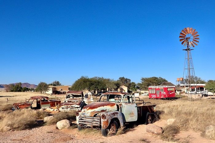
**DAY 12: Monday, May 5, 2025: Walvis Bay - Swakopmund - Round Trip to Cape Cross (seals) - Wreck of the Zeila en route - Henties Bay - Spitzkoppe Tented Camp & Campsite**
After an excellent night, a bit cooler and more humid than usual, we wake up around 7 AM and leave the camp at 7:45 AM to **follow the Atlantic coast heading north**. We thus leave **Walvis Bay**, a very pleasant stopover town, and follow the ocean via the B2. **We enter the mist and Swakopmund** at 8:40 AM, parking **near the lighthouse**. The atmosphere is very quiet, the streets seem dead with large empty parking lots and very little traffic, but the few open shops are filled with expatriates enjoying their breakfasts, French bakeries, cafes, travel agencies... **We are in this Benguela Current, a fast cold ocean current that flows from South Africa, up the coasts of Namibia and Angola, towards the northwest to join a warm equatorial current. Hence the supply of very fish-rich waters and this tenacious mist depending on the seasons. In the northern part of the Namib Desert, fogs are frequent during the southern winter. It's almost the only source of moisture since the city of Swakopmund receives, on average, only 11 liters of water per m² in December and January.**
**Swakopmund is wedged between the dunes and the Atlantic rollers. It is the Namibian capital of adventure activities and has a ghostly colonial remnant. With its German architecture, its seaside promenade, it resembles a seaside town of the North Sea or the Baltic.** It is also a bustling African city. **Nearly two-thirds of Swakopmund's population live in Mondesa, a township created during apartheid, northeast of the city center, a legacy of the South African mandate.** The heart of the city is located in the area of the pier, at the foot of the lighthouse, better known as the Mole. During the South African occupation of Swakopmund, the port took a back seat to Walvis Bay.
Continuing on this C34, sometimes on salt, we come across the famous **wreck of the Zeila, stranded in 2008**, on our left. We can see it through the thick fog, being very close to the beach. It's 10:15 AM. Further on, Henties Bay is a bay that attracts many fishermen; it's teeming with vehicles equipped with fishing rods. Besides its fish-rich waters, it enjoys a relaxed atmosphere and a large beach suitable for walks.
We continue further north, heading to Cape Cross, this time a round trip because we will turn off later here in Henties Bay to reach Spitzkoppe via good gravel roads that are quiet alternatives to the very busy paved B2 further south. **Henties Bay is part of the Dorob National Park, a multi-purpose park protecting coastal ecosystems and hosting the many renowned recreational activities of the region. The part of the coast north of Swakopmund up to the Ugab is particularly popular with fishermen who come in droves to fish for saltwater fish.** The small concrete buildings spaced at regular intervals are actually toilets for fishermen and campers. The coastline is also dotted with world-renowned surf spots.
Even before arriving, we can already smell it before we come across thousands of seals (population in 2021: 1.5 million). **The Cape Cross Seal Reserve, the most renowned on the Namibian coast, is home to the most famous breeding colony of fur seals, which seems to take full advantage of the high concentrations of fish present in the icy waters of the Benguela Current. We are impressed by the sight of these 100,000 pinnipeds lounging on the beach and frolicking in the waves.** We have a picnic a little away from the smells facing the ocean in the sun.
At 12:45 PM, it's time to hit the road again. We retrace our steps back to Henties Bay. We stop there to do another big grocery run before not encountering any big cities for many days. We will only buy fresh items day by day until the end of the trip; we have 23 € worth. **In the space of 30 minutes, we go from 15 to 36°C. The thermal shock with an amplitude of more than 20°C.** At 1:45 PM, we hit the road again via the D1918, then we try a very small track on our left, the D1925. It becomes narrow and rough; I have a bit of apprehension. We arrive at a gate to open in the middle of nowhere, then young children run up to us asking for water or food... We then drive to **Spitzkoppe. The arrival right in front of the mountains is majestic, off the beaten path. This mountain appears in the distance like a mirage above the dusty plains of southern Damaraland.** We come across a second gate held by a guard. We enter the "Community Camp" campsite without realizing it through the west entrance. We are given a small paper, then we go to the reception passing **at the foot of these gigantic, magnificent rocks.** Once at the reception, we are informed that this is not the camp we had booked. Ours is located just a little further, and in the end, it's better because the latter was packed. We were able to cross the park very close to these rocks without paying. We exit through the main entrance; 5 Himba children cling to our doors and trunk asking for bread and food again. We continue despite them staying attached, worried about hurting them. Phew, more fear than harm. We cross the few houses and arrive at the right camp at 4:30 PM, the Spitzkoppe Tented & Campsite. The spot is much quieter and well set up. We have site C12, cozy to perfection with its sink, a private shower and toilet, as well as electricity, under the shade of a tree and facing the mountains. The sunset and sunrise will be perfect. We set up the tent and, without delay, head to the pool for a big dose of coolness. Then it's time to prepare the BBQ and **contemplate the fading lights on the Spitzkoppe massif.**
> Today's road itinerary: 5 hours of driving: Head north on the B2 (paved) along the ocean > Swakopmund > C34 (paved) still heading north > On the left, the wreck of the Zeila before Henties Bay > Cape Cross round trip > Henties Bay > D1916 heading east (track) > Turn left onto D3716 > Turn left to the campsite.
> Gas station: Swakopmund or Henties Bay.
> Distance driven today: 344 km.
> Distance walked today: 6 km.
> Today's expenses: Groceries in Henties Bay: 23 € + Cape Cross park entry: 17 €.
> Accommodation: Spitzkoppe Tented Camp & Campsite - Spitzkoppe River Valley 00000, Spitzkoppe river valley, Namibia - (http://spitzkoppemountaincamp.com/) - 26 € - Pool - BBQ - Shower and toilet.
**DAY 13: Tuesday, May 6, 2025: Spitzkoppe - Rock Pools - Uis**
It's 6:45 AM, **we wake up at the foot of one of the most emblematic landscapes of the country, Spitzkoppe, which towers over the valley at 1,728 m.** **The Spitzkoppe massif, "pointed hat" in Afrikaans, is actually a set of three rock formations: Big Spitzkoppe, the granite domes of the Pontok Mountains that surround it, and Little Spitzkoppe, to the southwest. It was first climbed in 1946 and has never stopped attracting experienced climbers; it remains one of the most challenging ascents in the country. The climate in the region is hot**, so try to visit during the cooler months, as it can quickly reach 36°C in the sun in the afternoon. **Spitzkoppe is particularly striking at dusk, as it was last night, and at dawn this morning when the low light sets the rocks ablaze with red and orange hues. The spectacle is unique.**
We re-enter the park managed by the local community (160 NAD $ per person), then start with the **arch sector**. We quietly enjoy all the viewpoints under perfect orange colors. We leave this magnificent spot, reminding us of (https://www.montagne-aventure.net/2024/04/29/j19-1-juin-2024-canyonlands-national-park-et-arches-national-park/), but with much less crowding here. Around 10 AM, we head closer to these mythical peaks, including the main one nicknamed the Matterhorn of Namibia. Then we finish with the **ascent of the rock above Rock Pool. The 360° view of the park is a must-see. Small natural pools carved into the rock bring a bit of water to this arid and rocky landscape.** The wind blows strongly up there, and during a photo shoot with a tripod, it falls forward right onto the lens glass, cracking it... Frustration and shouts, these will be the last quality photos of this trip, and a new bill to pay when we return to replace it... Disgusted.
We continue to **Bushmans Paradise**, have a lunch break in the shade of a rock before hitting the road again around 12:30 PM after thoroughly exploring the park, feeling weakened and sad about my passion: photography...
We fill up with fuel as soon as we arrive in Uis at the price of 21 NAD $ per liter, a total of 1021 NAD $ for 50 liters (52 € by card). **Uis is a former mining town. Tin mining ceased in the early 1990s, but the high white mountain where the ore was dumped is clearly visible. The region is rich in amethysts, Brandberg crystals, and other semi-precious stones; we come across many vendors on the roadside.**
We then head to our final destination of the day, the **Daureb Isib Restcamp**. We arrive quite early for once at 2:45 PM in the heat, but the camp is just perfectly set up, surely the most upscale we will have during this trip. We are in a fortunately shaded area under palm leaves, with a table, chairs with cushions, a sink, a hot shower, toilets, a beautiful pool, and of course our private BBQ. Perfect for regaining a bit of a smile after the fall of my DSLR camera. **We are facing the Brandberg massif, the "fire mountain" in Afrikaans, dominated by Königstein (2,573 m), the highest peak in Namibia.** **The Brandberg owes its name to the reddish-orange glow that forms on its slopes at dawn and dusk, when the sun's rays awaken its red granite faces studded with crystals. It also hides a real treasure inside, as it contains an exceptional concentration of prehistoric rock art**, mainly paintings and some petroglyphs, including the most famous of them, the **White Lady in the Tsisab Gorge**. There are over 43,000 in total, dating back 2,000 to 4,000 years, scattered in hundreds of crevices around the mountain.
Time for the usual swim, laundry, and evening cooking. On the braai menu, local sausages with cheese pasta and leftovers for a good salad the next day.
> Today's road itinerary: 1h45: Head north on the D3716 > Then D1930 (gravel and sand track) to Uis.
> Gas station: Uis.
> Distance driven today: 113 km.
> Distance walked today: 6 km.
> Today's expenses: Fuel fill-up in Uis for 52 € (1,021 NAD $).
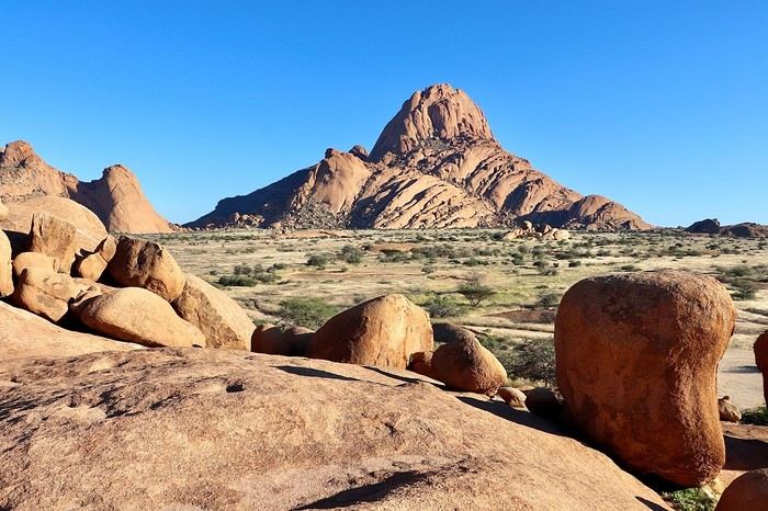
> Accommodation: Daureb Isib Restcamp - Erf 672 C/O 3rd & 4th Avenue Uis 9000, Uis, Namibia - (http://www.daurebisib.com/) – 31 € - Pool. Comfort with private bathroom + electricity + Wi-Fi at the restaurant. Clear sky for a beautiful starry night.
**DAY 14: Wednesday, May 7, 2025: Brandberg (Namibia's Highest Mountain) - Damaraland:**
**The Brandberg massif is an isolated, dome-shaped mountain, an inselberg, that towers over the gravel plains scorched by the sun of the Namib Desert to the northwest. It measures 23 km long and 20 km wide. It is the highest point in Namibia at 2,573 meters.**
This massif formed about 130 million years ago when a gigantic viscous mass of magma from deep within the Earth's crust rose through the surrounding rock layers before solidifying. Later, the granite mass was exposed by the erosion of the surrounding rocks.
**The Brandberg is the highest mountain in Namibia, peaking at an altitude of 2,573 m. The indigenous San people call it the "burning mountain," as it appears to glow with a red light at sunset. With its considerable height and width, this massif influences the local climate, attracting more rain on its slopes than the desert below.** The rain seeps through the springs. Unique animal and plant species thrive in this high-altitude environment, and prehistoric paintings adorn the rock faces hidden in the ravines around the base of the mountain.
The first night was also hot since the start of this trip, the thermometer did not drop below 20°C. We wake up gently around 8 AM, a pleasant sleep-in, the sun is already out. After a quick morning cleanup of the 4x4, we have time today, we hit the road at 9:30 AM, getting lost in the Brandberg massif. We are now in the **Damaraland, which stretches from the majestic rock formations of the Brandberg in the south, where we are today, to the bushy expanses at the foot of the rugged mountains of Sesfontein in the north, where we will be tomorrow. It is the perfect destination for wildlife and flora observation.**
We take the track heading towards the **White Lady**, but we want an alternative to this guided visit only. So, just before arriving, we turn right towards a viewpoint named on Google Maps **Rastplatz**. We come across **small Himba villages, living in extreme poverty with no natural resources; the inhabitants ask for water with every passing vehicle...** A bit further, we encounter about ten **ostriches** in the middle of the track, magnificent, as we get closer to the mountains in the background, and a few meters further, **a herd of Oryx**. Then we approach the **bed of the Ugab River**. We then go back and have a snack in the middle of nowhere, under the shade of our 4x4, facing the mountainous massif. We get back on the road around noon, while the temperature is at its peak in this very hot region, 35°C on the gauge with very dry air. We go up the C35 slightly then turn left onto the small track D2319 until we reach the Ugab bed again. Back to Uis in the mid-afternoon.
We did not book the same campsite as the previous night; today we are at the Brandberg Rest Camp. Unfortunately, the camp is not at the same level as the previous one, which was perfect. But the price is also much lower. The sites are next to each other, separated by small fences behind the main building. But it will do just fine. We have our BBQ and electricity, the shared sanitary facilities are decent. We then lounge in the large pool. We will then buy some water for 10 € at the supermarket located right across.
> Gas station: Uis.
> Distance driven today: 118 km.
> Today's expenses: Groceries in Uis: 10 €.
> Accommodation: Brandberg Rest Camp Uis - No 3 Uis Street Namibia 9000, Damaraland, Namibia - (http://www.brandbergrestcamp.com/) - Large pool – Shower – Electricity
**DAY 15: Thursday, May 8, 2025: Damaraland: Petrified Forest - Ugab Valley - Palmwag**
The night was excellent and slightly cooler than the previous one. We wake up around 7 AM and hit the road just before 7:45 AM heading to a new destination as we continue this Namibian road trip. **We cross Damaraland today from south to north.** First via the C35 to **Khorixas**, then turning left onto the C39. **We come across some villagers walking kilometers under the scorching sun with only a small water container in their hand... What a tough life, light-years away from ours.** About 40 km west of this town, we arrive at the **Petrified Forest National Monument**. It is a vast expanse of veld (open vegetation area), dotted with petrified tree trunks that can reach 34 m in length and 6 m in circumference, estimated to be over 260 million years old. These trees belonged to the Gymnospermae family, conifers among which we find today's cycads and welwitschias. The absence of roots and branches suggests that the trunks were deposited here during a significant flood. The site has about fifty trees, some half-buried in sandstone, others perfectly petrified in silica with their bark and growth rings. A guide is mandatory at the entrance to visit the site.
We then continue on this C39 due west to the junction of the D2612. We make a round trip to the south to **Twyfelfontein, which means "uncertain spring" or "bubbling spring" in Damara**. The site is a UNESCO World Heritage site, located at the entrance of the grassy Aba Huab Valley and houses one of the largest collections of rock art on the continent. More than **2,500 petroglyphs** have been discovered on over 200 stones, as well as some rock paintings. They date back about 6,000 years and others 2,500 years. Many engravings depict species that have since disappeared from the region, such as elephants, rhinoceroses, giraffes, and lions. The presence of a seal attests to the existence of links with the coastline at the time, now over 100 km away. It is here, as well as at Brandberg, that the human history of Namibia began with these testimonies of ritual and economic practices among hunter-gatherer peoples.
We continue a bit further south on the D3214 then D3254 to visit the **Organ Pipes, "organ pipes"**. The entrance is also paid, much to our regret... 500 NAD $ for two. We take a well-marked trail leading to a small gorge containing dolerite (coarse-grained basalt) columns 4 m high and aligned on an astonishing 100 m long wall. We are in a volcanic chain stretching over a dozen kilometers, a pile of scoria that seems to have been exposed to fire, the Burnt Mountain "burnt mountain" stands in a bleak and desolate landscape where almost nothing grows.
We head back north and return to the C39 then the C43 to **Palmwag where we will spend the night**. **This concession, covering an area of 5,500 km², is a region of red hills and plains, remarkable for its rolling landscapes as well as its rich fauna and flora**. The region serves as a **buffer zone between Etosha and the Skeleton Coast**. We have a good chance of encountering black rhinos, desert elephants, and lions, as well as spotted hyenas, giraffes, gemsboks, and other antelopes.
We pass the sanitary control barrier at 4 PM, just before entering Palmwag. In our direction, from south to north, we are simply asked about our future destinations and to present my French driver's license. A few meters further, there is a small gas station, then on our left our final destination of the day: the Palmwag Lodge Campsites. We are happy to arrive after this long journey. The welcome is very pleasant, and the site is very comfortable with a real brick shelter housing our shower and toilet, as well as water and electricity. We always have a BBQ available, but today we unfortunately no longer have meat due to concerns about the sanitary control, but we were not sure if it was rather in the other direction that the transport of fresh meat and dairy products is prohibited. We now cross our fingers to be able to observe some different animals, as the place is renowned for elephants, giraffes, and rhinos. We first take some time to relax in the pool before going for a walk around the reserve, without encountering anything unfortunately this evening, but the wake-up will be up to par... Time for the sunset, which is always one of the highlights of the day.
> Today's road itinerary: 5h30 of driving: C35 heading north > Then turn left onto the C39 > Petrified Forest > Go down on the D3612 in a round trip to Twyfelfontain (rock paintings and Organ Pipes) > Go back up on the C39 then C43 to Palmwag > Round trip on the C40 to Mount Grootberg Pass.
For info on the C43, there is a sanitary control at the entrance and exit (transporting raw meat is prohibited).
Palmwag: black rhinos (guided or free visit? at sunrise or sunset).
> Gas station: Twyfelfontain or Palmwag (07:00 – 19:00) – Tire repair in Palmwag.
> Distance driven today: 349 km.
> Distance walked today: km.
> Accommodation: North of Palmwag Lodge Campsites - GPS Coordinates -19.88556°, 13.93694° - Pool – Water and electricity – 34 € - (https://gondwana-collection.com/accommodation/palmwag-campsite?LodgeName=PALMWAG%20CAMPSITE)
**DAY 16: Friday, May 9, 2025: Palmwag - Sesfontein - Entry into Kaokoland - Opuwo**
This morning, we take our time watching for wildlife. We can finally observe our first **kudus** as the sun begins to illuminate the plain in front of us (see video and time-lapse of the day). A few minutes later, we also spot **a couple of giraffes with their calf**, moving calmly and serenely.
**We leave Palmwag** at 9 AM, heading to the northernmost point of Damaraland via the C43 to Sesfontein.
A few kilometers on the track, and we come across **a herd of zebras**, 11 to be exact, in the middle of green hills. Even further, it's more than twenty that cross right in front of us, a treat for our eyes. Their gait is majestic; they are very sensitive to noise. Some are more curious than others and don't hesitate to stay close if we remain quiet. We then cross numerous rough riverbeds. We must always stay very attentive at the wheel because we can drive at over 80 km/h on straight lines and then suddenly have to brake to cross these small streams, usually already dry at this time of year. Many antelopes are still present by the side of the track; the heat is already rising, and they are often lying on the ground at this hour.
**We arrive in Sesfontein at 11:15 AM**, just as the children are leaving school. Transportation is done by donkey-drawn carts. The villagers spend their time in the shade of the trees and in front of the few small shops. The atmosphere of its streets is dusty with a laid-back pace; this town has the feel of an oasis located **by the Hoanib River**, the town of six springs from which it gets its name. Founded in 1896, it was a military outpost built after a cattle plague epidemic. This page of its history is reflected in Fort Sesfontein, erected in 1905 to fight cattle diseases, arms smuggling, and poaching.
We take a lunch break at the exit of the village around 11:30 AM in the shade of a tree, so peaceful, it's 32°C. We continue further north, away from the usual tourist routes, and **enter the Kunene region, also called Kaokoland**. The track becomes narrower and more winding. **These are now vast solitary spaces largely devoid of roads, simply crossed by sandy tracks opened by the South African army just a few decades ago.** The fauna and flora have managed to adapt to this harsh and dry environment, like the desert elephant, an endangered species whose slender legs are perfectly suited to the long journeys the animal must make to find water, a rare resource. This region is also the territory of the Himba people, emblematic of the country. Its name comes from the Kunene River, which marks a narrow belt of vegetation at the Angolan border.
**We arrive in Opuwo at 3 PM**, **this town is the capital of the Kunene region**. Its name means "the end" in the Herero language, a fitting term for this dusty collection of commercial buildings surrounded by traditional huts with round thatched roofs.
**Opuwo is a strong cultural moment of this trip in Himba territory, this semi-nomadic people traditionally settles in an onganda (small village), moving if necessary to find access to water. Himba women are known for their ochre-colored cream, otjize, a mixture of butterfat and ochre powder, applied to protect and moisturize the skin and hair. Fire and smoke play an important role in their culture.** Smoke, often scented with herbs, is used by women for purification. It can also convey prayers to the supreme being, Muluru. In traditional celebrations, there is always a sacred fire that remains lit between the main hut and the animal enclosure, to maintain ties with the ancestors.
Right upon arrival, we fill up with fuel at the Shell station at the price of 21.48 NAD $ per liter, or 67 liters for 1454 NAD $ (72 €) by card. We then quickly stock up on meat at the Spar **where Himba women with bare breasts mix with us, the only white people shopping in the aisles**. **Since the beginning of this trip, this is where life is most bustling**. There are many people on these dusty streets, after kilometers without seeing anyone, the shock is brutal. There are small markets, poverty but also wealth. The town is quite spread out. There are no white people left, **we finally discover the true, harsh African life.**
We arrive at the **Opuwo Country Lodge at 3:30 PM**, located slightly on the heights. We have site 9 at the end of the property for maximum isolation as we like. Once again, we have private sanitary facilities, a BBQ, and electricity. Once settled, we walk 10 minutes to the reception where the pool is located to cool off. An infinity pool that is just magnificent facing the vast landscape before us. But this contrast between this little comfort and the town below makes us uneasy. The employees walk back down. A guard is present at the entrance of the lodge to ensure security; the park where we are is fenced. We enjoy a good braai, then enjoy the few lights of the town gradually lighting up. The night will be quite noisy for once with very loud music rising from a party below until 2:30 AM... And yet it comes from far away... Maybe a bar? In any case, we rule out what we thought was just a party during our visit here on Friday.
> Today's road itinerary: 4 hours of track: Return via the C43 heading south to Opuwo.
> Gas station: Okangwati or Opuwo
> Distance driven today: 261 km.
> Today's expenses: Fuel fill-up in Opuwo for 72 € + Groceries in Opuwo for 21 €.
> Accommodation: Opuwo Country Hotel - Opuwo Hilltop Opuwo 9000, Opuwo, Namibia - -18.044682 / 13.833861 - (http://www.opuwolodge.com/) - N$600.00 - Pool / Water / Private sanitary facilities / Electricity / BBQ.
**DAY 17: Saturday, May 10, 2025: Opuwo to Epupa Falls:**
We take our time this morning by the **Kunene River**, then we hit the road at 8:45 AM. This is our return trip to Opuwo.
After 4 good hours of driving, **we return to the bustling life of Opuwo**. We refill with fuel at the Shell station (21.48 NAD $ per liter) 820 NAD $ (40 €) for 38 liters and do a quick grocery run at the Spar for 488 NAD $ (24 €). We don't take any meat because we have the **sanitary barrier** to cross tomorrow before entering Etosha Park. We pay for these two expenses in cash for the first time; until now, the credit card was always accepted, so we now have to use the cash we withdrew at the airport. Then we head back to the Opuwo Country Lodge, arriving at the campsite at 2 PM. We are the first to arrive, we rest for a moment before heading to the pool and then end the day around our traditional BBQ with sausages and sautéed potatoes. The full moon accompanies us, perfect for nighttime observations in Etosha starting tomorrow.
The campsite's location should be avoided because we again have infernal music that gets louder from 7 PM to 2:30 AM... And yet it comes from far away... Maybe a bar? In any case, we eliminate what we thought was just a party during our visit here on Friday.
> Today's road itinerary: 4 hours of track: Return via the C43 heading south to Opuwo.
> Gas station: Okangwati or Opuwo
> Distance driven today: 180 km.
> Accommodation: Opuwo Country Hotel - Opuwo Hilltop Opuwo 9000, Opuwo, Namibia - -18.044682 / 13.833861 - (http://www.opuwolodge.com/) - N$600.00 - Pool / Water / Electricity / BBQ
**DAY 18: Sunday, May 11, 2025: Epupa Falls:**
Time for a "vacation" day; we wake up leisurely at 8 AM and take our time this morning. Breakfast and even coffee. The night was good, lulled by the sound of the waterfalls.
In the late morning, we head out on the small path along the banks of the Kunene River, which offers magnificent landscapes. We have a beautiful view of Angola from the opposite bank. The falls extend over about 1.5 km and flow over a series of promontories, the highest of which reaches 37 m.
At noon, we return to our campsite to eat in the shade of the palm trees. On the menu: fried eggs and pasta. We take advantage of this afternoon to rest before the last part of this road trip, with reading, writing, and pool time on the agenda.
In the late afternoon, we return to one of the viewpoints overlooking Epupa Falls to once again enjoy the sunset colors from a different angle. We are over the moon; our thoughts wander in all directions. We discuss future trips, adventures, reminisce about our memories, and think about the world around us... We savor the luck of being here. On the way back, a Himba woman asks if we can give her a ride in our 4x4 to Opuwo tomorrow.
Tonight, we dine on our traditional braai with white beans by the Kunene River. We are lulled by the sound of this powerful river flowing under the song of insects. The coolness sets in, and we fall asleep under the stars.
> Distance driven today: 0 km.
> Distance walked today: 10 km.
> Accommodation: Omarunga Lodge Campsites - 68 € for two nights - Site by the river - (https://gondwana-collection.com/fr/accommodation/omarunga-epupa-falls-campsite?LodgeName=OMARUNGA%20EPUPA-FALLS%20CAMPSITE&hsLang=en)
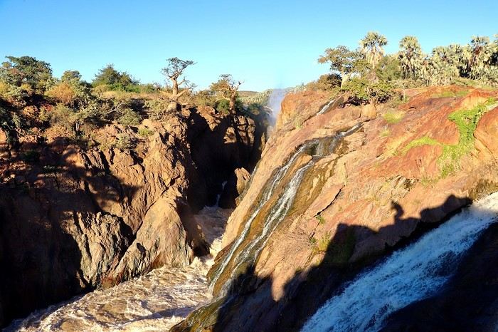
**DAY 19: Monday, May 12, 2025: Epupa to Opuwo**
We enjoy the morning a bit more by the **Kunene River**, then we hit the road at 8:45 AM. This is our return trip to Opuwo.
After 4 good hours on the road, **we return to the bustling life of Opuwo**. We refill with fuel at the Shell station (21.48 NAD $ per liter) for 820 NAD $ (40 €) for 38 liters and do a quick grocery run at the Spar for 488 NAD $ (24 €). We don't take any meat because we have the **sanitary barrier** to cross tomorrow before entering Etosha Park. We pay in cash for these two expenses for the first time; until now, the credit card was always accepted, so we have to use the cash we withdrew at the airport. Then we head back to the Opuwo Country Lodge, arriving at the campsite at 2:30 PM. We are the first to arrive, rest for a moment before heading to the pool, and then end the day with our traditional BBQ: sausages and sautéed potatoes. The full moon accompanies us, perfect for nighttime observations in Etosha starting tomorrow.
The campsite's location should be avoided, as we again have loud music until 2:30 AM... And it comes from far away... Maybe a bar? In any case, we rule out what we thought was just a party during our visit here on Friday.
> Today's road itinerary: 4 hours of track: Return via the C43 heading south to Opuwo.
> Gas station: Okangwati or Opuwo
> Distance driven today: 180 km.
> Accommodation: Opuwo Country Hotel - Opuwo Hilltop Opuwo 9000, Opuwo, Namibia - -18.044682 / 13.833861 - (http://www.opuwolodge.com/) - N$600.00 - Pool / Water / Private sanitary facilities / Electricity / BBQ
**DAY 20: Tuesday, May 13, 2025: Opuwo – Etosha - Olifantsrus**
We wake up before dawn around 6:30 AM. We pack up the camp at 7:15 AM heading to a first waterhole to watch the sunrise and start our day of observations and discoveries. It's 11°C, and as soon as we leave the campsite, we come across numerous zebras, foxes, and springboks with the sun rising on the horizon. Magnificent images.
**At 8:30 AM, we are still alone**, we witness **one of the most beautiful scenes of this trip: 3 lionesses hunting springboks**. It's thanks to the latter, slowing down, that we manage to spot 4 lionesses' heads barely above the tall grass. They hide, stand up, move slowly... We wait without moving. This is their perfect terrain for camouflage. **We are on the lookout and try to be discreet during this hunting scene**. We leave the area to let them finish their remarkable work and continue the track towards the East. The terrain becomes completely flat. It's now been 3 hours since we left the campsite without noticing the time passing, and especially without meeting anyone. Around 10 AM, near a waterhole, we come across a solitary elephant mixed with zebras, buffaloes, and springboks.
Around 11 AM, we take a lunch break; here, it's us who are enclosed in enclosures. Whether in the campsites or the few small equipped areas, we are fenced in by a gate. The animals are free on their territory. The wind has picked up again, just like the sun. We eat alone in absolute calm in the heart of this incredible, unique park; there are no words to describe what nature offers us here, far from any human activity. We start to see some safari vehicles arriving, but the attendance remains much lower than I had imagined. At most, a total of fifteen throughout the day.
Etosha is also a wonderful reserve of vegetation; you can find multiple mopane groves. But also acacias and other trees appreciated by ruminants. The south and east of the park have the most waterholes, which is where most animals gather. In the West, the vegetation is denser, and the wildlife is harder to spot, but it is well present, especially the black-faced impala and Hartmann's mountain zebra, which are found almost nowhere else. The area being less frequented, the bush feeling is more pronounced.
30 minutes of track after eating, **we come across a solitary male lion. The build compared to the females this morning is noticeable from afar**, even though this one is quite far from us unfortunately, unlike this morning when they were right on top of us.
**Etosha is the preferred habitat of lions in Namibia, with about 330 individuals roaming the park's plains, nearly half of the country's wild lions.** The big cats rest under the trees near waterholes, especially the one at Okaukuejo where we arrive today, but it's also a good spot for elephants and rhinos.
We then enter the territory of buffaloes, which we come across by the dozens now. Wow, the encounters keep coming. Then around 2 PM, we follow this immense **Etosha Pan** for the first time, which we will follow for a good part of tomorrow's day.
We arrive at our campsite at 3:30 PM after more than 8 hours of self-safari filled with discoveries. We sleep tonight at the **Olifantsrus Camp**, which we had previously booked in France. We had to wait and click several times for a spot to open up, as the camp has very few sites, and that's a good thing. It is located in one of the wildest areas of Etosha and has a practical observation tower overlooking a waterhole, offering us great opportunities to spot wildlife after nightfall (see photos). **The sunset is once again memorable.** In the guestbook at the reception, where each visitor can note their observations, 3 lions were seen the day before just a few steps from here (1 male, 1 female, and their cub), on a part of the track we didn't cover today; it will be on tomorrow morning's program. We cross our fingers for these predators.
> Today's road itinerary: 6 hours of driving: Leave Opuwo via the C41 (paved road) > Turn right onto the C35 (paved road) to the Galton Gate > Enter Etosha Park.
> Gas station: Opuwo.
> Distance driven today: 369 km.
> Accommodation: Olifantsrus Camping site - 53.4 € for two – Shared sanitary facilities – Electricity – BBQ – No grocery store - (https://www.etoshanationalpark.org/fr/accommodation/olifantsrus-camp)
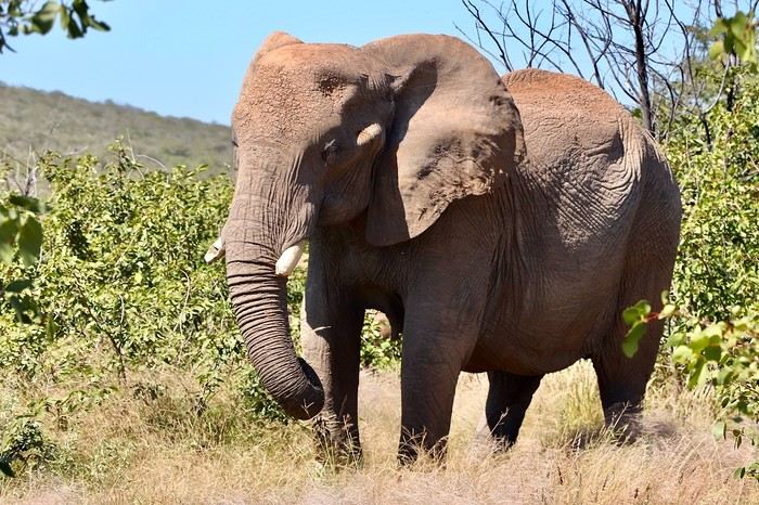
**DAY 21: Wednesday, May 14, 2025: Etosha National Park: From Olifantsrus to Okaukuejo:**
We wake up before dawn around 6:30 AM. We pack up the camp at 7:15 AM as the gates open, heading to a first waterhole to watch the sunrise and start our day of observations. It's 11°C, and just outside the campsite, we come across numerous zebras, foxes, and springboks with the sun rising on the horizon. Magnificent scenes.
**At 8:30 AM, we are still alone**, and we witness **one of the most beautiful moments of this trip: three lionesses hunting springboks**. Thanks to the springboks slowing down, we manage to spot four lionesses' heads barely above the tall grass. They hide, stand up, and move slowly... We wait without moving. This is their perfect terrain for camouflage. **We stay alert and try to be discreet during this hunting scene**. We leave the area to let them finish their remarkable work and continue the track towards the east. The terrain becomes completely flat. It's been 3 hours since we left the campsite without noticing the time, and especially without meeting anyone. Around 10 AM, near a waterhole, we come across a solitary elephant mixed with zebras, buffaloes, and springboks.
Around 11 AM, we take a lunch break; here, it's us who are enclosed in enclosures. Whether in the campsites or the few small equipped areas, we are fenced in by a gate. The animals are free on their territory. The wind has picked up again, just like the sun. We eat alone in absolute calm in the heart of this incredible, unique park; there are no words to describe what nature offers us here, far from any human activity. We start to see some safari vehicles arriving, but the attendance remains much lower than I had imagined. At most, a total of fifteen throughout the day.
Etosha is also a wonderful reserve of vegetation; you can find multiple mopane groves. But also acacias and other trees appreciated by ruminants. The south and east of the park have the most waterholes, which is where most animals gather. In the west, the vegetation is denser, and the wildlife is harder to spot, but it is well present, especially the black-faced impala and Hartmann's mountain zebra, which are found almost nowhere else. The area being less frequented, the bush feeling is more pronounced.
Thirty minutes of track after eating, **we come across a solitary male lion. The build compared to the females this morning is noticeable from afar**, even though this one is quite far from us unfortunately, unlike this morning when they were right on top of us.
**Etosha is the preferred habitat of lions in Namibia, with about 330 individuals roaming the park's plains, nearly half of the country's wild lions.** The big cats rest under the trees near waterholes, especially the one at Okaukuejo where we arrive today, but it's also a good spot for elephants and rhinos.
We then enter the territory of buffaloes, which we come across by the dozens now. Wow, the encounters keep coming. Then around 2 PM, we follow this immense **Etosha Pan** for the first time, which we will follow for a good part of tomorrow's day.
We arrive at our campsite at 3:30 PM after more than 8 hours of self-safari filled with discoveries. We sleep tonight at the **Okaukuejo Resort**. Upon arrival, this impression of a small town in the middle of hundreds of kilometers without infrastructure remains shocking. **The atmosphere is quite different from last night in our small wild campsite**. However, even though the attendance is higher, we are lucky to get a site in a corner (number 46). **The lit waterhole will also be a reward**. After checking in, we take advantage of the small grocery store to buy two meats for our next BBQs in the park, 3 pork chops and sausages, as well as a cold drink for 252 NAD $. This locality also offers a gas station, a restaurant, and a nice pool, but our goal during this park stay remains focused on the wildlife, so I won't give in this time. Time to set up, followed by a short rest, then our toilette before heading to the "waterhole" for the sunset around 6 PM. **A new grand spectacle unfolds before us, a hundred zebras come to hydrate right before our eyes at the water reserve facing the sunset in a cloud of dust. Then a couple of lions approach stealthily without managing to fill their stomachs. A third guest arrives, a second male lion also comes to drink. The waterhole now becomes the territory of the lions... We are speechless facing what nature offers us, we savor for over an hour scrutinizing the smallest details. What an intense day, images that will remain forever etched in our minds.** It's our turn to have our meal with three beautiful pork chops on the BBQ accompanied by curry vegetables.
At 9 PM, we decide to return to the waterhole, a wonderful idea because we find **an elephant and two black rhinos courting in the water. The male has a hard time seducing his sweetheart and eventually leaves, but a third rhino appears out of nowhere to join her. The scenes unfold under the spotlights** accompanied by a sky full of stars. We eventually go to bed. Looking forward to the rest of the story tomorrow.
> Today's road itinerary: Camp Olifantsrus > Camp Okaukuejo.
> Gas station: Okaukuejo camp.
> Distance driven today: 229 km. > Today's expenses: Groceries for 12 €.
> Accommodation: Okaukuejo Camping Site - 48.12 € for two - Pool - Gas station - Lit waterhole - Grocery store - (https://www.etoshanationalpark.org/fr/accommodation/okaukuejo)
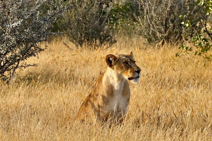
**DAY 22: Thursday, May 15, 2025: Etosha National Park: From Okaukuejo to Halali:**
We wake up around 5:30 AM to a strange noise getting closer, a few thunderclaps, then heavy rain pours down on us! The first since the start of this trip, we had forgotten its sound and smell. We leave the campsite quickly at 7:13 AM as the gates open, the rain stops just in time!
We are right in the heart of the park today. We arrive at the Etosha Pan, an immense flat salt desert that, a few days a year, transforms into a shallow expanse teeming with flamingos and pelicans. At the end of the dry season, everything, from elephants to grasslands, is covered in the white, chalky dust of Etosha.
Around noon, at the Riedfontein waterhole, we spot two male lions in this picturesque savannah. As we've noticed, the females hunt while the males protect the territory. The males and cubs will benefit first.
The day was less emotional than the previous one. We encounter far fewer animals, often at a greater distance. Is it because of the stormy rain we had at dawn this morning, or is it the area? The tracks were also more exhausting, especially the Rhino Drive without meeting a soul. But the view over the immense salt pan as far as the eye can see is worth seeing. Maybe the waterhole at the campsite will surprise us tonight as it did yesterday?
We arrive at 4 PM at the Halali Resort for our last night in the park. We still have a lit waterhole, more intimate than yesterday's, and we can walk around the park thanks to a hiking trail. The sanitary facilities are shared and quite recent, with each site offering its own BBQ and electrical outlet. After setting up and a quick wash, we head on foot to the Halali waterhole for sunset. Tonight's menu features local sausages (beef and pork) with curry pasta.
> Today's road itinerary: Camp Okaukuejo > Camp Halali.
> Gas station: Halali Camp.
> Distance driven today: 242 km.
> Accommodation: Halali Camping Site - 48.12 € for two - Pool - Gas station - Lit waterhole - Grocery store - (https://www.nwr.com.na/resorts/halali-resort/)
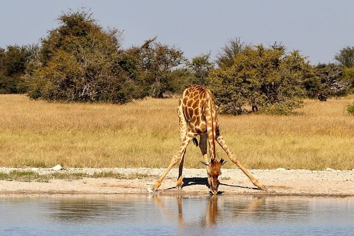
**DAY 23: Friday, May 16, 2025: Etosha National Park: From Halali to Namutoni - Waterberg Park:**
We pack up the camp at 7:15 AM as the gates open. It's 17°C, and the sun is out as usual. **We follow the Etosha Pan, still quite wet at this time of year.** The small track offers different viewpoints under a sun gradually rising higher.
The further east we go, the more we encounter gnus, kudus, and impalas. **We are once again spoiled and delighted by everything we discover this morning.** A majestic **giraffe** appears before our eyes just before arriving at **Namutoni** around 9:45 AM, quickly followed by 4 other companions. From there, we change plans, do the **Fischer's Pan** loop, and then decide to exit through the northern gate, allowing us to cover the entire park. Our last encounters will be with these tallest animals, the giraffes, and what a spectacle to see them spread their legs to hydrate, followed by gnus.
Just before the exit, we take a lunch break at an equipped area at 11:30 AM.
**We leave Etosha National Park with a touch of nostalgia through the King Nehale Iya Mpingana gate** at 12:30 PM. We find the beautiful paved B1 road, which is a great relief. Cows and goats take over; driving at 120 km/h on these single-lane, two-way roads with these animals we brush past requires constant vigilance. We fill up with fuel at 1:30 PM in **Oshivelo** (21.33 $ per liter), 93 liters for 99 € by card. Since we hadn't planned to go so far north out of Etosha, we are surprised to go through a **sanitary check** at the exit of the town, but it turns out to be even quicker than the previous one, a simple glance in the fridge by very smiling women, much more pleasant than the staff at the Etosha entrances and exits.
We pass **near Lake Otjikoto** ("deep hole" in Herero), which is **one of the only two natural lakes in Namibia along with its neighbor Lake Guinas**. In 1851, explorers Charles Andersson and Francis Galton came across this karst lake occupying a limestone cauldron 100 m long, 150 m wide, and 55 m deep. Its steep walls, about 20 m high, are the result of the collapse of the rock roof of the sinkhole under water pressure. This lake is also known for the large quantity of weapons and ammunition found in its depths. Remnants of the region's violent past, they were dumped there in 1915 by the retreating German army, refusing to let South African troops get their hands on them. Unfortunately, it's paid entry, and given the late hour, we continue on our way. To our great surprise, there is a lot of traffic on this B1, including many trucks, the first time we've seen so many people in this country. The landscapes change; we even discover deciduous trees taking on their autumn colors.
We pass through **Tsumeb**, and the road continues to **Otjiwarongo**, which means "pleasant place" in the Herero language, and the town lives up to its name. Prosperous and peaceful, with wide avenues and a relaxed atmosphere, we stop there to do some shopping. We buy some local meat to treat ourselves during these last two remaining camping nights: skewers, pork, and sausages, as well as biscuits, a last water tank, and yogurt for Mimi; 388 NAD $ - 20 €. We get back on the road heading south via the B1 for 15 minutes, then turn left onto the C42, still paved, for 30 minutes and 41 km, then left again onto the D2512, a wavy sandy track for 15 minutes.
**We enter the Waterberg National Park this evening.** The arrival facing this mountainous massif in the middle of the plains under the end-of-day lights of a deep red makes us even more eager to discover it. **Composed of impressive sandstone cliffs, tangles of vines, a canopy teeming with birds, elusive wildlife, and improbable dinosaur footprints. The Waterberg occupies a large sandstone plateau 50 km long and 16 km wide, at an altitude of 150 m above the plain.** It is possible to encounter elands, black wildebeests, roan antelopes, buffaloes, and red hartebeests, and with luck, leopards, as well as 200 identified bird species.
We arrive at the NWR campsite at 6 PM, the first time we arrive so late, just before nightfall. It's from here that various hiking trails start for tomorrow's day, including the **Mountain View Trail** that climbs to the edge of the plateau. We quickly settle into this peaceful camp where calm reigns, no more than 5 vehicles tonight. The place is shaded, with fairly recent shared sanitary facilities, electricity, and a BBQ for each. We savor our second-to-last braai under the stars, hearing our plane that brought us to Frankfurt fly over, every day at the same time over the Waterberg then Etosha. Very rare, as there are very few flights that land or fly over Namibian skies.
> Today's road itinerary: 10 hours of driving: B1 then C42 then D2512.
> Gas station: Exit of Etosha Park, Tsumeb, Otavi, or Waterberg Park.
> Distance driven today: 616 km.
> Accommodation: NWR Waterberg Camping Site - Pool - Water - 45 € for two - (https://www.nwr.com.na/resorts/waterberg-resort/#1577510913112-8f243e49-35a647e7-1997)
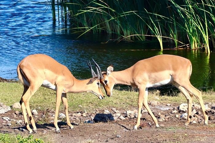
**DAY 24: Saturday, May 17, 2025: Waterberg Park - Otjiwa:**
We wake up around 7 AM after a very cool night.
**At sunrise, the cliffs appear even redder, and the cries of baboons echo around us.** We come across about thirty of them. We start the hike around 8:15 AM. **The Mountain View Trail will take us to the Waterberg Plateau.** The temperature is pleasant for walking. **The trail starts in a thick forest where the song of birds resonates.** The path is little frequented, so progress is slow and irregular; we regularly have to duck, step over, and climb rocks. However, in 35 minutes, we reach the top of the plateau. We are once again alone in the world in this Namibian nature. **The 360° panorama extends over a wide plain of green shrubs below, then over these steep red cliffs** giving access to this suspended plateau of the Waterberg. To enter, unfortunately, a special permit is required, and you must be accompanied by a guide. We savor the moment under the already hot sun at 9 AM. After an hour reminiscing about our journey on our rocky promontory, we start the descent at 10 AM, completing a loop back to our starting point. **At 10:30 AM, we pass by the small cemetery of German fighters who died in 1904**, then we hit the road back to the B1. We take a lunch break at noon at one of the tables scattered regularly along the paved roads. We are watched by **baboons** perched in their tree. We then decide to make a **detour through the town of Otjiwarongo**, which we didn't have time to explore properly yesterday. **A quick visit to the train station is a must to see locomotive No. 41, built in 1912 by the German company Henschel. It was transported to Namibia to carry ore between the mines of Tsumeb and the port of Swakopmund before being decommissioned in 1960 when the tracks were modified.**
We return to do some shopping and bring back some souvenirs for 300 NAD $ (14 €). We then take the road south on the B1. I start to feel the end of this immense loop through Namibia. Morale is gradually dropping. But we still have plenty of beautiful things to discover. We arrive at 3 PM at the **Otjiwa Safari Lodge. This will be our last night camping after 22 nights sleeping in the wild to the sound of animals.** The nostalgia is palpable. We enter this high-end private park; we don't really feel at home upon arrival. The reception, the pool, the restaurant, everything is very upscale, unlike anything we've experienced during this road trip. However, the reserve has its charm; we come across our beautiful antelopes again. The 10 sites are very comfortable, spaced apart under some bushes. Each has, of course, its BBQ, electricity, lighting, and sink. Before enjoying our last evening, we need to do a thorough dusting of the 4x4 and a good cleaning and organizing of our belongings. Then it's time for our last perfect braai: chicken and pork skewers, as well as tomato-flavored white beans.
> Today's road itinerary: 1h30 of driving: Waterberg > Otjiwarongo > Okonjima wildlife reserve - D2512 then C22 then B1 then turn right onto a 3 km track.
> Gas station: Waterberg Park.
> Distance driven today: 135 km.
> Distance walked today: 6 km.
> Today's expenses: Souvenirs for 14 €.
> Accommodation: Otjiwa Safari Lodge - B1 main road, west side Otjiwarongo 12001, Otjiwarongo, Namibia - (http://www.otjiwa.com.na/) – 40 € for two – From 3 PM.
**DAY 25: Sunday, May 18, 2025: Otjiwa - Windhoek:**
For this last leg of our Namibian journey, we complete the loop back to our starting point, Windhoek. We leave our last campsite at Otjiwa, later than usual, at 10 AM. We head due south on the B1 in less than 3 hours to the country's capital, not without a touch of nostalgia after all these kilometers traveled through Namibia. The landscapes roll by with a lot of melancholy. We make a stop 60 km north, in Okahandja. We take the opportunity to fill up with fuel (21.10 $ per liter), 500 NAD $ for 23 liters; the card machine wasn't working, so we had to withdraw from an ATM at the next gas station. A local was quite insistent at my window, asking for food or money. Anyway, after 15 minutes, we get back on the road.
From here, we take the new A1, a 2x2 lane highway limited, like the previous roads, to 120 km/h. Then we gradually see some of the country's industries before entering the capital in the blink of an eye. We arrive at 1:45 PM at Chameleon Backpackers. It's a small hostel-style hotel with a central pool, a shared kitchen, secure indoor parking, and a restaurant. They also organize tours (3 Day Express, 3 Day Link, 4 Days Etosha, 7 Day Norbert Adventure), very different from everything we've encountered so far, a kind of atmosphere like in Thailand. There are dormitories, rooms with shared bathrooms, and our little cocoon, the Love Bird, a room located alone on the upper floor with its small balcony, a swing, its bathroom, and its large bed with a thatched roof. A lot of charm while overlooking the pool. We eat before setting off to explore the capital.
Windhoek is a modern and well-maintained city, contrasting completely with the rest of the country. It is heavily influenced by its German colonial heritage, still very present in some streets of the capital. The architecture is colorful and surprising. The skyline is shared between the spires of a neo-baroque cathedral, the unusual silhouette of three castles from the German colonial era, and glass and steel skyscrapers. Office workers head to Zoo Park at lunchtime.
We enjoy the smell of grills at some street corners lined with small single-story houses with zinc roofs.
We first head to Windhoek's emblematic monument, its unofficial symbol: Christuskirche, just a 10-minute walk away. This German Lutheran church rises above the traffic at the center of an intersection. Built in 1907 with local sandstone. The roof and other elements were imported from Europe. The result evokes a gingerbread house.
We then walk along the pedestrian shopping street of **Post Street Mall** to admire African crafts, but on this Sunday, most shops are closed; we'll come back tomorrow. We return via the Wernhil shopping center.
> Today's road itinerary: Return to Windhoek in 3 hours via the B1 then the A1. In the capital, turn left onto Florence Nightingale, then right onto Beethoven Street then C28 then B6, then Bismarck Street. Take Church Street and Trift Street towards Voight Street.
> Gas station: Okahandja or Windhoek.
> Distance driven today: 245 km.
> Accommodation: Chameleon Backpackers & Guesthouse – 49 € for two - 5-7 Voigt St, North Windhoek Central, 9000 Windhoek
**DAY 26: Monday, May 19, 2025: Windhoek, Visit to the Namibian Capital:**
Our last sleep in Namibia... The wake-up is a bit sad; we still enjoy this return to comfort in a real bed. After a hearty breakfast, we check out of our little cocoon at 10 AM. We leave our vehicle in the secure parking lot and return for a walk in the center of Windhoek. On this Monday, the center is immediately livelier while still remaining extremely calm for a capital. The pace of life is slow; employees move slowly without rushing, each task is performed with a slowness that is almost surprising. A few skyscrapers further on, we quickly leave the hyper-center. We retrace our steps to the shopping gallery where we linger for a while. We eat around noon with African music in the background, making us even more nostalgic. Then the trip will gradually come to an end, unfortunately, until the moment when we will have to, not without regret, return our rental vehicle around 3 PM... We stop by the hotel again and then head to the rental agency and then to the airport by shuttle, included in our contract.
At 4:20 PM, we are back at the airport. We see ourselves upon arrival as if it were yesterday... Tears are not far off; we wait, the formalities are much quicker than upon arrival. **We board by walking across the tarmac on foot, escorted by about fifteen Namibians, facing the sunset. It will be there until the end, beautifully drawn on the horizon, to say goodbye to Namibia...**
> Round-trip flight tickets with Lufthansa from Lyon: 2029 €, or **1,014.50 €** per person.
> Vehicle rental: 4x4 Toyota with roof tent for 24 days: Gracious Whisp Car Rentals: 2,638 € (N$50,640) or **1,319 €** per person - (https://gwcarrentals.com/)
**DAY 27: Tuesday, May 20, 2025:** Flight FRA 8:15 AM -> 9:35 AM LYS (Air Dolomite No. 1074)
Total expenses including flight tickets + vehicle rental + visa + Lyon parking + food + fuel:
Cost per person: 3467 € Cost for two: 6935 €
>> All our photos and videos for each day on our website here: (https://www.montagne-aventure.net/voyages-découvertes/namibie-2025/)
>> Find all our photos and videos for each day on our website here: www.montagne-aventure.net
**DAY 1: Thursday, April 24, 2025: Outbound Flights from Lyon to Windhoek via Munich - Visit to Munich:**
Off we go on a new adventure. The alarm rings at 6:30 AM, the travel bags are packed, and we head to Lyon Airport. We booked our flight tickets with Lufthansa. The first leg to Munich, Germany, is operated by AirBaltic. Departure at 1:05 PM for a 1-hour and 20-minute flight. We arrive at 2:30 PM.
**We now have a 7-hour layover, so we take the opportunity to get some fresh air and explore Munich.** We quickly exit Terminal 2 of the airport and head towards the subway. We buy a group day ticket "Airport-city Day Zone M-5," valid for 2 to 5 people at a price of 30.50 € (instead of 16.30 € per person). We take the S8 line to **Marienplatz** in 35 minutes. **This is the heart of the city.** The weather is overcast, quite cool, but dry. Perfect for a little city trip between two flights while leaving our large luggage in transit at the airport. **Munich is the third-largest German city after Berlin and Hamburg, in the Bavaria region.** **The center has a lot of charm and brings together several religious buildings, easy to explore on foot.** We are impressed by the number of people enjoying these 100% pedestrian streets, which are very pleasant. After Marienplatz, the most famous square with the town hall, we head to the Cathedral of Our Lady, a Gothic church, then continue to **Karlsplatz** and move on to **the food market offering a wide selection of high-end food products in an atmosphere where a certain art of living prevails.** We also visit St. Peter's Church before grabbing a bite to eat. Two good hours were enough for this 10 km city walk. It's time to take the subway back: by 6:30 PM, we are back at the airport. Now, it's time for a bit of waiting and rest. Our second flight is scheduled for 9:35 PM for a 9-hour and 30-minute journey to our final destination in Namibia: **Windhoek.**
> Round-trip flight tickets with Lufthansa from Lyon: 2029 €, or 1,014.50 € per person.
> Lyon Airport parking: 120 €
> Today's expenses: 7 € for 2 pizzas in France / 14 € for the restaurant in Munich / 30.50 € for the daily subway ticket in Munich.
**DAY 2: Friday, April 25, 2024: Arrival in Windhoek, Visit to the Namibian Capital:**
After a 9-hour and 30-minute overnight flight with Discover Airlines, we finally land on Namibian soil just before 7:30 AM. The day is breaking, and the colors are already stunning. We are eager despite the usual fatigue from the flight. The airline was punctual, with friendly staff and good meals, though a bit light. We are the first flight of the day to land, with no more than 15 flights per day here, from 7 AM to 8 PM. We disembark on the tarmac at this airport located in the middle of nowhere, **I finally set foot on African soil for the first time.** We exit among the first from the aircraft to go through the long formalities at the front of the line, as the wait can quickly become endless. Allow at least 5 minutes per person for e-visas. We still wait 45 minutes despite only about twenty people ahead of us. Phew, it's done. We collect our luggage and then withdraw money from an ATM. We make 4 withdrawals of the maximum amount, 2000 NAD $ per withdrawal, for a total of 380 €, or 95.33 € per withdrawal.
Our driver arrives at the same time, perfect timing, we were quick.
We leave the airport at 8:45 AM. By 9:30 AM, we arrive at the **Gracious Whisp vehicle rental agency**, located at the entrance of Windhoek, small and human-sized with a fleet of recent vehicles. More formalities, then a short wait as our vehicle is not yet ready. Time to decompress, catch our breath, and enjoy the very pleasant morning temperature. Not a cloud in sight. Next, a briefing on the vehicle, always with a bit of apprehension due to our approximate English. Allow 45 minutes of explanations, including setting up the roof tent, camping equipment, technical information in case of a flat tire, driving tips in Namibia, and a tour of the 4x4. We have all the necessary equipment for camping: mattresses, sleeping bags, pillows, table, chairs, gas stove, BBQ grill... as well as 2 spare tires, a compressor, a dual tank, and accessories for removing wheels. Off we go, it's time to muster our courage and get behind the wheel. **Heading to SuperSpar Maerua**, fortunately located less than 10 minutes away. We park with the help of a parking attendant; it's very crowded, the space is narrow, but everything goes well despite the cursed right-hand drive. Today's new mission: stock up on groceries. The store is well-stocked with local and imported products, catering to all tastes. We spend 114 € on groceries, from pasta to meat, BBQ lighters to dishwashing products. Two people load our groceries into two carts and transfer them to our vehicle; we feel compelled to leave a tip, 50 NAD $, as we don't have change yet. Now, we head to the hotel, 15 minutes away. Traffic is difficult at a complicated intersection; this will likely be the only traffic jam in Namibia. **We arrive at Kate's Nest Guesthouse & Backpackers around 1:15 PM, quite tired.** We take some well-deserved rest at this recent establishment, quite calm with secure private parking. After a short nap, we enjoy the quiet by the hotel pool. Night falls between 6:30 PM and 7 PM. We eat quietly in our room tonight before starting this long 4x4 road trip in camping mode in the heart of Namibia.
> Today's grocery expenses: 114 € at Super Spar Marua (2395.21 NAD $).
> Round-trip flight tickets with Lufthansa from Lyon: 2029 €, or 1,014.50 € per person.
> Vehicle rental: 4x4 Toyota with roof tent for 24 days: Gracious Whisp Car Rentals: 2,638 € (N$50,640) or **1,319 €** per person - (https://gwcarrentals.com/)
> Distance driven today: 15 km.
> Accommodation: Kate's Nest Guesthouse & Backpackers - 4 Aristotles Street Academia, 9000 Windhoek - 36 € for two for one night.
> Windhoek International Airport website: (https://www.airports.com.na/)
**DAY 3: Saturday, April 26, 2025: Windhoek to Hardap: Mariental Region - Kalahari Desert:**
After a good, restful night, we wake up leisurely around 7 AM. We enjoy the comfort provided by this first and last hotel before 24 nights under the tent.
**We leave Kate's Nest Guesthouse at 8:30 AM to tackle the Namibian roads.** We quickly leave the capital; in just 30 minutes, we find ourselves almost alone in the world. The landscape is dotted with small domes. We leave the **paved B1** quickly to turn left onto the **C15**. **From there, we won't see more than 10 vehicles all day.** After passing through the few houses of **Lekkerwaterpoort**, we tackle our first gravel road. These road sections are limited to 100 km/h, but even at 70 km/h, I find it already challenging. However, I quickly get used to it and gradually pick up speed to reach my cruising speed of around 80 to 90 km/h. **We are on immense straight lines crossing wild expanses as far as the eye can see.** **We come across two baboons, a few ostriches, and numerous cattle and sheep farms.** We pass through the charming village of **Uhlenhorst** with its typical houses and children with broad smiles waving at us. Life here is already very different from Windhoek. **The thermometer rises quickly from 16°C at 8:30 AM to over 28°C in the early afternoon.**
**We arrive at the Hardap Dam reserve at 2 PM.** We stop at the toll booth at the park entrance to pay the entrance fee: 250 NAD $ for 2 people and 1 vehicle. We continue to the dam and then the camp entrance, located a bit further. We had booked in advance, but this place remains little frequented by foreigners.
We take advantage of the hottest hours to rest by the large pool overlooking the immense lake, a very enjoyable moment. Would this be a bit of a vacation?
Around 4:30 PM, we head to the campsite. We overlook this vast water reserve. We arrive first; we will be only 3 vehicles spending the night here. It's time to get to work and set up our equipment for the first time. It takes us a good 20 minutes to set everything up, with a slight apprehension about unfolding the tent. Once this task is done, which we will have to repeat for almost a month, we will become much more efficient over time. Time for rest and contemplation in total silence. The sun gradually sets, and the heat quickly becomes bearable again. Bliss! **This dam is located 20 km northwest of Mariental in an area dotted with conical hills topped with dolerite buttons (Hardap means "hillock" in Nama). It captures the Fish River, which flows south, creating a large lake in the middle of an arid environment. The contrast is striking.** We enjoy our first sunset facing this 360° otherworldly landscape.
Around 7 PM, we start our first BBQ, or "braai" as it's called here. The temperature is perfect. The sun sets, giving way to a star-filled sky of incredible beauty thanks to the absence of any light pollution. The Milky Way will lull us throughout the evening. After some good sausages and potatoes on the BBQ, we head to our roof tent around 9:30 PM with a complete change of scenery in just 24 hours. France already seems so far away...
This campsite has shared showers and toilets, quite clean and functional, as well as a central area with several BBQs and tables. The sites are arranged in a semicircle, each with an electrical outlet. The sites are close to each other but spacious, some slightly shaded. We are only three vehicles tonight, so it's perfectly comfortable and quiet. Not to mention the large pool near the restaurant. Our trip is off to a great start.
> Today's road itinerary: Windhoek > Head south on the B1 to Rehoboth > Turn left onto the C25 then C15 to Stampriet > C20 to Hardap > Full north on the B1 > Then turn left onto the M93 - 5 hours of driving.
> Distance driven today: 354 km.
> Accommodation: Hardap Recreation Resort - 23.3 € for two - Large pool - GR6W+3M2, Hardap Game Reserve, Mariental, Namibia - (http://www.nwr.com.na/resorts/hardap-resort/)
**DAY 4: Sunday, April 27, 2025: Hardap - Brukkaros Volcano - Keetmanshoop - Quivertree Forest Rest Camp**
Our first night under the tent was very pleasant; the little wind quickly calmed down, giving way to absolute silence. The mattress is decent, more comfortable than some nights in Nepal. The length and width give us enough space for maximum comfort, despite my height (1.91 m). We wake up a little before 7 AM as the sun rises, and the lights dazzle us from the start of the day. We pack up the equipment in 30 minutes, quite easily. Then we enjoy the sun, which warms up quickly while we keep our light fleece on.
At 8:30 AM, **we hit the road again, heading south** to our first stop in **Mariental**. We want to do some shopping at SuperSpar, but once we arrive in the parking lot, a young local is fighting with the supermarket security guards and then threatens to throw stones. We don't want to take any risks right at the start, so despite the baton blows he receives, he doesn't stop. We leave empty-handed but fill up with fuel at the Shell station 1 km further. The price per liter is 21.33 NAD $, we fill our 107-liter tank for 107 €. In Namibia, you get served, and they bring the card machine to the window to pay. It's then customary to leave a tip.
We then take the B1 heading due south on a recently renovated road. Around 11:30 AM, we leave it on our right to take **a wild gravel road, the M98**. Just before **Berseba**, we turn right onto a small track, the **D3904 towards Brukkaros Crater up to a camp at 1588 m altitude**. The track then becomes too bumpy. We stop on the counter-slopes where **a wide panorama unfolds over these immense plains as far as the eye can see**. It's 12:15 PM, time for us to eat a rice and tuna salad facing this landscape.
**We are alone in the world until a vehicle arrives and parks next to us.** A bit of apprehension, 4 men head towards us. It turns out to be 4 shepherds looking for a lost foal. The conversation is pleasant, lost in the middle of nowhere. We find ourselves alone again in this absolute silence. **The heat becomes stifling with a good 30°C**. We get back on the road around 1 PM. Back on the B1, **we continue due south to Keetmanshoop**, which we reach around 3 PM. We stop there to do some shopping for 262 NAD $ (12 eggs, a can of tuna, a can of corn, bread, a soda, and a 5-liter water container), or 12.48 €. Two quite insistent children ask us for money or candy at the store exit, yet we give them a small tip, but they continue to cling to the car. Locals parked next to us tell them to leave us alone. Anyway, we finish the trip to **Quivertree Forest**, 15 km away. We will spend the night in this **pleasant farm run by a German**. Upon arrival, as the day before, and as I suppose in the future, we dive straight into the cool pool to relax after all these kilometers. A bliss. Then we take our 4x4 and choose a spot near these famous trees. After the 33°C this afternoon, once 4 PM passed, the temperature drops again and becomes very pleasant. **We are in the middle of the Kokerboom, one of the most interesting and characteristic plants of hot and arid regions. It's not really a tree but a variant of the aloe plant whose botanical name is Aloe Dichotoma. This Kokerboom has a smooth and thick trunk reaching up to 1 m in thickness and 9 m in height. They bloom for the first time at the age of 20 to 30 years.** The flowers are yellow and reach about thirty centimeters during the season between June and July. **They grow mainly in an environment with a high concentration of black rocks absorbing a large amount of heat (38°C). The rocks also serve to anchor the tree with its tentacle-like roots. It also resists frost. Each is between 200 and 300 years old.**
Around 5 PM, we walk to the farm reception to watch the feeding of **two cheetahs**. Magnificent carnivores taking their time to savor their piece of meat. **Then we return near our campsite to enjoy the sunset among these trees. The colors are sublime, as every evening apparently. A magnificent spectacle with colors evolving from yellow to orange then to pink, before giving way once again to a sky filled with thousands of stars.** Our campsite at Quiver Tree Forest Camp is very comfortable; we have a water supply, a stone table, a small lamp, an electrical outlet, a small tree for shade, and a BBQ that we won't use tonight; we'll cook on gas. The sites are far apart, with some shared facilities scattered around, a very beautiful setting. No reservation possible, no need, just show up directly. **The campsite accommodation for 2 people costs 28 €, including the reserve entrance fee of 5 €**. We finish this second bivouac evening around 9:30 PM, time for some reading and sleep in peaceful silence without wind.
> Today's road itinerary: Mariental > B1 heading south to Brukkaros > At Tses turn right towards Berseba via the M98 > Turn right onto the D3904 > 8 km > Brukkaros Volcano (stop at the lower camp as the track is difficult for 1 hour) > Keetmanshoop > Turn left onto the M29 > Quivertree Forest - 4 hours of driving.
> Distance driven today: 371 km.
> Distance walked today: 6 km.
> Today's expenses: Groceries for 12.48 € (262 NAD $) / Fuel for 107 € (1 liter of diesel for 21.33 NAD $).
> Accommodation: Quivertree Forest Rest Camp, P.O. Box 262, Keetmanshoop, Namibia - BBQ, hot showers, toilets, and electricity - No reservation - Pool - 18 €/Person (N$ 340.00 with park entrance) - (http://www.quivertreeforest.com/)
**DAY 5: Monday, April 28, 2025: Quivertree Forest Rest Camp - Giant's Playground - Keetmanshoop - Fish River Canyon - Canyon Roadhouse:**
After an excellent start to the night, we are woken up by the wind shortly before 6 AM, but the sunrise is not far off. We get up at 6:30 AM to enjoy it. The atmosphere is a bit cooler this morning, but the reward is already here.
The adventure continues. At 7:45 AM, we head towards **Giant's Playground**, 4 km away. We take a 3-kilometer walk through this expanse of blocks and igneous rocks.
We continue south at 8:45 AM, passing through Keetmanshoop again where we do some shopping for 25 €, a big stock-up for a good part of the trip: meats, canned goods, pasta, fruits... At 9:30 AM, we take the B4 to Fish River Canyon.
At 11:30 AM, we arrive at the entrance to the NWR park (350 NAD $ entrance for 2 people and 1 vehicle). The track becomes bumpy immediately upon entering the park. After about ten kilometers, we come upon this landscape carved by nature. In the end, it's well worth the detour. We were at the Grand Canyon in the USA exactly (https://www.montagne-aventure.net/2024/04/29/j21-3-juin-2024-grand-canyon-et-lac-powell/) and can thus confirm that this Fish River Canyon is comparable. We make several stops along the southern flank. **Here, nothing is developed; nature is almost in the wild state.** **With 160 km in length, up to 27 km in width, and a depth of 150 m, it is indeed the second-largest canyon in the world.** The history of the canyon is apparent in its different earth layers and stratification: the antiquity of the place is tangible, and the absence of vegetation is surprising. **It consists of two nested canyons, formed at distinct periods. The first distinct layer of schist, sandstone, and eruptive material surrounding the canyon was formed a few two billion years ago, then transformed due to heat and pressure into more solid rock such as gneiss. The inner canyon, carved more recently by the Fish River, has a depth of 270 m.**
We have a picnic once again alone in the world facing this grand panorama at the **Sulphur Spring View Point**. This is where the hiking trail begins, plunging into this narrow canyon, but it is forbidden to venture there alone without a guide. It's 30°C, but a slight wind makes the atmosphere bearable. At 1 PM, we retrace our steps and continue to the **Main View Point** then to the **Hikers View Point**.
In the south of Namibia, the Fish River Canyon, 160 km long, is a true geological wonder: a canyon nested within another canyon, one of the largest in the world. The first sedimentary layers formed two billion years ago; 500 million years ago, a period of tectonic activity caused these layers to crack and tilt, opening a vast canyon in the Earth's crust. The second canyon, with a depth of 270 m, was carved over time by the passage of the Fish River in this new valley.
At 3 PM, we arrive at our very charming camp for the evening, the **Canyon Road House**. We fill up with fuel right away because tomorrow we have a long day of isolated driving: 55 liters for 1240 NAD $. Then we settle into the campsite we had previously reserved in France. We are assigned site 2, very well set up under a tree with its BBQ and stone table just steps from the pool. We quickly set up the tent and jump straight into the pool for the relaxation moment of the day. As usual, the water is quite cool, but it's a real pleasure. Then we stroll around this Canyon Road House, which recreates the atmosphere of the roadside inns of the 1950s with old car wrecks and vintage gas pumps in a bygone era. **Around 5:45 PM, we start a short walk leading us to the top of a hill overlooking the wide plateau where we are to watch the sunset.**
And finally, to end this beautiful day, it's time for the braai, with grilled sausages and white beans on the evening menu.
> Park entrance: 150 DN/person + 50 DN/vehicle (18 € for two). It is possible to enter at two access points: Hobas in the north and Ai-Ais in the south.
> Today's road itinerary: M29 > Keetmanshoop > B1 > B4 > C12 (track) > After Holoog turn right onto the D601 (C37 track) > Accommodation on our right (stop just to check in before 6 PM) > Continue 30 km (30 minutes of track) to the viewpoints after Hobas where you must pay the entrance fee. Sunset View Point to the left > Return before sunset as the park closes (best lights at sunrise). 3 hours.
> Distance driven today: 228 km.
> Distance walked today: 10 km.
> Today's expenses: 25 € for groceries / 17 € for the Fish River Canyon park entrance / 58 € for fuel.
> Accommodation: Canyon Roadhouse, Gondwana Collection Namibia – 34.4 € for two - Pool - Near Hobas - (http://www.gondwana-collection.com/fr/accommodation/canyon-road-campsite)
**DAY 6: Tuesday, April 29, 2025: Canyon Roadhouse - Orange River - South African Border - Vista Trail - Gondwana Sperrgebiet Park - Aus:**
The night was excellent in this very comfortable campsite. **We wake up to the sound of birds** before the alarm at 6:45 AM. Our little morning routine starts as the sun rises. **A big day of driving awaits us to the South African border. This will be the southernmost point of our journey.** We hit the road at 8 AM via the C37, pass through **Hobas**, then turn onto the D207 to **Aussenkehr.** **We cross a mountainous barrier with some high peaks and perfect cones. The rock varies from orange to pink to black.**
We then cross a lunar desert as far as the eye can see on a giant dome; the track winds through nowhere without meeting anyone for hours. The landscapes are surprising. **We spot several ostriches and a gemsbok.** In the middle of this endless expanse, we come to an improbable intersection and continue right onto the D278.
In the middle of these arid lands, we come across a green zone: a vast vineyard. At 10:30 AM, **we come across a "Road closed" sign, fortunately, a local resident waves us to continue; a bit stressed, we proceed.** We start to follow the beautiful Orange River. On the other side of the bank, just a few meters away, South Africa is there. It is the second-longest river in Southern Africa, after the Zambezi. It flows over 2,000 km to the Atlantic. After passing through narrow gorges, we regain altitude before starting the descent, gently heading back north.
**We now cross and follow the Fish River, which joins the Orange River further south** **along this gorge dating back millennia.** At exactly noon, we take a lunch break by the Fish River, still without meeting a soul in this landscape between greenery and aridity. The temperature here is cooler with a pleasant 23°C on the banks, the perfect spot. **We continue on the track to Rosh Pinah**, where we find a paved road again. **The section along the Orange River and the Fish River was officially closed, but we were able to pass without any issues, avoiding a detour of at least 3 hours.** Phew. We now drive at high speed (limited to 120 km/h) through these vast spaces. We come across many ostriches after the **dozens of monkeys along the Fish River**. Around 3 PM, 3 km after the very small town of **Aus**, we reach **our campsite for the evening at Klein Aus Vista**. A new **small peaceful haven very well set up**. As usual, after checking in at reception, we jump straight into the beautiful pool to get our well-deserved dose of coolness, another good thermal shock that our bodies appreciate. Once this moment of relaxation is over, we take our 4x4 to reach the campsite located a bit higher, set apart at the foot of a hill that overlooks us.
After setting up, **around 5 PM, we head to the Vista Trail to climb to the top of a mountain overlooking the vast plain that surrounds us at 360°**. It takes about 30 minutes to climb. The place is just magical, **the perfect viewpoint to admire the sunset**. **We fully savor the moment. We also spot one of the few wild horses in the world capable of living in the desert.** Their numbers have decreased in recent years due to predation and drought (around 100 to 150). At 7 PM, we return to the camp, time for the braai and preparing the meal in this peaceful little camp.
In the south of Namibia, the Fish River Canyon, 160 km long, is a true geological wonder: a canyon nested within another canyon, one of the largest in the world. The first sedimentary layers formed two billion years ago; 500 million years ago, a period of tectonic activity caused these layers to crack and tilt, opening a vast canyon in the Earth's crust. The second canyon, with a depth of 270 m, was carved over time by the passage of the Fish River in this new valley.
> Today's road itinerary: 5 hours of driving: D324 heading south (track) > turn right onto the C10 (track) > D316 heading south > turn right onto the C13 > In Aus turn left onto the B4 > Campsite via a track on the left.
> Fuel station: Solitaire or Aus.
> Distance driven today: 398 km.
> Distance walked today: 7 km.
> Accommodation: Klein-Aus Vista Desert Horse Campsite - Farm Klein-Aus No 8 on the B4 main road to Luederitz Aus 9000, Aus, Namibia - (http://www.klein-aus-vista.com/accommodation/desert-horse-campsite/) 17908 420 DN - Water + Shared shower (hot water). No electricity.
**DAY 7: Wednesday, April 30, 2025: Aus - Kolmanskop - Diaz Point - Luderitz - Kanaan Desert:**
We wake up around 6:45 AM, with partly cloudy weather for once; we feel the ocean's influence gradually. But the sun isn't far off. At 7 AM, we leave the campsite heading west towards Luderitz via the B4. **First stop of the day: Kolmanskop, the ghost town we reach at 8:30 AM**, entry costs 180 NAD $ per person. We discover this **timeless place** in 1.5 hours, moving from building to building amidst violent sand-laden gusts of wind. There's a lot of charm in these different living spaces. **The sand quickly reclaimed the place after this mining town was abandoned.** This was once the headquarters of Consolidated Diamond Mines. It's hard to believe that this former town, where the diamond industry once flourished, had a hospital, a bowling alley, and a theater. The decline in diamond sales after World War II and the discovery of richer deposits put an end to this golden age. By 1956, the town was already completely deserted, and the sand had reclaimed its rights. **These dilapidated buildings swallowed by shifting dunes have something surreal about them.**
At 10:15 AM, we hit the road again **heading to Luderitz, 22 km away**, and first to **Diaz Point** **facing the Atlantic Ocean**. It's a wind-swept peninsula with its characteristic red and white lighthouse. There's a campsite and a coffee shop on site, but the place doesn't inspire rest without shade or shelter from the wind. We return to the city via the D701 track that runs along the ocean, be careful at low tide. We come across **a few fishermen and a fox as well as flamingos.**
We walk through the few streets of the city, much smaller than I imagined, then climb to the **famous little Lutheran church that overlooks the city, the Felsenkirchr.** **The wind blows very strongly here, and the sand is omnipresent, surrounded by the Namib Desert and the southern Atlantic coast.** **A German colonial relic barely touched by the 21st century, Luderitz seems frozen in the past, giving it both a gloomy and a certain charm. In short, it's certainly one of the most incongruous places in Africa.**
At 1:15 PM, just before leaving Luderitz, we do some shopping for 20.50 € and fill up with fuel: 61.50 €, 1290 NAD $ for 61 liters (21.18 $ per liter).
**We return via the B4 to Aus** (paved), **then via rougher tracks**, the C13 then the D707, magnificent as it runs along a mountain range with multiple colors on our right and an endless flat desert on the other side.
To access our campsite for the evening, we must take a **narrow private track for 7 km** on our right to emerge, in this total vastness, at the **isolated Kanaan Desert Retreat on a small hill**. I don't have time today to jump into the pool near the reception; we arrive at 5 PM at 8 small, isolated, and unique sites with a small kitchen, a shower, and a private toilet under a small tarp shelter. **A crazy charm with a unique view...** **This will be my favorite accommodation of this trip. The photos speak for themselves.** We jump into the outdoor shower while savoring the landscape, then prepare our evening braai while enjoying the colors fading, facing this plateau with bushes turning a vivid orange. **A moment that will remain etched for life.** **Savanna atmosphere under a thin emerging moon. Every minute offers different colors. Facing our meal, we have a natural giant screen.**
We end this day contemplating the stars and admire this thin orange moon setting on the horizon (8:42 PM).
**Ghost town just before Luderitz: Kolmanskop** (open from 8 AM to 3 PM - N$ 180 p.p – 9 €). Once, Kolmanskoppe was organized around diamond mining. After finding new, more prolific spots, the town was abandoned and is now a ghost town. The sand and dunes have reclaimed their rights and buried everything humans had built. Houses, train station, bakery, everything has been covered by sand, which passes through the windows, even though they are 1 meter high.
> Today's road itinerary: 5h30: B4 to Luderitz (paved) > Round trip > Kolmanskop on the left > Return via the previous campsite > Then C13 (track) > Turn left D707 (track) > Then track to the right to the campsite.
> Distance driven today: 438 km.
> Distance walked today: 8 km.
> Today's expenses: Groceries at the Spar in Luderitz for 20.50 € / Fuel fill-up in Luderitz for 61.50 €.
> Official Kolmanskop website: (https://kolmanskuppe.com) (open from 8 AM to 1 PM - N$ 180 p.p – 9 €).
> Accommodation: Night at the south of the Namibrand Nature Reserve: Kanaan Desert Retreat – 26.5 € for two - (http://www.kanaannamibia.com/) - Farm 104 Karas 9000 - Sanitary facilities + BBQ + Water + Pool - No electricity - My favorite accommodation of this trip.
**DAY 8: Thursday, May 1, 2025: Kanaan Desert Retreat - Namib Desert - Crossing the Namibrand Nature Reserve – Sesriem Canyon - Elim Dune - Little Sossus Lodge**
After a cooler night than the previous ones with about 10°C, we wake up around 7 AM. We admire, as usual, the sunrise between the desert and the mountains. **The spot from last night was truly perfect, isolated from the world, in total serenity, with a wake-up call to the sound of birds.**
We hit the road a little after 8 AM, heading north via the D707 to Spes Bona, then the gravel road C27 via Betta to Sesriem. **The landscapes roll by and dazzle us.** **We are right in the heart of the Namibrand reserve**, coming across numerous **zebras**, **impalas**, **ruminants that reproduce in large numbers**, and **gemsboks**. At noon, we stop in the shade of a tree to eat. The spot is so romantic facing orange arid mountains and a vast green plateau. **A landscape full of contrasts, timeless and silent.**
**The Namib Desert is the oldest on the planet; its name means "vast arid plain," and it also gave its name to the entire country: Namibia.** The majority of these arid and semi-arid lands dotted with viewpoints are part of the Namib-Naukluft National Park, which covers 23,000 km².
At 1 PM, we enter the Sossusvlei park. We start with the **Sesriem Canyon**, which is 3 km long and 30 m deep. We enter it with a short 1-hour hike into its depths. **It was carved by the Tsauchab River in an agglomerate of sand and pebbles over 15 million years old.** We retrace our steps back to Sesriem, which means "six belts," referring to the number of leather belts (from ox wagons) needed to draw water from the canyon. This remote locality is mainly the gateway to Sossusvlei but offers a gas station and some accommodations. For our part, we sleep 40 km away tonight.
**We then move on to Elim Dune.** It takes about 45 minutes of walking to reach its summit, and the climb is very breath-taking as we progress in the sand where we almost slide back with each step. **A first grand 360° panorama unfolds. The ochre color of the sand contrasts completely with the yellow plain and the brown and black mountains in the distance.**
At 3:15 PM, we start the descent facing Sesriem. We were completely alone once again on this dune. **These Namib dunes are composed of colored quartzite sand, presenting hues ranging from cream to orange and from red to purple. Unlike the ancient dunes of the Kalahari, these move with the wind and adopt distinct, ever-changing shapes.** Star dunes resemble stars seen from above, while transverse dunes, like those on the coast south of Walvis Bay, stand perpendicular to the prevailing southwest wind. The most stable dunes, which thus have the most vegetation, are parabolic dunes, due to the variability of the winds. Longitudinal (seif) dunes measure up to 100 m in height, while barchan dunes, crescent-shaped and predominant at the extreme north of the Skeleton Coast and south of Luderitz, are the most mobile, created by unidirectional winds.
**We get back on the road for 45 minutes to our campsite for the evening, Little Sossus, which we reach at 5 PM**, via C27 then right onto C19. As often upon our arrival, I jump into the cool pool to relax after all this driving, then we proceed to set up the camp. As the day before, the campsite consists of 10 fairly distant sites, with private sanitary facilities and a small roof. We are delighted with this crazy charm. The hot water for our shower is wood-heated: a Namibian lights it every evening around 5 PM.
For a change, or not, the menu features a small BBQ with pork ribs and pasta, facing another sunset, this time with partial cloud cover giving equally splendid colors. Time for a well-deserved rest after long corrugated tracks covered in our 4x4 today.
> Today's road itinerary: 4h45 of driving: Find the D707 and head north (track) > At Spesbona turn left onto the C27 (track) > At Sesriem after entering the park, turn left following View Point Sesriem > Continue 4.5 km to the Sesriem Canyon Parking > Return then head towards Elim Dune > Exit the park then take the D826 > Turn right onto the C19 heading SE > Turn right facing the D854 to the campsite (campsite closes at 7 PM).
> Distance driven today: 272 km.
> Distance walked today: 8 km.
> Today's expenses: Entry to the Sossusvlei Namib-Naukluft Park: 17 € for two (with one car).
> Accommodation: Little Sossus Lodge – 35 € for two - At the junction of the C19 and D854 roads Maltahohe 9000, Maltahohe, Namibia - (http://www.littlesossus.net/) - Pool + Private bathroom + Hot water + Electricity + BBQ + Grocery store (bread to order the day before).
**DAY 9: Friday, May 2, 2025: Little Sossus Lodge - Namib-Naukluft National Park – Sesriem - Sossusvlei - Big Daddy – Deadvlei - Tsauchab River Camp**
Today we start the day early to tackle **the famous dunes of Sossusvlei at first light**. The alarm goes off at 6 AM to leave the camp at 6:45 AM. The wind is blowing quite strongly in gusts this morning, but it only woke us up a quarter of an hour before sunrise. The park opens at 7:15 AM. We start with a small encounter: a friendly **jackal lounging by the roadside.**
We first have to cover the 40 km of track to Sesriem, pay the entrance fee (350 NAD $), and drive 65 km on a paved road this time to reach the **vast salt pan (a lake whose sediments are made of salts) of Sossusvlei**. **It appears amidst the gigantic red dunes that rise on either side. The wind constantly changes the shape of the dunes, as well as their colors, which vary with the light. The setting is breathtaking, giving an impression of immensity and timeless grandeur.**
The paved road ends; the last 4 kilometers become technical and are reserved for 4x4s. Phew, I pass without any problems, though not without stress, switching to L4 mode. **We start the ascent to Big Daddy at 8:45 AM, 325 m of elevation gain in the sand nonetheless.** We climb at an excellent speed despite the strong wind, in exactly 1 hour. At 9:45 AM, we are at the summit of what will remain etched for a long time. The 360° view is simply unimaginable; you have to experience it to believe it. The wind blows violently up there, **it feels like being in the high mountains, on a snow ridge, with a strong transport of sand. The atmosphere is magical.** We start the descent running barefoot in the steep sand.
**We then move on to its neighbor, Deadvlei.** **Here, petrified trees stand in the "vlei" (basin) with their dried branches casting desolate shadows on the white ground. The juxtaposition of the deep blue sky and the towering dunes is captivating.**
We return to the 4x4 parking at 11 AM, the stress rises again for the sandy track passage. We retrace our steps and stop at **Dune 45**.
At noon, we take the opportunity to picnic at the foot of **the beautiful Dune 40**, where there is already no one left. We enjoy the quiet again, well, almost, as the wind remains omnipresent.
At 1 PM, we return to **Sesriem**, where we fill up with fuel (21.15 NAD $ per liter), totaling 1630 for 77 liters (78 €), and do some shopping for 245 NAD $ (two nice pieces of pork, 2 cans, 2 sandwiches for tomorrow, and 1 soda), which is 12.48 €. It's 27°C. We hit the road again, heading to a new destination at 2 PM. We take the C19 back to Little Sossus where we spent the night, then turn left onto the gravel road D854 for about 40 km to **Tsauchab River camp**. Finally, we won't be sleeping here; we are redirected 7 km downstream to **Naukluft View Camp**, which also belongs to Tsauchab River Camp.
We arrive at 4 PM, and thankfully, the fatigue was starting to set in. **Our campsite is located under a small forest, providing some protection from the wind that blew strongly all day. The calm does us a world of good. Once again, a lot of charm**, with very spaced-out sites without any visibility. We can't wait to take our shower. It will be possible from 5 PM with, as the day before, water heated by a wood fire. Time to prepare the campsite for the night. And on the menu, a braai with two superb pieces of pork bought in Sesriem and fries!!!!
**The Namib Desert**
An impressive coastal desert stretching from the Atlantic to a high plateau inland, the narrow Namib Desert runs along the southwest African coast for about 1,300 km. **Considered one of the oldest deserts in the world**, it is bordered to the north by the Kaokoland Desert, which extends into Angola, and to the south by South Africa's Karoo. The narrow Namib is mostly less than 160 km wide. Despite this, it is considered to consist of three sections: the coastal strip influenced by the Atlantic; the Outer Namib, occupying what remains of the western half; and the Inner Namib, comprising the eastern half of the desert. Generally called the Skeleton Coast, the coastal Namib receives almost no rain and depends on regular marine fogs for moisture. From sea level, the terrain rises to 900 m, where the desert meets the base of the Great Escarpment to the east. In the Inner Namib, average annual rainfall is only about 50 mm.
The dryness is such a characteristic of the Namib that it is thought to have been in this arid state for at least 55 million years. It is all the more surprising to learn that animals such as vipers, geckos, zebras, and elephants live in this desert. Some areas of the Namib are also rich in flora, including Welwitschia mirabilis, which grows near the ground with seemingly exhausted leaves, extracting moisture from marine fogs and can live over 1,000 years. In the southern Namib, some dunes are up to 32 km long and 240 m high.
**The frequent fog of the Skeleton Coast:** Driving north along the coast of Namibia, the cold Benguela Current in the Atlantic cools the moist air above the ocean, which, upon meeting the warm desert air, leads to the formation of thick fog banks that drift up to 100 km into the center of the Namib before evaporating under the sun.
> Today's road itinerary: 4 hours of driving: C19 towards Sesriem (track) > D826 (paved) > Foot of Big Daddy via a technical sandy track > Return via the same route > D854 to Tsauchab.
> Gas station: Sesriem.
> Distance driven today: 254 km.
> Distance walked today: 12 km.
> Today's expenses: Park entry at Sesriem for 2 people: 17 € / Fuel fill-up: 78 € / Groceries at Sesriem gas station: 12 € (245 NAD $).
> Accommodation: Tsauchab River Camp - Naukluft View Camp - D054 & D850 GPS: S24 26' 37" E16 10' 11" Sossusvlei 22007, Maltahohe, Namibia - BBQ + Private sanitary facilities + Water - www.tsauchab.com
**DAY 10: Saturday, May 3, 2025: Tsauchab River Camp - Naukluft National Park - Olive Trail Hike (10 km) - Ababis Guest Farm**
We pack up the camp at 8 AM and continue our road trip north via the D854, a bumpy track with many corrugated sections. It's cool this morning, 12°C.
**We enter the Naukluft massif, discovering landscapes with very different terrain than before.** We first need to check in at the campsite, 13 km from the entrance at the end of the track: 350 NAD $ for 2 people and 1 vehicle, then return 4 km back. **On the agenda is the lovely Olive Trail, a 10 km hiking loop that starts 4 km northwest of the park office**, along the D854 that we follow. At 9:45 AM, the hike begins with a fairly steep ascent (about 45 minutes) among the **wild olive trees** from which the trail gets its name. **At the summit, we enjoy a view that embraces the Naukluft Valley.** We then turn east and gradually descend into a deep valley, passing over sometimes slippery rocks. We have a snack around 11:30 AM in these small gorges. **Further on, to cross the wall of a canyon in front of us, some chains are fixed to the rock to help us pass.** We finish this superb loop clockwise at 1:15 PM, taking 3.5 hours including 30 minutes of breaks. We only crossed a small group of 3 people on this wild adventure far from everything. At 1:45 PM, we exit the park and take the **D854 track north to Bullsport**. From there, we turn left and take the C14, which **runs along the bed of the Tsondab River.**
**We arrive at our campsite for the evening, Ababis Guest Farm, at 3 PM.** Quite early for once, allowing us to rest a bit in this peaceful farm where many sheep wander around us. We also enjoy the pool under a magnificent sun, less hot than the previous days, it's 22°C. The camp has only 4 spaced-out sites around shared sanitary facilities. **We are in the middle of a vast plain facing the Naukluft massif mountains.** We will have another beautiful sunset on these mountains. For the first time on this trip, **we will be completely alone at this campsite.** **We haven't encountered many people today**, just 3 during the hike and fewer than 10 vehicles all day.
> Today's road itinerary: Head north on the D854 (track) > Turn left to enter the Naukfluft National Park > Continue on the track then turn right to the Olive Trail hike parking lot (1 hour for 45 km). Return to the D854 and continue north > At Bullsport turn left onto the C14 to Ababis (still a track) > The camp is located on the left facing the D1261 (1 hour for 60 km from Olive Trail). Total: 2 hours of driving for 100 km.
> Gas station: No gas station on the route, except in Solitaire.
> Distance driven today: 115 km.
> Distance walked today: 13 km.
> Accommodation: Ababis Gaestefarm - Night booked by email – payment on site: (https://www.ababis-gaestefarm.de/) - P.O.Box 1004, Maltahöhe - N$ 300.00 per person
**DAY 11: Sunday, May 4, 2025: Ababis Gaestefarm - Namib-Naukluft National Park – Solitaire - Gaub Pass - Kuiseb Canyon - Moon Landscape - Walvis Bay**
The night was, for the first time since the start of this road trip, quite difficult. A strong wind accompanied us all night, making the tent flap constantly. A racket that drove us crazy. We still managed to sleep a few hours. The morning sun brings back our smiles. We hit the road for this new stage a little before 7:45 AM.
We start the day with a first stop less than 15 km away **on the C14 in Solitaire** at 8:15 AM. **This town is lost in the middle of nowhere with its small gas station with a western atmosphere adorned with rusted and sand-covered car wrecks.** After a quick supply stop: 86 NAD $, or 4 € for 1 water container and a box of cookies, we continue north still on the C14, **crossing the Tropic of Capricorn** then devouring this **magnificent track up to Gaub Pass**. **A succession of narrow gorges, turns, climbs, and descents breaking the monotony of the previous long straight lines.** We are right in the heart of no man's land for 200 km. We then start the descent to the **Kuiseb Canyon. It houses the wide bed of the eponymous river, dry almost all year.** Even when it flows for 2 to 3 weeks during the rainy season, it doesn't go beyond Gobabeb and then seeps into the sand. **The drinking water that supplies Walvis Bay is pumped at Rooibank from this underground water table.** **We now cross the Kuiseb Desert where impressive dunes roll down.** We make a short stop at a **natural rock arch** reminding us of our (https://www.montagne-aventure.net/2024/04/29/j19-1-juin-2024-canyonlands-national-park-et-arches-national-park/). Then we gradually descend towards **Walvis Bay** where we will spend the night. At noon, we enter the **Dorob National Park**. The thermometer drops 10°C in 10 minutes as we get closer to the Atlantic Ocean.
At 12:45 PM, much earlier than initially planned, we arrive at the **Moon Landscape** (View Point 4, free) to have a snack, via a very recent surprising dual carriageway in the middle of nowhere, then via the C28. We are again in the hinterlands, the temperature has soared: 30°C without a bit of shade. Even if the colors and the panorama must be exceptional at sunrise or sunset, the detour for this 360° panorama is still worth it. Extreme aridity as far as the eye can see. The place lives up to its name; it really feels like being on the moon. We get back on the road at 1:30 PM via the D1991, C28, then again the A2, which is very new. The latter runs along the beautiful dunes up to the **Dune 7**, where we make another stop.
Then we head towards our final destination of the day, **Walvis Bay. Its port is sheltered by a sand spit, a natural breakwater that protects the city from the powerful assaults of the ocean. Its port was long a strategic place: claimed by the Cape Colony in 1795, it was officially annexed by the British in 1878 to counter Germany's ambitions in the region. A colony of fur seals, pelicans, flamingos, and whale terns have made it their home.**
We do a big grocery shopping at the Spar located in the center for 66 €; it's very easy to park there. Then we fill up with fuel at an Engen station right across for 1117 NAD $ for 54 liters (20.6 NAD $ per liter), which is 54 €. We then **enjoy the seaside in the Lagoon neighborhood**, where it's also easy to park. After kilometers in the desert, **this cool break is more than welcome. The outside temperature is 22°C. In the distance, we can clearly see the clouds lingering over Swakopmund.**
We take the 4x4 one last time to the **Lagoon Chalets where we will spend the night**. The spot is well set up and surprising in the heart of a residential neighborhood. The sites are quite large, separated by fences around very comfortable shared sanitary facilities. BBQ, electricity, and shaded area. We settle in quietly before going out on foot to watch the **sunset over the Pacific Ocean along Lagoon Promenade Road**. We can still see this impressive persistent mist in the distance. The neighborhood is very peaceful, certainly without much charm, but with a very well-developed seafront that inspires relaxation after kilometers without meeting anyone in inhospitable lands. We end the day with our traditional braai: grilled chicken thighs and sautéed potatoes in the coolness of a starry sky.
> Today's road itinerary: 5h30 of driving (or 3h30 of driving for 250 km without the Moon Landscape): Head north on the C14 > Cross the Tropic of Capricorn > Gaub Pass > Kuiseb Canyon on our left in a round trip > Continue to Green Valley and leave the C14 to the right on the D1984 > Turn right on the C28 > Then left D1991 to Moon Landscape D1991 View Point 4 > Return via the same road and stop at Dune 7 for sunset > Walvis Bay.
> Gas station: Solitaire or Walvis Bay.
> Distance driven today: 372 km.
> Distance walked today: 5 km.
> Today's expenses: Fuel fill-up for 54 € + Groceries for 66 € at Spar.
> Accommodation: Walvis Bay: Lagoon Chalets – 36.6 € for two - (http://www.lagoonchaletswb.com/) - 8th Road West, Meersig Meersig 9000, Walvis Bay, Namibia - BBQ – Electricity – Shared sanitary facilities.
**DAY 12: Monday, May 5, 2025: Walvis Bay - Swakopmund - Round Trip to Cape Cross (seals) - Wreck of the Zeila en route - Henties Bay - Spitzkoppe Tented Camp & Campsite**
After an excellent night, a bit cooler and more humid than usual, we wake up around 7 AM and leave the camp at 7:45 AM to **follow the Atlantic coast heading north**. We thus leave **Walvis Bay**, a very pleasant stopover town, and follow the ocean via the B2. **We enter the mist and Swakopmund** at 8:40 AM, parking **near the lighthouse**. The atmosphere is very quiet, the streets seem dead with large empty parking lots and very little traffic, but the few open shops are filled with expatriates enjoying their breakfasts, French bakeries, cafes, travel agencies... **We are in this Benguela Current, a fast cold ocean current that flows from South Africa, up the coasts of Namibia and Angola, towards the northwest to join a warm equatorial current. Hence the supply of very fish-rich waters and this tenacious mist depending on the seasons. In the northern part of the Namib Desert, fogs are frequent during the southern winter. It's almost the only source of moisture since the city of Swakopmund receives, on average, only 11 liters of water per m² in December and January.**
**Swakopmund is wedged between the dunes and the Atlantic rollers. It is the Namibian capital of adventure activities and has a ghostly colonial remnant. With its German architecture, its seaside promenade, it resembles a seaside town of the North Sea or the Baltic.** It is also a bustling African city. **Nearly two-thirds of Swakopmund's population live in Mondesa, a township created during apartheid, northeast of the city center, a legacy of the South African mandate.** The heart of the city is located in the area of the pier, at the foot of the lighthouse, better known as the Mole. During the South African occupation of Swakopmund, the port took a back seat to Walvis Bay.
Continuing on this C34, sometimes on salt, we come across the famous **wreck of the Zeila, stranded in 2008**, on our left. We can see it through the thick fog, being very close to the beach. It's 10:15 AM. Further on, Henties Bay is a bay that attracts many fishermen; it's teeming with vehicles equipped with fishing rods. Besides its fish-rich waters, it enjoys a relaxed atmosphere and a large beach suitable for walks.
We continue further north, heading to Cape Cross, this time a round trip because we will turn off later here in Henties Bay to reach Spitzkoppe via good gravel roads that are quiet alternatives to the very busy paved B2 further south. **Henties Bay is part of the Dorob National Park, a multi-purpose park protecting coastal ecosystems and hosting the many renowned recreational activities of the region. The part of the coast north of Swakopmund up to the Ugab is particularly popular with fishermen who come in droves to fish for saltwater fish.** The small concrete buildings spaced at regular intervals are actually toilets for fishermen and campers. The coastline is also dotted with world-renowned surf spots.
Even before arriving, we can already smell it before we come across thousands of seals (population in 2021: 1.5 million). **The Cape Cross Seal Reserve, the most renowned on the Namibian coast, is home to the most famous breeding colony of fur seals, which seems to take full advantage of the high concentrations of fish present in the icy waters of the Benguela Current. We are impressed by the sight of these 100,000 pinnipeds lounging on the beach and frolicking in the waves.** We have a picnic a little away from the smells facing the ocean in the sun.
At 12:45 PM, it's time to hit the road again. We retrace our steps back to Henties Bay. We stop there to do another big grocery run before not encountering any big cities for many days. We will only buy fresh items day by day until the end of the trip; we have 23 € worth. **In the space of 30 minutes, we go from 15 to 36°C. The thermal shock with an amplitude of more than 20°C.** At 1:45 PM, we hit the road again via the D1918, then we try a very small track on our left, the D1925. It becomes narrow and rough; I have a bit of apprehension. We arrive at a gate to open in the middle of nowhere, then young children run up to us asking for water or food... We then drive to **Spitzkoppe. The arrival right in front of the mountains is majestic, off the beaten path. This mountain appears in the distance like a mirage above the dusty plains of southern Damaraland.** We come across a second gate held by a guard. We enter the "Community Camp" campsite without realizing it through the west entrance. We are given a small paper, then we go to the reception passing **at the foot of these gigantic, magnificent rocks.** Once at the reception, we are informed that this is not the camp we had booked. Ours is located just a little further, and in the end, it's better because the latter was packed. We were able to cross the park very close to these rocks without paying. We exit through the main entrance; 5 Himba children cling to our doors and trunk asking for bread and food again. We continue despite them staying attached, worried about hurting them. Phew, more fear than harm. We cross the few houses and arrive at the right camp at 4:30 PM, the Spitzkoppe Tented & Campsite. The spot is much quieter and well set up. We have site C12, cozy to perfection with its sink, a private shower and toilet, as well as electricity, under the shade of a tree and facing the mountains. The sunset and sunrise will be perfect. We set up the tent and, without delay, head to the pool for a big dose of coolness. Then it's time to prepare the BBQ and **contemplate the fading lights on the Spitzkoppe massif.**
> Today's road itinerary: 5 hours of driving: Head north on the B2 (paved) along the ocean > Swakopmund > C34 (paved) still heading north > On the left, the wreck of the Zeila before Henties Bay > Cape Cross round trip > Henties Bay > D1916 heading east (track) > Turn left onto D3716 > Turn left to the campsite.
> Gas station: Swakopmund or Henties Bay.
> Distance driven today: 344 km.
> Distance walked today: 6 km.
> Today's expenses: Groceries in Henties Bay: 23 € + Cape Cross park entry: 17 €.
> Accommodation: Spitzkoppe Tented Camp & Campsite - Spitzkoppe River Valley 00000, Spitzkoppe river valley, Namibia - (http://spitzkoppemountaincamp.com/) - 26 € - Pool - BBQ - Shower and toilet.
**DAY 13: Tuesday, May 6, 2025: Spitzkoppe - Rock Pools - Uis**
It's 6:45 AM, **we wake up at the foot of one of the most emblematic landscapes of the country, Spitzkoppe, which towers over the valley at 1,728 m.** **The Spitzkoppe massif, "pointed hat" in Afrikaans, is actually a set of three rock formations: Big Spitzkoppe, the granite domes of the Pontok Mountains that surround it, and Little Spitzkoppe, to the southwest. It was first climbed in 1946 and has never stopped attracting experienced climbers; it remains one of the most challenging ascents in the country. The climate in the region is hot**, so try to visit during the cooler months, as it can quickly reach 36°C in the sun in the afternoon. **Spitzkoppe is particularly striking at dusk, as it was last night, and at dawn this morning when the low light sets the rocks ablaze with red and orange hues. The spectacle is unique.**
We re-enter the park managed by the local community (160 NAD $ per person), then start with the **arch sector**. We quietly enjoy all the viewpoints under perfect orange colors. We leave this magnificent spot, reminding us of (https://www.montagne-aventure.net/2024/04/29/j19-1-juin-2024-canyonlands-national-park-et-arches-national-park/), but with much less crowding here. Around 10 AM, we head closer to these mythical peaks, including the main one nicknamed the Matterhorn of Namibia. Then we finish with the **ascent of the rock above Rock Pool. The 360° view of the park is a must-see. Small natural pools carved into the rock bring a bit of water to this arid and rocky landscape.** The wind blows strongly up there, and during a photo shoot with a tripod, it falls forward right onto the lens glass, cracking it... Frustration and shouts, these will be the last quality photos of this trip, and a new bill to pay when we return to replace it... Disgusted.
We continue to **Bushmans Paradise**, have a lunch break in the shade of a rock before hitting the road again around 12:30 PM after thoroughly exploring the park, feeling weakened and sad about my passion: photography...
We fill up with fuel as soon as we arrive in Uis at the price of 21 NAD $ per liter, a total of 1021 NAD $ for 50 liters (52 € by card). **Uis is a former mining town. Tin mining ceased in the early 1990s, but the high white mountain where the ore was dumped is clearly visible. The region is rich in amethysts, Brandberg crystals, and other semi-precious stones; we come across many vendors on the roadside.**
We then head to our final destination of the day, the **Daureb Isib Restcamp**. We arrive quite early for once at 2:45 PM in the heat, but the camp is just perfectly set up, surely the most upscale we will have during this trip. We are in a fortunately shaded area under palm leaves, with a table, chairs with cushions, a sink, a hot shower, toilets, a beautiful pool, and of course our private BBQ. Perfect for regaining a bit of a smile after the fall of my DSLR camera. **We are facing the Brandberg massif, the "fire mountain" in Afrikaans, dominated by Königstein (2,573 m), the highest peak in Namibia.** **The Brandberg owes its name to the reddish-orange glow that forms on its slopes at dawn and dusk, when the sun's rays awaken its red granite faces studded with crystals. It also hides a real treasure inside, as it contains an exceptional concentration of prehistoric rock art**, mainly paintings and some petroglyphs, including the most famous of them, the **White Lady in the Tsisab Gorge**. There are over 43,000 in total, dating back 2,000 to 4,000 years, scattered in hundreds of crevices around the mountain.
Time for the usual swim, laundry, and evening cooking. On the braai menu, local sausages with cheese pasta and leftovers for a good salad the next day.
> Today's road itinerary: 1h45: Head north on the D3716 > Then D1930 (gravel and sand track) to Uis.
> Gas station: Uis.
> Distance driven today: 113 km.
> Distance walked today: 6 km.
> Today's expenses: Fuel fill-up in Uis for 52 € (1,021 NAD $).
> Accommodation: Daureb Isib Restcamp - Erf 672 C/O 3rd & 4th Avenue Uis 9000, Uis, Namibia - (http://www.daurebisib.com/) – 31 € - Pool. Comfort with private bathroom + electricity + Wi-Fi at the restaurant. Clear sky for a beautiful starry night.
**DAY 14: Wednesday, May 7, 2025: Brandberg (Namibia's Highest Mountain) - Damaraland:**
**The Brandberg massif is an isolated, dome-shaped mountain, an inselberg, that towers over the gravel plains scorched by the sun of the Namib Desert to the northwest. It measures 23 km long and 20 km wide. It is the highest point in Namibia at 2,573 meters.**
This massif formed about 130 million years ago when a gigantic viscous mass of magma from deep within the Earth's crust rose through the surrounding rock layers before solidifying. Later, the granite mass was exposed by the erosion of the surrounding rocks.
**The Brandberg is the highest mountain in Namibia, peaking at an altitude of 2,573 m. The indigenous San people call it the "burning mountain," as it appears to glow with a red light at sunset. With its considerable height and width, this massif influences the local climate, attracting more rain on its slopes than the desert below.** The rain seeps through the springs. Unique animal and plant species thrive in this high-altitude environment, and prehistoric paintings adorn the rock faces hidden in the ravines around the base of the mountain.
The first night was also hot since the start of this trip, the thermometer did not drop below 20°C. We wake up gently around 8 AM, a pleasant sleep-in, the sun is already out. After a quick morning cleanup of the 4x4, we have time today, we hit the road at 9:30 AM, getting lost in the Brandberg massif. We are now in the **Damaraland, which stretches from the majestic rock formations of the Brandberg in the south, where we are today, to the bushy expanses at the foot of the rugged mountains of Sesfontein in the north, where we will be tomorrow. It is the perfect destination for wildlife and flora observation.**
We take the track heading towards the **White Lady**, but we want an alternative to this guided visit only. So, just before arriving, we turn right towards a viewpoint named on Google Maps **Rastplatz**. We come across **small Himba villages, living in extreme poverty with no natural resources; the inhabitants ask for water with every passing vehicle...** A bit further, we encounter about ten **ostriches** in the middle of the track, magnificent, as we get closer to the mountains in the background, and a few meters further, **a herd of Oryx**. Then we approach the **bed of the Ugab River**. We then go back and have a snack in the middle of nowhere, under the shade of our 4x4, facing the mountainous massif. We get back on the road around noon, while the temperature is at its peak in this very hot region, 35°C on the gauge with very dry air. We go up the C35 slightly then turn left onto the small track D2319 until we reach the Ugab bed again. Back to Uis in the mid-afternoon.
We did not book the same campsite as the previous night; today we are at the Brandberg Rest Camp. Unfortunately, the camp is not at the same level as the previous one, which was perfect. But the price is also much lower. The sites are next to each other, separated by small fences behind the main building. But it will do just fine. We have our BBQ and electricity, the shared sanitary facilities are decent. We then lounge in the large pool. We will then buy some water for 10 € at the supermarket located right across.
> Gas station: Uis.
> Distance driven today: 118 km.
> Today's expenses: Groceries in Uis: 10 €.
> Accommodation: Brandberg Rest Camp Uis - No 3 Uis Street Namibia 9000, Damaraland, Namibia - (http://www.brandbergrestcamp.com/) - Large pool – Shower – Electricity
**DAY 15: Thursday, May 8, 2025: Damaraland: Petrified Forest - Ugab Valley - Palmwag**
The night was excellent and slightly cooler than the previous one. We wake up around 7 AM and hit the road just before 7:45 AM heading to a new destination as we continue this Namibian road trip. **We cross Damaraland today from south to north.** First via the C35 to **Khorixas**, then turning left onto the C39. **We come across some villagers walking kilometers under the scorching sun with only a small water container in their hand... What a tough life, light-years away from ours.** About 40 km west of this town, we arrive at the **Petrified Forest National Monument**. It is a vast expanse of veld (open vegetation area), dotted with petrified tree trunks that can reach 34 m in length and 6 m in circumference, estimated to be over 260 million years old. These trees belonged to the Gymnospermae family, conifers among which we find today's cycads and welwitschias. The absence of roots and branches suggests that the trunks were deposited here during a significant flood. The site has about fifty trees, some half-buried in sandstone, others perfectly petrified in silica with their bark and growth rings. A guide is mandatory at the entrance to visit the site.
We then continue on this C39 due west to the junction of the D2612. We make a round trip to the south to **Twyfelfontein, which means "uncertain spring" or "bubbling spring" in Damara**. The site is a UNESCO World Heritage site, located at the entrance of the grassy Aba Huab Valley and houses one of the largest collections of rock art on the continent. More than **2,500 petroglyphs** have been discovered on over 200 stones, as well as some rock paintings. They date back about 6,000 years and others 2,500 years. Many engravings depict species that have since disappeared from the region, such as elephants, rhinoceroses, giraffes, and lions. The presence of a seal attests to the existence of links with the coastline at the time, now over 100 km away. It is here, as well as at Brandberg, that the human history of Namibia began with these testimonies of ritual and economic practices among hunter-gatherer peoples.
We continue a bit further south on the D3214 then D3254 to visit the **Organ Pipes, "organ pipes"**. The entrance is also paid, much to our regret... 500 NAD $ for two. We take a well-marked trail leading to a small gorge containing dolerite (coarse-grained basalt) columns 4 m high and aligned on an astonishing 100 m long wall. We are in a volcanic chain stretching over a dozen kilometers, a pile of scoria that seems to have been exposed to fire, the Burnt Mountain "burnt mountain" stands in a bleak and desolate landscape where almost nothing grows.
We head back north and return to the C39 then the C43 to **Palmwag where we will spend the night**. **This concession, covering an area of 5,500 km², is a region of red hills and plains, remarkable for its rolling landscapes as well as its rich fauna and flora**. The region serves as a **buffer zone between Etosha and the Skeleton Coast**. We have a good chance of encountering black rhinos, desert elephants, and lions, as well as spotted hyenas, giraffes, gemsboks, and other antelopes.
We pass the sanitary control barrier at 4 PM, just before entering Palmwag. In our direction, from south to north, we are simply asked about our future destinations and to present my French driver's license. A few meters further, there is a small gas station, then on our left our final destination of the day: the Palmwag Lodge Campsites. We are happy to arrive after this long journey. The welcome is very pleasant, and the site is very comfortable with a real brick shelter housing our shower and toilet, as well as water and electricity. We always have a BBQ available, but today we unfortunately no longer have meat due to concerns about the sanitary control, but we were not sure if it was rather in the other direction that the transport of fresh meat and dairy products is prohibited. We now cross our fingers to be able to observe some different animals, as the place is renowned for elephants, giraffes, and rhinos. We first take some time to relax in the pool before going for a walk around the reserve, without encountering anything unfortunately this evening, but the wake-up will be up to par... Time for the sunset, which is always one of the highlights of the day.
> Today's road itinerary: 5h30 of driving: C35 heading north > Then turn left onto the C39 > Petrified Forest > Go down on the D3612 in a round trip to Twyfelfontain (rock paintings and Organ Pipes) > Go back up on the C39 then C43 to Palmwag > Round trip on the C40 to Mount Grootberg Pass.
For info on the C43, there is a sanitary control at the entrance and exit (transporting raw meat is prohibited).
Palmwag: black rhinos (guided or free visit? at sunrise or sunset).
> Gas station: Twyfelfontain or Palmwag (07:00 – 19:00) – Tire repair in Palmwag.
> Distance driven today: 349 km.
> Distance walked today: km.
> Accommodation: North of Palmwag Lodge Campsites - GPS Coordinates -19.88556°, 13.93694° - Pool – Water and electricity – 34 € - (https://gondwana-collection.com/accommodation/palmwag-campsite?LodgeName=PALMWAG%20CAMPSITE)
**DAY 16: Friday, May 9, 2025: Palmwag - Sesfontein - Entry into Kaokoland - Opuwo**
This morning, we take our time watching for wildlife. We can finally observe our first **kudus** as the sun begins to illuminate the plain in front of us (see video and time-lapse of the day). A few minutes later, we also spot **a couple of giraffes with their calf**, moving calmly and serenely.
**We leave Palmwag** at 9 AM, heading to the northernmost point of Damaraland via the C43 to Sesfontein.
A few kilometers on the track, and we come across **a herd of zebras**, 11 to be exact, in the middle of green hills. Even further, it's more than twenty that cross right in front of us, a treat for our eyes. Their gait is majestic; they are very sensitive to noise. Some are more curious than others and don't hesitate to stay close if we remain quiet. We then cross numerous rough riverbeds. We must always stay very attentive at the wheel because we can drive at over 80 km/h on straight lines and then suddenly have to brake to cross these small streams, usually already dry at this time of year. Many antelopes are still present by the side of the track; the heat is already rising, and they are often lying on the ground at this hour.
**We arrive in Sesfontein at 11:15 AM**, just as the children are leaving school. Transportation is done by donkey-drawn carts. The villagers spend their time in the shade of the trees and in front of the few small shops. The atmosphere of its streets is dusty with a laid-back pace; this town has the feel of an oasis located **by the Hoanib River**, the town of six springs from which it gets its name. Founded in 1896, it was a military outpost built after a cattle plague epidemic. This page of its history is reflected in Fort Sesfontein, erected in 1905 to fight cattle diseases, arms smuggling, and poaching.
We take a lunch break at the exit of the village around 11:30 AM in the shade of a tree, so peaceful, it's 32°C. We continue further north, away from the usual tourist routes, and **enter the Kunene region, also called Kaokoland**. The track becomes narrower and more winding. **These are now vast solitary spaces largely devoid of roads, simply crossed by sandy tracks opened by the South African army just a few decades ago.** The fauna and flora have managed to adapt to this harsh and dry environment, like the desert elephant, an endangered species whose slender legs are perfectly suited to the long journeys the animal must make to find water, a rare resource. This region is also the territory of the Himba people, emblematic of the country. Its name comes from the Kunene River, which marks a narrow belt of vegetation at the Angolan border.
**We arrive in Opuwo at 3 PM**, **this town is the capital of the Kunene region**. Its name means "the end" in the Herero language, a fitting term for this dusty collection of commercial buildings surrounded by traditional huts with round thatched roofs.
**Opuwo is a strong cultural moment of this trip in Himba territory, this semi-nomadic people traditionally settles in an onganda (small village), moving if necessary to find access to water. Himba women are known for their ochre-colored cream, otjize, a mixture of butterfat and ochre powder, applied to protect and moisturize the skin and hair. Fire and smoke play an important role in their culture.** Smoke, often scented with herbs, is used by women for purification. It can also convey prayers to the supreme being, Muluru. In traditional celebrations, there is always a sacred fire that remains lit between the main hut and the animal enclosure, to maintain ties with the ancestors.
Right upon arrival, we fill up with fuel at the Shell station at the price of 21.48 NAD $ per liter, or 67 liters for 1454 NAD $ (72 €) by card. We then quickly stock up on meat at the Spar **where Himba women with bare breasts mix with us, the only white people shopping in the aisles**. **Since the beginning of this trip, this is where life is most bustling**. There are many people on these dusty streets, after kilometers without seeing anyone, the shock is brutal. There are small markets, poverty but also wealth. The town is quite spread out. There are no white people left, **we finally discover the true, harsh African life.**
We arrive at the **Opuwo Country Lodge at 3:30 PM**, located slightly on the heights. We have site 9 at the end of the property for maximum isolation as we like. Once again, we have private sanitary facilities, a BBQ, and electricity. Once settled, we walk 10 minutes to the reception where the pool is located to cool off. An infinity pool that is just magnificent facing the vast landscape before us. But this contrast between this little comfort and the town below makes us uneasy. The employees walk back down. A guard is present at the entrance of the lodge to ensure security; the park where we are is fenced. We enjoy a good braai, then enjoy the few lights of the town gradually lighting up. The night will be quite noisy for once with very loud music rising from a party below until 2:30 AM... And yet it comes from far away... Maybe a bar? In any case, we rule out what we thought was just a party during our visit here on Friday.
> Today's road itinerary: 4 hours of track: Return via the C43 heading south to Opuwo.
> Gas station: Okangwati or Opuwo
> Distance driven today: 261 km.
> Today's expenses: Fuel fill-up in Opuwo for 72 € + Groceries in Opuwo for 21 €.
> Accommodation: Opuwo Country Hotel - Opuwo Hilltop Opuwo 9000, Opuwo, Namibia - -18.044682 / 13.833861 - (http://www.opuwolodge.com/) - N$600.00 - Pool / Water / Private sanitary facilities / Electricity / BBQ.
**DAY 17: Saturday, May 10, 2025: Opuwo to Epupa Falls:**
We take our time this morning by the **Kunene River**, then we hit the road at 8:45 AM. This is our return trip to Opuwo.
After 4 good hours of driving, **we return to the bustling life of Opuwo**. We refill with fuel at the Shell station (21.48 NAD $ per liter) 820 NAD $ (40 €) for 38 liters and do a quick grocery run at the Spar for 488 NAD $ (24 €). We don't take any meat because we have the **sanitary barrier** to cross tomorrow before entering Etosha Park. We pay for these two expenses in cash for the first time; until now, the credit card was always accepted, so we now have to use the cash we withdrew at the airport. Then we head back to the Opuwo Country Lodge, arriving at the campsite at 2 PM. We are the first to arrive, we rest for a moment before heading to the pool and then end the day around our traditional BBQ with sausages and sautéed potatoes. The full moon accompanies us, perfect for nighttime observations in Etosha starting tomorrow.
The campsite's location should be avoided because we again have infernal music that gets louder from 7 PM to 2:30 AM... And yet it comes from far away... Maybe a bar? In any case, we eliminate what we thought was just a party during our visit here on Friday.
> Today's road itinerary: 4 hours of track: Return via the C43 heading south to Opuwo.
> Gas station: Okangwati or Opuwo
> Distance driven today: 180 km.
> Accommodation: Opuwo Country Hotel - Opuwo Hilltop Opuwo 9000, Opuwo, Namibia - -18.044682 / 13.833861 - (http://www.opuwolodge.com/) - N$600.00 - Pool / Water / Electricity / BBQ
**DAY 18: Sunday, May 11, 2025: Epupa Falls:**
Time for a "vacation" day; we wake up leisurely at 8 AM and take our time this morning. Breakfast and even coffee. The night was good, lulled by the sound of the waterfalls.
In the late morning, we head out on the small path along the banks of the Kunene River, which offers magnificent landscapes. We have a beautiful view of Angola from the opposite bank. The falls extend over about 1.5 km and flow over a series of promontories, the highest of which reaches 37 m.
At noon, we return to our campsite to eat in the shade of the palm trees. On the menu: fried eggs and pasta. We take advantage of this afternoon to rest before the last part of this road trip, with reading, writing, and pool time on the agenda.
In the late afternoon, we return to one of the viewpoints overlooking Epupa Falls to once again enjoy the sunset colors from a different angle. We are over the moon; our thoughts wander in all directions. We discuss future trips, adventures, reminisce about our memories, and think about the world around us... We savor the luck of being here. On the way back, a Himba woman asks if we can give her a ride in our 4x4 to Opuwo tomorrow.
Tonight, we dine on our traditional braai with white beans by the Kunene River. We are lulled by the sound of this powerful river flowing under the song of insects. The coolness sets in, and we fall asleep under the stars.
> Distance driven today: 0 km.
> Distance walked today: 10 km.
> Accommodation: Omarunga Lodge Campsites - 68 € for two nights - Site by the river - (https://gondwana-collection.com/fr/accommodation/omarunga-epupa-falls-campsite?LodgeName=OMARUNGA%20EPUPA-FALLS%20CAMPSITE&hsLang=en)
**DAY 19: Monday, May 12, 2025: Epupa to Opuwo**
We enjoy the morning a bit more by the **Kunene River**, then we hit the road at 8:45 AM. This is our return trip to Opuwo.
After 4 good hours on the road, **we return to the bustling life of Opuwo**. We refill with fuel at the Shell station (21.48 NAD $ per liter) for 820 NAD $ (40 €) for 38 liters and do a quick grocery run at the Spar for 488 NAD $ (24 €). We don't take any meat because we have the **sanitary barrier** to cross tomorrow before entering Etosha Park. We pay in cash for these two expenses for the first time; until now, the credit card was always accepted, so we have to use the cash we withdrew at the airport. Then we head back to the Opuwo Country Lodge, arriving at the campsite at 2:30 PM. We are the first to arrive, rest for a moment before heading to the pool, and then end the day with our traditional BBQ: sausages and sautéed potatoes. The full moon accompanies us, perfect for nighttime observations in Etosha starting tomorrow.
The campsite's location should be avoided, as we again have loud music until 2:30 AM... And it comes from far away... Maybe a bar? In any case, we rule out what we thought was just a party during our visit here on Friday.
> Today's road itinerary: 4 hours of track: Return via the C43 heading south to Opuwo.
> Gas station: Okangwati or Opuwo
> Distance driven today: 180 km.
> Accommodation: Opuwo Country Hotel - Opuwo Hilltop Opuwo 9000, Opuwo, Namibia - -18.044682 / 13.833861 - (http://www.opuwolodge.com/) - N$600.00 - Pool / Water / Private sanitary facilities / Electricity / BBQ
**DAY 20: Tuesday, May 13, 2025: Opuwo – Etosha - Olifantsrus**
We wake up before dawn around 6:30 AM. We pack up the camp at 7:15 AM heading to a first waterhole to watch the sunrise and start our day of observations and discoveries. It's 11°C, and as soon as we leave the campsite, we come across numerous zebras, foxes, and springboks with the sun rising on the horizon. Magnificent images.
**At 8:30 AM, we are still alone**, we witness **one of the most beautiful scenes of this trip: 3 lionesses hunting springboks**. It's thanks to the latter, slowing down, that we manage to spot 4 lionesses' heads barely above the tall grass. They hide, stand up, move slowly... We wait without moving. This is their perfect terrain for camouflage. **We are on the lookout and try to be discreet during this hunting scene**. We leave the area to let them finish their remarkable work and continue the track towards the East. The terrain becomes completely flat. It's now been 3 hours since we left the campsite without noticing the time passing, and especially without meeting anyone. Around 10 AM, near a waterhole, we come across a solitary elephant mixed with zebras, buffaloes, and springboks.
Around 11 AM, we take a lunch break; here, it's us who are enclosed in enclosures. Whether in the campsites or the few small equipped areas, we are fenced in by a gate. The animals are free on their territory. The wind has picked up again, just like the sun. We eat alone in absolute calm in the heart of this incredible, unique park; there are no words to describe what nature offers us here, far from any human activity. We start to see some safari vehicles arriving, but the attendance remains much lower than I had imagined. At most, a total of fifteen throughout the day.
Etosha is also a wonderful reserve of vegetation; you can find multiple mopane groves. But also acacias and other trees appreciated by ruminants. The south and east of the park have the most waterholes, which is where most animals gather. In the West, the vegetation is denser, and the wildlife is harder to spot, but it is well present, especially the black-faced impala and Hartmann's mountain zebra, which are found almost nowhere else. The area being less frequented, the bush feeling is more pronounced.
30 minutes of track after eating, **we come across a solitary male lion. The build compared to the females this morning is noticeable from afar**, even though this one is quite far from us unfortunately, unlike this morning when they were right on top of us.
**Etosha is the preferred habitat of lions in Namibia, with about 330 individuals roaming the park's plains, nearly half of the country's wild lions.** The big cats rest under the trees near waterholes, especially the one at Okaukuejo where we arrive today, but it's also a good spot for elephants and rhinos.
We then enter the territory of buffaloes, which we come across by the dozens now. Wow, the encounters keep coming. Then around 2 PM, we follow this immense **Etosha Pan** for the first time, which we will follow for a good part of tomorrow's day.
We arrive at our campsite at 3:30 PM after more than 8 hours of self-safari filled with discoveries. We sleep tonight at the **Olifantsrus Camp**, which we had previously booked in France. We had to wait and click several times for a spot to open up, as the camp has very few sites, and that's a good thing. It is located in one of the wildest areas of Etosha and has a practical observation tower overlooking a waterhole, offering us great opportunities to spot wildlife after nightfall (see photos). **The sunset is once again memorable.** In the guestbook at the reception, where each visitor can note their observations, 3 lions were seen the day before just a few steps from here (1 male, 1 female, and their cub), on a part of the track we didn't cover today; it will be on tomorrow morning's program. We cross our fingers for these predators.
> Today's road itinerary: 6 hours of driving: Leave Opuwo via the C41 (paved road) > Turn right onto the C35 (paved road) to the Galton Gate > Enter Etosha Park.
> Gas station: Opuwo.
> Distance driven today: 369 km.
> Accommodation: Olifantsrus Camping site - 53.4 € for two – Shared sanitary facilities – Electricity – BBQ – No grocery store - (https://www.etoshanationalpark.org/fr/accommodation/olifantsrus-camp)
**DAY 21: Wednesday, May 14, 2025: Etosha National Park: From Olifantsrus to Okaukuejo:**
We wake up before dawn around 6:30 AM. We pack up the camp at 7:15 AM as the gates open, heading to a first waterhole to watch the sunrise and start our day of observations. It's 11°C, and just outside the campsite, we come across numerous zebras, foxes, and springboks with the sun rising on the horizon. Magnificent scenes.
**At 8:30 AM, we are still alone**, and we witness **one of the most beautiful moments of this trip: three lionesses hunting springboks**. Thanks to the springboks slowing down, we manage to spot four lionesses' heads barely above the tall grass. They hide, stand up, and move slowly... We wait without moving. This is their perfect terrain for camouflage. **We stay alert and try to be discreet during this hunting scene**. We leave the area to let them finish their remarkable work and continue the track towards the east. The terrain becomes completely flat. It's been 3 hours since we left the campsite without noticing the time, and especially without meeting anyone. Around 10 AM, near a waterhole, we come across a solitary elephant mixed with zebras, buffaloes, and springboks.
Around 11 AM, we take a lunch break; here, it's us who are enclosed in enclosures. Whether in the campsites or the few small equipped areas, we are fenced in by a gate. The animals are free on their territory. The wind has picked up again, just like the sun. We eat alone in absolute calm in the heart of this incredible, unique park; there are no words to describe what nature offers us here, far from any human activity. We start to see some safari vehicles arriving, but the attendance remains much lower than I had imagined. At most, a total of fifteen throughout the day.
Etosha is also a wonderful reserve of vegetation; you can find multiple mopane groves. But also acacias and other trees appreciated by ruminants. The south and east of the park have the most waterholes, which is where most animals gather. In the west, the vegetation is denser, and the wildlife is harder to spot, but it is well present, especially the black-faced impala and Hartmann's mountain zebra, which are found almost nowhere else. The area being less frequented, the bush feeling is more pronounced.
Thirty minutes of track after eating, **we come across a solitary male lion. The build compared to the females this morning is noticeable from afar**, even though this one is quite far from us unfortunately, unlike this morning when they were right on top of us.
**Etosha is the preferred habitat of lions in Namibia, with about 330 individuals roaming the park's plains, nearly half of the country's wild lions.** The big cats rest under the trees near waterholes, especially the one at Okaukuejo where we arrive today, but it's also a good spot for elephants and rhinos.
We then enter the territory of buffaloes, which we come across by the dozens now. Wow, the encounters keep coming. Then around 2 PM, we follow this immense **Etosha Pan** for the first time, which we will follow for a good part of tomorrow's day.
We arrive at our campsite at 3:30 PM after more than 8 hours of self-safari filled with discoveries. We sleep tonight at the **Okaukuejo Resort**. Upon arrival, this impression of a small town in the middle of hundreds of kilometers without infrastructure remains shocking. **The atmosphere is quite different from last night in our small wild campsite**. However, even though the attendance is higher, we are lucky to get a site in a corner (number 46). **The lit waterhole will also be a reward**. After checking in, we take advantage of the small grocery store to buy two meats for our next BBQs in the park, 3 pork chops and sausages, as well as a cold drink for 252 NAD $. This locality also offers a gas station, a restaurant, and a nice pool, but our goal during this park stay remains focused on the wildlife, so I won't give in this time. Time to set up, followed by a short rest, then our toilette before heading to the "waterhole" for the sunset around 6 PM. **A new grand spectacle unfolds before us, a hundred zebras come to hydrate right before our eyes at the water reserve facing the sunset in a cloud of dust. Then a couple of lions approach stealthily without managing to fill their stomachs. A third guest arrives, a second male lion also comes to drink. The waterhole now becomes the territory of the lions... We are speechless facing what nature offers us, we savor for over an hour scrutinizing the smallest details. What an intense day, images that will remain forever etched in our minds.** It's our turn to have our meal with three beautiful pork chops on the BBQ accompanied by curry vegetables.
At 9 PM, we decide to return to the waterhole, a wonderful idea because we find **an elephant and two black rhinos courting in the water. The male has a hard time seducing his sweetheart and eventually leaves, but a third rhino appears out of nowhere to join her. The scenes unfold under the spotlights** accompanied by a sky full of stars. We eventually go to bed. Looking forward to the rest of the story tomorrow.
> Today's road itinerary: Camp Olifantsrus > Camp Okaukuejo.
> Gas station: Okaukuejo camp.
> Distance driven today: 229 km. > Today's expenses: Groceries for 12 €.
> Accommodation: Okaukuejo Camping Site - 48.12 € for two - Pool - Gas station - Lit waterhole - Grocery store - (https://www.etoshanationalpark.org/fr/accommodation/okaukuejo)
**DAY 22: Thursday, May 15, 2025: Etosha National Park: From Okaukuejo to Halali:**
We wake up around 5:30 AM to a strange noise getting closer, a few thunderclaps, then heavy rain pours down on us! The first since the start of this trip, we had forgotten its sound and smell. We leave the campsite quickly at 7:13 AM as the gates open, the rain stops just in time!
We are right in the heart of the park today. We arrive at the Etosha Pan, an immense flat salt desert that, a few days a year, transforms into a shallow expanse teeming with flamingos and pelicans. At the end of the dry season, everything, from elephants to grasslands, is covered in the white, chalky dust of Etosha.
Around noon, at the Riedfontein waterhole, we spot two male lions in this picturesque savannah. As we've noticed, the females hunt while the males protect the territory. The males and cubs will benefit first.
The day was less emotional than the previous one. We encounter far fewer animals, often at a greater distance. Is it because of the stormy rain we had at dawn this morning, or is it the area? The tracks were also more exhausting, especially the Rhino Drive without meeting a soul. But the view over the immense salt pan as far as the eye can see is worth seeing. Maybe the waterhole at the campsite will surprise us tonight as it did yesterday?
We arrive at 4 PM at the Halali Resort for our last night in the park. We still have a lit waterhole, more intimate than yesterday's, and we can walk around the park thanks to a hiking trail. The sanitary facilities are shared and quite recent, with each site offering its own BBQ and electrical outlet. After setting up and a quick wash, we head on foot to the Halali waterhole for sunset. Tonight's menu features local sausages (beef and pork) with curry pasta.
> Today's road itinerary: Camp Okaukuejo > Camp Halali.
> Gas station: Halali Camp.
> Distance driven today: 242 km.
> Accommodation: Halali Camping Site - 48.12 € for two - Pool - Gas station - Lit waterhole - Grocery store - (https://www.nwr.com.na/resorts/halali-resort/)
**DAY 23: Friday, May 16, 2025: Etosha National Park: From Halali to Namutoni - Waterberg Park:**
We pack up the camp at 7:15 AM as the gates open. It's 17°C, and the sun is out as usual. **We follow the Etosha Pan, still quite wet at this time of year.** The small track offers different viewpoints under a sun gradually rising higher.
The further east we go, the more we encounter gnus, kudus, and impalas. **We are once again spoiled and delighted by everything we discover this morning.** A majestic **giraffe** appears before our eyes just before arriving at **Namutoni** around 9:45 AM, quickly followed by 4 other companions. From there, we change plans, do the **Fischer's Pan** loop, and then decide to exit through the northern gate, allowing us to cover the entire park. Our last encounters will be with these tallest animals, the giraffes, and what a spectacle to see them spread their legs to hydrate, followed by gnus.
Just before the exit, we take a lunch break at an equipped area at 11:30 AM.
**We leave Etosha National Park with a touch of nostalgia through the King Nehale Iya Mpingana gate** at 12:30 PM. We find the beautiful paved B1 road, which is a great relief. Cows and goats take over; driving at 120 km/h on these single-lane, two-way roads with these animals we brush past requires constant vigilance. We fill up with fuel at 1:30 PM in **Oshivelo** (21.33 $ per liter), 93 liters for 99 € by card. Since we hadn't planned to go so far north out of Etosha, we are surprised to go through a **sanitary check** at the exit of the town, but it turns out to be even quicker than the previous one, a simple glance in the fridge by very smiling women, much more pleasant than the staff at the Etosha entrances and exits.
We pass **near Lake Otjikoto** ("deep hole" in Herero), which is **one of the only two natural lakes in Namibia along with its neighbor Lake Guinas**. In 1851, explorers Charles Andersson and Francis Galton came across this karst lake occupying a limestone cauldron 100 m long, 150 m wide, and 55 m deep. Its steep walls, about 20 m high, are the result of the collapse of the rock roof of the sinkhole under water pressure. This lake is also known for the large quantity of weapons and ammunition found in its depths. Remnants of the region's violent past, they were dumped there in 1915 by the retreating German army, refusing to let South African troops get their hands on them. Unfortunately, it's paid entry, and given the late hour, we continue on our way. To our great surprise, there is a lot of traffic on this B1, including many trucks, the first time we've seen so many people in this country. The landscapes change; we even discover deciduous trees taking on their autumn colors.
We pass through **Tsumeb**, and the road continues to **Otjiwarongo**, which means "pleasant place" in the Herero language, and the town lives up to its name. Prosperous and peaceful, with wide avenues and a relaxed atmosphere, we stop there to do some shopping. We buy some local meat to treat ourselves during these last two remaining camping nights: skewers, pork, and sausages, as well as biscuits, a last water tank, and yogurt for Mimi; 388 NAD $ - 20 €. We get back on the road heading south via the B1 for 15 minutes, then turn left onto the C42, still paved, for 30 minutes and 41 km, then left again onto the D2512, a wavy sandy track for 15 minutes.
**We enter the Waterberg National Park this evening.** The arrival facing this mountainous massif in the middle of the plains under the end-of-day lights of a deep red makes us even more eager to discover it. **Composed of impressive sandstone cliffs, tangles of vines, a canopy teeming with birds, elusive wildlife, and improbable dinosaur footprints. The Waterberg occupies a large sandstone plateau 50 km long and 16 km wide, at an altitude of 150 m above the plain.** It is possible to encounter elands, black wildebeests, roan antelopes, buffaloes, and red hartebeests, and with luck, leopards, as well as 200 identified bird species.
We arrive at the NWR campsite at 6 PM, the first time we arrive so late, just before nightfall. It's from here that various hiking trails start for tomorrow's day, including the **Mountain View Trail** that climbs to the edge of the plateau. We quickly settle into this peaceful camp where calm reigns, no more than 5 vehicles tonight. The place is shaded, with fairly recent shared sanitary facilities, electricity, and a BBQ for each. We savor our second-to-last braai under the stars, hearing our plane that brought us to Frankfurt fly over, every day at the same time over the Waterberg then Etosha. Very rare, as there are very few flights that land or fly over Namibian skies.
> Today's road itinerary: 10 hours of driving: B1 then C42 then D2512.
> Gas station: Exit of Etosha Park, Tsumeb, Otavi, or Waterberg Park.
> Distance driven today: 616 km.
> Accommodation: NWR Waterberg Camping Site - Pool - Water - 45 € for two - (https://www.nwr.com.na/resorts/waterberg-resort/#1577510913112-8f243e49-35a647e7-1997)
**DAY 24: Saturday, May 17, 2025: Waterberg Park - Otjiwa:**
We wake up around 7 AM after a very cool night.
**At sunrise, the cliffs appear even redder, and the cries of baboons echo around us.** We come across about thirty of them. We start the hike around 8:15 AM. **The Mountain View Trail will take us to the Waterberg Plateau.** The temperature is pleasant for walking. **The trail starts in a thick forest where the song of birds resonates.** The path is little frequented, so progress is slow and irregular; we regularly have to duck, step over, and climb rocks. However, in 35 minutes, we reach the top of the plateau. We are once again alone in the world in this Namibian nature. **The 360° panorama extends over a wide plain of green shrubs below, then over these steep red cliffs** giving access to this suspended plateau of the Waterberg. To enter, unfortunately, a special permit is required, and you must be accompanied by a guide. We savor the moment under the already hot sun at 9 AM. After an hour reminiscing about our journey on our rocky promontory, we start the descent at 10 AM, completing a loop back to our starting point. **At 10:30 AM, we pass by the small cemetery of German fighters who died in 1904**, then we hit the road back to the B1. We take a lunch break at noon at one of the tables scattered regularly along the paved roads. We are watched by **baboons** perched in their tree. We then decide to make a **detour through the town of Otjiwarongo**, which we didn't have time to explore properly yesterday. **A quick visit to the train station is a must to see locomotive No. 41, built in 1912 by the German company Henschel. It was transported to Namibia to carry ore between the mines of Tsumeb and the port of Swakopmund before being decommissioned in 1960 when the tracks were modified.**
We return to do some shopping and bring back some souvenirs for 300 NAD $ (14 €). We then take the road south on the B1. I start to feel the end of this immense loop through Namibia. Morale is gradually dropping. But we still have plenty of beautiful things to discover. We arrive at 3 PM at the **Otjiwa Safari Lodge. This will be our last night camping after 22 nights sleeping in the wild to the sound of animals.** The nostalgia is palpable. We enter this high-end private park; we don't really feel at home upon arrival. The reception, the pool, the restaurant, everything is very upscale, unlike anything we've experienced during this road trip. However, the reserve has its charm; we come across our beautiful antelopes again. The 10 sites are very comfortable, spaced apart under some bushes. Each has, of course, its BBQ, electricity, lighting, and sink. Before enjoying our last evening, we need to do a thorough dusting of the 4x4 and a good cleaning and organizing of our belongings. Then it's time for our last perfect braai: chicken and pork skewers, as well as tomato-flavored white beans.
> Today's road itinerary: 1h30 of driving: Waterberg > Otjiwarongo > Okonjima wildlife reserve - D2512 then C22 then B1 then turn right onto a 3 km track.
> Gas station: Waterberg Park.
> Distance driven today: 135 km.
> Distance walked today: 6 km.
> Today's expenses: Souvenirs for 14 €.
> Accommodation: Otjiwa Safari Lodge - B1 main road, west side Otjiwarongo 12001, Otjiwarongo, Namibia - (http://www.otjiwa.com.na/) – 40 € for two – From 3 PM.
**DAY 25: Sunday, May 18, 2025: Otjiwa - Windhoek:**
For this last leg of our Namibian journey, we complete the loop back to our starting point, Windhoek. We leave our last campsite at Otjiwa, later than usual, at 10 AM. We head due south on the B1 in less than 3 hours to the country's capital, not without a touch of nostalgia after all these kilometers traveled through Namibia. The landscapes roll by with a lot of melancholy. We make a stop 60 km north, in Okahandja. We take the opportunity to fill up with fuel (21.10 $ per liter), 500 NAD $ for 23 liters; the card machine wasn't working, so we had to withdraw from an ATM at the next gas station. A local was quite insistent at my window, asking for food or money. Anyway, after 15 minutes, we get back on the road.
From here, we take the new A1, a 2x2 lane highway limited, like the previous roads, to 120 km/h. Then we gradually see some of the country's industries before entering the capital in the blink of an eye. We arrive at 1:45 PM at Chameleon Backpackers. It's a small hostel-style hotel with a central pool, a shared kitchen, secure indoor parking, and a restaurant. They also organize tours (3 Day Express, 3 Day Link, 4 Days Etosha, 7 Day Norbert Adventure), very different from everything we've encountered so far, a kind of atmosphere like in Thailand. There are dormitories, rooms with shared bathrooms, and our little cocoon, the Love Bird, a room located alone on the upper floor with its small balcony, a swing, its bathroom, and its large bed with a thatched roof. A lot of charm while overlooking the pool. We eat before setting off to explore the capital.
Windhoek is a modern and well-maintained city, contrasting completely with the rest of the country. It is heavily influenced by its German colonial heritage, still very present in some streets of the capital. The architecture is colorful and surprising. The skyline is shared between the spires of a neo-baroque cathedral, the unusual silhouette of three castles from the German colonial era, and glass and steel skyscrapers. Office workers head to Zoo Park at lunchtime.
We enjoy the smell of grills at some street corners lined with small single-story houses with zinc roofs.
We first head to Windhoek's emblematic monument, its unofficial symbol: Christuskirche, just a 10-minute walk away. This German Lutheran church rises above the traffic at the center of an intersection. Built in 1907 with local sandstone. The roof and other elements were imported from Europe. The result evokes a gingerbread house.
We then walk along the pedestrian shopping street of **Post Street Mall** to admire African crafts, but on this Sunday, most shops are closed; we'll come back tomorrow. We return via the Wernhil shopping center.
> Today's road itinerary: Return to Windhoek in 3 hours via the B1 then the A1. In the capital, turn left onto Florence Nightingale, then right onto Beethoven Street then C28 then B6, then Bismarck Street. Take Church Street and Trift Street towards Voight Street.
> Gas station: Okahandja or Windhoek.
> Distance driven today: 245 km.
> Accommodation: Chameleon Backpackers & Guesthouse – 49 € for two - 5-7 Voigt St, North Windhoek Central, 9000 Windhoek
**DAY 26: Monday, May 19, 2025: Windhoek, Visit to the Namibian Capital:**
Our last sleep in Namibia... The wake-up is a bit sad; we still enjoy this return to comfort in a real bed. After a hearty breakfast, we check out of our little cocoon at 10 AM. We leave our vehicle in the secure parking lot and return for a walk in the center of Windhoek. On this Monday, the center is immediately livelier while still remaining extremely calm for a capital. The pace of life is slow; employees move slowly without rushing, each task is performed with a slowness that is almost surprising. A few skyscrapers further on, we quickly leave the hyper-center. We retrace our steps to the shopping gallery where we linger for a while. We eat around noon with African music in the background, making us even more nostalgic. Then the trip will gradually come to an end, unfortunately, until the moment when we will have to, not without regret, return our rental vehicle around 3 PM... We stop by the hotel again and then head to the rental agency and then to the airport by shuttle, included in our contract.
At 4:20 PM, we are back at the airport. We see ourselves upon arrival as if it were yesterday... Tears are not far off; we wait, the formalities are much quicker than upon arrival. **We board by walking across the tarmac on foot, escorted by about fifteen Namibians, facing the sunset. It will be there until the end, beautifully drawn on the horizon, to say goodbye to Namibia...**
> Round-trip flight tickets with Lufthansa from Lyon: 2029 €, or **1,014.50 €** per person.
> Vehicle rental: 4x4 Toyota with roof tent for 24 days: Gracious Whisp Car Rentals: 2,638 € (N$50,640) or **1,319 €** per person - (https://gwcarrentals.com/)
**DAY 27: Tuesday, May 20, 2025:** Flight FRA 8:15 AM -> 9:35 AM LYS (Air Dolomite No. 1074)
Total expenses including flight tickets + vehicle rental + visa + Lyon parking + food + fuel:
Cost per person: 3467 € Cost for two: 6935 €
>> All our photos and videos for each day on our website here: (https://www.montagne-aventure.net/voyages-découvertes/namibie-2025/)
USA 2022 Road Trip
During our first road trip across the United States, we covered 23,000 km and crossed 28 states in 53 days.
Originally, we had planned to drive Route 66 all the way to Oatman in Arizona and visit various national parks in the American West over a two-month period.
This itinerary was planned before our departure, and all the relevant information had been gathered to stick to the schedule.
Everything went so smoothly that we finished visiting the national parks well ahead of our planned return date.
It helped that having a bed, a portable toilet, and a cooler in our vehicle gave us some autonomy since we didn’t have to worry about accommodation.
So, we decided to extend our road trip to the cities of Nashville and Memphis in Tennessee.
We then headed to Louisiana to visit Baton Rouge and New Orleans.
We crossed Mississippi and Alabama before driving along Florida’s west coast all the way to Key West.
We returned via Florida’s east coast and then crossed the eastern U.S. states to get back to Quebec through the Jackman border crossing in Maine.
So, I invite you to keep reading this long recap, which will let you discover the different attractions we visited throughout this amazing journey.
Videos are included throughout the recap. Click on the image to start the video.
To jump to a specific post, here are the relevant links:
Route 66 - Illinois & Missouri Route 66 - St. Louis (Missouri) - Gateway Arch National Park Route 66 - Cuba (Missouri) - City Murals Route 66 - Springfield (Missouri) - Fantastic Caverns Route 66 - Kansas & Oklahoma Route 66 - Texas & Arizona Route 66 - Texas - The Stations of the Cross in Groom Route 66 - Texas - Panhandle - VW Slug Bug Ranch Texas - Palo Duro Canyon State Park - Juniper Trails Texas - Palo Duro Canyon State Park - The Lighthouse Trail Route 66 - Texas - Amarillo - Cadillac Ranch Route 66 - New Mexico - Santa Rosa Blue Hole New Mexico - Bandelier National Monument - Alcove House Trail via Main Loop Trail New Mexico - Bandelier National Monument - Tsankawi Ruins Trail New Mexico - White Rock Overlook Route 66 - New Mexico - Albuquerque - Old Town New Mexico - White Sands National Park New Mexico - White Sands National Park - Dune Life Nature Trail New Mexico - White Sands National Park - Playa Trail New Mexico - White Sands National Park - Interdune Boardwalk New Mexico - Gila Cliff Dwellings National Monument New Mexico - Grants - Ice Cave & Bandera Volcano New Mexico - Gallup - Pyramide Rock Trail & Church Rock Trail Arizona - Holbrook - Painted Desert Arizona - Petrified Forest National Park - Puerco Pueblo & Newspaper Rock Viewpoint Arizona - Petrified Forest National Park - Blue Mesa Arizona - Petrified Forest National Park - The Teepees, Agate Bridge & Jasper Forest Overlook Arizona - Petrified Forest National Park - Crystal Forest Trail Arizona - Petrified Forest National Park - Giant Logs Trail Arizona - Winslow - Two Guns Ghost Town Arizona - Cameron - Little Colorado River Gorge Overlooks Arizona - Grand Canyon National Park - Shoshone Point Trail Arizona - Grand Canyon National Park - Desert View Drive Arizona - Grand Canyon National Park - Rim Route (Orange) & Village Route (Blue) Arizona - Grand Canyon National Park - Hermit Route (Red Line) Route 66 - Arizona - Historic Town of Oatman Arizona - Bullhead City Community Park Nevada - Red Rock Canyon - Calico I & II & Sandstone Quarry Nevada - Red Rock Canyon - Willow Springs Nevada - Red Rock Canyon Lookouts Nevada - Valley of Fire State Park - White Domes Trail Nevada - Valley of Fire State Park - Seven Wonders Trail, Pink Canyon, Fire Wave Nevada - Valley of Fire State Park - Rainbow Vista Trail Nevada - Valley of Fire State Park - Mouse's Tank Trail Nevada - Valley of Fire State Park - Rock Formations Nevada - Valley of Fire State Park - Scenic Routes Nevada - Cathedral Gorge State Park - Slot Canyons Nevada - Cathedral Gorge State Park - Eagle Point & Miller Point Utah - Bryce Canyon National Park - Mossy Cave & Tropic Ditch Waterfall Trail Utah - Bryce Canyon National Park - Scenic Drive Utah - Zion National Park - Pa'rus Trail Utah - Zion National Park - Sand Bench Trail Utah - Zion National Park - Emerald Pools Trail Utah - Zion National Park - West Rim Trail (Trail connecting to Angels Landing) Utah - Zion National Park - Riverside Walk Utah - Zion National Park - Court of The Patriarchs & Big Bend Utah - Zion National Park - Mount Carmel Highway Scenic Drive Utah - Kanab - Jackson Flat Reservoir Utah - Toadstools Trail in Grand Staircase-Escalante National Monument Arizona - Page - Glen Canyon Dam Overlook Arizona - Page - Glen Canyon National Recreation Area Arizona - Page - Horseshoe Bend Overlook Arizona - Page - Upper Antelope Canyon Arizona - Page - Navajo Canyon Boat Tour at Lake Powell Arizona - Page - Antelope Canyon X Arizona - Canyon de Chelly National Monument - Chelly Canyon Arizona - Canyon de Chelly National Monument - Canyon del Muerto Arizona - Monument Valley Navajo Tribal Park Utah - Mexican Hat Utah - Mexican Hat - Goosenecks State Park Utah - Mexican Hat - Valley of the Gods Utah - The Moki Dugway Scenic Backway Utah - Blanding - Natural Bridges National Monument Utah - Lake Powell - Hite Crossing Bridge Utah - Lake Powell - Glen Canyon National Recreation Area - Hite Overlook Utah - Capitol Reef National Park - Chimney Rock Loop Trail Utah - Capitol Reef National Park - Hickman Bridge Trail Utah - Capitol Reef National Park - Grand Wash Trail Utah - Capitol Reef National Park - Sunset Point Trail Utah - Capitol Reef National Park - Goosenecks Trail Utah - Capitol Reef National Park - Viewpoints - Fruita Area Utah - Capitol Reef National Park - Viewpoints - Scenic Drive Utah - Capitol Reef National Park - Cassidy Arch Trail Utah - Capitol Reef National Park - On the way to Capitol Gorge Trailhead Utah - Capitol Reef National Park - Capitol Gorge Trailhead Utah - Monroe - Mystic Hot Springs Utah - Scenic Overlooks on UT-24, UT-119 & I-70 Utah - Arches National Park - Park Avenue Trail Utah - Arches National Park - Courthouse Towers Section's Viewpoints Utah - Arches National Park - Balanced Rock, Pothole Arch, Ham Rock & Garden of Eden Utah - Arches National Park - Double Arch Trail, Cove Arch, Cove of Caves & Panorama Point Utah - Arches National Park - Windows Loop & Turret Arch Trail Utah - Arches National Park - Delicate Arch Trail Utah - Arches National Park - Upper Delicate Arch Viewpoint Trail Utah - Arches National Park - Fiery Furnace Section - Viewpoints Utah - Arches National Park - Sand Dune Arch Trail Utah - Arches National Park - Skyline Arch Trail Utah - Arches National Park - Devils Garden Trail Utah - Dead Horse Point State Park - West Rim Trail Utah - Dead Horse Point State Park - East Rim Trail Utah - Moab - Utah State Route 279 (Potash Road) Utah - Moab - Shafer Trail - Potash Evaporation Ponds Utah - Moab - Potash Road Dinosaur Tracks and Petroglyphs Utah - Moab - Potash Road - Corona, Bowtie & Pinto Arches Trail Utah - Moab - Potash Road - Wall Street Climbing Area Utah - Moab - Kane Springs Road Utah - Moab - Kane Springs Road - Side By Side Adventure Utah - Moab - Kane Springs Road to Moab Utah - Canyonlands National Park - Island in the Sky - Mesa Arch Trail Utah - Canyonlands National Park - Island in the Sky - Aztec Butte Trail Utah - Canyonlands National Park - Island in the Sky - Whale Rock Trail Utah - Canyonlands National Park - Island in the Sky - Upheaval Dome Trail Utah - Canyonlands National Park - Island in the Sky - Grand View Point Overlook Trail Utah - Canyonlands National Park - Island in the Sky - White Rim Overlook Trail Utah - Canyonlands National Park - Island in the Sky - Overlooks Utah - Moab - Wilson Arch Utah - Monticello - Newspaper Rock State Historical Monument Utah - Canyonlands National Park - The Needles - Road Side Ruin Trail Utah - Canyonlands National Park - The Needles - Cave Spring Trail Utah - Canyonlands National Park - The Needles - Pothole Point Trail Utah - Canyonlands National Park - The Needles - Big Spring Canyon Overlook Trail Utah - Canyonlands National Park - The Needles - Overlooks Colorado - Mesa Verde National Park - Mesa Top Ruins Road Colorado - Mesa Verde National Park - Chapin Mesa Road Colorado - Mesa Verde National Park - Mesa Top Loop Colorado - Mesa Verde National Park - Wetherill Mesa Road Colorado - Great Sand Dunes National Park Colorado - Mosca - Zapata Falls Colorado - Colorado Springs - Garden of the Gods Colorado - Black Canyon of the Gunnison National Park Colorado - Gunnison - Curecanti National Recreation Area Colorado - Gunnison - Blue Mesa Dam & Reservoir Colorado - Lake Pueblo State Park (Pueblo Reservoir) Kentucky - Mayfield, 5 months after an EF4 tornado Tennessee - Nashville - Downtown Walking Tour Tennessee - Graceland Mansion - Home of Elvis Presley Tennessee - Graceland - Lisa Marie & Hound Dog II Jets Tennessee - Graceland - Elvis Presley Automobile Museum & Exhibits Tennessee - Exploring Memphis Louisiana - Exploring Baton Rouge Louisiana - Exploring Lafayette Louisiana - Exploring Houma Louisiana - New Orleans - French Quarter Tour Louisiana - New Orleans - Garden District Tour Louisiana - New Orleans - Creole Queen Mississippi River Cruise Florida - Clearwater Beach Florida - Sanibel Island - Bowman's Beach Florida - Siesta Key Beach Florida - Captiva Island - Turner Beach Florida - Key Largo - Sunset Florida - Key West - Smathers Beach Florida - Miami Beach - Art Deco District Florida - Miami Beach South Carolina - Myrtle Beach Virginia - Virginia Beach Maine - Scarborough - Pine Point Beach
Visa, forms, and currency in Cuba
Hi there,
I just booked my round-trip flight ticket to visit Cuba for two months, from January to March 2025. I’ve heard about the challenges Cubans are facing and the recent changes the island has gone through—economically (like the end of the dual-currency system) and administratively (the introduction of an e-visa)...
This is my first time visiting the country, so I’m still figuring out all the administrative steps I need to take before I go.
1) Can I apply for the electronic e-visa now (still 22 €?) from home on the website evisacuba.cu?
2) I read that I need to fill out a form 48 hours before departure on the site dviajeros.mitrans.gol-.cu/inicio. Is it possible to do this now to save time?
3) I’m a bit confused about the currency. From what I understand, there’s now only the Cuban Peso. Should I exchange my euros at the airport, or wait until I arrive at the *casas particulares* in Havana that I’ve already booked and ask the owner?
Thanks in advance for your help!
Botswana-Namibie octobre 2019... le retour English translation pending
Cette fois c’est à trois que nous ferons le voyage, un ami de longue date nous accompagnant.
A l’origine cela devait être notre premier voyage avec notre propre véhicule (stationné à Maun), malheureusement quelque temps avant mon contact sur place m’annonce qu’il y avait un « bruit » manifestement un problème au niveau de la boite de transfert. La pièce fautive devant venir d’Afrique du Sud le véhicule ne sera pas prêt pour notre venue. J’ai contacté Bushlore chez qui nous avions déjà loué un véhicule et ils nous ont appris qu’ils ont maintenant une agence à Maun et il ne leur reste plus qu’un Land Cruiser … nickel c’est la voiture reine sous ces latitudes. Nous acceptons, même si c’est plus cher que rouler avec notre propre véhicule, mais on n’a pas voulu annuler ou décaler le voyage.
C’est ainsi que nous partons, gaillards, de notre aéroport favori, Frankfurt le mardi 22 octobre à 22h40. Nous volerons sur Lufthansa. A titre d’information pour les futurs voyageurs, ça nous a couté moins cher d’acheter d’un côté un A/R FRA-JNB, de l’autre un JNB-MUB et en troisième un WDH-JNB, plutôt qu’un billet combiné.
Mercredi 23 octobre
Arrivée à 8h30 à JNB Vol BP212 Botswana Air à 11h20 … ça fait une longue escale ! Arrivée à Maun à 13h20
Sur place Bushlore nous attend, on va à leur agence faire l’état des lieux et remplir les papiers. Ensuite les courses, puis un tour chez Joe pour voir la voiture. Malheureusement, là il est déjà tard, on part de Maun vers 17h30 / 18h.
La piste de nuit vers Duncan Camp’s n’est pas top. On s’arrête une première fois demander notre route, le gars a les yeux rouges explosés … On voit une piste qui part à gauche et on voit les phares arriver de cette piste, chouette ça doit être là !... quand on arrive à leur hauteur on les hèle, dans le véhicule 4 noirs armés de fusils … aille, à mon avis ce sont des braconniers … pas cool tout ça.😮 On reprend la piste principale qui va vers Mababe. Le problème c’est que T4A ne connait pas la piste qui mène au camp et Osmand veut nous proposer des « raccourcis ». En fait il faut rester sur la piste principale jusqu’à ce qu’on croise un panneau indiquant le camp (de nuit c’est moins évident). La piste est très approximative et sablonneuse … ce qui devait arriver arriva, à un embranchement nous avons hésité entre deux ornières et on s’est ensablé. Ok, il fait nuit, ok on est au milieu de nulle part … pas de panique. Il ne faut surtout pas insister, on sort « tranquillement », on analyse la situation, pelletons un peu, une marche arrière, un choix d’ornières et c’est reparti. On navigue plus ou moins au cap car point de référence sur les cartes. Au bout d’un moment on voit de la lumière au loin et ouf c’est là !😎 Les gars du camp était venu à notre rencontre lorsqu’ils ont vu des phares se « promener ».
L’accueil a été chaleureux. Il n’y a que nous. Nous avons deux tentes sur les 4 dont dispose le camp. L’endroit est splendide au bord de la Thamalakane, l’ambiance aussi … incroyable, on n’arrive pas à s’imaginer qu’il y a encore quelques heures nous étions au milieu de la civilisation occidentale, frénétique. Qu’est-ce qu’on est bien.🙂 Ce n’est pas tout ça mais là il est temps de boire une petite bière …😛 Ensuite le chef viendra nous chercher, nous énoncera le menu. Vous n’imaginez pas comme on est bien là, seuls au milieu de la nature, avec les bruits des animaux, la douceur du climat, le sourire de nos hôtes et la bonne nourriture … génial nous sommes de nouveau en Afrique Australe. 🙂 😎
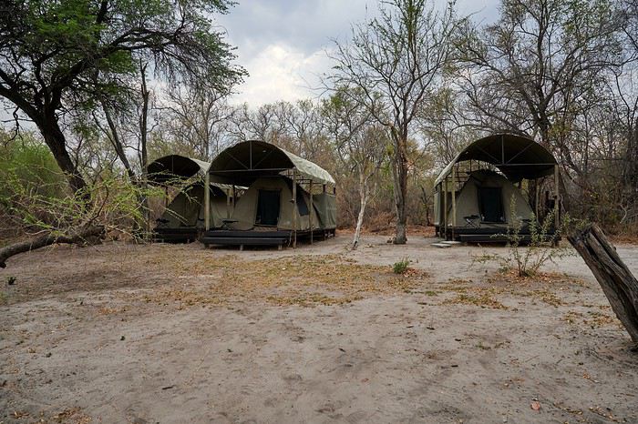
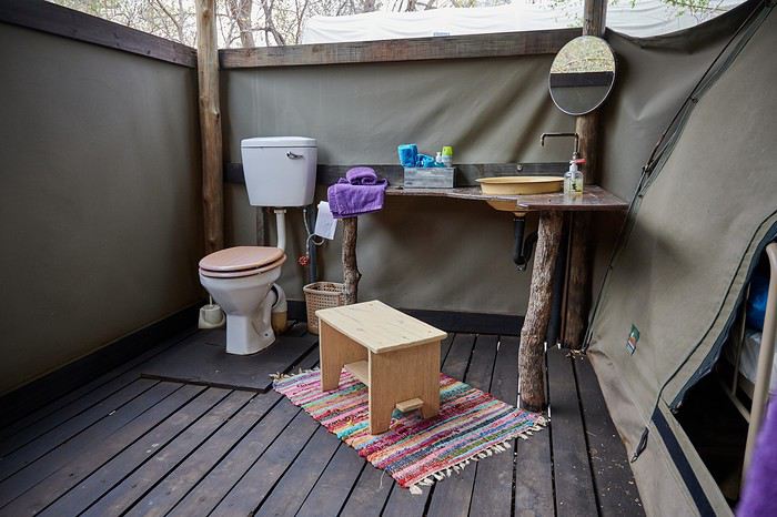
Vous l’aurez compris on recommande chaudement Duncan Camp ‘s. En revanche n’essayez pas d’y aller directement, réservation obligatoire et paiement soit par internet soit à Maun. La durée du trajet depuis Maun est de 1h30.
Version longue en cours de création ici
A l’origine cela devait être notre premier voyage avec notre propre véhicule (stationné à Maun), malheureusement quelque temps avant mon contact sur place m’annonce qu’il y avait un « bruit » manifestement un problème au niveau de la boite de transfert. La pièce fautive devant venir d’Afrique du Sud le véhicule ne sera pas prêt pour notre venue. J’ai contacté Bushlore chez qui nous avions déjà loué un véhicule et ils nous ont appris qu’ils ont maintenant une agence à Maun et il ne leur reste plus qu’un Land Cruiser … nickel c’est la voiture reine sous ces latitudes. Nous acceptons, même si c’est plus cher que rouler avec notre propre véhicule, mais on n’a pas voulu annuler ou décaler le voyage.
C’est ainsi que nous partons, gaillards, de notre aéroport favori, Frankfurt le mardi 22 octobre à 22h40. Nous volerons sur Lufthansa. A titre d’information pour les futurs voyageurs, ça nous a couté moins cher d’acheter d’un côté un A/R FRA-JNB, de l’autre un JNB-MUB et en troisième un WDH-JNB, plutôt qu’un billet combiné.
Mercredi 23 octobre
Arrivée à 8h30 à JNB Vol BP212 Botswana Air à 11h20 … ça fait une longue escale ! Arrivée à Maun à 13h20
Sur place Bushlore nous attend, on va à leur agence faire l’état des lieux et remplir les papiers. Ensuite les courses, puis un tour chez Joe pour voir la voiture. Malheureusement, là il est déjà tard, on part de Maun vers 17h30 / 18h.
La piste de nuit vers Duncan Camp’s n’est pas top. On s’arrête une première fois demander notre route, le gars a les yeux rouges explosés … On voit une piste qui part à gauche et on voit les phares arriver de cette piste, chouette ça doit être là !... quand on arrive à leur hauteur on les hèle, dans le véhicule 4 noirs armés de fusils … aille, à mon avis ce sont des braconniers … pas cool tout ça.😮 On reprend la piste principale qui va vers Mababe. Le problème c’est que T4A ne connait pas la piste qui mène au camp et Osmand veut nous proposer des « raccourcis ». En fait il faut rester sur la piste principale jusqu’à ce qu’on croise un panneau indiquant le camp (de nuit c’est moins évident). La piste est très approximative et sablonneuse … ce qui devait arriver arriva, à un embranchement nous avons hésité entre deux ornières et on s’est ensablé. Ok, il fait nuit, ok on est au milieu de nulle part … pas de panique. Il ne faut surtout pas insister, on sort « tranquillement », on analyse la situation, pelletons un peu, une marche arrière, un choix d’ornières et c’est reparti. On navigue plus ou moins au cap car point de référence sur les cartes. Au bout d’un moment on voit de la lumière au loin et ouf c’est là !😎 Les gars du camp était venu à notre rencontre lorsqu’ils ont vu des phares se « promener ».
L’accueil a été chaleureux. Il n’y a que nous. Nous avons deux tentes sur les 4 dont dispose le camp. L’endroit est splendide au bord de la Thamalakane, l’ambiance aussi … incroyable, on n’arrive pas à s’imaginer qu’il y a encore quelques heures nous étions au milieu de la civilisation occidentale, frénétique. Qu’est-ce qu’on est bien.🙂 Ce n’est pas tout ça mais là il est temps de boire une petite bière …😛 Ensuite le chef viendra nous chercher, nous énoncera le menu. Vous n’imaginez pas comme on est bien là, seuls au milieu de la nature, avec les bruits des animaux, la douceur du climat, le sourire de nos hôtes et la bonne nourriture … génial nous sommes de nouveau en Afrique Australe. 🙂 😎
Vous l’aurez compris on recommande chaudement Duncan Camp ‘s. En revanche n’essayez pas d’y aller directement, réservation obligatoire et paiement soit par internet soit à Maun. La durée du trajet depuis Maun est de 1h30.
Version longue en cours de création ici
Nord de l'Ethiopie: entre émerveillement et déception... English translation pending
Nous voici fraichement rentrés d’un voyage de 15 jours en Ethiopie. J’avais lu des carnets avant de partir(ceux de Max et de Michant en particulier, d’autres également et tous agrémentés de belles photos), je vais donc en rédiger un qui ne sera sans doute pas très original, mais vous y trouverez mes impressions , quelques détails d’ordre plus pratique et bien sûr des photos.
Cela faisait un moment que j’avais envie de découvrir ce pays. Nous n’avons pas une grande connaissance de l’Afrique ayant surtout voyagé en Asie et sur le continent Américain. Mais nous nous sommes quand même rendus au Kenya, en Tanzanie, en Namibie et au Zimbabwe. C’est important de le préciser car nous avons souvent comparé notre ressenti en Ethiopie par rapport à ce qu’on avait vécu dans ces autres pays d’Afrique. J’ai personnellement trouvé le voyage en Ethiopie plus difficile. On dit souvent que l’Inde ne peut laisser indifférent. On aime ou on déteste. C’est un peu la même chose au sujet de l’Ethiopie. On en revient pas indemne. Pour ma part, il y a eu des moments où j’ai adoré ce voyage et d’autres où j’avais du mal à supporter certaines choses.
Avant de partir, je pensais que les impressions négatives des uns et des autres étaient exagérées. Je les ai trouvé justifiées par la suite même si nous sommes tous d’accord au final pour dire que le voyage vaut largement le détour. Les paysages sont souvent magnifiques et le patrimoine culturel est bien présent.
Nous sommes passés par une agence locale de Lalibela qui s’est occupée de nous réserver un 4X4 avec chauffeur. Sinon, nous nous sommes « débrouillés » sur place. L’agence nous avait aussi réservé un circuit de 2 jours/1 nuit dans le Danakyl et un trek d’une journée au dessus de Lalibela. Nous n’avons pas rencontré beaucoup de voyageurs ayant choisi cette option. Beaucoup étaient en groupe et se déplaçaient donc avec le minibus de l’agence. Les voyageurs en individuel suivaient un programme qu’ils avaient totalement réservé auprès d’une agence et avaient un guide durant toute la durée de leur séjour. A la réflexion, cela peut être une bonne option quand on ne veut pas se prendre la tête avec les négociations sans fin concernant les guides sur place, les scouts etc…Au moins, cela évite d’avoir conscience de l’énormité des sommes demandées parfois pour visiter une église ou autre… J’y reviendrai ...
Oman, le pays des Mille et Une Merveilles English translation pending
Qui n’a jamais eu envie de vivre les aventures de Sindbad le marin, qui n’a jamais rêvé de Shéhérazade lors de ses lectures des contes Les Mille et Une Nuits? Ou encore de la reine de Saba...
Eh bien! En parcourant le Sultanat d’Oman, nous allons à leur recherche ou plutôt découvrir ce pays des Mille et Une Merveilles décrites dans les célèbres contes persans dont a fait partie l’actuel Sultanat.
Voici l’itinéraire prévu pour ces deux semaines :
21/12 Lyon – Mascate 22/12 Mascate 23/12 Mascate – Wadi Tiwi 24/12 Wadi Shab – Sour 25/12 Ras Al Jinz – Wadi Bani Kalid 26/12 Wahiba Sands 27/12 Sugar Dunes – Sanctuaire Oryx 28/12 Mirbat 29/12 Wadi Darbat – Salalah 30/12 Mughsayl – Rakyut 31/12 Rub Al Khali - Haima 01/01 Jabreen - Nizwa 02/01 Tanuf - Bahla – Jebel Shams 03/01 Jebel Shams – Al Hamra - Misfat 04/01 Bilad Sayt – Wadi Bani Awf – Mascate 05/01 Mascate - Lyon
Montagnes, Wadis, déserts et plages, chacun y trouvera son bonheur. Voici un petit aperçu de ce qui vous attend.
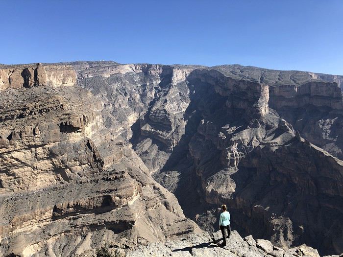
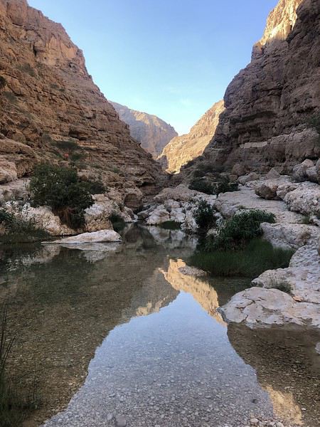
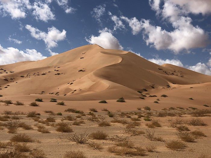
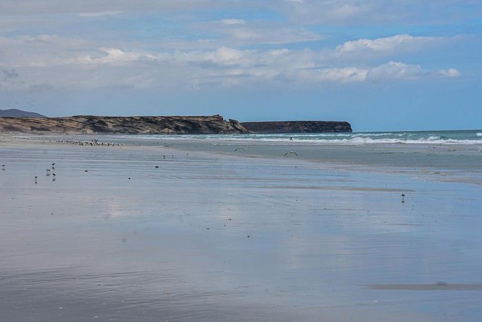
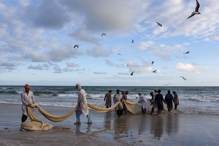
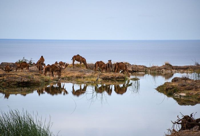
Alors si vous voulez bien me suivre...
Eh bien! En parcourant le Sultanat d’Oman, nous allons à leur recherche ou plutôt découvrir ce pays des Mille et Une Merveilles décrites dans les célèbres contes persans dont a fait partie l’actuel Sultanat.
Voici l’itinéraire prévu pour ces deux semaines :
21/12 Lyon – Mascate 22/12 Mascate 23/12 Mascate – Wadi Tiwi 24/12 Wadi Shab – Sour 25/12 Ras Al Jinz – Wadi Bani Kalid 26/12 Wahiba Sands 27/12 Sugar Dunes – Sanctuaire Oryx 28/12 Mirbat 29/12 Wadi Darbat – Salalah 30/12 Mughsayl – Rakyut 31/12 Rub Al Khali - Haima 01/01 Jabreen - Nizwa 02/01 Tanuf - Bahla – Jebel Shams 03/01 Jebel Shams – Al Hamra - Misfat 04/01 Bilad Sayt – Wadi Bani Awf – Mascate 05/01 Mascate - Lyon
Montagnes, Wadis, déserts et plages, chacun y trouvera son bonheur. Voici un petit aperçu de ce qui vous attend.
Alors si vous voulez bien me suivre...
Bolivia: Exploring the South Lipez by Self-Drive
Hi everyone,
The idea of traveling to Bolivia came to me after seeing Jean-François (Max68)’s photos on his website. I thought we *had* to see those stunning landscapes with the colorful lagoons for ourselves. But a self-drive trip didn’t seem doable at first. A few years ago, everyone advised against going to the South Lipez with just one car.
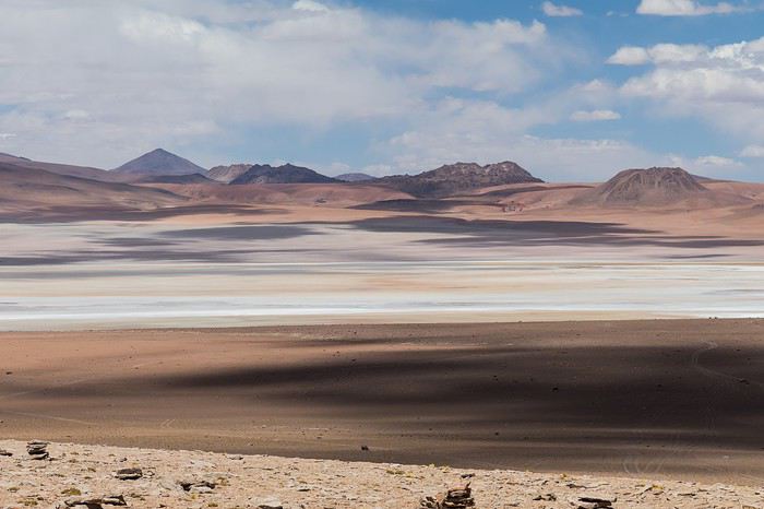 Laguna Kara
It was only after reading Laurent (Lolobe) and Pascal (Pepe874)’s travel journals—who explored the South Lipez solo with a car from Biz Rent a Car—that I thought we might be able to do the same. Meanwhile, we’d already contacted a local agency to organize a trip with a driver and guide. But the idea of a self-drive adventure really appealed to us. With encouragement and tips from Thierry (Tbernay) and Jean-François (Max68), we decided to plan our own self-drive trip. I’d like to thank them for their advice—it was *super* helpful. And a big thanks to all the other forum members for the info shared during our prep!
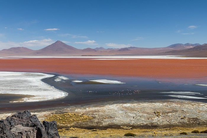 Laguna Colorada
Planning this trip happened during a tough time for our family. My mother-in-law’s illness and passing, plus a few health issues of my own, made us doubt the trip multiple times and nearly scrap the whole thing.
We booked our international flights in February with Swiss. They offered the best balance of travel time and price from Switzerland. Swiss operates Zurich–São Paulo with their own fleet, and São Paulo–Santa Cruz with GOL. In June, GOL canceled the Saturday flight and rebooked us on Sunday. Spending over 24 hours in that huge Brazilian city didn’t work for us at all, so we asked Swiss to put us on the next Zurich–São Paulo flight. Too bad—we lost a day in Bolivia and had to skip the Tarabucco market on Sunday.
Right after, we also booked the car in February. After contacting Imbex and Biz, we went with Biz. Not speaking Spanish, we were relieved to communicate with Alejandra in French. The contact was great—she answered all our questions patiently. Sometimes it took a few days to get a reply, but we could also reach her on WhatsApp. After our trip, we can *only* recommend Biz for rentals in Bolivia. The cars are well-prepped for the South Lipez tracks. The agency is reliable, and the vehicles are new and well-maintained.
 “Our” car, a Toyota Hilux
While planning, we realized the presidential elections would happen while we were in Bolivia. The risk of *bloqueos* (roadblocks and protests) was very real. But in Bolivia, *bloqueos* seem common—you always have to account for that kind of hassle. In late August/early September, Uyuni and the Salar region were blocked for days, leading to food, fuel, and cash shortages. Worried about a blockade in Uyuni and missing the Salar, we decided to visit it first *just in case*.
On election day, the whole country shut down. Planes were grounded, buses and taxis couldn’t circulate, and private cars were banned. There were a few exceptions—ambulances, police, or certain professions—but as tourists, we couldn’t get permission to drive. We asked the embassy, and Biz even requested a permit from the electoral office. So we had to plan to be somewhere with things to do *without* the car.
We decided not to book any accommodations in advance—a first for us. Usually, we plan our stops and reserve lodges, hotels, or campgrounds well ahead. This time, only the room in Sucre was booked, so we’d have a base when we arrived.
In July, Alex (Delhenry) reached out to propose joining part of the trip. He didn’t realize we were leaving in October. Still, we got fresh updates when he returned from the South Lipez. Thanks, Alex—your tips, especially about the Guadalupe–Tupiza stretch, were *super* useful.
In September, we connected with Jean-Louis (Avx) and Anne (Xeta), who were also heading to Bolivia in October, one and two weeks after us. We had dinner with Jean-Louis and his friend after our South Lipez trip and stayed in touch with Anne. It was great to chat with them! Unfortunately, Anne and her husband had a much rockier trip—they got hit hard by post-election issues.
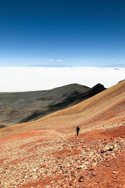 Climbing Volcán Tunupa
Our itinerary wasn’t set in stone—we decided to wing it on the spot. Two weeks before departure, I reconnected with Alejandra at Biz to move the car rental up by a day. With the elections, we wanted to leave Sucre ASAP and focus on the South Lipez. Outside Uyuni and Tupiza, the risk of blockades was zero. We also planned a two-night buffer in Sucre before our flights, just in case. It might sound overcautious, but in hindsight, we made the right call. If we’d left Sucre a day later, we wouldn’t have made it to Potosí—it was completely blocked. On the way back, we *just* dodged blockades in Potosí and elsewhere. Sometimes, you’ve gotta trust your gut.
Here’s our route—only the first two nights in Sucre were booked ahead:
D1 Departure from Switzerland
D2 Sucre (La Selenita)
D3 Sucre (La Selenita)
D4 Colchani (Hotel de Sal Luna Salada)
D5 Jirira (Auberge Doña Lupe)
D6 On the Salar (in the car)
D7 A few kilometers from Estancia Catal (in the car)
D8 Laguna Hedionda (Hotel Los Flamencos)
D9 Laguna Colorada (Lodge by the lagoon)
D10 Middle of nowhere, en route Laguna Verde–Mina Horsu–Quetena Chico (in the car)
D11 Quetena Chico (Lamphaya Lodge Andino)
D12 Quetena Chico (Lamphaya Lodge Andino)
D13 Guadalupe (Guest room at Celia’s)
D14 Along the Rio Grande (in the car)
D15 Tupiza (Hotel Mitru)
D16 Tupiza (Hotel Mitru)
D17 Sucre (La Selenita)
D18 Sucre (La Selenita)
D19 Santa Cruz (Hotel Sun)
D20 Departure from Santa Cruz
D21 Arrival in Switzerland
As you can see, we spent 13 nights in the South Lipez. Initially, we’d planned for nine, but Jean-François (Max68) suggested staying longer. Great advice—we didn’t regret it one bit. We could’ve even added 2–3 more days without getting bored.
Self-driving in the South Lipez takes some prep and a good GPS. We kept it simple and used maps.me to navigate. It’s a solid app—just save your waypoints ahead of time. For some stretches, I used Google Earth to visualize the tracks and sites. If you stick to the tour operator routes, you *almost* can’t get lost. But we often veered off the beaten path and took different routes. Some days, we didn’t see another car. So in case of a breakdown, it’s key to have water and food for several days. In some spots, there’s *zero* signal—your phone won’t work. Another must: it gets *cold* in the South Lipez, and a good sleeping bag is essential. We brought down sleeping bags rated for -10°C and didn’t regret it during our car nights.
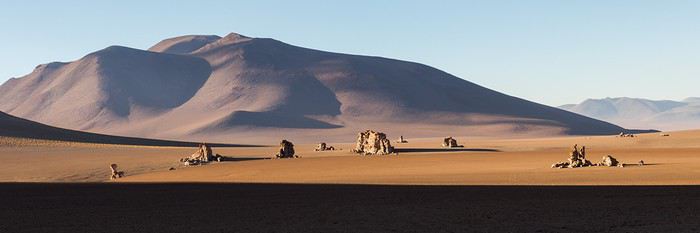 The Dalí Desert
Some tracks are *super* rocky—flat tires are a real risk. On those stretches, maps.me’s estimated travel time was way off. Some sections barely let us go over 15 km/h.
Lots of forum members recommend doing the South Lipez “loop” from Tupiza to Uyuni—ending with the Salar—to avoid Uyuni’s crowds. That might work for organized tours, but for self-drive, the direction *doesn’t* matter. I’ll say this: the few vehicles we saw mostly came from Tupiza and Chile, not Uyuni. So if starting from Uyuni works better for you, go for it! Ending in Tupiza means heading toward warmer weather. For our planned stops and climbs, starting in Uyuni helped with acclimatization. Spending a few nights between 3,600–3,800 m before going over 4,000 m is a smart move.
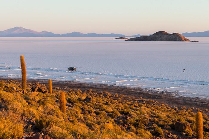 Uyuni Salt Flats in the morning
Overall, we barely saw anyone—except at Laguna Hedionda and Chalviri. There were several tour groups at Hotel Los Flamencos (Laguna Hedionda), but we didn’t cross paths during the day. Hardly anyone on the Salar, on the roads, or at the lodges in the evenings. The *only* place that shocked us was Chalviri. We’d planned to stay there, but it was fully booked—and we counted *forty* tour jeeps on-site. This was around noon! At the Polques hot springs (Chalviri), it was *packed*—we quickly nixed the idea of a dip. Plus, the vibe wasn’t great: soaking right by the road with lodges and restaurants in the background? Meh. Still, lots of tourists love it, so it’s up to you.
For the photos, I kept the colors and mood we saw. The lagoons’ hues are often stunning, but some online photos are *way* over-edited and oversaturated. The South Lipez’s landscapes are breathtaking—no need for excessive retouching.
If you don’t want to read all the details, the start of the travel journal is here: https://voyageforum.com/v.f?post=9888761;a=9888761
The idea of traveling to Bolivia came to me after seeing Jean-François (Max68)’s photos on his website. I thought we *had* to see those stunning landscapes with the colorful lagoons for ourselves. But a self-drive trip didn’t seem doable at first. A few years ago, everyone advised against going to the South Lipez with just one car.
Laguna KaraIt was only after reading Laurent (Lolobe) and Pascal (Pepe874)’s travel journals—who explored the South Lipez solo with a car from Biz Rent a Car—that I thought we might be able to do the same. Meanwhile, we’d already contacted a local agency to organize a trip with a driver and guide. But the idea of a self-drive adventure really appealed to us. With encouragement and tips from Thierry (Tbernay) and Jean-François (Max68), we decided to plan our own self-drive trip. I’d like to thank them for their advice—it was *super* helpful. And a big thanks to all the other forum members for the info shared during our prep!
Laguna ColoradaPlanning this trip happened during a tough time for our family. My mother-in-law’s illness and passing, plus a few health issues of my own, made us doubt the trip multiple times and nearly scrap the whole thing.
We booked our international flights in February with Swiss. They offered the best balance of travel time and price from Switzerland. Swiss operates Zurich–São Paulo with their own fleet, and São Paulo–Santa Cruz with GOL. In June, GOL canceled the Saturday flight and rebooked us on Sunday. Spending over 24 hours in that huge Brazilian city didn’t work for us at all, so we asked Swiss to put us on the next Zurich–São Paulo flight. Too bad—we lost a day in Bolivia and had to skip the Tarabucco market on Sunday.
Right after, we also booked the car in February. After contacting Imbex and Biz, we went with Biz. Not speaking Spanish, we were relieved to communicate with Alejandra in French. The contact was great—she answered all our questions patiently. Sometimes it took a few days to get a reply, but we could also reach her on WhatsApp. After our trip, we can *only* recommend Biz for rentals in Bolivia. The cars are well-prepped for the South Lipez tracks. The agency is reliable, and the vehicles are new and well-maintained.
“Our” car, a Toyota HiluxWhile planning, we realized the presidential elections would happen while we were in Bolivia. The risk of *bloqueos* (roadblocks and protests) was very real. But in Bolivia, *bloqueos* seem common—you always have to account for that kind of hassle. In late August/early September, Uyuni and the Salar region were blocked for days, leading to food, fuel, and cash shortages. Worried about a blockade in Uyuni and missing the Salar, we decided to visit it first *just in case*.
On election day, the whole country shut down. Planes were grounded, buses and taxis couldn’t circulate, and private cars were banned. There were a few exceptions—ambulances, police, or certain professions—but as tourists, we couldn’t get permission to drive. We asked the embassy, and Biz even requested a permit from the electoral office. So we had to plan to be somewhere with things to do *without* the car.
We decided not to book any accommodations in advance—a first for us. Usually, we plan our stops and reserve lodges, hotels, or campgrounds well ahead. This time, only the room in Sucre was booked, so we’d have a base when we arrived.
In July, Alex (Delhenry) reached out to propose joining part of the trip. He didn’t realize we were leaving in October. Still, we got fresh updates when he returned from the South Lipez. Thanks, Alex—your tips, especially about the Guadalupe–Tupiza stretch, were *super* useful.
In September, we connected with Jean-Louis (Avx) and Anne (Xeta), who were also heading to Bolivia in October, one and two weeks after us. We had dinner with Jean-Louis and his friend after our South Lipez trip and stayed in touch with Anne. It was great to chat with them! Unfortunately, Anne and her husband had a much rockier trip—they got hit hard by post-election issues.
Climbing Volcán TunupaOur itinerary wasn’t set in stone—we decided to wing it on the spot. Two weeks before departure, I reconnected with Alejandra at Biz to move the car rental up by a day. With the elections, we wanted to leave Sucre ASAP and focus on the South Lipez. Outside Uyuni and Tupiza, the risk of blockades was zero. We also planned a two-night buffer in Sucre before our flights, just in case. It might sound overcautious, but in hindsight, we made the right call. If we’d left Sucre a day later, we wouldn’t have made it to Potosí—it was completely blocked. On the way back, we *just* dodged blockades in Potosí and elsewhere. Sometimes, you’ve gotta trust your gut.
Here’s our route—only the first two nights in Sucre were booked ahead:
D1 Departure from Switzerland
D2 Sucre (La Selenita)
D3 Sucre (La Selenita)
D4 Colchani (Hotel de Sal Luna Salada)
D5 Jirira (Auberge Doña Lupe)
D6 On the Salar (in the car)
D7 A few kilometers from Estancia Catal (in the car)
D8 Laguna Hedionda (Hotel Los Flamencos)
D9 Laguna Colorada (Lodge by the lagoon)
D10 Middle of nowhere, en route Laguna Verde–Mina Horsu–Quetena Chico (in the car)
D11 Quetena Chico (Lamphaya Lodge Andino)
D12 Quetena Chico (Lamphaya Lodge Andino)
D13 Guadalupe (Guest room at Celia’s)
D14 Along the Rio Grande (in the car)
D15 Tupiza (Hotel Mitru)
D16 Tupiza (Hotel Mitru)
D17 Sucre (La Selenita)
D18 Sucre (La Selenita)
D19 Santa Cruz (Hotel Sun)
D20 Departure from Santa Cruz
D21 Arrival in Switzerland
As you can see, we spent 13 nights in the South Lipez. Initially, we’d planned for nine, but Jean-François (Max68) suggested staying longer. Great advice—we didn’t regret it one bit. We could’ve even added 2–3 more days without getting bored.
Self-driving in the South Lipez takes some prep and a good GPS. We kept it simple and used maps.me to navigate. It’s a solid app—just save your waypoints ahead of time. For some stretches, I used Google Earth to visualize the tracks and sites. If you stick to the tour operator routes, you *almost* can’t get lost. But we often veered off the beaten path and took different routes. Some days, we didn’t see another car. So in case of a breakdown, it’s key to have water and food for several days. In some spots, there’s *zero* signal—your phone won’t work. Another must: it gets *cold* in the South Lipez, and a good sleeping bag is essential. We brought down sleeping bags rated for -10°C and didn’t regret it during our car nights.
The Dalí DesertSome tracks are *super* rocky—flat tires are a real risk. On those stretches, maps.me’s estimated travel time was way off. Some sections barely let us go over 15 km/h.
Lots of forum members recommend doing the South Lipez “loop” from Tupiza to Uyuni—ending with the Salar—to avoid Uyuni’s crowds. That might work for organized tours, but for self-drive, the direction *doesn’t* matter. I’ll say this: the few vehicles we saw mostly came from Tupiza and Chile, not Uyuni. So if starting from Uyuni works better for you, go for it! Ending in Tupiza means heading toward warmer weather. For our planned stops and climbs, starting in Uyuni helped with acclimatization. Spending a few nights between 3,600–3,800 m before going over 4,000 m is a smart move.
Uyuni Salt Flats in the morningOverall, we barely saw anyone—except at Laguna Hedionda and Chalviri. There were several tour groups at Hotel Los Flamencos (Laguna Hedionda), but we didn’t cross paths during the day. Hardly anyone on the Salar, on the roads, or at the lodges in the evenings. The *only* place that shocked us was Chalviri. We’d planned to stay there, but it was fully booked—and we counted *forty* tour jeeps on-site. This was around noon! At the Polques hot springs (Chalviri), it was *packed*—we quickly nixed the idea of a dip. Plus, the vibe wasn’t great: soaking right by the road with lodges and restaurants in the background? Meh. Still, lots of tourists love it, so it’s up to you.
For the photos, I kept the colors and mood we saw. The lagoons’ hues are often stunning, but some online photos are *way* over-edited and oversaturated. The South Lipez’s landscapes are breathtaking—no need for excessive retouching.
If you don’t want to read all the details, the start of the travel journal is here: https://voyageforum.com/v.f?post=9888761;a=9888761
California! Nevada! Utah! Oh!
After my trip to Oregon in 2018 (see Travel Journal "Oregon and Only Oregon"), I vaguely intended to return to the West (the western USA, of course—the west of France is where I almost live) someday, later... with no specific date or plan.
November 2018, I stumbled upon a promotion for round-trip flights from Paris to San Francisco. Well, I *stumbled*—they must’ve collected some "data" on me to make sure this deal crossed my path. And it worked! My ESTA was still valid, and two days later, it was decided: May 13, 2019 (departure from Paris) to June 15, 2019 (return to Paris).
The travel style? Just like last year: low-budget trip, rental car, and accommodation only in campgrounds, with no reservations to stay as free as possible.
Exceptions? 3 nights in a youth hostel upon arrival in downtown San Francisco, and 1 night on the way back (right before flying) in Montara, near Pacifica—a spot that seemed well-located for driving back to the airport in the middle of the night.
Now, to sketch out the rough itinerary. Here’s what it looked like after the trip:
Westernmost point: Montara Lighthouse on the coast, 30 km south of San Francisco (California); Easternmost point: Zion National Park (Utah). Northernmost point: Reno (Nevada). Southernmost point: Spring Mountain Ranch State Park in Blue Diamond, near Las Vegas (Nevada).
Another view:
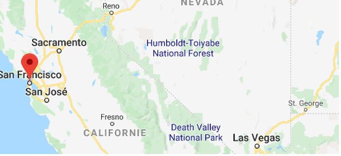
I’ll be spending 33 days in this little area! I’m a slow traveler.
Meanwhile, I realized that in some places I wanted to visit (Las Vegas and National Parks), it was better to book ahead. So, I added to my reservations: - 2 nights in a hostel in Las Vegas - 6 nights of camping in the national parks (2 at Zion NP, 2 at Yosemite NP, 2 at Sequoia-Kings Canyon NP). Between all these dated stops, it’s a choose-your-own-adventure from the ideas I found.
I’m also a slow writer—slow writer, slow traveler—so it’ll take me a while to wrap this up. I’ll start tomorrow.
November 2018, I stumbled upon a promotion for round-trip flights from Paris to San Francisco. Well, I *stumbled*—they must’ve collected some "data" on me to make sure this deal crossed my path. And it worked! My ESTA was still valid, and two days later, it was decided: May 13, 2019 (departure from Paris) to June 15, 2019 (return to Paris).
The travel style? Just like last year: low-budget trip, rental car, and accommodation only in campgrounds, with no reservations to stay as free as possible.
Exceptions? 3 nights in a youth hostel upon arrival in downtown San Francisco, and 1 night on the way back (right before flying) in Montara, near Pacifica—a spot that seemed well-located for driving back to the airport in the middle of the night.
Now, to sketch out the rough itinerary. Here’s what it looked like after the trip:
Westernmost point: Montara Lighthouse on the coast, 30 km south of San Francisco (California); Easternmost point: Zion National Park (Utah). Northernmost point: Reno (Nevada). Southernmost point: Spring Mountain Ranch State Park in Blue Diamond, near Las Vegas (Nevada).
Another view:
I’ll be spending 33 days in this little area! I’m a slow traveler.
Meanwhile, I realized that in some places I wanted to visit (Las Vegas and National Parks), it was better to book ahead. So, I added to my reservations: - 2 nights in a hostel in Las Vegas - 6 nights of camping in the national parks (2 at Zion NP, 2 at Yosemite NP, 2 at Sequoia-Kings Canyon NP). Between all these dated stops, it’s a choose-your-own-adventure from the ideas I found.
I’m also a slow writer—slow writer, slow traveler—so it’ll take me a while to wrap this up. I’ll start tomorrow.
Currency exchange while traveling: why do some still carry wads of cash?
Hi everyone,
In this age of zero-commission cards and fee-free accounts, I’m curious why some travelers still prefer to set off with a wallet stuffed with bills and exchange money on the spot.
I get it for those whose income comes from undeclared activities, but what about everyone else?
Between the risk of theft, scams at exchange counters, and fees that often end up being higher, I’m really puzzled.
The last time I traveled with a wad of cash was because I had to pay for accommodation in cash only, the local currency was the dollar (easy to exchange at a very low cost), and I was still paying some fees.
I’m still wondering about my next trip to Argentina because the situation there is very specific, but otherwise?
Is it an allergy to modern payment methods?
A budget so tight that an extra 20 € (the fees some local banks charge for withdrawals) on a 2000 € budget would be impossible to manage?
Thanks for shedding some light on this!
Carnet de Namibie (ou voyage au pays d’Hilux) English translation pending
Et oui, encore un ! 😉
(Le sous-titre vient uniquement de l’impression de n’avoir jamais vu autant de ce type de véhicule, l’impression qu’il n’y avait quasiment que ça.)
_
Ce voyage sera un « one-way » de 30 jours (15 août – 14 septembre), début à Windhoek (capitale de la Namibie) et fin à Victoria Falls (Zimbabwe), en Toyota Hilux avec tente sur le toit (loueur Asco Car Hire) et réservations (campings, hôtels et voiture) faites par Tourmaline ; les réservations ont été faites pratiquement 18 mois à l’avance, certains campings (Etosha par exemple) semblant être très demandés. La période a été choisie pour y être en hiver et avec encore assez d’eau aux chutes Victoria.
Nous (67 et 47 ans) avons l’habitude, aux USA, de dormir dans la voiture ; sur le toit, ce sera une première. Le matériel de couchage est fourni (couettes, drap, oreillers) mais nous apportons quand même nos duvets (on aurait pu s’en passer). La plupart des nuits seront en camping (mais pas sauvage) et une fois par semaine (environ) une nuit d’hôtel ou assimilé.
Comme nous serons en hiver, j’ai donné à Isabelle la fourchette de température (de 0 à 28°C) que nous devrions avoir à supporter, pour le choix des vêtements ; la réalité sera un peu différente mais n’anticipons pas.
_
Pour notre parcours, un bon dessin valant mieux qu’un long discours, voici la carte de notre projet :
_
 _
J00 – jeudi 15 août 2019
Départ pour la Namibie ; le vol principal a été choisi sur Air Namibia pour des raisons d'horaire (arrivée vers 6h30) et il nous faut donc rallier Francfort ; Air France nous propose des vols aller aux horaires convenables mais, pratiquement un an avant le départ, change complètement ses horaires d'où un départ très matinal de Brest à 6h vers Roissy puis Francfort pour un décollage final vers 20h10.
J01 – vendredi 16 août 2019 => Windhoek Finalement, tout se passe assez bien malgré les attentes un peu longues et nous atterrissons à Windhoek à 6h10 ; sortie de l’avion (on descend sur le tarmac), il fait encore nuit et frais. Passage de l’immigration assez rapide malgré le nombre de voyageurs, récupération des bagages et nous trouvons le chauffeur de chez Asco qui nous attend (enfin, pas que nous). On quitte l’aéroport à 7h10 soit 1 h après l’atterrissage ; il fait jour et, sur le trajet, nous découvrons nos premiers animaux « exotiques ». Arrivés chez Asco, nous faisons la connaissance de Benoît, notre interlocuteur français envoyé par Tourmaline ; les divers échanges et signatures de documents sont facilités par sa présence. Ensuite, découverte du véhicule, de la tente et toutes les explications qui vont avec (et il y en a !) ; j’espère que nous n’oublierons rien. Benoît demande à l’employé d’Asco de nous donner, en plus du matériel de camping, un escabeau 2 marches et il faut bien avouer que ce fût très pratique ; plus besoin de grimper sur le pneu (au risque de tomber) pour manipuler la fermeture-éclair de la tente. Je serai le seul conducteur (ce qui ne dérange pas trop Isabelle) car négociation impossible bien que nous venions de prendre le package d’assurances max. _ Le véhicule est donc un Hilux double cabine (pour notre confort), mais le modèle Raider avec snorkel (dont nous n’aurons pas besoin), 2,8l de cylindrée, boite auto et une vraie fonction 4x4 (long et court avec blocage de différentiel) et très belle garde au sol ; 6 pneus neufs à gros crampons équipent notre superbe destrier qui a environ 130 000 km et quelques « accrocs », ce qui n’est pas plus mal ; la peinture est noire, mais ça ne durera pas. La partie arrière, totalement fermée par de la tôle épaisse, est équipée de 2 énormes tiroirs de rangement sur glissières, d’une caisse plastique contenant le matériel de cuisine et d’un vrai frigo, lui aussi sur glissières ; ce frigo est branché sur une seconde batterie et, comme nous roulions tous les jours, nous n’avons jamais eu besoin de l’arrêter, même la nuit. _ Trois heures plus tard, nous quittons Asco pour le centre commercial Spar pour faire le plein de nourriture pour les jours suivants ; les essuie-glaces se mettent en route à chaque appui sur les clignotants, tout étant quasiment inversé avec la conduite à gauche. Comme aide à la conduite, nous utiliserons Maps.me sur le téléphone en mode avion (testé juste quelques jours auparavant) ; tous les trajets (format kml) sont chargés ainsi qu’environ 300 points GPS et une version de sauvegarde sur tablette au cas où. C’est donc une première pour nous avec cette application et je pense, après utilisation quotidienne pendant 1 mois, que l’on peut lui décerner une note de 8/10. Nous faisons nos courses dans la grande surface mais sommes déçus par certains rayons, notamment les fruits et légumes (nous trouverons nettement mieux le lendemain). _ En sortant, nous essayons d’acheter des pulas (monnaie du Botswana, pays limitrophe), mais impossible ; un bureau de change n’en a pas et la banque nationale de Windhoek ne traite qu’avec ceux qui ont un compte. Comment ferons-nous à la frontière puisque le Botswana refuse dorénavant tout paiement avec une autre monnaie que la sienne, y compris la carte bleue (information récente fournie par Tourmaline et que nous verrons affichée au poste frontière) ? Quelques dernières courses (vin, apéro…) et nous rejoignons notre havre pour la nuit, la pension Londiningi où nous avons retenu le repas du soir et la nuit ; cette pension est tenue par Nathalie, une française. Pour l’instant, Maps.me marche très bien. Un rafraîchissement puis nous sortons nos bagages de la voiture ; il va falloir vider nos 2 gros sacs de voyage et répartir les contenus (les duvets pour la tente, les polaires pour les nuits fraîches, …). Test de l’adaptateur électrique : impossible de brancher nos prises françaises dedans ; Nathalie et un des occupants nous montreront qu’il suffisait de casser 2 petits ergots. _ L’heure du dîner arrive et, avec un apéritif bien mérité, nous discutons avec nos proches voisins qui, eux, ont fini leur voyage ; ils ont donc des infos toutes fraîches. Assez rapidement, nous nous rendons compte que nous avons des « points communs » et pour cause, il s’agit de Rouquine38, membre de VF et de son mari. Retour à la chambre pour une nuit bien méritée. _ Notre carrosse pour un mois
_

_

_
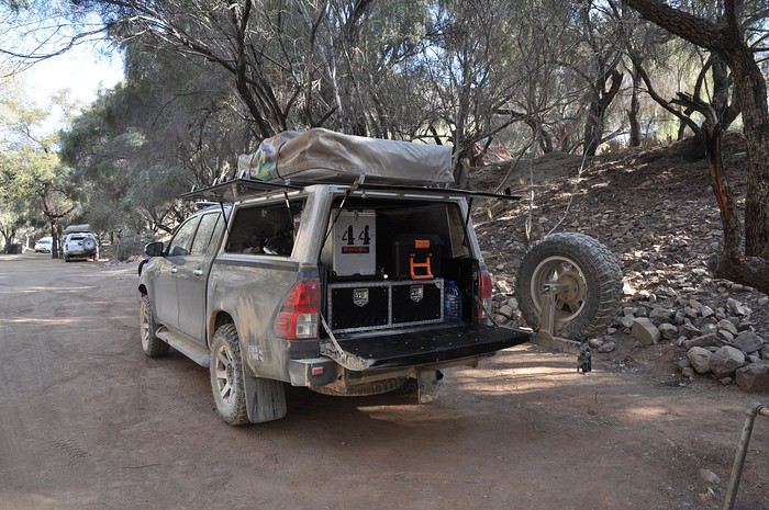
_
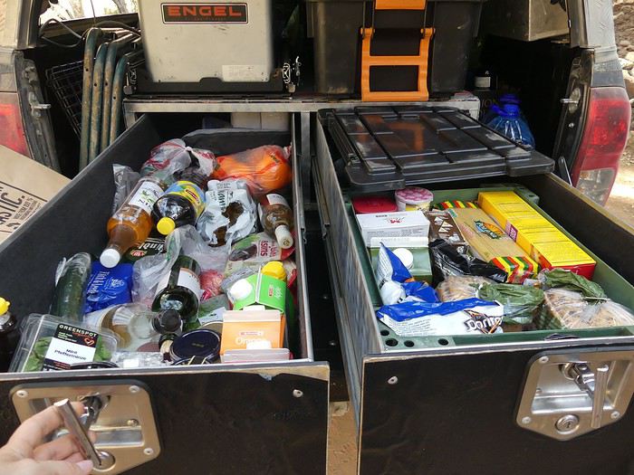 Les 2 énormes tiroirs
_
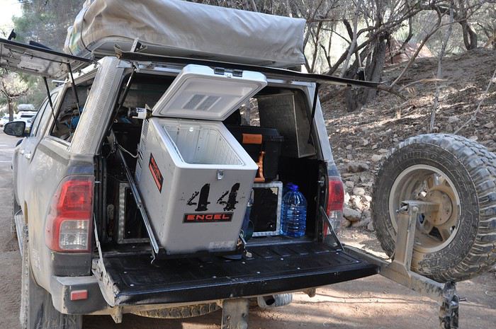 Le frigo de 44 litres en position ouvert
-

_
J00 – jeudi 15 août 2019
Départ pour la Namibie ; le vol principal a été choisi sur Air Namibia pour des raisons d'horaire (arrivée vers 6h30) et il nous faut donc rallier Francfort ; Air France nous propose des vols aller aux horaires convenables mais, pratiquement un an avant le départ, change complètement ses horaires d'où un départ très matinal de Brest à 6h vers Roissy puis Francfort pour un décollage final vers 20h10.J01 – vendredi 16 août 2019 => Windhoek Finalement, tout se passe assez bien malgré les attentes un peu longues et nous atterrissons à Windhoek à 6h10 ; sortie de l’avion (on descend sur le tarmac), il fait encore nuit et frais. Passage de l’immigration assez rapide malgré le nombre de voyageurs, récupération des bagages et nous trouvons le chauffeur de chez Asco qui nous attend (enfin, pas que nous). On quitte l’aéroport à 7h10 soit 1 h après l’atterrissage ; il fait jour et, sur le trajet, nous découvrons nos premiers animaux « exotiques ». Arrivés chez Asco, nous faisons la connaissance de Benoît, notre interlocuteur français envoyé par Tourmaline ; les divers échanges et signatures de documents sont facilités par sa présence. Ensuite, découverte du véhicule, de la tente et toutes les explications qui vont avec (et il y en a !) ; j’espère que nous n’oublierons rien. Benoît demande à l’employé d’Asco de nous donner, en plus du matériel de camping, un escabeau 2 marches et il faut bien avouer que ce fût très pratique ; plus besoin de grimper sur le pneu (au risque de tomber) pour manipuler la fermeture-éclair de la tente. Je serai le seul conducteur (ce qui ne dérange pas trop Isabelle) car négociation impossible bien que nous venions de prendre le package d’assurances max. _ Le véhicule est donc un Hilux double cabine (pour notre confort), mais le modèle Raider avec snorkel (dont nous n’aurons pas besoin), 2,8l de cylindrée, boite auto et une vraie fonction 4x4 (long et court avec blocage de différentiel) et très belle garde au sol ; 6 pneus neufs à gros crampons équipent notre superbe destrier qui a environ 130 000 km et quelques « accrocs », ce qui n’est pas plus mal ; la peinture est noire, mais ça ne durera pas. La partie arrière, totalement fermée par de la tôle épaisse, est équipée de 2 énormes tiroirs de rangement sur glissières, d’une caisse plastique contenant le matériel de cuisine et d’un vrai frigo, lui aussi sur glissières ; ce frigo est branché sur une seconde batterie et, comme nous roulions tous les jours, nous n’avons jamais eu besoin de l’arrêter, même la nuit. _ Trois heures plus tard, nous quittons Asco pour le centre commercial Spar pour faire le plein de nourriture pour les jours suivants ; les essuie-glaces se mettent en route à chaque appui sur les clignotants, tout étant quasiment inversé avec la conduite à gauche. Comme aide à la conduite, nous utiliserons Maps.me sur le téléphone en mode avion (testé juste quelques jours auparavant) ; tous les trajets (format kml) sont chargés ainsi qu’environ 300 points GPS et une version de sauvegarde sur tablette au cas où. C’est donc une première pour nous avec cette application et je pense, après utilisation quotidienne pendant 1 mois, que l’on peut lui décerner une note de 8/10. Nous faisons nos courses dans la grande surface mais sommes déçus par certains rayons, notamment les fruits et légumes (nous trouverons nettement mieux le lendemain). _ En sortant, nous essayons d’acheter des pulas (monnaie du Botswana, pays limitrophe), mais impossible ; un bureau de change n’en a pas et la banque nationale de Windhoek ne traite qu’avec ceux qui ont un compte. Comment ferons-nous à la frontière puisque le Botswana refuse dorénavant tout paiement avec une autre monnaie que la sienne, y compris la carte bleue (information récente fournie par Tourmaline et que nous verrons affichée au poste frontière) ? Quelques dernières courses (vin, apéro…) et nous rejoignons notre havre pour la nuit, la pension Londiningi où nous avons retenu le repas du soir et la nuit ; cette pension est tenue par Nathalie, une française. Pour l’instant, Maps.me marche très bien. Un rafraîchissement puis nous sortons nos bagages de la voiture ; il va falloir vider nos 2 gros sacs de voyage et répartir les contenus (les duvets pour la tente, les polaires pour les nuits fraîches, …). Test de l’adaptateur électrique : impossible de brancher nos prises françaises dedans ; Nathalie et un des occupants nous montreront qu’il suffisait de casser 2 petits ergots. _ L’heure du dîner arrive et, avec un apéritif bien mérité, nous discutons avec nos proches voisins qui, eux, ont fini leur voyage ; ils ont donc des infos toutes fraîches. Assez rapidement, nous nous rendons compte que nous avons des « points communs » et pour cause, il s’agit de Rouquine38, membre de VF et de son mari. Retour à la chambre pour une nuit bien méritée. _
Notre carrosse pour un mois
__
_
_
Les 2 énormes tiroirs
_
Le frigo de 44 litres en position ouvert-
Visites des "tribus" en Afrique et dans le monde en général English translation pending
je me pose la question sur les visites aux "tribus" en afrique et dans le monde en general
nicolas hulot a ete le premier a faire des emissions a grande ecoute sur la vallee de l omo les himbas les san et autres nous donnant l impression a l epoque que tout ca n etait pas accessible
maintenant ca l est
des flopees de touristes defilent tous les ans a travers ces musees humains
on va se faire les himbas visiter les villages san
les autorites des pays interesses se foutent de ces minorites qu ils aimeraient voir disparaitre
l afrique en "marche" ce n est pas ces sauvages
mais bon si ca amene des touristes pourquoi pas
demande t on a ces gens si ils veulent nous voir
parce que on les payent d une certaine facon argent petits cadeaux produits de premiere necessite, notre necessite
je ne suis pas donneuse de lecons
j etais en equateur il y a 30 ans dans les marches ruraux mais je n ai pas ose prendre de photos etant les seuls touristes j etais genee
j ai ete dans la vallee de l omo il y a 25 ans quand le to m a dit qu il fallait se munir de billets de 1 birr pour prendre les photos alors la c etait le pompon j admire l inde qui pour des raisons que j ignore interdit l acces a une partie des andaman ou vivent des gens de l age de pierre
je prone l interdiction de certaines zones de cette planete y compris l antarctique
je ne suis pas militante mais j ai beaucoup voyage
depuis 16 ans au botswana je ne bouge plus
Récit de 28 jours en Namibie English translation pending
Nous sommes de retour de 28 jours en Namibie.
Nous sommes partis à deux 4X4 avec des amis marseillais en majorité en camping. Il faut reconnaître que lorsqu'on prévoit 80 à 90% de pistes, il est toujours très sécurisant de savoir qu'on a un deuxième véhicule en cas de pépin. D'autant plus que, sur certaines pistes, nous n'avons pas croisé énormément de monde.
Sur base d'un itinéraire concocté par nos soins, nous sommes passés via la société Namvic pour confirmer que tout tenait la route et pour la location des véhicules ainsi que pour les réservations de camping.
Namvic a un contact à Paris, Pascal, ce qui est bien entendu plus simple pour les échanges.
Le véhicule était un 4X4 de deuxième catégorie, c'est-à-dire un véhicule qui avait déjà pas mal baroudé. Cela fait sans doute moins "standing" mais le portefeuille s'en porte mieux et finalement il sera aussi poussiéreux et sâle qu'un neuf. La vraie différence est dans l'agencement du coffre. Pour nous, il fallait vider le coffre chaque jour pour accéder au matériel, ou au frigo alors que les nouveaux véhicules sont mieux pensés et donc plus pratiques.
Pour le camping, nous disposions de deux tentes sur le toit qui se montaient en 5 minutes et se repliaient en 10 jusqu'à la troisième semaine où, avec la poussière et l'âge les tirettes devenaient difficiles à refermer et les jurons commencaient à fuser. En humidifant les tirettes avec de l'eau ou avec du liquide vaisselle, on vient à bout de se repliage. J'ai été assez étonnée du confort de ces tentes. Pas mal de place, un matelas finalement confortable, oreillers et sacs de couchage fournis. Nous avions un téléphone satellite et un petit GSM avec un peu de forfait afin de pouvoir appeler si nécessaire. Deux roues de secours mais que nous n'utiliserons heureusement pas. Les assurances sont compliquées en Namibie, il n' y a pas grand chose de couvert. Nous étions assurés pour un accident avec un tiers, un animal mais il fallait pouvoir prouver par des photos notre bonne foi, le bris du pare-brise et un pneu, tout le reste était à notre charge. Cela paraît assez complet mais quand on tente de compter le nombre de cailoux qui tapent la voiture, les animaux qui traversent inopinément et l'état de certaines pistes, la prudence est de mise.
Aussi si un couvercle de casserole est perdu, et bien il faut payer la casserole soit une vingtaine d'euros, tout doit revenir en l'état sous peine de frais supplémentaires lorsqu'on rend le véhicule. Le véhicule doit être également nettoyé afin que la société puisse aisément vérifier l'état du véhicule, sinon de nouveau c'est facturé. Nous avons de notre côté profité d'un des derniers campings pour donner un coup de chiffon car il y avait un tuyau, ce qui n'est pas forcément possible en lodge.
Pour le trajet, nous avons resigné avec Qatar en passant par Doha, Johannesburg puis Windhoek via South Africa Airlines. Namvic nous avait déconseillé de passer par Johannesburg, apparemment connu pour ses problèmes de bagages. Les compagnies aériennes l'ont bien compris car les vols évitant l'Afrique du Sud étaient hors de prix.
Pour nous tout s'est bien passé mais nos amis qui voyageaient de Marseile avec Turkish ont eu des soucis avec le dernier vol assuré par Namibian Airlines. Ils ont perdu une journée, bloqués à Johannesburg, et ils ont du courir après leurs bagages. J'ai rencontré pas mal de gens qui avaient un à deux jours de retard sur leur itinéraire à cause de bagages perdus.
L'Inde survivra-t-elle jusqu'en 2084? English translation pending
Je reproduis ci-dessous un article récent du "Figaro" et vous engage à échanger sur ce thème, associé à cet autre : Les pays non-préparés et non développés vont-ils souffrir beaucoup plus que d'autres de ces changements climatiques ?
Lorsqu'on connait la situation de Bénarès, peut on croire au miracle ou bien au suicide collectif de cette Union d’États indiens ?
Titre de l'article : Inde: les dernières gouttes d’eau de Bangalore
Par Sébastien Daycard Publié le 31/05/2019 à 07h15 REPORTAGE - Centre mondial des technologies de l’information et moteur de la croissance indienne, Bangalore connaît de graves pénuries d’approvisionnement en eau. Depuis vingt ans, la ville vit sous perfusion grâce au pompage des nappes phréatiques, dont l’épuisement est prévu en 2025. Reportage dans une ville au bord d’une faillite écologique.
De vastes étendues d’eau, des complexes sécurisés avec leurs jardinets à la végétation luxuriante, des noms évocateurs comme Strawberry Fields, Tuscany, Bellevue, Napa Valley ou Dream Acres, des appartements avec tout le confort moderne: les abords des lacs Bellandur et Varthur ressemblent à un rêve de classe moyenne qu’achètent sur papier glacé les couples avec enfants et les retraités. Un paysage de carte postale qui cache toutefois une autre réalité lorsqu’on écoute les riverains. «J’achète des bouteilles d’eau, je fais appel à un camion-citerne pour les usages domestiques et je reste chez moi à cause de l’odeur du lac. L’eau du robinet est tellement chlorée qu’elle en devient imbuvable. Et les chauffe-eau ne résistent pas aux sels et aux nitrates. Les gens quittent rapidement le quartier. Certains vendent, d’autres préfèrent mettre leur bien en location. Après six mois passés ici, je vais bientôt déménager», s’indigne Richard, un habitant de la ville.Un égout à ciel ouvert Autrefois réputée pour ses arbres et ses lacs construits par Kempe Gowda, le maharadjah de Mysore, Bangalore est aujourd’hui tristement célèbre pour ce cloaque nauséabond qu’est devenu le lac Bellandur. Dès que le courant s’accélère, une mousse blanche se forme à la surface, à cause des détergents. Et les jacinthes d’eau prolifèrent, favorisant la disparition de poissons et la formation de méthane qui s’enflamme régulièrement. «Quand j’étais petit, nous buvions cette eau, je nageais dans le lac et j’allais pêcher après l’école. C’étaient des terres agricoles. Puis la population de Bangalore a considérablement augmenté, les constructions se sont multipliées sur les plaines de l’Est. Tout ce développement s’est fait sans se préoccuper des infrastructures», déplore M. A. Khan, proviseur d’une école située en aval de ce gigantesque égout à ciel ouvert, qui collecte 60 % des effluents de la ville. » LIRE AUSSI - Bangalore, la Silicon Valley indienne, minée par la crise de l’eau Troisième mégapole indienne après Delhi et Bombay, Bangalore a connu un développement éblouissant: elle représente 10% du PIB indien et 40% du PIB du Karnataka. Pour chaque emploi créé dans les technologies de l’information et de la communication, la Silicon Valley de l’Inde en crée trois autres. De ce fait, elle attire les travailleurs de l’Inde tout entière qui s’installent en périphérie dans des compounds pour classes moyennes et des bidonvilles pour les plus pauvres. Mais elle a aussi pris trente ans de retard dans la gestion des eaux usées. «Il n’y a que deux stations d’épuration pour traiter 130 millions de litres par jour, alors que le lac Bellandur reçoit chaque jour 500 millions de litres d’eaux usées, explique le proviseur. Actuellement, la santé des riverains est affectée par la prolifération des moustiques qui apportent la fièvre, la dengue, la malaria ou des infections cutanées. Deux personnes sur 10 ont des problèmes de reins et subissent des dialyses dans la zone comprise entre les lacs Bellandur et Varthur.» «Nous avons ruiné l’avenir de nos enfants» Au bord du lac Varthur, la professeur Allinari réalise des prélèvements avec ses élèves pour leur expliquer, preuves à l’appui, que ce lac est lui aussi très pollué et qu’il ne faut plus jouer à proximité. «Nos enfants sont allés dans leurs immeubles pour sensibiliser les riverains à ces questions. Ils étaient goguenards: vous voulez sauver le lac, eh bien allez-y! Mais cette eau alimente ensuite les zones agricoles du Karnataka et du Tamil Nadu. Nous mangeons ces produits… Je suis inquiète pour la santé de mes élèves. Nous avons ruiné l’avenir de nos enfants.» Telle est la situation à Bangalore, où le meilleur des technologies et du savoir-faire indien côtoie des désastres écologiques dans la plus grande indifférence. «La cité s’est étendue en pensant que les lacs n’avaient plus aucune utilité et qu’il fallait désormais aller chercher de l’eau dans l’arrière-pays. Les promoteurs et les hommes politiques en ont profité pour les laisser croupir ou les assécher et construire des bureaux, des zones commerciales et des logements à perte de vue, sans connexion au réseau et sans système d’assainissement», dénonce V. Balasubramanian, l’ancien secrétaire général adjoint de l’Etat du Karnataka, qui fut le premier à lancer l’alerte.Une ville assoiffée Aujourd’hui, le service de l’eau n’approvisionne plus que le centre-ville actuel. «Toute la périphérie dépend de l’eau souterraine, soit 40% de la population. On dénombre plus de 400.000 forages sauvages. Pour autant, cette eau est, elle aussi, impropre à la consommation. Proches des lacs, les zones de pompage sont contaminées. Certes, les plus riches installent des systèmes privés de traitement à osmose inversée et le gouvernement installe des fontaines collectives fonctionnant sur ce même principe, mais cela ne résout pas le problème de l’approvisionnement à moyen terme», déplore T. V. Ramachandra, scientifique au prestigieux Institut des sciences.
Pas moins de 40 % de la population de Bangalore dépend de l’eau des nappes phréatiques, de plus en plus polluées. Il faut donc trouver des solutions alternatives. - Crédits photo : Laurent Weyl / Collectif Argos Conducteur d’un vieil Ashok Leyland de 24.000 litres, Rammu travaille pour l’entreprise Himalaya Water Supply. Comme lui, 300 à 400 camions-citernes circulent dans le quartier de Whitefield pour tenter de satisfaire les besoins d’une ville de plus en plus assoiffée. Trois à quatre fois par jour, il livre de l’eau aux centres commerciaux, aux hôtels ou aux hôpitaux. La raison est simple: il n’y a plus d’eau dans leurs forages à proximité. «Peu importe celui qui paie, nous livrons! Des plus pauvres habitants dans les bidonvilles, aux plus riches. Nous répondons aux urgences 24 heures sur 24, 7 jours sur 7, déclare fièrement son patron, Bhaskar Gowda. Les gens pestent contre nous parce que nous créons des bouchons et, en même temps, les entreprises n’ont pas de connexion à l’eau. De toute façon, le service public n’arrive même pas à leur en fournir en quantité suffisante!» Un univers digne des Shadoks, où tout le monde pompe allègrement et en permanence Quatre-vingt-dix pour cent de l’industrie et des services dépendant de l’eau souterraine, l’accès à l’eau a permis l’essor d’un commerce très rentable. Issu d’une famille de fermiers, Bhaskar Gowda a démarré avec un tracteur et une citerne. Il possède aujourd’hui cinq camions. La demande est tellement élevée qu’il existe une vingtaine d’entreprises comme la sienne à Whitefield. «Les gens pensent que nous sommes une mafia. C’est faux! Nous faisons juste pression pour que personne ne baisse les prix, parce que l’approvisionnement coûte très cher. Tous ceux qui essaient d’entrer sur le marché aujourd’hui font rapidement faillite. Les agriculteurs louent les dernières terres disponibles à prix d’or et, comme il n’a pas beaucoup plu l’an dernier, j’ai dû réaliser sept forages pour satisfaire la demande et, par cinq fois, je n’ai rien trouvé!» Dans cet univers digne des Shadoks, où tout le monde pompe allègrement et en permanence, un représentant de la communauté française de Bangalore, directeur d’une grande entreprise, est plutôt dubitatif: «La pénurie d’eau alimente les conversations et, en même temps, Bangalore vit dans le déni. Nous sommes tous consternés par la gestion du service public, mais la plupart des chefs d’entreprise pensent que le gouvernement fédéral va s’attaquer rapidement au problème, et que l’on aura trouvé des solutions techniques dans dix ans. Sauf que l’Inde n’est pas la Chine.»Forage des sous-sols À la tête d’une filiale de Safran, Damodaran Subramanian confirme qu’une bulle écologique s’est formée. «Bangalore a atteint un point de saturation et les avantages de son mode de développement low cost sont déjà en train de décroître. Les compagnies gardent encore leur siège social mais elles installent leurs filiales dans d’autres villes comme Hyderabad, Mangalore ou Mysore, qui manquent d’eau dans de moindres proportions.» Dans les campagnes, la situation n’est guère plus enviable. A Mandya, dès que la mousson n’apporte pas l’eau espérée, les rizières du Karnataka connaissent la faillite. «Mon frère cultivait la canne à sucre, le millet, le riz et la soie. Il était très endetté. Comme beaucoup d’agriculteurs, il avait emprunté pour avoir accès aux fertilisants, aux machines agricoles et embaucher des ouvriers. Mais tout a échoué. Pendant deux ans et demi, il n’y a pas eu de pluie et la récolte a été perdue. Il y a quatre semaines, il s’est suicidé parce qu’il n’arrivait plus à rembourser son prêt aux usuriers», raconte K. Krishna, 48 ans ; 1200 personnes ont connu le même sort depuis 2017. Dans les années 1970, le barrage Krishna Raja Sagar donnait l’espoir d’un accès à l’eau universel. Annoncé dans les journaux et guetté par les fermiers, ce flux irriguait toute la région. Aujourd’hui, le délestage a lieu une fois tous les deux à trois mois, faute de réserves suffisantes. «Désormais, on demande aux agriculteurs de ne pas cultiver pour sauver Bangalore. Sans compensation. Alors, ici aussi, il n’y a que les forages qui nous permettent de tenir», témoigne un vieil homme près de Karekura. Chacun retient son souffle lorsque la saison sèche arrive Faute d’avoir su préserver les nappes, l’Inde tout entière est confrontée à un choix cornélien: privilégier Bangalore, l’urbanisation galopante, le développement du tertiaire et de l’informatique. Ou maintenir la culture irriguée et la révolution verte basée sur l’agriculture intensive au Karnataka et au Tamil Nadu voisin, avec lequel les conflits vont croissant. Dans ce contexte, chacun retient son souffle lorsque arrive la saison sèche… Surnommé «Zen Rainman», S. Vishwanath est un ingénieur qui s’est mis à récolter les eaux de pluie dès les années 1990 dans une maison qu’il a conçue à cet effet. Écologiste unanimement respecté, il inspire nombre d’initiatives locales et tente de raisonner les pouvoirs publics: «Le rattrapage économique actuel consomme toutes les ressources en eau disponibles en Inde. Nous devons adopter un modèle de développement et un mode de vie qui nous correspondent, à la fois sobres et résilients, pour nous assurer que l’inégalité d’accès et la raréfaction de l’eau soient correctement traitées.» Selon lui, la ville ne manque pas d’eau, mais elle pourrait gérer ses ressources locales d’une bien meilleure manière. La rivière Cauvery fournit 1400 millions de litres par jour, dont 40% sont perdus dans les fuites du réseau, et l’eau souterraine 400 à 500 millions de litres supplémentaires, relâchés sous forme d’eau usée et polluée dans les lacs.L’heure des choix «Si nous arrivions à faire en sorte que cette eau soit traitée et non pas gâchée, nous pourrions la redistribuer ensuite aux fermiers pour nourrir la ville. La solution serait aussi de se concentrer sur la récolte des eaux de pluie et de faciliter la recharge des aquifères en préservant les lacs de retenue, pour que la demande en eau fraîche diminue. En attendant, un jour, d’améliorer le réseau de distribution et d’assainissement», plaide S. Vishwanath. Rainbow Drive est un compound qui accueille les habitants de 20 États indiens en périphérie de Bangalore. «Dans les années 1990, cet endroit était fantastique comparé à Delhi. L’eau était presque gratuite, nous consommions sans compter… jusqu’à ce que les forages s’épuisent, raconte K. P. Singh. C’est à ce moment-là que nous avons commencé à être prudents.» Avec l’aide d’hydrologues, cet ingénieur de l’Uttar Pradesh a convaincu les copropriétaires d’installer un système de récolte des eaux de pluie et de faire appel à des Mannu Vaddars, une corporation très ancienne, pour creuser des puits de recharge des nappes. Il a fallu aussi poser des compteurs individuels et facturer l’utilisation au-delà des seuils raisonnables. «Aujourd’hui, la plupart des habitants consomment entre 15.000 et 25.000 litres d’eau par an, et cela nous suffit amplement. Nous avons seulement besoin des camions-citernes au plus fort de la saison sèche», affirme fièrement K. P Singh. Bangalore a toute l’intelligence et le savoir-faire pour s’en sortir. Il ne lui manque que la volonté politique. Le temps presse: les prévisions de l’Institut des sciences indien de Bangalore annoncent l’extinction des ressources en eau dans les nappes phréatiques en 2025. C’est-à-dire demain…
La rédaction vous conseille :
Bangalore, la Silicon Valley indienne, minée par la crise de l'eau Bangalore, la Silicon Valley indienne La sécheresse en Inde pèse sur l'ensemble de l'économie
Retour d’une croisière en Chine, Japon, Corée du Sud, Taïwan, Philippines et Hong Kong English translation pending
...Sur le Westerdam de Holland America Line
Bonjour et bienvenue à tous pour embarquer avec nous dans cette longue croisière !
C’est une fois de plus un itinéraire hors du commun, riche et varié qui a été la raison de notre choix pour cette croisière. Ajouter à cela un prix particulièrement attractif, 4800 euros la cabine extérieure, au milieu du bateau, pont 4, avec une grande baie vitrée fixe, pour 28 jours de croisière et de découvertes.
Deux semaines avant le départ les prix avaient encore baissés, et une cabine balcon était disponible à quelques cabines de celle que j’avais réservée pour à peine plus cher. J’ai demandé à payer la différence pour l’obtenir mais Un Ocean De Croisiere, l’intermédiaire de HAL en France a refusé. Pourtant les canadiens avec qui nous partons se sont vus proposer un « upgrade » par la compagnie. Autant dire que je n’étais pas très contente.
L’itinéraire :
Shanghai (Chine, 2 jours), Qingdao (Chine), Tianjin (Pékin, Chine, 2 jours), Nagasaki (Japon), Jeju (Corée du Sud), Séoul (Corée du Sud), Kagoshima (Japon), Shanghai (2 jours), Fukuoka (Japon), Busan (Corée du Sud), Naha (Okinawa, Japon), Ishigaki (Sakishima Islands, Japon), Hualien (Taiwan), Keelung (Taiwan), Kaohsiung (Taiwan), Manille (Philippines), Hong Kong (Chine)
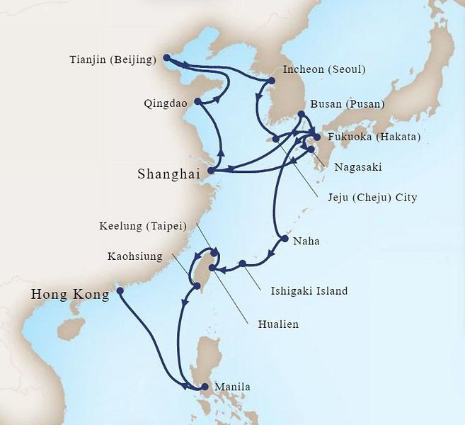
La croisière commence le 17 février mais dès le 13 février nous partons pour Shanghai afin de profiter de quelques jours sur place pour découvrir la ville que nous ne connaissons pas et que j’ai hâte de voir.
Le dernier vol du soir à Marseille est bondé pour rejoindre les différents vols de nuit au départ de Roissy. Le vol direct depuis CDG pour Shanghai passe rapidement, après Auckland, Shanghai ne parait pas bien loin.
Dès notre arrivée dans l’aérogare nous sommes harponnés par un pseudo représentant des hôtels, il a les badges de plusieurs grandes chaînes épinglées sur sa veste et essaie de se faire passer pour le responsable des transferts des hôtels. Il m’enlève ma valise des mains et je suis obligée de courir pour le rattraper et la récupérer. Il essaie de nous vendre un taxi à 850 ¥ (110€), beaucoup trop cher, ce n’est pas le prix que j’ai vu sur le net avant de partir.
Nous arrivons à nous en débarrasser et aussitôt un autre nous accoste avec le même procédé, cette fois c’est 550 ¥ rapidement tombés à 350 ¥ mais je cramponne ma valise et nous le semons dans les escalators.
Pour finir nous arrivons à trouver un stand officiel de taxi à l’extérieur où le prix est de 340 ¥ (44€), il y a aussi des taxis à prendre librement mais je suis méfiante. J’ai par la suite appris que c’était au minimum 320 ¥ quand on quittait l’aéroport pour aller en ville.
Tout au long de notre séjour nous avons à de multiples reprises pris les taxis qui fourmillent dans la ville. Ils fonctionnent très bien, avec un compteur et le prix est modique. Nous n’avons jamais eu aucun problème. Mais quand on arrive à l’aéroport ou pour aller au terminal de croisière, c’est une autre histoire…
Nous arrivons à notre hôtel à 20h45, c’est un Hôtel Boutique superbe. Une rose et des chocolats nous attendent dans la chambre qui est immense et très belle. Des « snacks » sont offerts gracieusement tous les soirs de 22h à 23h30. En réalité c’est un petit repas composé de soupe, de riz et de pâtes cuisinées à la chinoises, le tout très bon. Des boissons sont disponibles, dont du thé à la rose délicieux.
Bonjour et bienvenue à tous pour embarquer avec nous dans cette longue croisière !
C’est une fois de plus un itinéraire hors du commun, riche et varié qui a été la raison de notre choix pour cette croisière. Ajouter à cela un prix particulièrement attractif, 4800 euros la cabine extérieure, au milieu du bateau, pont 4, avec une grande baie vitrée fixe, pour 28 jours de croisière et de découvertes.
Deux semaines avant le départ les prix avaient encore baissés, et une cabine balcon était disponible à quelques cabines de celle que j’avais réservée pour à peine plus cher. J’ai demandé à payer la différence pour l’obtenir mais Un Ocean De Croisiere, l’intermédiaire de HAL en France a refusé. Pourtant les canadiens avec qui nous partons se sont vus proposer un « upgrade » par la compagnie. Autant dire que je n’étais pas très contente.
L’itinéraire :
Shanghai (Chine, 2 jours), Qingdao (Chine), Tianjin (Pékin, Chine, 2 jours), Nagasaki (Japon), Jeju (Corée du Sud), Séoul (Corée du Sud), Kagoshima (Japon), Shanghai (2 jours), Fukuoka (Japon), Busan (Corée du Sud), Naha (Okinawa, Japon), Ishigaki (Sakishima Islands, Japon), Hualien (Taiwan), Keelung (Taiwan), Kaohsiung (Taiwan), Manille (Philippines), Hong Kong (Chine)
La croisière commence le 17 février mais dès le 13 février nous partons pour Shanghai afin de profiter de quelques jours sur place pour découvrir la ville que nous ne connaissons pas et que j’ai hâte de voir.
Le dernier vol du soir à Marseille est bondé pour rejoindre les différents vols de nuit au départ de Roissy. Le vol direct depuis CDG pour Shanghai passe rapidement, après Auckland, Shanghai ne parait pas bien loin.
Dès notre arrivée dans l’aérogare nous sommes harponnés par un pseudo représentant des hôtels, il a les badges de plusieurs grandes chaînes épinglées sur sa veste et essaie de se faire passer pour le responsable des transferts des hôtels. Il m’enlève ma valise des mains et je suis obligée de courir pour le rattraper et la récupérer. Il essaie de nous vendre un taxi à 850 ¥ (110€), beaucoup trop cher, ce n’est pas le prix que j’ai vu sur le net avant de partir.
Nous arrivons à nous en débarrasser et aussitôt un autre nous accoste avec le même procédé, cette fois c’est 550 ¥ rapidement tombés à 350 ¥ mais je cramponne ma valise et nous le semons dans les escalators.
Pour finir nous arrivons à trouver un stand officiel de taxi à l’extérieur où le prix est de 340 ¥ (44€), il y a aussi des taxis à prendre librement mais je suis méfiante. J’ai par la suite appris que c’était au minimum 320 ¥ quand on quittait l’aéroport pour aller en ville.
Tout au long de notre séjour nous avons à de multiples reprises pris les taxis qui fourmillent dans la ville. Ils fonctionnent très bien, avec un compteur et le prix est modique. Nous n’avons jamais eu aucun problème. Mais quand on arrive à l’aéroport ou pour aller au terminal de croisière, c’est une autre histoire…
Nous arrivons à notre hôtel à 20h45, c’est un Hôtel Boutique superbe. Une rose et des chocolats nous attendent dans la chambre qui est immense et très belle. Des « snacks » sont offerts gracieusement tous les soirs de 22h à 23h30. En réalité c’est un petit repas composé de soupe, de riz et de pâtes cuisinées à la chinoises, le tout très bon. Des boissons sont disponibles, dont du thé à la rose délicieux.