Results for "plateaux+|+99+>+86"
13396 results found.
Conseils sur le Chili du Nord et la Bolivie English translation pending
Bonjour
Je pars 3 semaines fin Aout visiter le Nord du Chili et le Sud de la Bolivie. Certains d'entre vous ont il déjà traversé la frontière du Chili pour se rendre en Bolivie ? Est ce mieux de passer par une agence touristique de San Pedro ou y a t'il des bus qui se rendent à Uyuni en Bolivie ?
Quels sont les lieux à ne pas manquer dans cette région ?
Avez vous des adresses sympas à San Pedro, Uyuni et Sucre ?
Merci de vos réponses !
Véronique
Je pars 3 semaines fin Aout visiter le Nord du Chili et le Sud de la Bolivie. Certains d'entre vous ont il déjà traversé la frontière du Chili pour se rendre en Bolivie ? Est ce mieux de passer par une agence touristique de San Pedro ou y a t'il des bus qui se rendent à Uyuni en Bolivie ?
Quels sont les lieux à ne pas manquer dans cette région ?
Avez vous des adresses sympas à San Pedro, Uyuni et Sucre ?
Merci de vos réponses !
Véronique
A Brief A to Z of Peru
Foreword
This text has been proofread many times.
Sorry if some points in this A to Z have already been covered on this forum.
Text and drawings by the author.
Peru is still a very vast country, with so much to see, and obviously this text can't list all the attractions of the country.
*Abiseo (River) A national park that's very hard to access and doesn’t seem open to visitors. Includes the Gran Pajaten site (see below). Personally, it really sparks my imagination (not visited personally)
*Aguas Calientes the town next to Machu Picchu, more precisely below the archaeological site. As far as I know, you can only get there by train. Reminds me of the market where stalls line both sides of the tracks near Bangkok. I love it
*Altiplano: somewhere the "heart" of the Andes. I was able to trek across it on foot, starting from Caracollo in Bolivia, and of course, it’s vast plains to explore. This is where people live in a very rural way. Andean populations are quite austere compared to those in the lowlands or on the coast. You really have to appreciate the harshness of life to live there. Life is anything but superficial. I set a compass heading and found myself walking west toward the expanse of water near a place called La Joya. For pitching the tent, the nights were still chilly
*Canyon del Colca One of the deepest canyons in the world. Personally, I hiked down and back up on foot. The toughest stretch I’ve ever covered in my life.
*Ceviche More or less the national dish. A marinade of fish, shellfish, and lime. But you can find it in some restaurants in Europe, France, and certainly in Belgium or Switzerland. In the small restaurants of Pisco, you can eat excellent ceviche
*Cerro Sechín: Mostly bas-reliefs. A site little known to travelers in the Casma province. The first vestiges of a pre-Inca civilization with iconography similar to that of Chavín (not visited personally)
*Chan Chan A large city of the Chimú civilization and relatively vast to visit. You can see adobe walls with bas-reliefs. Visit from Trujillo, take a colectivo. Plan for the whole day
*Charango: a small guitar widely used in Andean music
*Chauchilla A necropolis near Nazca where you can see mummies exposed on the ground. YouTubers can do paranormal experiments there. And for anyone wondering about the fate of the soul and body after death, here’s the answer: the body remains after death. You can imagine your own flesh and body exposed to the winds of the Pampa and before eternity... (not visited personally)
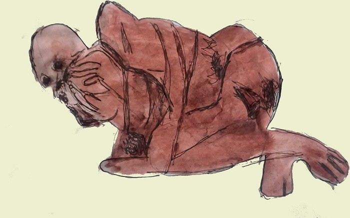
*Chavín de Huántar (Lanzón) The site’s appeal lies in its mountainous surroundings, the Lanzón stela, and the sculpted heads on the façades. What few people know is that the Chavín civilization began its expansion centuries before the Incas. Unfortunately, you can’t get too close to see the Lanzón—the day I was there, it was protected by grilles. To get there: minibus from Huaraz or trek from Olleros. Then cross a high pass (over 5,000m). If you do it solo on foot, be careful—the path isn’t obvious from Olleros
*Chullpa: funerary tower, notably at Sillustani in the Lake Titicaca region
*Chimú: pre-Inca civilization whose center was Chan Chan.
*Chola/Cholitas (Bolivia): typical clothing style of women from the Andean plateaus
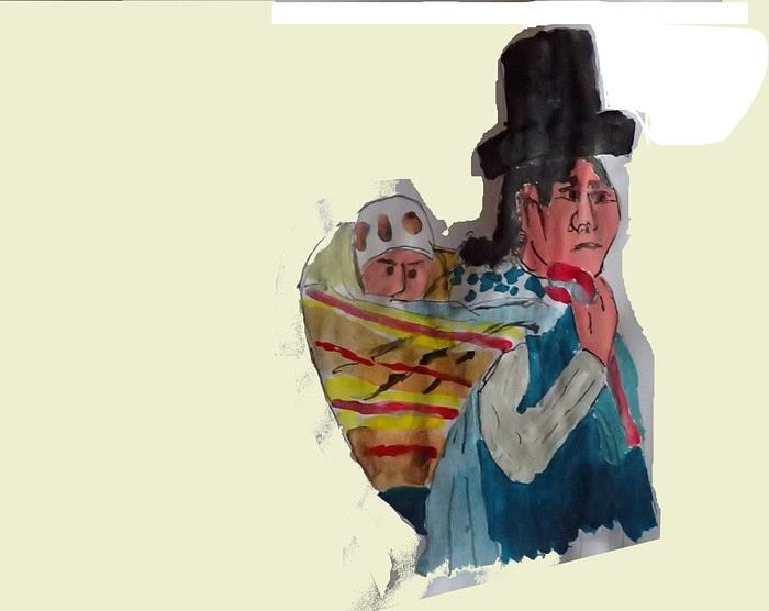
*Chompa: pronounce it *Chompaaa!* A common term for a wool sweater with vicuña patterns, often knitted from alpaca wool. If you dress like this, it’s a bit kitschy around the edges
*Cuy That one isn’t a guinea pig like in Guyana but an actual guinea pig. During a trip to Peru, I was hiking near a village north of Quillabamba (the terminus of the train line that passes through Aguas Calientes), and I was invited to stay in a house. The family raised a few of these pets. Apparently, the locals eat them. Since I’m not much of a meat-eater, it doesn’t really tempt me. How about you?
*Pacific Coast or how to talk about a place you haven’t visited? Except for the coast near Pisco and San Andrés, I haven’t visited any coastal cities. But that doesn’t mean these places lack interest or poetry. For fans of clichéd images, pelicans, seabirds, and fishing boats appear by the sea.
*Gran Pajaten: also closed to the public. Features anthropomorphic bas-reliefs. (not visited personally)
*Huaca. Visit the Huaca del Sol and Huaca de la Luna, especially near Trujillo. However, you can skip them—Chan Chan is still more interesting. Don’t forget to spend time visiting Chan Chan
*Huacachina A small oasis in the desert near Ica. Yes, we’re talking about an oasis because for those who’ve never traveled to Peru, the coastal strip along the Pacific is almost entirely desert, from north to south. Peru is territorially made up of three different regions: the desert coast, the Altiplano stretching north to south with mountain ranges (the Cordilleras), and the Amazon basin to the east. (not visited personally)
*Inca Kola It’s neither Coca-Cola nor Pepsi but a unique cola with a slightly orange color. Tastes like bubble gum
*Intiwatana: a carved rock shaped like a parallelepiped. Is it a sundial?
*Ballestas Islands: a highlight in Peru, though very touristy. You can only get there by boat from the port of San Andrés, a few kilometers from Pisco. It’s a surreal place to me—actually islets with cavities where sea lions and fur seals live. Since it’s a protected area, you’re not allowed to disembark. Guano is harvested there, which can be used as fertilizer.
*Kuelap: a fortress built by the Chachapoyas people. Rarely visited by travelers. (not visited personally)
*Larco Museum: an iconic museum in Lima with a large collection of pieces from archaeological and pre-Columbian sites. From what I remember, it has many pieces from the Moche civilization. As for the Moche statuettes, the prudish might look away. Probably a veneration of the god Priapus without knowing it.
*Nazca Lines Discovered by German archaeologist Maria Reiche, they stretch for kilometers. The designs in the desert around Nazca depict animals and cabalistic signs. The question I ask myself is why the creators of these lines represented a monkey and a hummingbird—species endemic to the tropical forest, not the desert plains around Nazca.
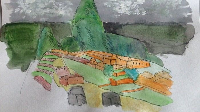
*Machu Picchu: means "old mountain" in Quechua. There’s also Wayna Picchu. The ruins of the site emerge from a sort of small plateau above Aguas Calientes. When the mist rises above the site and the bend of the Urubamba River, it’s truly magical... Also the starting point of the Inca Trail.
*Coca tea A decoction/infusion of the coca plant, meant to ease altitude sickness or *soroche*
*Chullo A rough translation would be a Peruvian wool hat.
*Moche: a civilization established in the Moche Valley, hence the term *Mochica*. What characterizes this civilization are the distinctive clay pieces representing faces and erotic statuettes
*Papa a la Huancaína A local potato dish
*Pisac: a typical market near Cusco
*Pisco Sour: perhaps the Peruvian equivalent of the *caipirinha* you drink in Brazil.
*Puya Raimondii A Bromeliaceae that still looks like a cactus, endemic to the Altiplano
*Quechua The language spoken by the indigenous people of the high plateaus (as well as Aymara in Bolivia)
*Quipu A knotted string used for counting. Widely used by the Inca administration.
*Sacsayhuamán (Q’enqo, Inca Bath) From Cusco’s Plaza de Armas, take the streets that climb above the city. Sacsayhuamán is called a fortress and is made up of large stone blocks. You wonder how the Incas could cut such huge blocks to assemble them—just like some streets in Cusco. The Q’enqo block is enigmatic; no one really knows what it represents.
*Savia Andina An Andean folk group.
*Tambo (=> Ollantaytambo) The Inca emperor (Atahualpa, Manco Capac) had the mission of controlling a vast empire. An empire that was still very extensive. Hence the importance of these *tambos* or relay stations. Napoleon created the civil code; the Incas invented the *tambos* and *quipus*.
*Tawantinsuyu: the Inca Empire
*Tinku: a warrior dance practiced mainly in Bolivia
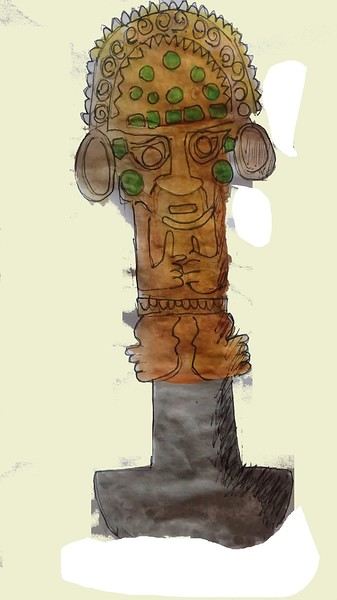
*Golden Tumi: a sacrificial weapon. Often featured in Peru travel guides. See illustration
*Terra X: a documentary series from the German TV channel that aired on Arte. Some episodes focused on pre-Inca and Inca Peru. I must have some old recording tapes. In memory of Gottfried Kirchner as a source of inspiration.
*Uros: I checked—it actually refers to the people who live on these floating islands. Even if it’s touristy, it’s a must-visit because it’s incredible how people can live on islets made from nothing. Take the boat from Puno
*Vicuña, llama, guanaco: camelids characteristic of the Altiplano
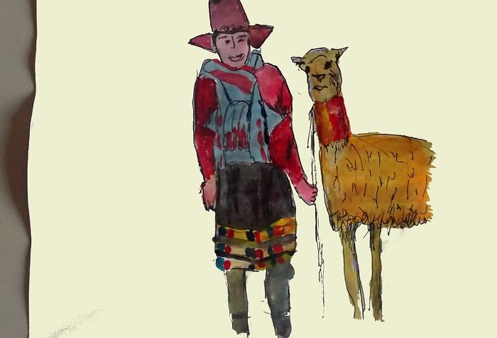
*Wayna Picchu The young Picchu mountain. In the first minutes of *Aguirre, the Wrath of God*, you see Klaus Kinski—well, Aguirre—making his way along the Inca Trail. Werner Herzog must have broken his back filming those sequences.
*Zampoña: pan flute
Peru is still a very vast country, with so much to see, and obviously this text can't list all the attractions of the country.
*Abiseo (River) A national park that's very hard to access and doesn’t seem open to visitors. Includes the Gran Pajaten site (see below). Personally, it really sparks my imagination (not visited personally)
*Aguas Calientes the town next to Machu Picchu, more precisely below the archaeological site. As far as I know, you can only get there by train. Reminds me of the market where stalls line both sides of the tracks near Bangkok. I love it
*Altiplano: somewhere the "heart" of the Andes. I was able to trek across it on foot, starting from Caracollo in Bolivia, and of course, it’s vast plains to explore. This is where people live in a very rural way. Andean populations are quite austere compared to those in the lowlands or on the coast. You really have to appreciate the harshness of life to live there. Life is anything but superficial. I set a compass heading and found myself walking west toward the expanse of water near a place called La Joya. For pitching the tent, the nights were still chilly
*Canyon del Colca One of the deepest canyons in the world. Personally, I hiked down and back up on foot. The toughest stretch I’ve ever covered in my life.
*Ceviche More or less the national dish. A marinade of fish, shellfish, and lime. But you can find it in some restaurants in Europe, France, and certainly in Belgium or Switzerland. In the small restaurants of Pisco, you can eat excellent ceviche
*Cerro Sechín: Mostly bas-reliefs. A site little known to travelers in the Casma province. The first vestiges of a pre-Inca civilization with iconography similar to that of Chavín (not visited personally)
*Chan Chan A large city of the Chimú civilization and relatively vast to visit. You can see adobe walls with bas-reliefs. Visit from Trujillo, take a colectivo. Plan for the whole day
*Charango: a small guitar widely used in Andean music
*Chauchilla A necropolis near Nazca where you can see mummies exposed on the ground. YouTubers can do paranormal experiments there. And for anyone wondering about the fate of the soul and body after death, here’s the answer: the body remains after death. You can imagine your own flesh and body exposed to the winds of the Pampa and before eternity... (not visited personally)
*Chavín de Huántar (Lanzón) The site’s appeal lies in its mountainous surroundings, the Lanzón stela, and the sculpted heads on the façades. What few people know is that the Chavín civilization began its expansion centuries before the Incas. Unfortunately, you can’t get too close to see the Lanzón—the day I was there, it was protected by grilles. To get there: minibus from Huaraz or trek from Olleros. Then cross a high pass (over 5,000m). If you do it solo on foot, be careful—the path isn’t obvious from Olleros
*Chullpa: funerary tower, notably at Sillustani in the Lake Titicaca region
*Chimú: pre-Inca civilization whose center was Chan Chan.
*Chola/Cholitas (Bolivia): typical clothing style of women from the Andean plateaus
*Chompa: pronounce it *Chompaaa!* A common term for a wool sweater with vicuña patterns, often knitted from alpaca wool. If you dress like this, it’s a bit kitschy around the edges
*Cuy That one isn’t a guinea pig like in Guyana but an actual guinea pig. During a trip to Peru, I was hiking near a village north of Quillabamba (the terminus of the train line that passes through Aguas Calientes), and I was invited to stay in a house. The family raised a few of these pets. Apparently, the locals eat them. Since I’m not much of a meat-eater, it doesn’t really tempt me. How about you?
*Pacific Coast or how to talk about a place you haven’t visited? Except for the coast near Pisco and San Andrés, I haven’t visited any coastal cities. But that doesn’t mean these places lack interest or poetry. For fans of clichéd images, pelicans, seabirds, and fishing boats appear by the sea.
*Gran Pajaten: also closed to the public. Features anthropomorphic bas-reliefs. (not visited personally)
*Huaca. Visit the Huaca del Sol and Huaca de la Luna, especially near Trujillo. However, you can skip them—Chan Chan is still more interesting. Don’t forget to spend time visiting Chan Chan
*Huacachina A small oasis in the desert near Ica. Yes, we’re talking about an oasis because for those who’ve never traveled to Peru, the coastal strip along the Pacific is almost entirely desert, from north to south. Peru is territorially made up of three different regions: the desert coast, the Altiplano stretching north to south with mountain ranges (the Cordilleras), and the Amazon basin to the east. (not visited personally)
*Inca Kola It’s neither Coca-Cola nor Pepsi but a unique cola with a slightly orange color. Tastes like bubble gum
*Intiwatana: a carved rock shaped like a parallelepiped. Is it a sundial?
*Ballestas Islands: a highlight in Peru, though very touristy. You can only get there by boat from the port of San Andrés, a few kilometers from Pisco. It’s a surreal place to me—actually islets with cavities where sea lions and fur seals live. Since it’s a protected area, you’re not allowed to disembark. Guano is harvested there, which can be used as fertilizer.
*Kuelap: a fortress built by the Chachapoyas people. Rarely visited by travelers. (not visited personally)
*Larco Museum: an iconic museum in Lima with a large collection of pieces from archaeological and pre-Columbian sites. From what I remember, it has many pieces from the Moche civilization. As for the Moche statuettes, the prudish might look away. Probably a veneration of the god Priapus without knowing it.
*Nazca Lines Discovered by German archaeologist Maria Reiche, they stretch for kilometers. The designs in the desert around Nazca depict animals and cabalistic signs. The question I ask myself is why the creators of these lines represented a monkey and a hummingbird—species endemic to the tropical forest, not the desert plains around Nazca.
*Machu Picchu: means "old mountain" in Quechua. There’s also Wayna Picchu. The ruins of the site emerge from a sort of small plateau above Aguas Calientes. When the mist rises above the site and the bend of the Urubamba River, it’s truly magical... Also the starting point of the Inca Trail.
*Coca tea A decoction/infusion of the coca plant, meant to ease altitude sickness or *soroche*
*Chullo A rough translation would be a Peruvian wool hat.
*Moche: a civilization established in the Moche Valley, hence the term *Mochica*. What characterizes this civilization are the distinctive clay pieces representing faces and erotic statuettes
*Papa a la Huancaína A local potato dish
*Pisac: a typical market near Cusco
*Pisco Sour: perhaps the Peruvian equivalent of the *caipirinha* you drink in Brazil.
*Puya Raimondii A Bromeliaceae that still looks like a cactus, endemic to the Altiplano
*Quechua The language spoken by the indigenous people of the high plateaus (as well as Aymara in Bolivia)
*Quipu A knotted string used for counting. Widely used by the Inca administration.
*Sacsayhuamán (Q’enqo, Inca Bath) From Cusco’s Plaza de Armas, take the streets that climb above the city. Sacsayhuamán is called a fortress and is made up of large stone blocks. You wonder how the Incas could cut such huge blocks to assemble them—just like some streets in Cusco. The Q’enqo block is enigmatic; no one really knows what it represents.
*Savia Andina An Andean folk group.
*Tambo (=> Ollantaytambo) The Inca emperor (Atahualpa, Manco Capac) had the mission of controlling a vast empire. An empire that was still very extensive. Hence the importance of these *tambos* or relay stations. Napoleon created the civil code; the Incas invented the *tambos* and *quipus*.
*Tawantinsuyu: the Inca Empire
*Tinku: a warrior dance practiced mainly in Bolivia
*Golden Tumi: a sacrificial weapon. Often featured in Peru travel guides. See illustration
*Terra X: a documentary series from the German TV channel that aired on Arte. Some episodes focused on pre-Inca and Inca Peru. I must have some old recording tapes. In memory of Gottfried Kirchner as a source of inspiration.
*Uros: I checked—it actually refers to the people who live on these floating islands. Even if it’s touristy, it’s a must-visit because it’s incredible how people can live on islets made from nothing. Take the boat from Puno
*Vicuña, llama, guanaco: camelids characteristic of the Altiplano
*Wayna Picchu The young Picchu mountain. In the first minutes of *Aguirre, the Wrath of God*, you see Klaus Kinski—well, Aguirre—making his way along the Inca Trail. Werner Herzog must have broken his back filming those sequences.
*Zampoña: pan flute
Some trips are born twice - Peru April - May 2025
Some trips are born twice.
Ours was supposed to happen in 2020. Everything was ready: the itinerary, the flight tickets, hotel reservations and Machu Picchu, the rental car, dreams of high altitudes and wide-open spaces. And then the world stopped.
Like so many other plans, our trip to Peru was put on hold. Disappointment was followed by a more concrete reality: paperwork, endless back-and-forth, and battles to recover some of the costs we’d already paid.
The years went by. Life moved on, with its shifting priorities and unexpected twists. Rescheduling this trip wasn’t possible until 2025.
The itinerary stayed mostly true to what we’d imagined five years earlier. One major difference, though—in 2020, we’d planned to rent a car and explore the roads completely independently. Most importantly, we hadn’t included the three-day Ausangate trek, due to lack of time.
For 2025, our plans evolved. 4x4 rental prices had skyrocketed, and when we looked at our schedule more closely, we realized quite a few days didn’t actually need a vehicle. So we made a different choice and opted for private drivers instead. A decision we never regretted. Always punctual, thoughtful, and available... they were so much more than just drivers.
All our reservations were made in January, except for the trek, which we booked in February.
Finding reliable drivers on our own was tough, so we asked Laurent from Tout Pérou to handle it for us. Going through Tout Pérou also gave us a discount on the train ride to Aguas Calientes, so Laurent booked those tickets too. He also bought our Machu Picchu entrance tickets at the same price we would’ve paid on the official website. When comparing domestic flight prices, we found it was cheaper to book from Peru, so Laurent took care of those as well.
This time, nothing was going to stop us. Peru was waiting. And we were ready. 🙂
Ours was supposed to happen in 2020. Everything was ready: the itinerary, the flight tickets, hotel reservations and Machu Picchu, the rental car, dreams of high altitudes and wide-open spaces. And then the world stopped.
Like so many other plans, our trip to Peru was put on hold. Disappointment was followed by a more concrete reality: paperwork, endless back-and-forth, and battles to recover some of the costs we’d already paid.
The years went by. Life moved on, with its shifting priorities and unexpected twists. Rescheduling this trip wasn’t possible until 2025.
The itinerary stayed mostly true to what we’d imagined five years earlier. One major difference, though—in 2020, we’d planned to rent a car and explore the roads completely independently. Most importantly, we hadn’t included the three-day Ausangate trek, due to lack of time.
For 2025, our plans evolved. 4x4 rental prices had skyrocketed, and when we looked at our schedule more closely, we realized quite a few days didn’t actually need a vehicle. So we made a different choice and opted for private drivers instead. A decision we never regretted. Always punctual, thoughtful, and available... they were so much more than just drivers.
All our reservations were made in January, except for the trek, which we booked in February.
Finding reliable drivers on our own was tough, so we asked Laurent from Tout Pérou to handle it for us. Going through Tout Pérou also gave us a discount on the train ride to Aguas Calientes, so Laurent booked those tickets too. He also bought our Machu Picchu entrance tickets at the same price we would’ve paid on the official website. When comparing domestic flight prices, we found it was cheaper to book from Peru, so Laurent took care of those as well.
This time, nothing was going to stop us. Peru was waiting. And we were ready. 🙂
Feedback on 1-month China itinerary
Hi there,
I’d love to get some feedback on our 30-day / 29-night itinerary in China. We’ll be there in September as a family with two kids (6 and 10 years old). Do you think I should cut a few nights between Wulingyuan (Avatar Mountain) and Yangshuo? I’ve planned 15 nights total there. We’ll be on a round-the-world trip starting May 2026 and will need to do schoolwork with the kids. Hoping to fit it in during train rides!! Ever since I started planning this China itinerary, I’ve been discovering completely mind-blowing places I’d never heard of before—30 days feels way too short for China!!!
Here’s our itinerary:
Beijing - 4 nights Forbidden City Great Wall of China Temple of Heaven
Xi’an - 3 nights Terracotta Army Muslim Quarter & Great Mosque
Chengdu - 3 nights Zoo - Research Base of Giant Panda Breeding Wenshu Yuan Temple
Wulingyuan (Avatar Mountain) - 3 nights "Avatar Mountains"
Zhangjiajie - 2 nights Tianmen Mountain
Furong Town - 2 nights
Fenghuang - 2 nights
Guilin - 2 nights Chuanshan Park Guilin Yaoshan Scenic Attraction Reed Flute Cave
Yangshuo - 4 nights Biking along the Yulong River Moon Hill Ruyi Peak Xianggong Hill
Shanghai - 4 nights Shanghai Disneyland Yu Garden / Yuyuan Garden Yuyuan Bazaar
Thanks! Cédric
I’d love to get some feedback on our 30-day / 29-night itinerary in China. We’ll be there in September as a family with two kids (6 and 10 years old). Do you think I should cut a few nights between Wulingyuan (Avatar Mountain) and Yangshuo? I’ve planned 15 nights total there. We’ll be on a round-the-world trip starting May 2026 and will need to do schoolwork with the kids. Hoping to fit it in during train rides!! Ever since I started planning this China itinerary, I’ve been discovering completely mind-blowing places I’d never heard of before—30 days feels way too short for China!!!
Here’s our itinerary:
Beijing - 4 nights Forbidden City Great Wall of China Temple of Heaven
Xi’an - 3 nights Terracotta Army Muslim Quarter & Great Mosque
Chengdu - 3 nights Zoo - Research Base of Giant Panda Breeding Wenshu Yuan Temple
Wulingyuan (Avatar Mountain) - 3 nights "Avatar Mountains"
Zhangjiajie - 2 nights Tianmen Mountain
Furong Town - 2 nights
Fenghuang - 2 nights
Guilin - 2 nights Chuanshan Park Guilin Yaoshan Scenic Attraction Reed Flute Cave
Yangshuo - 4 nights Biking along the Yulong River Moon Hill Ruyi Peak Xianggong Hill
Shanghai - 4 nights Shanghai Disneyland Yu Garden / Yuyuan Garden Yuyuan Bazaar
Thanks! Cédric
Looking for a local agency for northern Vietnam
hi everyone,
I want to travel in the north for 3 weeks in September-October 2026 to meet ethnic minorities, photograph mountain rice terraces and their harvest, and revisit Halong Bay—but maybe Lan Ha Bay instead. Can you recommend one or more local agencies?
Thanks, and happy holidays!
Very short layover at Doha Airport
Hi there
I completely forgot the transit procedure at Doha Airport and I’m a bit worried because I only have 1h30 to change planes, since my first flight was rescheduled. My flights: Barcelona/Doha: arrival at 6:15 AM Doha/Bangkok: departure at 7:50 AM
We only have carry-on luggage. Will they be checked again? Do we have to go through security again? Are the connections smooth and well signposted? Finally, is it common in this situation to ask a flight attendant for help?
Thanks! 🙂
I completely forgot the transit procedure at Doha Airport and I’m a bit worried because I only have 1h30 to change planes, since my first flight was rescheduled. My flights: Barcelona/Doha: arrival at 6:15 AM Doha/Bangkok: departure at 7:50 AM
We only have carry-on luggage. Will they be checked again? Do we have to go through security again? Are the connections smooth and well signposted? Finally, is it common in this situation to ask a flight attendant for help?
Thanks! 🙂
Roswell to Tucumcari leg: Route 66 conditions
Hi everyone! 🙂
We’re on the Roswell–Tucumcari leg. We’ll go through Fort Sumner. After visiting, there are two ways to reach Tucumcari:
Take US 84 to Santa Rosa, see its Blue Hole, then the almost ghost towns on the historic Route 66 (Cuervo, Newkirk, and Montoya). We won’t visit the Route 66 auto museum (we’ll do the one in Tucumcari). The other option is to take 252 and then 209.
The next day, we plan to head to our next stop in Las Vegas (the one in NM) by going up the Mesalands Scenic Byway (104).
Is the detour to Santa Rosa worth it? Are the historic Route 66 sections drivable?
Thanks for your tips! Marcalamar 🙂
We’re on the Roswell–Tucumcari leg. We’ll go through Fort Sumner. After visiting, there are two ways to reach Tucumcari:
Take US 84 to Santa Rosa, see its Blue Hole, then the almost ghost towns on the historic Route 66 (Cuervo, Newkirk, and Montoya). We won’t visit the Route 66 auto museum (we’ll do the one in Tucumcari). The other option is to take 252 and then 209.
The next day, we plan to head to our next stop in Las Vegas (the one in NM) by going up the Mesalands Scenic Byway (104).
Is the detour to Santa Rosa worth it? Are the historic Route 66 sections drivable?
Thanks for your tips! Marcalamar 🙂
Biking and Beer in Belgium
"The Most Refreshing Way to Travel Around Belgium"
This is the title of the guide published by Pierre Pauquay at Éditions HELVETIQ Sàrl, Lausanne, Switzerland, 2023.
I set off for Belgium with my camper van and my electric-assist bike, eager to deepen both my theoretical and practical knowledge of this country’s emblematic beverage while exploring the land. This guide became my trusted companion throughout the journey, which took place from June 4 to July 4, 2024.
Out of the 40 routes presented, I chose 21, covering a broad swath of Belgium—both Wallonia (14 routes) and Flanders (6 routes), plus one route around the Brussels-Capital region with a visit to the famous Grimbergen brewery.
Every route included a stop at a brewery, whether lesser-known or famous, artisanal or industrial, family-run or Trappist.
In total, I logged 1,111.2 km of biking over 58 hours and 42 minutes of pedaling, averaging 3 hours of cycling per ride of 55.6 km. I visited 21 breweries, toured a few, and had just one flat tire (I didn’t count the number of beers, but I tasted them all...).
I wasn’t always able to park my camper van near the brewery planned for that day’s route, but I made sure to enjoy the famous nectar only after completing the physical exercise required by the loops.
Traveling by camper van, I needed routes that formed a loop, starting and ending in the same place. Except in Brussels, I never had to rely on campsites for a safe night’s stay. I always found a welcoming public or private parking spot, secure enough to prepare for the next day’s ride.
I discovered Belgium from top to bottom, through hills (not very high) and valleys (very flat and often windy), at my own pace. I stopped whenever a photo caught my eye, grabbed a bite or a drink in the villages I passed through, and often felt like I was truly part of the landscape, in sync with the country’s rhythm and curious to see how people lived...
More to come, with photos in a future post...
Thanks for reading...
23-Day Itinerary in the Pacific Northwest (USA) and Western Canada
Hi everyone,
We’re heading to the Pacific Northwest (USA) and Western Canada this summer. We’ve made some progress planning, but we still have a few questions.
Our trip is mostly nature-focused—hiking, wildlife spotting (ideally bears, orcas/whales, otters, etc.), mountains, forests—and a few days in cities, though we’re not big on museums.
We’re looking at flying into Seattle (cheaper than Vancouver), then renting a car and staying in Airbnbs.
A few years ago, we traveled through eastern Canada/USA (Halifax/Montréal/Boston/Halifax) and ended up driving *way* too much and switching accommodations too often. This time, we’d like to settle in a bit more.
Here’s our current plan:
- 2 nights in Seattle to avoid hitting the road right after the flight. One day for a quick city visit, then we’ll leave early after the second night. -> Heading to Olympic National Park from the south.
- 4 nights near Olympic National Park, likely around Forks. -> Then to Port Angeles and a ferry to Vancouver Island via Victoria (maybe 1 night there).
- 7 nights in Port Alberni, which seems like a central base for exploring Vancouver Island (Tofino, Pacific Rim, Cathedral Grove, etc.). We really want to enjoy the area without constantly packing and unpacking.
The issue is, that brings us to 13–14 nights, and we’d like to spend 2 in Vancouver.
We’re wondering if we should head farther north on the island and add a few more days, or reduce our stay in Port Alberni to explore the north as well.
After that, we’d have about a week left. We’re considering a detour near the Canadian Rockies, then slowly making our way back to Seattle via North Cascades National Park.
Anyway, we’d love your input on all this!
Thanks for your suggestions,
Emilie and Thomas
We’re heading to the Pacific Northwest (USA) and Western Canada this summer. We’ve made some progress planning, but we still have a few questions.
Our trip is mostly nature-focused—hiking, wildlife spotting (ideally bears, orcas/whales, otters, etc.), mountains, forests—and a few days in cities, though we’re not big on museums.
We’re looking at flying into Seattle (cheaper than Vancouver), then renting a car and staying in Airbnbs.
A few years ago, we traveled through eastern Canada/USA (Halifax/Montréal/Boston/Halifax) and ended up driving *way* too much and switching accommodations too often. This time, we’d like to settle in a bit more.
Here’s our current plan:
- 2 nights in Seattle to avoid hitting the road right after the flight. One day for a quick city visit, then we’ll leave early after the second night. -> Heading to Olympic National Park from the south.
- 4 nights near Olympic National Park, likely around Forks. -> Then to Port Angeles and a ferry to Vancouver Island via Victoria (maybe 1 night there).
- 7 nights in Port Alberni, which seems like a central base for exploring Vancouver Island (Tofino, Pacific Rim, Cathedral Grove, etc.). We really want to enjoy the area without constantly packing and unpacking.
The issue is, that brings us to 13–14 nights, and we’d like to spend 2 in Vancouver.
We’re wondering if we should head farther north on the island and add a few more days, or reduce our stay in Port Alberni to explore the north as well.
After that, we’d have about a week left. We’re considering a detour near the Canadian Rockies, then slowly making our way back to Seattle via North Cascades National Park.
Anyway, we’d love your input on all this!
Thanks for your suggestions,
Emilie and Thomas
Cycling in Vietnam: From Hue to the Mekong Delta (Trip Report)
A firsthand account of a 30-day cycling trip (the length of the visa) in southern Vietnam, from Hue to the Mekong Delta. 1,500 kilometers pedaled in December 2022 and January 2023.
Roads and Traffic The roads are generally in very good condition. The secondary road network is limited. Since Vietnam is a densely populated country, needless to say, traffic is often heavy, including on secondary roads. Cyclists, along with pedestrians, are at the very bottom of the road-user hierarchy. In short, when you're on a bike, you never have the right of way. The atmosphere is deafening—Vietnamese people honk all the time. For a Western ear, it's hard to tell the difference between a honk that just signals someone's presence, one that warns of imminent danger, or an angry honk. 😏
Weather Vietnam is a long, narrow country (1,600 km). The weather isn’t the same in the north, center, or south. I cycled through the central part in December. Even though the monsoon peak had passed, I still encountered a lot of rain. Since the monsoon usually lasts until January, it might be better to cycle there starting in February. I was in the Mekong Delta in January. The best season, as it’s the driest month with the least hot temperatures. At this time of year, the prevailing winds come from the northeast. So, it’s better to travel from north to south. That way, you’ll usually have the wind at your back.
Accommodation I always stayed in hotels without ever booking in advance. Typically, I paid between 10 and 20 € for a double room with a private bathroom and AC. To find hotels, I used Google Maps and Maps.me. Wi-Fi is available for free almost everywhere.
The Route Hue → Danang → Hoi An → Nha Trang → Phan Rang → Tan Son → Dalat → Di Linh → Mui Ne → La Gi → Vung Tau → Nha Be → My Tho → Tra Vinh → Can Tho → Cao Lanh → Tranh Hoa → Trang Bang I took the train from Danang to Nha Trang. Not all trains accept bikes, so you’ll need to check beforehand. The railway handles bikes—they’re packed by staff and travel in the same train but in a freight car. I paid 14 € for the ticket plus 7 € for the bike (there’s an extra 0.50 € to pay upon arrival).
The Verdict So, is cycling in Vietnam worth it? If you enjoy biking in traffic, then yes. Otherwise... 😎
Roads and Traffic The roads are generally in very good condition. The secondary road network is limited. Since Vietnam is a densely populated country, needless to say, traffic is often heavy, including on secondary roads. Cyclists, along with pedestrians, are at the very bottom of the road-user hierarchy. In short, when you're on a bike, you never have the right of way. The atmosphere is deafening—Vietnamese people honk all the time. For a Western ear, it's hard to tell the difference between a honk that just signals someone's presence, one that warns of imminent danger, or an angry honk. 😏
Weather Vietnam is a long, narrow country (1,600 km). The weather isn’t the same in the north, center, or south. I cycled through the central part in December. Even though the monsoon peak had passed, I still encountered a lot of rain. Since the monsoon usually lasts until January, it might be better to cycle there starting in February. I was in the Mekong Delta in January. The best season, as it’s the driest month with the least hot temperatures. At this time of year, the prevailing winds come from the northeast. So, it’s better to travel from north to south. That way, you’ll usually have the wind at your back.
Accommodation I always stayed in hotels without ever booking in advance. Typically, I paid between 10 and 20 € for a double room with a private bathroom and AC. To find hotels, I used Google Maps and Maps.me. Wi-Fi is available for free almost everywhere.
The Route Hue → Danang → Hoi An → Nha Trang → Phan Rang → Tan Son → Dalat → Di Linh → Mui Ne → La Gi → Vung Tau → Nha Be → My Tho → Tra Vinh → Can Tho → Cao Lanh → Tranh Hoa → Trang Bang I took the train from Danang to Nha Trang. Not all trains accept bikes, so you’ll need to check beforehand. The railway handles bikes—they’re packed by staff and travel in the same train but in a freight car. I paid 14 € for the ticket plus 7 € for the bike (there’s an extra 0.50 € to pay upon arrival).
The Verdict So, is cycling in Vietnam worth it? If you enjoy biking in traffic, then yes. Otherwise... 😎
To the Top West End
In this time of general travel-journal scarcity, I’m stepping up to tell you about a far-too-short getaway to the Top West End, a local term for the very northern part of Western Australia, right on the border ( ;) ) with the Northern Territory.
As usual, I didn’t manage to keep it short, but this time I’ve got photos to go with it!
August 2020. Since the opportunities to explore the world are extremely limited right now, all we (R&X) can do is explore our own island! Well, just a part of it, because with the state borders still closed, we’re stuck in Western Australia (WA).
Luckily, we’re pretty fortunate because this state is huge: over 2.5 million km² (that’s more than four times the size of France or 1.5 times Quebec). What’s more, stretching over 20 degrees of latitude between the Antarctic Ocean and the Timor Sea, you’ll find climates ranging from Mediterranean to arid to tropical. That’s actually why we decided to head as far north as possible. Sick of the endless rainy winter in Perth, bring on the heat of the Kimberley... way up Nooorth!
Friday. At the airport, the main terminal was closed (not enough flights), so we ended up in the annex (where flights to the various mines usually depart from). There was no crowd at the gate, and in this huge, single departure lounge, empty seats were plentiful. Only three flights were listed on the screens for the rest of the morning: the first to Coondewanna (?), the second to Darwin, and ours to Kununurra (code KNX).
A cool breeze swept through the half-open corridors along the runways. At the top of the walkway leading to the Fokker 100 (the Airbuses and Boeings are now parked!), a flight attendant greeted us with a basket full of sanitary masks. We were actually the only masked passengers (the staff weren’t wearing them either). With zero Covid-19 cases in WA at the time, the only rule was to maintain social distancing—something pretty hard to do on a full plane!
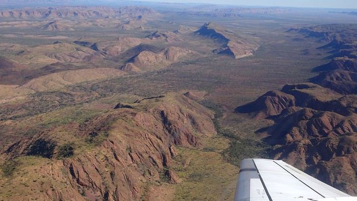
It was also my first time wearing a mask—it felt weird, pretty uncomfortable, and after a while, painful behind the ears. I really feel for those who have to wear one all day, every day. The flight lasted three long hours, but luckily, I had a good book. From the window, I watched an endless expanse of salt lakes in all shapes and sizes—round, elongated, gray, white, sometimes blue and green—and an infinity of winding, capricious meanders, along with long straight lines that led nowhere. The last half-hour got more interesting as rocky, swollen formations and long, sloping plateaus appeared. Against the vast ochre landscape, green patches became more frequent.
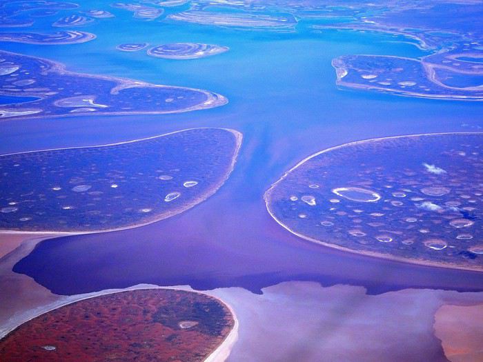
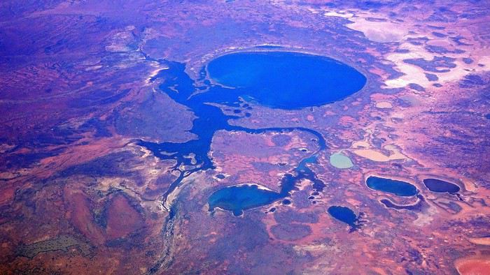
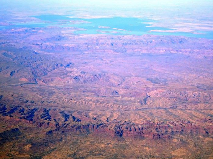
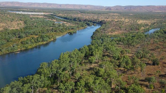
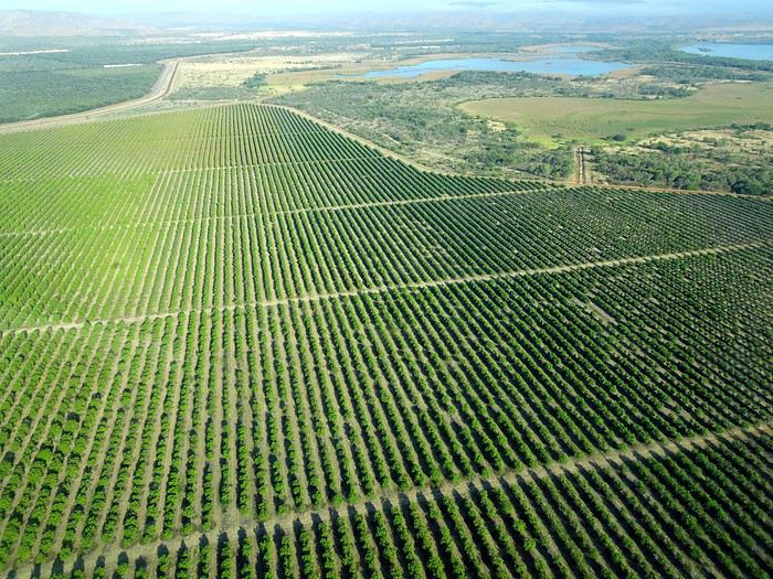
Just before landing, rows of green fields briefly appeared, along with an surprisingly wide river—but we were already rolling down the tarmac. A few hangars, a myriad of small, stationary planes, and a tiny terminal topped with a sign: “Welcome to Kununurra.”
We wanted heat, and here it was—34°C the moment we stepped off the plane! We felt alive again and totally ridiculous in our jeans and sweaters. We quickly grabbed our suitcase and picked up the 4x4 we’d rented—more out of necessity, since only that type of vehicle can access the national parks we planned to visit.
Just four kilometers separated us from Kununurra, a town of 5,000 people founded in 1961 during the construction of the Lake Argyle Dam and the development of the Ord River Irrigation Area Scheme (more on that later). On the horizon, mountain ranges (a bit of an exaggeration, since we know Mt. Meharry, WA’s highest ‘mountain,’ doesn’t even reach 1,250 meters!) and closer to the road, a few irrigation canals cutting through stretches of bush, then a huge park overlooking a small lake lined with reeds.
A row of baobabs (yes, there are baobabs in Australia too!), a series of motels with immaculate lawns, a gas station, and there’s the main street leading to the town center—that is, the parking lots of the two supermarkets, the bottleshop, the pub, the Town Hall, the municipal pool, and the Tourist Office (already closed!), and at the next roundabout, another park, the Presbyterian church, and a few other shops. In short, two or three green blocks that you can explore in no time.
One road leads to the small industrial area and one of the town’s three or four campgrounds, while another heads toward the residential neighborhoods, which look just like the typical suburbs you find in any Australian city—except with tropical vegetation. We stocked up at Coles, an identical copy of the one near our place, and—surprise—the prices were practically the same.
We checked into one of the motels. The receptionist listed the town’s three or four restaurants, insisting that it’s always better to book a table. She recommended the Pump House, a bit outside town on the lake’s edge. “Best spot to watch the sunset, but hurry up.” she told us. It was only 5:00 PM!
When we got there half an hour later, the place was packed, and the sun had already disappeared behind a row of trees! Sure enough, we’d see a few days later that the sunset can be a stunning spectacle—if you wait a bit for the sky (especially if it’s cloudy) to blaze and reflect in the lake’s calm waters. A little disappointed, we headed back into town, where we easily found the other lively spot in town: the pub (nothing like an old English pub). Above the long L-shaped bar, several giant screens (thankfully muted) were broadcasting live footy, rugby league, etc. In one corner, players circled the pool table, while in another, customers were digging into plates of the day’s special. Instead of rooms, there were various patios where groups of friends and coworkers (easily recognizable by the fluoro vests they were still wearing) were gathered. We found a table under a mango tree—unfortunately, a little too close to the guitarist strumming his entire Country Music repertoire, complete with Keith Urban-style tremolos. Guaranteed culture shock!
Since it’s the custom here, we called the Country Club to book a table before the kitchen closed! The CC is the town’s—and even the region’s—fancy spot. Dark decor, modern furniture, dim lighting, and the air conditioning blasting. The twenty or so customers had taken refuge on the vast terrace, lit by torches. The view of the tall eucalyptus trees, illuminated by spotlights shifting from red to blue, was breathtaking.
The menu was minimal, but the grilled salmon was excellent, and the Pavlova (the meringue dessert Kiwis and Aussies have been arguing over since 1906) with melon and watermelon was absolutely divine.
It wasn’t even 9:00 PM, and we were already in bed. Had we already adopted the Top West End’s chicken schedule?!
To be continued... Journal dedicated to Attila
As usual, I didn’t manage to keep it short, but this time I’ve got photos to go with it!
August 2020. Since the opportunities to explore the world are extremely limited right now, all we (R&X) can do is explore our own island! Well, just a part of it, because with the state borders still closed, we’re stuck in Western Australia (WA).
Luckily, we’re pretty fortunate because this state is huge: over 2.5 million km² (that’s more than four times the size of France or 1.5 times Quebec). What’s more, stretching over 20 degrees of latitude between the Antarctic Ocean and the Timor Sea, you’ll find climates ranging from Mediterranean to arid to tropical. That’s actually why we decided to head as far north as possible. Sick of the endless rainy winter in Perth, bring on the heat of the Kimberley... way up Nooorth!
Friday. At the airport, the main terminal was closed (not enough flights), so we ended up in the annex (where flights to the various mines usually depart from). There was no crowd at the gate, and in this huge, single departure lounge, empty seats were plentiful. Only three flights were listed on the screens for the rest of the morning: the first to Coondewanna (?), the second to Darwin, and ours to Kununurra (code KNX).
A cool breeze swept through the half-open corridors along the runways. At the top of the walkway leading to the Fokker 100 (the Airbuses and Boeings are now parked!), a flight attendant greeted us with a basket full of sanitary masks. We were actually the only masked passengers (the staff weren’t wearing them either). With zero Covid-19 cases in WA at the time, the only rule was to maintain social distancing—something pretty hard to do on a full plane!
It was also my first time wearing a mask—it felt weird, pretty uncomfortable, and after a while, painful behind the ears. I really feel for those who have to wear one all day, every day. The flight lasted three long hours, but luckily, I had a good book. From the window, I watched an endless expanse of salt lakes in all shapes and sizes—round, elongated, gray, white, sometimes blue and green—and an infinity of winding, capricious meanders, along with long straight lines that led nowhere. The last half-hour got more interesting as rocky, swollen formations and long, sloping plateaus appeared. Against the vast ochre landscape, green patches became more frequent.
Just before landing, rows of green fields briefly appeared, along with an surprisingly wide river—but we were already rolling down the tarmac. A few hangars, a myriad of small, stationary planes, and a tiny terminal topped with a sign: “Welcome to Kununurra.”
We wanted heat, and here it was—34°C the moment we stepped off the plane! We felt alive again and totally ridiculous in our jeans and sweaters. We quickly grabbed our suitcase and picked up the 4x4 we’d rented—more out of necessity, since only that type of vehicle can access the national parks we planned to visit.
Just four kilometers separated us from Kununurra, a town of 5,000 people founded in 1961 during the construction of the Lake Argyle Dam and the development of the Ord River Irrigation Area Scheme (more on that later). On the horizon, mountain ranges (a bit of an exaggeration, since we know Mt. Meharry, WA’s highest ‘mountain,’ doesn’t even reach 1,250 meters!) and closer to the road, a few irrigation canals cutting through stretches of bush, then a huge park overlooking a small lake lined with reeds.
A row of baobabs (yes, there are baobabs in Australia too!), a series of motels with immaculate lawns, a gas station, and there’s the main street leading to the town center—that is, the parking lots of the two supermarkets, the bottleshop, the pub, the Town Hall, the municipal pool, and the Tourist Office (already closed!), and at the next roundabout, another park, the Presbyterian church, and a few other shops. In short, two or three green blocks that you can explore in no time.
One road leads to the small industrial area and one of the town’s three or four campgrounds, while another heads toward the residential neighborhoods, which look just like the typical suburbs you find in any Australian city—except with tropical vegetation. We stocked up at Coles, an identical copy of the one near our place, and—surprise—the prices were practically the same.
We checked into one of the motels. The receptionist listed the town’s three or four restaurants, insisting that it’s always better to book a table. She recommended the Pump House, a bit outside town on the lake’s edge. “Best spot to watch the sunset, but hurry up.” she told us. It was only 5:00 PM!
When we got there half an hour later, the place was packed, and the sun had already disappeared behind a row of trees! Sure enough, we’d see a few days later that the sunset can be a stunning spectacle—if you wait a bit for the sky (especially if it’s cloudy) to blaze and reflect in the lake’s calm waters. A little disappointed, we headed back into town, where we easily found the other lively spot in town: the pub (nothing like an old English pub). Above the long L-shaped bar, several giant screens (thankfully muted) were broadcasting live footy, rugby league, etc. In one corner, players circled the pool table, while in another, customers were digging into plates of the day’s special. Instead of rooms, there were various patios where groups of friends and coworkers (easily recognizable by the fluoro vests they were still wearing) were gathered. We found a table under a mango tree—unfortunately, a little too close to the guitarist strumming his entire Country Music repertoire, complete with Keith Urban-style tremolos. Guaranteed culture shock!
Since it’s the custom here, we called the Country Club to book a table before the kitchen closed! The CC is the town’s—and even the region’s—fancy spot. Dark decor, modern furniture, dim lighting, and the air conditioning blasting. The twenty or so customers had taken refuge on the vast terrace, lit by torches. The view of the tall eucalyptus trees, illuminated by spotlights shifting from red to blue, was breathtaking.
The menu was minimal, but the grilled salmon was excellent, and the Pavlova (the meringue dessert Kiwis and Aussies have been arguing over since 1906) with melon and watermelon was absolutely divine.
It wasn’t even 9:00 PM, and we were already in bed. Had we already adopted the Top West End’s chicken schedule?!
To be continued... Journal dedicated to Attila
Discussion sur le thème (concours septembre 2020): lieux, scènes de départ ou d'arrivée English translation pending
Rebonjour, 🙂
C'est ici que l'on discute , échange, sur le thème: lieux, scènes de départ ou d'arrivée.
Pour revenir au concours, c'est ici
Concours photo, août 2020: Le voyage en noir et blanc English translation pending
Bonjour à tous
En préambule je rappelle que ma présence ici est tout à fait fortuite, j'ai l'honneur de remplacer Av31, gagnant du concours sur le thème "Verticales" avec sa photo de Devil's Tower.
« Je préfère photographier en noir et blanc qu’en couleurs. Le noir et blanc va à l'essentiel, la couleur aurait distrait l'histoire que je voulais raconter ».Kadir Van Lohuize
Je vous propose un concours dont le sujet sera complètement libre (youpi) mais avec une petite contrainte technique (pffff...). Nous regarderons la vie en noir & blanc.
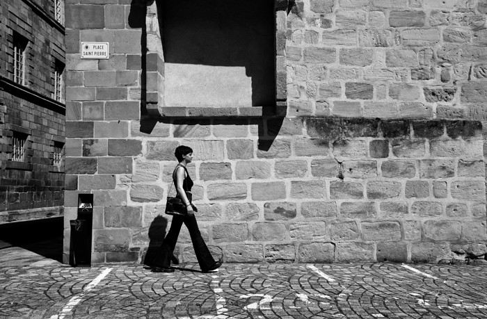
Vos photos devront évoquer le voyage mais je laisse à chacun une petite marge de manœuvre, par exemple celle de nous présenter un portrait (d'ici ou d'ailleurs), une image macro (fleur, insecte...), une image graphique (lignes et courbes). Mais sur vos 3 photos je n'accepterai qu'une seule exception, nous sommes ensemble pour parler voyage !
Il existe sur le net un tas de petits logiciels très faciles d'utilisation mais si vous rencontrez des difficultés pour convertir une image en noir et blanc je le ferai pour vous.
Quelques astuces pour choisir vos photos: Le noir et blanc convient à des sujets très variés mais vous pouvez donner un impact bien plus fort à votre image en tenant compte de certains points. La texture. La couleur aura tendance à l'éclipser alors que le noir et blanc lui donnera toute son importance en faisant ressortir l'intensité des détails: les stries et les nœuds du bois, le tissus, la pierre, les rides de la peau... Les lignes. Celles d’un bâtiment, d’une rue pavée, un marquage au sol ou bien les lumières de la rue. Diriger l'attention dessus, c’est faire ressortir un détail que l’on ne voit pas avec les couleurs. Les formes géométriques. Symétriques ou non, triangulaires, carrées ou rondes, dessinées par l’homme ou naturelles les formes attireront l’œil et se démarqueront bien plus qu'en couleur. Les contrastes. Ils sont vos amis ! Une lumière forte avec des zones d’ombre va créer une image avec des tonalités, c’est ce contraste qui est l'élément essentiel pour réussir une photographie en noir et blanc par exemple un ciel chargé de gros nuages percés par des rayons de soleil.
Vous pourrez participer jusqu’au samedi 22 août à 23h59, heure de Paris. Chaque participant est autorisé à poster jusqu’à trois photos, numérotées de 1 à 3, en précisant le lieu de prise de vue.
Le vote aura lieu du dimanche 23 à 0h01 au dimanche 30 août à 23h59. Il est accessible à tous, participants ou non, dans la limite d’un vote, et se fera par l’attribution d’un total de six points répartis sur 3 ou 4 photos : Photo n°1 : 3 points Photo n°2 : 2 points Photo n°3 : 1 point
La photo gagnante sera celle qui aura remporté le plus de points. En cas d’égalité pour la première position, les photos seront départagées par le nombre de votes à 3 points, puis, si l'égalité persiste, par le nombre de votes à 2 points, etc.
Le ou la gagnant(e) aura le privilège d’organiser le concours de septembre.
Ce fil est réservé aux photos participantes et aux votes. La discussion liée aux à-cotés se passe par là: https://voyageforum.com/v.f?post=10330486;a=10330486
Le lien pour le diaporama: https://flic.kr/s/aHsmPLqy2E
Les précédents concours: herikles.free.fr/.VF/VFconcours.html
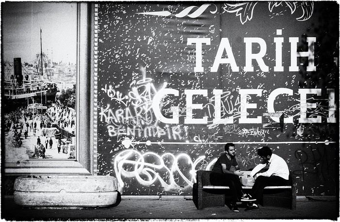
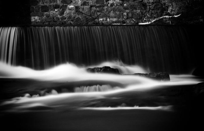
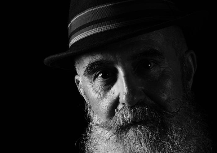
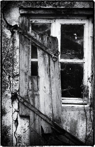
En préambule je rappelle que ma présence ici est tout à fait fortuite, j'ai l'honneur de remplacer Av31, gagnant du concours sur le thème "Verticales" avec sa photo de Devil's Tower.
« Je préfère photographier en noir et blanc qu’en couleurs. Le noir et blanc va à l'essentiel, la couleur aurait distrait l'histoire que je voulais raconter ».Kadir Van Lohuize
Je vous propose un concours dont le sujet sera complètement libre (youpi) mais avec une petite contrainte technique (pffff...). Nous regarderons la vie en noir & blanc.
Vos photos devront évoquer le voyage mais je laisse à chacun une petite marge de manœuvre, par exemple celle de nous présenter un portrait (d'ici ou d'ailleurs), une image macro (fleur, insecte...), une image graphique (lignes et courbes). Mais sur vos 3 photos je n'accepterai qu'une seule exception, nous sommes ensemble pour parler voyage !
Il existe sur le net un tas de petits logiciels très faciles d'utilisation mais si vous rencontrez des difficultés pour convertir une image en noir et blanc je le ferai pour vous.
Quelques astuces pour choisir vos photos: Le noir et blanc convient à des sujets très variés mais vous pouvez donner un impact bien plus fort à votre image en tenant compte de certains points. La texture. La couleur aura tendance à l'éclipser alors que le noir et blanc lui donnera toute son importance en faisant ressortir l'intensité des détails: les stries et les nœuds du bois, le tissus, la pierre, les rides de la peau... Les lignes. Celles d’un bâtiment, d’une rue pavée, un marquage au sol ou bien les lumières de la rue. Diriger l'attention dessus, c’est faire ressortir un détail que l’on ne voit pas avec les couleurs. Les formes géométriques. Symétriques ou non, triangulaires, carrées ou rondes, dessinées par l’homme ou naturelles les formes attireront l’œil et se démarqueront bien plus qu'en couleur. Les contrastes. Ils sont vos amis ! Une lumière forte avec des zones d’ombre va créer une image avec des tonalités, c’est ce contraste qui est l'élément essentiel pour réussir une photographie en noir et blanc par exemple un ciel chargé de gros nuages percés par des rayons de soleil.
Vous pourrez participer jusqu’au samedi 22 août à 23h59, heure de Paris. Chaque participant est autorisé à poster jusqu’à trois photos, numérotées de 1 à 3, en précisant le lieu de prise de vue.
Le vote aura lieu du dimanche 23 à 0h01 au dimanche 30 août à 23h59. Il est accessible à tous, participants ou non, dans la limite d’un vote, et se fera par l’attribution d’un total de six points répartis sur 3 ou 4 photos : Photo n°1 : 3 points Photo n°2 : 2 points Photo n°3 : 1 point
La photo gagnante sera celle qui aura remporté le plus de points. En cas d’égalité pour la première position, les photos seront départagées par le nombre de votes à 3 points, puis, si l'égalité persiste, par le nombre de votes à 2 points, etc.
Le ou la gagnant(e) aura le privilège d’organiser le concours de septembre.
Ce fil est réservé aux photos participantes et aux votes. La discussion liée aux à-cotés se passe par là: https://voyageforum.com/v.f?post=10330486;a=10330486
Le lien pour le diaporama: https://flic.kr/s/aHsmPLqy2E
Les précédents concours: herikles.free.fr/.VF/VFconcours.html
Randonnées en Ariège, parc des Écrins ou Vercors? English translation pending
Bonjour,
Grand dilemme, nous sommes deux femmes, nous avons 4 jours pour faire des randos. Nous voudrions trouver un village et sillonner autour, sereinement sans avoir peur de se retrouver seule dans la nature ou se perdre.. Envie de montagnes.. de grands espaces.. de verdure..
Nous hésitons entre : - l'Ariège, vers St-Girons ou Ax les Thermes - Le parc des écrins (mais quel point de chute pour faire des randos d'une journée?) - Le Vercors (idem quel point de chute?)
De là où nous sommes actuellement le trajet pour le parc des écrins ou le vercors serait de 2h30 alors que pour aller dans l'Ariège ce serait plutôt 4h... Et d'un autre coté les routes provençales nous paraissent plus tortueuses que celle en Ariège, donc moins facile de conduire pour des citadines..
Merci par avance de vos conseils. Sibylle
Grand dilemme, nous sommes deux femmes, nous avons 4 jours pour faire des randos. Nous voudrions trouver un village et sillonner autour, sereinement sans avoir peur de se retrouver seule dans la nature ou se perdre.. Envie de montagnes.. de grands espaces.. de verdure..
Nous hésitons entre : - l'Ariège, vers St-Girons ou Ax les Thermes - Le parc des écrins (mais quel point de chute pour faire des randos d'une journée?) - Le Vercors (idem quel point de chute?)
De là où nous sommes actuellement le trajet pour le parc des écrins ou le vercors serait de 2h30 alors que pour aller dans l'Ariège ce serait plutôt 4h... Et d'un autre coté les routes provençales nous paraissent plus tortueuses que celle en Ariège, donc moins facile de conduire pour des citadines..
Merci par avance de vos conseils. Sibylle
Cliquetement pédalier Shimano Deore 3 x 10 vitesses FC-M6000-3 English translation pending
Bonjour,
j'ai un velo de voyage neuf avec un pedalier Pédalier Shimano Deore 3 x 10 vitesses FC-M6000-3.
Depuis que je l'ai (Mai 2020) le pedalier fait un petit bruit de cliquetement lorsque la chaine est sur le plateau du milieu. Ce bruit n'apparait pas sur le petit ni sur le grand plateau. Il apparait uniquement sur le plateau du milieu pour tous les pignons.
Ca n'est pas un bruit de frottement, j'ai bien vérifié que le chaine ne frottait pas sur le derailleur mais bien des cliquettements.
Le vendeur m'a dit que cela pouvait venir des rivets situé au niveau du plateau du milieu qui toucheraient la chaine lorsque l'on roule. Apres 300km de rodage cela ne part pas.
Est ce que quelqu'un aurait une idée ?
Merci !
Quelle destination choisir en novembre au Vietnam English translation pending
Je doit choisir ma destination en Novembre au Vietnam que recommendez vous Hanoi ou Saigon
Vélo de voyage Vagabond de Genesis English translation pending
Bonjour à tous.
Je viens de vendre mon VSF Fahrrad T 300.
J'étais content de ce vélo sur sa fiabilité et son confort à vide ou chargé. Par contre , c'est un vrai panzer. Je souhaite un engin plus maniable et plus léger. Je veux rouler autant pour aller chercher le pain au bout de la rue que pour partir 1 à 2 fois par an sur des chemins carrossables. J'ai 68ans et 96kg et le Tout Terrain n'est pas trop mon truc.
J'ai été séduit par la géométrie du Vagabond que j'ai essayé.Je vais voyager uniquement avec 2 sacoches arrière et une sacoche de guidon. J'envisage d'y mettre des pneus plus roulants, je serai, je pense à 90% sur de l'enrobé et 10% sur du chemin confortable.
Mon choix vous paraît-il réaliste ou cela vous fait penser au gars qui achète un SUV pour rouler dans Paris.?
Merci d'avance pour votre avis sincère.
La crise de l’aviation va faire exploser le prix des billets d'avion? English translation pending
La crise de l’aviation va faire
exploser le prix des billets
les pistes explorées
pour convaincre les voyageurs sont diverses.
Mais il est déjà certain qu’elles vont
renchérir le prix des billets d’avion.
Certaines compagnies à bas prix ont déjà
fait faillite, et la pression sur les voyages low
● Prendre l’avion sera plus cher, et surtout
plus compliqué. Les compagnies cherchent
la parade.
Les mois qui viennent seront très compliquéspour l’aviation civile. Car il s’agit avant tout de regagner la confiance des usagers, tout en répondant aux nouvelles normes de sécurité sanitaire. Diminution des sièges en cabine, obligation de porter le masque, contrôle des températures est particulièrement forte. Certains prédisent carrément le retour à des prix que l’on connaissait avant les années 90. Et pour cette année, il faudrait s’attendre à une augmentation moyenne de près de 50%
Les mois qui viennent seront très compliquéspour l’aviation civile. Car il s’agit avant tout de regagner la confiance des usagers, tout en répondant aux nouvelles normes de sécurité sanitaire. Diminution des sièges en cabine, obligation de porter le masque, contrôle des températures est particulièrement forte. Certains prédisent carrément le retour à des prix que l’on connaissait avant les années 90. Et pour cette année, il faudrait s’attendre à une augmentation moyenne de près de 50%
Modification d'horaire de vol par la compagnie empêchant la correspondance English translation pending
Bonjour,
J'ai réservé via GoVoyage (compte prime) un A/R Barcelone - Denpasar (Bali) du 11.07.2020 au 05.08.2020. A l'aller comme au retour, les escales se font à Dubaï et Singapour.
La compagnie que l'on prend de Barcelone à Singapour est Emirates puis nous prenons AirAsia pour rejoindre Denpasar depuis Singapour. Cela fait déjà 3 fois que la compagnie modifie nos horaires de vols sur le voyage aller et cette dernière modification nous empeche de prendre la correspondance.
En effet, le vol AirAsia part de Singapour à 17h alors que nous arrivons à Singapour avec Emirates à 20h le même jour (contre 14h au départ). Cela nous fait en plus une escale de 9h à Dubaï au lieux de 2h prévu au départ.. Normal ?
Je sais qu'il y'a de fortes chances que le voyage soit annulé dans le contexte actuel lié au Covid-19 mais je préfère, par sécurité, prendre les devants.
Que dois-je faire pour résoudre la situation vu que ce sont deux compagnies différentes et que nous avons réservé en 1 fois sur GoVoyages ?
Je vous remercie par avance de vos réponses.
J'ai réservé via GoVoyage (compte prime) un A/R Barcelone - Denpasar (Bali) du 11.07.2020 au 05.08.2020. A l'aller comme au retour, les escales se font à Dubaï et Singapour.
La compagnie que l'on prend de Barcelone à Singapour est Emirates puis nous prenons AirAsia pour rejoindre Denpasar depuis Singapour. Cela fait déjà 3 fois que la compagnie modifie nos horaires de vols sur le voyage aller et cette dernière modification nous empeche de prendre la correspondance.
En effet, le vol AirAsia part de Singapour à 17h alors que nous arrivons à Singapour avec Emirates à 20h le même jour (contre 14h au départ). Cela nous fait en plus une escale de 9h à Dubaï au lieux de 2h prévu au départ.. Normal ?
Je sais qu'il y'a de fortes chances que le voyage soit annulé dans le contexte actuel lié au Covid-19 mais je préfère, par sécurité, prendre les devants.
Que dois-je faire pour résoudre la situation vu que ce sont deux compagnies différentes et que nous avons réservé en 1 fois sur GoVoyages ?
Je vous remercie par avance de vos réponses.
Intérêt du Vietnam English translation pending
Je vous donne mon avis sincère de voyageur sur le Vietnam sachant que j'ai voyagé là-bas en février et que je ne suis pas allé au nord de Hanoï ni au sud de Nha Trang.
Pour juger un voyage, j'ai l'habitude de séparer l'aspect pratique d'un côté et l'intérêt des sites de l'autre.
Du côté « pratique », le Vietnam obtient un 19/20. Je n'entre pas dans le détail mais il est incroyablement facile et bon marché de voyager dans ce pays. Et avec des standards occidentaux voire meilleurs. Enormément de moyens de transport, hôtels d'excellente qualité et vraiment pas chers...
Entre l'aspect pratique et l'intérêt des sites, je mets la cuisine et le climat. Je ne vais pas écrire des lignes sur la cuisine qui fait tout simplement partie des tops mondiaux. Juste 2 bémols : les prix sont très élevés dans les restaus raffinés par rapport aux prix du pays. Et contrairement à la Chine, on peut tomber sur des restaus où on se moque des touristes. Résultat : un repas perdu alors que chaque repas peut se transformer en souvenir de rêve au Vietnam. Donc attention. Les guides touristiques écrits sont ici très utiles.
On est averti qu'au Vietnam le temps peu être gris. Et selon les sources, on peut reprendre espoir et se dire que finalement cette saison n'a pas l'air si mal. Pour ma part, je n'ai peut-être pas eu de chance mais alors j'en ai eu beaucoup dans les nombreux autres pays où je suis allé. Le ciel est souvent gris. Au nord, ça peut même être une attraction pour curieux de voir cette grisaille prête à vous tomber sur la tête. D'autre part, j'ai rarement vu une telle fraîcheur à une telle lattitude.
Les gens sont très sympas. Certains parlent anglais et il est très intéressant d'échanger avec les vietnamiens mais il faut savoir qu'ils ont un caractère trempé dans l'acier...
Les sites sont d'un intérêt limité. Le pays est surpeuplé et avide de développement. L'aspect traditionnel et religieux est quasi absent notamment par rapport à la Thaïlande. La nature est très très abîmée. Quand vous lisez les guides, vous vous dîtes que vous allez vous régaler à explorer les côtes ou qu'il y a des animaux à voir. C'est le problèmes des guides écrits qui ne comparent pas les pays entre eux. Ils vont utiliser les même adjectifs pour un pays moyen et pour les plus beaux pays. Oui, il y a des pays beaucoup mieux que d'autres ! En fait les côtes vietnamiennes ne sont pas terribles. Selon un guide les îles Cham sont un « époustouflant archipel ». Peut-être que si le Vietnam était le seul pays sur terre ce serait vrai mais il n'en est rien et il y a beaucoup mieux ailleurs. Les grottes de Phong Nha ouvertes au grand public sont d'un intérêt très limité et les autres sont vraiment très très chères d'accès et nécessitent souvent des réservations.
Mon but n'est pas de dénigrer le Vietnam mais d'éclairer les voyageurs car les guides ne le font pas. Je pense que le Vietnam est un pays idéal pour un retraité ou pour vivre quelques mois. Par contre si vous souhaitez découvrir ce qu'il y a de mieux en Asie du sud-est et que vous n'avez que quelques semaines par an, ne commencez pas par le Vietnam.
Pour juger un voyage, j'ai l'habitude de séparer l'aspect pratique d'un côté et l'intérêt des sites de l'autre.
Du côté « pratique », le Vietnam obtient un 19/20. Je n'entre pas dans le détail mais il est incroyablement facile et bon marché de voyager dans ce pays. Et avec des standards occidentaux voire meilleurs. Enormément de moyens de transport, hôtels d'excellente qualité et vraiment pas chers...
Entre l'aspect pratique et l'intérêt des sites, je mets la cuisine et le climat. Je ne vais pas écrire des lignes sur la cuisine qui fait tout simplement partie des tops mondiaux. Juste 2 bémols : les prix sont très élevés dans les restaus raffinés par rapport aux prix du pays. Et contrairement à la Chine, on peut tomber sur des restaus où on se moque des touristes. Résultat : un repas perdu alors que chaque repas peut se transformer en souvenir de rêve au Vietnam. Donc attention. Les guides touristiques écrits sont ici très utiles.
On est averti qu'au Vietnam le temps peu être gris. Et selon les sources, on peut reprendre espoir et se dire que finalement cette saison n'a pas l'air si mal. Pour ma part, je n'ai peut-être pas eu de chance mais alors j'en ai eu beaucoup dans les nombreux autres pays où je suis allé. Le ciel est souvent gris. Au nord, ça peut même être une attraction pour curieux de voir cette grisaille prête à vous tomber sur la tête. D'autre part, j'ai rarement vu une telle fraîcheur à une telle lattitude.
Les gens sont très sympas. Certains parlent anglais et il est très intéressant d'échanger avec les vietnamiens mais il faut savoir qu'ils ont un caractère trempé dans l'acier...
Les sites sont d'un intérêt limité. Le pays est surpeuplé et avide de développement. L'aspect traditionnel et religieux est quasi absent notamment par rapport à la Thaïlande. La nature est très très abîmée. Quand vous lisez les guides, vous vous dîtes que vous allez vous régaler à explorer les côtes ou qu'il y a des animaux à voir. C'est le problèmes des guides écrits qui ne comparent pas les pays entre eux. Ils vont utiliser les même adjectifs pour un pays moyen et pour les plus beaux pays. Oui, il y a des pays beaucoup mieux que d'autres ! En fait les côtes vietnamiennes ne sont pas terribles. Selon un guide les îles Cham sont un « époustouflant archipel ». Peut-être que si le Vietnam était le seul pays sur terre ce serait vrai mais il n'en est rien et il y a beaucoup mieux ailleurs. Les grottes de Phong Nha ouvertes au grand public sont d'un intérêt très limité et les autres sont vraiment très très chères d'accès et nécessitent souvent des réservations.
Mon but n'est pas de dénigrer le Vietnam mais d'éclairer les voyageurs car les guides ne le font pas. Je pense que le Vietnam est un pays idéal pour un retraité ou pour vivre quelques mois. Par contre si vous souhaitez découvrir ce qu'il y a de mieux en Asie du sud-est et que vous n'avez que quelques semaines par an, ne commencez pas par le Vietnam.
Dérailleur Shimano XT 3x9 sur vélo Ridgeback Panorama English translation pending
J'ai des soucis avec mon dérailleur avant, et malgré mes tentatives de réglages, rien n'y fait. J'ai porté à 2 reprises mon vélo chez un pro, mais l'amélioration reste provisoire et les soucis reviennent rapidement : Difficultés ou impossibilité à passer le grand plateau, ou le petit (ça varie), bruits parasites, sensation que rien n'est fluide. J'ai changé la chaîne, sans résultat. Jamais auparavant un dérailleur avant ne m'avait posé le moindre problème.
Mon vélo est un ridgeback panorama 2019, équipé en shimano XT à l'arrière et Sora à l'avant.
J'en suis à me demander si les 2 modèles AV AR sont bien compatibles...
En désespoir de cause, j'envisage de changer la configuration à l'avant, et de tout mettre en XT pour une meilleure cohérence. Le problème est que XT ne semble pas ou plus exister en 3X9...
Avez-vous une info là-dessus ?
Avez-vous une info là-dessus ?
On the Silk Road: Chronicles of a Sixty-Something Traveling Completely Independently
From Beijing to Khiva: China, Kyrgyzstan, Tajikistan, Uzbekistan
Chronicle of anecdotes, highlights, and other adventures that marked this eight-week journey in 2018.
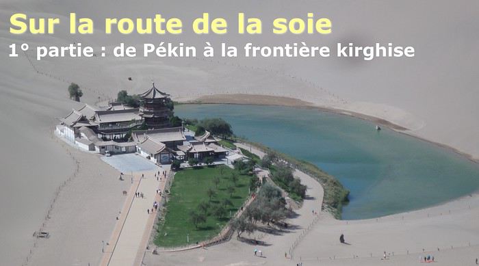
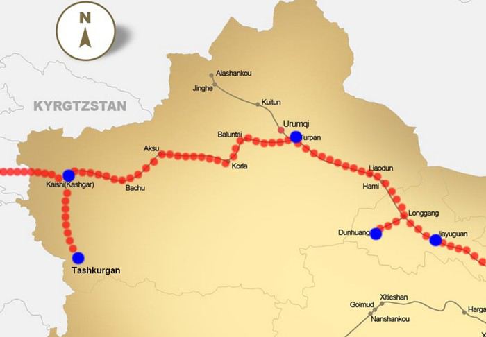
The Chinese Far West More than 30 years after my first trip to eastern China, I finally fulfilled an old dream: traveling solo from Beijing to the far west, discovering Xinjiang, the Uyghur people and the oppression they endure, the oases of Turpan and Kashgar, the Taklamakan Desert, the end of the Great Wall... The route was covered by train.
MENU PART 1: CHINA
1- Beijing (Jiankou) : the authentic Great Wall, without tourists 2- Cycling in Beijing, the best way to get around 3- Beijing : departure for the far west 4- Jiayuguan : getting by without English 5- Jiayuguan : scams and heritage 6- Dunhuang : abundance in the middle of the desert 7- Turpan : the Uyghurs under heavy surveillance 8- Kashgar : love at first sight for the old city 9- Kashgar : China’s recipe for controlling the populace 10- Tashkurgan : what on earth was I thinking going there! Kyrgyz border: a surreal epic Photo album from the 80s, contributions from other travelers (page 2)
1- JIANKOU Finding the authentic Great Wall, without tourists or a guide Friday, August 24, 2018 Thirty years later, I didn’t feel like revisiting the Great Wall at Badaling or any other overcrowded site. I chose to explore it at Jiankou, in its wildest, most authentic, and unrestored section, starting from a lost village deep in a valley—though it wasn’t *that* lost, since it had everything for communication.
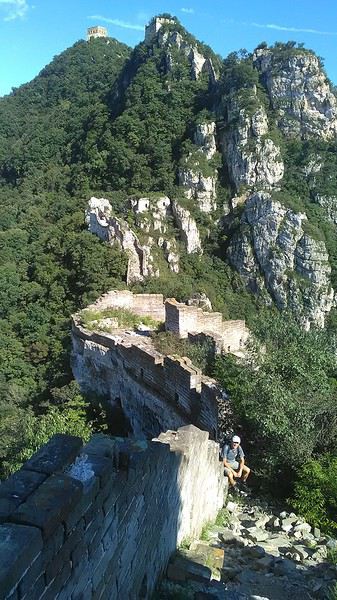
No need to pay for a taxi to get there—by timing it right, you can take the bus for just a few yuan. You have to get off at Xizhazi, the bus terminus. Be careful, there are only two buses a day in each direction. At the Xizhazi bus stop, I met a young couple who’d arrived with zero information about what to expect. We hiked the three of us toward the restored section of Mutianyu.
Still, be cautious With GPS and a topographic map (OpenTopoMap), you can set off without a problem or guide. The trail up to Jiankou is easy and well-marked. The trails down are too. But be careful—once you’re on the Wall, it’s real mountain hiking, with easy but dangerous climbing sections (over sheer drops). Not for amateurs or those afraid of heights! But what a reward. The Wall all to yourself, where it’s at its most daring. Truly mesmerizing.
More photos...
2- BEIJING The best way to get around the capital Sunday, August 26 The best way to explore the city is still by bike. Most are in a bike-share system, but you need to use an app—WeChat, the app that does everything, like monitoring your every move. No way I was installing that.
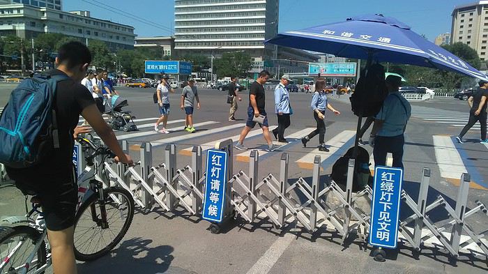
I found one at a rental shop near the hostel. The key is to quickly learn local traffic customs to minimize risks. Bike lanes are wide along the avenues.
But you still have to: - Watch out for anything parked on the bike paths—the most annoying are people napping or talking on the phone in their cars - Keep an eye on everything coming the wrong way—the list is long - The worst is right turns on red, which in Chinese traffic rules seem to have priority Once you get the hang of it, it’s fine. The city is huge but flat, so you can just wing it.
3- BEIJING By train to the far west Sunday, August 26 Beijing West Station is the size and operates like an airport. With your e-ticket from the agency, you first have to pick up your ticket at the special "English" counter, after passing through security. With your ticket in hand, you have to exit and enter through the boarding waiting area—not the platform—after a second security check.
 Then you find the right hall and wait for the sign to finally access the platform. In the end, it works pretty well given the incredible number of passengers to manage. Everywhere in Beijing, I saw that the Chinese have mastered crowd flow management.
Nice surprise: second-class carriages are clean, air-conditioned, and bright. Perfect, since I was in for 20 hours. One uniformed attendant per carriage, mobile meal service—luxury! Small downside: no luggage space. Hauling your suitcase up to the top bunk is quite a workout. I was in the middle, so it wasn’t too bad. The landscape, though, whether rural or urban, is pretty bleak. That should change once we leave the eastern plains.
Of course, I got my first police visit, with a thorough passport check and bag search. I was warned—going to the Chinese far west exposes you to this kind of hassle. But they were polite and respectful.
 The Chinese Far West
4- JIAYUGUAN Getting by without English Monday, August 27 At the gates of two deserts (Gobi and Taklamakan) and at the foot of the Tibetan highlands, the Great Wall ends at Jiayuguan. Here, I found the deeper China I’d somewhat rediscovered during my bike ride, even if now everyone gets around on electric bikes and I’m no longer stared at like an alien.
Prices are nothing like Beijing: you can find a full meal for 2 €, and my bike cost 7 € for two days. Plus, few people speak English—neither the owner of the HI hostel where I stayed, nor the ticket sellers at the sites, let alone the servers at the small eateries where I ate. Everything is written in Chinese. So I had to use the little Chinese I know to communicate about essentials. It makes the locals laugh to see a European trying to speak their language, but it earns respect. With Google Translate’s help, I managed.
Rant: With their avenues blocked for construction for kilometers without warning, and new roads not yet on maps, I must’ve taken 15 km of detours. More photos...
5- JIAYUGUAN Scams and heritage Tuesday, August 28 The Great Wall doesn’t exactly end at the fort I visited yesterday but 10 km further, at the entrance to a river gorge at the foot of the mountains. All that’s left is a badly damaged tower (more like a mound of earth) and a section of clay wall, similar to the one I biked yesterday.
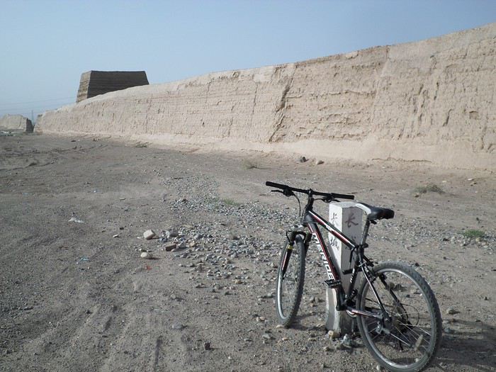
This morning, I hopped on my bike, determined to venture into the desert to see this highly symbolic site. First, you access it via a wide, brand-new road with not a soul in sight. Just before the site, I came across a grand welcome gate, very period-style, but it’s actually the inevitable toll booth.
Behind the gate, the road continues straight to the site, which you can see in the distance—at least 2 km away—the remains of the tower and wall. I had to leave my bike here. Fine. I went to the ticket counter and asked the price: 120 yuan! I couldn’t believe it—over 15 € for a simple mound of earth.
I showed my displeasure to the attendant, who couldn’t care less, and immediately turned back. 120 yuan—that’s the price for a new road, a fancy gate planted 2 km before the site just to force you to take a shuttle, and employees with nothing to do all day... Now I understand why I didn’t meet anyone!
Heritage China is a bit pricey Generally, sites are expensive for the country’s standard of living, but travelers are supposed to have money, so why hold back? I even gave up on the Forbidden City—reservations required days in advance (or on the black market at an impossible price). I prefer to keep the memory of my first visit, when entry must’ve cost a few dozen cents, and there were only a handful of visitors.
This morning, I took a taxi to see remarkable tombs of common people from the 3rd to 6th centuries. They’re small vaulted caves made of painted bricks, depicting scenes of daily life. Very pretty and moving. But even here, though the price was more reasonable, I was left wanting—only one of the 16 tombs is open to visitors, and it’s apparently not the most beautiful.
The authentic China—at least what’s left of it... Wandering the impersonal avenues of the city, you stumble upon a market. There, you still find traditional China—small shops with questionable hygiene, Go players, musicians, and even a dental prosthetist. The last refuge for those untouched by modernity. More photos...
6- DUNHUANG Abundance in the middle of the desert Wednesday, August 29 Well, I thought the landscape would be less bleak as I headed west. Nope. The only distraction in this expanse of dark, clayey sand is the forests of pylons and wind turbines, plus wild camels racing each other.
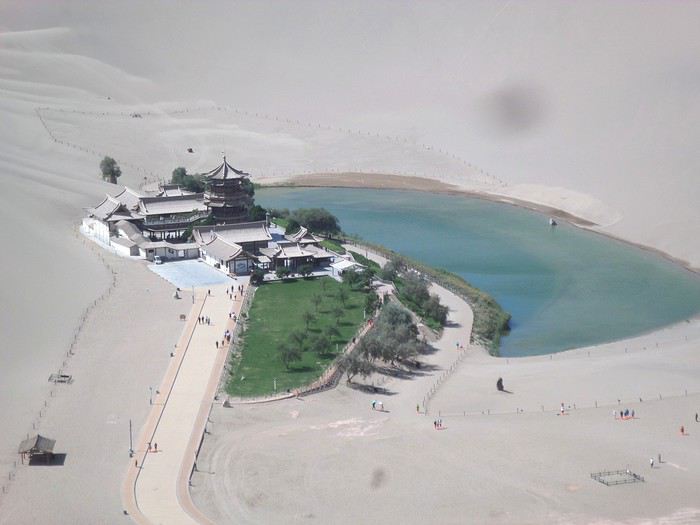 However, Dunhuang, the gateway to the Taklamakan, is by far the most pleasant Chinese city I know. There’s a real city center you can explore on foot. It’s hot but not unbearable, with a light, dry breeze. Much nicer than Beijing. The Han Chinese are still the majority, but the Muslim Uyghurs are more numerous, and the muezzin’s call to prayer echoes around the mosque.
The most surprising thing is the abundance and diversity of fruits and vegetables. You wonder how it all grows here. Well-irrigated, the desert sands are very fertile. Here, raisins have subtle, mysterious flavors, and the lamb really tastes like lamb.
Today, I visited the must-see Mingshashan, a dune complex next to which Pila is a molehill. The Basque Country, but covered in sand... More photos...
7- TURPAN The Uyghurs under heavy surveillance Friday, August 31 Surveillance cameras everywhere in the city, armed police stationed at intersections, in front of public buildings, at the entrance and inside tourist sites, police stations on every corner, patrols on foot or by car, khaki uniforms even for middle schoolers... here, the Han Chinese are in the minority, and you can feel it. Turpan feels like a city under siege.
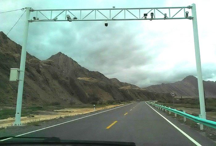
To enter the youth hostel where I stayed, there’s even a security gate, and the receptionist (a Han, like everyone in tourism) wears a bulletproof vest! Reassuring. Still, you don’t feel particularly threatened here, especially as a European. The troublemakers are the Chinese, not the Uyghurs. Generally, China is a very safe country for visitors.
Smile, you’re on camera! I was biking on an avenue when the car in front of me got flashed for driving slowly. I quickly understood why when I got flashed too.
Here, the official time is Beijing time, but it gets dark two hours later. It’ll be even worse in Kashgar. Trickier to manage: everything is displayed in Chinese and Arabic. Nothing in English. Choosing a menu is a shot in the dark. Apart from a few young Chinese, no one here speaks English, and my Chinese doesn’t seem very understandable...
Mogao, the end of the road for the Han Yesterday, near Dunhuang, I went to Mogao, a complex of decorated caves with Buddha sculptures and paintings. Stunning, but so crowded! Luckily, here in Turpan, Chinese tourists barely venture out. So I visited a Silk Road ghost town with only a handful of other visitors and under a howling wind.
The modern Chinese city is swallowing up the old Uyghur neighborhoods—only a museum-like district remains in the center, and pockets of resistance on the outskirts are doomed to disappear soon. More photos...
8- KASHGAR A (relative) love at first sight for the old city Sunday, September 2 After three overnight trains, here I am in the far west of China, nearly 4,000 km from the capital. Despite the omnipresent police and an old city preserved UNESCO-style, Kashgar is my Chinese love at first sight.
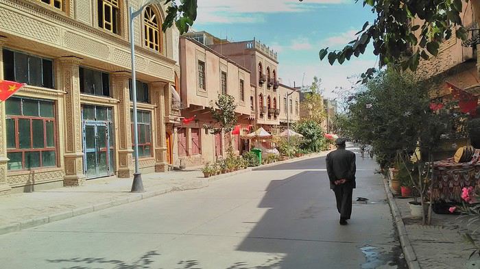
Finally, Chinese... well, sort of, because we’re in Uyghur territory here—a Turkic people with nothing culturally in common with the Han, the eastern Chinese. It started badly yesterday at Turfan station, where after three security gate passes, at least five passport checks, and a bag search, three adorable policewomen confiscated my antibacterial lotion because it had a flammable logo...
Then came the welcoming committee of armed cops at Kashgar station. Once all that was over, they left me alone—except you still have to go through security checks like everyone else to enter the old city, the bazaar, the livestock market... The further west you go, the more the siege mentality is evident. Luckily, the border isn’t far...
Despite the inevitable destruction-reconstruction, the city center has been well preserved. Thankfully, because it’s a very original style, a mix of local and colonial. I love it, even if it’s a bit too artificial, sanitized, and watered-down, and rather empty of residents. On the Silk Road, the city was famous for its great food. And it still is—rarely have I seen such richness and abundance of food! And not just scorpions or snakes. More photos...
9- KASHGAR China’s recipe for controlling the populace Saturday, September 1 Xinjiang, along with Tibet, is a "sensitive" area of rebellion in the eyes of Chinese authorities. As a result, the state has these regions and their populations under total control. Tourists also feel the consequences, even if they’re not at risk of re-education camps.
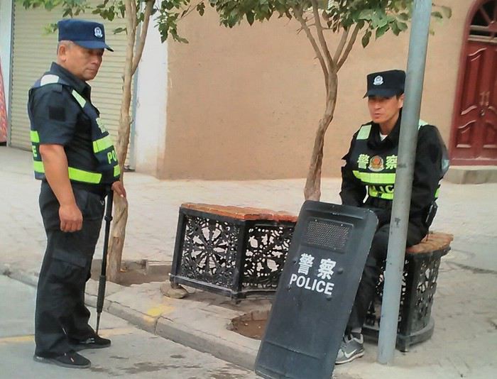 - Putting barbed wire and anti-ramming barriers around sensitive sites (schools, big hotels, government buildings...)
- Installing traffic surveillance gates with cameras and photo flashes (for all vehicles passing, including bikes) throughout the city and even in the countryside
- Posting uniformed guards with tasers, batons, or huge baseball bats every 100 meters
- Training the Han population (ethnic Chinese) in self-defense with sticks, preferably in the morning on the street. Men and women of all ages
- Starting school with the national anthem, doing military exercises, and receiving political indoctrination, all neatly lined up in the courtyard. (The dream school for any teacher)
- Placing a snitch in uniform (a pseudo-guard) in public gathering places, like youth hostels. Mine spends the day loafing around the courtyard
- Putting Chinese flags everywhere on the streets to remind everyone who’s in charge
- Installing security gates at every entrance to areas frequented by tourists (thanks for that) but not just there
- Never photographing cops, or else! I tried, but it’s not easy...
- Putting barbed wire and anti-ramming barriers around sensitive sites (schools, big hotels, government buildings...)
- Installing traffic surveillance gates with cameras and photo flashes (for all vehicles passing, including bikes) throughout the city and even in the countryside
- Posting uniformed guards with tasers, batons, or huge baseball bats every 100 meters
- Training the Han population (ethnic Chinese) in self-defense with sticks, preferably in the morning on the street. Men and women of all ages
- Starting school with the national anthem, doing military exercises, and receiving political indoctrination, all neatly lined up in the courtyard. (The dream school for any teacher)
- Placing a snitch in uniform (a pseudo-guard) in public gathering places, like youth hostels. Mine spends the day loafing around the courtyard
- Putting Chinese flags everywhere on the streets to remind everyone who’s in charge
- Installing security gates at every entrance to areas frequented by tourists (thanks for that) but not just there
- Never photographing cops, or else! I tried, but it’s not easy...
With all that, you can stroll around safely Not much crime! As for the amount the Chinese state spends to maintain such a system, it’s staggering! A third of the Han living in Xinjiang work in security. Today, I wandered freely around old Kashgar, which is quite large after all. More photos...
10- TASHKURGAN What on earth was I thinking going there! Wednesday, September 5 First, there’s the taxi—pretty crappy, with a driver who doesn’t speak a word of English and won’t stop smoking. Over six hours in that... shared with a completely out-of-it American.
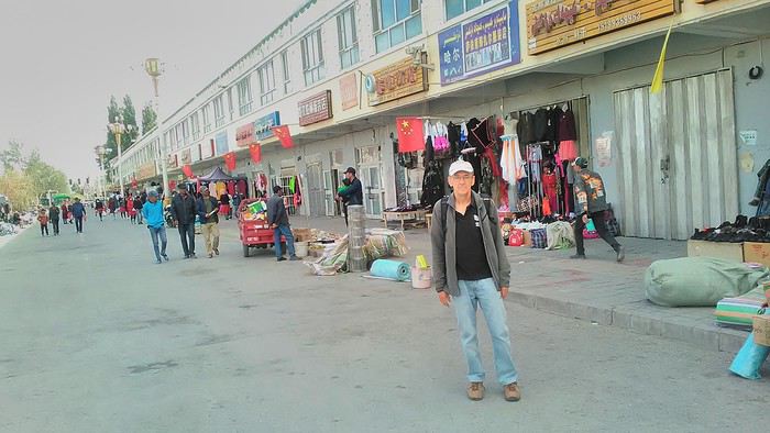
Then there are all the checkpoints along the way. I won’t go on—you know the drill by now.
After that, there’s Tashkurgan—a town with nothing to see, nothing to do. Deserted as soon as night falls. There’s this huge youth hostel and a few lost Chinese tapping away on their smartphones, chain-smoking. This lost American-European crowd, swapping tips on how to enter Pakistan or Tajikistan.
Luckily, there’s the Chinese Pamir Highway, lined with peaks over 7,000m. There’s the feeling of no longer being in China, with a population whose features are Middle Eastern. And these Tajik women with their stunning hairstyles and vibrant costumes. There’s the fact of having reached the westernmost Chinese city, far from crowds and tourist sites. A sort of end of the world. More photos...
11- KYRGYZ BORDER A surreal epic Thursday, September 6 The road from Kashgar to the Kyrgyzstan border is a little over 200 km and passes through beautiful landscapes of colorful, desert-like mountains with acrobatic folds. That’s the bucolic part of the trip.
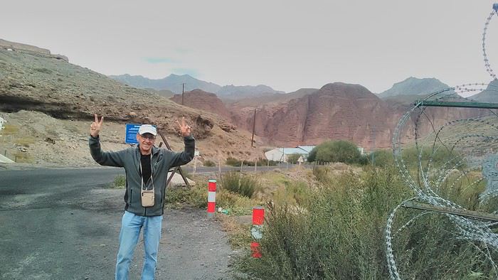 Yesterday, I managed to gather four people to rent a minibus to reach the border more easily: a Spaniard and an Argentine I’d already met in Turpan, and two New Zealanders who responded to the ad left at the hostel.
Absurdity and paranoia of Chinese authorities The highlight was crossing the town of Wuqia, 50 km past Kashgar. After tallying up with my fellow sufferers, we must’ve passed about ten checkpoints with: - Passport checks: 14 times, sometimes by two cops side by side - Bag checks: 4 times - Smartphone checks: 2 times, with deletion of "non-compliant" photos, and registration of your IMEI in the exit log!... Absurd and surreal at the same time, since my camera stayed in my bag, my apps are in French, and my photos have been online for ages...
With all that, we arrived just as the last checkpoint before the no man’s land marking the border between the two countries was on lunch break. And bam! Another 1.5-hour wait, alongside truckers who were much more used to this than we were.
What to think? The cops themselves aren’t fooled. They play the role they’re asked to, but sometimes you can coax a smile out of them—they realize how ridiculous the situation is.
What’s the point? That’s the big question my companions and I were tempted to answer with "to piss people off." To show you your place isn’t here, but with the other tourists, over there in the east, in Shanghai, Xi’an, or Guangzhou.
As for you, a traveler from a democratic country, you really experience this as aggression, humiliation, a violation of your private space. And yet, I’m respected, they speak to me properly. Today, I better understand what a Palestinian or a citizen of an occupied country might feel daily. A unique experience! Thanks, China.
And to top it off, the cherry on the cake! It’s still this glowing button you press to rate your passage after clearing the last obstacle before the exit stamp. I was so surprised it turned off before I could react. The Spaniard, with great humor and irony, had time to vote "excellent." In the end, he wasn’t wrong—you can hardly do better!
PS: I ditched my buddies at the border. They didn’t want to pay for a taxi to continue. So I took a direct taxi to Osh. The first 100 km are fabulous. I couldn’t take many photos, but I’ll be back on Monday to go to Tajikistan.
More photos...
The rest of the Silk Road, Part 2, in these travel journals: Kyrgyzstan, Tajikistan, Uzbekistan.
The Chinese Far West More than 30 years after my first trip to eastern China, I finally fulfilled an old dream: traveling solo from Beijing to the far west, discovering Xinjiang, the Uyghur people and the oppression they endure, the oases of Turpan and Kashgar, the Taklamakan Desert, the end of the Great Wall... The route was covered by train.
MENU PART 1: CHINA
1- Beijing (Jiankou) : the authentic Great Wall, without tourists 2- Cycling in Beijing, the best way to get around 3- Beijing : departure for the far west 4- Jiayuguan : getting by without English 5- Jiayuguan : scams and heritage 6- Dunhuang : abundance in the middle of the desert 7- Turpan : the Uyghurs under heavy surveillance 8- Kashgar : love at first sight for the old city 9- Kashgar : China’s recipe for controlling the populace 10- Tashkurgan : what on earth was I thinking going there! Kyrgyz border: a surreal epic Photo album from the 80s, contributions from other travelers (page 2)
1- JIANKOU Finding the authentic Great Wall, without tourists or a guide Friday, August 24, 2018 Thirty years later, I didn’t feel like revisiting the Great Wall at Badaling or any other overcrowded site. I chose to explore it at Jiankou, in its wildest, most authentic, and unrestored section, starting from a lost village deep in a valley—though it wasn’t *that* lost, since it had everything for communication.
No need to pay for a taxi to get there—by timing it right, you can take the bus for just a few yuan. You have to get off at Xizhazi, the bus terminus. Be careful, there are only two buses a day in each direction. At the Xizhazi bus stop, I met a young couple who’d arrived with zero information about what to expect. We hiked the three of us toward the restored section of Mutianyu.
Still, be cautious With GPS and a topographic map (OpenTopoMap), you can set off without a problem or guide. The trail up to Jiankou is easy and well-marked. The trails down are too. But be careful—once you’re on the Wall, it’s real mountain hiking, with easy but dangerous climbing sections (over sheer drops). Not for amateurs or those afraid of heights! But what a reward. The Wall all to yourself, where it’s at its most daring. Truly mesmerizing.
More photos...
2- BEIJING The best way to get around the capital Sunday, August 26 The best way to explore the city is still by bike. Most are in a bike-share system, but you need to use an app—WeChat, the app that does everything, like monitoring your every move. No way I was installing that.
I found one at a rental shop near the hostel. The key is to quickly learn local traffic customs to minimize risks. Bike lanes are wide along the avenues.
But you still have to: - Watch out for anything parked on the bike paths—the most annoying are people napping or talking on the phone in their cars - Keep an eye on everything coming the wrong way—the list is long - The worst is right turns on red, which in Chinese traffic rules seem to have priority Once you get the hang of it, it’s fine. The city is huge but flat, so you can just wing it.
3- BEIJING By train to the far west Sunday, August 26 Beijing West Station is the size and operates like an airport. With your e-ticket from the agency, you first have to pick up your ticket at the special "English" counter, after passing through security. With your ticket in hand, you have to exit and enter through the boarding waiting area—not the platform—after a second security check.
Then you find the right hall and wait for the sign to finally access the platform. In the end, it works pretty well given the incredible number of passengers to manage. Everywhere in Beijing, I saw that the Chinese have mastered crowd flow management.Nice surprise: second-class carriages are clean, air-conditioned, and bright. Perfect, since I was in for 20 hours. One uniformed attendant per carriage, mobile meal service—luxury! Small downside: no luggage space. Hauling your suitcase up to the top bunk is quite a workout. I was in the middle, so it wasn’t too bad. The landscape, though, whether rural or urban, is pretty bleak. That should change once we leave the eastern plains.
Of course, I got my first police visit, with a thorough passport check and bag search. I was warned—going to the Chinese far west exposes you to this kind of hassle. But they were polite and respectful.
The Chinese Far West4- JIAYUGUAN Getting by without English Monday, August 27 At the gates of two deserts (Gobi and Taklamakan) and at the foot of the Tibetan highlands, the Great Wall ends at Jiayuguan. Here, I found the deeper China I’d somewhat rediscovered during my bike ride, even if now everyone gets around on electric bikes and I’m no longer stared at like an alien.
Prices are nothing like Beijing: you can find a full meal for 2 €, and my bike cost 7 € for two days. Plus, few people speak English—neither the owner of the HI hostel where I stayed, nor the ticket sellers at the sites, let alone the servers at the small eateries where I ate. Everything is written in Chinese. So I had to use the little Chinese I know to communicate about essentials. It makes the locals laugh to see a European trying to speak their language, but it earns respect. With Google Translate’s help, I managed.
Rant: With their avenues blocked for construction for kilometers without warning, and new roads not yet on maps, I must’ve taken 15 km of detours. More photos...
5- JIAYUGUAN Scams and heritage Tuesday, August 28 The Great Wall doesn’t exactly end at the fort I visited yesterday but 10 km further, at the entrance to a river gorge at the foot of the mountains. All that’s left is a badly damaged tower (more like a mound of earth) and a section of clay wall, similar to the one I biked yesterday.
This morning, I hopped on my bike, determined to venture into the desert to see this highly symbolic site. First, you access it via a wide, brand-new road with not a soul in sight. Just before the site, I came across a grand welcome gate, very period-style, but it’s actually the inevitable toll booth.
Behind the gate, the road continues straight to the site, which you can see in the distance—at least 2 km away—the remains of the tower and wall. I had to leave my bike here. Fine. I went to the ticket counter and asked the price: 120 yuan! I couldn’t believe it—over 15 € for a simple mound of earth.
I showed my displeasure to the attendant, who couldn’t care less, and immediately turned back. 120 yuan—that’s the price for a new road, a fancy gate planted 2 km before the site just to force you to take a shuttle, and employees with nothing to do all day... Now I understand why I didn’t meet anyone!
Heritage China is a bit pricey Generally, sites are expensive for the country’s standard of living, but travelers are supposed to have money, so why hold back? I even gave up on the Forbidden City—reservations required days in advance (or on the black market at an impossible price). I prefer to keep the memory of my first visit, when entry must’ve cost a few dozen cents, and there were only a handful of visitors.
This morning, I took a taxi to see remarkable tombs of common people from the 3rd to 6th centuries. They’re small vaulted caves made of painted bricks, depicting scenes of daily life. Very pretty and moving. But even here, though the price was more reasonable, I was left wanting—only one of the 16 tombs is open to visitors, and it’s apparently not the most beautiful.
The authentic China—at least what’s left of it... Wandering the impersonal avenues of the city, you stumble upon a market. There, you still find traditional China—small shops with questionable hygiene, Go players, musicians, and even a dental prosthetist. The last refuge for those untouched by modernity. More photos...
6- DUNHUANG Abundance in the middle of the desert Wednesday, August 29 Well, I thought the landscape would be less bleak as I headed west. Nope. The only distraction in this expanse of dark, clayey sand is the forests of pylons and wind turbines, plus wild camels racing each other.
However, Dunhuang, the gateway to the Taklamakan, is by far the most pleasant Chinese city I know. There’s a real city center you can explore on foot. It’s hot but not unbearable, with a light, dry breeze. Much nicer than Beijing. The Han Chinese are still the majority, but the Muslim Uyghurs are more numerous, and the muezzin’s call to prayer echoes around the mosque.The most surprising thing is the abundance and diversity of fruits and vegetables. You wonder how it all grows here. Well-irrigated, the desert sands are very fertile. Here, raisins have subtle, mysterious flavors, and the lamb really tastes like lamb.
Today, I visited the must-see Mingshashan, a dune complex next to which Pila is a molehill. The Basque Country, but covered in sand... More photos...
7- TURPAN The Uyghurs under heavy surveillance Friday, August 31 Surveillance cameras everywhere in the city, armed police stationed at intersections, in front of public buildings, at the entrance and inside tourist sites, police stations on every corner, patrols on foot or by car, khaki uniforms even for middle schoolers... here, the Han Chinese are in the minority, and you can feel it. Turpan feels like a city under siege.
To enter the youth hostel where I stayed, there’s even a security gate, and the receptionist (a Han, like everyone in tourism) wears a bulletproof vest! Reassuring. Still, you don’t feel particularly threatened here, especially as a European. The troublemakers are the Chinese, not the Uyghurs. Generally, China is a very safe country for visitors.
Smile, you’re on camera! I was biking on an avenue when the car in front of me got flashed for driving slowly. I quickly understood why when I got flashed too.
Here, the official time is Beijing time, but it gets dark two hours later. It’ll be even worse in Kashgar. Trickier to manage: everything is displayed in Chinese and Arabic. Nothing in English. Choosing a menu is a shot in the dark. Apart from a few young Chinese, no one here speaks English, and my Chinese doesn’t seem very understandable...
Mogao, the end of the road for the Han Yesterday, near Dunhuang, I went to Mogao, a complex of decorated caves with Buddha sculptures and paintings. Stunning, but so crowded! Luckily, here in Turpan, Chinese tourists barely venture out. So I visited a Silk Road ghost town with only a handful of other visitors and under a howling wind.
The modern Chinese city is swallowing up the old Uyghur neighborhoods—only a museum-like district remains in the center, and pockets of resistance on the outskirts are doomed to disappear soon. More photos...
8- KASHGAR A (relative) love at first sight for the old city Sunday, September 2 After three overnight trains, here I am in the far west of China, nearly 4,000 km from the capital. Despite the omnipresent police and an old city preserved UNESCO-style, Kashgar is my Chinese love at first sight.
Finally, Chinese... well, sort of, because we’re in Uyghur territory here—a Turkic people with nothing culturally in common with the Han, the eastern Chinese. It started badly yesterday at Turfan station, where after three security gate passes, at least five passport checks, and a bag search, three adorable policewomen confiscated my antibacterial lotion because it had a flammable logo...
Then came the welcoming committee of armed cops at Kashgar station. Once all that was over, they left me alone—except you still have to go through security checks like everyone else to enter the old city, the bazaar, the livestock market... The further west you go, the more the siege mentality is evident. Luckily, the border isn’t far...
Despite the inevitable destruction-reconstruction, the city center has been well preserved. Thankfully, because it’s a very original style, a mix of local and colonial. I love it, even if it’s a bit too artificial, sanitized, and watered-down, and rather empty of residents. On the Silk Road, the city was famous for its great food. And it still is—rarely have I seen such richness and abundance of food! And not just scorpions or snakes. More photos...
9- KASHGAR China’s recipe for controlling the populace Saturday, September 1 Xinjiang, along with Tibet, is a "sensitive" area of rebellion in the eyes of Chinese authorities. As a result, the state has these regions and their populations under total control. Tourists also feel the consequences, even if they’re not at risk of re-education camps.
- Putting barbed wire and anti-ramming barriers around sensitive sites (schools, big hotels, government buildings...)
- Installing traffic surveillance gates with cameras and photo flashes (for all vehicles passing, including bikes) throughout the city and even in the countryside
- Posting uniformed guards with tasers, batons, or huge baseball bats every 100 meters
- Training the Han population (ethnic Chinese) in self-defense with sticks, preferably in the morning on the street. Men and women of all ages
- Starting school with the national anthem, doing military exercises, and receiving political indoctrination, all neatly lined up in the courtyard. (The dream school for any teacher)
- Placing a snitch in uniform (a pseudo-guard) in public gathering places, like youth hostels. Mine spends the day loafing around the courtyard
- Putting Chinese flags everywhere on the streets to remind everyone who’s in charge
- Installing security gates at every entrance to areas frequented by tourists (thanks for that) but not just there
- Never photographing cops, or else! I tried, but it’s not easy...With all that, you can stroll around safely Not much crime! As for the amount the Chinese state spends to maintain such a system, it’s staggering! A third of the Han living in Xinjiang work in security. Today, I wandered freely around old Kashgar, which is quite large after all. More photos...
10- TASHKURGAN What on earth was I thinking going there! Wednesday, September 5 First, there’s the taxi—pretty crappy, with a driver who doesn’t speak a word of English and won’t stop smoking. Over six hours in that... shared with a completely out-of-it American.
Then there are all the checkpoints along the way. I won’t go on—you know the drill by now.
After that, there’s Tashkurgan—a town with nothing to see, nothing to do. Deserted as soon as night falls. There’s this huge youth hostel and a few lost Chinese tapping away on their smartphones, chain-smoking. This lost American-European crowd, swapping tips on how to enter Pakistan or Tajikistan.
Luckily, there’s the Chinese Pamir Highway, lined with peaks over 7,000m. There’s the feeling of no longer being in China, with a population whose features are Middle Eastern. And these Tajik women with their stunning hairstyles and vibrant costumes. There’s the fact of having reached the westernmost Chinese city, far from crowds and tourist sites. A sort of end of the world. More photos...
11- KYRGYZ BORDER A surreal epic Thursday, September 6 The road from Kashgar to the Kyrgyzstan border is a little over 200 km and passes through beautiful landscapes of colorful, desert-like mountains with acrobatic folds. That’s the bucolic part of the trip.
Yesterday, I managed to gather four people to rent a minibus to reach the border more easily: a Spaniard and an Argentine I’d already met in Turpan, and two New Zealanders who responded to the ad left at the hostel.Absurdity and paranoia of Chinese authorities The highlight was crossing the town of Wuqia, 50 km past Kashgar. After tallying up with my fellow sufferers, we must’ve passed about ten checkpoints with: - Passport checks: 14 times, sometimes by two cops side by side - Bag checks: 4 times - Smartphone checks: 2 times, with deletion of "non-compliant" photos, and registration of your IMEI in the exit log!... Absurd and surreal at the same time, since my camera stayed in my bag, my apps are in French, and my photos have been online for ages...
With all that, we arrived just as the last checkpoint before the no man’s land marking the border between the two countries was on lunch break. And bam! Another 1.5-hour wait, alongside truckers who were much more used to this than we were.
What to think? The cops themselves aren’t fooled. They play the role they’re asked to, but sometimes you can coax a smile out of them—they realize how ridiculous the situation is.
What’s the point? That’s the big question my companions and I were tempted to answer with "to piss people off." To show you your place isn’t here, but with the other tourists, over there in the east, in Shanghai, Xi’an, or Guangzhou.
As for you, a traveler from a democratic country, you really experience this as aggression, humiliation, a violation of your private space. And yet, I’m respected, they speak to me properly. Today, I better understand what a Palestinian or a citizen of an occupied country might feel daily. A unique experience! Thanks, China.
And to top it off, the cherry on the cake! It’s still this glowing button you press to rate your passage after clearing the last obstacle before the exit stamp. I was so surprised it turned off before I could react. The Spaniard, with great humor and irony, had time to vote "excellent." In the end, he wasn’t wrong—you can hardly do better!
PS: I ditched my buddies at the border. They didn’t want to pay for a taxi to continue. So I took a direct taxi to Osh. The first 100 km are fabulous. I couldn’t take many photos, but I’ll be back on Monday to go to Tajikistan.
More photos...
The rest of the Silk Road, Part 2, in these travel journals: Kyrgyzstan, Tajikistan, Uzbekistan.
Back from 3 weeks in the Sultanate of Oman
Back from 3 weeks in Oman.
My wife and I just returned from 3 weeks in the Sultanate of Oman. I have to say we had a really enjoyable trip. While we usually prefer self-organized trips (real or imagined sense of freedom?), this time we opted for a pre-organized trip with the agency "Omanselfdrivetour" run by Paul Sistac—and we don’t regret it!
Based on a 15-day itinerary, we asked for a few adjustments and additions to make it a slightly more active 3-week trip. We rented a 4x4, which is essential for accessing many mountain villages. The road book, prepared by Paul, suggested visits and activities along the routes connecting our accommodations (always well-chosen for their character). We were free to follow it or not, but I have to say it was so well done that we pretty much did and saw everything it suggested—our days were packed!
Oman is a country that lends itself well to many outdoor activities thanks to its mountain ranges (the highest peak is at 3000 m) and especially its "Wadis."
A "Wadi" simply means "valley," but the local geology makes these valleys often very deep, resembling beautiful canyons. You can explore them by car in the wider ones, on hikes (some with water) in others, and even canyoning (with the right gear) in the narrowest ones with waterfalls, like the stunning Snake Canyon.
There are also great mountain hikes, well-marked, often leading to villages abandoned in recent years or decades. These villages are usually hours away on foot, nestled under massive rock overhangs (like those in Saab bani Khamis or Masirat al Jawamid), sheltered from the tropical sun and attacks.
For sunbathers, the Indian Ocean coastline offers beautiful beaches and some luxurious hotels. You can also rent kayaks to get a closer look at the rocky shores. Snorkeling is possible too (some spots are well-known), though conditions weren’t ideal during the few days we were by the sea (too much wind and murky waters).
Most of the country, however, is a vast desert. We spent 2 days in the Wahiba Sands dunes, but it wasn’t really our cup of tea.
Oman has some scattered historical monuments, like well-restored forts that reflect its history of internal rivalries—similar to our medieval castles.
The capital, Muscat, is pleasant and has a few great sights to explore over 2 days, like the old center (with the Sultan’s Palace and the National Museum), the Sultan Qaboos Grand Mosque, and the Opera House.
Sultan Qaboos, who passed away on January 10, 2020, after nearly half a century of rule, was sometimes called the "Philanthropist Sultan." He worked to modernize his country and open it up to tourism. Visitors are warmly welcomed by a tolerant and hospitable population. Omanis are always ready to help passing travelers, happy that they’re interested in their country (it’s not uncommon to be offered coffee, fruit, or other gifts for no reason).
The only downside: despite trash bins being everywhere, their use isn’t yet universal.
So, if you’re thinking of visiting Oman, now’s the time—before the crowds of tourists arrive on low-cost flights.
If I can humbly and modestly help anyone plan their trip, I’d be happy to.
L'Éthiopie veut construire le plus grand aéroport d'Afrique... et peut-être même du monde English translation pending
Le gouvernement éthiopien et Ethiopian Airlines ont décidé de construire au sud de la capitale ce qui pourrait être un jour le plus grand aéroport africain et même peut-être du monde avec une capacité autour de 100 millions de passagers/an. Celui-ci serait opérationnel pour 2028.
Lire la suite...
Les incontournables à voir dans le Massif Central? (à vélo) English translation pending
Bonjour,
Au départ d'Angoulème, j'aimerais faire un voyage à vélo non VTT dans le Massif central.
Si vous connaissez bien la région, quels sont selon vous les incontournables ?
Merci.
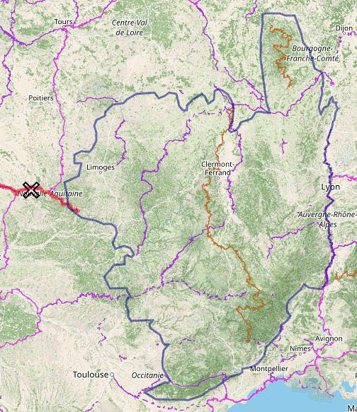
Au départ d'Angoulème, j'aimerais faire un voyage à vélo non VTT dans le Massif central.
Si vous connaissez bien la région, quels sont selon vous les incontournables ?
Merci.
Trop tard pour planifier un voyage à Madagascar cet été? English translation pending
Bonjour à tous,
La nouvelle trotte dans notre tête depuis cette semaine. Pourquoi pas Madagascar comme destination ! Avant de faire des recherches, j'ai une question toute simple. Est-il trop tard pour organiser 3 semaines de voyage en juillet/août ? Nous viendrons du Canada. J'imagine que les européens y vont beaucoup durant les grandes vacances...
Merci
La nouvelle trotte dans notre tête depuis cette semaine. Pourquoi pas Madagascar comme destination ! Avant de faire des recherches, j'ai une question toute simple. Est-il trop tard pour organiser 3 semaines de voyage en juillet/août ? Nous viendrons du Canada. J'imagine que les européens y vont beaucoup durant les grandes vacances...
Merci
Itinéraire avec 4x4 et chauffeur en Éthiopie du Nord English translation pending
Bonjour,
Voici mon itinéraire avec 4x4 et chauffeur, départ début mars, j'ai pris le choix de ne pas séjourner à Addis. Je suis un amoureux de la nature et j'apprécie peu les grandes villes polluées, je sais que je rate des choses sympas mais cela me permet de passer un jour de plus dans le Tigray .
Dès l'arrivée à Addis, je prends un autre avion pour Lalibela
3 nuits à Lalibela Eglises, une journée au Mont Abuna Yousef
Route Labila - Gondar Nuit à Gondar Visite de la ville
Route vers le Parc du Siemen 3 nuits Parc du Siemen rando, nature
Route vers Axoum 1 Nuit à Axoum visite de la ville
Route vers le Tigray 3 nuits à proximité des montagnes Gheralta 2 journées rando/églises Dernier jour un peu sport, direction le Dallol, puis retour Mekele , avion vers Addis en fin de journée, puis vol international de nuit vers Paris.
Cela fait peut être un peu trop de voiture à votre avis ? Le dernier jour est ambitieux ?
Je posterai ici mes impressions et quelques photos au retour de ce voyage qui je l'espère sera fantastique dans ce pays qui me rêver depuis ma plus tendre enfance.
Voyageusement 🙂
Voici mon itinéraire avec 4x4 et chauffeur, départ début mars, j'ai pris le choix de ne pas séjourner à Addis. Je suis un amoureux de la nature et j'apprécie peu les grandes villes polluées, je sais que je rate des choses sympas mais cela me permet de passer un jour de plus dans le Tigray .
Dès l'arrivée à Addis, je prends un autre avion pour Lalibela
3 nuits à Lalibela Eglises, une journée au Mont Abuna Yousef
Route Labila - Gondar Nuit à Gondar Visite de la ville
Route vers le Parc du Siemen 3 nuits Parc du Siemen rando, nature
Route vers Axoum 1 Nuit à Axoum visite de la ville
Route vers le Tigray 3 nuits à proximité des montagnes Gheralta 2 journées rando/églises Dernier jour un peu sport, direction le Dallol, puis retour Mekele , avion vers Addis en fin de journée, puis vol international de nuit vers Paris.
Cela fait peut être un peu trop de voiture à votre avis ? Le dernier jour est ambitieux ?
Je posterai ici mes impressions et quelques photos au retour de ce voyage qui je l'espère sera fantastique dans ce pays qui me rêver depuis ma plus tendre enfance.
Voyageusement 🙂
Quel vélo choisir pour un prémier voyage? (et d'autres) English translation pending
Bonjour!
Je voulais avoir votre aide, je vais faire un voyage à vélo cet été et je voulais m'acheter un nouveau vélo. Je roule tous le jours sur un Peugeot ancien mais qui tiens les 10/15km journaliers. Pour le voyage l'idée est de faire 50 kms par jour en moyen sur le Canal du Midi. J'ai un budget un peu serré (500 euros plus au moins). Dans ce prix il y en a des vélos mais je n'arrive pas à me décider. Certains parlaient de fourche rigide, d'autres suspendue, vtc/vtt, etc. Bref, je suis actuellement entre trois options, vous me direz votre avis et si jamais vous avez d'autres conseils.
Merci beaucoup! 🙂
Voici les options Peugeot t02 d 7 500e https://performancevelo.com/velos-adulte/16350-velo-vtc-polyvalent-peugeot-t02-d7-2020
Giant roam 450 e (garde boue à rajouter) https://www.giant-bicycles.com/fr/roam-4-disc-2020
Vermont brentwood 400 e https://www.bikester.fr/vermont-brentwood-black-matt-1122872.html
Je voulais avoir votre aide, je vais faire un voyage à vélo cet été et je voulais m'acheter un nouveau vélo. Je roule tous le jours sur un Peugeot ancien mais qui tiens les 10/15km journaliers. Pour le voyage l'idée est de faire 50 kms par jour en moyen sur le Canal du Midi. J'ai un budget un peu serré (500 euros plus au moins). Dans ce prix il y en a des vélos mais je n'arrive pas à me décider. Certains parlaient de fourche rigide, d'autres suspendue, vtc/vtt, etc. Bref, je suis actuellement entre trois options, vous me direz votre avis et si jamais vous avez d'autres conseils.
Merci beaucoup! 🙂
Voici les options Peugeot t02 d 7 500e https://performancevelo.com/velos-adulte/16350-velo-vtc-polyvalent-peugeot-t02-d7-2020
Giant roam 450 e (garde boue à rajouter) https://www.giant-bicycles.com/fr/roam-4-disc-2020
Vermont brentwood 400 e https://www.bikester.fr/vermont-brentwood-black-matt-1122872.html
Sharing ideas for a future retirement
Planning for retirement! Where? How? Why there? Current home: Réunion Island > it's great. Though a bit too crowded on this island... And the future looks way too expensive to live reasonably without spending too much. So, exploring the Indian Ocean. Your ideas are welcome! ;-) A bit of Bali, a touch of Rodrigues, a few weeks in Mauritius, summers in Nosy Be, and winters in Réunion. In a camper van... maybe.
Bivouac autour du Lac Baikal en mars English translation pending
Bonjour,
Nous arrivons à Irkoust début mars 2020 après 4 jours de Transibéria. Nous allons voyager à deux pendant 7 jours en itinérance, à pied, avant de rejoindre Irkoust. Je souhaiterai, pour les nuits, bivouaquer ou dormir dans des refuges/cabannes, Certains ont-ils déjà fait ce genre de voyage dans ce coin là et à cette période de l'année? Avez vous des idées d'itinéraire ou d'endroit où dormir? Je vous remercie d'avance pour vos réponses, et au plaisir de vous lire.
Cordialement
Arnaud
Nous arrivons à Irkoust début mars 2020 après 4 jours de Transibéria. Nous allons voyager à deux pendant 7 jours en itinérance, à pied, avant de rejoindre Irkoust. Je souhaiterai, pour les nuits, bivouaquer ou dormir dans des refuges/cabannes, Certains ont-ils déjà fait ce genre de voyage dans ce coin là et à cette période de l'année? Avez vous des idées d'itinéraire ou d'endroit où dormir? Je vous remercie d'avance pour vos réponses, et au plaisir de vous lire.
Cordialement
Arnaud