Hi everyone,
I’m posting this because in about two weeks, my wife and I want to go to Myanmar.
Ever since the country opened up, we’ve really wanted to visit. However, I’m wondering if there’s too much hype about it.
Everywhere you read that it’s authentic, not too touristy, really different, etc. So I’m worried we might be getting our hopes up too high and risk being disappointed if it’s not the case.
Because despite everything, it’s become a very popular destination in Asia, and a lot of tourists are heading there.
I’d love to hear your general thoughts. Were you disappointed? Or was it exactly what you expected?
Because if all this enthusiasm is a bit exaggerated, maybe we’ll choose another country instead.
Thanks in advance! :)
526 similar discussions in English
Hi there,
This travel journal is to share our trip to Myanmar in January-February 2017 and relive the experience...
Six stops:
- the economic capital, Yangon,
- the ethnic groups in the east around Kengtong,
- Inle Lake
- Mandalay
- Bagan
- the Golden Rock and Bago
A trip for two, but organized with a local agency.
Flight with Vietnam Airlines (Paris/Ho Chi Minh City/Yangon on the way out, Yangon/Hanoi/Paris on the way back)
First stop, Yangon
At last, we arrive! That moment of excitement and impatience we all know when we land in a country we don’t know but have been dreaming about for a while. Butterflies in our stomachs—not just from the long flight! It’s noon, everything goes smoothly (baggage, immigration, currency exchange, pre-booked taxi, ride to Yangon), and by 2:30 PM we check out of our hotel, tired from the journey but eager to explore the city and power through until evening to beat the jet lag. We’re driven by To-Wen. Traffic is pretty heavy, but strangely, no motorbikes or scooters... To-Wen explains that two-wheelers have been banned in Yangon for several years because they’d become too numerous and caused many injuries and fatalities. To compensate, a very developed public transport system has been put in place. Yangon, or Rangoon, isn’t Myanmar’s administrative capital. The official capital was moved to Naypyidaw in 2005 by government decision—some say to distance themselves from potential popular uprisings. Whatever the reason, it cost a fortune, and no one followed (only civil servants, who were forced to go), not even foreign embassies. This ghost capital makes all the Burmese we spoke to chuckle. Yangon is the economic, cultural, and diplomatic capital, and it’s the most populous city (4.5 million people).
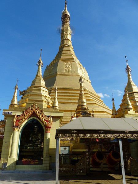
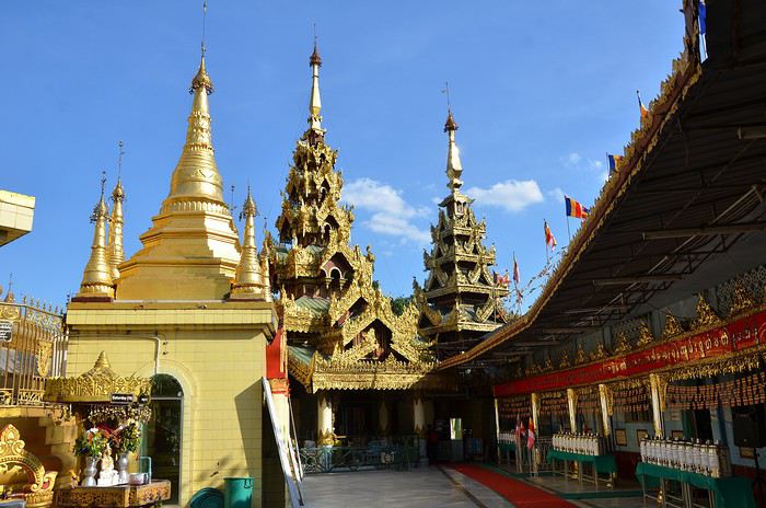
What did we see? Well, first we discovered the Sule Pagoda, a funny concept of a "roundabout pagoda" since it’s right in the middle of a busy intersection! Circular, its outer wall houses many tiny stalls. Then comes the miracle: the hustle and bustle of the street contrasts with the calm inside. You leave a noisy roundabout and suddenly find yourself in another world... flowers and fruit in front of the altars, the scent of jasmine mixed with incense... Actually, this pagoda is very old—it’s said to have been founded in 230 BC to enshrine a hair of the Buddha, but it was in the 15th century that the great zedi (a slender stupa) on top reached its current height of 44 meters (see photos). It’s a symbolic site in the fight for democracy, as it was the rallying point for monk protests in 2007.
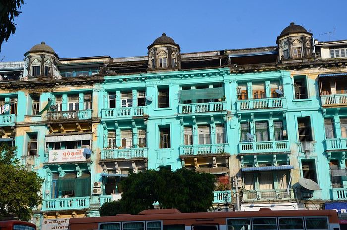
Next to the Sule Pagoda is Independence Park, which borders the colonial district (very run-down).
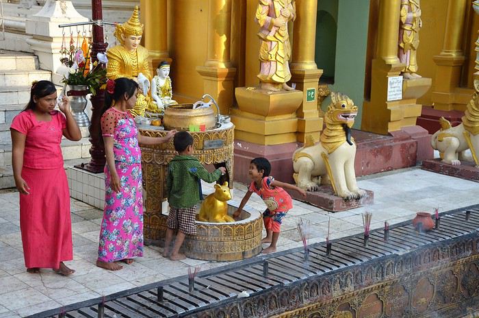
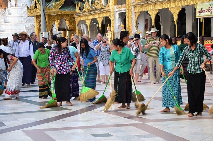
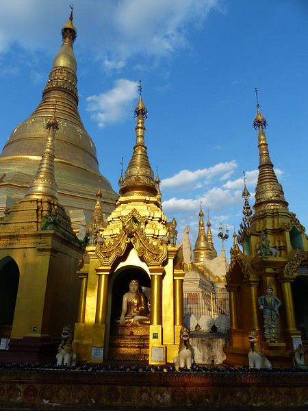
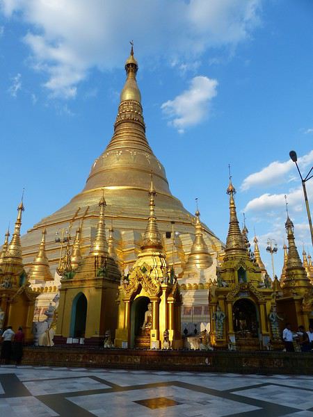
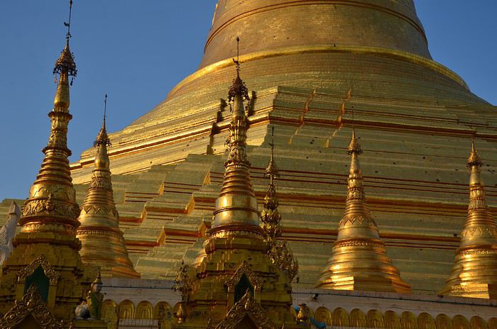
Then we had our first wow moment: the stunning Shwedagon Pagoda (see photos). It’s Myanmar’s most sacred Buddhist sanctuary, drawing crowds of devotees. Its stupa rises to 99 meters, surrounded by dozens of temples and zedis... It’s said that successive rulers have been embellishing and expanding it for over 1,500 years.
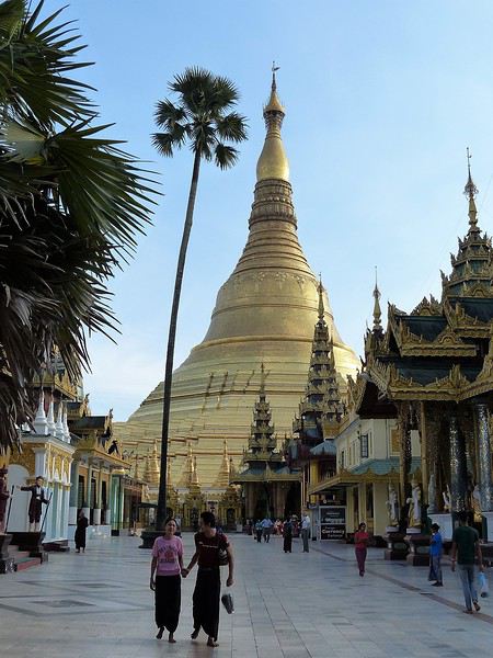
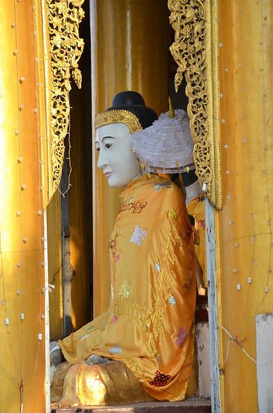
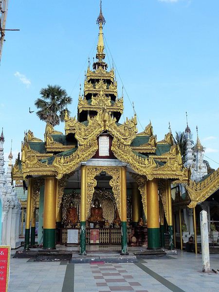
Believers gather in the many halls and circle the great golden stupa. Here, we encounter for the first time the incredible "quiet fervor" of the Burmese. A kind, open religiosity that doesn’t make us feel like intruders or nuisances—instead, it makes us want to understand their faith better.
If you go, make sure to be there in the late afternoon: the low rays of the setting sun bathe the site in gold and orange. The zedis glow... and everything becomes surreal.
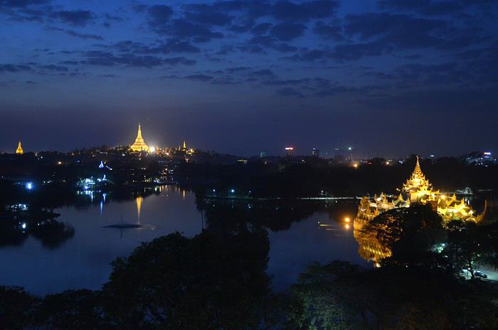
The sun sets early, so we head back to the hotel around 6:30 PM. Lucky for us, it has a stunning view of Yangon by night from the top floor. We settle in to sip our first vacation cocktail. In the foreground, the shadow of Kandawgyi Lake, and in the background, the illuminated Shwedagon Pagoda, which serves as a landmark for the whole city. (See photo.)
Tomorrow, we fly to Kengtung. We’ll be back in Yangon at the end of our trip to explore more.
Time for bed by 10 PM—we need a restful night to adjust to Myanmar time...
Next post: Kengtung and meeting the local ethnic groups.
First stop, Yangon
At last, we arrive! That moment of excitement and impatience we all know when we land in a country we don’t know but have been dreaming about for a while. Butterflies in our stomachs—not just from the long flight! It’s noon, everything goes smoothly (baggage, immigration, currency exchange, pre-booked taxi, ride to Yangon), and by 2:30 PM we check out of our hotel, tired from the journey but eager to explore the city and power through until evening to beat the jet lag. We’re driven by To-Wen. Traffic is pretty heavy, but strangely, no motorbikes or scooters... To-Wen explains that two-wheelers have been banned in Yangon for several years because they’d become too numerous and caused many injuries and fatalities. To compensate, a very developed public transport system has been put in place. Yangon, or Rangoon, isn’t Myanmar’s administrative capital. The official capital was moved to Naypyidaw in 2005 by government decision—some say to distance themselves from potential popular uprisings. Whatever the reason, it cost a fortune, and no one followed (only civil servants, who were forced to go), not even foreign embassies. This ghost capital makes all the Burmese we spoke to chuckle. Yangon is the economic, cultural, and diplomatic capital, and it’s the most populous city (4.5 million people).
What did we see? Well, first we discovered the Sule Pagoda, a funny concept of a "roundabout pagoda" since it’s right in the middle of a busy intersection! Circular, its outer wall houses many tiny stalls. Then comes the miracle: the hustle and bustle of the street contrasts with the calm inside. You leave a noisy roundabout and suddenly find yourself in another world... flowers and fruit in front of the altars, the scent of jasmine mixed with incense... Actually, this pagoda is very old—it’s said to have been founded in 230 BC to enshrine a hair of the Buddha, but it was in the 15th century that the great zedi (a slender stupa) on top reached its current height of 44 meters (see photos). It’s a symbolic site in the fight for democracy, as it was the rallying point for monk protests in 2007.
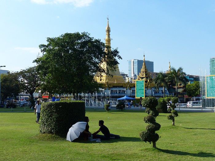
Next to the Sule Pagoda is Independence Park, which borders the colonial district (very run-down).
Then we had our first wow moment: the stunning Shwedagon Pagoda (see photos). It’s Myanmar’s most sacred Buddhist sanctuary, drawing crowds of devotees. Its stupa rises to 99 meters, surrounded by dozens of temples and zedis... It’s said that successive rulers have been embellishing and expanding it for over 1,500 years.
Believers gather in the many halls and circle the great golden stupa. Here, we encounter for the first time the incredible "quiet fervor" of the Burmese. A kind, open religiosity that doesn’t make us feel like intruders or nuisances—instead, it makes us want to understand their faith better.
If you go, make sure to be there in the late afternoon: the low rays of the setting sun bathe the site in gold and orange. The zedis glow... and everything becomes surreal.
The sun sets early, so we head back to the hotel around 6:30 PM. Lucky for us, it has a stunning view of Yangon by night from the top floor. We settle in to sip our first vacation cocktail. In the foreground, the shadow of Kandawgyi Lake, and in the background, the illuminated Shwedagon Pagoda, which serves as a landmark for the whole city. (See photo.)
Tomorrow, we fly to Kengtung. We’ll be back in Yangon at the end of our trip to explore more.
Time for bed by 10 PM—we need a restful night to adjust to Myanmar time...
Next post: Kengtung and meeting the local ethnic groups.
We just spent a little over 3 weeks in Morocco.
Three weeks on the road starting from Marrakech in a rental Logan.
We decided to split this trip into 3 highlights: the seaside first, a week in Aourir north of Agadir, Aït Baha and Tafraoute for another week, then a week in the Skoura palm grove followed by 3 days in Marrakech before heading back.
When we arrived, we were surprised by the temperatures—much higher than in previous years—and we were amazed by the quantities of flowers we saw throughout our journey. Moroccans explained that they had a lot of rain this winter, beneficial water, not the kind that destroys everything in its path.
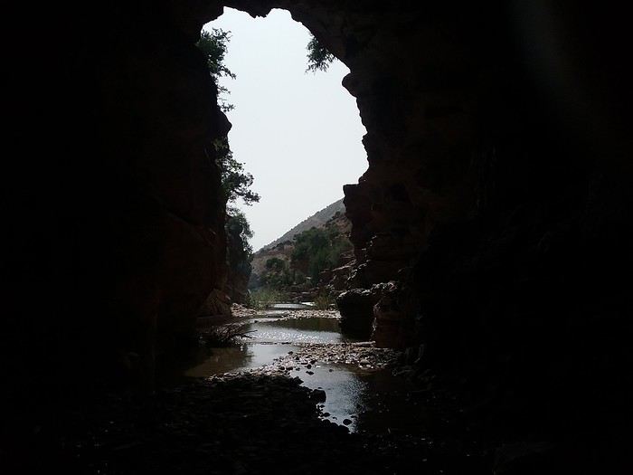
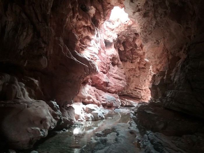
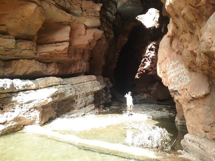
First stop: AOURIR. Staying at Bab Aourir, we were able to explore the area. A great discovery this year: the Assif El Had cave, beyond Imouzzer. A beautiful road to get there. Absolute tranquility once you're inside. A lovely spot for a picnic by the *séquia* (irrigation channel) at the cave’s entrance.
When we arrived, we were surprised by the temperatures—much higher than in previous years—and we were amazed by the quantities of flowers we saw throughout our journey. Moroccans explained that they had a lot of rain this winter, beneficial water, not the kind that destroys everything in its path.
First stop: AOURIR. Staying at Bab Aourir, we were able to explore the area. A great discovery this year: the Assif El Had cave, beyond Imouzzer. A beautiful road to get there. Absolute tranquility once you're inside. A lovely spot for a picnic by the *séquia* (irrigation channel) at the cave’s entrance.
Here we go...
It’s been almost a month since we got back, and my head is still over there... Just like every time... For my own sake, I know travel journals are useful for travelers planning a trip to a country. But selfishly, they’re also helpful for me—to put the final stone on each journey and revisit it from time to time, just for the memories...
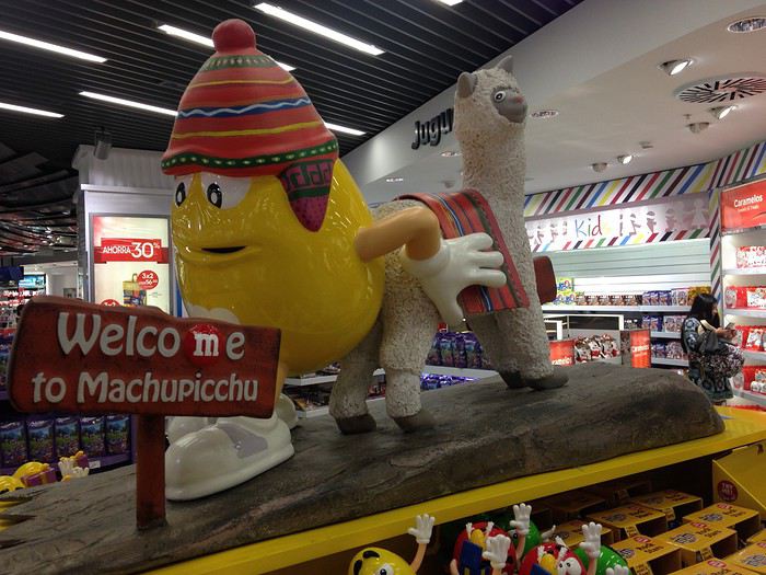
So, this trip won’t be any different, and I invite you to follow along on our Andean adventure, from Lima to the Southern Lipez, from December 16, 2016, to January 14, 2017. It’s a chronological journal because I don’t know how to approach it any other way. It doesn’t hold any absolute truths—just my experiences and feelings, which are obviously personal and not objective!
But if it inspires you to visit these magical countries (and I assume you’re already interested if you’re here) or gives you a couple of tips, then I’ll consider it a win!
So, let’s hit the road for the land of wide-open spaces!
It’s been almost a month since we got back, and my head is still over there... Just like every time... For my own sake, I know travel journals are useful for travelers planning a trip to a country. But selfishly, they’re also helpful for me—to put the final stone on each journey and revisit it from time to time, just for the memories...
So, this trip won’t be any different, and I invite you to follow along on our Andean adventure, from Lima to the Southern Lipez, from December 16, 2016, to January 14, 2017. It’s a chronological journal because I don’t know how to approach it any other way. It doesn’t hold any absolute truths—just my experiences and feelings, which are obviously personal and not objective!
But if it inspires you to visit these magical countries (and I assume you’re already interested if you’re here) or gives you a couple of tips, then I’ll consider it a win!
So, let’s hit the road for the land of wide-open spaces!
This year, we hadn’t planned on going to the United States. After two trips in 2012 and 2014, we needed to refill the piggy bank...
But we didn’t count on luck: one late September afternoon in 2014, while randomly browsing the web, I stumbled upon flight tickets for $753 per person for July 2015! After some calculations and hesitation, we decided to shorten the trip compared to the previous year (22 days this time), cut down on hotel costs (80 € per night on average), and skip expensive activities (no helicopter rides, rafting, or guided tours with outfitters, etc.), but we couldn’t pass up such a great opportunity!
Here’s the budget breakdown: - Flight tickets: 3,012 € for 4 (booked directly on AA’s website). One layover on the way out (CDG / Charlotte / Phoenix) and one on the way back (LAX / London / CDG). - Hotels: 1,685 € for 22 nights, averaging 76.60 € per night. We stuck to our budget (and even did better!), thanks to affordable hotels in NM, bookings made when the exchange rate was still favorable, and 2 free nights used on Hotels.com. - Car: 952 € for 22 days renting a standard SUV (Jeep Grand Cherokee). We went through AutoEurope, and the rental company was Dollar. - Gas: Around $20 per day on average (for 5,440 km). - Food: Just under $70 per day on average (for 4 people). We did a lot of grocery shopping for picnics, ate a lot of fast food, and only went to restaurants a few times. - America the Beautiful Pass: Free (the one we bought in July 2014 was still valid until the end of July 2015). - Not covered by the pass: $175 (entry fees for State Parks, a guided tour at Mesa Verde, Pow Wow entry, etc.).
In total, we spent 7,760 € for 4 people over 22 days. On top of that, we added $50 for the NYNY roller coaster (a gift for Hugo) and $135 for the *Mystère* show (a gift for Calista and me).
Here’s the itinerary: - Lost Dutchman SP, Goldfield Ghost Town, and Apache Trail - Chiricahua NM - White Sands NM - White Sands NM, Valley of Fires SP, and Old Town Albuquerque - Taos Pueblo, Pow Wow, and Chimayo - Bandelier NM and Santa Fe - Kasha Katuwe Tent Rocks NM - Shiprock and Mesa Verde NP - Bluff, Gooseneck SP, Road Canyon, and UT95 - Little Wild Horse Canyon and Goblin Valley SP - Capitol Reef NP (Cohab Canyon and Sulphur Creek) - Burr Trail - Zebra Slot Canyon and Lower Calf Creek Falls - Mossy Cave and Cedar Breaks NM - Kanarra Creek and Zion NP (Kolob Canyons) - Coyote Buttes South (Paw Hole) - Zion NP (Progeny Peak) - Snow Canyon SP - Lake Mead and Las Vegas - Las Vegas - Las Vegas - Los Angeles and the trip back
Here’s the budget breakdown: - Flight tickets: 3,012 € for 4 (booked directly on AA’s website). One layover on the way out (CDG / Charlotte / Phoenix) and one on the way back (LAX / London / CDG). - Hotels: 1,685 € for 22 nights, averaging 76.60 € per night. We stuck to our budget (and even did better!), thanks to affordable hotels in NM, bookings made when the exchange rate was still favorable, and 2 free nights used on Hotels.com. - Car: 952 € for 22 days renting a standard SUV (Jeep Grand Cherokee). We went through AutoEurope, and the rental company was Dollar. - Gas: Around $20 per day on average (for 5,440 km). - Food: Just under $70 per day on average (for 4 people). We did a lot of grocery shopping for picnics, ate a lot of fast food, and only went to restaurants a few times. - America the Beautiful Pass: Free (the one we bought in July 2014 was still valid until the end of July 2015). - Not covered by the pass: $175 (entry fees for State Parks, a guided tour at Mesa Verde, Pow Wow entry, etc.).
In total, we spent 7,760 € for 4 people over 22 days. On top of that, we added $50 for the NYNY roller coaster (a gift for Hugo) and $135 for the *Mystère* show (a gift for Calista and me).
Here’s the itinerary: - Lost Dutchman SP, Goldfield Ghost Town, and Apache Trail - Chiricahua NM - White Sands NM - White Sands NM, Valley of Fires SP, and Old Town Albuquerque - Taos Pueblo, Pow Wow, and Chimayo - Bandelier NM and Santa Fe - Kasha Katuwe Tent Rocks NM - Shiprock and Mesa Verde NP - Bluff, Gooseneck SP, Road Canyon, and UT95 - Little Wild Horse Canyon and Goblin Valley SP - Capitol Reef NP (Cohab Canyon and Sulphur Creek) - Burr Trail - Zebra Slot Canyon and Lower Calf Creek Falls - Mossy Cave and Cedar Breaks NM - Kanarra Creek and Zion NP (Kolob Canyons) - Coyote Buttes South (Paw Hole) - Zion NP (Progeny Peak) - Snow Canyon SP - Lake Mead and Las Vegas - Las Vegas - Las Vegas - Los Angeles and the trip back
Many of us longtime members surely remember the little frieze of monuments that used to decorate the top of VF pages.
Eiffel Tower, Statue of Liberty, Taj Mahal...
The famous must-see icons of architectural heritage!
Today, I’m inviting you to dig through your archives and share 3 photos of these international stars made of stone, marble, concrete, or steel.
I can already hear some of you protesting that this theme isn’t very original.
Well, it’s up to you to think outside the box...
So the monument doesn’t have to be the original. It could be its twin in Las Vegas, a matchstick replica made by Uncle Bob, a piece of jewelry, a gorgeous snow globe made in China, and so on.
The monument can be photographed from above, below, in the rain, as a reflection...
Deserted or swarming with visitors...
Montages are also allowed! 😉
In short, a classic topic that’ll become original thanks to your creative take.
Now, there are still 3 rules:
- No selfies (But a photo showing people taking selfies in front of a monument is allowed...🤪)
- Once a monument has been posted by someone, no one else can post it again. I don’t want to see the same thing 10 times...😊
- The theme isn’t about the monument’s originality. Please don’t post a photo of a monument known only to you or almost no one...😏
You can post your photos (one per message) until January 21, 2015, at 11:55 PM
Voting will take place from January 22, 2015, at 12:05 AM to January 29, 2015, at 11:55 PM.
During the vote, you’ll choose your 3 favorite photos, awarding 3 points to your top pick, 2 to your second, and 1 to your third.
Please clearly indicate the photographer’s name and the number of the winning photo!
For the rest, I’m using Cocottte’s rules:
The winner is the one with the most points. In case of a tie, the winner will be the one with the most first-place votes, or, if still tied, the most second-place votes. If there’s a perfect tie, the winner will be the one who reached their score first. The winner will then choose a theme for February’s contest and organize it. Ties for any place other than first won’t be broken.
You can vote without participating, participate without voting, or do neither. Slideshow
Finally, here’s the little off-topic link where all your comments and other expressions of good humor are welcome!
Eiffel Tower, Statue of Liberty, Taj Mahal...
The famous must-see icons of architectural heritage!
Today, I’m inviting you to dig through your archives and share 3 photos of these international stars made of stone, marble, concrete, or steel.
I can already hear some of you protesting that this theme isn’t very original.
Well, it’s up to you to think outside the box...
So the monument doesn’t have to be the original. It could be its twin in Las Vegas, a matchstick replica made by Uncle Bob, a piece of jewelry, a gorgeous snow globe made in China, and so on.
The monument can be photographed from above, below, in the rain, as a reflection...
Deserted or swarming with visitors...
Montages are also allowed! 😉
In short, a classic topic that’ll become original thanks to your creative take.
Now, there are still 3 rules:
- No selfies (But a photo showing people taking selfies in front of a monument is allowed...🤪)
- Once a monument has been posted by someone, no one else can post it again. I don’t want to see the same thing 10 times...😊
- The theme isn’t about the monument’s originality. Please don’t post a photo of a monument known only to you or almost no one...😏
You can post your photos (one per message) until January 21, 2015, at 11:55 PM
Voting will take place from January 22, 2015, at 12:05 AM to January 29, 2015, at 11:55 PM.
During the vote, you’ll choose your 3 favorite photos, awarding 3 points to your top pick, 2 to your second, and 1 to your third.
Please clearly indicate the photographer’s name and the number of the winning photo!
For the rest, I’m using Cocottte’s rules:
The winner is the one with the most points. In case of a tie, the winner will be the one with the most first-place votes, or, if still tied, the most second-place votes. If there’s a perfect tie, the winner will be the one who reached their score first. The winner will then choose a theme for February’s contest and organize it. Ties for any place other than first won’t be broken.
You can vote without participating, participate without voting, or do neither. Slideshow
Finally, here’s the little off-topic link where all your comments and other expressions of good humor are welcome!
I’ve never done a travel journal on VF before... so I’m giving it a go this year 😉. Just to share a bit of my 3-week trip around the West.
Since I couldn’t find anyone to share the trip with this year, I decided to go solo for 3 weeks at the last minute. So, it wasn’t a super organized or original trip—flight tickets booked last-minute, a loosely planned itinerary—but it was a choice I made.
I wanted to book zero hotels and just drive wherever I felt like. No set hikes or specific goals. Just a classic route through places I already knew for the most part, taking the time to soak in the landscapes. So, don’t expect a story about epic hikes leading to caves or hidden arches in unusual spots. It was more like a return to the roots of my first trip, with one twist: I wanted to explore some areas by mountain bike. Just to see things a little differently.
First up, instead of photos, I’ll share a little time-lapse I made during the trip.
Thursday, October 31: Left Nice early in the morning for Phoenix via London.
The trip was a bit long because I had to wait 5.5 hours in London. My flight ticket was booked kinda late, so I didn’t have much choice.
And then it hit me—when you’re prepping for a trip, you always think you’ll forget something. It was in London that I realized I’d left my driver’s license on my living room shelf. I searched everywhere, but nope, I didn’t bring it.🤪
Luckily, I had an international permit, but the rental contract clearly stated that both licenses had to be presented.
I called a friend to ask her to overnight it to my first hotel, crossing my fingers that the mail wouldn’t take two weeks to arrive.
The flight with British Airways went pretty well. Comfortable enough to watch two movies, eat, take a little nap, and boom—I was in Phoenix.
Around 8 PM local time, I got to the Alamo car rental agency, and surprise—they didn’t care about my license at all. They glanced at the international permit, told me to bring the other one when I got it (basically, they didn’t give a damn), and handed me my car! Woohoo! 😛

I headed to my hotel (the only one I’d booked for my first night), explained to the front desk that my license should arrive by mail so they’d be in the loop, and crashed for a well-deserved first night in the U.S.
Friday, November 1 (And yes! It was a holiday in France, which would complicate my mail situation later.)
I woke up super early with my first goal: find a decent mountain bike at a good price but sturdy enough to handle some national park trails.
As I mentioned earlier, I decided to switch things up this year and explore some mountain bike trails—or just ride whenever I got the chance 😉.
I checked two Walmarts before finally finding a solid bike for under $150. Some might wonder why I bought one—well, the reason’s simple. Renting a bike costs between $40 and $70 a day. My trip lasted 22 days. QED (that’s "quod erat demonstrandum" for those who didn’t get it).
I bought the bike, which fit in my Jeep Compass by folding down the back seats (not super convenient, but it worked).

Off I went on my first adventures.
I decided to head to Apache Junction.
First stop: the Apache Trail at Goldfield Ghost Town. Pretty cute, though super touristy. Some classic Western decor, a little chapel overlooking everything, a museum, a mine, a small Disneyland-style train, souvenir shops, and places to grab a snack. Nothing mind-blowing, but still a fun little visit—especially if you’ve got kids.


I got lucky and explored the ghost town with two school buses—about a hundred excited kids. Total chaos for a ghost town, but hilarious to watch from a distance 😎.
A little further down the Apache Trail, there’s Lost Dutchman State Park. I didn’t linger too long because my goal was to reach the lakes, and after my Walmart adventure and some driving, it was already almost 1 PM. I munched on a bag of chips and hit the road (lots of 20–25 mph speed limits).
I spotted N 1st Water Road along the way, planning to come back in a few days.
My plan to get to the lakes ASAP got derailed when I found a parking lot with a horse trail right in the middle of the saguaros.
I asked a ranger in the lot if I could ride the trail on my mountain bike. He said it’d probably be tough but gave me the green light.
Off I went in my padded shorts and helmet. First bike ride through the cacti with my trusty travel companion (my bike, obviously).

I started off super excited on what seemed like an easy trail, but I quickly realized horse trails don’t account for some key biking challenges 😎—like climbing rocks isn’t exactly a breeze on a mountain bike 😛. No biggie, I carried the bike a few times but got to see my first saguaros up close! A pretty cool way to explore—I don’t regret buying the bike at all!
I got back on the road after drinking 1.5 liters of water (even in November, the sun’s no joke) and headed toward Canyon Lake. With vibes like Lake Powell, I was blown away by the scenery and decided to hang out a bit—just to "soak it in" and enjoy the quiet to end my day. I didn’t see more of the Apache Trail because night falls fast, and for my first day, I figured that was plenty.


I’d decided not to stress about seeing everything at all costs since I’ve traveled a lot in the U.S. and plan to keep coming back. Whatever I missed, I’d catch next time—but I wanted to fully enjoy a few landscapes.
I drove back to Phoenix, grabbed a good burger, and spent the evening in my hotel room planning the next day. Originally, I was only supposed to stay one night in Phoenix, but with my license still MIA, I changed my plans. In the end, I was solo, no reservations anywhere, so I’d just take it day by day!
Saturday, November 2:
I decided to wake up early and head to Tucson for the day. The drive from Phoenix was pretty easy. About 2 hours later, I was at the entrance of Saguaro National Park.
And guess what? There was a little trail perfect for mountain biking. I parked my Jeep at the park entrance and hopped on my bike. I ended up biking the whole park from start to finish—about 20 kilometers, with a paved main road and a gorgeous central trail right through the saguaros! Stunning!

Even being careful, I still got a few cactus spines in my left arm from brushing too close (it stings!). Not easy to remove, so I’d advise anyone with the same idea to be more careful than I was. You’ll figure it out fast! 😉
I spent most of the day in this amazing park—it’s totally worth the detour. It feels like hundreds of chimneys all lined up at equal distances. A unique landscape you’ve gotta see.
Next, I headed to Tucson to check out the airplane boneyard. I’d seen it in a movie years ago and always wanted to see it for myself. Mission accomplished! It was pretty intense, but unfortunately, it didn’t seem possible to get to the most interesting plane alignments. There’s a museum with different types of planes and a guided tour. I settled for peeking through the fences at the planes guarded by military patrols.

I left around 6 PM and got back to Phoenix around 7:30–8 PM, super happy with my day of biking through the cacti!
Sunday, November 3:
Morning by the pool, lounging around—pure bliss. Around 11 AM, I headed to the Premium Outlets. Feeling pretty pleased with myself, I bought 5 pairs of Levi’s for the price of one in France. Just for that, I knew coming to the U.S. was worth it! After that, nothing super exciting—except a cotton field south of Phoenix that I couldn’t stop admiring for a good hour.

I drove around the city—pretty dead on a Sunday—and headed back to the Apache Trail to tackle N 1st Water Road, which I’d spotted two days earlier. A really fun trail to bike if you’ve got a mountain bike 😉. It gives access to several hikes and offers some great scenery. Highly recommend it.


Since I couldn’t find anyone to share the trip with this year, I decided to go solo for 3 weeks at the last minute. So, it wasn’t a super organized or original trip—flight tickets booked last-minute, a loosely planned itinerary—but it was a choice I made.
I wanted to book zero hotels and just drive wherever I felt like. No set hikes or specific goals. Just a classic route through places I already knew for the most part, taking the time to soak in the landscapes. So, don’t expect a story about epic hikes leading to caves or hidden arches in unusual spots. It was more like a return to the roots of my first trip, with one twist: I wanted to explore some areas by mountain bike. Just to see things a little differently.
First up, instead of photos, I’ll share a little time-lapse I made during the trip.
Thursday, October 31: Left Nice early in the morning for Phoenix via London.
The trip was a bit long because I had to wait 5.5 hours in London. My flight ticket was booked kinda late, so I didn’t have much choice.
And then it hit me—when you’re prepping for a trip, you always think you’ll forget something. It was in London that I realized I’d left my driver’s license on my living room shelf. I searched everywhere, but nope, I didn’t bring it.🤪
Luckily, I had an international permit, but the rental contract clearly stated that both licenses had to be presented.
I called a friend to ask her to overnight it to my first hotel, crossing my fingers that the mail wouldn’t take two weeks to arrive.
The flight with British Airways went pretty well. Comfortable enough to watch two movies, eat, take a little nap, and boom—I was in Phoenix.
Around 8 PM local time, I got to the Alamo car rental agency, and surprise—they didn’t care about my license at all. They glanced at the international permit, told me to bring the other one when I got it (basically, they didn’t give a damn), and handed me my car! Woohoo! 😛
I headed to my hotel (the only one I’d booked for my first night), explained to the front desk that my license should arrive by mail so they’d be in the loop, and crashed for a well-deserved first night in the U.S.
Friday, November 1 (And yes! It was a holiday in France, which would complicate my mail situation later.)
I woke up super early with my first goal: find a decent mountain bike at a good price but sturdy enough to handle some national park trails.
As I mentioned earlier, I decided to switch things up this year and explore some mountain bike trails—or just ride whenever I got the chance 😉.
I checked two Walmarts before finally finding a solid bike for under $150. Some might wonder why I bought one—well, the reason’s simple. Renting a bike costs between $40 and $70 a day. My trip lasted 22 days. QED (that’s "quod erat demonstrandum" for those who didn’t get it).
I bought the bike, which fit in my Jeep Compass by folding down the back seats (not super convenient, but it worked).
Off I went on my first adventures.
I decided to head to Apache Junction.
First stop: the Apache Trail at Goldfield Ghost Town. Pretty cute, though super touristy. Some classic Western decor, a little chapel overlooking everything, a museum, a mine, a small Disneyland-style train, souvenir shops, and places to grab a snack. Nothing mind-blowing, but still a fun little visit—especially if you’ve got kids.
I got lucky and explored the ghost town with two school buses—about a hundred excited kids. Total chaos for a ghost town, but hilarious to watch from a distance 😎.
A little further down the Apache Trail, there’s Lost Dutchman State Park. I didn’t linger too long because my goal was to reach the lakes, and after my Walmart adventure and some driving, it was already almost 1 PM. I munched on a bag of chips and hit the road (lots of 20–25 mph speed limits).
I spotted N 1st Water Road along the way, planning to come back in a few days.
My plan to get to the lakes ASAP got derailed when I found a parking lot with a horse trail right in the middle of the saguaros.
I asked a ranger in the lot if I could ride the trail on my mountain bike. He said it’d probably be tough but gave me the green light.
Off I went in my padded shorts and helmet. First bike ride through the cacti with my trusty travel companion (my bike, obviously).
I started off super excited on what seemed like an easy trail, but I quickly realized horse trails don’t account for some key biking challenges 😎—like climbing rocks isn’t exactly a breeze on a mountain bike 😛. No biggie, I carried the bike a few times but got to see my first saguaros up close! A pretty cool way to explore—I don’t regret buying the bike at all!
I got back on the road after drinking 1.5 liters of water (even in November, the sun’s no joke) and headed toward Canyon Lake. With vibes like Lake Powell, I was blown away by the scenery and decided to hang out a bit—just to "soak it in" and enjoy the quiet to end my day. I didn’t see more of the Apache Trail because night falls fast, and for my first day, I figured that was plenty.
I’d decided not to stress about seeing everything at all costs since I’ve traveled a lot in the U.S. and plan to keep coming back. Whatever I missed, I’d catch next time—but I wanted to fully enjoy a few landscapes.
I drove back to Phoenix, grabbed a good burger, and spent the evening in my hotel room planning the next day. Originally, I was only supposed to stay one night in Phoenix, but with my license still MIA, I changed my plans. In the end, I was solo, no reservations anywhere, so I’d just take it day by day!
Saturday, November 2:
I decided to wake up early and head to Tucson for the day. The drive from Phoenix was pretty easy. About 2 hours later, I was at the entrance of Saguaro National Park.
And guess what? There was a little trail perfect for mountain biking. I parked my Jeep at the park entrance and hopped on my bike. I ended up biking the whole park from start to finish—about 20 kilometers, with a paved main road and a gorgeous central trail right through the saguaros! Stunning!
Even being careful, I still got a few cactus spines in my left arm from brushing too close (it stings!). Not easy to remove, so I’d advise anyone with the same idea to be more careful than I was. You’ll figure it out fast! 😉
I spent most of the day in this amazing park—it’s totally worth the detour. It feels like hundreds of chimneys all lined up at equal distances. A unique landscape you’ve gotta see.
Next, I headed to Tucson to check out the airplane boneyard. I’d seen it in a movie years ago and always wanted to see it for myself. Mission accomplished! It was pretty intense, but unfortunately, it didn’t seem possible to get to the most interesting plane alignments. There’s a museum with different types of planes and a guided tour. I settled for peeking through the fences at the planes guarded by military patrols.
I left around 6 PM and got back to Phoenix around 7:30–8 PM, super happy with my day of biking through the cacti!
Sunday, November 3:
Morning by the pool, lounging around—pure bliss. Around 11 AM, I headed to the Premium Outlets. Feeling pretty pleased with myself, I bought 5 pairs of Levi’s for the price of one in France. Just for that, I knew coming to the U.S. was worth it! After that, nothing super exciting—except a cotton field south of Phoenix that I couldn’t stop admiring for a good hour.
I drove around the city—pretty dead on a Sunday—and headed back to the Apache Trail to tackle N 1st Water Road, which I’d spotted two days earlier. A really fun trail to bike if you’ve got a mountain bike 😉. It gives access to several hikes and offers some great scenery. Highly recommend it.
This travel journal is our second on VoyageForum, following last year’s where we recounted our four weeks in Vietnam.
The goal remains the same: since some members on this site share tips, experiences, and great deals that help us prepare for our trips, we do the same after returning—both to give back a little and in the hope that our experiences might be useful to others in some way.
Our route was as follows: Bangkok, Siem Reap, Krabi, Suratthani, Koh Phangan, Koh Tao, Chumphon, Bang Saphan, Prachuab Khiri Khan, Sam Roi Yod, Hua Hin, Phetchaburi, Bangkok.
Beyond rediscovering Bangkok, our objectives were the long-held dream of seeing Angkor and exploring southern Thailand, much of which isn’t overly touristy.
A quick big thank-you to Barbot, who took the time to answer several of our questions.
12/07/2013
The cheapest flight we found earlier this year was a Paris-Bangkok route with a layover in Moscow for 1440 €, total for two people. So, this time we tried Aeroflot. Airbus A318 for the first leg, A330 for the second. Nothing particularly annoying to report—the passengers were very calm, the cabin temperature was comfortable, and we had enough legroom. That said, the quality of the meal trays was pretty mediocre, and the flight attendants weren’t exactly comedians.
We’d like to remind everyone that it’s best to exchange as little money as possible at the airport upon arrival, since the rate is about 5% worse than at city banks.
Of course, we made sure to take the airport exit where you can catch official taxis to avoid getting scammed. So, we queued up, a little lady gave us the ticket, and off we went with the driver. Generally, this system works well because these drivers are registered, know their duties, and the risks they face if they break the rules. Except that day, right off the bat, we got the scammer of the day. His first move was to snatch the ticket from my wife’s hands—the one you’re supposed to keep in case of a complaint. My husband saw it, but after a full day of travel, we were a bit out of it, and honestly, there was no reason to be suspicious. But once we started driving, the guy refused to turn on the meter. We insisted more and more firmly, but nothing. So, I used the famous method of opening the door and starting to step out of the car. At 40 km/h, that scares the driver more than the passenger. He finally turned on the meter, but that didn’t calm him down—quite the opposite. For the next half-hour, he ruined the ride by demanding extra fees here and there. Having dealt with several scam attempts last year in Vietnam, this wasn’t exactly new, and we were proud of ourselves for staying pretty zen. Still, this guy was a little scary—he was completely wired and aggressive. Honestly, it was hard not to think he was on something. He’d be perfect for a *Scarface* remake. When we finally arrived at the hotel, he followed us to the entrance. We paid the two tolls (25 and 45 baht), gave him the usual 100 baht extra for the ride, and stayed polite but firm. So, meter: 245 baht + 100 baht + 25 and 45 baht for tolls—we paid the exact amount, no way we were tipping this guy. He left furious, but he was already like that before picking us up... Anyway, avoid Mr. Chartree Chidchen, number 089 826 7308, car E2663!
We were so relieved to finally settle in at Feung Nakorn Balcony hotel in the temple district. 42 € per night, great reception, all the staff is friendly. The AC works fine, the bed seemed hard at first but turned out to be comfortable. The hotel is quiet, away from the nightlife, but at this time of year, many places are less crowded than in high season. Even with a nice fish pond and outdoor breakfast area, it’s a decent hotel, though we felt we could’ve found something better.
After a night on the plane, the first afternoon is always a bit of a slog. We napped for a few hours, and when we woke up—guess what—we were starving. We visited a temple across from the hotel (nothing special) and then decided to take the Chao Phraya Express, the river shuttle that serves many piers along the river. It was a really enjoyable experience. The steel gangway wobbles when you board and disembark, the boat sits low in the water, and sometimes you get splashed. During peak times, you’re packed in like sardines, but most of all, there’s that exotic urban landscape passing by, especially the temple rooftops.
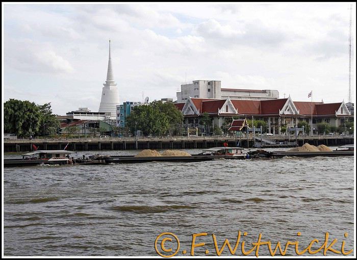
At that exact moment, the boat was packed. We didn’t see a ticket booth at the pier, and we tried in vain to pay the few baht for the ride. The cashier on the boat was too busy, and another employee we called didn’t have time to help us. Oh well, we weren’t going to force the issue. Still, this mode of transport is super practical for avoiding traffic, and at the piers, the lines with station names are clearly marked, with colors matching the flags on the boats. Combined with a map like the *Routard* guide, it’s easy to navigate.
We easily made it to the restaurant *Harmonique*, located near one of these piers. It’s a unanimous favorite on this forum, and let us tell you—it’s well-deserved. What a wonderful experience that evening! We only saw the outdoor gazebo because there was no way we were dining inside. It’s not flashy, so those looking for a luxurious setting should look elsewhere.
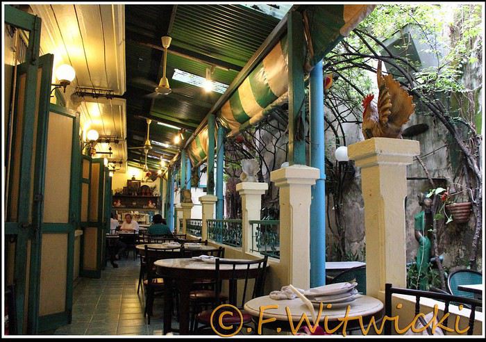
That night, the staff was a bit slow, and we had to track them down several times to move things along. But oh, my friends—what a feast on the plate! Start with the appetizer platter for two at 250 baht, featuring four specialties, each more tempting than the last, followed by their famous crab curry for 200 baht. There’s *so much* crab in there! The dish is so delicious and rich that when you finish, you feel—how to put it—like it was almost *too* good, to the point where you’re almost put off eating for days. And also, oh yes, we *will* be back. Their satay chicken is just as amazing, and it would be a crime not to mention their generous dessert with ice cream, warm banana, and chocolate, plus their *excellent* almond milkshake.
Later, we took a taxi to Kao San Road, mainly to book a Ko Tao-Chumphon trip for 600 baht per person at the Lomprayah counter. In hindsight, we should’ve booked all three of our trips there right away.
Kao San Road is *ultra*-touristy—better for younger crowds, but it’s still worth seeing. There’s rock ‘n’ roll, hippies, and crowds everywhere.
We walked back to the hotel, and when we got a little lost near a canal, a really nice older Thai man spontaneously appeared out of the night to kindly point us in the right direction.
Finally, a real long night of sleep ahead—we cranked up the AC. Sweet, the vacation has begun!
Our route was as follows: Bangkok, Siem Reap, Krabi, Suratthani, Koh Phangan, Koh Tao, Chumphon, Bang Saphan, Prachuab Khiri Khan, Sam Roi Yod, Hua Hin, Phetchaburi, Bangkok.
Beyond rediscovering Bangkok, our objectives were the long-held dream of seeing Angkor and exploring southern Thailand, much of which isn’t overly touristy.
A quick big thank-you to Barbot, who took the time to answer several of our questions.
12/07/2013
The cheapest flight we found earlier this year was a Paris-Bangkok route with a layover in Moscow for 1440 €, total for two people. So, this time we tried Aeroflot. Airbus A318 for the first leg, A330 for the second. Nothing particularly annoying to report—the passengers were very calm, the cabin temperature was comfortable, and we had enough legroom. That said, the quality of the meal trays was pretty mediocre, and the flight attendants weren’t exactly comedians.
We’d like to remind everyone that it’s best to exchange as little money as possible at the airport upon arrival, since the rate is about 5% worse than at city banks.
Of course, we made sure to take the airport exit where you can catch official taxis to avoid getting scammed. So, we queued up, a little lady gave us the ticket, and off we went with the driver. Generally, this system works well because these drivers are registered, know their duties, and the risks they face if they break the rules. Except that day, right off the bat, we got the scammer of the day. His first move was to snatch the ticket from my wife’s hands—the one you’re supposed to keep in case of a complaint. My husband saw it, but after a full day of travel, we were a bit out of it, and honestly, there was no reason to be suspicious. But once we started driving, the guy refused to turn on the meter. We insisted more and more firmly, but nothing. So, I used the famous method of opening the door and starting to step out of the car. At 40 km/h, that scares the driver more than the passenger. He finally turned on the meter, but that didn’t calm him down—quite the opposite. For the next half-hour, he ruined the ride by demanding extra fees here and there. Having dealt with several scam attempts last year in Vietnam, this wasn’t exactly new, and we were proud of ourselves for staying pretty zen. Still, this guy was a little scary—he was completely wired and aggressive. Honestly, it was hard not to think he was on something. He’d be perfect for a *Scarface* remake. When we finally arrived at the hotel, he followed us to the entrance. We paid the two tolls (25 and 45 baht), gave him the usual 100 baht extra for the ride, and stayed polite but firm. So, meter: 245 baht + 100 baht + 25 and 45 baht for tolls—we paid the exact amount, no way we were tipping this guy. He left furious, but he was already like that before picking us up... Anyway, avoid Mr. Chartree Chidchen, number 089 826 7308, car E2663!
We were so relieved to finally settle in at Feung Nakorn Balcony hotel in the temple district. 42 € per night, great reception, all the staff is friendly. The AC works fine, the bed seemed hard at first but turned out to be comfortable. The hotel is quiet, away from the nightlife, but at this time of year, many places are less crowded than in high season. Even with a nice fish pond and outdoor breakfast area, it’s a decent hotel, though we felt we could’ve found something better.
After a night on the plane, the first afternoon is always a bit of a slog. We napped for a few hours, and when we woke up—guess what—we were starving. We visited a temple across from the hotel (nothing special) and then decided to take the Chao Phraya Express, the river shuttle that serves many piers along the river. It was a really enjoyable experience. The steel gangway wobbles when you board and disembark, the boat sits low in the water, and sometimes you get splashed. During peak times, you’re packed in like sardines, but most of all, there’s that exotic urban landscape passing by, especially the temple rooftops.
At that exact moment, the boat was packed. We didn’t see a ticket booth at the pier, and we tried in vain to pay the few baht for the ride. The cashier on the boat was too busy, and another employee we called didn’t have time to help us. Oh well, we weren’t going to force the issue. Still, this mode of transport is super practical for avoiding traffic, and at the piers, the lines with station names are clearly marked, with colors matching the flags on the boats. Combined with a map like the *Routard* guide, it’s easy to navigate.
We easily made it to the restaurant *Harmonique*, located near one of these piers. It’s a unanimous favorite on this forum, and let us tell you—it’s well-deserved. What a wonderful experience that evening! We only saw the outdoor gazebo because there was no way we were dining inside. It’s not flashy, so those looking for a luxurious setting should look elsewhere.
That night, the staff was a bit slow, and we had to track them down several times to move things along. But oh, my friends—what a feast on the plate! Start with the appetizer platter for two at 250 baht, featuring four specialties, each more tempting than the last, followed by their famous crab curry for 200 baht. There’s *so much* crab in there! The dish is so delicious and rich that when you finish, you feel—how to put it—like it was almost *too* good, to the point where you’re almost put off eating for days. And also, oh yes, we *will* be back. Their satay chicken is just as amazing, and it would be a crime not to mention their generous dessert with ice cream, warm banana, and chocolate, plus their *excellent* almond milkshake.
Later, we took a taxi to Kao San Road, mainly to book a Ko Tao-Chumphon trip for 600 baht per person at the Lomprayah counter. In hindsight, we should’ve booked all three of our trips there right away.
Kao San Road is *ultra*-touristy—better for younger crowds, but it’s still worth seeing. There’s rock ‘n’ roll, hippies, and crowds everywhere.
We walked back to the hotel, and when we got a little lost near a canal, a really nice older Thai man spontaneously appeared out of the night to kindly point us in the right direction.
Finally, a real long night of sleep ahead—we cranked up the AC. Sweet, the vacation has begun!
As soon as I return to France, I catch myself thinking, "it’s better elsewhere."
Wherever we’ve been, I feel this lightness of living—less restriction, less pressure, less sadness—and I start dreaming of somewhere else, of living somewhere else, a simpler life, more authentic, with colors everywhere: markets, clothes, homes...!!! Meeting kindred spirits, genuine people, gentle and kind, and letting go of all this modernism, this technological rat race, the indifference toward others, the confinement, the racism against the elderly in France, against the poor, the weak, the beautiful... fleeing the news, politics, jealousy, meanness, stupidity, greed... And in my moments of clarity, I tell myself that every country, every city has its pros and cons, and that maybe the best of all worlds isn’t down here. But I also remind myself that you have to know how to COME BACK in order to LEAVE again... yet still...!!! IS IT REALLY BETTER ELSEWHERE?😏😏😏
An 80-Day Tour of Southern Africa
Back in South Africa
January 12, 2013, 5:30 AM, Flight BA043 London-Cape Town
Directly below, Windhoek glittered like a tangle of fairy lights still lit and tossed into a box.
The horizon, edged in purple, was setting up a backup fireworks display, and suddenly, like a cherry on the platter and with unbearable intensity, in less than two minutes the entire sun revealed a gray dam and then a vast, untouched massif.
A few more minutes and the glare to the east of the plane was total. In Africa, the sun is swift.
We still had a France to cross before landing, but it felt as if we were already there. To the west, the raking light revealed what looked like acne and long, swollen scars in a desert region that might be the Swartkloofberg. Further still, straight as far as the eye could see, the two parallel tracks of a dirt road.
At 11,500 meters altitude and 940 km/h, we had a sense of stillness until the Orange River appeared, an incongruous serpent, gray edged with green.
The first South African settlements were dotted with trees providing shade, then rivers highlighted by continuous lines of vegetation.
Water and shade that make life possible.
We’ll return here by the backroads.
Half an hour from Cape Town, the plane tilted toward the sea, crossing plantations (likely citrus) and then an explosion of cultivated greenery in circles on either side of an unruly river. Finally, the coastline was no longer just sand and water—a frothy hem, a suture?
A peninsula came into view, forming two magnificent bays, and... a flight attendant firmly instructed me to return to my seat: we’d arrived!
The Colors of Cape Town
The city was dressed up as I like them—deserted, fluid, free of its vendors.
In the parking lot of the endless beach next to the commercial port north of the city, about two hundred people were unloading their goods in front of their pickups or combis, none of which were from this century: mixed-race, ageless Black people, and white folks who looked like they’d stepped out of another era.
After a few minutes, intrigued, I played a game: first looking at the merchandise, then imagining who was selling it, and finally looking at who was actually manning the stall. Tall Black vendors were selling what they often sell in Europe—leather, sunglasses, watches; mixed-race folks offered discount bundles, and the tanned older white people seemed to have emptied their attics.
We left with an antique tin kettle for morning tea over an open fire, a pack of five exercise books (that’s 600 pages to fill), Bill Bryson’s earliest stories in English, some snoek rillettes (a local fish), and—never seen before—tuna biltong and snoek biltong.
In so-called advanced countries, Sunday is for sports: white cyclists dressed like pros sweating diligently, Black street vendors running in loops at red lights to sell trash bags that day; white golfers losing their balls, which a scantily clad Black man retrieves from the water; under the sails of kite surf boards, it’s all blondes, and in the foam, joyful splashes from a bunch of Black kids.
Searching for an unusual spot for lunch, we drove through the fishing port looking for a dive and, at the end of a dead-end road with no warning, we arrived at the Shimmy Beach Club—quite the program.
The place, open for just three weeks, aims to be ultra-trendy. You could be in San Francisco, Lisbon’s docks, or St. Barth. This time, the "visible" staff was diverse, but the clientele was exclusively white, except for one mixed-race couple.
For this Sunday lunch, the women had pulled out all the stops, and local starlets—who’d make ours look tame—were turning the terrace into a frenzy.
At Cape Town’s port, the girls have *port*. The trend seems to be crochet dresses over swimsuits.
For two hours, a team of employees watered and raked the sand, starting over when they finished. A child in a floaty pink dress and a gold headband, but a future adventurer, stepped onto the freshly raked artificial beach sand for the first time.
A lanky mixed-race man dragged a hose across the ground, followed by a white woman—enchanted?—who then started watering the sand herself, carelessly splashing the glass terrace her colleague had just swept. I suspect a tacit work arrangement to keep everyone employed.
A galleon packed with tourists (are there any in the hold? Does it take tourists to Robben Island?) left the port. A helicopter took off in its wake. Trawlers returned, cutting through a ballet of catamarans, their waterlines well above the water: a bad catch.
If there’s one country where you can’t pretend to ignore skin color, it’s this one. The question is in everyone’s mind, and here more than anywhere else, it’s a decisive economic and political factor.
Columbine of Brittany
200 km north of Cape Town and 9,000 km south of the Breton coast, but on the same cold ocean, we camped on the shore of the Columbine Cape Nature Reserve, sheltered by a rocky chaos that, at first light tomorrow, would transport us to Perros-Guirec.
Our first encounter with wild animals wouldn’t end well for them: it was crayfish season, and they were the size of lobsters at Lorient’s fish market. Bought for R60 (5.5 €) a pair from kids in Pater Noster, they’d end up between two rocks, over a fire. But first, we had to pair the Chenin blanc with some snoek biltong.
With no wood, I lit a fire at dawn with dried seaweed and kelp, as if petrified; it gave off a smell of court-bouillon and... tires. Two hundred fathoms away, on an outpost, an army of cormorants stood at attention, unmoved among the frolicking seals.
At the reserve’s exit, the guard spoke French; Patrick Mwanba had arrived from Congo three years earlier to study, but the cost of living here forced him to drop out. He’d like to return home because life is cheaper there, but the war made him hesitate.
Ding ding dong! Vroom! Arf arf, Woof! Buzz! (A night from hell!)
I’d long planned to visit Calvinia, the center of a region known for extensive sheep farming. An excellent provincial museum, run by an enthusiastic curator, kept us too late to start the drive north.
So we camped in a tiny, charming campsite set up in the garden of a house. A few trees, a patch of resilient grass, and a view of a pretty lit-up steeple—what else?
Well, it turned out to be a sound-and-light show, with the pretty steeple chiming the hours and half-hours. Then suddenly, we were in the VIP stands of the Karoo-Kalahari Truck Race: roaring trucks paraded under our canvas windows, and we realized we were on the main road through town. To top it off, we enjoyed an uninterrupted canine cacophony, from the *arf arf* of little dogs to the *woof* of a mastiff. Oh, and some mosquitoes—the first ones—insisted on keeping us company in the tent, and we hadn’t yet bought the arsenal to neutralize them.
I walked through Calvinia at night; the house gardens weren’t fenced, nor did they have the «Armed Response» signs so common in the country.
The Kalahari Trails
(No, no, I haven’t converted to hiking.)
North of Calvinia, in the south of the Northern Cape, small towns follow one another up to Upington, about a hundred kilometers apart—welcome havens. Between them, with no trees in sight, we stopped in the shade of a motionless cloud: the temperature exceeded 40°C in mid-January.
We were almost out of the High Karoo and into a region of pans drying up, until the first red dunes appeared, precursors of the Kalahari. In the sparse veld vegetation, gatherings of quiver trees in the kopjes, and a caravan of camels without a handler or packs, marching in perfect formation across a pan (no, I hadn’t overdone the Windhoek at the last stop, and no, I wasn’t dehydrated enough to hallucinate).
The historic part of these towns, European in style, was built on the same plans as those in the American Midwest or the Australian Outback: a grid of streets wide enough to turn a wagon pulled by eight pairs of oxen. The architecture was Dutch-inspired, tropicalized with awnings.
Then came more recent housing, functional in style, where the wealthier mixed-race people—who make up the majority of this state—lived, and further on, the township, an assemblage of corrugated iron and plastic, like everywhere else.
Orange, Right Bank
North of Augrabies Falls National Park, on the other side of the Orange River, stretches a rugged and wild territory the size of fifty Groix islands, crisscrossed by a few tracks—the Riemvasmaak.
The inhabitants were driven out half a century ago for a military base, and as soon as President Mandela was elected, he made it a symbol by allowing the exiled populations to return. Several ethnic groups live here on almost nothing, in government-built shacks.
A community camp is set up in a small cirque at the end of a canyon that, while not in the history books, offers a good descent. By mid-afternoon, the air was at 44°C, but luckily there was a spring... except it was a hot spring, with water at 38°C. And they haven’t invented a reversible spring yet. Once the birds and baboons had settled in, in absolute silence and far from any light pollution, we enjoyed the stars like nowhere else (well, that’s what they claim in the region).
The Orange didn’t choose the easy path: arriving from Lesotho, it was almost at the ocean. The terrain to the south and north of this massif seemed easier to cross. Was it to avoid the curse of the Okavango, whose waters disappear into the sands without ever seeing the sea, that it chose this rocky route, thinking that at least the granite wouldn’t steal its water?
I Love You, I Eat You
In the dry bed of the Auob, it lay panting, head raised, alert, between its paws but head-to-tail, a tawny springbok, motionless.
A few minutes earlier, their story had been written in a lightning-fast chase, captured in photos by the driver of the car that alerted us.
It would be a long time before it started eating at the groin without breaking its surveillance.
Earlier, there was a lion lounging in the shade and hundreds of antelopes: springboks and gemsboks (oryx) in herds, hartebeests and steenboks alone. Strange pairs, apart several times, formed by a springbok and a gemsbok.
A few solitary jackals moved slightly sideways, looking furtive. Ostriches, alone, looking a bit dazed.
It was a lucky morning in the Kgalagadi (KTP).
In and Out
Kgalagadi, Nossob Camp.
We were at the very end of the almost-empty camp, ten meters from the fence, whose structure wouldn’t resist an elephant (though there aren’t any here), but it was electrified.
At dusk, on the other side, ten meters away, three lions passed in a row, as if on parade, seemingly focused on their goal and indifferent to the camp, though they glanced at it.
A jackal had gotten into the camp and was trying to get out without success while scavenging. I offered it two pieces of snoek biltong (Don’t feed the animals!) from three meters away—it smelled strong and had bones (bones in biltong!). When it passed by again, it sniffed but didn’t dare approach. Curled up in the chair, motionless, by the faint moonlight, I finally saw it come closer, grab the nearest piece, and move ten meters away to enjoy it (how many jackals know the finer points of sea biltong?). A little reassured, it came back for the second piece.
Another Morning
By morning, the jackal was gone, but our luck hadn’t left us. Two cheetahs again, who found me in the way and slowly moved toward a calmer shadow. Enough birds of prey to form a squadron, but they’re solitary hunters. Two ostriches busy with their dozen unruly chicks. And while we’re at it, a group of four Kalahari lions, sprawled under a thorny bush. Lots of oryx crossing the dunes and herds of red hartebeest. Kori bustards and secretary birds.
It was the first time the Kgalagadi had spoiled us so much.
Back in South Africa
January 12, 2013, 5:30 AM, Flight BA043 London-Cape Town
Directly below, Windhoek glittered like a tangle of fairy lights still lit and tossed into a box.
The horizon, edged in purple, was setting up a backup fireworks display, and suddenly, like a cherry on the platter and with unbearable intensity, in less than two minutes the entire sun revealed a gray dam and then a vast, untouched massif.
A few more minutes and the glare to the east of the plane was total. In Africa, the sun is swift.
We still had a France to cross before landing, but it felt as if we were already there. To the west, the raking light revealed what looked like acne and long, swollen scars in a desert region that might be the Swartkloofberg. Further still, straight as far as the eye could see, the two parallel tracks of a dirt road.
At 11,500 meters altitude and 940 km/h, we had a sense of stillness until the Orange River appeared, an incongruous serpent, gray edged with green.
The first South African settlements were dotted with trees providing shade, then rivers highlighted by continuous lines of vegetation.
Water and shade that make life possible.
We’ll return here by the backroads.
Half an hour from Cape Town, the plane tilted toward the sea, crossing plantations (likely citrus) and then an explosion of cultivated greenery in circles on either side of an unruly river. Finally, the coastline was no longer just sand and water—a frothy hem, a suture?
A peninsula came into view, forming two magnificent bays, and... a flight attendant firmly instructed me to return to my seat: we’d arrived!
The Colors of Cape Town
The city was dressed up as I like them—deserted, fluid, free of its vendors.
In the parking lot of the endless beach next to the commercial port north of the city, about two hundred people were unloading their goods in front of their pickups or combis, none of which were from this century: mixed-race, ageless Black people, and white folks who looked like they’d stepped out of another era.
After a few minutes, intrigued, I played a game: first looking at the merchandise, then imagining who was selling it, and finally looking at who was actually manning the stall. Tall Black vendors were selling what they often sell in Europe—leather, sunglasses, watches; mixed-race folks offered discount bundles, and the tanned older white people seemed to have emptied their attics.
We left with an antique tin kettle for morning tea over an open fire, a pack of five exercise books (that’s 600 pages to fill), Bill Bryson’s earliest stories in English, some snoek rillettes (a local fish), and—never seen before—tuna biltong and snoek biltong.
In so-called advanced countries, Sunday is for sports: white cyclists dressed like pros sweating diligently, Black street vendors running in loops at red lights to sell trash bags that day; white golfers losing their balls, which a scantily clad Black man retrieves from the water; under the sails of kite surf boards, it’s all blondes, and in the foam, joyful splashes from a bunch of Black kids.
Searching for an unusual spot for lunch, we drove through the fishing port looking for a dive and, at the end of a dead-end road with no warning, we arrived at the Shimmy Beach Club—quite the program.
The place, open for just three weeks, aims to be ultra-trendy. You could be in San Francisco, Lisbon’s docks, or St. Barth. This time, the "visible" staff was diverse, but the clientele was exclusively white, except for one mixed-race couple.
For this Sunday lunch, the women had pulled out all the stops, and local starlets—who’d make ours look tame—were turning the terrace into a frenzy.
At Cape Town’s port, the girls have *port*. The trend seems to be crochet dresses over swimsuits.
For two hours, a team of employees watered and raked the sand, starting over when they finished. A child in a floaty pink dress and a gold headband, but a future adventurer, stepped onto the freshly raked artificial beach sand for the first time.
A lanky mixed-race man dragged a hose across the ground, followed by a white woman—enchanted?—who then started watering the sand herself, carelessly splashing the glass terrace her colleague had just swept. I suspect a tacit work arrangement to keep everyone employed.
A galleon packed with tourists (are there any in the hold? Does it take tourists to Robben Island?) left the port. A helicopter took off in its wake. Trawlers returned, cutting through a ballet of catamarans, their waterlines well above the water: a bad catch.
If there’s one country where you can’t pretend to ignore skin color, it’s this one. The question is in everyone’s mind, and here more than anywhere else, it’s a decisive economic and political factor.
Columbine of Brittany
200 km north of Cape Town and 9,000 km south of the Breton coast, but on the same cold ocean, we camped on the shore of the Columbine Cape Nature Reserve, sheltered by a rocky chaos that, at first light tomorrow, would transport us to Perros-Guirec.
Our first encounter with wild animals wouldn’t end well for them: it was crayfish season, and they were the size of lobsters at Lorient’s fish market. Bought for R60 (5.5 €) a pair from kids in Pater Noster, they’d end up between two rocks, over a fire. But first, we had to pair the Chenin blanc with some snoek biltong.
With no wood, I lit a fire at dawn with dried seaweed and kelp, as if petrified; it gave off a smell of court-bouillon and... tires. Two hundred fathoms away, on an outpost, an army of cormorants stood at attention, unmoved among the frolicking seals.
At the reserve’s exit, the guard spoke French; Patrick Mwanba had arrived from Congo three years earlier to study, but the cost of living here forced him to drop out. He’d like to return home because life is cheaper there, but the war made him hesitate.
Ding ding dong! Vroom! Arf arf, Woof! Buzz! (A night from hell!)
I’d long planned to visit Calvinia, the center of a region known for extensive sheep farming. An excellent provincial museum, run by an enthusiastic curator, kept us too late to start the drive north.
So we camped in a tiny, charming campsite set up in the garden of a house. A few trees, a patch of resilient grass, and a view of a pretty lit-up steeple—what else?
Well, it turned out to be a sound-and-light show, with the pretty steeple chiming the hours and half-hours. Then suddenly, we were in the VIP stands of the Karoo-Kalahari Truck Race: roaring trucks paraded under our canvas windows, and we realized we were on the main road through town. To top it off, we enjoyed an uninterrupted canine cacophony, from the *arf arf* of little dogs to the *woof* of a mastiff. Oh, and some mosquitoes—the first ones—insisted on keeping us company in the tent, and we hadn’t yet bought the arsenal to neutralize them.
I walked through Calvinia at night; the house gardens weren’t fenced, nor did they have the «Armed Response» signs so common in the country.
The Kalahari Trails
(No, no, I haven’t converted to hiking.)
North of Calvinia, in the south of the Northern Cape, small towns follow one another up to Upington, about a hundred kilometers apart—welcome havens. Between them, with no trees in sight, we stopped in the shade of a motionless cloud: the temperature exceeded 40°C in mid-January.
We were almost out of the High Karoo and into a region of pans drying up, until the first red dunes appeared, precursors of the Kalahari. In the sparse veld vegetation, gatherings of quiver trees in the kopjes, and a caravan of camels without a handler or packs, marching in perfect formation across a pan (no, I hadn’t overdone the Windhoek at the last stop, and no, I wasn’t dehydrated enough to hallucinate).
The historic part of these towns, European in style, was built on the same plans as those in the American Midwest or the Australian Outback: a grid of streets wide enough to turn a wagon pulled by eight pairs of oxen. The architecture was Dutch-inspired, tropicalized with awnings.
Then came more recent housing, functional in style, where the wealthier mixed-race people—who make up the majority of this state—lived, and further on, the township, an assemblage of corrugated iron and plastic, like everywhere else.
Orange, Right Bank
North of Augrabies Falls National Park, on the other side of the Orange River, stretches a rugged and wild territory the size of fifty Groix islands, crisscrossed by a few tracks—the Riemvasmaak.
The inhabitants were driven out half a century ago for a military base, and as soon as President Mandela was elected, he made it a symbol by allowing the exiled populations to return. Several ethnic groups live here on almost nothing, in government-built shacks.
A community camp is set up in a small cirque at the end of a canyon that, while not in the history books, offers a good descent. By mid-afternoon, the air was at 44°C, but luckily there was a spring... except it was a hot spring, with water at 38°C. And they haven’t invented a reversible spring yet. Once the birds and baboons had settled in, in absolute silence and far from any light pollution, we enjoyed the stars like nowhere else (well, that’s what they claim in the region).
The Orange didn’t choose the easy path: arriving from Lesotho, it was almost at the ocean. The terrain to the south and north of this massif seemed easier to cross. Was it to avoid the curse of the Okavango, whose waters disappear into the sands without ever seeing the sea, that it chose this rocky route, thinking that at least the granite wouldn’t steal its water?
I Love You, I Eat You
In the dry bed of the Auob, it lay panting, head raised, alert, between its paws but head-to-tail, a tawny springbok, motionless.
A few minutes earlier, their story had been written in a lightning-fast chase, captured in photos by the driver of the car that alerted us.
It would be a long time before it started eating at the groin without breaking its surveillance.
Earlier, there was a lion lounging in the shade and hundreds of antelopes: springboks and gemsboks (oryx) in herds, hartebeests and steenboks alone. Strange pairs, apart several times, formed by a springbok and a gemsbok.
A few solitary jackals moved slightly sideways, looking furtive. Ostriches, alone, looking a bit dazed.
It was a lucky morning in the Kgalagadi (KTP).
In and Out
Kgalagadi, Nossob Camp.
We were at the very end of the almost-empty camp, ten meters from the fence, whose structure wouldn’t resist an elephant (though there aren’t any here), but it was electrified.
At dusk, on the other side, ten meters away, three lions passed in a row, as if on parade, seemingly focused on their goal and indifferent to the camp, though they glanced at it.
A jackal had gotten into the camp and was trying to get out without success while scavenging. I offered it two pieces of snoek biltong (Don’t feed the animals!) from three meters away—it smelled strong and had bones (bones in biltong!). When it passed by again, it sniffed but didn’t dare approach. Curled up in the chair, motionless, by the faint moonlight, I finally saw it come closer, grab the nearest piece, and move ten meters away to enjoy it (how many jackals know the finer points of sea biltong?). A little reassured, it came back for the second piece.
Another Morning
By morning, the jackal was gone, but our luck hadn’t left us. Two cheetahs again, who found me in the way and slowly moved toward a calmer shadow. Enough birds of prey to form a squadron, but they’re solitary hunters. Two ostriches busy with their dozen unruly chicks. And while we’re at it, a group of four Kalahari lions, sprawled under a thorny bush. Lots of oryx crossing the dunes and herds of red hartebeest. Kori bustards and secretary birds.
It was the first time the Kgalagadi had spoiled us so much.
Cycling Through Provence's Big Climbs
In the autumn of 2011, Provence was hit by apocalyptic weather—torrential rain and a particularly violent east wind, reaching 130 kilometers per hour, whipping up waves as high as seven meters. It wasn’t the best time to venture outside. Yet, I told myself that after the storm, calm would return. I kept an eye on the weather forecast and noticed that starting November 10th, a favorable window should open for a little 600-kilometer cycling trip across Provence. The weather reports promised a high-pressure system that would keep the bad weather at bay over these highlands. That was all I needed to decide to set off. The planned route would take me through Provence’s biggest climbs: Mont Ventoux, Montagne de Lure, the Verdon Gorge, the Massif des Maures, and Sainte-Baume.
And so, despite my doubts, the call of adventure was stronger. The train pulled away, and once again, a journey began at Part-Dieu station. This time, I headed toward Haute-Provence for a cycling adventure. It would be my first solo bike trip. I was a little nervous—cycling with panniers makes you feel vulnerable to theft. I’d already been robbed while traveling in a group in Peru, and that experience left me deeply shaken. Alone, I hesitated. But no need to panic—I’d read accounts from long-distance cyclists who hadn’t been robbed, even if it does happen sometimes. I was particularly thinking of a young schoolteacher who had taken a sabbatical to cycle around the world. Her students had remarked, "Teacher, you’re not sporty—how will you manage to cycle around the world?" This young woman was full of resourcefulness. In South America, before flying to China, she locked her bike to a post to take care of a natural need. When she returned, the post had been torn out, and her bike—along with all her gear—was gone. It was a shock for many, but not for her. She boarded her flight to the Middle Kingdom, bought the essentials (including a new bike) once there, and continued her journey! Remembering this story, I almost felt ashamed of my cowardice. These were the thoughts running through my mind as the Rhône Valley rolled by toward Orange, the starting point of my Provençal adventure through the big climbs.
Day One: Orange to Sault via Mont Ventoux – 90 km
9:30 AM, I stepped off the train. With all my gear, I had to navigate the underground passage—no easy feat, given that my bike and luggage weighed 35 kilos. At this time of year, I expected some areas to be deserted, so I’d packed enough to bivouac comfortably. Once outside the station, the southern light flooded over me. I understood why people dream of retiring in these sun-drenched regions. As always, after disembarking from public transport, I had to get my bearings and decide which way to go. The sun, still low on the horizon, pointed east. The roar of fighter jet engines helped me locate the Air Base 115. That was all I needed to "reset the gyros."
As soon as I started pedaling, all my apprehensions vanished. The joy of discovery and physical effort took over, and euphoria washed over me. It’s amazing how emotions can shift from one moment to the next based on seemingly minor circumstances.
The weather was splendid—the forecast had predicted continuous showers, but it was completely wrong. I quickly left the city behind. Mont Ventoux loomed mysteriously, its dimensions hard to gauge. It was even more enigmatic with its summit hidden beneath swirling, mottled clouds clinging to the ridges. It reminded me of a great South American volcano. I struggled to imagine that in a few hours, I’d be up there under that blanket of mist.
The countryside was shaking off its autumnal nighttime dampness. The vineyards, interspersed with tall cypress hedges, confirmed I was in the magnificent Côtes du Rhône wine region. The distinctive Dentelles de Montmirail were very much in evidence. The air force base wasn’t far. I passed the runway’s end markers. A Mirage 2000 flew overhead in a tight turn, followed by another roaring into takeoff. It came straight at me before climbing sharply with a thunderous roar. Thirty years spent in that captivating world came rushing back. I recalled countless extraordinary human and technical experiences from my time in the service. But the purpose of this post isn’t to promote the air force—though I might post some articles one day about travels among men at war.
I continued on my way, leaving my past loves behind. As I pedaled, delightful names rolled by: Violès, Vacqueyras, Gigondas, Beaumes-de-Venise—the crème de la crème of the Côtes du Rhône Villages appellation. I let myself be enchanted by the vineyards and the little paths crisscrossing them. I started to doubt my route, though the imposing mass of Mont Ventoux in the distance acted like a giant beacon. At a crossroads, a car appeared. I approached to ask the driver for directions, but she didn’t even look at me and sped off, clearly frightened. I’d almost forgotten what a fearful world we live in, no doubt traumatized by all the horrors we see in the news and on TV.
The kilometers started adding up, but was my day’s goal too ambitious? It had been two months since I’d last ridden my bike. True, my last trip had been good training—the Route des Grandes Alpes—but that was two months ago. I can’t just take my bike out for a day trip; I need that sense of adventure to find the courage to exercise.
Two cyclists overtook me. Intrigued by my load, they struck up a conversation. They were skeptical when I told them I planned to cross Mont Ventoux that day. One of them pointed out a small chapel near the summit where I could bivouac sheltered. That motivated me even more to reach the top on this first stage. The chapel also had a mythical name for me—Sainte-Anne, the name of my parents’ villa. It was already noon, and I’d covered 50 kilometers. Malaucène appeared—the sacred village of Ventoux’s mad cyclists. Surprisingly, I didn’t see any other cyclists today. I remembered this place in June, teeming with aspirants for the king of summits. Before tackling the climb ahead, I needed to refuel. I enjoyed a pleasant gastronomic break at Max’s. At 1 PM, I started the most famous climb in cycling—21 kilometers, which would actually be 23. I knew it would be tough, especially with two handicaps: 50 kilometers already in my legs and 20 kilos of luggage. But I was counting on my tiny chainring, which let me climb trees to tackle the steep ramps.
I set off at a brisk pace along a deserted road. My speed held up for the first few kilometers. I quickly rose above the valley, the horizon widening. I was surprised to see no one on this world-renowned route among cycling enthusiasts. During the climb and descent, I’d only see five cyclists—but I’ll come back to that. I passed a sign explaining that the effort would be roughly equivalent to climbing the Col de la Bonnette. Having done the latter in September, I figured I’d be fine. I crossed paths with my first cyclist—a woman speeding downhill. After 12 kilometers, I hit slopes averaging 12%. I don’t know if the number 12 is cursed, but I got such a "bamboo" hit that I’d never experienced before. I thought I wouldn’t make it to the summit today. I stopped. My thighs burned so much I could barely walk—lactic acid overload. I looked for a relatively flat spot to pitch my tent. It was 3:30 PM, with two hours of daylight left. But I found nothing.
I got back on my bike, intending to stop as soon as I found a good bivouac spot. But nothing came up. However, my strength slowly returned, perhaps because the slope eased, though it remained around 10%. I entered the summit mists. A cyclist overtook me. I was in the zone where I had to pass the summit. Dusk caught me in the final difficulties. The atmosphere was downright austere. In the twilight, a kilometer from the summit, a cyclist was fixing his bike. I asked if he needed help. He made it clear he didn’t understand. So I asked, "Do you need some help?" His answer was clear: "No, thank you." He showed me his new inner tube. Inside, I thought, "Phew!" If I’d had to stop, sweating in the falling night with the cold intensifying, I’d have struggled to get going again. But he managed, and I continued into the twilight fog. I could barely make out the summit’s large antennas in the clouds, like immense ghosts trying to evade sight. The bike delivered sensations worthy of mountain racing. My goal was to quickly find the famous chapel in the descent to take shelter. As I glided down the southern slope, two cyclists without lights crossed my path in the night—probably heading to the station above, its lights visible in the fog.
I scanned the roadside in the dark for the chapel but saw nothing. After a kilometer or two, I lost all hope. I stopped to put on more clothes as the cold became intense. I had no idea where I could stop on these steep slopes to set up camp. Between the swirls of mist, I could intermittently see the Rhône Valley below, dotted with illuminated towns and villages. The sight was striking. What was I doing on this mountain at night? Then the miracle happened—the clouds parted, and from the ridge above me to the east, a beautiful full moon emerged, casting enough light to consider a nighttime descent to Sault, 26 kilometers away.
In this eerie atmosphere between the moon’s pale rays and patches of fog, I began my descent through a hazy, almost unreal world. The Ventoux’s characteristic white scree reflected the moonlight faintly, dimmed by the mist. In places, entire mountainsides were plunged into complete darkness, and I lost all sense of the road’s path. Then, around a tight bend caused by a land shift, the light returned. It seemed extreme compared to the darkness I’d left behind. I could once again clearly see the road’s contours, though not its potholes or gravel patches. Still, I let the slope carry me, and the speed felt significant, though the low light prevented me from reading my speedometer. In these moments, concentration was at its peak—all senses alert, reflexes ready to react to the slightest incident that could lead to a fall.
I was relieved to see Sault’s lights growing closer. In less than an hour, I reached it, considering the final little climb that required one last push. This village, bustling in summer, was deserted at this time of year—almost dead. The first hotel I came across was closed. A quick shadow passed in a small sloping street. Before it disappeared into the darkness at a house corner, I chased after it and asked about accommodation options. Very kindly, I was directed to what was probably the only hotel open in November. I quickly found it, and the reception was open. I entered wearing my black balaclava, bought in the Ayacucho region—the birthplace of Peru’s Shining Path. At this late hour, I saw questioning glances directed at me. I prefaced, "This isn’t a hold-up." Clearly, the owners had a sense of humor—they started smiling. I took off my balaclava and asked for a room. No problem, and from that moment, the pressure eased. I really didn’t feel like going back out to find a spot to pitch my tent in the biting cold.
The stage had been nearly 100 kilometers, and it was the first. It had been two months since I’d touched my bike, and I probably lacked even minimal training, even though my last bike trip had been crossing the French Alps. I really had to dig deep to overcome my weakness on Ventoux’s steep section. I don’t remember ever having to search so deeply for the energy to keep going. I knew the stage I’d set for tomorrow was significant, with the climb up Montagne de Lure’s northern slope—Ventoux’s little sister, whose ascent is reputed to be endless, over 25 kilometers. I hoped this first day wouldn’t leave me too sore to avoid suffering excessively tomorrow.
For now, relaxation—a hot shower did me a world of good, followed by a good meal. I ate a delicious andouillette from Troyes, very fine, with a particularly successful herb seasoning. I loved it, and yet I’m from Lyon and pride myself on knowing a thing or two about andouillette—not just a sausage but a whole category! A bit chauvinistic, I had to admit, though reluctantly, that I found it better than the ones I usually eat in the Lyon region!
Day Two: Sault to Forcalquier via Montagne de Lure – 116 km
This morning, the weather was magnificent—the air clear, still, very fresh, and invigorating, as only the late season can offer on these Provençal highlands. In summer, they’re known for their scorching heat and drought, but often overlooked is how harsh they can be with cold and storms. Authors like Giono or Bosco described them and their inhabitants wonderfully in books like "Les Âmes Fortes."
The miracle of the night had worked. I wasn’t sore anywhere and felt in great shape. I set off well-equipped, but the effort and sun soon made me sweat. It was time to shed some layers—hat and gloves. A gentle warmth replaced the cold, making for excellent cycling conditions. On the road to Trinit, there was no traffic—only the occasional hunters’ cars parked in the distance. These vehicles were recognizable by their large cages, used to transport hunting dogs. Sometimes, the silence was broken by a distant gunshot. The deciduous forests were losing their foliage, taking on that dull brown hue of late autumn, though here and there, a tree or shrub still resisted, displaying vivid yellow or red. The meadows, their grass already scorched by the cold, were damp from the night’s heavy humidity. The low sun highlighted thousands of spider webs that had trapped insects during the warm season.
Behind me, Mont Ventoux dominated these vast spaces. As often, its imposing, stony summit was crowned with a blanket of clouds. What an impressive mountain—it’s always so hard to gauge its dimensions. I struggled to realize that last night I’d been at the summit and descended its immense southern ridge in the dark. I hoped to return one day in favorable conditions—daylight and no clouds—to enjoy the vast panorama from this unique summit.
Leaving the very Provençal village of Trinit, I tackled my first climb of the day—the Col de l’Homme Mort. The road rose moderately for five kilometers in gentle warmth. The view over the region widened, and I felt the sheer joy of pedaling. At a good pace, I overcame this first little challenge. Once at the pass, I couldn’t resist the ritual of photographing my bike in front of the sign, giving the name and altitude—1,213 meters.
The northern slope was austere and still in shadow. The cold bit again. The road was wet and covered with leaves in places. It wasn’t impossible that some treacherous patches of black ice lurked around a bend. I descended toward the Jabron Valley with caution. Suddenly, around a bend in a forest clearing, the freshly snow-covered Alps, gleaming in the sun, leapt into view, blocking the horizon. I thought I recognized the distinctive silhouette of the Écrins’ south face above a multitude of jagged peaks.
This snow and these mountains awakened a flood of memories of great joys, but I also thought of the guide and his client who had just lost their lives on the Grandes Jorasses’ north face, at the top of a route called the Linceul. The name comes from the face’s appearance—a great ice slope bordering the Grandes Jorasses’ north wall. It was first climbed by René Desmaison in 1968. He passed away a few years ago and, in his final wishes, asked that his ashes be scattered in the Dévoluy Massif at the foot of Pic de Bure, not far from here in these immense pre-Alpine folds.
At my feet, the Jabron Valley stretched almost endlessly east toward Sisteron. In the distance, the dark mass of Montagne de Lure’s north face loomed. This mountain shares similarities with Mont Ventoux. It has the same summit scree of bright limestone, the same forests climbing up to the final rocky stretch, and that blanket of clouds adding a secretive, austere touch to the scene.
I turned left past the town of Séderon and headed toward the little Col de la Pigière, which in a few kilometers allowed me to truly plunge into the beautiful Jabron Valley. I passed through several villages with charming local names—Saint-Vincent, Noyer-sur-Jabron. The river offered lovely views of its narrow gorges with clear, cold water. Autumn seemed less advanced here than on the plateau I’d just left. Many trees still wore brilliant colors, some revealing extraordinary hues—mixes of crimson, pink, and bright red.
Arriving in Noyer-sur-Jabron, I took a tiny road on the river’s right bank, leading in a few kilometers to the foot of Montagne de Lure. In the village of Valbelle, I picnicked on leftovers I’d brought from home—an old cheese and a somewhat stale loaf of bread. It was 1:30 PM. I began the long climb of about 25 kilometers. According to a friend who’s a cycling expert in the region, this section is tough. No wonder it’s called Ventoux’s little sister—the Mont Blanc of cyclists. The elevation gain on this side is still 1,200 meters, while Ventoux via Malaucène is nearly 1,600 meters.
I hoped to reach the summit before nightfall and avoid reliving a nighttime descent. The route wound through a vast forest, following the terrain’s folds. There was activity—mushroom hunters were busy searching for the coveted chanterelle. The climb, though never very steep (only one kilometer at 9%), was interminable. Though traffic was practically nonexistent, I was overtaken by a group of Harley bikers—I counted about forty. Perched high on their machines, hands in the air on wildly shaped handlebars, some with their feet nearly in the sky due to the high footpegs, they didn’t even glance my way. What’s this idiot doing, unable to ride a motorcycle and forced to climb these mountains on a bike with big bags! I wasn’t offended—real Harley purists often see other motorcyclists as renegades, so bikes are even lower on the totem pole! But I didn’t want to start a debate about motorcycles. In my youth, when I was a wild motorcyclist (22 accidents on two wheels), clans were divided into Japanese, German, Italian, and British bike owners. The latter, on their vibrating, oil-leaking machines, considered themselves the purest. But let’s not fight—there’s a statute of limitations, and it’s been nearly forty years.
As yesterday, a few kilometers below the summit, I entered the fog, and the light dropped suddenly. What a hostile mountain in these conditions! It heightened the sense of living an incredible experience. The conditions we encounter play a major role in how the adventure imprints on our memory. I realized once again that in France, you can feel like you’re very far away. Finally, after this very long climb, the Pas de Graille sign suddenly appeared out of the grayness. Strange! Below the sign, a kilometer marker indicated this same pass was over three kilometers away. Clearly, the climb continued. In these final kilometers through the scree, I gained another 130 meters of elevation. Finally, the road’s high point was reached—1,720 meters. It was cold and damp. I quickly covered up, added my balaclava under my helmet, and put on warm gloves. As I was about to start the descent, a car stopped at the summit, and one of the passengers was surprised to find a bike there in these chilly, twilight conditions.
A 20-kilometer descent led me to the village of Saint-Étienne-les-Orgues. I hoped to find a place to stay for the night. No such luck! Everything was clearly closed—no chance of finding shelter. Tonight was getting complicated. I already had exactly 100 kilometers in my legs and didn’t feel like pedaling anymore, especially at night. But I had even less desire to sleep outside. What to do to avoid it? The town of Forcalquier was 16 kilometers away—I hoped the road would descend. I set off in that direction. The first third was along a beautiful, lightly trafficked departmental road with a slight downhill—I pedaled hard. But it got tougher. I joined a busier road, and night had fallen. A several-kilometer climb finished the journey. I knew my magnetic lights weren’t very powerful—hence the danger. They were even less so on the climb because the slower I went, the less they illuminated. Cars coming the opposite way often saw me late and blinded me with their high beams. After passing, I was plunged into total darkness for a few seconds while my pupils readjusted to the night. I imagined those coming up behind me saw me with little warning, despite my slightly fluorescent jacket. When the roadside was clear, I always positioned myself to quickly jump off the road. But unfortunately, in this long final climb, a guardrail prevented any escape to the right in case of sudden braking behind me. That was even more anxiety-inducing since I was stuck at a snail’s pace. Time seemed long. I pedaled as hard as I could, on the verge of asphyxiation, trying to escape this dangerous situation as quickly as possible. My only reference point was the vehicles in front of me, letting me know the climb wasn’t over. Then suddenly, the ordeal ended—the road’s high point was reached. The town and its lights emerged from the void, and clarity returned. Phew! I glided down toward this little town bathed in light. On November 11th, I hoped to find an open hotel since I’d clearly exceeded 100 kilometers, and the idea of having to leave town to find a bivouac spot somewhat frightened me.
I arrived in the town center. Activity was low. The first hotel was closed, but I spotted a lit sign for another establishment further on. I headed there, got off my bike, and entered. The welcome was immediately friendly—a big cat came to rub against me. For me, that was a very good sign, and the first impression was confirmed. I still had to go out to eat. I covered the minimum distance. A restaurant advertised "Mom’s Cooking." I expected Provençal specialties, but they were Moroccan. I chose a delicious tagine with lime and olives, followed by almond and honey ice cream. Exhausted after this 116-kilometer stage, I returned to my room. As often after intense efforts, it was hard to fall asleep.
Day Three: Forcalquier to Moustiers-Sainte-Marie – 58 km
On this third day, due to the progress made yesterday, the stage would be short. I’d call it a transition between two mountain ranges. Indeed, the next big climb is the Verdon Gorge. I planned to position myself at its foot this evening in preparation for a tough stage tomorrow. I made a few purchases—bread, bananas, and medicine for stomach burns (the midday sausage wasn’t always kind to me). The weather was still perfect. The route began with a long descent toward the Durance. It’s always nice to start a cycling day with a downhill—it boosts morale and allows for a gentle warm-up.
I quickly reached the town of Oraison. Just at its entrance, I crossed the Durance, which still bore traces of last week’s heavy rains along its sandbanks. Indeed, numerous stumps and trunks were scattered along its vast gravel bed, along with less ecological debris like old tires.
A little south of Oraison, I took the D907, a small road heading due east between scrubland and meadows. There it was—the Provence we imagine. This stable autumn weather, with still air, neither hot nor cold, just a fresh feeling when emerging from a shaded valley or a slight warmth under the sun, was ideal for a cyclist. After about ten kilometers at the bottom of a small valley I quickly passed through, the village of Le Brunet appeared on the right. It clung to the slopes leading to the Valensole Plateau. A few steep kilometers along a tiny winding road, and suddenly a vast panorama unfolded as the climb ended.
What a magnificent plateau! Though known for its wind, luckily today was completely calm. Far to the east, the Verdon’s great cliffs blocked the horizon. This allowed me to contemplate part of tomorrow’s stage. This place is full of mysteries—many UFO and extraterrestrial encounter stories are associated with it. Moreover, for about thirty years, France hid its ground-to-ground nuclear ballistic missiles here, grouped in the 1st GMS (Ballistic Missile Group), under the air force. Naturally, these rockets fueled fantasies, and pacifist groups settled in the region to protest this type of armament. This gives many reasons to shroud this austere, deserted land in mystery.
I took a dirt path leading to the heart of this zone and stopped at the forest’s edge for lunch. The silence was total, the view stretched very far. But nothing strange or bizarre manifested. No Martian came to share my frankly moldy cheese, very peppery sausage, or bruised banana—sniff! I resumed my route, and as often when crossing places with strong character, I tended to slow down to enjoy them longer. The immense lavender fields stretched endlessly, not very fragrant at this season. I arrived at a group of truffle oaks protected by a fence, with large red signs warning "Firearm." Clearly, the war for the black diamond was raging in this region. I remembered a novel where an old farmer made buyers believe nothing grew on his land. Every year, he secretly stole the mushrooms from the unsuspecting owners. Then one day, they discovered the truth, catching this "polite" neighbor trying to hide a basket full of beautiful, large truffles!
In these vast spaces, I felt good—a sense of plenitude. It’s strange that I only conceive of cycling through wandering. I struggle to plan a day trip. And if I do, it’s highly likely I won’t get up. I need that sense of adventure to fully appreciate my physical effort. Maybe one day I should get psychoanalyzed, but at my age, it’s probably too late! Today, I had all the time in the world—the stage was half as long as yesterday’s, with very little elevation gain. Not a sound, an impressive calm, a beautiful landscape—I pedaled in a wonderful place. That’s probably happiness!
I reached the village of Puimoisson on the plateau’s eastern edge—only 12 kilometers left to Moustiers. I took my time, sat at a café terrace in the sun, and leisurely enjoyed a coffee while listening to the village come to life. I was delighted by these melodious southern voices, bursting into great laughter. There are places where, despite the anxieties caused by our debt-ridden, dysfunctional societies, some have decided to take life on the bright side and show a saving insouciance.
The rest of the journey was a simple formality—I let the slope carry me toward the pretty little town of Moustiers-Sainte-Marie, clinging to the cliff and famous for its faïence. Arriving early for once, I went to the tourist office to choose a comfortable hotel. Indeed, the Hôtel des Restanques was very comfortable and admirably well-located. But at this time of year, I’d have to return to the village center for dinner. The very kind receptionist reserved a table for me at La Treille Muscate, a restaurant with a magnificently arranged room on the church square. It was only 3:30 PM—I continued to take my time, showering and relaxing in front of the TV. Then I set off to explore—or rather, re-explore—this village I’d visited several times before. But I’d never climbed to its chapel perched in the middle of the great cliff towering over the houses. A stony, aerial path led there. The first mentions of the Notre-Dame de Beauvoir chapel, known in ancient times as Notre-Dame d’Entre-Roches, date back to the 9th century. It’s one of the rare "respite" chapels found in Provence. These are chapels where stillborn children were brought to be revived for a few moments, just long enough to baptize them. They could then be buried religiously, ensuring the salvation of their souls. I was also very moved by reading some ex-votos, like the one from "A mother for her three children returned from the war."
The place was impressive, especially as night fell. I was alone and watched the shadows fill the great cliffs above me. With an old climber’s reflex, I looked for possible climbing routes among these slabs and cracks. But climbing is probably forbidden here, too close to the houses. Then I descended to stroll through the village, admiring the magnificent, finely crafted faïence patterns found in many shops. Finally, dinnertime arrived, and I joined my restaurant, which had been highly recommended. I was delighted by the foie gras ravioli and the pieds et paquets—the chef’s specialty. I’ll come back with family.
Day Four: Moustiers to Fréjus via the Verdon – 122 km
A hearty breakfast prepared me for the day’s tough efforts. Next to me, four Chinese people chatted animatedly. Of course, I didn’t understand a word—it was a language with strange intonations and sounds. I left the dining room and prepared my bike on the terrace. Seeing the volume of my luggage, my Chinese friends rushed over and asked to take turns having their photo taken in front of this funny setup. All laughing, they took photos in front of what they probably considered a French coolie off on some trading business! When they show these photos to their relatives, they’ll likely be perplexed about what motivates some to travel by bike rather than car. For them, the car is a symbol of success—according to an article I read last year, 14,000 cars are registered in China every day!
This morning, the air was fresh. As yesterday, I started with a long descent, this time leading to the edge of Lac de Sainte-Croix. A strong, biting headwind slowed me down. It wouldn’t last, as it was generated by the gorge’s outlet, which I’d reach in a few kilometers. On this cold morning, the lake’s shores exuded great tranquility. The sun was still hidden behind the Verdon’s mountainous mass. Trees with yellow leaves stood out against the water’s pale blue. The bridge marking the gorge’s beginning at the lake’s edge was an ideal spot to admire this natural splendor. At this early hour, the play of light and shadow on the water and the immense cliffs delivered a grandiose spectacle in beautiful harmony. This first contact with the gorges, which I knew well, amazed me.
Once past the bridge, the wind calmed. A little further on, I began the long climb that would take me to the top of this immense natural gash, which water had taken millions of years to carve. I was in good shape and highly motivated by the splendors to come. First, I reached the village of Aiguines, which offered a magnificent viewpoint over the lake. Then I continued toward the Corniche Sublime, where countless breathtaking panoramas unfolded as I progressed. But the climb was sustained and long, requiring effort—though my small chainring worked miracles. I first passed the Col d’Illoire, already 500 meters above the lake. Seeing all these great cliffs, countless climbing memories came flooding back. The classic routes of the Escalès cliff, over 300 meters high, flashed by. Routes with legendary names—La Demande, Les Écureuils, Luna-Bong, and many others. The one that left me with the best memory was ULA—a crack, vertical or even overhanging, of sheer beauty rising above a 40-meter slab in one go for 280 meters of sustained, beautiful climbing on extraordinary rock. It made me want to return to climb there, to immerse myself in the atmosphere of those past times. But climbing habits have changed—now routes are accessed from above by rappel, and people don’t always bother to do these great climbs in their entirety, focusing instead on shorter but technically much more difficult enterprises.
At almost every bend, I stopped and scanned these great cliffs, searching for memories of past experiences and emotions in these secret rock folds. The road climbed well above the pass, exceeding 1,200 meters. It was cool, especially since I was sweating. Finally reaching the high point of the Corniche Sublime, I couldn’t gain speed on the descent—my gaze was always drawn to this astonishing canyon. Around a bend, two cyclists with funny small-wheeled bikes. Wow! It was a couple of Australians doing a year-long tour of France. We chatted passionately about our two-wheeled experiences for a moment. But time was passing, and if I wanted to reach Fréjus before nightfall, I’d have to pedal seriously.
I stopped at the Pont de l’Artuby, where bungee jumping was in full swing. But I quickly set off again toward Comps. The wind was against me, and it was climbing. I started to doubt whether I’d make it to the coast that evening. At 2 PM, I was in Comps-sur-Artuby. I didn’t stop, knowing that before reaching the coast, I’d have no alternative to bivouacking, and I had 70 kilometers left to cover. Sure, it should be downhill, but a few climbs were on the program. After a descent out of the village, I crossed the Artuby River again on the Canjuers military camp. A several-kilometer climb followed, fortunately not too steep. I took the D19 toward Barjols. From there, despite the late hour, I opted for a tiny road passing through Claviers, a small perched village. Time passed quickly, but the kilometers added up. I regained hope. Fifteen kilometers after this last village, I reached Saint-Paul-en-Forêt via a magnificent forested route. I had plenty of time to observe mushroom hunters. I asked one who clearly had some in a plastic bag. He gave me this hilarious answer with a magnificent southern accent: "I only picked the bad ones." No reply was possible. I moved on with a smile. A little further on, another hunter carried a basket. As soon as he saw me, he quickly hid it—just in case I saw what it contained. Arriving at the village involved a steep climb, and I was close to 100 kilometers. I still had a little over 20 kilometers to go before reaching Fréjus. The race against nightfall had begun. Over there to my right, I saw the sun setting behind Roquebrune-sur-Argens’ distinctive rock. The sea appeared. There it was—I was in Fréjus’ industrial zone. On this Sunday evening, traffic was heavy. Indeed, many had taken advantage of the return of good weather after very heavy storms to go for a walk. After quite a few detours, I arrived at the seaside just as night fell. My odometer showed 122 km for the day. I quickly found a simple hotel, ate just as quickly, and went to bed.
Day Five: Fréjus to Solliès-Pont – 92 km
Once again, the night had done its restorative work, and I prepared to cross the Massif des Maures feeling quite fresh. The weather forecast was still favorable for today, but a deterioration was expected tomorrow. I tended to trust it because the east wind was blowing, and in the region, that’s a sign of rain. For now, in the short term, this wind would be very useful—it would push me generously throughout the day.
I started calmly along the harbor quays, looking at the boats. Then I joined the road to Saint-Aygulf and followed the coast for forty kilometers to Port-Grimaud. All these seaside resorts—Saint-Aygulf, Les Issambres, Sainte-Maxime—reminded me of my youth when we spent all our vacations fishing, whether from shore, underwater, or by boat. Looking at the sea roll by, I knew what the seabeds looked like under that surface hiding them. The marine areas we knew best were now under the parking lots and commercial zones of Saint-Raphaël’s new port. In our youth, these infrastructures didn’t exist, and their construction came at the expense of coastal marine areas. Our wonderful fishing spots were permanently buried. I remember seeing the first big trucks that came to dump their loads of earth and rubble, destroying all those wonderful places—sandbanks, seaweed beds, groups of rocky holes teeming with fish that enchanted our youth. Over forty years later, I can still visualize them in my imagination under those parking lots and stores, with the names we gave them—my brothers and I: le casse-croûte, le casse-pipe, les montagnes, la digue, la grille, la mare à mulets, la petite-plage, le trou, etc.
Let’s not be overwhelmed by nostalgia. I left the coast and took the little road through the Maures to Collobrières. The route led from ridge to ridge following the terrain’s movements. At this time of year, the region was admirable. Due to the heavy storms of recent weeks, water was streaming everywhere. Waterfalls and streams murmured all along the way. I didn’t recognize the Maures, which I knew for their dryness causing apocalyptic fires. Indeed, around a bend, I came across a small rest area where a memorial had been erected for three firefighters who lost their lives here while fighting one of those gigantic fires fanned by the mistral.
This forest holds treasures—first, the cork oak, then the arbutus, chestnut trees, and of course, mushrooms that love this granitic soil:
The cork oak can be found all along the road. It’s the forest’s essential element. You can recognize it by its light bark (before exploitation), which forms large bulges along the trunk. But after exploitation, the trunks are much smoother, less voluminous, and dark in color. The arbutus is a large berry with red skin covered in small protuberances, growing on the arbutus tree. This fruit, common in Mediterranean areas, ripens in November. That means today, there were plenty around me. Its flesh is orange, with the consistency of firm purée, and it crushes softly in the mouth. The taste of this berry is sweet and excellent. I didn’t hold back—I gorged myself on them, which served as my midday meal. Sometimes I had to climb embankments to get them.
The chestnut tree, a true industry of the region, brings wealth to the surrounding villages. They make candied chestnuts, ice cream, and other products derived from chestnut flour. Be careful not to stop just anywhere to pick this fruit, as the tree owners might not agree. They even make this clear with signs and surround their chestnut trees with fences. Mushrooms—saffron milk caps and porcini—are highly prized in the area. I saw a few hunters, but it clearly wasn’t miraculous. Supposedly, there had been too much rain?
There’s no time to get bored along this little road, from which you can sometimes see the sea. I passed the Col de Taillude at over 400 meters. I began the descent to Collobrières, the chestnut capital, whose festival attracts many people. Before entering, about a hundred meters from the first houses, a cyclist—probably an agricultural worker—came toward me. As he passed, he cheerfully called out, "Go on, little guy! It’s almost there!" We both smiled. At the end of November, the village was cold and almost deserted. Dead leaves swept the wet streets of the town. You could feel winter on the way. I continued my route to Pierrefeu-du-Var, on the western edge of the Massif des Maures. So I gave my last pedal strokes in this pretty little massif so characteristic of Provence.
I looked for a hotel in Cuers but without success. I descended toward Toulon and finally found one on the outskirts of Solliès-Pont. It catered to people coming to work in the region, so nothing very bucolic. But if the weather were to deteriorate tomorrow and turn to rain, I could quickly reach Hyères or Toulon station, which was a significant advantage. Indeed, November rains aren’t usually very pleasant on a bike.
Day Six: Solliès-Pont to Cassis via Sainte-Baume – 85 km
This morning, contrary to the weather forecast, the weather was beautiful, and the latest bulletin seemed to contradict yesterday’s. So no escape to Toulon—I resumed my route toward Sainte-Baume. I left the hotel via a tiny road that, through ups and downs, led me via shortcuts to the road to Belgentier. My body had gotten used to intense daily efforts, and I felt in Olympic form. At a good pace, I launched into a long climb with a moderate slope. The road was busy, but fortunately, the side lane for cyclists often made the exercise more pleasant. The villages rolled by—Méounes, La Roquebrussanne. Near the latter, I observed a Tiger combat helicopter in training. It hovered motionless for long periods—perhaps the pilots were training to master their increasingly sophisticated weapon systems, requiring even more learning?
I left the busy road and headed via an almost deserted route toward the village of Mazaugues. The climbs became steeper. A long descent, and there I was in this pretty village. A grocery store, which besides selling a few ingredients also served as a café. I sat near the electric heater—it was cold, and I was sweaty. I watched customers come and go and listened to the shopkeeper tell me about village life. The name Mazaugues comes from "water mass," which is why drought doesn’t usually affect this area. Apparently, you can even find mushrooms here in summer! I had a good time, and as I was leaving, a local cyclist started a conversation and told me about her dreams of long bike trips, currently limited by her situation as a mother of terrible children. She settled for day trips with her club, which was already good in this very hilly region. I told her the story of a man who, at 73, cycled solo around Morocco. So no panic—she still had thirty or forty years to realize her wildest dreams!
I was warned that it would be a tough climb to reach Sainte-Baume’s northern slope. Indeed, over eight kilometers, the average slope was sustained, but the landscape was wonderful. Here too, water was streaming everywhere. I passed one of those famous icehouses that used to supply Marseille with ice throughout the year. This northern slope of Sainte-Baume is very cold, and this characteristic was exploited in previous centuries to produce ice. Large cylindrical structures, well-protected to the north and semi-buried, received large quantities of water in late autumn, which froze during winter and was kept cool for months until the following winter. Ice blocks were cut and delivered by cart to the city. That’s how, in ancient times, ice was available in summer to keep fish fresh in Marseille. Did pastis exist at that time? If not, the ice cubes must have been bored!
Once the climb was over, the long ridge of Sainte-Baume appeared, and I could see its characteristic antennas. Nestled at the foot of the cliffs, the magnificent millennial forest revealed itself with its autumn colors. I stopped at the monastery. I’d been there several times before and had even slept there during a long walking trip. The welcome had been first-rate by the Dominicans, especially the sisters in their long immaculate robes. They radiated a serenity that was very contagious. Don’t hesitate to stop there for the night. I struggled to get back on my way—some places have a special spirit.
I was soon at the end of my journey. I continued along this magnificent mountain to the Col de l’Espigoulier. To the north, another immense wave of white limestone rose—Montagne Sainte-Victoire, a high place in Provence that painter Cézanne made world-famous. Once at the pass, the entire city of Marseille spread out at my feet, the Mediterranean coast revealed itself from the Calanques to La Ciotat, passing by the famous Cap Canaille, Europe’s highest sea cliff. Above me, bathed in sunlight, Bartagne’s northwest face, very popular among climbers, showed all its reliefs. With an old climber’s reflex, I spotted the many climbs I’d done there. I let myself be carried into a steep, winding descent toward the village of Gémenos in a beautiful setting full of cliffs.
A few more kilometers of climbing toward the Col de l’Ange, then toward Roquefort-la-Bédoule. In this last climb, I raced with two cyclists, admittedly not very young. Then, in a six-kilometer descent, I reached Cassis station, the endpoint of my six-day journey through this wild Provençal land between sea and mountain. I experienced great pleasure during these 570 kilometers through these renowned yet wild French massifs. As always, when a beautiful project comes to an end, you feel a bit orphaned by a beautiful dream come true. You have to quickly envision the next one to avoid a vague sense of emptiness taking over. My next adventure is already taking shape in my mind, but that’s another story.
In the autumn of 2011, Provence was hit by apocalyptic weather—torrential rain and a particularly violent east wind, reaching 130 kilometers per hour, whipping up waves as high as seven meters. It wasn’t the best time to venture outside. Yet, I told myself that after the storm, calm would return. I kept an eye on the weather forecast and noticed that starting November 10th, a favorable window should open for a little 600-kilometer cycling trip across Provence. The weather reports promised a high-pressure system that would keep the bad weather at bay over these highlands. That was all I needed to decide to set off. The planned route would take me through Provence’s biggest climbs: Mont Ventoux, Montagne de Lure, the Verdon Gorge, the Massif des Maures, and Sainte-Baume.
And so, despite my doubts, the call of adventure was stronger. The train pulled away, and once again, a journey began at Part-Dieu station. This time, I headed toward Haute-Provence for a cycling adventure. It would be my first solo bike trip. I was a little nervous—cycling with panniers makes you feel vulnerable to theft. I’d already been robbed while traveling in a group in Peru, and that experience left me deeply shaken. Alone, I hesitated. But no need to panic—I’d read accounts from long-distance cyclists who hadn’t been robbed, even if it does happen sometimes. I was particularly thinking of a young schoolteacher who had taken a sabbatical to cycle around the world. Her students had remarked, "Teacher, you’re not sporty—how will you manage to cycle around the world?" This young woman was full of resourcefulness. In South America, before flying to China, she locked her bike to a post to take care of a natural need. When she returned, the post had been torn out, and her bike—along with all her gear—was gone. It was a shock for many, but not for her. She boarded her flight to the Middle Kingdom, bought the essentials (including a new bike) once there, and continued her journey! Remembering this story, I almost felt ashamed of my cowardice. These were the thoughts running through my mind as the Rhône Valley rolled by toward Orange, the starting point of my Provençal adventure through the big climbs.
Day One: Orange to Sault via Mont Ventoux – 90 km
9:30 AM, I stepped off the train. With all my gear, I had to navigate the underground passage—no easy feat, given that my bike and luggage weighed 35 kilos. At this time of year, I expected some areas to be deserted, so I’d packed enough to bivouac comfortably. Once outside the station, the southern light flooded over me. I understood why people dream of retiring in these sun-drenched regions. As always, after disembarking from public transport, I had to get my bearings and decide which way to go. The sun, still low on the horizon, pointed east. The roar of fighter jet engines helped me locate the Air Base 115. That was all I needed to "reset the gyros."
As soon as I started pedaling, all my apprehensions vanished. The joy of discovery and physical effort took over, and euphoria washed over me. It’s amazing how emotions can shift from one moment to the next based on seemingly minor circumstances.
The weather was splendid—the forecast had predicted continuous showers, but it was completely wrong. I quickly left the city behind. Mont Ventoux loomed mysteriously, its dimensions hard to gauge. It was even more enigmatic with its summit hidden beneath swirling, mottled clouds clinging to the ridges. It reminded me of a great South American volcano. I struggled to imagine that in a few hours, I’d be up there under that blanket of mist.
The countryside was shaking off its autumnal nighttime dampness. The vineyards, interspersed with tall cypress hedges, confirmed I was in the magnificent Côtes du Rhône wine region. The distinctive Dentelles de Montmirail were very much in evidence. The air force base wasn’t far. I passed the runway’s end markers. A Mirage 2000 flew overhead in a tight turn, followed by another roaring into takeoff. It came straight at me before climbing sharply with a thunderous roar. Thirty years spent in that captivating world came rushing back. I recalled countless extraordinary human and technical experiences from my time in the service. But the purpose of this post isn’t to promote the air force—though I might post some articles one day about travels among men at war.
I continued on my way, leaving my past loves behind. As I pedaled, delightful names rolled by: Violès, Vacqueyras, Gigondas, Beaumes-de-Venise—the crème de la crème of the Côtes du Rhône Villages appellation. I let myself be enchanted by the vineyards and the little paths crisscrossing them. I started to doubt my route, though the imposing mass of Mont Ventoux in the distance acted like a giant beacon. At a crossroads, a car appeared. I approached to ask the driver for directions, but she didn’t even look at me and sped off, clearly frightened. I’d almost forgotten what a fearful world we live in, no doubt traumatized by all the horrors we see in the news and on TV.
The kilometers started adding up, but was my day’s goal too ambitious? It had been two months since I’d last ridden my bike. True, my last trip had been good training—the Route des Grandes Alpes—but that was two months ago. I can’t just take my bike out for a day trip; I need that sense of adventure to find the courage to exercise.
Two cyclists overtook me. Intrigued by my load, they struck up a conversation. They were skeptical when I told them I planned to cross Mont Ventoux that day. One of them pointed out a small chapel near the summit where I could bivouac sheltered. That motivated me even more to reach the top on this first stage. The chapel also had a mythical name for me—Sainte-Anne, the name of my parents’ villa. It was already noon, and I’d covered 50 kilometers. Malaucène appeared—the sacred village of Ventoux’s mad cyclists. Surprisingly, I didn’t see any other cyclists today. I remembered this place in June, teeming with aspirants for the king of summits. Before tackling the climb ahead, I needed to refuel. I enjoyed a pleasant gastronomic break at Max’s. At 1 PM, I started the most famous climb in cycling—21 kilometers, which would actually be 23. I knew it would be tough, especially with two handicaps: 50 kilometers already in my legs and 20 kilos of luggage. But I was counting on my tiny chainring, which let me climb trees to tackle the steep ramps.
I set off at a brisk pace along a deserted road. My speed held up for the first few kilometers. I quickly rose above the valley, the horizon widening. I was surprised to see no one on this world-renowned route among cycling enthusiasts. During the climb and descent, I’d only see five cyclists—but I’ll come back to that. I passed a sign explaining that the effort would be roughly equivalent to climbing the Col de la Bonnette. Having done the latter in September, I figured I’d be fine. I crossed paths with my first cyclist—a woman speeding downhill. After 12 kilometers, I hit slopes averaging 12%. I don’t know if the number 12 is cursed, but I got such a "bamboo" hit that I’d never experienced before. I thought I wouldn’t make it to the summit today. I stopped. My thighs burned so much I could barely walk—lactic acid overload. I looked for a relatively flat spot to pitch my tent. It was 3:30 PM, with two hours of daylight left. But I found nothing.
I got back on my bike, intending to stop as soon as I found a good bivouac spot. But nothing came up. However, my strength slowly returned, perhaps because the slope eased, though it remained around 10%. I entered the summit mists. A cyclist overtook me. I was in the zone where I had to pass the summit. Dusk caught me in the final difficulties. The atmosphere was downright austere. In the twilight, a kilometer from the summit, a cyclist was fixing his bike. I asked if he needed help. He made it clear he didn’t understand. So I asked, "Do you need some help?" His answer was clear: "No, thank you." He showed me his new inner tube. Inside, I thought, "Phew!" If I’d had to stop, sweating in the falling night with the cold intensifying, I’d have struggled to get going again. But he managed, and I continued into the twilight fog. I could barely make out the summit’s large antennas in the clouds, like immense ghosts trying to evade sight. The bike delivered sensations worthy of mountain racing. My goal was to quickly find the famous chapel in the descent to take shelter. As I glided down the southern slope, two cyclists without lights crossed my path in the night—probably heading to the station above, its lights visible in the fog.
I scanned the roadside in the dark for the chapel but saw nothing. After a kilometer or two, I lost all hope. I stopped to put on more clothes as the cold became intense. I had no idea where I could stop on these steep slopes to set up camp. Between the swirls of mist, I could intermittently see the Rhône Valley below, dotted with illuminated towns and villages. The sight was striking. What was I doing on this mountain at night? Then the miracle happened—the clouds parted, and from the ridge above me to the east, a beautiful full moon emerged, casting enough light to consider a nighttime descent to Sault, 26 kilometers away.
In this eerie atmosphere between the moon’s pale rays and patches of fog, I began my descent through a hazy, almost unreal world. The Ventoux’s characteristic white scree reflected the moonlight faintly, dimmed by the mist. In places, entire mountainsides were plunged into complete darkness, and I lost all sense of the road’s path. Then, around a tight bend caused by a land shift, the light returned. It seemed extreme compared to the darkness I’d left behind. I could once again clearly see the road’s contours, though not its potholes or gravel patches. Still, I let the slope carry me, and the speed felt significant, though the low light prevented me from reading my speedometer. In these moments, concentration was at its peak—all senses alert, reflexes ready to react to the slightest incident that could lead to a fall.
I was relieved to see Sault’s lights growing closer. In less than an hour, I reached it, considering the final little climb that required one last push. This village, bustling in summer, was deserted at this time of year—almost dead. The first hotel I came across was closed. A quick shadow passed in a small sloping street. Before it disappeared into the darkness at a house corner, I chased after it and asked about accommodation options. Very kindly, I was directed to what was probably the only hotel open in November. I quickly found it, and the reception was open. I entered wearing my black balaclava, bought in the Ayacucho region—the birthplace of Peru’s Shining Path. At this late hour, I saw questioning glances directed at me. I prefaced, "This isn’t a hold-up." Clearly, the owners had a sense of humor—they started smiling. I took off my balaclava and asked for a room. No problem, and from that moment, the pressure eased. I really didn’t feel like going back out to find a spot to pitch my tent in the biting cold.
The stage had been nearly 100 kilometers, and it was the first. It had been two months since I’d touched my bike, and I probably lacked even minimal training, even though my last bike trip had been crossing the French Alps. I really had to dig deep to overcome my weakness on Ventoux’s steep section. I don’t remember ever having to search so deeply for the energy to keep going. I knew the stage I’d set for tomorrow was significant, with the climb up Montagne de Lure’s northern slope—Ventoux’s little sister, whose ascent is reputed to be endless, over 25 kilometers. I hoped this first day wouldn’t leave me too sore to avoid suffering excessively tomorrow.
For now, relaxation—a hot shower did me a world of good, followed by a good meal. I ate a delicious andouillette from Troyes, very fine, with a particularly successful herb seasoning. I loved it, and yet I’m from Lyon and pride myself on knowing a thing or two about andouillette—not just a sausage but a whole category! A bit chauvinistic, I had to admit, though reluctantly, that I found it better than the ones I usually eat in the Lyon region!
Day Two: Sault to Forcalquier via Montagne de Lure – 116 km
This morning, the weather was magnificent—the air clear, still, very fresh, and invigorating, as only the late season can offer on these Provençal highlands. In summer, they’re known for their scorching heat and drought, but often overlooked is how harsh they can be with cold and storms. Authors like Giono or Bosco described them and their inhabitants wonderfully in books like "Les Âmes Fortes."
The miracle of the night had worked. I wasn’t sore anywhere and felt in great shape. I set off well-equipped, but the effort and sun soon made me sweat. It was time to shed some layers—hat and gloves. A gentle warmth replaced the cold, making for excellent cycling conditions. On the road to Trinit, there was no traffic—only the occasional hunters’ cars parked in the distance. These vehicles were recognizable by their large cages, used to transport hunting dogs. Sometimes, the silence was broken by a distant gunshot. The deciduous forests were losing their foliage, taking on that dull brown hue of late autumn, though here and there, a tree or shrub still resisted, displaying vivid yellow or red. The meadows, their grass already scorched by the cold, were damp from the night’s heavy humidity. The low sun highlighted thousands of spider webs that had trapped insects during the warm season.
Behind me, Mont Ventoux dominated these vast spaces. As often, its imposing, stony summit was crowned with a blanket of clouds. What an impressive mountain—it’s always so hard to gauge its dimensions. I struggled to realize that last night I’d been at the summit and descended its immense southern ridge in the dark. I hoped to return one day in favorable conditions—daylight and no clouds—to enjoy the vast panorama from this unique summit.
Leaving the very Provençal village of Trinit, I tackled my first climb of the day—the Col de l’Homme Mort. The road rose moderately for five kilometers in gentle warmth. The view over the region widened, and I felt the sheer joy of pedaling. At a good pace, I overcame this first little challenge. Once at the pass, I couldn’t resist the ritual of photographing my bike in front of the sign, giving the name and altitude—1,213 meters.
The northern slope was austere and still in shadow. The cold bit again. The road was wet and covered with leaves in places. It wasn’t impossible that some treacherous patches of black ice lurked around a bend. I descended toward the Jabron Valley with caution. Suddenly, around a bend in a forest clearing, the freshly snow-covered Alps, gleaming in the sun, leapt into view, blocking the horizon. I thought I recognized the distinctive silhouette of the Écrins’ south face above a multitude of jagged peaks.
This snow and these mountains awakened a flood of memories of great joys, but I also thought of the guide and his client who had just lost their lives on the Grandes Jorasses’ north face, at the top of a route called the Linceul. The name comes from the face’s appearance—a great ice slope bordering the Grandes Jorasses’ north wall. It was first climbed by René Desmaison in 1968. He passed away a few years ago and, in his final wishes, asked that his ashes be scattered in the Dévoluy Massif at the foot of Pic de Bure, not far from here in these immense pre-Alpine folds.
At my feet, the Jabron Valley stretched almost endlessly east toward Sisteron. In the distance, the dark mass of Montagne de Lure’s north face loomed. This mountain shares similarities with Mont Ventoux. It has the same summit scree of bright limestone, the same forests climbing up to the final rocky stretch, and that blanket of clouds adding a secretive, austere touch to the scene.
I turned left past the town of Séderon and headed toward the little Col de la Pigière, which in a few kilometers allowed me to truly plunge into the beautiful Jabron Valley. I passed through several villages with charming local names—Saint-Vincent, Noyer-sur-Jabron. The river offered lovely views of its narrow gorges with clear, cold water. Autumn seemed less advanced here than on the plateau I’d just left. Many trees still wore brilliant colors, some revealing extraordinary hues—mixes of crimson, pink, and bright red.
Arriving in Noyer-sur-Jabron, I took a tiny road on the river’s right bank, leading in a few kilometers to the foot of Montagne de Lure. In the village of Valbelle, I picnicked on leftovers I’d brought from home—an old cheese and a somewhat stale loaf of bread. It was 1:30 PM. I began the long climb of about 25 kilometers. According to a friend who’s a cycling expert in the region, this section is tough. No wonder it’s called Ventoux’s little sister—the Mont Blanc of cyclists. The elevation gain on this side is still 1,200 meters, while Ventoux via Malaucène is nearly 1,600 meters.
I hoped to reach the summit before nightfall and avoid reliving a nighttime descent. The route wound through a vast forest, following the terrain’s folds. There was activity—mushroom hunters were busy searching for the coveted chanterelle. The climb, though never very steep (only one kilometer at 9%), was interminable. Though traffic was practically nonexistent, I was overtaken by a group of Harley bikers—I counted about forty. Perched high on their machines, hands in the air on wildly shaped handlebars, some with their feet nearly in the sky due to the high footpegs, they didn’t even glance my way. What’s this idiot doing, unable to ride a motorcycle and forced to climb these mountains on a bike with big bags! I wasn’t offended—real Harley purists often see other motorcyclists as renegades, so bikes are even lower on the totem pole! But I didn’t want to start a debate about motorcycles. In my youth, when I was a wild motorcyclist (22 accidents on two wheels), clans were divided into Japanese, German, Italian, and British bike owners. The latter, on their vibrating, oil-leaking machines, considered themselves the purest. But let’s not fight—there’s a statute of limitations, and it’s been nearly forty years.
As yesterday, a few kilometers below the summit, I entered the fog, and the light dropped suddenly. What a hostile mountain in these conditions! It heightened the sense of living an incredible experience. The conditions we encounter play a major role in how the adventure imprints on our memory. I realized once again that in France, you can feel like you’re very far away. Finally, after this very long climb, the Pas de Graille sign suddenly appeared out of the grayness. Strange! Below the sign, a kilometer marker indicated this same pass was over three kilometers away. Clearly, the climb continued. In these final kilometers through the scree, I gained another 130 meters of elevation. Finally, the road’s high point was reached—1,720 meters. It was cold and damp. I quickly covered up, added my balaclava under my helmet, and put on warm gloves. As I was about to start the descent, a car stopped at the summit, and one of the passengers was surprised to find a bike there in these chilly, twilight conditions.
A 20-kilometer descent led me to the village of Saint-Étienne-les-Orgues. I hoped to find a place to stay for the night. No such luck! Everything was clearly closed—no chance of finding shelter. Tonight was getting complicated. I already had exactly 100 kilometers in my legs and didn’t feel like pedaling anymore, especially at night. But I had even less desire to sleep outside. What to do to avoid it? The town of Forcalquier was 16 kilometers away—I hoped the road would descend. I set off in that direction. The first third was along a beautiful, lightly trafficked departmental road with a slight downhill—I pedaled hard. But it got tougher. I joined a busier road, and night had fallen. A several-kilometer climb finished the journey. I knew my magnetic lights weren’t very powerful—hence the danger. They were even less so on the climb because the slower I went, the less they illuminated. Cars coming the opposite way often saw me late and blinded me with their high beams. After passing, I was plunged into total darkness for a few seconds while my pupils readjusted to the night. I imagined those coming up behind me saw me with little warning, despite my slightly fluorescent jacket. When the roadside was clear, I always positioned myself to quickly jump off the road. But unfortunately, in this long final climb, a guardrail prevented any escape to the right in case of sudden braking behind me. That was even more anxiety-inducing since I was stuck at a snail’s pace. Time seemed long. I pedaled as hard as I could, on the verge of asphyxiation, trying to escape this dangerous situation as quickly as possible. My only reference point was the vehicles in front of me, letting me know the climb wasn’t over. Then suddenly, the ordeal ended—the road’s high point was reached. The town and its lights emerged from the void, and clarity returned. Phew! I glided down toward this little town bathed in light. On November 11th, I hoped to find an open hotel since I’d clearly exceeded 100 kilometers, and the idea of having to leave town to find a bivouac spot somewhat frightened me.
I arrived in the town center. Activity was low. The first hotel was closed, but I spotted a lit sign for another establishment further on. I headed there, got off my bike, and entered. The welcome was immediately friendly—a big cat came to rub against me. For me, that was a very good sign, and the first impression was confirmed. I still had to go out to eat. I covered the minimum distance. A restaurant advertised "Mom’s Cooking." I expected Provençal specialties, but they were Moroccan. I chose a delicious tagine with lime and olives, followed by almond and honey ice cream. Exhausted after this 116-kilometer stage, I returned to my room. As often after intense efforts, it was hard to fall asleep.
Day Three: Forcalquier to Moustiers-Sainte-Marie – 58 km
On this third day, due to the progress made yesterday, the stage would be short. I’d call it a transition between two mountain ranges. Indeed, the next big climb is the Verdon Gorge. I planned to position myself at its foot this evening in preparation for a tough stage tomorrow. I made a few purchases—bread, bananas, and medicine for stomach burns (the midday sausage wasn’t always kind to me). The weather was still perfect. The route began with a long descent toward the Durance. It’s always nice to start a cycling day with a downhill—it boosts morale and allows for a gentle warm-up.
I quickly reached the town of Oraison. Just at its entrance, I crossed the Durance, which still bore traces of last week’s heavy rains along its sandbanks. Indeed, numerous stumps and trunks were scattered along its vast gravel bed, along with less ecological debris like old tires.
A little south of Oraison, I took the D907, a small road heading due east between scrubland and meadows. There it was—the Provence we imagine. This stable autumn weather, with still air, neither hot nor cold, just a fresh feeling when emerging from a shaded valley or a slight warmth under the sun, was ideal for a cyclist. After about ten kilometers at the bottom of a small valley I quickly passed through, the village of Le Brunet appeared on the right. It clung to the slopes leading to the Valensole Plateau. A few steep kilometers along a tiny winding road, and suddenly a vast panorama unfolded as the climb ended.
What a magnificent plateau! Though known for its wind, luckily today was completely calm. Far to the east, the Verdon’s great cliffs blocked the horizon. This allowed me to contemplate part of tomorrow’s stage. This place is full of mysteries—many UFO and extraterrestrial encounter stories are associated with it. Moreover, for about thirty years, France hid its ground-to-ground nuclear ballistic missiles here, grouped in the 1st GMS (Ballistic Missile Group), under the air force. Naturally, these rockets fueled fantasies, and pacifist groups settled in the region to protest this type of armament. This gives many reasons to shroud this austere, deserted land in mystery.
I took a dirt path leading to the heart of this zone and stopped at the forest’s edge for lunch. The silence was total, the view stretched very far. But nothing strange or bizarre manifested. No Martian came to share my frankly moldy cheese, very peppery sausage, or bruised banana—sniff! I resumed my route, and as often when crossing places with strong character, I tended to slow down to enjoy them longer. The immense lavender fields stretched endlessly, not very fragrant at this season. I arrived at a group of truffle oaks protected by a fence, with large red signs warning "Firearm." Clearly, the war for the black diamond was raging in this region. I remembered a novel where an old farmer made buyers believe nothing grew on his land. Every year, he secretly stole the mushrooms from the unsuspecting owners. Then one day, they discovered the truth, catching this "polite" neighbor trying to hide a basket full of beautiful, large truffles!
In these vast spaces, I felt good—a sense of plenitude. It’s strange that I only conceive of cycling through wandering. I struggle to plan a day trip. And if I do, it’s highly likely I won’t get up. I need that sense of adventure to fully appreciate my physical effort. Maybe one day I should get psychoanalyzed, but at my age, it’s probably too late! Today, I had all the time in the world—the stage was half as long as yesterday’s, with very little elevation gain. Not a sound, an impressive calm, a beautiful landscape—I pedaled in a wonderful place. That’s probably happiness!
I reached the village of Puimoisson on the plateau’s eastern edge—only 12 kilometers left to Moustiers. I took my time, sat at a café terrace in the sun, and leisurely enjoyed a coffee while listening to the village come to life. I was delighted by these melodious southern voices, bursting into great laughter. There are places where, despite the anxieties caused by our debt-ridden, dysfunctional societies, some have decided to take life on the bright side and show a saving insouciance.
The rest of the journey was a simple formality—I let the slope carry me toward the pretty little town of Moustiers-Sainte-Marie, clinging to the cliff and famous for its faïence. Arriving early for once, I went to the tourist office to choose a comfortable hotel. Indeed, the Hôtel des Restanques was very comfortable and admirably well-located. But at this time of year, I’d have to return to the village center for dinner. The very kind receptionist reserved a table for me at La Treille Muscate, a restaurant with a magnificently arranged room on the church square. It was only 3:30 PM—I continued to take my time, showering and relaxing in front of the TV. Then I set off to explore—or rather, re-explore—this village I’d visited several times before. But I’d never climbed to its chapel perched in the middle of the great cliff towering over the houses. A stony, aerial path led there. The first mentions of the Notre-Dame de Beauvoir chapel, known in ancient times as Notre-Dame d’Entre-Roches, date back to the 9th century. It’s one of the rare "respite" chapels found in Provence. These are chapels where stillborn children were brought to be revived for a few moments, just long enough to baptize them. They could then be buried religiously, ensuring the salvation of their souls. I was also very moved by reading some ex-votos, like the one from "A mother for her three children returned from the war."
The place was impressive, especially as night fell. I was alone and watched the shadows fill the great cliffs above me. With an old climber’s reflex, I looked for possible climbing routes among these slabs and cracks. But climbing is probably forbidden here, too close to the houses. Then I descended to stroll through the village, admiring the magnificent, finely crafted faïence patterns found in many shops. Finally, dinnertime arrived, and I joined my restaurant, which had been highly recommended. I was delighted by the foie gras ravioli and the pieds et paquets—the chef’s specialty. I’ll come back with family.
Day Four: Moustiers to Fréjus via the Verdon – 122 km
A hearty breakfast prepared me for the day’s tough efforts. Next to me, four Chinese people chatted animatedly. Of course, I didn’t understand a word—it was a language with strange intonations and sounds. I left the dining room and prepared my bike on the terrace. Seeing the volume of my luggage, my Chinese friends rushed over and asked to take turns having their photo taken in front of this funny setup. All laughing, they took photos in front of what they probably considered a French coolie off on some trading business! When they show these photos to their relatives, they’ll likely be perplexed about what motivates some to travel by bike rather than car. For them, the car is a symbol of success—according to an article I read last year, 14,000 cars are registered in China every day!
This morning, the air was fresh. As yesterday, I started with a long descent, this time leading to the edge of Lac de Sainte-Croix. A strong, biting headwind slowed me down. It wouldn’t last, as it was generated by the gorge’s outlet, which I’d reach in a few kilometers. On this cold morning, the lake’s shores exuded great tranquility. The sun was still hidden behind the Verdon’s mountainous mass. Trees with yellow leaves stood out against the water’s pale blue. The bridge marking the gorge’s beginning at the lake’s edge was an ideal spot to admire this natural splendor. At this early hour, the play of light and shadow on the water and the immense cliffs delivered a grandiose spectacle in beautiful harmony. This first contact with the gorges, which I knew well, amazed me.
Once past the bridge, the wind calmed. A little further on, I began the long climb that would take me to the top of this immense natural gash, which water had taken millions of years to carve. I was in good shape and highly motivated by the splendors to come. First, I reached the village of Aiguines, which offered a magnificent viewpoint over the lake. Then I continued toward the Corniche Sublime, where countless breathtaking panoramas unfolded as I progressed. But the climb was sustained and long, requiring effort—though my small chainring worked miracles. I first passed the Col d’Illoire, already 500 meters above the lake. Seeing all these great cliffs, countless climbing memories came flooding back. The classic routes of the Escalès cliff, over 300 meters high, flashed by. Routes with legendary names—La Demande, Les Écureuils, Luna-Bong, and many others. The one that left me with the best memory was ULA—a crack, vertical or even overhanging, of sheer beauty rising above a 40-meter slab in one go for 280 meters of sustained, beautiful climbing on extraordinary rock. It made me want to return to climb there, to immerse myself in the atmosphere of those past times. But climbing habits have changed—now routes are accessed from above by rappel, and people don’t always bother to do these great climbs in their entirety, focusing instead on shorter but technically much more difficult enterprises.
At almost every bend, I stopped and scanned these great cliffs, searching for memories of past experiences and emotions in these secret rock folds. The road climbed well above the pass, exceeding 1,200 meters. It was cool, especially since I was sweating. Finally reaching the high point of the Corniche Sublime, I couldn’t gain speed on the descent—my gaze was always drawn to this astonishing canyon. Around a bend, two cyclists with funny small-wheeled bikes. Wow! It was a couple of Australians doing a year-long tour of France. We chatted passionately about our two-wheeled experiences for a moment. But time was passing, and if I wanted to reach Fréjus before nightfall, I’d have to pedal seriously.
I stopped at the Pont de l’Artuby, where bungee jumping was in full swing. But I quickly set off again toward Comps. The wind was against me, and it was climbing. I started to doubt whether I’d make it to the coast that evening. At 2 PM, I was in Comps-sur-Artuby. I didn’t stop, knowing that before reaching the coast, I’d have no alternative to bivouacking, and I had 70 kilometers left to cover. Sure, it should be downhill, but a few climbs were on the program. After a descent out of the village, I crossed the Artuby River again on the Canjuers military camp. A several-kilometer climb followed, fortunately not too steep. I took the D19 toward Barjols. From there, despite the late hour, I opted for a tiny road passing through Claviers, a small perched village. Time passed quickly, but the kilometers added up. I regained hope. Fifteen kilometers after this last village, I reached Saint-Paul-en-Forêt via a magnificent forested route. I had plenty of time to observe mushroom hunters. I asked one who clearly had some in a plastic bag. He gave me this hilarious answer with a magnificent southern accent: "I only picked the bad ones." No reply was possible. I moved on with a smile. A little further on, another hunter carried a basket. As soon as he saw me, he quickly hid it—just in case I saw what it contained. Arriving at the village involved a steep climb, and I was close to 100 kilometers. I still had a little over 20 kilometers to go before reaching Fréjus. The race against nightfall had begun. Over there to my right, I saw the sun setting behind Roquebrune-sur-Argens’ distinctive rock. The sea appeared. There it was—I was in Fréjus’ industrial zone. On this Sunday evening, traffic was heavy. Indeed, many had taken advantage of the return of good weather after very heavy storms to go for a walk. After quite a few detours, I arrived at the seaside just as night fell. My odometer showed 122 km for the day. I quickly found a simple hotel, ate just as quickly, and went to bed.
Day Five: Fréjus to Solliès-Pont – 92 km
Once again, the night had done its restorative work, and I prepared to cross the Massif des Maures feeling quite fresh. The weather forecast was still favorable for today, but a deterioration was expected tomorrow. I tended to trust it because the east wind was blowing, and in the region, that’s a sign of rain. For now, in the short term, this wind would be very useful—it would push me generously throughout the day.
I started calmly along the harbor quays, looking at the boats. Then I joined the road to Saint-Aygulf and followed the coast for forty kilometers to Port-Grimaud. All these seaside resorts—Saint-Aygulf, Les Issambres, Sainte-Maxime—reminded me of my youth when we spent all our vacations fishing, whether from shore, underwater, or by boat. Looking at the sea roll by, I knew what the seabeds looked like under that surface hiding them. The marine areas we knew best were now under the parking lots and commercial zones of Saint-Raphaël’s new port. In our youth, these infrastructures didn’t exist, and their construction came at the expense of coastal marine areas. Our wonderful fishing spots were permanently buried. I remember seeing the first big trucks that came to dump their loads of earth and rubble, destroying all those wonderful places—sandbanks, seaweed beds, groups of rocky holes teeming with fish that enchanted our youth. Over forty years later, I can still visualize them in my imagination under those parking lots and stores, with the names we gave them—my brothers and I: le casse-croûte, le casse-pipe, les montagnes, la digue, la grille, la mare à mulets, la petite-plage, le trou, etc.
Let’s not be overwhelmed by nostalgia. I left the coast and took the little road through the Maures to Collobrières. The route led from ridge to ridge following the terrain’s movements. At this time of year, the region was admirable. Due to the heavy storms of recent weeks, water was streaming everywhere. Waterfalls and streams murmured all along the way. I didn’t recognize the Maures, which I knew for their dryness causing apocalyptic fires. Indeed, around a bend, I came across a small rest area where a memorial had been erected for three firefighters who lost their lives here while fighting one of those gigantic fires fanned by the mistral.
This forest holds treasures—first, the cork oak, then the arbutus, chestnut trees, and of course, mushrooms that love this granitic soil:
The cork oak can be found all along the road. It’s the forest’s essential element. You can recognize it by its light bark (before exploitation), which forms large bulges along the trunk. But after exploitation, the trunks are much smoother, less voluminous, and dark in color. The arbutus is a large berry with red skin covered in small protuberances, growing on the arbutus tree. This fruit, common in Mediterranean areas, ripens in November. That means today, there were plenty around me. Its flesh is orange, with the consistency of firm purée, and it crushes softly in the mouth. The taste of this berry is sweet and excellent. I didn’t hold back—I gorged myself on them, which served as my midday meal. Sometimes I had to climb embankments to get them.
The chestnut tree, a true industry of the region, brings wealth to the surrounding villages. They make candied chestnuts, ice cream, and other products derived from chestnut flour. Be careful not to stop just anywhere to pick this fruit, as the tree owners might not agree. They even make this clear with signs and surround their chestnut trees with fences. Mushrooms—saffron milk caps and porcini—are highly prized in the area. I saw a few hunters, but it clearly wasn’t miraculous. Supposedly, there had been too much rain?
There’s no time to get bored along this little road, from which you can sometimes see the sea. I passed the Col de Taillude at over 400 meters. I began the descent to Collobrières, the chestnut capital, whose festival attracts many people. Before entering, about a hundred meters from the first houses, a cyclist—probably an agricultural worker—came toward me. As he passed, he cheerfully called out, "Go on, little guy! It’s almost there!" We both smiled. At the end of November, the village was cold and almost deserted. Dead leaves swept the wet streets of the town. You could feel winter on the way. I continued my route to Pierrefeu-du-Var, on the western edge of the Massif des Maures. So I gave my last pedal strokes in this pretty little massif so characteristic of Provence.
I looked for a hotel in Cuers but without success. I descended toward Toulon and finally found one on the outskirts of Solliès-Pont. It catered to people coming to work in the region, so nothing very bucolic. But if the weather were to deteriorate tomorrow and turn to rain, I could quickly reach Hyères or Toulon station, which was a significant advantage. Indeed, November rains aren’t usually very pleasant on a bike.
Day Six: Solliès-Pont to Cassis via Sainte-Baume – 85 km
This morning, contrary to the weather forecast, the weather was beautiful, and the latest bulletin seemed to contradict yesterday’s. So no escape to Toulon—I resumed my route toward Sainte-Baume. I left the hotel via a tiny road that, through ups and downs, led me via shortcuts to the road to Belgentier. My body had gotten used to intense daily efforts, and I felt in Olympic form. At a good pace, I launched into a long climb with a moderate slope. The road was busy, but fortunately, the side lane for cyclists often made the exercise more pleasant. The villages rolled by—Méounes, La Roquebrussanne. Near the latter, I observed a Tiger combat helicopter in training. It hovered motionless for long periods—perhaps the pilots were training to master their increasingly sophisticated weapon systems, requiring even more learning?
I left the busy road and headed via an almost deserted route toward the village of Mazaugues. The climbs became steeper. A long descent, and there I was in this pretty village. A grocery store, which besides selling a few ingredients also served as a café. I sat near the electric heater—it was cold, and I was sweaty. I watched customers come and go and listened to the shopkeeper tell me about village life. The name Mazaugues comes from "water mass," which is why drought doesn’t usually affect this area. Apparently, you can even find mushrooms here in summer! I had a good time, and as I was leaving, a local cyclist started a conversation and told me about her dreams of long bike trips, currently limited by her situation as a mother of terrible children. She settled for day trips with her club, which was already good in this very hilly region. I told her the story of a man who, at 73, cycled solo around Morocco. So no panic—she still had thirty or forty years to realize her wildest dreams!
I was warned that it would be a tough climb to reach Sainte-Baume’s northern slope. Indeed, over eight kilometers, the average slope was sustained, but the landscape was wonderful. Here too, water was streaming everywhere. I passed one of those famous icehouses that used to supply Marseille with ice throughout the year. This northern slope of Sainte-Baume is very cold, and this characteristic was exploited in previous centuries to produce ice. Large cylindrical structures, well-protected to the north and semi-buried, received large quantities of water in late autumn, which froze during winter and was kept cool for months until the following winter. Ice blocks were cut and delivered by cart to the city. That’s how, in ancient times, ice was available in summer to keep fish fresh in Marseille. Did pastis exist at that time? If not, the ice cubes must have been bored!
Once the climb was over, the long ridge of Sainte-Baume appeared, and I could see its characteristic antennas. Nestled at the foot of the cliffs, the magnificent millennial forest revealed itself with its autumn colors. I stopped at the monastery. I’d been there several times before and had even slept there during a long walking trip. The welcome had been first-rate by the Dominicans, especially the sisters in their long immaculate robes. They radiated a serenity that was very contagious. Don’t hesitate to stop there for the night. I struggled to get back on my way—some places have a special spirit.
I was soon at the end of my journey. I continued along this magnificent mountain to the Col de l’Espigoulier. To the north, another immense wave of white limestone rose—Montagne Sainte-Victoire, a high place in Provence that painter Cézanne made world-famous. Once at the pass, the entire city of Marseille spread out at my feet, the Mediterranean coast revealed itself from the Calanques to La Ciotat, passing by the famous Cap Canaille, Europe’s highest sea cliff. Above me, bathed in sunlight, Bartagne’s northwest face, very popular among climbers, showed all its reliefs. With an old climber’s reflex, I spotted the many climbs I’d done there. I let myself be carried into a steep, winding descent toward the village of Gémenos in a beautiful setting full of cliffs.
A few more kilometers of climbing toward the Col de l’Ange, then toward Roquefort-la-Bédoule. In this last climb, I raced with two cyclists, admittedly not very young. Then, in a six-kilometer descent, I reached Cassis station, the endpoint of my six-day journey through this wild Provençal land between sea and mountain. I experienced great pleasure during these 570 kilometers through these renowned yet wild French massifs. As always, when a beautiful project comes to an end, you feel a bit orphaned by a beautiful dream come true. You have to quickly envision the next one to avoid a vague sense of emptiness taking over. My next adventure is already taking shape in my mind, but that’s another story.
Hello,
Taking the boat from VENICE to Alexandria is easier than going through Tunisia and Libya.
We’re putting together a group to split costs for a trip in 2011 or early 2012.
Inshallah.
I’m looking for people who’ve recently crossed the Libyan Desert—sand sea, oases, etc.—with their 4x4s.
Any info is welcome, thanks in advance.
Things like:
Entry formalities for the 4x4.
Agencies and guides for the desert.
Military requirements.
Fuel, etc.
Thanks again.
Saharan greetings.
Hi everyone, I just got back from a trip to Northern India with my family. Given the time it took to organize, I thought future travelers might find this useful.
Context: First time in India. Dates: August 5 to August 23. 2 adults + 2 boys (17 and 11 years old). Itinerary: Delhi - Shekawati (Bagar, Mandawa) - Bikaner - Thar Desert (Kaku) - Jaisalmer - Jodhpur - Udaipur - Bundi - Jaipur - Agra - Delhi. High-end hotels, travel in a Toyota Innova (like a Renault Espace) with a driver. Agency: Atithi Travels, contact: Rajeev, Driver: William. Budget: 3112 € for flights (Air India chartered by Air France and booked through Go Voyages), 1080 US$ per person for hotels with breakfast, car with driver, full-board night in the desert, camel ride, boat on the lake in Udaipur, farewell dinner, 1000 € for on-site expenses (drinks and meals—1 per day / various tips including driver (150 rupees per day) / monuments and outings / personal shopping and gifts (including 2 carpets 1x2m, 1 bedspread, a pair of curtains, 10 shirts, 2 pairs of pants, 2 tablecloths, 5 scarves, 1 small piece of jewelry, and various trinkets...). In short, about 1900 € per person all-inclusive for 17 nights.
Review of Atithi Travels: Very professional and accommodating. They responded quickly to my many prep emails, accepted all my hotel choices—even those they weren’t used to working with (I picked them beforehand using TripAdvisor, VoyageForum, the *Routard* guide, and Ulysses’ Rajasthan guide). They were the only agency out of the nine I consulted that accepted all my choices. Their pricing was reasonable, in the first quartile of the agencies I contacted. They allowed payment in three installments (1/3 at booking by bank transfer, 1/3 upon arrival in India, 1/3 in Udaipur). They checked in throughout the trip to ensure everything was going well with the driver and local reps. They offered a great solution for the night in the desert. My direct contact (Rajeev) personally picked us up at Delhi airport on the evening of the 5th (a Sunday). If I had to do it again, I’d go with Atithi again without hesitation—just negotiate the prices a bit.
Review of the Driver (William): He drove very cautiously (which is super important in this country). He kept his distance from his "guests," which worked perfectly for us. No hard sell to take us to shops or restaurants. Just so you know, the driver gets 150 rupees per day for lodging and meals. When he stops at a tourist restaurant, especially on the road, he eats for free (for you, if you eat there, it’s 2–3 times more expensive than elsewhere). Some shops, especially in Jaipur, give him commissions. Overall, we had an unspoken agreement. The driver would stop halfway through the journey at a tourist restaurant so we could use clean toilets, grab a Coke, and he could eat and rest (after 2.5 hours on the road in India, it’s well-deserved and necessary). After 30 minutes, we’d hit the road again. For shops, he didn’t pressure us, and we were very clear about stopping only at places we’d chosen (via Lonely Planet, for example). Overall, we were happy with his service.
Review of the Stops: Generally speaking, in very touristy places, you’re constantly approached by touts and vendors. As soon as you move away from those spots, Indians are welcoming, friendly, and happy to chat with foreigners. Between each stop, it’s 4–6 hours because the roads are tough—average speed is 50 km/h. Keep this in mind when planning your route. We chose to stay 2 nights in most places to avoid spending all our time in the car. Delhi: Worth seeing, but rough for a first impression—loud in some areas, aggressive, but we don’t regret it. For our first taste of Indian cuisine, we dined at United Coffee House on Connaught Place, a restaurant for the Indian middle class. It was delicious, really nice, and reassured us that we’d enjoy the food. Shekawati: Amazing, off the beaten path, not very touristy, and the people are friendly. Note: Bagar, which we picked after reading an article in *Ulysses*. It’s off the usual routes. Result: we were the only tourists in this small town and had a fantastic evening. Mandawa (just an hour from Bagar) is on all the Shekhawati circuits, so it’s more touristy. But still nice because of the colorful Havelis (go see them alone, without clingy guides trying to charge you extra for every visit without giving all the details—only the rupees matter to them). Note: there’s a great, affordable cobbler on the main street of Mandawa (Main Bazaar), just before Sonathia Gate on the right. Beautiful handmade slippers for 300 rupees. By the end of the trip, I regretted not buying more pairs—the leather is so soft and comfortable. I haven’t seen any as nice since. Bikaner: Good, a necessary stop before crossing the desert if you’re heading to Jaisalmer (recommended). It lets you see the Karni Mata Temple (Temple of the Rats), a camel farm, a first Jain temple, a quiet spice bazaar (take a rickshaw for a morning), and the well-maintained fort. Kaku (night in the Thar Desert): A highlight, absolutely must-do. Nothing like what you’ll find in Jaisalmer. Simple, remote, and wild—no tourist buses, just you and the few Indians taking care of you. Watching the sunset, the starry sky, shooting stars, and sleeping under the stars is unforgettable. It’s neither too cold nor too hot. The toilet facilities are basic but hygienic. It’s fantastic, and the whole family loved it. Jaisalmer: Very exotic, at the edge of Rajasthan, right out of the Thar Desert. A magical little town. Watch the sunset near the cenotaphs, visit Gadi Sagar for a picturesque stop with a temple by the lake, lots of Indians feeding huge catfish, and pedal boats for rent. Nearby, the best lassi of the trip at "Mohan Juice Center." Don’t miss the three Havelis—take the back streets if you want to avoid the touristy areas. As for the classic camel ride at sunset, know that the dune spots are beautiful, but at the same spot, at the same time, hundreds (no exaggeration) of tourists arrive by the busload, each on their own camel (hundreds of them), with vendors selling drinks, trinkets, and impromptu shows. It kills the dream. Jodhpur: The Mehrangarh Fort is EXCEPTIONAL, very well maintained, with a great audio guide in French. The most beautiful fort/palace visit of the whole trip. The restaurant inside is excellent. Spend a morning there, and don’t forget to visit the temple at the end of the ramparts for a top-notch view of the Blue City. Around the Clock Tower, you can try delicious, fresh lassis at Shri Mishrilal Hotel, mostly frequented by locals, and grab a tasty masala omelet on the go at Vicky’s Omelette Shop—he’s always smiling and collects notebooks full of messages from his customers. We found beautiful cashmere scarves at Handloom House, a fixed-price shop with good prices. Ranakpur: Another highlight. An exceptional Jain temple in the middle of nature. We chatted with the high priest, ate in the refectory at 5 PM (meals at 5, 5:30, and 6 PM) with locals (super good, all-you-can-eat for 20 rupees per person). Our only regret: not staying overnight. For just 50 rupees more, you can sleep in simple but clean cells and attend the evening ceremony, see the temple at sunset (otherwise, it closes at 5 PM), and be alone in the middle of nowhere. It’s also a lush place full of non-aggressive monkeys that take what you give them from your hand. Don’t miss it under any circumstances. Udaipur: Unique and charming, our first glimpse of Ghats on this trip with Indians bathing in the morning and doing laundry. The lake is enchanting, and the Hindu temple is special. Dinner at Jagat Niwas Palace Hotel (where we were staying) with a stunning view of the lake. Very good food, reasonable prices, and an exceptional setting. Bundi: First regret. A charming little town off the tourist trail, but dull after Shekawati. Not much to see. Jaipur: Second regret. VERY aggressive, overcrowded, with glaring poverty in the streets, persistent beggars, relentless vendors, deafening traffic, and endless traffic jams. The Hawa Mahal is on a polluted main road, and the Amber Fort is a tourist trap. It’s poorly maintained, and the elephant ride is the ultimate tourist attraction: hundreds of tourists on elephants in a line, 550 rupees for 2 people for a 10-minute ride, with vendors shouting the whole way while the elephant handler reminds you 10 times to tip him. Tourism at its worst. Don’t go unless you’re with young kids who’ll remember riding an elephant forever. Even then, it’s possible in other cities like Udaipur. Don’t believe your driver if he says not to shop before Jaipur because that’s where the best selection and prices are. It’s false. There’s no more selection (except for jewelry), prices aren’t lower, and the quality isn’t better. It’s just a big city with lots of shops that pay commissions to touts. Still, there’s a beautiful textile shop that doesn’t look like much but has fixed prices, is affordable, and offers superb quality: SOMA (http://www.somashop.com/). The local middle and upper classes shop there for home textiles (tablecloths, bedspreads, sheets, curtains) and clothes. This shop is even mentioned by *Forbes* as one of the "World's Top Shops" (http://www.forbes.com/..._sb_1215feat_ls.html). The one positive in Jaipur: Raj Mandir, a historic, stunning cinema. You can go with your eyes closed—guaranteed atmosphere with Indians cheering, laughing, and taking sides for the characters. Even without speaking the language, we understood everything and had a great family moment. Plus, there’s an intermission to grab a snack. It’s fantastic. The theater is often full, but you can reserve. Nearby, the Galta Temple is picturesque with hundreds of monkeys and kids bathing in the pools. Fun, especially in the late afternoon. If we had to do it again, we’d skip Jaipur—too noisy, too aggressive. Agra: Just before Agra, stop at Fatehpur Sikri. The visit takes about 3 hours. It’s beautiful. I regret not staying overnight to admire Akbar the Great’s city at sunset. In Agra, the Taj Mahal is king. Our best photos were taken from the Yamuna River. From there, the Taj is stunning (its back = its front), and you can stay as long as you want (it’s free). The next day, we visited at 6 AM and stayed for 4 hours—it was peaceful and gorgeous.
Overall, we would’ve liked one more night in Ranakpur, one more in Udaipur, one in Fatehpur Sikri, and just one in Jaipur to see the Hawa Mahal and go to the Raj Mandir.
Review of the Hotels
Delhi / Amaraya Haveli: Clean and nice, run by two French people in a quiet neighborhood of New Delhi. Comfortable rooms, good breakfast, clean, a bit pricey. Satisfaction rating: 3 out of 5
Bagar / Piramal Haveli: A charming stop, a Haveli from the early 20th century, with very large rooms, warm and attentive service, and a GREAT dinner. All for a modest price since it’s off the tourist trail. Highly recommend. Satisfaction rating: 5 out of 5
Mandawa / Desert Resort: Outside the city, at the edge of the desert. Rooms are in "traditional" huts with all the comforts. There’s a pool, and it’s very quiet. Breakfast is mediocre. Avoid dinner—it’s a rip-off (three times more expensive than elsewhere and not good). Satisfaction rating: 4 out of 5
Bikaner / Lallgarh Palace: Former maharaja’s palace, well maintained, gorgeous rooms with marble everywhere, a large art-deco indoor pool, good restaurant, very classy. Worth the price. Satisfaction rating: 5 out of 5
Jaisalmer / Gorbandh Palace: Large modern hotel mimicking local architecture. Big pool, but the rooms are poor—noisy and small. Mediocre breakfast. Satisfaction rating: 2 out of 5
Jodhpur / Ajit Bhawan: Former residence, very classy, Hollywood-style pool with waterfalls and fountains, comfortable rooms tastefully decorated. Great breakfast. Satisfaction rating: 5 out of 5
Udaipur / Jagat Niwas Palace: By the lake, very charming, good food, restaurant with an exceptional view, very romantic, but the room amenities are mediocre. Satisfaction rating: 5 out of 5
Bundi / Braj Bhushanjee: The best hotel in Bundi, in a beautifully decorated old Haveli. The rooms are mediocre and very noisy. Breakfast is average, but the welcome is warm. Satisfaction rating: 2 out of 5
Jaipur / Samode Haveli: Exceptional, very comfortable, gorgeous pool, spacious rooms, attentive and non-pushy service, free Wi-Fi, beautiful restaurant, great breakfast. Satisfaction rating: 5 out of 5
Agra / Howard Park Plaza: A mid-range chain hotel with a small pool. Comfortable enough, limited service, terrible breakfast. Satisfaction rating: 1 out of 5
If this feedback was helpful, feel free to leave me a message.
Thierry
Context: First time in India. Dates: August 5 to August 23. 2 adults + 2 boys (17 and 11 years old). Itinerary: Delhi - Shekawati (Bagar, Mandawa) - Bikaner - Thar Desert (Kaku) - Jaisalmer - Jodhpur - Udaipur - Bundi - Jaipur - Agra - Delhi. High-end hotels, travel in a Toyota Innova (like a Renault Espace) with a driver. Agency: Atithi Travels, contact: Rajeev, Driver: William. Budget: 3112 € for flights (Air India chartered by Air France and booked through Go Voyages), 1080 US$ per person for hotels with breakfast, car with driver, full-board night in the desert, camel ride, boat on the lake in Udaipur, farewell dinner, 1000 € for on-site expenses (drinks and meals—1 per day / various tips including driver (150 rupees per day) / monuments and outings / personal shopping and gifts (including 2 carpets 1x2m, 1 bedspread, a pair of curtains, 10 shirts, 2 pairs of pants, 2 tablecloths, 5 scarves, 1 small piece of jewelry, and various trinkets...). In short, about 1900 € per person all-inclusive for 17 nights.
Review of Atithi Travels: Very professional and accommodating. They responded quickly to my many prep emails, accepted all my hotel choices—even those they weren’t used to working with (I picked them beforehand using TripAdvisor, VoyageForum, the *Routard* guide, and Ulysses’ Rajasthan guide). They were the only agency out of the nine I consulted that accepted all my choices. Their pricing was reasonable, in the first quartile of the agencies I contacted. They allowed payment in three installments (1/3 at booking by bank transfer, 1/3 upon arrival in India, 1/3 in Udaipur). They checked in throughout the trip to ensure everything was going well with the driver and local reps. They offered a great solution for the night in the desert. My direct contact (Rajeev) personally picked us up at Delhi airport on the evening of the 5th (a Sunday). If I had to do it again, I’d go with Atithi again without hesitation—just negotiate the prices a bit.
Review of the Driver (William): He drove very cautiously (which is super important in this country). He kept his distance from his "guests," which worked perfectly for us. No hard sell to take us to shops or restaurants. Just so you know, the driver gets 150 rupees per day for lodging and meals. When he stops at a tourist restaurant, especially on the road, he eats for free (for you, if you eat there, it’s 2–3 times more expensive than elsewhere). Some shops, especially in Jaipur, give him commissions. Overall, we had an unspoken agreement. The driver would stop halfway through the journey at a tourist restaurant so we could use clean toilets, grab a Coke, and he could eat and rest (after 2.5 hours on the road in India, it’s well-deserved and necessary). After 30 minutes, we’d hit the road again. For shops, he didn’t pressure us, and we were very clear about stopping only at places we’d chosen (via Lonely Planet, for example). Overall, we were happy with his service.
Review of the Stops: Generally speaking, in very touristy places, you’re constantly approached by touts and vendors. As soon as you move away from those spots, Indians are welcoming, friendly, and happy to chat with foreigners. Between each stop, it’s 4–6 hours because the roads are tough—average speed is 50 km/h. Keep this in mind when planning your route. We chose to stay 2 nights in most places to avoid spending all our time in the car. Delhi: Worth seeing, but rough for a first impression—loud in some areas, aggressive, but we don’t regret it. For our first taste of Indian cuisine, we dined at United Coffee House on Connaught Place, a restaurant for the Indian middle class. It was delicious, really nice, and reassured us that we’d enjoy the food. Shekawati: Amazing, off the beaten path, not very touristy, and the people are friendly. Note: Bagar, which we picked after reading an article in *Ulysses*. It’s off the usual routes. Result: we were the only tourists in this small town and had a fantastic evening. Mandawa (just an hour from Bagar) is on all the Shekhawati circuits, so it’s more touristy. But still nice because of the colorful Havelis (go see them alone, without clingy guides trying to charge you extra for every visit without giving all the details—only the rupees matter to them). Note: there’s a great, affordable cobbler on the main street of Mandawa (Main Bazaar), just before Sonathia Gate on the right. Beautiful handmade slippers for 300 rupees. By the end of the trip, I regretted not buying more pairs—the leather is so soft and comfortable. I haven’t seen any as nice since. Bikaner: Good, a necessary stop before crossing the desert if you’re heading to Jaisalmer (recommended). It lets you see the Karni Mata Temple (Temple of the Rats), a camel farm, a first Jain temple, a quiet spice bazaar (take a rickshaw for a morning), and the well-maintained fort. Kaku (night in the Thar Desert): A highlight, absolutely must-do. Nothing like what you’ll find in Jaisalmer. Simple, remote, and wild—no tourist buses, just you and the few Indians taking care of you. Watching the sunset, the starry sky, shooting stars, and sleeping under the stars is unforgettable. It’s neither too cold nor too hot. The toilet facilities are basic but hygienic. It’s fantastic, and the whole family loved it. Jaisalmer: Very exotic, at the edge of Rajasthan, right out of the Thar Desert. A magical little town. Watch the sunset near the cenotaphs, visit Gadi Sagar for a picturesque stop with a temple by the lake, lots of Indians feeding huge catfish, and pedal boats for rent. Nearby, the best lassi of the trip at "Mohan Juice Center." Don’t miss the three Havelis—take the back streets if you want to avoid the touristy areas. As for the classic camel ride at sunset, know that the dune spots are beautiful, but at the same spot, at the same time, hundreds (no exaggeration) of tourists arrive by the busload, each on their own camel (hundreds of them), with vendors selling drinks, trinkets, and impromptu shows. It kills the dream. Jodhpur: The Mehrangarh Fort is EXCEPTIONAL, very well maintained, with a great audio guide in French. The most beautiful fort/palace visit of the whole trip. The restaurant inside is excellent. Spend a morning there, and don’t forget to visit the temple at the end of the ramparts for a top-notch view of the Blue City. Around the Clock Tower, you can try delicious, fresh lassis at Shri Mishrilal Hotel, mostly frequented by locals, and grab a tasty masala omelet on the go at Vicky’s Omelette Shop—he’s always smiling and collects notebooks full of messages from his customers. We found beautiful cashmere scarves at Handloom House, a fixed-price shop with good prices. Ranakpur: Another highlight. An exceptional Jain temple in the middle of nature. We chatted with the high priest, ate in the refectory at 5 PM (meals at 5, 5:30, and 6 PM) with locals (super good, all-you-can-eat for 20 rupees per person). Our only regret: not staying overnight. For just 50 rupees more, you can sleep in simple but clean cells and attend the evening ceremony, see the temple at sunset (otherwise, it closes at 5 PM), and be alone in the middle of nowhere. It’s also a lush place full of non-aggressive monkeys that take what you give them from your hand. Don’t miss it under any circumstances. Udaipur: Unique and charming, our first glimpse of Ghats on this trip with Indians bathing in the morning and doing laundry. The lake is enchanting, and the Hindu temple is special. Dinner at Jagat Niwas Palace Hotel (where we were staying) with a stunning view of the lake. Very good food, reasonable prices, and an exceptional setting. Bundi: First regret. A charming little town off the tourist trail, but dull after Shekawati. Not much to see. Jaipur: Second regret. VERY aggressive, overcrowded, with glaring poverty in the streets, persistent beggars, relentless vendors, deafening traffic, and endless traffic jams. The Hawa Mahal is on a polluted main road, and the Amber Fort is a tourist trap. It’s poorly maintained, and the elephant ride is the ultimate tourist attraction: hundreds of tourists on elephants in a line, 550 rupees for 2 people for a 10-minute ride, with vendors shouting the whole way while the elephant handler reminds you 10 times to tip him. Tourism at its worst. Don’t go unless you’re with young kids who’ll remember riding an elephant forever. Even then, it’s possible in other cities like Udaipur. Don’t believe your driver if he says not to shop before Jaipur because that’s where the best selection and prices are. It’s false. There’s no more selection (except for jewelry), prices aren’t lower, and the quality isn’t better. It’s just a big city with lots of shops that pay commissions to touts. Still, there’s a beautiful textile shop that doesn’t look like much but has fixed prices, is affordable, and offers superb quality: SOMA (http://www.somashop.com/). The local middle and upper classes shop there for home textiles (tablecloths, bedspreads, sheets, curtains) and clothes. This shop is even mentioned by *Forbes* as one of the "World's Top Shops" (http://www.forbes.com/..._sb_1215feat_ls.html). The one positive in Jaipur: Raj Mandir, a historic, stunning cinema. You can go with your eyes closed—guaranteed atmosphere with Indians cheering, laughing, and taking sides for the characters. Even without speaking the language, we understood everything and had a great family moment. Plus, there’s an intermission to grab a snack. It’s fantastic. The theater is often full, but you can reserve. Nearby, the Galta Temple is picturesque with hundreds of monkeys and kids bathing in the pools. Fun, especially in the late afternoon. If we had to do it again, we’d skip Jaipur—too noisy, too aggressive. Agra: Just before Agra, stop at Fatehpur Sikri. The visit takes about 3 hours. It’s beautiful. I regret not staying overnight to admire Akbar the Great’s city at sunset. In Agra, the Taj Mahal is king. Our best photos were taken from the Yamuna River. From there, the Taj is stunning (its back = its front), and you can stay as long as you want (it’s free). The next day, we visited at 6 AM and stayed for 4 hours—it was peaceful and gorgeous.
Overall, we would’ve liked one more night in Ranakpur, one more in Udaipur, one in Fatehpur Sikri, and just one in Jaipur to see the Hawa Mahal and go to the Raj Mandir.
Review of the Hotels
Delhi / Amaraya Haveli: Clean and nice, run by two French people in a quiet neighborhood of New Delhi. Comfortable rooms, good breakfast, clean, a bit pricey. Satisfaction rating: 3 out of 5
Bagar / Piramal Haveli: A charming stop, a Haveli from the early 20th century, with very large rooms, warm and attentive service, and a GREAT dinner. All for a modest price since it’s off the tourist trail. Highly recommend. Satisfaction rating: 5 out of 5
Mandawa / Desert Resort: Outside the city, at the edge of the desert. Rooms are in "traditional" huts with all the comforts. There’s a pool, and it’s very quiet. Breakfast is mediocre. Avoid dinner—it’s a rip-off (three times more expensive than elsewhere and not good). Satisfaction rating: 4 out of 5
Bikaner / Lallgarh Palace: Former maharaja’s palace, well maintained, gorgeous rooms with marble everywhere, a large art-deco indoor pool, good restaurant, very classy. Worth the price. Satisfaction rating: 5 out of 5
Jaisalmer / Gorbandh Palace: Large modern hotel mimicking local architecture. Big pool, but the rooms are poor—noisy and small. Mediocre breakfast. Satisfaction rating: 2 out of 5
Jodhpur / Ajit Bhawan: Former residence, very classy, Hollywood-style pool with waterfalls and fountains, comfortable rooms tastefully decorated. Great breakfast. Satisfaction rating: 5 out of 5
Udaipur / Jagat Niwas Palace: By the lake, very charming, good food, restaurant with an exceptional view, very romantic, but the room amenities are mediocre. Satisfaction rating: 5 out of 5
Bundi / Braj Bhushanjee: The best hotel in Bundi, in a beautifully decorated old Haveli. The rooms are mediocre and very noisy. Breakfast is average, but the welcome is warm. Satisfaction rating: 2 out of 5
Jaipur / Samode Haveli: Exceptional, very comfortable, gorgeous pool, spacious rooms, attentive and non-pushy service, free Wi-Fi, beautiful restaurant, great breakfast. Satisfaction rating: 5 out of 5
Agra / Howard Park Plaza: A mid-range chain hotel with a small pool. Comfortable enough, limited service, terrible breakfast. Satisfaction rating: 1 out of 5
If this feedback was helpful, feel free to leave me a message.
Thierry
Why bike (MTB) along the canal between the Two Seas: the lateral canal of the Garonne from Bordeaux to Toulouse, and the Midi Canal from Toulouse to the Mediterranean?
This canal was created to connect the Mediterranean to the Atlantic without going around Spain, and along its entire length, there’s an old towpath (used to pull barges). Since this path is closed to traffic (except for service vehicles from Voies Navigables de France), no cars drive on it—it’s dangerous, noisy, and polluting. The Canal between the Two Seas was built for transporting goods, so it passes through many towns you can explore without dealing with traffic. You can stock up on supplies or spend the night. You’ll discover the varied landscapes of the countryside, always in the serenity brought by the calm and slow flow of the canal’s water. Most of the time, you’ll be in the shade of trees planted to stabilize the banks with their roots. All you have to do is follow this blue—or rather green—ribbon without needing to consult a map. But the biggest advantage is that it’s flat! Of course, on the Canal du Midi, water flows from the watershed divide at Naurouze eastward to the Mediterranean and westward to Toulouse. On the lateral canal of the Garonne, water flows toward Bordeaux. But this slope is almost imperceptible, which is a huge plus when you want to travel by bike for several days with luggage.
When I say "bike," I really mean MTB because, while the towpath has been replaced in some places by a paved bike path, it mostly resembles a dirt trail—sometimes smooth, sometimes rocky, and often cluttered with roots from the magnificent trees lining it. Since the canal was classified as a UNESCO World Heritage site, improvements have been underway, but it won’t be tomorrow that you’ll be able to ride from Bordeaux to Sète on a road bike. And I’m afraid the first sections of the path will be worn out before the rest is finished. You might even run into construction work for this bike path. That’s what happened to me during the spring of 2007.
Sunday, 03/11 – Valence d'Agen 08:15 to Toulouse (Rangueil) 16:30 97 km in 8h15 (6h on the bike) I started on the recently paved path along the lateral canal of the Garonne. The first locks appeared, and as I approached Moissac, the path turned into a billiard table until Castelsarrasin. After the Cousteau port, I was back on the classic dirt towpath with its rocks, roots, and nutria holes. But not for long—soon, I hit ruts left by backhoes and bulldozers, which, fortunately, were resting for the Sunday. A pile of rubble taller than me blocked the entire width of the path. I didn’t want to turn back to find the previous bridge and ride on the other bank, which was just as impassable (dense grass). It wasn’t easy to carry a bike with full panniers, so I lifted it over several mounds. I kept going, sometimes on foot, unsure how far the construction extended. Another bulldozer—luckily, the ground was dry. The work went all the way to Montech, making the path impassable. I recommend taking the N113, which runs parallel (that’s what I did on the way back). In Montech, the famous water slope was at rest, waiting for tourists. For many kilometers, I was back on the traditional towpath. The closer I got to Toulouse, the better the surface became, and the more cyclists and pedestrians I saw—until the city center, where there was nonstop bike traffic, especially students heading to Rangueil.
Monday, 03/12 – Rangueil 09:10 to Revel 16:30 86 km in 7h20 (5h30 on the bike) As soon as you reach Toulouse, you make a 90° turn to follow the connection between the lateral canal and the Canal du Midi. Heading east, you pass the barge selling the famous Toulouse violet souvenirs. A real bike path has been built for 50 km to Port Lauragais. It’s a true joy for Toulousains and travelers. Restrooms have been installed or shared with highway rest areas, allowing you to refill water (of course, bikes are banned from ASF rest areas, but cleverly placed racks let you secure your bike and walk in). At Port Lauragais, it’s another rest area shared by highway users, cyclists, and boaters. You’ll find a cafeteria, restaurant, hotel, and a shop selling regional souvenirs. But the real pleasure is reaching the watershed divide at Naurouze, where water flows toward the Mediterranean on one side and the Atlantic on the other. There, I decided to leave the Canal du Midi, which continues toward Castelnaudary with a much rougher towpath, to follow the *Rigole* that feeds the canal with water from the Saint-Ferréol basin. For me, it was like returning to the source—a bit like a pilgrimage in honor of the brilliant Pierre-Paul Riquet, the designer of this magnificent work. I followed the service trail along the *Rigole*. It’s actually a variant of the GR 653, leading to Revel alongside this artificial waterway. It’s fed by water from the Montagne Noire, and I was worried about a steep climb. But that wasn’t the case—the *Rigole* winds for 40 km, flowing gently under the trees. It was better than a dream: a smooth dirt path with the crunch of pine needles under the wheels, where I only crossed paths with a few fishermen... And to soothe sore buns, the last kilometers were on packed earth—a paradise (ATVs, stay away!). More walkers and cyclists appeared there.
Tuesday, 03/13 After a restful night in Revel, I started the morning with a walk around Lake Saint-Ferréol. A very pleasant 10 km hike, but I don’t recommend it for mountain bikers unless you’re used to mountain terrain and have strong calves. Otherwise, you can take the road—there are at least two hotels near the lake. In the afternoon, I began the return trip to Tarn-et-Garonne via the same path, with the same pleasure.
Total: 378 km of suffering and bliss, for which I must thank the departmental and regional councils for their funding, Voies Navigables de France for maintenance, and the volunteers who mark the hiking trails. And don’t you think you’re exaggerating a bit with your 378 km of bliss and the paradise of the *Rigole*?
Okay, fine—it wasn’t always idyllic. Sometimes the path was downright *pierrique*... but I had great weather, and the landscapes were so beautiful (water, sun, vegetation). In the rain or mud, it would’ve been less fun. What does *pierrique* even mean?
*Pierrique* is worse than rocky. I know a Pierrick, and he’s tough. And why *Facteur4*?
It’s France’s goal to reduce greenhouse gas emissions by a factor of 4 by 2050. I’m doing my part by biking to work 3 out of 4 times. And your cassoulet?
Guilty as charged. I ate the best cassoulet of my life at the Hôtel du Midi in Revel. But it was very productive in methane. My stomach hurt so much I couldn’t sleep and ended up writing my postcards between 3 and 4 AM. So many great memories!
This canal was created to connect the Mediterranean to the Atlantic without going around Spain, and along its entire length, there’s an old towpath (used to pull barges). Since this path is closed to traffic (except for service vehicles from Voies Navigables de France), no cars drive on it—it’s dangerous, noisy, and polluting. The Canal between the Two Seas was built for transporting goods, so it passes through many towns you can explore without dealing with traffic. You can stock up on supplies or spend the night. You’ll discover the varied landscapes of the countryside, always in the serenity brought by the calm and slow flow of the canal’s water. Most of the time, you’ll be in the shade of trees planted to stabilize the banks with their roots. All you have to do is follow this blue—or rather green—ribbon without needing to consult a map. But the biggest advantage is that it’s flat! Of course, on the Canal du Midi, water flows from the watershed divide at Naurouze eastward to the Mediterranean and westward to Toulouse. On the lateral canal of the Garonne, water flows toward Bordeaux. But this slope is almost imperceptible, which is a huge plus when you want to travel by bike for several days with luggage.
When I say "bike," I really mean MTB because, while the towpath has been replaced in some places by a paved bike path, it mostly resembles a dirt trail—sometimes smooth, sometimes rocky, and often cluttered with roots from the magnificent trees lining it. Since the canal was classified as a UNESCO World Heritage site, improvements have been underway, but it won’t be tomorrow that you’ll be able to ride from Bordeaux to Sète on a road bike. And I’m afraid the first sections of the path will be worn out before the rest is finished. You might even run into construction work for this bike path. That’s what happened to me during the spring of 2007.
Sunday, 03/11 – Valence d'Agen 08:15 to Toulouse (Rangueil) 16:30 97 km in 8h15 (6h on the bike) I started on the recently paved path along the lateral canal of the Garonne. The first locks appeared, and as I approached Moissac, the path turned into a billiard table until Castelsarrasin. After the Cousteau port, I was back on the classic dirt towpath with its rocks, roots, and nutria holes. But not for long—soon, I hit ruts left by backhoes and bulldozers, which, fortunately, were resting for the Sunday. A pile of rubble taller than me blocked the entire width of the path. I didn’t want to turn back to find the previous bridge and ride on the other bank, which was just as impassable (dense grass). It wasn’t easy to carry a bike with full panniers, so I lifted it over several mounds. I kept going, sometimes on foot, unsure how far the construction extended. Another bulldozer—luckily, the ground was dry. The work went all the way to Montech, making the path impassable. I recommend taking the N113, which runs parallel (that’s what I did on the way back). In Montech, the famous water slope was at rest, waiting for tourists. For many kilometers, I was back on the traditional towpath. The closer I got to Toulouse, the better the surface became, and the more cyclists and pedestrians I saw—until the city center, where there was nonstop bike traffic, especially students heading to Rangueil.
Monday, 03/12 – Rangueil 09:10 to Revel 16:30 86 km in 7h20 (5h30 on the bike) As soon as you reach Toulouse, you make a 90° turn to follow the connection between the lateral canal and the Canal du Midi. Heading east, you pass the barge selling the famous Toulouse violet souvenirs. A real bike path has been built for 50 km to Port Lauragais. It’s a true joy for Toulousains and travelers. Restrooms have been installed or shared with highway rest areas, allowing you to refill water (of course, bikes are banned from ASF rest areas, but cleverly placed racks let you secure your bike and walk in). At Port Lauragais, it’s another rest area shared by highway users, cyclists, and boaters. You’ll find a cafeteria, restaurant, hotel, and a shop selling regional souvenirs. But the real pleasure is reaching the watershed divide at Naurouze, where water flows toward the Mediterranean on one side and the Atlantic on the other. There, I decided to leave the Canal du Midi, which continues toward Castelnaudary with a much rougher towpath, to follow the *Rigole* that feeds the canal with water from the Saint-Ferréol basin. For me, it was like returning to the source—a bit like a pilgrimage in honor of the brilliant Pierre-Paul Riquet, the designer of this magnificent work. I followed the service trail along the *Rigole*. It’s actually a variant of the GR 653, leading to Revel alongside this artificial waterway. It’s fed by water from the Montagne Noire, and I was worried about a steep climb. But that wasn’t the case—the *Rigole* winds for 40 km, flowing gently under the trees. It was better than a dream: a smooth dirt path with the crunch of pine needles under the wheels, where I only crossed paths with a few fishermen... And to soothe sore buns, the last kilometers were on packed earth—a paradise (ATVs, stay away!). More walkers and cyclists appeared there.
Tuesday, 03/13 After a restful night in Revel, I started the morning with a walk around Lake Saint-Ferréol. A very pleasant 10 km hike, but I don’t recommend it for mountain bikers unless you’re used to mountain terrain and have strong calves. Otherwise, you can take the road—there are at least two hotels near the lake. In the afternoon, I began the return trip to Tarn-et-Garonne via the same path, with the same pleasure.
Total: 378 km of suffering and bliss, for which I must thank the departmental and regional councils for their funding, Voies Navigables de France for maintenance, and the volunteers who mark the hiking trails. And don’t you think you’re exaggerating a bit with your 378 km of bliss and the paradise of the *Rigole*?
Okay, fine—it wasn’t always idyllic. Sometimes the path was downright *pierrique*... but I had great weather, and the landscapes were so beautiful (water, sun, vegetation). In the rain or mud, it would’ve been less fun. What does *pierrique* even mean?
*Pierrique* is worse than rocky. I know a Pierrick, and he’s tough. And why *Facteur4*?
It’s France’s goal to reduce greenhouse gas emissions by a factor of 4 by 2050. I’m doing my part by biking to work 3 out of 4 times. And your cassoulet?
Guilty as charged. I ate the best cassoulet of my life at the Hôtel du Midi in Revel. But it was very productive in methane. My stomach hurt so much I couldn’t sleep and ended up writing my postcards between 3 and 4 AM. So many great memories!
Hi! I just spent a month in New Caledonia (backpacking/tent) and I know some of you were looking for info on accommodations and itineraries, so feel free to reach out if you want me to share my little experience. Just to say—New Caledonia is AMAZING!!!
I’ve kept the habit of blowing my nose in the sink and then washing my hands—a custom I picked up in India. Sometimes, non-travelers are shocked when they catch me in the act... 🤪
Also, when I run out of toilet paper, it doesn’t bother me—unless I’ve got company over... 🤪
Just got back from walking a friend’s dog (while they’re on vacation), wearing a djellaba and Tibetan boots... 😏😏😏 Oh, for sure, if I’d run into locals, I probably would’ve shocked them? 😏
Anyway, as long as I’m not spitting on the floor at a restaurant or squatting on the side of a highway with a water bottle in hand...
Do you bring back customs from your travels?
Also, when I run out of toilet paper, it doesn’t bother me—unless I’ve got company over... 🤪
Just got back from walking a friend’s dog (while they’re on vacation), wearing a djellaba and Tibetan boots... 😏😏😏 Oh, for sure, if I’d run into locals, I probably would’ve shocked them? 😏
Anyway, as long as I’m not spitting on the floor at a restaurant or squatting on the side of a highway with a water bottle in hand...
Do you bring back customs from your travels?
Hi there,
Three years after exploring northern Argentina and Chile, my two travel buddies and I want to discover the southern part of these two countries. We’re traveling on a budget, backpacker-style, favoring public transport and modest accommodations, but we don’t hesitate to splurge a little when it’s worth it. The classic spots that have been fueling our dreams: Bariloche, the lakes, Chiloé, El Chaltén, Torres del Paine, Perito Moreno, El Calafate, Fitz Roy, Ushuaia and Tierra del Fuego, and wrapping up in Valparaíso. We’ll take a round-trip flight to Santiago, then I’m thinking of a one-way flight from Santiago to Punta Arenas. From there, we’ll explore and do several day hikes in the south, including Ushuaia and, if possible, Tierra del Fuego. Then we’ll head back north by bus to Bariloche and the lakes, followed by Chiloé, then a bus to Santiago and Valparaíso. Based on your experience, could you help me figure out the best way to structure this trip and maybe suggest some ideas? Thanks in advance. Didier
Three years after exploring northern Argentina and Chile, my two travel buddies and I want to discover the southern part of these two countries. We’re traveling on a budget, backpacker-style, favoring public transport and modest accommodations, but we don’t hesitate to splurge a little when it’s worth it. The classic spots that have been fueling our dreams: Bariloche, the lakes, Chiloé, El Chaltén, Torres del Paine, Perito Moreno, El Calafate, Fitz Roy, Ushuaia and Tierra del Fuego, and wrapping up in Valparaíso. We’ll take a round-trip flight to Santiago, then I’m thinking of a one-way flight from Santiago to Punta Arenas. From there, we’ll explore and do several day hikes in the south, including Ushuaia and, if possible, Tierra del Fuego. Then we’ll head back north by bus to Bariloche and the lakes, followed by Chiloé, then a bus to Santiago and Valparaíso. Based on your experience, could you help me figure out the best way to structure this trip and maybe suggest some ideas? Thanks in advance. Didier
March 2nd — Departure by bus from Latour at 6:50 AM. The journey isn’t direct: we pass through Elne then Corneilla. In Perpignan, I switch to a BlablaBus heading to Barcelona’s northern bus station. Before reaching Le Perthus, French police stop us to check IDs. Several people aren’t in order, but after about fifteen minutes, we’re on our way again. We’re checked again at La Jonquera: this time, the wait lasts almost forty-five minutes while police identify those in violation and wait for a vehicle to pick them up. The driver then tries to make up for lost time; we finally arrive at our destination half an hour late.
I quickly head to the Arc de Triomphe metro station, located 200 meters away: you have to cross the bridge along the bus parking lot, then walk through a large garden; the station is on the right before the garden entrance. The trip to the airport isn’t direct: I have to change at Tomasso and take the line to the airport, where I arrive at 1 PM.
At the Emirates counter, I learn my flight was just canceled due to the war in Iran; they offer me another flight for the next day. I have to wait at the airport until 7 PM before being taken to a hotel; the next morning, I’ll take a flight to Vienna (with an 8-hour layover), then an Air India flight to Delhi, and finally a flight to Kolkata. I agree: I don’t know Vienna, so it’ll be an unexpected discovery.
At 7 PM, a small group is taken to the hotel, 35 minutes from the airport, where we’re served a light dinner upon arrival.
March 3rd — A taxi picks me up at 6:30 AM; the flight to Vienna takes off at 9:30 AM and arrives at noon. I’m free until 7 PM; the metro is direct to the city center. The weather is pleasant and not too cold, luckily, since my clothes are light.
When I exit the metro, I spot the St. Stephen’s Cathedral tower in the distance and approach it: the roof, made of glazed tiles, is remarkable.
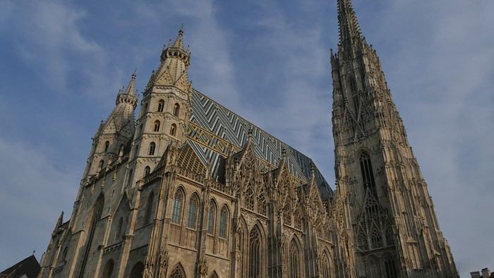
Entry is free, and the interior, a mix of Gothic and Baroque styles in the center, is stunning.
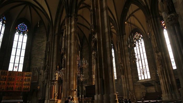
Not far from there is St. Anne’s Church
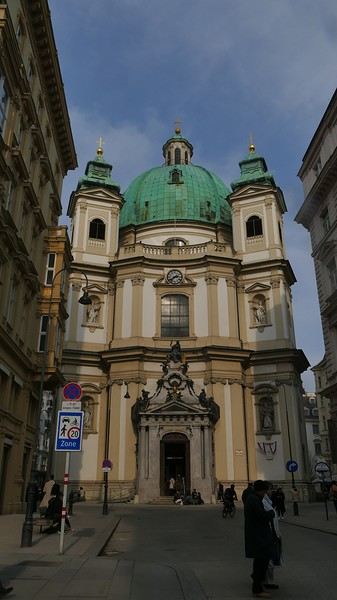
, also Baroque, adorned with beautiful frescoes
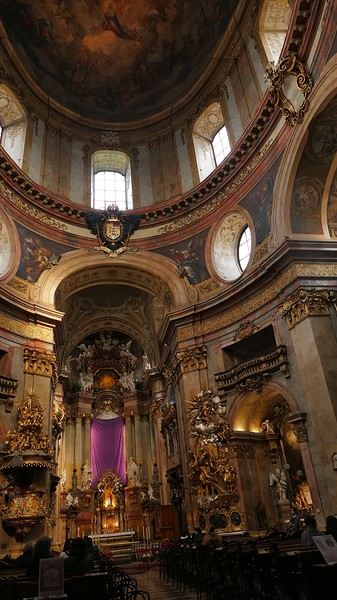
—a music concert adds an enchanting atmosphere to the visit. I continue my walk at random through the pedestrian streets lined with magnificent buildings: I’m charmed by the city.
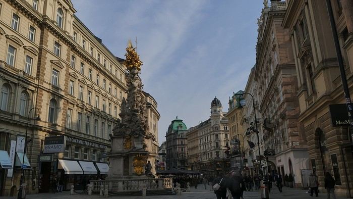
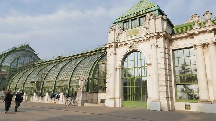
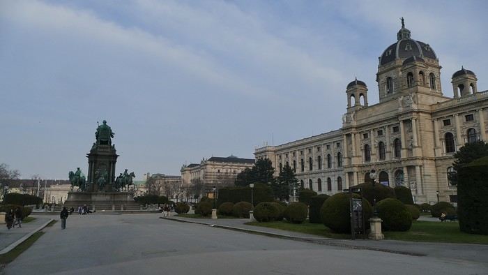
Before heading back to the airport, I stop at a lovely tea salon. My flight will eventually leave with a delay.
Wednesday, March 4th — Delhi and a little luggage scare We arrive in Delhi shortly after noon. Immigration is quick, and good news: my bag was checked through from Barcelona to Kolkata. I head to the connecting terminal and arrive half an hour before boarding: the flight goes smoothly. Upon arrival, the luggage comes out quickly… except mine. After filing a report, I’m told my bag is in Delhi—I have to retrieve it before taking another flight. I didn’t know (or had forgotten): with the delays, I wouldn’t have had time to pick it up and make the connection.
I take a taxi to the Ichamati Hotel. The welcome is warm, and the room is clean but very small. Without my bag, I feel a bit lost—I have nothing to change into.
Tonight, I’m dining with Raja and his friends at a beautiful restaurant, an old colonial house turned into a hotel.
We’re happy to see each other and have a comforting evening together.
I quickly head to the Arc de Triomphe metro station, located 200 meters away: you have to cross the bridge along the bus parking lot, then walk through a large garden; the station is on the right before the garden entrance. The trip to the airport isn’t direct: I have to change at Tomasso and take the line to the airport, where I arrive at 1 PM.
At the Emirates counter, I learn my flight was just canceled due to the war in Iran; they offer me another flight for the next day. I have to wait at the airport until 7 PM before being taken to a hotel; the next morning, I’ll take a flight to Vienna (with an 8-hour layover), then an Air India flight to Delhi, and finally a flight to Kolkata. I agree: I don’t know Vienna, so it’ll be an unexpected discovery.
At 7 PM, a small group is taken to the hotel, 35 minutes from the airport, where we’re served a light dinner upon arrival.
March 3rd — A taxi picks me up at 6:30 AM; the flight to Vienna takes off at 9:30 AM and arrives at noon. I’m free until 7 PM; the metro is direct to the city center. The weather is pleasant and not too cold, luckily, since my clothes are light.
When I exit the metro, I spot the St. Stephen’s Cathedral tower in the distance and approach it: the roof, made of glazed tiles, is remarkable.
Entry is free, and the interior, a mix of Gothic and Baroque styles in the center, is stunning.
Not far from there is St. Anne’s Church
, also Baroque, adorned with beautiful frescoes
—a music concert adds an enchanting atmosphere to the visit. I continue my walk at random through the pedestrian streets lined with magnificent buildings: I’m charmed by the city.
Before heading back to the airport, I stop at a lovely tea salon. My flight will eventually leave with a delay.
Wednesday, March 4th — Delhi and a little luggage scare We arrive in Delhi shortly after noon. Immigration is quick, and good news: my bag was checked through from Barcelona to Kolkata. I head to the connecting terminal and arrive half an hour before boarding: the flight goes smoothly. Upon arrival, the luggage comes out quickly… except mine. After filing a report, I’m told my bag is in Delhi—I have to retrieve it before taking another flight. I didn’t know (or had forgotten): with the delays, I wouldn’t have had time to pick it up and make the connection.
I take a taxi to the Ichamati Hotel. The welcome is warm, and the room is clean but very small. Without my bag, I feel a bit lost—I have nothing to change into.
Tonight, I’m dining with Raja and his friends at a beautiful restaurant, an old colonial house turned into a hotel.
We’re happy to see each other and have a comforting evening together.
Wednesday, April 1st
Hazaribagh I’ve got a meet-up with Adam Iman, a guide and painter. He picks me up from the hotel at 10 AM. Another traveler from Bangalore is supposed to join us, but while we wait for him to arrive, Adam takes me to see the paintings his mother and sister created at Hazaribagh station. The town became famous thanks to these murals, which can also be found in several surrounding villages. This art form has earned recognition and is now protected, a sign of its cultural importance. Once the visit is over, we go to pick up the other traveler and then head to our first village: Belwara, where Sohrai art is practiced. At the entrance, a sign proudly announces that we’re entering an artists’ village, where this art is created by women organized into micro-enterprises. Some even offer workshops for those who’d like to learn this tradition.
Sohrai art is tied to the harvest season, from October to mid-November. The motifs, in natural colors, celebrate fertility and abundance. The artists use pigments from the earth: red oxides, ochre, white kaolin, and black manganese. On the walls, you’ll see animals, fish, birds—all symbols of life and prosperity. As I look closer at the murals, I start to realize that each motif tells a story. Large animals like cows or bulls often take center stage. Their bodies are filled with intricate, almost hypnotic patterns. They symbolize wealth and prosperity for the household, as well as the deep respect for cattle, which are essential to daily life. On some facades, elephants stand out—massive and decorated with the same precision. They evoke quiet strength and protection. But it’s when I stop in front of one of the houses that I really take the time to look. The wall, a soft ochre, is entirely covered in murals. Two large animals stretch out on either side of the door, their elongated bodies fitting the length of the wall. Their silhouettes are filled with geometric patterns and incredibly fine curved lines, as if every space was patiently filled. Around them, stylized plants, flowers, and small decorative elements fill every gap. The door, dark and worn, becomes almost the silent center of the composition, framed by these living, protective forms. To the right, a more colorful motif catches the eye—a flower or a stylized lamp—like a touch of light on the earth. The whole thing gives an impression of perfect balance, between the rigor of the patterns and the freedom of the gesture.
Elsewhere, birds and freer forms bring movement. Peacocks, recognizable by their stylized silhouettes, embody beauty and vitality, while fish symbolize water, fertility, and the continuity of life.
 On some paintings, the scenes become almost narrative: you can make out figures, everyday gestures, like a memory of the village inscribed in the walls. The decorative frames around the doors aren’t left to chance either—they symbolically protect the house, like a boundary between the inside and the outside world.
During the Sohrai festival, cattle are led into the jungle in the morning. Meanwhile, the women finish the *aripans*—these floor paintings—and continue the wall murals. Around noon, the animals return to the village, and the bulls’ horns are anointed with oil and vermilion in a gesture of gratitude, amid the vibrant colors adorning the houses. We visit several artists, including Parvat Devi, a well-known woman who has received many awards. Her arms are adorned with intriguing tattoos, which I’ll talk about in more detail later.
On another wall, the style changes completely. Here, no massive animals—just birds occupying the space, light and graceful, as if caught in mid-movement. Two silhouettes face each other, their long necks arched almost like mirrors, while their outstretched wings seem to vibrate with the patterns that compose them.
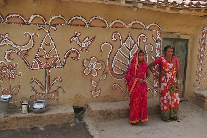
The design is more graphic, almost airy. The lines are smoother, more fluid, as if drawn in one confident stroke. The birds’ bodies aren’t solid—they’re filled with repetitive motifs like scales, stylized feathers, and spirals, giving a sense of continuous movement. Around them, everything comes to life: flowers burst open, arabesques swirl, and even the simplest shapes seem alive. What strikes me here is the sense of lightness. Where the large animals evoked stability and grounding, these birds bring something freer, almost joyful. They seem to embody movement, the circulation of life, like a breath flowing through the village.
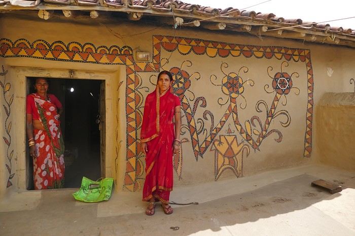
The colors remain the same—deep reds, intense blacks, and chalky white—but the rhythm is different. Faster, more spontaneous. As if each wall had its own personality, while still speaking the same language.
That’s probably why I’m so moved. I’d heard about these paintings from my friend Raja, and last year, I saw an exhibition in a village near my home. That first encounter made me want to come here. But seeing them in person is a whole different experience. These paintings are unique. This ancient art is passed down from mother to daughter, or mother-in-law to daughter-in-law, in a quiet, deeply living continuity. At first glance, it might seem almost childlike in its simplicity and pared-down forms. And yet, everything is thought out, balanced, mastered. Nothing is left to chance.
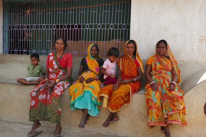
That apparent simplicity, combined with such rich symbolism, touches me deeply. There’s something sincere and essential in these walls—and that’s what moves me.
Hazaribagh I’ve got a meet-up with Adam Iman, a guide and painter. He picks me up from the hotel at 10 AM. Another traveler from Bangalore is supposed to join us, but while we wait for him to arrive, Adam takes me to see the paintings his mother and sister created at Hazaribagh station. The town became famous thanks to these murals, which can also be found in several surrounding villages. This art form has earned recognition and is now protected, a sign of its cultural importance. Once the visit is over, we go to pick up the other traveler and then head to our first village: Belwara, where Sohrai art is practiced. At the entrance, a sign proudly announces that we’re entering an artists’ village, where this art is created by women organized into micro-enterprises. Some even offer workshops for those who’d like to learn this tradition.
Sohrai art is tied to the harvest season, from October to mid-November. The motifs, in natural colors, celebrate fertility and abundance. The artists use pigments from the earth: red oxides, ochre, white kaolin, and black manganese. On the walls, you’ll see animals, fish, birds—all symbols of life and prosperity. As I look closer at the murals, I start to realize that each motif tells a story. Large animals like cows or bulls often take center stage. Their bodies are filled with intricate, almost hypnotic patterns. They symbolize wealth and prosperity for the household, as well as the deep respect for cattle, which are essential to daily life. On some facades, elephants stand out—massive and decorated with the same precision. They evoke quiet strength and protection. But it’s when I stop in front of one of the houses that I really take the time to look. The wall, a soft ochre, is entirely covered in murals. Two large animals stretch out on either side of the door, their elongated bodies fitting the length of the wall. Their silhouettes are filled with geometric patterns and incredibly fine curved lines, as if every space was patiently filled. Around them, stylized plants, flowers, and small decorative elements fill every gap. The door, dark and worn, becomes almost the silent center of the composition, framed by these living, protective forms. To the right, a more colorful motif catches the eye—a flower or a stylized lamp—like a touch of light on the earth. The whole thing gives an impression of perfect balance, between the rigor of the patterns and the freedom of the gesture.
Elsewhere, birds and freer forms bring movement. Peacocks, recognizable by their stylized silhouettes, embody beauty and vitality, while fish symbolize water, fertility, and the continuity of life.
On some paintings, the scenes become almost narrative: you can make out figures, everyday gestures, like a memory of the village inscribed in the walls. The decorative frames around the doors aren’t left to chance either—they symbolically protect the house, like a boundary between the inside and the outside world.During the Sohrai festival, cattle are led into the jungle in the morning. Meanwhile, the women finish the *aripans*—these floor paintings—and continue the wall murals. Around noon, the animals return to the village, and the bulls’ horns are anointed with oil and vermilion in a gesture of gratitude, amid the vibrant colors adorning the houses. We visit several artists, including Parvat Devi, a well-known woman who has received many awards. Her arms are adorned with intriguing tattoos, which I’ll talk about in more detail later.
On another wall, the style changes completely. Here, no massive animals—just birds occupying the space, light and graceful, as if caught in mid-movement. Two silhouettes face each other, their long necks arched almost like mirrors, while their outstretched wings seem to vibrate with the patterns that compose them.
The design is more graphic, almost airy. The lines are smoother, more fluid, as if drawn in one confident stroke. The birds’ bodies aren’t solid—they’re filled with repetitive motifs like scales, stylized feathers, and spirals, giving a sense of continuous movement. Around them, everything comes to life: flowers burst open, arabesques swirl, and even the simplest shapes seem alive. What strikes me here is the sense of lightness. Where the large animals evoked stability and grounding, these birds bring something freer, almost joyful. They seem to embody movement, the circulation of life, like a breath flowing through the village.
The colors remain the same—deep reds, intense blacks, and chalky white—but the rhythm is different. Faster, more spontaneous. As if each wall had its own personality, while still speaking the same language.
That’s probably why I’m so moved. I’d heard about these paintings from my friend Raja, and last year, I saw an exhibition in a village near my home. That first encounter made me want to come here. But seeing them in person is a whole different experience. These paintings are unique. This ancient art is passed down from mother to daughter, or mother-in-law to daughter-in-law, in a quiet, deeply living continuity. At first glance, it might seem almost childlike in its simplicity and pared-down forms. And yet, everything is thought out, balanced, mastered. Nothing is left to chance.
That apparent simplicity, combined with such rich symbolism, touches me deeply. There’s something sincere and essential in these walls—and that’s what moves me.
April 5 - Day 1
After as many weeks as I have fingers on my right hand, we're hitting the road again, fully recovered from our pharaonic adventure. Back in France to drop off our daughters (sorry, girls!), this time it's just the two of us, ready to be welcomed by a new destination. They say it offers one of the richest cultural heritages in the world for those willing to put in the effort. It's the land of the ancient Silk Road, where we'll follow a journey steeped in history and discoveries straight out of *One Thousand and One Nights*. A former Soviet bloc region independent only since 1991, we'll be walking in the footsteps of Genghis Khan, Tamerlane, Alexander the Great, Marco Polo...
Another fun fact about this country: it's strictly forbidden to import porn on your phone. True story. The same goes for painkillers! Unless it's about sodomy—though the two don’t seem connected, that’s just how it is. Don’t ask me why! Anyway, I’m getting off track. Here’s the big question: Where do you think we’ve just landed?... To give you a hint, the locals are known for being incredibly welcoming. No sooner said than done—our first taxi driver, proud to transport French travelers, refused to let us pay for the ride. Great vibes for these two weeks ahead. So, any guesses? Uzbekistan!!!
After as many weeks as I have fingers on my right hand, we're hitting the road again, fully recovered from our pharaonic adventure. Back in France to drop off our daughters (sorry, girls!), this time it's just the two of us, ready to be welcomed by a new destination. They say it offers one of the richest cultural heritages in the world for those willing to put in the effort. It's the land of the ancient Silk Road, where we'll follow a journey steeped in history and discoveries straight out of *One Thousand and One Nights*. A former Soviet bloc region independent only since 1991, we'll be walking in the footsteps of Genghis Khan, Tamerlane, Alexander the Great, Marco Polo...
Another fun fact about this country: it's strictly forbidden to import porn on your phone. True story. The same goes for painkillers! Unless it's about sodomy—though the two don’t seem connected, that’s just how it is. Don’t ask me why! Anyway, I’m getting off track. Here’s the big question: Where do you think we’ve just landed?... To give you a hint, the locals are known for being incredibly welcoming. No sooner said than done—our first taxi driver, proud to transport French travelers, refused to let us pay for the ride. Great vibes for these two weeks ahead. So, any guesses? Uzbekistan!!!
I hesitated about writing this travel journal...
This summer, we only did the classics (the 3 northern parks and Zanzibar) and let a local agency take care of everything from start to finish.
No craziness, no risks, no sleeping under the stars, no self-drive, no venturing off the beaten path, no incidents, and not even any delays in the pre-planned itinerary...
But don’t think we were disappointed! The whole family (there were 6 of us) came back with smiles and memories of great moments spent together. So, if you're looking for a "classic" way to discover Tanzania, this is the place to be.
Our 2-week itinerary: - Arusha (1 night upon arrival) - Tarangire (1 night) - Ngorongoro (2 nights in Karatu then Irmisigiyo) - Serengeti (3 nights in Robanda, Togoro Plains, and Seronera) - Zanzibar Stone Town (1 night) - Zanzibar Matemwe (3 nights) - Zanzibar Jambiani (3 nights)
Hakuna matata!
No craziness, no risks, no sleeping under the stars, no self-drive, no venturing off the beaten path, no incidents, and not even any delays in the pre-planned itinerary...
But don’t think we were disappointed! The whole family (there were 6 of us) came back with smiles and memories of great moments spent together. So, if you're looking for a "classic" way to discover Tanzania, this is the place to be.
Our 2-week itinerary: - Arusha (1 night upon arrival) - Tarangire (1 night) - Ngorongoro (2 nights in Karatu then Irmisigiyo) - Serengeti (3 nights in Robanda, Togoro Plains, and Seronera) - Zanzibar Stone Town (1 night) - Zanzibar Matemwe (3 nights) - Zanzibar Jambiani (3 nights)
Hakuna matata!
Here are some tips from our 6-week trip (summer 2026) to China, Vietnam, and Cambodia. We traveled as a family of four with two kids aged 15 and 12.
I hope these notes help other travelers!
CHINA General You’ll need to download and set up a few apps: - Alipay and WeChat for payments (I didn’t withdraw a single bill the entire trip) - Didi for taxis - Amap = Chinese Maps (works great, especially for subways) - A translation app (we used Papago, but it sometimes gave weird results) - Google Lens for translating menus or signs—super handy. - HelloRide for bikes - Gemini and ChatGPT for everything: understanding daily life, enhancing visits, checking the weather, finding things. - HomeExchange if you want to lower travel costs (few listings in Asia except in big cities, often expats) - Trip.com is very useful, even essential, for trains, domestic flights, and hotels. Like Booking.com, the more you book with them, the more perks you get. So I’d even suggest checking flight tickets on this site, even if it’s a bit pricier. However, buying train tickets is complicated because (1) they only open 15 days in advance, and (2) they sell out fast. Trip.com just promises to buy them as soon as they’re available but doesn’t always succeed. It’s stressful and might force you to change your plans, especially if you’re aiming for a sleeper car and there are no seats left. Watch out for station names—many cities have multiple stations, including a high-speed rail one outside the city. For internet, we got the Asia plan from Holafly. It worked but seemed much slower than Chinese internet. I regretted not buying a Chinese SIM card because without internet in China, everything is VERY complicated (money, transport, etc.).
For the firewall, we used ExpressVPN, but it wasn’t always reliable. A bit disappointing. Ask ChatGPT for tips with screenshots to improve the settings.
Since we only had one SIM card with internet, we couldn’t rent shared bikes. If I were to do it again, I’d get a SIM for each person, even the kids, because distances in cities are huge. We walked *a lot*. Same goes for buses—it’s tricky with just one internet connection. Better to have a phone per person with internet. Book your visits as far in advance as possible—they often sell out. Watch out for power banks: if they don’t explicitly say "3C," they’ll confiscate it. Even if there’s a little airplane logo.
Shanghai In the evening, the streets leading to the Bund from the metro were so crowded that police were out in force blocking roads. Arrive early. We went around the north side.
Suzhou Be careful—there are two stations (common in China), and the high-speed rail one is 45–50 minutes from the old town. The Humble Administrator’s Garden was *packed*—we don’t recommend it. It turned into a marathon day from Shanghai (almost 4 hours from our hotel to the garden).
Beijing Forbidden City: Don’t go—I know it’s a shame, but it’s too crowded. I couldn’t buy tickets on the official site because of the kids’ passports. We ended up with a guided tour, the only way to get in (tickets sell out fast). The visit was disappointing—bad guide *and* massive crowds. You’ll queue a lot to enter and see certain areas. You’ll be checked often, so pack your bags carefully. Great Wall at Mutianyu: Crowded. Two hours by bus, and even though we arrived early, people were already leaving! I really think the best option is to leave your big bags in Beijing and stay overnight near the Wall. That way, you’ll have it to yourself a bit more. For transport: get off at Tiananmen Square metro and look for buses with official guides in bright yellow-green vests. No need to buy tickets online—they made me cancel mine to rebook on the spot. Buses leave when full. Note: the cable car and chairlift are separate—if you want to go up one side and down the other, you’ll need different tickets. The endless queue for the toboggan ride put us off. Quick tip: Incredible swimming spot in Beijing—on the north shore of Houhai Lake, you can swim by crossing the barrier. We did it twice with about ten other people. Bring a swimsuit!
Shapotou Desert Amazing, but it gets *very* hot in the afternoon. We had a tent (not an air-conditioned bungalow), which was unbearable during the day. We hung out in the restaurant. The paid activities are fun, except the camels—they look sad. The real highlight is the evening and sunset. The only downside: you can’t explore the desert alone or far—they don’t rent 4x4s, for example. We stayed at "The Desert Camping Hotel of the Proprietress of Shapotou." They were lovely.
Zhongwei Gaomiao Temple and its underground: Fun and short—you’ll see quirky Buddhist hell paintings.
Xi’an Terracotta Army: We took a Didi because for four people, a car was almost the same price as four shuttle tickets. It was packed—chaotic to see properly. We visited the halls in order: 3, 2, then 1—a good choice. Hua Shan Mountains: Left before sunrise to arrive when the ticket office opened (7 AM, I think). We were shocked to see so many people already coming down. 45 minutes by bus to the west cable car, then 15 minutes up. We did the west, south, east, central, then north peaks (in that order) before taking the other cable car down (you can buy the ticket at the top). A beautiful day. In the city, check out...
Chengdu Panda Research Center: Like Hua Shan, plan to arrive when the ticket office opens. Already *tons* of people, and it moves fast to see the big pandas before their nap. Have them drop you at the west entrance (not south), or you’ll have to walk uphill. Leshan Giant Buddha: Interesting. The trip is a bit long (metro, then train, then city bus, then shuttle on-site). We didn’t take the boat option but walked. In the end, you only spend a few minutes at the Buddha’s feet, but it’s a nice day out. Hotel tip: Panda Enjoy Home Hotel Apartments (Chengdu East Railway Station Dongda Road Branch). The view is insane, and the neighborhood is super convenient and nice. 646 CNY for 2 nights. Swimming: The municipal pool is an interesting experience, but don’t expect to swim—no one does. Everyone just splashes around where they can stand. The hours are a bit odd, with a break in the late afternoon.
Kunming The bike path along Dian Lake is pretty and often well-protected from cars. But like everywhere in China, it’s *packed*. Not much to say about visits—the flower market is a wholesale market, not very interesting. The ethnic minorities museum closed right in front of us. All the big malls are good for shopping.
Dali We thought we could bike around the lake in two days. Wrong on two counts: First, the lake’s edge is blocked to traffic and reserved for bikes (or tourist mini-buses). So you’re stuck on the main road, which never gives you a view of the lake, with all the trucks and cars. Doing 120 km like that wouldn’t make sense, in our opinion. The rice fields around are nice but not as impressive as elsewhere, so Dali isn’t worth it for that. The old town, all restored, is pretty but *packed*—thousands of people, especially in the evening.
Hekou (Vietnam border) Comfortable train from Kunming. In the parking lot, a bus (not well-marked, but Didi is an option) takes you to the border in 15–20 minutes. Short wait at both border posts. Fun to see the two lampposts near the border line: the Chinese one is new, modern, with a surveillance camera (of course), while the Vietnamese one is old and a bit rusty.
VIETNAM General: - You’ll need the Grab app for taxis - Very disappointed with 12Go—it doesn’t show all buses, never connects you with the company, and refuses refunds. Try booking directly with companies like FUTA Bus instead. - Credit cards are often accepted (supermarkets and modern stores), otherwise, you’ll need cash
Lao Cai 2 km between the border and the train station. The sleeper bus to Hanoi with Sao Viet is well-organized—it works.
Hanoi Ho Chi Minh Mausoleum closes early (10:30 AM, I think). Women’s Museum: Very good, not too long Temple of Literature: Beautiful, fairly quick This is where you should buy souvenirs, clothes, and knockoffs—the prices are reasonable, and the sellers are nicer than elsewhere. We recommend Cho Dong Xuan.
Tu Long Bay We did 2 days, 1 night (so really 24 hours on the boat) with Parfum d’Automne (French-speaking agency), which put us on a Cycad Cruise boat. Cost: 300 € per person—expensive, but it was amazing, super luxurious, and the buffet meals were delicious. We don’t regret the splurge. The only downside: no swimming in the bay (but there’s a pool on the boat). To swim, you’d need a 3-day, 2-night trip to an area not protected by the maritime park.
Phong Nha If you didn’t do the northern mountains due to time or weather (like us), Phong Nha is a great stop for a motorbike ride. It’s beautiful, especially the mountains west of the city toward the caves. There are two (small) swimming spots at the Botanic Garden—a pleasant 45-minute walk without stops. Hotel tip: Sunbeam Village (very friendly, pool, breakfast by the river, motorbike rentals)
Da Nang Hotel tip: Meridians by Hsuite—you’ll have the beach almost to yourself. You’ll still need to walk 15–20 minutes to the hyper-touristy area if you want to rent surfboards (150–200k VND per hour). The beach is beautiful, and the water is 30°C—great for a break on a long trip, especially since all transport goes through Da Nang.
Hoi An 45 minutes from Da Nang, so it’s easy to visit in a day, especially since the city isn’t that big and it’s *very* hot. Cooking class: MS Hanh cooking class—great (the market tour is a bit useless). We don’t recommend the "basket boat" tour—it’s a bit sad on a big brown pond with elderly guides.
Ho Chi Minh City Ben Thanh Market is a nightmare: starting prices are exorbitant, and the vendors are aggressive. Don’t go. The War Remnants Museum can be really tough for kids.
Can Tho Avoid this city. We made the mistake of going to see the floating market—don’t.
Chau Doc No Grab in the city, but regular taxis. One day is enough if you go early to the forest and the mountain in the late afternoon. 250k VND per person for the forest and its canals (45 minutes by motorbike) The sunset at Victoria Nui Sam can be magnificent if the clouds cooperate. Cheap and good restaurant: Quan Nem Nuong Sau Hiep Hotel tip: Homestay Khoa (2,250,000 VND for 3 nights)—adorable hostess, full of tips, clean rooms.
The speedboat to Cambodia is more comfortable than a bus. Book with Hangchau a few days in advance—payment in cash on the day (1,640,000 đ).
CAMBODIA General: - Issues with the "Bakong Tourists" app—we had to go to a big bank to load money onto it. We barely used it afterward.
Phnom Penh For us, a day and a half is enough if you want to spend more time elsewhere. Markets close early (around 6 PM) and are less interesting than in Hanoi, for example. The Royal Palace has a break from 11 AM to 2 PM, but there aren’t many people in the afternoon.
Siem Reap Trip with Capitol company—the bus is basic but cheap. Departs at 10:15 AM, 7-hour ride. Angkor entrance fee: 62 USD per person for a 3-day pass. Tickets are picked up at Angkor Enterprise. Renting two 125cc motorbikes: 10 USD each, plus 7 USD for gas. By bike, it took me 25 minutes to reach Angkor Wat’s pools. A basic city bike rental was 1 USD per hour. Short circuit by motorbike (in reverse): 7 hours with stops everywhere. Grand tour by tuk-tuk: Only 5 temples, 4.5 hours. If you want to see lots of monkeys, they’re grouped west of Bayon. For the temples, we asked Gemini (AI) at each stop to point out details that might interest kids (who can get bored with the repetition). It gave fun facts and things to look for—great for the little ones. Hotel tip: The Five Senses, run by a Frenchman, Bruno, who knows Cambodia inside out and organizes tours. Restaurant tip: Wild (only spring rolls, but *so* many varieties—delicious and cheap) Watch out: 1 hour to the airport, 50 km from the city. Show tip: The Phare Circus
CHINA General You’ll need to download and set up a few apps: - Alipay and WeChat for payments (I didn’t withdraw a single bill the entire trip) - Didi for taxis - Amap = Chinese Maps (works great, especially for subways) - A translation app (we used Papago, but it sometimes gave weird results) - Google Lens for translating menus or signs—super handy. - HelloRide for bikes - Gemini and ChatGPT for everything: understanding daily life, enhancing visits, checking the weather, finding things. - HomeExchange if you want to lower travel costs (few listings in Asia except in big cities, often expats) - Trip.com is very useful, even essential, for trains, domestic flights, and hotels. Like Booking.com, the more you book with them, the more perks you get. So I’d even suggest checking flight tickets on this site, even if it’s a bit pricier. However, buying train tickets is complicated because (1) they only open 15 days in advance, and (2) they sell out fast. Trip.com just promises to buy them as soon as they’re available but doesn’t always succeed. It’s stressful and might force you to change your plans, especially if you’re aiming for a sleeper car and there are no seats left. Watch out for station names—many cities have multiple stations, including a high-speed rail one outside the city. For internet, we got the Asia plan from Holafly. It worked but seemed much slower than Chinese internet. I regretted not buying a Chinese SIM card because without internet in China, everything is VERY complicated (money, transport, etc.).
For the firewall, we used ExpressVPN, but it wasn’t always reliable. A bit disappointing. Ask ChatGPT for tips with screenshots to improve the settings.
Since we only had one SIM card with internet, we couldn’t rent shared bikes. If I were to do it again, I’d get a SIM for each person, even the kids, because distances in cities are huge. We walked *a lot*. Same goes for buses—it’s tricky with just one internet connection. Better to have a phone per person with internet. Book your visits as far in advance as possible—they often sell out. Watch out for power banks: if they don’t explicitly say "3C," they’ll confiscate it. Even if there’s a little airplane logo.
Shanghai In the evening, the streets leading to the Bund from the metro were so crowded that police were out in force blocking roads. Arrive early. We went around the north side.
Suzhou Be careful—there are two stations (common in China), and the high-speed rail one is 45–50 minutes from the old town. The Humble Administrator’s Garden was *packed*—we don’t recommend it. It turned into a marathon day from Shanghai (almost 4 hours from our hotel to the garden).
Beijing Forbidden City: Don’t go—I know it’s a shame, but it’s too crowded. I couldn’t buy tickets on the official site because of the kids’ passports. We ended up with a guided tour, the only way to get in (tickets sell out fast). The visit was disappointing—bad guide *and* massive crowds. You’ll queue a lot to enter and see certain areas. You’ll be checked often, so pack your bags carefully. Great Wall at Mutianyu: Crowded. Two hours by bus, and even though we arrived early, people were already leaving! I really think the best option is to leave your big bags in Beijing and stay overnight near the Wall. That way, you’ll have it to yourself a bit more. For transport: get off at Tiananmen Square metro and look for buses with official guides in bright yellow-green vests. No need to buy tickets online—they made me cancel mine to rebook on the spot. Buses leave when full. Note: the cable car and chairlift are separate—if you want to go up one side and down the other, you’ll need different tickets. The endless queue for the toboggan ride put us off. Quick tip: Incredible swimming spot in Beijing—on the north shore of Houhai Lake, you can swim by crossing the barrier. We did it twice with about ten other people. Bring a swimsuit!
Shapotou Desert Amazing, but it gets *very* hot in the afternoon. We had a tent (not an air-conditioned bungalow), which was unbearable during the day. We hung out in the restaurant. The paid activities are fun, except the camels—they look sad. The real highlight is the evening and sunset. The only downside: you can’t explore the desert alone or far—they don’t rent 4x4s, for example. We stayed at "The Desert Camping Hotel of the Proprietress of Shapotou." They were lovely.
Zhongwei Gaomiao Temple and its underground: Fun and short—you’ll see quirky Buddhist hell paintings.
Xi’an Terracotta Army: We took a Didi because for four people, a car was almost the same price as four shuttle tickets. It was packed—chaotic to see properly. We visited the halls in order: 3, 2, then 1—a good choice. Hua Shan Mountains: Left before sunrise to arrive when the ticket office opened (7 AM, I think). We were shocked to see so many people already coming down. 45 minutes by bus to the west cable car, then 15 minutes up. We did the west, south, east, central, then north peaks (in that order) before taking the other cable car down (you can buy the ticket at the top). A beautiful day. In the city, check out...
Chengdu Panda Research Center: Like Hua Shan, plan to arrive when the ticket office opens. Already *tons* of people, and it moves fast to see the big pandas before their nap. Have them drop you at the west entrance (not south), or you’ll have to walk uphill. Leshan Giant Buddha: Interesting. The trip is a bit long (metro, then train, then city bus, then shuttle on-site). We didn’t take the boat option but walked. In the end, you only spend a few minutes at the Buddha’s feet, but it’s a nice day out. Hotel tip: Panda Enjoy Home Hotel Apartments (Chengdu East Railway Station Dongda Road Branch). The view is insane, and the neighborhood is super convenient and nice. 646 CNY for 2 nights. Swimming: The municipal pool is an interesting experience, but don’t expect to swim—no one does. Everyone just splashes around where they can stand. The hours are a bit odd, with a break in the late afternoon.
Kunming The bike path along Dian Lake is pretty and often well-protected from cars. But like everywhere in China, it’s *packed*. Not much to say about visits—the flower market is a wholesale market, not very interesting. The ethnic minorities museum closed right in front of us. All the big malls are good for shopping.
Dali We thought we could bike around the lake in two days. Wrong on two counts: First, the lake’s edge is blocked to traffic and reserved for bikes (or tourist mini-buses). So you’re stuck on the main road, which never gives you a view of the lake, with all the trucks and cars. Doing 120 km like that wouldn’t make sense, in our opinion. The rice fields around are nice but not as impressive as elsewhere, so Dali isn’t worth it for that. The old town, all restored, is pretty but *packed*—thousands of people, especially in the evening.
Hekou (Vietnam border) Comfortable train from Kunming. In the parking lot, a bus (not well-marked, but Didi is an option) takes you to the border in 15–20 minutes. Short wait at both border posts. Fun to see the two lampposts near the border line: the Chinese one is new, modern, with a surveillance camera (of course), while the Vietnamese one is old and a bit rusty.
VIETNAM General: - You’ll need the Grab app for taxis - Very disappointed with 12Go—it doesn’t show all buses, never connects you with the company, and refuses refunds. Try booking directly with companies like FUTA Bus instead. - Credit cards are often accepted (supermarkets and modern stores), otherwise, you’ll need cash
Lao Cai 2 km between the border and the train station. The sleeper bus to Hanoi with Sao Viet is well-organized—it works.
Hanoi Ho Chi Minh Mausoleum closes early (10:30 AM, I think). Women’s Museum: Very good, not too long Temple of Literature: Beautiful, fairly quick This is where you should buy souvenirs, clothes, and knockoffs—the prices are reasonable, and the sellers are nicer than elsewhere. We recommend Cho Dong Xuan.
Tu Long Bay We did 2 days, 1 night (so really 24 hours on the boat) with Parfum d’Automne (French-speaking agency), which put us on a Cycad Cruise boat. Cost: 300 € per person—expensive, but it was amazing, super luxurious, and the buffet meals were delicious. We don’t regret the splurge. The only downside: no swimming in the bay (but there’s a pool on the boat). To swim, you’d need a 3-day, 2-night trip to an area not protected by the maritime park.
Phong Nha If you didn’t do the northern mountains due to time or weather (like us), Phong Nha is a great stop for a motorbike ride. It’s beautiful, especially the mountains west of the city toward the caves. There are two (small) swimming spots at the Botanic Garden—a pleasant 45-minute walk without stops. Hotel tip: Sunbeam Village (very friendly, pool, breakfast by the river, motorbike rentals)
Da Nang Hotel tip: Meridians by Hsuite—you’ll have the beach almost to yourself. You’ll still need to walk 15–20 minutes to the hyper-touristy area if you want to rent surfboards (150–200k VND per hour). The beach is beautiful, and the water is 30°C—great for a break on a long trip, especially since all transport goes through Da Nang.
Hoi An 45 minutes from Da Nang, so it’s easy to visit in a day, especially since the city isn’t that big and it’s *very* hot. Cooking class: MS Hanh cooking class—great (the market tour is a bit useless). We don’t recommend the "basket boat" tour—it’s a bit sad on a big brown pond with elderly guides.
Ho Chi Minh City Ben Thanh Market is a nightmare: starting prices are exorbitant, and the vendors are aggressive. Don’t go. The War Remnants Museum can be really tough for kids.
Can Tho Avoid this city. We made the mistake of going to see the floating market—don’t.
Chau Doc No Grab in the city, but regular taxis. One day is enough if you go early to the forest and the mountain in the late afternoon. 250k VND per person for the forest and its canals (45 minutes by motorbike) The sunset at Victoria Nui Sam can be magnificent if the clouds cooperate. Cheap and good restaurant: Quan Nem Nuong Sau Hiep Hotel tip: Homestay Khoa (2,250,000 VND for 3 nights)—adorable hostess, full of tips, clean rooms.
The speedboat to Cambodia is more comfortable than a bus. Book with Hangchau a few days in advance—payment in cash on the day (1,640,000 đ).
CAMBODIA General: - Issues with the "Bakong Tourists" app—we had to go to a big bank to load money onto it. We barely used it afterward.
Phnom Penh For us, a day and a half is enough if you want to spend more time elsewhere. Markets close early (around 6 PM) and are less interesting than in Hanoi, for example. The Royal Palace has a break from 11 AM to 2 PM, but there aren’t many people in the afternoon.
Siem Reap Trip with Capitol company—the bus is basic but cheap. Departs at 10:15 AM, 7-hour ride. Angkor entrance fee: 62 USD per person for a 3-day pass. Tickets are picked up at Angkor Enterprise. Renting two 125cc motorbikes: 10 USD each, plus 7 USD for gas. By bike, it took me 25 minutes to reach Angkor Wat’s pools. A basic city bike rental was 1 USD per hour. Short circuit by motorbike (in reverse): 7 hours with stops everywhere. Grand tour by tuk-tuk: Only 5 temples, 4.5 hours. If you want to see lots of monkeys, they’re grouped west of Bayon. For the temples, we asked Gemini (AI) at each stop to point out details that might interest kids (who can get bored with the repetition). It gave fun facts and things to look for—great for the little ones. Hotel tip: The Five Senses, run by a Frenchman, Bruno, who knows Cambodia inside out and organizes tours. Restaurant tip: Wild (only spring rolls, but *so* many varieties—delicious and cheap) Watch out: 1 hour to the airport, 50 km from the city. Show tip: The Phare Circus
Hi everyone, we're back from a DIY USA road trip we organized from July 31, 2026, to August 26, 2026.
The destination: The Southwest USA, including Texas, Arizona, and New Mexico. Roughly 7,000 kilometers covered.
The car: A Chevrolet Equinox for two, rented through BSP Auto and Avis. Inside, we had 2 suitcases, a travel bag, two carry-on bags, a Walmart cooler, photo gear, and water bottles (a 40-pack).
The route: Dallas DFW, Fort Worth, Houston, Austin, San Antonio, Alpine, El Paso, Tucson, Sedona, Albuquerque, Amarillo, and back to Dallas to finish with a departure from DFW.
The travelers: Two seniors well advanced in years (73 and 75) but still active (nothing too physically demanding—to stay alive and fund our trips), fully independent physically, though a bit less so mentally. Big USA fans, a country where anything is possible. More walkers than hikers, preferring 3-star hotels over roadside motels, Italian restaurants over US food, frequent stops for photos, museums over nothing, naps over forced marches. Not too whiny, just enough to stay French in the land of the "great Satan," as they say. Not great with languages—street English (but handy), and my Spanish is non-existent except for: "Hola! Una cerveza por favor!" That’s about it. My wife understands everything but refuses to speak.
The cost of the road trip: Around 12,000 €, including AF flights, the car, gas, gifts, visits, and everything else. Well managed, since we’d budgeted 13,500 € initially.
The positive side: A delight, with those endless open roads. Museums to discover. The realization of the Hispanic presence and its important history in this part of America. Lovely locals. Tourists who were more or less friendly. A terrible Texan accent that was hard to understand. Gas stations that were like real stores, with prepared food, alcohol sold in Arizona and New Mexico, and employees who were always up for a laugh!
The negative side: The heat throughout the trip... 43°C in Dallas at the end. Impossible to walk the streets. Lots of homeless people in downtown Dallas. Hotel breakfasts that were always the same. You get used to it.
So, it was positive overall, but the concept is starting to wear us out. We might rethink the DIY road trip model for next time. If the man upstairs grants us more time.
Next up, we’ll wait for the first batch of sorted photos to go through the wringer.
See you soon.
The destination: The Southwest USA, including Texas, Arizona, and New Mexico. Roughly 7,000 kilometers covered.
The car: A Chevrolet Equinox for two, rented through BSP Auto and Avis. Inside, we had 2 suitcases, a travel bag, two carry-on bags, a Walmart cooler, photo gear, and water bottles (a 40-pack).
The route: Dallas DFW, Fort Worth, Houston, Austin, San Antonio, Alpine, El Paso, Tucson, Sedona, Albuquerque, Amarillo, and back to Dallas to finish with a departure from DFW.
The travelers: Two seniors well advanced in years (73 and 75) but still active (nothing too physically demanding—to stay alive and fund our trips), fully independent physically, though a bit less so mentally. Big USA fans, a country where anything is possible. More walkers than hikers, preferring 3-star hotels over roadside motels, Italian restaurants over US food, frequent stops for photos, museums over nothing, naps over forced marches. Not too whiny, just enough to stay French in the land of the "great Satan," as they say. Not great with languages—street English (but handy), and my Spanish is non-existent except for: "Hola! Una cerveza por favor!" That’s about it. My wife understands everything but refuses to speak.
The cost of the road trip: Around 12,000 €, including AF flights, the car, gas, gifts, visits, and everything else. Well managed, since we’d budgeted 13,500 € initially.
The positive side: A delight, with those endless open roads. Museums to discover. The realization of the Hispanic presence and its important history in this part of America. Lovely locals. Tourists who were more or less friendly. A terrible Texan accent that was hard to understand. Gas stations that were like real stores, with prepared food, alcohol sold in Arizona and New Mexico, and employees who were always up for a laugh!
The negative side: The heat throughout the trip... 43°C in Dallas at the end. Impossible to walk the streets. Lots of homeless people in downtown Dallas. Hotel breakfasts that were always the same. You get used to it.
So, it was positive overall, but the concept is starting to wear us out. We might rethink the DIY road trip model for next time. If the man upstairs grants us more time.
Next up, we’ll wait for the first batch of sorted photos to go through the wringer.
See you soon.
If I close my eyes and think of the Sultanate of Oman, I first smell a light scent of incense, feel the warmth of a sunbeam on my skin, before sand slips through my fingers. I taste the sweetness of a date, a real candy, then the flavor of coffee with a hint of cardamom and rosewater... I hear the desert wind whistling in my ears, the distant call of a muezzin, then the murmur of water. I open my eyes to see smiles, welcoming gestures, a turquoise sea, rocks ranging from ochre to purple, deep wadis where torrents burst forth, orange dunes, white sandy beaches where tiny crabs scurry at full speed. I see incredible oases emerging between arid mountains. I see abandoned villages that I’d dream were full of life, imposing fortresses overlooking valleys, and lively souks where offers are delicate and negotiation is a mutual courtesy.
All that, and so much more.
This is what I tried to capture in my illustrated travel journal, which I’ll fill in here and there with photos. I drew this journal “cold,” after my return (actually, I made it this summer, while our trip was last winter). It’s a pretty special format—I bought it in Japan without really knowing what I’d do with it. Well, it found its purpose! Below is a photo of this accordion-style journal: here, it’s only partially open, because when fully unfolded, it’s 5 meters long!
For drawing enthusiasts: The accordion format is both a constraint (each sheet is 9 cm x 27 cm) and a freedom (you can create a fresco). The paper is also a bit special: it doesn’t allow for fine lines, but it takes ink well (liner pen). However, everything has to be done almost in one go (with a very light pencil sketch) because it erases poorly. It absorbs too much water for coloring with markers or watercolors (unless you avoid soaking it), but it works well with oil pastels and their use with a brush and solvent. Since it’s yellowish, it allowed me to create contrasts even with white pastel.
 On the right, the "welcome marker"—those dates offered everywhere as a sign of hospitality. On the left, a tribute to those stunning doors worn by time, admired all over the old quarters, including the abandoned ones.
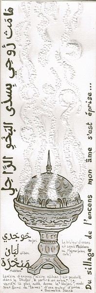
Oman is one of the world’s largest producers of frankincense resin. Incense burners are everywhere, from the simplest clay ones to the most precious handcrafted silver ones...
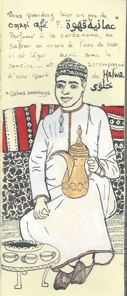 Hospitality will often lead you to accept a small coffee, an "Omani coffee," very light, subtly flavored with cardamom, maybe a touch of saffron, and occasionally rosewater.
Here, I’ve depicted a man in the common everyday attire of Omanis: the dishdasha, mostly white (during the week and daytime; colors are more common in the evening or on Fridays and Saturdays). While you’ll see some men dressed in Western clothes, they’re very few. The white dishdasha is truly the shared attire of all men. The dishdasha, which has no hood, is distinguished by a small pom-pom attached to the collar, the furakha, which is soaked in perfume. And believe me, Omanis go overboard with it! "It smells like the pom-pom" is an expression that’s now part of our shared language, my husband and I.
Another must of men’s attire is the kuma, a small round head covering, usually white with brightly colored patterns. The keffiyeh is also worn (but without the cord called an agal in Arab countries), and it’s mostly worn by those with roots in the desert, from what I understood.
And what about the women, you might ask? Some are veiled, some in full black (but not a burka—more like a chador + abaya), due to the influence of Saudi Arabia and the United Arab Emirates, whereas the traditional outfit used to be a layering of very colorful dresses. Most of the women we saw wore neutral clothing, a plain veil over their hair, but with their faces uncovered. We also saw many saris and colorful veils—don’t forget that 40% of the population consists of Indian, Nepalese, and Bangladeshi immigrants, who work a lot in tourism, hospitality, restaurants, services, and construction.
Just to clarify, as a tourist, there’s no pressure to wear a veil, and never any disapproving looks. Of course, you’ll save the mini shorts, plunging necklines, bare shoulders, and midriffs for the hotel terrace—but I’d say that’s the same for men and women, and with the sun being strong, it’s better for your skin too.
Here’s the introduction! In the next post, I’ll tell you about my itinerary, and we can dive in!
My partner and I traveled from Sunday, July 5, 2026, to Wednesday, July 22, 2026.
We spent a long time debating whether to rent a car or use public transportation. In the end, after reading so many posts about travelers getting scammed by police or rental companies—even those recommended by blogs and reviews—we decided to stick with public transport. It worked out really well. Sure, we had a little less freedom to go where we wanted, but it was way less stressful for us.
Sunday, July 5:
Arrived at Cancun Airport. Withdrew cash from the ATM in the terminal just before exiting. The ADO bus counter (they pronounce it "A-Jee-O") is right behind you when you're facing the ATM. Bus to downtown Cancun cost 145 pesos per person. Stayed at "Rose 5," booked on Booking. The studio was super clean and perfect for one night. The owner’s instructions for accessing the place were very precise, with photos included. Check-in was self-service with a code. The ADO bus terminal isn’t far, and there are shops and restaurants nearby. We really appreciated that the AC was already on when we arrived. By the way, I’d recommend always booking places with AC—it’s *really* hot in Mexico.
Monday, July 6:
Bought a SIM card with data from a TELCEL store. My partner, who’s on Free Mobile, was able to use her regular plan. Just so you know, I found the network pretty unstable. As soon as we left the cities, neither of us—me with TELCEL or her with Free—had any signal. Another thing to watch out for: roaming charges. I had to turn my SIM back on for less than 30 seconds to get a bank SMS code, and my phone apparently connected to the internet—resulting in an 8-euro roaming fee. Left on an ADO bus to Chiquila for 278 pesos per person. During our trip, ADO buses were always on time, comfortable, and clean. The AC is *cranked* though, so bring something to cover up with—it gets cold. Some routes were fully booked even in the low season, so try to reserve 1 or 2 days in advance either via the app (when it works) or at the counter. When we arrived at the ADO terminal in Chiquila, the ferry company counters were right next to it. Ferries leave every 30 minutes, alternating between companies, so no need to book ahead. Just take whichever one is leaving next (330 pesos per person). When we got to Holbox (pronounced "Hol-bosh"), we’d booked a place via Booking called "Casa de Nana." It was a huge studio with a fridge, cooking plate, and utensils. The best part? The *location*. It was 100 meters from the beach and 200 meters from a Chedraui supermarket. They provided bath towels and beach towels, and the AC worked perfectly. There’s a key box so you can leave your keys inside when you go out. The only downside was that no one was there to let us in when we arrived, so we had to wait a while. The Wi-Fi was good, which was lucky because during our 4-day stay in Holbox, the phone network *never* worked. According to locals, that’s pretty common in Holbox, along with water outages. Luckily, I’d had the good idea to download an offline map, which helped us find our way back to the place more easily. You can walk there from the dock.
The restaurant next to our place (La Barracuda) was great if you like seafood—I’d recommend their octopus dishes.
Tuesday, July 7:
We did a kayak tour in Holbox’s mangroves at 6 AM. We were looking for a sunrise kayak tour with a French-speaking guide. That’s exactly what we got with "Kayaking Holbox," where Diego, the owner, speaks English and French. He was joined by Gustavo, another guide. We’d booked for a group tour, but we were the only ones. Diego still went ahead with it instead of canceling due to lack of participants, so we got a private tour at the group rate—really professional of him. They showed us this amazing ecosystem for over 3 hours. We saw all kinds of birds: pink flamingos, pelicans, egrets, frigatebirds... rays, a horseshoe crab, and a little crocodile that was *so* well hidden. Diego and Gustavo have a real eye for spotting animals—I could’ve passed by the crocodile 100 times and never seen it, it blended in so well. Their explanations about the flora and fauna were super interesting. We also got a little break where we tasted mangoes and bananas that taste *nothing* like the ones in France. A real treat—those little Mexican yellow mangoes! I’d definitely recommend Diego and his agency for a French-language kayak tour (1000 pesos per person). In the evening, we walked to Punta Coco to see the bioluminescence. No need for a guided tour—if you really don’t want to walk, you can take a taxi. At Punta Coco, you have to pass the beach bar/restaurant and then go left into a kind of inlet that forms a lagoon. You have to wiggle your feet or move your hands in the water to create movement, which makes the light appear. Just don’t expect the kind of photos you’ve seen online—they’re all edited! It’s fun to see, but you won’t be dazzled by the light...
Wednesday, July 8:
Whale shark tour with "My Holbox Tours." Why recommend this agency over others for swimming with whale sharks? Simply because Valérie surrounds herself with top professionals to make your experience unforgettable. We were with Captain Fernando, who does everything to position the boat perfectly and make your swim easier. In the water, we were with Humberto, who also goes above and beyond to make sure you have an incredible time. He doesn’t just "supervise" like some guides from other companies who leave you on your own. No, Humberto reads the whale shark’s trajectory and guides you—all you have to do is follow him. He really puts in the effort, even holding your hand to guide you through this quick but intense encounter. Humberto also films the moment and will offer to show you the videos and sell them to you. His footage is really high quality. Fernando and Humberto also prepared food for us. Special mention for their guacamole! Valérie is there to make sure everything goes smoothly on the boat and to answer your questions in French, English, or Spanish about these animals. If you choose My Holbox Tours, you can be sure you’ll get a top-notch experience. About the tour itself: before you go, you should know that the sharks can be *really* far away. The day we went, it took 3.5 hours by boat to reach them. The boats are small, and let me tell you—on the way there, when we weren’t going with the waves, it was *rough*. Out of 9 passengers, 4 got seasick. But once you’re face-to-face with the shark, you forget all about that. Even if swimming with a whale shark isn’t exactly a walk in the park—they swim pretty fast, so you need some endurance to keep up. You’ll usually get 2 turns. Our first swim lasted a little over 4 minutes, and the second about 2 minutes because the shark was moving fast and we were still tired from the first swim. It might seem short, but when you’re swimming, it feels *long*. Either way, it’s an experience you *have* to do—but choose your company wisely. On the way back, there’s a stop at Cabo Catoche. Honestly, the snorkeling is pretty disappointing if you’ve done it elsewhere in the world. But the lunch stop at Cabo Catoche is really nice for relaxing (white sand and hammocks).
Thursday, July 9:
Short morning walk to Punta Mosquito at 6 AM. Really nice. Ferry to Chiquila (330 pesos per person) + ADO bus to Valladolid (300 pesos per person).
In Valladolid, we booked "Casa Lucia" via Booking. The hotel is gorgeous, with a colonial style, and very close to the ADO bus terminal and downtown. It’s super quiet and clean. There’s a shared kitchen you can use with a fridge, microwave, and water dispenser, plus a big table by the pool and a nice indoor terrace. Breakfast was simple but included. The only small downsides were the tiny room and bathroom, no mirror in the room, and a noisy fan.
Friday, July 10:
Not far from the ADO bus terminal is the colectivo station for Chichen Itza. They offer a round-trip to Chichen Itza with an option to stop at Ik Kil cenote on the way back and then drop you off in Valladolid for 370 pesos per person (Ik Kil entrance included). For the Chichen Itza visit, we’d booked a tour with a guide often mentioned in groups—his name is Juan Pat. He’s a Maya who lives near the site and speaks excellent French. He reserves spots in advance for you and queues up to be the first on-site. It cost 500 pesos per person + entrance fees. His tour lasts 2 hours and focuses mainly on the main pyramid and the ball court. He’s passionate and fascinating, even if some of his claims, as a Maya, might be a little biased. I think it’s *really* important to have a guide—otherwise, you’ll miss so much. You can contact Juan Pat on WhatsApp at +52 985 121 2381. Afterward, we went to Ik Kil cenote (showers and life jackets mandatory, lockers available). It’s *very* crowded, but still really beautiful with its lush vegetation.
Saturday, July 11:
Since we didn’t have a car but still wanted to visit other cenotes that seemed hard to reach by public transport, we decided to book a taxi for the day. We agreed on 1200 pesos to take us to 3 different cenotes and wait for us at each one. (To find taxis, just look where they park near the ADO bus station.) He picked us up at Zaci cenote, which we’d walked to. We got there at opening time and were the first ones there—had the place to ourselves for a while! 150 pesos per person. A pretty cenote in the city center with lush vegetation. It’s a bit like Ik Kil but without the deep cylindrical effect.
Cenote Xcanahaltun: the most beautiful cenote we visited. Entry 250 pesos per person. It’s a closed cenote with a hole that lets light in—a cave-like setting. You can kayak inside. There are little fish at the edge that nibble dead skin off your feet. Since it’s closed, the water is *freezing*!
Cenote Palomitas: entry 250 pesos per person. Another stunning closed cenote, even more enclosed than Xcanahaltun. The hole in the ceiling is smaller, so it was pretty dark when we arrived—kind of an eerie vibe. But when the staff turned on the lights, it looked like a "Gothic cathedral" full of bright stalactites.
Cenote Sac Aua: entry 290 pesos per person. The ticket includes a guided cave tour (tip-based). This cenote is really unique with its central island and way less crowded than Suytun. Just so you know, the water is *really* cold in cenotes. In these three, in July, we had the place to ourselves for a while and never saw more than 2 families at once—so peaceful!
Sunday, July 12:
ADO bus to Bacalar (536 pesos per person). In Bacalar, we stayed via Airbnb with a host named Luli, who offers several rooms with shared bathroom and kitchen.
The room is nicely decorated in a pleasant setting. It’s ideally located near the lagoon and downtown. The shared kitchen is handy. The mosquito net over the bed is useful because there are *a lot* of mosquitoes in Bacalar. Luli provides a water jug, which is really nice. The only big downside is the lack of water pressure in the shower—we had to rinse off by filling a bucket. Also, there’s no real door separating the room from the bathroom. We never met Luli in person, but she was very responsive via messages. The terrace in the middle of the vegetation is lovely. From the ADO terminal to the place, we took a taxi for 40 pesos. Since this driver was honest about the price (we’d checked beforehand), we decided to use him every time we needed a taxi in Bacalar. Here’s his WhatsApp: +52 983 184 3585.
Monday, July 13:
We did a boat tour on the lagoon with "Bacalar Francophone Activities." Since we were just the two of us, it cost 3500 pesos. If we’d managed to be 4 people, it would’ve been 1000 pesos per person. We had a private 4-hour tour on the lagoon with Steeve and his very comfortable boat. He’s from Quebec, so his French is perfect. During those 4 hours, Steeve showed us the lagoon’s iconic spots *and* places other boats don’t go. He told us about the lagoon’s history and gave great tips on where to go and where to eat. As a little bonus, he gave us a video taken with his drone during our swimming break.
Tuesday, July 14:
We went to Los Rapidos by taxi (400 pesos round trip) and entry was 225 pesos per person. It’s *very* touristy but really beautiful. You can eat there (expensive), relax, and go down the "rapids" as many times as you want. It’s worth it if you spend a few hours there. You can’t bring in food or drinks—you leave them at the entrance and pick them up on the way out.
Wednesday, July 15:
On Wednesdays, navigation is banned on Bacalar Lagoon, so we’d planned another excursion. Visit to Calakmul from Bacalar with ABCtours (WhatsApp +52 983 319 8359). This agency organized a trip from Bacalar to Calakmul with a French-speaking guide. Communication beforehand via WhatsApp was smooth. Mr. Checo, the driver, and Fernando, the guide (who spoke great French), picked us up on the day. Mr. Checo drove very carefully on the long road and always made sure we were comfortable. Fernando is passionate about flora and fauna—he’s a biologist with a degree in ornithology, so he knows *everything* about animals. The slightest sound or song, and he knows what it is. He’s got an eye for spotting them, from the biggest to the smallest. During the trip, we stopped at km 27 for a short forest walk, then went to see the two main pyramids on the site. On the way back, we stopped at the bat cave for the magical spectacle of millions of bats flying out at dusk. In the end, we saw or glimpsed (some briefly) spider monkeys, howler monkeys, a toucan, 2 tapirs, turkeys, 2 deer, and lots of birds. If, like us, you’re more into flora and fauna than archaeology, I’d *highly* recommend this agency and tour with Fernando. It’s not cheap, but the road between Bacalar and the site is *long* (3.5 hours). Price: 3900 pesos per person for 2 (3500 for 3, 3200 for 4).
Thursday, July 16:
ADO bus to Playa del Carmen (614 pesos per person). In Playa del Carmen, we stayed in an Airbnb. The building is on the town hall square, next to the casino. The best thing about this place is the *location*—super close to Fifth Avenue (La Quinta). The kitchen is pretty basic, but the fridge works well. There are supermarkets nearby. The rooftop pool is really nice. The two big downsides, though, are the soundproofing (you can *hear* the neighbor’s alarm and all the events on the square) and the *total* lack of water pressure in the shower. We had to fill a trash can with water to pour over ourselves. When we told the owner, he said it wasn’t normal and someone would come fix it, but we never heard back. Based on previous reviews, this seems to be a known issue that never gets resolved. Playa del Carmen is *very* touristy on Fifth Avenue, but in a fun, musical vibe—we never felt unsafe. There are *tons* of little souvenir shops for tourists on this street. There’s a beautiful monumental sculpture on the beach (the two figures meeting in the air), next to which you can see the Voladores show (men climbing a pole, tying themselves with ropes, and descending headfirst while "flying" around the pole). The show is tip-based and happens several times a day. In our opinion, Calle 38 is prettier than Fifth Avenue—it’s lush, green, and quieter, with the sea at the end. Great for an early evening stroll. We had really good meals at great prices at "El Tio Noy" tacos, just a few meters from Fifth Avenue in a side street. For souvenirs, we’d recommend going to Walmart instead of Fifth Avenue—you’ll find skulls, tequila, mezcal, keychains, mugs, glasses... at good, fixed prices.
Friday, July 17:
We did the excursion to Isla Contoy. Isla Contoy is an uninhabited, highly protected island. Only 200 people are allowed to land per day on a rotating basis, so only a few companies have permission to dock there. Most agencies subcontract the day to a third-party company. We booked through VRM (Viviendo Riviera Maya), but it was Ocean Tours Mexico that handled the tour. Contoy is a little paradise. We were accompanied by multilingual guides, including French speakers, throughout the day. Steffy gave us info about the island during a short walk on the marked trails, and Leño Tlatemoa kept the mood up on the boat rides with music and dancing. Isla Contoy is *truly* stunning, and the lunch was delicious: grilled fish and chicken, guacamole and tortilla chips, rice, fruit, drinks (everything is brought and taken back by the guides). The snorkeling part was pretty disappointing if you’ve done it in Cozumel, though. The stop at Isla Mujeres isn’t very interesting either—it’s too short to explore, and the island is *extremely* touristy. Still, the excursion was very well organized, and we had a great day (2970 pesos per person).
Saturday, July 18:
We wanted to go snorkeling in Cozumel but thought the prices from French-speaking agencies were too high. Plus, for snorkeling, we figured we didn’t *need* a French-speaking guide. So we found a much cheaper solution by taking the ferry from Playa del Carmen ourselves and choosing an agency in Playa. The round-trip ferry cost 663.50 pesos per person. Then we took a taxi to the snorkeling boat (100 pesos). The agency we chose is called Mystic Snorkel—they don’t have a physical office. The tour cost 1400 pesos per person. It was a small boat, but that day we were the only ones, so we got a private tour at the group rate. We stopped at 4 different sites, all very different and beautiful. We saw all kinds of fish, corals, a nurse shark, and turtles. El Cielo, with its huge starfish, is *exceptional*. If you’re going snorkeling in the Yucatan Peninsula, this is *the* tour to do—the other sites are pretty "poor" in comparison.
Sunday, July 19:
Morning dive with Triton Diving. I chose the Cozumel dive option. Great experience. Booking via WhatsApp was easy. On the day of the dive, Selene, who speaks French, was our guide. She’s *very* attentive to the group’s safety. The briefings are clear and precise. In Cozumel, we did 2 very different sites: the first was a drift dive with lots of life—beautiful corals and fish. The second was a wreck, the C53, a 56-meter boat you can enter. Not much marine life, but a beautiful wreck intentionally sunk for divers—still in great condition. An unforgettable moment. Selene even took videos during the dive, which the club sends you for free afterward. I’d *highly* recommend this club.
Just so you know, in Playa del Carmen, the beaches were full of sargassum during our stay, despite barriers and daily cleanup. Locals told us the problem is getting worse and the sargassum is arriving earlier in the season. Tourism has taken a *big* hit this summer, and they’re wondering if tourism can even survive the sargassum season anymore. A lot of tourists are heading to the islands—Isla Mujeres and Cozumel—to enjoy the beaches, as the west side of those islands is sargassum-free.
Monday, July 20:
Colectivo to Puerto Morelos. First, a colectivo toward Cancun that drops you off between Puerto Morelos town and Puerto Morelos beach (40 pesos per person), then another from that junction to the beach (10 pesos per person). In Puerto Morelos, we’d booked a room via Airbnb at "Piedra del Caribe." *Best* place we stayed in Mexico. It’s an aparthotel. Our room was ready before check-in, so they let us in early. The place matched the description—spacious, with a comfortable king-size bed. The shower had *great* pressure, which isn’t a given in Mexico. The staff was super friendly and welcoming. They let us use the pool, restrooms, and rooftop shower after check-out while we waited for our ride to Cancun Airport. They even kept our luggage. I *highly* recommend this place. In Puerto Morelos, there was *way* less sargassum than in Playa del Carmen—it was actually swimmable. We did the snorkeling tour with the fishermen’s cooperative for 450 pesos per person for 2 hours. The reef is close to the beach (you’re not allowed to swim there), so the boat ride is short. It’s not as pretty as Cozumel, but it’s nice and affordable. On Puerto Morelos’s page, you can also access a small, not-very-well-preserved reef. There’s also a cenote in the sea where fresh water mixes with saltwater—the water is murky there. We had a great dinner and excellent cocktails at "La Choza del Puerto."
Tuesday, July 21:
Wandered around Puerto Morelos (check out the church and read everything—it’s entertaining!), relaxed by the hotel pool, and left for Cancun Airport by taxi (400 pesos) booked via InDrive to head back to France.
Our highlights: - Holbox - The whale shark tour - The cenotes - The local flora and fauna (so present!) - Isla Contoy - Cabo Catoche (except for the snorkeling)
What we liked least: - The bioluminescence (barely visible despite good conditions) - The food—we found it not very diverse in taquerias - The constant tipping - The lack of water pressure in showers (fixed, wall-mounted, no hose or showerhead)
Don’t hesitate to ask if you have any questions while it’s still fresh in our minds.
Sunday, July 5:
Arrived at Cancun Airport. Withdrew cash from the ATM in the terminal just before exiting. The ADO bus counter (they pronounce it "A-Jee-O") is right behind you when you're facing the ATM. Bus to downtown Cancun cost 145 pesos per person. Stayed at "Rose 5," booked on Booking. The studio was super clean and perfect for one night. The owner’s instructions for accessing the place were very precise, with photos included. Check-in was self-service with a code. The ADO bus terminal isn’t far, and there are shops and restaurants nearby. We really appreciated that the AC was already on when we arrived. By the way, I’d recommend always booking places with AC—it’s *really* hot in Mexico.
Monday, July 6:
Bought a SIM card with data from a TELCEL store. My partner, who’s on Free Mobile, was able to use her regular plan. Just so you know, I found the network pretty unstable. As soon as we left the cities, neither of us—me with TELCEL or her with Free—had any signal. Another thing to watch out for: roaming charges. I had to turn my SIM back on for less than 30 seconds to get a bank SMS code, and my phone apparently connected to the internet—resulting in an 8-euro roaming fee. Left on an ADO bus to Chiquila for 278 pesos per person. During our trip, ADO buses were always on time, comfortable, and clean. The AC is *cranked* though, so bring something to cover up with—it gets cold. Some routes were fully booked even in the low season, so try to reserve 1 or 2 days in advance either via the app (when it works) or at the counter. When we arrived at the ADO terminal in Chiquila, the ferry company counters were right next to it. Ferries leave every 30 minutes, alternating between companies, so no need to book ahead. Just take whichever one is leaving next (330 pesos per person). When we got to Holbox (pronounced "Hol-bosh"), we’d booked a place via Booking called "Casa de Nana." It was a huge studio with a fridge, cooking plate, and utensils. The best part? The *location*. It was 100 meters from the beach and 200 meters from a Chedraui supermarket. They provided bath towels and beach towels, and the AC worked perfectly. There’s a key box so you can leave your keys inside when you go out. The only downside was that no one was there to let us in when we arrived, so we had to wait a while. The Wi-Fi was good, which was lucky because during our 4-day stay in Holbox, the phone network *never* worked. According to locals, that’s pretty common in Holbox, along with water outages. Luckily, I’d had the good idea to download an offline map, which helped us find our way back to the place more easily. You can walk there from the dock.
The restaurant next to our place (La Barracuda) was great if you like seafood—I’d recommend their octopus dishes.
Tuesday, July 7:
We did a kayak tour in Holbox’s mangroves at 6 AM. We were looking for a sunrise kayak tour with a French-speaking guide. That’s exactly what we got with "Kayaking Holbox," where Diego, the owner, speaks English and French. He was joined by Gustavo, another guide. We’d booked for a group tour, but we were the only ones. Diego still went ahead with it instead of canceling due to lack of participants, so we got a private tour at the group rate—really professional of him. They showed us this amazing ecosystem for over 3 hours. We saw all kinds of birds: pink flamingos, pelicans, egrets, frigatebirds... rays, a horseshoe crab, and a little crocodile that was *so* well hidden. Diego and Gustavo have a real eye for spotting animals—I could’ve passed by the crocodile 100 times and never seen it, it blended in so well. Their explanations about the flora and fauna were super interesting. We also got a little break where we tasted mangoes and bananas that taste *nothing* like the ones in France. A real treat—those little Mexican yellow mangoes! I’d definitely recommend Diego and his agency for a French-language kayak tour (1000 pesos per person). In the evening, we walked to Punta Coco to see the bioluminescence. No need for a guided tour—if you really don’t want to walk, you can take a taxi. At Punta Coco, you have to pass the beach bar/restaurant and then go left into a kind of inlet that forms a lagoon. You have to wiggle your feet or move your hands in the water to create movement, which makes the light appear. Just don’t expect the kind of photos you’ve seen online—they’re all edited! It’s fun to see, but you won’t be dazzled by the light...
Wednesday, July 8:
Whale shark tour with "My Holbox Tours." Why recommend this agency over others for swimming with whale sharks? Simply because Valérie surrounds herself with top professionals to make your experience unforgettable. We were with Captain Fernando, who does everything to position the boat perfectly and make your swim easier. In the water, we were with Humberto, who also goes above and beyond to make sure you have an incredible time. He doesn’t just "supervise" like some guides from other companies who leave you on your own. No, Humberto reads the whale shark’s trajectory and guides you—all you have to do is follow him. He really puts in the effort, even holding your hand to guide you through this quick but intense encounter. Humberto also films the moment and will offer to show you the videos and sell them to you. His footage is really high quality. Fernando and Humberto also prepared food for us. Special mention for their guacamole! Valérie is there to make sure everything goes smoothly on the boat and to answer your questions in French, English, or Spanish about these animals. If you choose My Holbox Tours, you can be sure you’ll get a top-notch experience. About the tour itself: before you go, you should know that the sharks can be *really* far away. The day we went, it took 3.5 hours by boat to reach them. The boats are small, and let me tell you—on the way there, when we weren’t going with the waves, it was *rough*. Out of 9 passengers, 4 got seasick. But once you’re face-to-face with the shark, you forget all about that. Even if swimming with a whale shark isn’t exactly a walk in the park—they swim pretty fast, so you need some endurance to keep up. You’ll usually get 2 turns. Our first swim lasted a little over 4 minutes, and the second about 2 minutes because the shark was moving fast and we were still tired from the first swim. It might seem short, but when you’re swimming, it feels *long*. Either way, it’s an experience you *have* to do—but choose your company wisely. On the way back, there’s a stop at Cabo Catoche. Honestly, the snorkeling is pretty disappointing if you’ve done it elsewhere in the world. But the lunch stop at Cabo Catoche is really nice for relaxing (white sand and hammocks).
Thursday, July 9:
Short morning walk to Punta Mosquito at 6 AM. Really nice. Ferry to Chiquila (330 pesos per person) + ADO bus to Valladolid (300 pesos per person).
In Valladolid, we booked "Casa Lucia" via Booking. The hotel is gorgeous, with a colonial style, and very close to the ADO bus terminal and downtown. It’s super quiet and clean. There’s a shared kitchen you can use with a fridge, microwave, and water dispenser, plus a big table by the pool and a nice indoor terrace. Breakfast was simple but included. The only small downsides were the tiny room and bathroom, no mirror in the room, and a noisy fan.
Friday, July 10:
Not far from the ADO bus terminal is the colectivo station for Chichen Itza. They offer a round-trip to Chichen Itza with an option to stop at Ik Kil cenote on the way back and then drop you off in Valladolid for 370 pesos per person (Ik Kil entrance included). For the Chichen Itza visit, we’d booked a tour with a guide often mentioned in groups—his name is Juan Pat. He’s a Maya who lives near the site and speaks excellent French. He reserves spots in advance for you and queues up to be the first on-site. It cost 500 pesos per person + entrance fees. His tour lasts 2 hours and focuses mainly on the main pyramid and the ball court. He’s passionate and fascinating, even if some of his claims, as a Maya, might be a little biased. I think it’s *really* important to have a guide—otherwise, you’ll miss so much. You can contact Juan Pat on WhatsApp at +52 985 121 2381. Afterward, we went to Ik Kil cenote (showers and life jackets mandatory, lockers available). It’s *very* crowded, but still really beautiful with its lush vegetation.
Saturday, July 11:
Since we didn’t have a car but still wanted to visit other cenotes that seemed hard to reach by public transport, we decided to book a taxi for the day. We agreed on 1200 pesos to take us to 3 different cenotes and wait for us at each one. (To find taxis, just look where they park near the ADO bus station.) He picked us up at Zaci cenote, which we’d walked to. We got there at opening time and were the first ones there—had the place to ourselves for a while! 150 pesos per person. A pretty cenote in the city center with lush vegetation. It’s a bit like Ik Kil but without the deep cylindrical effect.
Cenote Xcanahaltun: the most beautiful cenote we visited. Entry 250 pesos per person. It’s a closed cenote with a hole that lets light in—a cave-like setting. You can kayak inside. There are little fish at the edge that nibble dead skin off your feet. Since it’s closed, the water is *freezing*!
Cenote Palomitas: entry 250 pesos per person. Another stunning closed cenote, even more enclosed than Xcanahaltun. The hole in the ceiling is smaller, so it was pretty dark when we arrived—kind of an eerie vibe. But when the staff turned on the lights, it looked like a "Gothic cathedral" full of bright stalactites.
Cenote Sac Aua: entry 290 pesos per person. The ticket includes a guided cave tour (tip-based). This cenote is really unique with its central island and way less crowded than Suytun. Just so you know, the water is *really* cold in cenotes. In these three, in July, we had the place to ourselves for a while and never saw more than 2 families at once—so peaceful!
Sunday, July 12:
ADO bus to Bacalar (536 pesos per person). In Bacalar, we stayed via Airbnb with a host named Luli, who offers several rooms with shared bathroom and kitchen.
The room is nicely decorated in a pleasant setting. It’s ideally located near the lagoon and downtown. The shared kitchen is handy. The mosquito net over the bed is useful because there are *a lot* of mosquitoes in Bacalar. Luli provides a water jug, which is really nice. The only big downside is the lack of water pressure in the shower—we had to rinse off by filling a bucket. Also, there’s no real door separating the room from the bathroom. We never met Luli in person, but she was very responsive via messages. The terrace in the middle of the vegetation is lovely. From the ADO terminal to the place, we took a taxi for 40 pesos. Since this driver was honest about the price (we’d checked beforehand), we decided to use him every time we needed a taxi in Bacalar. Here’s his WhatsApp: +52 983 184 3585.
Monday, July 13:
We did a boat tour on the lagoon with "Bacalar Francophone Activities." Since we were just the two of us, it cost 3500 pesos. If we’d managed to be 4 people, it would’ve been 1000 pesos per person. We had a private 4-hour tour on the lagoon with Steeve and his very comfortable boat. He’s from Quebec, so his French is perfect. During those 4 hours, Steeve showed us the lagoon’s iconic spots *and* places other boats don’t go. He told us about the lagoon’s history and gave great tips on where to go and where to eat. As a little bonus, he gave us a video taken with his drone during our swimming break.
Tuesday, July 14:
We went to Los Rapidos by taxi (400 pesos round trip) and entry was 225 pesos per person. It’s *very* touristy but really beautiful. You can eat there (expensive), relax, and go down the "rapids" as many times as you want. It’s worth it if you spend a few hours there. You can’t bring in food or drinks—you leave them at the entrance and pick them up on the way out.
Wednesday, July 15:
On Wednesdays, navigation is banned on Bacalar Lagoon, so we’d planned another excursion. Visit to Calakmul from Bacalar with ABCtours (WhatsApp +52 983 319 8359). This agency organized a trip from Bacalar to Calakmul with a French-speaking guide. Communication beforehand via WhatsApp was smooth. Mr. Checo, the driver, and Fernando, the guide (who spoke great French), picked us up on the day. Mr. Checo drove very carefully on the long road and always made sure we were comfortable. Fernando is passionate about flora and fauna—he’s a biologist with a degree in ornithology, so he knows *everything* about animals. The slightest sound or song, and he knows what it is. He’s got an eye for spotting them, from the biggest to the smallest. During the trip, we stopped at km 27 for a short forest walk, then went to see the two main pyramids on the site. On the way back, we stopped at the bat cave for the magical spectacle of millions of bats flying out at dusk. In the end, we saw or glimpsed (some briefly) spider monkeys, howler monkeys, a toucan, 2 tapirs, turkeys, 2 deer, and lots of birds. If, like us, you’re more into flora and fauna than archaeology, I’d *highly* recommend this agency and tour with Fernando. It’s not cheap, but the road between Bacalar and the site is *long* (3.5 hours). Price: 3900 pesos per person for 2 (3500 for 3, 3200 for 4).
Thursday, July 16:
ADO bus to Playa del Carmen (614 pesos per person). In Playa del Carmen, we stayed in an Airbnb. The building is on the town hall square, next to the casino. The best thing about this place is the *location*—super close to Fifth Avenue (La Quinta). The kitchen is pretty basic, but the fridge works well. There are supermarkets nearby. The rooftop pool is really nice. The two big downsides, though, are the soundproofing (you can *hear* the neighbor’s alarm and all the events on the square) and the *total* lack of water pressure in the shower. We had to fill a trash can with water to pour over ourselves. When we told the owner, he said it wasn’t normal and someone would come fix it, but we never heard back. Based on previous reviews, this seems to be a known issue that never gets resolved. Playa del Carmen is *very* touristy on Fifth Avenue, but in a fun, musical vibe—we never felt unsafe. There are *tons* of little souvenir shops for tourists on this street. There’s a beautiful monumental sculpture on the beach (the two figures meeting in the air), next to which you can see the Voladores show (men climbing a pole, tying themselves with ropes, and descending headfirst while "flying" around the pole). The show is tip-based and happens several times a day. In our opinion, Calle 38 is prettier than Fifth Avenue—it’s lush, green, and quieter, with the sea at the end. Great for an early evening stroll. We had really good meals at great prices at "El Tio Noy" tacos, just a few meters from Fifth Avenue in a side street. For souvenirs, we’d recommend going to Walmart instead of Fifth Avenue—you’ll find skulls, tequila, mezcal, keychains, mugs, glasses... at good, fixed prices.
Friday, July 17:
We did the excursion to Isla Contoy. Isla Contoy is an uninhabited, highly protected island. Only 200 people are allowed to land per day on a rotating basis, so only a few companies have permission to dock there. Most agencies subcontract the day to a third-party company. We booked through VRM (Viviendo Riviera Maya), but it was Ocean Tours Mexico that handled the tour. Contoy is a little paradise. We were accompanied by multilingual guides, including French speakers, throughout the day. Steffy gave us info about the island during a short walk on the marked trails, and Leño Tlatemoa kept the mood up on the boat rides with music and dancing. Isla Contoy is *truly* stunning, and the lunch was delicious: grilled fish and chicken, guacamole and tortilla chips, rice, fruit, drinks (everything is brought and taken back by the guides). The snorkeling part was pretty disappointing if you’ve done it in Cozumel, though. The stop at Isla Mujeres isn’t very interesting either—it’s too short to explore, and the island is *extremely* touristy. Still, the excursion was very well organized, and we had a great day (2970 pesos per person).
Saturday, July 18:
We wanted to go snorkeling in Cozumel but thought the prices from French-speaking agencies were too high. Plus, for snorkeling, we figured we didn’t *need* a French-speaking guide. So we found a much cheaper solution by taking the ferry from Playa del Carmen ourselves and choosing an agency in Playa. The round-trip ferry cost 663.50 pesos per person. Then we took a taxi to the snorkeling boat (100 pesos). The agency we chose is called Mystic Snorkel—they don’t have a physical office. The tour cost 1400 pesos per person. It was a small boat, but that day we were the only ones, so we got a private tour at the group rate. We stopped at 4 different sites, all very different and beautiful. We saw all kinds of fish, corals, a nurse shark, and turtles. El Cielo, with its huge starfish, is *exceptional*. If you’re going snorkeling in the Yucatan Peninsula, this is *the* tour to do—the other sites are pretty "poor" in comparison.
Sunday, July 19:
Morning dive with Triton Diving. I chose the Cozumel dive option. Great experience. Booking via WhatsApp was easy. On the day of the dive, Selene, who speaks French, was our guide. She’s *very* attentive to the group’s safety. The briefings are clear and precise. In Cozumel, we did 2 very different sites: the first was a drift dive with lots of life—beautiful corals and fish. The second was a wreck, the C53, a 56-meter boat you can enter. Not much marine life, but a beautiful wreck intentionally sunk for divers—still in great condition. An unforgettable moment. Selene even took videos during the dive, which the club sends you for free afterward. I’d *highly* recommend this club.
Just so you know, in Playa del Carmen, the beaches were full of sargassum during our stay, despite barriers and daily cleanup. Locals told us the problem is getting worse and the sargassum is arriving earlier in the season. Tourism has taken a *big* hit this summer, and they’re wondering if tourism can even survive the sargassum season anymore. A lot of tourists are heading to the islands—Isla Mujeres and Cozumel—to enjoy the beaches, as the west side of those islands is sargassum-free.
Monday, July 20:
Colectivo to Puerto Morelos. First, a colectivo toward Cancun that drops you off between Puerto Morelos town and Puerto Morelos beach (40 pesos per person), then another from that junction to the beach (10 pesos per person). In Puerto Morelos, we’d booked a room via Airbnb at "Piedra del Caribe." *Best* place we stayed in Mexico. It’s an aparthotel. Our room was ready before check-in, so they let us in early. The place matched the description—spacious, with a comfortable king-size bed. The shower had *great* pressure, which isn’t a given in Mexico. The staff was super friendly and welcoming. They let us use the pool, restrooms, and rooftop shower after check-out while we waited for our ride to Cancun Airport. They even kept our luggage. I *highly* recommend this place. In Puerto Morelos, there was *way* less sargassum than in Playa del Carmen—it was actually swimmable. We did the snorkeling tour with the fishermen’s cooperative for 450 pesos per person for 2 hours. The reef is close to the beach (you’re not allowed to swim there), so the boat ride is short. It’s not as pretty as Cozumel, but it’s nice and affordable. On Puerto Morelos’s page, you can also access a small, not-very-well-preserved reef. There’s also a cenote in the sea where fresh water mixes with saltwater—the water is murky there. We had a great dinner and excellent cocktails at "La Choza del Puerto."
Tuesday, July 21:
Wandered around Puerto Morelos (check out the church and read everything—it’s entertaining!), relaxed by the hotel pool, and left for Cancun Airport by taxi (400 pesos) booked via InDrive to head back to France.
Our highlights: - Holbox - The whale shark tour - The cenotes - The local flora and fauna (so present!) - Isla Contoy - Cabo Catoche (except for the snorkeling)
What we liked least: - The bioluminescence (barely visible despite good conditions) - The food—we found it not very diverse in taquerias - The constant tipping - The lack of water pressure in showers (fixed, wall-mounted, no hose or showerhead)
Don’t hesitate to ask if you have any questions while it’s still fresh in our minds.
Hi everyone, I stumbled upon this article about Bali, which has finally decided to take action against "influencers" and expel them from the island. A special brigade has even been created to stop them. Details in the article below.
https://www.franceinfo.fr/replay-radio/l-il-de-constance/bali-n-en-peut-plus-des-influenceurs-l-ile-declare-la-guerre-aux-createurs-de-contenu_8144909.html
So, I’ll answer my own question—I won’t beat around the bush: I can’t stand influencers anymore. It’s just another layer on top of the eco-conscious/hipster crowd. Now we’ve got influencers added to the mix. Because beyond skyrocketing prices and paradise spots ruined in just a few years, the real result is the homogenization of all tourist spots. They demand their little cafés serving vegan, Instagram-worthy food, their coworking spaces, their vegan Instagram shops, etc.
In short, to me, these people are a cancer in tourism. They act like they’re above the rules, especially when it comes to taking photos, think they’re all-powerful, and on top of that, I don’t think they contribute anything to the local economy… Besides matcha tea, paddleboarding, and vegan food, all they do is make videos.
Sure, I’m not saying some influencers don’t stand out, but 99% of them are just doing completely useless stuff…
https://www.franceinfo.fr/replay-radio/l-il-de-constance/bali-n-en-peut-plus-des-influenceurs-l-ile-declare-la-guerre-aux-createurs-de-contenu_8144909.html
So, I’ll answer my own question—I won’t beat around the bush: I can’t stand influencers anymore. It’s just another layer on top of the eco-conscious/hipster crowd. Now we’ve got influencers added to the mix. Because beyond skyrocketing prices and paradise spots ruined in just a few years, the real result is the homogenization of all tourist spots. They demand their little cafés serving vegan, Instagram-worthy food, their coworking spaces, their vegan Instagram shops, etc.
In short, to me, these people are a cancer in tourism. They act like they’re above the rules, especially when it comes to taking photos, think they’re all-powerful, and on top of that, I don’t think they contribute anything to the local economy… Besides matcha tea, paddleboarding, and vegan food, all they do is make videos.
Sure, I’m not saying some influencers don’t stand out, but 99% of them are just doing completely useless stuff…
 When it comes to the Caribbean island of Saint-Martin, it's customary to praise its coastline and dreamy beaches—and they certainly deserve it.
But in this story, I’d like to highlight other memories, aspects, and impressions for a slightly different change of scenery.
Enjoy the read—some text and, above all, lots of photos.
« Byenveni sou zile Sen Maten! » (Welcome to the island of Saint-Martin)
-- -- Full and luminous To avoid seeming too conventional at the start of this alternative take on Saint-Martin... here’s not a stunning sunrise over the sea but rather a moonrise—a less "typical" choice. And when you get to witness it, it’s a truly unique moment of contemplation. However, three conditions are essential for this spectacle: a full moon phase, a cloud-free horizon, and—most importantly—a moonrise at twilight. That early evening, all the conditions aligned—lucky us! Just above the sea, a strange glow gradually appeared. A huge moon was about to shine against a deep blue night sky.
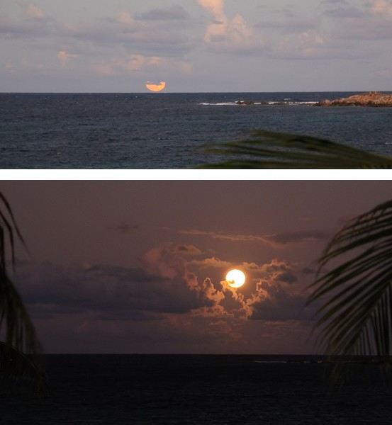
What’s more, its light sparkled on the water’s surface—gorgeous! But so fleeting. We’re on the east coast of the island, by the wide stretch of light sand at Baie Orientale, Saint-Martin’s own. Now, just because I wanted to start with something a little different doesn’t mean we should overlook the bright sunrises you can see on this bay. They’re far more common than a beautiful full moonrise, but they also require two things: being an early riser and a clear horizon without misty clouds. Views to soak in without restraint...
Other memories of beautiful lights and lovely colors—a morning when the sun had a brief meet-up with the rain, creating a stunning rainbow.
And let’s talk about the moon again... On a clear night, a "blood moon," the result of a lunar eclipse that had turned our familiar satellite red.
-- --
A butterfly with golden wings! In the tropics, swarms of butterflies flutter everywhere, from flower to flower. They sip the sweet nectar from stamens and blooming corollas with delight.
Here, a monarch, one of the great migratory butterflies, taking its time to enjoy the pollen of this Ixora coccinea—or Japanese hydrangea, but let’s stick to Saint-Martin.
This one is an *Agraulis vanillae*, to be precise—and thanks to the internet for the ID. Photographing them isn’t always easy; these fearless butterflies often fly off before you can get a good focus, challenging both the framing eye and the autofocus! But on the island, I noticed some butterflies were much easier to shoot—those decorating a few murals. ;)
One of the graffiti artists behind several Saint-Martin murals has made it his signature. The talented Jimmy Sheik slips a little butterfly into each of his works, even if it’s not the main subject. It’s a nod to his home island, Guadeloupe, whose territory—with Basse-Terre and Grande-Terre—looks uncannily like a giant butterfly. In the photo above, a great initiative: turning this beach bungalow, abandoned after Hurricane Irma’s (2017) devastation, into a mural canvas—it’s a real success. Well done, artist!
To be continued >>>>>>
Hello everyone!
I’m planning an 18-day trip to Bali between June 12th and 30th. I’ve been to Bali twice before, in 1981 and 1982, but I know it’s changed a lot since then. I have a rough itinerary in mind but I’m open to tweaking it based on any advice I can get:
- Arriving the evening of June 12th, 2 nights in Sanur. Not because I’m particularly attached to Sanur, but just to rest a bit before heading further; - 3 nights in Lovina; - 3 nights in Ubud; - 2 nights in Kintamani (I remember being blown away by the view of the giant caldera!); - 2 nights in Besakih; - 1 night in Sidemen; - 3 nights in Candi Dasa; - 2 nights back in Ubud to wrap up, in case we’ve made any purchases or have shopping plans. By shopping, I mean handicrafts (fabrics, batik, etc.), and I think Ubud is the perfect place for that.
I’m a bit unsure about public transport, especially for getting from Kintamani down to Candi Dasa via Besakih and Sidemen.
We’re traveling as a couple—I forgot to mention that! We’re seasoned travelers and used to packing light. Also, I speak pretty good Bahasa Indonesia, having lived in Indonesia a long time ago!
What do the ‘experts’ think?
I’m planning an 18-day trip to Bali between June 12th and 30th. I’ve been to Bali twice before, in 1981 and 1982, but I know it’s changed a lot since then. I have a rough itinerary in mind but I’m open to tweaking it based on any advice I can get:
- Arriving the evening of June 12th, 2 nights in Sanur. Not because I’m particularly attached to Sanur, but just to rest a bit before heading further; - 3 nights in Lovina; - 3 nights in Ubud; - 2 nights in Kintamani (I remember being blown away by the view of the giant caldera!); - 2 nights in Besakih; - 1 night in Sidemen; - 3 nights in Candi Dasa; - 2 nights back in Ubud to wrap up, in case we’ve made any purchases or have shopping plans. By shopping, I mean handicrafts (fabrics, batik, etc.), and I think Ubud is the perfect place for that.
I’m a bit unsure about public transport, especially for getting from Kintamani down to Candi Dasa via Besakih and Sidemen.
We’re traveling as a couple—I forgot to mention that! We’re seasoned travelers and used to packing light. Also, I speak pretty good Bahasa Indonesia, having lived in Indonesia a long time ago!
What do the ‘experts’ think?
😉Hi there,
A few months ago, CFC put the EN VOGUE experience on sale, departing from Dunkirk.
I booked this package to test the boat and onboard services for myself.
I’d read a lot of reviews mentioning numerous issues on board, so I wanted to see for myself what it was really like…
Okay, I’ll stop rambling… The package included boarding at 6 PM on Friday, dinner, a show, an overnight stay, and breakfast. We chose an interior cabin for this experience—since the boat wasn’t leaving the dock, we didn’t see the point in paying more… All in all, it cost 130 € per person. My mom joined us; she got the same cabin for 130 € with no single occupancy supplement.
We’d checked in online to board faster. We took the train to DUNKIRK, then a taxi to the shuttle pavilion—7 € for the ride. When we arrived at the pavilion, we were told to wait because there was a connection issue with check-in. Great start… After about ten minutes, we were finally allowed to proceed. At the counter, they said they didn’t have our cabin cards and no record of our check-in… Very odd. With no solution, they put us on the bus and said we’d sort it out at reception. Perfect. We went through security, and they confiscated our water bottles—never seen that before! Then they said my mom had a corkscrew in her bag, so they searched it… but there was no corkscrew. Total amateur hour… They eventually dropped it.
We got on the bus for a ten-minute ride… We boarded the ship with a crew member and headed to reception. Turns out, we weren’t the only ones in this situation. The nightmare began… Only two staff members were handling all the issues, and everything seemed complicated. They told my mom her cabin had been given to someone else 😲. That was the last straw…
It took forever—they had to redo the entire check-in. Finally, they told my mom her cabin was good to go; they’d mixed her up with someone else… After a solid half-hour, we could finally head to our cabin.
I’m determined to test everything: the pool, jacuzzi, show, restaurant, spa, etc… TO BE CONTINUED
Okay, I’ll stop rambling… The package included boarding at 6 PM on Friday, dinner, a show, an overnight stay, and breakfast. We chose an interior cabin for this experience—since the boat wasn’t leaving the dock, we didn’t see the point in paying more… All in all, it cost 130 € per person. My mom joined us; she got the same cabin for 130 € with no single occupancy supplement.
We’d checked in online to board faster. We took the train to DUNKIRK, then a taxi to the shuttle pavilion—7 € for the ride. When we arrived at the pavilion, we were told to wait because there was a connection issue with check-in. Great start… After about ten minutes, we were finally allowed to proceed. At the counter, they said they didn’t have our cabin cards and no record of our check-in… Very odd. With no solution, they put us on the bus and said we’d sort it out at reception. Perfect. We went through security, and they confiscated our water bottles—never seen that before! Then they said my mom had a corkscrew in her bag, so they searched it… but there was no corkscrew. Total amateur hour… They eventually dropped it.
We got on the bus for a ten-minute ride… We boarded the ship with a crew member and headed to reception. Turns out, we weren’t the only ones in this situation. The nightmare began… Only two staff members were handling all the issues, and everything seemed complicated. They told my mom her cabin had been given to someone else 😲. That was the last straw…
It took forever—they had to redo the entire check-in. Finally, they told my mom her cabin was good to go; they’d mixed her up with someone else… After a solid half-hour, we could finally head to our cabin.
I’m determined to test everything: the pool, jacuzzi, show, restaurant, spa, etc… TO BE CONTINUED
We arrive in the evening in Marrakesh, and a taxi arranged by our friendly Riad is waiting for us. The driver takes us to the door, where we’re briefly greeted by our hosts. The room is heated—phew—because it’s really cold on this January 17th for our arrival. Riad Alisma, where we’re staying for 2 nights. The next morning, it’s pouring rain when we wake up, but after a good breakfast, the rain has calmed down. Off we go to the medersa, which allows for a relatively sheltered visit. We’d visited this palace 15 years ago—it’s been renovated since then.
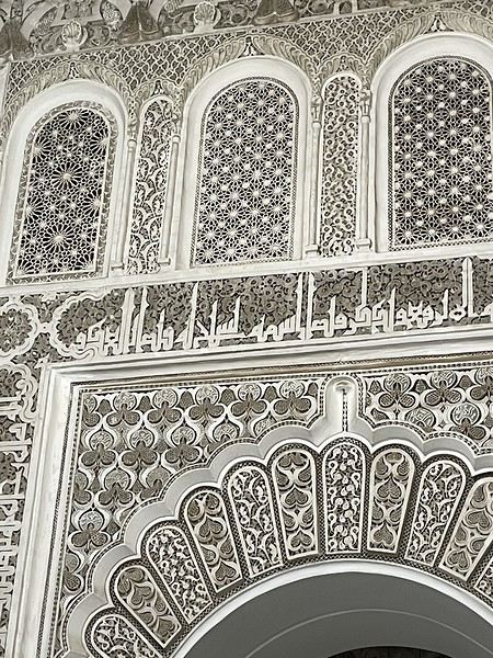
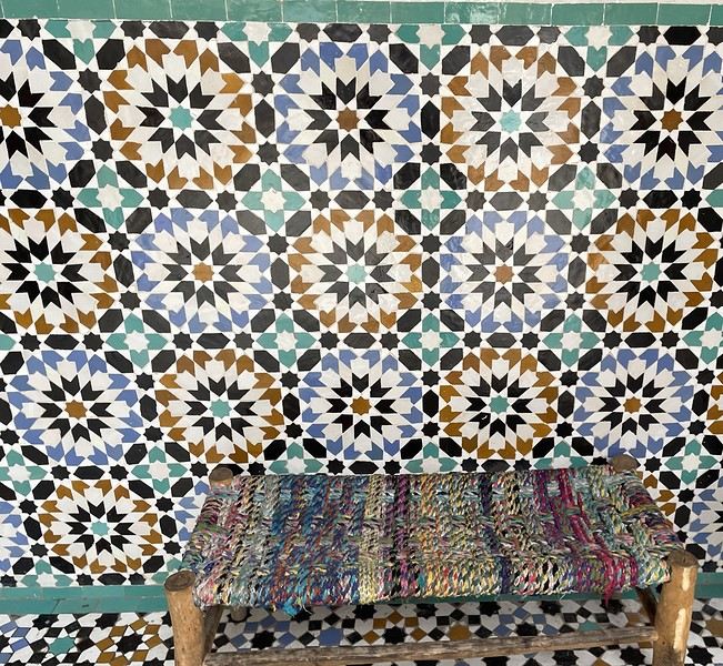
From there, without the rain, we wander aimlessly and eventually end up near the tanneries, but it’s Sunday, and there’s very little activity. Of course, we get hassled by a tout.
Here, the hides after being treated with lime—I love the colors.
We part ways a bit annoyed. He gets a little revenge by giving us bad directions, and we end up outside the city walls. We decide to take a taxi to the new modern art museum—60 dirhams for the 5 km, which is nothing when you think about it. That tout, who we didn’t ask for anything and made it clear we weren’t buying anything, dragged us into a shop supposedly only open that day and demanded 50 dirhams for his "services"! Let’s forget that bad moment and enjoy the exhibition at the MACAL.
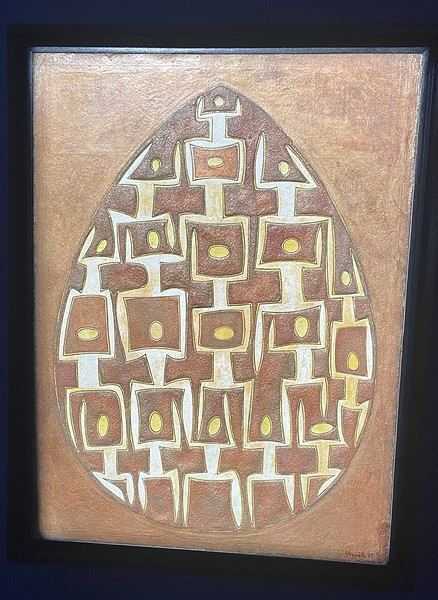
The taxi on the way back drops us off at Place des Ferblantiers, not far from our Riad. We’re a little peckish—it’s worth mentioning that at lunchtime, we only ate a plate of beans from a street vendor. So, we buy a bunch of little sweets, each more delicious than the last, at Ajar. We snack while sipping mint tea and watching life go by around us. A final visit to the Museum of Moroccan Cuisine on our way back helps us dodge a few more showers. Then it’s back to the Riad. The atmosphere in the city is heating up—it’s the AFCON final tonight. The temperatures, though? Not so much. We ordered a meal at the Riad, and it was a good call—not only was it really tasty, but the rain also picked up again. Our day in Marrakesh ends under the covers with a good book and some photo sorting. Still, we managed 10,750 steps. View of our Riad
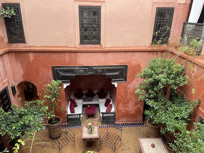
Tomorrow, we’ll pick up our rental car from Medloc and head to Essaouira.
From there, without the rain, we wander aimlessly and eventually end up near the tanneries, but it’s Sunday, and there’s very little activity. Of course, we get hassled by a tout.
Here, the hides after being treated with lime—I love the colors.
We part ways a bit annoyed. He gets a little revenge by giving us bad directions, and we end up outside the city walls. We decide to take a taxi to the new modern art museum—60 dirhams for the 5 km, which is nothing when you think about it. That tout, who we didn’t ask for anything and made it clear we weren’t buying anything, dragged us into a shop supposedly only open that day and demanded 50 dirhams for his "services"! Let’s forget that bad moment and enjoy the exhibition at the MACAL.
The taxi on the way back drops us off at Place des Ferblantiers, not far from our Riad. We’re a little peckish—it’s worth mentioning that at lunchtime, we only ate a plate of beans from a street vendor. So, we buy a bunch of little sweets, each more delicious than the last, at Ajar. We snack while sipping mint tea and watching life go by around us. A final visit to the Museum of Moroccan Cuisine on our way back helps us dodge a few more showers. Then it’s back to the Riad. The atmosphere in the city is heating up—it’s the AFCON final tonight. The temperatures, though? Not so much. We ordered a meal at the Riad, and it was a good call—not only was it really tasty, but the rain also picked up again. Our day in Marrakesh ends under the covers with a good book and some photo sorting. Still, we managed 10,750 steps. View of our Riad
Tomorrow, we’ll pick up our rental car from Medloc and head to Essaouira.