After five trips to the American West, we had planned to switch countries and continents to visit Turkey. However, by the time we made up our minds, flight ticket prices had nearly doubled, reaching 400 € for a round-trip ticket. A bit disappointed, I started looking at transatlantic flight prices and stumbled upon discounted tickets from Basel-Mulhouse to Dallas—at the same price as our tickets to Turkey!
No hesitation needed; we bought the five tickets for a total of 1,860 € excluding baggage!
From Fort Worth Airport, we had two options:
- Head west on a loop through Texas, New Mexico, and southern Colorado
- Head east to change the scenery and explore East Texas, Louisiana, with a possible detour into Florida.
The latter option won unanimously, so here we are, off to discover new states, mainly Louisiana and Texas.
One of the main post-COVID challenges is finding a reasonably priced car rental. After an initial booking around 1,300 €, we kept an eye on prices a few weeks before departure and managed to snag a better deal at around 900 € for a comfortable sedan.
Yes, this summer will also be a first: no 4x4, no camping, and plenty of restaurants!
As always, I’ve planned a packed itinerary, ready to adjust on the go. A few weeks before departure, we learned we’d be at full capacity—our eldest son, Maxime, got his first-year med school results. By finishing as a top admit, he avoided the mandatory July-August internship that would’ve kept him from joining us. Instead, he wrapped up his internship at the last minute the night before our big departure.
We’ll get to savor these special moments together.
The itinerary:
Day 1 - 07/15: Fort Worth
Day 2: Dallas
Day 3: Jefferson - Caddo Lake
Day 4: Black Bayou Lake - Natchez - Stanton Hall and Rosalie Mansion
Day 5: St. Francisville - Rosedown Plantation - Cat Island Wildlife Refuge
Day 6: Mobile - USS Alabama Battleship Memorial Park
Day 7 - 8: Pensacola Beach
Day 9: Bellingrath Gardens - New Orleans
Day 10 - 11: New Orleans
Day 12: Plantation Route
Day 13: Jungle Gardens - Tabasco Factory - Vermilionville - Lake Martin
Day 14: Baton Rouge - USS Kidd
Day 15: Houma - Cajun Man's Swamp Tour
Day 16: Galveston, Texas
Day 17: Space Center Houston - Painted Churches
Day 18: San Antonio
Day 19: Texas Hill Country
Day 20: Texas Hill Country and evening in San Antonio
Day 21: Austin and Waco
Day 0 - 07/14: The departure timing isn’t exactly relaxing. On Thursday late afternoon, we hit the road to Alsace, aiming to drop off our two cockers with family before reaching the airport at 2 AM for a 3-hour power nap.
Not exactly fresh, we arrive at the terminal looking for a British Airways counter. None in sight, so we try our luck at a United Airlines counter—who knows, maybe it’ll work out. And bingo! The agent checks us in. We didn’t quite understand why, but maybe there’s some agreement between airlines. For the first time, we’re traveling without checked baggage, so no extra fees. Not a huge feat, given the scorching temperatures awaiting us!
The connecting flight to London goes smoothly.
During the layover, liquid checks get stricter—now requiring small bottles to be in a pre-approved clear bag, with only one bag allowed per passenger. Normally, no big deal, but between deodorant, sunscreen, after-sun lotion, hand sanitizer, contact lens solution, etc., we spend 20 minutes optimizing the arrangement! When we finally succeed, one of the security staff bursts out laughing and congratulates us!
With our stomachs growling, we grab an American breakfast before browsing the airport shops.
We then discover our plane for the long-haul flight and are thrilled to see it’s an A380—a first for Laetitia, though the rest of the family experienced it during our winter getaway. Still just as impressive!
With a hint of uncertainty, we take off for the States—my third trip in barely 12 months. This time, no endless badlands, canyons, slot canyons, hoodoos, or brain rocks, but a journey through five states (Texas, Louisiana, a quick stop in Mississippi, Alabama, and the northwest tip of Florida), where we hope to soak up a unique vibe... with a packed schedule of diverse visits.
Arrival at Fort Worth Airport and customs go smoothly. Since we have no checked baggage, we’re first in line at the Dollar counter. In just 3 minutes, the formalities are done. We decline the Toll Pass, which I don’t think we’ll need based on my "calculations," and head to the Dollar parking lot, where an employee tells us we can pick any car we want!
There are about thirty cars waiting. Too many choices!
After last year’s mishap in Oakland, where our 4x4’s trunk was broken into, we’re looking for a sedan to hide our luggage this time. Unfortunately, there are none—only SUVs. We finally settle on a comfortable 7-seater Ford SUV with a massive trunk when set up for five.
On the road from Fort Worth to Dallas, we accidentally take a toll highway without realizing until it’s too late to exit. Let’s hope Dollar doesn’t charge us a week’s worth of their pricey Toll Pass for a $2 toll. We’ll see... In the meantime, Maxime sets up Google Maps to avoid toll roads.
Since it’s not too late, we stop by the nearest Walmart for groceries before checking into our hotel room for three nights in East Dallas suburb.
10 similar discussions in English
Here we go...
It’s been almost a month since we got back, and my head is still over there... Just like every time... For my own sake, I know travel journals are useful for travelers planning a trip to a country. But selfishly, they’re also helpful for me—to put the final stone on each journey and revisit it from time to time, just for the memories...
So, this trip won’t be any different, and I invite you to follow along on our Andean adventure, from Lima to the Southern Lipez, from December 16, 2016, to January 14, 2017. It’s a chronological journal because I don’t know how to approach it any other way. It doesn’t hold any absolute truths—just my experiences and feelings, which are obviously personal and not objective!
But if it inspires you to visit these magical countries (and I assume you’re already interested if you’re here) or gives you a couple of tips, then I’ll consider it a win!
So, let’s hit the road for the land of wide-open spaces!
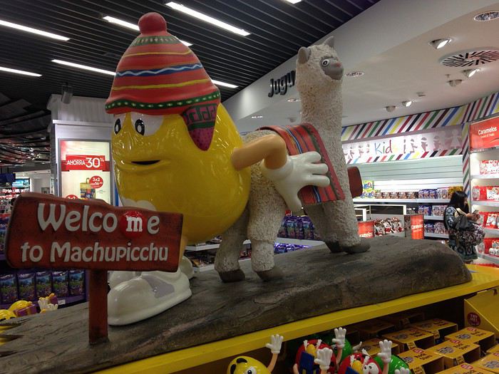
It’s been almost a month since we got back, and my head is still over there... Just like every time... For my own sake, I know travel journals are useful for travelers planning a trip to a country. But selfishly, they’re also helpful for me—to put the final stone on each journey and revisit it from time to time, just for the memories...
So, this trip won’t be any different, and I invite you to follow along on our Andean adventure, from Lima to the Southern Lipez, from December 16, 2016, to January 14, 2017. It’s a chronological journal because I don’t know how to approach it any other way. It doesn’t hold any absolute truths—just my experiences and feelings, which are obviously personal and not objective!
But if it inspires you to visit these magical countries (and I assume you’re already interested if you’re here) or gives you a couple of tips, then I’ll consider it a win!
So, let’s hit the road for the land of wide-open spaces!
Hi everyone,
I’m planning a 3-week solo trip to South Korea in April/May 2025. Here’s my current wishlist on the map—I need to check how realistic it is.
Questions: The DMZ: I haven’t planned to go, and I’m struggling to see the appeal. What do you think? Jeju: I’m on the fence about Jeju. It seems like the *place to be*, but I’m not sure what makes it so charming or what’s really a must-do there?
On my map, I’m hesitating about Hahoe. I’m definitely going to Jeonju because there are several sites in that area. For Hahoe, I’m unsure because I’d need to stop overnight and arrange transfers between Andong and Hahoe. Is Hahoe the same as Jeonju? (Hanok village)—if so, I’ll skip Hahoe.
Last question: In the south, there are lots of sites that interest me, but I’m wondering about transportation. Can I stay in one place for several days and do day trips to each site? Is that possible with buses?
Anyway, thanks in advance for your tips! Sabrina
Good evening everyone! 🙂
We’re back from our September 2025 road trip, this time to explore Arizona and New Mexico, and it’s time for me to start my travel journal—especially since everything’s already booked for another trip in September 2026 (to California), and I need to get started on the planning.
I was a little worried this new visit to Uncle Sam’s country might not be as "wow" as the others, but we still discovered some incredible places.
For those who don’t know us, we’re a couple in our seventies who speak very little English, but that didn’t stop us from fully enjoying our stay.
For this 6th road trip in the U.S., we spent 21 nights there, drove 4,160 km by car, and walked nearly 160 km in a loop starting from Phoenix.
We’d been to Arizona before (but not this side) and never to New Mexico. This whole road trip was a huge discovery for us.
In the prices mentioned (some in euros, others in dollars), bank fees and exchange charges are included. The flights, car rental, and parking were all paid for in December 2024 when we booked.
We’d downloaded the MPC (Mobile Passport Control) app, but there wasn’t a dedicated line at Phoenix Airport. Still, we got through quickly with friendly, smiling agents.
I don’t drive at all (I hate it), so the stops were chosen based on activities but also, for some, to limit daily mileage for the sole driver. The kilometers listed in the itinerary are the daily distances.
We traveled from September 9th to 22nd, unfortunately once again without our dear friends Mimi and Maumau.
The itinerary
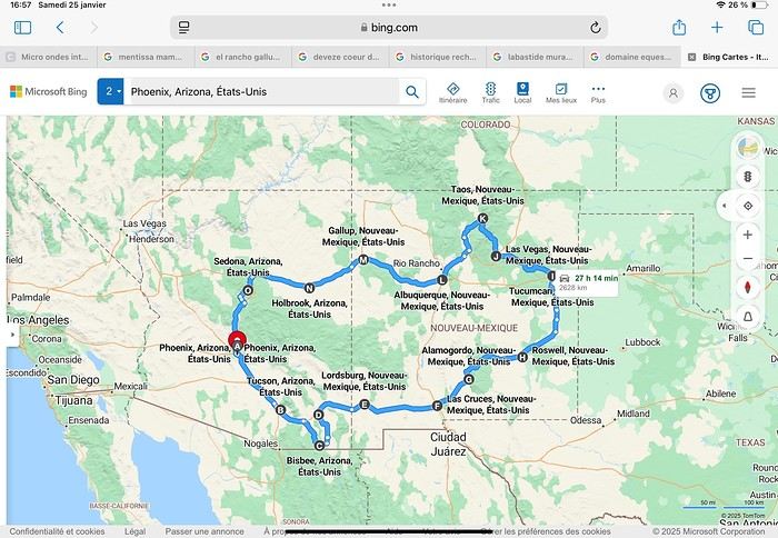
Day 1: Flight Marseille-Paris-Phoenix, then Gold Canyon (133 km) Day 2: Tucson (271 km) Lost Dutchman State Park Day 3: Tucson (155 km) Day 4: Tucson (34 km) Day 5: Bisbee (182 km) Day 6: Lordsburg (345 km) Day 7: Las Cruces (253 km) Day 8: Alamogordo (162 km) Day 9: Roswell (264 km) Day 10: Tucumcari (369 km) Day 11: Las Vegas (281 km) – the one in New Mexico Day 12: Taos (213 km) Day 13: Santa Fe (224 km) Day 14: Albuquerque (123 km) Day 15: Gallup (246 km) Day 16: Holbrook (224 km) Day 17: Flagstaff (179 km) Day 18: Sedona (118 km) Day 19: Sedona (48 km) Day 20: Sedona (41 km) Day 21: Phoenix (256 km) Day 22: Phoenix Airport (35 km)
📊 **Budget**: A little over 7,500 € for both of us, all included. The exchange rate was in our favor (1.17 dollars to 1 €). 📊 **Flights**: Marseille-Paris Charles de Gaulle-Phoenix: 1,787 € for two, with one checked bag each (Air France) 📊 **ESTA**: $42 📊 **America the Beautiful Pass**: $80 📊 **Parking**: 134 € (super eco at Marseille) 📊 **Car rental (Hertz)**: 865 €. Since there were no SUVs left in the reserved category (Nissan Rogue), we got an upgrade (4x4 Ford Explorer). We booked through Air France (15% discount). We’d originally reserved it in December for 1,140 €, but since prices dropped in March, we canceled and rebooked for 865 €. Hertz offers a free Hertz Gold Plus Rewards program, which gives you priority counter service when picking up the car. 📊 **Accommodation**: 2,400 € We stayed in hotels and motels of varying standards (from 60 to 203 € per night, depending on the city), all booked through Booking.com or Hotels.com. Out of 21 nights, only two didn’t include breakfast in the price. Booking.com sometimes offers slightly cheaper rates if you book by phone using the mobile app, and our Genius 3 status on the site also got us some preferential rates. 📊 **Supplementary insurance**: AVA 200 € for medical care if needed 📊 **Cash**: $2,078. We left with 1,000 € exchanged before departure and made two withdrawals of $500. This cash covered: - Evening restaurants and tips - Midday picnics - Gas: $298 for 4,160 km - Museum and private park entries (per person): - Lost Dutchman: $10 - Arizona-Sonora Desert Museum: $28 - Bird Cage Theater: $16 - Tombstone Shootout: $8 - New Mexico Farm & Ranch Museum: $12 - Roswell International UFO Museum: $5 - Billy the Kid Museum: $7 - Rancho de Taos: $22 - West Fork Oak Creek Trail entry: $15 We got a few discounts thanks to our senior age (+65). - Souvenirs and little treats
Like on our previous road trips, we didn’t rent a GPS. We got around using offline GPS apps Here WeGo and Organic Maps, with maps of the states we visited downloaded before we left (on our phones).
❤️❤️❤️ **Highlights** (there are so many!) 📍 Goldfield Ghost Town (even if it’s a reconstruction) 📍 The standing army of Saguaro cacti at Saguaro National Park West 📍 Diving into the cowboy universe of Tombstone 📍 The welcome from Rick and Henry at our guesthouse in Bisbee (Garden at Mile High Ranch) 📍 The tangled rocks of Chiricahua National Monument 📍 The flavored pistachios from Dwayne’s Fresh Jerky and Mac Ginnis Pistachioland 📍 Restaurants: La Posta (Las Cruces), Diner 66 (Albuquerque), and the Haunted Hamburger (Jerome) 📍 The old plazas of New Mexico 📍 The solitude and beauty of the white dunes at White Sands National Park 📍 Stepping back in time at the Billy the Kid Museum (Fort Stanton) 📍 Sections of historic Route 66 and the old motels of Tucumcari, especially at night when all the neon lights are on 📍 Taos Pueblo and diving into Native American culture 📍 After the Rio Grande Bridge, the descent via NM 567 to the very bottom of the Rio Grande Gorge, then the road along the riverbanks to Taos 📍 The tranquility of the Chimayo Sanctuary 📍 Discovering the ingenious native dwellings at Bandelier National Monument and Walnut Canyon National Park 📍 The small towns along the Turquoise Trail 📍 The red rocks of Red Rock Park and the Painted Desert 📍 The extraordinary colors of the petrified trees at Petrified Forest National Park 📍 Sedona, its red rocks, and the reward of the viewpoints at the end of hikes (Devil’s Bridge, The Subway, and West Fork Oak Creek) 📍 The immersion in Mexico when visiting Tlaquepaque 📍 The almost-ghost town of Jerome and its terraced streets 📍 The incredible kindness of Americans, always ready to help and up for a chat ❤️
☹️☹️☹️ **Flops** (there are very few) 📍 Several museums and churches being closed, so we couldn’t visit them 📍 Some museums and visitor centers opening late (10 AM) and closing early (4 PM) 📍 A 64 € phone roaming charge because we got near the Mexican border and picked up their cell tower 📍 The outrageous price ($5.99) for a gallon of gas at the Shell near Phoenix Airport
I hope this helps! Anyway, thanks for reading my long post. Don’t hesitate to reach out, even via PM, if you see I haven’t replied and you’d like more details. Have a great evening, everyone! 🙂
We’re back from our September 2025 road trip, this time to explore Arizona and New Mexico, and it’s time for me to start my travel journal—especially since everything’s already booked for another trip in September 2026 (to California), and I need to get started on the planning.
I was a little worried this new visit to Uncle Sam’s country might not be as "wow" as the others, but we still discovered some incredible places.
For those who don’t know us, we’re a couple in our seventies who speak very little English, but that didn’t stop us from fully enjoying our stay.
For this 6th road trip in the U.S., we spent 21 nights there, drove 4,160 km by car, and walked nearly 160 km in a loop starting from Phoenix.
We’d been to Arizona before (but not this side) and never to New Mexico. This whole road trip was a huge discovery for us.
In the prices mentioned (some in euros, others in dollars), bank fees and exchange charges are included. The flights, car rental, and parking were all paid for in December 2024 when we booked.
We’d downloaded the MPC (Mobile Passport Control) app, but there wasn’t a dedicated line at Phoenix Airport. Still, we got through quickly with friendly, smiling agents.
I don’t drive at all (I hate it), so the stops were chosen based on activities but also, for some, to limit daily mileage for the sole driver. The kilometers listed in the itinerary are the daily distances.
We traveled from September 9th to 22nd, unfortunately once again without our dear friends Mimi and Maumau.
The itinerary
Day 1: Flight Marseille-Paris-Phoenix, then Gold Canyon (133 km) Day 2: Tucson (271 km) Lost Dutchman State Park Day 3: Tucson (155 km) Day 4: Tucson (34 km) Day 5: Bisbee (182 km) Day 6: Lordsburg (345 km) Day 7: Las Cruces (253 km) Day 8: Alamogordo (162 km) Day 9: Roswell (264 km) Day 10: Tucumcari (369 km) Day 11: Las Vegas (281 km) – the one in New Mexico Day 12: Taos (213 km) Day 13: Santa Fe (224 km) Day 14: Albuquerque (123 km) Day 15: Gallup (246 km) Day 16: Holbrook (224 km) Day 17: Flagstaff (179 km) Day 18: Sedona (118 km) Day 19: Sedona (48 km) Day 20: Sedona (41 km) Day 21: Phoenix (256 km) Day 22: Phoenix Airport (35 km)
📊 **Budget**: A little over 7,500 € for both of us, all included. The exchange rate was in our favor (1.17 dollars to 1 €). 📊 **Flights**: Marseille-Paris Charles de Gaulle-Phoenix: 1,787 € for two, with one checked bag each (Air France) 📊 **ESTA**: $42 📊 **America the Beautiful Pass**: $80 📊 **Parking**: 134 € (super eco at Marseille) 📊 **Car rental (Hertz)**: 865 €. Since there were no SUVs left in the reserved category (Nissan Rogue), we got an upgrade (4x4 Ford Explorer). We booked through Air France (15% discount). We’d originally reserved it in December for 1,140 €, but since prices dropped in March, we canceled and rebooked for 865 €. Hertz offers a free Hertz Gold Plus Rewards program, which gives you priority counter service when picking up the car. 📊 **Accommodation**: 2,400 € We stayed in hotels and motels of varying standards (from 60 to 203 € per night, depending on the city), all booked through Booking.com or Hotels.com. Out of 21 nights, only two didn’t include breakfast in the price. Booking.com sometimes offers slightly cheaper rates if you book by phone using the mobile app, and our Genius 3 status on the site also got us some preferential rates. 📊 **Supplementary insurance**: AVA 200 € for medical care if needed 📊 **Cash**: $2,078. We left with 1,000 € exchanged before departure and made two withdrawals of $500. This cash covered: - Evening restaurants and tips - Midday picnics - Gas: $298 for 4,160 km - Museum and private park entries (per person): - Lost Dutchman: $10 - Arizona-Sonora Desert Museum: $28 - Bird Cage Theater: $16 - Tombstone Shootout: $8 - New Mexico Farm & Ranch Museum: $12 - Roswell International UFO Museum: $5 - Billy the Kid Museum: $7 - Rancho de Taos: $22 - West Fork Oak Creek Trail entry: $15 We got a few discounts thanks to our senior age (+65). - Souvenirs and little treats
Like on our previous road trips, we didn’t rent a GPS. We got around using offline GPS apps Here WeGo and Organic Maps, with maps of the states we visited downloaded before we left (on our phones).
❤️❤️❤️ **Highlights** (there are so many!) 📍 Goldfield Ghost Town (even if it’s a reconstruction) 📍 The standing army of Saguaro cacti at Saguaro National Park West 📍 Diving into the cowboy universe of Tombstone 📍 The welcome from Rick and Henry at our guesthouse in Bisbee (Garden at Mile High Ranch) 📍 The tangled rocks of Chiricahua National Monument 📍 The flavored pistachios from Dwayne’s Fresh Jerky and Mac Ginnis Pistachioland 📍 Restaurants: La Posta (Las Cruces), Diner 66 (Albuquerque), and the Haunted Hamburger (Jerome) 📍 The old plazas of New Mexico 📍 The solitude and beauty of the white dunes at White Sands National Park 📍 Stepping back in time at the Billy the Kid Museum (Fort Stanton) 📍 Sections of historic Route 66 and the old motels of Tucumcari, especially at night when all the neon lights are on 📍 Taos Pueblo and diving into Native American culture 📍 After the Rio Grande Bridge, the descent via NM 567 to the very bottom of the Rio Grande Gorge, then the road along the riverbanks to Taos 📍 The tranquility of the Chimayo Sanctuary 📍 Discovering the ingenious native dwellings at Bandelier National Monument and Walnut Canyon National Park 📍 The small towns along the Turquoise Trail 📍 The red rocks of Red Rock Park and the Painted Desert 📍 The extraordinary colors of the petrified trees at Petrified Forest National Park 📍 Sedona, its red rocks, and the reward of the viewpoints at the end of hikes (Devil’s Bridge, The Subway, and West Fork Oak Creek) 📍 The immersion in Mexico when visiting Tlaquepaque 📍 The almost-ghost town of Jerome and its terraced streets 📍 The incredible kindness of Americans, always ready to help and up for a chat ❤️
☹️☹️☹️ **Flops** (there are very few) 📍 Several museums and churches being closed, so we couldn’t visit them 📍 Some museums and visitor centers opening late (10 AM) and closing early (4 PM) 📍 A 64 € phone roaming charge because we got near the Mexican border and picked up their cell tower 📍 The outrageous price ($5.99) for a gallon of gas at the Shell near Phoenix Airport
I hope this helps! Anyway, thanks for reading my long post. Don’t hesitate to reach out, even via PM, if you see I haven’t replied and you’d like more details. Have a great evening, everyone! 🙂
Hey there, community! Back this weekend, below is my travel journal from my adventure in Indonesia. Enjoy the read!!!
Day 1 - August 10, 2025 New life downloading for three weeks! And for that, Flo and I launched a public tender... A public tender? What’s that got to do with a travel journal???... Well, when you think about it, few destinations tick all the boxes for an August adventure: Meaning, finding a place that’s exotic in the middle of August, not too expensive, not too packed with tourists, warm but not *too* warm, with postcard-perfect landscapes, dreamy beaches, tasty cuisine with a hint of exoticism, friendly and welcoming locals, where you’re free to sleep under the stars among the mosquitos, take transport surrounded by chickens, and even eat from a pig trough if you feel like it—well, turns out it’s not that easy to find! I’d even say, given how thick the list of requirements is, there’s a big risk the tender could be declared unsuccessful for failing to meet just one criterion. Let’s just say the candidates better submit a rock-solid proposal!
After reviewing all the responses and presentations from the candidates, the obvious choice for us is... Indonesia! Except that trying to explore a country as vast as Indonesia and its 17,504 islands in less than five years is a bit like reading the summary of a Proust novel without taking the time to savor each of its 950 pages! Don’t worry, I won’t name them all here. Besides, do they even all have names? No! Only 7,870 have been named—their parents clearly ran out of ideas for the rest. Anyway, our society, which worships the "work more to earn more" mantra, unfortunately limits our adventure time. So we’ll only get to see a small part of Indonesia, and we’ll have to make a tough choice to head for the best of the best in this archipelago of over seventeen thousand islands. Each one has its own selling points: Sumatra, Sulawesi, Java, the Celebes, Bali, Borneo, Papua, Timor, the Moluccas... So many names that smell of adventure... Another tender, another list of requirements, another review of proposals... Drumroll... Splash splash... And the lucky winner is... Ta-da... Java, Bali’s big sister, where I’ve already been eight years ago... Java the programming language. The Java of Broadway. We’re gonna *do* the Java. Java the coffee. And yes, Java is also an island!
This island, four times smaller than France, is home to 136 million people, making it the most populated island in the world! Fun fact: Indonesia, with its 260 million inhabitants, is just shy of the podium for the world’s most populated countries, after the winning trio of India, China, and the United States. And it’s on this island of Java that you’ll find Jakarta, the (soon-to-be-former) capital and main airport of the country, where we’ll soon land after our nineteen-hour flight! Yep, nineteen hours! I mean, Indonesia in general—and Java in particular—is a *tad* farther than going on vacation to Grandma Yoyo’s! Not sure where it is? Easy. Grab a map. Plant your finger on the big island at the bottom right—aka Australia for those who struggle with geography—move it up two centimeters, and bam, welcome to Indonesia!
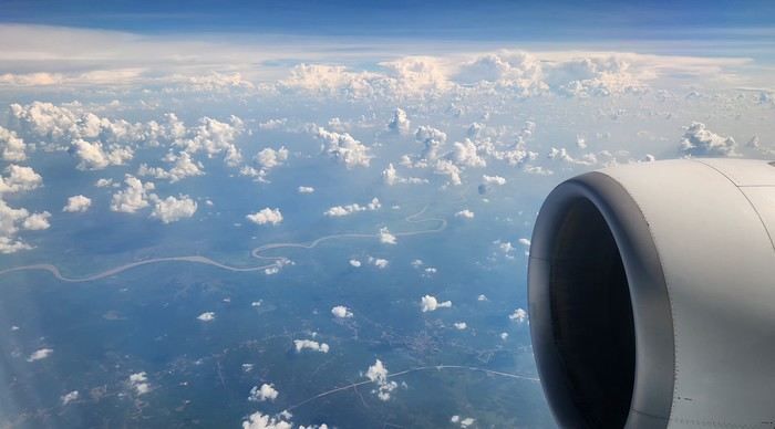
Nice transition, right? Because "Welcome to Indonesia" is exactly what the friendly flight attendant just said to me as we got off the plane! That’s it, our chakras are open, we’ve arrived at our (air)port. Time for rest, pool, cocktails, and a beach with our toes spread out... Wait, if you bought that, you clearly don’t know us yet! Since we still have energy to burn and need to adjust to the flight and time difference, we tackle the long administrative formalities to enter Indonesia, just to earn the right to hop in a 45-minute Grab taxi to the train station. The train station? What train station?... What do you usually do at a train station? Take a train, of course! Off we go for a three-hour train ride to Bandung, where we’ll officially start our adventure tomorrow after our first Indonesian night...
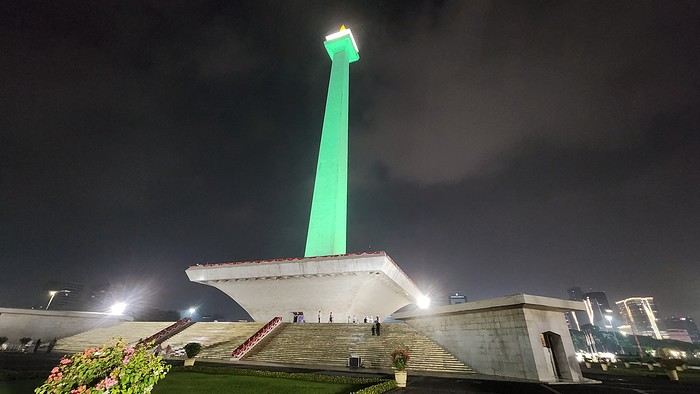
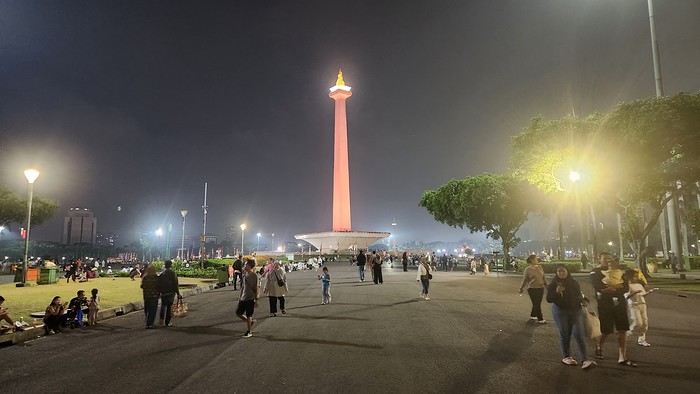
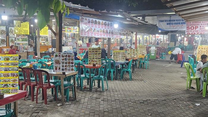
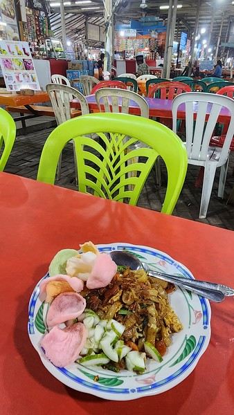
Unfortunately, we were a bit slow off the mark, which meant we missed the 6:25 PM train by two minutes. Oh well, we’ll have to wait until 11 PM. We take the opportunity to stretch our legs in Jakarta, soak up the atmosphere, and enjoy the delicious smells wafting from the *warungs*—those little typical street restaurants. A quick stop at the National Monument, a detour to a night market to devour our first *kwetiaw goreng* and *teh manis* for 60,000 rupiahs (that’s 3 € for two), and just like that, our penalty is lifted, and we’re allowed to hit the road again. Off to Bandung, where we arrive at 2 AM for... a *very* short night...
Day 1 - August 10, 2025 New life downloading for three weeks! And for that, Flo and I launched a public tender... A public tender? What’s that got to do with a travel journal???... Well, when you think about it, few destinations tick all the boxes for an August adventure: Meaning, finding a place that’s exotic in the middle of August, not too expensive, not too packed with tourists, warm but not *too* warm, with postcard-perfect landscapes, dreamy beaches, tasty cuisine with a hint of exoticism, friendly and welcoming locals, where you’re free to sleep under the stars among the mosquitos, take transport surrounded by chickens, and even eat from a pig trough if you feel like it—well, turns out it’s not that easy to find! I’d even say, given how thick the list of requirements is, there’s a big risk the tender could be declared unsuccessful for failing to meet just one criterion. Let’s just say the candidates better submit a rock-solid proposal!
After reviewing all the responses and presentations from the candidates, the obvious choice for us is... Indonesia! Except that trying to explore a country as vast as Indonesia and its 17,504 islands in less than five years is a bit like reading the summary of a Proust novel without taking the time to savor each of its 950 pages! Don’t worry, I won’t name them all here. Besides, do they even all have names? No! Only 7,870 have been named—their parents clearly ran out of ideas for the rest. Anyway, our society, which worships the "work more to earn more" mantra, unfortunately limits our adventure time. So we’ll only get to see a small part of Indonesia, and we’ll have to make a tough choice to head for the best of the best in this archipelago of over seventeen thousand islands. Each one has its own selling points: Sumatra, Sulawesi, Java, the Celebes, Bali, Borneo, Papua, Timor, the Moluccas... So many names that smell of adventure... Another tender, another list of requirements, another review of proposals... Drumroll... Splash splash... And the lucky winner is... Ta-da... Java, Bali’s big sister, where I’ve already been eight years ago... Java the programming language. The Java of Broadway. We’re gonna *do* the Java. Java the coffee. And yes, Java is also an island!
This island, four times smaller than France, is home to 136 million people, making it the most populated island in the world! Fun fact: Indonesia, with its 260 million inhabitants, is just shy of the podium for the world’s most populated countries, after the winning trio of India, China, and the United States. And it’s on this island of Java that you’ll find Jakarta, the (soon-to-be-former) capital and main airport of the country, where we’ll soon land after our nineteen-hour flight! Yep, nineteen hours! I mean, Indonesia in general—and Java in particular—is a *tad* farther than going on vacation to Grandma Yoyo’s! Not sure where it is? Easy. Grab a map. Plant your finger on the big island at the bottom right—aka Australia for those who struggle with geography—move it up two centimeters, and bam, welcome to Indonesia!
Nice transition, right? Because "Welcome to Indonesia" is exactly what the friendly flight attendant just said to me as we got off the plane! That’s it, our chakras are open, we’ve arrived at our (air)port. Time for rest, pool, cocktails, and a beach with our toes spread out... Wait, if you bought that, you clearly don’t know us yet! Since we still have energy to burn and need to adjust to the flight and time difference, we tackle the long administrative formalities to enter Indonesia, just to earn the right to hop in a 45-minute Grab taxi to the train station. The train station? What train station?... What do you usually do at a train station? Take a train, of course! Off we go for a three-hour train ride to Bandung, where we’ll officially start our adventure tomorrow after our first Indonesian night...
Unfortunately, we were a bit slow off the mark, which meant we missed the 6:25 PM train by two minutes. Oh well, we’ll have to wait until 11 PM. We take the opportunity to stretch our legs in Jakarta, soak up the atmosphere, and enjoy the delicious smells wafting from the *warungs*—those little typical street restaurants. A quick stop at the National Monument, a detour to a night market to devour our first *kwetiaw goreng* and *teh manis* for 60,000 rupiahs (that’s 3 € for two), and just like that, our penalty is lifted, and we’re allowed to hit the road again. Off to Bandung, where we arrive at 2 AM for... a *very* short night...
Fellow travelers,
Don’t they say "never two without three"? It seems so. Here I am again on the forum to share—and let’s be honest, indulge a bit of selfish pleasure—by recounting the story of this third installment in the Land of the Rising Sun.
Where? It’s all in the title. On the island of Kyushu in southern Japan, more precisely in the northwest between Fukuoka and Nagasaki. I hope to take you along with me for 19 nights and 18 full days this autumn of 2024. On the itinerary: gastronomy, crafts, festivals, waterfalls, encounters, and leisurely strolls in all simplicity.
A last-minute flight booked just 7 days before departure, and the route evolved regularly based on whims and accommodation availability, eventually settling on this:
- 5 nights in Fukuoka: Fukuoka city, Ukiha, Itoshima, Dazaifu, Yanagawa - 4 nights in Hasami, Nagasaki Prefecture: Okawachiyama, Arita, Takeo, Kashima, Yobuko, Karatsu, Kabeshima - 6 nights in Nagasaki: Ureshino, Higashi-Sonogi, Nagasaki city, Unzen, Sotome - 4 nights in Fukuoka: Karatsu, Fukuoka city
Most of the trip was done by car for practical reasons—easier access to certain places and freedom of movement—but also for the sheer joy of it. Despite slow traffic at times, driving in rural Japan is a delight.
If the program interests you, see you soon for the start of the journey.
Hi everyone,
In this age of zero-commission cards and fee-free accounts, I’m curious why some travelers still prefer to set off with a wallet stuffed with bills and exchange money on the spot.
I get it for those whose income comes from undeclared activities, but what about everyone else?
Between the risk of theft, scams at exchange counters, and fees that often end up being higher, I’m really puzzled.
The last time I traveled with a wad of cash was because I had to pay for accommodation in cash only, the local currency was the dollar (easy to exchange at a very low cost), and I was still paying some fees.
I’m still wondering about my next trip to Argentina because the situation there is very specific, but otherwise?
Is it an allergy to modern payment methods?
A budget so tight that an extra 20 € (the fees some local banks charge for withdrawals) on a 2000 € budget would be impossible to manage?
Thanks for shedding some light on this!
Hi,
I'm about to open an account (payment card) with N26 Black (seems more transparent in its presentation and explanations) or maybe Revolut (but it seems to hide quite a few things).
Has anyone here used either of these two cards (or both) in India?
Thanks for your feedback and experience with this payment method.
After nearly 2 years of waiting (yeah, like many of you, we wanted to hit the road again as soon as we got back to France... but first, we had to fill up the piggy bank!), here we are at last—July, the month we’ve been waiting for!
We’ve got 30 days of exploring new places ahead of us, as well as revisiting some spots we loved back in 2012.
Here’s the plan: - Joshua Tree NP - Las Vegas - Valley of Fire SP - Yant Flat - Zion NP (Angel’s Landing) - Bryce Canyon NP (Fairyland Loop trail) - Devils Garden on the HITTR - Capitol Reef NP - Grand Teton NP - Yellowstone NP: Old Faithful - Yellowstone NP: Norris Geyser Basin and Mammoth Hot Springs - Yellowstone NP: Grand Canyon of the Yellowstone - West Thumb and Grand Teton NP - Flaming Gorge - Colorado NM and Fisher Towers - Moab: Arches - Moab: Canyonlands and Corona Arch - Moab: Canyonlands - Moab: rafting and Dead Horse Point SP - Natural Bridges NM and Valley of the Gods - Monument Valley and Horseshoe Bend - Coyote Buttes South - Grand Canyon NP (North Rim) - Grand Canyon NP (North Rim) and Navajo Bridge - Sedona - From Sedona to Tucson - Arizona-Sonora Desert Museum and Saguaro NP - Tombstone
Practical details:
- I’d read that it was better to book flight tickets directly on an airline’s website rather than through a comparison site. So, I spent months searching for reasonably priced tickets for two adults and two kids from Paris to Las Vegas for the outbound trip and from Tucson to Paris for the return. I mostly checked Air France, KLM, and British Airways, but prices were always around 4600 €. Not finding anything, we eventually went through a comparison site: Ebookers. We bought our tickets in mid-December: Paris/Atlanta with Air France, then Atlanta/Los Angeles with Delta for the outbound trip, and Tucson/Atlanta with Delta, then Atlanta/Paris with Air France for the return. Total cost: 4300 €. The layover on the outbound trip made me a little nervous because it was only 2 hours and 15 minutes. A month later, we got an email from Ebookers saying the layover had been reduced to 1 hour and 40 minutes! And a few months after that, it was down to just 1 hour and 30 minutes... So, we called Air France directly (we didn’t go through Ebookers, and it wasn’t a problem), and they put us on different flights. The new layover was 2 hours and 10 minutes—still not a ton of time, but I felt better than with 1 hour and 30 minutes. And anyway, we figured we’d see how it went!
- For the car, we tried several comparison sites, and in the end, AutoEurope won this year: 808 € for a 30-day rental of a Chevrolet Impala through Thrifty. The second driver was free for the entire trip since we picked up the car in California.
- We didn’t rent a GPS or buy one—we just downloaded Sygic on our two phones and bought the US map. I don’t remember the exact amount, but it cost us around 30 €.
- For hotels, I either booked directly on the sites (Xanterra, Grand Canyon Lodge, etc.) or used Hotels.com (to earn nights through their Welcome Rewards program) or Booking.com (when hotels weren’t available on Hotels.com). I always compared the price on Hotels.com with the hotel’s direct rate, but they were usually the same. So, for the same price, I’d rather earn a night with Welcome Rewards! We’d set a budget of 100 € per night on average, and we stuck to it pretty well—the final average came out to 101.20 € when including everything (nights + taxes + any nightly fees + parking fees + bank fees).
- As for luggage, we didn’t want to overpack! So, we left with one medium suitcase for Calista, one for me, one large suitcase for Hugo and Yannick, and a sports bag with Calista’s booster seat (we could’ve taken it on the plane with us, but I didn’t want to lug it around the airport during the layover). That sports bag came in handy on the way back, too—because, as everyone knows, you always come back with more than you left with! Each of us also had a backpack as a carry-on.
Before wrapping up this intro and getting into the real details, I’d like to thank everyone who contributed to my discussions and helped me improve our itinerary!
Quick intro for those who don’t know us: Yannick (36), Peggy (36), Hugo (11), and Calista (8).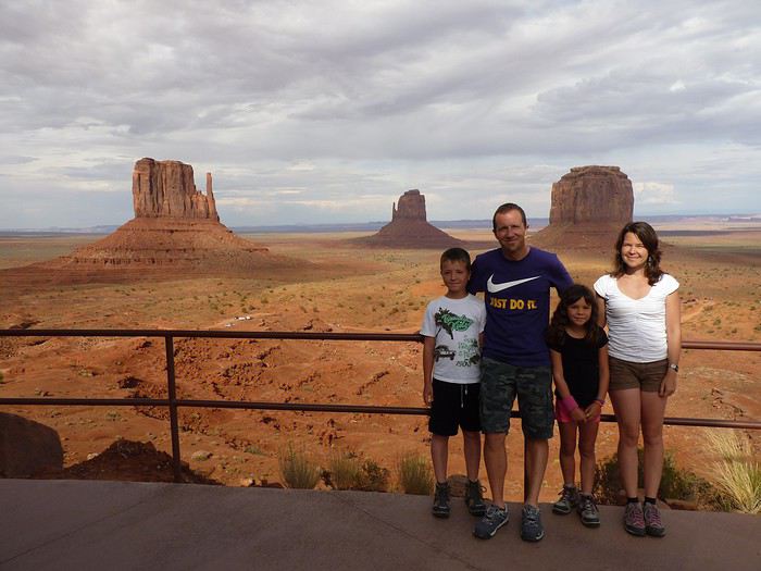
Here’s the plan: - Joshua Tree NP - Las Vegas - Valley of Fire SP - Yant Flat - Zion NP (Angel’s Landing) - Bryce Canyon NP (Fairyland Loop trail) - Devils Garden on the HITTR - Capitol Reef NP - Grand Teton NP - Yellowstone NP: Old Faithful - Yellowstone NP: Norris Geyser Basin and Mammoth Hot Springs - Yellowstone NP: Grand Canyon of the Yellowstone - West Thumb and Grand Teton NP - Flaming Gorge - Colorado NM and Fisher Towers - Moab: Arches - Moab: Canyonlands and Corona Arch - Moab: Canyonlands - Moab: rafting and Dead Horse Point SP - Natural Bridges NM and Valley of the Gods - Monument Valley and Horseshoe Bend - Coyote Buttes South - Grand Canyon NP (North Rim) - Grand Canyon NP (North Rim) and Navajo Bridge - Sedona - From Sedona to Tucson - Arizona-Sonora Desert Museum and Saguaro NP - Tombstone
Practical details:
- I’d read that it was better to book flight tickets directly on an airline’s website rather than through a comparison site. So, I spent months searching for reasonably priced tickets for two adults and two kids from Paris to Las Vegas for the outbound trip and from Tucson to Paris for the return. I mostly checked Air France, KLM, and British Airways, but prices were always around 4600 €. Not finding anything, we eventually went through a comparison site: Ebookers. We bought our tickets in mid-December: Paris/Atlanta with Air France, then Atlanta/Los Angeles with Delta for the outbound trip, and Tucson/Atlanta with Delta, then Atlanta/Paris with Air France for the return. Total cost: 4300 €. The layover on the outbound trip made me a little nervous because it was only 2 hours and 15 minutes. A month later, we got an email from Ebookers saying the layover had been reduced to 1 hour and 40 minutes! And a few months after that, it was down to just 1 hour and 30 minutes... So, we called Air France directly (we didn’t go through Ebookers, and it wasn’t a problem), and they put us on different flights. The new layover was 2 hours and 10 minutes—still not a ton of time, but I felt better than with 1 hour and 30 minutes. And anyway, we figured we’d see how it went!
- For the car, we tried several comparison sites, and in the end, AutoEurope won this year: 808 € for a 30-day rental of a Chevrolet Impala through Thrifty. The second driver was free for the entire trip since we picked up the car in California.
- We didn’t rent a GPS or buy one—we just downloaded Sygic on our two phones and bought the US map. I don’t remember the exact amount, but it cost us around 30 €.
- For hotels, I either booked directly on the sites (Xanterra, Grand Canyon Lodge, etc.) or used Hotels.com (to earn nights through their Welcome Rewards program) or Booking.com (when hotels weren’t available on Hotels.com). I always compared the price on Hotels.com with the hotel’s direct rate, but they were usually the same. So, for the same price, I’d rather earn a night with Welcome Rewards! We’d set a budget of 100 € per night on average, and we stuck to it pretty well—the final average came out to 101.20 € when including everything (nights + taxes + any nightly fees + parking fees + bank fees).
- As for luggage, we didn’t want to overpack! So, we left with one medium suitcase for Calista, one for me, one large suitcase for Hugo and Yannick, and a sports bag with Calista’s booster seat (we could’ve taken it on the plane with us, but I didn’t want to lug it around the airport during the layover). That sports bag came in handy on the way back, too—because, as everyone knows, you always come back with more than you left with! Each of us also had a backpack as a carry-on.
Before wrapping up this intro and getting into the real details, I’d like to thank everyone who contributed to my discussions and helped me improve our itinerary!
Quick intro for those who don’t know us: Yannick (36), Peggy (36), Hugo (11), and Calista (8).
Why bike (MTB) along the canal between the Two Seas: the lateral canal of the Garonne from Bordeaux to Toulouse, and the Midi Canal from Toulouse to the Mediterranean?
This canal was created to connect the Mediterranean to the Atlantic without going around Spain, and along its entire length, there’s an old towpath (used to pull barges). Since this path is closed to traffic (except for service vehicles from Voies Navigables de France), no cars drive on it—it’s dangerous, noisy, and polluting. The Canal between the Two Seas was built for transporting goods, so it passes through many towns you can explore without dealing with traffic. You can stock up on supplies or spend the night. You’ll discover the varied landscapes of the countryside, always in the serenity brought by the calm and slow flow of the canal’s water. Most of the time, you’ll be in the shade of trees planted to stabilize the banks with their roots. All you have to do is follow this blue—or rather green—ribbon without needing to consult a map. But the biggest advantage is that it’s flat! Of course, on the Canal du Midi, water flows from the watershed divide at Naurouze eastward to the Mediterranean and westward to Toulouse. On the lateral canal of the Garonne, water flows toward Bordeaux. But this slope is almost imperceptible, which is a huge plus when you want to travel by bike for several days with luggage.
When I say "bike," I really mean MTB because, while the towpath has been replaced in some places by a paved bike path, it mostly resembles a dirt trail—sometimes smooth, sometimes rocky, and often cluttered with roots from the magnificent trees lining it. Since the canal was classified as a UNESCO World Heritage site, improvements have been underway, but it won’t be tomorrow that you’ll be able to ride from Bordeaux to Sète on a road bike. And I’m afraid the first sections of the path will be worn out before the rest is finished. You might even run into construction work for this bike path. That’s what happened to me during the spring of 2007.
Sunday, 03/11 – Valence d'Agen 08:15 to Toulouse (Rangueil) 16:30 97 km in 8h15 (6h on the bike) I started on the recently paved path along the lateral canal of the Garonne. The first locks appeared, and as I approached Moissac, the path turned into a billiard table until Castelsarrasin. After the Cousteau port, I was back on the classic dirt towpath with its rocks, roots, and nutria holes. But not for long—soon, I hit ruts left by backhoes and bulldozers, which, fortunately, were resting for the Sunday. A pile of rubble taller than me blocked the entire width of the path. I didn’t want to turn back to find the previous bridge and ride on the other bank, which was just as impassable (dense grass). It wasn’t easy to carry a bike with full panniers, so I lifted it over several mounds. I kept going, sometimes on foot, unsure how far the construction extended. Another bulldozer—luckily, the ground was dry. The work went all the way to Montech, making the path impassable. I recommend taking the N113, which runs parallel (that’s what I did on the way back). In Montech, the famous water slope was at rest, waiting for tourists. For many kilometers, I was back on the traditional towpath. The closer I got to Toulouse, the better the surface became, and the more cyclists and pedestrians I saw—until the city center, where there was nonstop bike traffic, especially students heading to Rangueil.
Monday, 03/12 – Rangueil 09:10 to Revel 16:30 86 km in 7h20 (5h30 on the bike) As soon as you reach Toulouse, you make a 90° turn to follow the connection between the lateral canal and the Canal du Midi. Heading east, you pass the barge selling the famous Toulouse violet souvenirs. A real bike path has been built for 50 km to Port Lauragais. It’s a true joy for Toulousains and travelers. Restrooms have been installed or shared with highway rest areas, allowing you to refill water (of course, bikes are banned from ASF rest areas, but cleverly placed racks let you secure your bike and walk in). At Port Lauragais, it’s another rest area shared by highway users, cyclists, and boaters. You’ll find a cafeteria, restaurant, hotel, and a shop selling regional souvenirs. But the real pleasure is reaching the watershed divide at Naurouze, where water flows toward the Mediterranean on one side and the Atlantic on the other. There, I decided to leave the Canal du Midi, which continues toward Castelnaudary with a much rougher towpath, to follow the *Rigole* that feeds the canal with water from the Saint-Ferréol basin. For me, it was like returning to the source—a bit like a pilgrimage in honor of the brilliant Pierre-Paul Riquet, the designer of this magnificent work. I followed the service trail along the *Rigole*. It’s actually a variant of the GR 653, leading to Revel alongside this artificial waterway. It’s fed by water from the Montagne Noire, and I was worried about a steep climb. But that wasn’t the case—the *Rigole* winds for 40 km, flowing gently under the trees. It was better than a dream: a smooth dirt path with the crunch of pine needles under the wheels, where I only crossed paths with a few fishermen... And to soothe sore buns, the last kilometers were on packed earth—a paradise (ATVs, stay away!). More walkers and cyclists appeared there.
Tuesday, 03/13 After a restful night in Revel, I started the morning with a walk around Lake Saint-Ferréol. A very pleasant 10 km hike, but I don’t recommend it for mountain bikers unless you’re used to mountain terrain and have strong calves. Otherwise, you can take the road—there are at least two hotels near the lake. In the afternoon, I began the return trip to Tarn-et-Garonne via the same path, with the same pleasure.
Total: 378 km of suffering and bliss, for which I must thank the departmental and regional councils for their funding, Voies Navigables de France for maintenance, and the volunteers who mark the hiking trails. And don’t you think you’re exaggerating a bit with your 378 km of bliss and the paradise of the *Rigole*?
Okay, fine—it wasn’t always idyllic. Sometimes the path was downright *pierrique*... but I had great weather, and the landscapes were so beautiful (water, sun, vegetation). In the rain or mud, it would’ve been less fun. What does *pierrique* even mean?
*Pierrique* is worse than rocky. I know a Pierrick, and he’s tough. And why *Facteur4*?
It’s France’s goal to reduce greenhouse gas emissions by a factor of 4 by 2050. I’m doing my part by biking to work 3 out of 4 times. And your cassoulet?
Guilty as charged. I ate the best cassoulet of my life at the Hôtel du Midi in Revel. But it was very productive in methane. My stomach hurt so much I couldn’t sleep and ended up writing my postcards between 3 and 4 AM. So many great memories!