Excellent bike path almost entirely off-road, with a really scenic route. We joined it in Bad Tölz after coming from Strasbourg and left it 100 km before Venice to stay in the mountains and connect with the end of the Via Claudia, which is probably on next year’s program. The trail is often on packed gravel, but even though some short sections aren’t great, our 32C tires were enough—though wider would’ve been better. Mostly wild camping, often by a lake or river. The signage is top-notch. The only downside is the noise from cars in some valleys—out of sight but not out of earshot.
Sites that explain it better than I can: https://italy-cycling-guide.info/
An English site—check the INTERNATIONAL CYCLE ROUTES section.
It’s almost *too* detailed—a 1:200,000 map is plenty.
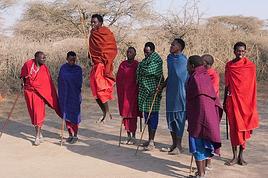
And here’s a photo to inspire you!
892 similar discussions in English
EDITOR’S NOTE: As with every travel journal I publish, I won’t force anyone to agree with my comments—they’re my own, I share my feelings, and that’s it. Your comments are, of course, welcome, but I’ll refrain from responding to any hint of controversy, as has happened in the past.
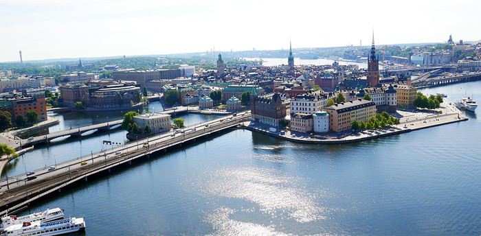
For the summer holidays of 2018, we decided to take a break from long-haul, transcontinental trips. They’re expensive and exhausting, and this year, we also had to consider our young student’s limited vacation days. So, it was a short 14-day circuit in Scandinavia. Very quickly, I had to abandon the unrealistic idea of driving door-to-door with our personal car (unlike last year—see my "Balkan Stroll" story). Too many kilometers and stops. Still, crossing Poland, Lithuania, Estonia, and Latvia before taking a ferry from Tallinn to Helsinki and Finland was tempting—what a shame.
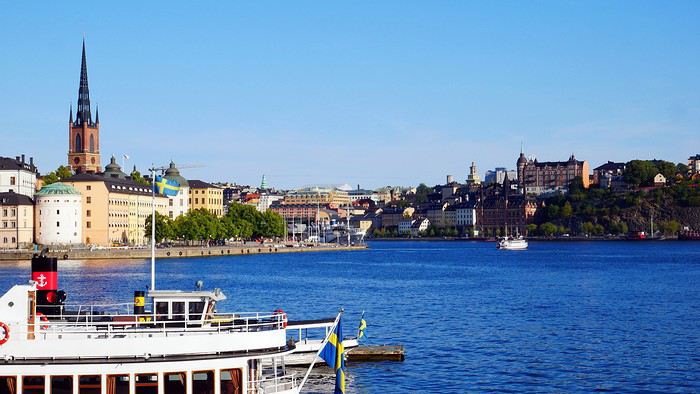
As usual, I planned ahead and started booking in early February for a mid-July departure, typically the best time weather-wise for this destination. Browsing tour operator catalogs didn’t offer much insight—just the usual circuits. Most aim for the North Cape, but we didn’t have time for that. First, via Expedia, we booked our flight tickets: Paris to Stockholm, Helsinki to Paris for the return (880 euros for three), plus a domestic flight from Oulu to Helsinki in Finland (220 euros). The unanimous advice was that there’s not much to see between the two cities, so this saved us a night’s accommodation and a day of car rental. However, the "drop-off" fees (not returning the car to the country of origin) were unavoidable. Out of 1,100 euros for 12 days of rental, this fee was significant—I say this from memory because I never received a detailed document or even the contract itself after picking up the car, despite my complaints. That said, Holiday Autos offered the best rates at the time with Hertz. Plus, I think we were unknowingly upgraded to a Volvo XC 40 T5 automatic, packed with electronics and an incredibly efficient GPS (so I lugged around my updated TomTom for nothing). I wasn’t used to it, and I’ll come back to that. For 50 euros, I also booked one of the many mandatory ferry crossings in Norway—unless you want to drive kilometers around the countless fjords. Specifically, the Bognes-Lødingen route to reach the Lofoten Islands, a must-see in Norway (though not necessarily the best choice I made—I’ll come back to that). Then, gradually via Booking.com, I reserved hotel accommodations, which wasn’t easy at reasonable prices. For three people, it’s nearly impossible to find a room with three real beds—often a sofa bed or even two separate rooms!!!! Norway isn’t a budget-friendly destination for us, yet French tourists are everywhere—groups or families traveling independently. Okay, you’re probably wondering when I’ll get started—I’m getting there... First up, Stockholm, a two-hour flight from Paris. A first for us: we’d gotten used to online check-in within 30 hours of the flight and sometimes printing our boarding passes. But, as progress never stops, at Roissy, we now also print our baggage tags at a kiosk, then place them on the conveyor belt ourselves, scan the barcode with the handheld scanner, and watch the luggage disappear—hoping it doesn’t get misrouted. With all this reduced staff, I hope ticket prices will drop. What? Huh? I’m naive... Okay, fine! Plus, during the flight, don’t expect any snacks—everything’s paid for now, except for water and coffee. I didn’t think I was on a low-cost flight!!! Picking up the car at Arlanda Airport went smoothly, except the contract signed on a tablet (progress, right?) was never emailed to me as promised—too bad... The Volvo SUV packed with electronics: as usual, aside from adjusting the mirrors and seat, I didn’t bother learning all the features and accessories for better handling. So, from the start, I felt jerky movements in the steering, independent of my control. The white-line detection was activated and corrected my direction whenever I got too close... And that’s not all—there’s also driving assistance. Besides the speed limiter, the car accelerates or brakes on its own based on the distance from the vehicle ahead. You still have to keep your hands on the wheel, though—too bad, we could’ve played cards and let it drive itself. When you slow down, if you signal to overtake and turn the wheel, it accelerates to pass. Soon, we won’t even need a driver’s license... Not to mention the little light in the side mirror to signal vehicles in the "blind spot"—very useful. But given the excessively strict speed limits in these parts, it’s still handy. I’ll unfortunately come back to this later!!!!!! In the end, we covered 4,700 km in 8 days of actual travel—no small feat!!!!!! Stockholm: still loyal to the hop-on-hop-off sightseeing buses (or the reverse), I booked our tickets online with a discount. It remains (for us) one of the best ways to visit and get around big cities. The tourist attractions aren’t that numerous. Forty kilometers from the airport, we reached our hotel, Clarion Amaranten. At reception, we were told our reservation was for four days, not two. I insisted, and they told me to call Booking.com to fix it—they couldn’t do anything themselves. Luckily, a nice blonde understood the situation and asked where we were from to lighten the mood. For me, it worked... After a few minutes of back-and-forth, we realized a namesake had booked at the same time. I think the intern got mixed up—oh well. We finally dropped off our bags and headed out under the sun for the included boat tour. It’s beautiful and relaxing under 26°C. We glided past massive cruise ships, very common in these Nordic countries, especially for fjord tours.
We passed Djurgården, one of the city’s 14 islands, home to the Tivoli amusement park and several museums, including the ABBA Museum and the Vasa Museum. I’m not talking about the crispy sandwiches sold since 1919 but the infamous warship that sank in the harbor on its maiden voyage in 1628 after sailing just a few hundred meters. Its intact hull was salvaged in 1961, and since then, it’s one of Sweden’s most visited museums. The country is a quarter smaller than France and has 10 million inhabitants, mostly in the three big cities (Stockholm, Gothenburg, Malmö). The rest is empty, filled with lakes and forests. The currency is the krona, with 1 euro worth about 10 SEK. Dinner in the Old Town consisted of a so-called Viking burger (more like a kebab) and meatballs—the famous Swedish meatballs with potatoes, just like at IKEA... I have to say, here, it seems the Vikings have long been just blond heads—I get it... It still cost us 550 SEK. A beer alone costs at least 9 euros!!!!
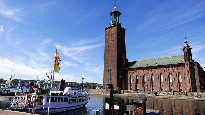
DAY 2. Sunny skies. After a hearty buffet breakfast with salmon, herring in all forms, eggs, cold cuts, bread, and pastries (don’t worry, the classics are there), we started the day by visiting the City Hall tower, famous for hosting the Nobel Prizes (except the Peace Prize, awarded in Oslo). At 106 meters tall, with 365 steps and 9 clocks, it weighs twice as much as the Eiffel Tower. Access is at fixed times in small groups for safety. You can climb up to 73 meters for a 360° view of the city. Next, we visited the Royal Palace, still the official residence of the King of Sweden, and its Treasury (entry: 160 SEK). We skipped the 12:15 PM changing of the guard—three-quarters of an hour before, dozens of onlookers were already crowding the front rows in the sun.
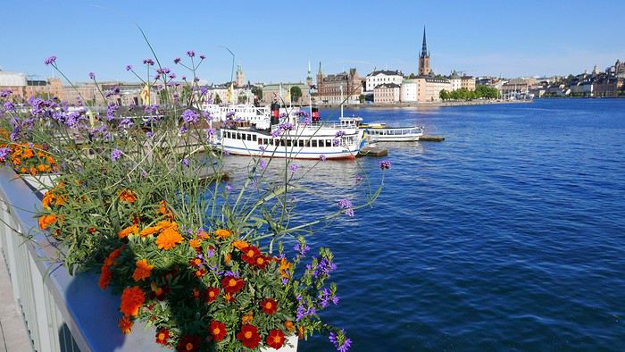
So, we took our favorite bus to rest a bit and tour the city. We also took the subway to see several "decorated" stations—love it or hate it, but it’s original. In the late afternoon, we returned to the Old Town and its Gamla Stan to find some souvenirs, even if it feels more like Bollywood than Viking country, complete with music in the shops—a nice sign of integration... One of the first things that surprised us was the very light car traffic—no traffic jams in this capital. But there are tons of electric and regular bikes, skateboards, and scooters. Also, lots of roadwork and housing construction—apparently a big need. For dinner (our only meal of the day), we treated ourselves to something local at Borgmästaren (Stora Nygatan 35). DECIDEDLY, I’M TELLING YOU EVERYTHING...
DAYS 3 & 4. Contrary to what I was told upon arrival, the hotel parking (700 SEK for 2 nights) didn’t open at 7:00 AM but at 9:00 AM on Saturday. After having to call myself (the French-speaking African receptionist couldn’t do it for me, especially after I told him I thought Croatia would win against France in the World Cup final), the kind parking attendant (partnered with the hotel—there’s the catch) arrived early and let us leave at 8:30 AM to start our east-to-west route to Norway and Oslo, 530 km away, finally beginning our summer adventure. At the border, absolutely no checks, and on the road, aside from lakes and forests, not much to see. However, tolls are very common—don’t overlook this in your budget. In Sweden, everything’s covered by the rental company, but not in other countries. In Norway, there are many automatic toll sections—cameras film your license plate and send you the bill later. So, you must register online at www.epcplc.com/rental, with or without your credit card details, and wait for the final bill. As of now, I haven’t received it, but after noting almost all of them, it should easily reach 200 euros. Roads, tunnels, and bridges are often toll-based to fund maintenance or new constructions. We reached the Norwegian capital at 3:00 PM and checked into our room. Small hiccup: the hotel parking, not reservable, was full on Saturday. Parking meters only take coins for a max of 2 hours. Luckily, tomorrow’s Sunday—free parking from 8:00 PM until Monday morning. After circling the neighborhood, I finally found a spot for my little car—even if it’s not mine, I still care about it...
The Thon Slottsparken Hotel is slightly off-center, but a little walking won’t hurt. The nearby Hertz agency was closed—too bad, I would’ve liked to complain about still not receiving my rental contract by email... With the nice weather, we started with a walking tour of the main sights: the palace, Karl Johans gate (the main street), and some souvenir shopping to fill the display cases back home—if there’s space. We also visited the deserted Akershus Fortress, where two poor young soldiers stood guard in the scorching sun. Below it, the World Cup final fan zone was being set up. Dinner was at Rorbua for 90 euros—ouch. Hard to find, tucked away from the harbor pier. We skipped the paid ascent of the city’s only "tower" with a panoramic view—tickets had to be paid by credit card, and given the fees my bank charges, I’d had enough. Note that card payments are widely accepted here, even for small amounts. When I tried to get change in cash for a 50-euro equivalent bill, some café owners were embarrassed.
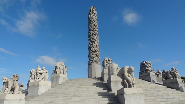
DAY 4. After discussion, we planned the day: first up, one of Oslo’s must-sees, the Vigeland Sculpture Park, featuring bronze, granite, and cast-iron works by Gustav Vigeland (1869–1943). Given the distance, we took the tram—some cars still had their old-school charm!!!! Despite the early hour, hordes of Asian tourists were already there, making photo-taking a nightmare—same everywhere they go. The park is a matter of taste... The 17-meter monolith with 121 intertwined bodies is remarkable, and rightly so. Lazy, we took the tram again to save time—same name, tight schedule. I stopped by the Hertz agency, where the overwhelmed employee promised to try to help. Given his enthusiasm, I doubted it. From the start, I’ve really felt the welcome here, at least for French visitors, isn’t great. Remember my previous reports—it’s becoming a habit. Tourist brochures aren’t available in French here either—strange... Anyway, we took a relaxing fjord cruise. Besides the quirky opera house, the beautiful summer homes on the islands were really tempting. Next, with another paid boat, we headed to the Bygdøy peninsula and its museums. We skipped the Viking Ship Museum in favor of the Norwegian Folk Museum. It features different buildings from across the country, by era and region. Unfortunately, few actors in period costumes—common in this type of tourist attraction. Its real highlight is the stave church, very beautiful. On this late Sunday afternoon, bars and restaurants competed to become World Cup 2018 fan zones—crowds everywhere. So, we decided to head back to rest and catch a glimpse of the African French team against Croatia. It’ll go down in history: a 4-2 victory, with a beautiful goal by Lloris... Go "Les Bleus"—I get it...
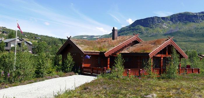
DAY 5. Oslo to Bergen: 450 km, but with detours, it was nearly 550. The real journey begins. Departure at 7:00 AM after sleeping in and a mediocre breakfast. Arrival at 5:00 PM—yes, driving’s slow... More tolls, but under 26°C, the real beauty starts around Geilo. First real fjord—it’s stunning. Then those houses with vegetated roofs blending perfectly into the landscape, sometimes nearly invisible... (Not bad, right? And it’s all me!!!)
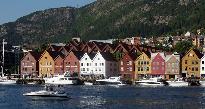
We also discovered tunnels with "indoor roundabouts" and underground roads crossing—never seen that before!! We followed the shores of Lake Tyrifjord and the Hallingdal valleys. After Geilo, views of the Hardangerjøkulen glacier (achoo!) and the Vøringfossen waterfall (Norway’s highest at 163 meters) and Steinsdalsfossen in the Hardangerfjord (the country’s second-longest). Bergen, Norway’s second city, is built between seven mountains. Aside from the colorful old docks along the wharf, there’s not much to see. At the market, stalls of fresh fish, jars of various fish eggs (all called "caviar" here), and cold cuts made from reindeer, moose, and whale.
For 10 euros per person, we queued for the steep funicular for a great view of the city. Dinner was at "Fish Me," very busy. The salmon looked appetizing, and my first whale steak for 27 euros was... interesting. Our hotel, Augustin, is near the center. They charged me 150 NOK to park in the nearby public lot...
DAY 6. Bøverdalen, our evening stop, was less than 300 km away, but along the way, we had our first two scenic routes and first ferry crossing. When I got back in the car, I noticed the seagulls—rightful tenants of the harbor—had turned it into a Picasso painting overnight... First stop in Voss to peek inside its Vangskyrkja church (for a fee). The mural icons all have a marked squint, making the angels on the ceiling smile—quite the original touch. In 1277, it shocked people.
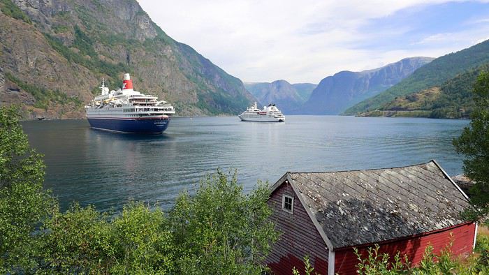
Gudvangen at the end of the Nærøyfjord offers beautiful views and a waterfall. An 11 km tunnel took us to Aurland and the Sognefjord, the king of fjords at 180 km long. Then we took Route 243 to Lærdal instead of a second long tunnel. A 47 km very narrow road with no passing except in designated spots. Buses, RVs, and trailers were in the mix—between backing up and moving forward, how do you expect me to... pass? At some spots, I had to "burn some oil" (non-edible). The beautiful viewpoints along Jotunheimen Park and its high peaks were hard-earned.
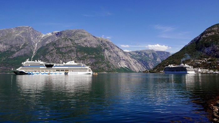
By midday, the 26°C of previous days gave way to 11°C with downpours and gusts. To reach Kaupanger, its stave church, and Route 55 (108 km), we took the Fodnes-Mannheller ferry for 119 kr (about 13 euros) for a 20-minute crossing. For these short trips, rotations are frequent, and wait times are short. The Sognefjellet route took us along lakes and snow-capped peaks—too bad the weather wasn’t cooperating. In Bøverdalen, in the middle of nowhere, we reached the Elveseter Hotel, the only one in the area, and it was packed. Luckily, it’s big. Recent reviews had us a bit worried, but personally, all the well-maintained wooden buildings gave the place charm. Our two small, simple rooms had character, and the common areas’ decor was interesting—a pile of antiques... Unless you dine on-site (reservations required for one of two sittings), the only option is to drive 20 km to Lom to see its beautiful stave church—but we didn’t go in (7 euros per person, and that’s enough). Dinner was three pizzas for 70 euros—yes, it’s expensive here.
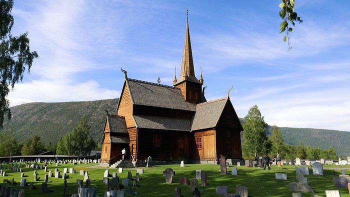
Note that in most establishments, bars, or restaurants, you have to order and pay at the counter yourself. A *stavkirke* or *stavkyrkje* (in Norwegian Bokmål and Nynorsk) is a medieval wooden church typical of Norway, though excavations suggest similar churches may have existed elsewhere in Northern Europe. About 1,300 medieval churches were recorded, with 28 preserved in Norway. In French, they’re called "églises en bois debout" (standing wood churches) because masts or posts support the roof and nave elevation, as well as the walls. The stave church is one of the most elaborate and technically advanced types of wooden construction in Northwestern Europe during the Middle Ages. This technique is represented by the Urnes Stave Church (a UNESCO World Heritage Site), Borgund (the best-preserved in its medieval form), and 25 others—from the largest, Heddal, to the smallest, Undredal, in the stunning Sognefjord, plus a few others in Northwestern Europe.
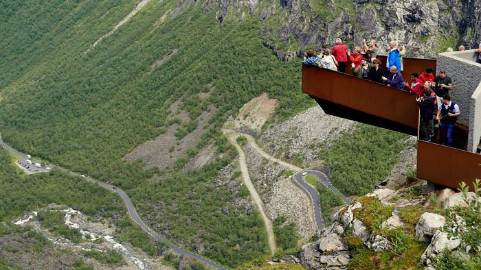
DAY 7. Heading to Trondheim—supposedly 320 km, but with detours, it was nearly 550. Unpredictable weather until about 1:00 PM, but it’s better because it’s the day of the "triples": 3 scenic routes, 3 ferries, and 3 "underwater" tunnels. No rush—here, there’s no need to "hurry to arrive before night" because as you head north, the sun lingers and sets less and less, eventually not setting at all. First, in Grotli, we took the 27 km of Route 258, *Gamle Strynefjellsvegen* (achoo), also very narrow and unpaved in the first section. Luckily, campers and RVs aren’t early risers—otherwise, I’d have had to make not just oil but olives this time. We only passed four other users. However, despite the early hour, local road workers were already on the job, and we had to ask the excavators to move several times to let us pass. At Langvatnet, we joined Route 63, called the Eagle Road here—mediocre, except for Geiranger at the end of the narrowest fjord in the country. A cruise ship had just unloaded its passengers, who rushed into the few shops. After the Eidsdal-Linge ferry (10 minutes) and Gudbrandsjuvet with its waterfalls, we tackled the famous Trollstigen (Troll’s Path), winding and very touristy. Coming from the south, we descended it. Mandatory photo stop at the tourist center and its impressive walkway. The descent into the valley was tough—the bus driver ahead of us must’ve been disabled, blind, and quadriplegic, taking two tries at every hairpin turn, causing a traffic jam behind and for those "going up" waiting at passing spots!!!
On Route 64, we took the Åfarnes-Solnes ferry instead of the initially planned 660 because my young passenger insisted on part of the "Atlantic Road." From what we’d read on blogs, only the last 11 km are spectacular, with arched bridges connecting islets. So, in Molde, we headed to Eide, then Vevang—beautiful but nothing more. The rain spoiled the scenery. Quick photo stop in Kristiansund, then a long underwater tunnel and the Kanestraum-Halsa ferry (7 km, 20 minutes) to reach the E39 toward Trondheim.
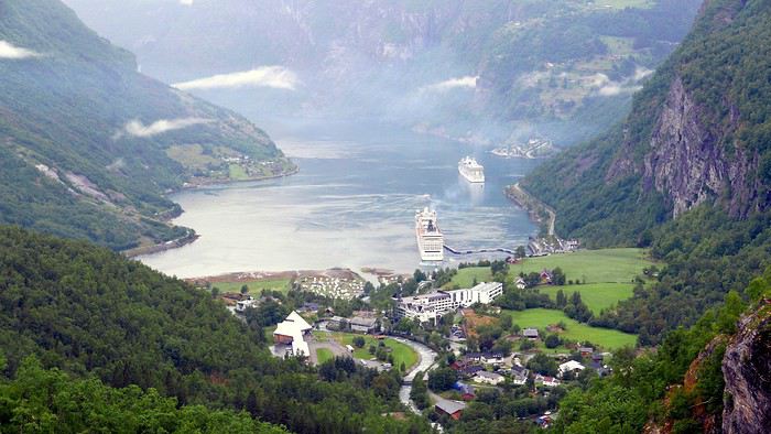
We all agreed that all these wooden houses and churches reminded us of the U.S. in their architecture—especially since, like there, a flagpole with the national flag often stands in front of homes. Trondheim, Norway’s third city, doesn’t have much to see. A university town in the country’s center, aside from its Nidaros Cathedral (closed when we arrived late), its wooden bridge, and colorful old docks on pilings—nothing else. Even finding food was complicated. As for accommodation, Booking.com had forgotten to mention that the Nidaros Pilgrimsgard is a "pilgrim hostel" on the Camino de Santiago. Monastic atmosphere and spartan rooms for reflection—same for the frugal breakfast in silence... Anyway... Luckily, the night before, in a kitschy place run by hip youngsters, I’d stocked up on a hearty assortment of marinated herring with aquavit that burned the rest of my esophagus. (BAKLANDET SKYDSSTATION) I’m really doing all the work for you...
DAY 8. Heading to Mo i Rana—633 km actually covered instead of the planned 480 through Nord-Trøndelag!!! After Steinkjer and its fjord, we decided to take Route 763, parallel to the E6, for less traffic and to see pretty mountain villages. We also stopped in Bola to see a petroglyph (Stone Age rock carving) of a reindeer. After Medja, we skipped Kjerringfoss and Europe’s largest salmon ladder (paid access). Instead, via the Holm-Vennesund ferry, we took a bit of the scenic Route 17 before reaching Mosjøen and Mo i Rana (too many ferries if you do the whole route). Along the way, we saw reindeer and moose relaxing on the road several times. Mo i Rana is small. The Ole Tobias Hotel was packed, and parking was complicated. For dinner, we crossed the street to "No. 3," the only option. Two spicy bacalao and a whale steak cost us 90 euros... At this rate, I had to find an ATM to finish the Norwegian stay properly. The 2,000 euros exchanged before leaving (at 9.28) were already partially gone. Cigarettes cost 13 euros a pack here—twice as much as in Sweden—while unleaded gas is 1.85 euros per liter.
DAY 9. Heading to the main event of the trip: the Lofoten Islands. First programming mistake: not studying the subject well, I preferred a shorter ferry crossing from further north on the mainland. But that also meant arriving further north on the islands.
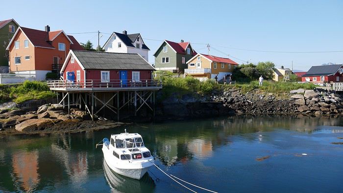
I booked for 50 euros (vehicle, driver, and two passengers included on the official Torghatten Nord site) for Bognes-Lødingen—a one-hour crossing. I should’ve left from Bodø to Leknes or better yet Moskenes and the town of Å for three hours—it would’ve saved time by avoiding the drive north and crossing to the south before heading back up the islands. Luckily, we still managed two different routes. Fortunately, the great weather returned, and I have to say, IT’S REALLY, REALLY, REALLY... BEAUTIFUL... Memory cards are melting—not just from the heat.
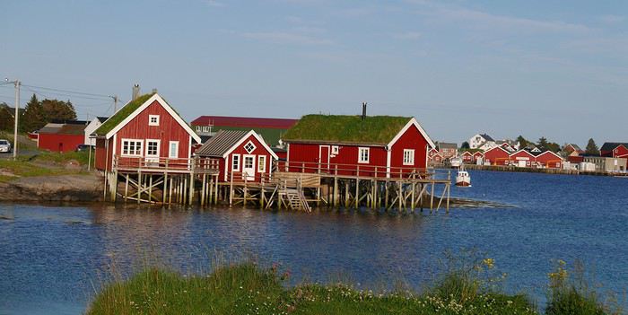
Two things worked in our favor, if I may say so, and countered my little blunder: first, I’d booked the 2:30 PM ferry, but arriving at the departure at noon, we easily took the earlier one—two hours saved. With the longer crossings, rotations with only two boats are much less frequent (8 to 12 per day depending on the season, vs. 6 to 8 for the southern route). Second, after Mo i Rana, we crossed the Arctic Circle, and today, the sun only "sets" from 12:20 AM to 1:50 AM. What luck! With a 7:40 AM departure (after sleeping in), I could drive until 11:00 PM easy!!!!!! And cover only 740 km!!!!!! Here, winters don’t drop below zero, but from early November to late January, it’s night almost all the time, with a supposed daylight clarity from 10:00 AM to 2:00 PM like a rainy day back home. But apparently, the northern lights and reflections on the snow also provide light!! I’d love to see that, but I’ll have to come back... We crisscrossed everything humanly possible, sometimes stopping abruptly in the middle of the road for photos—much to the locals’ dismay, but they’re used to the madness of temporary invaders enchanted by the place... These steep mountains "falling" into the water with all those colorful "rorbu" villages are magnificent. Rorbu are traditional fishermen’s cabins on stilts by the water, which over time have become the must-stay accommodation here—many have never housed any fishermen!!! The villages follow one after another, each more beautiful than the last. In Nusfjord, in season, pedestrians are even charged an access fee between 10:00 AM and 6:00 PM. At 7:00 PM, the booth was closed—lucky us, no crowd. The ochre wooden facades are beautiful, but don’t get too close—the seagulls nest there and see any approach as aggression. The result? Bomb-like droppings that can leave unpleasant memories. Go peek inside the grocery store—it’s kept its old-world charm. With the season, the many cod drying racks are empty. The hour turned, and our southward journey stopped in Reine—too bad for Å, not far, but fatigue got the better of me. We had to "go back up" to Kabelvåg for our rorbu at Nyvågar. We’d stocked up on groceries to eat quietly in this cozy little place (very small single beds upstairs).
DAY 10. We headed back north on the islands to reach Tromsø (grandiosely nicknamed the "Paris of the North"), with a late 7:50 AM departure despite 450 km to cover—things are getting lax at the end of the trip!!! However, this stop didn’t reveal much of interest—it’s the lake region, but meh. Tour operators include it as the last stop toward the far north. Aside from the Målselvfossen waterfall and its (paid) salmon ladder, nothing to report. We arrived at 3:00 PM, and the second room in our Quality Saga Hotel wasn’t ready yet. Plus, the parking we’d requested wasn’t accessible—the eight spots were taken. Even in this small town, free and easy parking is rare. Two souvenir shops and a main street (Storgata)—that’s it. Not to mention a nice storm that cooled things down. The only curiosity is the church, but it’s closed and under renovation—the exterior scaffolding ruins the only photo opportunity here. Otherwise, the Arctic Cathedral is visible from afar—that’s enough for us. The sun only sets for 20 minutes, from 12:40 AM to 1:00 AM!!!!! Last note before leaving this country: every morning at the breakfast buffet with all those eggs, I asked for a Norwegian omelet. Believe it or not, they don’t know the recipe for a Norwegian omelet!!!! 😏😛😉
DAY 11. Heading to Finland (with an extra hour time difference) and Rovaniemi, self-proclaimed official Santa Claus Village—it’s not nice to play on kids’ heartstrings for money!!!! On the 400 km of road (that or avoiding the Lofoten), nothing to see except two sad "Sami" shops. But there’s also AND ESPECIALLY: The run-in with a police radar mounted on the dashboard to welcome me to this country: alone, on a straight, flat road in the middle of the forest, I had this privilege—especially at a spot limited to 80 km/h instead of 100 as I thought. Of course, most well-meaning readers will think: serves him right... Only here’s the thing: in Finland, for years, speeding fines depend on the "Päiväsakko," meaning based on your income and number of children, a subtle calculation of average daily money is made and multiplied proportionally to the estimated severity of the offense... Ignorant of this, I naively but honestly answered the questions. The result? The fine was enormous—I won’t say the amount out of shame, but especially out of hatred for this country that ruined my vacation. Others like me, potential murderers, have been fined up to 170,000 euros (I wrote ONE HUNDRED SEVENTY THOUSAND EUROS) for a 40 km/h speeding offense!!!! I hope the clowns running France quickly adopt this particularly SOCIAL measure. Let the lazy and parasites of the country freely enjoy the road in their BMWs and MERCs!!! Let me tell you, I’ll spend my savings elsewhere in the future. So, a tip: be as dishonest as these conscientious police—say you’re unemployed with five kids, and maybe they’ll give you money!!!!! I’m really disgusted. No wonder in this nothing-to-see town, drivers sheepishly drive in a "little train" at 40 behind an RV without anyone daring to overtake. I think sometimes human stupidity should have limits, and the word freedom should regain its meaning!!! To those who understand, cheers. And as written at the start: trolls, abstain. I stand by what I said and sign it. After this brutal introduction to Finnish discriminatory laws, you can imagine Rovaniemi and its two-bit Santa Claus—I couldn’t care less. Even under the storm, at 6:00 PM on Sunday, even in summer, the scammer shops and profiteers of the Santa Claus Village (conveniently located on the Arctic Circle...) were already closed. Good riddance!!! The Arctic City Hotel is fine. I struggled to swallow my Tex-Mex at Pancho Villa (local chain).
DAY 12. Toward Oulu via Tornio, 200 km, and again, nothing to see in this land of lakes and forests. Detour and only photo stop in Tervola for a wooden church—my vacation is officially ruined... The Cumulus City Hotel is fine in this pleasant but empty and dull city, though it’s a university and tech hub. To cheer myself up, we splurged on a supposedly Viking meal at Harald—don’t know if the recipes are authentic, but my "Viking" knowledge stops at Vik, the animated boobs... Anyway, it’s good, unusual, and hearty.
DAY 13. After struggling to fill the tank (no station open with cash payment, only cards), we returned the chariot at the airport. The offices weren’t open yet at this early hour (8:35 AM flight), so I left the key in a mailbox without any inspection—I didn’t like that at all. I thought we’d get a propeller plane, but it was a well-filled Airbus. One-hour flight to Helsinki, the capital. Impossible to get clear information on buses to the city center, 40 km away. So, for 37 euros, we took a taxi with a trunk big enough for our three suitcases and three "cabin" bags. I’m not counting the cost anymore. At 10:00 AM, we could finally check into our large triple room at the Cumulus City Hotel on Hakaniemi Square—again, despite the size, with a fold-out armchair bed. Off to visit our last city, with the obvious purchase—you guessed it—a 24-hour bus ticket with a 1.5-hour mini-cruise for 43 euros per person...
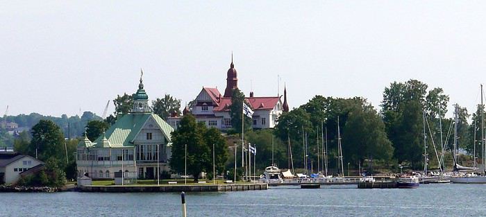
The boat tour showed that the standard of living seems high here too—summer homes (or not) on the islands are very beautiful. A small canal was even dug to save these lucky owners time on maritime transport. Apartments sell for a fortune. Back at Market Square, we grabbed a snack at the market—a reindeer kebab with dried reindeer, cheese, and a mini cracker—simple but delicious. No time to waste—ours is limited. Even if there’s not much to see tourist-wise. Four churches compete: the very busy and beautiful Helsinki Cathedral (better outside than in), its direct rival the Orthodox Uspenski Cathedral (same), the Rock Church (Temppeliaukio) and the Wooden Church (Kampin)—both as beautiful inside as out!!! Here too, very little car traffic, but tons of people—tourists or not—and joggers. In the evening, a bit tired, we headed to the off-center hotel to try the Scandinavian Hesburger chain. For connoisseurs and 29 euros, decent fries and burgers resembling Burger King’s—while the other American giant is left behind. Personal taste, I guess. The next day, we took the bus tour again, passing the Parliament and the controversial Sibelius Monument—a 24-ton pile of clanging iron pipes. Then, to kill time, we headed to Linnanmäki amusement park, on a hill overlooking the city. Rides are packed together, and a new one appears every year. Mostly family-oriented, but two or three thrill rides were packed. Despite my advancing age, I gave it a try—obviously regretted it afterward... Europe’s oldest wooden roller coaster (1950) shows the genius of its creators, with a brakeman at the back—worth the detour and passes the time. We ate (if you can call it that) on-site for 19 euros. Back "in town," classic shopping centers are numerous, but souvenir shops can be counted on one hand. No matter—we had to pack because tomorrow’s the return. We ate burgers again near the hotel and Hes... but served at the table for 67 euros. The next morning, to kill time before the 4:00 PM flight, we went to the port and its tourist market, where I splurged 15 euros on a cap to add to (or clutter) my already well-stocked collection. We finally learned that bus 615 goes to the airport, with a stop in front of our hotel where the luggage was left in storage after checking out. Still, count 40 minutes with this indirect route. Via an Air France flight operated by Finnair, after 3 hours, we returned to Roissy CDG—our vacation is truly over!!!!!!
CONCLUSION (if I may) Among the three capitals we visited, our unanimous ranking is: Oslo, Helsinki, and Stockholm—period. Despite a few imperfections in my itinerary, I’d say the Lofoten Islands are really worth it—two days on-site is a minimum. Finland, and not just because of the radars, is way below—nothing to see tourist-wise. I didn’t say nothing to do for those with time—nuance... Norwegian fjords, even if once you’ve seen one, you’ve seen them all, are really beautiful, though this destination is quite expensive for us. Norway, thanks to its oil and gas, is very wealthy, near full employment, with an annual GDP per capita of 70,000 euros!!! A pack of cigarettes at 13 euros and beer at 10 euros doesn’t make this a dream destination for an addict like me. We were very lucky with the weather—only two and a half days of rain over 14, unlike many bloggers whose stories I read before leaving. The welcome wasn’t always what we expected. Despite the massive French presence, we’re not always as welcome as Asian conquerors, to whom the West, racing to its doom, continues to roll out the red carpet—literally! I don’t regret our choice—it’s worth seeing once, but only once. At least now we know what we’re talking about!!!!! Finally, as always, here’s the link to my public slideshow on YouTube. For the private one, some spicy scenes (especially with Santa and a troll) could cause me more problems—I’ve had enough!!! www.youtube.com/...zbIgZC6Pk&t=165s See you soon, maybe for new adventures and getaways. DJ93.
For the summer holidays of 2018, we decided to take a break from long-haul, transcontinental trips. They’re expensive and exhausting, and this year, we also had to consider our young student’s limited vacation days. So, it was a short 14-day circuit in Scandinavia. Very quickly, I had to abandon the unrealistic idea of driving door-to-door with our personal car (unlike last year—see my "Balkan Stroll" story). Too many kilometers and stops. Still, crossing Poland, Lithuania, Estonia, and Latvia before taking a ferry from Tallinn to Helsinki and Finland was tempting—what a shame.
As usual, I planned ahead and started booking in early February for a mid-July departure, typically the best time weather-wise for this destination. Browsing tour operator catalogs didn’t offer much insight—just the usual circuits. Most aim for the North Cape, but we didn’t have time for that. First, via Expedia, we booked our flight tickets: Paris to Stockholm, Helsinki to Paris for the return (880 euros for three), plus a domestic flight from Oulu to Helsinki in Finland (220 euros). The unanimous advice was that there’s not much to see between the two cities, so this saved us a night’s accommodation and a day of car rental. However, the "drop-off" fees (not returning the car to the country of origin) were unavoidable. Out of 1,100 euros for 12 days of rental, this fee was significant—I say this from memory because I never received a detailed document or even the contract itself after picking up the car, despite my complaints. That said, Holiday Autos offered the best rates at the time with Hertz. Plus, I think we were unknowingly upgraded to a Volvo XC 40 T5 automatic, packed with electronics and an incredibly efficient GPS (so I lugged around my updated TomTom for nothing). I wasn’t used to it, and I’ll come back to that. For 50 euros, I also booked one of the many mandatory ferry crossings in Norway—unless you want to drive kilometers around the countless fjords. Specifically, the Bognes-Lødingen route to reach the Lofoten Islands, a must-see in Norway (though not necessarily the best choice I made—I’ll come back to that). Then, gradually via Booking.com, I reserved hotel accommodations, which wasn’t easy at reasonable prices. For three people, it’s nearly impossible to find a room with three real beds—often a sofa bed or even two separate rooms!!!! Norway isn’t a budget-friendly destination for us, yet French tourists are everywhere—groups or families traveling independently. Okay, you’re probably wondering when I’ll get started—I’m getting there... First up, Stockholm, a two-hour flight from Paris. A first for us: we’d gotten used to online check-in within 30 hours of the flight and sometimes printing our boarding passes. But, as progress never stops, at Roissy, we now also print our baggage tags at a kiosk, then place them on the conveyor belt ourselves, scan the barcode with the handheld scanner, and watch the luggage disappear—hoping it doesn’t get misrouted. With all this reduced staff, I hope ticket prices will drop. What? Huh? I’m naive... Okay, fine! Plus, during the flight, don’t expect any snacks—everything’s paid for now, except for water and coffee. I didn’t think I was on a low-cost flight!!! Picking up the car at Arlanda Airport went smoothly, except the contract signed on a tablet (progress, right?) was never emailed to me as promised—too bad... The Volvo SUV packed with electronics: as usual, aside from adjusting the mirrors and seat, I didn’t bother learning all the features and accessories for better handling. So, from the start, I felt jerky movements in the steering, independent of my control. The white-line detection was activated and corrected my direction whenever I got too close... And that’s not all—there’s also driving assistance. Besides the speed limiter, the car accelerates or brakes on its own based on the distance from the vehicle ahead. You still have to keep your hands on the wheel, though—too bad, we could’ve played cards and let it drive itself. When you slow down, if you signal to overtake and turn the wheel, it accelerates to pass. Soon, we won’t even need a driver’s license... Not to mention the little light in the side mirror to signal vehicles in the "blind spot"—very useful. But given the excessively strict speed limits in these parts, it’s still handy. I’ll unfortunately come back to this later!!!!!! In the end, we covered 4,700 km in 8 days of actual travel—no small feat!!!!!! Stockholm: still loyal to the hop-on-hop-off sightseeing buses (or the reverse), I booked our tickets online with a discount. It remains (for us) one of the best ways to visit and get around big cities. The tourist attractions aren’t that numerous. Forty kilometers from the airport, we reached our hotel, Clarion Amaranten. At reception, we were told our reservation was for four days, not two. I insisted, and they told me to call Booking.com to fix it—they couldn’t do anything themselves. Luckily, a nice blonde understood the situation and asked where we were from to lighten the mood. For me, it worked... After a few minutes of back-and-forth, we realized a namesake had booked at the same time. I think the intern got mixed up—oh well. We finally dropped off our bags and headed out under the sun for the included boat tour. It’s beautiful and relaxing under 26°C. We glided past massive cruise ships, very common in these Nordic countries, especially for fjord tours.
We passed Djurgården, one of the city’s 14 islands, home to the Tivoli amusement park and several museums, including the ABBA Museum and the Vasa Museum. I’m not talking about the crispy sandwiches sold since 1919 but the infamous warship that sank in the harbor on its maiden voyage in 1628 after sailing just a few hundred meters. Its intact hull was salvaged in 1961, and since then, it’s one of Sweden’s most visited museums. The country is a quarter smaller than France and has 10 million inhabitants, mostly in the three big cities (Stockholm, Gothenburg, Malmö). The rest is empty, filled with lakes and forests. The currency is the krona, with 1 euro worth about 10 SEK. Dinner in the Old Town consisted of a so-called Viking burger (more like a kebab) and meatballs—the famous Swedish meatballs with potatoes, just like at IKEA... I have to say, here, it seems the Vikings have long been just blond heads—I get it... It still cost us 550 SEK. A beer alone costs at least 9 euros!!!!
DAY 2. Sunny skies. After a hearty buffet breakfast with salmon, herring in all forms, eggs, cold cuts, bread, and pastries (don’t worry, the classics are there), we started the day by visiting the City Hall tower, famous for hosting the Nobel Prizes (except the Peace Prize, awarded in Oslo). At 106 meters tall, with 365 steps and 9 clocks, it weighs twice as much as the Eiffel Tower. Access is at fixed times in small groups for safety. You can climb up to 73 meters for a 360° view of the city. Next, we visited the Royal Palace, still the official residence of the King of Sweden, and its Treasury (entry: 160 SEK). We skipped the 12:15 PM changing of the guard—three-quarters of an hour before, dozens of onlookers were already crowding the front rows in the sun.
So, we took our favorite bus to rest a bit and tour the city. We also took the subway to see several "decorated" stations—love it or hate it, but it’s original. In the late afternoon, we returned to the Old Town and its Gamla Stan to find some souvenirs, even if it feels more like Bollywood than Viking country, complete with music in the shops—a nice sign of integration... One of the first things that surprised us was the very light car traffic—no traffic jams in this capital. But there are tons of electric and regular bikes, skateboards, and scooters. Also, lots of roadwork and housing construction—apparently a big need. For dinner (our only meal of the day), we treated ourselves to something local at Borgmästaren (Stora Nygatan 35). DECIDEDLY, I’M TELLING YOU EVERYTHING...
DAYS 3 & 4. Contrary to what I was told upon arrival, the hotel parking (700 SEK for 2 nights) didn’t open at 7:00 AM but at 9:00 AM on Saturday. After having to call myself (the French-speaking African receptionist couldn’t do it for me, especially after I told him I thought Croatia would win against France in the World Cup final), the kind parking attendant (partnered with the hotel—there’s the catch) arrived early and let us leave at 8:30 AM to start our east-to-west route to Norway and Oslo, 530 km away, finally beginning our summer adventure. At the border, absolutely no checks, and on the road, aside from lakes and forests, not much to see. However, tolls are very common—don’t overlook this in your budget. In Sweden, everything’s covered by the rental company, but not in other countries. In Norway, there are many automatic toll sections—cameras film your license plate and send you the bill later. So, you must register online at www.epcplc.com/rental, with or without your credit card details, and wait for the final bill. As of now, I haven’t received it, but after noting almost all of them, it should easily reach 200 euros. Roads, tunnels, and bridges are often toll-based to fund maintenance or new constructions. We reached the Norwegian capital at 3:00 PM and checked into our room. Small hiccup: the hotel parking, not reservable, was full on Saturday. Parking meters only take coins for a max of 2 hours. Luckily, tomorrow’s Sunday—free parking from 8:00 PM until Monday morning. After circling the neighborhood, I finally found a spot for my little car—even if it’s not mine, I still care about it...
The Thon Slottsparken Hotel is slightly off-center, but a little walking won’t hurt. The nearby Hertz agency was closed—too bad, I would’ve liked to complain about still not receiving my rental contract by email... With the nice weather, we started with a walking tour of the main sights: the palace, Karl Johans gate (the main street), and some souvenir shopping to fill the display cases back home—if there’s space. We also visited the deserted Akershus Fortress, where two poor young soldiers stood guard in the scorching sun. Below it, the World Cup final fan zone was being set up. Dinner was at Rorbua for 90 euros—ouch. Hard to find, tucked away from the harbor pier. We skipped the paid ascent of the city’s only "tower" with a panoramic view—tickets had to be paid by credit card, and given the fees my bank charges, I’d had enough. Note that card payments are widely accepted here, even for small amounts. When I tried to get change in cash for a 50-euro equivalent bill, some café owners were embarrassed.
DAY 4. After discussion, we planned the day: first up, one of Oslo’s must-sees, the Vigeland Sculpture Park, featuring bronze, granite, and cast-iron works by Gustav Vigeland (1869–1943). Given the distance, we took the tram—some cars still had their old-school charm!!!! Despite the early hour, hordes of Asian tourists were already there, making photo-taking a nightmare—same everywhere they go. The park is a matter of taste... The 17-meter monolith with 121 intertwined bodies is remarkable, and rightly so. Lazy, we took the tram again to save time—same name, tight schedule. I stopped by the Hertz agency, where the overwhelmed employee promised to try to help. Given his enthusiasm, I doubted it. From the start, I’ve really felt the welcome here, at least for French visitors, isn’t great. Remember my previous reports—it’s becoming a habit. Tourist brochures aren’t available in French here either—strange... Anyway, we took a relaxing fjord cruise. Besides the quirky opera house, the beautiful summer homes on the islands were really tempting. Next, with another paid boat, we headed to the Bygdøy peninsula and its museums. We skipped the Viking Ship Museum in favor of the Norwegian Folk Museum. It features different buildings from across the country, by era and region. Unfortunately, few actors in period costumes—common in this type of tourist attraction. Its real highlight is the stave church, very beautiful. On this late Sunday afternoon, bars and restaurants competed to become World Cup 2018 fan zones—crowds everywhere. So, we decided to head back to rest and catch a glimpse of the African French team against Croatia. It’ll go down in history: a 4-2 victory, with a beautiful goal by Lloris... Go "Les Bleus"—I get it...
DAY 5. Oslo to Bergen: 450 km, but with detours, it was nearly 550. The real journey begins. Departure at 7:00 AM after sleeping in and a mediocre breakfast. Arrival at 5:00 PM—yes, driving’s slow... More tolls, but under 26°C, the real beauty starts around Geilo. First real fjord—it’s stunning. Then those houses with vegetated roofs blending perfectly into the landscape, sometimes nearly invisible... (Not bad, right? And it’s all me!!!)
We also discovered tunnels with "indoor roundabouts" and underground roads crossing—never seen that before!! We followed the shores of Lake Tyrifjord and the Hallingdal valleys. After Geilo, views of the Hardangerjøkulen glacier (achoo!) and the Vøringfossen waterfall (Norway’s highest at 163 meters) and Steinsdalsfossen in the Hardangerfjord (the country’s second-longest). Bergen, Norway’s second city, is built between seven mountains. Aside from the colorful old docks along the wharf, there’s not much to see. At the market, stalls of fresh fish, jars of various fish eggs (all called "caviar" here), and cold cuts made from reindeer, moose, and whale.
For 10 euros per person, we queued for the steep funicular for a great view of the city. Dinner was at "Fish Me," very busy. The salmon looked appetizing, and my first whale steak for 27 euros was... interesting. Our hotel, Augustin, is near the center. They charged me 150 NOK to park in the nearby public lot...
DAY 6. Bøverdalen, our evening stop, was less than 300 km away, but along the way, we had our first two scenic routes and first ferry crossing. When I got back in the car, I noticed the seagulls—rightful tenants of the harbor—had turned it into a Picasso painting overnight... First stop in Voss to peek inside its Vangskyrkja church (for a fee). The mural icons all have a marked squint, making the angels on the ceiling smile—quite the original touch. In 1277, it shocked people.
Gudvangen at the end of the Nærøyfjord offers beautiful views and a waterfall. An 11 km tunnel took us to Aurland and the Sognefjord, the king of fjords at 180 km long. Then we took Route 243 to Lærdal instead of a second long tunnel. A 47 km very narrow road with no passing except in designated spots. Buses, RVs, and trailers were in the mix—between backing up and moving forward, how do you expect me to... pass? At some spots, I had to "burn some oil" (non-edible). The beautiful viewpoints along Jotunheimen Park and its high peaks were hard-earned.
By midday, the 26°C of previous days gave way to 11°C with downpours and gusts. To reach Kaupanger, its stave church, and Route 55 (108 km), we took the Fodnes-Mannheller ferry for 119 kr (about 13 euros) for a 20-minute crossing. For these short trips, rotations are frequent, and wait times are short. The Sognefjellet route took us along lakes and snow-capped peaks—too bad the weather wasn’t cooperating. In Bøverdalen, in the middle of nowhere, we reached the Elveseter Hotel, the only one in the area, and it was packed. Luckily, it’s big. Recent reviews had us a bit worried, but personally, all the well-maintained wooden buildings gave the place charm. Our two small, simple rooms had character, and the common areas’ decor was interesting—a pile of antiques... Unless you dine on-site (reservations required for one of two sittings), the only option is to drive 20 km to Lom to see its beautiful stave church—but we didn’t go in (7 euros per person, and that’s enough). Dinner was three pizzas for 70 euros—yes, it’s expensive here.
Note that in most establishments, bars, or restaurants, you have to order and pay at the counter yourself. A *stavkirke* or *stavkyrkje* (in Norwegian Bokmål and Nynorsk) is a medieval wooden church typical of Norway, though excavations suggest similar churches may have existed elsewhere in Northern Europe. About 1,300 medieval churches were recorded, with 28 preserved in Norway. In French, they’re called "églises en bois debout" (standing wood churches) because masts or posts support the roof and nave elevation, as well as the walls. The stave church is one of the most elaborate and technically advanced types of wooden construction in Northwestern Europe during the Middle Ages. This technique is represented by the Urnes Stave Church (a UNESCO World Heritage Site), Borgund (the best-preserved in its medieval form), and 25 others—from the largest, Heddal, to the smallest, Undredal, in the stunning Sognefjord, plus a few others in Northwestern Europe.
DAY 7. Heading to Trondheim—supposedly 320 km, but with detours, it was nearly 550. Unpredictable weather until about 1:00 PM, but it’s better because it’s the day of the "triples": 3 scenic routes, 3 ferries, and 3 "underwater" tunnels. No rush—here, there’s no need to "hurry to arrive before night" because as you head north, the sun lingers and sets less and less, eventually not setting at all. First, in Grotli, we took the 27 km of Route 258, *Gamle Strynefjellsvegen* (achoo), also very narrow and unpaved in the first section. Luckily, campers and RVs aren’t early risers—otherwise, I’d have had to make not just oil but olives this time. We only passed four other users. However, despite the early hour, local road workers were already on the job, and we had to ask the excavators to move several times to let us pass. At Langvatnet, we joined Route 63, called the Eagle Road here—mediocre, except for Geiranger at the end of the narrowest fjord in the country. A cruise ship had just unloaded its passengers, who rushed into the few shops. After the Eidsdal-Linge ferry (10 minutes) and Gudbrandsjuvet with its waterfalls, we tackled the famous Trollstigen (Troll’s Path), winding and very touristy. Coming from the south, we descended it. Mandatory photo stop at the tourist center and its impressive walkway. The descent into the valley was tough—the bus driver ahead of us must’ve been disabled, blind, and quadriplegic, taking two tries at every hairpin turn, causing a traffic jam behind and for those "going up" waiting at passing spots!!!
On Route 64, we took the Åfarnes-Solnes ferry instead of the initially planned 660 because my young passenger insisted on part of the "Atlantic Road." From what we’d read on blogs, only the last 11 km are spectacular, with arched bridges connecting islets. So, in Molde, we headed to Eide, then Vevang—beautiful but nothing more. The rain spoiled the scenery. Quick photo stop in Kristiansund, then a long underwater tunnel and the Kanestraum-Halsa ferry (7 km, 20 minutes) to reach the E39 toward Trondheim.
We all agreed that all these wooden houses and churches reminded us of the U.S. in their architecture—especially since, like there, a flagpole with the national flag often stands in front of homes. Trondheim, Norway’s third city, doesn’t have much to see. A university town in the country’s center, aside from its Nidaros Cathedral (closed when we arrived late), its wooden bridge, and colorful old docks on pilings—nothing else. Even finding food was complicated. As for accommodation, Booking.com had forgotten to mention that the Nidaros Pilgrimsgard is a "pilgrim hostel" on the Camino de Santiago. Monastic atmosphere and spartan rooms for reflection—same for the frugal breakfast in silence... Anyway... Luckily, the night before, in a kitschy place run by hip youngsters, I’d stocked up on a hearty assortment of marinated herring with aquavit that burned the rest of my esophagus. (BAKLANDET SKYDSSTATION) I’m really doing all the work for you...
DAY 8. Heading to Mo i Rana—633 km actually covered instead of the planned 480 through Nord-Trøndelag!!! After Steinkjer and its fjord, we decided to take Route 763, parallel to the E6, for less traffic and to see pretty mountain villages. We also stopped in Bola to see a petroglyph (Stone Age rock carving) of a reindeer. After Medja, we skipped Kjerringfoss and Europe’s largest salmon ladder (paid access). Instead, via the Holm-Vennesund ferry, we took a bit of the scenic Route 17 before reaching Mosjøen and Mo i Rana (too many ferries if you do the whole route). Along the way, we saw reindeer and moose relaxing on the road several times. Mo i Rana is small. The Ole Tobias Hotel was packed, and parking was complicated. For dinner, we crossed the street to "No. 3," the only option. Two spicy bacalao and a whale steak cost us 90 euros... At this rate, I had to find an ATM to finish the Norwegian stay properly. The 2,000 euros exchanged before leaving (at 9.28) were already partially gone. Cigarettes cost 13 euros a pack here—twice as much as in Sweden—while unleaded gas is 1.85 euros per liter.
DAY 9. Heading to the main event of the trip: the Lofoten Islands. First programming mistake: not studying the subject well, I preferred a shorter ferry crossing from further north on the mainland. But that also meant arriving further north on the islands.
I booked for 50 euros (vehicle, driver, and two passengers included on the official Torghatten Nord site) for Bognes-Lødingen—a one-hour crossing. I should’ve left from Bodø to Leknes or better yet Moskenes and the town of Å for three hours—it would’ve saved time by avoiding the drive north and crossing to the south before heading back up the islands. Luckily, we still managed two different routes. Fortunately, the great weather returned, and I have to say, IT’S REALLY, REALLY, REALLY... BEAUTIFUL... Memory cards are melting—not just from the heat.
Two things worked in our favor, if I may say so, and countered my little blunder: first, I’d booked the 2:30 PM ferry, but arriving at the departure at noon, we easily took the earlier one—two hours saved. With the longer crossings, rotations with only two boats are much less frequent (8 to 12 per day depending on the season, vs. 6 to 8 for the southern route). Second, after Mo i Rana, we crossed the Arctic Circle, and today, the sun only "sets" from 12:20 AM to 1:50 AM. What luck! With a 7:40 AM departure (after sleeping in), I could drive until 11:00 PM easy!!!!!! And cover only 740 km!!!!!! Here, winters don’t drop below zero, but from early November to late January, it’s night almost all the time, with a supposed daylight clarity from 10:00 AM to 2:00 PM like a rainy day back home. But apparently, the northern lights and reflections on the snow also provide light!! I’d love to see that, but I’ll have to come back... We crisscrossed everything humanly possible, sometimes stopping abruptly in the middle of the road for photos—much to the locals’ dismay, but they’re used to the madness of temporary invaders enchanted by the place... These steep mountains "falling" into the water with all those colorful "rorbu" villages are magnificent. Rorbu are traditional fishermen’s cabins on stilts by the water, which over time have become the must-stay accommodation here—many have never housed any fishermen!!! The villages follow one after another, each more beautiful than the last. In Nusfjord, in season, pedestrians are even charged an access fee between 10:00 AM and 6:00 PM. At 7:00 PM, the booth was closed—lucky us, no crowd. The ochre wooden facades are beautiful, but don’t get too close—the seagulls nest there and see any approach as aggression. The result? Bomb-like droppings that can leave unpleasant memories. Go peek inside the grocery store—it’s kept its old-world charm. With the season, the many cod drying racks are empty. The hour turned, and our southward journey stopped in Reine—too bad for Å, not far, but fatigue got the better of me. We had to "go back up" to Kabelvåg for our rorbu at Nyvågar. We’d stocked up on groceries to eat quietly in this cozy little place (very small single beds upstairs).
DAY 10. We headed back north on the islands to reach Tromsø (grandiosely nicknamed the "Paris of the North"), with a late 7:50 AM departure despite 450 km to cover—things are getting lax at the end of the trip!!! However, this stop didn’t reveal much of interest—it’s the lake region, but meh. Tour operators include it as the last stop toward the far north. Aside from the Målselvfossen waterfall and its (paid) salmon ladder, nothing to report. We arrived at 3:00 PM, and the second room in our Quality Saga Hotel wasn’t ready yet. Plus, the parking we’d requested wasn’t accessible—the eight spots were taken. Even in this small town, free and easy parking is rare. Two souvenir shops and a main street (Storgata)—that’s it. Not to mention a nice storm that cooled things down. The only curiosity is the church, but it’s closed and under renovation—the exterior scaffolding ruins the only photo opportunity here. Otherwise, the Arctic Cathedral is visible from afar—that’s enough for us. The sun only sets for 20 minutes, from 12:40 AM to 1:00 AM!!!!! Last note before leaving this country: every morning at the breakfast buffet with all those eggs, I asked for a Norwegian omelet. Believe it or not, they don’t know the recipe for a Norwegian omelet!!!! 😏😛😉
DAY 11. Heading to Finland (with an extra hour time difference) and Rovaniemi, self-proclaimed official Santa Claus Village—it’s not nice to play on kids’ heartstrings for money!!!! On the 400 km of road (that or avoiding the Lofoten), nothing to see except two sad "Sami" shops. But there’s also AND ESPECIALLY: The run-in with a police radar mounted on the dashboard to welcome me to this country: alone, on a straight, flat road in the middle of the forest, I had this privilege—especially at a spot limited to 80 km/h instead of 100 as I thought. Of course, most well-meaning readers will think: serves him right... Only here’s the thing: in Finland, for years, speeding fines depend on the "Päiväsakko," meaning based on your income and number of children, a subtle calculation of average daily money is made and multiplied proportionally to the estimated severity of the offense... Ignorant of this, I naively but honestly answered the questions. The result? The fine was enormous—I won’t say the amount out of shame, but especially out of hatred for this country that ruined my vacation. Others like me, potential murderers, have been fined up to 170,000 euros (I wrote ONE HUNDRED SEVENTY THOUSAND EUROS) for a 40 km/h speeding offense!!!! I hope the clowns running France quickly adopt this particularly SOCIAL measure. Let the lazy and parasites of the country freely enjoy the road in their BMWs and MERCs!!! Let me tell you, I’ll spend my savings elsewhere in the future. So, a tip: be as dishonest as these conscientious police—say you’re unemployed with five kids, and maybe they’ll give you money!!!!! I’m really disgusted. No wonder in this nothing-to-see town, drivers sheepishly drive in a "little train" at 40 behind an RV without anyone daring to overtake. I think sometimes human stupidity should have limits, and the word freedom should regain its meaning!!! To those who understand, cheers. And as written at the start: trolls, abstain. I stand by what I said and sign it. After this brutal introduction to Finnish discriminatory laws, you can imagine Rovaniemi and its two-bit Santa Claus—I couldn’t care less. Even under the storm, at 6:00 PM on Sunday, even in summer, the scammer shops and profiteers of the Santa Claus Village (conveniently located on the Arctic Circle...) were already closed. Good riddance!!! The Arctic City Hotel is fine. I struggled to swallow my Tex-Mex at Pancho Villa (local chain).
DAY 12. Toward Oulu via Tornio, 200 km, and again, nothing to see in this land of lakes and forests. Detour and only photo stop in Tervola for a wooden church—my vacation is officially ruined... The Cumulus City Hotel is fine in this pleasant but empty and dull city, though it’s a university and tech hub. To cheer myself up, we splurged on a supposedly Viking meal at Harald—don’t know if the recipes are authentic, but my "Viking" knowledge stops at Vik, the animated boobs... Anyway, it’s good, unusual, and hearty.
DAY 13. After struggling to fill the tank (no station open with cash payment, only cards), we returned the chariot at the airport. The offices weren’t open yet at this early hour (8:35 AM flight), so I left the key in a mailbox without any inspection—I didn’t like that at all. I thought we’d get a propeller plane, but it was a well-filled Airbus. One-hour flight to Helsinki, the capital. Impossible to get clear information on buses to the city center, 40 km away. So, for 37 euros, we took a taxi with a trunk big enough for our three suitcases and three "cabin" bags. I’m not counting the cost anymore. At 10:00 AM, we could finally check into our large triple room at the Cumulus City Hotel on Hakaniemi Square—again, despite the size, with a fold-out armchair bed. Off to visit our last city, with the obvious purchase—you guessed it—a 24-hour bus ticket with a 1.5-hour mini-cruise for 43 euros per person...
The boat tour showed that the standard of living seems high here too—summer homes (or not) on the islands are very beautiful. A small canal was even dug to save these lucky owners time on maritime transport. Apartments sell for a fortune. Back at Market Square, we grabbed a snack at the market—a reindeer kebab with dried reindeer, cheese, and a mini cracker—simple but delicious. No time to waste—ours is limited. Even if there’s not much to see tourist-wise. Four churches compete: the very busy and beautiful Helsinki Cathedral (better outside than in), its direct rival the Orthodox Uspenski Cathedral (same), the Rock Church (Temppeliaukio) and the Wooden Church (Kampin)—both as beautiful inside as out!!! Here too, very little car traffic, but tons of people—tourists or not—and joggers. In the evening, a bit tired, we headed to the off-center hotel to try the Scandinavian Hesburger chain. For connoisseurs and 29 euros, decent fries and burgers resembling Burger King’s—while the other American giant is left behind. Personal taste, I guess. The next day, we took the bus tour again, passing the Parliament and the controversial Sibelius Monument—a 24-ton pile of clanging iron pipes. Then, to kill time, we headed to Linnanmäki amusement park, on a hill overlooking the city. Rides are packed together, and a new one appears every year. Mostly family-oriented, but two or three thrill rides were packed. Despite my advancing age, I gave it a try—obviously regretted it afterward... Europe’s oldest wooden roller coaster (1950) shows the genius of its creators, with a brakeman at the back—worth the detour and passes the time. We ate (if you can call it that) on-site for 19 euros. Back "in town," classic shopping centers are numerous, but souvenir shops can be counted on one hand. No matter—we had to pack because tomorrow’s the return. We ate burgers again near the hotel and Hes... but served at the table for 67 euros. The next morning, to kill time before the 4:00 PM flight, we went to the port and its tourist market, where I splurged 15 euros on a cap to add to (or clutter) my already well-stocked collection. We finally learned that bus 615 goes to the airport, with a stop in front of our hotel where the luggage was left in storage after checking out. Still, count 40 minutes with this indirect route. Via an Air France flight operated by Finnair, after 3 hours, we returned to Roissy CDG—our vacation is truly over!!!!!!
CONCLUSION (if I may) Among the three capitals we visited, our unanimous ranking is: Oslo, Helsinki, and Stockholm—period. Despite a few imperfections in my itinerary, I’d say the Lofoten Islands are really worth it—two days on-site is a minimum. Finland, and not just because of the radars, is way below—nothing to see tourist-wise. I didn’t say nothing to do for those with time—nuance... Norwegian fjords, even if once you’ve seen one, you’ve seen them all, are really beautiful, though this destination is quite expensive for us. Norway, thanks to its oil and gas, is very wealthy, near full employment, with an annual GDP per capita of 70,000 euros!!! A pack of cigarettes at 13 euros and beer at 10 euros doesn’t make this a dream destination for an addict like me. We were very lucky with the weather—only two and a half days of rain over 14, unlike many bloggers whose stories I read before leaving. The welcome wasn’t always what we expected. Despite the massive French presence, we’re not always as welcome as Asian conquerors, to whom the West, racing to its doom, continues to roll out the red carpet—literally! I don’t regret our choice—it’s worth seeing once, but only once. At least now we know what we’re talking about!!!!! Finally, as always, here’s the link to my public slideshow on YouTube. For the private one, some spicy scenes (especially with Santa and a troll) could cause me more problems—I’ve had enough!!! www.youtube.com/...zbIgZC6Pk&t=165s See you soon, maybe for new adventures and getaways. DJ93.
Hello everyone...
Well, here I am, back again...
By chance, a bit like Mrs. Attila, my route roughly followed the same paths I took 8 and 6 years ago... I even thought of various travel journal titles like... "Where the grass has grown back!"
And then. People who know me (and some forum members) must be wondering:
"Why come back so often, almost every year since the 2000s, to this part of the world?"
Usually, I answer:
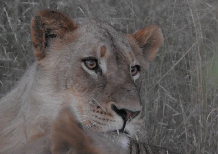
For the people, the landscapes, the animals. Because it’s a big country, a very big one where the horizon feels even farther away.
A country with so much variety—deserts, mountains, oceans, cities...
Because it’s a country that’s quite easy for "average" Europeans to navigate in terms of hygiene, food, driving, and way of life... Because you can plan your entire trip from your living room, all by yourself.
And because there’s still a pioneer spirit in the air.
And most of all, it’s a country that has turned toward the future without forgetting its past, giving the word "forgiveness" its full meaning.
Well, all that... those are just words.
Here comes, little by little, an example of a "classic" itinerary—simple, reliable, efficient, and balanced. Three weeks of discoveries, a first taste of this country!
Hence the final title of this travel journal:
Why South Africa? A simple example!
Well, here I am, back again...
By chance, a bit like Mrs. Attila, my route roughly followed the same paths I took 8 and 6 years ago... I even thought of various travel journal titles like... "Where the grass has grown back!"
And then. People who know me (and some forum members) must be wondering:
"Why come back so often, almost every year since the 2000s, to this part of the world?"
Usually, I answer:
For the people, the landscapes, the animals. Because it’s a big country, a very big one where the horizon feels even farther away.
A country with so much variety—deserts, mountains, oceans, cities...
Because it’s a country that’s quite easy for "average" Europeans to navigate in terms of hygiene, food, driving, and way of life... Because you can plan your entire trip from your living room, all by yourself.
And because there’s still a pioneer spirit in the air.
And most of all, it’s a country that has turned toward the future without forgetting its past, giving the word "forgiveness" its full meaning.
Well, all that... those are just words.
Here comes, little by little, an example of a "classic" itinerary—simple, reliable, efficient, and balanced. Three weeks of discoveries, a first taste of this country!
Hence the final title of this travel journal:
Why South Africa? A simple example!
Hi everyone,
Actually, we ended up going to Japan almost by chance. I’d caught glimpses of the country during business trips, and it had been on my “wish list” for a while, but I thought we’d go “when the kids were grown up.”
But this summer (2016), the kids couldn’t agree on a destination—their wishes were completely opposite. Then, realizing that flight tickets weren’t outrageously priced—and having read that Japan wasn’t as expensive as people think—we, the parents, suggested Japan… while warning that it would be scorching hot and humid and that no one should complain. Our eldest (18) was immediately thrilled: “Oh! Mom! I’ve always dreamed of going to Japan!” She convinced her brother (16) that it was the perfect destination. Deal sealed: we’re going to Japan, but no one complains about the heat.
After some forum discussions and family brainstorming, I settled on the following itinerary. One non-negotiable shaped part of our choices: being in Hiroshima on August 6th to attend the lantern floating ceremony. To avoid overloading the trip with extra transport, we skipped Nara, Nikko, and Kamakura.
Day 1 - Arrival at 8:30 AM in Osaka – Kyoto - around the station Day 2 - Kyoto - East - night: Kyoto Day 3 - Kyoto - North and center - night: Kyoto Day 4 - Osaka (stroll with Osaka Safari) - Fushimi Inari -night : Kyoto Day 5 - Train - Naoshima - night: Uno Day 6 - Teshima -night: Uno Day 7 - Naoshima – Hiroshima - night: Hiroshima Day 8 - Hiroshima – Commemorations - night: Hiroshima Day 10 - Miyajima- night: Miyajima Day 10 - Miyajima - Himeji Castle - night: Osaka Day 11 - Osaka - night: Osaka Day 12 - Kyoto - West -night: Osaka Day 13 - Kanazawa to Ainokura - night: Ainokura Day 14 - Shirakawa-go - Takayama - night: Takayama Day 15 - Kamikochi night: Takayama Day 16 - Takayama - return to Kanazawa night: Kanazawa Day 17 - Kanazawa -night: Kanazawa Day 18 - Travel to Tokyo (Shibuya) -night: Tokyo Day 19 - Tokyo (visit with Tokyo Free Guide – Yoyogi Park - Meiji Shrine - Harajuku - Takeshita-dori - Omote Sando - Odaiba) - night: Tokyo Day 20 - Tokyo (with Tokyo Safari) - night: Tokyo Day 21 - Tokyo (Tsukiji, Hama-Rikyu Onshi Teien, Asakusa and Senso-ji, Kappabashi, Ameyoko, and Ueno) - night: Tokyo Day 22 - Tokyo (Shibuya-Yoyogi Park again - Ikebukuro - Shinjuku (Tokyo Metropolitan Government Building, Omoide-yokocho, Golden Gai) - night: Tokyo Day 23 - Tokyo (Yanaka – Ueno – Edo-Tokyo Museum - Takashita-Dori again - back to Shibuya) - departure at 10:50 PM for Paris
(You can access the published days directly by clicking on them).
The itinerary perfectly matched our expectations: a good pace, a wide variety of visits, the must-sees, but also a first taste of rural Japan. If we were to do it again, I’d do exactly the same (except for the back-and-forth between Kyoto and Osaka on Days 4 and 12, which were due to my desire to explore Osaka with Osaka Safari). Of course, we had to skip some sights, especially in Kyoto where we missed a few “highlights,” but that was a deliberate choice—I’d limited our time in the city, which is known for being stifling in summer.
For accommodations, we mixed Airbnb apartments and quadruple rooms in guesthouses and ryokan. It worked out perfectly. The apartments gave us more space and the chance to dine in some evenings, while the guesthouses and ryokan helped us experience Japanese customs.
First, a quick recap: all four of us were enchanted by our trip. Japan is a constant source of wonder, just like the preface of *Tokyo Sanpo* by Florent Chavouet describes—I’ll take this opportunity to plug the book, which I read with great pleasure after our vacation. That’s exactly it: everything is a reason for amazement. Everything is so different from home. I wanted to photograph everything around me constantly. I promise, I won’t say “photograph like a Japanese” anymore—during this trip, *I* was the Japanese. And I better understand the culture shock Japanese travelers experience in Europe.
As a friend of mine put it: “It’s simple—they have ten fingers, so they count in base 10. Otherwise, they do everything differently from us.” Well summarized.
Another thing: everything is easy. Everything seems to have its place and be exactly where it should be. The smallest detail seems to have been thought out to make life easier. Things that come to mind: the incredibly well-designed signage in train stations and the subway, the ubiquitous public toilets, designated smoking areas, those hyper-detailed maps with all the useful information available at every place we visited… These maps are so well done that we got into the habit of picking them up systematically. It’s that simple: I came back to Paris with a complete collection. And when we arrived in Takayama by car, our first stop was at the train station to get THE map. But this order goes beyond all these practical elements. There’s a certain *je ne sais quoi* that makes you feel like everything is exactly where it should be. Even during rush hour, in the crowds, people manage to avoid each other in a smooth, collision-free flow—the opposite of the Paris metro. Anyone who’s experienced certain transfers in Paris at certain times will understand.
The exquisite politeness of the Japanese and their desire to be helpful are another highlight of the trip. Every person we met tried to help us and make our lives easier. It was really great.
Oh! I almost forgot: Japan’s hyper-safe side. I’ve rarely felt as safe as I did in Japan. No need to keep an eye on your belongings—they’re not going anywhere. One example among many: in Tokyo, Japanese women leave their bags open with their smartphones casually placed on top. Even I could’ve taken them without them noticing, let alone a pickpocket… No wonder France is seen as dangerous.
That said, I’m not claiming Japanese society is flawless. The role of women and gender relations are downright shocking and archaic from our European perspective. I also don’t think I could live in such a codified society, where the individual is so dissolved into the collective. But for a vacation, it’s simply delightful. On that note, I recommend *Nââânde?!* by Eriko Nakamura, which I discovered after our trip on the recommendation of our eldest’s friend. It’s the story of a Japanese woman married to a Frenchman living in Paris, recounting her astonishment at French habits and customs. Even though I tried to be careful, I’m sure I made quite a few blunders.
As for the climate, it didn’t stop us from enjoying our trip. Sure, we were hot—*really* hot—but by protecting ourselves from the sun (hat for me, caps for the others, plus umbrellas—Japanese-style parasols) and drinking liters and liters of water, it was manageable and didn’t bother us too much, even if we probably had a slower pace than we would’ve with milder weather. That said, with small children, we would’ve struggled more.
Last point before diving into the trip details: the cost. Despite what I’d read, traveling in Japan is still expensive. I’m not talking about our specific trip, where—using our daughter’s 18th birthday and our 20th wedding anniversary as an excuse—I splurged on a few extras that drove up the cost. I was particularly surprised by the price of quadruple rooms, which is roughly the same as two double rooms. So for a family, that’s a significant extra cost. The various paid sites in Kyoto also add up. As for food, it’s generally cheap, but it would be a shame not to budget for a few extras to try some less affordable specialties—like Hida beef in our case.
Actually, we ended up going to Japan almost by chance. I’d caught glimpses of the country during business trips, and it had been on my “wish list” for a while, but I thought we’d go “when the kids were grown up.”
But this summer (2016), the kids couldn’t agree on a destination—their wishes were completely opposite. Then, realizing that flight tickets weren’t outrageously priced—and having read that Japan wasn’t as expensive as people think—we, the parents, suggested Japan… while warning that it would be scorching hot and humid and that no one should complain. Our eldest (18) was immediately thrilled: “Oh! Mom! I’ve always dreamed of going to Japan!” She convinced her brother (16) that it was the perfect destination. Deal sealed: we’re going to Japan, but no one complains about the heat.
After some forum discussions and family brainstorming, I settled on the following itinerary. One non-negotiable shaped part of our choices: being in Hiroshima on August 6th to attend the lantern floating ceremony. To avoid overloading the trip with extra transport, we skipped Nara, Nikko, and Kamakura.
Day 1 - Arrival at 8:30 AM in Osaka – Kyoto - around the station Day 2 - Kyoto - East - night: Kyoto Day 3 - Kyoto - North and center - night: Kyoto Day 4 - Osaka (stroll with Osaka Safari) - Fushimi Inari -night : Kyoto Day 5 - Train - Naoshima - night: Uno Day 6 - Teshima -night: Uno Day 7 - Naoshima – Hiroshima - night: Hiroshima Day 8 - Hiroshima – Commemorations - night: Hiroshima Day 10 - Miyajima- night: Miyajima Day 10 - Miyajima - Himeji Castle - night: Osaka Day 11 - Osaka - night: Osaka Day 12 - Kyoto - West -night: Osaka Day 13 - Kanazawa to Ainokura - night: Ainokura Day 14 - Shirakawa-go - Takayama - night: Takayama Day 15 - Kamikochi night: Takayama Day 16 - Takayama - return to Kanazawa night: Kanazawa Day 17 - Kanazawa -night: Kanazawa Day 18 - Travel to Tokyo (Shibuya) -night: Tokyo Day 19 - Tokyo (visit with Tokyo Free Guide – Yoyogi Park - Meiji Shrine - Harajuku - Takeshita-dori - Omote Sando - Odaiba) - night: Tokyo Day 20 - Tokyo (with Tokyo Safari) - night: Tokyo Day 21 - Tokyo (Tsukiji, Hama-Rikyu Onshi Teien, Asakusa and Senso-ji, Kappabashi, Ameyoko, and Ueno) - night: Tokyo Day 22 - Tokyo (Shibuya-Yoyogi Park again - Ikebukuro - Shinjuku (Tokyo Metropolitan Government Building, Omoide-yokocho, Golden Gai) - night: Tokyo Day 23 - Tokyo (Yanaka – Ueno – Edo-Tokyo Museum - Takashita-Dori again - back to Shibuya) - departure at 10:50 PM for Paris
(You can access the published days directly by clicking on them).
The itinerary perfectly matched our expectations: a good pace, a wide variety of visits, the must-sees, but also a first taste of rural Japan. If we were to do it again, I’d do exactly the same (except for the back-and-forth between Kyoto and Osaka on Days 4 and 12, which were due to my desire to explore Osaka with Osaka Safari). Of course, we had to skip some sights, especially in Kyoto where we missed a few “highlights,” but that was a deliberate choice—I’d limited our time in the city, which is known for being stifling in summer.
For accommodations, we mixed Airbnb apartments and quadruple rooms in guesthouses and ryokan. It worked out perfectly. The apartments gave us more space and the chance to dine in some evenings, while the guesthouses and ryokan helped us experience Japanese customs.
First, a quick recap: all four of us were enchanted by our trip. Japan is a constant source of wonder, just like the preface of *Tokyo Sanpo* by Florent Chavouet describes—I’ll take this opportunity to plug the book, which I read with great pleasure after our vacation. That’s exactly it: everything is a reason for amazement. Everything is so different from home. I wanted to photograph everything around me constantly. I promise, I won’t say “photograph like a Japanese” anymore—during this trip, *I* was the Japanese. And I better understand the culture shock Japanese travelers experience in Europe.
As a friend of mine put it: “It’s simple—they have ten fingers, so they count in base 10. Otherwise, they do everything differently from us.” Well summarized.
Another thing: everything is easy. Everything seems to have its place and be exactly where it should be. The smallest detail seems to have been thought out to make life easier. Things that come to mind: the incredibly well-designed signage in train stations and the subway, the ubiquitous public toilets, designated smoking areas, those hyper-detailed maps with all the useful information available at every place we visited… These maps are so well done that we got into the habit of picking them up systematically. It’s that simple: I came back to Paris with a complete collection. And when we arrived in Takayama by car, our first stop was at the train station to get THE map. But this order goes beyond all these practical elements. There’s a certain *je ne sais quoi* that makes you feel like everything is exactly where it should be. Even during rush hour, in the crowds, people manage to avoid each other in a smooth, collision-free flow—the opposite of the Paris metro. Anyone who’s experienced certain transfers in Paris at certain times will understand.
The exquisite politeness of the Japanese and their desire to be helpful are another highlight of the trip. Every person we met tried to help us and make our lives easier. It was really great.
Oh! I almost forgot: Japan’s hyper-safe side. I’ve rarely felt as safe as I did in Japan. No need to keep an eye on your belongings—they’re not going anywhere. One example among many: in Tokyo, Japanese women leave their bags open with their smartphones casually placed on top. Even I could’ve taken them without them noticing, let alone a pickpocket… No wonder France is seen as dangerous.
That said, I’m not claiming Japanese society is flawless. The role of women and gender relations are downright shocking and archaic from our European perspective. I also don’t think I could live in such a codified society, where the individual is so dissolved into the collective. But for a vacation, it’s simply delightful. On that note, I recommend *Nââânde?!* by Eriko Nakamura, which I discovered after our trip on the recommendation of our eldest’s friend. It’s the story of a Japanese woman married to a Frenchman living in Paris, recounting her astonishment at French habits and customs. Even though I tried to be careful, I’m sure I made quite a few blunders.
As for the climate, it didn’t stop us from enjoying our trip. Sure, we were hot—*really* hot—but by protecting ourselves from the sun (hat for me, caps for the others, plus umbrellas—Japanese-style parasols) and drinking liters and liters of water, it was manageable and didn’t bother us too much, even if we probably had a slower pace than we would’ve with milder weather. That said, with small children, we would’ve struggled more.
Last point before diving into the trip details: the cost. Despite what I’d read, traveling in Japan is still expensive. I’m not talking about our specific trip, where—using our daughter’s 18th birthday and our 20th wedding anniversary as an excuse—I splurged on a few extras that drove up the cost. I was particularly surprised by the price of quadruple rooms, which is roughly the same as two double rooms. So for a family, that’s a significant extra cost. The various paid sites in Kyoto also add up. As for food, it’s generally cheap, but it would be a shame not to budget for a few extras to try some less affordable specialties—like Hida beef in our case.
After the wide-open spaces of the American West, we're off to a new destination: Dubai. Not just for a layover, but for a real family vacation!! The question that kept coming up was "why Dubai?" (after why Colorado this summer, people are going to think we're really weird 😅). So, why Dubai? First, because skiing isn’t really our thing anymore—so in winter, we want sunshine 😎. But not just any sunshine—warm enough to swim, which narrows things down a bit 😅. The second constraint this year: Franck can’t take more than a week off (and it’s unpaid), so we’re ruling out destinations with 12-hour flights and jet lag that knocks you out when you get back 😅. The options are getting tighter… So, against all odds, it’s me who ends up suggesting Dubai (my husband’s been nagging me for years about Atlantis and its mega water park—ah, the kids! 😉).
Actually, Dubai only has 2 days of rain a year (you’d have to be *really* unlucky!!), temperatures around 30°C in winter, the sea (oh yeah, I forgot—the sea was something we missed this summer, so it was on our list 😅), a 6/7-hour flight, just 3 hours of jet lag, reasonable family prices, and tons of activities for all tastes. Starting my research with a pretty negative bias, I’m now looking forward to this trip with excitement and impatience… and without spoiling the ending, I won’t be disappointed—our whole family will come back enthusiastic and ready to go back!!
So, I’m taking you along for a week in Dubai at the beginning of March.
Actually, Dubai only has 2 days of rain a year (you’d have to be *really* unlucky!!), temperatures around 30°C in winter, the sea (oh yeah, I forgot—the sea was something we missed this summer, so it was on our list 😅), a 6/7-hour flight, just 3 hours of jet lag, reasonable family prices, and tons of activities for all tastes. Starting my research with a pretty negative bias, I’m now looking forward to this trip with excitement and impatience… and without spoiling the ending, I won’t be disappointed—our whole family will come back enthusiastic and ready to go back!!
So, I’m taking you along for a week in Dubai at the beginning of March.
hi everyone,
I’m new to this site. Here’s my issue: I just got married in Cameroon to my wife, and I’m waiting for our family record book. After that, I’m trying to figure out what I need to do to apply for her visa. But I’d like her to apply for visas for her children at the same time so they can come with her—is that possible?! Do we need to get passports for her children, or is just the visa application enough? They’re 8 and 15 years old. Thanks!
Otherwise, I’d have to apply for family reunification, but she’d have to stay in France for 18 months before she can apply for her children’s visas—that’s way too long!!!
If anyone can give me some advice or help with this complicated situation, I’d really appreciate it. Thanks so much for your help. Best regards,
Otherwise, I’d have to apply for family reunification, but she’d have to stay in France for 18 months before she can apply for her children’s visas—that’s way too long!!!
If anyone can give me some advice or help with this complicated situation, I’d really appreciate it. Thanks so much for your help. Best regards,
For a few years now, it’s become obvious that the typical tourist in Thailand is increasingly "mimile"—I see it every day.
The issue is that Thais know how to adapt and are offering more and more things that appeal to this kind of crowd. That’s why we’re seeing more and more pizzerias and burger joints... Even hotels are proudly displaying up to 5 stars for places that barely deserve 3 by European standards, and this "working-class" crowd is over the moon, totally buying into it!
In short, travelers looking to discover other civilizations and cultures might end up pretty disappointed.
Second trip to Morocco, with our kids and our grandson.
A trip for five that delighted us all.
First stop: Marrakech, where we landed in late morning under a blazing sun. We had lunch on Avenue Mohamed V and took a little rest before heading to Djema El F'Na Square in the late afternoon, when the temperature dropped slightly. A quick stroll through the medina and the souks, still as lively as ever. Mountains of goods, craftsmanship that amazes us, a palette of colors, and all sorts of scents...
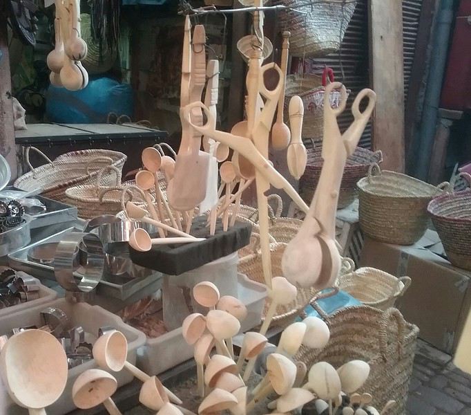
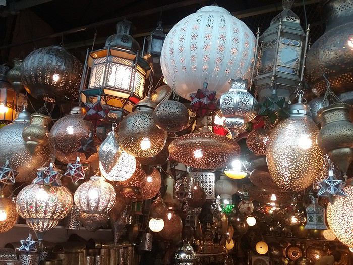
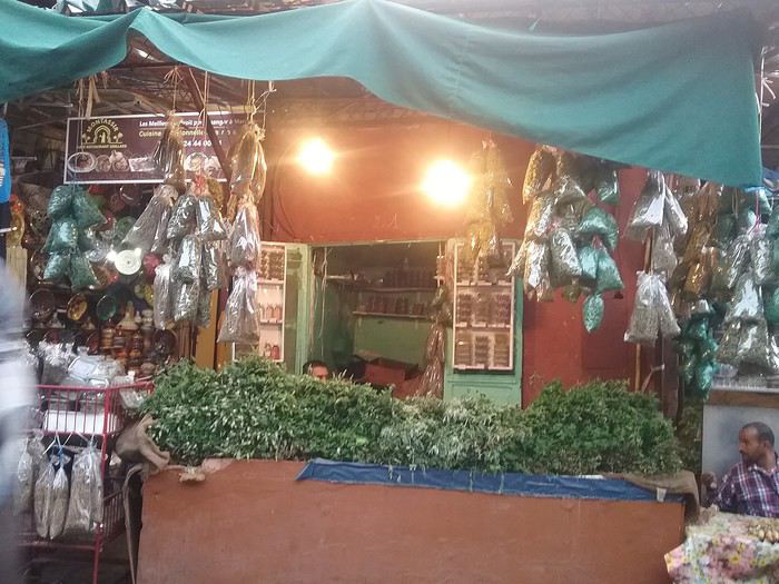
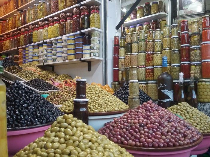
Then, when night fell, we wandered around the square among the little stalls serving all kinds of dishes: salads, grilled meats, soups, snails... It's incredible. Everyone is super friendly. I suspect they tell the same jokes every night to the tourists passing by. But it's really fun. And surprise, surprise—here, it's already Christmas. Colorful garlands at every stall.
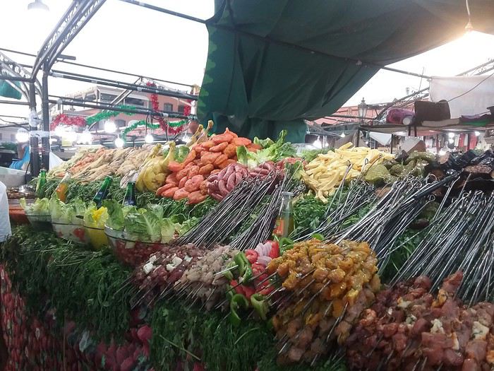
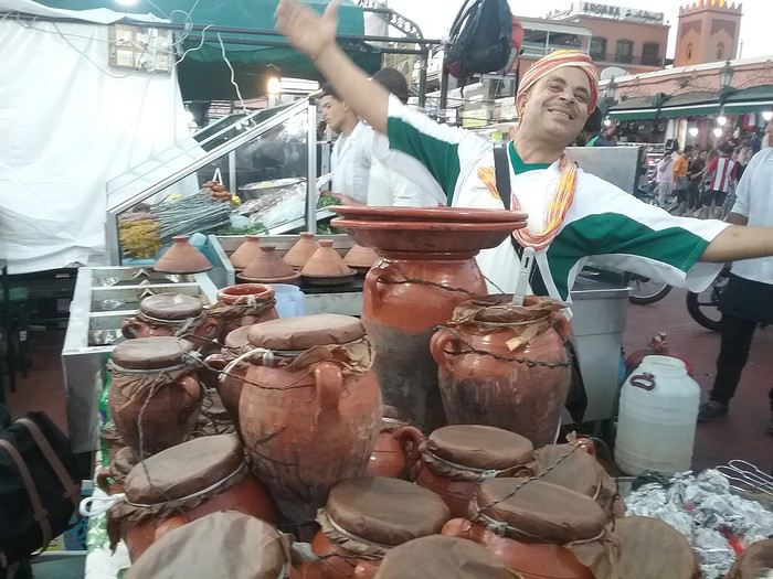
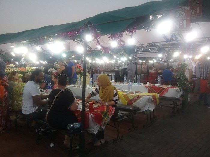
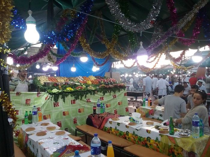
But, rightly or wrongly, even though we're charmed, we prefer not to dine on the square... We're afraid of ruining the rest of the vacation... But what an extraordinary atmosphere on that square. It's overwhelming!
The next morning, we left Marrakech, hoping to find milder temperatures outside the city. On the way to Tichka. The change of scenery is huge. Our grandson can't get over seeing all the vendors selling real or fake minerals, real or fake fossils, merchants who approach as soon as we stop to admire a site or take a photo. There are also apple sellers—real apples for a picnic, which is perfect.
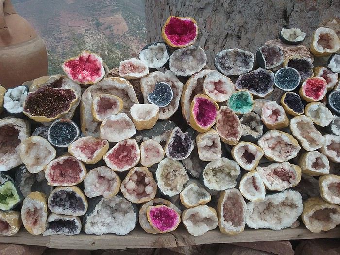
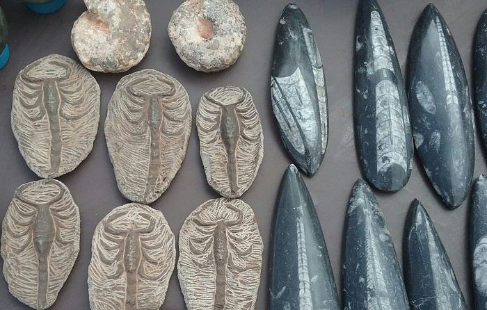
Photo stops are frequent. At every turn, a new discovery, a new viewpoint. The villages blend into the mountains. It's stunning.
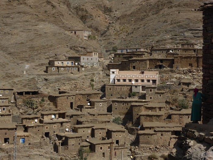
First stop: Marrakech, where we landed in late morning under a blazing sun. We had lunch on Avenue Mohamed V and took a little rest before heading to Djema El F'Na Square in the late afternoon, when the temperature dropped slightly. A quick stroll through the medina and the souks, still as lively as ever. Mountains of goods, craftsmanship that amazes us, a palette of colors, and all sorts of scents...
Then, when night fell, we wandered around the square among the little stalls serving all kinds of dishes: salads, grilled meats, soups, snails... It's incredible. Everyone is super friendly. I suspect they tell the same jokes every night to the tourists passing by. But it's really fun. And surprise, surprise—here, it's already Christmas. Colorful garlands at every stall.
But, rightly or wrongly, even though we're charmed, we prefer not to dine on the square... We're afraid of ruining the rest of the vacation... But what an extraordinary atmosphere on that square. It's overwhelming!
The next morning, we left Marrakech, hoping to find milder temperatures outside the city. On the way to Tichka. The change of scenery is huge. Our grandson can't get over seeing all the vendors selling real or fake minerals, real or fake fossils, merchants who approach as soon as we stop to admire a site or take a photo. There are also apple sellers—real apples for a picnic, which is perfect.
Photo stops are frequent. At every turn, a new discovery, a new viewpoint. The villages blend into the mountains. It's stunning.
Hi everyone,
I’m coming back to ask for your valuable advice once again (which has already helped me out multiple times for other trips, thanks! 🙂) for a 3.5-week itinerary in Colombia this January. We’re traveling as a couple, backpacking, and our trip will be by bus only (unless we crack and take a plane once, but we’d prefer to avoid it).
To avoid rushing around and because we want to steer clear of the tourist crowds on the Caribbean coast, we’ve planned a route that might seem a bit off the beaten path. Could you let me know what you think, please?
We land in Bogotá -> Armenia (Cocora Valley) -> Coffee Region -> Medellín -> Guatapé and Jardín -> Capurganá and Sapzurro -> back to Bogotá (or Páramo de Ocetá if we have time).
We’re more drawn to relaxed spots without too many tourists, and we’d really love to swim in a beautiful place (we live in Quebec, and it’s pretty tough to swim in the sea, especially in January!).
Thanks to all of you!
I’m coming back to ask for your valuable advice once again (which has already helped me out multiple times for other trips, thanks! 🙂) for a 3.5-week itinerary in Colombia this January. We’re traveling as a couple, backpacking, and our trip will be by bus only (unless we crack and take a plane once, but we’d prefer to avoid it).
To avoid rushing around and because we want to steer clear of the tourist crowds on the Caribbean coast, we’ve planned a route that might seem a bit off the beaten path. Could you let me know what you think, please?
We land in Bogotá -> Armenia (Cocora Valley) -> Coffee Region -> Medellín -> Guatapé and Jardín -> Capurganá and Sapzurro -> back to Bogotá (or Páramo de Ocetá if we have time).
We’re more drawn to relaxed spots without too many tourists, and we’d really love to swim in a beautiful place (we live in Quebec, and it’s pretty tough to swim in the sea, especially in January!).
Thanks to all of you!
IRELAND - INTRODUCTION
We planned our 15-day trip to Ireland several months in advance to create an itinerary that would let us see a multitude of tourist attractions across various regions of the Republic of Ireland and Northern Ireland.
We researched the main attractions in each region and noted their GPS coordinates.
After that, we used Google Maps to create a packed but realistic daily route. We printed all the itineraries, and they proved extremely useful since some attractions weren’t listed on the GPS a friend lent us, and some roads aren’t clearly marked.
This way, we were able to stick to our daily schedule.
Three months before our departure, we rented a car directly from Autoescape’s website for 136.44 € over 14 days. The rental was with BUDGET, and the car we got was a ŠKODA Citigo.
This rate includes unlimited mileage, collision damage waiver (CDW), theft protection (TP) with a 1,500 € excess, and unlimited third-party liability coverage.
Some roads in Ireland are very narrow, so a compact car is much appreciated. Don’t forget that driving is on the left, and there are plenty of roundabouts.
Luckily, my partner finds driving this way easy, and our travels went smoothly.
It’s worth mentioning how courteous and patient Irish drivers are—it’s truly phenomenal.
Two weeks before our trip, we booked our accommodations at various places like B&Bs, hotels, and university campuses through Hotels.com. We’ll talk more about each of them later.
When we arrived at Dublin Airport, going through customs was quite tedious. There are two lines: one for EU citizens and another for other foreigners. The wait for non-EU travelers is significantly longer.
The car rental isn’t directly at the terminal. You have to take a shuttle to the rental center. Once there, a company representative finalizes the contract and hands over the keys to our rental car.
And off we went on our adventure!
It’s also important to note that some roads have tolls. For most of them, you pay directly at a toll booth, and the fees are usually under 2 €.
However, the M50 motorway around Dublin works differently—it’s a prepaid toll. You’re charged when you drive between Junction 6 (N3 Blanchardstown) and Junction 7 (N4 Lucan). A large purple sign warns you as you approach one of these junctions.
Cameras automatically record your license plate, and fees are applied based on your vehicle category. For a standard car, the fee is 3.10 €.
You have until 8:00 PM the next day to pay at an authorized retailer or online at https://www.eflow.ie/.
We prepaid these fees directly on the site mentioned above.
If you don’t pay within the required time, you’ll be charged substantial penalties.
For dining, most grocery stores and gas stations offer a great selection of hot and cold meals at very reasonable prices. That’s why we mostly bought our food at places like SuperValu, Lidl, Spar, and Centra.
We invite you to keep reading about our adventure in the next section.
We planned our 15-day trip to Ireland several months in advance to create an itinerary that would let us see a multitude of tourist attractions across various regions of the Republic of Ireland and Northern Ireland.
We researched the main attractions in each region and noted their GPS coordinates.
After that, we used Google Maps to create a packed but realistic daily route. We printed all the itineraries, and they proved extremely useful since some attractions weren’t listed on the GPS a friend lent us, and some roads aren’t clearly marked.
This way, we were able to stick to our daily schedule.
Three months before our departure, we rented a car directly from Autoescape’s website for 136.44 € over 14 days. The rental was with BUDGET, and the car we got was a ŠKODA Citigo.
This rate includes unlimited mileage, collision damage waiver (CDW), theft protection (TP) with a 1,500 € excess, and unlimited third-party liability coverage.
Some roads in Ireland are very narrow, so a compact car is much appreciated. Don’t forget that driving is on the left, and there are plenty of roundabouts.
Luckily, my partner finds driving this way easy, and our travels went smoothly.
It’s worth mentioning how courteous and patient Irish drivers are—it’s truly phenomenal.
Two weeks before our trip, we booked our accommodations at various places like B&Bs, hotels, and university campuses through Hotels.com. We’ll talk more about each of them later.
When we arrived at Dublin Airport, going through customs was quite tedious. There are two lines: one for EU citizens and another for other foreigners. The wait for non-EU travelers is significantly longer.
The car rental isn’t directly at the terminal. You have to take a shuttle to the rental center. Once there, a company representative finalizes the contract and hands over the keys to our rental car.
And off we went on our adventure!
It’s also important to note that some roads have tolls. For most of them, you pay directly at a toll booth, and the fees are usually under 2 €.
However, the M50 motorway around Dublin works differently—it’s a prepaid toll. You’re charged when you drive between Junction 6 (N3 Blanchardstown) and Junction 7 (N4 Lucan). A large purple sign warns you as you approach one of these junctions.
Cameras automatically record your license plate, and fees are applied based on your vehicle category. For a standard car, the fee is 3.10 €.
You have until 8:00 PM the next day to pay at an authorized retailer or online at https://www.eflow.ie/.
We prepaid these fees directly on the site mentioned above.
If you don’t pay within the required time, you’ll be charged substantial penalties.
For dining, most grocery stores and gas stations offer a great selection of hot and cold meals at very reasonable prices. That’s why we mostly bought our food at places like SuperValu, Lidl, Spar, and Centra.
We invite you to keep reading about our adventure in the next section.
Hi there,
Here’s our account of our trip to Malaysia from September 11th to 27th. I hope our tips can help others as much as this forum has helped us!
Day 0:
Departure from Nantes with a transfer in Amsterdam via KLM (720 €).
Day 1:
We arrive at KLIA1 in the early afternoon. First challenge: figuring out where to pick up our luggage. Turns out the answer is right under our noses—we need to take the airport’s internal metro! Once we’ve got our bags, we withdraw some cash from a Maybank ATM right there. Next up: SIM card! Just outside the arrivals hall, several kiosks offer them. We go for a Celcom 5 GB card (70 RM). Then it’s taxi time to get to KL, in the Bukit Bintang area—about 85 RM in a slightly old taxi with weak air conditioning. We check into our Airbnb apartment, which is clean, more spacious than a hotel room, and—best of all—has a charming balcony with a gorgeous nighttime view!
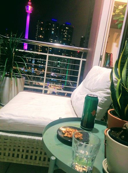
We end up hanging out on that balcony, reviewing our plans for the next day. After dark, we take the monorail just a short walk away to enjoy our first evening on a rooftop at the 34th floor: Hélipad (Raja Chulan station—you have to enter the Menara Tower at the base of the station) with a panoramic view of the city and its iconic towers.
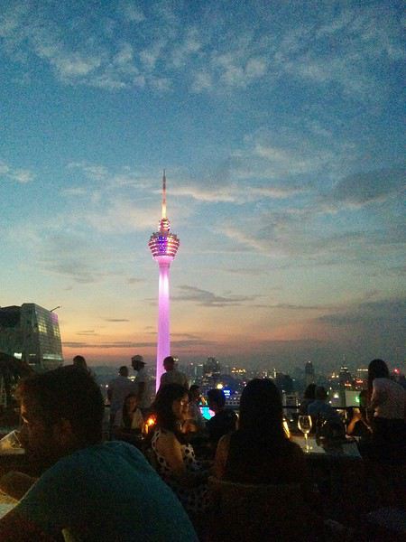
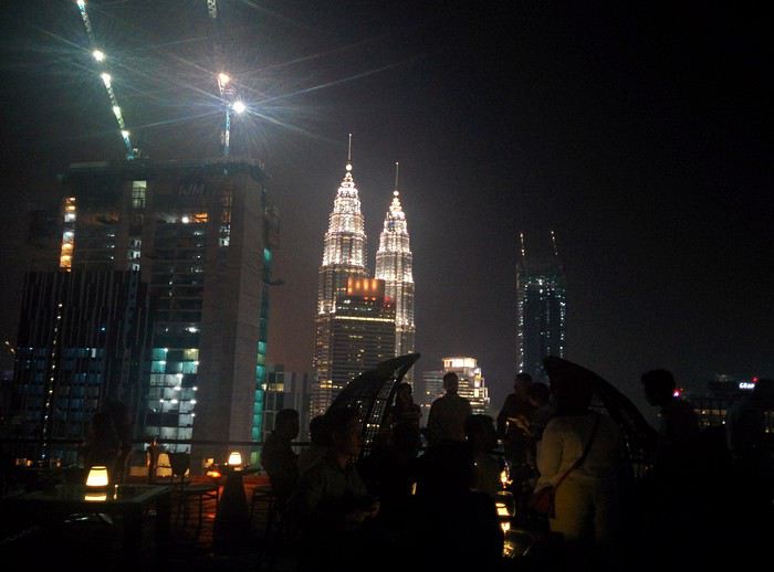
Finally, we head to Jalan Alor to grab a bite in this super busy street. Big sleep ahead! 😴
Here’s our account of our trip to Malaysia from September 11th to 27th. I hope our tips can help others as much as this forum has helped us!
Day 0:
Departure from Nantes with a transfer in Amsterdam via KLM (720 €).
Day 1:
We arrive at KLIA1 in the early afternoon. First challenge: figuring out where to pick up our luggage. Turns out the answer is right under our noses—we need to take the airport’s internal metro! Once we’ve got our bags, we withdraw some cash from a Maybank ATM right there. Next up: SIM card! Just outside the arrivals hall, several kiosks offer them. We go for a Celcom 5 GB card (70 RM). Then it’s taxi time to get to KL, in the Bukit Bintang area—about 85 RM in a slightly old taxi with weak air conditioning. We check into our Airbnb apartment, which is clean, more spacious than a hotel room, and—best of all—has a charming balcony with a gorgeous nighttime view!
We end up hanging out on that balcony, reviewing our plans for the next day. After dark, we take the monorail just a short walk away to enjoy our first evening on a rooftop at the 34th floor: Hélipad (Raja Chulan station—you have to enter the Menara Tower at the base of the station) with a panoramic view of the city and its iconic towers.
Finally, we head to Jalan Alor to grab a bite in this super busy street. Big sleep ahead! 😴
Hi everyone...
Must be around 5,000 photos to sort through!
Makes sense after 3 intense weeks in SA.
Anyway, to set the mood, here are a few photos... Well, yeah, they’re not amazing!
Suspense, suspense...
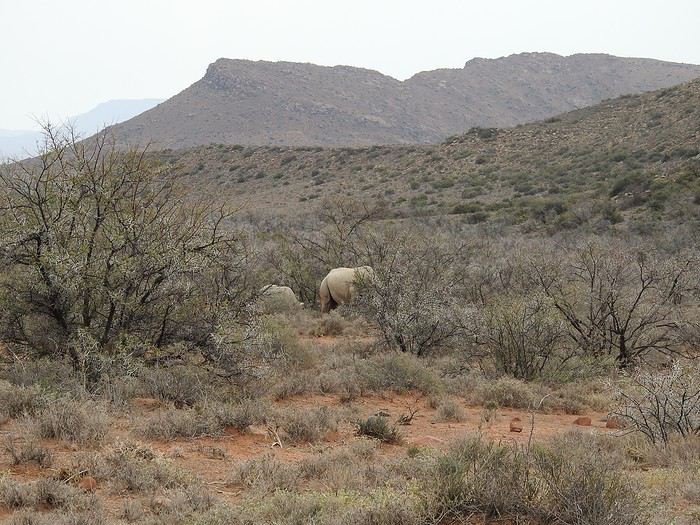
Must be around 5,000 photos to sort through!
Makes sense after 3 intense weeks in SA.
Anyway, to set the mood, here are a few photos... Well, yeah, they’re not amazing!
Suspense, suspense...
Hello,
We’re not sure this report will really be useful for VF backpackers.
As mentioned in our profile, our travel journals are primarily aimed at young van converters who’ve been following our trips for years. No cultural fluff—just a visual reconstruction that strictly follows our motorized routes.
That said, they might offer a different perspective: traveling immersed in a small, go-anywhere vehicle that fascinated the Iranians. We didn’t just visit once—we had to show off our van setup 100 times!
Anyway, it’s up to you to decide. 😏
The itinerary? No overly precise plan. It’s all about the vibe, improvisation, and what we felt like doing... since our van makes us completely self-sufficient. Sylvie wanted to see Persepolis, the desert cities, and the jewel that is Isfahan. For me, it was Abadan and Bandar Abbas—where I used to drive TIR trucks back in the 1970s. Then Bam and Baluchistan, where I’d never driven before.
Speaking of which, over 40 years of international road experience doesn’t make you immune to mistakes. Overconfident, I underestimated tensions in certain areas. You’ll find the stories in the text accompanying the photos.
All in all, these 30 days are shared online in two albums.
Click the "i" to display the story alongside the photos:
Album 1: PERSIAN GULF
Album 2: IRAN 2017
The travel journal map:
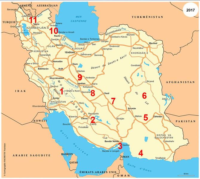
To wrap up, a few snapshots of our favorite spots 😏
Shushtar, Khuzestan
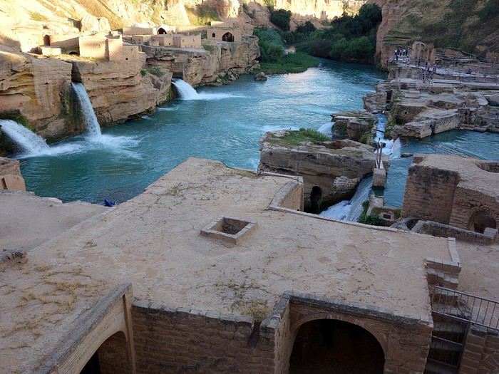
Qeshm Island
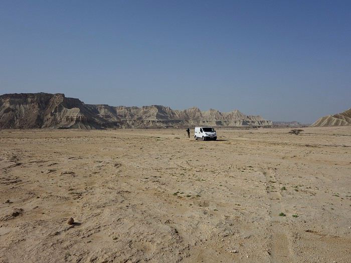
Strait of Hormuz
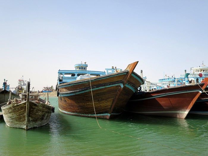
Bam
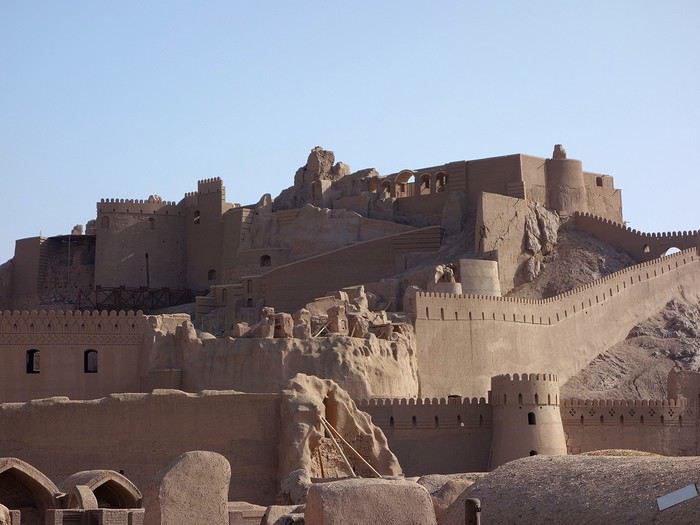
Gulf of Oman
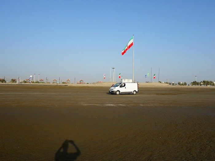
Shahdad Desert
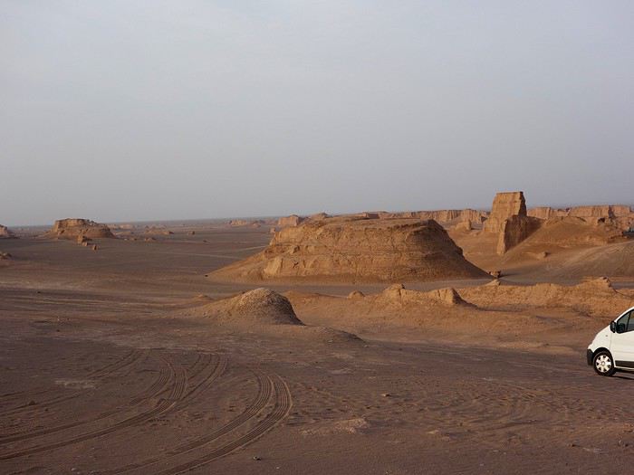
Ardabil
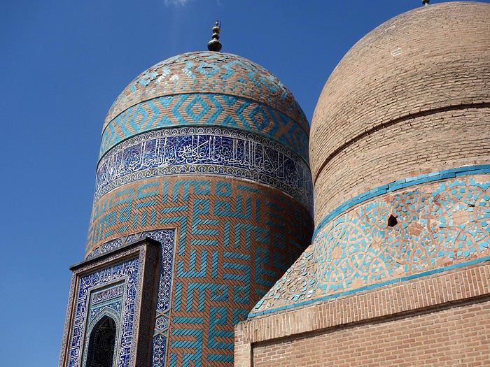
Varzaneh
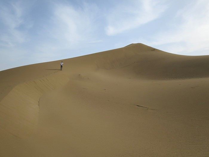
Best regards, Sylvie & Bernard
We’re not sure this report will really be useful for VF backpackers.
As mentioned in our profile, our travel journals are primarily aimed at young van converters who’ve been following our trips for years. No cultural fluff—just a visual reconstruction that strictly follows our motorized routes.
That said, they might offer a different perspective: traveling immersed in a small, go-anywhere vehicle that fascinated the Iranians. We didn’t just visit once—we had to show off our van setup 100 times!
Anyway, it’s up to you to decide. 😏
The itinerary? No overly precise plan. It’s all about the vibe, improvisation, and what we felt like doing... since our van makes us completely self-sufficient. Sylvie wanted to see Persepolis, the desert cities, and the jewel that is Isfahan. For me, it was Abadan and Bandar Abbas—where I used to drive TIR trucks back in the 1970s. Then Bam and Baluchistan, where I’d never driven before.
Speaking of which, over 40 years of international road experience doesn’t make you immune to mistakes. Overconfident, I underestimated tensions in certain areas. You’ll find the stories in the text accompanying the photos.
All in all, these 30 days are shared online in two albums.
Click the "i" to display the story alongside the photos:
Album 1: PERSIAN GULF
Album 2: IRAN 2017
The travel journal map:
To wrap up, a few snapshots of our favorite spots 😏
Shushtar, Khuzestan
Qeshm Island
Strait of Hormuz
Bam
Gulf of Oman
Shahdad Desert
Ardabil
Varzaneh
Best regards, Sylvie & Bernard
Hi there,
This travel journal is to share our trip to Myanmar in January-February 2017 and relive the experience...
Six stops:
- the economic capital, Yangon,
- the ethnic groups in the east around Kengtong,
- Inle Lake
- Mandalay
- Bagan
- the Golden Rock and Bago
A trip for two, but organized with a local agency.
Flight with Vietnam Airlines (Paris/Ho Chi Minh City/Yangon on the way out, Yangon/Hanoi/Paris on the way back)
First stop, Yangon
At last, we arrive! That moment of excitement and impatience we all know when we land in a country we don’t know but have been dreaming about for a while. Butterflies in our stomachs—not just from the long flight! It’s noon, everything goes smoothly (baggage, immigration, currency exchange, pre-booked taxi, ride to Yangon), and by 2:30 PM we check out of our hotel, tired from the journey but eager to explore the city and power through until evening to beat the jet lag. We’re driven by To-Wen. Traffic is pretty heavy, but strangely, no motorbikes or scooters... To-Wen explains that two-wheelers have been banned in Yangon for several years because they’d become too numerous and caused many injuries and fatalities. To compensate, a very developed public transport system has been put in place. Yangon, or Rangoon, isn’t Myanmar’s administrative capital. The official capital was moved to Naypyidaw in 2005 by government decision—some say to distance themselves from potential popular uprisings. Whatever the reason, it cost a fortune, and no one followed (only civil servants, who were forced to go), not even foreign embassies. This ghost capital makes all the Burmese we spoke to chuckle. Yangon is the economic, cultural, and diplomatic capital, and it’s the most populous city (4.5 million people).
What did we see? Well, first we discovered the Sule Pagoda, a funny concept of a "roundabout pagoda" since it’s right in the middle of a busy intersection! Circular, its outer wall houses many tiny stalls. Then comes the miracle: the hustle and bustle of the street contrasts with the calm inside. You leave a noisy roundabout and suddenly find yourself in another world... flowers and fruit in front of the altars, the scent of jasmine mixed with incense... Actually, this pagoda is very old—it’s said to have been founded in 230 BC to enshrine a hair of the Buddha, but it was in the 15th century that the great zedi (a slender stupa) on top reached its current height of 44 meters (see photos). It’s a symbolic site in the fight for democracy, as it was the rallying point for monk protests in 2007.
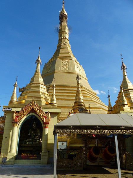
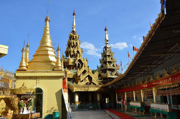
Next to the Sule Pagoda is Independence Park, which borders the colonial district (very run-down).
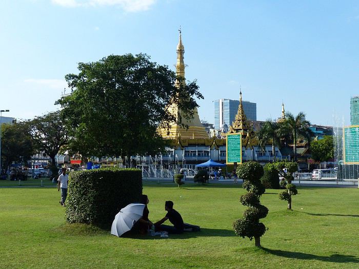
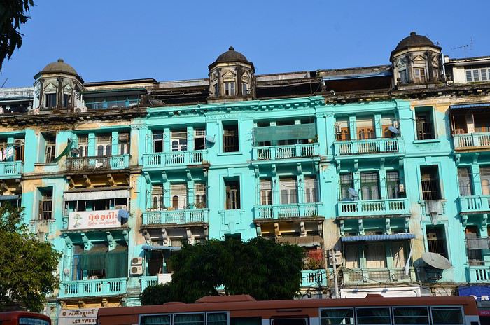
Then we had our first wow moment: the stunning Shwedagon Pagoda (see photos). It’s Myanmar’s most sacred Buddhist sanctuary, drawing crowds of devotees. Its stupa rises to 99 meters, surrounded by dozens of temples and zedis... It’s said that successive rulers have been embellishing and expanding it for over 1,500 years.
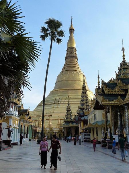
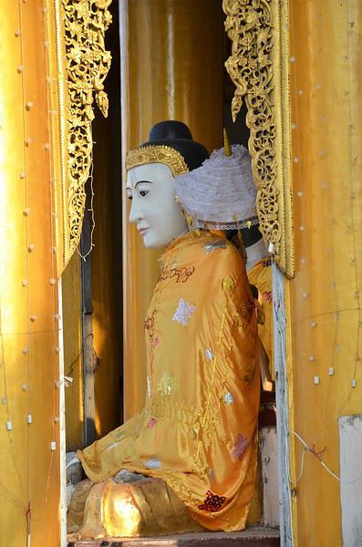
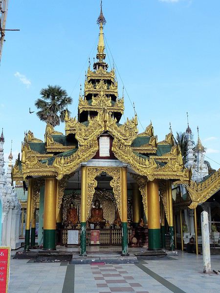
Believers gather in the many halls and circle the great golden stupa. Here, we encounter for the first time the incredible "quiet fervor" of the Burmese. A kind, open religiosity that doesn’t make us feel like intruders or nuisances—instead, it makes us want to understand their faith better.
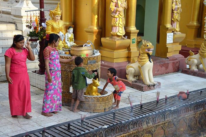
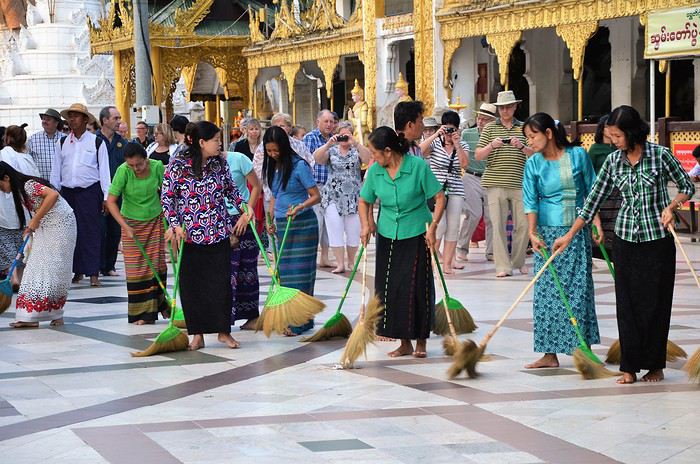
If you go, make sure to be there in the late afternoon: the low rays of the setting sun bathe the site in gold and orange. The zedis glow... and everything becomes surreal.
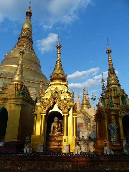
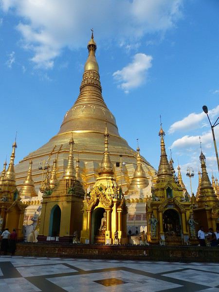
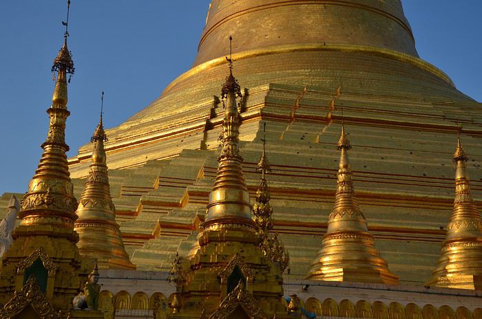
The sun sets early, so we head back to the hotel around 6:30 PM. Lucky for us, it has a stunning view of Yangon by night from the top floor. We settle in to sip our first vacation cocktail. In the foreground, the shadow of Kandawgyi Lake, and in the background, the illuminated Shwedagon Pagoda, which serves as a landmark for the whole city. (See photo.)
Tomorrow, we fly to Kengtung. We’ll be back in Yangon at the end of our trip to explore more.
Time for bed by 10 PM—we need a restful night to adjust to Myanmar time...
Next post: Kengtung and meeting the local ethnic groups.
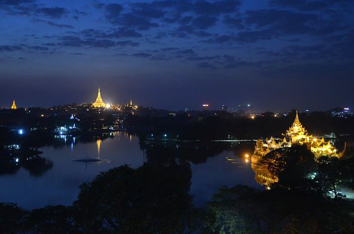
First stop, Yangon
At last, we arrive! That moment of excitement and impatience we all know when we land in a country we don’t know but have been dreaming about for a while. Butterflies in our stomachs—not just from the long flight! It’s noon, everything goes smoothly (baggage, immigration, currency exchange, pre-booked taxi, ride to Yangon), and by 2:30 PM we check out of our hotel, tired from the journey but eager to explore the city and power through until evening to beat the jet lag. We’re driven by To-Wen. Traffic is pretty heavy, but strangely, no motorbikes or scooters... To-Wen explains that two-wheelers have been banned in Yangon for several years because they’d become too numerous and caused many injuries and fatalities. To compensate, a very developed public transport system has been put in place. Yangon, or Rangoon, isn’t Myanmar’s administrative capital. The official capital was moved to Naypyidaw in 2005 by government decision—some say to distance themselves from potential popular uprisings. Whatever the reason, it cost a fortune, and no one followed (only civil servants, who were forced to go), not even foreign embassies. This ghost capital makes all the Burmese we spoke to chuckle. Yangon is the economic, cultural, and diplomatic capital, and it’s the most populous city (4.5 million people).
What did we see? Well, first we discovered the Sule Pagoda, a funny concept of a "roundabout pagoda" since it’s right in the middle of a busy intersection! Circular, its outer wall houses many tiny stalls. Then comes the miracle: the hustle and bustle of the street contrasts with the calm inside. You leave a noisy roundabout and suddenly find yourself in another world... flowers and fruit in front of the altars, the scent of jasmine mixed with incense... Actually, this pagoda is very old—it’s said to have been founded in 230 BC to enshrine a hair of the Buddha, but it was in the 15th century that the great zedi (a slender stupa) on top reached its current height of 44 meters (see photos). It’s a symbolic site in the fight for democracy, as it was the rallying point for monk protests in 2007.
Next to the Sule Pagoda is Independence Park, which borders the colonial district (very run-down).
Then we had our first wow moment: the stunning Shwedagon Pagoda (see photos). It’s Myanmar’s most sacred Buddhist sanctuary, drawing crowds of devotees. Its stupa rises to 99 meters, surrounded by dozens of temples and zedis... It’s said that successive rulers have been embellishing and expanding it for over 1,500 years.
Believers gather in the many halls and circle the great golden stupa. Here, we encounter for the first time the incredible "quiet fervor" of the Burmese. A kind, open religiosity that doesn’t make us feel like intruders or nuisances—instead, it makes us want to understand their faith better.
If you go, make sure to be there in the late afternoon: the low rays of the setting sun bathe the site in gold and orange. The zedis glow... and everything becomes surreal.
The sun sets early, so we head back to the hotel around 6:30 PM. Lucky for us, it has a stunning view of Yangon by night from the top floor. We settle in to sip our first vacation cocktail. In the foreground, the shadow of Kandawgyi Lake, and in the background, the illuminated Shwedagon Pagoda, which serves as a landmark for the whole city. (See photo.)
Tomorrow, we fly to Kengtung. We’ll be back in Yangon at the end of our trip to explore more.
Time for bed by 10 PM—we need a restful night to adjust to Myanmar time...
Next post: Kengtung and meeting the local ethnic groups.
hi, I'm looking for info on possible transport to Ilam and then Phidim from KTM, as well as details about this trek. I found the PDF but no feedback from those who’ve tried it... have a great day, Aichatou
Here we go...
It’s been almost a month since we got back, and my head is still over there... Just like every time... For my own sake, I know travel journals are useful for travelers planning a trip to a country. But selfishly, they’re also helpful for me—to put the final stone on each journey and revisit it from time to time, just for the memories...
So, this trip won’t be any different, and I invite you to follow along on our Andean adventure, from Lima to the Southern Lipez, from December 16, 2016, to January 14, 2017. It’s a chronological journal because I don’t know how to approach it any other way. It doesn’t hold any absolute truths—just my experiences and feelings, which are obviously personal and not objective!
But if it inspires you to visit these magical countries (and I assume you’re already interested if you’re here) or gives you a couple of tips, then I’ll consider it a win!
So, let’s hit the road for the land of wide-open spaces!
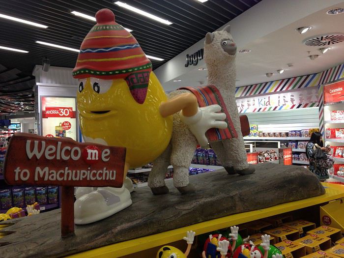
It’s been almost a month since we got back, and my head is still over there... Just like every time... For my own sake, I know travel journals are useful for travelers planning a trip to a country. But selfishly, they’re also helpful for me—to put the final stone on each journey and revisit it from time to time, just for the memories...
So, this trip won’t be any different, and I invite you to follow along on our Andean adventure, from Lima to the Southern Lipez, from December 16, 2016, to January 14, 2017. It’s a chronological journal because I don’t know how to approach it any other way. It doesn’t hold any absolute truths—just my experiences and feelings, which are obviously personal and not objective!
But if it inspires you to visit these magical countries (and I assume you’re already interested if you’re here) or gives you a couple of tips, then I’ll consider it a win!
So, let’s hit the road for the land of wide-open spaces!
Hi there!
After scouring the forum, reading several guides, and browsing websites, here are a few questions about our upcoming trip to Ecuador this summer.
We’re planning to travel with our 16-month-old son (he’s already been to Russia, Argentina, and Uruguay in his first three months), and here are some questions we have.
The big question: What type of baby carrier would you recommend? (We have a JPMBB, but I’ve never really been able to use it—it digs into my shoulders and isn’t comfortable. For short walks or strolls with the baby, we need something solid!)
Roughly, we’d arrive in Quito and return from Guayaquil (with the end of the trip in the Galápagos). The route would be something like this: Quito, Quilotoa, Papallacta, Cotopaxi, Baños, Riobamba, Chimborazo, Cuenca, Guayaquil, and the Galápagos.
For the Galápagos, we were thinking of 8 days—does that seem reasonable?
Regarding transportation, what are the buses like in Ecuador? (More like Argentina/Chile or more like Bolivia/Nicaragua?) How manageable is it with a baby?
Does the itinerary seem doable, and how much time would you roughly spend in each place? It’s clear we won’t be doing any major ascents, but we enjoy walking—a 2-3 hour hike to see the wildlife and flora at the foot of Chimborazo doesn’t scare us.
Without a baby, what do you think of the Baños-Puyo route? Some recommend the Chimborazo descent instead. With a baby, is the Baños-Puyo route doable? Is it possible to have a baby carrier on the bike?
Thanks so much! :)
After scouring the forum, reading several guides, and browsing websites, here are a few questions about our upcoming trip to Ecuador this summer.
We’re planning to travel with our 16-month-old son (he’s already been to Russia, Argentina, and Uruguay in his first three months), and here are some questions we have.
The big question: What type of baby carrier would you recommend? (We have a JPMBB, but I’ve never really been able to use it—it digs into my shoulders and isn’t comfortable. For short walks or strolls with the baby, we need something solid!)
Roughly, we’d arrive in Quito and return from Guayaquil (with the end of the trip in the Galápagos). The route would be something like this: Quito, Quilotoa, Papallacta, Cotopaxi, Baños, Riobamba, Chimborazo, Cuenca, Guayaquil, and the Galápagos.
For the Galápagos, we were thinking of 8 days—does that seem reasonable?
Regarding transportation, what are the buses like in Ecuador? (More like Argentina/Chile or more like Bolivia/Nicaragua?) How manageable is it with a baby?
Does the itinerary seem doable, and how much time would you roughly spend in each place? It’s clear we won’t be doing any major ascents, but we enjoy walking—a 2-3 hour hike to see the wildlife and flora at the foot of Chimborazo doesn’t scare us.
Without a baby, what do you think of the Baños-Puyo route? Some recommend the Chimborazo descent instead. With a baby, is the Baños-Puyo route doable? Is it possible to have a baby carrier on the bike?
Thanks so much! :)
Hello,
We’re planning our trip for October 2017!! (Yes, it’s still far off—but planning it is already like a vacation.) We’re interested in the Ban Gioc Waterfalls, but I can’t quite make up my mind about them. Will there still be water in October? Is this stop worth it? (Even if there’s no water?) Thanks for your replies! Happy travels to everyone, Eric
We’re planning our trip for October 2017!! (Yes, it’s still far off—but planning it is already like a vacation.) We’re interested in the Ban Gioc Waterfalls, but I can’t quite make up my mind about them. Will there still be water in October? Is this stop worth it? (Even if there’s no water?) Thanks for your replies! Happy travels to everyone, Eric
I hope this travel journal might interest some people, but since we were completely self-sufficient (tent, sleeping bag, pot, cooking over a wood fire…) almost every day, I don’t have many hotel addresses or great restaurant tips to share! Sorry!
We used the Maio map at 1:50,000 scale. It’s part of the Boa Vista/Sal/Maio map. Bought on Amazon, but currently unavailable as of the latest news.
The people of Maio are extremely welcoming and warm, and we were always more than well received in the villages where we pitched our tent!
We’re usually big hikers, but since Maio is a beach island (gorgeous ones, at that!), we alternated a few hours of walking in the morning with some relaxation in the afternoon: beach, reading, fishing, resting…
1 euro = 110 escudos
Day 1 (Friday) Transfers by plane: Fogo-Praia-Maio We opted for the plane to save some time on transfers, as the boat connections between Fogo and Praia take a while, and those between Praia and Maio are almost nonexistent.
You should budget around 40-50 euros per flight per person.
There are 2 flights per week between Praia and Maio—on Tuesdays and Fridays when we were there (January 2016), but currently on Mondays and Fridays.
Tickets were booked directly and without issue on the TACV website: https://flytacv.com/?lang=en
A bit of a delay leaving Praia, but we arrived on Maio without any problems around 4 PM.
We took an *aluguer* (shared transport, 200 escudos per person) to the center of Vila do Maio, but it’s totally doable on foot with a backpack.
Since it was already a bit late, for this first night, we dropped our bags at Big Game Maio. A standard European-style hotel run by a very nice Italian family. It’s a bit pricey for us (5500 escudos for 2 people with breakfast), but after our 2 weeks in a tent on Fogo, we were happy to find a little comfort. And the breakfast is ultra-generous, with fresh products (cured ham, fruit, cheese, bread) and top quality. The hotel restaurant offers dishes that are a clever mix of Italian and Cape Verdean cuisine. Excellent!
Little tip: We didn’t try it, but Big Game Maio offers big-game fishing trips, diving, and quad rentals.
The hotel is 2 minutes from Vila’s beautiful beach, and we went for a dip at sunset and took a stroll around town. They’re redeveloping the waterfront with pretty sidewalks and light stone walls.
 Vila beach
 Sunset behind Santiago

Day 2 (Saturday): rest day + fishing After 2 weeks of hiking and since Vila is such a peaceful place where it’s nice to take your time, we decided to spend an extra day there. We took the path heading south along the coast to reach Ponta Preta beach in 20 minutes. The path isn’t very pretty because there’s quite a bit of construction going on, which prevents you from really walking along the shore. Lots of real estate agencies, especially Italian ones, have taken over the land. But Ponta Preta beach is a stunning black-sand beach where we had the whole place to ourselves. We decided to go fishing from the rocks.
At 1 PM, the sun was blazing, so we headed back to Vila and dried the fish for the following days.
At 6 PM, we went fishing again, but this time at night from the rocks at the end of Vila beach.
8:30 PM: back to shower and eat at the restaurant.
 The rocks and sea at Ponta Preta
Day 3 (Sunday): from Vila do Maio to Calheta de Baixo, via Monte Batalha (path 101) Hiking time: 5h Since there aren’t many “summits” on Maio, we decided to head to Calheta de Baixo but via Monte Batalha. We left at 8:20 AM and somehow made it to Monte Batalha by 11 AM (2h40 of hiking). But the path is really hard to find in the middle of the dry grass and acacia trees. We kind of cut through randomly, aiming for the summit. Even though it’s not very high (around 300 m), the view is amazing—you can see all of Maio at 360°!
Short 30-minute break. The descent through the “forest” of acacias is even worse for finding your way. We oriented ourselves a bit by the sun to find the road connecting Vila to Calheta. We arrived around 1:30 PM at Calheta de Baixo. A very pretty little seaside village with colorful houses. An idyllic beach, a newly renovated square, and super-friendly people. We pitched our tent facing the sea on the terrace of an abandoned house (after asking the locals for permission).
We cooked some of the dried fish we’d caught the day before, along with fresh beans we’d brought from Fogo (and were still carrying!).
 At the summit of Monte Batalha
 Calheta
 Calheta de Baixo
Day 4 (Monday): From Calheta de Baixo to Morrinho on foot. Hiking time: 3h. Then hitching a bus to Cascabulho, and a car to Pedro Vaz. We left around 9:30 AM heading north (path 201), following the coastline where the beaches just keep coming—each one wilder and more beautiful than the last: Praia de Soca, Calheta Braca, Ponta de Pau Seco, Calhetina. We reached the dunes of Baia de Santana. There’s no real path, so you have to follow the coast, then go around the dunes, and when you spot the 3 coconut trees, head east toward them to find the track leading to Morrinho. Again, we discovered a village with a Wild West vibe, with colorful houses lined up on either side of a paved road. Just enough time to accept a drink offered by a local before jumping onto the passing school bus that took us to Cascabulho. There, we waited for a ride. A political delegation of 10 cars drove right past us without stopping. Luckily, one of the cars had a flat tire and came by 30 minutes later—and that one, thankfully, gave us a lift! They were heading to the inauguration of a water pump in Pedro Vaz. So that’s where we stopped too. After getting permission from the school principal, we pitched our tent in front of the village school… and became the attraction for all the kids who kept us company until nightfall! A woman gave us 2 jugs of water, but with all that company, it was tough to take a peaceful shower!!
Dinner: pasta with beans.
We were woken up by rain during the night and had to rush to bring all our stuff inside the tent!

 The beaches just keep coming...
 The dunes
 The 3 coconut trees, a landmark to find the track
Day 5 (Tuesday): Rest day and fishing at Boca da Ribeira beach We packed up at 8 AM because the kids had school. We filled the 2 water jugs that the woman lent us and headed down to camp at Boca da Ribeira beach, which is a bit further east of Pedro Vaz. It took less than an hour to get there. This time, we really were alone in the world! We pitched the tent and spent the day fishing, reading, playing, and swimming regularly because the sun was beating down hard!!! We caught a nice fish that we grilled over the fire in the evening. With the crabs and shellfish we gathered, we made a seafood rice! Yum! What a feast!
That night, once the tent was zipped up, we felt something like rain on the tent fabric. I decided to go out and gather our things, and then—shock!!! It wasn’t raindrops we were feeling and hearing, but bugs attracted by the light!! Not just a few bugs—a huge swarm of them!!! Thousands of bugs covering the whole tent, the ropes, slipping into the seams and hems! Everywhere! The blue tent had turned green!!! After that, it was a real struggle to get back inside without letting any in! A real challenge, and there were always 3 or 4 that managed to sneak in anyway. Total war!!!
 Boca da Ribeira beach

Day 6 (Wednesday): From Boca da Ribeira to Ribeira Dom João. Hiking time: 3h30 We woke up leisurely and waited for the sun to dry our things, damp from the dew. A man passed by, and we gave him the water jugs we’d borrowed, which saved us a trip back to Pedro Vaz to return them to the woman.
We left around 10 AM. We followed the sea to Alcatraz, then headed toward Pilão Cão. The path runs alongside the small hills on our right, and we passed above Lagoa Cimidor. The terrain is arid, and the path is hard to find among the many goat tracks.
After 3h30 of hiking, we reached Ribeira Dom João with 2 young people we’d met along the way.
Since it was a public holiday in Cape Verde, the kids didn’t have school, and with the principal’s permission, we pitched our tent in the kindergarten. She even kindly opened the school toilets for us. The neighbor gave us the water we needed to wash up and cook. We cooked beef steaks on charcoal. A nice change from fish!! Charcoal is a widespread artisanal product on the island. People almost never cook directly over wood but always with these big chunks of charcoal.
 The hills on our right
 Ribeira Dom João
Day 7 (Thursday): From Ribeira Dom João to Vila do Maio. Hiking time: 3h30 We woke up at 6:30 AM to clear out of the school by 8 AM. The neighbor made us coffee to save time. It took us 2 hours to reach Barreiro, another Wild West-style town! Since we didn’t want to walk on the road, we took the old track and reached Vila do Maio in 1h30.
Last night before taking the plane back to Praia the next day.
 Barreiro
 The old track
 The church in Vila do Maio
That’s where this trip ends!
Maio is truly a magical island! A remote, isolated place with incredible, wild beaches and villages with a Wild West feel—colorful houses on either side of well-paved, well-maintained, and decorated streets. And the locals are so warm and welcoming.
Even for hikers like us, it was a great discovery, and we were able to alternate hiking and relaxation with great pleasure! Too bad the area around Vila do Maio is being overrun by real estate construction—ongoing, unfinished, abandoned…
Safe travels to all!
We used the Maio map at 1:50,000 scale. It’s part of the Boa Vista/Sal/Maio map. Bought on Amazon, but currently unavailable as of the latest news.
The people of Maio are extremely welcoming and warm, and we were always more than well received in the villages where we pitched our tent!
We’re usually big hikers, but since Maio is a beach island (gorgeous ones, at that!), we alternated a few hours of walking in the morning with some relaxation in the afternoon: beach, reading, fishing, resting…
1 euro = 110 escudos
Day 1 (Friday) Transfers by plane: Fogo-Praia-Maio We opted for the plane to save some time on transfers, as the boat connections between Fogo and Praia take a while, and those between Praia and Maio are almost nonexistent.
You should budget around 40-50 euros per flight per person.
There are 2 flights per week between Praia and Maio—on Tuesdays and Fridays when we were there (January 2016), but currently on Mondays and Fridays.
Tickets were booked directly and without issue on the TACV website: https://flytacv.com/?lang=en
A bit of a delay leaving Praia, but we arrived on Maio without any problems around 4 PM.
We took an *aluguer* (shared transport, 200 escudos per person) to the center of Vila do Maio, but it’s totally doable on foot with a backpack.
Since it was already a bit late, for this first night, we dropped our bags at Big Game Maio. A standard European-style hotel run by a very nice Italian family. It’s a bit pricey for us (5500 escudos for 2 people with breakfast), but after our 2 weeks in a tent on Fogo, we were happy to find a little comfort. And the breakfast is ultra-generous, with fresh products (cured ham, fruit, cheese, bread) and top quality. The hotel restaurant offers dishes that are a clever mix of Italian and Cape Verdean cuisine. Excellent!
Little tip: We didn’t try it, but Big Game Maio offers big-game fishing trips, diving, and quad rentals.
The hotel is 2 minutes from Vila’s beautiful beach, and we went for a dip at sunset and took a stroll around town. They’re redeveloping the waterfront with pretty sidewalks and light stone walls.
Vila beach
Sunset behind SantiagoDay 2 (Saturday): rest day + fishing After 2 weeks of hiking and since Vila is such a peaceful place where it’s nice to take your time, we decided to spend an extra day there. We took the path heading south along the coast to reach Ponta Preta beach in 20 minutes. The path isn’t very pretty because there’s quite a bit of construction going on, which prevents you from really walking along the shore. Lots of real estate agencies, especially Italian ones, have taken over the land. But Ponta Preta beach is a stunning black-sand beach where we had the whole place to ourselves. We decided to go fishing from the rocks.
At 1 PM, the sun was blazing, so we headed back to Vila and dried the fish for the following days.
At 6 PM, we went fishing again, but this time at night from the rocks at the end of Vila beach.
8:30 PM: back to shower and eat at the restaurant.
The rocks and sea at Ponta PretaDay 3 (Sunday): from Vila do Maio to Calheta de Baixo, via Monte Batalha (path 101) Hiking time: 5h Since there aren’t many “summits” on Maio, we decided to head to Calheta de Baixo but via Monte Batalha. We left at 8:20 AM and somehow made it to Monte Batalha by 11 AM (2h40 of hiking). But the path is really hard to find in the middle of the dry grass and acacia trees. We kind of cut through randomly, aiming for the summit. Even though it’s not very high (around 300 m), the view is amazing—you can see all of Maio at 360°!
Short 30-minute break. The descent through the “forest” of acacias is even worse for finding your way. We oriented ourselves a bit by the sun to find the road connecting Vila to Calheta. We arrived around 1:30 PM at Calheta de Baixo. A very pretty little seaside village with colorful houses. An idyllic beach, a newly renovated square, and super-friendly people. We pitched our tent facing the sea on the terrace of an abandoned house (after asking the locals for permission).
We cooked some of the dried fish we’d caught the day before, along with fresh beans we’d brought from Fogo (and were still carrying!).
At the summit of Monte Batalha
Calheta
Calheta de BaixoDay 4 (Monday): From Calheta de Baixo to Morrinho on foot. Hiking time: 3h. Then hitching a bus to Cascabulho, and a car to Pedro Vaz. We left around 9:30 AM heading north (path 201), following the coastline where the beaches just keep coming—each one wilder and more beautiful than the last: Praia de Soca, Calheta Braca, Ponta de Pau Seco, Calhetina. We reached the dunes of Baia de Santana. There’s no real path, so you have to follow the coast, then go around the dunes, and when you spot the 3 coconut trees, head east toward them to find the track leading to Morrinho. Again, we discovered a village with a Wild West vibe, with colorful houses lined up on either side of a paved road. Just enough time to accept a drink offered by a local before jumping onto the passing school bus that took us to Cascabulho. There, we waited for a ride. A political delegation of 10 cars drove right past us without stopping. Luckily, one of the cars had a flat tire and came by 30 minutes later—and that one, thankfully, gave us a lift! They were heading to the inauguration of a water pump in Pedro Vaz. So that’s where we stopped too. After getting permission from the school principal, we pitched our tent in front of the village school… and became the attraction for all the kids who kept us company until nightfall! A woman gave us 2 jugs of water, but with all that company, it was tough to take a peaceful shower!!
Dinner: pasta with beans.
We were woken up by rain during the night and had to rush to bring all our stuff inside the tent!
The beaches just keep coming...
The dunes
The 3 coconut trees, a landmark to find the trackDay 5 (Tuesday): Rest day and fishing at Boca da Ribeira beach We packed up at 8 AM because the kids had school. We filled the 2 water jugs that the woman lent us and headed down to camp at Boca da Ribeira beach, which is a bit further east of Pedro Vaz. It took less than an hour to get there. This time, we really were alone in the world! We pitched the tent and spent the day fishing, reading, playing, and swimming regularly because the sun was beating down hard!!! We caught a nice fish that we grilled over the fire in the evening. With the crabs and shellfish we gathered, we made a seafood rice! Yum! What a feast!
That night, once the tent was zipped up, we felt something like rain on the tent fabric. I decided to go out and gather our things, and then—shock!!! It wasn’t raindrops we were feeling and hearing, but bugs attracted by the light!! Not just a few bugs—a huge swarm of them!!! Thousands of bugs covering the whole tent, the ropes, slipping into the seams and hems! Everywhere! The blue tent had turned green!!! After that, it was a real struggle to get back inside without letting any in! A real challenge, and there were always 3 or 4 that managed to sneak in anyway. Total war!!!
Boca da Ribeira beachDay 6 (Wednesday): From Boca da Ribeira to Ribeira Dom João. Hiking time: 3h30 We woke up leisurely and waited for the sun to dry our things, damp from the dew. A man passed by, and we gave him the water jugs we’d borrowed, which saved us a trip back to Pedro Vaz to return them to the woman.
We left around 10 AM. We followed the sea to Alcatraz, then headed toward Pilão Cão. The path runs alongside the small hills on our right, and we passed above Lagoa Cimidor. The terrain is arid, and the path is hard to find among the many goat tracks.
After 3h30 of hiking, we reached Ribeira Dom João with 2 young people we’d met along the way.
Since it was a public holiday in Cape Verde, the kids didn’t have school, and with the principal’s permission, we pitched our tent in the kindergarten. She even kindly opened the school toilets for us. The neighbor gave us the water we needed to wash up and cook. We cooked beef steaks on charcoal. A nice change from fish!! Charcoal is a widespread artisanal product on the island. People almost never cook directly over wood but always with these big chunks of charcoal.
The hills on our right
Ribeira Dom JoãoDay 7 (Thursday): From Ribeira Dom João to Vila do Maio. Hiking time: 3h30 We woke up at 6:30 AM to clear out of the school by 8 AM. The neighbor made us coffee to save time. It took us 2 hours to reach Barreiro, another Wild West-style town! Since we didn’t want to walk on the road, we took the old track and reached Vila do Maio in 1h30.
Last night before taking the plane back to Praia the next day.
Barreiro
The old track
The church in Vila do MaioThat’s where this trip ends!
Maio is truly a magical island! A remote, isolated place with incredible, wild beaches and villages with a Wild West feel—colorful houses on either side of well-paved, well-maintained, and decorated streets. And the locals are so warm and welcoming.
Even for hikers like us, it was a great discovery, and we were able to alternate hiking and relaxation with great pleasure! Too bad the area around Vila do Maio is being overrun by real estate construction—ongoing, unfinished, abandoned…
Safe travels to all!
On my flight from Chiang Rai (CEI) to Krabi (KBV) via Bangkok (DMK), I took two connecting flights: the first with Nok Air and the second with AirAsia, with a layover of about 1 hour and 10 minutes. Just enough time to grab my backpack and check in—basically a quick sprint through the airport...
Everything went smoothly, but at DMK, the AirAsia flight was 30 minutes late...
Once comfortably seated in the departure lounge, I checked my passport and boarding passes and realized Nok Air had weighed my checked backpack at 8 kg, but when it arrived at DMK, AirAsia had weighed it at 10 kg! So, my bag supposedly gained 2 kg after just 1 hour and 10 minutes of flight...??? 😮
Nok Air offers 15 kg of baggage for free, while AirAsia offers nothing—you have to buy 15 kg (300 baht) when purchasing your ticket or pay 900 baht at the counter for the same allowance. Excess baggage costs 400 baht per additional kg.
Low-cost airlines worldwide (and even major carriers) are eyeing baggage weight—having paid for it with Corsair before—but these "extra" 2 kg that magically appeared are still worth pointing out. My bag weighed 7.8 kg when leaving YUL (Air China), and it’s a 35L backpack that also weighed 8 kg on the way back.
So, be careful...
"😎😎"
Nok Air offers 15 kg of baggage for free, while AirAsia offers nothing—you have to buy 15 kg (300 baht) when purchasing your ticket or pay 900 baht at the counter for the same allowance. Excess baggage costs 400 baht per additional kg.
Low-cost airlines worldwide (and even major carriers) are eyeing baggage weight—having paid for it with Corsair before—but these "extra" 2 kg that magically appeared are still worth pointing out. My bag weighed 7.8 kg when leaving YUL (Air China), and it’s a 35L backpack that also weighed 8 kg on the way back.
So, be careful...
"😎😎"
Bom dia, travelers,
A little feedback from our discovery of Madeira—there aren’t many out there! Hoping it might be useful to some of you 🙂
We stayed 7 days in Madeira between May 18th and 25th.
Base: Funchal, the Lido hotel area. A practical neighborhood (lots of restaurants, shops, buses, etc.) but lacking charm. While getting back to Funchal is quick thanks to the road infrastructure, the outskirts of the city are particularly congested in the morning and evening, often due to tourist buses blocking traffic. Plus, even though Funchal enjoys milder weather compared to the rest of the island, you won’t see any sunrises or sunsets there! In short, if I were to do it again, I wouldn’t stay in Funchal for 7 days, even if it’s convenient to unpack once and for all.
Car rental for the week with Avis through locationdevoiture.fr (now Carigami). Zero-excess insurance, two drivers included, full tank on pickup, return with a full tank. After everything I’d read, I was dreading it. No issues at pickup or return. A Citroën C3 with 4,000 km on the clock, which served us perfectly. We brought our own GPS and map, which came in handy. There are signs, of course, but not always where you need them 😛.
Guides & maps: The Rother for hikes, the *Évasion* guide (quite general but very complete), and the Sunflower (borrowed), which I liked less—I found the explanations less clear and a bit messy, but maybe it was just me being unclear 😇. We also had the Freytag & Berndt map at 1:40,000, very useful when exploring the tiniest roads.
Day 1: In the morning, we head to CURRAL DAS FREIRAS. The viewpoint is pretty, very well developed (too much?). We take a short walk down the path as recommended in the Sunflower guide. The environment is wild but doesn’t offer much in terms of views.


We then head east via the expressway. Destination: PONTA DE SÃO LOURENÇO. The sky is overcast there, while just earlier, we were under the sun 😕! We’ll have to deal with the weather’s whims—a constant in Madeira! Off we go for a 3.5-hour round-trip hike, including photo stops, a picnic, and the climb to Ponta do Furado at the very end.


It’s nice, very open, and unlike anywhere else on the island. But it’s also *very* crowded. Mass tourism where everyone’s staring at their feet, barely a smile, hardly a hello 😠. The vibe kind of kills the charm. We were there at lunchtime but didn’t escape the crowds.


Practical detail that matters: no restrooms at the parking lot, none at the Casa do Sardinha, and an environment with no trees or bushes where you can see for miles. Ladies, plan ahead... A hike you should do regardless, with no major difficulty aside from the final climb, though it "undulates" constantly. The trail is perfectly safe.

Back at the parking lot, we take the road to PORTO DA CRUZ, a small village nestled at the foot of the mountain. The natural pools, being cleaned, are empty, and the seaside promenade, splashed by waves, feels a bit gloomy. The charm isn’t there. Return to Funchal via PORTELA and the MIRADOURO DOS INGLESES, which is tricky to find—hidden at the back of a lovely park, tended like an old lady from the 19th century, maybe the former owner of the place...


To be continued... 😉
We stayed 7 days in Madeira between May 18th and 25th.
Base: Funchal, the Lido hotel area. A practical neighborhood (lots of restaurants, shops, buses, etc.) but lacking charm. While getting back to Funchal is quick thanks to the road infrastructure, the outskirts of the city are particularly congested in the morning and evening, often due to tourist buses blocking traffic. Plus, even though Funchal enjoys milder weather compared to the rest of the island, you won’t see any sunrises or sunsets there! In short, if I were to do it again, I wouldn’t stay in Funchal for 7 days, even if it’s convenient to unpack once and for all.
Car rental for the week with Avis through locationdevoiture.fr (now Carigami). Zero-excess insurance, two drivers included, full tank on pickup, return with a full tank. After everything I’d read, I was dreading it. No issues at pickup or return. A Citroën C3 with 4,000 km on the clock, which served us perfectly. We brought our own GPS and map, which came in handy. There are signs, of course, but not always where you need them 😛.
Guides & maps: The Rother for hikes, the *Évasion* guide (quite general but very complete), and the Sunflower (borrowed), which I liked less—I found the explanations less clear and a bit messy, but maybe it was just me being unclear 😇. We also had the Freytag & Berndt map at 1:40,000, very useful when exploring the tiniest roads.
Day 1: In the morning, we head to CURRAL DAS FREIRAS. The viewpoint is pretty, very well developed (too much?). We take a short walk down the path as recommended in the Sunflower guide. The environment is wild but doesn’t offer much in terms of views.
We then head east via the expressway. Destination: PONTA DE SÃO LOURENÇO. The sky is overcast there, while just earlier, we were under the sun 😕! We’ll have to deal with the weather’s whims—a constant in Madeira! Off we go for a 3.5-hour round-trip hike, including photo stops, a picnic, and the climb to Ponta do Furado at the very end.
It’s nice, very open, and unlike anywhere else on the island. But it’s also *very* crowded. Mass tourism where everyone’s staring at their feet, barely a smile, hardly a hello 😠. The vibe kind of kills the charm. We were there at lunchtime but didn’t escape the crowds.
Practical detail that matters: no restrooms at the parking lot, none at the Casa do Sardinha, and an environment with no trees or bushes where you can see for miles. Ladies, plan ahead... A hike you should do regardless, with no major difficulty aside from the final climb, though it "undulates" constantly. The trail is perfectly safe.
Back at the parking lot, we take the road to PORTO DA CRUZ, a small village nestled at the foot of the mountain. The natural pools, being cleaned, are empty, and the seaside promenade, splashed by waves, feels a bit gloomy. The charm isn’t there. Return to Funchal via PORTELA and the MIRADOURO DOS INGLESES, which is tricky to find—hidden at the back of a lovely park, tended like an old lady from the 19th century, maybe the former owner of the place...
To be continued... 😉
After nearly 2 years of waiting (yeah, like many of you, we wanted to hit the road again as soon as we got back to France... but first, we had to fill up the piggy bank!), here we are at last—July, the month we’ve been waiting for!
We’ve got 30 days of exploring new places ahead of us, as well as revisiting some spots we loved back in 2012.
Here’s the plan: - Joshua Tree NP - Las Vegas - Valley of Fire SP - Yant Flat - Zion NP (Angel’s Landing) - Bryce Canyon NP (Fairyland Loop trail) - Devils Garden on the HITTR - Capitol Reef NP - Grand Teton NP - Yellowstone NP: Old Faithful - Yellowstone NP: Norris Geyser Basin and Mammoth Hot Springs - Yellowstone NP: Grand Canyon of the Yellowstone - West Thumb and Grand Teton NP - Flaming Gorge - Colorado NM and Fisher Towers - Moab: Arches - Moab: Canyonlands and Corona Arch - Moab: Canyonlands - Moab: rafting and Dead Horse Point SP - Natural Bridges NM and Valley of the Gods - Monument Valley and Horseshoe Bend - Coyote Buttes South - Grand Canyon NP (North Rim) - Grand Canyon NP (North Rim) and Navajo Bridge - Sedona - From Sedona to Tucson - Arizona-Sonora Desert Museum and Saguaro NP - Tombstone
Practical details:
- I’d read that it was better to book flight tickets directly on an airline’s website rather than through a comparison site. So, I spent months searching for reasonably priced tickets for two adults and two kids from Paris to Las Vegas for the outbound trip and from Tucson to Paris for the return. I mostly checked Air France, KLM, and British Airways, but prices were always around 4600 €. Not finding anything, we eventually went through a comparison site: Ebookers. We bought our tickets in mid-December: Paris/Atlanta with Air France, then Atlanta/Los Angeles with Delta for the outbound trip, and Tucson/Atlanta with Delta, then Atlanta/Paris with Air France for the return. Total cost: 4300 €. The layover on the outbound trip made me a little nervous because it was only 2 hours and 15 minutes. A month later, we got an email from Ebookers saying the layover had been reduced to 1 hour and 40 minutes! And a few months after that, it was down to just 1 hour and 30 minutes... So, we called Air France directly (we didn’t go through Ebookers, and it wasn’t a problem), and they put us on different flights. The new layover was 2 hours and 10 minutes—still not a ton of time, but I felt better than with 1 hour and 30 minutes. And anyway, we figured we’d see how it went!
- For the car, we tried several comparison sites, and in the end, AutoEurope won this year: 808 € for a 30-day rental of a Chevrolet Impala through Thrifty. The second driver was free for the entire trip since we picked up the car in California.
- We didn’t rent a GPS or buy one—we just downloaded Sygic on our two phones and bought the US map. I don’t remember the exact amount, but it cost us around 30 €.
- For hotels, I either booked directly on the sites (Xanterra, Grand Canyon Lodge, etc.) or used Hotels.com (to earn nights through their Welcome Rewards program) or Booking.com (when hotels weren’t available on Hotels.com). I always compared the price on Hotels.com with the hotel’s direct rate, but they were usually the same. So, for the same price, I’d rather earn a night with Welcome Rewards! We’d set a budget of 100 € per night on average, and we stuck to it pretty well—the final average came out to 101.20 € when including everything (nights + taxes + any nightly fees + parking fees + bank fees).
- As for luggage, we didn’t want to overpack! So, we left with one medium suitcase for Calista, one for me, one large suitcase for Hugo and Yannick, and a sports bag with Calista’s booster seat (we could’ve taken it on the plane with us, but I didn’t want to lug it around the airport during the layover). That sports bag came in handy on the way back, too—because, as everyone knows, you always come back with more than you left with! Each of us also had a backpack as a carry-on.
Before wrapping up this intro and getting into the real details, I’d like to thank everyone who contributed to my discussions and helped me improve our itinerary!
Quick intro for those who don’t know us: Yannick (36), Peggy (36), Hugo (11), and Calista (8).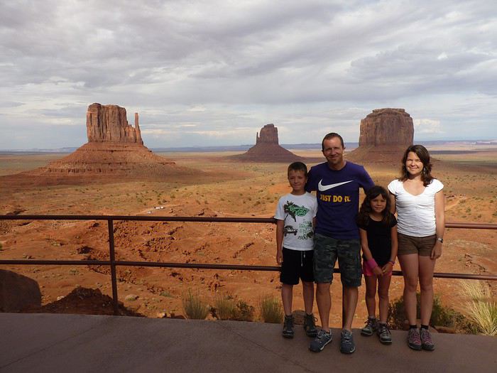
Here’s the plan: - Joshua Tree NP - Las Vegas - Valley of Fire SP - Yant Flat - Zion NP (Angel’s Landing) - Bryce Canyon NP (Fairyland Loop trail) - Devils Garden on the HITTR - Capitol Reef NP - Grand Teton NP - Yellowstone NP: Old Faithful - Yellowstone NP: Norris Geyser Basin and Mammoth Hot Springs - Yellowstone NP: Grand Canyon of the Yellowstone - West Thumb and Grand Teton NP - Flaming Gorge - Colorado NM and Fisher Towers - Moab: Arches - Moab: Canyonlands and Corona Arch - Moab: Canyonlands - Moab: rafting and Dead Horse Point SP - Natural Bridges NM and Valley of the Gods - Monument Valley and Horseshoe Bend - Coyote Buttes South - Grand Canyon NP (North Rim) - Grand Canyon NP (North Rim) and Navajo Bridge - Sedona - From Sedona to Tucson - Arizona-Sonora Desert Museum and Saguaro NP - Tombstone
Practical details:
- I’d read that it was better to book flight tickets directly on an airline’s website rather than through a comparison site. So, I spent months searching for reasonably priced tickets for two adults and two kids from Paris to Las Vegas for the outbound trip and from Tucson to Paris for the return. I mostly checked Air France, KLM, and British Airways, but prices were always around 4600 €. Not finding anything, we eventually went through a comparison site: Ebookers. We bought our tickets in mid-December: Paris/Atlanta with Air France, then Atlanta/Los Angeles with Delta for the outbound trip, and Tucson/Atlanta with Delta, then Atlanta/Paris with Air France for the return. Total cost: 4300 €. The layover on the outbound trip made me a little nervous because it was only 2 hours and 15 minutes. A month later, we got an email from Ebookers saying the layover had been reduced to 1 hour and 40 minutes! And a few months after that, it was down to just 1 hour and 30 minutes... So, we called Air France directly (we didn’t go through Ebookers, and it wasn’t a problem), and they put us on different flights. The new layover was 2 hours and 10 minutes—still not a ton of time, but I felt better than with 1 hour and 30 minutes. And anyway, we figured we’d see how it went!
- For the car, we tried several comparison sites, and in the end, AutoEurope won this year: 808 € for a 30-day rental of a Chevrolet Impala through Thrifty. The second driver was free for the entire trip since we picked up the car in California.
- We didn’t rent a GPS or buy one—we just downloaded Sygic on our two phones and bought the US map. I don’t remember the exact amount, but it cost us around 30 €.
- For hotels, I either booked directly on the sites (Xanterra, Grand Canyon Lodge, etc.) or used Hotels.com (to earn nights through their Welcome Rewards program) or Booking.com (when hotels weren’t available on Hotels.com). I always compared the price on Hotels.com with the hotel’s direct rate, but they were usually the same. So, for the same price, I’d rather earn a night with Welcome Rewards! We’d set a budget of 100 € per night on average, and we stuck to it pretty well—the final average came out to 101.20 € when including everything (nights + taxes + any nightly fees + parking fees + bank fees).
- As for luggage, we didn’t want to overpack! So, we left with one medium suitcase for Calista, one for me, one large suitcase for Hugo and Yannick, and a sports bag with Calista’s booster seat (we could’ve taken it on the plane with us, but I didn’t want to lug it around the airport during the layover). That sports bag came in handy on the way back, too—because, as everyone knows, you always come back with more than you left with! Each of us also had a backpack as a carry-on.
Before wrapping up this intro and getting into the real details, I’d like to thank everyone who contributed to my discussions and helped me improve our itinerary!
Quick intro for those who don’t know us: Yannick (36), Peggy (36), Hugo (11), and Calista (8).
Hi,
Does anyone know the address of a rose flower distillery in the Valley of Roses / Kelaa M'Gouna? A traditional distillery, not just the tourist shop.
Thanks a bunch!
Nicolas :-)
Does anyone know the address of a rose flower distillery in the Valley of Roses / Kelaa M'Gouna? A traditional distillery, not just the tourist shop.
Thanks a bunch!
Nicolas :-)
I’ve never done a travel journal on VF before... so I’m giving it a go this year 😉. Just to share a bit of my 3-week trip around the West.
Since I couldn’t find anyone to share the trip with this year, I decided to go solo for 3 weeks at the last minute. So, it wasn’t a super organized or original trip—flight tickets booked last-minute, a loosely planned itinerary—but it was a choice I made.
I wanted to book zero hotels and just drive wherever I felt like. No set hikes or specific goals. Just a classic route through places I already knew for the most part, taking the time to soak in the landscapes. So, don’t expect a story about epic hikes leading to caves or hidden arches in unusual spots. It was more like a return to the roots of my first trip, with one twist: I wanted to explore some areas by mountain bike. Just to see things a little differently.
First up, instead of photos, I’ll share a little time-lapse I made during the trip.
Thursday, October 31: Left Nice early in the morning for Phoenix via London.
The trip was a bit long because I had to wait 5.5 hours in London. My flight ticket was booked kinda late, so I didn’t have much choice.
And then it hit me—when you’re prepping for a trip, you always think you’ll forget something. It was in London that I realized I’d left my driver’s license on my living room shelf. I searched everywhere, but nope, I didn’t bring it.🤪
Luckily, I had an international permit, but the rental contract clearly stated that both licenses had to be presented.
I called a friend to ask her to overnight it to my first hotel, crossing my fingers that the mail wouldn’t take two weeks to arrive.
The flight with British Airways went pretty well. Comfortable enough to watch two movies, eat, take a little nap, and boom—I was in Phoenix.
Around 8 PM local time, I got to the Alamo car rental agency, and surprise—they didn’t care about my license at all. They glanced at the international permit, told me to bring the other one when I got it (basically, they didn’t give a damn), and handed me my car! Woohoo! 😛

I headed to my hotel (the only one I’d booked for my first night), explained to the front desk that my license should arrive by mail so they’d be in the loop, and crashed for a well-deserved first night in the U.S.
Friday, November 1 (And yes! It was a holiday in France, which would complicate my mail situation later.)
I woke up super early with my first goal: find a decent mountain bike at a good price but sturdy enough to handle some national park trails.
As I mentioned earlier, I decided to switch things up this year and explore some mountain bike trails—or just ride whenever I got the chance 😉.
I checked two Walmarts before finally finding a solid bike for under $150. Some might wonder why I bought one—well, the reason’s simple. Renting a bike costs between $40 and $70 a day. My trip lasted 22 days. QED (that’s "quod erat demonstrandum" for those who didn’t get it).
I bought the bike, which fit in my Jeep Compass by folding down the back seats (not super convenient, but it worked).

Off I went on my first adventures.
I decided to head to Apache Junction.
First stop: the Apache Trail at Goldfield Ghost Town. Pretty cute, though super touristy. Some classic Western decor, a little chapel overlooking everything, a museum, a mine, a small Disneyland-style train, souvenir shops, and places to grab a snack. Nothing mind-blowing, but still a fun little visit—especially if you’ve got kids.


I got lucky and explored the ghost town with two school buses—about a hundred excited kids. Total chaos for a ghost town, but hilarious to watch from a distance 😎.
A little further down the Apache Trail, there’s Lost Dutchman State Park. I didn’t linger too long because my goal was to reach the lakes, and after my Walmart adventure and some driving, it was already almost 1 PM. I munched on a bag of chips and hit the road (lots of 20–25 mph speed limits).
I spotted N 1st Water Road along the way, planning to come back in a few days.
My plan to get to the lakes ASAP got derailed when I found a parking lot with a horse trail right in the middle of the saguaros.
I asked a ranger in the lot if I could ride the trail on my mountain bike. He said it’d probably be tough but gave me the green light.
Off I went in my padded shorts and helmet. First bike ride through the cacti with my trusty travel companion (my bike, obviously).

I started off super excited on what seemed like an easy trail, but I quickly realized horse trails don’t account for some key biking challenges 😎—like climbing rocks isn’t exactly a breeze on a mountain bike 😛. No biggie, I carried the bike a few times but got to see my first saguaros up close! A pretty cool way to explore—I don’t regret buying the bike at all!
I got back on the road after drinking 1.5 liters of water (even in November, the sun’s no joke) and headed toward Canyon Lake. With vibes like Lake Powell, I was blown away by the scenery and decided to hang out a bit—just to "soak it in" and enjoy the quiet to end my day. I didn’t see more of the Apache Trail because night falls fast, and for my first day, I figured that was plenty.


I’d decided not to stress about seeing everything at all costs since I’ve traveled a lot in the U.S. and plan to keep coming back. Whatever I missed, I’d catch next time—but I wanted to fully enjoy a few landscapes.
I drove back to Phoenix, grabbed a good burger, and spent the evening in my hotel room planning the next day. Originally, I was only supposed to stay one night in Phoenix, but with my license still MIA, I changed my plans. In the end, I was solo, no reservations anywhere, so I’d just take it day by day!
Saturday, November 2:
I decided to wake up early and head to Tucson for the day. The drive from Phoenix was pretty easy. About 2 hours later, I was at the entrance of Saguaro National Park.
And guess what? There was a little trail perfect for mountain biking. I parked my Jeep at the park entrance and hopped on my bike. I ended up biking the whole park from start to finish—about 20 kilometers, with a paved main road and a gorgeous central trail right through the saguaros! Stunning!

Even being careful, I still got a few cactus spines in my left arm from brushing too close (it stings!). Not easy to remove, so I’d advise anyone with the same idea to be more careful than I was. You’ll figure it out fast! 😉
I spent most of the day in this amazing park—it’s totally worth the detour. It feels like hundreds of chimneys all lined up at equal distances. A unique landscape you’ve gotta see.
Next, I headed to Tucson to check out the airplane boneyard. I’d seen it in a movie years ago and always wanted to see it for myself. Mission accomplished! It was pretty intense, but unfortunately, it didn’t seem possible to get to the most interesting plane alignments. There’s a museum with different types of planes and a guided tour. I settled for peeking through the fences at the planes guarded by military patrols.

I left around 6 PM and got back to Phoenix around 7:30–8 PM, super happy with my day of biking through the cacti!
Sunday, November 3:
Morning by the pool, lounging around—pure bliss. Around 11 AM, I headed to the Premium Outlets. Feeling pretty pleased with myself, I bought 5 pairs of Levi’s for the price of one in France. Just for that, I knew coming to the U.S. was worth it! After that, nothing super exciting—except a cotton field south of Phoenix that I couldn’t stop admiring for a good hour.

I drove around the city—pretty dead on a Sunday—and headed back to the Apache Trail to tackle N 1st Water Road, which I’d spotted two days earlier. A really fun trail to bike if you’ve got a mountain bike 😉. It gives access to several hikes and offers some great scenery. Highly recommend it.


Since I couldn’t find anyone to share the trip with this year, I decided to go solo for 3 weeks at the last minute. So, it wasn’t a super organized or original trip—flight tickets booked last-minute, a loosely planned itinerary—but it was a choice I made.
I wanted to book zero hotels and just drive wherever I felt like. No set hikes or specific goals. Just a classic route through places I already knew for the most part, taking the time to soak in the landscapes. So, don’t expect a story about epic hikes leading to caves or hidden arches in unusual spots. It was more like a return to the roots of my first trip, with one twist: I wanted to explore some areas by mountain bike. Just to see things a little differently.
First up, instead of photos, I’ll share a little time-lapse I made during the trip.
Thursday, October 31: Left Nice early in the morning for Phoenix via London.
The trip was a bit long because I had to wait 5.5 hours in London. My flight ticket was booked kinda late, so I didn’t have much choice.
And then it hit me—when you’re prepping for a trip, you always think you’ll forget something. It was in London that I realized I’d left my driver’s license on my living room shelf. I searched everywhere, but nope, I didn’t bring it.🤪
Luckily, I had an international permit, but the rental contract clearly stated that both licenses had to be presented.
I called a friend to ask her to overnight it to my first hotel, crossing my fingers that the mail wouldn’t take two weeks to arrive.
The flight with British Airways went pretty well. Comfortable enough to watch two movies, eat, take a little nap, and boom—I was in Phoenix.
Around 8 PM local time, I got to the Alamo car rental agency, and surprise—they didn’t care about my license at all. They glanced at the international permit, told me to bring the other one when I got it (basically, they didn’t give a damn), and handed me my car! Woohoo! 😛
I headed to my hotel (the only one I’d booked for my first night), explained to the front desk that my license should arrive by mail so they’d be in the loop, and crashed for a well-deserved first night in the U.S.
Friday, November 1 (And yes! It was a holiday in France, which would complicate my mail situation later.)
I woke up super early with my first goal: find a decent mountain bike at a good price but sturdy enough to handle some national park trails.
As I mentioned earlier, I decided to switch things up this year and explore some mountain bike trails—or just ride whenever I got the chance 😉.
I checked two Walmarts before finally finding a solid bike for under $150. Some might wonder why I bought one—well, the reason’s simple. Renting a bike costs between $40 and $70 a day. My trip lasted 22 days. QED (that’s "quod erat demonstrandum" for those who didn’t get it).
I bought the bike, which fit in my Jeep Compass by folding down the back seats (not super convenient, but it worked).
Off I went on my first adventures.
I decided to head to Apache Junction.
First stop: the Apache Trail at Goldfield Ghost Town. Pretty cute, though super touristy. Some classic Western decor, a little chapel overlooking everything, a museum, a mine, a small Disneyland-style train, souvenir shops, and places to grab a snack. Nothing mind-blowing, but still a fun little visit—especially if you’ve got kids.
I got lucky and explored the ghost town with two school buses—about a hundred excited kids. Total chaos for a ghost town, but hilarious to watch from a distance 😎.
A little further down the Apache Trail, there’s Lost Dutchman State Park. I didn’t linger too long because my goal was to reach the lakes, and after my Walmart adventure and some driving, it was already almost 1 PM. I munched on a bag of chips and hit the road (lots of 20–25 mph speed limits).
I spotted N 1st Water Road along the way, planning to come back in a few days.
My plan to get to the lakes ASAP got derailed when I found a parking lot with a horse trail right in the middle of the saguaros.
I asked a ranger in the lot if I could ride the trail on my mountain bike. He said it’d probably be tough but gave me the green light.
Off I went in my padded shorts and helmet. First bike ride through the cacti with my trusty travel companion (my bike, obviously).
I started off super excited on what seemed like an easy trail, but I quickly realized horse trails don’t account for some key biking challenges 😎—like climbing rocks isn’t exactly a breeze on a mountain bike 😛. No biggie, I carried the bike a few times but got to see my first saguaros up close! A pretty cool way to explore—I don’t regret buying the bike at all!
I got back on the road after drinking 1.5 liters of water (even in November, the sun’s no joke) and headed toward Canyon Lake. With vibes like Lake Powell, I was blown away by the scenery and decided to hang out a bit—just to "soak it in" and enjoy the quiet to end my day. I didn’t see more of the Apache Trail because night falls fast, and for my first day, I figured that was plenty.
I’d decided not to stress about seeing everything at all costs since I’ve traveled a lot in the U.S. and plan to keep coming back. Whatever I missed, I’d catch next time—but I wanted to fully enjoy a few landscapes.
I drove back to Phoenix, grabbed a good burger, and spent the evening in my hotel room planning the next day. Originally, I was only supposed to stay one night in Phoenix, but with my license still MIA, I changed my plans. In the end, I was solo, no reservations anywhere, so I’d just take it day by day!
Saturday, November 2:
I decided to wake up early and head to Tucson for the day. The drive from Phoenix was pretty easy. About 2 hours later, I was at the entrance of Saguaro National Park.
And guess what? There was a little trail perfect for mountain biking. I parked my Jeep at the park entrance and hopped on my bike. I ended up biking the whole park from start to finish—about 20 kilometers, with a paved main road and a gorgeous central trail right through the saguaros! Stunning!
Even being careful, I still got a few cactus spines in my left arm from brushing too close (it stings!). Not easy to remove, so I’d advise anyone with the same idea to be more careful than I was. You’ll figure it out fast! 😉
I spent most of the day in this amazing park—it’s totally worth the detour. It feels like hundreds of chimneys all lined up at equal distances. A unique landscape you’ve gotta see.
Next, I headed to Tucson to check out the airplane boneyard. I’d seen it in a movie years ago and always wanted to see it for myself. Mission accomplished! It was pretty intense, but unfortunately, it didn’t seem possible to get to the most interesting plane alignments. There’s a museum with different types of planes and a guided tour. I settled for peeking through the fences at the planes guarded by military patrols.
I left around 6 PM and got back to Phoenix around 7:30–8 PM, super happy with my day of biking through the cacti!
Sunday, November 3:
Morning by the pool, lounging around—pure bliss. Around 11 AM, I headed to the Premium Outlets. Feeling pretty pleased with myself, I bought 5 pairs of Levi’s for the price of one in France. Just for that, I knew coming to the U.S. was worth it! After that, nothing super exciting—except a cotton field south of Phoenix that I couldn’t stop admiring for a good hour.
I drove around the city—pretty dead on a Sunday—and headed back to the Apache Trail to tackle N 1st Water Road, which I’d spotted two days earlier. A really fun trail to bike if you’ve got a mountain bike 😉. It gives access to several hikes and offers some great scenery. Highly recommend it.
Hi everyone. Good evening!
I’m back from Sententon. I’ve recovered now. What a beautiful, beautiful island—did it both ways.
The crossing I’d call the "Madman’s Crossing" (a nod to another well-known one) is the one from Tarrafal to Ponta do Sol, which I did in 4.5 hours without speeding like Gonzalez.
Then there’s what I’d call the "Grogue Diagonal"—the north-south route from Ribeira do Paul to the Janela Lighthouse, passing through Cova, Pico da Cruz, and Silva. A day and a half of pure enjoyment, wrapping up my visit to the island in supreme beauty.
In my opinion, here are the island’s 7 must-dos:
- The most stunning *bordeira* – the *bordeira do norte*
- The most fantastic – the climb from João do Bento to Orgueiro
- The most pleasant – the *vereda* Cova/Pico da Cruz/Silva
- The most overrated – the northern coastal path
- The most beautiful paved section – Ribeira de Penede’s lower part
- The most grueling – Figueira de Cima to Chupador
- The toughest – the climb to Salto Preto
And for any hiker, the Norte plateau is a must. Unfortunately, I couldn’t make it to Tope de Coroa—my only rainy day—but it was still good, even with the summit shrouded in clouds all day.
Here are my initial thoughts. I’m happy to share more with anyone planning the same crossings. I’m currently posting the route details on my blog and might share a few here. Though since the forum’s text editor isn’t top-notch without HTML, I’m not sure how it’ll turn out. In the meantime, you can check it out here --> Cape Verde. Should be of interest to hikers. Bye
And for any hiker, the Norte plateau is a must. Unfortunately, I couldn’t make it to Tope de Coroa—my only rainy day—but it was still good, even with the summit shrouded in clouds all day.
Here are my initial thoughts. I’m happy to share more with anyone planning the same crossings. I’m currently posting the route details on my blog and might share a few here. Though since the forum’s text editor isn’t top-notch without HTML, I’m not sure how it’ll turn out. In the meantime, you can check it out here --> Cape Verde. Should be of interest to hikers. Bye
This travel journal is our second on VoyageForum, following last year’s where we recounted our four weeks in Vietnam.
The goal remains the same: since some members on this site share tips, experiences, and great deals that help us prepare for our trips, we do the same after returning—both to give back a little and in the hope that our experiences might be useful to others in some way.
Our route was as follows: Bangkok, Siem Reap, Krabi, Suratthani, Koh Phangan, Koh Tao, Chumphon, Bang Saphan, Prachuab Khiri Khan, Sam Roi Yod, Hua Hin, Phetchaburi, Bangkok.
Beyond rediscovering Bangkok, our objectives were the long-held dream of seeing Angkor and exploring southern Thailand, much of which isn’t overly touristy.
A quick big thank-you to Barbot, who took the time to answer several of our questions.
12/07/2013
The cheapest flight we found earlier this year was a Paris-Bangkok route with a layover in Moscow for 1440 €, total for two people. So, this time we tried Aeroflot. Airbus A318 for the first leg, A330 for the second. Nothing particularly annoying to report—the passengers were very calm, the cabin temperature was comfortable, and we had enough legroom. That said, the quality of the meal trays was pretty mediocre, and the flight attendants weren’t exactly comedians.
We’d like to remind everyone that it’s best to exchange as little money as possible at the airport upon arrival, since the rate is about 5% worse than at city banks.
Of course, we made sure to take the airport exit where you can catch official taxis to avoid getting scammed. So, we queued up, a little lady gave us the ticket, and off we went with the driver. Generally, this system works well because these drivers are registered, know their duties, and the risks they face if they break the rules. Except that day, right off the bat, we got the scammer of the day. His first move was to snatch the ticket from my wife’s hands—the one you’re supposed to keep in case of a complaint. My husband saw it, but after a full day of travel, we were a bit out of it, and honestly, there was no reason to be suspicious. But once we started driving, the guy refused to turn on the meter. We insisted more and more firmly, but nothing. So, I used the famous method of opening the door and starting to step out of the car. At 40 km/h, that scares the driver more than the passenger. He finally turned on the meter, but that didn’t calm him down—quite the opposite. For the next half-hour, he ruined the ride by demanding extra fees here and there. Having dealt with several scam attempts last year in Vietnam, this wasn’t exactly new, and we were proud of ourselves for staying pretty zen. Still, this guy was a little scary—he was completely wired and aggressive. Honestly, it was hard not to think he was on something. He’d be perfect for a *Scarface* remake. When we finally arrived at the hotel, he followed us to the entrance. We paid the two tolls (25 and 45 baht), gave him the usual 100 baht extra for the ride, and stayed polite but firm. So, meter: 245 baht + 100 baht + 25 and 45 baht for tolls—we paid the exact amount, no way we were tipping this guy. He left furious, but he was already like that before picking us up... Anyway, avoid Mr. Chartree Chidchen, number 089 826 7308, car E2663!
We were so relieved to finally settle in at Feung Nakorn Balcony hotel in the temple district. 42 € per night, great reception, all the staff is friendly. The AC works fine, the bed seemed hard at first but turned out to be comfortable. The hotel is quiet, away from the nightlife, but at this time of year, many places are less crowded than in high season. Even with a nice fish pond and outdoor breakfast area, it’s a decent hotel, though we felt we could’ve found something better.
After a night on the plane, the first afternoon is always a bit of a slog. We napped for a few hours, and when we woke up—guess what—we were starving. We visited a temple across from the hotel (nothing special) and then decided to take the Chao Phraya Express, the river shuttle that serves many piers along the river. It was a really enjoyable experience. The steel gangway wobbles when you board and disembark, the boat sits low in the water, and sometimes you get splashed. During peak times, you’re packed in like sardines, but most of all, there’s that exotic urban landscape passing by, especially the temple rooftops.
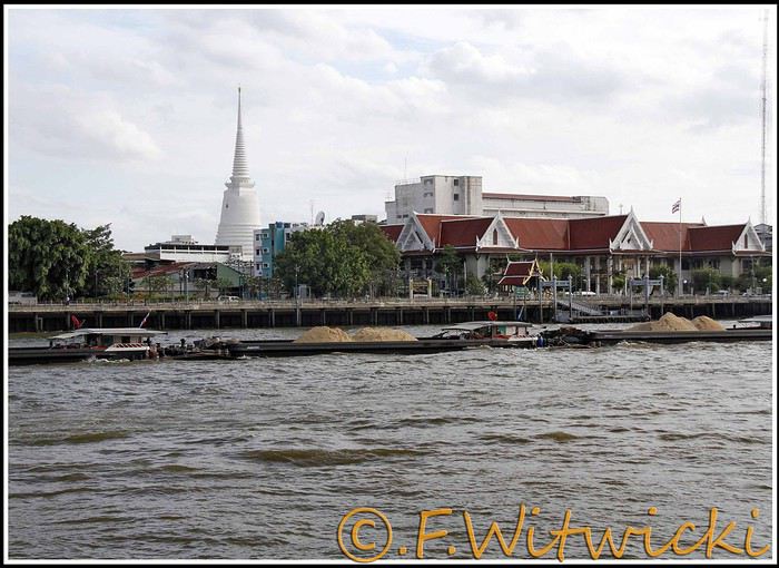
At that exact moment, the boat was packed. We didn’t see a ticket booth at the pier, and we tried in vain to pay the few baht for the ride. The cashier on the boat was too busy, and another employee we called didn’t have time to help us. Oh well, we weren’t going to force the issue. Still, this mode of transport is super practical for avoiding traffic, and at the piers, the lines with station names are clearly marked, with colors matching the flags on the boats. Combined with a map like the *Routard* guide, it’s easy to navigate.
We easily made it to the restaurant *Harmonique*, located near one of these piers. It’s a unanimous favorite on this forum, and let us tell you—it’s well-deserved. What a wonderful experience that evening! We only saw the outdoor gazebo because there was no way we were dining inside. It’s not flashy, so those looking for a luxurious setting should look elsewhere.
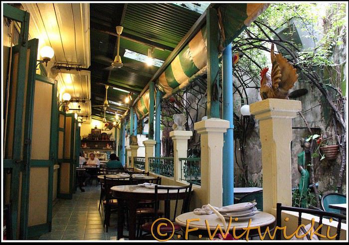
That night, the staff was a bit slow, and we had to track them down several times to move things along. But oh, my friends—what a feast on the plate! Start with the appetizer platter for two at 250 baht, featuring four specialties, each more tempting than the last, followed by their famous crab curry for 200 baht. There’s *so much* crab in there! The dish is so delicious and rich that when you finish, you feel—how to put it—like it was almost *too* good, to the point where you’re almost put off eating for days. And also, oh yes, we *will* be back. Their satay chicken is just as amazing, and it would be a crime not to mention their generous dessert with ice cream, warm banana, and chocolate, plus their *excellent* almond milkshake.
Later, we took a taxi to Kao San Road, mainly to book a Ko Tao-Chumphon trip for 600 baht per person at the Lomprayah counter. In hindsight, we should’ve booked all three of our trips there right away.
Kao San Road is *ultra*-touristy—better for younger crowds, but it’s still worth seeing. There’s rock ‘n’ roll, hippies, and crowds everywhere.
We walked back to the hotel, and when we got a little lost near a canal, a really nice older Thai man spontaneously appeared out of the night to kindly point us in the right direction.
Finally, a real long night of sleep ahead—we cranked up the AC. Sweet, the vacation has begun!
Our route was as follows: Bangkok, Siem Reap, Krabi, Suratthani, Koh Phangan, Koh Tao, Chumphon, Bang Saphan, Prachuab Khiri Khan, Sam Roi Yod, Hua Hin, Phetchaburi, Bangkok.
Beyond rediscovering Bangkok, our objectives were the long-held dream of seeing Angkor and exploring southern Thailand, much of which isn’t overly touristy.
A quick big thank-you to Barbot, who took the time to answer several of our questions.
12/07/2013
The cheapest flight we found earlier this year was a Paris-Bangkok route with a layover in Moscow for 1440 €, total for two people. So, this time we tried Aeroflot. Airbus A318 for the first leg, A330 for the second. Nothing particularly annoying to report—the passengers were very calm, the cabin temperature was comfortable, and we had enough legroom. That said, the quality of the meal trays was pretty mediocre, and the flight attendants weren’t exactly comedians.
We’d like to remind everyone that it’s best to exchange as little money as possible at the airport upon arrival, since the rate is about 5% worse than at city banks.
Of course, we made sure to take the airport exit where you can catch official taxis to avoid getting scammed. So, we queued up, a little lady gave us the ticket, and off we went with the driver. Generally, this system works well because these drivers are registered, know their duties, and the risks they face if they break the rules. Except that day, right off the bat, we got the scammer of the day. His first move was to snatch the ticket from my wife’s hands—the one you’re supposed to keep in case of a complaint. My husband saw it, but after a full day of travel, we were a bit out of it, and honestly, there was no reason to be suspicious. But once we started driving, the guy refused to turn on the meter. We insisted more and more firmly, but nothing. So, I used the famous method of opening the door and starting to step out of the car. At 40 km/h, that scares the driver more than the passenger. He finally turned on the meter, but that didn’t calm him down—quite the opposite. For the next half-hour, he ruined the ride by demanding extra fees here and there. Having dealt with several scam attempts last year in Vietnam, this wasn’t exactly new, and we were proud of ourselves for staying pretty zen. Still, this guy was a little scary—he was completely wired and aggressive. Honestly, it was hard not to think he was on something. He’d be perfect for a *Scarface* remake. When we finally arrived at the hotel, he followed us to the entrance. We paid the two tolls (25 and 45 baht), gave him the usual 100 baht extra for the ride, and stayed polite but firm. So, meter: 245 baht + 100 baht + 25 and 45 baht for tolls—we paid the exact amount, no way we were tipping this guy. He left furious, but he was already like that before picking us up... Anyway, avoid Mr. Chartree Chidchen, number 089 826 7308, car E2663!
We were so relieved to finally settle in at Feung Nakorn Balcony hotel in the temple district. 42 € per night, great reception, all the staff is friendly. The AC works fine, the bed seemed hard at first but turned out to be comfortable. The hotel is quiet, away from the nightlife, but at this time of year, many places are less crowded than in high season. Even with a nice fish pond and outdoor breakfast area, it’s a decent hotel, though we felt we could’ve found something better.
After a night on the plane, the first afternoon is always a bit of a slog. We napped for a few hours, and when we woke up—guess what—we were starving. We visited a temple across from the hotel (nothing special) and then decided to take the Chao Phraya Express, the river shuttle that serves many piers along the river. It was a really enjoyable experience. The steel gangway wobbles when you board and disembark, the boat sits low in the water, and sometimes you get splashed. During peak times, you’re packed in like sardines, but most of all, there’s that exotic urban landscape passing by, especially the temple rooftops.
At that exact moment, the boat was packed. We didn’t see a ticket booth at the pier, and we tried in vain to pay the few baht for the ride. The cashier on the boat was too busy, and another employee we called didn’t have time to help us. Oh well, we weren’t going to force the issue. Still, this mode of transport is super practical for avoiding traffic, and at the piers, the lines with station names are clearly marked, with colors matching the flags on the boats. Combined with a map like the *Routard* guide, it’s easy to navigate.
We easily made it to the restaurant *Harmonique*, located near one of these piers. It’s a unanimous favorite on this forum, and let us tell you—it’s well-deserved. What a wonderful experience that evening! We only saw the outdoor gazebo because there was no way we were dining inside. It’s not flashy, so those looking for a luxurious setting should look elsewhere.
That night, the staff was a bit slow, and we had to track them down several times to move things along. But oh, my friends—what a feast on the plate! Start with the appetizer platter for two at 250 baht, featuring four specialties, each more tempting than the last, followed by their famous crab curry for 200 baht. There’s *so much* crab in there! The dish is so delicious and rich that when you finish, you feel—how to put it—like it was almost *too* good, to the point where you’re almost put off eating for days. And also, oh yes, we *will* be back. Their satay chicken is just as amazing, and it would be a crime not to mention their generous dessert with ice cream, warm banana, and chocolate, plus their *excellent* almond milkshake.
Later, we took a taxi to Kao San Road, mainly to book a Ko Tao-Chumphon trip for 600 baht per person at the Lomprayah counter. In hindsight, we should’ve booked all three of our trips there right away.
Kao San Road is *ultra*-touristy—better for younger crowds, but it’s still worth seeing. There’s rock ‘n’ roll, hippies, and crowds everywhere.
We walked back to the hotel, and when we got a little lost near a canal, a really nice older Thai man spontaneously appeared out of the night to kindly point us in the right direction.
Finally, a real long night of sleep ahead—we cranked up the AC. Sweet, the vacation has begun!
Hey fellow travelers,
As a huge Asia lover, I don’t usually post trip reports here since I find it so easy to get around in those countries (whether online beforehand or on the spot). But after 15 days in Zanzibar, I figured our experience (we’re traveling as a couple) might help some of you.
To sum it up, this island is absolutely stunning but not exactly a walk in the park for independent travelers!
**TRANSPORTATION**
Since we’re not Bill Gates, we have to make choices—especially in Zanzibar, which is way pricier than Asia.
One option was taking the *dalla dalla* (local minibuses) to get around the island, but it was just too complicated for us. For example, going from Nungwi to Matemwe takes half an hour by car but hours by *dalla dalla* because you *have* to go back through the capital!
Taking taxis from one hotel to another didn’t interest us since we see travel as a way to immerse ourselves in the country and get as close to locals as possible (sounds a bit pompous, but I couldn’t find a better way to put it!!).
So, we decided to rent a car to move freely and stop wherever we wanted. If you’re looking for info on the Dolphin Tour, Spice Tour, or Safari Blue… you can skip this part—we didn’t do any of that (I know, it’s a shame, but we can’t do everything, right? 😉). There are agencies everywhere that can organize those for you without any hassle.
Long story short, after some searching, we rented a car from Ally Keys (found on *Le Routard*), a small Toyota 4x4 for $350 for 11 days (we drove about 900 km and spent 80 € on gas).
The roads are basically wide boulevards—just watch out for pedestrians and cyclists constantly. Once you leave Stone Town, though, there’s hardly any traffic.
**The police—quite the love story for us!!** First off, no paranoia needed: police checkpoints stop *every* car, not just the ones with "white" people.
In 11 days of driving around the island, we were stopped… 13 times, no joke!!
Every time, they asked for our international driver’s permit and the Tanzanian permit Ally gave us for free before we left. They were all super friendly and didn’t give us any trouble (a few words in Swahili can help). Except once, when they noticed the insurance had expired *two days* earlier 🤪.
We hadn’t paid attention, and neither had Ally—our bad.
It turned into quite the scene, lasting about 2 hours, but Ally, who we called, negotiated with them. The fine went from $200 down to $20, and Ally even reimbursed us afterward!! Quite the experience, to say the least.
**THE PEOPLE**
Okay, I’ll try to explain our experience *without getting "stoned," please*. I’m not judging anyone—I just want to share what we felt during these 15 days (way too short to really understand, of course).
My go-to motto, "If you smile, they’ll smile back," didn’t really work there. We found the locals weren’t exactly approachable, especially the women.
That said, we *did* meet some genuinely kind and selfless people: one in Stone Town, sometimes in the local eateries where we ate, and with hitchhikers (male and female) we picked up whenever we saw them (the only way we found to share a bit of our "wealth" with them). But overall, I found it *really* tough.
At the same time, it clarified things. Every time someone approached us in a friendly, warm way, they had something to offer (a restaurant, a shop to visit, a snorkeling tour, a taxi…). No issues with them—they were lovely, just like the staff at all the hotels we stayed in.
In Matemwe, we walked through the village every morning and evening for 5 days. I made an effort to smile and say hello every day, morning and night, but even by the end, the best I got was a nod.
We learned a few words in Swahili (hello, how are you…) to break the ice, but it was pretty much a lost cause, with a few exceptions.
Obviously, since I’d never experienced anything like this, I tried to find an explanation—but we were there too briefly to really figure it out. Here are my hypotheses:
- The strong Muslim presence (even little girls wear veils). Maybe they see us white people as "depraved," even though we always dressed modestly.
- Smiling might not be part of their communication style (sounds dumb, but you never know!).
- Maybe there’s some resentment toward white people, which, honestly, I’d totally understand. Let me explain: two worlds share this island without really mixing. 50% of tourists stay in Nungwi and Kendwa, 25% stay in resorts all around the island, 23% go from hotel to hotel by taxi or *dalla dalla*, and maybe 2% travel like we did (totally unscientific stats, obviously).
In 11 days of exploring the island (except Stone Town and the beaches), we *never* saw a white person outside a hotel or taxi (no exaggeration)—never in villages, markets…
Luxury resorts sit right next to villages in extreme poverty (no running water, no electricity, etc.), and the tourism money barely trickles down to locals. It’s enough to make you ashamed of being white—I felt that way more than once!
Anyway, if anyone here knows Zanzibaris well, I’d *love* to hear their perspective.
**PHOTOS**
Given what I just said, you can imagine it wasn’t easy.
The women were the hardest to approach—I gave up on taking their photos after 3 or 4 clear refusals (they’d cover their faces, not angrily, but firmly).
Most men I asked agreed.
With kids, anything goes:
- Some pose for a photo and laugh hysterically when they see themselves.
- Some pose but then demand a dollar, shillings, pens, or even your hair tie if that’s all you’ve got!!
Some happily agree when you ask, while others shout a big "Nooooo" or even threaten to throw rocks at you *before* you’ve even turned on your camera!!
Once again, I put myself in their shoes and watched how "white" people behave. They walk by without a word, raise their camera, snap a shot, and leave without even a wave. When you see yourself in that mirror, it really puts things into perspective!
**STONE TOWN**
Like everyone else, we started our trip in Stone Town—one of the most beautiful cities I’ve ever seen (no exaggeration!). Despite being super touristy, it’s managed to keep its soul, which is pretty rare.
The sea and its *dhows* (boats with triangular sails straight out of another era), colonial buildings everywhere (some renovated, others run-down but still beautiful), narrow alleys with stunning doors (not just in hotels, as I thought), women in colorful veils all over the streets, the call to prayer echoing through the alleys, and, of course, the Darajani Street market—not to be missed if you want even a tiny taste of African life. Pure magic!
The only downside? Quite a few shady guys offering all kinds of services, some of them drug users and a bit unsettling (one even waited for hours outside our hotel after we told him we didn’t need anything). We stayed polite and friendly, and it went fine, but it did create a slightly "sketchy" vibe at times.
For our hotel, we spent the first two nights at Karibu Zanzibar Inn, found online for $65 a night. Right in the heart of the old town, perfect for us—clean, quiet, rooftop terrace for breakfast, welcoming staff. Nothing to complain about, except maybe the price!
For the last two nights before leaving, we found a place on the spot, super well-located, for $45 a night (DM me for details if you’re interested).
We also rented bikes to get around—great for $5 a day per bike.
**MONEY**
Money’s a bit tricky here, I found. Some hotels supposedly only accept dollars (not the ones we stayed in, though), and a lot of prices are listed in that currency. Either way, you can leave your euros at home—several exchange bureaus won’t take them. My advice? Bring enough dollars to avoid credit card fees (you can’t withdraw more than 190 € at a time from ATMs, so you’d pay a fee each time).
For our budget, we spent 800 € per person for 14 days, staying in hotels averaging $45 a night (not easy to find, by the way) and eating often in local eateries (more on that below). Meals in touristy restaurants cost between 6 and 9 € per person, a beer is 2 €, a Coke is 1 €…
Don’t forget, for two people: $100 for visas, $60 for airport-port round-trip taxis, and $160 for Dar-Stone Town round-trip boats.
**FOOD & ACCOMMODATION**
We ate in local restaurants about ten times: chicken or beef skewers with fries or rice for 1.50 € per person. But:
1 – You have to find the "restaurant" that doesn’t look like one (usually a roadside shack).
2 – With a shady spot to sit, which isn’t always possible.
3 – For the squeamish, hygiene conditions are *way* below standard (no fridge, well water used to wash dishes, flies everywhere)!!
We figured if locals eat there, it’s probably a good sign, and honestly, the food was good, and we never got sick.
Plus, it’s the best way to meet Zanzibaris.
Hotels were tough to find under $50. Thankfully, we had the car to scout around (prices in guidebooks had gone up!). We chose to stay 5 days in the north of the island (Matemwe) and 5 days in the south (Jambiani), which let us explore almost the whole island.
We decided that on the spot after checking things out.
In Matemwe, we didn’t overthink it—we stayed at Allykeys Bungalow, whose owner rented us the car! At first, we were a bit wary of his offer, but after checking it out, we loved it. Simple bungalows but with everything we needed, a great setting facing the sea, sun loungers to relax, a restaurant and bar by the water, and—best of all—a very local vibe (about 50 *dhows* leaving for fishing every morning between 5:30 and 6:00, and their return around 1:00 PM with haggling over fish prices on the beach—pure bliss).
Just so you know, it’s pretty noisy (I love the call to prayer, but at 4:30 and 5:30 AM, it’s *early*—especially when it goes on for so long!!), no hot water (just lukewarm), and no Wi-Fi. But for that, there’s a great deal at the Green… at the very north end of the beach. Just by ordering a drink (3 € for a beer, 2 € for a Coke), you can enjoy the Wi-Fi and pool all afternoon. Super friendly welcome at this luxury hotel, even for "bumpkins" like us!!
In Jambiani, we found Pakachi Beach Resort—a dream come true. Listed at over $60 online, they offered us a beachfront bungalow (a big bed downstairs, another upstairs with a sea view and ocean breeze included), a bathroom with hot water, Wi-Fi in common areas, and a pool (low tide is *really* low there!!) for $45 a night. It was so amazing we wondered if they mistook us for *Le Routard* guides since we arrived alone with our car!!
It was also super quiet—only three plugs in use, including ours, which might explain it!!
**THE BEACHES**
Quick rundown:
- The most beautiful aesthetically and for swimming anytime: Kendwa, no question. The downside? Way too many resorts for our taste and no local life. We went for a day before heading back to Matemwe.
- The most tourist-packed: Nungwi, obviously. Not our cup of tea, but I guess it’s great for young people who want to party.
- Best for local life: Matemwe, hands down. The daily fishing returns are a highlight, plus village life, seaweed gatherers, kids on the beach—we *loved* it.
- Best for peace and beauty (but no swimming at low tide): Pongwe, Uroa, Kiwengwa, Jambiani, and a special mention for Dongwe, which we found absolutely gorgeous.
- If you want to feel like you’re in the middle of nowhere but still by the water: Kae Kuu and Unguja Ukuu.
There you go—that’s pretty much everything we saw!
Sorry for the novel. I doubt many of you made it to the end of my "prose." At least no one can say I didn’t share my experience this time 😉.
If you’ve got questions, don’t hesitate.
See you soon, and happy travels!
As a huge Asia lover, I don’t usually post trip reports here since I find it so easy to get around in those countries (whether online beforehand or on the spot). But after 15 days in Zanzibar, I figured our experience (we’re traveling as a couple) might help some of you.
To sum it up, this island is absolutely stunning but not exactly a walk in the park for independent travelers!
**TRANSPORTATION**
Since we’re not Bill Gates, we have to make choices—especially in Zanzibar, which is way pricier than Asia.
One option was taking the *dalla dalla* (local minibuses) to get around the island, but it was just too complicated for us. For example, going from Nungwi to Matemwe takes half an hour by car but hours by *dalla dalla* because you *have* to go back through the capital!
Taking taxis from one hotel to another didn’t interest us since we see travel as a way to immerse ourselves in the country and get as close to locals as possible (sounds a bit pompous, but I couldn’t find a better way to put it!!).
So, we decided to rent a car to move freely and stop wherever we wanted. If you’re looking for info on the Dolphin Tour, Spice Tour, or Safari Blue… you can skip this part—we didn’t do any of that (I know, it’s a shame, but we can’t do everything, right? 😉). There are agencies everywhere that can organize those for you without any hassle.
Long story short, after some searching, we rented a car from Ally Keys (found on *Le Routard*), a small Toyota 4x4 for $350 for 11 days (we drove about 900 km and spent 80 € on gas).
The roads are basically wide boulevards—just watch out for pedestrians and cyclists constantly. Once you leave Stone Town, though, there’s hardly any traffic.
**The police—quite the love story for us!!** First off, no paranoia needed: police checkpoints stop *every* car, not just the ones with "white" people.
In 11 days of driving around the island, we were stopped… 13 times, no joke!!
Every time, they asked for our international driver’s permit and the Tanzanian permit Ally gave us for free before we left. They were all super friendly and didn’t give us any trouble (a few words in Swahili can help). Except once, when they noticed the insurance had expired *two days* earlier 🤪.
We hadn’t paid attention, and neither had Ally—our bad.
It turned into quite the scene, lasting about 2 hours, but Ally, who we called, negotiated with them. The fine went from $200 down to $20, and Ally even reimbursed us afterward!! Quite the experience, to say the least.
**THE PEOPLE**
Okay, I’ll try to explain our experience *without getting "stoned," please*. I’m not judging anyone—I just want to share what we felt during these 15 days (way too short to really understand, of course).
My go-to motto, "If you smile, they’ll smile back," didn’t really work there. We found the locals weren’t exactly approachable, especially the women.
That said, we *did* meet some genuinely kind and selfless people: one in Stone Town, sometimes in the local eateries where we ate, and with hitchhikers (male and female) we picked up whenever we saw them (the only way we found to share a bit of our "wealth" with them). But overall, I found it *really* tough.
At the same time, it clarified things. Every time someone approached us in a friendly, warm way, they had something to offer (a restaurant, a shop to visit, a snorkeling tour, a taxi…). No issues with them—they were lovely, just like the staff at all the hotels we stayed in.
In Matemwe, we walked through the village every morning and evening for 5 days. I made an effort to smile and say hello every day, morning and night, but even by the end, the best I got was a nod.
We learned a few words in Swahili (hello, how are you…) to break the ice, but it was pretty much a lost cause, with a few exceptions.
Obviously, since I’d never experienced anything like this, I tried to find an explanation—but we were there too briefly to really figure it out. Here are my hypotheses:
- The strong Muslim presence (even little girls wear veils). Maybe they see us white people as "depraved," even though we always dressed modestly.
- Smiling might not be part of their communication style (sounds dumb, but you never know!).
- Maybe there’s some resentment toward white people, which, honestly, I’d totally understand. Let me explain: two worlds share this island without really mixing. 50% of tourists stay in Nungwi and Kendwa, 25% stay in resorts all around the island, 23% go from hotel to hotel by taxi or *dalla dalla*, and maybe 2% travel like we did (totally unscientific stats, obviously).
In 11 days of exploring the island (except Stone Town and the beaches), we *never* saw a white person outside a hotel or taxi (no exaggeration)—never in villages, markets…
Luxury resorts sit right next to villages in extreme poverty (no running water, no electricity, etc.), and the tourism money barely trickles down to locals. It’s enough to make you ashamed of being white—I felt that way more than once!
Anyway, if anyone here knows Zanzibaris well, I’d *love* to hear their perspective.
**PHOTOS**
Given what I just said, you can imagine it wasn’t easy.
The women were the hardest to approach—I gave up on taking their photos after 3 or 4 clear refusals (they’d cover their faces, not angrily, but firmly).
Most men I asked agreed.
With kids, anything goes:
- Some pose for a photo and laugh hysterically when they see themselves.
- Some pose but then demand a dollar, shillings, pens, or even your hair tie if that’s all you’ve got!!
Some happily agree when you ask, while others shout a big "Nooooo" or even threaten to throw rocks at you *before* you’ve even turned on your camera!!
Once again, I put myself in their shoes and watched how "white" people behave. They walk by without a word, raise their camera, snap a shot, and leave without even a wave. When you see yourself in that mirror, it really puts things into perspective!
**STONE TOWN**
Like everyone else, we started our trip in Stone Town—one of the most beautiful cities I’ve ever seen (no exaggeration!). Despite being super touristy, it’s managed to keep its soul, which is pretty rare.
The sea and its *dhows* (boats with triangular sails straight out of another era), colonial buildings everywhere (some renovated, others run-down but still beautiful), narrow alleys with stunning doors (not just in hotels, as I thought), women in colorful veils all over the streets, the call to prayer echoing through the alleys, and, of course, the Darajani Street market—not to be missed if you want even a tiny taste of African life. Pure magic!
The only downside? Quite a few shady guys offering all kinds of services, some of them drug users and a bit unsettling (one even waited for hours outside our hotel after we told him we didn’t need anything). We stayed polite and friendly, and it went fine, but it did create a slightly "sketchy" vibe at times.
For our hotel, we spent the first two nights at Karibu Zanzibar Inn, found online for $65 a night. Right in the heart of the old town, perfect for us—clean, quiet, rooftop terrace for breakfast, welcoming staff. Nothing to complain about, except maybe the price!
For the last two nights before leaving, we found a place on the spot, super well-located, for $45 a night (DM me for details if you’re interested).
We also rented bikes to get around—great for $5 a day per bike.
**MONEY**
Money’s a bit tricky here, I found. Some hotels supposedly only accept dollars (not the ones we stayed in, though), and a lot of prices are listed in that currency. Either way, you can leave your euros at home—several exchange bureaus won’t take them. My advice? Bring enough dollars to avoid credit card fees (you can’t withdraw more than 190 € at a time from ATMs, so you’d pay a fee each time).
For our budget, we spent 800 € per person for 14 days, staying in hotels averaging $45 a night (not easy to find, by the way) and eating often in local eateries (more on that below). Meals in touristy restaurants cost between 6 and 9 € per person, a beer is 2 €, a Coke is 1 €…
Don’t forget, for two people: $100 for visas, $60 for airport-port round-trip taxis, and $160 for Dar-Stone Town round-trip boats.
**FOOD & ACCOMMODATION**
We ate in local restaurants about ten times: chicken or beef skewers with fries or rice for 1.50 € per person. But:
1 – You have to find the "restaurant" that doesn’t look like one (usually a roadside shack).
2 – With a shady spot to sit, which isn’t always possible.
3 – For the squeamish, hygiene conditions are *way* below standard (no fridge, well water used to wash dishes, flies everywhere)!!
We figured if locals eat there, it’s probably a good sign, and honestly, the food was good, and we never got sick.
Plus, it’s the best way to meet Zanzibaris.
Hotels were tough to find under $50. Thankfully, we had the car to scout around (prices in guidebooks had gone up!). We chose to stay 5 days in the north of the island (Matemwe) and 5 days in the south (Jambiani), which let us explore almost the whole island.
We decided that on the spot after checking things out.
In Matemwe, we didn’t overthink it—we stayed at Allykeys Bungalow, whose owner rented us the car! At first, we were a bit wary of his offer, but after checking it out, we loved it. Simple bungalows but with everything we needed, a great setting facing the sea, sun loungers to relax, a restaurant and bar by the water, and—best of all—a very local vibe (about 50 *dhows* leaving for fishing every morning between 5:30 and 6:00, and their return around 1:00 PM with haggling over fish prices on the beach—pure bliss).
Just so you know, it’s pretty noisy (I love the call to prayer, but at 4:30 and 5:30 AM, it’s *early*—especially when it goes on for so long!!), no hot water (just lukewarm), and no Wi-Fi. But for that, there’s a great deal at the Green… at the very north end of the beach. Just by ordering a drink (3 € for a beer, 2 € for a Coke), you can enjoy the Wi-Fi and pool all afternoon. Super friendly welcome at this luxury hotel, even for "bumpkins" like us!!
In Jambiani, we found Pakachi Beach Resort—a dream come true. Listed at over $60 online, they offered us a beachfront bungalow (a big bed downstairs, another upstairs with a sea view and ocean breeze included), a bathroom with hot water, Wi-Fi in common areas, and a pool (low tide is *really* low there!!) for $45 a night. It was so amazing we wondered if they mistook us for *Le Routard* guides since we arrived alone with our car!!
It was also super quiet—only three plugs in use, including ours, which might explain it!!
**THE BEACHES**
Quick rundown:
- The most beautiful aesthetically and for swimming anytime: Kendwa, no question. The downside? Way too many resorts for our taste and no local life. We went for a day before heading back to Matemwe.
- The most tourist-packed: Nungwi, obviously. Not our cup of tea, but I guess it’s great for young people who want to party.
- Best for local life: Matemwe, hands down. The daily fishing returns are a highlight, plus village life, seaweed gatherers, kids on the beach—we *loved* it.
- Best for peace and beauty (but no swimming at low tide): Pongwe, Uroa, Kiwengwa, Jambiani, and a special mention for Dongwe, which we found absolutely gorgeous.
- If you want to feel like you’re in the middle of nowhere but still by the water: Kae Kuu and Unguja Ukuu.
There you go—that’s pretty much everything we saw!
Sorry for the novel. I doubt many of you made it to the end of my "prose." At least no one can say I didn’t share my experience this time 😉.
If you’ve got questions, don’t hesitate.
See you soon, and happy travels!
Hi everyone,
I’m planning a two-week trip to Iran in September and I’m reaching out for some valuable tips....
After doing a bit of research, I’ve sketched out a rough itinerary.
I plan to spend 2–3 days in Tehran, then head down to Isfahan for 4–5 days with an overnight stop in Kashan. After that, I’m thinking of going to Shiraz for 2–3 days, including a visit to Persepolis. Then back to Tehran with a 2-day stop in Yazd.
What do you think? Is this doable? Are there any other must-see spots?
The north, with Tabriz and Masuleh, also caught my eye, but what should I cut to fit them in?
If you have any recommendations for high-quality, authentic hotels, I’d love to hear them.
And one last (silly) question—I’m a smoker (unfortunately!), so is it allowed for women to smoke in Iran? If so, under what conditions?
Thanks in advance for your help, and I’m all ears for any advice!
I’m planning a two-week trip to Iran in September and I’m reaching out for some valuable tips....
After doing a bit of research, I’ve sketched out a rough itinerary.
I plan to spend 2–3 days in Tehran, then head down to Isfahan for 4–5 days with an overnight stop in Kashan. After that, I’m thinking of going to Shiraz for 2–3 days, including a visit to Persepolis. Then back to Tehran with a 2-day stop in Yazd.
What do you think? Is this doable? Are there any other must-see spots?
The north, with Tabriz and Masuleh, also caught my eye, but what should I cut to fit them in?
If you have any recommendations for high-quality, authentic hotels, I’d love to hear them.
And one last (silly) question—I’m a smoker (unfortunately!), so is it allowed for women to smoke in Iran? If so, under what conditions?
Thanks in advance for your help, and I’m all ears for any advice!
An 80-Day Tour of Southern Africa
Back in South Africa
January 12, 2013, 5:30 AM, Flight BA043 London-Cape Town
Directly below, Windhoek glittered like a tangle of fairy lights still lit and tossed into a box.
The horizon, edged in purple, was setting up a backup fireworks display, and suddenly, like a cherry on the platter and with unbearable intensity, in less than two minutes the entire sun revealed a gray dam and then a vast, untouched massif.
A few more minutes and the glare to the east of the plane was total. In Africa, the sun is swift.
We still had a France to cross before landing, but it felt as if we were already there. To the west, the raking light revealed what looked like acne and long, swollen scars in a desert region that might be the Swartkloofberg. Further still, straight as far as the eye could see, the two parallel tracks of a dirt road.
At 11,500 meters altitude and 940 km/h, we had a sense of stillness until the Orange River appeared, an incongruous serpent, gray edged with green.
The first South African settlements were dotted with trees providing shade, then rivers highlighted by continuous lines of vegetation.
Water and shade that make life possible.
We’ll return here by the backroads.
Half an hour from Cape Town, the plane tilted toward the sea, crossing plantations (likely citrus) and then an explosion of cultivated greenery in circles on either side of an unruly river. Finally, the coastline was no longer just sand and water—a frothy hem, a suture?
A peninsula came into view, forming two magnificent bays, and... a flight attendant firmly instructed me to return to my seat: we’d arrived!
The Colors of Cape Town
The city was dressed up as I like them—deserted, fluid, free of its vendors.
In the parking lot of the endless beach next to the commercial port north of the city, about two hundred people were unloading their goods in front of their pickups or combis, none of which were from this century: mixed-race, ageless Black people, and white folks who looked like they’d stepped out of another era.
After a few minutes, intrigued, I played a game: first looking at the merchandise, then imagining who was selling it, and finally looking at who was actually manning the stall. Tall Black vendors were selling what they often sell in Europe—leather, sunglasses, watches; mixed-race folks offered discount bundles, and the tanned older white people seemed to have emptied their attics.
We left with an antique tin kettle for morning tea over an open fire, a pack of five exercise books (that’s 600 pages to fill), Bill Bryson’s earliest stories in English, some snoek rillettes (a local fish), and—never seen before—tuna biltong and snoek biltong.
In so-called advanced countries, Sunday is for sports: white cyclists dressed like pros sweating diligently, Black street vendors running in loops at red lights to sell trash bags that day; white golfers losing their balls, which a scantily clad Black man retrieves from the water; under the sails of kite surf boards, it’s all blondes, and in the foam, joyful splashes from a bunch of Black kids.
Searching for an unusual spot for lunch, we drove through the fishing port looking for a dive and, at the end of a dead-end road with no warning, we arrived at the Shimmy Beach Club—quite the program.
The place, open for just three weeks, aims to be ultra-trendy. You could be in San Francisco, Lisbon’s docks, or St. Barth. This time, the "visible" staff was diverse, but the clientele was exclusively white, except for one mixed-race couple.
For this Sunday lunch, the women had pulled out all the stops, and local starlets—who’d make ours look tame—were turning the terrace into a frenzy.
At Cape Town’s port, the girls have *port*. The trend seems to be crochet dresses over swimsuits.
For two hours, a team of employees watered and raked the sand, starting over when they finished. A child in a floaty pink dress and a gold headband, but a future adventurer, stepped onto the freshly raked artificial beach sand for the first time.
A lanky mixed-race man dragged a hose across the ground, followed by a white woman—enchanted?—who then started watering the sand herself, carelessly splashing the glass terrace her colleague had just swept. I suspect a tacit work arrangement to keep everyone employed.
A galleon packed with tourists (are there any in the hold? Does it take tourists to Robben Island?) left the port. A helicopter took off in its wake. Trawlers returned, cutting through a ballet of catamarans, their waterlines well above the water: a bad catch.
If there’s one country where you can’t pretend to ignore skin color, it’s this one. The question is in everyone’s mind, and here more than anywhere else, it’s a decisive economic and political factor.
Columbine of Brittany
200 km north of Cape Town and 9,000 km south of the Breton coast, but on the same cold ocean, we camped on the shore of the Columbine Cape Nature Reserve, sheltered by a rocky chaos that, at first light tomorrow, would transport us to Perros-Guirec.
Our first encounter with wild animals wouldn’t end well for them: it was crayfish season, and they were the size of lobsters at Lorient’s fish market. Bought for R60 (5.5 €) a pair from kids in Pater Noster, they’d end up between two rocks, over a fire. But first, we had to pair the Chenin blanc with some snoek biltong.
With no wood, I lit a fire at dawn with dried seaweed and kelp, as if petrified; it gave off a smell of court-bouillon and... tires. Two hundred fathoms away, on an outpost, an army of cormorants stood at attention, unmoved among the frolicking seals.
At the reserve’s exit, the guard spoke French; Patrick Mwanba had arrived from Congo three years earlier to study, but the cost of living here forced him to drop out. He’d like to return home because life is cheaper there, but the war made him hesitate.
Ding ding dong! Vroom! Arf arf, Woof! Buzz! (A night from hell!)
I’d long planned to visit Calvinia, the center of a region known for extensive sheep farming. An excellent provincial museum, run by an enthusiastic curator, kept us too late to start the drive north.
So we camped in a tiny, charming campsite set up in the garden of a house. A few trees, a patch of resilient grass, and a view of a pretty lit-up steeple—what else?
Well, it turned out to be a sound-and-light show, with the pretty steeple chiming the hours and half-hours. Then suddenly, we were in the VIP stands of the Karoo-Kalahari Truck Race: roaring trucks paraded under our canvas windows, and we realized we were on the main road through town. To top it off, we enjoyed an uninterrupted canine cacophony, from the *arf arf* of little dogs to the *woof* of a mastiff. Oh, and some mosquitoes—the first ones—insisted on keeping us company in the tent, and we hadn’t yet bought the arsenal to neutralize them.
I walked through Calvinia at night; the house gardens weren’t fenced, nor did they have the «Armed Response» signs so common in the country.
The Kalahari Trails
(No, no, I haven’t converted to hiking.)
North of Calvinia, in the south of the Northern Cape, small towns follow one another up to Upington, about a hundred kilometers apart—welcome havens. Between them, with no trees in sight, we stopped in the shade of a motionless cloud: the temperature exceeded 40°C in mid-January.
We were almost out of the High Karoo and into a region of pans drying up, until the first red dunes appeared, precursors of the Kalahari. In the sparse veld vegetation, gatherings of quiver trees in the kopjes, and a caravan of camels without a handler or packs, marching in perfect formation across a pan (no, I hadn’t overdone the Windhoek at the last stop, and no, I wasn’t dehydrated enough to hallucinate).
The historic part of these towns, European in style, was built on the same plans as those in the American Midwest or the Australian Outback: a grid of streets wide enough to turn a wagon pulled by eight pairs of oxen. The architecture was Dutch-inspired, tropicalized with awnings.
Then came more recent housing, functional in style, where the wealthier mixed-race people—who make up the majority of this state—lived, and further on, the township, an assemblage of corrugated iron and plastic, like everywhere else.
Orange, Right Bank
North of Augrabies Falls National Park, on the other side of the Orange River, stretches a rugged and wild territory the size of fifty Groix islands, crisscrossed by a few tracks—the Riemvasmaak.
The inhabitants were driven out half a century ago for a military base, and as soon as President Mandela was elected, he made it a symbol by allowing the exiled populations to return. Several ethnic groups live here on almost nothing, in government-built shacks.
A community camp is set up in a small cirque at the end of a canyon that, while not in the history books, offers a good descent. By mid-afternoon, the air was at 44°C, but luckily there was a spring... except it was a hot spring, with water at 38°C. And they haven’t invented a reversible spring yet. Once the birds and baboons had settled in, in absolute silence and far from any light pollution, we enjoyed the stars like nowhere else (well, that’s what they claim in the region).
The Orange didn’t choose the easy path: arriving from Lesotho, it was almost at the ocean. The terrain to the south and north of this massif seemed easier to cross. Was it to avoid the curse of the Okavango, whose waters disappear into the sands without ever seeing the sea, that it chose this rocky route, thinking that at least the granite wouldn’t steal its water?
I Love You, I Eat You
In the dry bed of the Auob, it lay panting, head raised, alert, between its paws but head-to-tail, a tawny springbok, motionless.
A few minutes earlier, their story had been written in a lightning-fast chase, captured in photos by the driver of the car that alerted us.
It would be a long time before it started eating at the groin without breaking its surveillance.
Earlier, there was a lion lounging in the shade and hundreds of antelopes: springboks and gemsboks (oryx) in herds, hartebeests and steenboks alone. Strange pairs, apart several times, formed by a springbok and a gemsbok.
A few solitary jackals moved slightly sideways, looking furtive. Ostriches, alone, looking a bit dazed.
It was a lucky morning in the Kgalagadi (KTP).
In and Out
Kgalagadi, Nossob Camp.
We were at the very end of the almost-empty camp, ten meters from the fence, whose structure wouldn’t resist an elephant (though there aren’t any here), but it was electrified.
At dusk, on the other side, ten meters away, three lions passed in a row, as if on parade, seemingly focused on their goal and indifferent to the camp, though they glanced at it.
A jackal had gotten into the camp and was trying to get out without success while scavenging. I offered it two pieces of snoek biltong (Don’t feed the animals!) from three meters away—it smelled strong and had bones (bones in biltong!). When it passed by again, it sniffed but didn’t dare approach. Curled up in the chair, motionless, by the faint moonlight, I finally saw it come closer, grab the nearest piece, and move ten meters away to enjoy it (how many jackals know the finer points of sea biltong?). A little reassured, it came back for the second piece.
Another Morning
By morning, the jackal was gone, but our luck hadn’t left us. Two cheetahs again, who found me in the way and slowly moved toward a calmer shadow. Enough birds of prey to form a squadron, but they’re solitary hunters. Two ostriches busy with their dozen unruly chicks. And while we’re at it, a group of four Kalahari lions, sprawled under a thorny bush. Lots of oryx crossing the dunes and herds of red hartebeest. Kori bustards and secretary birds.
It was the first time the Kgalagadi had spoiled us so much.
Back in South Africa
January 12, 2013, 5:30 AM, Flight BA043 London-Cape Town
Directly below, Windhoek glittered like a tangle of fairy lights still lit and tossed into a box.
The horizon, edged in purple, was setting up a backup fireworks display, and suddenly, like a cherry on the platter and with unbearable intensity, in less than two minutes the entire sun revealed a gray dam and then a vast, untouched massif.
A few more minutes and the glare to the east of the plane was total. In Africa, the sun is swift.
We still had a France to cross before landing, but it felt as if we were already there. To the west, the raking light revealed what looked like acne and long, swollen scars in a desert region that might be the Swartkloofberg. Further still, straight as far as the eye could see, the two parallel tracks of a dirt road.
At 11,500 meters altitude and 940 km/h, we had a sense of stillness until the Orange River appeared, an incongruous serpent, gray edged with green.
The first South African settlements were dotted with trees providing shade, then rivers highlighted by continuous lines of vegetation.
Water and shade that make life possible.
We’ll return here by the backroads.
Half an hour from Cape Town, the plane tilted toward the sea, crossing plantations (likely citrus) and then an explosion of cultivated greenery in circles on either side of an unruly river. Finally, the coastline was no longer just sand and water—a frothy hem, a suture?
A peninsula came into view, forming two magnificent bays, and... a flight attendant firmly instructed me to return to my seat: we’d arrived!
The Colors of Cape Town
The city was dressed up as I like them—deserted, fluid, free of its vendors.
In the parking lot of the endless beach next to the commercial port north of the city, about two hundred people were unloading their goods in front of their pickups or combis, none of which were from this century: mixed-race, ageless Black people, and white folks who looked like they’d stepped out of another era.
After a few minutes, intrigued, I played a game: first looking at the merchandise, then imagining who was selling it, and finally looking at who was actually manning the stall. Tall Black vendors were selling what they often sell in Europe—leather, sunglasses, watches; mixed-race folks offered discount bundles, and the tanned older white people seemed to have emptied their attics.
We left with an antique tin kettle for morning tea over an open fire, a pack of five exercise books (that’s 600 pages to fill), Bill Bryson’s earliest stories in English, some snoek rillettes (a local fish), and—never seen before—tuna biltong and snoek biltong.
In so-called advanced countries, Sunday is for sports: white cyclists dressed like pros sweating diligently, Black street vendors running in loops at red lights to sell trash bags that day; white golfers losing their balls, which a scantily clad Black man retrieves from the water; under the sails of kite surf boards, it’s all blondes, and in the foam, joyful splashes from a bunch of Black kids.
Searching for an unusual spot for lunch, we drove through the fishing port looking for a dive and, at the end of a dead-end road with no warning, we arrived at the Shimmy Beach Club—quite the program.
The place, open for just three weeks, aims to be ultra-trendy. You could be in San Francisco, Lisbon’s docks, or St. Barth. This time, the "visible" staff was diverse, but the clientele was exclusively white, except for one mixed-race couple.
For this Sunday lunch, the women had pulled out all the stops, and local starlets—who’d make ours look tame—were turning the terrace into a frenzy.
At Cape Town’s port, the girls have *port*. The trend seems to be crochet dresses over swimsuits.
For two hours, a team of employees watered and raked the sand, starting over when they finished. A child in a floaty pink dress and a gold headband, but a future adventurer, stepped onto the freshly raked artificial beach sand for the first time.
A lanky mixed-race man dragged a hose across the ground, followed by a white woman—enchanted?—who then started watering the sand herself, carelessly splashing the glass terrace her colleague had just swept. I suspect a tacit work arrangement to keep everyone employed.
A galleon packed with tourists (are there any in the hold? Does it take tourists to Robben Island?) left the port. A helicopter took off in its wake. Trawlers returned, cutting through a ballet of catamarans, their waterlines well above the water: a bad catch.
If there’s one country where you can’t pretend to ignore skin color, it’s this one. The question is in everyone’s mind, and here more than anywhere else, it’s a decisive economic and political factor.
Columbine of Brittany
200 km north of Cape Town and 9,000 km south of the Breton coast, but on the same cold ocean, we camped on the shore of the Columbine Cape Nature Reserve, sheltered by a rocky chaos that, at first light tomorrow, would transport us to Perros-Guirec.
Our first encounter with wild animals wouldn’t end well for them: it was crayfish season, and they were the size of lobsters at Lorient’s fish market. Bought for R60 (5.5 €) a pair from kids in Pater Noster, they’d end up between two rocks, over a fire. But first, we had to pair the Chenin blanc with some snoek biltong.
With no wood, I lit a fire at dawn with dried seaweed and kelp, as if petrified; it gave off a smell of court-bouillon and... tires. Two hundred fathoms away, on an outpost, an army of cormorants stood at attention, unmoved among the frolicking seals.
At the reserve’s exit, the guard spoke French; Patrick Mwanba had arrived from Congo three years earlier to study, but the cost of living here forced him to drop out. He’d like to return home because life is cheaper there, but the war made him hesitate.
Ding ding dong! Vroom! Arf arf, Woof! Buzz! (A night from hell!)
I’d long planned to visit Calvinia, the center of a region known for extensive sheep farming. An excellent provincial museum, run by an enthusiastic curator, kept us too late to start the drive north.
So we camped in a tiny, charming campsite set up in the garden of a house. A few trees, a patch of resilient grass, and a view of a pretty lit-up steeple—what else?
Well, it turned out to be a sound-and-light show, with the pretty steeple chiming the hours and half-hours. Then suddenly, we were in the VIP stands of the Karoo-Kalahari Truck Race: roaring trucks paraded under our canvas windows, and we realized we were on the main road through town. To top it off, we enjoyed an uninterrupted canine cacophony, from the *arf arf* of little dogs to the *woof* of a mastiff. Oh, and some mosquitoes—the first ones—insisted on keeping us company in the tent, and we hadn’t yet bought the arsenal to neutralize them.
I walked through Calvinia at night; the house gardens weren’t fenced, nor did they have the «Armed Response» signs so common in the country.
The Kalahari Trails
(No, no, I haven’t converted to hiking.)
North of Calvinia, in the south of the Northern Cape, small towns follow one another up to Upington, about a hundred kilometers apart—welcome havens. Between them, with no trees in sight, we stopped in the shade of a motionless cloud: the temperature exceeded 40°C in mid-January.
We were almost out of the High Karoo and into a region of pans drying up, until the first red dunes appeared, precursors of the Kalahari. In the sparse veld vegetation, gatherings of quiver trees in the kopjes, and a caravan of camels without a handler or packs, marching in perfect formation across a pan (no, I hadn’t overdone the Windhoek at the last stop, and no, I wasn’t dehydrated enough to hallucinate).
The historic part of these towns, European in style, was built on the same plans as those in the American Midwest or the Australian Outback: a grid of streets wide enough to turn a wagon pulled by eight pairs of oxen. The architecture was Dutch-inspired, tropicalized with awnings.
Then came more recent housing, functional in style, where the wealthier mixed-race people—who make up the majority of this state—lived, and further on, the township, an assemblage of corrugated iron and plastic, like everywhere else.
Orange, Right Bank
North of Augrabies Falls National Park, on the other side of the Orange River, stretches a rugged and wild territory the size of fifty Groix islands, crisscrossed by a few tracks—the Riemvasmaak.
The inhabitants were driven out half a century ago for a military base, and as soon as President Mandela was elected, he made it a symbol by allowing the exiled populations to return. Several ethnic groups live here on almost nothing, in government-built shacks.
A community camp is set up in a small cirque at the end of a canyon that, while not in the history books, offers a good descent. By mid-afternoon, the air was at 44°C, but luckily there was a spring... except it was a hot spring, with water at 38°C. And they haven’t invented a reversible spring yet. Once the birds and baboons had settled in, in absolute silence and far from any light pollution, we enjoyed the stars like nowhere else (well, that’s what they claim in the region).
The Orange didn’t choose the easy path: arriving from Lesotho, it was almost at the ocean. The terrain to the south and north of this massif seemed easier to cross. Was it to avoid the curse of the Okavango, whose waters disappear into the sands without ever seeing the sea, that it chose this rocky route, thinking that at least the granite wouldn’t steal its water?
I Love You, I Eat You
In the dry bed of the Auob, it lay panting, head raised, alert, between its paws but head-to-tail, a tawny springbok, motionless.
A few minutes earlier, their story had been written in a lightning-fast chase, captured in photos by the driver of the car that alerted us.
It would be a long time before it started eating at the groin without breaking its surveillance.
Earlier, there was a lion lounging in the shade and hundreds of antelopes: springboks and gemsboks (oryx) in herds, hartebeests and steenboks alone. Strange pairs, apart several times, formed by a springbok and a gemsbok.
A few solitary jackals moved slightly sideways, looking furtive. Ostriches, alone, looking a bit dazed.
It was a lucky morning in the Kgalagadi (KTP).
In and Out
Kgalagadi, Nossob Camp.
We were at the very end of the almost-empty camp, ten meters from the fence, whose structure wouldn’t resist an elephant (though there aren’t any here), but it was electrified.
At dusk, on the other side, ten meters away, three lions passed in a row, as if on parade, seemingly focused on their goal and indifferent to the camp, though they glanced at it.
A jackal had gotten into the camp and was trying to get out without success while scavenging. I offered it two pieces of snoek biltong (Don’t feed the animals!) from three meters away—it smelled strong and had bones (bones in biltong!). When it passed by again, it sniffed but didn’t dare approach. Curled up in the chair, motionless, by the faint moonlight, I finally saw it come closer, grab the nearest piece, and move ten meters away to enjoy it (how many jackals know the finer points of sea biltong?). A little reassured, it came back for the second piece.
Another Morning
By morning, the jackal was gone, but our luck hadn’t left us. Two cheetahs again, who found me in the way and slowly moved toward a calmer shadow. Enough birds of prey to form a squadron, but they’re solitary hunters. Two ostriches busy with their dozen unruly chicks. And while we’re at it, a group of four Kalahari lions, sprawled under a thorny bush. Lots of oryx crossing the dunes and herds of red hartebeest. Kori bustards and secretary birds.
It was the first time the Kgalagadi had spoiled us so much.
I want to rent an economy-class car in France for 12 days. I checked prices on several sites mentioned in this forum, and they’re pretty comparable—around 350 € or $470 CAD.
Strangely, Auto Europe is showing prices between $300 and $330 CAD for an economy-class vehicle. That seems too good to be true. What do you think?
Strangely, Auto Europe is showing prices between $300 and $330 CAD for an economy-class vehicle. That seems too good to be true. What do you think?