Results for "Mont-Blanc+et+restaurant+|+127"
53338 results found.
Quoi faire en dix semaines en Europe? English translation pending
Bonjour à tous. Je suis en train de voir à mon voyage en Europe. Malheureusement je ne pourrai pas prendre 5-6 mois comme je le voulais dû à l'université. Par contre, je vais prendre entre 9 et 10 semaines de vacances à la fin de mon étude collégiales et j'aimerais ne pas manquer les HOT SPOTS de certains endroits que je vais visiter. Tous commentaires sont bienvenues, que ce soit sur mes choix d'endroits, ou trucs à faire ou voir.
Alors moi et 2 potes allons faire notre petit voyage en Europe de Fin juin à Fin aout et voici ce que nous avions en tête. Italie: Rome, Milan, Naples, Florence, Pise France: la Loire, St-Denis, Paris, Avignon, Marseille Espagne: Barcelone Pays-Bas: Amsterdam Suisse: Genève Corse: Ajaccio
Nous pensions également faire un petit tour en Belgique, tant qu'à aller à Amsterdam! En vaut-il la peine? Si oui, où est-il préférable d'aller?
En Corse, nous voulions aller en Corse car se semblait une belle place chaude et avec de belles plages, y a-t-il quelque chose à savoir? Expériences?
Barcelone, choses à ne pas manquer s.v.p.?
Milan et Florence valent-il la peine? Y-a-t'il des villes que je devrais rajouter en Italie?
En France, y-a-t'il des villes que je devrais rajouter?
En Suisse, Genève en vaut-il la peine, où une autre ville serait mieux?
Nous avons également penser à aller voir Londres, par contre il faut traverser la manche, cela en vaut-il le détour? Si oui, trucs à voir, à faire et temps suggérer ?
Ne vous gêner surtout pas à partager vos expériences et opinions et suggestions, cela serait très utile à mes amis et moi pour la réalisation de notre projet.!
Merci beaucoup!
Alors moi et 2 potes allons faire notre petit voyage en Europe de Fin juin à Fin aout et voici ce que nous avions en tête. Italie: Rome, Milan, Naples, Florence, Pise France: la Loire, St-Denis, Paris, Avignon, Marseille Espagne: Barcelone Pays-Bas: Amsterdam Suisse: Genève Corse: Ajaccio
Nous pensions également faire un petit tour en Belgique, tant qu'à aller à Amsterdam! En vaut-il la peine? Si oui, où est-il préférable d'aller?
En Corse, nous voulions aller en Corse car se semblait une belle place chaude et avec de belles plages, y a-t-il quelque chose à savoir? Expériences?
Barcelone, choses à ne pas manquer s.v.p.?
Milan et Florence valent-il la peine? Y-a-t'il des villes que je devrais rajouter en Italie?
En France, y-a-t'il des villes que je devrais rajouter?
En Suisse, Genève en vaut-il la peine, où une autre ville serait mieux?
Nous avons également penser à aller voir Londres, par contre il faut traverser la manche, cela en vaut-il le détour? Si oui, trucs à voir, à faire et temps suggérer ?
Ne vous gêner surtout pas à partager vos expériences et opinions et suggestions, cela serait très utile à mes amis et moi pour la réalisation de notre projet.!
Merci beaucoup!
Philippines: Palawan ou Cebu/Bohol? English translation pending
Bonsoir,
Nous partons aux Philippines dans 15jours. Faute de temps, nous devons faire un choix: Palawan (le Nord et El nido) ou Cébu (Bohol, Panglao) Avez-vous des suggestions? Merci de votre aide :-)
Nous partons aux Philippines dans 15jours. Faute de temps, nous devons faire un choix: Palawan (le Nord et El nido) ou Cébu (Bohol, Panglao) Avez-vous des suggestions? Merci de votre aide :-)
Hôtel Breezes Trewalny English translation pending
Est-ce quelqu'un peut me dire si l'hotel est loin de l'aeroport, quels sont vos commentaires sur cette hotel, combiens coutent l'excursion avec les dauphins
Biking (MTB) along the Canal between the Two Seas (France)
Why bike (MTB) along the canal between the Two Seas: the lateral canal of the Garonne from Bordeaux to Toulouse, and the Midi Canal from Toulouse to the Mediterranean?
This canal was created to connect the Mediterranean to the Atlantic without going around Spain, and along its entire length, there’s an old towpath (used to pull barges). Since this path is closed to traffic (except for service vehicles from Voies Navigables de France), no cars drive on it—it’s dangerous, noisy, and polluting. The Canal between the Two Seas was built for transporting goods, so it passes through many towns you can explore without dealing with traffic. You can stock up on supplies or spend the night. You’ll discover the varied landscapes of the countryside, always in the serenity brought by the calm and slow flow of the canal’s water. Most of the time, you’ll be in the shade of trees planted to stabilize the banks with their roots. All you have to do is follow this blue—or rather green—ribbon without needing to consult a map. But the biggest advantage is that it’s flat! Of course, on the Canal du Midi, water flows from the watershed divide at Naurouze eastward to the Mediterranean and westward to Toulouse. On the lateral canal of the Garonne, water flows toward Bordeaux. But this slope is almost imperceptible, which is a huge plus when you want to travel by bike for several days with luggage.
When I say "bike," I really mean MTB because, while the towpath has been replaced in some places by a paved bike path, it mostly resembles a dirt trail—sometimes smooth, sometimes rocky, and often cluttered with roots from the magnificent trees lining it. Since the canal was classified as a UNESCO World Heritage site, improvements have been underway, but it won’t be tomorrow that you’ll be able to ride from Bordeaux to Sète on a road bike. And I’m afraid the first sections of the path will be worn out before the rest is finished. You might even run into construction work for this bike path. That’s what happened to me during the spring of 2007.
Sunday, 03/11 – Valence d'Agen 08:15 to Toulouse (Rangueil) 16:30 97 km in 8h15 (6h on the bike) I started on the recently paved path along the lateral canal of the Garonne. The first locks appeared, and as I approached Moissac, the path turned into a billiard table until Castelsarrasin. After the Cousteau port, I was back on the classic dirt towpath with its rocks, roots, and nutria holes. But not for long—soon, I hit ruts left by backhoes and bulldozers, which, fortunately, were resting for the Sunday. A pile of rubble taller than me blocked the entire width of the path. I didn’t want to turn back to find the previous bridge and ride on the other bank, which was just as impassable (dense grass). It wasn’t easy to carry a bike with full panniers, so I lifted it over several mounds. I kept going, sometimes on foot, unsure how far the construction extended. Another bulldozer—luckily, the ground was dry. The work went all the way to Montech, making the path impassable. I recommend taking the N113, which runs parallel (that’s what I did on the way back). In Montech, the famous water slope was at rest, waiting for tourists. For many kilometers, I was back on the traditional towpath. The closer I got to Toulouse, the better the surface became, and the more cyclists and pedestrians I saw—until the city center, where there was nonstop bike traffic, especially students heading to Rangueil.
Monday, 03/12 – Rangueil 09:10 to Revel 16:30 86 km in 7h20 (5h30 on the bike) As soon as you reach Toulouse, you make a 90° turn to follow the connection between the lateral canal and the Canal du Midi. Heading east, you pass the barge selling the famous Toulouse violet souvenirs. A real bike path has been built for 50 km to Port Lauragais. It’s a true joy for Toulousains and travelers. Restrooms have been installed or shared with highway rest areas, allowing you to refill water (of course, bikes are banned from ASF rest areas, but cleverly placed racks let you secure your bike and walk in). At Port Lauragais, it’s another rest area shared by highway users, cyclists, and boaters. You’ll find a cafeteria, restaurant, hotel, and a shop selling regional souvenirs. But the real pleasure is reaching the watershed divide at Naurouze, where water flows toward the Mediterranean on one side and the Atlantic on the other. There, I decided to leave the Canal du Midi, which continues toward Castelnaudary with a much rougher towpath, to follow the *Rigole* that feeds the canal with water from the Saint-Ferréol basin. For me, it was like returning to the source—a bit like a pilgrimage in honor of the brilliant Pierre-Paul Riquet, the designer of this magnificent work. I followed the service trail along the *Rigole*. It’s actually a variant of the GR 653, leading to Revel alongside this artificial waterway. It’s fed by water from the Montagne Noire, and I was worried about a steep climb. But that wasn’t the case—the *Rigole* winds for 40 km, flowing gently under the trees. It was better than a dream: a smooth dirt path with the crunch of pine needles under the wheels, where I only crossed paths with a few fishermen... And to soothe sore buns, the last kilometers were on packed earth—a paradise (ATVs, stay away!). More walkers and cyclists appeared there.
Tuesday, 03/13 After a restful night in Revel, I started the morning with a walk around Lake Saint-Ferréol. A very pleasant 10 km hike, but I don’t recommend it for mountain bikers unless you’re used to mountain terrain and have strong calves. Otherwise, you can take the road—there are at least two hotels near the lake. In the afternoon, I began the return trip to Tarn-et-Garonne via the same path, with the same pleasure.
Total: 378 km of suffering and bliss, for which I must thank the departmental and regional councils for their funding, Voies Navigables de France for maintenance, and the volunteers who mark the hiking trails. And don’t you think you’re exaggerating a bit with your 378 km of bliss and the paradise of the *Rigole*?
Okay, fine—it wasn’t always idyllic. Sometimes the path was downright *pierrique*... but I had great weather, and the landscapes were so beautiful (water, sun, vegetation). In the rain or mud, it would’ve been less fun. What does *pierrique* even mean?
*Pierrique* is worse than rocky. I know a Pierrick, and he’s tough. And why *Facteur4*?
It’s France’s goal to reduce greenhouse gas emissions by a factor of 4 by 2050. I’m doing my part by biking to work 3 out of 4 times. And your cassoulet?
Guilty as charged. I ate the best cassoulet of my life at the Hôtel du Midi in Revel. But it was very productive in methane. My stomach hurt so much I couldn’t sleep and ended up writing my postcards between 3 and 4 AM. So many great memories!
This canal was created to connect the Mediterranean to the Atlantic without going around Spain, and along its entire length, there’s an old towpath (used to pull barges). Since this path is closed to traffic (except for service vehicles from Voies Navigables de France), no cars drive on it—it’s dangerous, noisy, and polluting. The Canal between the Two Seas was built for transporting goods, so it passes through many towns you can explore without dealing with traffic. You can stock up on supplies or spend the night. You’ll discover the varied landscapes of the countryside, always in the serenity brought by the calm and slow flow of the canal’s water. Most of the time, you’ll be in the shade of trees planted to stabilize the banks with their roots. All you have to do is follow this blue—or rather green—ribbon without needing to consult a map. But the biggest advantage is that it’s flat! Of course, on the Canal du Midi, water flows from the watershed divide at Naurouze eastward to the Mediterranean and westward to Toulouse. On the lateral canal of the Garonne, water flows toward Bordeaux. But this slope is almost imperceptible, which is a huge plus when you want to travel by bike for several days with luggage.
When I say "bike," I really mean MTB because, while the towpath has been replaced in some places by a paved bike path, it mostly resembles a dirt trail—sometimes smooth, sometimes rocky, and often cluttered with roots from the magnificent trees lining it. Since the canal was classified as a UNESCO World Heritage site, improvements have been underway, but it won’t be tomorrow that you’ll be able to ride from Bordeaux to Sète on a road bike. And I’m afraid the first sections of the path will be worn out before the rest is finished. You might even run into construction work for this bike path. That’s what happened to me during the spring of 2007.
Sunday, 03/11 – Valence d'Agen 08:15 to Toulouse (Rangueil) 16:30 97 km in 8h15 (6h on the bike) I started on the recently paved path along the lateral canal of the Garonne. The first locks appeared, and as I approached Moissac, the path turned into a billiard table until Castelsarrasin. After the Cousteau port, I was back on the classic dirt towpath with its rocks, roots, and nutria holes. But not for long—soon, I hit ruts left by backhoes and bulldozers, which, fortunately, were resting for the Sunday. A pile of rubble taller than me blocked the entire width of the path. I didn’t want to turn back to find the previous bridge and ride on the other bank, which was just as impassable (dense grass). It wasn’t easy to carry a bike with full panniers, so I lifted it over several mounds. I kept going, sometimes on foot, unsure how far the construction extended. Another bulldozer—luckily, the ground was dry. The work went all the way to Montech, making the path impassable. I recommend taking the N113, which runs parallel (that’s what I did on the way back). In Montech, the famous water slope was at rest, waiting for tourists. For many kilometers, I was back on the traditional towpath. The closer I got to Toulouse, the better the surface became, and the more cyclists and pedestrians I saw—until the city center, where there was nonstop bike traffic, especially students heading to Rangueil.
Monday, 03/12 – Rangueil 09:10 to Revel 16:30 86 km in 7h20 (5h30 on the bike) As soon as you reach Toulouse, you make a 90° turn to follow the connection between the lateral canal and the Canal du Midi. Heading east, you pass the barge selling the famous Toulouse violet souvenirs. A real bike path has been built for 50 km to Port Lauragais. It’s a true joy for Toulousains and travelers. Restrooms have been installed or shared with highway rest areas, allowing you to refill water (of course, bikes are banned from ASF rest areas, but cleverly placed racks let you secure your bike and walk in). At Port Lauragais, it’s another rest area shared by highway users, cyclists, and boaters. You’ll find a cafeteria, restaurant, hotel, and a shop selling regional souvenirs. But the real pleasure is reaching the watershed divide at Naurouze, where water flows toward the Mediterranean on one side and the Atlantic on the other. There, I decided to leave the Canal du Midi, which continues toward Castelnaudary with a much rougher towpath, to follow the *Rigole* that feeds the canal with water from the Saint-Ferréol basin. For me, it was like returning to the source—a bit like a pilgrimage in honor of the brilliant Pierre-Paul Riquet, the designer of this magnificent work. I followed the service trail along the *Rigole*. It’s actually a variant of the GR 653, leading to Revel alongside this artificial waterway. It’s fed by water from the Montagne Noire, and I was worried about a steep climb. But that wasn’t the case—the *Rigole* winds for 40 km, flowing gently under the trees. It was better than a dream: a smooth dirt path with the crunch of pine needles under the wheels, where I only crossed paths with a few fishermen... And to soothe sore buns, the last kilometers were on packed earth—a paradise (ATVs, stay away!). More walkers and cyclists appeared there.
Tuesday, 03/13 After a restful night in Revel, I started the morning with a walk around Lake Saint-Ferréol. A very pleasant 10 km hike, but I don’t recommend it for mountain bikers unless you’re used to mountain terrain and have strong calves. Otherwise, you can take the road—there are at least two hotels near the lake. In the afternoon, I began the return trip to Tarn-et-Garonne via the same path, with the same pleasure.
Total: 378 km of suffering and bliss, for which I must thank the departmental and regional councils for their funding, Voies Navigables de France for maintenance, and the volunteers who mark the hiking trails. And don’t you think you’re exaggerating a bit with your 378 km of bliss and the paradise of the *Rigole*?
Okay, fine—it wasn’t always idyllic. Sometimes the path was downright *pierrique*... but I had great weather, and the landscapes were so beautiful (water, sun, vegetation). In the rain or mud, it would’ve been less fun. What does *pierrique* even mean?
*Pierrique* is worse than rocky. I know a Pierrick, and he’s tough. And why *Facteur4*?
It’s France’s goal to reduce greenhouse gas emissions by a factor of 4 by 2050. I’m doing my part by biking to work 3 out of 4 times. And your cassoulet?
Guilty as charged. I ate the best cassoulet of my life at the Hôtel du Midi in Revel. But it was very productive in methane. My stomach hurt so much I couldn’t sleep and ended up writing my postcards between 3 and 4 AM. So many great memories!
Namibia Travel Journal: May 2025 - Trip Review
NAMIBIA TRIP 2025: April 24 to May 20: Feel free to comment or ask us any questions about this amazing journey.
>> Find all our photos and videos for each day on our website here: www.montagne-aventure.net
**DAY 1: Thursday, April 24, 2025: Outbound Flights from Lyon to Windhoek via Munich - Visit to Munich:**

Off we go on a new adventure. The alarm rings at 6:30 AM, the travel bags are packed, and we head to Lyon Airport. We booked our flight tickets with Lufthansa. The first leg to Munich, Germany, is operated by AirBaltic. Departure at 1:05 PM for a 1-hour and 20-minute flight. We arrive at 2:30 PM.
**We now have a 7-hour layover, so we take the opportunity to get some fresh air and explore Munich.** We quickly exit Terminal 2 of the airport and head towards the subway. We buy a group day ticket "Airport-city Day Zone M-5," valid for 2 to 5 people at a price of 30.50 € (instead of 16.30 € per person). We take the S8 line to **Marienplatz** in 35 minutes. **This is the heart of the city.** The weather is overcast, quite cool, but dry. Perfect for a little city trip between two flights while leaving our large luggage in transit at the airport. **Munich is the third-largest German city after Berlin and Hamburg, in the Bavaria region.** **The center has a lot of charm and brings together several religious buildings, easy to explore on foot.** We are impressed by the number of people enjoying these 100% pedestrian streets, which are very pleasant. After Marienplatz, the most famous square with the town hall, we head to the Cathedral of Our Lady, a Gothic church, then continue to **Karlsplatz** and move on to **the food market offering a wide selection of high-end food products in an atmosphere where a certain art of living prevails.** We also visit St. Peter's Church before grabbing a bite to eat. Two good hours were enough for this 10 km city walk. It's time to take the subway back: by 6:30 PM, we are back at the airport. Now, it's time for a bit of waiting and rest. Our second flight is scheduled for 9:35 PM for a 9-hour and 30-minute journey to our final destination in Namibia: **Windhoek.**
> Round-trip flight tickets with Lufthansa from Lyon: 2029 €, or 1,014.50 € per person.
> Lyon Airport parking: 120 €
> Today's expenses: 7 € for 2 pizzas in France / 14 € for the restaurant in Munich / 30.50 € for the daily subway ticket in Munich.
**DAY 2: Friday, April 25, 2024: Arrival in Windhoek, Visit to the Namibian Capital:**
After a 9-hour and 30-minute overnight flight with Discover Airlines, we finally land on Namibian soil just before 7:30 AM. The day is breaking, and the colors are already stunning. We are eager despite the usual fatigue from the flight. The airline was punctual, with friendly staff and good meals, though a bit light. We are the first flight of the day to land, with no more than 15 flights per day here, from 7 AM to 8 PM. We disembark on the tarmac at this airport located in the middle of nowhere, **I finally set foot on African soil for the first time.** We exit among the first from the aircraft to go through the long formalities at the front of the line, as the wait can quickly become endless. Allow at least 5 minutes per person for e-visas. We still wait 45 minutes despite only about twenty people ahead of us. Phew, it's done. We collect our luggage and then withdraw money from an ATM. We make 4 withdrawals of the maximum amount, 2000 NAD $ per withdrawal, for a total of 380 €, or 95.33 € per withdrawal.
Our driver arrives at the same time, perfect timing, we were quick.
We leave the airport at 8:45 AM. By 9:30 AM, we arrive at the **Gracious Whisp vehicle rental agency**, located at the entrance of Windhoek, small and human-sized with a fleet of recent vehicles. More formalities, then a short wait as our vehicle is not yet ready. Time to decompress, catch our breath, and enjoy the very pleasant morning temperature. Not a cloud in sight. Next, a briefing on the vehicle, always with a bit of apprehension due to our approximate English. Allow 45 minutes of explanations, including setting up the roof tent, camping equipment, technical information in case of a flat tire, driving tips in Namibia, and a tour of the 4x4. We have all the necessary equipment for camping: mattresses, sleeping bags, pillows, table, chairs, gas stove, BBQ grill... as well as 2 spare tires, a compressor, a dual tank, and accessories for removing wheels. Off we go, it's time to muster our courage and get behind the wheel. **Heading to SuperSpar Maerua**, fortunately located less than 10 minutes away. We park with the help of a parking attendant; it's very crowded, the space is narrow, but everything goes well despite the cursed right-hand drive. Today's new mission: stock up on groceries. The store is well-stocked with local and imported products, catering to all tastes. We spend 114 € on groceries, from pasta to meat, BBQ lighters to dishwashing products. Two people load our groceries into two carts and transfer them to our vehicle; we feel compelled to leave a tip, 50 NAD $, as we don't have change yet. Now, we head to the hotel, 15 minutes away. Traffic is difficult at a complicated intersection; this will likely be the only traffic jam in Namibia. **We arrive at Kate's Nest Guesthouse & Backpackers around 1:15 PM, quite tired.** We take some well-deserved rest at this recent establishment, quite calm with secure private parking. After a short nap, we enjoy the quiet by the hotel pool. Night falls between 6:30 PM and 7 PM. We eat quietly in our room tonight before starting this long 4x4 road trip in camping mode in the heart of Namibia.
> Today's grocery expenses: 114 € at Super Spar Marua (2395.21 NAD $).
> Round-trip flight tickets with Lufthansa from Lyon: 2029 €, or 1,014.50 € per person.
> Vehicle rental: 4x4 Toyota with roof tent for 24 days: Gracious Whisp Car Rentals: 2,638 € (N$50,640) or **1,319 €** per person - (https://gwcarrentals.com/)
> Distance driven today: 15 km.
> Accommodation: Kate's Nest Guesthouse & Backpackers - 4 Aristotles Street Academia, 9000 Windhoek - 36 € for two for one night.
> Windhoek International Airport website: (https://www.airports.com.na/)
**DAY 3: Saturday, April 26, 2025: Windhoek to Hardap: Mariental Region - Kalahari Desert:**
After a good, restful night, we wake up leisurely around 7 AM. We enjoy the comfort provided by this first and last hotel before 24 nights under the tent.
**We leave Kate's Nest Guesthouse at 8:30 AM to tackle the Namibian roads.** We quickly leave the capital; in just 30 minutes, we find ourselves almost alone in the world. The landscape is dotted with small domes. We leave the **paved B1** quickly to turn left onto the **C15**. **From there, we won't see more than 10 vehicles all day.** After passing through the few houses of **Lekkerwaterpoort**, we tackle our first gravel road. These road sections are limited to 100 km/h, but even at 70 km/h, I find it already challenging. However, I quickly get used to it and gradually pick up speed to reach my cruising speed of around 80 to 90 km/h. **We are on immense straight lines crossing wild expanses as far as the eye can see.** **We come across two baboons, a few ostriches, and numerous cattle and sheep farms.** We pass through the charming village of **Uhlenhorst** with its typical houses and children with broad smiles waving at us. Life here is already very different from Windhoek. **The thermometer rises quickly from 16°C at 8:30 AM to over 28°C in the early afternoon.**
**We arrive at the Hardap Dam reserve at 2 PM.** We stop at the toll booth at the park entrance to pay the entrance fee: 250 NAD $ for 2 people and 1 vehicle. We continue to the dam and then the camp entrance, located a bit further. We had booked in advance, but this place remains little frequented by foreigners.
We take advantage of the hottest hours to rest by the large pool overlooking the immense lake, a very enjoyable moment. Would this be a bit of a vacation?
Around 4:30 PM, we head to the campsite. We overlook this vast water reserve. We arrive first; we will be only 3 vehicles spending the night here. It's time to get to work and set up our equipment for the first time. It takes us a good 20 minutes to set everything up, with a slight apprehension about unfolding the tent. Once this task is done, which we will have to repeat for almost a month, we will become much more efficient over time. Time for rest and contemplation in total silence. The sun gradually sets, and the heat quickly becomes bearable again. Bliss! **This dam is located 20 km northwest of Mariental in an area dotted with conical hills topped with dolerite buttons (Hardap means "hillock" in Nama). It captures the Fish River, which flows south, creating a large lake in the middle of an arid environment. The contrast is striking.** We enjoy our first sunset facing this 360° otherworldly landscape.
Around 7 PM, we start our first BBQ, or "braai" as it's called here. The temperature is perfect. The sun sets, giving way to a star-filled sky of incredible beauty thanks to the absence of any light pollution. The Milky Way will lull us throughout the evening. After some good sausages and potatoes on the BBQ, we head to our roof tent around 9:30 PM with a complete change of scenery in just 24 hours. France already seems so far away...
This campsite has shared showers and toilets, quite clean and functional, as well as a central area with several BBQs and tables. The sites are arranged in a semicircle, each with an electrical outlet. The sites are close to each other but spacious, some slightly shaded. We are only three vehicles tonight, so it's perfectly comfortable and quiet. Not to mention the large pool near the restaurant. Our trip is off to a great start.
> Today's road itinerary: Windhoek > Head south on the B1 to Rehoboth > Turn left onto the C25 then C15 to Stampriet > C20 to Hardap > Full north on the B1 > Then turn left onto the M93 - 5 hours of driving.
> Distance driven today: 354 km.
> Accommodation: Hardap Recreation Resort - 23.3 € for two - Large pool - GR6W+3M2, Hardap Game Reserve, Mariental, Namibia - (http://www.nwr.com.na/resorts/hardap-resort/)
**DAY 4: Sunday, April 27, 2025: Hardap - Brukkaros Volcano - Keetmanshoop - Quivertree Forest Rest Camp**
Our first night under the tent was very pleasant; the little wind quickly calmed down, giving way to absolute silence. The mattress is decent, more comfortable than some nights in Nepal. The length and width give us enough space for maximum comfort, despite my height (1.91 m). We wake up a little before 7 AM as the sun rises, and the lights dazzle us from the start of the day. We pack up the equipment in 30 minutes, quite easily. Then we enjoy the sun, which warms up quickly while we keep our light fleece on.
At 8:30 AM, **we hit the road again, heading south** to our first stop in **Mariental**. We want to do some shopping at SuperSpar, but once we arrive in the parking lot, a young local is fighting with the supermarket security guards and then threatens to throw stones. We don't want to take any risks right at the start, so despite the baton blows he receives, he doesn't stop. We leave empty-handed but fill up with fuel at the Shell station 1 km further. The price per liter is 21.33 NAD $, we fill our 107-liter tank for 107 €. In Namibia, you get served, and they bring the card machine to the window to pay. It's then customary to leave a tip.
We then take the B1 heading due south on a recently renovated road. Around 11:30 AM, we leave it on our right to take **a wild gravel road, the M98**. Just before **Berseba**, we turn right onto a small track, the **D3904 towards Brukkaros Crater up to a camp at 1588 m altitude**. The track then becomes too bumpy. We stop on the counter-slopes where **a wide panorama unfolds over these immense plains as far as the eye can see**. It's 12:15 PM, time for us to eat a rice and tuna salad facing this landscape.
**We are alone in the world until a vehicle arrives and parks next to us.** A bit of apprehension, 4 men head towards us. It turns out to be 4 shepherds looking for a lost foal. The conversation is pleasant, lost in the middle of nowhere. We find ourselves alone again in this absolute silence. **The heat becomes stifling with a good 30°C**. We get back on the road around 1 PM. Back on the B1, **we continue due south to Keetmanshoop**, which we reach around 3 PM. We stop there to do some shopping for 262 NAD $ (12 eggs, a can of tuna, a can of corn, bread, a soda, and a 5-liter water container), or 12.48 €. Two quite insistent children ask us for money or candy at the store exit, yet we give them a small tip, but they continue to cling to the car. Locals parked next to us tell them to leave us alone. Anyway, we finish the trip to **Quivertree Forest**, 15 km away. We will spend the night in this **pleasant farm run by a German**. Upon arrival, as the day before, and as I suppose in the future, we dive straight into the cool pool to relax after all these kilometers. A bliss. Then we take our 4x4 and choose a spot near these famous trees. After the 33°C this afternoon, once 4 PM passed, the temperature drops again and becomes very pleasant. **We are in the middle of the Kokerboom, one of the most interesting and characteristic plants of hot and arid regions. It's not really a tree but a variant of the aloe plant whose botanical name is Aloe Dichotoma. This Kokerboom has a smooth and thick trunk reaching up to 1 m in thickness and 9 m in height. They bloom for the first time at the age of 20 to 30 years.** The flowers are yellow and reach about thirty centimeters during the season between June and July. **They grow mainly in an environment with a high concentration of black rocks absorbing a large amount of heat (38°C). The rocks also serve to anchor the tree with its tentacle-like roots. It also resists frost. Each is between 200 and 300 years old.**
Around 5 PM, we walk to the farm reception to watch the feeding of **two cheetahs**. Magnificent carnivores taking their time to savor their piece of meat. **Then we return near our campsite to enjoy the sunset among these trees. The colors are sublime, as every evening apparently. A magnificent spectacle with colors evolving from yellow to orange then to pink, before giving way once again to a sky filled with thousands of stars.** Our campsite at Quiver Tree Forest Camp is very comfortable; we have a water supply, a stone table, a small lamp, an electrical outlet, a small tree for shade, and a BBQ that we won't use tonight; we'll cook on gas. The sites are far apart, with some shared facilities scattered around, a very beautiful setting. No reservation possible, no need, just show up directly. **The campsite accommodation for 2 people costs 28 €, including the reserve entrance fee of 5 €**. We finish this second bivouac evening around 9:30 PM, time for some reading and sleep in peaceful silence without wind.
> Today's road itinerary: Mariental > B1 heading south to Brukkaros > At Tses turn right towards Berseba via the M98 > Turn right onto the D3904 > 8 km > Brukkaros Volcano (stop at the lower camp as the track is difficult for 1 hour) > Keetmanshoop > Turn left onto the M29 > Quivertree Forest - 4 hours of driving.
> Distance driven today: 371 km.
> Distance walked today: 6 km.
> Today's expenses: Groceries for 12.48 € (262 NAD $) / Fuel for 107 € (1 liter of diesel for 21.33 NAD $).
> Accommodation: Quivertree Forest Rest Camp, P.O. Box 262, Keetmanshoop, Namibia - BBQ, hot showers, toilets, and electricity - No reservation - Pool - 18 €/Person (N$ 340.00 with park entrance) - (http://www.quivertreeforest.com/)
**DAY 5: Monday, April 28, 2025: Quivertree Forest Rest Camp - Giant's Playground - Keetmanshoop - Fish River Canyon - Canyon Roadhouse:**
After an excellent start to the night, we are woken up by the wind shortly before 6 AM, but the sunrise is not far off. We get up at 6:30 AM to enjoy it. The atmosphere is a bit cooler this morning, but the reward is already here.
The adventure continues. At 7:45 AM, we head towards **Giant's Playground**, 4 km away. We take a 3-kilometer walk through this expanse of blocks and igneous rocks.
We continue south at 8:45 AM, passing through Keetmanshoop again where we do some shopping for 25 €, a big stock-up for a good part of the trip: meats, canned goods, pasta, fruits... At 9:30 AM, we take the B4 to Fish River Canyon.
At 11:30 AM, we arrive at the entrance to the NWR park (350 NAD $ entrance for 2 people and 1 vehicle). The track becomes bumpy immediately upon entering the park. After about ten kilometers, we come upon this landscape carved by nature. In the end, it's well worth the detour. We were at the Grand Canyon in the USA exactly (https://www.montagne-aventure.net/2024/04/29/j21-3-juin-2024-grand-canyon-et-lac-powell/) and can thus confirm that this Fish River Canyon is comparable. We make several stops along the southern flank. **Here, nothing is developed; nature is almost in the wild state.** **With 160 km in length, up to 27 km in width, and a depth of 150 m, it is indeed the second-largest canyon in the world.** The history of the canyon is apparent in its different earth layers and stratification: the antiquity of the place is tangible, and the absence of vegetation is surprising. **It consists of two nested canyons, formed at distinct periods. The first distinct layer of schist, sandstone, and eruptive material surrounding the canyon was formed a few two billion years ago, then transformed due to heat and pressure into more solid rock such as gneiss. The inner canyon, carved more recently by the Fish River, has a depth of 270 m.**
We have a picnic once again alone in the world facing this grand panorama at the **Sulphur Spring View Point**. This is where the hiking trail begins, plunging into this narrow canyon, but it is forbidden to venture there alone without a guide. It's 30°C, but a slight wind makes the atmosphere bearable. At 1 PM, we retrace our steps and continue to the **Main View Point** then to the **Hikers View Point**.
In the south of Namibia, the Fish River Canyon, 160 km long, is a true geological wonder: a canyon nested within another canyon, one of the largest in the world. The first sedimentary layers formed two billion years ago; 500 million years ago, a period of tectonic activity caused these layers to crack and tilt, opening a vast canyon in the Earth's crust. The second canyon, with a depth of 270 m, was carved over time by the passage of the Fish River in this new valley.
At 3 PM, we arrive at our very charming camp for the evening, the **Canyon Road House**. We fill up with fuel right away because tomorrow we have a long day of isolated driving: 55 liters for 1240 NAD $. Then we settle into the campsite we had previously reserved in France. We are assigned site 2, very well set up under a tree with its BBQ and stone table just steps from the pool. We quickly set up the tent and jump straight into the pool for the relaxation moment of the day. As usual, the water is quite cool, but it's a real pleasure. Then we stroll around this Canyon Road House, which recreates the atmosphere of the roadside inns of the 1950s with old car wrecks and vintage gas pumps in a bygone era. **Around 5:45 PM, we start a short walk leading us to the top of a hill overlooking the wide plateau where we are to watch the sunset.**
And finally, to end this beautiful day, it's time for the braai, with grilled sausages and white beans on the evening menu.
> Park entrance: 150 DN/person + 50 DN/vehicle (18 € for two). It is possible to enter at two access points: Hobas in the north and Ai-Ais in the south.
> Today's road itinerary: M29 > Keetmanshoop > B1 > B4 > C12 (track) > After Holoog turn right onto the D601 (C37 track) > Accommodation on our right (stop just to check in before 6 PM) > Continue 30 km (30 minutes of track) to the viewpoints after Hobas where you must pay the entrance fee. Sunset View Point to the left > Return before sunset as the park closes (best lights at sunrise). 3 hours.
> Distance driven today: 228 km.
> Distance walked today: 10 km.
> Today's expenses: 25 € for groceries / 17 € for the Fish River Canyon park entrance / 58 € for fuel.
> Accommodation: Canyon Roadhouse, Gondwana Collection Namibia – 34.4 € for two - Pool - Near Hobas - (http://www.gondwana-collection.com/fr/accommodation/canyon-road-campsite)
**DAY 6: Tuesday, April 29, 2025: Canyon Roadhouse - Orange River - South African Border - Vista Trail - Gondwana Sperrgebiet Park - Aus:**
The night was excellent in this very comfortable campsite. **We wake up to the sound of birds** before the alarm at 6:45 AM. Our little morning routine starts as the sun rises. **A big day of driving awaits us to the South African border. This will be the southernmost point of our journey.** We hit the road at 8 AM via the C37, pass through **Hobas**, then turn onto the D207 to **Aussenkehr.** **We cross a mountainous barrier with some high peaks and perfect cones. The rock varies from orange to pink to black.**
We then cross a lunar desert as far as the eye can see on a giant dome; the track winds through nowhere without meeting anyone for hours. The landscapes are surprising. **We spot several ostriches and a gemsbok.** In the middle of this endless expanse, we come to an improbable intersection and continue right onto the D278.
In the middle of these arid lands, we come across a green zone: a vast vineyard. At 10:30 AM, **we come across a "Road closed" sign, fortunately, a local resident waves us to continue; a bit stressed, we proceed.** We start to follow the beautiful Orange River. On the other side of the bank, just a few meters away, South Africa is there. It is the second-longest river in Southern Africa, after the Zambezi. It flows over 2,000 km to the Atlantic. After passing through narrow gorges, we regain altitude before starting the descent, gently heading back north.
**We now cross and follow the Fish River, which joins the Orange River further south** **along this gorge dating back millennia.** At exactly noon, we take a lunch break by the Fish River, still without meeting a soul in this landscape between greenery and aridity. The temperature here is cooler with a pleasant 23°C on the banks, the perfect spot. **We continue on the track to Rosh Pinah**, where we find a paved road again. **The section along the Orange River and the Fish River was officially closed, but we were able to pass without any issues, avoiding a detour of at least 3 hours.** Phew. We now drive at high speed (limited to 120 km/h) through these vast spaces. We come across many ostriches after the **dozens of monkeys along the Fish River**. Around 3 PM, 3 km after the very small town of **Aus**, we reach **our campsite for the evening at Klein Aus Vista**. A new **small peaceful haven very well set up**. As usual, after checking in at reception, we jump straight into the beautiful pool to get our well-deserved dose of coolness, another good thermal shock that our bodies appreciate. Once this moment of relaxation is over, we take our 4x4 to reach the campsite located a bit higher, set apart at the foot of a hill that overlooks us.
After setting up, **around 5 PM, we head to the Vista Trail to climb to the top of a mountain overlooking the vast plain that surrounds us at 360°**. It takes about 30 minutes to climb. The place is just magical, **the perfect viewpoint to admire the sunset**. **We fully savor the moment. We also spot one of the few wild horses in the world capable of living in the desert.** Their numbers have decreased in recent years due to predation and drought (around 100 to 150). At 7 PM, we return to the camp, time for the braai and preparing the meal in this peaceful little camp.
In the south of Namibia, the Fish River Canyon, 160 km long, is a true geological wonder: a canyon nested within another canyon, one of the largest in the world. The first sedimentary layers formed two billion years ago; 500 million years ago, a period of tectonic activity caused these layers to crack and tilt, opening a vast canyon in the Earth's crust. The second canyon, with a depth of 270 m, was carved over time by the passage of the Fish River in this new valley.
> Today's road itinerary: 5 hours of driving: D324 heading south (track) > turn right onto the C10 (track) > D316 heading south > turn right onto the C13 > In Aus turn left onto the B4 > Campsite via a track on the left.
> Fuel station: Solitaire or Aus.
> Distance driven today: 398 km.
> Distance walked today: 7 km.
> Accommodation: Klein-Aus Vista Desert Horse Campsite - Farm Klein-Aus No 8 on the B4 main road to Luederitz Aus 9000, Aus, Namibia - (http://www.klein-aus-vista.com/accommodation/desert-horse-campsite/) 17908 420 DN - Water + Shared shower (hot water). No electricity.
**DAY 7: Wednesday, April 30, 2025: Aus - Kolmanskop - Diaz Point - Luderitz - Kanaan Desert:**
We wake up around 6:45 AM, with partly cloudy weather for once; we feel the ocean's influence gradually. But the sun isn't far off. At 7 AM, we leave the campsite heading west towards Luderitz via the B4. **First stop of the day: Kolmanskop, the ghost town we reach at 8:30 AM**, entry costs 180 NAD $ per person. We discover this **timeless place** in 1.5 hours, moving from building to building amidst violent sand-laden gusts of wind. There's a lot of charm in these different living spaces. **The sand quickly reclaimed the place after this mining town was abandoned.** This was once the headquarters of Consolidated Diamond Mines. It's hard to believe that this former town, where the diamond industry once flourished, had a hospital, a bowling alley, and a theater. The decline in diamond sales after World War II and the discovery of richer deposits put an end to this golden age. By 1956, the town was already completely deserted, and the sand had reclaimed its rights. **These dilapidated buildings swallowed by shifting dunes have something surreal about them.**
At 10:15 AM, we hit the road again **heading to Luderitz, 22 km away**, and first to **Diaz Point** **facing the Atlantic Ocean**. It's a wind-swept peninsula with its characteristic red and white lighthouse. There's a campsite and a coffee shop on site, but the place doesn't inspire rest without shade or shelter from the wind. We return to the city via the D701 track that runs along the ocean, be careful at low tide. We come across **a few fishermen and a fox as well as flamingos.**
We walk through the few streets of the city, much smaller than I imagined, then climb to the **famous little Lutheran church that overlooks the city, the Felsenkirchr.** **The wind blows very strongly here, and the sand is omnipresent, surrounded by the Namib Desert and the southern Atlantic coast.** **A German colonial relic barely touched by the 21st century, Luderitz seems frozen in the past, giving it both a gloomy and a certain charm. In short, it's certainly one of the most incongruous places in Africa.**
At 1:15 PM, just before leaving Luderitz, we do some shopping for 20.50 € and fill up with fuel: 61.50 €, 1290 NAD $ for 61 liters (21.18 $ per liter).
**We return via the B4 to Aus** (paved), **then via rougher tracks**, the C13 then the D707, magnificent as it runs along a mountain range with multiple colors on our right and an endless flat desert on the other side.
To access our campsite for the evening, we must take a **narrow private track for 7 km** on our right to emerge, in this total vastness, at the **isolated Kanaan Desert Retreat on a small hill**. I don't have time today to jump into the pool near the reception; we arrive at 5 PM at 8 small, isolated, and unique sites with a small kitchen, a shower, and a private toilet under a small tarp shelter. **A crazy charm with a unique view...** **This will be my favorite accommodation of this trip. The photos speak for themselves.** We jump into the outdoor shower while savoring the landscape, then prepare our evening braai while enjoying the colors fading, facing this plateau with bushes turning a vivid orange. **A moment that will remain etched for life.** **Savanna atmosphere under a thin emerging moon. Every minute offers different colors. Facing our meal, we have a natural giant screen.**
We end this day contemplating the stars and admire this thin orange moon setting on the horizon (8:42 PM).
**Ghost town just before Luderitz: Kolmanskop** (open from 8 AM to 3 PM - N$ 180 p.p – 9 €). Once, Kolmanskoppe was organized around diamond mining. After finding new, more prolific spots, the town was abandoned and is now a ghost town. The sand and dunes have reclaimed their rights and buried everything humans had built. Houses, train station, bakery, everything has been covered by sand, which passes through the windows, even though they are 1 meter high.
> Today's road itinerary: 5h30: B4 to Luderitz (paved) > Round trip > Kolmanskop on the left > Return via the previous campsite > Then C13 (track) > Turn left D707 (track) > Then track to the right to the campsite.
> Distance driven today: 438 km.
> Distance walked today: 8 km.
> Today's expenses: Groceries at the Spar in Luderitz for 20.50 € / Fuel fill-up in Luderitz for 61.50 €.
> Official Kolmanskop website: (https://kolmanskuppe.com) (open from 8 AM to 1 PM - N$ 180 p.p – 9 €).
> Accommodation: Night at the south of the Namibrand Nature Reserve: Kanaan Desert Retreat – 26.5 € for two - (http://www.kanaannamibia.com/) - Farm 104 Karas 9000 - Sanitary facilities + BBQ + Water + Pool - No electricity - My favorite accommodation of this trip.
**DAY 8: Thursday, May 1, 2025: Kanaan Desert Retreat - Namib Desert - Crossing the Namibrand Nature Reserve – Sesriem Canyon - Elim Dune - Little Sossus Lodge**
After a cooler night than the previous ones with about 10°C, we wake up around 7 AM. We admire, as usual, the sunrise between the desert and the mountains. **The spot from last night was truly perfect, isolated from the world, in total serenity, with a wake-up call to the sound of birds.**
We hit the road a little after 8 AM, heading north via the D707 to Spes Bona, then the gravel road C27 via Betta to Sesriem. **The landscapes roll by and dazzle us.** **We are right in the heart of the Namibrand reserve**, coming across numerous **zebras**, **impalas**, **ruminants that reproduce in large numbers**, and **gemsboks**. At noon, we stop in the shade of a tree to eat. The spot is so romantic facing orange arid mountains and a vast green plateau. **A landscape full of contrasts, timeless and silent.**
**The Namib Desert is the oldest on the planet; its name means "vast arid plain," and it also gave its name to the entire country: Namibia.** The majority of these arid and semi-arid lands dotted with viewpoints are part of the Namib-Naukluft National Park, which covers 23,000 km².
At 1 PM, we enter the Sossusvlei park. We start with the **Sesriem Canyon**, which is 3 km long and 30 m deep. We enter it with a short 1-hour hike into its depths. **It was carved by the Tsauchab River in an agglomerate of sand and pebbles over 15 million years old.** We retrace our steps back to Sesriem, which means "six belts," referring to the number of leather belts (from ox wagons) needed to draw water from the canyon. This remote locality is mainly the gateway to Sossusvlei but offers a gas station and some accommodations. For our part, we sleep 40 km away tonight.
**We then move on to Elim Dune.** It takes about 45 minutes of walking to reach its summit, and the climb is very breath-taking as we progress in the sand where we almost slide back with each step. **A first grand 360° panorama unfolds. The ochre color of the sand contrasts completely with the yellow plain and the brown and black mountains in the distance.**
At 3:15 PM, we start the descent facing Sesriem. We were completely alone once again on this dune. **These Namib dunes are composed of colored quartzite sand, presenting hues ranging from cream to orange and from red to purple. Unlike the ancient dunes of the Kalahari, these move with the wind and adopt distinct, ever-changing shapes.** Star dunes resemble stars seen from above, while transverse dunes, like those on the coast south of Walvis Bay, stand perpendicular to the prevailing southwest wind. The most stable dunes, which thus have the most vegetation, are parabolic dunes, due to the variability of the winds. Longitudinal (seif) dunes measure up to 100 m in height, while barchan dunes, crescent-shaped and predominant at the extreme north of the Skeleton Coast and south of Luderitz, are the most mobile, created by unidirectional winds.
**We get back on the road for 45 minutes to our campsite for the evening, Little Sossus, which we reach at 5 PM**, via C27 then right onto C19. As often upon our arrival, I jump into the cool pool to relax after all this driving, then we proceed to set up the camp. As the day before, the campsite consists of 10 fairly distant sites, with private sanitary facilities and a small roof. We are delighted with this crazy charm. The hot water for our shower is wood-heated: a Namibian lights it every evening around 5 PM.
For a change, or not, the menu features a small BBQ with pork ribs and pasta, facing another sunset, this time with partial cloud cover giving equally splendid colors. Time for a well-deserved rest after long corrugated tracks covered in our 4x4 today.
> Today's road itinerary: 4h45 of driving: Find the D707 and head north (track) > At Spesbona turn left onto the C27 (track) > At Sesriem after entering the park, turn left following View Point Sesriem > Continue 4.5 km to the Sesriem Canyon Parking > Return then head towards Elim Dune > Exit the park then take the D826 > Turn right onto the C19 heading SE > Turn right facing the D854 to the campsite (campsite closes at 7 PM).
> Distance driven today: 272 km.
> Distance walked today: 8 km.
> Today's expenses: Entry to the Sossusvlei Namib-Naukluft Park: 17 € for two (with one car).
> Accommodation: Little Sossus Lodge – 35 € for two - At the junction of the C19 and D854 roads Maltahohe 9000, Maltahohe, Namibia - (http://www.littlesossus.net/) - Pool + Private bathroom + Hot water + Electricity + BBQ + Grocery store (bread to order the day before).
**DAY 9: Friday, May 2, 2025: Little Sossus Lodge - Namib-Naukluft National Park – Sesriem - Sossusvlei - Big Daddy – Deadvlei - Tsauchab River Camp**
Today we start the day early to tackle **the famous dunes of Sossusvlei at first light**. The alarm goes off at 6 AM to leave the camp at 6:45 AM. The wind is blowing quite strongly in gusts this morning, but it only woke us up a quarter of an hour before sunrise. The park opens at 7:15 AM. We start with a small encounter: a friendly **jackal lounging by the roadside.**
We first have to cover the 40 km of track to Sesriem, pay the entrance fee (350 NAD $), and drive 65 km on a paved road this time to reach the **vast salt pan (a lake whose sediments are made of salts) of Sossusvlei**. **It appears amidst the gigantic red dunes that rise on either side. The wind constantly changes the shape of the dunes, as well as their colors, which vary with the light. The setting is breathtaking, giving an impression of immensity and timeless grandeur.**
The paved road ends; the last 4 kilometers become technical and are reserved for 4x4s. Phew, I pass without any problems, though not without stress, switching to L4 mode. **We start the ascent to Big Daddy at 8:45 AM, 325 m of elevation gain in the sand nonetheless.** We climb at an excellent speed despite the strong wind, in exactly 1 hour. At 9:45 AM, we are at the summit of what will remain etched for a long time. The 360° view is simply unimaginable; you have to experience it to believe it. The wind blows violently up there, **it feels like being in the high mountains, on a snow ridge, with a strong transport of sand. The atmosphere is magical.** We start the descent running barefoot in the steep sand.
**We then move on to its neighbor, Deadvlei.** **Here, petrified trees stand in the "vlei" (basin) with their dried branches casting desolate shadows on the white ground. The juxtaposition of the deep blue sky and the towering dunes is captivating.**
We return to the 4x4 parking at 11 AM, the stress rises again for the sandy track passage. We retrace our steps and stop at **Dune 45**.
At noon, we take the opportunity to picnic at the foot of **the beautiful Dune 40**, where there is already no one left. We enjoy the quiet again, well, almost, as the wind remains omnipresent.
At 1 PM, we return to **Sesriem**, where we fill up with fuel (21.15 NAD $ per liter), totaling 1630 for 77 liters (78 €), and do some shopping for 245 NAD $ (two nice pieces of pork, 2 cans, 2 sandwiches for tomorrow, and 1 soda), which is 12.48 €. It's 27°C. We hit the road again, heading to a new destination at 2 PM. We take the C19 back to Little Sossus where we spent the night, then turn left onto the gravel road D854 for about 40 km to **Tsauchab River camp**. Finally, we won't be sleeping here; we are redirected 7 km downstream to **Naukluft View Camp**, which also belongs to Tsauchab River Camp.
We arrive at 4 PM, and thankfully, the fatigue was starting to set in. **Our campsite is located under a small forest, providing some protection from the wind that blew strongly all day. The calm does us a world of good. Once again, a lot of charm**, with very spaced-out sites without any visibility. We can't wait to take our shower. It will be possible from 5 PM with, as the day before, water heated by a wood fire. Time to prepare the campsite for the night. And on the menu, a braai with two superb pieces of pork bought in Sesriem and fries!!!!
**The Namib Desert**
An impressive coastal desert stretching from the Atlantic to a high plateau inland, the narrow Namib Desert runs along the southwest African coast for about 1,300 km. **Considered one of the oldest deserts in the world**, it is bordered to the north by the Kaokoland Desert, which extends into Angola, and to the south by South Africa's Karoo. The narrow Namib is mostly less than 160 km wide. Despite this, it is considered to consist of three sections: the coastal strip influenced by the Atlantic; the Outer Namib, occupying what remains of the western half; and the Inner Namib, comprising the eastern half of the desert. Generally called the Skeleton Coast, the coastal Namib receives almost no rain and depends on regular marine fogs for moisture. From sea level, the terrain rises to 900 m, where the desert meets the base of the Great Escarpment to the east. In the Inner Namib, average annual rainfall is only about 50 mm.
The dryness is such a characteristic of the Namib that it is thought to have been in this arid state for at least 55 million years. It is all the more surprising to learn that animals such as vipers, geckos, zebras, and elephants live in this desert. Some areas of the Namib are also rich in flora, including Welwitschia mirabilis, which grows near the ground with seemingly exhausted leaves, extracting moisture from marine fogs and can live over 1,000 years. In the southern Namib, some dunes are up to 32 km long and 240 m high.
**The frequent fog of the Skeleton Coast:** Driving north along the coast of Namibia, the cold Benguela Current in the Atlantic cools the moist air above the ocean, which, upon meeting the warm desert air, leads to the formation of thick fog banks that drift up to 100 km into the center of the Namib before evaporating under the sun.
> Today's road itinerary: 4 hours of driving: C19 towards Sesriem (track) > D826 (paved) > Foot of Big Daddy via a technical sandy track > Return via the same route > D854 to Tsauchab.
> Gas station: Sesriem.
> Distance driven today: 254 km.
> Distance walked today: 12 km.
> Today's expenses: Park entry at Sesriem for 2 people: 17 € / Fuel fill-up: 78 € / Groceries at Sesriem gas station: 12 € (245 NAD $).
> Accommodation: Tsauchab River Camp - Naukluft View Camp - D054 & D850 GPS: S24 26' 37" E16 10' 11" Sossusvlei 22007, Maltahohe, Namibia - BBQ + Private sanitary facilities + Water - www.tsauchab.com
**DAY 10: Saturday, May 3, 2025: Tsauchab River Camp - Naukluft National Park - Olive Trail Hike (10 km) - Ababis Guest Farm**
We pack up the camp at 8 AM and continue our road trip north via the D854, a bumpy track with many corrugated sections. It's cool this morning, 12°C.
**We enter the Naukluft massif, discovering landscapes with very different terrain than before.** We first need to check in at the campsite, 13 km from the entrance at the end of the track: 350 NAD $ for 2 people and 1 vehicle, then return 4 km back. **On the agenda is the lovely Olive Trail, a 10 km hiking loop that starts 4 km northwest of the park office**, along the D854 that we follow. At 9:45 AM, the hike begins with a fairly steep ascent (about 45 minutes) among the **wild olive trees** from which the trail gets its name. **At the summit, we enjoy a view that embraces the Naukluft Valley.** We then turn east and gradually descend into a deep valley, passing over sometimes slippery rocks. We have a snack around 11:30 AM in these small gorges. **Further on, to cross the wall of a canyon in front of us, some chains are fixed to the rock to help us pass.** We finish this superb loop clockwise at 1:15 PM, taking 3.5 hours including 30 minutes of breaks. We only crossed a small group of 3 people on this wild adventure far from everything. At 1:45 PM, we exit the park and take the **D854 track north to Bullsport**. From there, we turn left and take the C14, which **runs along the bed of the Tsondab River.**
**We arrive at our campsite for the evening, Ababis Guest Farm, at 3 PM.** Quite early for once, allowing us to rest a bit in this peaceful farm where many sheep wander around us. We also enjoy the pool under a magnificent sun, less hot than the previous days, it's 22°C. The camp has only 4 spaced-out sites around shared sanitary facilities. **We are in the middle of a vast plain facing the Naukluft massif mountains.** We will have another beautiful sunset on these mountains. For the first time on this trip, **we will be completely alone at this campsite.** **We haven't encountered many people today**, just 3 during the hike and fewer than 10 vehicles all day.
> Today's road itinerary: Head north on the D854 (track) > Turn left to enter the Naukfluft National Park > Continue on the track then turn right to the Olive Trail hike parking lot (1 hour for 45 km). Return to the D854 and continue north > At Bullsport turn left onto the C14 to Ababis (still a track) > The camp is located on the left facing the D1261 (1 hour for 60 km from Olive Trail). Total: 2 hours of driving for 100 km.
> Gas station: No gas station on the route, except in Solitaire.
> Distance driven today: 115 km.
> Distance walked today: 13 km.
> Accommodation: Ababis Gaestefarm - Night booked by email – payment on site: (https://www.ababis-gaestefarm.de/) - P.O.Box 1004, Maltahöhe - N$ 300.00 per person
**DAY 11: Sunday, May 4, 2025: Ababis Gaestefarm - Namib-Naukluft National Park – Solitaire - Gaub Pass - Kuiseb Canyon - Moon Landscape - Walvis Bay**
The night was, for the first time since the start of this road trip, quite difficult. A strong wind accompanied us all night, making the tent flap constantly. A racket that drove us crazy. We still managed to sleep a few hours. The morning sun brings back our smiles. We hit the road for this new stage a little before 7:45 AM.
We start the day with a first stop less than 15 km away **on the C14 in Solitaire** at 8:15 AM. **This town is lost in the middle of nowhere with its small gas station with a western atmosphere adorned with rusted and sand-covered car wrecks.** After a quick supply stop: 86 NAD $, or 4 € for 1 water container and a box of cookies, we continue north still on the C14, **crossing the Tropic of Capricorn** then devouring this **magnificent track up to Gaub Pass**. **A succession of narrow gorges, turns, climbs, and descents breaking the monotony of the previous long straight lines.** We are right in the heart of no man's land for 200 km. We then start the descent to the **Kuiseb Canyon. It houses the wide bed of the eponymous river, dry almost all year.** Even when it flows for 2 to 3 weeks during the rainy season, it doesn't go beyond Gobabeb and then seeps into the sand. **The drinking water that supplies Walvis Bay is pumped at Rooibank from this underground water table.** **We now cross the Kuiseb Desert where impressive dunes roll down.** We make a short stop at a **natural rock arch** reminding us of our (https://www.montagne-aventure.net/2024/04/29/j19-1-juin-2024-canyonlands-national-park-et-arches-national-park/). Then we gradually descend towards **Walvis Bay** where we will spend the night. At noon, we enter the **Dorob National Park**. The thermometer drops 10°C in 10 minutes as we get closer to the Atlantic Ocean.
At 12:45 PM, much earlier than initially planned, we arrive at the **Moon Landscape** (View Point 4, free) to have a snack, via a very recent surprising dual carriageway in the middle of nowhere, then via the C28. We are again in the hinterlands, the temperature has soared: 30°C without a bit of shade. Even if the colors and the panorama must be exceptional at sunrise or sunset, the detour for this 360° panorama is still worth it. Extreme aridity as far as the eye can see. The place lives up to its name; it really feels like being on the moon. We get back on the road at 1:30 PM via the D1991, C28, then again the A2, which is very new. The latter runs along the beautiful dunes up to the **Dune 7**, where we make another stop.
Then we head towards our final destination of the day, **Walvis Bay. Its port is sheltered by a sand spit, a natural breakwater that protects the city from the powerful assaults of the ocean. Its port was long a strategic place: claimed by the Cape Colony in 1795, it was officially annexed by the British in 1878 to counter Germany's ambitions in the region. A colony of fur seals, pelicans, flamingos, and whale terns have made it their home.**
We do a big grocery shopping at the Spar located in the center for 66 €; it's very easy to park there. Then we fill up with fuel at an Engen station right across for 1117 NAD $ for 54 liters (20.6 NAD $ per liter), which is 54 €. We then **enjoy the seaside in the Lagoon neighborhood**, where it's also easy to park. After kilometers in the desert, **this cool break is more than welcome. The outside temperature is 22°C. In the distance, we can clearly see the clouds lingering over Swakopmund.**
We take the 4x4 one last time to the **Lagoon Chalets where we will spend the night**. The spot is well set up and surprising in the heart of a residential neighborhood. The sites are quite large, separated by fences around very comfortable shared sanitary facilities. BBQ, electricity, and shaded area. We settle in quietly before going out on foot to watch the **sunset over the Pacific Ocean along Lagoon Promenade Road**. We can still see this impressive persistent mist in the distance. The neighborhood is very peaceful, certainly without much charm, but with a very well-developed seafront that inspires relaxation after kilometers without meeting anyone in inhospitable lands. We end the day with our traditional braai: grilled chicken thighs and sautéed potatoes in the coolness of a starry sky.
> Today's road itinerary: 5h30 of driving (or 3h30 of driving for 250 km without the Moon Landscape): Head north on the C14 > Cross the Tropic of Capricorn > Gaub Pass > Kuiseb Canyon on our left in a round trip > Continue to Green Valley and leave the C14 to the right on the D1984 > Turn right on the C28 > Then left D1991 to Moon Landscape D1991 View Point 4 > Return via the same road and stop at Dune 7 for sunset > Walvis Bay.
> Gas station: Solitaire or Walvis Bay.
> Distance driven today: 372 km.
> Distance walked today: 5 km.
> Today's expenses: Fuel fill-up for 54 € + Groceries for 66 € at Spar.
> Accommodation: Walvis Bay: Lagoon Chalets – 36.6 € for two - (http://www.lagoonchaletswb.com/) - 8th Road West, Meersig Meersig 9000, Walvis Bay, Namibia - BBQ – Electricity – Shared sanitary facilities.

**DAY 12: Monday, May 5, 2025: Walvis Bay - Swakopmund - Round Trip to Cape Cross (seals) - Wreck of the Zeila en route - Henties Bay - Spitzkoppe Tented Camp & Campsite**
After an excellent night, a bit cooler and more humid than usual, we wake up around 7 AM and leave the camp at 7:45 AM to **follow the Atlantic coast heading north**. We thus leave **Walvis Bay**, a very pleasant stopover town, and follow the ocean via the B2. **We enter the mist and Swakopmund** at 8:40 AM, parking **near the lighthouse**. The atmosphere is very quiet, the streets seem dead with large empty parking lots and very little traffic, but the few open shops are filled with expatriates enjoying their breakfasts, French bakeries, cafes, travel agencies... **We are in this Benguela Current, a fast cold ocean current that flows from South Africa, up the coasts of Namibia and Angola, towards the northwest to join a warm equatorial current. Hence the supply of very fish-rich waters and this tenacious mist depending on the seasons. In the northern part of the Namib Desert, fogs are frequent during the southern winter. It's almost the only source of moisture since the city of Swakopmund receives, on average, only 11 liters of water per m² in December and January.**
**Swakopmund is wedged between the dunes and the Atlantic rollers. It is the Namibian capital of adventure activities and has a ghostly colonial remnant. With its German architecture, its seaside promenade, it resembles a seaside town of the North Sea or the Baltic.** It is also a bustling African city. **Nearly two-thirds of Swakopmund's population live in Mondesa, a township created during apartheid, northeast of the city center, a legacy of the South African mandate.** The heart of the city is located in the area of the pier, at the foot of the lighthouse, better known as the Mole. During the South African occupation of Swakopmund, the port took a back seat to Walvis Bay.
Continuing on this C34, sometimes on salt, we come across the famous **wreck of the Zeila, stranded in 2008**, on our left. We can see it through the thick fog, being very close to the beach. It's 10:15 AM. Further on, Henties Bay is a bay that attracts many fishermen; it's teeming with vehicles equipped with fishing rods. Besides its fish-rich waters, it enjoys a relaxed atmosphere and a large beach suitable for walks.
We continue further north, heading to Cape Cross, this time a round trip because we will turn off later here in Henties Bay to reach Spitzkoppe via good gravel roads that are quiet alternatives to the very busy paved B2 further south. **Henties Bay is part of the Dorob National Park, a multi-purpose park protecting coastal ecosystems and hosting the many renowned recreational activities of the region. The part of the coast north of Swakopmund up to the Ugab is particularly popular with fishermen who come in droves to fish for saltwater fish.** The small concrete buildings spaced at regular intervals are actually toilets for fishermen and campers. The coastline is also dotted with world-renowned surf spots.
Even before arriving, we can already smell it before we come across thousands of seals (population in 2021: 1.5 million). **The Cape Cross Seal Reserve, the most renowned on the Namibian coast, is home to the most famous breeding colony of fur seals, which seems to take full advantage of the high concentrations of fish present in the icy waters of the Benguela Current. We are impressed by the sight of these 100,000 pinnipeds lounging on the beach and frolicking in the waves.** We have a picnic a little away from the smells facing the ocean in the sun.
At 12:45 PM, it's time to hit the road again. We retrace our steps back to Henties Bay. We stop there to do another big grocery run before not encountering any big cities for many days. We will only buy fresh items day by day until the end of the trip; we have 23 € worth. **In the space of 30 minutes, we go from 15 to 36°C. The thermal shock with an amplitude of more than 20°C.** At 1:45 PM, we hit the road again via the D1918, then we try a very small track on our left, the D1925. It becomes narrow and rough; I have a bit of apprehension. We arrive at a gate to open in the middle of nowhere, then young children run up to us asking for water or food... We then drive to **Spitzkoppe. The arrival right in front of the mountains is majestic, off the beaten path. This mountain appears in the distance like a mirage above the dusty plains of southern Damaraland.** We come across a second gate held by a guard. We enter the "Community Camp" campsite without realizing it through the west entrance. We are given a small paper, then we go to the reception passing **at the foot of these gigantic, magnificent rocks.** Once at the reception, we are informed that this is not the camp we had booked. Ours is located just a little further, and in the end, it's better because the latter was packed. We were able to cross the park very close to these rocks without paying. We exit through the main entrance; 5 Himba children cling to our doors and trunk asking for bread and food again. We continue despite them staying attached, worried about hurting them. Phew, more fear than harm. We cross the few houses and arrive at the right camp at 4:30 PM, the Spitzkoppe Tented & Campsite. The spot is much quieter and well set up. We have site C12, cozy to perfection with its sink, a private shower and toilet, as well as electricity, under the shade of a tree and facing the mountains. The sunset and sunrise will be perfect. We set up the tent and, without delay, head to the pool for a big dose of coolness. Then it's time to prepare the BBQ and **contemplate the fading lights on the Spitzkoppe massif.**
> Today's road itinerary: 5 hours of driving: Head north on the B2 (paved) along the ocean > Swakopmund > C34 (paved) still heading north > On the left, the wreck of the Zeila before Henties Bay > Cape Cross round trip > Henties Bay > D1916 heading east (track) > Turn left onto D3716 > Turn left to the campsite.
> Gas station: Swakopmund or Henties Bay.
> Distance driven today: 344 km.
> Distance walked today: 6 km.
> Today's expenses: Groceries in Henties Bay: 23 € + Cape Cross park entry: 17 €.
> Accommodation: Spitzkoppe Tented Camp & Campsite - Spitzkoppe River Valley 00000, Spitzkoppe river valley, Namibia - (http://spitzkoppemountaincamp.com/) - 26 € - Pool - BBQ - Shower and toilet.
**DAY 13: Tuesday, May 6, 2025: Spitzkoppe - Rock Pools - Uis**
It's 6:45 AM, **we wake up at the foot of one of the most emblematic landscapes of the country, Spitzkoppe, which towers over the valley at 1,728 m.** **The Spitzkoppe massif, "pointed hat" in Afrikaans, is actually a set of three rock formations: Big Spitzkoppe, the granite domes of the Pontok Mountains that surround it, and Little Spitzkoppe, to the southwest. It was first climbed in 1946 and has never stopped attracting experienced climbers; it remains one of the most challenging ascents in the country. The climate in the region is hot**, so try to visit during the cooler months, as it can quickly reach 36°C in the sun in the afternoon. **Spitzkoppe is particularly striking at dusk, as it was last night, and at dawn this morning when the low light sets the rocks ablaze with red and orange hues. The spectacle is unique.**
We re-enter the park managed by the local community (160 NAD $ per person), then start with the **arch sector**. We quietly enjoy all the viewpoints under perfect orange colors. We leave this magnificent spot, reminding us of (https://www.montagne-aventure.net/2024/04/29/j19-1-juin-2024-canyonlands-national-park-et-arches-national-park/), but with much less crowding here. Around 10 AM, we head closer to these mythical peaks, including the main one nicknamed the Matterhorn of Namibia. Then we finish with the **ascent of the rock above Rock Pool. The 360° view of the park is a must-see. Small natural pools carved into the rock bring a bit of water to this arid and rocky landscape.** The wind blows strongly up there, and during a photo shoot with a tripod, it falls forward right onto the lens glass, cracking it... Frustration and shouts, these will be the last quality photos of this trip, and a new bill to pay when we return to replace it... Disgusted.
We continue to **Bushmans Paradise**, have a lunch break in the shade of a rock before hitting the road again around 12:30 PM after thoroughly exploring the park, feeling weakened and sad about my passion: photography...
We fill up with fuel as soon as we arrive in Uis at the price of 21 NAD $ per liter, a total of 1021 NAD $ for 50 liters (52 € by card). **Uis is a former mining town. Tin mining ceased in the early 1990s, but the high white mountain where the ore was dumped is clearly visible. The region is rich in amethysts, Brandberg crystals, and other semi-precious stones; we come across many vendors on the roadside.**
We then head to our final destination of the day, the **Daureb Isib Restcamp**. We arrive quite early for once at 2:45 PM in the heat, but the camp is just perfectly set up, surely the most upscale we will have during this trip. We are in a fortunately shaded area under palm leaves, with a table, chairs with cushions, a sink, a hot shower, toilets, a beautiful pool, and of course our private BBQ. Perfect for regaining a bit of a smile after the fall of my DSLR camera. **We are facing the Brandberg massif, the "fire mountain" in Afrikaans, dominated by Königstein (2,573 m), the highest peak in Namibia.** **The Brandberg owes its name to the reddish-orange glow that forms on its slopes at dawn and dusk, when the sun's rays awaken its red granite faces studded with crystals. It also hides a real treasure inside, as it contains an exceptional concentration of prehistoric rock art**, mainly paintings and some petroglyphs, including the most famous of them, the **White Lady in the Tsisab Gorge**. There are over 43,000 in total, dating back 2,000 to 4,000 years, scattered in hundreds of crevices around the mountain.
Time for the usual swim, laundry, and evening cooking. On the braai menu, local sausages with cheese pasta and leftovers for a good salad the next day.
> Today's road itinerary: 1h45: Head north on the D3716 > Then D1930 (gravel and sand track) to Uis.
> Gas station: Uis.
> Distance driven today: 113 km.
> Distance walked today: 6 km.
> Today's expenses: Fuel fill-up in Uis for 52 € (1,021 NAD $).

> Accommodation: Daureb Isib Restcamp - Erf 672 C/O 3rd & 4th Avenue Uis 9000, Uis, Namibia - (http://www.daurebisib.com/) – 31 € - Pool. Comfort with private bathroom + electricity + Wi-Fi at the restaurant. Clear sky for a beautiful starry night.
**DAY 14: Wednesday, May 7, 2025: Brandberg (Namibia's Highest Mountain) - Damaraland:**
**The Brandberg massif is an isolated, dome-shaped mountain, an inselberg, that towers over the gravel plains scorched by the sun of the Namib Desert to the northwest. It measures 23 km long and 20 km wide. It is the highest point in Namibia at 2,573 meters.**
This massif formed about 130 million years ago when a gigantic viscous mass of magma from deep within the Earth's crust rose through the surrounding rock layers before solidifying. Later, the granite mass was exposed by the erosion of the surrounding rocks.
**The Brandberg is the highest mountain in Namibia, peaking at an altitude of 2,573 m. The indigenous San people call it the "burning mountain," as it appears to glow with a red light at sunset. With its considerable height and width, this massif influences the local climate, attracting more rain on its slopes than the desert below.** The rain seeps through the springs. Unique animal and plant species thrive in this high-altitude environment, and prehistoric paintings adorn the rock faces hidden in the ravines around the base of the mountain.
The first night was also hot since the start of this trip, the thermometer did not drop below 20°C. We wake up gently around 8 AM, a pleasant sleep-in, the sun is already out. After a quick morning cleanup of the 4x4, we have time today, we hit the road at 9:30 AM, getting lost in the Brandberg massif. We are now in the **Damaraland, which stretches from the majestic rock formations of the Brandberg in the south, where we are today, to the bushy expanses at the foot of the rugged mountains of Sesfontein in the north, where we will be tomorrow. It is the perfect destination for wildlife and flora observation.**
We take the track heading towards the **White Lady**, but we want an alternative to this guided visit only. So, just before arriving, we turn right towards a viewpoint named on Google Maps **Rastplatz**. We come across **small Himba villages, living in extreme poverty with no natural resources; the inhabitants ask for water with every passing vehicle...** A bit further, we encounter about ten **ostriches** in the middle of the track, magnificent, as we get closer to the mountains in the background, and a few meters further, **a herd of Oryx**. Then we approach the **bed of the Ugab River**. We then go back and have a snack in the middle of nowhere, under the shade of our 4x4, facing the mountainous massif. We get back on the road around noon, while the temperature is at its peak in this very hot region, 35°C on the gauge with very dry air. We go up the C35 slightly then turn left onto the small track D2319 until we reach the Ugab bed again. Back to Uis in the mid-afternoon.
We did not book the same campsite as the previous night; today we are at the Brandberg Rest Camp. Unfortunately, the camp is not at the same level as the previous one, which was perfect. But the price is also much lower. The sites are next to each other, separated by small fences behind the main building. But it will do just fine. We have our BBQ and electricity, the shared sanitary facilities are decent. We then lounge in the large pool. We will then buy some water for 10 € at the supermarket located right across.
> Gas station: Uis.
> Distance driven today: 118 km.
> Today's expenses: Groceries in Uis: 10 €.
> Accommodation: Brandberg Rest Camp Uis - No 3 Uis Street Namibia 9000, Damaraland, Namibia - (http://www.brandbergrestcamp.com/) - Large pool – Shower – Electricity
**DAY 15: Thursday, May 8, 2025: Damaraland: Petrified Forest - Ugab Valley - Palmwag**
The night was excellent and slightly cooler than the previous one. We wake up around 7 AM and hit the road just before 7:45 AM heading to a new destination as we continue this Namibian road trip. **We cross Damaraland today from south to north.** First via the C35 to **Khorixas**, then turning left onto the C39. **We come across some villagers walking kilometers under the scorching sun with only a small water container in their hand... What a tough life, light-years away from ours.** About 40 km west of this town, we arrive at the **Petrified Forest National Monument**. It is a vast expanse of veld (open vegetation area), dotted with petrified tree trunks that can reach 34 m in length and 6 m in circumference, estimated to be over 260 million years old. These trees belonged to the Gymnospermae family, conifers among which we find today's cycads and welwitschias. The absence of roots and branches suggests that the trunks were deposited here during a significant flood. The site has about fifty trees, some half-buried in sandstone, others perfectly petrified in silica with their bark and growth rings. A guide is mandatory at the entrance to visit the site.
We then continue on this C39 due west to the junction of the D2612. We make a round trip to the south to **Twyfelfontein, which means "uncertain spring" or "bubbling spring" in Damara**. The site is a UNESCO World Heritage site, located at the entrance of the grassy Aba Huab Valley and houses one of the largest collections of rock art on the continent. More than **2,500 petroglyphs** have been discovered on over 200 stones, as well as some rock paintings. They date back about 6,000 years and others 2,500 years. Many engravings depict species that have since disappeared from the region, such as elephants, rhinoceroses, giraffes, and lions. The presence of a seal attests to the existence of links with the coastline at the time, now over 100 km away. It is here, as well as at Brandberg, that the human history of Namibia began with these testimonies of ritual and economic practices among hunter-gatherer peoples.
We continue a bit further south on the D3214 then D3254 to visit the **Organ Pipes, "organ pipes"**. The entrance is also paid, much to our regret... 500 NAD $ for two. We take a well-marked trail leading to a small gorge containing dolerite (coarse-grained basalt) columns 4 m high and aligned on an astonishing 100 m long wall. We are in a volcanic chain stretching over a dozen kilometers, a pile of scoria that seems to have been exposed to fire, the Burnt Mountain "burnt mountain" stands in a bleak and desolate landscape where almost nothing grows.
We head back north and return to the C39 then the C43 to **Palmwag where we will spend the night**. **This concession, covering an area of 5,500 km², is a region of red hills and plains, remarkable for its rolling landscapes as well as its rich fauna and flora**. The region serves as a **buffer zone between Etosha and the Skeleton Coast**. We have a good chance of encountering black rhinos, desert elephants, and lions, as well as spotted hyenas, giraffes, gemsboks, and other antelopes.
We pass the sanitary control barrier at 4 PM, just before entering Palmwag. In our direction, from south to north, we are simply asked about our future destinations and to present my French driver's license. A few meters further, there is a small gas station, then on our left our final destination of the day: the Palmwag Lodge Campsites. We are happy to arrive after this long journey. The welcome is very pleasant, and the site is very comfortable with a real brick shelter housing our shower and toilet, as well as water and electricity. We always have a BBQ available, but today we unfortunately no longer have meat due to concerns about the sanitary control, but we were not sure if it was rather in the other direction that the transport of fresh meat and dairy products is prohibited. We now cross our fingers to be able to observe some different animals, as the place is renowned for elephants, giraffes, and rhinos. We first take some time to relax in the pool before going for a walk around the reserve, without encountering anything unfortunately this evening, but the wake-up will be up to par... Time for the sunset, which is always one of the highlights of the day.
> Today's road itinerary: 5h30 of driving: C35 heading north > Then turn left onto the C39 > Petrified Forest > Go down on the D3612 in a round trip to Twyfelfontain (rock paintings and Organ Pipes) > Go back up on the C39 then C43 to Palmwag > Round trip on the C40 to Mount Grootberg Pass.
For info on the C43, there is a sanitary control at the entrance and exit (transporting raw meat is prohibited).
Palmwag: black rhinos (guided or free visit? at sunrise or sunset).
> Gas station: Twyfelfontain or Palmwag (07:00 – 19:00) – Tire repair in Palmwag.
> Distance driven today: 349 km.
> Distance walked today: km.
> Accommodation: North of Palmwag Lodge Campsites - GPS Coordinates -19.88556°, 13.93694° - Pool – Water and electricity – 34 € - (https://gondwana-collection.com/accommodation/palmwag-campsite?LodgeName=PALMWAG%20CAMPSITE)
**DAY 16: Friday, May 9, 2025: Palmwag - Sesfontein - Entry into Kaokoland - Opuwo**
This morning, we take our time watching for wildlife. We can finally observe our first **kudus** as the sun begins to illuminate the plain in front of us (see video and time-lapse of the day). A few minutes later, we also spot **a couple of giraffes with their calf**, moving calmly and serenely.
**We leave Palmwag** at 9 AM, heading to the northernmost point of Damaraland via the C43 to Sesfontein.
A few kilometers on the track, and we come across **a herd of zebras**, 11 to be exact, in the middle of green hills. Even further, it's more than twenty that cross right in front of us, a treat for our eyes. Their gait is majestic; they are very sensitive to noise. Some are more curious than others and don't hesitate to stay close if we remain quiet. We then cross numerous rough riverbeds. We must always stay very attentive at the wheel because we can drive at over 80 km/h on straight lines and then suddenly have to brake to cross these small streams, usually already dry at this time of year. Many antelopes are still present by the side of the track; the heat is already rising, and they are often lying on the ground at this hour.
**We arrive in Sesfontein at 11:15 AM**, just as the children are leaving school. Transportation is done by donkey-drawn carts. The villagers spend their time in the shade of the trees and in front of the few small shops. The atmosphere of its streets is dusty with a laid-back pace; this town has the feel of an oasis located **by the Hoanib River**, the town of six springs from which it gets its name. Founded in 1896, it was a military outpost built after a cattle plague epidemic. This page of its history is reflected in Fort Sesfontein, erected in 1905 to fight cattle diseases, arms smuggling, and poaching.
We take a lunch break at the exit of the village around 11:30 AM in the shade of a tree, so peaceful, it's 32°C. We continue further north, away from the usual tourist routes, and **enter the Kunene region, also called Kaokoland**. The track becomes narrower and more winding. **These are now vast solitary spaces largely devoid of roads, simply crossed by sandy tracks opened by the South African army just a few decades ago.** The fauna and flora have managed to adapt to this harsh and dry environment, like the desert elephant, an endangered species whose slender legs are perfectly suited to the long journeys the animal must make to find water, a rare resource. This region is also the territory of the Himba people, emblematic of the country. Its name comes from the Kunene River, which marks a narrow belt of vegetation at the Angolan border.
**We arrive in Opuwo at 3 PM**, **this town is the capital of the Kunene region**. Its name means "the end" in the Herero language, a fitting term for this dusty collection of commercial buildings surrounded by traditional huts with round thatched roofs.
**Opuwo is a strong cultural moment of this trip in Himba territory, this semi-nomadic people traditionally settles in an onganda (small village), moving if necessary to find access to water. Himba women are known for their ochre-colored cream, otjize, a mixture of butterfat and ochre powder, applied to protect and moisturize the skin and hair. Fire and smoke play an important role in their culture.** Smoke, often scented with herbs, is used by women for purification. It can also convey prayers to the supreme being, Muluru. In traditional celebrations, there is always a sacred fire that remains lit between the main hut and the animal enclosure, to maintain ties with the ancestors.
Right upon arrival, we fill up with fuel at the Shell station at the price of 21.48 NAD $ per liter, or 67 liters for 1454 NAD $ (72 €) by card. We then quickly stock up on meat at the Spar **where Himba women with bare breasts mix with us, the only white people shopping in the aisles**. **Since the beginning of this trip, this is where life is most bustling**. There are many people on these dusty streets, after kilometers without seeing anyone, the shock is brutal. There are small markets, poverty but also wealth. The town is quite spread out. There are no white people left, **we finally discover the true, harsh African life.**
We arrive at the **Opuwo Country Lodge at 3:30 PM**, located slightly on the heights. We have site 9 at the end of the property for maximum isolation as we like. Once again, we have private sanitary facilities, a BBQ, and electricity. Once settled, we walk 10 minutes to the reception where the pool is located to cool off. An infinity pool that is just magnificent facing the vast landscape before us. But this contrast between this little comfort and the town below makes us uneasy. The employees walk back down. A guard is present at the entrance of the lodge to ensure security; the park where we are is fenced. We enjoy a good braai, then enjoy the few lights of the town gradually lighting up. The night will be quite noisy for once with very loud music rising from a party below until 2:30 AM... And yet it comes from far away... Maybe a bar? In any case, we rule out what we thought was just a party during our visit here on Friday.
> Today's road itinerary: 4 hours of track: Return via the C43 heading south to Opuwo.
> Gas station: Okangwati or Opuwo
> Distance driven today: 261 km.
> Today's expenses: Fuel fill-up in Opuwo for 72 € + Groceries in Opuwo for 21 €.
> Accommodation: Opuwo Country Hotel - Opuwo Hilltop Opuwo 9000, Opuwo, Namibia - -18.044682 / 13.833861 - (http://www.opuwolodge.com/) - N$600.00 - Pool / Water / Private sanitary facilities / Electricity / BBQ.
**DAY 17: Saturday, May 10, 2025: Opuwo to Epupa Falls:**
We take our time this morning by the **Kunene River**, then we hit the road at 8:45 AM. This is our return trip to Opuwo.
After 4 good hours of driving, **we return to the bustling life of Opuwo**. We refill with fuel at the Shell station (21.48 NAD $ per liter) 820 NAD $ (40 €) for 38 liters and do a quick grocery run at the Spar for 488 NAD $ (24 €). We don't take any meat because we have the **sanitary barrier** to cross tomorrow before entering Etosha Park. We pay for these two expenses in cash for the first time; until now, the credit card was always accepted, so we now have to use the cash we withdrew at the airport. Then we head back to the Opuwo Country Lodge, arriving at the campsite at 2 PM. We are the first to arrive, we rest for a moment before heading to the pool and then end the day around our traditional BBQ with sausages and sautéed potatoes. The full moon accompanies us, perfect for nighttime observations in Etosha starting tomorrow.
The campsite's location should be avoided because we again have infernal music that gets louder from 7 PM to 2:30 AM... And yet it comes from far away... Maybe a bar? In any case, we eliminate what we thought was just a party during our visit here on Friday.
> Today's road itinerary: 4 hours of track: Return via the C43 heading south to Opuwo.
> Gas station: Okangwati or Opuwo
> Distance driven today: 180 km.
> Accommodation: Opuwo Country Hotel - Opuwo Hilltop Opuwo 9000, Opuwo, Namibia - -18.044682 / 13.833861 - (http://www.opuwolodge.com/) - N$600.00 - Pool / Water / Electricity / BBQ
**DAY 18: Sunday, May 11, 2025: Epupa Falls:**
Time for a "vacation" day; we wake up leisurely at 8 AM and take our time this morning. Breakfast and even coffee. The night was good, lulled by the sound of the waterfalls.
In the late morning, we head out on the small path along the banks of the Kunene River, which offers magnificent landscapes. We have a beautiful view of Angola from the opposite bank. The falls extend over about 1.5 km and flow over a series of promontories, the highest of which reaches 37 m.
At noon, we return to our campsite to eat in the shade of the palm trees. On the menu: fried eggs and pasta. We take advantage of this afternoon to rest before the last part of this road trip, with reading, writing, and pool time on the agenda.
In the late afternoon, we return to one of the viewpoints overlooking Epupa Falls to once again enjoy the sunset colors from a different angle. We are over the moon; our thoughts wander in all directions. We discuss future trips, adventures, reminisce about our memories, and think about the world around us... We savor the luck of being here. On the way back, a Himba woman asks if we can give her a ride in our 4x4 to Opuwo tomorrow.
Tonight, we dine on our traditional braai with white beans by the Kunene River. We are lulled by the sound of this powerful river flowing under the song of insects. The coolness sets in, and we fall asleep under the stars.
> Distance driven today: 0 km.
> Distance walked today: 10 km.
> Accommodation: Omarunga Lodge Campsites - 68 € for two nights - Site by the river - (https://gondwana-collection.com/fr/accommodation/omarunga-epupa-falls-campsite?LodgeName=OMARUNGA%20EPUPA-FALLS%20CAMPSITE&hsLang=en)

**DAY 19: Monday, May 12, 2025: Epupa to Opuwo**
We enjoy the morning a bit more by the **Kunene River**, then we hit the road at 8:45 AM. This is our return trip to Opuwo.
After 4 good hours on the road, **we return to the bustling life of Opuwo**. We refill with fuel at the Shell station (21.48 NAD $ per liter) for 820 NAD $ (40 €) for 38 liters and do a quick grocery run at the Spar for 488 NAD $ (24 €). We don't take any meat because we have the **sanitary barrier** to cross tomorrow before entering Etosha Park. We pay in cash for these two expenses for the first time; until now, the credit card was always accepted, so we have to use the cash we withdrew at the airport. Then we head back to the Opuwo Country Lodge, arriving at the campsite at 2:30 PM. We are the first to arrive, rest for a moment before heading to the pool, and then end the day with our traditional BBQ: sausages and sautéed potatoes. The full moon accompanies us, perfect for nighttime observations in Etosha starting tomorrow.
The campsite's location should be avoided, as we again have loud music until 2:30 AM... And it comes from far away... Maybe a bar? In any case, we rule out what we thought was just a party during our visit here on Friday.
> Today's road itinerary: 4 hours of track: Return via the C43 heading south to Opuwo.
> Gas station: Okangwati or Opuwo
> Distance driven today: 180 km.
> Accommodation: Opuwo Country Hotel - Opuwo Hilltop Opuwo 9000, Opuwo, Namibia - -18.044682 / 13.833861 - (http://www.opuwolodge.com/) - N$600.00 - Pool / Water / Private sanitary facilities / Electricity / BBQ
**DAY 20: Tuesday, May 13, 2025: Opuwo – Etosha - Olifantsrus**
We wake up before dawn around 6:30 AM. We pack up the camp at 7:15 AM heading to a first waterhole to watch the sunrise and start our day of observations and discoveries. It's 11°C, and as soon as we leave the campsite, we come across numerous zebras, foxes, and springboks with the sun rising on the horizon. Magnificent images.
**At 8:30 AM, we are still alone**, we witness **one of the most beautiful scenes of this trip: 3 lionesses hunting springboks**. It's thanks to the latter, slowing down, that we manage to spot 4 lionesses' heads barely above the tall grass. They hide, stand up, move slowly... We wait without moving. This is their perfect terrain for camouflage. **We are on the lookout and try to be discreet during this hunting scene**. We leave the area to let them finish their remarkable work and continue the track towards the East. The terrain becomes completely flat. It's now been 3 hours since we left the campsite without noticing the time passing, and especially without meeting anyone. Around 10 AM, near a waterhole, we come across a solitary elephant mixed with zebras, buffaloes, and springboks.
Around 11 AM, we take a lunch break; here, it's us who are enclosed in enclosures. Whether in the campsites or the few small equipped areas, we are fenced in by a gate. The animals are free on their territory. The wind has picked up again, just like the sun. We eat alone in absolute calm in the heart of this incredible, unique park; there are no words to describe what nature offers us here, far from any human activity. We start to see some safari vehicles arriving, but the attendance remains much lower than I had imagined. At most, a total of fifteen throughout the day.
Etosha is also a wonderful reserve of vegetation; you can find multiple mopane groves. But also acacias and other trees appreciated by ruminants. The south and east of the park have the most waterholes, which is where most animals gather. In the West, the vegetation is denser, and the wildlife is harder to spot, but it is well present, especially the black-faced impala and Hartmann's mountain zebra, which are found almost nowhere else. The area being less frequented, the bush feeling is more pronounced.
30 minutes of track after eating, **we come across a solitary male lion. The build compared to the females this morning is noticeable from afar**, even though this one is quite far from us unfortunately, unlike this morning when they were right on top of us.
**Etosha is the preferred habitat of lions in Namibia, with about 330 individuals roaming the park's plains, nearly half of the country's wild lions.** The big cats rest under the trees near waterholes, especially the one at Okaukuejo where we arrive today, but it's also a good spot for elephants and rhinos.
We then enter the territory of buffaloes, which we come across by the dozens now. Wow, the encounters keep coming. Then around 2 PM, we follow this immense **Etosha Pan** for the first time, which we will follow for a good part of tomorrow's day.
We arrive at our campsite at 3:30 PM after more than 8 hours of self-safari filled with discoveries. We sleep tonight at the **Olifantsrus Camp**, which we had previously booked in France. We had to wait and click several times for a spot to open up, as the camp has very few sites, and that's a good thing. It is located in one of the wildest areas of Etosha and has a practical observation tower overlooking a waterhole, offering us great opportunities to spot wildlife after nightfall (see photos). **The sunset is once again memorable.** In the guestbook at the reception, where each visitor can note their observations, 3 lions were seen the day before just a few steps from here (1 male, 1 female, and their cub), on a part of the track we didn't cover today; it will be on tomorrow morning's program. We cross our fingers for these predators.
> Today's road itinerary: 6 hours of driving: Leave Opuwo via the C41 (paved road) > Turn right onto the C35 (paved road) to the Galton Gate > Enter Etosha Park.
> Gas station: Opuwo.
> Distance driven today: 369 km.
> Accommodation: Olifantsrus Camping site - 53.4 € for two – Shared sanitary facilities – Electricity – BBQ – No grocery store - (https://www.etoshanationalpark.org/fr/accommodation/olifantsrus-camp)

**DAY 21: Wednesday, May 14, 2025: Etosha National Park: From Olifantsrus to Okaukuejo:**
We wake up before dawn around 6:30 AM. We pack up the camp at 7:15 AM as the gates open, heading to a first waterhole to watch the sunrise and start our day of observations. It's 11°C, and just outside the campsite, we come across numerous zebras, foxes, and springboks with the sun rising on the horizon. Magnificent scenes.
**At 8:30 AM, we are still alone**, and we witness **one of the most beautiful moments of this trip: three lionesses hunting springboks**. Thanks to the springboks slowing down, we manage to spot four lionesses' heads barely above the tall grass. They hide, stand up, and move slowly... We wait without moving. This is their perfect terrain for camouflage. **We stay alert and try to be discreet during this hunting scene**. We leave the area to let them finish their remarkable work and continue the track towards the east. The terrain becomes completely flat. It's been 3 hours since we left the campsite without noticing the time, and especially without meeting anyone. Around 10 AM, near a waterhole, we come across a solitary elephant mixed with zebras, buffaloes, and springboks.
Around 11 AM, we take a lunch break; here, it's us who are enclosed in enclosures. Whether in the campsites or the few small equipped areas, we are fenced in by a gate. The animals are free on their territory. The wind has picked up again, just like the sun. We eat alone in absolute calm in the heart of this incredible, unique park; there are no words to describe what nature offers us here, far from any human activity. We start to see some safari vehicles arriving, but the attendance remains much lower than I had imagined. At most, a total of fifteen throughout the day.
Etosha is also a wonderful reserve of vegetation; you can find multiple mopane groves. But also acacias and other trees appreciated by ruminants. The south and east of the park have the most waterholes, which is where most animals gather. In the west, the vegetation is denser, and the wildlife is harder to spot, but it is well present, especially the black-faced impala and Hartmann's mountain zebra, which are found almost nowhere else. The area being less frequented, the bush feeling is more pronounced.
Thirty minutes of track after eating, **we come across a solitary male lion. The build compared to the females this morning is noticeable from afar**, even though this one is quite far from us unfortunately, unlike this morning when they were right on top of us.
**Etosha is the preferred habitat of lions in Namibia, with about 330 individuals roaming the park's plains, nearly half of the country's wild lions.** The big cats rest under the trees near waterholes, especially the one at Okaukuejo where we arrive today, but it's also a good spot for elephants and rhinos.
We then enter the territory of buffaloes, which we come across by the dozens now. Wow, the encounters keep coming. Then around 2 PM, we follow this immense **Etosha Pan** for the first time, which we will follow for a good part of tomorrow's day.
We arrive at our campsite at 3:30 PM after more than 8 hours of self-safari filled with discoveries. We sleep tonight at the **Okaukuejo Resort**. Upon arrival, this impression of a small town in the middle of hundreds of kilometers without infrastructure remains shocking. **The atmosphere is quite different from last night in our small wild campsite**. However, even though the attendance is higher, we are lucky to get a site in a corner (number 46). **The lit waterhole will also be a reward**. After checking in, we take advantage of the small grocery store to buy two meats for our next BBQs in the park, 3 pork chops and sausages, as well as a cold drink for 252 NAD $. This locality also offers a gas station, a restaurant, and a nice pool, but our goal during this park stay remains focused on the wildlife, so I won't give in this time. Time to set up, followed by a short rest, then our toilette before heading to the "waterhole" for the sunset around 6 PM. **A new grand spectacle unfolds before us, a hundred zebras come to hydrate right before our eyes at the water reserve facing the sunset in a cloud of dust. Then a couple of lions approach stealthily without managing to fill their stomachs. A third guest arrives, a second male lion also comes to drink. The waterhole now becomes the territory of the lions... We are speechless facing what nature offers us, we savor for over an hour scrutinizing the smallest details. What an intense day, images that will remain forever etched in our minds.** It's our turn to have our meal with three beautiful pork chops on the BBQ accompanied by curry vegetables.
At 9 PM, we decide to return to the waterhole, a wonderful idea because we find **an elephant and two black rhinos courting in the water. The male has a hard time seducing his sweetheart and eventually leaves, but a third rhino appears out of nowhere to join her. The scenes unfold under the spotlights** accompanied by a sky full of stars. We eventually go to bed. Looking forward to the rest of the story tomorrow.
> Today's road itinerary: Camp Olifantsrus > Camp Okaukuejo.
> Gas station: Okaukuejo camp.
> Distance driven today: 229 km. > Today's expenses: Groceries for 12 €.
> Accommodation: Okaukuejo Camping Site - 48.12 € for two - Pool - Gas station - Lit waterhole - Grocery store - (https://www.etoshanationalpark.org/fr/accommodation/okaukuejo)

**DAY 22: Thursday, May 15, 2025: Etosha National Park: From Okaukuejo to Halali:**
We wake up around 5:30 AM to a strange noise getting closer, a few thunderclaps, then heavy rain pours down on us! The first since the start of this trip, we had forgotten its sound and smell. We leave the campsite quickly at 7:13 AM as the gates open, the rain stops just in time!
We are right in the heart of the park today. We arrive at the Etosha Pan, an immense flat salt desert that, a few days a year, transforms into a shallow expanse teeming with flamingos and pelicans. At the end of the dry season, everything, from elephants to grasslands, is covered in the white, chalky dust of Etosha.
Around noon, at the Riedfontein waterhole, we spot two male lions in this picturesque savannah. As we've noticed, the females hunt while the males protect the territory. The males and cubs will benefit first.
The day was less emotional than the previous one. We encounter far fewer animals, often at a greater distance. Is it because of the stormy rain we had at dawn this morning, or is it the area? The tracks were also more exhausting, especially the Rhino Drive without meeting a soul. But the view over the immense salt pan as far as the eye can see is worth seeing. Maybe the waterhole at the campsite will surprise us tonight as it did yesterday?
We arrive at 4 PM at the Halali Resort for our last night in the park. We still have a lit waterhole, more intimate than yesterday's, and we can walk around the park thanks to a hiking trail. The sanitary facilities are shared and quite recent, with each site offering its own BBQ and electrical outlet. After setting up and a quick wash, we head on foot to the Halali waterhole for sunset. Tonight's menu features local sausages (beef and pork) with curry pasta.
> Today's road itinerary: Camp Okaukuejo > Camp Halali.
> Gas station: Halali Camp.
> Distance driven today: 242 km.
> Accommodation: Halali Camping Site - 48.12 € for two - Pool - Gas station - Lit waterhole - Grocery store - (https://www.nwr.com.na/resorts/halali-resort/)

**DAY 23: Friday, May 16, 2025: Etosha National Park: From Halali to Namutoni - Waterberg Park:**
We pack up the camp at 7:15 AM as the gates open. It's 17°C, and the sun is out as usual. **We follow the Etosha Pan, still quite wet at this time of year.** The small track offers different viewpoints under a sun gradually rising higher.
The further east we go, the more we encounter gnus, kudus, and impalas. **We are once again spoiled and delighted by everything we discover this morning.** A majestic **giraffe** appears before our eyes just before arriving at **Namutoni** around 9:45 AM, quickly followed by 4 other companions. From there, we change plans, do the **Fischer's Pan** loop, and then decide to exit through the northern gate, allowing us to cover the entire park. Our last encounters will be with these tallest animals, the giraffes, and what a spectacle to see them spread their legs to hydrate, followed by gnus.
Just before the exit, we take a lunch break at an equipped area at 11:30 AM.
**We leave Etosha National Park with a touch of nostalgia through the King Nehale Iya Mpingana gate** at 12:30 PM. We find the beautiful paved B1 road, which is a great relief. Cows and goats take over; driving at 120 km/h on these single-lane, two-way roads with these animals we brush past requires constant vigilance. We fill up with fuel at 1:30 PM in **Oshivelo** (21.33 $ per liter), 93 liters for 99 € by card. Since we hadn't planned to go so far north out of Etosha, we are surprised to go through a **sanitary check** at the exit of the town, but it turns out to be even quicker than the previous one, a simple glance in the fridge by very smiling women, much more pleasant than the staff at the Etosha entrances and exits.
We pass **near Lake Otjikoto** ("deep hole" in Herero), which is **one of the only two natural lakes in Namibia along with its neighbor Lake Guinas**. In 1851, explorers Charles Andersson and Francis Galton came across this karst lake occupying a limestone cauldron 100 m long, 150 m wide, and 55 m deep. Its steep walls, about 20 m high, are the result of the collapse of the rock roof of the sinkhole under water pressure. This lake is also known for the large quantity of weapons and ammunition found in its depths. Remnants of the region's violent past, they were dumped there in 1915 by the retreating German army, refusing to let South African troops get their hands on them. Unfortunately, it's paid entry, and given the late hour, we continue on our way. To our great surprise, there is a lot of traffic on this B1, including many trucks, the first time we've seen so many people in this country. The landscapes change; we even discover deciduous trees taking on their autumn colors.
We pass through **Tsumeb**, and the road continues to **Otjiwarongo**, which means "pleasant place" in the Herero language, and the town lives up to its name. Prosperous and peaceful, with wide avenues and a relaxed atmosphere, we stop there to do some shopping. We buy some local meat to treat ourselves during these last two remaining camping nights: skewers, pork, and sausages, as well as biscuits, a last water tank, and yogurt for Mimi; 388 NAD $ - 20 €. We get back on the road heading south via the B1 for 15 minutes, then turn left onto the C42, still paved, for 30 minutes and 41 km, then left again onto the D2512, a wavy sandy track for 15 minutes.
**We enter the Waterberg National Park this evening.** The arrival facing this mountainous massif in the middle of the plains under the end-of-day lights of a deep red makes us even more eager to discover it. **Composed of impressive sandstone cliffs, tangles of vines, a canopy teeming with birds, elusive wildlife, and improbable dinosaur footprints. The Waterberg occupies a large sandstone plateau 50 km long and 16 km wide, at an altitude of 150 m above the plain.** It is possible to encounter elands, black wildebeests, roan antelopes, buffaloes, and red hartebeests, and with luck, leopards, as well as 200 identified bird species.
We arrive at the NWR campsite at 6 PM, the first time we arrive so late, just before nightfall. It's from here that various hiking trails start for tomorrow's day, including the **Mountain View Trail** that climbs to the edge of the plateau. We quickly settle into this peaceful camp where calm reigns, no more than 5 vehicles tonight. The place is shaded, with fairly recent shared sanitary facilities, electricity, and a BBQ for each. We savor our second-to-last braai under the stars, hearing our plane that brought us to Frankfurt fly over, every day at the same time over the Waterberg then Etosha. Very rare, as there are very few flights that land or fly over Namibian skies.
> Today's road itinerary: 10 hours of driving: B1 then C42 then D2512.
> Gas station: Exit of Etosha Park, Tsumeb, Otavi, or Waterberg Park.
> Distance driven today: 616 km.
> Accommodation: NWR Waterberg Camping Site - Pool - Water - 45 € for two - (https://www.nwr.com.na/resorts/waterberg-resort/#1577510913112-8f243e49-35a647e7-1997)

**DAY 24: Saturday, May 17, 2025: Waterberg Park - Otjiwa:**
We wake up around 7 AM after a very cool night.
**At sunrise, the cliffs appear even redder, and the cries of baboons echo around us.** We come across about thirty of them. We start the hike around 8:15 AM. **The Mountain View Trail will take us to the Waterberg Plateau.** The temperature is pleasant for walking. **The trail starts in a thick forest where the song of birds resonates.** The path is little frequented, so progress is slow and irregular; we regularly have to duck, step over, and climb rocks. However, in 35 minutes, we reach the top of the plateau. We are once again alone in the world in this Namibian nature. **The 360° panorama extends over a wide plain of green shrubs below, then over these steep red cliffs** giving access to this suspended plateau of the Waterberg. To enter, unfortunately, a special permit is required, and you must be accompanied by a guide. We savor the moment under the already hot sun at 9 AM. After an hour reminiscing about our journey on our rocky promontory, we start the descent at 10 AM, completing a loop back to our starting point. **At 10:30 AM, we pass by the small cemetery of German fighters who died in 1904**, then we hit the road back to the B1. We take a lunch break at noon at one of the tables scattered regularly along the paved roads. We are watched by **baboons** perched in their tree. We then decide to make a **detour through the town of Otjiwarongo**, which we didn't have time to explore properly yesterday. **A quick visit to the train station is a must to see locomotive No. 41, built in 1912 by the German company Henschel. It was transported to Namibia to carry ore between the mines of Tsumeb and the port of Swakopmund before being decommissioned in 1960 when the tracks were modified.**
We return to do some shopping and bring back some souvenirs for 300 NAD $ (14 €). We then take the road south on the B1. I start to feel the end of this immense loop through Namibia. Morale is gradually dropping. But we still have plenty of beautiful things to discover. We arrive at 3 PM at the **Otjiwa Safari Lodge. This will be our last night camping after 22 nights sleeping in the wild to the sound of animals.** The nostalgia is palpable. We enter this high-end private park; we don't really feel at home upon arrival. The reception, the pool, the restaurant, everything is very upscale, unlike anything we've experienced during this road trip. However, the reserve has its charm; we come across our beautiful antelopes again. The 10 sites are very comfortable, spaced apart under some bushes. Each has, of course, its BBQ, electricity, lighting, and sink. Before enjoying our last evening, we need to do a thorough dusting of the 4x4 and a good cleaning and organizing of our belongings. Then it's time for our last perfect braai: chicken and pork skewers, as well as tomato-flavored white beans.
> Today's road itinerary: 1h30 of driving: Waterberg > Otjiwarongo > Okonjima wildlife reserve - D2512 then C22 then B1 then turn right onto a 3 km track.
> Gas station: Waterberg Park.
> Distance driven today: 135 km.
> Distance walked today: 6 km.
> Today's expenses: Souvenirs for 14 €.
> Accommodation: Otjiwa Safari Lodge - B1 main road, west side Otjiwarongo 12001, Otjiwarongo, Namibia - (http://www.otjiwa.com.na/) – 40 € for two – From 3 PM.
**DAY 25: Sunday, May 18, 2025: Otjiwa - Windhoek:**
For this last leg of our Namibian journey, we complete the loop back to our starting point, Windhoek. We leave our last campsite at Otjiwa, later than usual, at 10 AM. We head due south on the B1 in less than 3 hours to the country's capital, not without a touch of nostalgia after all these kilometers traveled through Namibia. The landscapes roll by with a lot of melancholy. We make a stop 60 km north, in Okahandja. We take the opportunity to fill up with fuel (21.10 $ per liter), 500 NAD $ for 23 liters; the card machine wasn't working, so we had to withdraw from an ATM at the next gas station. A local was quite insistent at my window, asking for food or money. Anyway, after 15 minutes, we get back on the road.
From here, we take the new A1, a 2x2 lane highway limited, like the previous roads, to 120 km/h. Then we gradually see some of the country's industries before entering the capital in the blink of an eye. We arrive at 1:45 PM at Chameleon Backpackers. It's a small hostel-style hotel with a central pool, a shared kitchen, secure indoor parking, and a restaurant. They also organize tours (3 Day Express, 3 Day Link, 4 Days Etosha, 7 Day Norbert Adventure), very different from everything we've encountered so far, a kind of atmosphere like in Thailand. There are dormitories, rooms with shared bathrooms, and our little cocoon, the Love Bird, a room located alone on the upper floor with its small balcony, a swing, its bathroom, and its large bed with a thatched roof. A lot of charm while overlooking the pool. We eat before setting off to explore the capital.
Windhoek is a modern and well-maintained city, contrasting completely with the rest of the country. It is heavily influenced by its German colonial heritage, still very present in some streets of the capital. The architecture is colorful and surprising. The skyline is shared between the spires of a neo-baroque cathedral, the unusual silhouette of three castles from the German colonial era, and glass and steel skyscrapers. Office workers head to Zoo Park at lunchtime.
We enjoy the smell of grills at some street corners lined with small single-story houses with zinc roofs.
We first head to Windhoek's emblematic monument, its unofficial symbol: Christuskirche, just a 10-minute walk away. This German Lutheran church rises above the traffic at the center of an intersection. Built in 1907 with local sandstone. The roof and other elements were imported from Europe. The result evokes a gingerbread house.
We then walk along the pedestrian shopping street of **Post Street Mall** to admire African crafts, but on this Sunday, most shops are closed; we'll come back tomorrow. We return via the Wernhil shopping center.
> Today's road itinerary: Return to Windhoek in 3 hours via the B1 then the A1. In the capital, turn left onto Florence Nightingale, then right onto Beethoven Street then C28 then B6, then Bismarck Street. Take Church Street and Trift Street towards Voight Street.
> Gas station: Okahandja or Windhoek.
> Distance driven today: 245 km.
> Accommodation: Chameleon Backpackers & Guesthouse – 49 € for two - 5-7 Voigt St, North Windhoek Central, 9000 Windhoek
**DAY 26: Monday, May 19, 2025: Windhoek, Visit to the Namibian Capital:**
Our last sleep in Namibia... The wake-up is a bit sad; we still enjoy this return to comfort in a real bed. After a hearty breakfast, we check out of our little cocoon at 10 AM. We leave our vehicle in the secure parking lot and return for a walk in the center of Windhoek. On this Monday, the center is immediately livelier while still remaining extremely calm for a capital. The pace of life is slow; employees move slowly without rushing, each task is performed with a slowness that is almost surprising. A few skyscrapers further on, we quickly leave the hyper-center. We retrace our steps to the shopping gallery where we linger for a while. We eat around noon with African music in the background, making us even more nostalgic. Then the trip will gradually come to an end, unfortunately, until the moment when we will have to, not without regret, return our rental vehicle around 3 PM... We stop by the hotel again and then head to the rental agency and then to the airport by shuttle, included in our contract.
At 4:20 PM, we are back at the airport. We see ourselves upon arrival as if it were yesterday... Tears are not far off; we wait, the formalities are much quicker than upon arrival. **We board by walking across the tarmac on foot, escorted by about fifteen Namibians, facing the sunset. It will be there until the end, beautifully drawn on the horizon, to say goodbye to Namibia...**
> Round-trip flight tickets with Lufthansa from Lyon: 2029 €, or **1,014.50 €** per person.
> Vehicle rental: 4x4 Toyota with roof tent for 24 days: Gracious Whisp Car Rentals: 2,638 € (N$50,640) or **1,319 €** per person - (https://gwcarrentals.com/)
**DAY 27: Tuesday, May 20, 2025:** Flight FRA 8:15 AM -> 9:35 AM LYS (Air Dolomite No. 1074)
Total expenses including flight tickets + vehicle rental + visa + Lyon parking + food + fuel:
Cost per person: 3467 € Cost for two: 6935 €
>> All our photos and videos for each day on our website here: (https://www.montagne-aventure.net/voyages-découvertes/namibie-2025/)
>> Find all our photos and videos for each day on our website here: www.montagne-aventure.net
**DAY 1: Thursday, April 24, 2025: Outbound Flights from Lyon to Windhoek via Munich - Visit to Munich:**
Off we go on a new adventure. The alarm rings at 6:30 AM, the travel bags are packed, and we head to Lyon Airport. We booked our flight tickets with Lufthansa. The first leg to Munich, Germany, is operated by AirBaltic. Departure at 1:05 PM for a 1-hour and 20-minute flight. We arrive at 2:30 PM.
**We now have a 7-hour layover, so we take the opportunity to get some fresh air and explore Munich.** We quickly exit Terminal 2 of the airport and head towards the subway. We buy a group day ticket "Airport-city Day Zone M-5," valid for 2 to 5 people at a price of 30.50 € (instead of 16.30 € per person). We take the S8 line to **Marienplatz** in 35 minutes. **This is the heart of the city.** The weather is overcast, quite cool, but dry. Perfect for a little city trip between two flights while leaving our large luggage in transit at the airport. **Munich is the third-largest German city after Berlin and Hamburg, in the Bavaria region.** **The center has a lot of charm and brings together several religious buildings, easy to explore on foot.** We are impressed by the number of people enjoying these 100% pedestrian streets, which are very pleasant. After Marienplatz, the most famous square with the town hall, we head to the Cathedral of Our Lady, a Gothic church, then continue to **Karlsplatz** and move on to **the food market offering a wide selection of high-end food products in an atmosphere where a certain art of living prevails.** We also visit St. Peter's Church before grabbing a bite to eat. Two good hours were enough for this 10 km city walk. It's time to take the subway back: by 6:30 PM, we are back at the airport. Now, it's time for a bit of waiting and rest. Our second flight is scheduled for 9:35 PM for a 9-hour and 30-minute journey to our final destination in Namibia: **Windhoek.**
> Round-trip flight tickets with Lufthansa from Lyon: 2029 €, or 1,014.50 € per person.
> Lyon Airport parking: 120 €
> Today's expenses: 7 € for 2 pizzas in France / 14 € for the restaurant in Munich / 30.50 € for the daily subway ticket in Munich.
**DAY 2: Friday, April 25, 2024: Arrival in Windhoek, Visit to the Namibian Capital:**
After a 9-hour and 30-minute overnight flight with Discover Airlines, we finally land on Namibian soil just before 7:30 AM. The day is breaking, and the colors are already stunning. We are eager despite the usual fatigue from the flight. The airline was punctual, with friendly staff and good meals, though a bit light. We are the first flight of the day to land, with no more than 15 flights per day here, from 7 AM to 8 PM. We disembark on the tarmac at this airport located in the middle of nowhere, **I finally set foot on African soil for the first time.** We exit among the first from the aircraft to go through the long formalities at the front of the line, as the wait can quickly become endless. Allow at least 5 minutes per person for e-visas. We still wait 45 minutes despite only about twenty people ahead of us. Phew, it's done. We collect our luggage and then withdraw money from an ATM. We make 4 withdrawals of the maximum amount, 2000 NAD $ per withdrawal, for a total of 380 €, or 95.33 € per withdrawal.
Our driver arrives at the same time, perfect timing, we were quick.
We leave the airport at 8:45 AM. By 9:30 AM, we arrive at the **Gracious Whisp vehicle rental agency**, located at the entrance of Windhoek, small and human-sized with a fleet of recent vehicles. More formalities, then a short wait as our vehicle is not yet ready. Time to decompress, catch our breath, and enjoy the very pleasant morning temperature. Not a cloud in sight. Next, a briefing on the vehicle, always with a bit of apprehension due to our approximate English. Allow 45 minutes of explanations, including setting up the roof tent, camping equipment, technical information in case of a flat tire, driving tips in Namibia, and a tour of the 4x4. We have all the necessary equipment for camping: mattresses, sleeping bags, pillows, table, chairs, gas stove, BBQ grill... as well as 2 spare tires, a compressor, a dual tank, and accessories for removing wheels. Off we go, it's time to muster our courage and get behind the wheel. **Heading to SuperSpar Maerua**, fortunately located less than 10 minutes away. We park with the help of a parking attendant; it's very crowded, the space is narrow, but everything goes well despite the cursed right-hand drive. Today's new mission: stock up on groceries. The store is well-stocked with local and imported products, catering to all tastes. We spend 114 € on groceries, from pasta to meat, BBQ lighters to dishwashing products. Two people load our groceries into two carts and transfer them to our vehicle; we feel compelled to leave a tip, 50 NAD $, as we don't have change yet. Now, we head to the hotel, 15 minutes away. Traffic is difficult at a complicated intersection; this will likely be the only traffic jam in Namibia. **We arrive at Kate's Nest Guesthouse & Backpackers around 1:15 PM, quite tired.** We take some well-deserved rest at this recent establishment, quite calm with secure private parking. After a short nap, we enjoy the quiet by the hotel pool. Night falls between 6:30 PM and 7 PM. We eat quietly in our room tonight before starting this long 4x4 road trip in camping mode in the heart of Namibia.
> Today's grocery expenses: 114 € at Super Spar Marua (2395.21 NAD $).
> Round-trip flight tickets with Lufthansa from Lyon: 2029 €, or 1,014.50 € per person.
> Vehicle rental: 4x4 Toyota with roof tent for 24 days: Gracious Whisp Car Rentals: 2,638 € (N$50,640) or **1,319 €** per person - (https://gwcarrentals.com/)
> Distance driven today: 15 km.
> Accommodation: Kate's Nest Guesthouse & Backpackers - 4 Aristotles Street Academia, 9000 Windhoek - 36 € for two for one night.
> Windhoek International Airport website: (https://www.airports.com.na/)
**DAY 3: Saturday, April 26, 2025: Windhoek to Hardap: Mariental Region - Kalahari Desert:**
After a good, restful night, we wake up leisurely around 7 AM. We enjoy the comfort provided by this first and last hotel before 24 nights under the tent.
**We leave Kate's Nest Guesthouse at 8:30 AM to tackle the Namibian roads.** We quickly leave the capital; in just 30 minutes, we find ourselves almost alone in the world. The landscape is dotted with small domes. We leave the **paved B1** quickly to turn left onto the **C15**. **From there, we won't see more than 10 vehicles all day.** After passing through the few houses of **Lekkerwaterpoort**, we tackle our first gravel road. These road sections are limited to 100 km/h, but even at 70 km/h, I find it already challenging. However, I quickly get used to it and gradually pick up speed to reach my cruising speed of around 80 to 90 km/h. **We are on immense straight lines crossing wild expanses as far as the eye can see.** **We come across two baboons, a few ostriches, and numerous cattle and sheep farms.** We pass through the charming village of **Uhlenhorst** with its typical houses and children with broad smiles waving at us. Life here is already very different from Windhoek. **The thermometer rises quickly from 16°C at 8:30 AM to over 28°C in the early afternoon.**
**We arrive at the Hardap Dam reserve at 2 PM.** We stop at the toll booth at the park entrance to pay the entrance fee: 250 NAD $ for 2 people and 1 vehicle. We continue to the dam and then the camp entrance, located a bit further. We had booked in advance, but this place remains little frequented by foreigners.
We take advantage of the hottest hours to rest by the large pool overlooking the immense lake, a very enjoyable moment. Would this be a bit of a vacation?
Around 4:30 PM, we head to the campsite. We overlook this vast water reserve. We arrive first; we will be only 3 vehicles spending the night here. It's time to get to work and set up our equipment for the first time. It takes us a good 20 minutes to set everything up, with a slight apprehension about unfolding the tent. Once this task is done, which we will have to repeat for almost a month, we will become much more efficient over time. Time for rest and contemplation in total silence. The sun gradually sets, and the heat quickly becomes bearable again. Bliss! **This dam is located 20 km northwest of Mariental in an area dotted with conical hills topped with dolerite buttons (Hardap means "hillock" in Nama). It captures the Fish River, which flows south, creating a large lake in the middle of an arid environment. The contrast is striking.** We enjoy our first sunset facing this 360° otherworldly landscape.
Around 7 PM, we start our first BBQ, or "braai" as it's called here. The temperature is perfect. The sun sets, giving way to a star-filled sky of incredible beauty thanks to the absence of any light pollution. The Milky Way will lull us throughout the evening. After some good sausages and potatoes on the BBQ, we head to our roof tent around 9:30 PM with a complete change of scenery in just 24 hours. France already seems so far away...
This campsite has shared showers and toilets, quite clean and functional, as well as a central area with several BBQs and tables. The sites are arranged in a semicircle, each with an electrical outlet. The sites are close to each other but spacious, some slightly shaded. We are only three vehicles tonight, so it's perfectly comfortable and quiet. Not to mention the large pool near the restaurant. Our trip is off to a great start.
> Today's road itinerary: Windhoek > Head south on the B1 to Rehoboth > Turn left onto the C25 then C15 to Stampriet > C20 to Hardap > Full north on the B1 > Then turn left onto the M93 - 5 hours of driving.
> Distance driven today: 354 km.
> Accommodation: Hardap Recreation Resort - 23.3 € for two - Large pool - GR6W+3M2, Hardap Game Reserve, Mariental, Namibia - (http://www.nwr.com.na/resorts/hardap-resort/)
**DAY 4: Sunday, April 27, 2025: Hardap - Brukkaros Volcano - Keetmanshoop - Quivertree Forest Rest Camp**
Our first night under the tent was very pleasant; the little wind quickly calmed down, giving way to absolute silence. The mattress is decent, more comfortable than some nights in Nepal. The length and width give us enough space for maximum comfort, despite my height (1.91 m). We wake up a little before 7 AM as the sun rises, and the lights dazzle us from the start of the day. We pack up the equipment in 30 minutes, quite easily. Then we enjoy the sun, which warms up quickly while we keep our light fleece on.
At 8:30 AM, **we hit the road again, heading south** to our first stop in **Mariental**. We want to do some shopping at SuperSpar, but once we arrive in the parking lot, a young local is fighting with the supermarket security guards and then threatens to throw stones. We don't want to take any risks right at the start, so despite the baton blows he receives, he doesn't stop. We leave empty-handed but fill up with fuel at the Shell station 1 km further. The price per liter is 21.33 NAD $, we fill our 107-liter tank for 107 €. In Namibia, you get served, and they bring the card machine to the window to pay. It's then customary to leave a tip.
We then take the B1 heading due south on a recently renovated road. Around 11:30 AM, we leave it on our right to take **a wild gravel road, the M98**. Just before **Berseba**, we turn right onto a small track, the **D3904 towards Brukkaros Crater up to a camp at 1588 m altitude**. The track then becomes too bumpy. We stop on the counter-slopes where **a wide panorama unfolds over these immense plains as far as the eye can see**. It's 12:15 PM, time for us to eat a rice and tuna salad facing this landscape.
**We are alone in the world until a vehicle arrives and parks next to us.** A bit of apprehension, 4 men head towards us. It turns out to be 4 shepherds looking for a lost foal. The conversation is pleasant, lost in the middle of nowhere. We find ourselves alone again in this absolute silence. **The heat becomes stifling with a good 30°C**. We get back on the road around 1 PM. Back on the B1, **we continue due south to Keetmanshoop**, which we reach around 3 PM. We stop there to do some shopping for 262 NAD $ (12 eggs, a can of tuna, a can of corn, bread, a soda, and a 5-liter water container), or 12.48 €. Two quite insistent children ask us for money or candy at the store exit, yet we give them a small tip, but they continue to cling to the car. Locals parked next to us tell them to leave us alone. Anyway, we finish the trip to **Quivertree Forest**, 15 km away. We will spend the night in this **pleasant farm run by a German**. Upon arrival, as the day before, and as I suppose in the future, we dive straight into the cool pool to relax after all these kilometers. A bliss. Then we take our 4x4 and choose a spot near these famous trees. After the 33°C this afternoon, once 4 PM passed, the temperature drops again and becomes very pleasant. **We are in the middle of the Kokerboom, one of the most interesting and characteristic plants of hot and arid regions. It's not really a tree but a variant of the aloe plant whose botanical name is Aloe Dichotoma. This Kokerboom has a smooth and thick trunk reaching up to 1 m in thickness and 9 m in height. They bloom for the first time at the age of 20 to 30 years.** The flowers are yellow and reach about thirty centimeters during the season between June and July. **They grow mainly in an environment with a high concentration of black rocks absorbing a large amount of heat (38°C). The rocks also serve to anchor the tree with its tentacle-like roots. It also resists frost. Each is between 200 and 300 years old.**
Around 5 PM, we walk to the farm reception to watch the feeding of **two cheetahs**. Magnificent carnivores taking their time to savor their piece of meat. **Then we return near our campsite to enjoy the sunset among these trees. The colors are sublime, as every evening apparently. A magnificent spectacle with colors evolving from yellow to orange then to pink, before giving way once again to a sky filled with thousands of stars.** Our campsite at Quiver Tree Forest Camp is very comfortable; we have a water supply, a stone table, a small lamp, an electrical outlet, a small tree for shade, and a BBQ that we won't use tonight; we'll cook on gas. The sites are far apart, with some shared facilities scattered around, a very beautiful setting. No reservation possible, no need, just show up directly. **The campsite accommodation for 2 people costs 28 €, including the reserve entrance fee of 5 €**. We finish this second bivouac evening around 9:30 PM, time for some reading and sleep in peaceful silence without wind.
> Today's road itinerary: Mariental > B1 heading south to Brukkaros > At Tses turn right towards Berseba via the M98 > Turn right onto the D3904 > 8 km > Brukkaros Volcano (stop at the lower camp as the track is difficult for 1 hour) > Keetmanshoop > Turn left onto the M29 > Quivertree Forest - 4 hours of driving.
> Distance driven today: 371 km.
> Distance walked today: 6 km.
> Today's expenses: Groceries for 12.48 € (262 NAD $) / Fuel for 107 € (1 liter of diesel for 21.33 NAD $).
> Accommodation: Quivertree Forest Rest Camp, P.O. Box 262, Keetmanshoop, Namibia - BBQ, hot showers, toilets, and electricity - No reservation - Pool - 18 €/Person (N$ 340.00 with park entrance) - (http://www.quivertreeforest.com/)
**DAY 5: Monday, April 28, 2025: Quivertree Forest Rest Camp - Giant's Playground - Keetmanshoop - Fish River Canyon - Canyon Roadhouse:**
After an excellent start to the night, we are woken up by the wind shortly before 6 AM, but the sunrise is not far off. We get up at 6:30 AM to enjoy it. The atmosphere is a bit cooler this morning, but the reward is already here.
The adventure continues. At 7:45 AM, we head towards **Giant's Playground**, 4 km away. We take a 3-kilometer walk through this expanse of blocks and igneous rocks.
We continue south at 8:45 AM, passing through Keetmanshoop again where we do some shopping for 25 €, a big stock-up for a good part of the trip: meats, canned goods, pasta, fruits... At 9:30 AM, we take the B4 to Fish River Canyon.
At 11:30 AM, we arrive at the entrance to the NWR park (350 NAD $ entrance for 2 people and 1 vehicle). The track becomes bumpy immediately upon entering the park. After about ten kilometers, we come upon this landscape carved by nature. In the end, it's well worth the detour. We were at the Grand Canyon in the USA exactly (https://www.montagne-aventure.net/2024/04/29/j21-3-juin-2024-grand-canyon-et-lac-powell/) and can thus confirm that this Fish River Canyon is comparable. We make several stops along the southern flank. **Here, nothing is developed; nature is almost in the wild state.** **With 160 km in length, up to 27 km in width, and a depth of 150 m, it is indeed the second-largest canyon in the world.** The history of the canyon is apparent in its different earth layers and stratification: the antiquity of the place is tangible, and the absence of vegetation is surprising. **It consists of two nested canyons, formed at distinct periods. The first distinct layer of schist, sandstone, and eruptive material surrounding the canyon was formed a few two billion years ago, then transformed due to heat and pressure into more solid rock such as gneiss. The inner canyon, carved more recently by the Fish River, has a depth of 270 m.**
We have a picnic once again alone in the world facing this grand panorama at the **Sulphur Spring View Point**. This is where the hiking trail begins, plunging into this narrow canyon, but it is forbidden to venture there alone without a guide. It's 30°C, but a slight wind makes the atmosphere bearable. At 1 PM, we retrace our steps and continue to the **Main View Point** then to the **Hikers View Point**.
In the south of Namibia, the Fish River Canyon, 160 km long, is a true geological wonder: a canyon nested within another canyon, one of the largest in the world. The first sedimentary layers formed two billion years ago; 500 million years ago, a period of tectonic activity caused these layers to crack and tilt, opening a vast canyon in the Earth's crust. The second canyon, with a depth of 270 m, was carved over time by the passage of the Fish River in this new valley.
At 3 PM, we arrive at our very charming camp for the evening, the **Canyon Road House**. We fill up with fuel right away because tomorrow we have a long day of isolated driving: 55 liters for 1240 NAD $. Then we settle into the campsite we had previously reserved in France. We are assigned site 2, very well set up under a tree with its BBQ and stone table just steps from the pool. We quickly set up the tent and jump straight into the pool for the relaxation moment of the day. As usual, the water is quite cool, but it's a real pleasure. Then we stroll around this Canyon Road House, which recreates the atmosphere of the roadside inns of the 1950s with old car wrecks and vintage gas pumps in a bygone era. **Around 5:45 PM, we start a short walk leading us to the top of a hill overlooking the wide plateau where we are to watch the sunset.**
And finally, to end this beautiful day, it's time for the braai, with grilled sausages and white beans on the evening menu.
> Park entrance: 150 DN/person + 50 DN/vehicle (18 € for two). It is possible to enter at two access points: Hobas in the north and Ai-Ais in the south.
> Today's road itinerary: M29 > Keetmanshoop > B1 > B4 > C12 (track) > After Holoog turn right onto the D601 (C37 track) > Accommodation on our right (stop just to check in before 6 PM) > Continue 30 km (30 minutes of track) to the viewpoints after Hobas where you must pay the entrance fee. Sunset View Point to the left > Return before sunset as the park closes (best lights at sunrise). 3 hours.
> Distance driven today: 228 km.
> Distance walked today: 10 km.
> Today's expenses: 25 € for groceries / 17 € for the Fish River Canyon park entrance / 58 € for fuel.
> Accommodation: Canyon Roadhouse, Gondwana Collection Namibia – 34.4 € for two - Pool - Near Hobas - (http://www.gondwana-collection.com/fr/accommodation/canyon-road-campsite)
**DAY 6: Tuesday, April 29, 2025: Canyon Roadhouse - Orange River - South African Border - Vista Trail - Gondwana Sperrgebiet Park - Aus:**
The night was excellent in this very comfortable campsite. **We wake up to the sound of birds** before the alarm at 6:45 AM. Our little morning routine starts as the sun rises. **A big day of driving awaits us to the South African border. This will be the southernmost point of our journey.** We hit the road at 8 AM via the C37, pass through **Hobas**, then turn onto the D207 to **Aussenkehr.** **We cross a mountainous barrier with some high peaks and perfect cones. The rock varies from orange to pink to black.**
We then cross a lunar desert as far as the eye can see on a giant dome; the track winds through nowhere without meeting anyone for hours. The landscapes are surprising. **We spot several ostriches and a gemsbok.** In the middle of this endless expanse, we come to an improbable intersection and continue right onto the D278.
In the middle of these arid lands, we come across a green zone: a vast vineyard. At 10:30 AM, **we come across a "Road closed" sign, fortunately, a local resident waves us to continue; a bit stressed, we proceed.** We start to follow the beautiful Orange River. On the other side of the bank, just a few meters away, South Africa is there. It is the second-longest river in Southern Africa, after the Zambezi. It flows over 2,000 km to the Atlantic. After passing through narrow gorges, we regain altitude before starting the descent, gently heading back north.
**We now cross and follow the Fish River, which joins the Orange River further south** **along this gorge dating back millennia.** At exactly noon, we take a lunch break by the Fish River, still without meeting a soul in this landscape between greenery and aridity. The temperature here is cooler with a pleasant 23°C on the banks, the perfect spot. **We continue on the track to Rosh Pinah**, where we find a paved road again. **The section along the Orange River and the Fish River was officially closed, but we were able to pass without any issues, avoiding a detour of at least 3 hours.** Phew. We now drive at high speed (limited to 120 km/h) through these vast spaces. We come across many ostriches after the **dozens of monkeys along the Fish River**. Around 3 PM, 3 km after the very small town of **Aus**, we reach **our campsite for the evening at Klein Aus Vista**. A new **small peaceful haven very well set up**. As usual, after checking in at reception, we jump straight into the beautiful pool to get our well-deserved dose of coolness, another good thermal shock that our bodies appreciate. Once this moment of relaxation is over, we take our 4x4 to reach the campsite located a bit higher, set apart at the foot of a hill that overlooks us.
After setting up, **around 5 PM, we head to the Vista Trail to climb to the top of a mountain overlooking the vast plain that surrounds us at 360°**. It takes about 30 minutes to climb. The place is just magical, **the perfect viewpoint to admire the sunset**. **We fully savor the moment. We also spot one of the few wild horses in the world capable of living in the desert.** Their numbers have decreased in recent years due to predation and drought (around 100 to 150). At 7 PM, we return to the camp, time for the braai and preparing the meal in this peaceful little camp.
In the south of Namibia, the Fish River Canyon, 160 km long, is a true geological wonder: a canyon nested within another canyon, one of the largest in the world. The first sedimentary layers formed two billion years ago; 500 million years ago, a period of tectonic activity caused these layers to crack and tilt, opening a vast canyon in the Earth's crust. The second canyon, with a depth of 270 m, was carved over time by the passage of the Fish River in this new valley.
> Today's road itinerary: 5 hours of driving: D324 heading south (track) > turn right onto the C10 (track) > D316 heading south > turn right onto the C13 > In Aus turn left onto the B4 > Campsite via a track on the left.
> Fuel station: Solitaire or Aus.
> Distance driven today: 398 km.
> Distance walked today: 7 km.
> Accommodation: Klein-Aus Vista Desert Horse Campsite - Farm Klein-Aus No 8 on the B4 main road to Luederitz Aus 9000, Aus, Namibia - (http://www.klein-aus-vista.com/accommodation/desert-horse-campsite/) 17908 420 DN - Water + Shared shower (hot water). No electricity.
**DAY 7: Wednesday, April 30, 2025: Aus - Kolmanskop - Diaz Point - Luderitz - Kanaan Desert:**
We wake up around 6:45 AM, with partly cloudy weather for once; we feel the ocean's influence gradually. But the sun isn't far off. At 7 AM, we leave the campsite heading west towards Luderitz via the B4. **First stop of the day: Kolmanskop, the ghost town we reach at 8:30 AM**, entry costs 180 NAD $ per person. We discover this **timeless place** in 1.5 hours, moving from building to building amidst violent sand-laden gusts of wind. There's a lot of charm in these different living spaces. **The sand quickly reclaimed the place after this mining town was abandoned.** This was once the headquarters of Consolidated Diamond Mines. It's hard to believe that this former town, where the diamond industry once flourished, had a hospital, a bowling alley, and a theater. The decline in diamond sales after World War II and the discovery of richer deposits put an end to this golden age. By 1956, the town was already completely deserted, and the sand had reclaimed its rights. **These dilapidated buildings swallowed by shifting dunes have something surreal about them.**
At 10:15 AM, we hit the road again **heading to Luderitz, 22 km away**, and first to **Diaz Point** **facing the Atlantic Ocean**. It's a wind-swept peninsula with its characteristic red and white lighthouse. There's a campsite and a coffee shop on site, but the place doesn't inspire rest without shade or shelter from the wind. We return to the city via the D701 track that runs along the ocean, be careful at low tide. We come across **a few fishermen and a fox as well as flamingos.**
We walk through the few streets of the city, much smaller than I imagined, then climb to the **famous little Lutheran church that overlooks the city, the Felsenkirchr.** **The wind blows very strongly here, and the sand is omnipresent, surrounded by the Namib Desert and the southern Atlantic coast.** **A German colonial relic barely touched by the 21st century, Luderitz seems frozen in the past, giving it both a gloomy and a certain charm. In short, it's certainly one of the most incongruous places in Africa.**
At 1:15 PM, just before leaving Luderitz, we do some shopping for 20.50 € and fill up with fuel: 61.50 €, 1290 NAD $ for 61 liters (21.18 $ per liter).
**We return via the B4 to Aus** (paved), **then via rougher tracks**, the C13 then the D707, magnificent as it runs along a mountain range with multiple colors on our right and an endless flat desert on the other side.
To access our campsite for the evening, we must take a **narrow private track for 7 km** on our right to emerge, in this total vastness, at the **isolated Kanaan Desert Retreat on a small hill**. I don't have time today to jump into the pool near the reception; we arrive at 5 PM at 8 small, isolated, and unique sites with a small kitchen, a shower, and a private toilet under a small tarp shelter. **A crazy charm with a unique view...** **This will be my favorite accommodation of this trip. The photos speak for themselves.** We jump into the outdoor shower while savoring the landscape, then prepare our evening braai while enjoying the colors fading, facing this plateau with bushes turning a vivid orange. **A moment that will remain etched for life.** **Savanna atmosphere under a thin emerging moon. Every minute offers different colors. Facing our meal, we have a natural giant screen.**
We end this day contemplating the stars and admire this thin orange moon setting on the horizon (8:42 PM).
**Ghost town just before Luderitz: Kolmanskop** (open from 8 AM to 3 PM - N$ 180 p.p – 9 €). Once, Kolmanskoppe was organized around diamond mining. After finding new, more prolific spots, the town was abandoned and is now a ghost town. The sand and dunes have reclaimed their rights and buried everything humans had built. Houses, train station, bakery, everything has been covered by sand, which passes through the windows, even though they are 1 meter high.
> Today's road itinerary: 5h30: B4 to Luderitz (paved) > Round trip > Kolmanskop on the left > Return via the previous campsite > Then C13 (track) > Turn left D707 (track) > Then track to the right to the campsite.
> Distance driven today: 438 km.
> Distance walked today: 8 km.
> Today's expenses: Groceries at the Spar in Luderitz for 20.50 € / Fuel fill-up in Luderitz for 61.50 €.
> Official Kolmanskop website: (https://kolmanskuppe.com) (open from 8 AM to 1 PM - N$ 180 p.p – 9 €).
> Accommodation: Night at the south of the Namibrand Nature Reserve: Kanaan Desert Retreat – 26.5 € for two - (http://www.kanaannamibia.com/) - Farm 104 Karas 9000 - Sanitary facilities + BBQ + Water + Pool - No electricity - My favorite accommodation of this trip.
**DAY 8: Thursday, May 1, 2025: Kanaan Desert Retreat - Namib Desert - Crossing the Namibrand Nature Reserve – Sesriem Canyon - Elim Dune - Little Sossus Lodge**
After a cooler night than the previous ones with about 10°C, we wake up around 7 AM. We admire, as usual, the sunrise between the desert and the mountains. **The spot from last night was truly perfect, isolated from the world, in total serenity, with a wake-up call to the sound of birds.**
We hit the road a little after 8 AM, heading north via the D707 to Spes Bona, then the gravel road C27 via Betta to Sesriem. **The landscapes roll by and dazzle us.** **We are right in the heart of the Namibrand reserve**, coming across numerous **zebras**, **impalas**, **ruminants that reproduce in large numbers**, and **gemsboks**. At noon, we stop in the shade of a tree to eat. The spot is so romantic facing orange arid mountains and a vast green plateau. **A landscape full of contrasts, timeless and silent.**
**The Namib Desert is the oldest on the planet; its name means "vast arid plain," and it also gave its name to the entire country: Namibia.** The majority of these arid and semi-arid lands dotted with viewpoints are part of the Namib-Naukluft National Park, which covers 23,000 km².
At 1 PM, we enter the Sossusvlei park. We start with the **Sesriem Canyon**, which is 3 km long and 30 m deep. We enter it with a short 1-hour hike into its depths. **It was carved by the Tsauchab River in an agglomerate of sand and pebbles over 15 million years old.** We retrace our steps back to Sesriem, which means "six belts," referring to the number of leather belts (from ox wagons) needed to draw water from the canyon. This remote locality is mainly the gateway to Sossusvlei but offers a gas station and some accommodations. For our part, we sleep 40 km away tonight.
**We then move on to Elim Dune.** It takes about 45 minutes of walking to reach its summit, and the climb is very breath-taking as we progress in the sand where we almost slide back with each step. **A first grand 360° panorama unfolds. The ochre color of the sand contrasts completely with the yellow plain and the brown and black mountains in the distance.**
At 3:15 PM, we start the descent facing Sesriem. We were completely alone once again on this dune. **These Namib dunes are composed of colored quartzite sand, presenting hues ranging from cream to orange and from red to purple. Unlike the ancient dunes of the Kalahari, these move with the wind and adopt distinct, ever-changing shapes.** Star dunes resemble stars seen from above, while transverse dunes, like those on the coast south of Walvis Bay, stand perpendicular to the prevailing southwest wind. The most stable dunes, which thus have the most vegetation, are parabolic dunes, due to the variability of the winds. Longitudinal (seif) dunes measure up to 100 m in height, while barchan dunes, crescent-shaped and predominant at the extreme north of the Skeleton Coast and south of Luderitz, are the most mobile, created by unidirectional winds.
**We get back on the road for 45 minutes to our campsite for the evening, Little Sossus, which we reach at 5 PM**, via C27 then right onto C19. As often upon our arrival, I jump into the cool pool to relax after all this driving, then we proceed to set up the camp. As the day before, the campsite consists of 10 fairly distant sites, with private sanitary facilities and a small roof. We are delighted with this crazy charm. The hot water for our shower is wood-heated: a Namibian lights it every evening around 5 PM.
For a change, or not, the menu features a small BBQ with pork ribs and pasta, facing another sunset, this time with partial cloud cover giving equally splendid colors. Time for a well-deserved rest after long corrugated tracks covered in our 4x4 today.
> Today's road itinerary: 4h45 of driving: Find the D707 and head north (track) > At Spesbona turn left onto the C27 (track) > At Sesriem after entering the park, turn left following View Point Sesriem > Continue 4.5 km to the Sesriem Canyon Parking > Return then head towards Elim Dune > Exit the park then take the D826 > Turn right onto the C19 heading SE > Turn right facing the D854 to the campsite (campsite closes at 7 PM).
> Distance driven today: 272 km.
> Distance walked today: 8 km.
> Today's expenses: Entry to the Sossusvlei Namib-Naukluft Park: 17 € for two (with one car).
> Accommodation: Little Sossus Lodge – 35 € for two - At the junction of the C19 and D854 roads Maltahohe 9000, Maltahohe, Namibia - (http://www.littlesossus.net/) - Pool + Private bathroom + Hot water + Electricity + BBQ + Grocery store (bread to order the day before).
**DAY 9: Friday, May 2, 2025: Little Sossus Lodge - Namib-Naukluft National Park – Sesriem - Sossusvlei - Big Daddy – Deadvlei - Tsauchab River Camp**
Today we start the day early to tackle **the famous dunes of Sossusvlei at first light**. The alarm goes off at 6 AM to leave the camp at 6:45 AM. The wind is blowing quite strongly in gusts this morning, but it only woke us up a quarter of an hour before sunrise. The park opens at 7:15 AM. We start with a small encounter: a friendly **jackal lounging by the roadside.**
We first have to cover the 40 km of track to Sesriem, pay the entrance fee (350 NAD $), and drive 65 km on a paved road this time to reach the **vast salt pan (a lake whose sediments are made of salts) of Sossusvlei**. **It appears amidst the gigantic red dunes that rise on either side. The wind constantly changes the shape of the dunes, as well as their colors, which vary with the light. The setting is breathtaking, giving an impression of immensity and timeless grandeur.**
The paved road ends; the last 4 kilometers become technical and are reserved for 4x4s. Phew, I pass without any problems, though not without stress, switching to L4 mode. **We start the ascent to Big Daddy at 8:45 AM, 325 m of elevation gain in the sand nonetheless.** We climb at an excellent speed despite the strong wind, in exactly 1 hour. At 9:45 AM, we are at the summit of what will remain etched for a long time. The 360° view is simply unimaginable; you have to experience it to believe it. The wind blows violently up there, **it feels like being in the high mountains, on a snow ridge, with a strong transport of sand. The atmosphere is magical.** We start the descent running barefoot in the steep sand.
**We then move on to its neighbor, Deadvlei.** **Here, petrified trees stand in the "vlei" (basin) with their dried branches casting desolate shadows on the white ground. The juxtaposition of the deep blue sky and the towering dunes is captivating.**
We return to the 4x4 parking at 11 AM, the stress rises again for the sandy track passage. We retrace our steps and stop at **Dune 45**.
At noon, we take the opportunity to picnic at the foot of **the beautiful Dune 40**, where there is already no one left. We enjoy the quiet again, well, almost, as the wind remains omnipresent.
At 1 PM, we return to **Sesriem**, where we fill up with fuel (21.15 NAD $ per liter), totaling 1630 for 77 liters (78 €), and do some shopping for 245 NAD $ (two nice pieces of pork, 2 cans, 2 sandwiches for tomorrow, and 1 soda), which is 12.48 €. It's 27°C. We hit the road again, heading to a new destination at 2 PM. We take the C19 back to Little Sossus where we spent the night, then turn left onto the gravel road D854 for about 40 km to **Tsauchab River camp**. Finally, we won't be sleeping here; we are redirected 7 km downstream to **Naukluft View Camp**, which also belongs to Tsauchab River Camp.
We arrive at 4 PM, and thankfully, the fatigue was starting to set in. **Our campsite is located under a small forest, providing some protection from the wind that blew strongly all day. The calm does us a world of good. Once again, a lot of charm**, with very spaced-out sites without any visibility. We can't wait to take our shower. It will be possible from 5 PM with, as the day before, water heated by a wood fire. Time to prepare the campsite for the night. And on the menu, a braai with two superb pieces of pork bought in Sesriem and fries!!!!
**The Namib Desert**
An impressive coastal desert stretching from the Atlantic to a high plateau inland, the narrow Namib Desert runs along the southwest African coast for about 1,300 km. **Considered one of the oldest deserts in the world**, it is bordered to the north by the Kaokoland Desert, which extends into Angola, and to the south by South Africa's Karoo. The narrow Namib is mostly less than 160 km wide. Despite this, it is considered to consist of three sections: the coastal strip influenced by the Atlantic; the Outer Namib, occupying what remains of the western half; and the Inner Namib, comprising the eastern half of the desert. Generally called the Skeleton Coast, the coastal Namib receives almost no rain and depends on regular marine fogs for moisture. From sea level, the terrain rises to 900 m, where the desert meets the base of the Great Escarpment to the east. In the Inner Namib, average annual rainfall is only about 50 mm.
The dryness is such a characteristic of the Namib that it is thought to have been in this arid state for at least 55 million years. It is all the more surprising to learn that animals such as vipers, geckos, zebras, and elephants live in this desert. Some areas of the Namib are also rich in flora, including Welwitschia mirabilis, which grows near the ground with seemingly exhausted leaves, extracting moisture from marine fogs and can live over 1,000 years. In the southern Namib, some dunes are up to 32 km long and 240 m high.
**The frequent fog of the Skeleton Coast:** Driving north along the coast of Namibia, the cold Benguela Current in the Atlantic cools the moist air above the ocean, which, upon meeting the warm desert air, leads to the formation of thick fog banks that drift up to 100 km into the center of the Namib before evaporating under the sun.
> Today's road itinerary: 4 hours of driving: C19 towards Sesriem (track) > D826 (paved) > Foot of Big Daddy via a technical sandy track > Return via the same route > D854 to Tsauchab.
> Gas station: Sesriem.
> Distance driven today: 254 km.
> Distance walked today: 12 km.
> Today's expenses: Park entry at Sesriem for 2 people: 17 € / Fuel fill-up: 78 € / Groceries at Sesriem gas station: 12 € (245 NAD $).
> Accommodation: Tsauchab River Camp - Naukluft View Camp - D054 & D850 GPS: S24 26' 37" E16 10' 11" Sossusvlei 22007, Maltahohe, Namibia - BBQ + Private sanitary facilities + Water - www.tsauchab.com
**DAY 10: Saturday, May 3, 2025: Tsauchab River Camp - Naukluft National Park - Olive Trail Hike (10 km) - Ababis Guest Farm**
We pack up the camp at 8 AM and continue our road trip north via the D854, a bumpy track with many corrugated sections. It's cool this morning, 12°C.
**We enter the Naukluft massif, discovering landscapes with very different terrain than before.** We first need to check in at the campsite, 13 km from the entrance at the end of the track: 350 NAD $ for 2 people and 1 vehicle, then return 4 km back. **On the agenda is the lovely Olive Trail, a 10 km hiking loop that starts 4 km northwest of the park office**, along the D854 that we follow. At 9:45 AM, the hike begins with a fairly steep ascent (about 45 minutes) among the **wild olive trees** from which the trail gets its name. **At the summit, we enjoy a view that embraces the Naukluft Valley.** We then turn east and gradually descend into a deep valley, passing over sometimes slippery rocks. We have a snack around 11:30 AM in these small gorges. **Further on, to cross the wall of a canyon in front of us, some chains are fixed to the rock to help us pass.** We finish this superb loop clockwise at 1:15 PM, taking 3.5 hours including 30 minutes of breaks. We only crossed a small group of 3 people on this wild adventure far from everything. At 1:45 PM, we exit the park and take the **D854 track north to Bullsport**. From there, we turn left and take the C14, which **runs along the bed of the Tsondab River.**
**We arrive at our campsite for the evening, Ababis Guest Farm, at 3 PM.** Quite early for once, allowing us to rest a bit in this peaceful farm where many sheep wander around us. We also enjoy the pool under a magnificent sun, less hot than the previous days, it's 22°C. The camp has only 4 spaced-out sites around shared sanitary facilities. **We are in the middle of a vast plain facing the Naukluft massif mountains.** We will have another beautiful sunset on these mountains. For the first time on this trip, **we will be completely alone at this campsite.** **We haven't encountered many people today**, just 3 during the hike and fewer than 10 vehicles all day.
> Today's road itinerary: Head north on the D854 (track) > Turn left to enter the Naukfluft National Park > Continue on the track then turn right to the Olive Trail hike parking lot (1 hour for 45 km). Return to the D854 and continue north > At Bullsport turn left onto the C14 to Ababis (still a track) > The camp is located on the left facing the D1261 (1 hour for 60 km from Olive Trail). Total: 2 hours of driving for 100 km.
> Gas station: No gas station on the route, except in Solitaire.
> Distance driven today: 115 km.
> Distance walked today: 13 km.
> Accommodation: Ababis Gaestefarm - Night booked by email – payment on site: (https://www.ababis-gaestefarm.de/) - P.O.Box 1004, Maltahöhe - N$ 300.00 per person
**DAY 11: Sunday, May 4, 2025: Ababis Gaestefarm - Namib-Naukluft National Park – Solitaire - Gaub Pass - Kuiseb Canyon - Moon Landscape - Walvis Bay**
The night was, for the first time since the start of this road trip, quite difficult. A strong wind accompanied us all night, making the tent flap constantly. A racket that drove us crazy. We still managed to sleep a few hours. The morning sun brings back our smiles. We hit the road for this new stage a little before 7:45 AM.
We start the day with a first stop less than 15 km away **on the C14 in Solitaire** at 8:15 AM. **This town is lost in the middle of nowhere with its small gas station with a western atmosphere adorned with rusted and sand-covered car wrecks.** After a quick supply stop: 86 NAD $, or 4 € for 1 water container and a box of cookies, we continue north still on the C14, **crossing the Tropic of Capricorn** then devouring this **magnificent track up to Gaub Pass**. **A succession of narrow gorges, turns, climbs, and descents breaking the monotony of the previous long straight lines.** We are right in the heart of no man's land for 200 km. We then start the descent to the **Kuiseb Canyon. It houses the wide bed of the eponymous river, dry almost all year.** Even when it flows for 2 to 3 weeks during the rainy season, it doesn't go beyond Gobabeb and then seeps into the sand. **The drinking water that supplies Walvis Bay is pumped at Rooibank from this underground water table.** **We now cross the Kuiseb Desert where impressive dunes roll down.** We make a short stop at a **natural rock arch** reminding us of our (https://www.montagne-aventure.net/2024/04/29/j19-1-juin-2024-canyonlands-national-park-et-arches-national-park/). Then we gradually descend towards **Walvis Bay** where we will spend the night. At noon, we enter the **Dorob National Park**. The thermometer drops 10°C in 10 minutes as we get closer to the Atlantic Ocean.
At 12:45 PM, much earlier than initially planned, we arrive at the **Moon Landscape** (View Point 4, free) to have a snack, via a very recent surprising dual carriageway in the middle of nowhere, then via the C28. We are again in the hinterlands, the temperature has soared: 30°C without a bit of shade. Even if the colors and the panorama must be exceptional at sunrise or sunset, the detour for this 360° panorama is still worth it. Extreme aridity as far as the eye can see. The place lives up to its name; it really feels like being on the moon. We get back on the road at 1:30 PM via the D1991, C28, then again the A2, which is very new. The latter runs along the beautiful dunes up to the **Dune 7**, where we make another stop.
Then we head towards our final destination of the day, **Walvis Bay. Its port is sheltered by a sand spit, a natural breakwater that protects the city from the powerful assaults of the ocean. Its port was long a strategic place: claimed by the Cape Colony in 1795, it was officially annexed by the British in 1878 to counter Germany's ambitions in the region. A colony of fur seals, pelicans, flamingos, and whale terns have made it their home.**
We do a big grocery shopping at the Spar located in the center for 66 €; it's very easy to park there. Then we fill up with fuel at an Engen station right across for 1117 NAD $ for 54 liters (20.6 NAD $ per liter), which is 54 €. We then **enjoy the seaside in the Lagoon neighborhood**, where it's also easy to park. After kilometers in the desert, **this cool break is more than welcome. The outside temperature is 22°C. In the distance, we can clearly see the clouds lingering over Swakopmund.**
We take the 4x4 one last time to the **Lagoon Chalets where we will spend the night**. The spot is well set up and surprising in the heart of a residential neighborhood. The sites are quite large, separated by fences around very comfortable shared sanitary facilities. BBQ, electricity, and shaded area. We settle in quietly before going out on foot to watch the **sunset over the Pacific Ocean along Lagoon Promenade Road**. We can still see this impressive persistent mist in the distance. The neighborhood is very peaceful, certainly without much charm, but with a very well-developed seafront that inspires relaxation after kilometers without meeting anyone in inhospitable lands. We end the day with our traditional braai: grilled chicken thighs and sautéed potatoes in the coolness of a starry sky.
> Today's road itinerary: 5h30 of driving (or 3h30 of driving for 250 km without the Moon Landscape): Head north on the C14 > Cross the Tropic of Capricorn > Gaub Pass > Kuiseb Canyon on our left in a round trip > Continue to Green Valley and leave the C14 to the right on the D1984 > Turn right on the C28 > Then left D1991 to Moon Landscape D1991 View Point 4 > Return via the same road and stop at Dune 7 for sunset > Walvis Bay.
> Gas station: Solitaire or Walvis Bay.
> Distance driven today: 372 km.
> Distance walked today: 5 km.
> Today's expenses: Fuel fill-up for 54 € + Groceries for 66 € at Spar.
> Accommodation: Walvis Bay: Lagoon Chalets – 36.6 € for two - (http://www.lagoonchaletswb.com/) - 8th Road West, Meersig Meersig 9000, Walvis Bay, Namibia - BBQ – Electricity – Shared sanitary facilities.
**DAY 12: Monday, May 5, 2025: Walvis Bay - Swakopmund - Round Trip to Cape Cross (seals) - Wreck of the Zeila en route - Henties Bay - Spitzkoppe Tented Camp & Campsite**
After an excellent night, a bit cooler and more humid than usual, we wake up around 7 AM and leave the camp at 7:45 AM to **follow the Atlantic coast heading north**. We thus leave **Walvis Bay**, a very pleasant stopover town, and follow the ocean via the B2. **We enter the mist and Swakopmund** at 8:40 AM, parking **near the lighthouse**. The atmosphere is very quiet, the streets seem dead with large empty parking lots and very little traffic, but the few open shops are filled with expatriates enjoying their breakfasts, French bakeries, cafes, travel agencies... **We are in this Benguela Current, a fast cold ocean current that flows from South Africa, up the coasts of Namibia and Angola, towards the northwest to join a warm equatorial current. Hence the supply of very fish-rich waters and this tenacious mist depending on the seasons. In the northern part of the Namib Desert, fogs are frequent during the southern winter. It's almost the only source of moisture since the city of Swakopmund receives, on average, only 11 liters of water per m² in December and January.**
**Swakopmund is wedged between the dunes and the Atlantic rollers. It is the Namibian capital of adventure activities and has a ghostly colonial remnant. With its German architecture, its seaside promenade, it resembles a seaside town of the North Sea or the Baltic.** It is also a bustling African city. **Nearly two-thirds of Swakopmund's population live in Mondesa, a township created during apartheid, northeast of the city center, a legacy of the South African mandate.** The heart of the city is located in the area of the pier, at the foot of the lighthouse, better known as the Mole. During the South African occupation of Swakopmund, the port took a back seat to Walvis Bay.
Continuing on this C34, sometimes on salt, we come across the famous **wreck of the Zeila, stranded in 2008**, on our left. We can see it through the thick fog, being very close to the beach. It's 10:15 AM. Further on, Henties Bay is a bay that attracts many fishermen; it's teeming with vehicles equipped with fishing rods. Besides its fish-rich waters, it enjoys a relaxed atmosphere and a large beach suitable for walks.
We continue further north, heading to Cape Cross, this time a round trip because we will turn off later here in Henties Bay to reach Spitzkoppe via good gravel roads that are quiet alternatives to the very busy paved B2 further south. **Henties Bay is part of the Dorob National Park, a multi-purpose park protecting coastal ecosystems and hosting the many renowned recreational activities of the region. The part of the coast north of Swakopmund up to the Ugab is particularly popular with fishermen who come in droves to fish for saltwater fish.** The small concrete buildings spaced at regular intervals are actually toilets for fishermen and campers. The coastline is also dotted with world-renowned surf spots.
Even before arriving, we can already smell it before we come across thousands of seals (population in 2021: 1.5 million). **The Cape Cross Seal Reserve, the most renowned on the Namibian coast, is home to the most famous breeding colony of fur seals, which seems to take full advantage of the high concentrations of fish present in the icy waters of the Benguela Current. We are impressed by the sight of these 100,000 pinnipeds lounging on the beach and frolicking in the waves.** We have a picnic a little away from the smells facing the ocean in the sun.
At 12:45 PM, it's time to hit the road again. We retrace our steps back to Henties Bay. We stop there to do another big grocery run before not encountering any big cities for many days. We will only buy fresh items day by day until the end of the trip; we have 23 € worth. **In the space of 30 minutes, we go from 15 to 36°C. The thermal shock with an amplitude of more than 20°C.** At 1:45 PM, we hit the road again via the D1918, then we try a very small track on our left, the D1925. It becomes narrow and rough; I have a bit of apprehension. We arrive at a gate to open in the middle of nowhere, then young children run up to us asking for water or food... We then drive to **Spitzkoppe. The arrival right in front of the mountains is majestic, off the beaten path. This mountain appears in the distance like a mirage above the dusty plains of southern Damaraland.** We come across a second gate held by a guard. We enter the "Community Camp" campsite without realizing it through the west entrance. We are given a small paper, then we go to the reception passing **at the foot of these gigantic, magnificent rocks.** Once at the reception, we are informed that this is not the camp we had booked. Ours is located just a little further, and in the end, it's better because the latter was packed. We were able to cross the park very close to these rocks without paying. We exit through the main entrance; 5 Himba children cling to our doors and trunk asking for bread and food again. We continue despite them staying attached, worried about hurting them. Phew, more fear than harm. We cross the few houses and arrive at the right camp at 4:30 PM, the Spitzkoppe Tented & Campsite. The spot is much quieter and well set up. We have site C12, cozy to perfection with its sink, a private shower and toilet, as well as electricity, under the shade of a tree and facing the mountains. The sunset and sunrise will be perfect. We set up the tent and, without delay, head to the pool for a big dose of coolness. Then it's time to prepare the BBQ and **contemplate the fading lights on the Spitzkoppe massif.**
> Today's road itinerary: 5 hours of driving: Head north on the B2 (paved) along the ocean > Swakopmund > C34 (paved) still heading north > On the left, the wreck of the Zeila before Henties Bay > Cape Cross round trip > Henties Bay > D1916 heading east (track) > Turn left onto D3716 > Turn left to the campsite.
> Gas station: Swakopmund or Henties Bay.
> Distance driven today: 344 km.
> Distance walked today: 6 km.
> Today's expenses: Groceries in Henties Bay: 23 € + Cape Cross park entry: 17 €.
> Accommodation: Spitzkoppe Tented Camp & Campsite - Spitzkoppe River Valley 00000, Spitzkoppe river valley, Namibia - (http://spitzkoppemountaincamp.com/) - 26 € - Pool - BBQ - Shower and toilet.
**DAY 13: Tuesday, May 6, 2025: Spitzkoppe - Rock Pools - Uis**
It's 6:45 AM, **we wake up at the foot of one of the most emblematic landscapes of the country, Spitzkoppe, which towers over the valley at 1,728 m.** **The Spitzkoppe massif, "pointed hat" in Afrikaans, is actually a set of three rock formations: Big Spitzkoppe, the granite domes of the Pontok Mountains that surround it, and Little Spitzkoppe, to the southwest. It was first climbed in 1946 and has never stopped attracting experienced climbers; it remains one of the most challenging ascents in the country. The climate in the region is hot**, so try to visit during the cooler months, as it can quickly reach 36°C in the sun in the afternoon. **Spitzkoppe is particularly striking at dusk, as it was last night, and at dawn this morning when the low light sets the rocks ablaze with red and orange hues. The spectacle is unique.**
We re-enter the park managed by the local community (160 NAD $ per person), then start with the **arch sector**. We quietly enjoy all the viewpoints under perfect orange colors. We leave this magnificent spot, reminding us of (https://www.montagne-aventure.net/2024/04/29/j19-1-juin-2024-canyonlands-national-park-et-arches-national-park/), but with much less crowding here. Around 10 AM, we head closer to these mythical peaks, including the main one nicknamed the Matterhorn of Namibia. Then we finish with the **ascent of the rock above Rock Pool. The 360° view of the park is a must-see. Small natural pools carved into the rock bring a bit of water to this arid and rocky landscape.** The wind blows strongly up there, and during a photo shoot with a tripod, it falls forward right onto the lens glass, cracking it... Frustration and shouts, these will be the last quality photos of this trip, and a new bill to pay when we return to replace it... Disgusted.
We continue to **Bushmans Paradise**, have a lunch break in the shade of a rock before hitting the road again around 12:30 PM after thoroughly exploring the park, feeling weakened and sad about my passion: photography...
We fill up with fuel as soon as we arrive in Uis at the price of 21 NAD $ per liter, a total of 1021 NAD $ for 50 liters (52 € by card). **Uis is a former mining town. Tin mining ceased in the early 1990s, but the high white mountain where the ore was dumped is clearly visible. The region is rich in amethysts, Brandberg crystals, and other semi-precious stones; we come across many vendors on the roadside.**
We then head to our final destination of the day, the **Daureb Isib Restcamp**. We arrive quite early for once at 2:45 PM in the heat, but the camp is just perfectly set up, surely the most upscale we will have during this trip. We are in a fortunately shaded area under palm leaves, with a table, chairs with cushions, a sink, a hot shower, toilets, a beautiful pool, and of course our private BBQ. Perfect for regaining a bit of a smile after the fall of my DSLR camera. **We are facing the Brandberg massif, the "fire mountain" in Afrikaans, dominated by Königstein (2,573 m), the highest peak in Namibia.** **The Brandberg owes its name to the reddish-orange glow that forms on its slopes at dawn and dusk, when the sun's rays awaken its red granite faces studded with crystals. It also hides a real treasure inside, as it contains an exceptional concentration of prehistoric rock art**, mainly paintings and some petroglyphs, including the most famous of them, the **White Lady in the Tsisab Gorge**. There are over 43,000 in total, dating back 2,000 to 4,000 years, scattered in hundreds of crevices around the mountain.
Time for the usual swim, laundry, and evening cooking. On the braai menu, local sausages with cheese pasta and leftovers for a good salad the next day.
> Today's road itinerary: 1h45: Head north on the D3716 > Then D1930 (gravel and sand track) to Uis.
> Gas station: Uis.
> Distance driven today: 113 km.
> Distance walked today: 6 km.
> Today's expenses: Fuel fill-up in Uis for 52 € (1,021 NAD $).
> Accommodation: Daureb Isib Restcamp - Erf 672 C/O 3rd & 4th Avenue Uis 9000, Uis, Namibia - (http://www.daurebisib.com/) – 31 € - Pool. Comfort with private bathroom + electricity + Wi-Fi at the restaurant. Clear sky for a beautiful starry night.
**DAY 14: Wednesday, May 7, 2025: Brandberg (Namibia's Highest Mountain) - Damaraland:**
**The Brandberg massif is an isolated, dome-shaped mountain, an inselberg, that towers over the gravel plains scorched by the sun of the Namib Desert to the northwest. It measures 23 km long and 20 km wide. It is the highest point in Namibia at 2,573 meters.**
This massif formed about 130 million years ago when a gigantic viscous mass of magma from deep within the Earth's crust rose through the surrounding rock layers before solidifying. Later, the granite mass was exposed by the erosion of the surrounding rocks.
**The Brandberg is the highest mountain in Namibia, peaking at an altitude of 2,573 m. The indigenous San people call it the "burning mountain," as it appears to glow with a red light at sunset. With its considerable height and width, this massif influences the local climate, attracting more rain on its slopes than the desert below.** The rain seeps through the springs. Unique animal and plant species thrive in this high-altitude environment, and prehistoric paintings adorn the rock faces hidden in the ravines around the base of the mountain.
The first night was also hot since the start of this trip, the thermometer did not drop below 20°C. We wake up gently around 8 AM, a pleasant sleep-in, the sun is already out. After a quick morning cleanup of the 4x4, we have time today, we hit the road at 9:30 AM, getting lost in the Brandberg massif. We are now in the **Damaraland, which stretches from the majestic rock formations of the Brandberg in the south, where we are today, to the bushy expanses at the foot of the rugged mountains of Sesfontein in the north, where we will be tomorrow. It is the perfect destination for wildlife and flora observation.**
We take the track heading towards the **White Lady**, but we want an alternative to this guided visit only. So, just before arriving, we turn right towards a viewpoint named on Google Maps **Rastplatz**. We come across **small Himba villages, living in extreme poverty with no natural resources; the inhabitants ask for water with every passing vehicle...** A bit further, we encounter about ten **ostriches** in the middle of the track, magnificent, as we get closer to the mountains in the background, and a few meters further, **a herd of Oryx**. Then we approach the **bed of the Ugab River**. We then go back and have a snack in the middle of nowhere, under the shade of our 4x4, facing the mountainous massif. We get back on the road around noon, while the temperature is at its peak in this very hot region, 35°C on the gauge with very dry air. We go up the C35 slightly then turn left onto the small track D2319 until we reach the Ugab bed again. Back to Uis in the mid-afternoon.
We did not book the same campsite as the previous night; today we are at the Brandberg Rest Camp. Unfortunately, the camp is not at the same level as the previous one, which was perfect. But the price is also much lower. The sites are next to each other, separated by small fences behind the main building. But it will do just fine. We have our BBQ and electricity, the shared sanitary facilities are decent. We then lounge in the large pool. We will then buy some water for 10 € at the supermarket located right across.
> Gas station: Uis.
> Distance driven today: 118 km.
> Today's expenses: Groceries in Uis: 10 €.
> Accommodation: Brandberg Rest Camp Uis - No 3 Uis Street Namibia 9000, Damaraland, Namibia - (http://www.brandbergrestcamp.com/) - Large pool – Shower – Electricity
**DAY 15: Thursday, May 8, 2025: Damaraland: Petrified Forest - Ugab Valley - Palmwag**
The night was excellent and slightly cooler than the previous one. We wake up around 7 AM and hit the road just before 7:45 AM heading to a new destination as we continue this Namibian road trip. **We cross Damaraland today from south to north.** First via the C35 to **Khorixas**, then turning left onto the C39. **We come across some villagers walking kilometers under the scorching sun with only a small water container in their hand... What a tough life, light-years away from ours.** About 40 km west of this town, we arrive at the **Petrified Forest National Monument**. It is a vast expanse of veld (open vegetation area), dotted with petrified tree trunks that can reach 34 m in length and 6 m in circumference, estimated to be over 260 million years old. These trees belonged to the Gymnospermae family, conifers among which we find today's cycads and welwitschias. The absence of roots and branches suggests that the trunks were deposited here during a significant flood. The site has about fifty trees, some half-buried in sandstone, others perfectly petrified in silica with their bark and growth rings. A guide is mandatory at the entrance to visit the site.
We then continue on this C39 due west to the junction of the D2612. We make a round trip to the south to **Twyfelfontein, which means "uncertain spring" or "bubbling spring" in Damara**. The site is a UNESCO World Heritage site, located at the entrance of the grassy Aba Huab Valley and houses one of the largest collections of rock art on the continent. More than **2,500 petroglyphs** have been discovered on over 200 stones, as well as some rock paintings. They date back about 6,000 years and others 2,500 years. Many engravings depict species that have since disappeared from the region, such as elephants, rhinoceroses, giraffes, and lions. The presence of a seal attests to the existence of links with the coastline at the time, now over 100 km away. It is here, as well as at Brandberg, that the human history of Namibia began with these testimonies of ritual and economic practices among hunter-gatherer peoples.
We continue a bit further south on the D3214 then D3254 to visit the **Organ Pipes, "organ pipes"**. The entrance is also paid, much to our regret... 500 NAD $ for two. We take a well-marked trail leading to a small gorge containing dolerite (coarse-grained basalt) columns 4 m high and aligned on an astonishing 100 m long wall. We are in a volcanic chain stretching over a dozen kilometers, a pile of scoria that seems to have been exposed to fire, the Burnt Mountain "burnt mountain" stands in a bleak and desolate landscape where almost nothing grows.
We head back north and return to the C39 then the C43 to **Palmwag where we will spend the night**. **This concession, covering an area of 5,500 km², is a region of red hills and plains, remarkable for its rolling landscapes as well as its rich fauna and flora**. The region serves as a **buffer zone between Etosha and the Skeleton Coast**. We have a good chance of encountering black rhinos, desert elephants, and lions, as well as spotted hyenas, giraffes, gemsboks, and other antelopes.
We pass the sanitary control barrier at 4 PM, just before entering Palmwag. In our direction, from south to north, we are simply asked about our future destinations and to present my French driver's license. A few meters further, there is a small gas station, then on our left our final destination of the day: the Palmwag Lodge Campsites. We are happy to arrive after this long journey. The welcome is very pleasant, and the site is very comfortable with a real brick shelter housing our shower and toilet, as well as water and electricity. We always have a BBQ available, but today we unfortunately no longer have meat due to concerns about the sanitary control, but we were not sure if it was rather in the other direction that the transport of fresh meat and dairy products is prohibited. We now cross our fingers to be able to observe some different animals, as the place is renowned for elephants, giraffes, and rhinos. We first take some time to relax in the pool before going for a walk around the reserve, without encountering anything unfortunately this evening, but the wake-up will be up to par... Time for the sunset, which is always one of the highlights of the day.
> Today's road itinerary: 5h30 of driving: C35 heading north > Then turn left onto the C39 > Petrified Forest > Go down on the D3612 in a round trip to Twyfelfontain (rock paintings and Organ Pipes) > Go back up on the C39 then C43 to Palmwag > Round trip on the C40 to Mount Grootberg Pass.
For info on the C43, there is a sanitary control at the entrance and exit (transporting raw meat is prohibited).
Palmwag: black rhinos (guided or free visit? at sunrise or sunset).
> Gas station: Twyfelfontain or Palmwag (07:00 – 19:00) – Tire repair in Palmwag.
> Distance driven today: 349 km.
> Distance walked today: km.
> Accommodation: North of Palmwag Lodge Campsites - GPS Coordinates -19.88556°, 13.93694° - Pool – Water and electricity – 34 € - (https://gondwana-collection.com/accommodation/palmwag-campsite?LodgeName=PALMWAG%20CAMPSITE)
**DAY 16: Friday, May 9, 2025: Palmwag - Sesfontein - Entry into Kaokoland - Opuwo**
This morning, we take our time watching for wildlife. We can finally observe our first **kudus** as the sun begins to illuminate the plain in front of us (see video and time-lapse of the day). A few minutes later, we also spot **a couple of giraffes with their calf**, moving calmly and serenely.
**We leave Palmwag** at 9 AM, heading to the northernmost point of Damaraland via the C43 to Sesfontein.
A few kilometers on the track, and we come across **a herd of zebras**, 11 to be exact, in the middle of green hills. Even further, it's more than twenty that cross right in front of us, a treat for our eyes. Their gait is majestic; they are very sensitive to noise. Some are more curious than others and don't hesitate to stay close if we remain quiet. We then cross numerous rough riverbeds. We must always stay very attentive at the wheel because we can drive at over 80 km/h on straight lines and then suddenly have to brake to cross these small streams, usually already dry at this time of year. Many antelopes are still present by the side of the track; the heat is already rising, and they are often lying on the ground at this hour.
**We arrive in Sesfontein at 11:15 AM**, just as the children are leaving school. Transportation is done by donkey-drawn carts. The villagers spend their time in the shade of the trees and in front of the few small shops. The atmosphere of its streets is dusty with a laid-back pace; this town has the feel of an oasis located **by the Hoanib River**, the town of six springs from which it gets its name. Founded in 1896, it was a military outpost built after a cattle plague epidemic. This page of its history is reflected in Fort Sesfontein, erected in 1905 to fight cattle diseases, arms smuggling, and poaching.
We take a lunch break at the exit of the village around 11:30 AM in the shade of a tree, so peaceful, it's 32°C. We continue further north, away from the usual tourist routes, and **enter the Kunene region, also called Kaokoland**. The track becomes narrower and more winding. **These are now vast solitary spaces largely devoid of roads, simply crossed by sandy tracks opened by the South African army just a few decades ago.** The fauna and flora have managed to adapt to this harsh and dry environment, like the desert elephant, an endangered species whose slender legs are perfectly suited to the long journeys the animal must make to find water, a rare resource. This region is also the territory of the Himba people, emblematic of the country. Its name comes from the Kunene River, which marks a narrow belt of vegetation at the Angolan border.
**We arrive in Opuwo at 3 PM**, **this town is the capital of the Kunene region**. Its name means "the end" in the Herero language, a fitting term for this dusty collection of commercial buildings surrounded by traditional huts with round thatched roofs.
**Opuwo is a strong cultural moment of this trip in Himba territory, this semi-nomadic people traditionally settles in an onganda (small village), moving if necessary to find access to water. Himba women are known for their ochre-colored cream, otjize, a mixture of butterfat and ochre powder, applied to protect and moisturize the skin and hair. Fire and smoke play an important role in their culture.** Smoke, often scented with herbs, is used by women for purification. It can also convey prayers to the supreme being, Muluru. In traditional celebrations, there is always a sacred fire that remains lit between the main hut and the animal enclosure, to maintain ties with the ancestors.
Right upon arrival, we fill up with fuel at the Shell station at the price of 21.48 NAD $ per liter, or 67 liters for 1454 NAD $ (72 €) by card. We then quickly stock up on meat at the Spar **where Himba women with bare breasts mix with us, the only white people shopping in the aisles**. **Since the beginning of this trip, this is where life is most bustling**. There are many people on these dusty streets, after kilometers without seeing anyone, the shock is brutal. There are small markets, poverty but also wealth. The town is quite spread out. There are no white people left, **we finally discover the true, harsh African life.**
We arrive at the **Opuwo Country Lodge at 3:30 PM**, located slightly on the heights. We have site 9 at the end of the property for maximum isolation as we like. Once again, we have private sanitary facilities, a BBQ, and electricity. Once settled, we walk 10 minutes to the reception where the pool is located to cool off. An infinity pool that is just magnificent facing the vast landscape before us. But this contrast between this little comfort and the town below makes us uneasy. The employees walk back down. A guard is present at the entrance of the lodge to ensure security; the park where we are is fenced. We enjoy a good braai, then enjoy the few lights of the town gradually lighting up. The night will be quite noisy for once with very loud music rising from a party below until 2:30 AM... And yet it comes from far away... Maybe a bar? In any case, we rule out what we thought was just a party during our visit here on Friday.
> Today's road itinerary: 4 hours of track: Return via the C43 heading south to Opuwo.
> Gas station: Okangwati or Opuwo
> Distance driven today: 261 km.
> Today's expenses: Fuel fill-up in Opuwo for 72 € + Groceries in Opuwo for 21 €.
> Accommodation: Opuwo Country Hotel - Opuwo Hilltop Opuwo 9000, Opuwo, Namibia - -18.044682 / 13.833861 - (http://www.opuwolodge.com/) - N$600.00 - Pool / Water / Private sanitary facilities / Electricity / BBQ.
**DAY 17: Saturday, May 10, 2025: Opuwo to Epupa Falls:**
We take our time this morning by the **Kunene River**, then we hit the road at 8:45 AM. This is our return trip to Opuwo.
After 4 good hours of driving, **we return to the bustling life of Opuwo**. We refill with fuel at the Shell station (21.48 NAD $ per liter) 820 NAD $ (40 €) for 38 liters and do a quick grocery run at the Spar for 488 NAD $ (24 €). We don't take any meat because we have the **sanitary barrier** to cross tomorrow before entering Etosha Park. We pay for these two expenses in cash for the first time; until now, the credit card was always accepted, so we now have to use the cash we withdrew at the airport. Then we head back to the Opuwo Country Lodge, arriving at the campsite at 2 PM. We are the first to arrive, we rest for a moment before heading to the pool and then end the day around our traditional BBQ with sausages and sautéed potatoes. The full moon accompanies us, perfect for nighttime observations in Etosha starting tomorrow.
The campsite's location should be avoided because we again have infernal music that gets louder from 7 PM to 2:30 AM... And yet it comes from far away... Maybe a bar? In any case, we eliminate what we thought was just a party during our visit here on Friday.
> Today's road itinerary: 4 hours of track: Return via the C43 heading south to Opuwo.
> Gas station: Okangwati or Opuwo
> Distance driven today: 180 km.
> Accommodation: Opuwo Country Hotel - Opuwo Hilltop Opuwo 9000, Opuwo, Namibia - -18.044682 / 13.833861 - (http://www.opuwolodge.com/) - N$600.00 - Pool / Water / Electricity / BBQ
**DAY 18: Sunday, May 11, 2025: Epupa Falls:**
Time for a "vacation" day; we wake up leisurely at 8 AM and take our time this morning. Breakfast and even coffee. The night was good, lulled by the sound of the waterfalls.
In the late morning, we head out on the small path along the banks of the Kunene River, which offers magnificent landscapes. We have a beautiful view of Angola from the opposite bank. The falls extend over about 1.5 km and flow over a series of promontories, the highest of which reaches 37 m.
At noon, we return to our campsite to eat in the shade of the palm trees. On the menu: fried eggs and pasta. We take advantage of this afternoon to rest before the last part of this road trip, with reading, writing, and pool time on the agenda.
In the late afternoon, we return to one of the viewpoints overlooking Epupa Falls to once again enjoy the sunset colors from a different angle. We are over the moon; our thoughts wander in all directions. We discuss future trips, adventures, reminisce about our memories, and think about the world around us... We savor the luck of being here. On the way back, a Himba woman asks if we can give her a ride in our 4x4 to Opuwo tomorrow.
Tonight, we dine on our traditional braai with white beans by the Kunene River. We are lulled by the sound of this powerful river flowing under the song of insects. The coolness sets in, and we fall asleep under the stars.
> Distance driven today: 0 km.
> Distance walked today: 10 km.
> Accommodation: Omarunga Lodge Campsites - 68 € for two nights - Site by the river - (https://gondwana-collection.com/fr/accommodation/omarunga-epupa-falls-campsite?LodgeName=OMARUNGA%20EPUPA-FALLS%20CAMPSITE&hsLang=en)
**DAY 19: Monday, May 12, 2025: Epupa to Opuwo**
We enjoy the morning a bit more by the **Kunene River**, then we hit the road at 8:45 AM. This is our return trip to Opuwo.
After 4 good hours on the road, **we return to the bustling life of Opuwo**. We refill with fuel at the Shell station (21.48 NAD $ per liter) for 820 NAD $ (40 €) for 38 liters and do a quick grocery run at the Spar for 488 NAD $ (24 €). We don't take any meat because we have the **sanitary barrier** to cross tomorrow before entering Etosha Park. We pay in cash for these two expenses for the first time; until now, the credit card was always accepted, so we have to use the cash we withdrew at the airport. Then we head back to the Opuwo Country Lodge, arriving at the campsite at 2:30 PM. We are the first to arrive, rest for a moment before heading to the pool, and then end the day with our traditional BBQ: sausages and sautéed potatoes. The full moon accompanies us, perfect for nighttime observations in Etosha starting tomorrow.
The campsite's location should be avoided, as we again have loud music until 2:30 AM... And it comes from far away... Maybe a bar? In any case, we rule out what we thought was just a party during our visit here on Friday.
> Today's road itinerary: 4 hours of track: Return via the C43 heading south to Opuwo.
> Gas station: Okangwati or Opuwo
> Distance driven today: 180 km.
> Accommodation: Opuwo Country Hotel - Opuwo Hilltop Opuwo 9000, Opuwo, Namibia - -18.044682 / 13.833861 - (http://www.opuwolodge.com/) - N$600.00 - Pool / Water / Private sanitary facilities / Electricity / BBQ
**DAY 20: Tuesday, May 13, 2025: Opuwo – Etosha - Olifantsrus**
We wake up before dawn around 6:30 AM. We pack up the camp at 7:15 AM heading to a first waterhole to watch the sunrise and start our day of observations and discoveries. It's 11°C, and as soon as we leave the campsite, we come across numerous zebras, foxes, and springboks with the sun rising on the horizon. Magnificent images.
**At 8:30 AM, we are still alone**, we witness **one of the most beautiful scenes of this trip: 3 lionesses hunting springboks**. It's thanks to the latter, slowing down, that we manage to spot 4 lionesses' heads barely above the tall grass. They hide, stand up, move slowly... We wait without moving. This is their perfect terrain for camouflage. **We are on the lookout and try to be discreet during this hunting scene**. We leave the area to let them finish their remarkable work and continue the track towards the East. The terrain becomes completely flat. It's now been 3 hours since we left the campsite without noticing the time passing, and especially without meeting anyone. Around 10 AM, near a waterhole, we come across a solitary elephant mixed with zebras, buffaloes, and springboks.
Around 11 AM, we take a lunch break; here, it's us who are enclosed in enclosures. Whether in the campsites or the few small equipped areas, we are fenced in by a gate. The animals are free on their territory. The wind has picked up again, just like the sun. We eat alone in absolute calm in the heart of this incredible, unique park; there are no words to describe what nature offers us here, far from any human activity. We start to see some safari vehicles arriving, but the attendance remains much lower than I had imagined. At most, a total of fifteen throughout the day.
Etosha is also a wonderful reserve of vegetation; you can find multiple mopane groves. But also acacias and other trees appreciated by ruminants. The south and east of the park have the most waterholes, which is where most animals gather. In the West, the vegetation is denser, and the wildlife is harder to spot, but it is well present, especially the black-faced impala and Hartmann's mountain zebra, which are found almost nowhere else. The area being less frequented, the bush feeling is more pronounced.
30 minutes of track after eating, **we come across a solitary male lion. The build compared to the females this morning is noticeable from afar**, even though this one is quite far from us unfortunately, unlike this morning when they were right on top of us.
**Etosha is the preferred habitat of lions in Namibia, with about 330 individuals roaming the park's plains, nearly half of the country's wild lions.** The big cats rest under the trees near waterholes, especially the one at Okaukuejo where we arrive today, but it's also a good spot for elephants and rhinos.
We then enter the territory of buffaloes, which we come across by the dozens now. Wow, the encounters keep coming. Then around 2 PM, we follow this immense **Etosha Pan** for the first time, which we will follow for a good part of tomorrow's day.
We arrive at our campsite at 3:30 PM after more than 8 hours of self-safari filled with discoveries. We sleep tonight at the **Olifantsrus Camp**, which we had previously booked in France. We had to wait and click several times for a spot to open up, as the camp has very few sites, and that's a good thing. It is located in one of the wildest areas of Etosha and has a practical observation tower overlooking a waterhole, offering us great opportunities to spot wildlife after nightfall (see photos). **The sunset is once again memorable.** In the guestbook at the reception, where each visitor can note their observations, 3 lions were seen the day before just a few steps from here (1 male, 1 female, and their cub), on a part of the track we didn't cover today; it will be on tomorrow morning's program. We cross our fingers for these predators.
> Today's road itinerary: 6 hours of driving: Leave Opuwo via the C41 (paved road) > Turn right onto the C35 (paved road) to the Galton Gate > Enter Etosha Park.
> Gas station: Opuwo.
> Distance driven today: 369 km.
> Accommodation: Olifantsrus Camping site - 53.4 € for two – Shared sanitary facilities – Electricity – BBQ – No grocery store - (https://www.etoshanationalpark.org/fr/accommodation/olifantsrus-camp)
**DAY 21: Wednesday, May 14, 2025: Etosha National Park: From Olifantsrus to Okaukuejo:**
We wake up before dawn around 6:30 AM. We pack up the camp at 7:15 AM as the gates open, heading to a first waterhole to watch the sunrise and start our day of observations. It's 11°C, and just outside the campsite, we come across numerous zebras, foxes, and springboks with the sun rising on the horizon. Magnificent scenes.
**At 8:30 AM, we are still alone**, and we witness **one of the most beautiful moments of this trip: three lionesses hunting springboks**. Thanks to the springboks slowing down, we manage to spot four lionesses' heads barely above the tall grass. They hide, stand up, and move slowly... We wait without moving. This is their perfect terrain for camouflage. **We stay alert and try to be discreet during this hunting scene**. We leave the area to let them finish their remarkable work and continue the track towards the east. The terrain becomes completely flat. It's been 3 hours since we left the campsite without noticing the time, and especially without meeting anyone. Around 10 AM, near a waterhole, we come across a solitary elephant mixed with zebras, buffaloes, and springboks.
Around 11 AM, we take a lunch break; here, it's us who are enclosed in enclosures. Whether in the campsites or the few small equipped areas, we are fenced in by a gate. The animals are free on their territory. The wind has picked up again, just like the sun. We eat alone in absolute calm in the heart of this incredible, unique park; there are no words to describe what nature offers us here, far from any human activity. We start to see some safari vehicles arriving, but the attendance remains much lower than I had imagined. At most, a total of fifteen throughout the day.
Etosha is also a wonderful reserve of vegetation; you can find multiple mopane groves. But also acacias and other trees appreciated by ruminants. The south and east of the park have the most waterholes, which is where most animals gather. In the west, the vegetation is denser, and the wildlife is harder to spot, but it is well present, especially the black-faced impala and Hartmann's mountain zebra, which are found almost nowhere else. The area being less frequented, the bush feeling is more pronounced.
Thirty minutes of track after eating, **we come across a solitary male lion. The build compared to the females this morning is noticeable from afar**, even though this one is quite far from us unfortunately, unlike this morning when they were right on top of us.
**Etosha is the preferred habitat of lions in Namibia, with about 330 individuals roaming the park's plains, nearly half of the country's wild lions.** The big cats rest under the trees near waterholes, especially the one at Okaukuejo where we arrive today, but it's also a good spot for elephants and rhinos.
We then enter the territory of buffaloes, which we come across by the dozens now. Wow, the encounters keep coming. Then around 2 PM, we follow this immense **Etosha Pan** for the first time, which we will follow for a good part of tomorrow's day.
We arrive at our campsite at 3:30 PM after more than 8 hours of self-safari filled with discoveries. We sleep tonight at the **Okaukuejo Resort**. Upon arrival, this impression of a small town in the middle of hundreds of kilometers without infrastructure remains shocking. **The atmosphere is quite different from last night in our small wild campsite**. However, even though the attendance is higher, we are lucky to get a site in a corner (number 46). **The lit waterhole will also be a reward**. After checking in, we take advantage of the small grocery store to buy two meats for our next BBQs in the park, 3 pork chops and sausages, as well as a cold drink for 252 NAD $. This locality also offers a gas station, a restaurant, and a nice pool, but our goal during this park stay remains focused on the wildlife, so I won't give in this time. Time to set up, followed by a short rest, then our toilette before heading to the "waterhole" for the sunset around 6 PM. **A new grand spectacle unfolds before us, a hundred zebras come to hydrate right before our eyes at the water reserve facing the sunset in a cloud of dust. Then a couple of lions approach stealthily without managing to fill their stomachs. A third guest arrives, a second male lion also comes to drink. The waterhole now becomes the territory of the lions... We are speechless facing what nature offers us, we savor for over an hour scrutinizing the smallest details. What an intense day, images that will remain forever etched in our minds.** It's our turn to have our meal with three beautiful pork chops on the BBQ accompanied by curry vegetables.
At 9 PM, we decide to return to the waterhole, a wonderful idea because we find **an elephant and two black rhinos courting in the water. The male has a hard time seducing his sweetheart and eventually leaves, but a third rhino appears out of nowhere to join her. The scenes unfold under the spotlights** accompanied by a sky full of stars. We eventually go to bed. Looking forward to the rest of the story tomorrow.
> Today's road itinerary: Camp Olifantsrus > Camp Okaukuejo.
> Gas station: Okaukuejo camp.
> Distance driven today: 229 km. > Today's expenses: Groceries for 12 €.
> Accommodation: Okaukuejo Camping Site - 48.12 € for two - Pool - Gas station - Lit waterhole - Grocery store - (https://www.etoshanationalpark.org/fr/accommodation/okaukuejo)
**DAY 22: Thursday, May 15, 2025: Etosha National Park: From Okaukuejo to Halali:**
We wake up around 5:30 AM to a strange noise getting closer, a few thunderclaps, then heavy rain pours down on us! The first since the start of this trip, we had forgotten its sound and smell. We leave the campsite quickly at 7:13 AM as the gates open, the rain stops just in time!
We are right in the heart of the park today. We arrive at the Etosha Pan, an immense flat salt desert that, a few days a year, transforms into a shallow expanse teeming with flamingos and pelicans. At the end of the dry season, everything, from elephants to grasslands, is covered in the white, chalky dust of Etosha.
Around noon, at the Riedfontein waterhole, we spot two male lions in this picturesque savannah. As we've noticed, the females hunt while the males protect the territory. The males and cubs will benefit first.
The day was less emotional than the previous one. We encounter far fewer animals, often at a greater distance. Is it because of the stormy rain we had at dawn this morning, or is it the area? The tracks were also more exhausting, especially the Rhino Drive without meeting a soul. But the view over the immense salt pan as far as the eye can see is worth seeing. Maybe the waterhole at the campsite will surprise us tonight as it did yesterday?
We arrive at 4 PM at the Halali Resort for our last night in the park. We still have a lit waterhole, more intimate than yesterday's, and we can walk around the park thanks to a hiking trail. The sanitary facilities are shared and quite recent, with each site offering its own BBQ and electrical outlet. After setting up and a quick wash, we head on foot to the Halali waterhole for sunset. Tonight's menu features local sausages (beef and pork) with curry pasta.
> Today's road itinerary: Camp Okaukuejo > Camp Halali.
> Gas station: Halali Camp.
> Distance driven today: 242 km.
> Accommodation: Halali Camping Site - 48.12 € for two - Pool - Gas station - Lit waterhole - Grocery store - (https://www.nwr.com.na/resorts/halali-resort/)
**DAY 23: Friday, May 16, 2025: Etosha National Park: From Halali to Namutoni - Waterberg Park:**
We pack up the camp at 7:15 AM as the gates open. It's 17°C, and the sun is out as usual. **We follow the Etosha Pan, still quite wet at this time of year.** The small track offers different viewpoints under a sun gradually rising higher.
The further east we go, the more we encounter gnus, kudus, and impalas. **We are once again spoiled and delighted by everything we discover this morning.** A majestic **giraffe** appears before our eyes just before arriving at **Namutoni** around 9:45 AM, quickly followed by 4 other companions. From there, we change plans, do the **Fischer's Pan** loop, and then decide to exit through the northern gate, allowing us to cover the entire park. Our last encounters will be with these tallest animals, the giraffes, and what a spectacle to see them spread their legs to hydrate, followed by gnus.
Just before the exit, we take a lunch break at an equipped area at 11:30 AM.
**We leave Etosha National Park with a touch of nostalgia through the King Nehale Iya Mpingana gate** at 12:30 PM. We find the beautiful paved B1 road, which is a great relief. Cows and goats take over; driving at 120 km/h on these single-lane, two-way roads with these animals we brush past requires constant vigilance. We fill up with fuel at 1:30 PM in **Oshivelo** (21.33 $ per liter), 93 liters for 99 € by card. Since we hadn't planned to go so far north out of Etosha, we are surprised to go through a **sanitary check** at the exit of the town, but it turns out to be even quicker than the previous one, a simple glance in the fridge by very smiling women, much more pleasant than the staff at the Etosha entrances and exits.
We pass **near Lake Otjikoto** ("deep hole" in Herero), which is **one of the only two natural lakes in Namibia along with its neighbor Lake Guinas**. In 1851, explorers Charles Andersson and Francis Galton came across this karst lake occupying a limestone cauldron 100 m long, 150 m wide, and 55 m deep. Its steep walls, about 20 m high, are the result of the collapse of the rock roof of the sinkhole under water pressure. This lake is also known for the large quantity of weapons and ammunition found in its depths. Remnants of the region's violent past, they were dumped there in 1915 by the retreating German army, refusing to let South African troops get their hands on them. Unfortunately, it's paid entry, and given the late hour, we continue on our way. To our great surprise, there is a lot of traffic on this B1, including many trucks, the first time we've seen so many people in this country. The landscapes change; we even discover deciduous trees taking on their autumn colors.
We pass through **Tsumeb**, and the road continues to **Otjiwarongo**, which means "pleasant place" in the Herero language, and the town lives up to its name. Prosperous and peaceful, with wide avenues and a relaxed atmosphere, we stop there to do some shopping. We buy some local meat to treat ourselves during these last two remaining camping nights: skewers, pork, and sausages, as well as biscuits, a last water tank, and yogurt for Mimi; 388 NAD $ - 20 €. We get back on the road heading south via the B1 for 15 minutes, then turn left onto the C42, still paved, for 30 minutes and 41 km, then left again onto the D2512, a wavy sandy track for 15 minutes.
**We enter the Waterberg National Park this evening.** The arrival facing this mountainous massif in the middle of the plains under the end-of-day lights of a deep red makes us even more eager to discover it. **Composed of impressive sandstone cliffs, tangles of vines, a canopy teeming with birds, elusive wildlife, and improbable dinosaur footprints. The Waterberg occupies a large sandstone plateau 50 km long and 16 km wide, at an altitude of 150 m above the plain.** It is possible to encounter elands, black wildebeests, roan antelopes, buffaloes, and red hartebeests, and with luck, leopards, as well as 200 identified bird species.
We arrive at the NWR campsite at 6 PM, the first time we arrive so late, just before nightfall. It's from here that various hiking trails start for tomorrow's day, including the **Mountain View Trail** that climbs to the edge of the plateau. We quickly settle into this peaceful camp where calm reigns, no more than 5 vehicles tonight. The place is shaded, with fairly recent shared sanitary facilities, electricity, and a BBQ for each. We savor our second-to-last braai under the stars, hearing our plane that brought us to Frankfurt fly over, every day at the same time over the Waterberg then Etosha. Very rare, as there are very few flights that land or fly over Namibian skies.
> Today's road itinerary: 10 hours of driving: B1 then C42 then D2512.
> Gas station: Exit of Etosha Park, Tsumeb, Otavi, or Waterberg Park.
> Distance driven today: 616 km.
> Accommodation: NWR Waterberg Camping Site - Pool - Water - 45 € for two - (https://www.nwr.com.na/resorts/waterberg-resort/#1577510913112-8f243e49-35a647e7-1997)
**DAY 24: Saturday, May 17, 2025: Waterberg Park - Otjiwa:**
We wake up around 7 AM after a very cool night.
**At sunrise, the cliffs appear even redder, and the cries of baboons echo around us.** We come across about thirty of them. We start the hike around 8:15 AM. **The Mountain View Trail will take us to the Waterberg Plateau.** The temperature is pleasant for walking. **The trail starts in a thick forest where the song of birds resonates.** The path is little frequented, so progress is slow and irregular; we regularly have to duck, step over, and climb rocks. However, in 35 minutes, we reach the top of the plateau. We are once again alone in the world in this Namibian nature. **The 360° panorama extends over a wide plain of green shrubs below, then over these steep red cliffs** giving access to this suspended plateau of the Waterberg. To enter, unfortunately, a special permit is required, and you must be accompanied by a guide. We savor the moment under the already hot sun at 9 AM. After an hour reminiscing about our journey on our rocky promontory, we start the descent at 10 AM, completing a loop back to our starting point. **At 10:30 AM, we pass by the small cemetery of German fighters who died in 1904**, then we hit the road back to the B1. We take a lunch break at noon at one of the tables scattered regularly along the paved roads. We are watched by **baboons** perched in their tree. We then decide to make a **detour through the town of Otjiwarongo**, which we didn't have time to explore properly yesterday. **A quick visit to the train station is a must to see locomotive No. 41, built in 1912 by the German company Henschel. It was transported to Namibia to carry ore between the mines of Tsumeb and the port of Swakopmund before being decommissioned in 1960 when the tracks were modified.**
We return to do some shopping and bring back some souvenirs for 300 NAD $ (14 €). We then take the road south on the B1. I start to feel the end of this immense loop through Namibia. Morale is gradually dropping. But we still have plenty of beautiful things to discover. We arrive at 3 PM at the **Otjiwa Safari Lodge. This will be our last night camping after 22 nights sleeping in the wild to the sound of animals.** The nostalgia is palpable. We enter this high-end private park; we don't really feel at home upon arrival. The reception, the pool, the restaurant, everything is very upscale, unlike anything we've experienced during this road trip. However, the reserve has its charm; we come across our beautiful antelopes again. The 10 sites are very comfortable, spaced apart under some bushes. Each has, of course, its BBQ, electricity, lighting, and sink. Before enjoying our last evening, we need to do a thorough dusting of the 4x4 and a good cleaning and organizing of our belongings. Then it's time for our last perfect braai: chicken and pork skewers, as well as tomato-flavored white beans.
> Today's road itinerary: 1h30 of driving: Waterberg > Otjiwarongo > Okonjima wildlife reserve - D2512 then C22 then B1 then turn right onto a 3 km track.
> Gas station: Waterberg Park.
> Distance driven today: 135 km.
> Distance walked today: 6 km.
> Today's expenses: Souvenirs for 14 €.
> Accommodation: Otjiwa Safari Lodge - B1 main road, west side Otjiwarongo 12001, Otjiwarongo, Namibia - (http://www.otjiwa.com.na/) – 40 € for two – From 3 PM.
**DAY 25: Sunday, May 18, 2025: Otjiwa - Windhoek:**
For this last leg of our Namibian journey, we complete the loop back to our starting point, Windhoek. We leave our last campsite at Otjiwa, later than usual, at 10 AM. We head due south on the B1 in less than 3 hours to the country's capital, not without a touch of nostalgia after all these kilometers traveled through Namibia. The landscapes roll by with a lot of melancholy. We make a stop 60 km north, in Okahandja. We take the opportunity to fill up with fuel (21.10 $ per liter), 500 NAD $ for 23 liters; the card machine wasn't working, so we had to withdraw from an ATM at the next gas station. A local was quite insistent at my window, asking for food or money. Anyway, after 15 minutes, we get back on the road.
From here, we take the new A1, a 2x2 lane highway limited, like the previous roads, to 120 km/h. Then we gradually see some of the country's industries before entering the capital in the blink of an eye. We arrive at 1:45 PM at Chameleon Backpackers. It's a small hostel-style hotel with a central pool, a shared kitchen, secure indoor parking, and a restaurant. They also organize tours (3 Day Express, 3 Day Link, 4 Days Etosha, 7 Day Norbert Adventure), very different from everything we've encountered so far, a kind of atmosphere like in Thailand. There are dormitories, rooms with shared bathrooms, and our little cocoon, the Love Bird, a room located alone on the upper floor with its small balcony, a swing, its bathroom, and its large bed with a thatched roof. A lot of charm while overlooking the pool. We eat before setting off to explore the capital.
Windhoek is a modern and well-maintained city, contrasting completely with the rest of the country. It is heavily influenced by its German colonial heritage, still very present in some streets of the capital. The architecture is colorful and surprising. The skyline is shared between the spires of a neo-baroque cathedral, the unusual silhouette of three castles from the German colonial era, and glass and steel skyscrapers. Office workers head to Zoo Park at lunchtime.
We enjoy the smell of grills at some street corners lined with small single-story houses with zinc roofs.
We first head to Windhoek's emblematic monument, its unofficial symbol: Christuskirche, just a 10-minute walk away. This German Lutheran church rises above the traffic at the center of an intersection. Built in 1907 with local sandstone. The roof and other elements were imported from Europe. The result evokes a gingerbread house.
We then walk along the pedestrian shopping street of **Post Street Mall** to admire African crafts, but on this Sunday, most shops are closed; we'll come back tomorrow. We return via the Wernhil shopping center.
> Today's road itinerary: Return to Windhoek in 3 hours via the B1 then the A1. In the capital, turn left onto Florence Nightingale, then right onto Beethoven Street then C28 then B6, then Bismarck Street. Take Church Street and Trift Street towards Voight Street.
> Gas station: Okahandja or Windhoek.
> Distance driven today: 245 km.
> Accommodation: Chameleon Backpackers & Guesthouse – 49 € for two - 5-7 Voigt St, North Windhoek Central, 9000 Windhoek
**DAY 26: Monday, May 19, 2025: Windhoek, Visit to the Namibian Capital:**
Our last sleep in Namibia... The wake-up is a bit sad; we still enjoy this return to comfort in a real bed. After a hearty breakfast, we check out of our little cocoon at 10 AM. We leave our vehicle in the secure parking lot and return for a walk in the center of Windhoek. On this Monday, the center is immediately livelier while still remaining extremely calm for a capital. The pace of life is slow; employees move slowly without rushing, each task is performed with a slowness that is almost surprising. A few skyscrapers further on, we quickly leave the hyper-center. We retrace our steps to the shopping gallery where we linger for a while. We eat around noon with African music in the background, making us even more nostalgic. Then the trip will gradually come to an end, unfortunately, until the moment when we will have to, not without regret, return our rental vehicle around 3 PM... We stop by the hotel again and then head to the rental agency and then to the airport by shuttle, included in our contract.
At 4:20 PM, we are back at the airport. We see ourselves upon arrival as if it were yesterday... Tears are not far off; we wait, the formalities are much quicker than upon arrival. **We board by walking across the tarmac on foot, escorted by about fifteen Namibians, facing the sunset. It will be there until the end, beautifully drawn on the horizon, to say goodbye to Namibia...**
> Round-trip flight tickets with Lufthansa from Lyon: 2029 €, or **1,014.50 €** per person.
> Vehicle rental: 4x4 Toyota with roof tent for 24 days: Gracious Whisp Car Rentals: 2,638 € (N$50,640) or **1,319 €** per person - (https://gwcarrentals.com/)
**DAY 27: Tuesday, May 20, 2025:** Flight FRA 8:15 AM -> 9:35 AM LYS (Air Dolomite No. 1074)
Total expenses including flight tickets + vehicle rental + visa + Lyon parking + food + fuel:
Cost per person: 3467 € Cost for two: 6935 €
>> All our photos and videos for each day on our website here: (https://www.montagne-aventure.net/voyages-découvertes/namibie-2025/)
Uganda: 20 days discovering authenticity
Preamble:
For summer 2019, the idea was to return to Africa. We had already been to Namibia in 2017 (+ a few days in Botswana and the end of the trip at Victoria Falls), which we loved, and a trip to Asia in 2018 (Borneo, Perhentian, and Singapore), a nature-focused trip but a bit disappointing due to environmental destruction. The desire to return to Africa was very strong. We wanted a change of scenery, nature, discoveries, to step out of our little comfort zone (a bit, anyway!) and experience travel differently. In short, we dreamed of authenticity, and we weren’t disappointed.
We traveled as a family of four with our daughters, aged 19 and 17. When the urge for Africa hit, Uganda quickly stood out, especially for the chance to see rare animals, particularly the famous mountain gorillas. When I looked into the budget, I was quickly disheartened. It’s really expensive. Too expensive… Then, after reading a few trip reports on "VoyageForum" (thanks Muriel J!), I decided to ask a local agency for a quote. The first contact was very friendly and responsive, and the initial offer for two weeks fit our budget :). A few images gathered from the internet (especially Sipi Falls) finally convinced us all. I asked for an adapted offer with a few more sites to extend the trip to three weeks and cover a fairly complete visit to the country (which, of course, increased the budget! To stay within an acceptable range, we prioritized activities over accommodations and regularly chose the cheapest options, with 2-3 nice lodges in between). It’s booked! We were in October 2018, and the first thing to do was reserve permits to see the gorillas and chimpanzees. Then, the agency took care of all the bookings except for the international flights, which we booked with Ethiopian Airlines. A few months of waiting to look forward to… and a little worry too! Two events didn’t reassure us: the kidnapping of an American tourist by four men at the DRC border and the Ebola outbreak in Congo, with confirmed cases in Uganda by mid-June…
Here we are in July, and departure is approaching. The suitcases are packed (warm clothes, long, short, dark, light, practical, sun, rain, hiking/trekking shoes, flip-flops—clothes for every situation! Don’t forget: headlamp (essential!), binoculars, cameras), and we’re ready.
One day before departure, our agency Mpolampola, through its manager Paul, informs us that he won’t be the one taking care of us during the trip but another guide named Moses. He has a big problem with a vehicle and can’t do otherwise. For us, as long as everything is okay, no worries, especially since I had read glowing reviews about Moses, who turned out to be a very pleasant guide, cautious (most important) on the road, clear about all the activities, and an expert on birds, his specialty. We briefly met Paul in the middle of the trip, who is also very friendly. In short, we 100% recommend this agency. Flights to Entebbe went smoothly; we arrived around 10:30 AM, filled out health forms (Ebola information signs everywhere), visas, baggage claim, and met Moses, who took us directly to the vehicle. It was in pretty good condition with huge tires (we’d understand why later!), but it had quite a few miles (400,000 on the odometer!). Just missing a seatbelt… Okay, it’s Africa!
Now, here’s our day-by-day itinerary, which I’ll summarize briefly with ratings for each activity: ****TOPISSIME (Amazing) ***Very good **Good *Meh
Day 1) Departure from the airport at 11:45 AM for some currency exchange. Stop along the way at the equator for a meal and souvenir photo! Arrival at Lake Mburo Park *** around 5:00 PM. Even before entering the park, we saw lots of antelopes, zebras, elks, etc.—it’s magnificent. On the way, we had already encountered many goats and cows, and we were impressed by their enormous horns. We enjoyed a nice game drive until about 7:00 PM, when we reached our lodge, one of the nicest of the trip, Eagle’s Nest ****, with a magnificent view, a tent with a nice bathroom/shower, and a very good meal.
Day 2) Departure at 7:00 AM for a game drive; we encountered many animals again, especially antelopes, zebras, and birds. There are no giraffes, lions, or cheetahs in this park. We didn’t get lucky enough to see a leopard… :-) Then, we continued to Lake Bunyonyi ***, where the road and views are very beautiful, but we were shocked to see locals (mostly women and children) breaking stones by hand on the mountainside in very precarious safety conditions. There are regularly dramatic accidents because, over time, entire sections detach and cause landslides. These stones are then used for road construction… Another world… This was the only place we saw this. Lake Bunyonyi is a nice stop (but less exotic in our opinion since we have many lakes back home too!). We took a boat to our accommodation, Byoona Amagara ***, which has a lot of charm. We stayed in huts called "geodomes," completely open to nature, so it was very cool at night. To reach the toilets located below, you had to be brave! The meal consisted of lake shrimp—good but a bit bland.
Day 3) After a good breakfast, departure at 9:00 AM to visit three islands. We took several nice walks with beautiful views of the lake and islands. A local meal was served on the last island. At 1:00 PM, we met Moses for the rest of the program and headed to Ruhija in Bwindi Forest****. The landscapes are breathtaking. After two hours of driving and many photo stops, we arrived at our accommodation near the trekking starting point, Ruhija Gorilla Friends Resort **. We stayed in a room instead of the initially planned tents, which was just as well because there was a lot of wind during the night. We still had time for an activity and decided to meet the Bwata pygmies despite the bad reviews in the guide… The first part of the visit was quite nice, with a visit to a school where the children gave us a very joyful welcome. We had a great time listening to them sing and dance! Then we met the Bwata pygmies who live on the edge of the forest. When Bwindi Forest was declared a national park, they had to leave their habitat because their activities weren’t compatible with nature and wildlife protection. We left on a somewhat sad note… The visit ended with a local doctor explaining different medicinal plants, and we watched the making of local beer from sorghum. Good meal. We had butterflies in our stomachs—tomorrow was a big day! I admit I was a bit stressed, not entirely confident in my physical abilities…
Day 4) After a short night due to excitement, breakfast, and departure at 7:30 AM. First, it started calmly with singing and dancing. Then, a 15-minute briefing and group assignments. No one asked if we had any physical problems or anything (when booking, I had inquired a bit, and they told me groups were assigned based on physical abilities). We were assigned to the Mukiza group. At first, I was pretty happy—it was a fairly large group with babies :). The ranger explained that for now, they didn’t know where the gorillas were… the trackers couldn’t find them… Oh… (that’s not a good sign!!!) We set off at a good pace, first on a reasonably sloped path. We were accompanied by a family of four Italians and five porters (four for us!). After an hour, the ranger stopped us and informed us they still couldn’t find them—they had fought with another group the day before and scattered throughout the forest, so they were very far away, and we needed to move faster… Hmm… we picked up the pace (we weren’t going slowly before!!!) and walked for another good hour—down, up, down again, up again, we kept going, but always more or less on paths. Then another stop. A 10-minute break waiting for news. The news wasn’t very precise, it seemed! The ranger decided to cut through the forest—machetes were used to clear the path. We descended unimaginable slopes, then climbed back up. Our stick kept getting stuck; luckily, our porter helped us, held our hands, and the terrain was vertical! An hour later, another stop: we heard gorilla cries (yay!!!). False hope—we waited again for news from the trackers, who informed our ranger that it was a non-habituated family, so we couldn’t see them. Cold shower—we had to go all the way back up and return to the starting point to maybe see another group. But time was running out… We arrived around 1:30 PM; all the other groups had already left long ago. Our guide was worried because we still had a long drive ahead. We quickly ate a banana, and off we went for another trek (I was exhausted!). Luckily, this group was close—about 45 minutes of steep descent (I was already thinking about the climb back and considering being adopted by a gorilla ). The forest was sublime, with magnificent tree ferns—the place was truly splendid. Finally, we were there. The porters stayed behind, we grabbed our cameras, and followed the ranger. The progress wasn’t easy, but suddenly, a female was in front of us, curled up in a little ball, eating—so cute. The emotion overwhelmed us. But she moved away—it’s hard to observe them; they move constantly, and the terrain is very steep and uneven. We saw a female descending from a tree with a baby on her back—too adorable. Then, here was the silverback, enormous, incredible, yet so calm and peaceful. He ate quietly and gave us a nice demonstration of nostril exploration! We could observe them for a good hour, but photographing them wasn’t easy because they kept moving, and we could barely stand! Toward the end, a large male (black back) suddenly stood up and decided to pass right where I was! I ended up in the bushes, and the male passed in front of me just a few centimeters away (he stepped on one of my daughters’ feet!) followed by the whole family. Just an exceptional moment. It was time to leave; we had to climb back up. I dreaded it because, I admit, I was exhausted. We finished the hike after 4:00 PM, exhausted but happy. The ranger gave us diplomas, and we didn’t linger because we still had a long drive—we needed to reach Ishasha before nightfall. Our guide was a bit stressed. If we were to do it again, we’d spend an extra night in Bwindi. However, it seems finishing so late is exceptional—it never happens, according to our guide! The road between Bwindi and Ishasha is sublime, with extraordinary landscapes, and despite the late hour, we regularly asked our guide to stop for photos. We arrived at Enjojo *** Lodge around 6:00 PM. The huts are located quite far from the reception and the bathrooms, a bit far from the huts, but otherwise, it was very nice.
Day 5) Departure at 8:00 AM after a good breakfast with the hope of seeing tree-climbing lions (no luck!). Overall, there weren’t many animals, and we arrived around 12:45 PM at our next stop, Parkview Safari Lodge ****, with a magnificent view, a beautiful family bungalow, and a good meal. We enjoyed a short relaxation by the lovely pool. At 4:00 PM, we left to see Kyambura Gorge *** and hike there. Unfortunately, this activity is no longer available, so we walked around the area—it was very beautiful. Back at the hotel, a little rest after the previous day wasn’t a bad idea! Reading, swimming, meals, and dances made the end of the day enjoyable.
Day 6) Departure at 6:30 AM—one of our daughters was sick (stomachache, cold sweats…). Safari in Queen Elizabeth ** (Kaseny Plains)—a bit disappointing. Stop by the salt lake with a nice view. A small market, but we weren’t thrilled by the crafts (overall, apart from some beautiful baskets/plates, there wasn’t much, and the wooden objects were, in our opinion, much less pretty than in Namibia). Then we took the crater road (27 km long) **** with magnificent landscapes. However, you absolutely must close the windows because it’s infested with tsetse flies. At noon, we arrived at Mweya, where we stayed in basic rooms, but the restaurant was well-placed with a beautiful view of the Kazinga Channel. At 2:00 PM, we enjoyed a magnificent cruise **** on the channel. Elephants, antelopes, crocodiles, hippos (including adorable babies), buffaloes, all kinds of birds. Wow!!! Two hours of pure bliss. Quiet end of the day playing cards with a view of the channel and elephants.
Day 7) Departure at 6:00 AM—still sick, we weren’t sure if it was due to the preventive treatment (Malarone) or something else… Another game drive in Queen Elizabeth (Kaseny Plains) and breakfast by the salt lake. Overall, we were a bit disappointed by this park. Then we took the road to Crater Lakes***, again with very beautiful landscapes. A hike of about an hour and a half allowed us to discover these beautiful crater lakes (the water mainly comes from the Rwenzoris). We crossed pretty villages and had nice encounters. End of the day at Tinka’s Home ****, with a family. We loved this place—very welcoming, where we took a cooking class with our hosts. A really great time. After the meal, we enjoyed African stories and dances. Really awesome.
Day 8) Departure at 7:30 AM for another highly anticipated discovery—the chimpanzees in Kibale Forest ****. We went to the meeting point and were split into groups of six, each with a guide. We saw three different groups, and for the last group, we followed a chimpanzee (slightly more comfortable running in the forest than we were!) that led us to the group. Their cries are very impressive, and we could observe them well, even though they were often high up in the trees. We were lucky enough to see two on the ground, very close to us. It was magnificent. End of the encounter and return to the starting point—it was noon. We went back to Tinka’s Home for the meal (delicious!). At 2:00 PM, we hiked in Bigodi Swamp ***, a marsh surrounded by beautiful vegetation, especially huge papyrus, and inhabited by many birds and monkeys. We saw, among others, black-and-white colobus monkeys, red colobus monkeys, and vervet monkeys. We also visited a basket-weaving workshop where we bought two beautiful baskets. Then a short stop in Fort Portal, where we stayed for two nights at Ruwenzori View Guesthouse ***, a nice place with a family room and very good communal meals.
Day 9) Departure at 8:00 AM for a hike in the Rwenzori****—it was a bit chaotic today. First, we had to exchange shillings because we wouldn’t have another chance in the following days. At the bank, employees went to get the bills by motorcycle from other buildings—it was quite surreal! And it took time! Then there was a misunderstanding between the organizer and me… I really wanted to see the region where chameleons are found in the Rwenzori—this region is south of the mountain range, and we were in the north! Anyway, the program included an ascent in the northern part with a positive elevation gain of over 1,500 meters… Talking to the guide scheduled for this hike (Noah), we explained that we really wanted to discover the vegetation and these famous chameleons, not necessarily achieve a physical feat… (we’d had enough!). The decision was made to go south, which meant quite a bit of driving. The hike was really enjoyable, with magnificent vegetation by the river. We saw three of the four chameleon species present, including the famous three-horned chameleon. The region is superb. We ended with a drink at Ruboni Camp, which has a magnificent view of the region (ideally, we should have stayed there). Two hours of driving to finish, and a good meal :).
Day 10) Departure at 8:00 AM—we had a long drive to Ziwa Rhino Ranch****. We passed through Hoima, had lunch in Masindi, and arrived in time for the rhino tracking walk. We could approach them closely on foot—it was impressive. We saw eight. Since we were staying on-site in the guesthouse **, we received precise safety instructions for moving between the rooms and the restaurant. And we quickly understood why!
Day 11) Departure at 6:00 AM for breakfast—surprise, in front of our room, several large rhinos were sleeping (we had also heard a lot of animal noises during the night—rhinos but also what seemed to be predators). So we had to take a detour to reach the restaurant! Second surprise—next to the restaurant, just three meters away at most, two mothers and their baby were also sleeping! Memorable! Then we had an appointment for the shoebill trek and canoe ride **** (package with the previous day’s walk). So there we were, in our boots, splashing through 30 cm of water in search of the shoebill (I really wanted to see one :))! It was really fun, and luck was on our side—a shoebill had just landed in the distance! We approached as best we could and observed it from afar. What a strange bird! There are very few left, and Uganda is one of the countries where the chances of seeing one are quite good. The tour continued with a canoe cruise where we saw a herd of cows (the famous ones with enormous horns) being swum as a dowry to the father of the future bride! A funny spectacle. This stop wasn’t the most anticipated, but we all thought it was really worth the detour. Road to Murchison Falls Park, and arrival around noon at Red Chili Rest Camp **, where we stayed for two nights (family banda). Good meal. Then a cruise to Murchison Falls*** where we disembarked and continued on foot. It was pretty. Back to Red Chili.
Day 12) This morning, early departure for a cruise in search of the shoebill*** (booked in case we didn’t see one at Ziwa). The landscapes were pretty, but there weren’t many birds in the end. We spotted the chosen one from afar after the first 10 minutes—so the suspense didn’t last long :-) It was a nice activity but quite long—5 hours. In the afternoon, safari in Murchison Park****—this park is sublime, the landscapes fabulous. Really one of our favorite parts of the trip. Lots of animals and even a leopard spotted with binoculars because it was far away! Night at Red Chili.
Day 13) Departure for the first morning ferry—it was drizzling, the sky was threatening at first, so the landscape was spectacular! Beautiful contrasts. In the middle of the morning, we were lucky to observe a whole group of lions, first from afar, then with a little patience, the whole group approached until they passed beside and in front of our vehicle. What emotion and excitement! We could then observe large groups of giraffes. They were magnificent. The morning was incredible. Then we headed to our lodge, Fort Murchison ****, and on the way, we saw a whole group of elephants—the view was magnificent. We had a very good meal and enjoyed the pool a bit. We also met Paul, the organizer of our trip. Very nice :). In the late afternoon, off for a short safari in the park. We slept in very well-equipped tents.
Day 14) Today, we had a long drive to Kidepo Park. It was raining, which didn’t help our guide—according to him, the tracks near Kidepo turn to mud with rain and become difficult to navigate. We saw, among other things, a bus in a bad situation in the ditch. Some sections were really tricky, and we were glad to have a driver. The end of the trip—the landscape was spectacular and original, and we saw some traditional villages. We arrived at Kidepo quite late. Short safari in the park before reaching the accommodation. We booked two simple bandas in the park camp**. It was clean but didn’t hold up well in the rain . The restaurant was very nice, though.
Day 15) The day was dedicated to discovering Kidepo Park **** where the landscapes were again superb. First encounter with a lioness resting on a rock. We saw other lions later and observed them for a long time. There were almost no other tourists in the park. Our daughter wasn’t feeling well, and by the time we arrived at the lodge, she had a temperature of 39.5°C (103.1°F)… A nap was necessary. In the late afternoon, we returned to the spot where we had seen the lions that morning, and they were still there—they weren’t happy because rain was threatening! It was a great photo opportunity. Then came the downpour, and our driver urged us to return quickly because the tracks were becoming impassable. Indeed, a jeep was in the ditch… The return was eventful, and several times we slid without being able to do anything… Wow, what a day!
Day 16) No safari this morning because of impassable tracks—the road to Kotido*** was longer than expected as we had to take a detour. The landscapes along the way were surprising. We finally arrived around 1:00 PM at the accommodation and left at 3:00 PM to visit the largest manyatta in East Africa with two translators. It was incredible—a very beautiful experience. The manyatta is immense and has 28,000 inhabitants. Night at Karamojaarts guesthouse*—very average meal.
Day 17) Departure for Moroto****—on the way, we saw many bird species. Moroto doesn’t look like other Ugandan cities. Life there seems very pleasant. We arrived at Kara-Tunga and had a bite to eat. At 4:00 PM, we left to visit a Karamojong village. We enjoyed beautiful dances and watched communal games—it was fun and so authentic. Then we headed to a kraal (where shepherds and herds are) to set up our camp. Moses had to get used to the idea of sleeping in the tribe in a tent! It was incredible to find ourselves in this universe. The place was beautiful, and we had a great time with the Karamojong. Some had never seen white people… had never been in a car… Their culture is incredible. During the evening, around the fire, to our guide’s dismay (a bird enthusiast), they grilled hornbills! On our side, we ate a meal prepared by Kara-Tunga for our sensitive stomachs! Night in a tent.
Day 18) Dawn wake-up in the fog—the atmosphere was quite strange. Our daughter was attacked by a cow—fortunately, more fear than harm, but she ended up with a lot of thorns in her buttocks and thighs ! Then we left for the Mount Elgon region, specifically Sipi Falls****. Lacam Lodge****, perched on the edge of the cliff with a direct view of one of the falls, was just magnificent. The view and landscapes were fabulous. Big favorite. We had dinner and then went for a hike to visit the three falls in the region, partly in the rain. The landscapes were breathtaking! Sunset at Lacam Lodge with the sun setting over the waterfall. We couldn’t get enough and stayed to admire until nightfall!
Day 19) Visit to coffee plantations*** where we were given all the useful explanations to understand the culture and the incredible work required for this product, which is ultimately not very glorified. The visit was very interesting, and we drank very good coffee with the owners. Last photos at Lacam Lodge, and then departure for Jinja, where we arrived in the middle of the afternoon. We took a small cruise to see the source of the Nile*. Very touristy and not at all to our taste… Then a meal at Jinja Base Camp** where we enjoyed guacamole. Our guide Moses left us because another group was waiting for him!
Day 20) Road to Kampala***, the market, the Gaddafi Mosque. Short but interesting visit. Last meal in Entebbe by Lake Victoria, where we almost felt like we were by the sea. Transfer to the airport and return to Switzerland…
Epilogue: All four of us were enchanted by this trip, which will undoubtedly remain one of the most beautiful we’ve ever taken. Talking about it gives me chills and brings tears to my eyes. It was simply a magnificent experience. However, I wouldn’t recommend this trip to everyone because you often have to overlook small inconveniences like toilets (the worst of my life) and certain comfort details that, for us, remain details but could be important to others.
Our favorites: - The gorilla trek - The cruise on Kazinga Channel - The Fort Portal region - The Rwenzori Mountains - The chimpanzee trek - Murchison Falls - Kidepo - Spending time with the Karamojong tribe - The Sipi Falls region - The accommodations: Eagle’s Nest, Byonna Amagara, Parkview Lodge, Tinka’s Home, Rwenzori Guesthouse, Fort Murchison, Night in the kraal, and Lacam Lodge
What we liked less: - Queen Elizabeth Park - Jinja - The accommodations: Ziwa Rhino Ranch, Karamojaarts Guesthouse
I’ll try to post some photos later. If you have any questions about a future trip, I’d be happy to answer them.
For summer 2019, the idea was to return to Africa. We had already been to Namibia in 2017 (+ a few days in Botswana and the end of the trip at Victoria Falls), which we loved, and a trip to Asia in 2018 (Borneo, Perhentian, and Singapore), a nature-focused trip but a bit disappointing due to environmental destruction. The desire to return to Africa was very strong. We wanted a change of scenery, nature, discoveries, to step out of our little comfort zone (a bit, anyway!) and experience travel differently. In short, we dreamed of authenticity, and we weren’t disappointed.
We traveled as a family of four with our daughters, aged 19 and 17. When the urge for Africa hit, Uganda quickly stood out, especially for the chance to see rare animals, particularly the famous mountain gorillas. When I looked into the budget, I was quickly disheartened. It’s really expensive. Too expensive… Then, after reading a few trip reports on "VoyageForum" (thanks Muriel J!), I decided to ask a local agency for a quote. The first contact was very friendly and responsive, and the initial offer for two weeks fit our budget :). A few images gathered from the internet (especially Sipi Falls) finally convinced us all. I asked for an adapted offer with a few more sites to extend the trip to three weeks and cover a fairly complete visit to the country (which, of course, increased the budget! To stay within an acceptable range, we prioritized activities over accommodations and regularly chose the cheapest options, with 2-3 nice lodges in between). It’s booked! We were in October 2018, and the first thing to do was reserve permits to see the gorillas and chimpanzees. Then, the agency took care of all the bookings except for the international flights, which we booked with Ethiopian Airlines. A few months of waiting to look forward to… and a little worry too! Two events didn’t reassure us: the kidnapping of an American tourist by four men at the DRC border and the Ebola outbreak in Congo, with confirmed cases in Uganda by mid-June…
Here we are in July, and departure is approaching. The suitcases are packed (warm clothes, long, short, dark, light, practical, sun, rain, hiking/trekking shoes, flip-flops—clothes for every situation! Don’t forget: headlamp (essential!), binoculars, cameras), and we’re ready.
One day before departure, our agency Mpolampola, through its manager Paul, informs us that he won’t be the one taking care of us during the trip but another guide named Moses. He has a big problem with a vehicle and can’t do otherwise. For us, as long as everything is okay, no worries, especially since I had read glowing reviews about Moses, who turned out to be a very pleasant guide, cautious (most important) on the road, clear about all the activities, and an expert on birds, his specialty. We briefly met Paul in the middle of the trip, who is also very friendly. In short, we 100% recommend this agency. Flights to Entebbe went smoothly; we arrived around 10:30 AM, filled out health forms (Ebola information signs everywhere), visas, baggage claim, and met Moses, who took us directly to the vehicle. It was in pretty good condition with huge tires (we’d understand why later!), but it had quite a few miles (400,000 on the odometer!). Just missing a seatbelt… Okay, it’s Africa!
Now, here’s our day-by-day itinerary, which I’ll summarize briefly with ratings for each activity: ****TOPISSIME (Amazing) ***Very good **Good *Meh
Day 1) Departure from the airport at 11:45 AM for some currency exchange. Stop along the way at the equator for a meal and souvenir photo! Arrival at Lake Mburo Park *** around 5:00 PM. Even before entering the park, we saw lots of antelopes, zebras, elks, etc.—it’s magnificent. On the way, we had already encountered many goats and cows, and we were impressed by their enormous horns. We enjoyed a nice game drive until about 7:00 PM, when we reached our lodge, one of the nicest of the trip, Eagle’s Nest ****, with a magnificent view, a tent with a nice bathroom/shower, and a very good meal.
Day 2) Departure at 7:00 AM for a game drive; we encountered many animals again, especially antelopes, zebras, and birds. There are no giraffes, lions, or cheetahs in this park. We didn’t get lucky enough to see a leopard… :-) Then, we continued to Lake Bunyonyi ***, where the road and views are very beautiful, but we were shocked to see locals (mostly women and children) breaking stones by hand on the mountainside in very precarious safety conditions. There are regularly dramatic accidents because, over time, entire sections detach and cause landslides. These stones are then used for road construction… Another world… This was the only place we saw this. Lake Bunyonyi is a nice stop (but less exotic in our opinion since we have many lakes back home too!). We took a boat to our accommodation, Byoona Amagara ***, which has a lot of charm. We stayed in huts called "geodomes," completely open to nature, so it was very cool at night. To reach the toilets located below, you had to be brave! The meal consisted of lake shrimp—good but a bit bland.
Day 3) After a good breakfast, departure at 9:00 AM to visit three islands. We took several nice walks with beautiful views of the lake and islands. A local meal was served on the last island. At 1:00 PM, we met Moses for the rest of the program and headed to Ruhija in Bwindi Forest****. The landscapes are breathtaking. After two hours of driving and many photo stops, we arrived at our accommodation near the trekking starting point, Ruhija Gorilla Friends Resort **. We stayed in a room instead of the initially planned tents, which was just as well because there was a lot of wind during the night. We still had time for an activity and decided to meet the Bwata pygmies despite the bad reviews in the guide… The first part of the visit was quite nice, with a visit to a school where the children gave us a very joyful welcome. We had a great time listening to them sing and dance! Then we met the Bwata pygmies who live on the edge of the forest. When Bwindi Forest was declared a national park, they had to leave their habitat because their activities weren’t compatible with nature and wildlife protection. We left on a somewhat sad note… The visit ended with a local doctor explaining different medicinal plants, and we watched the making of local beer from sorghum. Good meal. We had butterflies in our stomachs—tomorrow was a big day! I admit I was a bit stressed, not entirely confident in my physical abilities…
Day 4) After a short night due to excitement, breakfast, and departure at 7:30 AM. First, it started calmly with singing and dancing. Then, a 15-minute briefing and group assignments. No one asked if we had any physical problems or anything (when booking, I had inquired a bit, and they told me groups were assigned based on physical abilities). We were assigned to the Mukiza group. At first, I was pretty happy—it was a fairly large group with babies :). The ranger explained that for now, they didn’t know where the gorillas were… the trackers couldn’t find them… Oh… (that’s not a good sign!!!) We set off at a good pace, first on a reasonably sloped path. We were accompanied by a family of four Italians and five porters (four for us!). After an hour, the ranger stopped us and informed us they still couldn’t find them—they had fought with another group the day before and scattered throughout the forest, so they were very far away, and we needed to move faster… Hmm… we picked up the pace (we weren’t going slowly before!!!) and walked for another good hour—down, up, down again, up again, we kept going, but always more or less on paths. Then another stop. A 10-minute break waiting for news. The news wasn’t very precise, it seemed! The ranger decided to cut through the forest—machetes were used to clear the path. We descended unimaginable slopes, then climbed back up. Our stick kept getting stuck; luckily, our porter helped us, held our hands, and the terrain was vertical! An hour later, another stop: we heard gorilla cries (yay!!!). False hope—we waited again for news from the trackers, who informed our ranger that it was a non-habituated family, so we couldn’t see them. Cold shower—we had to go all the way back up and return to the starting point to maybe see another group. But time was running out… We arrived around 1:30 PM; all the other groups had already left long ago. Our guide was worried because we still had a long drive ahead. We quickly ate a banana, and off we went for another trek (I was exhausted!). Luckily, this group was close—about 45 minutes of steep descent (I was already thinking about the climb back and considering being adopted by a gorilla ). The forest was sublime, with magnificent tree ferns—the place was truly splendid. Finally, we were there. The porters stayed behind, we grabbed our cameras, and followed the ranger. The progress wasn’t easy, but suddenly, a female was in front of us, curled up in a little ball, eating—so cute. The emotion overwhelmed us. But she moved away—it’s hard to observe them; they move constantly, and the terrain is very steep and uneven. We saw a female descending from a tree with a baby on her back—too adorable. Then, here was the silverback, enormous, incredible, yet so calm and peaceful. He ate quietly and gave us a nice demonstration of nostril exploration! We could observe them for a good hour, but photographing them wasn’t easy because they kept moving, and we could barely stand! Toward the end, a large male (black back) suddenly stood up and decided to pass right where I was! I ended up in the bushes, and the male passed in front of me just a few centimeters away (he stepped on one of my daughters’ feet!) followed by the whole family. Just an exceptional moment. It was time to leave; we had to climb back up. I dreaded it because, I admit, I was exhausted. We finished the hike after 4:00 PM, exhausted but happy. The ranger gave us diplomas, and we didn’t linger because we still had a long drive—we needed to reach Ishasha before nightfall. Our guide was a bit stressed. If we were to do it again, we’d spend an extra night in Bwindi. However, it seems finishing so late is exceptional—it never happens, according to our guide! The road between Bwindi and Ishasha is sublime, with extraordinary landscapes, and despite the late hour, we regularly asked our guide to stop for photos. We arrived at Enjojo *** Lodge around 6:00 PM. The huts are located quite far from the reception and the bathrooms, a bit far from the huts, but otherwise, it was very nice.
Day 5) Departure at 8:00 AM after a good breakfast with the hope of seeing tree-climbing lions (no luck!). Overall, there weren’t many animals, and we arrived around 12:45 PM at our next stop, Parkview Safari Lodge ****, with a magnificent view, a beautiful family bungalow, and a good meal. We enjoyed a short relaxation by the lovely pool. At 4:00 PM, we left to see Kyambura Gorge *** and hike there. Unfortunately, this activity is no longer available, so we walked around the area—it was very beautiful. Back at the hotel, a little rest after the previous day wasn’t a bad idea! Reading, swimming, meals, and dances made the end of the day enjoyable.
Day 6) Departure at 6:30 AM—one of our daughters was sick (stomachache, cold sweats…). Safari in Queen Elizabeth ** (Kaseny Plains)—a bit disappointing. Stop by the salt lake with a nice view. A small market, but we weren’t thrilled by the crafts (overall, apart from some beautiful baskets/plates, there wasn’t much, and the wooden objects were, in our opinion, much less pretty than in Namibia). Then we took the crater road (27 km long) **** with magnificent landscapes. However, you absolutely must close the windows because it’s infested with tsetse flies. At noon, we arrived at Mweya, where we stayed in basic rooms, but the restaurant was well-placed with a beautiful view of the Kazinga Channel. At 2:00 PM, we enjoyed a magnificent cruise **** on the channel. Elephants, antelopes, crocodiles, hippos (including adorable babies), buffaloes, all kinds of birds. Wow!!! Two hours of pure bliss. Quiet end of the day playing cards with a view of the channel and elephants.
Day 7) Departure at 6:00 AM—still sick, we weren’t sure if it was due to the preventive treatment (Malarone) or something else… Another game drive in Queen Elizabeth (Kaseny Plains) and breakfast by the salt lake. Overall, we were a bit disappointed by this park. Then we took the road to Crater Lakes***, again with very beautiful landscapes. A hike of about an hour and a half allowed us to discover these beautiful crater lakes (the water mainly comes from the Rwenzoris). We crossed pretty villages and had nice encounters. End of the day at Tinka’s Home ****, with a family. We loved this place—very welcoming, where we took a cooking class with our hosts. A really great time. After the meal, we enjoyed African stories and dances. Really awesome.
Day 8) Departure at 7:30 AM for another highly anticipated discovery—the chimpanzees in Kibale Forest ****. We went to the meeting point and were split into groups of six, each with a guide. We saw three different groups, and for the last group, we followed a chimpanzee (slightly more comfortable running in the forest than we were!) that led us to the group. Their cries are very impressive, and we could observe them well, even though they were often high up in the trees. We were lucky enough to see two on the ground, very close to us. It was magnificent. End of the encounter and return to the starting point—it was noon. We went back to Tinka’s Home for the meal (delicious!). At 2:00 PM, we hiked in Bigodi Swamp ***, a marsh surrounded by beautiful vegetation, especially huge papyrus, and inhabited by many birds and monkeys. We saw, among others, black-and-white colobus monkeys, red colobus monkeys, and vervet monkeys. We also visited a basket-weaving workshop where we bought two beautiful baskets. Then a short stop in Fort Portal, where we stayed for two nights at Ruwenzori View Guesthouse ***, a nice place with a family room and very good communal meals.
Day 9) Departure at 8:00 AM for a hike in the Rwenzori****—it was a bit chaotic today. First, we had to exchange shillings because we wouldn’t have another chance in the following days. At the bank, employees went to get the bills by motorcycle from other buildings—it was quite surreal! And it took time! Then there was a misunderstanding between the organizer and me… I really wanted to see the region where chameleons are found in the Rwenzori—this region is south of the mountain range, and we were in the north! Anyway, the program included an ascent in the northern part with a positive elevation gain of over 1,500 meters… Talking to the guide scheduled for this hike (Noah), we explained that we really wanted to discover the vegetation and these famous chameleons, not necessarily achieve a physical feat… (we’d had enough!). The decision was made to go south, which meant quite a bit of driving. The hike was really enjoyable, with magnificent vegetation by the river. We saw three of the four chameleon species present, including the famous three-horned chameleon. The region is superb. We ended with a drink at Ruboni Camp, which has a magnificent view of the region (ideally, we should have stayed there). Two hours of driving to finish, and a good meal :).
Day 10) Departure at 8:00 AM—we had a long drive to Ziwa Rhino Ranch****. We passed through Hoima, had lunch in Masindi, and arrived in time for the rhino tracking walk. We could approach them closely on foot—it was impressive. We saw eight. Since we were staying on-site in the guesthouse **, we received precise safety instructions for moving between the rooms and the restaurant. And we quickly understood why!
Day 11) Departure at 6:00 AM for breakfast—surprise, in front of our room, several large rhinos were sleeping (we had also heard a lot of animal noises during the night—rhinos but also what seemed to be predators). So we had to take a detour to reach the restaurant! Second surprise—next to the restaurant, just three meters away at most, two mothers and their baby were also sleeping! Memorable! Then we had an appointment for the shoebill trek and canoe ride **** (package with the previous day’s walk). So there we were, in our boots, splashing through 30 cm of water in search of the shoebill (I really wanted to see one :))! It was really fun, and luck was on our side—a shoebill had just landed in the distance! We approached as best we could and observed it from afar. What a strange bird! There are very few left, and Uganda is one of the countries where the chances of seeing one are quite good. The tour continued with a canoe cruise where we saw a herd of cows (the famous ones with enormous horns) being swum as a dowry to the father of the future bride! A funny spectacle. This stop wasn’t the most anticipated, but we all thought it was really worth the detour. Road to Murchison Falls Park, and arrival around noon at Red Chili Rest Camp **, where we stayed for two nights (family banda). Good meal. Then a cruise to Murchison Falls*** where we disembarked and continued on foot. It was pretty. Back to Red Chili.
Day 12) This morning, early departure for a cruise in search of the shoebill*** (booked in case we didn’t see one at Ziwa). The landscapes were pretty, but there weren’t many birds in the end. We spotted the chosen one from afar after the first 10 minutes—so the suspense didn’t last long :-) It was a nice activity but quite long—5 hours. In the afternoon, safari in Murchison Park****—this park is sublime, the landscapes fabulous. Really one of our favorite parts of the trip. Lots of animals and even a leopard spotted with binoculars because it was far away! Night at Red Chili.
Day 13) Departure for the first morning ferry—it was drizzling, the sky was threatening at first, so the landscape was spectacular! Beautiful contrasts. In the middle of the morning, we were lucky to observe a whole group of lions, first from afar, then with a little patience, the whole group approached until they passed beside and in front of our vehicle. What emotion and excitement! We could then observe large groups of giraffes. They were magnificent. The morning was incredible. Then we headed to our lodge, Fort Murchison ****, and on the way, we saw a whole group of elephants—the view was magnificent. We had a very good meal and enjoyed the pool a bit. We also met Paul, the organizer of our trip. Very nice :). In the late afternoon, off for a short safari in the park. We slept in very well-equipped tents.
Day 14) Today, we had a long drive to Kidepo Park. It was raining, which didn’t help our guide—according to him, the tracks near Kidepo turn to mud with rain and become difficult to navigate. We saw, among other things, a bus in a bad situation in the ditch. Some sections were really tricky, and we were glad to have a driver. The end of the trip—the landscape was spectacular and original, and we saw some traditional villages. We arrived at Kidepo quite late. Short safari in the park before reaching the accommodation. We booked two simple bandas in the park camp**. It was clean but didn’t hold up well in the rain . The restaurant was very nice, though.
Day 15) The day was dedicated to discovering Kidepo Park **** where the landscapes were again superb. First encounter with a lioness resting on a rock. We saw other lions later and observed them for a long time. There were almost no other tourists in the park. Our daughter wasn’t feeling well, and by the time we arrived at the lodge, she had a temperature of 39.5°C (103.1°F)… A nap was necessary. In the late afternoon, we returned to the spot where we had seen the lions that morning, and they were still there—they weren’t happy because rain was threatening! It was a great photo opportunity. Then came the downpour, and our driver urged us to return quickly because the tracks were becoming impassable. Indeed, a jeep was in the ditch… The return was eventful, and several times we slid without being able to do anything… Wow, what a day!
Day 16) No safari this morning because of impassable tracks—the road to Kotido*** was longer than expected as we had to take a detour. The landscapes along the way were surprising. We finally arrived around 1:00 PM at the accommodation and left at 3:00 PM to visit the largest manyatta in East Africa with two translators. It was incredible—a very beautiful experience. The manyatta is immense and has 28,000 inhabitants. Night at Karamojaarts guesthouse*—very average meal.
Day 17) Departure for Moroto****—on the way, we saw many bird species. Moroto doesn’t look like other Ugandan cities. Life there seems very pleasant. We arrived at Kara-Tunga and had a bite to eat. At 4:00 PM, we left to visit a Karamojong village. We enjoyed beautiful dances and watched communal games—it was fun and so authentic. Then we headed to a kraal (where shepherds and herds are) to set up our camp. Moses had to get used to the idea of sleeping in the tribe in a tent! It was incredible to find ourselves in this universe. The place was beautiful, and we had a great time with the Karamojong. Some had never seen white people… had never been in a car… Their culture is incredible. During the evening, around the fire, to our guide’s dismay (a bird enthusiast), they grilled hornbills! On our side, we ate a meal prepared by Kara-Tunga for our sensitive stomachs! Night in a tent.
Day 18) Dawn wake-up in the fog—the atmosphere was quite strange. Our daughter was attacked by a cow—fortunately, more fear than harm, but she ended up with a lot of thorns in her buttocks and thighs ! Then we left for the Mount Elgon region, specifically Sipi Falls****. Lacam Lodge****, perched on the edge of the cliff with a direct view of one of the falls, was just magnificent. The view and landscapes were fabulous. Big favorite. We had dinner and then went for a hike to visit the three falls in the region, partly in the rain. The landscapes were breathtaking! Sunset at Lacam Lodge with the sun setting over the waterfall. We couldn’t get enough and stayed to admire until nightfall!
Day 19) Visit to coffee plantations*** where we were given all the useful explanations to understand the culture and the incredible work required for this product, which is ultimately not very glorified. The visit was very interesting, and we drank very good coffee with the owners. Last photos at Lacam Lodge, and then departure for Jinja, where we arrived in the middle of the afternoon. We took a small cruise to see the source of the Nile*. Very touristy and not at all to our taste… Then a meal at Jinja Base Camp** where we enjoyed guacamole. Our guide Moses left us because another group was waiting for him!
Day 20) Road to Kampala***, the market, the Gaddafi Mosque. Short but interesting visit. Last meal in Entebbe by Lake Victoria, where we almost felt like we were by the sea. Transfer to the airport and return to Switzerland…
Epilogue: All four of us were enchanted by this trip, which will undoubtedly remain one of the most beautiful we’ve ever taken. Talking about it gives me chills and brings tears to my eyes. It was simply a magnificent experience. However, I wouldn’t recommend this trip to everyone because you often have to overlook small inconveniences like toilets (the worst of my life) and certain comfort details that, for us, remain details but could be important to others.
Our favorites: - The gorilla trek - The cruise on Kazinga Channel - The Fort Portal region - The Rwenzori Mountains - The chimpanzee trek - Murchison Falls - Kidepo - Spending time with the Karamojong tribe - The Sipi Falls region - The accommodations: Eagle’s Nest, Byonna Amagara, Parkview Lodge, Tinka’s Home, Rwenzori Guesthouse, Fort Murchison, Night in the kraal, and Lacam Lodge
What we liked less: - Queen Elizabeth Park - Jinja - The accommodations: Ziwa Rhino Ranch, Karamojaarts Guesthouse
I’ll try to post some photos later. If you have any questions about a future trip, I’d be happy to answer them.
Retour de l'Ouest américain, de Yellowstone à Las Vegas English translation pending
Voilà maintenant quelques semaines que nous sommes rentrés des terres lointaines de l'Ouest américain.
Pour ma part, j'ai eu la chance de parcourir ces endroits pour la troisième fois. J'étais accompagnée cette fois de ma mère et de mon frère, qui eux, découvraient toutes ces merveilles pour la première fois.
Nous avons préparé ce voyage pendant plusieurs mois, pour finalement partir du 08 Juin au 01 Juillet 2017. J'en profite pour remercier tous les membres de ce forum qui partagent leurs expériences, cela m'a grandement aidé pour la préparation de mes trois voyages aux USA. Je vais donc à mon tour, partager les expériences positives, et négatives (!!!) de ce voyage, afin peut-être, qu'elles aident d'autres voyageurs !
Voici donc notre parcours en 23 jours :
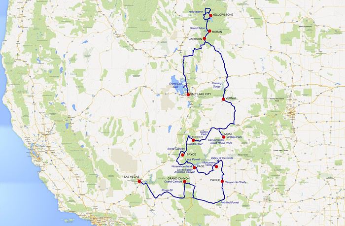
Pour ma part, j'ai eu la chance de parcourir ces endroits pour la troisième fois. J'étais accompagnée cette fois de ma mère et de mon frère, qui eux, découvraient toutes ces merveilles pour la première fois.
Nous avons préparé ce voyage pendant plusieurs mois, pour finalement partir du 08 Juin au 01 Juillet 2017. J'en profite pour remercier tous les membres de ce forum qui partagent leurs expériences, cela m'a grandement aidé pour la préparation de mes trois voyages aux USA. Je vais donc à mon tour, partager les expériences positives, et négatives (!!!) de ce voyage, afin peut-être, qu'elles aident d'autres voyageurs !
Voici donc notre parcours en 23 jours :
Découvrir la Nouvelle-Zélande en van English translation pending
23 mai 2017
Nous sommes rentrés hier d'un voyage de 4 semaines en Nouvelle-Zélande, des images plein la tête, mais pas encore les mots pour décrire tout ce que nous avons vu et ressenti. Tout est encore si frais, et pourtant déjà si loin...
Comme d'habitude, ce forum m'a largement aidée à préparer ce voyage, mais paradoxalement, j'ai trouvé peu de carnets de voyage sur cette destination. Or, je lis toujours avec beaucoup d'intérêt les carnets d'autres voyageurs, et j'admire le temps qu'ils consacrent à partager leur vécu et leurs avis. Alors modestement, je vais tenter d'apporter ma petite pierre à l'édifice. C'est la première fois que je me lance, lors de nos précédents voyages (surtout aux Etats-Unis) je ne pensais rien apporter de bien nouveau ou original. Cette fois, je franchis le pas, peut-être ce compte-rendu pourra-t-il en aider certains dans leur préparation ou donner à d'autres le goût d'aller se balader en Terre du Milieu ! Je ne prétends pas à l'exhaustivité, ce sera simplement notre expérience et nos impressions. 🙂
Petite présentation rapide : nous sommes un couple de trentenaires adorant voyager, pas vraiment de grands randonneurs, mais pas tentés non plus par les tours organisés, un peu feignasses sur les bords 😄, mais toujours partants pour la découverte !
Comme d'habitude, ce forum m'a largement aidée à préparer ce voyage, mais paradoxalement, j'ai trouvé peu de carnets de voyage sur cette destination. Or, je lis toujours avec beaucoup d'intérêt les carnets d'autres voyageurs, et j'admire le temps qu'ils consacrent à partager leur vécu et leurs avis. Alors modestement, je vais tenter d'apporter ma petite pierre à l'édifice. C'est la première fois que je me lance, lors de nos précédents voyages (surtout aux Etats-Unis) je ne pensais rien apporter de bien nouveau ou original. Cette fois, je franchis le pas, peut-être ce compte-rendu pourra-t-il en aider certains dans leur préparation ou donner à d'autres le goût d'aller se balader en Terre du Milieu ! Je ne prétends pas à l'exhaustivité, ce sera simplement notre expérience et nos impressions. 🙂
Petite présentation rapide : nous sommes un couple de trentenaires adorant voyager, pas vraiment de grands randonneurs, mais pas tentés non plus par les tours organisés, un peu feignasses sur les bords 😄, mais toujours partants pour la découverte !
Carnet de voyage au sud du Maroc English translation pending
Bonjour,
Comme promis avant le départ, je vous livre ici mon carnet de voyage, en espérant qu'il vous plaira. J'y ajouterai des photos pour illustrer, car je trouve les carnets avec photos toujours beaucoup plus intéressants et agréables à lire.
Merci à tous ceux qui m'ont aidé dans la préparation de ce voyage qui fut vraiment une superbe expérience pour moi.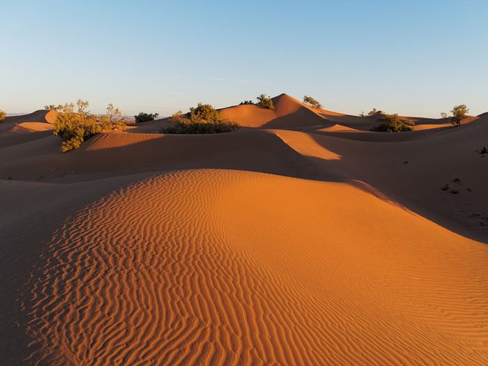
Pour ce break de Nouvel An Chinois, loin de l’Asie c’est au Maroc que je pars pour dix jours, à la découverte des beaux paysages du Sud du pays et aussi du désert.
Jour 1 : Départ et route jusqu'à Ait Ben Haddou par le Col de Tizi N Tichka
Lundi matin très tôt, je prends mon sac et rejoins mon covoiturage qui m’amènera directement à l’aéroport. Je trouve une très gentille jeune fille avec qui nous aurons une passionnante discussion qui me dépose devant le terminal sur la route de son travail. Il n’y a pas beaucoup de monde à l’aéroport et les formalités sont vite expédiées.
Le vol Swiss pour Marrakech est un peu en retard. C’est pas grave on est pas pressé. L’avion est plein à craquer, les hotesses ont été obligées de demander aux passagers avec les plus gros bagages à main de les poser en soute. Décollage au dessus des nuages, ils disparaitront un peu avant de passer le détroit de Gibraltar, superbe même depuis le ciel.
Nous arrivons en début d’après midi dans le terminal 2 de l’aéroport de Marrakech, magnifique bâtiment moderne. Première surprise, depuis le hublot, on est frappé par la proximité des montagnes enneigées, qui paraissent toutes proches de Marrakech. Superbe contraste, car la deuxième surprise c’est l’agréable température au soleil, une température digne d’un mois d’Avril - Mai en France.
Je récupère la voiture rapidement auprès de l’agent Hertz, une 208 quasiment neuve qui se révèle très agréable à conduire en plus d’être économe, parfaite pour le tour que j’ai prévu au Sud de l’Atlas.
Je branche mon GPS et sort non sans mal de Marrakech, il y a beaucoup de circulation et je n’avais pas compris qu’il fallait bien passer sous les murailles pour entrer dans la ville pour la traverser et non pas essayer de la contourner. Puis rapidement on arrive dans un paysage de montagne semi aride. La route est en très bon état. Je ne peux m’empêcher de m’arrêter de temps en temps pour prendre quelques photos du paysage grandiose.
 On suit le cours d’eau qui serpente au fond de la vallée, on passe des petits villages.
 Puis la montée du col débute lorsqu’un panneau annonçant une troisième voie de dépassement. C’est un boulevard pour grimper le plus haut col du Maroc à 2200m d’altitude, mais alors quel plaisir de grimper ces lacets sur une voie aussi large et dans un tel décor.
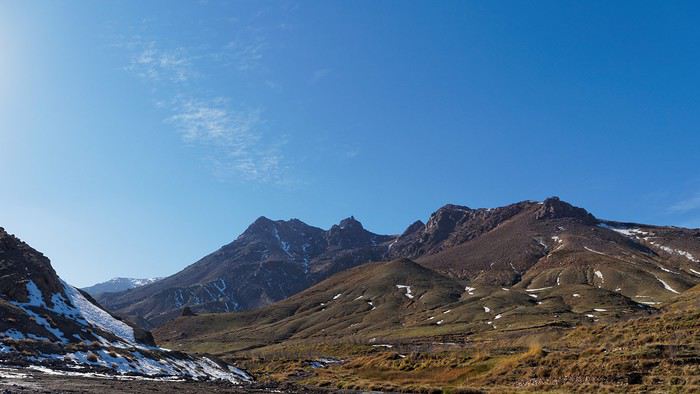 Arret au col de Tizi N Tchika pour se dégourdir les jambes.
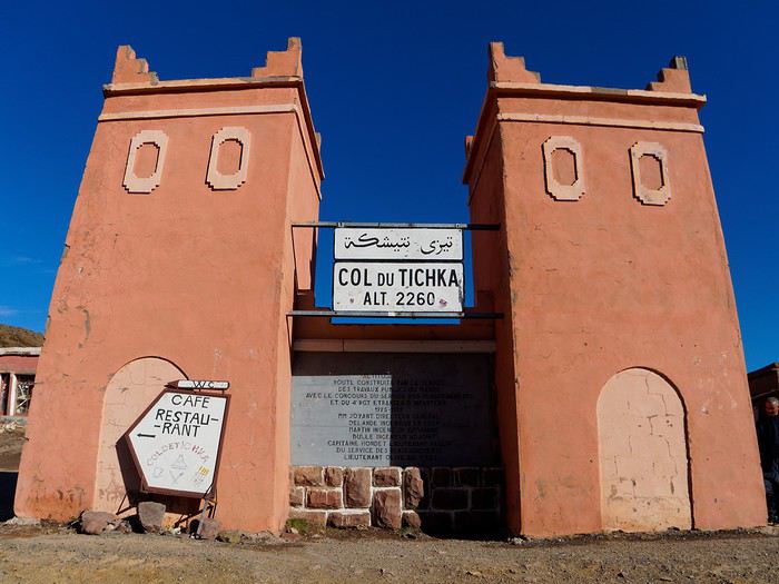
La vue depuis le col est grandiose.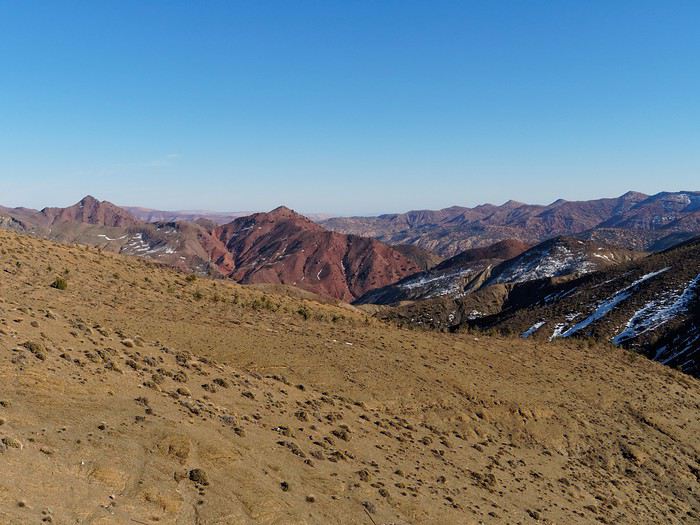
De nombreux revendeurs attendent les touristes pour leur vendre des « pierres ». Je ne suis pas sur qu’ils doivent en vendre beaucoup, néanmoins ils ont une technique de vente très rodée. Je discute un peu avec eux, vu l’heure il n’y aura plus beaucoup de clients potentiels aujourd’hui. Un ancien me demande si je peux le raccompagner chez lui, plus bas dans la vallée à Aguelmouss. Je suis quand même un peu sur la défensive, étant donné l’accumulation d’énormités sortie de la bouche de son copain depuis que je suis arrêté pour me vendre une fausse pierre brillante, voyant cela il me dit « je suis berbère, les berbères sont corrects », argument imparable non ? Allez en voiture ! En route, on discute de la France et du Maroc dans la voiture, il a plus de 70 ans et a eu 7 enfants avec sa femme, qui l’attend à la maison, je le dépose chez lui. Il me propose de prendre le thé, je refuse poliment, le soleil est déjà bien bas et j’ai encore de la route. La vue depuis son village est splendide les roches sont rougeoyantes.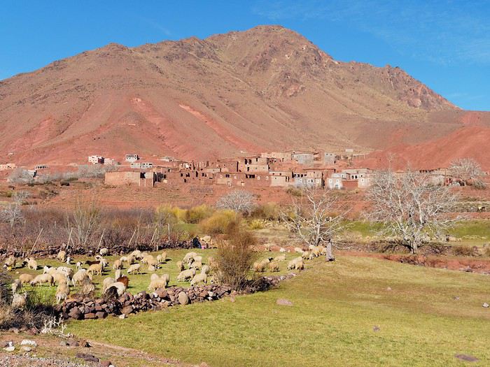 La descente vers Ouarzazate se fait dans un paysage de moins en moins montagnard, on suit une vallée ou les abords de la rivière sont cultivés, avec des petits villages en bordure de route.
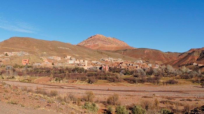 Enfin, on arrive dans une zone désertique où l’on trouve des formes minérales extraordinaires, des monticules de terre couleur pastel, et pas un arbre. Les couleurs ressortent bien avec la lumière de fin de journée. On aurait envie de s’arrêter et explorer à pied toute cette zone, je me contenterai de les contempler depuis la voiture.
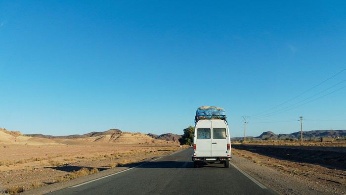 Mais je veux arriver avant la nuit à ma destination du jour, Ait Benhaddou.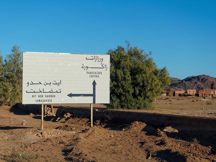
A suivre...
Comme promis avant le départ, je vous livre ici mon carnet de voyage, en espérant qu'il vous plaira. J'y ajouterai des photos pour illustrer, car je trouve les carnets avec photos toujours beaucoup plus intéressants et agréables à lire.
Merci à tous ceux qui m'ont aidé dans la préparation de ce voyage qui fut vraiment une superbe expérience pour moi.
Pour ce break de Nouvel An Chinois, loin de l’Asie c’est au Maroc que je pars pour dix jours, à la découverte des beaux paysages du Sud du pays et aussi du désert.
Jour 1 : Départ et route jusqu'à Ait Ben Haddou par le Col de Tizi N Tichka
Lundi matin très tôt, je prends mon sac et rejoins mon covoiturage qui m’amènera directement à l’aéroport. Je trouve une très gentille jeune fille avec qui nous aurons une passionnante discussion qui me dépose devant le terminal sur la route de son travail. Il n’y a pas beaucoup de monde à l’aéroport et les formalités sont vite expédiées.
Le vol Swiss pour Marrakech est un peu en retard. C’est pas grave on est pas pressé. L’avion est plein à craquer, les hotesses ont été obligées de demander aux passagers avec les plus gros bagages à main de les poser en soute. Décollage au dessus des nuages, ils disparaitront un peu avant de passer le détroit de Gibraltar, superbe même depuis le ciel.
Nous arrivons en début d’après midi dans le terminal 2 de l’aéroport de Marrakech, magnifique bâtiment moderne. Première surprise, depuis le hublot, on est frappé par la proximité des montagnes enneigées, qui paraissent toutes proches de Marrakech. Superbe contraste, car la deuxième surprise c’est l’agréable température au soleil, une température digne d’un mois d’Avril - Mai en France.
Je récupère la voiture rapidement auprès de l’agent Hertz, une 208 quasiment neuve qui se révèle très agréable à conduire en plus d’être économe, parfaite pour le tour que j’ai prévu au Sud de l’Atlas.
Je branche mon GPS et sort non sans mal de Marrakech, il y a beaucoup de circulation et je n’avais pas compris qu’il fallait bien passer sous les murailles pour entrer dans la ville pour la traverser et non pas essayer de la contourner. Puis rapidement on arrive dans un paysage de montagne semi aride. La route est en très bon état. Je ne peux m’empêcher de m’arrêter de temps en temps pour prendre quelques photos du paysage grandiose.
On suit le cours d’eau qui serpente au fond de la vallée, on passe des petits villages.
Puis la montée du col débute lorsqu’un panneau annonçant une troisième voie de dépassement. C’est un boulevard pour grimper le plus haut col du Maroc à 2200m d’altitude, mais alors quel plaisir de grimper ces lacets sur une voie aussi large et dans un tel décor.
Arret au col de Tizi N Tchika pour se dégourdir les jambes.La vue depuis le col est grandiose.
De nombreux revendeurs attendent les touristes pour leur vendre des « pierres ». Je ne suis pas sur qu’ils doivent en vendre beaucoup, néanmoins ils ont une technique de vente très rodée. Je discute un peu avec eux, vu l’heure il n’y aura plus beaucoup de clients potentiels aujourd’hui. Un ancien me demande si je peux le raccompagner chez lui, plus bas dans la vallée à Aguelmouss. Je suis quand même un peu sur la défensive, étant donné l’accumulation d’énormités sortie de la bouche de son copain depuis que je suis arrêté pour me vendre une fausse pierre brillante, voyant cela il me dit « je suis berbère, les berbères sont corrects », argument imparable non ? Allez en voiture ! En route, on discute de la France et du Maroc dans la voiture, il a plus de 70 ans et a eu 7 enfants avec sa femme, qui l’attend à la maison, je le dépose chez lui. Il me propose de prendre le thé, je refuse poliment, le soleil est déjà bien bas et j’ai encore de la route. La vue depuis son village est splendide les roches sont rougeoyantes.
La descente vers Ouarzazate se fait dans un paysage de moins en moins montagnard, on suit une vallée ou les abords de la rivière sont cultivés, avec des petits villages en bordure de route.
Enfin, on arrive dans une zone désertique où l’on trouve des formes minérales extraordinaires, des monticules de terre couleur pastel, et pas un arbre. Les couleurs ressortent bien avec la lumière de fin de journée. On aurait envie de s’arrêter et explorer à pied toute cette zone, je me contenterai de les contempler depuis la voiture.
Mais je veux arriver avant la nuit à ma destination du jour, Ait Benhaddou.A suivre...
L'avenir du tourisme en Angleterre English translation pending
Depuis 2002, l'Euro est devenue la monnaie européenne. C'est un atout pour les pays qui l'ont adopté, car cela favorise le tourisme chez eux et facilite la tâche aux voyageurs qui n'ont pas besoin de changer leurs devises à l'aller et au retour. En revanche, le Royaume Uni, qui a refusé de l'adopter, condamne le tourisme à un déclin lent mais certain sur son territoire. En effet, voici, en exclusivité pour vous ...
L'Histoire du Futur du Tourisme dans les îles Britanniques ...
2017 : l'Ecosse organise un référendum pour son indépendance. Contrairement au référendum du 18 septembre 2014, les Ecossais votent pour l'indépendance à 52 %
2018 : le Brexit entre en application. Conformément à l'article 50 de la Constitution européenne, le Royaume Uni quitte l'UE, conséquence du référendum du 23 juin 2016. Les Anglais qui tiennent des gîtes ruraux en Aquitaine ou en Bretagne ont désormais besoin d'un visa, d'un permis de séjour et d'un permis de travail, pour ne pas être considérés comme des immigrés clandestins. Idem pour les Européens qui vivent au Royaume Uni. C'est une catastrophe économique pour ce pays. La £ passe en-dessous de la barre symbolique de 1 € ... Les touristes ont besoin d'un VISA ou d'un PASSEPORT coûteux pour séjourner en Angleterre, ce qui incite les familles à envoyer leurs enfants en séjour linguistique en Irlande.
2019 : l'Ecosse obtient son indépendance, le Royaume Uni doit changer de drapeau, car l'Union Jack est la fusion des drapeaux de l'Angleterre, de l'Ecosse, du Pays de Galles et de l'Irlande du Nord.
2020 : l'Ecosse devient membre de l'Union Européenne, et dans la foulée, adopte l'Euro. Sur le côté face des pièces, on y grave le Chardon, symbole de l'Ecosse. La zone Euro s'enrichit de 5 295 000 habitants. Les touristes qui boudaient l'Angleterre se tournent à présent vers l'Ecosse.
2021 : l'Irlande du Nord (les 6 comtés de l'Ulster occupés par le Royaume Uni) organise un référendum pour son indépendance, le peuple vote pour l'indépendance à 53 %. En effet, l'évolution démographique a fait que les Catholiques sont devenus majoritaires par rapport aux Orangistes.
2022 : l'Irlande du Nord obtient son indépendance, le Royaume Uni est réduit à l'Angleterre et au Pays de Galles, il doit à nouveau changer de drapeau, sa superficie n'est plus que de 151 156 km², soit un peu plus que la Bulgarie (110 994 km²), seulement 63 % de la Roumanie (238 391 km²) et … 27 % de la France métropolitaine ! (551 500 km²)
2023 : l'Irlande du Nord rejoint l'Union Européenne, et, dans la foulée, la zone Euro, qui s'enrichit de 1 811 000 habitants. Le nombre de touristes en Irlande du Nord augmente de manière exponentielle.
2024 : l'Irlande du Nord demande son rattachement à l'EIRE (République d'Irlande). L'île d'émeraude retrouve enfin son unité, ce qui inspire confiance aux voyageurs.
L'Histoire du Futur du Tourisme dans les îles Britanniques ...
2017 : l'Ecosse organise un référendum pour son indépendance. Contrairement au référendum du 18 septembre 2014, les Ecossais votent pour l'indépendance à 52 %
2018 : le Brexit entre en application. Conformément à l'article 50 de la Constitution européenne, le Royaume Uni quitte l'UE, conséquence du référendum du 23 juin 2016. Les Anglais qui tiennent des gîtes ruraux en Aquitaine ou en Bretagne ont désormais besoin d'un visa, d'un permis de séjour et d'un permis de travail, pour ne pas être considérés comme des immigrés clandestins. Idem pour les Européens qui vivent au Royaume Uni. C'est une catastrophe économique pour ce pays. La £ passe en-dessous de la barre symbolique de 1 € ... Les touristes ont besoin d'un VISA ou d'un PASSEPORT coûteux pour séjourner en Angleterre, ce qui incite les familles à envoyer leurs enfants en séjour linguistique en Irlande.
2019 : l'Ecosse obtient son indépendance, le Royaume Uni doit changer de drapeau, car l'Union Jack est la fusion des drapeaux de l'Angleterre, de l'Ecosse, du Pays de Galles et de l'Irlande du Nord.
2020 : l'Ecosse devient membre de l'Union Européenne, et dans la foulée, adopte l'Euro. Sur le côté face des pièces, on y grave le Chardon, symbole de l'Ecosse. La zone Euro s'enrichit de 5 295 000 habitants. Les touristes qui boudaient l'Angleterre se tournent à présent vers l'Ecosse.
2021 : l'Irlande du Nord (les 6 comtés de l'Ulster occupés par le Royaume Uni) organise un référendum pour son indépendance, le peuple vote pour l'indépendance à 53 %. En effet, l'évolution démographique a fait que les Catholiques sont devenus majoritaires par rapport aux Orangistes.
2022 : l'Irlande du Nord obtient son indépendance, le Royaume Uni est réduit à l'Angleterre et au Pays de Galles, il doit à nouveau changer de drapeau, sa superficie n'est plus que de 151 156 km², soit un peu plus que la Bulgarie (110 994 km²), seulement 63 % de la Roumanie (238 391 km²) et … 27 % de la France métropolitaine ! (551 500 km²)
2023 : l'Irlande du Nord rejoint l'Union Européenne, et, dans la foulée, la zone Euro, qui s'enrichit de 1 811 000 habitants. Le nombre de touristes en Irlande du Nord augmente de manière exponentielle.
2024 : l'Irlande du Nord demande son rattachement à l'EIRE (République d'Irlande). L'île d'émeraude retrouve enfin son unité, ce qui inspire confiance aux voyageurs.
Retour au Japon pour deux semaines... en duo English translation pending
Bonjour à tous ! Plus d'un an après, je trouve enfin le temps de poster mon retour sur mon deuxième voyage au Japon.
Après un premier voyage en solitaire d'un peu plus de trois semaines en septembre/octobre 2009, nous avons décidé d'y retourner en couple en avril 2013 car je n'arrêtais pas de bassiner Mme sur le Japon et elle a finalement concédé de m'y accompagner.
À savoir: - lors de mon premier voyage j'avais visité Kyoto (2 jours), Osaka (1 jour) et bien sûr Tokyo (environ 3 semaines avec une journée à Enoshima et une journée à Kamakura). Pour ce deuxième voyage, il fallait bien sûr refaire ces essentiels car Mme n'y étais jamais allée mais il fallait aussi découvrir de nouvelle choses pour que je ne m'ennuie pas 😇 - Mme était enceinte de 4 mois et donc un peu fragile. Il ne fallait donc pas trop forcer sur le planning et aménager des journées sans trop de déplacements. - j'apprécie l'architecture, surtout urbaine, sans en être spécialiste, je ne suis pas fan de manga mais j'aime ce qu'on appelle "la culture geek". Par contre je suis un grand fan de jeux vidéo (sans y passer des heures non plus). Je suis un grand amateur de nourriture et j'aime essayer pleins de nouvelles choses. Mme aime beaucoup l'Asie en général et l'artisanat asiatique plus précisément. Comme moi elle aime découvrir de nouvelles gastronomie et aime beaucoup visiter. Elle aime le shopping sans en être accro.
Préparation du voyage: - billets réservés sur Opodo.fr au départ de Paris le 18/04 avec escale à Dubaï de 2 heures à l'aller et de 10 heures au retour (le temps pour nous de visiter le Burj Khalifa). 546 euros aller-retour, si je me souviens bien, par personne. - après une première expérience concluante en 2009 pour le Japon et en 2011 pour les États-Unis, nous avons décidé de refaire confiance au site Yes Change pour changer nos euros: 1000 euros à un taux pas trop désavantageux à l'époque (1€=141 yen si je me souviens bien alors qu'il était à 121 lors de mon premier voyage 😐).
Visites prévues: Vous le découvrirez au fil du carnet, c'est plus amusant. Par contre je vous préviens, c'est du classique de chez classique 😉
PS: j'en profite pour remercier les forumeurs de VF pour leur aide et leurs conseils juste avant de partir.

Après un premier voyage en solitaire d'un peu plus de trois semaines en septembre/octobre 2009, nous avons décidé d'y retourner en couple en avril 2013 car je n'arrêtais pas de bassiner Mme sur le Japon et elle a finalement concédé de m'y accompagner.
À savoir: - lors de mon premier voyage j'avais visité Kyoto (2 jours), Osaka (1 jour) et bien sûr Tokyo (environ 3 semaines avec une journée à Enoshima et une journée à Kamakura). Pour ce deuxième voyage, il fallait bien sûr refaire ces essentiels car Mme n'y étais jamais allée mais il fallait aussi découvrir de nouvelle choses pour que je ne m'ennuie pas 😇 - Mme était enceinte de 4 mois et donc un peu fragile. Il ne fallait donc pas trop forcer sur le planning et aménager des journées sans trop de déplacements. - j'apprécie l'architecture, surtout urbaine, sans en être spécialiste, je ne suis pas fan de manga mais j'aime ce qu'on appelle "la culture geek". Par contre je suis un grand fan de jeux vidéo (sans y passer des heures non plus). Je suis un grand amateur de nourriture et j'aime essayer pleins de nouvelles choses. Mme aime beaucoup l'Asie en général et l'artisanat asiatique plus précisément. Comme moi elle aime découvrir de nouvelles gastronomie et aime beaucoup visiter. Elle aime le shopping sans en être accro.
Préparation du voyage: - billets réservés sur Opodo.fr au départ de Paris le 18/04 avec escale à Dubaï de 2 heures à l'aller et de 10 heures au retour (le temps pour nous de visiter le Burj Khalifa). 546 euros aller-retour, si je me souviens bien, par personne. - après une première expérience concluante en 2009 pour le Japon et en 2011 pour les États-Unis, nous avons décidé de refaire confiance au site Yes Change pour changer nos euros: 1000 euros à un taux pas trop désavantageux à l'époque (1€=141 yen si je me souviens bien alors qu'il était à 121 lors de mon premier voyage 😐).
Visites prévues: Vous le découvrirez au fil du carnet, c'est plus amusant. Par contre je vous préviens, c'est du classique de chez classique 😉
PS: j'en profite pour remercier les forumeurs de VF pour leur aide et leurs conseils juste avant de partir.
De Cape Town à Johannesburg English translation pending
Note aux nouveaux lecteurs:
Bonjour, Au départ il ne s agissait que d'un voyage. Au fil du temps c'est devenu un tournicota en afs et dans les pays voisins... Donc on fera ensemble, si vous le voulez ce tournicoti tournicota en passant par les différentes régions d'afs avec en supplément le Lesotho, le pays Swazi, un bout de Bots et un bout de Namibie.
Un petit compte-rendu sur notre dernier voyage en AFS (le N°14). Le parcours : Cape Town, Paternoster, Cederberg, Clanwilliam, Upington, Augrabies, Kuruman, Madikwe, Cradle of Humankind, Joburg. Tout a été fait par nos soins via le net et en direct.
L’avion : Turkish CDG Istanbul Cape Town et retour Joburg Istanbul CDG. Le transfert à Istanbul se fait facilement dans les 2 heures allouées. A Joburg, il s’agit d’une escale technique…Le plein, les niveaux et le pare-brise ? Et on prend des passagers. Vol de nuit. Arrivée à CapeTown vers 13 heures. 750 €. Les compagnies aériennes ont décidé que les passagers devaient se contenter de peu de place…Idem chez Turkish mais pareil qu’avec Lufthansa, AF ou autres…A380 ou pas.
La voiture : Un Fortuner 4x4 de Toyota, extra, voiture en ordre, aucun souci. La version 4x4 avait son intérêt pour le Cederberg, un côté rassurant aux Augrabies et ailleurs…Un SUV était tout à fait suffisant même si moins rassurant sauf dans le Cederberg vu ce que nous voulions faire.
Après coup, seule l’étape d’Upington était inutile. Les Augrabies valent le long détour.
Septembre…Un poil trop tard pour les fleurs de la West Coast et du Cederberg mais un poil trop tôt pour les Augrabies et la route avant et après Clanwilliam. Tout cela dépend des pluies…Et je ne suis pas prévisionniste météo !
Dissertons plus précisément :
Cape Town :
Comme d’habitude, les chiens renifleurs sont des beagles…Et pas des Bergers Belges ou des Bergers Allemands. Plus sympas peut-être mais le contrôle discret est loin d’être anodin. On peut changer son liquide dès l’aéroport, le prix de la commission n’est pas catastrophique ! Notre point de chute est une guest house à Camps Bay.
Camps Bay a beaucoup d’avantages.
L’ambiance est plus cool. La situation permet d’aller facilement dans toutes les directions…Le centre-ville, la région des vins, la péninsule, la route de l’Est, les sites de Table Mountain, Signal Hills, Lion’s Head, le quartier malais…Bref, on est à peu de distance de tout ! L’endroit est superbe, la plage aussi même si l’eau est « frisquette++ ». Nombreux restos sur Camps Bay drive et passage des bustouristiques (qui peuvent être très utiles).
Se lever tôt ! C’est le premier conseil en AFS ! La nuit tombe vers 18 heures. Les restos sont au taquet à 19 heures. Donc on se lève tôt et si Table Mountain est dégagée…On y va !C’est le meilleur moment (pas encore de queues, une vue très claire). Autre conseil : La montée de Lion’s Head…Montée pas difficile ne nécessitant qu’un peu de gambettes (une bonne matinée en tout, prenez de l’eau, c’est safe)…Le pied intégral et à mon sens la meilleure vue sur…tout ! L’apéro du soir sur Signal Hill ? La passion des sud af pour les sundowners est exotique…C’est aussi un plan valable. Après Table Mountain ou Lion’s Head…Un petit tour surWaterfront. Attention, on retombe sur le touristique plein pot mais on y mange et on y achète des cartes postales…Surtout on prend le bateau pour Robben Island.
Robben Island : Vous pouvez réserver via le net. Certaines traversées sont complètes. Evitez si possible celle de 12/13 heures car le plus de monde et le bateau le plus lent du monde ! Evidemment avec le soleil la vue sur la baie vaut à elle seule la traversée…Mais c’est pour la prison que vous y allez ! Nous y étions au début des années 2000 donc 3 ou 4 ans seulement après qu’elle soit visitable. Il y soufflait un vent d’enthousiasme, de volonté d’expliquer, de dire et de pardonner… 10 ans plus tard, ce sont toujours les anciens prisonniersqui font la visite principale mais le vent est retombé… Le public aussi a changé…Quelquefois plus intéressé par son Facebook, acheter une glace ou glousser avec son voisin… J’en reviens cette année avec un goût un peu amer… Robben Island attraction touristique appartenant au passé ou mémoire vivante d’un passé proche et lourd ? Acteurs et spectateurs ont changé ? En bien ?
La péninsule du Cap : Evidemment à faire et mérite sa journée ! Quelques conseils : Allez-y via la route Ouest après la route touristique payante qui suit Hout Bay. C’est plus joli, bien plus… Attention babouins qui savent parfaitement et très rapidement ouvrir la portière de votre voiture (passagers ou pas !). Donc avoir l’obsession de la fermeture centralisée des portières. Les randonneurs ne sont ridicules armés d’un bâton. Prenezgarde à votre sac. Ne résistez pas en cas d’intervention babouine ! Après le petit « funiculaire » prenez le petitcircuit pour aller au bout du bout de la pointe. Ne confondez pas Cape Point et Cape of Good Hope. Ouvrez vos yeux pour chercher les baleines…Et plutôt côté Est et au pied des falaises.
Faites coucou aux Dassies (Damans, Roch Hyrax) pas timides mais ce n’est pas une raison pour les nourrir ou essayer de les toucher. N’oubliez pas qu’ils font partie du même embranchement que les éléphants ! Le resto de la pointe du Cap est touristique, certes mais pratique. Revenez par Simon’s Town pour voir les pingouins de BouldersBeach.
Hermanus : Une excursion (1h30 de route) incontournable par beau tempset à la bonne saison. Des baleines quelques fois comme s’il en pleuvait. Une route le long de la côte (à l’aller) qui est un enchantement… et passez par Betty’s Bay pour voir ou revoir des pingouins(plus, pour 15 rands, dans un coin moins aménagé…mais plus pour longtemps). Voilà nos 3 journées bien occupées…
Ce qui a changé en 15 ans (j’y reviendrai souvent) : Moins de bidons villes et avec de l’éclairage, de l’eau…Plusde quartiers pas riches mais moins pauvres. Une plus grande mixité. Les noirs… Remarque : Je dis les noirs sans racisme ou autre connotation. Quand vous êtes sud af on vous demande, même si vous êtes blonde comme les blés de vous définir comme « white » (blancs), « coloured » (métis)ou « black » (noir). Pour moi, c’est un fait pas un jugement…De toute façon nous avons tous et toutes le même grand-père ou la même grand-mère (j’yreviendrai).
Donc, les noirs sont aussi des clients dans les restos…On voit des couples mixtes…Sur la route, il y a 15 ans (moins à Cape Town qu’ailleurs), sur la route voiture = blancs. Si voiture avec non blancs = voiture pourrie.Aujourd’hui, ce n’est plus vrai. On voit beaucoup d’homosexuels… qui ne se cachent pas. (Noussommes à Cape Town mais cela a aussi changé). On voit beaucoup de noirs venant de RDC. Il y a un stade de foot pour moi totalement anachronique enplein milieu de Cape Town.
Pour une première intervention c’est suffisant pour aujourd’hui…
Michel
PS : tout ceci n’est que mon opinion ou mon ressenti.
Bonjour, Au départ il ne s agissait que d'un voyage. Au fil du temps c'est devenu un tournicota en afs et dans les pays voisins... Donc on fera ensemble, si vous le voulez ce tournicoti tournicota en passant par les différentes régions d'afs avec en supplément le Lesotho, le pays Swazi, un bout de Bots et un bout de Namibie.
Un petit compte-rendu sur notre dernier voyage en AFS (le N°14). Le parcours : Cape Town, Paternoster, Cederberg, Clanwilliam, Upington, Augrabies, Kuruman, Madikwe, Cradle of Humankind, Joburg. Tout a été fait par nos soins via le net et en direct.
L’avion : Turkish CDG Istanbul Cape Town et retour Joburg Istanbul CDG. Le transfert à Istanbul se fait facilement dans les 2 heures allouées. A Joburg, il s’agit d’une escale technique…Le plein, les niveaux et le pare-brise ? Et on prend des passagers. Vol de nuit. Arrivée à CapeTown vers 13 heures. 750 €. Les compagnies aériennes ont décidé que les passagers devaient se contenter de peu de place…Idem chez Turkish mais pareil qu’avec Lufthansa, AF ou autres…A380 ou pas.
La voiture : Un Fortuner 4x4 de Toyota, extra, voiture en ordre, aucun souci. La version 4x4 avait son intérêt pour le Cederberg, un côté rassurant aux Augrabies et ailleurs…Un SUV était tout à fait suffisant même si moins rassurant sauf dans le Cederberg vu ce que nous voulions faire.
Après coup, seule l’étape d’Upington était inutile. Les Augrabies valent le long détour.
Septembre…Un poil trop tard pour les fleurs de la West Coast et du Cederberg mais un poil trop tôt pour les Augrabies et la route avant et après Clanwilliam. Tout cela dépend des pluies…Et je ne suis pas prévisionniste météo !
Dissertons plus précisément :
Cape Town :
Comme d’habitude, les chiens renifleurs sont des beagles…Et pas des Bergers Belges ou des Bergers Allemands. Plus sympas peut-être mais le contrôle discret est loin d’être anodin. On peut changer son liquide dès l’aéroport, le prix de la commission n’est pas catastrophique ! Notre point de chute est une guest house à Camps Bay.
Camps Bay a beaucoup d’avantages.
L’ambiance est plus cool. La situation permet d’aller facilement dans toutes les directions…Le centre-ville, la région des vins, la péninsule, la route de l’Est, les sites de Table Mountain, Signal Hills, Lion’s Head, le quartier malais…Bref, on est à peu de distance de tout ! L’endroit est superbe, la plage aussi même si l’eau est « frisquette++ ». Nombreux restos sur Camps Bay drive et passage des bustouristiques (qui peuvent être très utiles).
Se lever tôt ! C’est le premier conseil en AFS ! La nuit tombe vers 18 heures. Les restos sont au taquet à 19 heures. Donc on se lève tôt et si Table Mountain est dégagée…On y va !C’est le meilleur moment (pas encore de queues, une vue très claire). Autre conseil : La montée de Lion’s Head…Montée pas difficile ne nécessitant qu’un peu de gambettes (une bonne matinée en tout, prenez de l’eau, c’est safe)…Le pied intégral et à mon sens la meilleure vue sur…tout ! L’apéro du soir sur Signal Hill ? La passion des sud af pour les sundowners est exotique…C’est aussi un plan valable. Après Table Mountain ou Lion’s Head…Un petit tour surWaterfront. Attention, on retombe sur le touristique plein pot mais on y mange et on y achète des cartes postales…Surtout on prend le bateau pour Robben Island.
Robben Island : Vous pouvez réserver via le net. Certaines traversées sont complètes. Evitez si possible celle de 12/13 heures car le plus de monde et le bateau le plus lent du monde ! Evidemment avec le soleil la vue sur la baie vaut à elle seule la traversée…Mais c’est pour la prison que vous y allez ! Nous y étions au début des années 2000 donc 3 ou 4 ans seulement après qu’elle soit visitable. Il y soufflait un vent d’enthousiasme, de volonté d’expliquer, de dire et de pardonner… 10 ans plus tard, ce sont toujours les anciens prisonniersqui font la visite principale mais le vent est retombé… Le public aussi a changé…Quelquefois plus intéressé par son Facebook, acheter une glace ou glousser avec son voisin… J’en reviens cette année avec un goût un peu amer… Robben Island attraction touristique appartenant au passé ou mémoire vivante d’un passé proche et lourd ? Acteurs et spectateurs ont changé ? En bien ?
La péninsule du Cap : Evidemment à faire et mérite sa journée ! Quelques conseils : Allez-y via la route Ouest après la route touristique payante qui suit Hout Bay. C’est plus joli, bien plus… Attention babouins qui savent parfaitement et très rapidement ouvrir la portière de votre voiture (passagers ou pas !). Donc avoir l’obsession de la fermeture centralisée des portières. Les randonneurs ne sont ridicules armés d’un bâton. Prenezgarde à votre sac. Ne résistez pas en cas d’intervention babouine ! Après le petit « funiculaire » prenez le petitcircuit pour aller au bout du bout de la pointe. Ne confondez pas Cape Point et Cape of Good Hope. Ouvrez vos yeux pour chercher les baleines…Et plutôt côté Est et au pied des falaises.
Faites coucou aux Dassies (Damans, Roch Hyrax) pas timides mais ce n’est pas une raison pour les nourrir ou essayer de les toucher. N’oubliez pas qu’ils font partie du même embranchement que les éléphants ! Le resto de la pointe du Cap est touristique, certes mais pratique. Revenez par Simon’s Town pour voir les pingouins de BouldersBeach.
Hermanus : Une excursion (1h30 de route) incontournable par beau tempset à la bonne saison. Des baleines quelques fois comme s’il en pleuvait. Une route le long de la côte (à l’aller) qui est un enchantement… et passez par Betty’s Bay pour voir ou revoir des pingouins(plus, pour 15 rands, dans un coin moins aménagé…mais plus pour longtemps). Voilà nos 3 journées bien occupées…
Ce qui a changé en 15 ans (j’y reviendrai souvent) : Moins de bidons villes et avec de l’éclairage, de l’eau…Plusde quartiers pas riches mais moins pauvres. Une plus grande mixité. Les noirs… Remarque : Je dis les noirs sans racisme ou autre connotation. Quand vous êtes sud af on vous demande, même si vous êtes blonde comme les blés de vous définir comme « white » (blancs), « coloured » (métis)ou « black » (noir). Pour moi, c’est un fait pas un jugement…De toute façon nous avons tous et toutes le même grand-père ou la même grand-mère (j’yreviendrai).
Donc, les noirs sont aussi des clients dans les restos…On voit des couples mixtes…Sur la route, il y a 15 ans (moins à Cape Town qu’ailleurs), sur la route voiture = blancs. Si voiture avec non blancs = voiture pourrie.Aujourd’hui, ce n’est plus vrai. On voit beaucoup d’homosexuels… qui ne se cachent pas. (Noussommes à Cape Town mais cela a aussi changé). On voit beaucoup de noirs venant de RDC. Il y a un stade de foot pour moi totalement anachronique enplein milieu de Cape Town.
Pour une première intervention c’est suffisant pour aujourd’hui…
Michel
PS : tout ceci n’est que mon opinion ou mon ressenti.
Voyages maintenus au Japon English translation pending
Salut à tous 🙂
En ce lundi matin, je démarre une nouvelle discussion pour réunir ceux qui pour l'instant n'ont pas annulé leur voyage au Japon et qui hésitent, ceux qui partiront quoi qu'il en soit et pkoi pas ceux qui y sont en ce moment !
Bien évidemment la situation est toujours très instable et c'est à chacun de prendre sa décision, sans juger ce que va faire l'autre.
Sont aussi les bienvenues, les infos concernant les modifications de dates pour les remboursements des vols.
http://www.irsn.fr/FR/Documents/home.htm http://www.asn.fr/ http://www.criirad.org/ http://www.lejapon.fr/blog/http://twitter.com/lejapon
Merci à tous ceux à tous ceux qui participeront 🙂 bonne journée !
En ce lundi matin, je démarre une nouvelle discussion pour réunir ceux qui pour l'instant n'ont pas annulé leur voyage au Japon et qui hésitent, ceux qui partiront quoi qu'il en soit et pkoi pas ceux qui y sont en ce moment !
Bien évidemment la situation est toujours très instable et c'est à chacun de prendre sa décision, sans juger ce que va faire l'autre.
Sont aussi les bienvenues, les infos concernant les modifications de dates pour les remboursements des vols.
http://www.irsn.fr/FR/Documents/home.htm http://www.asn.fr/ http://www.criirad.org/ http://www.lejapon.fr/blog/http://twitter.com/lejapon
Merci à tous ceux à tous ceux qui participeront 🙂 bonne journée !
Un peu d'Eire! English translation pending
Voici le récit de notre séjour dans l' ouest de l' Irlande du 02 au 07 juillet 2009 , une "échappée" de quelques jours entre petites villes et Nature à la découverte d' un pays Adorable !!!
Je rentre peut-être un peu trop dans les détails mais cela nous permet de conserver nos souvenirs intacts 😊... Peut-être pourra t 'il également aider certaines personnes à préparer leur périple là bas .... J' ai essayé de donner à cette intention, pas mal d' infos sur la préparation du parcours avant de rentrer dans les détails de nos visites jour par jour ...
TOUT COMMENCE PAR UN CADEAU D ANNIVERSAIRE :
Début mai 2009 , l' anniv de Ced approche et je n' ai toujours pas trouvé de cadeau 😕 ... Quelques semaines de vacances déja plannifiées en Bretagne pour cet été , mais une bonne petite envie d 'évasion qui me trotte dans la tête mine de rien ...J 'essayerai bien de plannifier une petite échappée à deux pendant ces congés là ...Je farfouille sur le net histoire de me donner des idées ... Juillet est déja pas mal chargé partout ! Jersey : ouais ...bof ...pas bien folichon tout ça ...il appréciera pas spécialement et moi non plus.... Tiens !!! Ryanair propose des vols au départ de Nantes pour l' Irlande !!!! Nantes-Shannon : pile de bons tarifs du 02 au 07 juillet!!! Ok c' est court mais ça permettra de passer quand meme pas mal de temps sur Erdeven après !!!
C' est décidé je lui fais la surprise de l 'emmener au "Pays des Moutons" (tout en me faisant plaisir à moi aussi ) 😎😎!!! Je réserve juste les billets pour le moment et nous deciderons du parcours ensemble plus tard . J' ai également repris contact avec une vieille copine irlandaise que je n' ai pas revu depuis presque 10 ans et on a plannifié de se voir à Galway .Tout s' annonce très bien !
Je trépignais d'impatience de lui offrir son cadeau et lui de le recevoir car il me posait pas mal de questions ! J ai du pourtant lui mettre la puce a l' oreille en lui faisant comprendre qu' on ne passerait pas completement toutes nos vacances en Bretagne mais c'est tout ...
"Ah je te vois venir, me dit-il , tu sais si c'est pour conduire à gauche je peux le faire 😉 !!!" "et un petit we à Jersey je dis pourquoi pas !" (Quoi ????!!! mais comment a t' il su ça 🤪🤪🤪!!!!?? j 'ai pourtant bien pris soin d' effacer tout l' historique de mes recherches sur internet et de n' en parler à personne !!! Mais tu te plantes un chouilla mon grand hi hi hi 😏...) Gênée je lui répond que "euh.. non désolée mais j' ai pas trop les moyens en ce moment et que ben ...non c 'est pas du tout ça" ... Mais je jubile intérieurement sur le fait qu 'il soit persuadé que ce soit Jersey ...
Et je l 'ai laissé croire ça jusqu'au 16 mai , jour de son anniv où je lui ai offert une petite carte couverte de trèfles , "fabriquée maison" sous forme de petit jeu avec des images clichés de l' Irlande à décacheter pour découvrir la destination au fur et à mesure de la lecture . C'était plutot sympa de voir son sourire s 'éclairer lorsqu il découvrait un mouton ou un Leprechaun par-ci par-là !! Très surpris et super content , nous nous mettons déja à rêver sur le pays ...
LA PREPARATION DU PARCOURS ET QUELQUES ADRESSES QUI NOUS ONT ETE UTILES:

La préparation n' a pas été franchement évidente , j' avoue qu' il est assez difficile de plannifier un parcours là bas surtout sur si peu de temps ... Nous nous sommes rendus à la "Maison de l' Irlande", 33 rue de Miromesnil 75008 PARIS pour y prendre plein d' infos. Une personne très sympa nous a reçu et nous a fourni pas mal de brochures , de cartes , et un guide complet des B&B.
Dur de s' y retrouver entre tout ça même après la lecture de quelques carnets de voyages en ligne et recherches sur certains sites (www.sejour-en-irlande.com ou www.terresceltes.net ou encore www.guide-irlande.com).
Entre cette personne de la "Maison de l' Irlande" qui nous affirme que l'on roule parfois en moyenne a 25km/h sur certaines routes, et Googlemaps qui nous indique finalement des temps de trajets assez court et bien ...on nage 🤪!!!...
Et on en a mis du temps a trouver "THE parcours" et c'est grace notamment aux intervenants de www.Voyageforum.com ( Jalan22, Boumbastic, Lilie82 ..) et ceux du forum IRISH PUB du site www.guide-irlande.com ( Celtic Girl, Phil1908, Pitchoune et Caro ) que l'on a reussi à trouver enfin notre bonheur !! Un grand merci à vous tous si vous avez l'ocasion de me lire 😉!!!
Inutile de vouloir trop en faire mais il vaut mieux se concenter sur une région en particulier . Notre arrivée sur Shannon nous a permis de profiter des verts paysages typiques de l' Irlande nous ne souhaitions pas voir Dublin de toutes façons. Voici la carte du parcours effectué (détaillé jour par jour plus tard ):

Vol aller Nantes le 02/07/2009 decollage a 09h30 arrivée Shannon a 10h10
1 Nuit à Clifden 2 nuits à Galway 2 nuits à Killarney
Vol retour Shannon le 07/07/2009 decollage a 15h45 arrivée Nantes a 18h20
Au compteur à l 'arrivée 1300 kms, pas mal de route finalement !!! Tout ça sous un soleil de plomb ... non je déconne évidemment 😛😛😛!!! Un temps plutôt maussade mais de belles éclaircies durant nos balades , ambiance un coup chaleur et un coup fraîcheur constamment .
LE CHOIX DES HEBERGEMENTS :
Non, là j' avoue le camping sous un risque de pluie ça nous attire pas trop 🤪...les hotels proposent des tarifs exhorbitants et les Auberges de Jeunesse sont majoritairement complètes en chambres privées à nos dates et dormir dans un dortoir de 30 personnes séparé de mon homme pour un voyage en amoureux et ben c' est pas mon truc non plus 🤪....
Le B&B , tarif petit dèj inclus à prix très raisonnables souvent ( en moyenne 35 a 45 euros /personne /nuit) est parfait !!!
Nous avons décidé de réserver des B&B en centre ville ou du moins proches, car comme on allait faire pas mal de voiture , la laisser le soir et se balader à pieds nous semblait idéal . Les B&B ont été reservés sur internet à l' avance pour juillet c'est ce que l'on nous avait conseillé de faire . Pas mal d' entres eux affichaient cependant des panneaux "vacancies" une fois sur place mais on ne voulait pas se risquer à ne pas réserver sur si peu de temps ...
Voici les sites de reservations utilisés (pratique si comme moi vous n' aimez pas trop donner votre CB par téléphone ou sur un simple mail non sécurisé) : www.goireland.com et www.Hostelworld.com entre autres . On y paye une garantie d'environ 10% et le reste est a payer sur place .
LES B&B CHOISIS :
CLIFDEN: le KINGSTOWN HOUSE : (www.kingstownhouse.com) Hotel très bien situé au centre ville de Clifden calme et simple, une dizaine de chambres décorées à "l'anglaise", tout le confort nécessaire , chambre somme toute assez petite mais très correcte. Hotes acceuillants , excellent petit dèj pas mal de choix ( pancakes , irish breakfast , assiette de fromages, fruits et céréales ..etc... ). parking gratuit entre 18h00 et 11h30 dans la rue où se situe l hotel sinon parking payant un peu plus haut .
GALWAY: le RONCALLI HOUSE ( www.roncallihouse.com) Situé à 10 /15 minutes a pieds du centre ville . Proche du bord de mer et très au calme . Chambre sympa vue partielle sur la mer . On a apprécié la bouilloire /thé et café dans la chambre . Hotel tenu par un couple de personnes assez agées et charmants . Petit dej avec pas mal de choix également, j' ai juste moyennement apprécié qu' on nous demande la veille quel petit déj on souhaitait pour le lendemain matin ça donne presque l impression de devoir "se presser" et du coup tant pis si on change d' avis le fameux matin ...mais je pense que c'était pour bien faire ! chambre très bien mais salle de bain minuscule ... accueil sympa et parking privé . Très bonne impression générale .
KILLARNEY : le SUNNYBANK B&B (http://www.sunnybankbb.com/) Situé à peine à 3 minutes à pieds du plein centre de Killarney , B&B très propre , chambres spacieuses et modernes .. très bonne salle de bains avec enfin une pomme de douche qui a un bon débit !! Peu de choix au niveau du petit dèj cependant : soit Irish breakfast soit céreales et toasts . Accueil extrêmement chaleureux de Brendan le propriétaire ( on a meme eu le droit a la bise en partant)! mais sa femme reste très en retrait et est très "froide" ( pas un seul bonjour, ni merci ni au revoir, je me demande ce qu'elle fiche ici d' ailleurs...) une dizaine de chambres , hotel calme et moderne . Voie de chemin de fer a coté mais pas gênante du tout .
LA VOITURE :
Je savais qu' il était inutile de louer un 4x4 en Irlande surtout pour une première expérience de conduite à gauche alors on a opté pour une petite voiture un peu en Kit 😉 ( boite à gants qui se décrochait , 1 enjoliveur manquant et les 3 autres "rafistolés maison" et de belles rayures sur le coté ) : la Nissan Micra ! Parfaite pour rouler sur les petites routes et se ranger sur le bas côté pour laisser passer les "gros" . Coffre minuscule mais ok pour 2 petites valises . Bref on a eu un bon prix alors on peut pas se plaindre 😏 ! Voiture réservée auprès de Holidays Autos , récupérée au comptoir de Budget à l'aéroport de Shannon louée de 12h00 à 12h00 malgré nos horaires pour éviter une journée de location en plus .. et bien... on a bien poireauté à l' aller avant de la récuperer ayant attérri a 10h10 et comme on l' a rendu a 12h00 au retour aussi on a re-poireauté jusque 15h00 pour l' embarquement 🤪... Bref on connait par coeur l'aéroport de Shannon maintenant 😉 !!


NOTRE AVIS SUR RYANAIR :
Très bonne compagnie mine de rien, qui n' a pas pourtant forcément très bonne réputation, mais bonne surprise ! Aucun retard sur le vol. Bon accueil . Seule compagnie que je connaisse qui ne donne pas de numéro de sièges attribués et où l'on se place où l' on veut , où les hotesses ne cessent de passer dans la rangée pour vendre des pizzas , hot dogs , le nouveau parfum de Jennifer Lopez et des cartes à gratter pour jouer à la Lotterie de Ryanair !!! Le plus marrant c' est qu' à chaque attérrissage retentit un fulgurant bruit de trompette "TaTa TaTa TaTa !!!!!!!!!!" et là tout le monde applaudit .. Nous, tout ce petit "cirque" nous a fait marrer 😏😏😏!!

LE GUIDE DE VOYAGE :
J' avais acheté le Guide du Routard Irlande 2009 pour l'offrir à Ced en meme temps que ma petite carte d' anniv.. Et bien on l' a trouvé hyper mal foutu ... je ne saurais pas trop quel guide papier conseiller du coup mais pas le GDR 😠🏴☠️!!
Celui pour notre dernier voyage pour l' ouest des USA était précis et bien fait , pas pour tout bien sur, mais a été utile au moins!!! Alors que là .... rien de bien impressionnant , des descriptifs très succincts voire presques érronés par endroits sur les lieux interressants ( exemple la randonnée que nous avons fait au parc national du Connémara est décrite comme se faisant en 2h et assez facile: resultat 3 heures de marche aller retour et ce n' est pas une promenade du dimanche :toute en escaliers de pierres ! ) , des adresses de restos qui sentent un peu l' arnaque et qui ne valent pas le coup ... bref je le déconseille complètement ...
LE PARCOURS JOUR PAR JOUR :
Jeudi 02/07/2009 :
Ouh la la le réveil est dur ce matin , il est 05h00 du mat , on a à peine dormi 4h ayant trainé tard en famille la veille, mais on préfère "partir large" pour l' aéroport quitte à devoir patienter sur place . On arrive à Nantes Atlantique vers 07h00 seulement du coup on prendra un petit café-croissant avec mes parents qui nous ont gentiment emmené ce matin.
Le décollage a lieu à l' heure et on attérri à Shannon à 10h10 sous un temps aussi pluvieux qu' à Nantes , il fait un peu plus frais tout de meme... reste à récuperer les bagages et la voiture .. On poireautera 2 heures dans l'aéroport pour pouvoir la récuperer au centre Budget .
Midi arrive (enfin !) et on découvre notre petite voiture. On bourre tant bien que mal nos 2 valises dans le mini-coffre , quelques bonnes secondes de réaction avant de s'appercevoir qu' on est chacun plantés du mauvais coté pour rentrer dans la voiture ( volant à droite oblige ça perturbe beaucoup au debut 😛!!) , on échange les places conducteur/passager (d'ailleurs on reproduira cette petite danse autour de la voiture de nombreuses fois durant le séjour lors de nos arrêts , se trompant très souvent de côté !) , on branche le GPS en priant pour qu'il fonctionne , on respire bien fort et "Zzzzouuuu Vogue la Galère", direction le Connemara et Clifden 😎!!
Ca fait tout bizarre d 'emprunter notre premier rond-point à l'envers , l' adrénaline monte un peu quand on se retrouve sur quelques "grandes" routes en quittant l 'aéroport , on reste sur la file complètement à gauche qui d'après ce qu'on arrive à assimiler est la voie pour les véhicule plus lents , tout à l'inverse de nous quoi .... En tant que co-pilote je rectifie le tir quand Ced roule trop à gauche et rase de trop près les murets exterieurs.. difficile pour lui d' évaluer la largeur de la voiture de mon coté mais il s'habitue assez vite .. moi j'aurais été morte de trouille de conduire à sa place mais il m' avait bien dit que conduire à gauche ne l' embetait pas !!! 😉
Nous faisons route vers Clifden en passant par Galway , la traversée se fait sans encombres . On décide de s' arreter aux alentours du Lac Corrib un peu avant Oughterard pour aller visiter le "Aughnanure Castle" , toujours sous un temps partiellement humide mais avec de jolies éclaircies . Arrivés au parking du chateau nous sommes accueillis par un chien ma foi fort sympatique qui nous escorte jusqu' à l'entrée du site .


Aughnanure est un vieux chateau du 16ème siècle assez bien conservé qui a gardé pas mal de cachet . L entrée est de 2 ou 3 euros . Nous grimpons dans les étages de la vieille tour , pas grand chose à voir dedans mais ce sont surtout les exterieurs qui sont sympas .
Nous reprenons la route vers Leenane sous une pluie toujours aussi désespérante, mais les paysages parsemés de lacs et peuplés de moutons sont somptueux, les orages grondent au loin et les nuages s'accrochent aux versants des montagnes vertes . Partout des petits torrents s'écoulent en cascades vers la vallée.


Nous arrivons à Leenane , un charmant petit bourg tout coloré aux pied du seul Fjord irlandais que nous avions envie de voir mais le temps n' étant pas avec nous on décide d'aller se mettre à l'abri dans un pub pour déguster notre toute première GUINNESS 🙂!!!
Sous le porche deux petits vieux irlandais édentés rigolent de nous voir arriver trempés et nous saluent au passage . Ils avaient des "trombines" bien typiques et j'aurais bien voulu les photographier mais je n' ai pas osé .. Nous nous installons au comptoir observant le barman tirer notre GUINNESS en plusieures fois . Elle est plutot agréable à boire et nous cale bien l 'estomac . Nous faisons un brin de causette avec un Ecossais de passage ici , attablé à coté de nous .


(On reprend la route toujours sous la pluie en passant près de Letterfarck et l ' Abbaye de Kylemore que l' on apperçoit du bord de le route devant son lac, mais il fait trop sombre pour la photographier et nous y reviendrons demain de toutes façons! )
 Sur la route vers Clifden ...
Nous arrivons à Clifden vers 18h30 et prenons possession de notre chambre au Kingstown House en plein centre . On crève de faim et on est explosés ( levés depuis 5h du mat ) . Une bonne douche et on décide de sortir se balader dans cette petite ville très colorée et mignonne . Il y a beaucoup de restaurants et de pubs sur place mais on décide de suivre les conseils de la proprio du B&B qui nous a conseillé le "GUY' S BAR" pour diner .


Tout le monde mange tot vers 18h00 en Irlande et la plupart des restaus ne servent plus après 21h .. On se reboit une petite mousse en terrasse et on profite un peu du soleil qui a décidé de revenir avant d 'entrer déguster un très bon Fish and Chips à l 'interieur . Assez écoeurant sur la fin j'avoue mais le poisson est très frais , ça fait du bien ... On rentre vers 21h à l'hotel et on tombe comme des mouches...
Vendredi 03/07/2009 :
Reveil tranquile vers 08h00 on descend prendre notre excellent petit dèj .. Mon estomac n' apprecie pas trop le sâlé dès le matin , et meme si j'aimerai bien tester l 'Irish Breakfast ( saucisse , lard , oeufs brouillés et beans ) je me régale de délicieux pancakes au sirop d'érable et Ced d' une assiette de fromages. Nous quittons nos hôtes vers 09h00. Au programme ce matin, randonnée dans le Parc National du Connémara ! On a de la chance, le temps est à peu près avec nous , du moins il ne pleut pas c' est l' essentiel 😉!!!
Nous arrivons au parking du NP et enfilons nos chaussures de randos pour entamer l'ascenscion du Diamond Hill . Plusieures pistes s'offrent à nous classées par difficulté/temps de parcours. On a réellement envie d 'aller jusqu'en haut alors on suit la piste rouge . Comme je l' ai dit plus haut le Guide du Routard raconte un peu n' importe quoi . La jaune est effectivement extrêmement facile mais n' apporte pas grand chose , la bleue est moyenne, sympa mais ne va pas très haut et la rouge est assez difficile et le tour complet se fait en 3 heures .


 Diamond Hill
C' est superbe nous croisons quelques chevaux au début, et au fur et a mesure de la montée les paysages sont à couper le souffle ( la marche aussi !! 😛 ) avec un panorama sublime sur la vallée , jusqu' à la mer ... De longs pontons en bois ont été aménagés pour passer a travers les zones marécageuses . Par moment nous avons le droit à quelques superbes faisceaux de lumière traversant les nuages pour venir éclairer la lande , ça donne presque une ambiance "religieuse" aux lieux....


Nous sommes suivis par une famille et nous nous faisons vite rattraper par leurs enfants agés à peine d' une dizaine d' années .. mais c' est qu'ils grimpent vite eux!!! Et ils ont la patate dis donc !!!! je sais pas comment ils font car on a déja un peu beaucoup de mal 🤪.... Ils nous abandonnent au début de la piste rouge (ouf l'honneur est sauf !!😛) ... et on continue à grimper vers le sommet malgré le vent qui vient de se lever et le tonnerre qui gronde un peu au loin 🤪...

Je suis ereintée à force de monter ces milliers de marches de pierres , en arrivant au sommet Cedric est assez loin devant et je ne le vois plus , le vent souffle tellement fort que j'arrive meme plus à avancer et il commence à pleuvoir à grosses gouttes...
J' appelle Ced dans un petit élan de panique et entre les rafales de vent il ne peut meme pas m 'entendre , j' arrive au sommet le retrouvant à terre il venait de glisser sur un rocher... Merde ...C'est pas le moment de se blesser 🤪... Et on doit tout redescendre ... On se pose quelques minutes histoire de récuperer un peu , ça va mieux , finalement rien de grave ..On prends quelques clichés d' en haut entre 2 éclaircies avec vue sur la Kylemore Abbey minuscule tout en bas mais le vent nous gifle tellement fort qu' on attend pas plus longtemps pour redescendre de l' autre coté .

Il faut également un assez bon jeu de jambes pour la descente et le vent se calme enfin à mi-parcours . Nous observons le soleil qui glisse et ondule doucement à travers les nuages caressant les vertes prairies dans un mouvement très doux ....Nous regagnons la sortie du parc à travers les marécages où poussent des fleurs appelées "bog cotton" en appercevant quelques moutons perchés tout en equilibre au sommet du mont Diamond.
Un petit arrêt a Letterfrack, "une barre de céréales, une petite GUINNESS et ça repart" 😎!!!
Nous reprenons la route vers Kylemore Abbey , que nous ne visiterons pas mais que l' on peut facilement photographier de la route ou bien en allant se garer au parking un peu plus loin . On attend patiemment les éclaircies avant de shooter mais elles se font très timides 😕...


On se perd un peu sur la péninsule de Renvyle avant de tomber sur une plage magnifique digne des Caraïbes , avec une eau bleu turquoise transparente et du sable très blanc...sublime et étonnante , on ne pensait pas à en trouver de si belles en Irlande !


Nous décidons de reprendre la route vers Galway en passant par la Inagh Valley , superbes lacs, très beaux paysages de collines verdoyantes et à nouveau des moutons partout au milieu des tourbières ...


Nous arrivons à Galway vers 17h00, on trouve le Roncalli House très facilement , contents d 'être aussi bien accueillis, la chambre est très sympa avec vue sur la mer . Un article de journal affiché dans l 'entrée nous apprend que Chelsea Clinton a séjourné là il y a quelques temps et les proprios en sont super fiers!
Hop une bonne petite douche et on part se balader à pieds dans Galway . La ville est sympa , c 'est a priori la 3ème plus grande ville d ' Irlande . On passe à travers une des rues principales "Quay Street" , blindée de Pubs et de monde , ça et là des musiciens font la manche , les rues sont très animées .
Nous ne savons pas trop où diner , il y a tellement de choix !!! On jette quand meme un oeil dans le guide du routard qui parle en bien d' un petit restau appelé le "Fennigans" .. va pour un Irish Stew , le plat typique que l' on avait envie de tester .. Sorte de ragoût de mouton accompagné de pommes de terre , carottes et poireaux, sauce "gravy" ... très lourd à digerer, un bon plat d' hiver qui tient bien au corps quoi !! mais on aura testé au moins 😛!!
Nous rentrons à l'hotel en longeant les quais et observons des pêcheurs à la mouche dans la Corrib River. L' hotel n' est qu 'a 10 /15 minutes à pieds du centre et la balade nous a fait digérer ...
Samedi 04/07/2009 :
Départ vers 09h30 de l' hotel Roncalli après quelques bons pancakes (qui ressemblaient plus à des crêpes d' ailleurs!😛) pour remonter à nouveau vers Clifden et faire un tour sur la fameuse "Sky Road".
Il fait assez beau aujourd 'hui . Le début de la route est très joli , avec de belles petites maisons colorées et fleuries entourées de murets de pierres ou de haies de Fuschias . Nous nous arrêtons pour admirer en contrebas un très beau chateau en ruines ( le Clifden Castle) , et de beaux panoramas sur le bras de mer au loin .


Arrive une bifurcation : upper Sky Road et lower Sky road .. On opte à tort pour lower n' ayant pas assez lu d' infos sur le net dessus avant de partir... Et encore une fois le GDR en parle très peu mis à part dire qu 'elle est très belle , il ne mentionne pas cette bifurcation 😠... Il aurait fallu selon ce que j' ai lu au retour la prendre par en haut 😕!! ... On se retrouve dans des coins assez "crados" sur la fin ...des rochers souillés par les algues avec des vieilles machines d' ostreîculture toutes rouillées ... c 'est moche et tellement décevant.... mais je suis sure que par en haut les paysages sont différents ... à vérifier donc ...
On se paume sur la fin de la route et notre GPS aussi ( on avait oublié de l' actualiser avant le départ 🤪....) On continue de longer la côte pour un arrêt a Roundstone , un petit port de pêche tout tranquile . Un petit snack où l' on poireautera bien 1 heure avant d' être servis alors qu' il n'y avait que 2 autres clients attablés à côté de nous, les serveuses ont l' air débordées et viennent à 3 servir le plat de ces clients sans venir vers nous 😐 😐... mais bon il fait un beau soleil et on se sent bien , assis là en terrasse ...
On reprend la route toujours en longeant la côte , c' est mignon , plein de maisons par-ci par -là , des paysages un peu "lunaires" jonchés de petits rochers au milieu de la verdure et remplis de moutons ...
Nous traversons le parc du chateau de Ballinahinch (sans s' y arrêter vraiment car on ne voulait pas trop trainer on avait RDV avec ma vieille copine irlandaise à Galway ce soir là!) . A la sortie des jardins du chateau nous tombons sur une jolie rivière avec 3 pêcheurs à la mouche , l' ambiance est si paisible... On entend l 'eau couler doucement et se mêler au bruit de la ligne que les pêcheurs font virevolter autour d'eux ...et nous restons là à les observer un petit moment en silence... Cela m'a fait penser au très beau film "2 jours à tuer" de Jean Becker avec Albert Dupontel , il a été tourné en partie dans le Connémara mais je ne sais pas où exactement ...


Des moutons qui surgissent de nulle part juste à côté de nous nous font sortir de notre rêverie et nous reprenons la route vers Galway .

"Ced !!!!!!!!!!!!!!!!!!" "Quoi ??????????????!!!!!!" " Mais tu roules à DROOOOOOOOOITE !!!!!!" " Ah !!!! M... Désolé !!!!" et on reprend vite fait bien fait la voie de gauche ...ouf.....juste à temps ....un conducteur en face de nous nous fait un appel de phares et arrivé à notre hauteur nous fait un signe de la main genre "complètement tarés ceux là" !!!!! Bon ben ça va ..on a pas fait exprès 😊😊😊 ....
On du mal également sur toutes ces petites routes, à comprendre comment on peut atteindre la vitesse maximum autorisée presque partout de 100km/h alors qu 'on arrive à peine à rouler à 60kms/h 😐...
Arrivés à l 'hotel on saute dans la douche et on se prépare pour sortir . Nous avons rendez vous avec Tracy à 19h00 au SKEFF' Bar situé sur la place de Eyesquare . On l' attend en terrasse , je suis un peu anxieuse ... est ce qu 'on va se reconnaitre au bout de presque 10 ans ???... A t 'elle changé ??? J 'observe une fille qui lui ressemble vaguement et qui me regarde bizzarement aussi... mais non ce n 'est pas elle , elle me regarde tout simplement car je dois la regarder avec insistance 😛!!!
On passe le temps à observer la "Faune" d 'un samedi soir à Galway autour de Eyesquare : entre les petits "djeunes" dont le seul membre majeur du groupe a pu aller acheter un pack de bières au supermarché du coin , la fille très rondouillette et déja complètement bourrée qui agiche tout le monde assise sur un banc , maquillée à outrance et vétue d ' une archi-mini-robe rose fluo "à ras du bonbon" et d 'un manteau en fourrure sans manche et qui nous fait bien marrer 😏....et entre toutes ces filles qui sont super pomponnées , tous ces enterrements de vies de jeunes filles au même endroit, on a pas de quoi s'ennuyer !!! On a pas pensé à emmener une tenue de gala dans nos valises, alors habillés très simples on passe bien pour des touristes au final 😏!!
Tracy arrive enfin , toute belle et également bien pomponnée au bras de son ami Steven , on se reconnait aussitôt finalement , grandes ambrassades et on fait les présentations de nos moitiés respectives. On passe une excellente soirée à rigoler et à se raconter nos vieux souvenirs lorsqu' on etait colocataires pendant 4 mois en été 2000 .... Et on enchaîne les pintes de bière chacun payant sa tournée ... On se retrouve vite avec 2 pintes chacun remplies devant nous avant d' avoir pu en finir une seule ...Misère la soirée va être dure 🤪😉...


Mais comment font ils pour boire tout ça et tenir le coup 😮😮😮??? Au bout de 3 pintes on est déja bien guillerets mais ça réenchaine sur de nouvelles tournées 🤪😏 !!! L'ambiance est super sympa on rigole bien, le Pub est rempli et se transforme doucement en boite de nuit. Des amis à eux nous rejoignent et un nouveau tour de table s 'annonce !!! Ouh là là doucement je vois plus très clair moi 😛... Ils décident alors de faire la tournée des Pubs . Il est déja tard , on est claqués et j' avoue que je marchais plus bien droit 😊...en plus on doit se lever tôt demain pour rejoindre Killarney ... On les accompagne jusqu' à Quays Street et puis on se dit au revoir désolés de pas pouvoir tenir la route en promettant de ne surtout pas attendre 10 ans pour se revoir cette fois !!! J ' hallucine encore aujourd'hui sur leur bonne descente !!! On retrouve tous les deux un peu émèchés le chemin de l 'hotel tout de meme et on s' endort très facilement à "Guinness grand G" ..euh ...je veux dire à "Vitesse grand V" 😉!!!
Dimanche 05/07/2009:
Aujourd'hui au planning : Aspirine +++ 😉 et traversée du comté de Clare pour rejoindre le Kerry à travers les paysages typiques du Burren et ses champs de pierres. On s' arrête quelques minutes pour aller visiter les restes d' une vieille chapelle en ruines au bord de la route entourée de pierres tombales et de croix celtes :


Puis nous nous rendons aux "Cliffs of Moher", ces fameuses falaises plutôt impressionnantes qui méritent le détour mais qui sont blindées de monde.... les touristes y affluent par bus entiers .


Nous y passerons une petite heure avant de reprendre la route et s' arreter dans un Pub non loin dans une petite ville sympa que Tracy et Steven nous avaient conseillé : Lehinch . C ' est une petite ville ambiance " balnéaire" avec une grande plage remplie de surfeurs et d' écoles de voile .
Nous reprenons la route pour Killimer afin d 'emprunter le bac , 20 minutes de traversée pour rejoindre Tarbert (bien pratique car cela évite un détour de plus de 2 heures de route !) Ce gain de temps et de Kms mérite bien les 18 euros versés pour monter sur le bac: www.shannonferries.com/timetable/ . Les paysages ne sont pas terribles pendant la traversée , loin de là , mais on a trouvé ce petit phare mignon tout perdu au milieu des usines :

Nous poussons jusqu' à Dingle via un superbe col de montagne appelé "Connor Pass" , superbe de ce que l' on a réussi tout juste à en appercevoir car nous y passons au milieu des nuages et sous des trombes d 'eau 🏴☠️🏴☠️😕.. La route était cerclée de rochers et de cascades . C 'est dommage ça avait l' air sublime ... Arrivés en bas , le temps se calme enfin et nous nous arrêtons en bord de route pour aller câliner 2 superbes poneys :


Nous arrivons à Dingle vers 16h30 , la ville est très mignonne et donne envie de rester à y flâner . Le centre ville est très coloré , rempli de petites boutiques , un petit port de pêche agréable et un arbre sculpté juste à coté de l'église qui attire notre attention : le Trinity Tree .


Tout comme le monstre du Loch Ness en Ecosse , Dingle possède aussi sa petite attraction locale : "Fungie le Dauphin" qui vit là parait-il depuis quelques années . Apres quelques petits achats , un petit arrêt au Murphy's Pub nous reprenons la route vers Killarney .
On trouve sans problème le Sunnybank B&B et nous sommes accueillis chaleureusement par un bon gros pataud de labrador, et Brendan le propriétaire nous ouvre la porte de son très bel hotel avec un grand sourire et nous accueille comme si nous étions des amis de longue date . Ca fait vraiment plaisir et se sent tout de suite comme à la maison 🙂!
Une bonne douche et nos estomacs criants famine on part crapahuter dans Killarney à la recherche d' un petit resto. Le plein centre est à peine a 3 minutes à pieds de l' hôtel . Killarney est une ville qui fait assez "bourgeoise" avec de nombreux hotels de luxe proche des jardins du parc , animée ce soir là on tombe en pleine "foire d'été" , manèges et spectacles de rue un peu partout.
On a du mal à trouver un resto qui nous branche... Brendan nous a conseillé tout simplement le Murphy's pub mais on a envie de changer des pubs un peu ce soir . On trouve un resto qui a l' air pas trop mal le " O' Donoghue's Public House" en fait c' est finalement assez "graillon" . Un groupe de 4 chanteurs s ' installent pendant que nous finissons de diner , et nous embarquent dans une ambiance "chants de marins" irlandais franchement sympa ! Nous restons un petit moment à les écouter puis nous rentrons tranquilement à l 'hotel .
Lundi 06/07/2009:
Nous quittons le Sunnybank ce matin là vers 09h30 pour rejoindre la péninsule de Beara juste au dessous de celle du Kerry , ce fut notre choix de ne pas visiter cette dernière lors de ce ce premier voyage ...
Nous traversons le Parc National de Killarney, et de très beaux paysages s' offrent à nous , remplis de sous bois mousseux arrosés de soleil qui prennent alors une couleur verte presque fluo, quelques petits ruisseaux viennent alimenter de petites casacades .
Un premier arrêt au bord de la route devant un petit chateau en ruines posé là au milieu de nulle part étouffé un peu par de vielles racines, puis ârret au fameux point de vue de "Ladies View", sublime... On attend le soleil quelques minutes en observant de jolis petits rouges-gorges qui viennent nous quémander un peu de nourriture avec insistance et qui n'ont pas froid aux yeux , limite prêts à embarquer dans les voitures garées là !!! Ced leur donne des petits bouts de gateaux lorsque je m' écrie tout à coup : "une éclaircie !! le soleil arrive !!! Sors ton appareil photo !!!" ... tout ça pour un résultat assez sombre ... mais c' est quoi ce pays où il pleut tout le temps 😏😛??? Tant pis pour la photo , mais la vue est superbe et mérite de le voir de ses propres yeux ...


Nous reprenons la route entre Kenmare et Glengariff , celle ci est très belle , remplies de petits lacs entre les montagnes . Continuation de la route vers Adrigole puis nous empruntons un col montagneux qui porte le nom de "Healy Pass" jusque Lauragh. Le paysage est somptueux , c' est une petite route sinueuse toute en lacets et evidemment encore une fois peuplée de moutons !!! Certains sont colorés en bleu rouge ou vert , probablement pour signifier leur appartenance... je sais pas trop (???)... On se fait escorter doucement par toute une famille : le père la mère et le bébé , puis les oncles et tantes qui se rajoutent au groupe et qui bêlent à qui mieux mieux ....
 Healy Pass


Nous poursuivons la route vers Castletownbere un peu plus au sud pour aller jeter un coup d' oeil sur les ruines du Dunboy Castle et du Puxley Manor . Pas facile à trouver , c' est super mal indiqué , on apperçoit juste une petite route sur notre gauche avec une entrée qui ressemble un peu à celle d ' une vieille forteresse ... On tente ... On s' attend rééllement à un chateau en ruines mais il est complètement refait à neuf et encore en travaux , en train d' être transformé en hotel de luxe .. On hallucine à nouveau sur les conseils du "super GDR Irlande" (soit disant de 2009 , d ' une précision étonnante 🤪!!!) et qui nous parle d ' un chateau en ruines ....En effet il y a les vieilles ruines de la bâtisse de Dunboy quelques centaines de mètres plus loin mais ça ne ressemble en rien à un chateau mais tout juste 4 murs...en ruines certes ... le Manoir de Puxley s' il était resté en l 'état aurait eu un cachet fou...mais le GDR ne précise pas tout ça ...J ' ai filmé le futur hotel de luxe mais on a meme pas pris la peine de le prendre en photo , on était déçus ...Juste en face subsiste les restes d' une vieille épave de bateau .

Il est 14h00 ... on se tâte .. je meurs d 'envie d' aller voir les ruines du château de Ballycarbery mais c 'est au bout du Ring of Kerry et ça ne semble pas raisonnable du tout de tenter autant de route juste pour ça... Tant pis on fera la péninsule de Kerry en entier le jour où on reviendra en Irlande !!!
A la place nous nous arrêtons dans un petit pub à Kenmare après être repassé par par le "Healy Pass" juste par pur plaisir et décidons d' aller se balader ensuite dans le Parc National de Killarney . Une petite balade ça nous fera du bien ! Mine de rien on a fait pas mal de voiture ce jour encore !
On s 'arrete aux abords du National Parc direction les "Torc Waterfalls", une rando balisée comme pour le Connémara de couleurs jaune, bleue ou rouge en rapport avec la durée et difficulté du parcours . On se contentera de la jaune car il fait presque froid , la rouge est partiellement fermée de toutes façons ... Le sentier est très joli , petite balade très agréable et tranquile en fôret, on atteint vite la cascade assez impressionnante puis on grimpe jusqu' en haut du parc pour la contourner avant de redesendre vers la voiture tout en observant la flore tout autour de nous .


Nous continuons pour rentrer dans le parc côté jardins vers la Muckross House, grosse attraction touristique blindée de monde . C' est certes un très joli parc bien entretenu où passent souvent des calèches ...mais... nos petits moutons et les paysages naturels nous manquent déja....


On termine la journée sur Ross Castle qui est en train de fermer ses portes , on en fait juste le tour vite fait , il fait très gris et le vent est glacial .

Dernière soirée en Irlande , une dernière petite Guinness au Murphy's Bar et nous dînons dans un super petit resto juste en face de celui ci: le CRONIN' S RESTAURANT . Très bon accueil , super bon , on se régale d' un superbe "Seafood Chowder" ( sorte de soupe de poisson mais à base de crème fraîche , de vrais morceaux de poissons et crustacés ...) exquis ! suivi pour moi de cotelettes d 'agneau grillées délicieuses ( et Ced , qui me culpabilise à mort en imittant le bêlement du mouton me voyant me régaler nous qui en avions vu partout auparavant ... mais j' ai craqué 😊😊😊....) . Pour lui ce sera un succulent poisson grillé . Vraiment on se régale et ce n' est franchement pas trop cher .
Mardi 07/07/2009:
Jour du départ 😕 .... On quitte l' hotel vers 09h00 non sans une bise de Brendan, qui m' a tout d' abord surprise mais j' ai trouvé ça rigolo et hyper sympa de sa part, "çai keume ça cuon féai en Fwrance ness pâ 😉 ???" me lance t' il avec une grosse poignée de main chaleureuse pour Ced !
La route est assez monotone jusque Shannon .. On passe à travers Limerick , un mélange entre le style anglais et le type de bâtiments que l' on voit à Roubaix dans le Nord ... Un ville toute en briques rouges....tout bof... On arrive vers 11h30 à l' aéroport pour rendre notre petite voiture et on erre dans les couloirs de Shannon Airport jusqu' au décollage de 15h45 ....Arrivés vers 18h30 à Nantes on retrouve un temps malheureusement tout aussi maussade ...mais on rentre avec plein de belles images en tête , on a vu l 'Irlande tout comme on se l 'imaginait , c' est un pays magnifique et je suis sure qu' on y reviendra !!!
Et cette nuit là devinez évidemment de quoi j' ai rêvé 🙂?????? J' ai rêvé que j' avais adopté un bébé mouton dont je ne n' arrivais absolument pas à retrouver le nom et ça me perturbait beaucoup..... peut être l' avais-je tout simplement appelé "Guinness" qui sait ??? 😛...
Alex et Ced
TOUT COMMENCE PAR UN CADEAU D ANNIVERSAIRE :
Début mai 2009 , l' anniv de Ced approche et je n' ai toujours pas trouvé de cadeau 😕 ... Quelques semaines de vacances déja plannifiées en Bretagne pour cet été , mais une bonne petite envie d 'évasion qui me trotte dans la tête mine de rien ...J 'essayerai bien de plannifier une petite échappée à deux pendant ces congés là ...Je farfouille sur le net histoire de me donner des idées ... Juillet est déja pas mal chargé partout ! Jersey : ouais ...bof ...pas bien folichon tout ça ...il appréciera pas spécialement et moi non plus.... Tiens !!! Ryanair propose des vols au départ de Nantes pour l' Irlande !!!! Nantes-Shannon : pile de bons tarifs du 02 au 07 juillet!!! Ok c' est court mais ça permettra de passer quand meme pas mal de temps sur Erdeven après !!!
C' est décidé je lui fais la surprise de l 'emmener au "Pays des Moutons" (tout en me faisant plaisir à moi aussi ) 😎😎!!! Je réserve juste les billets pour le moment et nous deciderons du parcours ensemble plus tard . J' ai également repris contact avec une vieille copine irlandaise que je n' ai pas revu depuis presque 10 ans et on a plannifié de se voir à Galway .Tout s' annonce très bien !
Je trépignais d'impatience de lui offrir son cadeau et lui de le recevoir car il me posait pas mal de questions ! J ai du pourtant lui mettre la puce a l' oreille en lui faisant comprendre qu' on ne passerait pas completement toutes nos vacances en Bretagne mais c'est tout ...
"Ah je te vois venir, me dit-il , tu sais si c'est pour conduire à gauche je peux le faire 😉 !!!" "et un petit we à Jersey je dis pourquoi pas !" (Quoi ????!!! mais comment a t' il su ça 🤪🤪🤪!!!!?? j 'ai pourtant bien pris soin d' effacer tout l' historique de mes recherches sur internet et de n' en parler à personne !!! Mais tu te plantes un chouilla mon grand hi hi hi 😏...) Gênée je lui répond que "euh.. non désolée mais j' ai pas trop les moyens en ce moment et que ben ...non c 'est pas du tout ça" ... Mais je jubile intérieurement sur le fait qu 'il soit persuadé que ce soit Jersey ...
Et je l 'ai laissé croire ça jusqu'au 16 mai , jour de son anniv où je lui ai offert une petite carte couverte de trèfles , "fabriquée maison" sous forme de petit jeu avec des images clichés de l' Irlande à décacheter pour découvrir la destination au fur et à mesure de la lecture . C'était plutot sympa de voir son sourire s 'éclairer lorsqu il découvrait un mouton ou un Leprechaun par-ci par-là !! Très surpris et super content , nous nous mettons déja à rêver sur le pays ...
LA PREPARATION DU PARCOURS ET QUELQUES ADRESSES QUI NOUS ONT ETE UTILES:
La préparation n' a pas été franchement évidente , j' avoue qu' il est assez difficile de plannifier un parcours là bas surtout sur si peu de temps ... Nous nous sommes rendus à la "Maison de l' Irlande", 33 rue de Miromesnil 75008 PARIS pour y prendre plein d' infos. Une personne très sympa nous a reçu et nous a fourni pas mal de brochures , de cartes , et un guide complet des B&B.
Dur de s' y retrouver entre tout ça même après la lecture de quelques carnets de voyages en ligne et recherches sur certains sites (www.sejour-en-irlande.com ou www.terresceltes.net ou encore www.guide-irlande.com).
Entre cette personne de la "Maison de l' Irlande" qui nous affirme que l'on roule parfois en moyenne a 25km/h sur certaines routes, et Googlemaps qui nous indique finalement des temps de trajets assez court et bien ...on nage 🤪!!!...
Et on en a mis du temps a trouver "THE parcours" et c'est grace notamment aux intervenants de www.Voyageforum.com ( Jalan22, Boumbastic, Lilie82 ..) et ceux du forum IRISH PUB du site www.guide-irlande.com ( Celtic Girl, Phil1908, Pitchoune et Caro ) que l'on a reussi à trouver enfin notre bonheur !! Un grand merci à vous tous si vous avez l'ocasion de me lire 😉!!!
Inutile de vouloir trop en faire mais il vaut mieux se concenter sur une région en particulier . Notre arrivée sur Shannon nous a permis de profiter des verts paysages typiques de l' Irlande nous ne souhaitions pas voir Dublin de toutes façons. Voici la carte du parcours effectué (détaillé jour par jour plus tard ):
Vol aller Nantes le 02/07/2009 decollage a 09h30 arrivée Shannon a 10h10
1 Nuit à Clifden 2 nuits à Galway 2 nuits à Killarney
Vol retour Shannon le 07/07/2009 decollage a 15h45 arrivée Nantes a 18h20
Au compteur à l 'arrivée 1300 kms, pas mal de route finalement !!! Tout ça sous un soleil de plomb ... non je déconne évidemment 😛😛😛!!! Un temps plutôt maussade mais de belles éclaircies durant nos balades , ambiance un coup chaleur et un coup fraîcheur constamment .
LE CHOIX DES HEBERGEMENTS :
Non, là j' avoue le camping sous un risque de pluie ça nous attire pas trop 🤪...les hotels proposent des tarifs exhorbitants et les Auberges de Jeunesse sont majoritairement complètes en chambres privées à nos dates et dormir dans un dortoir de 30 personnes séparé de mon homme pour un voyage en amoureux et ben c' est pas mon truc non plus 🤪....
Le B&B , tarif petit dèj inclus à prix très raisonnables souvent ( en moyenne 35 a 45 euros /personne /nuit) est parfait !!!
Nous avons décidé de réserver des B&B en centre ville ou du moins proches, car comme on allait faire pas mal de voiture , la laisser le soir et se balader à pieds nous semblait idéal . Les B&B ont été reservés sur internet à l' avance pour juillet c'est ce que l'on nous avait conseillé de faire . Pas mal d' entres eux affichaient cependant des panneaux "vacancies" une fois sur place mais on ne voulait pas se risquer à ne pas réserver sur si peu de temps ...
Voici les sites de reservations utilisés (pratique si comme moi vous n' aimez pas trop donner votre CB par téléphone ou sur un simple mail non sécurisé) : www.goireland.com et www.Hostelworld.com entre autres . On y paye une garantie d'environ 10% et le reste est a payer sur place .
LES B&B CHOISIS :
CLIFDEN: le KINGSTOWN HOUSE : (www.kingstownhouse.com) Hotel très bien situé au centre ville de Clifden calme et simple, une dizaine de chambres décorées à "l'anglaise", tout le confort nécessaire , chambre somme toute assez petite mais très correcte. Hotes acceuillants , excellent petit dèj pas mal de choix ( pancakes , irish breakfast , assiette de fromages, fruits et céréales ..etc... ). parking gratuit entre 18h00 et 11h30 dans la rue où se situe l hotel sinon parking payant un peu plus haut .
GALWAY: le RONCALLI HOUSE ( www.roncallihouse.com) Situé à 10 /15 minutes a pieds du centre ville . Proche du bord de mer et très au calme . Chambre sympa vue partielle sur la mer . On a apprécié la bouilloire /thé et café dans la chambre . Hotel tenu par un couple de personnes assez agées et charmants . Petit dej avec pas mal de choix également, j' ai juste moyennement apprécié qu' on nous demande la veille quel petit déj on souhaitait pour le lendemain matin ça donne presque l impression de devoir "se presser" et du coup tant pis si on change d' avis le fameux matin ...mais je pense que c'était pour bien faire ! chambre très bien mais salle de bain minuscule ... accueil sympa et parking privé . Très bonne impression générale .
KILLARNEY : le SUNNYBANK B&B (http://www.sunnybankbb.com/) Situé à peine à 3 minutes à pieds du plein centre de Killarney , B&B très propre , chambres spacieuses et modernes .. très bonne salle de bains avec enfin une pomme de douche qui a un bon débit !! Peu de choix au niveau du petit dèj cependant : soit Irish breakfast soit céreales et toasts . Accueil extrêmement chaleureux de Brendan le propriétaire ( on a meme eu le droit a la bise en partant)! mais sa femme reste très en retrait et est très "froide" ( pas un seul bonjour, ni merci ni au revoir, je me demande ce qu'elle fiche ici d' ailleurs...) une dizaine de chambres , hotel calme et moderne . Voie de chemin de fer a coté mais pas gênante du tout .
LA VOITURE :
Je savais qu' il était inutile de louer un 4x4 en Irlande surtout pour une première expérience de conduite à gauche alors on a opté pour une petite voiture un peu en Kit 😉 ( boite à gants qui se décrochait , 1 enjoliveur manquant et les 3 autres "rafistolés maison" et de belles rayures sur le coté ) : la Nissan Micra ! Parfaite pour rouler sur les petites routes et se ranger sur le bas côté pour laisser passer les "gros" . Coffre minuscule mais ok pour 2 petites valises . Bref on a eu un bon prix alors on peut pas se plaindre 😏 ! Voiture réservée auprès de Holidays Autos , récupérée au comptoir de Budget à l'aéroport de Shannon louée de 12h00 à 12h00 malgré nos horaires pour éviter une journée de location en plus .. et bien... on a bien poireauté à l' aller avant de la récuperer ayant attérri a 10h10 et comme on l' a rendu a 12h00 au retour aussi on a re-poireauté jusque 15h00 pour l' embarquement 🤪... Bref on connait par coeur l'aéroport de Shannon maintenant 😉 !!
NOTRE AVIS SUR RYANAIR :
Très bonne compagnie mine de rien, qui n' a pas pourtant forcément très bonne réputation, mais bonne surprise ! Aucun retard sur le vol. Bon accueil . Seule compagnie que je connaisse qui ne donne pas de numéro de sièges attribués et où l'on se place où l' on veut , où les hotesses ne cessent de passer dans la rangée pour vendre des pizzas , hot dogs , le nouveau parfum de Jennifer Lopez et des cartes à gratter pour jouer à la Lotterie de Ryanair !!! Le plus marrant c' est qu' à chaque attérrissage retentit un fulgurant bruit de trompette "TaTa TaTa TaTa !!!!!!!!!!" et là tout le monde applaudit .. Nous, tout ce petit "cirque" nous a fait marrer 😏😏😏!!
LE GUIDE DE VOYAGE :
J' avais acheté le Guide du Routard Irlande 2009 pour l'offrir à Ced en meme temps que ma petite carte d' anniv.. Et bien on l' a trouvé hyper mal foutu ... je ne saurais pas trop quel guide papier conseiller du coup mais pas le GDR 😠🏴☠️!!
Celui pour notre dernier voyage pour l' ouest des USA était précis et bien fait , pas pour tout bien sur, mais a été utile au moins!!! Alors que là .... rien de bien impressionnant , des descriptifs très succincts voire presques érronés par endroits sur les lieux interressants ( exemple la randonnée que nous avons fait au parc national du Connémara est décrite comme se faisant en 2h et assez facile: resultat 3 heures de marche aller retour et ce n' est pas une promenade du dimanche :toute en escaliers de pierres ! ) , des adresses de restos qui sentent un peu l' arnaque et qui ne valent pas le coup ... bref je le déconseille complètement ...
LE PARCOURS JOUR PAR JOUR :
Jeudi 02/07/2009 :
Ouh la la le réveil est dur ce matin , il est 05h00 du mat , on a à peine dormi 4h ayant trainé tard en famille la veille, mais on préfère "partir large" pour l' aéroport quitte à devoir patienter sur place . On arrive à Nantes Atlantique vers 07h00 seulement du coup on prendra un petit café-croissant avec mes parents qui nous ont gentiment emmené ce matin.
Le décollage a lieu à l' heure et on attérri à Shannon à 10h10 sous un temps aussi pluvieux qu' à Nantes , il fait un peu plus frais tout de meme... reste à récuperer les bagages et la voiture .. On poireautera 2 heures dans l'aéroport pour pouvoir la récuperer au centre Budget .
Midi arrive (enfin !) et on découvre notre petite voiture. On bourre tant bien que mal nos 2 valises dans le mini-coffre , quelques bonnes secondes de réaction avant de s'appercevoir qu' on est chacun plantés du mauvais coté pour rentrer dans la voiture ( volant à droite oblige ça perturbe beaucoup au debut 😛!!) , on échange les places conducteur/passager (d'ailleurs on reproduira cette petite danse autour de la voiture de nombreuses fois durant le séjour lors de nos arrêts , se trompant très souvent de côté !) , on branche le GPS en priant pour qu'il fonctionne , on respire bien fort et "Zzzzouuuu Vogue la Galère", direction le Connemara et Clifden 😎!!
Ca fait tout bizarre d 'emprunter notre premier rond-point à l'envers , l' adrénaline monte un peu quand on se retrouve sur quelques "grandes" routes en quittant l 'aéroport , on reste sur la file complètement à gauche qui d'après ce qu'on arrive à assimiler est la voie pour les véhicule plus lents , tout à l'inverse de nous quoi .... En tant que co-pilote je rectifie le tir quand Ced roule trop à gauche et rase de trop près les murets exterieurs.. difficile pour lui d' évaluer la largeur de la voiture de mon coté mais il s'habitue assez vite .. moi j'aurais été morte de trouille de conduire à sa place mais il m' avait bien dit que conduire à gauche ne l' embetait pas !!! 😉
Nous faisons route vers Clifden en passant par Galway , la traversée se fait sans encombres . On décide de s' arreter aux alentours du Lac Corrib un peu avant Oughterard pour aller visiter le "Aughnanure Castle" , toujours sous un temps partiellement humide mais avec de jolies éclaircies . Arrivés au parking du chateau nous sommes accueillis par un chien ma foi fort sympatique qui nous escorte jusqu' à l'entrée du site .
Aughnanure est un vieux chateau du 16ème siècle assez bien conservé qui a gardé pas mal de cachet . L entrée est de 2 ou 3 euros . Nous grimpons dans les étages de la vieille tour , pas grand chose à voir dedans mais ce sont surtout les exterieurs qui sont sympas .
Nous reprenons la route vers Leenane sous une pluie toujours aussi désespérante, mais les paysages parsemés de lacs et peuplés de moutons sont somptueux, les orages grondent au loin et les nuages s'accrochent aux versants des montagnes vertes . Partout des petits torrents s'écoulent en cascades vers la vallée.
Nous arrivons à Leenane , un charmant petit bourg tout coloré aux pied du seul Fjord irlandais que nous avions envie de voir mais le temps n' étant pas avec nous on décide d'aller se mettre à l'abri dans un pub pour déguster notre toute première GUINNESS 🙂!!!
Sous le porche deux petits vieux irlandais édentés rigolent de nous voir arriver trempés et nous saluent au passage . Ils avaient des "trombines" bien typiques et j'aurais bien voulu les photographier mais je n' ai pas osé .. Nous nous installons au comptoir observant le barman tirer notre GUINNESS en plusieures fois . Elle est plutot agréable à boire et nous cale bien l 'estomac . Nous faisons un brin de causette avec un Ecossais de passage ici , attablé à coté de nous .
(On reprend la route toujours sous la pluie en passant près de Letterfarck et l ' Abbaye de Kylemore que l' on apperçoit du bord de le route devant son lac, mais il fait trop sombre pour la photographier et nous y reviendrons demain de toutes façons! )
Nous arrivons à Clifden vers 18h30 et prenons possession de notre chambre au Kingstown House en plein centre . On crève de faim et on est explosés ( levés depuis 5h du mat ) . Une bonne douche et on décide de sortir se balader dans cette petite ville très colorée et mignonne . Il y a beaucoup de restaurants et de pubs sur place mais on décide de suivre les conseils de la proprio du B&B qui nous a conseillé le "GUY' S BAR" pour diner .
Tout le monde mange tot vers 18h00 en Irlande et la plupart des restaus ne servent plus après 21h .. On se reboit une petite mousse en terrasse et on profite un peu du soleil qui a décidé de revenir avant d 'entrer déguster un très bon Fish and Chips à l 'interieur . Assez écoeurant sur la fin j'avoue mais le poisson est très frais , ça fait du bien ... On rentre vers 21h à l'hotel et on tombe comme des mouches...
Vendredi 03/07/2009 :
Reveil tranquile vers 08h00 on descend prendre notre excellent petit dèj .. Mon estomac n' apprecie pas trop le sâlé dès le matin , et meme si j'aimerai bien tester l 'Irish Breakfast ( saucisse , lard , oeufs brouillés et beans ) je me régale de délicieux pancakes au sirop d'érable et Ced d' une assiette de fromages. Nous quittons nos hôtes vers 09h00. Au programme ce matin, randonnée dans le Parc National du Connémara ! On a de la chance, le temps est à peu près avec nous , du moins il ne pleut pas c' est l' essentiel 😉!!!
Nous arrivons au parking du NP et enfilons nos chaussures de randos pour entamer l'ascenscion du Diamond Hill . Plusieures pistes s'offrent à nous classées par difficulté/temps de parcours. On a réellement envie d 'aller jusqu'en haut alors on suit la piste rouge . Comme je l' ai dit plus haut le Guide du Routard raconte un peu n' importe quoi . La jaune est effectivement extrêmement facile mais n' apporte pas grand chose , la bleue est moyenne, sympa mais ne va pas très haut et la rouge est assez difficile et le tour complet se fait en 3 heures .
C' est superbe nous croisons quelques chevaux au début, et au fur et a mesure de la montée les paysages sont à couper le souffle ( la marche aussi !! 😛 ) avec un panorama sublime sur la vallée , jusqu' à la mer ... De longs pontons en bois ont été aménagés pour passer a travers les zones marécageuses . Par moment nous avons le droit à quelques superbes faisceaux de lumière traversant les nuages pour venir éclairer la lande , ça donne presque une ambiance "religieuse" aux lieux....
Nous sommes suivis par une famille et nous nous faisons vite rattraper par leurs enfants agés à peine d' une dizaine d' années .. mais c' est qu'ils grimpent vite eux!!! Et ils ont la patate dis donc !!!! je sais pas comment ils font car on a déja un peu beaucoup de mal 🤪.... Ils nous abandonnent au début de la piste rouge (ouf l'honneur est sauf !!😛) ... et on continue à grimper vers le sommet malgré le vent qui vient de se lever et le tonnerre qui gronde un peu au loin 🤪...
Je suis ereintée à force de monter ces milliers de marches de pierres , en arrivant au sommet Cedric est assez loin devant et je ne le vois plus , le vent souffle tellement fort que j'arrive meme plus à avancer et il commence à pleuvoir à grosses gouttes...
J' appelle Ced dans un petit élan de panique et entre les rafales de vent il ne peut meme pas m 'entendre , j' arrive au sommet le retrouvant à terre il venait de glisser sur un rocher... Merde ...C'est pas le moment de se blesser 🤪... Et on doit tout redescendre ... On se pose quelques minutes histoire de récuperer un peu , ça va mieux , finalement rien de grave ..On prends quelques clichés d' en haut entre 2 éclaircies avec vue sur la Kylemore Abbey minuscule tout en bas mais le vent nous gifle tellement fort qu' on attend pas plus longtemps pour redescendre de l' autre coté .
Il faut également un assez bon jeu de jambes pour la descente et le vent se calme enfin à mi-parcours . Nous observons le soleil qui glisse et ondule doucement à travers les nuages caressant les vertes prairies dans un mouvement très doux ....Nous regagnons la sortie du parc à travers les marécages où poussent des fleurs appelées "bog cotton" en appercevant quelques moutons perchés tout en equilibre au sommet du mont Diamond.
Un petit arrêt a Letterfrack, "une barre de céréales, une petite GUINNESS et ça repart" 😎!!!
Nous reprenons la route vers Kylemore Abbey , que nous ne visiterons pas mais que l' on peut facilement photographier de la route ou bien en allant se garer au parking un peu plus loin . On attend patiemment les éclaircies avant de shooter mais elles se font très timides 😕...
On se perd un peu sur la péninsule de Renvyle avant de tomber sur une plage magnifique digne des Caraïbes , avec une eau bleu turquoise transparente et du sable très blanc...sublime et étonnante , on ne pensait pas à en trouver de si belles en Irlande !
Nous décidons de reprendre la route vers Galway en passant par la Inagh Valley , superbes lacs, très beaux paysages de collines verdoyantes et à nouveau des moutons partout au milieu des tourbières ...
Nous arrivons à Galway vers 17h00, on trouve le Roncalli House très facilement , contents d 'être aussi bien accueillis, la chambre est très sympa avec vue sur la mer . Un article de journal affiché dans l 'entrée nous apprend que Chelsea Clinton a séjourné là il y a quelques temps et les proprios en sont super fiers!
Hop une bonne petite douche et on part se balader à pieds dans Galway . La ville est sympa , c 'est a priori la 3ème plus grande ville d ' Irlande . On passe à travers une des rues principales "Quay Street" , blindée de Pubs et de monde , ça et là des musiciens font la manche , les rues sont très animées .
Nous ne savons pas trop où diner , il y a tellement de choix !!! On jette quand meme un oeil dans le guide du routard qui parle en bien d' un petit restau appelé le "Fennigans" .. va pour un Irish Stew , le plat typique que l' on avait envie de tester .. Sorte de ragoût de mouton accompagné de pommes de terre , carottes et poireaux, sauce "gravy" ... très lourd à digerer, un bon plat d' hiver qui tient bien au corps quoi !! mais on aura testé au moins 😛!!
Nous rentrons à l'hotel en longeant les quais et observons des pêcheurs à la mouche dans la Corrib River. L' hotel n' est qu 'a 10 /15 minutes à pieds du centre et la balade nous a fait digérer ...
Samedi 04/07/2009 :
Départ vers 09h30 de l' hotel Roncalli après quelques bons pancakes (qui ressemblaient plus à des crêpes d' ailleurs!😛) pour remonter à nouveau vers Clifden et faire un tour sur la fameuse "Sky Road".
Il fait assez beau aujourd 'hui . Le début de la route est très joli , avec de belles petites maisons colorées et fleuries entourées de murets de pierres ou de haies de Fuschias . Nous nous arrêtons pour admirer en contrebas un très beau chateau en ruines ( le Clifden Castle) , et de beaux panoramas sur le bras de mer au loin .
Arrive une bifurcation : upper Sky Road et lower Sky road .. On opte à tort pour lower n' ayant pas assez lu d' infos sur le net dessus avant de partir... Et encore une fois le GDR en parle très peu mis à part dire qu 'elle est très belle , il ne mentionne pas cette bifurcation 😠... Il aurait fallu selon ce que j' ai lu au retour la prendre par en haut 😕!! ... On se retrouve dans des coins assez "crados" sur la fin ...des rochers souillés par les algues avec des vieilles machines d' ostreîculture toutes rouillées ... c 'est moche et tellement décevant.... mais je suis sure que par en haut les paysages sont différents ... à vérifier donc ...
On se paume sur la fin de la route et notre GPS aussi ( on avait oublié de l' actualiser avant le départ 🤪....) On continue de longer la côte pour un arrêt a Roundstone , un petit port de pêche tout tranquile . Un petit snack où l' on poireautera bien 1 heure avant d' être servis alors qu' il n'y avait que 2 autres clients attablés à côté de nous, les serveuses ont l' air débordées et viennent à 3 servir le plat de ces clients sans venir vers nous 😐 😐... mais bon il fait un beau soleil et on se sent bien , assis là en terrasse ...
On reprend la route toujours en longeant la côte , c' est mignon , plein de maisons par-ci par -là , des paysages un peu "lunaires" jonchés de petits rochers au milieu de la verdure et remplis de moutons ...
Nous traversons le parc du chateau de Ballinahinch (sans s' y arrêter vraiment car on ne voulait pas trop trainer on avait RDV avec ma vieille copine irlandaise à Galway ce soir là!) . A la sortie des jardins du chateau nous tombons sur une jolie rivière avec 3 pêcheurs à la mouche , l' ambiance est si paisible... On entend l 'eau couler doucement et se mêler au bruit de la ligne que les pêcheurs font virevolter autour d'eux ...et nous restons là à les observer un petit moment en silence... Cela m'a fait penser au très beau film "2 jours à tuer" de Jean Becker avec Albert Dupontel , il a été tourné en partie dans le Connémara mais je ne sais pas où exactement ...
Des moutons qui surgissent de nulle part juste à côté de nous nous font sortir de notre rêverie et nous reprenons la route vers Galway .
"Ced !!!!!!!!!!!!!!!!!!" "Quoi ??????????????!!!!!!" " Mais tu roules à DROOOOOOOOOITE !!!!!!" " Ah !!!! M... Désolé !!!!" et on reprend vite fait bien fait la voie de gauche ...ouf.....juste à temps ....un conducteur en face de nous nous fait un appel de phares et arrivé à notre hauteur nous fait un signe de la main genre "complètement tarés ceux là" !!!!! Bon ben ça va ..on a pas fait exprès 😊😊😊 ....
On du mal également sur toutes ces petites routes, à comprendre comment on peut atteindre la vitesse maximum autorisée presque partout de 100km/h alors qu 'on arrive à peine à rouler à 60kms/h 😐...
Arrivés à l 'hotel on saute dans la douche et on se prépare pour sortir . Nous avons rendez vous avec Tracy à 19h00 au SKEFF' Bar situé sur la place de Eyesquare . On l' attend en terrasse , je suis un peu anxieuse ... est ce qu 'on va se reconnaitre au bout de presque 10 ans ???... A t 'elle changé ??? J 'observe une fille qui lui ressemble vaguement et qui me regarde bizzarement aussi... mais non ce n 'est pas elle , elle me regarde tout simplement car je dois la regarder avec insistance 😛!!!
On passe le temps à observer la "Faune" d 'un samedi soir à Galway autour de Eyesquare : entre les petits "djeunes" dont le seul membre majeur du groupe a pu aller acheter un pack de bières au supermarché du coin , la fille très rondouillette et déja complètement bourrée qui agiche tout le monde assise sur un banc , maquillée à outrance et vétue d ' une archi-mini-robe rose fluo "à ras du bonbon" et d 'un manteau en fourrure sans manche et qui nous fait bien marrer 😏....et entre toutes ces filles qui sont super pomponnées , tous ces enterrements de vies de jeunes filles au même endroit, on a pas de quoi s'ennuyer !!! On a pas pensé à emmener une tenue de gala dans nos valises, alors habillés très simples on passe bien pour des touristes au final 😏!!
Tracy arrive enfin , toute belle et également bien pomponnée au bras de son ami Steven , on se reconnait aussitôt finalement , grandes ambrassades et on fait les présentations de nos moitiés respectives. On passe une excellente soirée à rigoler et à se raconter nos vieux souvenirs lorsqu' on etait colocataires pendant 4 mois en été 2000 .... Et on enchaîne les pintes de bière chacun payant sa tournée ... On se retrouve vite avec 2 pintes chacun remplies devant nous avant d' avoir pu en finir une seule ...Misère la soirée va être dure 🤪😉...
Mais comment font ils pour boire tout ça et tenir le coup 😮😮😮??? Au bout de 3 pintes on est déja bien guillerets mais ça réenchaine sur de nouvelles tournées 🤪😏 !!! L'ambiance est super sympa on rigole bien, le Pub est rempli et se transforme doucement en boite de nuit. Des amis à eux nous rejoignent et un nouveau tour de table s 'annonce !!! Ouh là là doucement je vois plus très clair moi 😛... Ils décident alors de faire la tournée des Pubs . Il est déja tard , on est claqués et j' avoue que je marchais plus bien droit 😊...en plus on doit se lever tôt demain pour rejoindre Killarney ... On les accompagne jusqu' à Quays Street et puis on se dit au revoir désolés de pas pouvoir tenir la route en promettant de ne surtout pas attendre 10 ans pour se revoir cette fois !!! J ' hallucine encore aujourd'hui sur leur bonne descente !!! On retrouve tous les deux un peu émèchés le chemin de l 'hotel tout de meme et on s' endort très facilement à "Guinness grand G" ..euh ...je veux dire à "Vitesse grand V" 😉!!!
Dimanche 05/07/2009:
Aujourd'hui au planning : Aspirine +++ 😉 et traversée du comté de Clare pour rejoindre le Kerry à travers les paysages typiques du Burren et ses champs de pierres. On s' arrête quelques minutes pour aller visiter les restes d' une vieille chapelle en ruines au bord de la route entourée de pierres tombales et de croix celtes :
Puis nous nous rendons aux "Cliffs of Moher", ces fameuses falaises plutôt impressionnantes qui méritent le détour mais qui sont blindées de monde.... les touristes y affluent par bus entiers .
Nous y passerons une petite heure avant de reprendre la route et s' arreter dans un Pub non loin dans une petite ville sympa que Tracy et Steven nous avaient conseillé : Lehinch . C ' est une petite ville ambiance " balnéaire" avec une grande plage remplie de surfeurs et d' écoles de voile .
Nous reprenons la route pour Killimer afin d 'emprunter le bac , 20 minutes de traversée pour rejoindre Tarbert (bien pratique car cela évite un détour de plus de 2 heures de route !) Ce gain de temps et de Kms mérite bien les 18 euros versés pour monter sur le bac: www.shannonferries.com/timetable/ . Les paysages ne sont pas terribles pendant la traversée , loin de là , mais on a trouvé ce petit phare mignon tout perdu au milieu des usines :
Nous poussons jusqu' à Dingle via un superbe col de montagne appelé "Connor Pass" , superbe de ce que l' on a réussi tout juste à en appercevoir car nous y passons au milieu des nuages et sous des trombes d 'eau 🏴☠️🏴☠️😕.. La route était cerclée de rochers et de cascades . C 'est dommage ça avait l' air sublime ... Arrivés en bas , le temps se calme enfin et nous nous arrêtons en bord de route pour aller câliner 2 superbes poneys :
Nous arrivons à Dingle vers 16h30 , la ville est très mignonne et donne envie de rester à y flâner . Le centre ville est très coloré , rempli de petites boutiques , un petit port de pêche agréable et un arbre sculpté juste à coté de l'église qui attire notre attention : le Trinity Tree .
Tout comme le monstre du Loch Ness en Ecosse , Dingle possède aussi sa petite attraction locale : "Fungie le Dauphin" qui vit là parait-il depuis quelques années . Apres quelques petits achats , un petit arrêt au Murphy's Pub nous reprenons la route vers Killarney .
On trouve sans problème le Sunnybank B&B et nous sommes accueillis chaleureusement par un bon gros pataud de labrador, et Brendan le propriétaire nous ouvre la porte de son très bel hotel avec un grand sourire et nous accueille comme si nous étions des amis de longue date . Ca fait vraiment plaisir et se sent tout de suite comme à la maison 🙂!
Une bonne douche et nos estomacs criants famine on part crapahuter dans Killarney à la recherche d' un petit resto. Le plein centre est à peine a 3 minutes à pieds de l' hôtel . Killarney est une ville qui fait assez "bourgeoise" avec de nombreux hotels de luxe proche des jardins du parc , animée ce soir là on tombe en pleine "foire d'été" , manèges et spectacles de rue un peu partout.
On a du mal à trouver un resto qui nous branche... Brendan nous a conseillé tout simplement le Murphy's pub mais on a envie de changer des pubs un peu ce soir . On trouve un resto qui a l' air pas trop mal le " O' Donoghue's Public House" en fait c' est finalement assez "graillon" . Un groupe de 4 chanteurs s ' installent pendant que nous finissons de diner , et nous embarquent dans une ambiance "chants de marins" irlandais franchement sympa ! Nous restons un petit moment à les écouter puis nous rentrons tranquilement à l 'hotel .
Lundi 06/07/2009:
Nous quittons le Sunnybank ce matin là vers 09h30 pour rejoindre la péninsule de Beara juste au dessous de celle du Kerry , ce fut notre choix de ne pas visiter cette dernière lors de ce ce premier voyage ...
Nous traversons le Parc National de Killarney, et de très beaux paysages s' offrent à nous , remplis de sous bois mousseux arrosés de soleil qui prennent alors une couleur verte presque fluo, quelques petits ruisseaux viennent alimenter de petites casacades .
Un premier arrêt au bord de la route devant un petit chateau en ruines posé là au milieu de nulle part étouffé un peu par de vielles racines, puis ârret au fameux point de vue de "Ladies View", sublime... On attend le soleil quelques minutes en observant de jolis petits rouges-gorges qui viennent nous quémander un peu de nourriture avec insistance et qui n'ont pas froid aux yeux , limite prêts à embarquer dans les voitures garées là !!! Ced leur donne des petits bouts de gateaux lorsque je m' écrie tout à coup : "une éclaircie !! le soleil arrive !!! Sors ton appareil photo !!!" ... tout ça pour un résultat assez sombre ... mais c' est quoi ce pays où il pleut tout le temps 😏😛??? Tant pis pour la photo , mais la vue est superbe et mérite de le voir de ses propres yeux ...
Nous reprenons la route entre Kenmare et Glengariff , celle ci est très belle , remplies de petits lacs entre les montagnes . Continuation de la route vers Adrigole puis nous empruntons un col montagneux qui porte le nom de "Healy Pass" jusque Lauragh. Le paysage est somptueux , c' est une petite route sinueuse toute en lacets et evidemment encore une fois peuplée de moutons !!! Certains sont colorés en bleu rouge ou vert , probablement pour signifier leur appartenance... je sais pas trop (???)... On se fait escorter doucement par toute une famille : le père la mère et le bébé , puis les oncles et tantes qui se rajoutent au groupe et qui bêlent à qui mieux mieux ....
Nous poursuivons la route vers Castletownbere un peu plus au sud pour aller jeter un coup d' oeil sur les ruines du Dunboy Castle et du Puxley Manor . Pas facile à trouver , c' est super mal indiqué , on apperçoit juste une petite route sur notre gauche avec une entrée qui ressemble un peu à celle d ' une vieille forteresse ... On tente ... On s' attend rééllement à un chateau en ruines mais il est complètement refait à neuf et encore en travaux , en train d' être transformé en hotel de luxe .. On hallucine à nouveau sur les conseils du "super GDR Irlande" (soit disant de 2009 , d ' une précision étonnante 🤪!!!) et qui nous parle d ' un chateau en ruines ....En effet il y a les vieilles ruines de la bâtisse de Dunboy quelques centaines de mètres plus loin mais ça ne ressemble en rien à un chateau mais tout juste 4 murs...en ruines certes ... le Manoir de Puxley s' il était resté en l 'état aurait eu un cachet fou...mais le GDR ne précise pas tout ça ...J ' ai filmé le futur hotel de luxe mais on a meme pas pris la peine de le prendre en photo , on était déçus ...Juste en face subsiste les restes d' une vieille épave de bateau .
Il est 14h00 ... on se tâte .. je meurs d 'envie d' aller voir les ruines du château de Ballycarbery mais c 'est au bout du Ring of Kerry et ça ne semble pas raisonnable du tout de tenter autant de route juste pour ça... Tant pis on fera la péninsule de Kerry en entier le jour où on reviendra en Irlande !!!
A la place nous nous arrêtons dans un petit pub à Kenmare après être repassé par par le "Healy Pass" juste par pur plaisir et décidons d' aller se balader ensuite dans le Parc National de Killarney . Une petite balade ça nous fera du bien ! Mine de rien on a fait pas mal de voiture ce jour encore !
On s 'arrete aux abords du National Parc direction les "Torc Waterfalls", une rando balisée comme pour le Connémara de couleurs jaune, bleue ou rouge en rapport avec la durée et difficulté du parcours . On se contentera de la jaune car il fait presque froid , la rouge est partiellement fermée de toutes façons ... Le sentier est très joli , petite balade très agréable et tranquile en fôret, on atteint vite la cascade assez impressionnante puis on grimpe jusqu' en haut du parc pour la contourner avant de redesendre vers la voiture tout en observant la flore tout autour de nous .
Nous continuons pour rentrer dans le parc côté jardins vers la Muckross House, grosse attraction touristique blindée de monde . C' est certes un très joli parc bien entretenu où passent souvent des calèches ...mais... nos petits moutons et les paysages naturels nous manquent déja....
On termine la journée sur Ross Castle qui est en train de fermer ses portes , on en fait juste le tour vite fait , il fait très gris et le vent est glacial .
Dernière soirée en Irlande , une dernière petite Guinness au Murphy's Bar et nous dînons dans un super petit resto juste en face de celui ci: le CRONIN' S RESTAURANT . Très bon accueil , super bon , on se régale d' un superbe "Seafood Chowder" ( sorte de soupe de poisson mais à base de crème fraîche , de vrais morceaux de poissons et crustacés ...) exquis ! suivi pour moi de cotelettes d 'agneau grillées délicieuses ( et Ced , qui me culpabilise à mort en imittant le bêlement du mouton me voyant me régaler nous qui en avions vu partout auparavant ... mais j' ai craqué 😊😊😊....) . Pour lui ce sera un succulent poisson grillé . Vraiment on se régale et ce n' est franchement pas trop cher .
Mardi 07/07/2009:
Jour du départ 😕 .... On quitte l' hotel vers 09h00 non sans une bise de Brendan, qui m' a tout d' abord surprise mais j' ai trouvé ça rigolo et hyper sympa de sa part, "çai keume ça cuon féai en Fwrance ness pâ 😉 ???" me lance t' il avec une grosse poignée de main chaleureuse pour Ced !
La route est assez monotone jusque Shannon .. On passe à travers Limerick , un mélange entre le style anglais et le type de bâtiments que l' on voit à Roubaix dans le Nord ... Un ville toute en briques rouges....tout bof... On arrive vers 11h30 à l' aéroport pour rendre notre petite voiture et on erre dans les couloirs de Shannon Airport jusqu' au décollage de 15h45 ....Arrivés vers 18h30 à Nantes on retrouve un temps malheureusement tout aussi maussade ...mais on rentre avec plein de belles images en tête , on a vu l 'Irlande tout comme on se l 'imaginait , c' est un pays magnifique et je suis sure qu' on y reviendra !!!
Et cette nuit là devinez évidemment de quoi j' ai rêvé 🙂?????? J' ai rêvé que j' avais adopté un bébé mouton dont je ne n' arrivais absolument pas à retrouver le nom et ça me perturbait beaucoup..... peut être l' avais-je tout simplement appelé "Guinness" qui sait ??? 😛...
Alex et Ced
Iinéraire pour deux ou trois semaines en France English translation pending
Bonjour je suis nouvelle 🙂
Nous planifions un voyage en France pour 2 ou 3 semaines en juin prochain....
Bon... j'étudie par dessus la tête...
J'étudie les cartes, visite les nombreux sites internet qui parlent de voyages.... me suis achetée les guides du routard de la Provence et celui de la Côte d'Azur mais... plus je lis....plus j'ai des questions
Premièrement, nous nous cherchons un itinéraire
Deuxièmement, nous ne sommes pas trop chauds à l'idée de louer une voiture car la conduite est, paraîtrait-il, très différente de la nôtre ainsi que les routes, surtout dans les grosses villes et c'est là que se trouvent les aéroports...
Mais... si nous ne louons pas une voiture, serons-nous confinés seulement dans les grandes villes? Je sais qu'il y a les TGV... c'est une avenue que je vais explorer...
Serions-nous mieux de choisir 2 villes où il y a un aéroport, se déplacer en car ou à pieds et afin de pouvoir visiter entre les deux, se louer une voiture?
Ah... autre point.... se peut-il que les restos et bistrots soient beaucoup plus dispendieux en Provence et sur la Côte d'Azur qu'au Québec?... Mes références viennent du guide du routard...
Vos commentaires et expériences me seraient d'un grand secours...
Je parles de Provence et Côte d'Azur mais si mon budget ne me permet pas ces destinations, je suis prête à visiter tout pays de l'Europe...
Je ne connais rien, mais rien du tout, au delà de la grande mare...
Que me suggérez-vous? Tout sera en fonction de l'itinéraire...
Ah... oui pour l'hébergement, est-ce vraiment mieux de tout réserver à l'avance, à la journée près ou est-ce facile, rendus sur place, de trouver des hébergements à la dernière minute. Nous désirons voyager en chambres d'hôtes, ce qui est l'équivalent ici du bed and breakfast... Pour nous, les contacts avec les gens sont importants et rassurants...compte tenu que nous sommes néophytes...
Ouf que de questions (gênée)
Merci de vos réponses
Nous planifions un voyage en France pour 2 ou 3 semaines en juin prochain....
Bon... j'étudie par dessus la tête...
J'étudie les cartes, visite les nombreux sites internet qui parlent de voyages.... me suis achetée les guides du routard de la Provence et celui de la Côte d'Azur mais... plus je lis....plus j'ai des questions
Premièrement, nous nous cherchons un itinéraire
Deuxièmement, nous ne sommes pas trop chauds à l'idée de louer une voiture car la conduite est, paraîtrait-il, très différente de la nôtre ainsi que les routes, surtout dans les grosses villes et c'est là que se trouvent les aéroports...
Mais... si nous ne louons pas une voiture, serons-nous confinés seulement dans les grandes villes? Je sais qu'il y a les TGV... c'est une avenue que je vais explorer...
Serions-nous mieux de choisir 2 villes où il y a un aéroport, se déplacer en car ou à pieds et afin de pouvoir visiter entre les deux, se louer une voiture?
Ah... autre point.... se peut-il que les restos et bistrots soient beaucoup plus dispendieux en Provence et sur la Côte d'Azur qu'au Québec?... Mes références viennent du guide du routard...
Vos commentaires et expériences me seraient d'un grand secours...
Je parles de Provence et Côte d'Azur mais si mon budget ne me permet pas ces destinations, je suis prête à visiter tout pays de l'Europe...
Je ne connais rien, mais rien du tout, au delà de la grande mare...
Que me suggérez-vous? Tout sera en fonction de l'itinéraire...
Ah... oui pour l'hébergement, est-ce vraiment mieux de tout réserver à l'avance, à la journée près ou est-ce facile, rendus sur place, de trouver des hébergements à la dernière minute. Nous désirons voyager en chambres d'hôtes, ce qui est l'équivalent ici du bed and breakfast... Pour nous, les contacts avec les gens sont importants et rassurants...compte tenu que nous sommes néophytes...
Ouf que de questions (gênée)
Merci de vos réponses
Road Trip USA 2023 - Part 2
HIGHWAY 1
Highway 1 runs along the Pacific coast of California from Leggett in the north to Dana Point in the south. It's the longest state route in California, stretching 1,050 km.
It's famous for its breathtaking ocean views. That’s actually why it’s become such a popular route for road trips, with tons of attractions and points of interest all along the way.
After crossing the U.S. interior on our way out (see Road Trip USA 2023 - Part 1), we’re starting our return trip along this route from Leggett.
Videos are embedded throughout the summary. Please click on the image to start the video. To jump to a specific post, here are the appropriate links:
CALIFORNIA:
Scenic Overlooks on Route 1 Between Leggett and Fort Bragg The Pudding Creek Trestle Bridge in Fort Bragg Glass Beach - Fort Bragg Jenner Lookout Point - Highway 1 Goat Rock Beach - Sonoma Coast State Park - Jenner Point Reyes National Seashore - White House Pool Trail Point Reyes National Seashore - Limantour Beach Point Reyes National Seashore - Point Reyes Shipwreck Point Reyes National Seashore - Kehoe Beach Trail Point Reyes National Seashore - McClures Beach Trail Point Reyes National Seashore - Cypress Tree Tunnel Point Reyes National Seashore - Point Reyes Beach North Point Reyes National Seashore - Elephant Seals on Drakes Beach Point Reyes National Seashore - Point Reyes Beach South Point Reyes National Seashore – Elephant Seals Overlooks Point Reyes National Seashore - Chimney Rock Trail Point Reyes National Seashore - Point Reyes Lighthouse Trail Point Reyes National Seashore – Tule Elk Observation Point Bonita Lighthouse Trail - Sausalito Hawk Hill - Sausalito Battery Spencer Trail - Sausalito Rodeo Beach - Sausalito Point Cavallo - Golden Gate View - Sausalito Exploring Downtown Sausalito Visiting Sausalito’s Houseboats Crossing the Golden Gate Bridge - San Francisco Golden Gate Bridge Viewpoints - San Francisco Cruise to Alcatraz Island - San Francisco Visiting Alcatraz Island - San Francisco Civic Center - Downtown San Francisco Market Street & Yerba Buena Gardens - Downtown San Francisco Union Square & Financial District - Downtown San Francisco Fisherman's Wharf, Pier 39 & Embarcadero - San Francisco Sea Lion Observation - Pier 39 - San Francisco Lombard Street & Cable Car - Russian Hill - San Francisco Macondray Lane Historic District - Russian Hill - San Francisco Grace Cathedral & Huntington Park - Nob Hill - San Francisco Telegraph Hill - San Francisco Chinatown - San Francisco Alamo Square & Painted Ladies - Western Addition - San Francisco Palace of Fine Arts - Marina District - San Francisco Presidio of San Francisco California Coastal Trail - Lincoln Park - San Francisco California Palace of the Legion of Honor - Lincoln Park - San Francisco Sutro Baths - Lincoln Park - San Francisco Queen Wilhelmina Garden - Golden Gate Park - San Francisco Bison Paddock - Golden Gate Park - San Francisco Portals of the Past - Golden Gate Park - San Francisco Strawberry Hill - Golden Gate Park – San Francisco Prayerbook Cross & Robin Williams Meadow - Golden Gate Park - San Francisco Hidden Garden Steps & 16th Avenue Tiled Steps - San Francisco Grandview Park - San Francisco Hike - Twin Peaks Three Summits - San Francisco Longboarding Down Twin Peaks Blvd in San Francisco Haight-Ashbury - San Francisco Corona Heights Park - San Francisco Mission Dolores - San Francisco Mural Frescoes (Part 1) - Mission District - San Francisco Mural Frescoes (Part 2) - Mission District - San Francisco Devil's Slide Bunker - Pacifica Mavericks Beach - Half Moon Bay Martins Beach - Half Moon Bay Pigeon Point Lighthouse State Historic Park - Pescadero What to See in Santa Cruz Visiting Capitola What to See in Monterey Carmel-by-the-Sea Lovers Point Park - Pacific Grove Castle Rock, Hurricane Point & Little Sur River Viewpoints Pfeiffer Falls Trail Julia Pfeiffer Burns State Park Vista Point & McWay Falls Highway 1 - Big Sur Viewpoints Salmon Creek Falls San Carpoforo Creek Trail Elephant Seal Vista Point - San Simeon San Simeon Pier Moonstone Beach Boardwalk Shipwreck - Estero Bluffs State Park Surfing Competition in Morro Bay Port San Luis Pier - San Luis Obispo Pismo Beach Monarch Butterfly Grove - Pismo State Beach Nojoqui Falls Park - Solvang Arroyo Hondo Vista Point Solvang, a Charming Danish Town in California Chumash Painted Cave - Santa Barbara Goleta San Marcos Rd & Cachuma Lake Vista Points - Santa Barbara Old Santa Barbara Mission Walking Tour of Santa Barbara’s Historic Downtown West Beach - Santa Barbara What to See in Ventura Paradise Falls - Wildwood Regional Park - Thousand Oaks Sandy Dune & El Matador State Beach - Malibu Point Dume Nature Reserve - Malibu Malibu Pier Road Trip in the Malibu Mountains Los Liones Trail - Santa Monica Santa Monica Pier Rodeo Drive - Beverly Hills Greystone Mansion - Beverly Hills Hollywood Walk of Fame - Los Angeles Griffith Observatory - Los Angeles Hollywood Forever Cemetery - Los Angeles What to See in Venice Beach Venice Beach Skatepark ShoreLine Aquatic Park - Long Beach Alamitos Beach - Long Beach Naples Island - Long Beach Crescent Bay Point Park & Helser Park Kiosk - Laguna Beach Shell Beach at Twin Points - Laguna Beach Prairie Dogs at Agra Vista Point Top Gun House & Oceanside Pier Annie's Canyon Trail - Solana Beach (Via North Rios Trailhead Loop) Old Town San Diego La Jolla Coastal Trail - San Diego Balboa Park - San Diego Pacific Beach - San Diego Mission Beach - San Diego Ocean Beach Tide Pools - San Diego Sunset Cliffs Natural Park - San Diego Tuna Harbor Park - San Diego Seaport Village & Embarcadero Marina Park - San Diego Gaslamp Quarter - Downtown San Diego Coronado Island - San Diego Dead Dolly Lane - Alpine Galleta Meadows Metal Sculptures - Borrego Springs What to See in Palm Springs Robolights - Palm Springs Andreas Canyon Trail - Indian Canyons - Palm Springs Palm Canyon Trail - Indian Canyons - Palm Springs West Fork Falls Trail - Indian Canyons - Palm Springs Tahquitz Canyon Loop Trail - Indian Canyons - Palm Springs Desert Christ Park - Yucca Valley Pioneertown Salvation Mountain - Niland Slab City - Niland
Highway 1 runs along the Pacific coast of California from Leggett in the north to Dana Point in the south. It's the longest state route in California, stretching 1,050 km.
It's famous for its breathtaking ocean views. That’s actually why it’s become such a popular route for road trips, with tons of attractions and points of interest all along the way.
After crossing the U.S. interior on our way out (see Road Trip USA 2023 - Part 1), we’re starting our return trip along this route from Leggett.
Videos are embedded throughout the summary. Please click on the image to start the video. To jump to a specific post, here are the appropriate links:
CALIFORNIA:
Scenic Overlooks on Route 1 Between Leggett and Fort Bragg The Pudding Creek Trestle Bridge in Fort Bragg Glass Beach - Fort Bragg Jenner Lookout Point - Highway 1 Goat Rock Beach - Sonoma Coast State Park - Jenner Point Reyes National Seashore - White House Pool Trail Point Reyes National Seashore - Limantour Beach Point Reyes National Seashore - Point Reyes Shipwreck Point Reyes National Seashore - Kehoe Beach Trail Point Reyes National Seashore - McClures Beach Trail Point Reyes National Seashore - Cypress Tree Tunnel Point Reyes National Seashore - Point Reyes Beach North Point Reyes National Seashore - Elephant Seals on Drakes Beach Point Reyes National Seashore - Point Reyes Beach South Point Reyes National Seashore – Elephant Seals Overlooks Point Reyes National Seashore - Chimney Rock Trail Point Reyes National Seashore - Point Reyes Lighthouse Trail Point Reyes National Seashore – Tule Elk Observation Point Bonita Lighthouse Trail - Sausalito Hawk Hill - Sausalito Battery Spencer Trail - Sausalito Rodeo Beach - Sausalito Point Cavallo - Golden Gate View - Sausalito Exploring Downtown Sausalito Visiting Sausalito’s Houseboats Crossing the Golden Gate Bridge - San Francisco Golden Gate Bridge Viewpoints - San Francisco Cruise to Alcatraz Island - San Francisco Visiting Alcatraz Island - San Francisco Civic Center - Downtown San Francisco Market Street & Yerba Buena Gardens - Downtown San Francisco Union Square & Financial District - Downtown San Francisco Fisherman's Wharf, Pier 39 & Embarcadero - San Francisco Sea Lion Observation - Pier 39 - San Francisco Lombard Street & Cable Car - Russian Hill - San Francisco Macondray Lane Historic District - Russian Hill - San Francisco Grace Cathedral & Huntington Park - Nob Hill - San Francisco Telegraph Hill - San Francisco Chinatown - San Francisco Alamo Square & Painted Ladies - Western Addition - San Francisco Palace of Fine Arts - Marina District - San Francisco Presidio of San Francisco California Coastal Trail - Lincoln Park - San Francisco California Palace of the Legion of Honor - Lincoln Park - San Francisco Sutro Baths - Lincoln Park - San Francisco Queen Wilhelmina Garden - Golden Gate Park - San Francisco Bison Paddock - Golden Gate Park - San Francisco Portals of the Past - Golden Gate Park - San Francisco Strawberry Hill - Golden Gate Park – San Francisco Prayerbook Cross & Robin Williams Meadow - Golden Gate Park - San Francisco Hidden Garden Steps & 16th Avenue Tiled Steps - San Francisco Grandview Park - San Francisco Hike - Twin Peaks Three Summits - San Francisco Longboarding Down Twin Peaks Blvd in San Francisco Haight-Ashbury - San Francisco Corona Heights Park - San Francisco Mission Dolores - San Francisco Mural Frescoes (Part 1) - Mission District - San Francisco Mural Frescoes (Part 2) - Mission District - San Francisco Devil's Slide Bunker - Pacifica Mavericks Beach - Half Moon Bay Martins Beach - Half Moon Bay Pigeon Point Lighthouse State Historic Park - Pescadero What to See in Santa Cruz Visiting Capitola What to See in Monterey Carmel-by-the-Sea Lovers Point Park - Pacific Grove Castle Rock, Hurricane Point & Little Sur River Viewpoints Pfeiffer Falls Trail Julia Pfeiffer Burns State Park Vista Point & McWay Falls Highway 1 - Big Sur Viewpoints Salmon Creek Falls San Carpoforo Creek Trail Elephant Seal Vista Point - San Simeon San Simeon Pier Moonstone Beach Boardwalk Shipwreck - Estero Bluffs State Park Surfing Competition in Morro Bay Port San Luis Pier - San Luis Obispo Pismo Beach Monarch Butterfly Grove - Pismo State Beach Nojoqui Falls Park - Solvang Arroyo Hondo Vista Point Solvang, a Charming Danish Town in California Chumash Painted Cave - Santa Barbara Goleta San Marcos Rd & Cachuma Lake Vista Points - Santa Barbara Old Santa Barbara Mission Walking Tour of Santa Barbara’s Historic Downtown West Beach - Santa Barbara What to See in Ventura Paradise Falls - Wildwood Regional Park - Thousand Oaks Sandy Dune & El Matador State Beach - Malibu Point Dume Nature Reserve - Malibu Malibu Pier Road Trip in the Malibu Mountains Los Liones Trail - Santa Monica Santa Monica Pier Rodeo Drive - Beverly Hills Greystone Mansion - Beverly Hills Hollywood Walk of Fame - Los Angeles Griffith Observatory - Los Angeles Hollywood Forever Cemetery - Los Angeles What to See in Venice Beach Venice Beach Skatepark ShoreLine Aquatic Park - Long Beach Alamitos Beach - Long Beach Naples Island - Long Beach Crescent Bay Point Park & Helser Park Kiosk - Laguna Beach Shell Beach at Twin Points - Laguna Beach Prairie Dogs at Agra Vista Point Top Gun House & Oceanside Pier Annie's Canyon Trail - Solana Beach (Via North Rios Trailhead Loop) Old Town San Diego La Jolla Coastal Trail - San Diego Balboa Park - San Diego Pacific Beach - San Diego Mission Beach - San Diego Ocean Beach Tide Pools - San Diego Sunset Cliffs Natural Park - San Diego Tuna Harbor Park - San Diego Seaport Village & Embarcadero Marina Park - San Diego Gaslamp Quarter - Downtown San Diego Coronado Island - San Diego Dead Dolly Lane - Alpine Galleta Meadows Metal Sculptures - Borrego Springs What to See in Palm Springs Robolights - Palm Springs Andreas Canyon Trail - Indian Canyons - Palm Springs Palm Canyon Trail - Indian Canyons - Palm Springs West Fork Falls Trail - Indian Canyons - Palm Springs Tahquitz Canyon Loop Trail - Indian Canyons - Palm Springs Desert Christ Park - Yucca Valley Pioneertown Salvation Mountain - Niland Slab City - Niland
MSC Fantasia - 21 février English translation pending
Bonsoir,
Qui sera avec nous sur le MSC Fantasia au départ de Gènes le 21 février 2016 ?
Bonne soirée à tous 😉
Hector
Compte-rendu croisière aux Caraïbes MSC 14 au 21 janvier 2014 English translation pending
Nos commentaires sur le périple, car si l’on croit tous les commentaires sur cette croisière, pas grand-chose à faire ou à voir à terre lors cette croisière, sauf si l’on veut faire de la plage, mais pas de plage à proximité aux escales.
Merci, pour ce CR de Luigi 250771, dont je me suis largement inspiré pour préparer notre croisière du 14 au 22 janvier 2014, même si notre but n’était pas la plage à tout prix, ce qui nous intéresse en premier lors de nos croisières et voyages, c’est de découvrir en premier les « Gens » et leur mode de vie, le patrimoine, l’histoire
Tout d’abord, 2 ou 3 astuces ou conseils, à suivre ou pas !!!
Prévoir un anti-moustique, et le conserver lors des descentes à terre contrairement à Luigi (sur St Martin) nous avons-nous été dévoré sur l’ile de Saona et pas la bombe restée sur le boot, donc à conserver sur soi
A chaque des descentes, au pied du bateau, chercher un plan de l’ile* ou de la ville (très pratique, pour suivre vos excursions ou visites) vous pouvez également le faire avant le départ sur le net
Pour aller à la plage (même en excursion), inutile de charger vos valises avec des serviettes de plage, elles vous seront remises gratuitement au pied du bateau à chaque débarquement
Pour les excursions libres, se regrouper (même si on ne connait pas les gens) pour négocier les prix des taxis collectifs (de 5 à 12 personnes) (on peut vite tomber les prix de $ 40 à 20 par personne) ne pas hésiter à négocier et à partir si le prix ne convient pas, le chauffeur reviendra vous chercher
Excursions MSC : toutes les excursions (par escale) proposées sur le dépliant (tour magazine) ne sont pas systématiquement proposés, consulter le Daily program
Ne pas hésiter de négocier aussi pour les achats de souvenir
Prévoir un maximum de $ pour la croisière : beaucoup plus intéressant de payer en $ qu’en € (sauf en Guadeloupe, Martinique et St martin partie Française) si vous faites vos excursions hors MSC et pour les achats (souvent on vous demande par exemple 5 € ou 5$) selon le change 1 € = 1.30 $
Surtout ne pas retirer des $ au distributeur à Antigua (un seul trouvé) ce sont des East Caribbean dollar XCD et non des $ américain qui sont distribués, mais pas indiqué
100 XCD = environ 30 €
Personne n’en veut si vous voulez prendre un taxi
Si besoin changer vos € en $ sur le bateau
Dutty Free : cigarettes : si vous êtes en manque à Pointe à Pitre avec le Fly a moins 5 %
Marlboro à 18 € la cartouche -5% soit env. 17 € Luky à 17 € la cartouche
Inutile de chercher nous avons comparé tous les Dutty en final c’est à Phillipsburg le moins cher Marlboro a 90 $ (67 € env.) les 5 cartouches soit env. 13.50 € la cartouche (à vérifier sur place)
Sur le bateau, 2 promos durant le séjour 93 € les 5 soit 18.60 € la cartouche
Alcool : interdit d’en rentrer, si vous achetez de l’alcool à terre, il vous sera confisqué (étiqueté) à l’entrée du bateau (police de l’alcool) et vous sera remis à votre départ. Vous pouvez entrer avec de l’eau ou du coca.
Attention : beaucoup l’on signalé, la nuit tombe très vite (toute l’année) en moyenne à 17 h 30 donc plus rien à voir après
Wifi : très chère sur le bateau, quelques endroits à terre Wifi gratuite
En bonus : quelques photos et commentaires touristiques et historiques
Je ne ferais pas de commentaires sur les restos, ni les spectacles, à chacun sa propre opinion
Bien sûr il ne s’agit pas ici d’avoir la science infuse, ni les réponses à tout, loin de là mais juste de relater notre croisière, plus ou moins bien préparée et réussie, ne vous attendez pas à des iles « immenses » loin de là !!! Voir après
Retour d'expérience d'un voyage en Polynésie: organisation, budget, séjour... English translation pending
Je reviens d’un séjour de 3 semaines en Polynésie cet été.
J’ai passé pas mal de temps ici à lire les commentaires afin de préparer ce voyage.
J’ai donc pensé qu’il serait juste en retour d’apporter quelques conseils à ceux qui préparent leur voyage.
Préparer son voyage soi-même ou passer par une agence : Je n’ai pas souhaité passer par une agence pour ce type de voyage. Ce n’est pas un pays à risque, il n’y a pas la barrière de la langue, on reste en France, toutes les réservations sont simples à faire par Internet.… Bref si vous êtes un peu organisé et que vous avez envie de faire un voyage qui corresponde 100% à vos goûts, la meilleure solution est je pense de gérer cela vous-même.
Choisir ses îles : L’avantage de préparer son voyage c’est également de choisir ses îles en fonction de ce qu’on recherche. La Polynésie est composée de grands groupes d’îles : les îles de la société, les Tuamotu, les Marquises, les Gambiers et les Australes. Vous ne pourrez pas tout faire, il faut donc choisir en fonction de la durée de votre séjour et de vos goûts. Pour notre part, nous nous sommes limités aux îles de la société et aux Tuamotu. C’est ce qui correspondait le plus à l’idée que je me faisais de la Polynésie et c’est ce qui nous attirait le plus. On conseille en général de passer 2 à 4 (ou plus) nuits par île. Sachant que 2 nuits reste juste puisque vous n’aurez alors qu’une seule journée pleine sur une île. Bref, la difficulté est de voir tout ce qu’on aimerait voir sans pour autant passer trop de temps dans les aéroports.
Il y a beaucoup d’informations sur le Web. Si besoin, le Lonely Planet sur la Polynésie est également un excellent guide touristique.
Voici un rapide tour des principales îles :
- Tahiti : Pas vraiment de plages magnifiques à Tahiti. Il y a toutefois beaucoup de choses à voir puisque l’île est grande. Il peut être intéressant d’y passer un peu de temps au retour (une, deux nuits ou plus), cela permet de s’assurer qu’on ne ratera pas son vol retour mais également de découvrir l’île. - Moorea : A 30mn en bateau de Tahiti. Les Tahitiens vont souvent y passer leur week-end. On est loin de l’idée qu’on peut se faire des îles désertes. Mais on est également très très loin du tourisme de masse. A noter qu’à partir de Juillet, on peut y voir des baleines. Intérieur luxuriant et très découpé avec de belles montagnes. De belles plages et des couleurs idylliques. Une agréable surprise pour nous et un de nos coups de cœur. - Huahine : On dit que c’est l’île préférée des Tahitiens et ce n’est pas pour rien. Plus sauvage que Moorea, c’est une île au relief érodé et luxuriante. - Raiatea : Pas/peu de plage ici. Raiatea est assez grande, c’est un centre administratif. C’est l’occasion d’en profiter pour en savoir plus sur la culture polynésienne. L’intérieur de l’île est également très beau. Si vous aimez les randonnées, il y a de quoi faire. On peut y voir des cascades, des rivières (ce qui est rare en Polynésie), des montagnes, … - Tahaa : Voisine de Raiatea aux eaux limpides. Ressemble un peu à Huahine. - Bora Bora : Changement de décor avec un lagon féérique. Toutefois l’île est très (trop?) touristique. Donc moins authentique. - Maupiti : Très petit (on peut faire le tour de l'île à pieds en 2h), peu touristique, magnifique lagon que l’on dit aussi beau que celui de Bora. On la compare un peu à Bora avant l'invasion des grands hôtels.
Les îles Tuamotu : Changement de décor, on va voir ici des atolls. Donc, pas de montagnes, ce sont des îles qui ne sont guère plus hautes que le niveau de la mer. L’atoll forme un anneau étroit qui entoure un immense lagon. Dépaysement garanti et paysages de cartes postales. - Rangiroa : Temple de la plongée. Pas / peu de plages. Immense lagon intérieur. - Tikehau : Atoll paradisiaque : on peut passer de motu en motu à la nage ou à pieds dans de petites passes. Ici, on est vraiment au bout du monde. Très peu de touristes, le paradis. Le village se trouve sur un bout de l’atoll assez réduit dont on peut faire le tour en vélo en moins d’une heure. Le coup de cœur de notre voyage. - Fakarava : Réserve Biosphére. L’île est tout de même un peu plus développée que Tikehau (plus de monde, plus d’infrastructures). Fakarava est bien plus grand que Tikehau (ici pas de tour en vélo ou alors il faut être sportif). - Manihi : Un autre petit atoll peu touristique.
Il y a bien d’autres îles, je n’ai cité que les plus connues. Chacune a son charme et nous n’avons jamais été déçus même si nous avons eu des coups de cœurs.
L’hébergement : Les principales formules sont les pensions de famille et les hôtels. Il y a des campings mais j’avoue ne pas m’y être intéressé (plus assez jeune pour ça J ). La pension reste un bon rapport qualité prix. J’avais pensé faire une ou deux nuits dans un grand hôtel pour voir ça une fois dans ma vie. Mais une nuit dans un grand hôtel coute à peu près le même prix que 4 nuits en pension voir parfois beaucoup plus… Le choix était donc vite fait, j’ai préféré rallonger mon séjour d’autant. Au final, aucun regret. Les pensions sont souvent tenues par des locaux et permettent de faire de belles rencontres. L’ambiance est familiale et moins impersonnelle que dans un grand hôtel.
Formalités : Pour votre escale à Los Angeles, vous devrez passer la douane. Même si vous faites un simple transit, c’est la même chose que si vous rentriez aux USA. Bref, il vous faudra nécessairement un passeport biométrique ou électronique en cours de validité ou un passeport individuel à lecture optique en cours de validité émis avant le 26 octobre 2005. Dans tous les cas, vous devrez impérativement demander une sorte de visa électronique en ligne : l’Esta. Les formalités payantes mais pas très chères se font ici . C’est assez rapide à obtenir (quelques jours en général) mais mieux vaut s’y prendre en avance. Le passage de la douane dans les deux sens (sortie de l’avion puis embarquement) prend beaucoup de temps et laisse peu de temps libre. Par contre, vous n’aurez pas à gérer vos valises.
Les réservations : J’ai réservé les vols 10 mois avant le départ et un de vols intérieurs était déjà complet. Donc, prévoyez votre voyage le plus tôt possible. Pour les pensions, en réservant 10 mois avant, vous n’aurez aucun souci. Pensez même à confirmer vos réservations 2 ou 3 mois avant votre départ. Un simple mail suffira pour demander confirmation. Ca permet de vérifier que les pensions n’ont pas oublié votre réservation (ça m’est arrivé). Vous en profiterez pour confirmer vos horaires d’arrivée puisque Air Tahiti change ses horaires deux fois par an et qu’ils auront donc peut-être été modifiés par rapport à votre réservation initiale. La plupart des pensions demandent des arrhes (à régler via Paypal ou par virement ou via des chèques de caution non encaissés). La plupart du temps tout se fait en ligne très simplement. Toutes les réservations se font sans problème par mail. Pour les avions, j’ai tout fait en ligne. J’ai simplement contacté une fois Air Tahiti par téléphone pour changer un vol mais vous pouvez aussi le faire par mail. Prévoyez large pour vos escales si vous en avez. On a eu une heure de retard sur le vol international retour. On a également eu 2h de retard sur un des vols intérieurs.
Les vols intérieurs de Air Tahiti : En fonction du nombre d’îles visitées, si vous réservez indépendamment tous vos vols, vous risquez d’avoir une addition salée. Air Tahiti propose donc une formule très intéressante d’un point de vue économique : Le Pass inter-îles. Vous pourrez faire autant de vols que vous le souhaitez (dans la limite d’un séjour de 28 jours). Mais il y a des conditions. Les principales sont : - vous ne devez pas revenir à Tahiti ou dans une île déjà visitée - vous ne pouvez pas revenir dans un archipel déjà visité. Pas possible par exemple de visiter Huahine (archipel de la société), puis Tikehau (archipel des Tuamotu), puis d’aller à Bora Bora puisque Bora est dans l’archipel de la société où vous êtes déjà allé.
Le prix du pass dépend du nombre d’archipels que vous allez visiter et de la saison. Pour vous donner une idée, en pleine saison et pour deux archipels (société et Tuamotu) nous avons payé env. 500 euros par personne. Pour 8 vols, cela nous a paru être une formule très intéressante. La réservation des vols se fait facîlement en ligne.
La seule difficulté ici, est d’arriver à composer votre itinéraire tout en respectant les règles du pass. C’est la seule chose qui a été la plus compliquée dans la préparation de ce voyage. J’ai d’ailleurs pas mal galéré pour faire un tour qui correspondait aux îles que je souhaitais visiter et j’ai dû faire quelques concessions. On trouve sur le site de Air Tahiti un fichier Excel avec tous les vols existants (jour de la semaine et heure). Cela m’a donné une idée. J’ai développé un petit logiciel qui m’a permis de pourvoir paramétrer les îles que je souhaitais visiter, le nombre de nuits mini et maxi souhaitées par île ainsi que les différentes dates possibles d’arrivée à Tahiti. Le logiciel calcule alors toutes les possibilités existantes et les affiche. Ca m’a permis de déterminer parmi les parcours possible celui qui correspondait le plus à mes attentes. J’avais fait un post dans ce topic qui décrivait le fonctionnement de ce programme. Ca n’a rien d’exceptionnel mais c’est assez pratique. Si besoin, m’envoyez moi un mp avec votre adresse mail et je vous le ferai suivre.
Les voitures : on peut réserver en ligne sans problème chez les grands loueurs. A noter que les sites ne sont pas forcément à jour sur l’emplacement des agences. Donc, n’hésitez pas à contacter votre pension par mail pour vous faire indiquer le loueur le plus pratique à partir de la pension.
Pour les excursions, inutîle de réserver très tôt. J’ai réservé un à deux mois à l’avance, ça suffisait largement.
Pour les plongées, je n’ai rien réservé et j’ai pu plonger à chaque fois que je le souhaitais sans problème.
Le voyage : Il y a 12 heures de vol jusqu’à Los Angeles, 2 heures d’escale puis 8 heures de vol jusqu’à Papeete.
En réservant vos vols, vous pourrez choisir vos places dès la réservation chez Air France. Pensez qu’un changement d’horaire (même de quelques minutes) vous fera perdre votre réservation de siège. Je m’en suis aperçu tardivement et Air France a même maintenu que je n’avais jamais réservé de sièges. Bref, vérifiez de temps en temps sur leur site qu’ils n’ont pas « oublié » vos numéros de sièges.
Je n’ai pas comparé les tarifs des autres compagnies vu que je n’ai pas payé mes billets (réservation avec des Mîles). Donc n’hésitez pas regarder ce qui existe d’autre et à quel prix.
En classe éco, on est quand même assez à l’étroit et le vol est très long. Evitez les places trop près des toîlettes (trop de passage) ou au premier rang (moins pratiques). Il y a de petits écrans incrustés dans les sièges devant vous et vous pourrez choisir parmi de jouer (c’est pas une Playstation quand même), voir des séries, des documentaires ou des films assez récents.
En comptant les escales, de chez nous (en province) à Moorea on a fait un voyage de 35h à l’aller. Au retour, de Papeete à chez nous, 30 heures de voyage. Bref compte tenu de la longueur du voyage, j’ai fait le choix d’un séjour long (3 semaines). A mon avis, partir 5 à 10 jours est trop court. Mieux vaut faire quelques économies, repousser son voyage d’un an et partir plus longtemps. A aller si loin, mieux vaut rentabiliser les heures perdues durant le voyage et le prix du billet. Sur une durée courte, il existe d’autres coins paradisiaques à visiter dans le monde . Le voyage est long, pensez à mettre des chaussettes de contention, vous arriverez en meilleur forme. Décalage horaire : en été, il est 12h de moins en Polynésie (11h en hiver). Le mieux est de s’appliquer le décalage horaire dès le départ. Par exemple, si vous décollez le soir à 19h de Paris, il est 7h du matin en Polynésie. Donc, il ne faut pas dormir avant Los Angeles. Ensuite, vous devrez impérativement dormir de LA à Papeete. Vous arrivez le matin à 5h heure locale il faudra alors tenir jusqu’au soir 20h/21h (surtout de ne pas faire de sieste). Si vous appliquez cette stratégie, le décalage horaire sera vite absorbé.
Le Budget : Je fais ici un calcul moyen sur la base de 2 personnes et 21 nuits en haute saison. Je prévois quelques plongées, quelques excursions, de la location de voiture. Je prends un hébergement dans des pensions assez confortables sans pour autant être exceptionnelles (notre critère de base était d’avoir sanitaires et sdb dans le bungalow). Cela vous permettra permet d’avoir un ordre d’idée de budget. C’est à vous d’adapter en fonction de la durée de votre séjour, de vos activités, de votre formule d’hébergement, …
- Vol A/R Paris Papeete : 2700 euros par personne => 5400 euros. - Pass Air Tahiti : 530 euros par personne => 1060 euros - Repas : 20 euros par repas et par personne => 1680 euros. A noter que si vous mangez local, vous serez plutôt à 13/15 euros par personne. Si vous avez une cuisine dans votre bungalow ce sera encore moins cher. J’ai donc pris un peu de marge ici. - Excursions : 80 euros par personne. 6 excursions sur le séjour => 960 euros. Cela peut comprendre : locations de bateau, sorties en mer, … - Plongées : comptez 50 à 60 euros par plongée par personne. Je pars sur 6 plongées par personne sur le séjour => 600 euros. Essayez de passer votre niveau 1 avant de partir si vous ne l’avez pas déjà. Sinon vous ne pourrez faire que des baptêmes. Toutefois, si vous passez 4 nuits dans une île, il reste jouable d’en profiter pour passer votre niveau 1. A noter qu’avec un niveau 1 vous pourrez aller jusqu’à 29m de profondeur en Polynésie. La Polynésie est aussi belle sur l’eau que sous l’eau. Il serait dommage de passer au travers d’un de ces deux aspects. De la même manière, j’ai croisé des gens qui ne venaient que pour plonger. Je trouve ça un peu dommage de faire autant de kilomètres pour ne s’intéresser qu’à un seul aspect de ce pays. J’ai compté dans le budget 6 plongées en 21 jours ce qui laisse du temps pour autre chose sachant que les sorties se font généralement par demi-journées (le plus souvent le matin) incluant deux plongées. Pensez qu’il ne faut pas prendre l'avion tout de suite APRES avoir fait une plongée bouteille. Il faut attendre 24h de préférence. On conseille le plus souvent d'attendre 12h avant de prendre l'avion pour les vols inter îles et 24h pour les vols internationaux. - Locations de voiture : Je pars sur un total de 4 jours de location à 85 euros par jour => 340 Cela dépendra des îles que vous visiterez et des excursions que vous avez prévues. Mais sur les grandes îles (Moorea, Huahine, Raiatea, Tahiti) il est quand même sympa de pouvoir se déplacer facîlement ou au moins de prendre un jour ou deux pour faire le tour de l’île. - Pensions : 94 euros * 21 nuits => 1974 euros Notre pension la moins chère était à 70 euros la nuit. J’ai fait une moyenne de nos différentes pensions et je suis arrivé à 94 euros. Bien entendu, ce sera variable en fonction de chaque pension et de la saison. - Divers (dépenses diverses, souvenirs, ….) : 600 euros
Total pour 2 pers et 21 nuits : 5400 (vols internationaux) + 1060 (Pass air Tahiti) + 1680 (repas) + 960 (excursions) + 600 (plongées) + 340 (location voitures) + 1974 (pensions) + 600 (divers) = 12614 Euros.
C’est clairement un gros budget. Mais ce n’est pas le genre de voyage qu’on fait tous les jours….
Quand partir Juillet, aout et septembre sont les meilleurs mois (voir ici). C’est l’hiver sur place. Cela correspond à un climat plus sec (peu/pas de pluies). L’eau est entre 25 et 26 degrés. Il fait environ 26-28 dans la journée. Le soir on doit être à 20/21 degrés. On a quand même eu de la pluie en Juillet. Sur place on nous a indiqué que le climat avait tendance à se décaler et que Juillet était un peu tôt pour partir. A noter que de Juillet à Octobre vous pourrez également voir les baleines (Juillet est le tout début de la saison, là encore, mieux vaut partir en août). Il fait nuit noire vers 18h en Polynésie. Donc on se lève tôt et on se couche tôt.
Pharmacie / santé Quelques idées pour préparer votre pharmacie ici. A noter que sur certaines îles comme Tikehau, il n’y a ni médecin ni pharmacie. D’où l’intérêt de prévoir pas mal de choses (comme des antibiotiques). J’ai une forte tendance à faire une tourista à chaque voyage. Ici, je n’ai eu aucun problème en 3 semaines et je n’ai vraiment pas fait attention (crudités, glaçons, eau du robinet lorsqu’elle était potable, glaces, …). Bref, c’est plutôt tranquille à ce niveau- là.
Coté assurances, s’il vous arrive un problème sur un atoll loin de tout pensez qu’un rapatriement sanitaire peut couter très très cher. J’ai trouvé les assurances de type Mondial Assistance beaucoup trop onéreuses. J’ai donc simplement utilisé l’assurance d’une carte bancaire. Les cartes Gold/Premier proposent généralement des contrats assez complets pour peu que vous réserviez votre voyage avec la dite carte. Cela vaut donc le coup de prendre ce type de carte même si vous ne la gardez qu’un an.
Bien que vous soyez en France, votre carte Vital et votre mutuelle ne pourront pas servir. Il existe en Polynésie un équivalent à notre sécu mais ce n��est pas la même chose que la nôtre. Vous devrez donc faire l’avance et vous faire rembourser en rentrant.
La faune : Pas / peu d’animaux en Polynésie. On regrette d’ailleurs l’absence d’oiseaux multicolores, … Même dans la forêt il n’y a pas de chants ou de cris d’animaux comme on peut en trouver ailleurs. Mais du coup, rien de dangereux. Pas de serpents ou d’araignées. Les seules bestioles notables sont : - les requins : on en voit beaucoup de petits… et des plus gros. Mais ici, il n’y a pas d’accidents dès lors qu’on ne fait pas n’importe quoi avec eux (genre essayer de les nourrir à la main), il n’y a pas de danger spécifique. - les scolopendres. Sorte de mille-pattes donc les piqûres peuvent être ennuyeuse. Mais on a exactement les mêmes dans le sud de la France donc rien de bien effrayant. - Les moustiques : Sur place, vous pourrez acheter du Off qui est un répulsif efficace. On en trouve dès l’arrivée au magasin de souvenirs de l’aéroport de Faa'a. Les spirales permettent également de prendre l’apéro tranquille sur la terrasse de son bungalow. Les diffuseurs électriques avec des recharges liquides sont très efficaces pour l’intérieur. A noter que vous trouverez sur place du Tamanu : une huîle naturelle faite avec une noix locale. C’est efficace pour tous les problèmes de peau (brulures, piqures, acné, ….). On a suivi les conseils locaux et on a effectivement trouvé ça vraiment très bien pour les piqures de moustiques. Un peu moins rapide à agir que les crèmes à base de cortisone mais mieux sur la durée (plus de trace des boutons) et plus naturel. On a définitivement adopté le produit. Je regrette de ne pas en avoir ramené plus, je viens d’en commander deux nouveaux flacons en ligne (bien plus chers que ceux l’achetés là-bas). - Les nonos : sortes de petits moucherons qui mordent. La morsure est très douloureuse et peut démanger plusieurs semaines. Le nono attaque surtout en fin d’après-midi mais pas la nuit. Il donne une plaque rouge boursoufflée d'environ 5 ou 6 cm. Les répulsifs moustiques n’ont aucun effet. La seule solution est de s’enduire de monoï dans lequel ils s’engluent. Ne surtout pas gratter les piqures de nonos même si la démangeaison est parfois limite supportable. Si le nono attaque sur une plage, fuir dans l’eau à plusieurs mètres du rivage. Nous n’en n’avons pas vu un seul durant notre voyage. - Les poulets ! C’est la plaie. Il y a des poulets sauvages partout. Les bestioles sont coriaces, on les voit parfois voler à plusieurs mètres de hauteur. Si-si, je vous jure, c’est des poulets de compet’. Mais surtout, les coqs chantent tout le temps (même en pleine nuit). Bref, pensez à prendre des boules quies. - Les chiens : il y a de nombreux chiens sauvages. Ils sont rarement agressifs mais ça arrive (en tous cas ça nous est arrivé). Généralement, il suffit de se baisser et de faire semblant de ramasser une pierre pour les faire fuir. Ils étaient vraiment nombreux à Huahine et à Raiatea. - Les poissons pierres. C’est la seule bestiole vraiment dangereuse. Il ne faut pas marcher dessus. Le plus simple reste donc d’avoir des chaussures d’eau (on en trouve à Décath) lorsqu’on marche dans la mer sur des rochers.
Téléphonie : N’utilisez pas votre forfait mobîle, cela pourrait vous couter très cher. Pensez à désactiver les données si vous l’allumez. Sur place, vous pourrez prendre une sim rechargeable chez l’opérateur local Vini. En arrivant à l’aéroport de Papeete, allez à la Poste qui est dans l’aéroport et achetez votre Sim. Ensuite, vous pourrez recharger directement en ligne sur Internet votre forfait si vous avez apporté une tablette ou un smartphone et que vous avez le wifi dans votre pension. Lorsque vous aurez votre numéro Vini sur place, pensez à le communiquer à Air Tahiti pour être informé des éventuels retards d’avion. J’avais également préparé des mails pour toutes les pensions et excursions. Je n’ai eu qu’à insérer mon numéro de Vini dans les mails quand je l’ai eu et à les envoyer. Ca permet de pouvoir être contacté en cas de problème. Vous aurez besoin d’un mobîle débloqué pour votre Vini card. Si vous ne souhaitez pas emporter votre Smartphone préféré, vous pouvez acheter un mobîle. Il y a des modèles types baroudeurs (étanches, incassables, qui tiennent la charge pendant une semaine, …). Par exemple le Samsung B 2710.
Argent / Carte bleue : La monnaie est le franc Pacific. 1 Euro = 119 FCP. Une méthode pratique pour passer des FCP en euro consiste à diviser par 100 puis à enlever 20%. Venez avec du liquide (1000 ou 1500 euros) puis utilisez au maximum votre CB pur retirer en FCP. En arrivant, juste à la sortie après les douanes, légèrement sur la gauche, un guichet automatique vous permettra de changer vos euros. A noter qu’il n’y aura aucun frais (de change ou autre) pour les retraits sur place avec votre CB puisque vous êtes en France. Toutefois, on atteint très vite son plafond de retrait et il n’y a pas des distributeurs dans toutes les îles. Voyez donc votre banque pour essayer de faire provisoirement augmenter votre plafond. Au retour, j’ai changé mes FCP en euros à Los Angeles après avoir repassé la douane.
Duty Free : Au retour, pour faire des emplettes sans taxes, choisissez Los Angeles. A titre d’exemple, une crème pour le visage achetée 33 euros à l’aéroport de Papeete était à 18 euros à Los Angeles.
Sécurité : Nous n’avons eu aucun sentiment d’insécurité. A aucun moment. C’est même un plaisir par rapport à la métropole de ne pas avoir à penser à ce genre de choses. On nous a conseillé de nous méfier sur certaines îles (Moorea, Rangiroa et surtout Tahiti) mais on n’a eu aucun problème. On nous y a expliqué qu’il fallait fermer le bungalow, qu’il n’y avait pas de vols avec effraction mais que si une porte ou une fenêtre était ouverte, il y avait des risques. Quoi qu’il en soit, prenez garde à votre passeport. Pensez que si vous le perdez ou qu’on vous le vole vous ne pourrez pas rentrer par Los Angeles avec un passeport provisoire. Il vous faudra donc essayer par Tokyo et c’est sans garantie.
Tout est prêt, il ne vous reste plus qu’à boucler vos valises : Voici donc quelques idées pour les remplir. - Pour les habits, prenez du léger. Une petite laine pour le soir (je ne l’ai utilisée qu’un seul soir). Sinon, des bermudas (pas besoin de pantalon sauf éventuellement pour le vol international vu qu’il fait froid dans les avions). Une paire de basquets pour la marche avec quelques chaussettes. Pour le reste, des tongs / sandalettes. Emportez des chaussures d’eau pour ne pas risquer de poser les pieds sur un poisson pierre. Pensez à prendre un chapeau et des lunettes de soleil. - Plein de crème solaire et de crème contre les coups de soleil. - Liseuse électronique (pour éviter de transporter de gros bouquins) - Palmes masque et Tuba - Un masque adapté à votre vue si vous avez des lunettes (on peut en faire directement en ligne moins cher que chez les opticiens). J’ai fait faire le mien ici. - Appareil photo étanche : par exemple un Olympus TG-820 (étanche 10m) ou un Olympus TG-1 (étanche 12m). Un conseil, configurez tous vos appareils photos à la même heure en arrivant. Vous verrez, ça facilitera fortement le tri de vos photos après votre retour J. - Un étui pour appareil photo pratique pour le snorkeling (ici par exemple). - Un caisson étanche pour vos plongées bouteille. - Un pèse valise électronique si vous prévoyez de faire pas mal d’achats sur place - Une multiprise de voyage. Très pratique puisqu’il n’y aura pas forcément beaucoup de prises électriques dans les pensions. Si vous devez brancher les diffuseurs anti-moustiques, recharger vos différents appareils, cela peut être bien utîle. - Des diffuseurs anti-moustique électriques (en emmener deux est une bonne idée pour couvrir les différentes pièces) avec des recharges liquides pour avoir de quoi dès les premiers soirs. Pour la suite, on a trouvé des recharges sur place sans problème. Idem pour les spirales, il y en a partout. - Une petite rallonge électrique qui ne tient pas de place : pratique pour disposer vos diffuseurs dans des pièces différentes comme vous le souhaitez. - Une ceinture avec doublure pour y mettre vos billets. Par exemple ici. - Une housse de protection pour vos liseuses et autres tablettes. Cela permet de les utiliser même à l’intérieur la housse. Pratique pour protéger vos appareils pendant une sortie bateau par exemple. - Des sachets de sel dessicant (vous en trouverez sur eBay pour quelques euros). Tout est très humide. Vous pourrez ainsi protéger vos appareils électroniques dans des sachets étanches avec un petit sachet de sel dessicant. En plus, c’est réutilisable, il suffit de les passer au four à micro-onde. - Des sacs de congélation de type ZipLoc. C’est étanche, pas cher et cela permet d’y mettre vos objets à l’abri de l’eau. - Une petite lampe électrique. Il fait nuit à 18h et l’extérieur des pensions n’est pas toujours éclairé, cela peut donc servir. - Un certificat médical d’aptitude à la plongée. - Votre permis bateau si vous l’avez. - Votre carnet de plongée si vous en avez un. - Des chaussettes de contention de classe 2. A mon avis, c’est vraiment un plus pour le voyage en avion compte tenu de sa durée. Cela évite les accidents de type phlébite. Ca vous permettra aussi d’arriver en pleine forme sans avoir les pieds gonflés et les jambes lourdes. - Du champoing solide (sous forme de savon) pour gagner de la place dans les valises (il y en a chez Lush, on a testé et on a adoré). - Une brosse à dent de voyage histoire de ne pas rester 24h sans se brosser les dents (pratique le dentifrice de Lush (non, je n’ai pas d’actions) qu’on trouve sous forme de petites pastilles solides à croquer). - Valises : Sur Air Tahiti : 1 bagage cabine/pers. Max : 10 kg. Dimensions maxi : 56cm x 36cm x 23cm. 1 Bagage soute/pers maxi 23Kg et 158cm max (hauteur + longueur + largeur). Prenez des valises solides (vu le nombre de vols et les escales sur les vols internationaux, il vaut mieux que ce soit un minimum costaud). Si possible, prenez les avec une serrure tsa (qui permet à la douane américaines de pouvoir ouvrir votre valise sans pour autant casser la serrure) - Un couteau Suisse
Préparer son voyage soi-même ou passer par une agence : Je n’ai pas souhaité passer par une agence pour ce type de voyage. Ce n’est pas un pays à risque, il n’y a pas la barrière de la langue, on reste en France, toutes les réservations sont simples à faire par Internet.… Bref si vous êtes un peu organisé et que vous avez envie de faire un voyage qui corresponde 100% à vos goûts, la meilleure solution est je pense de gérer cela vous-même.
Choisir ses îles : L’avantage de préparer son voyage c’est également de choisir ses îles en fonction de ce qu’on recherche. La Polynésie est composée de grands groupes d’îles : les îles de la société, les Tuamotu, les Marquises, les Gambiers et les Australes. Vous ne pourrez pas tout faire, il faut donc choisir en fonction de la durée de votre séjour et de vos goûts. Pour notre part, nous nous sommes limités aux îles de la société et aux Tuamotu. C’est ce qui correspondait le plus à l’idée que je me faisais de la Polynésie et c’est ce qui nous attirait le plus. On conseille en général de passer 2 à 4 (ou plus) nuits par île. Sachant que 2 nuits reste juste puisque vous n’aurez alors qu’une seule journée pleine sur une île. Bref, la difficulté est de voir tout ce qu’on aimerait voir sans pour autant passer trop de temps dans les aéroports.
Il y a beaucoup d’informations sur le Web. Si besoin, le Lonely Planet sur la Polynésie est également un excellent guide touristique.
Voici un rapide tour des principales îles :
- Tahiti : Pas vraiment de plages magnifiques à Tahiti. Il y a toutefois beaucoup de choses à voir puisque l’île est grande. Il peut être intéressant d’y passer un peu de temps au retour (une, deux nuits ou plus), cela permet de s’assurer qu’on ne ratera pas son vol retour mais également de découvrir l’île. - Moorea : A 30mn en bateau de Tahiti. Les Tahitiens vont souvent y passer leur week-end. On est loin de l’idée qu’on peut se faire des îles désertes. Mais on est également très très loin du tourisme de masse. A noter qu’à partir de Juillet, on peut y voir des baleines. Intérieur luxuriant et très découpé avec de belles montagnes. De belles plages et des couleurs idylliques. Une agréable surprise pour nous et un de nos coups de cœur. - Huahine : On dit que c’est l’île préférée des Tahitiens et ce n’est pas pour rien. Plus sauvage que Moorea, c’est une île au relief érodé et luxuriante. - Raiatea : Pas/peu de plage ici. Raiatea est assez grande, c’est un centre administratif. C’est l’occasion d’en profiter pour en savoir plus sur la culture polynésienne. L’intérieur de l’île est également très beau. Si vous aimez les randonnées, il y a de quoi faire. On peut y voir des cascades, des rivières (ce qui est rare en Polynésie), des montagnes, … - Tahaa : Voisine de Raiatea aux eaux limpides. Ressemble un peu à Huahine. - Bora Bora : Changement de décor avec un lagon féérique. Toutefois l’île est très (trop?) touristique. Donc moins authentique. - Maupiti : Très petit (on peut faire le tour de l'île à pieds en 2h), peu touristique, magnifique lagon que l’on dit aussi beau que celui de Bora. On la compare un peu à Bora avant l'invasion des grands hôtels.
Les îles Tuamotu : Changement de décor, on va voir ici des atolls. Donc, pas de montagnes, ce sont des îles qui ne sont guère plus hautes que le niveau de la mer. L’atoll forme un anneau étroit qui entoure un immense lagon. Dépaysement garanti et paysages de cartes postales. - Rangiroa : Temple de la plongée. Pas / peu de plages. Immense lagon intérieur. - Tikehau : Atoll paradisiaque : on peut passer de motu en motu à la nage ou à pieds dans de petites passes. Ici, on est vraiment au bout du monde. Très peu de touristes, le paradis. Le village se trouve sur un bout de l’atoll assez réduit dont on peut faire le tour en vélo en moins d’une heure. Le coup de cœur de notre voyage. - Fakarava : Réserve Biosphére. L’île est tout de même un peu plus développée que Tikehau (plus de monde, plus d’infrastructures). Fakarava est bien plus grand que Tikehau (ici pas de tour en vélo ou alors il faut être sportif). - Manihi : Un autre petit atoll peu touristique.
Il y a bien d’autres îles, je n’ai cité que les plus connues. Chacune a son charme et nous n’avons jamais été déçus même si nous avons eu des coups de cœurs.
L’hébergement : Les principales formules sont les pensions de famille et les hôtels. Il y a des campings mais j’avoue ne pas m’y être intéressé (plus assez jeune pour ça J ). La pension reste un bon rapport qualité prix. J’avais pensé faire une ou deux nuits dans un grand hôtel pour voir ça une fois dans ma vie. Mais une nuit dans un grand hôtel coute à peu près le même prix que 4 nuits en pension voir parfois beaucoup plus… Le choix était donc vite fait, j’ai préféré rallonger mon séjour d’autant. Au final, aucun regret. Les pensions sont souvent tenues par des locaux et permettent de faire de belles rencontres. L’ambiance est familiale et moins impersonnelle que dans un grand hôtel.
Formalités : Pour votre escale à Los Angeles, vous devrez passer la douane. Même si vous faites un simple transit, c’est la même chose que si vous rentriez aux USA. Bref, il vous faudra nécessairement un passeport biométrique ou électronique en cours de validité ou un passeport individuel à lecture optique en cours de validité émis avant le 26 octobre 2005. Dans tous les cas, vous devrez impérativement demander une sorte de visa électronique en ligne : l’Esta. Les formalités payantes mais pas très chères se font ici . C’est assez rapide à obtenir (quelques jours en général) mais mieux vaut s’y prendre en avance. Le passage de la douane dans les deux sens (sortie de l’avion puis embarquement) prend beaucoup de temps et laisse peu de temps libre. Par contre, vous n’aurez pas à gérer vos valises.
Les réservations : J’ai réservé les vols 10 mois avant le départ et un de vols intérieurs était déjà complet. Donc, prévoyez votre voyage le plus tôt possible. Pour les pensions, en réservant 10 mois avant, vous n’aurez aucun souci. Pensez même à confirmer vos réservations 2 ou 3 mois avant votre départ. Un simple mail suffira pour demander confirmation. Ca permet de vérifier que les pensions n’ont pas oublié votre réservation (ça m’est arrivé). Vous en profiterez pour confirmer vos horaires d’arrivée puisque Air Tahiti change ses horaires deux fois par an et qu’ils auront donc peut-être été modifiés par rapport à votre réservation initiale. La plupart des pensions demandent des arrhes (à régler via Paypal ou par virement ou via des chèques de caution non encaissés). La plupart du temps tout se fait en ligne très simplement. Toutes les réservations se font sans problème par mail. Pour les avions, j’ai tout fait en ligne. J’ai simplement contacté une fois Air Tahiti par téléphone pour changer un vol mais vous pouvez aussi le faire par mail. Prévoyez large pour vos escales si vous en avez. On a eu une heure de retard sur le vol international retour. On a également eu 2h de retard sur un des vols intérieurs.
Les vols intérieurs de Air Tahiti : En fonction du nombre d’îles visitées, si vous réservez indépendamment tous vos vols, vous risquez d’avoir une addition salée. Air Tahiti propose donc une formule très intéressante d’un point de vue économique : Le Pass inter-îles. Vous pourrez faire autant de vols que vous le souhaitez (dans la limite d’un séjour de 28 jours). Mais il y a des conditions. Les principales sont : - vous ne devez pas revenir à Tahiti ou dans une île déjà visitée - vous ne pouvez pas revenir dans un archipel déjà visité. Pas possible par exemple de visiter Huahine (archipel de la société), puis Tikehau (archipel des Tuamotu), puis d’aller à Bora Bora puisque Bora est dans l’archipel de la société où vous êtes déjà allé.
Le prix du pass dépend du nombre d’archipels que vous allez visiter et de la saison. Pour vous donner une idée, en pleine saison et pour deux archipels (société et Tuamotu) nous avons payé env. 500 euros par personne. Pour 8 vols, cela nous a paru être une formule très intéressante. La réservation des vols se fait facîlement en ligne.
La seule difficulté ici, est d’arriver à composer votre itinéraire tout en respectant les règles du pass. C’est la seule chose qui a été la plus compliquée dans la préparation de ce voyage. J’ai d’ailleurs pas mal galéré pour faire un tour qui correspondait aux îles que je souhaitais visiter et j’ai dû faire quelques concessions. On trouve sur le site de Air Tahiti un fichier Excel avec tous les vols existants (jour de la semaine et heure). Cela m’a donné une idée. J’ai développé un petit logiciel qui m’a permis de pourvoir paramétrer les îles que je souhaitais visiter, le nombre de nuits mini et maxi souhaitées par île ainsi que les différentes dates possibles d’arrivée à Tahiti. Le logiciel calcule alors toutes les possibilités existantes et les affiche. Ca m’a permis de déterminer parmi les parcours possible celui qui correspondait le plus à mes attentes. J’avais fait un post dans ce topic qui décrivait le fonctionnement de ce programme. Ca n’a rien d’exceptionnel mais c’est assez pratique. Si besoin, m’envoyez moi un mp avec votre adresse mail et je vous le ferai suivre.
Les voitures : on peut réserver en ligne sans problème chez les grands loueurs. A noter que les sites ne sont pas forcément à jour sur l’emplacement des agences. Donc, n’hésitez pas à contacter votre pension par mail pour vous faire indiquer le loueur le plus pratique à partir de la pension.
Pour les excursions, inutîle de réserver très tôt. J’ai réservé un à deux mois à l’avance, ça suffisait largement.
Pour les plongées, je n’ai rien réservé et j’ai pu plonger à chaque fois que je le souhaitais sans problème.
Le voyage : Il y a 12 heures de vol jusqu’à Los Angeles, 2 heures d’escale puis 8 heures de vol jusqu’à Papeete.
En réservant vos vols, vous pourrez choisir vos places dès la réservation chez Air France. Pensez qu’un changement d’horaire (même de quelques minutes) vous fera perdre votre réservation de siège. Je m’en suis aperçu tardivement et Air France a même maintenu que je n’avais jamais réservé de sièges. Bref, vérifiez de temps en temps sur leur site qu’ils n’ont pas « oublié » vos numéros de sièges.
Je n’ai pas comparé les tarifs des autres compagnies vu que je n’ai pas payé mes billets (réservation avec des Mîles). Donc n’hésitez pas regarder ce qui existe d’autre et à quel prix.
En classe éco, on est quand même assez à l’étroit et le vol est très long. Evitez les places trop près des toîlettes (trop de passage) ou au premier rang (moins pratiques). Il y a de petits écrans incrustés dans les sièges devant vous et vous pourrez choisir parmi de jouer (c’est pas une Playstation quand même), voir des séries, des documentaires ou des films assez récents.
En comptant les escales, de chez nous (en province) à Moorea on a fait un voyage de 35h à l’aller. Au retour, de Papeete à chez nous, 30 heures de voyage. Bref compte tenu de la longueur du voyage, j’ai fait le choix d’un séjour long (3 semaines). A mon avis, partir 5 à 10 jours est trop court. Mieux vaut faire quelques économies, repousser son voyage d’un an et partir plus longtemps. A aller si loin, mieux vaut rentabiliser les heures perdues durant le voyage et le prix du billet. Sur une durée courte, il existe d’autres coins paradisiaques à visiter dans le monde . Le voyage est long, pensez à mettre des chaussettes de contention, vous arriverez en meilleur forme. Décalage horaire : en été, il est 12h de moins en Polynésie (11h en hiver). Le mieux est de s’appliquer le décalage horaire dès le départ. Par exemple, si vous décollez le soir à 19h de Paris, il est 7h du matin en Polynésie. Donc, il ne faut pas dormir avant Los Angeles. Ensuite, vous devrez impérativement dormir de LA à Papeete. Vous arrivez le matin à 5h heure locale il faudra alors tenir jusqu’au soir 20h/21h (surtout de ne pas faire de sieste). Si vous appliquez cette stratégie, le décalage horaire sera vite absorbé.
Le Budget : Je fais ici un calcul moyen sur la base de 2 personnes et 21 nuits en haute saison. Je prévois quelques plongées, quelques excursions, de la location de voiture. Je prends un hébergement dans des pensions assez confortables sans pour autant être exceptionnelles (notre critère de base était d’avoir sanitaires et sdb dans le bungalow). Cela vous permettra permet d’avoir un ordre d’idée de budget. C’est à vous d’adapter en fonction de la durée de votre séjour, de vos activités, de votre formule d’hébergement, …
- Vol A/R Paris Papeete : 2700 euros par personne => 5400 euros. - Pass Air Tahiti : 530 euros par personne => 1060 euros - Repas : 20 euros par repas et par personne => 1680 euros. A noter que si vous mangez local, vous serez plutôt à 13/15 euros par personne. Si vous avez une cuisine dans votre bungalow ce sera encore moins cher. J’ai donc pris un peu de marge ici. - Excursions : 80 euros par personne. 6 excursions sur le séjour => 960 euros. Cela peut comprendre : locations de bateau, sorties en mer, … - Plongées : comptez 50 à 60 euros par plongée par personne. Je pars sur 6 plongées par personne sur le séjour => 600 euros. Essayez de passer votre niveau 1 avant de partir si vous ne l’avez pas déjà. Sinon vous ne pourrez faire que des baptêmes. Toutefois, si vous passez 4 nuits dans une île, il reste jouable d’en profiter pour passer votre niveau 1. A noter qu’avec un niveau 1 vous pourrez aller jusqu’à 29m de profondeur en Polynésie. La Polynésie est aussi belle sur l’eau que sous l’eau. Il serait dommage de passer au travers d’un de ces deux aspects. De la même manière, j’ai croisé des gens qui ne venaient que pour plonger. Je trouve ça un peu dommage de faire autant de kilomètres pour ne s’intéresser qu’à un seul aspect de ce pays. J’ai compté dans le budget 6 plongées en 21 jours ce qui laisse du temps pour autre chose sachant que les sorties se font généralement par demi-journées (le plus souvent le matin) incluant deux plongées. Pensez qu’il ne faut pas prendre l'avion tout de suite APRES avoir fait une plongée bouteille. Il faut attendre 24h de préférence. On conseille le plus souvent d'attendre 12h avant de prendre l'avion pour les vols inter îles et 24h pour les vols internationaux. - Locations de voiture : Je pars sur un total de 4 jours de location à 85 euros par jour => 340 Cela dépendra des îles que vous visiterez et des excursions que vous avez prévues. Mais sur les grandes îles (Moorea, Huahine, Raiatea, Tahiti) il est quand même sympa de pouvoir se déplacer facîlement ou au moins de prendre un jour ou deux pour faire le tour de l’île. - Pensions : 94 euros * 21 nuits => 1974 euros Notre pension la moins chère était à 70 euros la nuit. J’ai fait une moyenne de nos différentes pensions et je suis arrivé à 94 euros. Bien entendu, ce sera variable en fonction de chaque pension et de la saison. - Divers (dépenses diverses, souvenirs, ….) : 600 euros
Total pour 2 pers et 21 nuits : 5400 (vols internationaux) + 1060 (Pass air Tahiti) + 1680 (repas) + 960 (excursions) + 600 (plongées) + 340 (location voitures) + 1974 (pensions) + 600 (divers) = 12614 Euros.
C’est clairement un gros budget. Mais ce n’est pas le genre de voyage qu’on fait tous les jours….
Quand partir Juillet, aout et septembre sont les meilleurs mois (voir ici). C’est l’hiver sur place. Cela correspond à un climat plus sec (peu/pas de pluies). L’eau est entre 25 et 26 degrés. Il fait environ 26-28 dans la journée. Le soir on doit être à 20/21 degrés. On a quand même eu de la pluie en Juillet. Sur place on nous a indiqué que le climat avait tendance à se décaler et que Juillet était un peu tôt pour partir. A noter que de Juillet à Octobre vous pourrez également voir les baleines (Juillet est le tout début de la saison, là encore, mieux vaut partir en août). Il fait nuit noire vers 18h en Polynésie. Donc on se lève tôt et on se couche tôt.
Pharmacie / santé Quelques idées pour préparer votre pharmacie ici. A noter que sur certaines îles comme Tikehau, il n’y a ni médecin ni pharmacie. D’où l’intérêt de prévoir pas mal de choses (comme des antibiotiques). J’ai une forte tendance à faire une tourista à chaque voyage. Ici, je n’ai eu aucun problème en 3 semaines et je n’ai vraiment pas fait attention (crudités, glaçons, eau du robinet lorsqu’elle était potable, glaces, …). Bref, c’est plutôt tranquille à ce niveau- là.
Coté assurances, s’il vous arrive un problème sur un atoll loin de tout pensez qu’un rapatriement sanitaire peut couter très très cher. J’ai trouvé les assurances de type Mondial Assistance beaucoup trop onéreuses. J’ai donc simplement utilisé l’assurance d’une carte bancaire. Les cartes Gold/Premier proposent généralement des contrats assez complets pour peu que vous réserviez votre voyage avec la dite carte. Cela vaut donc le coup de prendre ce type de carte même si vous ne la gardez qu’un an.
Bien que vous soyez en France, votre carte Vital et votre mutuelle ne pourront pas servir. Il existe en Polynésie un équivalent à notre sécu mais ce n��est pas la même chose que la nôtre. Vous devrez donc faire l’avance et vous faire rembourser en rentrant.
La faune : Pas / peu d’animaux en Polynésie. On regrette d’ailleurs l’absence d’oiseaux multicolores, … Même dans la forêt il n’y a pas de chants ou de cris d’animaux comme on peut en trouver ailleurs. Mais du coup, rien de dangereux. Pas de serpents ou d’araignées. Les seules bestioles notables sont : - les requins : on en voit beaucoup de petits… et des plus gros. Mais ici, il n’y a pas d’accidents dès lors qu’on ne fait pas n’importe quoi avec eux (genre essayer de les nourrir à la main), il n’y a pas de danger spécifique. - les scolopendres. Sorte de mille-pattes donc les piqûres peuvent être ennuyeuse. Mais on a exactement les mêmes dans le sud de la France donc rien de bien effrayant. - Les moustiques : Sur place, vous pourrez acheter du Off qui est un répulsif efficace. On en trouve dès l’arrivée au magasin de souvenirs de l’aéroport de Faa'a. Les spirales permettent également de prendre l’apéro tranquille sur la terrasse de son bungalow. Les diffuseurs électriques avec des recharges liquides sont très efficaces pour l’intérieur. A noter que vous trouverez sur place du Tamanu : une huîle naturelle faite avec une noix locale. C’est efficace pour tous les problèmes de peau (brulures, piqures, acné, ….). On a suivi les conseils locaux et on a effectivement trouvé ça vraiment très bien pour les piqures de moustiques. Un peu moins rapide à agir que les crèmes à base de cortisone mais mieux sur la durée (plus de trace des boutons) et plus naturel. On a définitivement adopté le produit. Je regrette de ne pas en avoir ramené plus, je viens d’en commander deux nouveaux flacons en ligne (bien plus chers que ceux l’achetés là-bas). - Les nonos : sortes de petits moucherons qui mordent. La morsure est très douloureuse et peut démanger plusieurs semaines. Le nono attaque surtout en fin d’après-midi mais pas la nuit. Il donne une plaque rouge boursoufflée d'environ 5 ou 6 cm. Les répulsifs moustiques n’ont aucun effet. La seule solution est de s’enduire de monoï dans lequel ils s’engluent. Ne surtout pas gratter les piqures de nonos même si la démangeaison est parfois limite supportable. Si le nono attaque sur une plage, fuir dans l’eau à plusieurs mètres du rivage. Nous n’en n’avons pas vu un seul durant notre voyage. - Les poulets ! C’est la plaie. Il y a des poulets sauvages partout. Les bestioles sont coriaces, on les voit parfois voler à plusieurs mètres de hauteur. Si-si, je vous jure, c’est des poulets de compet’. Mais surtout, les coqs chantent tout le temps (même en pleine nuit). Bref, pensez à prendre des boules quies. - Les chiens : il y a de nombreux chiens sauvages. Ils sont rarement agressifs mais ça arrive (en tous cas ça nous est arrivé). Généralement, il suffit de se baisser et de faire semblant de ramasser une pierre pour les faire fuir. Ils étaient vraiment nombreux à Huahine et à Raiatea. - Les poissons pierres. C’est la seule bestiole vraiment dangereuse. Il ne faut pas marcher dessus. Le plus simple reste donc d’avoir des chaussures d’eau (on en trouve à Décath) lorsqu’on marche dans la mer sur des rochers.
Téléphonie : N’utilisez pas votre forfait mobîle, cela pourrait vous couter très cher. Pensez à désactiver les données si vous l’allumez. Sur place, vous pourrez prendre une sim rechargeable chez l’opérateur local Vini. En arrivant à l’aéroport de Papeete, allez à la Poste qui est dans l’aéroport et achetez votre Sim. Ensuite, vous pourrez recharger directement en ligne sur Internet votre forfait si vous avez apporté une tablette ou un smartphone et que vous avez le wifi dans votre pension. Lorsque vous aurez votre numéro Vini sur place, pensez à le communiquer à Air Tahiti pour être informé des éventuels retards d’avion. J’avais également préparé des mails pour toutes les pensions et excursions. Je n’ai eu qu’à insérer mon numéro de Vini dans les mails quand je l’ai eu et à les envoyer. Ca permet de pouvoir être contacté en cas de problème. Vous aurez besoin d’un mobîle débloqué pour votre Vini card. Si vous ne souhaitez pas emporter votre Smartphone préféré, vous pouvez acheter un mobîle. Il y a des modèles types baroudeurs (étanches, incassables, qui tiennent la charge pendant une semaine, …). Par exemple le Samsung B 2710.
Argent / Carte bleue : La monnaie est le franc Pacific. 1 Euro = 119 FCP. Une méthode pratique pour passer des FCP en euro consiste à diviser par 100 puis à enlever 20%. Venez avec du liquide (1000 ou 1500 euros) puis utilisez au maximum votre CB pur retirer en FCP. En arrivant, juste à la sortie après les douanes, légèrement sur la gauche, un guichet automatique vous permettra de changer vos euros. A noter qu’il n’y aura aucun frais (de change ou autre) pour les retraits sur place avec votre CB puisque vous êtes en France. Toutefois, on atteint très vite son plafond de retrait et il n’y a pas des distributeurs dans toutes les îles. Voyez donc votre banque pour essayer de faire provisoirement augmenter votre plafond. Au retour, j’ai changé mes FCP en euros à Los Angeles après avoir repassé la douane.
Duty Free : Au retour, pour faire des emplettes sans taxes, choisissez Los Angeles. A titre d’exemple, une crème pour le visage achetée 33 euros à l’aéroport de Papeete était à 18 euros à Los Angeles.
Sécurité : Nous n’avons eu aucun sentiment d’insécurité. A aucun moment. C’est même un plaisir par rapport à la métropole de ne pas avoir à penser à ce genre de choses. On nous a conseillé de nous méfier sur certaines îles (Moorea, Rangiroa et surtout Tahiti) mais on n’a eu aucun problème. On nous y a expliqué qu’il fallait fermer le bungalow, qu’il n’y avait pas de vols avec effraction mais que si une porte ou une fenêtre était ouverte, il y avait des risques. Quoi qu’il en soit, prenez garde à votre passeport. Pensez que si vous le perdez ou qu’on vous le vole vous ne pourrez pas rentrer par Los Angeles avec un passeport provisoire. Il vous faudra donc essayer par Tokyo et c’est sans garantie.
Tout est prêt, il ne vous reste plus qu’à boucler vos valises : Voici donc quelques idées pour les remplir. - Pour les habits, prenez du léger. Une petite laine pour le soir (je ne l’ai utilisée qu’un seul soir). Sinon, des bermudas (pas besoin de pantalon sauf éventuellement pour le vol international vu qu’il fait froid dans les avions). Une paire de basquets pour la marche avec quelques chaussettes. Pour le reste, des tongs / sandalettes. Emportez des chaussures d’eau pour ne pas risquer de poser les pieds sur un poisson pierre. Pensez à prendre un chapeau et des lunettes de soleil. - Plein de crème solaire et de crème contre les coups de soleil. - Liseuse électronique (pour éviter de transporter de gros bouquins) - Palmes masque et Tuba - Un masque adapté à votre vue si vous avez des lunettes (on peut en faire directement en ligne moins cher que chez les opticiens). J’ai fait faire le mien ici. - Appareil photo étanche : par exemple un Olympus TG-820 (étanche 10m) ou un Olympus TG-1 (étanche 12m). Un conseil, configurez tous vos appareils photos à la même heure en arrivant. Vous verrez, ça facilitera fortement le tri de vos photos après votre retour J. - Un étui pour appareil photo pratique pour le snorkeling (ici par exemple). - Un caisson étanche pour vos plongées bouteille. - Un pèse valise électronique si vous prévoyez de faire pas mal d’achats sur place - Une multiprise de voyage. Très pratique puisqu’il n’y aura pas forcément beaucoup de prises électriques dans les pensions. Si vous devez brancher les diffuseurs anti-moustiques, recharger vos différents appareils, cela peut être bien utîle. - Des diffuseurs anti-moustique électriques (en emmener deux est une bonne idée pour couvrir les différentes pièces) avec des recharges liquides pour avoir de quoi dès les premiers soirs. Pour la suite, on a trouvé des recharges sur place sans problème. Idem pour les spirales, il y en a partout. - Une petite rallonge électrique qui ne tient pas de place : pratique pour disposer vos diffuseurs dans des pièces différentes comme vous le souhaitez. - Une ceinture avec doublure pour y mettre vos billets. Par exemple ici. - Une housse de protection pour vos liseuses et autres tablettes. Cela permet de les utiliser même à l’intérieur la housse. Pratique pour protéger vos appareils pendant une sortie bateau par exemple. - Des sachets de sel dessicant (vous en trouverez sur eBay pour quelques euros). Tout est très humide. Vous pourrez ainsi protéger vos appareils électroniques dans des sachets étanches avec un petit sachet de sel dessicant. En plus, c’est réutilisable, il suffit de les passer au four à micro-onde. - Des sacs de congélation de type ZipLoc. C’est étanche, pas cher et cela permet d’y mettre vos objets à l’abri de l’eau. - Une petite lampe électrique. Il fait nuit à 18h et l’extérieur des pensions n’est pas toujours éclairé, cela peut donc servir. - Un certificat médical d’aptitude à la plongée. - Votre permis bateau si vous l’avez. - Votre carnet de plongée si vous en avez un. - Des chaussettes de contention de classe 2. A mon avis, c’est vraiment un plus pour le voyage en avion compte tenu de sa durée. Cela évite les accidents de type phlébite. Ca vous permettra aussi d’arriver en pleine forme sans avoir les pieds gonflés et les jambes lourdes. - Du champoing solide (sous forme de savon) pour gagner de la place dans les valises (il y en a chez Lush, on a testé et on a adoré). - Une brosse à dent de voyage histoire de ne pas rester 24h sans se brosser les dents (pratique le dentifrice de Lush (non, je n’ai pas d’actions) qu’on trouve sous forme de petites pastilles solides à croquer). - Valises : Sur Air Tahiti : 1 bagage cabine/pers. Max : 10 kg. Dimensions maxi : 56cm x 36cm x 23cm. 1 Bagage soute/pers maxi 23Kg et 158cm max (hauteur + longueur + largeur). Prenez des valises solides (vu le nombre de vols et les escales sur les vols internationaux, il vaut mieux que ce soit un minimum costaud). Si possible, prenez les avec une serrure tsa (qui permet à la douane américaines de pouvoir ouvrir votre valise sans pour autant casser la serrure) - Un couteau Suisse
Corée du Nord English translation pending
En octobre 2003, je suis parti en vacances en Corée du Nord, dans le cadre d'un voyage bien évidemment organisé qui a duré cinq ou six jours. Extrêmement dense, ce voyage fut étonnant à tous les égards, même si je n'ai évidemment vu que ce qu'on m'autorisait à voir. Ces visites, ainsi que la propagande omniprésente qui nous était assenée ont fait de ces quelques jours mon expérience de voyage la plus dépaysante: voyage dans un pays étonnant bien sûr, mais surtout voyage dans le temps. A quelques petits détails près, on se serait cru dans l'Europe de l'Est des années 60, et c'est bel et bien "une autre planète" que j'avais l'impression de visiter.
A mon retour, j'ai donc rédigé un carnet de route - ce que je ne fais en principe jamais -, tant que mes souvenirs étaient encore frais, et y ai noté presque tous les détails de ce voyage. Je l'ai posté sur le forum généraliste que j'ai l'habitude de fréquenter, et l'ai divisé en 27 chapitres. Vous le voyez, c'est plutôt long pour un voyage de même pas une semaine! Puisque je vois ici qu'on a l'habitude de poster ses carnets de voyage, je vais aussi vous en faire profiter, en vous demandant d'être indulgent pour les nombreuses maladresses de style et les idées parfois quelque peu extravagantes qui me traversent l'esprit. Je ne vais tout poster d'un coup, car il faut que j'épure le récit initial (pas mal de fautes à corriger, et des références à l'autre forum - réponses à des intervenants à supprimer).
Naturellement, vos commentaires sont les bienvenus.
A mon retour, j'ai donc rédigé un carnet de route - ce que je ne fais en principe jamais -, tant que mes souvenirs étaient encore frais, et y ai noté presque tous les détails de ce voyage. Je l'ai posté sur le forum généraliste que j'ai l'habitude de fréquenter, et l'ai divisé en 27 chapitres. Vous le voyez, c'est plutôt long pour un voyage de même pas une semaine! Puisque je vois ici qu'on a l'habitude de poster ses carnets de voyage, je vais aussi vous en faire profiter, en vous demandant d'être indulgent pour les nombreuses maladresses de style et les idées parfois quelque peu extravagantes qui me traversent l'esprit. Je ne vais tout poster d'un coup, car il faut que j'épure le récit initial (pas mal de fautes à corriger, et des références à l'autre forum - réponses à des intervenants à supprimer).
Naturellement, vos commentaires sont les bienvenus.
Trois mois en Afrique Australe en Ford Figo English translation pending
Amis baroudeurs, salut!
De retour d'un périple en solo de trois mois en Afrique australe (Afrique du Sud, Lesotho, Namibie, Botswana, Swaziland), l'occasion est belle de me lancer dans mon premier carnet de voyage.
Je me concentrerai sur les aspects pratiques, tout en agrémentant le "récit" de photos choisies avec amour (il va sans dire, même si je saurai me montrer sélectif 😏). Pour des questions de respect de la vie privée, je veillerai à ce que personne (à commencer par moi-même 😇) ne soit facilement reconnaissable ou identifiable sur les clichés publiés.
Dates du voyage: 30 mars-28 juin. Compagnie aérienne: South African Airlines. Vols: Genève-Johannesburg avec arrêt à Francfort. Idem au retour. Voiture de location: Ford Figo (type Polo) chez First Car Rental, 4480 km au compteur, 88 jours.
Quelques chiffres:
1 crevaison (seulement) 😎 2 chocs 🏴☠️ 5 pays visités 90 jours de voyage (vols compris) Env. 500 locaux pris en auto-stop 6000 photos (le tri continue 😏) 6156 francs suisses (5675 euros) dépensés au total (détail à venir) 19'900 km parcourus en voiture de location (soit l'équivalent de ce que je roule en près de quatre ans en Suisse 😮)
Les étapes (déplacements inclus)
Afrique du Sud + Lesotho (37 jours)
Arrivée à O.R. Tembo (Johannesburg), prise du véhicule puis route jusqu’à Clarens 1j 1) Drakensberg (Golden Gate Highlands NP) 2j 2) Drakensberg (Sentinel Hiking Trail) 1j 3) Drakensberg (Champagne Valley) 1,5j 4) Lesotho 5,5j 5) KwaZulu-Natal chez l'habitant 1,5j 6) Lake Eland GR + Oribi Gorge NR 0,5j 7) Wild Coast 1,5j 8) Hogsback 1j 9) Addo Elephant NP 1,5j 10) Jeffreys Bay + Tsitsikamma NP 1j 11) Camdeboo NP + Nieu Bethesda 2,5j 12) Prince Albert + Swartberg Pass 1,5j 13) Mossel Bay + Cape Agulhas 1j 14) Hermanus + Stellenbosch 1,5j 15) Cape Town 9j (dont 4j à travailler) 16) West Coast NP + Elands Bay 1j 17) Cederberg Wilderness Area 2,5j (dont 1j à travailler)
Namibie (20 jours)
18) Fish River Canyon + Fish River 2j 19) Lüderitz 2,5j (dont 1,5j à travailler) 20) Aus 0,5j 21) Sesriem/Sossusvlei 1.5j 22) Swakopmund 1j 23) Spitzkoppe 1j 24) Brandberg 1j 25) Henties Bay + Cape Cross Seal Reserve 1j 26) Skeleton Coast NP + Twyvelfontein + Petrified Forest 1j 27) Etosha NP 3,5j 28) Tsumeb + Waterberg 2,5j (dont 1j de repos) 29) Caprivi Strip 2j
Botswana (10 jours)
30) Kasane + Chobe NP 3j 31) Planet Baobab + Maun + Okavango Delta + Moremi Game Reserve 6j Route (1300 km avec détour) entre Maun (Botswana) et Pilanesberg NP (Afrique du Sud) 1j
Afrique du Sud + Swaziland (24 jours)
32) Pilanesberg NP 1j 33) Sun City + Marakele NP 1j 34) Tzaneen + King's Walden 1j 35) Musina + Mapungubwe NP 2,5j 36) Kruger NP 5j 37) Graskop + Blyde River Canyon 1,5j 38) Swaziland 2j 39) St Lucia + iSimangaliso Wetland Park 1j 40) Hluhluwe-iMfolozi Park 1j Route vers Kruger NP via Swaziland et Hlane Royal NP 1j 41) Kruger NP 5j (dont trek 4j) 42) Graskop 1j Route vers Jo’burg 1j
Edit: je remets ici la vidéo ajoutée en page 19 de mon carnet, près de six mois après mon retour. Cinq petites minutes pour "résumer" trois mois de périple... avec quelques floutés de rigueur. 😉
https://www.youtube.com/watch?v=bNsdBfIvNBw
De retour d'un périple en solo de trois mois en Afrique australe (Afrique du Sud, Lesotho, Namibie, Botswana, Swaziland), l'occasion est belle de me lancer dans mon premier carnet de voyage.
Je me concentrerai sur les aspects pratiques, tout en agrémentant le "récit" de photos choisies avec amour (il va sans dire, même si je saurai me montrer sélectif 😏). Pour des questions de respect de la vie privée, je veillerai à ce que personne (à commencer par moi-même 😇) ne soit facilement reconnaissable ou identifiable sur les clichés publiés.
Dates du voyage: 30 mars-28 juin. Compagnie aérienne: South African Airlines. Vols: Genève-Johannesburg avec arrêt à Francfort. Idem au retour. Voiture de location: Ford Figo (type Polo) chez First Car Rental, 4480 km au compteur, 88 jours.
Quelques chiffres:
1 crevaison (seulement) 😎 2 chocs 🏴☠️ 5 pays visités 90 jours de voyage (vols compris) Env. 500 locaux pris en auto-stop 6000 photos (le tri continue 😏) 6156 francs suisses (5675 euros) dépensés au total (détail à venir) 19'900 km parcourus en voiture de location (soit l'équivalent de ce que je roule en près de quatre ans en Suisse 😮)
Les étapes (déplacements inclus)
Afrique du Sud + Lesotho (37 jours)
Arrivée à O.R. Tembo (Johannesburg), prise du véhicule puis route jusqu’à Clarens 1j 1) Drakensberg (Golden Gate Highlands NP) 2j 2) Drakensberg (Sentinel Hiking Trail) 1j 3) Drakensberg (Champagne Valley) 1,5j 4) Lesotho 5,5j 5) KwaZulu-Natal chez l'habitant 1,5j 6) Lake Eland GR + Oribi Gorge NR 0,5j 7) Wild Coast 1,5j 8) Hogsback 1j 9) Addo Elephant NP 1,5j 10) Jeffreys Bay + Tsitsikamma NP 1j 11) Camdeboo NP + Nieu Bethesda 2,5j 12) Prince Albert + Swartberg Pass 1,5j 13) Mossel Bay + Cape Agulhas 1j 14) Hermanus + Stellenbosch 1,5j 15) Cape Town 9j (dont 4j à travailler) 16) West Coast NP + Elands Bay 1j 17) Cederberg Wilderness Area 2,5j (dont 1j à travailler)
Namibie (20 jours)
18) Fish River Canyon + Fish River 2j 19) Lüderitz 2,5j (dont 1,5j à travailler) 20) Aus 0,5j 21) Sesriem/Sossusvlei 1.5j 22) Swakopmund 1j 23) Spitzkoppe 1j 24) Brandberg 1j 25) Henties Bay + Cape Cross Seal Reserve 1j 26) Skeleton Coast NP + Twyvelfontein + Petrified Forest 1j 27) Etosha NP 3,5j 28) Tsumeb + Waterberg 2,5j (dont 1j de repos) 29) Caprivi Strip 2j
Botswana (10 jours)
30) Kasane + Chobe NP 3j 31) Planet Baobab + Maun + Okavango Delta + Moremi Game Reserve 6j Route (1300 km avec détour) entre Maun (Botswana) et Pilanesberg NP (Afrique du Sud) 1j
Afrique du Sud + Swaziland (24 jours)
32) Pilanesberg NP 1j 33) Sun City + Marakele NP 1j 34) Tzaneen + King's Walden 1j 35) Musina + Mapungubwe NP 2,5j 36) Kruger NP 5j 37) Graskop + Blyde River Canyon 1,5j 38) Swaziland 2j 39) St Lucia + iSimangaliso Wetland Park 1j 40) Hluhluwe-iMfolozi Park 1j Route vers Kruger NP via Swaziland et Hlane Royal NP 1j 41) Kruger NP 5j (dont trek 4j) 42) Graskop 1j Route vers Jo’burg 1j
Edit: je remets ici la vidéo ajoutée en page 19 de mon carnet, près de six mois après mon retour. Cinq petites minutes pour "résumer" trois mois de périple... avec quelques floutés de rigueur. 😉
https://www.youtube.com/watch?v=bNsdBfIvNBw
Népalais recherche travail saisonnier dans les refuges/restaurants en France English translation pending
chers amis, je suis un Nepalais j, ai 29ans, je cherche un travaille saisonaire en france sois dans les gites sois dans le restaurant oui dans les vignes, donc si vous avez qq idees de me donner des renseignement pour trouver ce genres du travaille je serais heureux merci de me repondre,
Namaste du Nepal
Soirée trek à Lille mardi 14 avril 2015: Préparation et ascension du Mont-Blanc English translation pending

La prochaine Soirée Trek aura lieu le mardi 14 Avril 2015.
José nous présentera "Comment accrocher le Mont-Blanc à votre palmarès !" Il nous détaillera le stage de préparation et l’ascension du Mont-Blanc en nous faisons part de son expérience.
Les rencontres les Soirées Trek sont un rendez-vous pour se retrouver entre marcheurs et futur-marcheurs autour d'un verre, d'un repas. Randonneurs, trekkeurs, mul ou mulet, que ce soit en solo, en groupe ou par agence, tous les marcheurs sont les bienvenus pour venir partager leurs expériences, découvrir de nouvelles destinations, échanger des informations, trouver des équipiers... Ou tout simplement passer une bonne soirée.
Ce rendez-vous mensuel, animé par des amoureux de la marche, vous est proposé gratuitement. Néanmoins, nous vous demandons la consommation d'un repas au bar-restaurant qui nous accueille (Prix moyen d'une soirée : 14,00 à 25,00 €)
Les Soirées Trek ont lieu à partir de 19h30 au restaurant : Zango 36 rue de Gand
Les inscriptions sont ouvertes !
A bientôt, les Soirées Trek www.lessoireestrek.org
Rencontre limitée à environ 20 personnes. Merci à ceux qui ne pourraient plus venir une fois inscrit de nous prévenir afin de libérer votre place.
Coût d'un repas dans un restaurant en France? English translation pending
Bonjour je vais en France au printemps.
J'aimerais savoir combien coûte un repas dans un restaurant à l'heure du midi.
Je crois que dans un bistro de Paris ça joue autour de 15 euros. Est-ce la même chose dans les autres villes et villages.
Merci
Nine
J'aimerais savoir combien coûte un repas dans un restaurant à l'heure du midi.
Je crois que dans un bistro de Paris ça joue autour de 15 euros. Est-ce la même chose dans les autres villes et villages.
Merci
Nine
Restaurant vietnamien à Lausanne? English translation pending
Qui connait un resto viet vraiment bien a Lausanne?Merci...
Vos restaurants ''coup de coeur'' au Québec English translation pending
Salut VFistes,
Après ''vos Hébergements coup de coeur'' voici vos restaurants coup de coeur, car selon le proverbe ''Qui dort dîne'' mais mieux vaut manger au restaurant pour bien en profiter!! 😛
Bref, je compte sur vous pour alimenter cette discussion. Essayez de présenter vos adresses aussi lisiblement que possible!!
Alors je me lance :
En Gaspésie le restau La Vieille Usine à l'Anse à Beaufils : http://lavieilleusine.qc.ca/web2/resto/ Petit restau sympa, bon rapport qualité prix, petite terrasse au bord du port, microbrasserie en face 😄
Bref, je compte sur vous pour alimenter cette discussion. Essayez de présenter vos adresses aussi lisiblement que possible!!
Alors je me lance :
En Gaspésie le restau La Vieille Usine à l'Anse à Beaufils : http://lavieilleusine.qc.ca/web2/resto/ Petit restau sympa, bon rapport qualité prix, petite terrasse au bord du port, microbrasserie en face 😄
Soirée trek à Lille le mardi 10 mars 2015: Mont Liban et vallée Qadisha au Liban English translation pending

La prochaine Soirée Trek aura lieu le mardi 10 mars 2015.
Anne-Marie nous présentera un trek au Liban, Mont Liban et vallée Qadisha.
Les rencontres les Soirées Trek sont un rendez-vous pour se retrouver entre marcheurs et futur-marcheurs autour d'un verre, d'un repas. Randonneurs, trekkeurs, mul ou mulet, que ce soit en solo, en groupe ou par agence, tous les marcheurs sont les bienvenus pour venir partager leurs expériences, découvrir de nouvelles destinations, échanger des informations, trouver des équipiers... Ou tout simplement passer une bonne soirée.
Ce rendez-vous mensuel, animé par des amoureux de la marche, vous est proposé gratuitement. Néanmoins, nous vous demandons la consommation d'un repas au bar-restaurant qui nous accueille (Prix moyen d'une soirée : 14,00 à 25,00 €)
Les Soirées Trek ont lieu à partir de 19h30 au restaurant : Zango 36 rue de Gand
Les inscriptions sont ouvertes !
A bientôt, les Soirées Trek www.lessoireestrek.org
Rencontre limitée à environ 20 personnes. Merci à ceux qui ne pourraient plus venir une fois inscrit de nous prévenir afin de libérer votre place.
Quelques jours à vélo entre Lyon et Annecy English translation pending
Salut les cyclotouristes!
On va profiter ma copine et moi du pont du 15 mai pour faire Lyon-Annecy sur la Via Rhôna (3-4 jours)
Quelqu'un a déjà fait cette partie? Conseillez-vous des endroits en particulier, campings, restaurants, etc? Comment est la Via Rhôna à cet endroit?
Merci d'avance pour vos conseils! Arthur
On va profiter ma copine et moi du pont du 15 mai pour faire Lyon-Annecy sur la Via Rhôna (3-4 jours)
Quelqu'un a déjà fait cette partie? Conseillez-vous des endroits en particulier, campings, restaurants, etc? Comment est la Via Rhôna à cet endroit?
Merci d'avance pour vos conseils! Arthur
Visiter l'ouest de la Suisse, région Neuchatel et Léman mi-juillet English translation pending
Bonjour,
Nous souhaitons visiter l'ouest de la suisse région neuchatel et Léman et pourquoi pas plus loin puis retour par le mont Blanc.
Nous partons de la loire atlantique et nous recherchons des informations sur les possibilités pour les nuités en suisse ( hors campings ); les sites incontournables .
merci pour vos réponses
Nous partons de la loire atlantique et nous recherchons des informations sur les possibilités pour les nuités en suisse ( hors campings ); les sites incontournables .
merci pour vos réponses
Mon séjour à Québec English translation pending
🙂Je reviens de Québec. Quelle ville, quel pays !! J’avais eu l’occasion, il y a quelques années, d’aller à Montréal et c’est une visite que je n’ai jamais oublie. Il me reste d’ailleurs une feuille d’érable ramassé à Mont-Royal. Idiot non ?
Mais Québec, j’ai adoré. Peut-être parce que c’est plus petit. Mais j’ai eu surtout la chance d’être accueillie par des amis canadiens qui m’ont fait connaître autre chose que la visite touristique habituelle. Et cela fut une expérience que je ne suis pas prête d'oublier.
Comment font-ils pour être aussi gentils ? Comment font ils pour être toujours aussi accueillants et si souriants ? Ou alors je ne fréquente que des râleurs !!! J’ai apprécié de pouvoir faire la queue dans un magasin sans que cela ne devienne le parcours du combattant, avoir une réponse à mon bonjour.
Et puis, cet espace, je n’en reviens pas, nous sommes tellement habitués dans le Sud à ce que chaque mètre carré soit construit.
Un seul bémol. LE FROID. Ca c'est vraiment difficile!!! Mais je dois reconnaitre, que la vie est parfaitement adaptée à la temperature : des démarreurs à distance pour les voitures, des pneus performants, des vêtements efficaces etc...
D’accord je les ai fait beaucoup rire avec mon manteau, mon bonnet, mes tonnes de chaussettes et mes chaufferettes😏
Ah oui vous savez comment on fait rire un douanier canadien lorsqu’il vous demande ce que sont ces sachets dans votre sac ? Et bien vous lui expliquez que ce sont des chaufferettes et qu’il suffit de les casser pour que cela produise de la chaleur. Oui mort de rire le douanier !!! Car il parait que ce n’est pas vraiment l’hiver encore et bien qu’est ce qu’il leur faut, non vraiment ils ont de l'humour.🏴☠️
Ces quelques jours à Québec ont confirmé mon précédent séjour, à savoir J'AIME ce pays comme beaucoup de français d'ailleurs mais je crois que cette fois-ci j'y ai laissé un bout de mon coeur.
J'espère y retourner dès que possible. Je reprendrai le traversier, je retournerai me promener sous le château Frontenac, me promener à l'île d'Orleans sous la neige.
Et surtout, j'essaierai de me fondre le plus possible dans ce pays qui m'a tant donné.