Skip to content
Atlantic Coast of Morocco

Travel guide · Morocco

Atlantic Coast of Morocco

★ 3 · last edited Dec 11, 2019

From the south of Tangier to the Mauritanian border, Morocco boasts over 2,000 km of Atlantic coastline, home to some of the country’s most visited destinations.

Overview

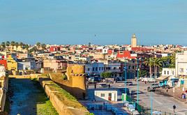
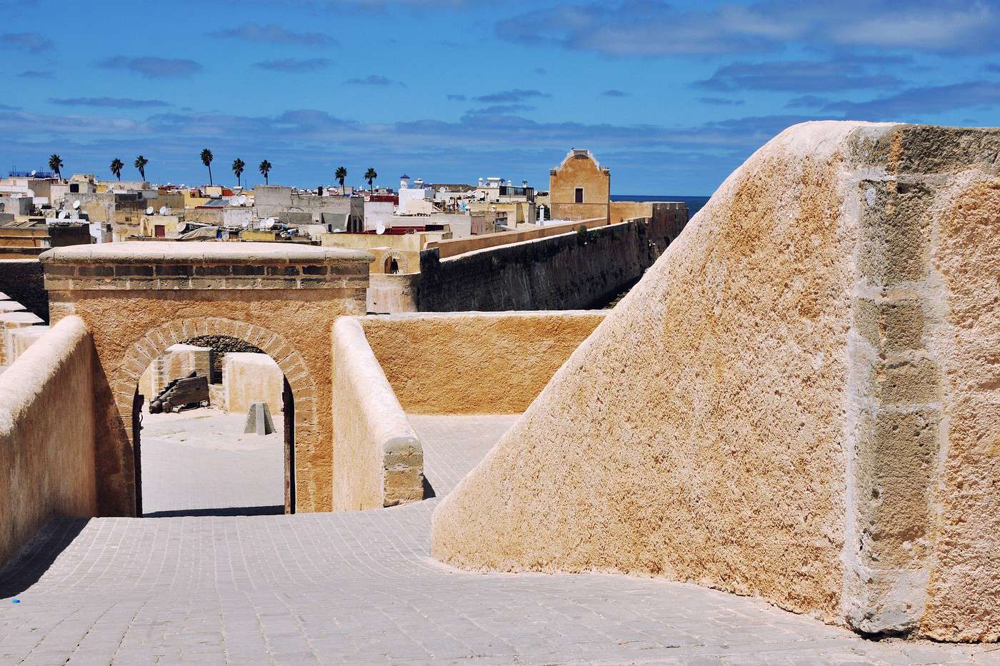
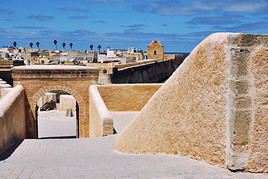
El Jadida, Maroc
El Jadida, Maroc · © VoyageForum

From the south of Tangier to the Mauritanian border, Morocco boasts over 2,000 kilometers of Atlantic coastline, home to some of the country’s most visited spots. This is especially true in the northern part, as beyond Agadir toward the south, inhabited and tourist areas become increasingly rare, giving way to the desert, particularly in Western Sahara. Both in the north and south, as you move inland, the landscape shifts to the foothills of the Atlas or desert terrain, depending on the region.

Schematically, this coastal area can be divided into two parts: the North Atlantic Coast, stretching roughly from the south of Tangier to the south of Casablanca, and the South Atlantic Coast, which continues to the borders of Western Sahara. The northern section is home to major cities like Casablanca and Rabat, as well as several seaside resorts. The south, meanwhile, is wilder and less populated, though it features two must-see Moroccan destinations: Essaouira and Agadir.

Main Cities

The most "active" part of the country lies along the northern coast, centered around Rabat, the kingdom’s capital, and Casablanca, its "economic capital." The two major urban areas are about a hundred kilometers apart. As you head further south, densely populated zones become more spaced out. However, several important cities still line the coast, including the former Portuguese trading posts of El Jadida and Essaouira, the industrial and port city of Safi, and, of course, Agadir, which is essentially the last major coastal city before Western Sahara.

Tourist Attractions

Touristically, the Atlantic coast offers two main areas of interest (and a secondary one):

Cities and Their Heritage

Several coastal cities hold undeniable appeal, starting with the capital, Rabat, and its "twin" Salé, which together offer a remarkable heritage, partly listed as a UNESCO World Heritage site. In a more modern vein, their neighbor Casablanca is also worth a visit, though it bears little resemblance to the traditional image of a Moroccan city...

Since Morocco was colonized by several European powers, you can still see well-preserved remnants of the former Portuguese trading posts that were El Jadida and, especially, Essaouira. More traditional are the beautiful medinas to explore in cities like Asilah, Azemmour, and, to a lesser extent, Tiznit. For ancient history lovers, the Roman ruins of Lixus, located on the outskirts of Larache, are also worth noting, though they are far less impressive than those of Volubilis in the Meknes region.

To round things out, several remarkable cities like Tetouan, Fez, Meknes, and Marrakech are not far from the coast and can easily be visited from there.

Beaches and Seaside

This is often the image associated with much of the Atlantic coast. Beyond Agadir, the most famous and renowned of all, other lesser-known (or newer) seaside resorts will delight relaxation seekers and fans of surfing and other water sports. From north to south, notable spots include Asilah, Azemmour, Taghazout, and Mirleft, along with the beautiful coastal road from Essaouira to Agadir, where water sports and beach enthusiasts will find plenty to enjoy.

Nature and Activities

While not spectacular, the Atlantic coastline offers some lovely seaside landscapes, particularly in the southern part. Activities naturally revolve around water sports (surfing, windsurfing, etc.), though there are few opportunities for hiking (though the Atlas Mountains are nearby).

A few natural areas worth mentioning, especially for birdwatchers, include the Sidi Boughaba Lake Reserve and the Merja Zerga Reserve on the northern coast, as well as the Khenifiss National Park and the Souss-Massa National Park in the south.

Climate and Weather

The Atlantic coast is characterized by a "Mediterranean climate with oceanic influences," particularly in terms of rainfall and the frequent morning fogs and dews in certain areas during summer.

Generally, summers are dry and very sunny, with pleasant temperatures softened by the trade winds, though the thermometer can occasionally soar in the more arid south during Saharan air surges. Winters are also mild, with temperatures differing by barely ten degrees compared to summer months.

The northern coast experiences a rainy season from October to April, while in the south, this period is slightly shorter. The further south you go, the lower the rainfall; the Tangier region receives three times more precipitation than the Agadir area.
Agadir

For decades, it has been the country's main seaside resort and its second most popular tourist destination after Marrakech. The only thing missing is the city's historical heritage, lost in the 1960 earthquake. In short, Agadir is purely a "holiday-relaxation" destination. Overview of Agadir History, Culture and Society of Agadir Dining in Agadir Climate and Weather in Agadir What to See in Agadir Things to Do in Agadir Tips for Agadir Flying to Agadir Getting to Agadir by Land or Sea Getting Around in Agadir Accommodation in Agadir Other practical information for Agadir Living in Agadir

Further reading on VoyageForum

View guide page: Agadir

Overview of Agadir

Overview of the city

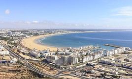
For decades, Agadir has been the country's leading seaside resort, with around 900,000 visitors per year. This trend is set to continue with the ongoing project for a new "mega-resort", Taghazout-Argana Bay, located just a few kilometres north of the city.

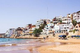
Along Agadir's 10 kilometres of fine sandy beaches, you can sunbathe, ride a camel, windsurf, and go deep-sea fishing. In the evening, the choice is just as tough between the shops, international restaurants, cafés, and nightclubs. All these amenities, along with an international airport, make Agadir Morocco's second most popular tourist destination after Marrakech. The city lacks historical heritage, however, as this was lost in the 1960 earthquake that destroyed it entirely. In short, Agadir is purely a "holiday-relaxation" destination and should be treated as such.

Key facts

  • Type of place: large city.
  • Latitude/longitude: 30.26' N and 9.36' W.
  • Location: on the Atlantic coast, southwest of Marrakech.
  • Local time: Heure : 131.
  • Population: 421,844 inhabitants (2014).
  • Area:
  • Altitude: sea level.

Tourism

Travel essentials

  • By air: France-Agadir for 150/400 €.
  • Backpacker daily budget:
  • Best for accommodation:
  • Best for getting around:
  • Best time for climate/crowds/prices: the shoulder seasons from late April to June and September to October.
  • Tourist interest: (worth seeing).
View guide page: Overview of Agadir

Flying to Agadir

Agadir Airport is the country's third busiest by traffic, behind those of Casablanca and Marrakech . It offers all the facilities and services (currency exchange and more) of major airports. As a holiday destination, Agadir benefits from numerous seasonal or…

Read the full guide: Flying to Agadir

Getting to Agadir by Land or Sea

Agadir is easily accessible by road, particularly via the A7 motorway linking Casablanca to Agadir via Marrakech . Though toll-based, it offers significant time savings. For example, Casablanca is about 4 hours 30 minutes from Agadir, and Marrakech is around…

Read the full guide: Getting to Agadir by Land or Sea

Getting Around in Agadir

Agadir isn't really a large city. It's also, and above all, a city rebuilt just a few decades ago with urban planning that has little in common with what you'll find elsewhere in Morocco. In short, you can generally find your way around without too much…

Read the full guide: Getting Around in Agadir

Accommodation in Agadir

Overview

Given its tourist vocation, Agadir has a very large hotel sector with countless mid-range and upscale or "all-inclusive" establishments. Budget or backpacker-friendly hotels, however, are proportionally fewer than elsewhere. Logically enough, seafront accommodations are the most expensive.

For those looking for an alternative to Agadir, Taghazout, about fifteen kilometres to the north, also offers seafront accommodations.

Hotels of all kinds

A very wide choice, primarily with major chains and upscale hotels located by the sea. Otherwise, the Talborjt district is where you’ll find more affordable establishments.

Riad

While riads are a Moroccan specialty, "real" ones are quite rare in Agadir, which no longer has these large traditional charming houses. In fact, you’ll find a bit of everything architecturally under this label, used primarily for commercial purposes.

All-inclusive

Camping

Agadir is well-equipped for camping, starting with a very well-located municipal campsite on Boulevard Mohammed V. Several others are nearby, particularly to the north on the Essaouira road. Most meet "European standards" (including Wi-Fi in some) and offer bungalows for rent. Expect to pay less than 10 €/day for a basic pitch for two people.

Other options

Homestay

Apartment or villa rentals

Choosing your accommodation

Additional information

View guide page: Accommodation in Agadir

Dining in Agadir

What to eat?

Logically enough, Agadir’s cuisine is varied and international. You can easily find Moroccan food, as well as French, Italian, Chinese, Japanese, and more—though prices often reflect the city’s busy tourism scene. Many hotels have their own restaurants.

Local specialties

Agadir offers a few culinary specialties, such as thyme snails, hare or mackerel tagines, and fish couscous with corn semolina. The region is also known for the argan tree, whose crushed kernels produce argan oil, prized for its dietary benefits and widely used in local cooking.

Where to eat?

Several neighborhoods have restaurants, depending on what you’re looking for: upscale, tourist-friendly, or local. The seaside corniche offers the most diverse options, catering to tourists with matching prices. For more local spots (and sometimes alcohol-free), try the working-class Nouveau Talbourjt district or the seafood restaurants at the fishing port.

Further reading on VoyageForum

View guide page: Dining in Agadir

What to See in Agadir

Agadir is primarily—if not exclusively—a relaxation and holiday destination. The sights to discover here are extremely limited; an earthquake indeed leveled almost the entire city in 1960. That said, you can spend days in Agadir if you enjoy beach resorts and…

Read the full guide: What to See in Agadir

Things to Do in Agadir

While Agadir doesn’t have much to see, there’s plenty to do, as is typical in large beach resorts. This is the "main" activity for many visitors, both in Agadir itself and in nearby areas like Taghazout. The region boasts some of Morocco’s most beautiful…

Read the full guide: Things to Do in Agadir

Tips for Agadir

The pleasant period roughly from April to November is ideal, though the climate remains far from prohibitive for a stay at other times. That said, summer is also the busiest time on the coast, with prices to match. It’s best to opt for the shoulder…

Read the full guide: Tips for Agadir

Climate and Weather in Agadir

Climate Overview

Agadir has a fairly consistent and pleasant, though dry, climate. Average high temperatures range from 20 to 30°C year-round, with nighttime lows generally above 10 to 15°C. Winter rainfall is light, morning fog is frequent, and a gentle sea breeze makes the heat very manageable. In short, Agadir’s climate has nothing in common with that of Marrakech, despite the short distance.

Best Time to Visit Agadir

In Agadir, as along the nearby coast, the pleasant period from roughly April to November is ideal, though the climate remains far from prohibitive for a stay at other times of the year.

Jan.Feb.Mar.Apr.MayJun.Jul.Aug.Sep.Oct.Nov.Dec.
Climate/

: very favourable | : favourable | : moderately favourable | : unfavourable.

Sea Temperature Throughout the Year

The sea temperature is never extreme, averaging 16/17°C in winter and just over 20°C in summer.

Jan.Feb.Mar.Apr.MayJun.Jul.Aug.Sep.Oct.Nov.Dec.
Agadir171616171920212222211918

Climate and Forecast

Additional Information

View guide page: Climate and Weather in Agadir

Other practical information for Agadir

What to pack

From spring to autumn, pack light clothing plus a sweater for evenings or air conditioning. In winter, slightly warmer or mid-season clothes are enough. However, sunglasses, sun protection, a hat, and optionally a cheich (a long local scarf) are essential year-round or nearly so.

Budget

Precautions

Staying in Agadir doesn’t require any special precautions; risks are very limited as long as you don’t act carelessly, and there’s a tourist police force ensuring everything runs smoothly. What’s more, the city is far more tolerant on many issues (including homosexuality) than the rest of the country. The only real thing to watch out for is the sometimes strong currents along certain parts of the coast when swimming.

Consulates

Among the few consulates in the city:

  • Belgium: Borj Dlalate Building, corner of Av. Hassan II and Av. Abderrahim Bouabid, 80020 Agadir. Tel.: 528 84 74 30.
  • France: Bd Mohamed Cheikh Saadi, 80000 Agadir. Tel.: 528 29 91 50.

Opening hours

Communication

Tourist office

Phone and internet

Beyond cybercafés, Wi-Fi is widely available in Agadir, both in accommodations and in bars and restaurants that cater to tourists.

Post office

Laundries

French language use

No language issues in Agadir—you’ll always find people who speak French.

View guide page: Other practical information for Agadir

Asilah

The tourist appeal of this seaside resort south of Tangier lies, beyond its beaches, in its stunning all-white medina. Moreover, the city has become increasingly popular in summer. Although founded by the Phoenicians, Asilah (or Assilah) owes its current…

Read the full guide: Asilah

Azemmour

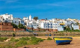
A small seaside resort south of Casablanca, known for its tranquility and old town. With its long beach, it’s also a favorite spot for surfers and watersports enthusiasts.

Overview of Azemmour

A small seaside resort just a few dozen kilometers south of Casablanca, Azemmour is known for its tranquility and old town. Its long beach also makes it a popular spot for surfers and watersports enthusiasts.

Key facts

  • Type de lieu: small town.
  • Intérêt touristique: (worth seeing).
  • Localisation: on the Atlantic coast, between El Jadida and Casablanca.
  • Heure locale: Heure : 133.
  • Population: 40,920 inhabitants (2014).
  • Superficie: 5 km².
  • Altitude: sea level.
  • Site internet:

History of Azemmour

What to see and do in Azemmour

The old town

A blend of Portuguese and Arab styles, the old town is well worth a visit. The medina is well preserved, as are its mellah (Jewish quarter), the old Portuguese bastions, and parts of its ramparts. Wandering through its alleys and souks is a pleasure.

Beaches and watersports

This is the other highlight. Azemmour has a vast beach, El Haouzia, two kilometers from the center, renowned for watersports.

In the surrounding area

Casablanca, Maroc
Casablanca (85 km)
It's the country's largest city and economic capital. Almost all its buildings date from the 20th century, and its new districts, with their contemporary architecture, compete in opulence and modernity. In short, it’s quite far from the "traditional" image one might have of a Moroccan city...
El Jadida, Maroc
El Jadida (20 km)
It’s thanks to its UNESCO-listed Portuguese ruins that El Jadida is a well-known tourist destination. The city overlooks a stunning natural bay.

Climate and weather in Azemmour

Transport

Getting there

Getting around

Sleep

Eat

Useful addresses

Further reading

View guide page: Azemmour

Casablanca

It's the country's largest city and economic capital. Almost all its buildings date from the 20th century, and its new districts, with their contemporary architecture, compete in opulence and modernity. In short, it’s quite far from the "traditional" image one might have of a Moroccan city... Overview of Casablanca Climate and Weather in Casablanca What to see in Casablanca Things to Do in Casablanca Flying to Casablanca Getting to Casablanca by Land or Sea Getting Around Casablanca Sleeping and Eating in Casablanca Living in Casablanca

Further reading on VoyageForum

View guide page: Casablanca

Overview of Casablanca

Overview of the city

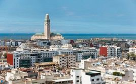
Casablanca (or Casa) is the largest city in Morocco; over one in five Moroccans lives in the metropolitan area. It is also, in a way, the economic capital of Morocco.

Almost all the city's buildings date from the 20th century, and the new downtown districts with their contemporary architecture compete in opulence and modernity. In short, Casablanca is quite far from the "traditional" image one might have of a Moroccan city... which may be why it is so rarely visited.

Landmarks

  • Type of place: main city.
  • Tourist interest: (worth a stop if you are in the area).
  • Location: on the Atlantic coast, just below Rabat.
  • Local time: Heure : 134.
  • Population: 4.37 million inhabitants and over 8 million for the metropolitan area (2016).
  • Area: 220 km².
  • Altitude: sea level.

History of Casablanca

Precautions

Useful addresses

  • Tourist Office:

Services

  • Local agencies:
  • Banks:
  • Consulates:

-- Belgium: 9 rue Al Farabi, 20070 Casablanca. Tel.: 522 43 17 80.

-- France: 1 Rue du Prince Moullay Abdallah, 15810 Casablanca. Tel.: 522 48 93 00.

  • Hospital:
  • Internet:
  • Laundries:
  • Vehicle rental:
  • Post office:
View guide page: Overview of Casablanca

What to see in Casablanca

Casablanca isn’t a major tourist hotspot, so the city can be explored in about half a day. Given their proximity, Casablanca and Rabat can even be combined into a single visit, with either city serving as your base. New Town of Casablanca ★ Moroccan…

Read the full guide: What to see in Casablanca

Flying to Casablanca

Casablanca Airport is the country's busiest in terms of traffic, ahead of Marrakech , with numerous connections including long-haul flights. It is also the hub (main hub) for the national carrier Royal Air Maroc (RAM) and Air Arabia. Name: Mohammed V Airport…

Read the full guide: Flying to Casablanca

Getting to Casablanca by Land or Sea

Beyond shared taxis, several operators run bus services from the city. Among them, CTM and Supratours (a subsidiary of ONCF) are the two best known, with extensive networks and comfortable buses. Agadir: numerous daily departures for a 7- to 8-hour journey…

Read the full guide: Getting to Casablanca by Land or Sea

Climate and Weather in Casablanca

Climate Overview

Best Time to Visit Casablanca

Jan.Feb.Mar.Apr.MayJun.Jul.Aug.Sep.Oct.Nov.Dec.
Climate

Sea Temperature Throughout the Year

Jan.Feb.Mar.Apr.MayJun.Jul.Aug.Sep.Oct.Nov.Dec.
Casablanca171616171920212222211918

Climate and Forecast

Additional Information

View guide page: Climate and Weather in Casablanca

El Jadida

It’s thanks to its UNESCO-listed Portuguese ruins that El Jadida is a well-known tourist destination. The city overlooks a stunning natural bay.

Overview of El Jadida

The Phoenicians were the first to arrive, followed much later by the Portuguese, who named it Mazagan. They rebuilt and fortified it, allowing them to resist for two and a half centuries. Thanks to its UNESCO-listed Portuguese ruins, El Jadida is a well-known tourist destination. It overlooks a stunning natural bay.

Key Facts

  • Type de lieu: city.
  • Intérêt touristique: (recommended).
  • Localisation: on the Atlantic coast between Safi and Casablanca.
  • Distances: Casablanca (62 miles to the northeast), Marrakech (134 miles to the south), Safi (87 miles to the southwest).
  • Heure locale: Heure : 135.
  • Population: 372,438 inhabitants (2017).
  • Superficie: 38 square miles.
  • Altitude: sea level.

History of El Jadida

What to See and Do in El Jadida

Ville portugaise d'El Jadida, El Jadida, Maroc
Portuguese City of El Jadida
More precisely, the Portuguese city of Mazagan, which offers an exceptional testimony to the influences of European and Moroccan cultures over the past centuries.
  • Les plages: The city’s other major draw. El Jadida boasts vast beaches that attract growing numbers of visitors.

In the Surrounding Area

Azemmour, Maroc
Azemmour (12 miles)
A small seaside resort south of Casablanca, known for its tranquility and old town. With its long beach, it’s also a favorite spot for surfers and watersports enthusiasts.
Casablanca, Maroc
Casablanca (62 miles)
It's the country's largest city and economic capital. Almost all its buildings date from the 20th century, and its new districts, with their contemporary architecture, compete in opulence and modernity. In short, it’s quite far from the "traditional" image one might have of a Moroccan city...

Climate and Weather in El Jadida

Transportation

Getting There

Getting Around

Accommodation

Food

Useful Addresses

Additional Information

View guide page: El Jadida

Portuguese City of El Jadida

More precisely, the Portuguese city of Mazagan, which offers an exceptional testimony to the influences of European and Moroccan cultures over the past centuries.

Overview of the Portuguese City

It has been a UNESCO World Heritage site since 2004. In the early 16th century, it was one of the first settlements established in Africa by Portuguese explorers en route to India. It offers an exceptional example of the influences between European and Moroccan cultures from the 16th to the 18th century.

Within the ramparts, several Portuguese buildings are still visible, including the cistern, the Mazagan fortress, and the Church of the Assumption, built in the Manueline style. The most interesting of all is the Portuguese cistern, an underground reservoir whose vaults, supported by 25 pillars, are reflected in the water.

History of the Portuguese City

What to See

What to Do

Events and Entertainment

Practical Information

  • Location:
  • How to Get There:
  • How to Get Around:

Eat

Sleep

What to See Nearby

  1. == Further Reading
View guide page: Portuguese City of El Jadida

Larache

The town is primarily known for the Roman ruins of Lixus on its outskirts and, secondarily, the Merja Zerga National Park, as well as the (future) seaside resort of Port Lixus nearby. The city itself has only moderate tourist appeal but is primarily known for…

Read the full guide: Larache

Mehdia

This coastal town near Kenitra is popular for surfing as well as the nearby Sidi Boughaba Lake Park.

Overview of Mehdia

Still relatively untouristed, this coastal town near Kenitra is primarily known for its surfing and the nearby Sidi Boughaba Lake Park. It is also home to a "historic" casbah.

Key Details

  • Type de lieu: small town.
  • Intérêt touristique: (worth a stop if you are in the area).
  • Localisation: on the outskirts of Kenitra, on the Atlantic coast, north of Rabat.
  • Distances: Kenitra (10 km to the east), Meknes (160 km to the east), Rabat (40 km to the southwest).
  • Heure locale: Heure : 138.
  • Population: 28,636 inhabitants (2014).
  • Superficie:
  • Altitude: sea level.
  • Site internet:

History of Mehdia

What to See and Do in Mehdia

  • The town: This picturesque little fishing port at the mouth of the Sebou River has a beautiful casbah dating from the Spanish era.
  • Beaches and surfing: The town offers long stretches of fine sandy beaches, very popular with surfers and bodyboarders.
Sidi Boughaba Lake Reserve
Right next to Mehdia, this coastal forest park is home to colonies of rare birds.

In the Surrounding Area

Réserve de Merja Zerga, Maroc
Merja Zerga Reserve (85 km)
This spot, south of Larache, is a wintering area for many birds. As the park is by the sea, around a lagoon, boat trips are available.
Rabat, Maroc
Rabat (40 km)
The capital of the Kingdom and, along with its "twin" Salé, a historically significant city whose most remarkable monuments showcase architectural perfection from the Middle Ages to the present day. Rabat is a UNESCO World Heritage site.
Salé, Maroc
Salé (30 km)
The city faces Rabat, with which it is "indissociable." Its monuments and cultural heritage are among the attractions of the Rabat-Salé metropolitan area.

Climate and Weather in Mehdia

Transportation

Getting There

Getting Around

Accommodation

Dining

Useful Addresses

Further Information

View guide page: Mehdia

Safi

An industrial and port city, Safi has limited tourist appeal, though it retains several remnants from the Portuguese era.

Overview of Safi

An industrial and port city, Safi has limited tourist appeal, though it retains several remnants from the Portuguese era and has a number of beaches in the surrounding area.

Key Facts

  • Type of place: city.
  • Tourist interest: (worth a stop if you are in the area).
  • Location: on the Atlantic coast, between Essaouira and Casablanca.
  • Local time: Heure : 140.
  • Population: 308,508 inhabitants (2014).
  • Area:
  • Altitude: sea level.

History of Safi

What to See and Do in Safi

The City

Though the area has become industrial, the city’s history has left a few traces. The medina, near the port, was fortified by the Portuguese, and you can explore a 16th-century sea fortress, the Sea Castle, as well as the Portuguese cathedral in the Gothic style. Also worth seeing are several fortresses and buildings from the era of the sultans. Safi is also home to the National Ceramics Museum.

In the Surrounding Area

Moulay Bouzerktoun (95 km)
A small fishing port a few kilometres north of Essaouira. It’s a place that remains somewhat wild and, above all, a top spot for windsurfing and kitesurfing.

Climate and Weather in Safi

Transportation

Getting There

Getting Around

Accommodation

Dining

Useful Addresses

Further Reading

View guide page: Safi

Sidi Ifni

One of the last formerly Spanish cities to gain independence in 1969. Touristically, it offers only moderate interest despite its partly Art Deco style and nearby beaches.

Overview of Sidi Ifni

Sidi Ifni was one of the last formerly Spanish cities to gain independence in 1969. In recent years, its region has been part of a major seaside resort project: "Plage Blanche Guelmim".

Key Facts

  • Type of place: small town.
  • Tourist interest: (worth a stop if you are in the area).
  • Location: on the Atlantic coast, between the cities of Tiznit and Guelmim.
  • Distances: Agadir (170 km to the north), Guelmim (55 km to the south), Tiznit (70 km to the northeast).
  • Local time: Heure : 141.
  • Population: 21,618 inhabitants (2014).
  • Area:
  • Altitude: sea level.
  • Website:

History of Sidi Ifni

What to See and Do in Sidi Ifni

Art Deco Architecture

The city was built in just a few years by the Spanish on a grid of streets and avenues leading to a large central square. It still features a number of Art Deco buildings, some in better condition than others, which characterized the city during the 1930s.

Beaches and Surfing

Sidi Ifni is surrounded by several beaches, the most famous being Plage Blanche, stretching 40 km and destined to become one of the country’s main seaside resorts ("Plage Blanche Guelmim"). The coast offers several great spots for surfing and windsurfing.

In the Surrounding Area

Guelmim, Maroc
Guelmim (55 km)
Traditionally known as the gateway to the Grand South, the city was once a major caravan hub on the route to Timbuktu.
Mirleft, Maroc
Mirleft (30 km)
A small town between Tiznit and Sidi Ifni known for its beaches and surfing.

Climate and Weather in Sidi Ifni

Transportation

Getting There

Getting Around

Accommodation

Eating

Useful Addresses

Further Information

View guide page: Sidi Ifni

Tiznit

This Berber city, about fifteen kilometres from the Atlantic, is primarily known for its late 19th-century ramparts that surround the medina.

Overview

This Berber city, about fifteen kilometres from the Atlantic, is primarily known for its late 19th-century ramparts that surround the medina.

Key Facts

  • Type de lieu: city.
  • Intérêt touristique: (worth a stop if you are in the area).
  • Localisation: south of Agadir, not far from the sea.
  • Heure locale: Heure : 143.
  • Population: 74,699 inhabitants (2014).
  • Superficie:
  • Altitude: 244 m.

History of Tiznit

What to See and Do in Tiznit

Like Taroudant, the city has long ramparts, opened by 9 gates, that surround the medina. Its souk is renowned for its goldsmiths. Otherwise, the Atlantic beaches are not far away.

In the Surrounding Area

Agadir, Maroc
Agadir (95 km)
For decades, it has been the country's main seaside resort and its second most popular tourist destination after Marrakech. The only thing missing is the city's historical heritage, lost in the 1960 earthquake. In short, Agadir is purely a "holiday-relaxation" destination.
Mirleft, Maroc
Mirleft (45 km)
A small town between Tiznit and Sidi Ifni known for its beaches and surfing.
Parc national de Sous-Massa, Maroc
Souss-Massa National Park (approx. 50 km)
Located almost at the gates of Agadir, the site is primarily renowned for birdwatching.
Sidi Ifni, Maroc
Sidi Ifni (75 km)
One of the last formerly Spanish cities to gain independence in 1969. Touristically, it offers only moderate interest despite its partly Art Deco style and nearby beaches.

Climate and Weather in Tiznit

Transport

Getting There

Getting Around

Accommodation

Food

Useful Addresses

Further Information

View guide page: Tiznit

Guelmim

Traditionally known as the gateway to the Grand South, the city was once a major caravan hub on the route to Timbuktu.

Overview of Guelmim

Traditionally known as the gateway to the Grand South, the city was once a major caravan hub on the route to Timbuktu. While it has been famous for its camel market, it may one day also be recognized for its coastline, which will host one of the country’s most important beach resorts ("Plage Blanche-Guelmim").

Key Facts

  • Type of place: city.
  • Tourist interest: (worth a stop if you are in the area).
  • Location: near the Atlantic coast, south of Agadir.
  • Distances: Agadir (124 miles to the north), Sidi Ifni (37 miles to the north), Tiznit (68 miles to the north).
  • Local time: Heure : 163.
  • Population: 118,318 inhabitants (2014).
  • Area:
  • Altitude:

History of Guelmim

What to See and Do in Guelmim

City and Camel Market

Guelmim is the famous "Blue Men" city, where every Saturday a camel market is held about 1.2 miles south of the town. It is the largest market of its kind in the country. Beyond that, the city itself does not offer much of tourist interest.

Plage Blanche - Guelmim

As part of the "Plan Azur," there is a project to develop a beach resort a few dozen miles from Guelmim on the coast. Named Plage Blanche - Guelmim, it is set to include a large tourist complex. However, due to numerous financial issues, the project remains on hold for now...

In the Surrounding Area

Mirleft, Maroc
Mirleft (50 miles)
A small town between Tiznit and Sidi Ifni known for its beaches and surfing.
Sidi Ifni, Maroc
Sidi Ifni (37 miles)
One of the last formerly Spanish cities to gain independence in 1969. Touristically, it offers only moderate interest despite its partly Art Deco style and nearby beaches.

Climate and Weather in Guelmim

Transportation

Getting There

Getting Around

Where to Stay

Where to Eat

Useful Addresses

Additional Information

View guide page: Guelmim

Souss-Massa National Park

Located almost at the gates of Agadir, the site is primarily renowned for birdwatching.

Overview of Souss-Massa Park

Located almost at the gates of Agadir, Souss-Massa National Park is primarily renowned for birdwatching. It was established in 1991.

Key details

  • Type of place: national park.
  • Tourist interest: (worth a stop if you are in the area).
  • Features: coastal ornithological park.
  • Location: a few kilometres south of Agadir.
  • Area: 338 km².
  • Altitude: sea level.

Site environment

The entire park runs along the coastline, featuring beaches, dunes, and cliffs. Over 250 bird species, both sedentary and migratory, can be found here, particularly near the mouths of the Souss and Massa wadis. Beyond flamingos, storks, cranes, and falcons, you can observe the world’s last colony of northern bald ibises. The park is also home to around a hundred red-necked ostriches and gazelles being reintroduced, as well as about thirty mammal species (wild boar, jackal, fox, wildcat, etc.).

What to see and do

The park has been open to the public since 2007, offering a trail for birdwatching in the Massa wadi and Sidi R’bat area, and another focused on small animal reserves housing gazelles and ostriches.

In the surrounding area

Climate and weather

Precautions

Transport

Getting there

Entry to the park is free. It’s best to have your own vehicle to reach the park, as the accessible part is located to the south, near the village of Massa. Alternatively, you can take a bus or shared taxi from Agadir/Inzegane to this village. From there, you’ll still need to walk or hitchhike at least 5 km to the reserve and the village of Sidi R’bat. In short, you’ll need to be motivated.

Getting around

You explore the park on foot, optionally with a guide. Donkey rides are also available around Sidi R’bat.

Accommodation and dining

Additional information

View guide page: Souss-Massa National Park

Rabat

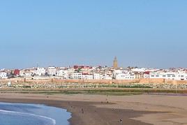
The capital of the Kingdom and, along with its "twin" Salé, a historically significant city whose most remarkable monuments showcase architectural perfection from the Middle Ages to the present day. Rabat is a UNESCO World Heritage site. Overview of Rabat Rabat Climate and Weather What to See in Rabat Things to Do in Rabat Flying to Rabat Getting to Rabat by Land or Sea Getting Around Rabat Sleeping and Eating in Rabat Living in Rabat
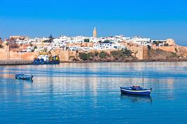
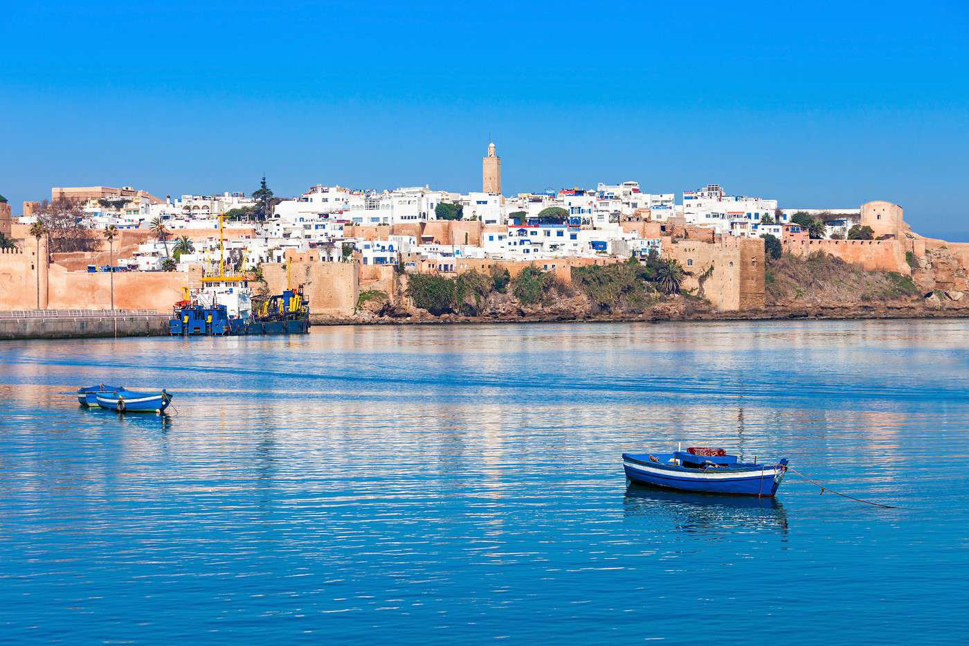
Rabat, Maroc
Rabat, Maroc · © VoyageForum

Further reading on VoyageForum

View guide page: Rabat

Overview of Rabat

Overview of Rabat

Rabat is the capital of the Kingdom and, along with its "twin" Salé, a significant city for centuries, whose most remarkable monuments showcase architectural perfection from the Middle Ages to the present day. Rabat has been a UNESCO World Heritage site since 2012.

Key Facts

  • Type of place: large city.
  • Tourist interest: (worth seeing).
  • Location: on the Atlantic coast, just above Casablanca.
  • Local time: Heure : 909.
  • Population: 577,827 inhabitants and 1.78 million for the greater area (2014).
  • Area: 118.5 km².
  • Altitude: sea level.

History of Rabat

Precautions

Useful Addresses

  • Tourist Office:

Services

  • Local agencies:
  • Banks:
  • Consulates/Embassies:

-- Belgium: 6 av. Mohammed El Fassi, Tour Hassan, 10000 Rabat. Tel.: 537 26 80 60.

-- Canada: 13 bis Jaâfar As-Sadik, Agdal-Rabat. Tel.: 537 68 74 00.

-- France: 49 av. Allal Ben Abdellah, 10000 Rabat. Tel.: 537 68 97 00.

-- Mauritania: 6 rue Thami Lamdouar, Rabat. Tel.: 537 65 87 36.

-- Switzerland: Square de Berkane, 10001 Rabat. Tel.: 537 26 80 30.

  • Hospital:
  • Internet:
  • Laundries:
  • Vehicle rental:
  • Post office:
View guide page: Overview of Rabat

What to See in Rabat

The Rabat-Salé conurbation can be explored in a day. If you have time, given the proximity, you can also use your stop in Rabat to make a day trip to Casablanca , though it’s not a major tourist destination. Since 2012, the "Modern and Historic City of Rabat"…

Read the full guide: What to See in Rabat

Getting to Rabat by Land or Sea

By Road

By Car

By Bus

Main Routes

Shared Taxis

By Train

By Sea

Ferries

Cargo Ships

Cruises

Sailboats

Distances

Distances (km) between Rabat and the main cities of Morocco:

Aga.Casa.Dakh.Erra.Essa.FèsMarra.Mekn.NadorOuar.Oujd.RabatSafiTan-T.Tang.Tét.
Agadir465120068017575527574010603751070600295360800825
Casablanca465163556036029524024560044061090255840340360
Dakhla12001635182013501910141018602200152522201710147084519551970
Errachidia68056018207103405003305253005404656651030665590
Essaouira175360135071070018065010003801020445125530690710
Fès7552951910340700490703156003302005301090285260
Marrakech2752401410500180490480775205790325150600570595
Meknes7402451860330650704803705603851504801040260260
Nador1060600220052510003157753707951355058301390425370
Ouarzazate3754401525300380600205560795820525355670770790
Oujda1070610222054010203307903851358205358601420560480
Rabat600901710465445200325150505525535325890250270
Safi2952551470665125530150480830355860325650570590
Tan Tan3608408451030530109060010401390670142089065011101135
Tangier8003401955665690285570260425770560250570111060
Tétouan8253601970590710260595260370790480270590113560
View guide page: Getting to Rabat by Land or Sea

Getting Around Rabat

Getting Your Bearings

Transport

Car

Public Transport

Bus

Tram

Since 2011, there has been a tramway running across the Rabat-Salé urban area with two lines in service. A ticket costs 6 Dh (0.50 €) and allows transfers within one hour of the first validation.

Taxis

Two Wheels

On Foot

View guide page: Getting Around Rabat

Rabat Climate and Weather

Climate Overview

Best Time to Visit Rabat

Jan.Feb.Mar.Apr.MayJun.Jul.Aug.Sep.Oct.Nov.Dec.
Climate

Sea Temperature Throughout the Year

Jan.Feb.Mar.Apr.MayJun.Jul.Aug.Sep.Oct.Nov.Dec.
Rabat171616171920212222211918

Climate and Forecast

Further Information

View guide page: Rabat Climate and Weather

Flying to Rabat

Rabat Airport

Rabat-Salé Airport is both civilian and military, with relatively low commercial traffic due to the proximity of Casablanca around a hundred kilometres away.

Airport details

  • Name:
  • IATA code: RBA
  • Hub: no
  • Number of terminals: 1.
  • Annual passenger capacity: 3.5 million.
  • Passenger traffic: 987,485 (2018).
  • Distance from city centre: 8 km northeast of the city.

Services

Sleeping at the airport

Transport to the city centre

The airport is connected to the city centre, particularly Rabat-Ville train station, by a shuttle costing 20 Dh (approx. 2 €). Expect to pay around 150 Dh (13 €) for a taxi.

Other nearby airports

Casablanca, with its multiple Royal Air Maroc connections to European and other countries, is 110 kilometres from the capital. It is Rabat-Salé’s main competitor and the reason for its moderate traffic.

Airlines and destinations

Rabat is served by regular or low-cost flights from around ten cities, plus a few seasonal routes.

Domestic

Agadir is the only Moroccan airport served from Rabat by Air Arabia.

Europe

This accounts for almost all regular traffic, with the main routes being:

  • England: London (RAM, Ryanair).
  • Belgium: Brussels (RAM, TUI) + Charleroi (Ryanair).
  • Spain: Girona (Ryanair) + Madrid (Air Nostrum, Ryanair).
  • France: Beauvais (Ryanair) + Marseille (RAM, Ryanair) + Paris CDG (Air France, TUI) + Paris Orly (TUI, Transavia).

Choosing your flight

From France

  • Price range: 150 €–400.
  • Flight duration (direct): 3h00 to 3h30.

Except from the Paris region, the limited service to the capital often makes arriving via Casablanca a better option.

From elsewhere

The same applies, except for Belgium, where there are more options via Casablanca.

Additional information

View guide page: Flying to Rabat

Essaouira

A city with undeniable charm, shaped by its former Portuguese presence, featuring a UNESCO-listed medina. Essaouira also hosts the increasingly renowned Gnawa music festival every June. Overview of Essaouira Essaouira Climate and Weather What to See in Essaouira Things to Do in Essaouira Flying to Essaouira Getting to Essaouira by Land or Sea Getting Around Essaouira Sleeping and eating in Essaouira Living in Essaouira

Further reading on VoyageForum

View guide page: Essaouira

Overview of Essaouira

Located on the edge of the Atlantic Ocean, Essaouira was called Mogador until the country's independence. Its history dates back to the Phoenicians and the Romans, but it was the Portuguese who left the most visible mark. From the early 16th century, they…

Read the full guide: Overview of Essaouira

What to See in Essaouira

Essaouira can generally be visited in half a day or a full day if you plan to enjoy its surroundings a little. All the points of interest are close by, and the port as well as the old town with its ramparts only require a few hours to explore. If you have…

Read the full guide: What to See in Essaouira

Things to Do in Essaouira

While Essaouira doesn’t offer as wide a range of activities as other cities in the country, it still has plenty of nature-based and cultural events to enjoy. The Gnawa Music Festival and surfing/windsurfing are the city’s two main highlights in these areas.…

Read the full guide: Things to Do in Essaouira

Getting to Essaouira by Land or Sea

Two major national roads serve the city: the N1, which connects Casablanca to Agadir via Essaouira, and the N8/207, which goes to Marrakech . While these roads are in good condition, they are often congested. Essaouira has two bus stations, both close to the…

Read the full guide: Getting to Essaouira by Land or Sea

Getting Around Essaouira

Getting Your Bearings

Essaouira is a relatively small city where it’s easy to find your way around, or at least to locate the main points of interest: the port, the medina, and the beach.

Transport

Car

As in many towns, a car isn’t really the best way to get around Essaouira, especially in the city and medina where traffic is theoretically banned. It’s best to leave your vehicle in one of the parking lots near the centre; the most convenient are the one near the port and Moulay Hassan Square, and the one at Bab Marrakech facing the medina. Essaouira has three or four car rental agencies.

Public Transport

Taxis

Urban taxis remain affordable as long as you negotiate the fare beforehand. Expect to pay the equivalent of 1 € to 2 € for a trip within the centre.

Two Wheels

This is an option with the few bike rental shops in the city. Beyond getting around the urban centre, cycling can also be a way to explore the surrounding area.

On Foot

By far the best way to get around. The distances between points of interest are short, so walking is the best way to discover the city.

View guide page: Getting Around Essaouira

Sleeping and eating in Essaouira

Accommodation

Essaouira is a tourist town with a wide range of hotels, guesthouses, riads, and even campsites. Touts often approach customers at the bus stations. The only downside is that during high season or the Gnaoua Festival (late June), prices tend to rise, and finding a room isn’t always easy. However, Essaouira is increasing its accommodation capacity with the Mogador-Essaouira resort just a few kilometres from the city.

Hotels and riads

Generally, smaller establishments and riads are located in the medina, while more upscale hotels are outside or on the outskirts of the city.

Camping

There are several campsites, more or less well-equipped, on the outskirts of the city. However, it’s recommended to have your own transport if you plan to stay there.

Other accommodation

Villas and apartments are also available in Essaouira. This is a good option if you’re travelling in a group and planning to stay for several days.

Food

No problem finding somewhere to eat. From small local eateries to more upscale or touristy spots, there’s something for every taste and budget. However, places serving alcohol are relatively few.

Where to eat?

There are roughly three areas for dining in Essaouira:

  • The port: Here, you can eat fresh fish caught on the spot in small open-air stalls.
  • The city centre and medina: A wide variety of options in all categories and price ranges.
  • Along the beach: A few more upscale or touristy establishments.
View guide page: Sleeping and eating in Essaouira

Essaouira Climate and Weather

Climate Overview

Thanks to its seaside location, Essaouira enjoys mild winters (averaging 17°C in January) and very tolerable summers (just over 20°C on average in summer, so a light sweater is recommended), especially compared to Marrakech, which isn’t far away. The city is also windy, which not only softens the climate but also offers windsurfing enthusiasts fantastic opportunities. Some rain occurs from November to March.

As for sea temperatures, they’re never extreme, averaging 16°C in winter and just over 20°C in summer.

Best time to visit Essaouira weather-wise:

Jan.Feb.Mar.Apr.MayJun.Jul.Aug.Sep.Oct.Nov.Dec.
Climate

Sea temperatures throughout the year:

Jan.Feb.Mar.Apr.MayJun.Jul.Aug.Sep.Oct.Nov.Dec.
Essaouira171616171920212222211918

Climate and Forecast

Additional Information

View guide page: Essaouira Climate and Weather

Flying to Essaouira

Essaouira Airport

Essaouira Airport is small and can only accommodate medium-haul aircraft at best. Its maximum capacity is 300,000 passengers per year.

Airport details

  • Name: Essaouira-Mogador Airport.
  • IATA code: ESU
  • Hub: No.
  • Number of terminals: 1.
  • Passenger capacity per year: 300,000.
  • Passenger traffic:
  • Distance from city centre: 16 km southeast of the city.

Services

Services at the airport are quite limited, with opening hours often tied to flight schedules, such as currency exchange counters or vehicle rental.

Sleeping at the airport

Transport to the city centre

Other nearby airports

Within 200 km of Essaouira, Agadir and especially Marrakech offer a much wider choice of flights from Europe. In most cases, this remains the most practical option for those wanting to reach the city by air.

Destinations

While the city receives some seasonal charter flights, regular services are limited to Orly (Transavia), Casablanca (RAM), plus London and Brussels (Ryanair).

Additional information

View guide page: Flying to Essaouira

Essaouira to Agadir Route

Over more than 150 km, the road hugs the coast, offering stunning landscapes where the ocean blends with the foothills of the Atlas. It’s also where surfing and beach enthusiasts will find their paradise. Over more than 150 km, the road from Essaouira to…

Read the full guide: Essaouira to Agadir Route

Salé

The city faces Rabat, with which it is "indissociable." Its monuments and cultural heritage are among the attractions of the Rabat-Salé metropolitan area. The city faces Rabat , with which it is "indissociable," on the opposite bank of the Bouregreg River…

Read the full guide: Salé

Imouzzer Waterfall

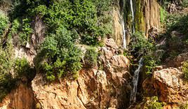
North of Agadir, the commune perched at over 1,100 m is home to a lovely waterfall. Several Amazigh villages nearby.

Overview

North of Agadir, the commune of Imouzzer des Ida-Outanane sits at over 1,100 m, with several Amazigh villages in the surrounding area. It is home to a charming waterfall known as Imouzzer Waterfall, which has become a popular day trip from Agadir over time.

Key details

  • Type of place: waterfall.
  • Tourist interest: (worth seeing).
  • Features: waterfalls in a mountainous setting.
  • Location: in the mountains north of Agadir.
  • Height:
  • Altitude: 1,160 m.

Site environment

Precautions

Climate and weather

What to see and do

The spectacular waterfalls and the panoramic views from the village are the main attractions. There are also opportunities for walks in the Imouzzer area.

Nearby

Getting there

The waterfall is slightly outside the village but can be reached on foot.

Sleeping and eating

Additional information

View guide page: Imouzzer Waterfall

Taghazout

A small fishing port renowned for its surfing and the beauty of its beaches. It’s also the planned site for what may one day become Morocco’s first seaside resort: Taghazout-Argana Bay. This small fishing port, known for the beauty of its beaches, is also a…

Read the full guide: Taghazout

Tarfaya

This town in the former Spanish territory of Cape Juby is famous for hosting the "aviator-writer" Antoine de Saint-Exupéry for 18 months during the Aéropostale era. A small monument and a museum are dedicated to him.

Overview

This town in the former Spanish territory of Cape Juby is famous for hosting "the aviator-writer" Antoine de Saint-Exupéry from 1927 to 1929, for 18 months during the Aéropostale era. A small monument and a museum are dedicated to him.

Landmarks

  • Type of place: small town.
  • Tourist interest: (worth a stop if you are in the area).
  • Location: on the Atlantic coast, just before Western Sahara.
  • Local time: Heure : 1858.
  • Population: 8,027 inhabitants (2014).
  • Area: 25 km².
  • Altitude: sea level.

History of Tarfaya

What to see and do in Tarfaya

Though the Aéropostale and Saint-Exupéry left their mark on the town in their time, Tarfaya remains little visited by tourists. Three things to see:

  • Casa del Mar: the ruins of a small two-century-old English fortress now a few dozen meters off the coast, in the open sea.
  • Antoine de Saint-Exupéry Monument: a statue of a small airplane on its pedestal dedicated to the aviator.
  • Antoine de Saint-Exupéry Museum of Tarfaya: this museum dedicated to the Aéropostale opened in 2004. It traces the adventure of the Toulouse–Saint-Louis, Senegal air route through various documents.

In the surrounding area

Parc national de Khenifiss, Maroc
Khenifiss National Park (50 km)
This site near Tarfaya borders the ocean and consists, among other things, of beautiful dunes. It is a nesting area for birds.

Climate and weather in Tarfaya

Transport

Getting there

Getting around

Sleep

Eat

Useful addresses

Further reading

View guide page: Tarfaya

Lixus

These Roman ruins, 2 or 3 kilometres from Larache across the river, represent the second ancient site in Morocco after Volubilis. The site itself includes, among other things, the remains of an acropolis, temples, and an amphitheatre.

Overview of Lixus

The Roman ruins of the city of Lixus are on the outskirts of Larache, 2 or 3 kilometres across the river. They represent the second ancient site in Morocco, behind Volubilis, which is still significantly more interesting.

History of Lixus

Although the city of Lixus was founded by the Phoenicians in the 7th century BC, numerous archaeological remains attest to the presence of a major Roman colony in the region. The site itself includes, among other things, the ruins of an acropolis, temples, and an amphitheatre.

What to see and do

Practical information

  • Location:
  • Local time: Heure : 1877.
  • Opening hours:
  • Price:

Transport

Sleeping and eating

What to see nearby

  1. == Additional information
View guide page: Lixus

Sidi Boughaba Lake Reserve

Right next to Mehdia, this coastal forest park is home to colonies of rare birds.

Overview of Sidi Boughaba Lake

Right next to Mehdia, this coastal forest park is home to colonies of rare birds.

Key details

  • Location: on the outskirts of the small town of Mehdia.
  • Interest of the site: (worth a stop if you are in the area).
  • Distances: Kenitra (6 miles to the east), Rabat (22 miles to the southwest).
  • Features: coastal wetland.
  • Area: 2.5 square miles.
  • Altitude: sea level.

Environment

Wildlife and flora

Climate and weather

Practical information

Access

Fees and information

Getting around

Sleeping and eating

What to see and do

  1. == Further reading
View guide page: Sidi Boughaba Lake Reserve

Merja Zerga Reserve

This spot, south of Larache, is a wintering area for many birds. As the park is by the sea, around a lagoon, boat trips are available.

Overview of Merja Zerga Reserve

Located around forty kilometres south of Larache, this area is a wintering zone for a large number of birds. Since the park is by the sea, around a lagoon, boat trips are available.

Key details

  • Type of place: nature reserve.
  • Tourist interest: (worth a stop if you are in the area).
  • Features: coastal nature reserve centred around a lagoon.
  • Location: south of Larache, opposite the town of Moulay Bousselham.
  • Distances: Larache (45 km to the north), Rabat (130 km to the south).
  • Area:
  • Altitude: sea level.

What to see and do

The nature reserve

Beaches and surfing

Merja Zerga is located opposite the village of Moulay Bousselham, which is a renowned surfing spot.

In the surrounding area

Climate and weather

Getting there

Where to stay and eat

  1. == Further information
View guide page: Merja Zerga Reserve

Khenifiss National Park

This site near Tarfaya borders the ocean and consists, among other things, of beautiful dunes. It is a nesting area for birds.

Overview of Khenifiss Park

This site near Tarfaya borders the ocean and consists, among other things, of beautiful dunes. It is a nesting area for birds.

Key Details

  • Type of place: national park.
  • Tourist interest: (worth seeing).
  • Features: coastal park of cliffs and dunes.
  • Location: on the Atlantic coast, just before Western Sahara.
  • Distances: Laayoune (150 km southwest), Tan-Tan (approx. 160 km northwest), Tarfaya (approx. 50 km west)
  • Area: 1,850 km².
  • Altitude: sea level.

Park Environment

Wildlife and Flora

What to See and Do

Far from being a typical tourist spot, Khenifiss is primarily a nesting area for birds, with over 200 species living here. The site, where lagoon, sea, and desert blend, also offers stunning landscapes.

Nearby Attractions

Climate and Weather

Precautions

Getting There

Sleeping and Eating

  1. == In Addition
View guide page: Khenifiss National Park

Mirleft

A small town between Tiznit and Sidi Ifni known for its beaches and surfing.

Overview

Mirleft is a small town between Tiznit and Sidi Ifni known for its beaches and surfing.

Key details

  • Type of place: small town.
  • Tourist interest: (worth a stop if you are in the area).
  • Location: on the Atlantic coast, south of Agadir.
  • Distances: Agadir (84 miles to the north), Guelmim (53 miles to the south), Sidi Ifni (19 miles to the south), Tiznit (28 miles to the east).
  • Local time: Heure : 1900.
  • Population: 8,162 inhabitants (2014).
  • Area:
  • Altitude: sea level.
  • Website:

History of Mirleft

What to see and do in Mirleft

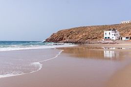
Beautiful beaches, cliffs, and small coves—Mirleft’s appeal lies in its seaside location. The town is also gaining recognition for surfing and windsurfing. However, be cautious of strong currents when swimming.

In the surrounding area

Climate and weather in Mirleft

Transport

Getting there

Getting around

Accommodation

Eating

Useful addresses

Further information

View guide page: Mirleft

Moulay Bouzerktoun

A small fishing port a few kilometres north of Essaouira. It’s a place that remains somewhat wild and, above all, a top spot for windsurfing and kitesurfing.

Overview of Moulay Bouzerktoun

Moulay Bouzerktoun is a small fishing port a few kilometres from Essaouira, on the road to Safi. It’s a place that remains somewhat wild, as it hasn’t been overrun by mass tourism. Above all, it’s a top spot for windsurfing and kitesurfing.

Key details

  • Type de lieu: small town.
  • Intérêt touristique: (worth a stop if you are in the area).
  • Localisation: 30 km north of Essaouira on the coast.
  • Distances: Essaouira (30 km to the south), Safi (95 km to the north-east).
  • Heure locale: Heure : 1957.
  • Population: 6,069 inhabitants (2012).
  • Superficie:
  • Altitude: sea level.
  • Site internet:

History of Moulay Bouzerktoun

What to see and do

The site has a stunning beach between dunes and cliffs. Strong winds (the *cherki*) blow mainly from March to November, but windsurfing and kitesurfing can be practised year-round. However, the spot requires a certain skill level.

In the surrounding area

Climate and weather

Transport

Getting there

If you’re not driving, you can reach the village by shared taxi or bus for around 2 € from Essaouira. The village is just over a kilometre from the main road.

Getting around

The village is tiny and right by the beach, so you can easily get around on foot.

Sleeping and eating

Moulay Bouzerktoun has a few budget-friendly homestay options and a café-restaurant (Dar Lawana) that can provide information (there’s also a small grocery store for basics). That said, with a few exceptions, comfort is generally basic, but you can stay for under 12 € per person, and windsurfers can leave their gear on-site. Otherwise, Essaouira isn’t far away.

Useful addresses

Further information

View guide page: Moulay Bouzerktoun

El Ouatia

Better known and more popular than its neighbor Tan-Tan, this small fishing port, also locally called Tan-Tan Plage, has developed a seaside tourism scene.

Overview of El Ouatia

Better known and more popular than its neighbor Tan-Tan, this fishing port, also locally called Tan-Tan Plage, has developed a seaside tourism scene.

Key Facts

  • Type of place: small town.
  • Tourist interest: (worth a stop if you are in the area).
  • Location: on the Atlantic coast, past Guelmim, heading toward Western Sahara.
  • Distances: Guelmim (155 km northeast), Laayoune (290 km southwest), Tan-Tan (25 km east).
  • Local time: Heure : 2037.
  • Population: 9,295 inhabitants (2014).
  • Area: 19.9 km².
  • Altitude: sea level.
  • Website:

History of El Ouatia

What to See and Do in El Ouatia

In the Surrounding Area

Climate and Weather in El Ouatia

Transportation

Getting There

Getting Around

Accommodation

Food

Useful Addresses

Further Information

View guide page: El Ouatia

Paradise Valley

A lovely valley along a wadi in the hinterland of Agadir, perfect for a short hike.

Overview of the site

Paradise Valley is a lovely valley along a wadi in the hinterland of Agadir, perfect for a short hike.

Key details

  • Type de lieu: valley.
  • Intérêt touristique: (worth seeing).
  • Caractéristiques:
  • Localisation: in the mountains north of Agadir.
  • Longueur:
  • Altitude:
  • Site internet:

Valley environment

Wildlife and flora

Precautions

Climate and weather

What to see and do

Nearby

Agadir, Maroc
Agadir (40 km)
For decades, it has been the country's main seaside resort and its second most popular tourist destination after Marrakech. The only thing missing is the city's historical heritage, lost in the 1960 earthquake. In short, Agadir is purely a "holiday-relaxation" destination.
Cascade d'Imouzzer, Maroc
Imouzzer Waterfall (25 km)
North of Agadir, the commune perched at over 1,100 m is home to a lovely waterfall. Several Amazigh villages nearby.
Taghazout, Route d'Essaouira à Agadir, Maroc
Essaouira to Agadir Route
Over more than 150 km, the road hugs the coast, offering stunning landscapes where the ocean blends with the foothills of the Atlas. It’s also where surfing and beach enthusiasts will find their paradise.

Transport

Getting there

Getting around

Sleeping and eating

Further information

View guide page: Paradise Valley

Something wrong or out of date? Report this page